
Natural Resources
Conservation Service
Upland Clay Loam (Low Sagebrush)


Scenario model
Current ecosystem state
Select a state

Management practices/drivers
Select a transition or restoration pathway
- Transition T1A More details
- Transition T2A More details
-
No transition or restoration pathway between the selected states has been described
Target ecosystem state
Select a state

Description
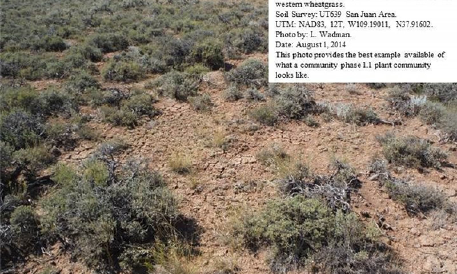
This reference state describes the various biotic communities that are expected to be found on this ecological site under natural conditions. This reference state has a well developed shrub layer with low sagebrush dominating. Fourwing saltbush and winterfat are other common shrub species. Indian ricegrass and western wheatgrass are the dominant herbaceous species with James galleta and needle-and-thread commonly occurring. Other native grasses, forbs, and shrubs will often produce a significant portion of vegetative composition in the plant community.
This site occurs on 2 to 10% slopes on all aspects. It is usually found on rolling hills and ridges and on alluvial formations. Its soils have a well developed argillic horizon occurring at 20 to 30 inches. Surface textures are typically silty clays.
The reference state is self-sustaining and resistant to change due to a good natural resilience to its natural disturbances. The primary natural disturbance mechanisms are wildlife population densities which can affect the shrub layer composition, weather fluctuations, and fire period.
Definitions:
Reference State: Natural plant communities as influenced by shrub canopy density, long term weather fluctuations, and periodic fire.
Indicators: These communities are dominated by low sagebrush and Indian ricegrass. The density of the shrub canopy determines the amount and composition of the other native species present in the community.
Feedbacks: Natural fluctuations in weather patterns that allow for a self-sustaining tree and shrub and native grass community. Prolonged drought, an increase in fire frequency, or other disturbances may allow for the establishment of invasive species.
At-risk Community Phase: All communities are at risk when native plants are stressed and conditions are created that may allow invasive plants to establish.
Trigger: The establishment of invasive plant species.
Submodel
State 2
Current Potential State

Current Potential State

Description
The Current Potential State is similar to the Reference Sate except that non-native species are now present. This state describes the plant communities that may or have become established on this ecological site under various successional sequences and disturbance conditions. Low sagebrush dominates the shrub layer. Fourwing saltbush and winterfat are other common shrub species. Crested wheatgrass dominates the herbaceous layer. Indian ricegrass and James galleta and other perennial grasses and forbs are commonly found. Native grasses, forbs, and shrubs may produce a significant amount of the sites production. Cheatgrass, Russian thistle, redstem storksbill, various mustard species and other non-native species are present on the site and under certain circumstances, may visually dominate the sites aspect.
The primary disturbance mechanisms are the shrub layer density; the amount of invasive species present; weather fluctuations; and fire. The current potential state is still self-sustaining but may be losing its resistance to change due to the impact of disturbances with less resilience following those disturbances.
Definitions:
Current Potential State: Plant communities influenced by shrub canopy density, long term weather fluctuations, and periodic fire. Invasive species are present in various amounts.
Indicators: A community dominated by low sagebrush, crested wheatgrass and Indian ricegrass. The density of the shrub canopy determines the amount and composition of the other native and introduced grasses and forbs that may be present.
Feedbacks: Natural fluctuations in weather patterns that allow for a self sustaining shrub and native grass community. Prolonged drought, more frequent fires, and/or other disturbances that may allow for the increase of invasive species.
At-risk Community Phase: All communities are at risk when native plants are stressed and nutrients become available for invasive plants to increase.
Trigger: A reduction of perennial grass and forb species combined with an increase of invasive plant species.
Submodel

Description
The Altered State of this ecological site has been mechanically disked to remove all perennial vegetation. The site is then typically converted to dry cropland or seeded to introduced range grasses such as crested wheatgrass or intermediate wheatgrass. Where cropland has been abandoned or range seedings fail, invasive weeds may dominate the site. This state has lost significant resistance to natural disturbances.
Terminology:
Current Potential State: Plant communities influenced by man influenced events including disking, rodent activity and climatic fluctuations.
Indicators: Non-native species are now present in all plant communities.
Feedbacks: Extended drought and other disturbance that changes the ecological dynamics of the site.
At-risk Community Phase: All communities are at risk.
Trigger: Disturbance that facilitates the dominance of invasive forbs and/or grasses.
Submodel
Mechanism
This pathway describes the affects of a long term drought that does not allow for sufficient precipitation to support herbaceous species and/or long periods without fire. Heavy wildlife browsing can allow for non-palatable shrubs to increase. Heavy livestock grazing will reduce palatable herbaceous species. Invasive weedy species may invade plant communities.
Model keys
Briefcase
Add { ecological sites } and { Major Land Resource Areas } to your briefcase by clicking on the briefcase
(![]() ) icon wherever it occurs. Drag and drop items to reorder. Cookies are used to store briefcase items between browsing sessions. Because of this, the number of items that can be added to your briefcase is limited, and briefcase items added on one device and browser cannot be accessed from another device or browser. Users who do not wish to place cookies on their devices should not use the briefcase tool. Briefcase cookies serve no other purpose than described here and are deleted whenever browsing history is cleared.
) icon wherever it occurs. Drag and drop items to reorder. Cookies are used to store briefcase items between browsing sessions. Because of this, the number of items that can be added to your briefcase is limited, and briefcase items added on one device and browser cannot be accessed from another device or browser. Users who do not wish to place cookies on their devices should not use the briefcase tool. Briefcase cookies serve no other purpose than described here and are deleted whenever browsing history is cleared.
Ecological sites
Major Land Resource Areas
The Ecosystem Dynamics Interpretive Tool is an information system framework developed by the USDA-ARS Jornada Experimental Range, USDA Natural Resources Conservation Service, and New Mexico State University.
Accessibility statement