


Natural Resources
Conservation Service
Colorado Plateau Riparian Complex Perennial (Valley Type VIII - B4C Stream Type)


Scenario model
Current ecosystem state
Select a state

Management practices/drivers
Select a transition or restoration pathway
- Transition 1 More details
- Transition 2 More details
- Transition 3 More details
-
No transition or restoration pathway between the selected states has been described
Target ecosystem state
Select a state
State 1
Reference Channel
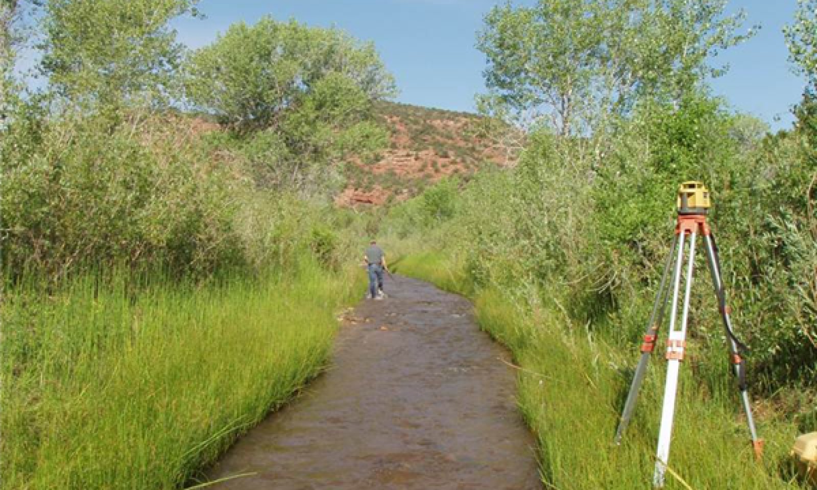
Reference Channel


Description
The reference channel is a B4c channel. There is one phase identified in this state, a B4c channel. Plant roots hold the fine bank sediment together and above ground the plant stems capture sediment and allow it to deposit on the banks. The freshly deposited sediment is colonized by plants either through seed or rhizomes. The material on the stream banks is fine material (sand) that is more susceptible to erosion when not held together by roots, especially from rhizomatous plants and shrubs. Movement to any other channel type indicates a threshold has been crossed and the channel will not change back to a B4c channel in phase 1.1 without major inputs of money or energy.
Submodel
State 2
Deepened and Widened Channel

Deepened and Widened Channel


Description
This state occurs when disturbances (to phases in state 1 or state 3) remove bank stabilizing vegetation which leads to destabilization of banks and bed. Because of the alluvial fill of valley type VIII, there is potential for downcutting in this site. Scour of the bed material may lead to a channel type “G”. Once the channel gradient has stabilized, the channel will begin to erode the steep “G” streambanks, creating an “F” channel type. Both of these channels are considered unstable. Disturbances that could cause this include large floods that scour vegetation below flood prone area. Increased erosion of banks and bed result in some vertical instability and especially lateral instability. In this state the stream becomes disconnected from the floodplains. Stream bank vegetation (PCC1) is removed either from erosion or from the banks drying from lack of connection to the groundwater. PCC2 may increase in this state and the edges of the riparian complex will begin to dry and support upland vegetation (Loamy Bottom ecological site). These terraces begin to develop because of the floodplains increasing disconnection with ground water as the channel deepens. This PCC3 will form on this new terrace. This channel morphology may also be the result of a large sediment pulse that is deposited in the channel and that the intermittent flow is unable to carry downstream.
Submodel
Description
The channels in this state are stable analogues (stable channels that have similar morphology as state 1 channels) that have re-established some floodplain connection during bankfull flows. These channels also have the potential to express all plant community components. The lower channel may have established after several incremental entrenchment and widening events, as evidenced by floodplains and terraces.
Stable analogue B4c channel. This channel succession within state 3 is similar to state 1, but at a lower elevation. These stable analogue channel types are at risk of crossing a threshold back to state 2 if sediment and flow do not remain in balance.
Submodel
Mechanism
Channel degradation
Mechanism
Channel deposition and stabilization
Model keys
Briefcase
Add { ecological sites } and { Major Land Resource Areas } to your briefcase by clicking on the briefcase
( ) icon wherever it occurs. Drag and drop items to reorder. Cookies are used to store briefcase items between browsing sessions. Because of this, the number of items that can be added to your briefcase is limited, and briefcase items added on one device and browser cannot be accessed from another device or browser. Users who do not wish to place cookies on their devices should not use the briefcase tool. Briefcase cookies serve no other purpose than described here and are deleted whenever browsing history is cleared.
Ecological sites
Major Land Resource Areas


The Ecosystem Dynamics Interpretive Tool is an information system framework developed by the USDA-ARS Jornada Experimental Range, USDA Natural Resources Conservation Service, and New Mexico State University.
Accessibility statement