
Natural Resources
Conservation Service
Ecological site R035XY021UT
Colorado Plateau Riparian Complex Perennial (Valley Type VIII - B4C Stream Type)
Accessed: 10/16/2026
-
Search


Major Land Resource Area or ecological site by name and/or ID.
PreviousSectionsNextGeneral information
Draft. A draft ecological site description is either incomplete or has not undergone quality control and quality assurance review.
Classification relationships
Vegetation Classification and Mapping Project Report, Capitol Reef National Park (Clark et al. 2009)
Plant Associations:
Salix exigua/Barren Shrubland (PCC1)
Eleocharis palustris (PCC1)
Juncus balticus (PCC1)
Schoenoplectus pungens (PCC1)
Populus fremontii/Salix exigua (PCC2)
Populus fremontii/Ericameria nauseosa (PCC2)
Populus fremontii/mesic graminoids (PCC2)
Map Class:
Fremont Cottonwood Woodland Complex (PCC1 and PCC2)
Willow Shrubland Complex (PCC1)Ecological site concept
This site covers perennial riparian complexes in MLRA 35. Stream flow occurs year round with high water occurring during spring runoff and throughout the summer monsoon season. Episodic high flow duration is variable during the summer monsoon season and can vary on a daily or hourly basis depending on rainfall within the watershed. The episodic flooding of this site is typical of streams in the Colorado Plateau that are influenced by monsoonal climate patterns. This riparian complex has developed within an alluvial valley (Valley Type VIII) and has a narrow but continuous ribbon of riparian vegetation. The dominant vegetation is Fremont cottonwood (Populus fremontii) and Baltic rush (Juncus arcticus ssp. littoralis) and/or common threesquare (Schoenoplectus pungens). This complex is dependent on natural hydrology (i.e. annual and storm induced flooding).
This riparian complex is characterized by a B4c stream channel with bed material that is predominantly gravelly with components of sand and cobble. The parent material is composed of alluvium derived from mixed materials. The canyon bottoms have a single thread channel with associated floodplains and flood-plain step. There are two native plant community components that are generally found in a continuous narrow ribbon throughout the riparian corridor. The plant community component located within the bank zone below bankfull is predominantly composed of Baltic rush and coyote willow (Salix exigua). The second plant community located on the overbank zone within floodprone width is predominantly composed of Fremont cottonwood. A third plant community can develop as the result of channel downcutting. This community is found on terraces and is predominantly composed of basin big sagebrush (Artemisia tridentata var. tridentata). The terrace site has been correlated to site R035XY011UT, please refer to this ecological site description. (see Hoag et al. 2001 for riparian zones).Associated sites
R035XY011UT Loamy Bottom (Basin Big Sagebrush)
This site is often found on the terrace of degraded channels. Although this site can also be found without the association of a channel.
R035XY020UT Colorado Plateau Riparian Complex Perennial (Valley Type IV - B4C Stream Type)
This site generally occurs upstream, where the valley type is different. The potential State and Transition Model is different although the plant community components are similar.
Table 1. Dominant plant species
Tree (1) Populus fremontii
Shrub (1) Salix exigua
Herbaceous (1) Juncus arcticus var. littoralis
(2) Schoenoplectus pungensPhysiographic features
This site is located in the Canyon Lands sections of the Colorado Plateau province of the Intermontane Plateaus. This site is characterized by narrow canyons and restricted riparian complex development. This site occurs on streambanks, flood plains, flood-plain steps, and terraces.
Table 2. Representative physiographic features
Landforms (1) Flood plain
(2) Flood-plain step
(3) Terrace
Flooding duration Extremely brief (0.1 to 4 hours) to very brief (4 to 48 hours) Flooding frequency Frequent to occasional Ponding frequency None Elevation 5740 – 6230 ft Slope 1 – 6 % Water table depth 4 – 60 in Climatic features
The climate is characterized by hot summers and cool to warm winters, which can be slightly modified by local topographic conditions, such as aspect. Large fluctuations in daily temperatures are common. Precipitation is variable from month to month and year to year, but averages between 7 and 10 inches. Most of the precipitation comes as rain march through October. On average, July through October are the wettest months. Much of the summer precipitation occurs as convective thunderstorms.
Table 3 Representative climatic features
Frost-free period (average) 180 days Freeze-free period (average) 210 days Precipitation total (average) 10 in BarLineFigure 1. Monthly precipitation range
BarLineFigure 2. Monthly average minimum and maximum temperature
Figure 3. Annual precipitation pattern
Figure 4 Annual average temperature pattern
">Influencing water features
This site is a perennial fluvial system with surface and ground water influence. Water chemistry is neutral and non-saline (fresh).<br />
<br />
Valley Type: VIII: Wide gentle valley slope with well developed flood plain adjacent to river terraces. This valley type is identified by the presence of a wide valley with multiple terraces along the stream channel. Alluvial terraces and flood plains are the predominant depositional landform. Soils are developed over alluvium originated with fluvial deposition in the valley bottom.<br />
<br />
Reference Stream Type: The B4c stream type is found in systems that are moderately entrenched with a moderate gradient. They are typically riffle dominated with infrequently spaced pools. The channel bed material is dominated by gravels and the banks generally consist of finer materials. The B4c stream type is generally very stable in plan and profile with stable banks. The “c” notation after the stream type indicates that the slope is less than 2%.<br />
<br />
Channel Material: Gravels dominate the channel bed with smaller accumulations of sand and cobble. Streambanks are dominated by sand and silts with a dense root mat. <br />
<br />
Stream Succession Scenario: B4c>G4c>F4>B4c<br />
<br />
Channel Evolution Stage: I>II>V<br />
<br />
Delineative Criteria <br />
Entrenchment ratio: 1.4-2.2<br />
Width/Depth ratio: 10.7-36.7<br />
Sinuosity: 1.2-1.7<br />
Slope range: 0.002-0.02<br />
Channel materials D50: 16-24<br />
Channel Materials D84: 64-96<br />
<br />
(Information from Rosgen, 1996 and modified as needed for site description. Delineative criteria are for the stream type and may represent a larger range of values than exists within the site.)Soil features
The soils within this site are alluviual derived from mixed sources. Soils in this site occur on a potential of three fluvial surfaces/landforms. This site occurs on streambanks and flood plains (PCC1), flood-plain steps (PCC2), and terraces (PCC3). The dominant soil texture is fine sand for all fluvial surfaces. The soils in this site have been correlated to Bowington and Green River soil components (streambanks and flood plains), Livan family (PCC2). See ecological site R035XY011UT (Loamy Bottom) for more details on the terrace soil components.
Table 4. Representative soil features
Surface texture (1) Fine sand
Drainage class Somewhat poorly drained to excessively drained Soil depth 60 – 0 in Surface fragment cover <=3" 0 – 65 % Available water capacity
(0-40in)3 – 6.9 in Calcium carbonate equivalent
(0-40in)0 – 3 % Electrical conductivity
(0-40in)0 – 2 mmhos/cm Sodium adsorption ratio
(0-40in)Not specified Soil reaction (1:1 water)
(0-40in)8.4 – 0 Subsurface fragment volume <=3"
(Depth not specified)0 – 65 % Ecological dynamics
Fluvial Geomorpholgy, Channel Evolution, and Stream Type Succession of the Site
These alluvial valleys within MLRA 35 have low gradient B4c channels that have developed flood plains that are able to support cottonwoods. The streams within this site are perennial with regular spring runoff high flow and intermittent flash flooding during summer monsoon season. In stream large wood may also contribute to channel form, allowing sediment to accumulate and build banks. This process would occur when mature cottonwoods fall in the channel, or when large wood from upstream riparian trees are deposited on the bank after flooding. Beaver activity could also provide input of large wood, although no recent beaver activity was found on any riparian complexes within this ecological site.
Large magnitude floods may occur July through October within this MLRA. These floods are generally the result of heavy rain in the summer and/or fall. Channel morphology can remain stable with large floods, although vegetation can be scoured or buried as a result. However, vegetation found in this type of flashy system is adapted to this type of disturbance. Coyote willow has very flexible stems that bend with the water and the dominant herbaceous vegetation (Baltic rush, common threesquare) grows up through fresh sediment deposits (McBride & Strahan 1984; Anderson 2006).
The wider valley bottom in the site and alluvial fill in the valley with little bedrock control allows for channel degradation. Degradation can be caused by a decrease in sediment loads, increase in annual or peak discharges, or an increase in channel slope (Simon & Rinaldi 2006). Channel downcutting can create higher and steeper streambanks. This process can cause streambanks to become susceptible to erosion and bank failure, which generally results in channel widening. Channels with eroding banks can supply large quantities of sediment to the channel, possibly affecting in-stream habitat. Channel incision effectively reduces ground water interaction with the flood plain, which can cause plant stress and eventually lead to a shift in plant community composition. Fremont cottonwood on this site was replaced by basin big sagebrush on the old floodplain (now a terrace). As the channel degrades, the channel slope is decreased while bank heights become more disconnected with ground water. Obligate riparian vegetation at this stage begins to be replaced vegetation that does not have the root structure to hold streambanks together. This process along with increase stream velocities in the channel leads to undercut banks and eventual bank failure and channel widening. As the channel slope is flattened, deposition begins to occur and a more stable channel will be formed at a lower elevation than the previous channel. Sediment deposition on the banks allows riparian vegetation to establish which functions to hold streambanks together and provide roughness on the surface to allow for more sediment deposition (Simon & Rinaldi 2006).
Historic land management practices may have influenced current channel morphology directly or indirectly through upland watershed degradation. Over use by livestock can lead to removal of bank stabilizing vegetation that could increase bank failure, accelerating bank erosion and undermining channel stability. Perennial water in this region is a rare and valuable resource and is often developed for human use. Perennial channels in this region have commonly been altered by irrigation withdrawals, impoundments, and channelization. These uses can influence the channel geomorphology and vegetation structure of this ecological site. Altered hydrology can affect the establishment of cottonwoods because cottonwood germination is dependent on timing and magnitude of flooding (see next section). Channel geometry is also determined by hydrology. Bankfull events (1.5 to 2 year flood events) are what form the channel, if those channel forming flows are altered, the channel geometry will also change and adjust to the altered hydrology.
The state and transition model is based on a customized (derived from documented scenarios) stream succession scenario of B4c>G4>F>B4c.
Ecological Dynamics of the Site
General: This riparian complex is a low gradient (12) width/depth ratio. The site extends throughout MLRA 35 including streams that have the same potential channel morphology, channel succession, bed and bank materials, fluvial surfaces, potential plant community components, and similar response to disturbance.
Plant Communities and Fluvial Surfaces: This system exhibits a complex of narrow streambanks, flood plains and flood-plain steps. The streambanks and flood plains are composed of alluvial sediment that is generally sandy on the surface and can be gravelly below the surface. Vegetation composition is influenced by flood frequency, flow duration and length of inundation. Fluvial surfaces that are closer to the channel are inundated more frequently with floods, thus have less woody vegetation. The vegetation growing on the fluvial surfaces close to the channel have more access to ground water, allowing more obligate wetland species to dominate. Fluvial surfaces further from the channel are inundated less frequently and have greater woody vegetation cover and also have less access to ground water except through deep roots. Dominant vegetation in this ecological site is adapted to yearly variations in flow and sediment deposition, cottonwoods and willows particular to this site are adapted to frequent disturbance and are known to be aggressive colonizers of disturbed sites (Richenbacher 1984). The adaptations of willows and cottonwoods are: they produce a large number of seeds, the seedlings have a high growth rate, stem fragments can regenerate, and willow root systems are extensive and allow the plant to anchor and bind the soil (Karrenberg et al. 2002). Willows and cottonwoods also require fresh wet sediment that is devoid of other vegetation to germinate (Braatne et al. 1996). Yearly variations in flow and large floods that scour vegetation and deposit sediment on floodplains are ideal microsites for willow and cottonwood seeds. Cottonwoods and willows produce large amounts of wind and water dispersed seeds that are only viable for a short period of time after the seeds come in contact with moist soil (Braatne et al. 1996). Germination can occur quickly, usually in a 24 hour period (Karrenberg et al. 2002) and they will remain viable for 2 to 3 days (Braatne et al. 1996). Mortality of cottonwood and willow seedlings is very high ranging from 77 to 100% in the first year (Karrenberg et al. 2002). Mortality is often attributed to desiccation of the seedling and seedlings are at a great risk of subsequent summer floods that may scour the recently deposited sediment (Braatne et al. 1996; Karrenberg et al. 2002).
The stream banks/flood plains are very narrow and are correlated to plant community component 1 (PCC1). They are close enough to the water table and water in the channel to support obligate wetland vegetation. Plant communities that are found closest to the channel on the stream banks are rushes, common reed and mesic forbs. These rhizomatous plants have the ability to survive frequent high flow and can send stems up through freshly deposited sediment. Willows and mesic forbs often establish on the upper edge of the narrow flood plain away from the channel because it is an intermediate location between high flows and access to the water table. Coyote willows found in this community have flexible stems and are able to bend with high flow (Karrenberg et al. 2002; McBride & Strahan 1984). Native fish and other aquatic species, including frogs and aquatic insects, are present, utilizing floodplain wetlands for refuge during high flows, and deeper residual pools as drying occurs during the drier months of the year.
Flood-plain steps are not flooded as frequently and are dominated by a mix of facultative wet and upland vegetation (PCC2). The mesic species in these communities probably established when the water table was closer to the soil surface or established after a large flood in a wet year and the upland species establish between wet years or high flow events. The flood-plain steps support Fremont cottonwood generally with upland species in the understory such as basin big sagebrush, rabbitbrush, and Indian rice grass. Cottonwood survival is based on the proximity to water in the channel and in the water table. The establishment of cottonwoods and coyote willow is cyclical, typically after a flood. These events deposit the needed wet sediment for germination. The likelihood of cottonwoods reaching maturity decreases if they germinate closer to the channel, because of the susceptibility of the streambank to high flow and scouring.
Terraces are rarely flooded and are not dominated by riparian species. The terraces found in this ecological site were once a part of the riparian floodplain, but as the channel degraded and the water table dropped, species more adapted to dry conditions establish. Basin big sagebrush and basin wildrye/Indian ricegrass dominate this site (correlated to the Loam Bottom ecological site R035XY011UT).
Invasive Species: Tamarisk, Russian olive and Russian thistle are often found within this ecological site. Tamarisk is the most common invader and can readily replace the willows and cottonwoods. If the channel abandons floodplains and terraces, the groundwater influence decreases which can create a better environment for tamarisk to establish (Horton et al. 2001). Tamarisk is more tolerant of drought and salinity than native species (Horton et al. 2001). The timing of seed dispersal is also different for tamarisk than native shrubs. Tamarisk produces seed from April to October (Horton et al. 2001) and with high summer flows could be at a seed dispersal advantage over cottonwoods and willows, which produce seed from February to April (Braatne et al. 1996). Tamarisk seedlings can establish midsummer on fresh sediment deposits from runoff during summer rain storms, months after cottonwood and willows dispersed seed (Stromberg et al. 2007). Tamarisk invasion can create a feedback loop that is difficult to reverse. Once tamarisk invades and begins to replace willows and cottonwoods, bare soil begins to decrease and shade increases, further decreasing the chance that cottonwoods and willows will regenerate in the site.
Fire: Fire has not been found to be a major factor contributing to plant community change. The landscape is dissected by canyons and the many of the uplands do not support high grass production that would allow a fire to spread. Fremont cottonwood is not as tolerant of fire as narrowleaf cottonwood, indicating that the dominant plant community is not adapted to frequent fire. Fremont cottonwood can be top killed even by a moderate fire and the cambium layer has been found to be damaged by a low severity fire, although it can sprout from the bole and roots (Taylor 2000).
Plant Communities and Transitional Pathways (Narrative)
A State and Transition Model (STM) for the Colorado Plateau Riparian Complex Perennial (Valley Type VIII - B4c Stream Type) lotic riparian complex ecological site (021) is depicted in Figure 1. Thorough descriptions of each state, transition, plant community, and pathway follow the model. This model is based on available experimental research, field observations, and interpretations by experts. It is likely to change as knowledge increases.
The plant communities will differ across the MLRA due to the naturally occurring variability in the extent of fluvial surfaces, soils, and influence of surface water and ground water in the hyporheic zone. The biological processes on this site are complex; therefore, representative values are presented in a land management context. The species lists are representative and are not botanical descriptions of all species occurring, or potentially occurring, on this site. They are not intended to cover every situation or the full range of conditions, species, and responses for the site.
Both percent species composition by weight and percent foliar cover are used in this ESD. Most observers find it easier to visualize or estimate percent canopy for woody species (trees and shrubs). Species composition by dry weight remains an important descriptor of the herbaceous community and of the community as a whole. Woody species are included in species composition for the site.
This STM includes only native communities and states. The converted communities are described in the Ecological Dynamics section above.
Plant Community Components
These plant communities exist on specific fluvial surfaces (PCC1 on stream banks/flood plains, PCC2 on flood plain step and PCC3 on terraces). These communities may exist over the entire length of the site and vary slightly to moderately in plant community composition.
Plant Community Component 1
This community is frequently disturbed by flooding. Shrubs and trees are generally not found within this plant community because of the close proximity to the stream channel and scouring floods. Herbaceous plants can establish between flooding events and can often come up though sediment if they are buried during a flood event. Baltic rush is a sod forming, rhizomatous perennial graminoid that forms a dense root system that can bind non-cohesive stream bank sediment. Baltic rush can tolerate fluctuating hydrology. It is adapted to flooding and drought. It is also tolerant of a range of soil conditions, including mild to moderate salinity and alkaline to calcareous soils. Common threesquare is similar to Baltic rush, it is also rhizomatous and it tolerant of alkaline conditions. Coyote willow is often found on the upper edge within this community because it is able to expand through rhizomes and grow under conditions that it would not normally be capable of germination (Anderson 2006). Roots of graminoids and coyote willow hold the stream banks during typical flood events, but may be scoured during large floods. Willows have flexible branches that are able to bend with the force of water without much damage to the plant (Karrenberg et al. 2002; McBride & Stahan 1984). Coyote willow (Salix exigua) is drought resistant and very tolerant of flooding (Anderson 2006) an essential characteristic in the dry environment of southern Utah. Willow seeds are non-dormant and quickly loose viability. Seedlings generally establish close enough to a water supply and far enough from the channel to be protected from scouring during floods (Anderson 2006). Once established, vegetative clones can expand perpendicular to the stream channel, developing closer to the water source (Anderson 2006). Branches can resprout if buried by sediment and they may also regenerate vegetatively from broken stems and roots (Anderson 2006). Coyote willow is shade intolerant and is shaded out once cottonwoods grow tall enough to dominate the overstory (Karrenberg et al. 2002). Seedlings of willow and cottonwood require the same germination conditions, bare, moist soil so they often germinate together. Initially, willows grow faster than cottonwood, but given time cottonwood overtops the willows. The reason cottonwood is not the dominant overstory plant in this plant community is because it is too close to the channel and is scoured before it can grow to maturity. Young cottonwood can be found scattered on this fluvial surface but is not dominant.
This community initially develops on streambanks and may become established on exposed depositional sand bars. Establishment of this community depends on periodic flooding for maintenance and growth. As sediment and debris become trapped among woody stems, the bar becomes more stable. This community occurs on flood plains with sufficient sediment deposition. Downed wood is sparse.
State and transition model
Custom diagramStandard diagram
Figure 5. State and Transition Model
More interactive model formats are also available. View Interactive Models
More interactive model formats are also available. View Interactive Models
Click on state and transition labels to scroll to the respective textState 1 submodel, plant communities
State 2 submodel, plant communities
State 3 submodel, plant communities
State 1
Reference ChannelThe reference channel is a B4c channel. There is one phase identified in this state, a B4c channel. Plant roots hold the fine bank sediment together and above ground the plant stems capture sediment and allow it to deposit on the banks. The freshly deposited sediment is colonized by plants either through seed or rhizomes. The material on the stream banks is fine material (sand) that is more susceptible to erosion when not held together by roots, especially from rhizomatous plants and shrubs. Movement to any other channel type indicates a threshold has been crossed and the channel will not change back to a B4c channel in phase 1.1 without major inputs of money or energy.
Community 1.1
B4c Channel
Figure 6. Typical cross-section

Figure 7. Plant community component 1

Figure 8. Plant community component 2

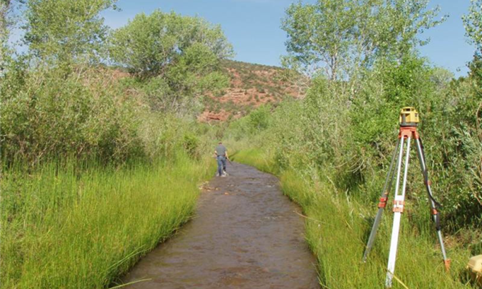
Figure 9. Typical view of a reference reach.
This phase represents a relatively stable combination of stream morphology and potential natural vegetation. There are generally two major fluvial surfaces with distinct plant community components, PCC1 (graminoids) on streambanks/flood plain and PCC2 (Fremont cottonwood) on flood-plain step. Stream banks/floodplains have herbaceous and shrubby vegetation for stabilizing fine sediment soils on the stream banks and are below the flood prone area. Above the flood prone area within the flood-plain step are wider, flatter terraces with scattered cottonwood and shrubs with few grasses (PCC2).
Figure 10. Annual production by plant type (representative values) or group (midpoint values)
Table 5. Annual production by plant type
Plant type Low
(lb/acre)Representative value
(lb/acre)High
(lb/acre)Grass/Grasslike 200 1500 3000 Forb 50 300 800 Shrub/Vine 50 300 700 Total 300 2100 4500 Table 6. Ground cover
Tree foliar cover 0% Shrub/vine/liana foliar cover 0% Grass/grasslike foliar cover 0-0% Forb foliar cover 0% Non-vascular plants 0% Biological crusts 0% Litter 10-50% Surface fragments >0.25" and <=3" 0% Surface fragments >3" 0% Bedrock 0% Water 0% Bare ground 20-80% Table 7. Soil surface cover
Tree basal cover 0% Shrub/vine/liana basal cover 0% Grass/grasslike basal cover 0% Forb basal cover 0% Non-vascular plants 0% Biological crusts 0% Litter 10-50% Surface fragments >0.25" and <=3" 0% Surface fragments >3" 0% Bedrock 0% Water 0% Bare ground 50-100% Table 8. Woody ground cover
Downed wood, fine-small (<0.40" diameter; 1-hour fuels) 0-5% N* Downed wood, fine-medium (0.40-0.99" diameter; 10-hour fuels) 0-2% N* Downed wood, fine-large (1.00-2.99" diameter; 100-hour fuels) 0-2% N* Downed wood, coarse-small (3.00-8.99" diameter; 1,000-hour fuels) 0-2% N* Downed wood, coarse-large (>9.00" diameter; 10,000-hour fuels) 0-1% N* Tree snags** (hard***) – Tree snags** (soft***) – Tree snag count** (hard***) 0-0 per acre Tree snag count** (hard***) 0-0 per acre * Decomposition Classes: N - no or little integration with the soil surface; I - partial to nearly full integration with the soil surface.
** >10.16cm diameter at 1.3716m above ground and >1.8288m height--if less diameter OR height use applicable down wood type; for pinyon and juniper, use 0.3048m above ground.
*** Hard - tree is dead with most or all of bark intact; Soft - most of bark has sloughed off.
Table 9. Canopy structure (% cover)
Height Above Ground (ft) Tree Shrub/Vine Grass/
GrasslikeForb <0.5 – 0-5% 25-40% 5-15% >0.5 <= 1 – – 10-25% 0-10% >1 <= 2 – – – – >2 <= 4.5 – 5-25% – – >4.5 <= 13 – 0-5% – – >13 <= 40 0-25% – – – >40 <= 80 – – – – >80 <= 120 – – – – >120 – – – – State 2
Deepened and Widened ChannelThis state occurs when disturbances (to phases in state 1 or state 3) remove bank stabilizing vegetation which leads to destabilization of banks and bed. Because of the alluvial fill of valley type VIII, there is potential for downcutting in this site. Scour of the bed material may lead to a channel type “G”. Once the channel gradient has stabilized, the channel will begin to erode the steep “G” streambanks, creating an “F” channel type. Both of these channels are considered unstable. Disturbances that could cause this include large floods that scour vegetation below flood prone area. Increased erosion of banks and bed result in some vertical instability and especially lateral instability. In this state the stream becomes disconnected from the floodplains. Stream bank vegetation (PCC1) is removed either from erosion or from the banks drying from lack of connection to the groundwater. PCC2 may increase in this state and the edges of the riparian complex will begin to dry and support upland vegetation (Loamy Bottom ecological site). These terraces begin to develop because of the floodplains increasing disconnection with ground water as the channel deepens. This PCC3 will form on this new terrace. This channel morphology may also be the result of a large sediment pulse that is deposited in the channel and that the intermittent flow is unable to carry downstream.
Community 2.1
G4c Channel
Figure 11. G4c channel

Figure 12. G4c channel, PCC2 dominant

Figure 13. Steep cut banks and bank failure
This channel type may occur when either the sediment supply or water amount is altered within the channel which can cause degradation and downcutting. The new channel is typically shorter and steeper than the previous channel. Often in this site, the new channel has coarser bed material. This channel type probably does not last long in this site because the fine sediments found in the banks are erodible when not held together by the appropriate vegetation. This phase has floodplain remaining (PCC2) and has very little or no streambank remaining (PCC1). A terrace begins to form in this stage.
Community 2.2
F4b Channel
Figure 14. F4b channel
This phase represents the channel after sediment has been scoured from banks, creating a wider, shallower channel. The flood-plain step (PCC2) is the predominant fluvial surface in this state; however PCC1 may be present in narrow and/or short sections where the banks have slumped. Stream banks/floodplains have some herbaceous and shrubby vegetation, but generally not enough for stabilizing fine sediment soils on the stream banks. Above the flood prone area are wider, flatter terraces with scattered cottonwood and shrubs with few grasses (PCC2). The terrace community (PCC3) continues to develop in this phase.
Pathway 1
Community 2.1 to 2.2
G4c Channel
F4b ChannelChannel widening, loss of obligate riparian vegetation
Pathway 2
Community 2.2 to 2.1
F4b Channel
G4c ChannelChannel degradation
State 3
Entrenched, Stable AnalogueThe channels in this state are stable analogues (stable channels that have similar morphology as state 1 channels) that have re-established some floodplain connection during bankfull flows. These channels also have the potential to express all plant community components. The lower channel may have established after several incremental entrenchment and widening events, as evidenced by floodplains and terraces.
Stable analogue B4c channel. This channel succession within state 3 is similar to state 1, but at a lower elevation. These stable analogue channel types are at risk of crossing a threshold back to state 2 if sediment and flow do not remain in balance.Community 3.1
B4c channel, stable analog
Figure 15. Stable analog B4c channel
This phase represents the re-establishment of stream connectivity to its floodplain. Wider, more efficient floodplains are established with depositional features that PCC1 can establish and develop. Local water tables are raised creating better conditions for terrace vegetation as well. The entire system is constrained by moderate entrenchment so lateral development of floodplains is limited to previous widening (phase 2.1) provides the room necessary for floodplain establishment.
All plant community components are found in this phase.Transition 1
State 1 to 2Channel degradation
Transition 2
State 2 to 3Channel deposition and stabilization
Transition 3
State 3 to 2Channel and bank erosion, de-stabilization
Additional community tables
Table 10. Community 1.1 plant community composition
Group Common name Symbol Scientific name Annual production () Foliar cover (%) Tree1 PCC1 0–50 common threesquare SCPU10 Schoenoplectus pungens 1500–3000 15–30 mountain rush JUARL Juncus arcticus ssp. littoralis 100–300 10–25 scouringrush horsetail EQHY Equisetum hyemale 100–200 1–10 smooth horsetail EQLA Equisetum laevigatum 100–200 1–10 narrowleaf willow SAEX Salix exigua 0–50 0–10 Shrub (>.5m) 2SHRUB Shrub (>.5m) 1–50 1–5 Grass, annual 2GA Grass, annual 0–50 0–5 Grass, perennial 2GP Grass, perennial 0–50 0–5 Canada wildrye ELCA4 Elymus canadensis 0–50 0–5 common spikerush ELPAP Eleocharis palustris var. palustris 5–25 1–5 Nebraska sedge CANE2 Carex nebrascensis 0–25 0–5 Forb, perennial 2FP Forb, perennial 0–25 0–5 rush JUNCU Juncus 0–20 0–5 sedge CAREX Carex 0–20 0–5 yellow willow SALU2 Salix lutea 0–15 0–5 Forb, annual 2FA Forb, annual 0–15 0–2 swordleaf rush JUEN Juncus ensifolius 0–10 0–2 foxtail barley HOJU Hordeum jubatum 0–10 0–2 field horsetail EQAR Equisetum arvense 0–5 0–2 Fremont cottonwood POFR2 Populus fremontii 0–5 0–2 Shrub/Vine1 PCC1 25–100 Indian ricegrass ACHY Achnatherum hymenoides 0–300 – rubber rabbitbrush ERNA10 Ericameria nauseosa 150–250 1–10 saltgrass DISP Distichlis spicata 5–200 5–15 scratchgrass MUAS Muhlenbergia asperifolia 0–200 0–10 yellow rabbitbrush CHVI8 Chrysothamnus viscidiflorus 100–200 1–10 field horsetail EQAR Equisetum arvense 0–200 0–10 Wyoming Indian paintbrush CALI4 Castilleja linariifolia 0–150 0–10 Shrub (>.5m) 2SHRUB Shrub (>.5m) 0–100 0–15 povertyweed IVAX Iva axillaris 0–65 0–10 scouringrush horsetail EQHY Equisetum hyemale 0–50 0–5 smooth horsetail EQLA Equisetum laevigatum 0–50 0–5 water birch BEOC2 Betula occidentalis 0–50 0–5 Grass, annual 2GA Grass, annual 0–50 0–5 Grass, perennial 2GP Grass, perennial 0–50 0–5 mountain rush JUARL Juncus arcticus ssp. littoralis 0–35 0–5 Forb, annual 2FA Forb, annual 5–25 1–10 Forb, perennial 2FP Forb, perennial 5–25 1–5 yellow willow SALU2 Salix lutea 0–25 0–5 western white clematis CLLI2 Clematis ligusticifolia 1–25 1–2 hairy false goldenaster HEVI4 Heterotheca villosa 0–25 0–2 Utah milkweed ASLA Asclepias labriformis 0–20 0–2 milkvetch ASTRA Astragalus 0–19 9–2 flatspine bur ragweed AMAC2 Ambrosia acanthicarpa 0–15 0–2 alkali cordgrass SPGR Spartina gracilis 0–10 0–5 dropseed SPORO Sporobolus 0–10 0–5 narrowleaf four o'clock MILI3 Mirabilis linearis 0–10 0–5 pale evening primrose OEPA Oenothera pallida 0–10 0–5 copperweed OXAC4 Oxytenia acerosa 0–10 0–2 lemon scurfpea PSLA3 Psoralidium lanceolatum 0–10 0–2 hoary tansyaster MACA2 Machaeranthera canescens 0–10 0–2 gray aster EUGL19 Eurybia glauca 0–10 0–2 Cainville thistle CICA10 Cirsium calcareum 0–10 0–2 Canadian horseweed COCA5 Conyza canadensis 0–10 0–2 white prairie clover DACA7 Dalea candida 0–10 0–2 lesser wirelettuce STMI13 Stephanomeria minor 0–10 0–2 hoary Townsend daisy TOIN Townsendia incana 0–10 0–2 mesa dropseed SPFL2 Sporobolus flexuosus 0–10 0–2 showy milkweed ASSP Asclepias speciosa 0–10 0–2 milkweed ASCLE Asclepias 0–10 0–2 sumac RHUS Rhus 0–10 0–2 narrowleaf willow SAEX Salix exigua 0–10 0–2 white sagebrush ARLU Artemisia ludoviciana 0–5 0–2 fineleaf hymenopappus HYFI Hymenopappus filifolius 0–5 0–2 scarlet gilia IPAG Ipomopsis aggregata 0–5 0–2 scarlet globemallow SPCO Sphaeralcea coccinea 0–5 0–2 2 PCC2 300–600 Grass/Grasslike1 PCC1 1500–3000 2 PCC2 250–500 Forb1 PCC1 200–500 2 PCC2 50–300 Table 11. Community 1.1 forest overstory composition
Common name Symbol Scientific name Nativity Height ft Canopy cover (%) Diameter in Basal area (square ft/acre) TreeFremont cottonwood POFR2 Populus fremontii Native 5-21 5-10 2-10 0 POHI8 Populus ×hinckleyana Native 6-30 0-5 2-10 0 narrowleaf cottonwood POAN3 Populus angustifolia Native – 0-1 2-8 0 Goodding's willow SAGO Salix gooddingii Native – 0-1 1-5 0 Table 12. Community 2.1 plant community composition
Group Common name Symbol Scientific name Annual production () Foliar cover (%) Table 13. Community 2.2 plant community composition
Group Common name Symbol Scientific name Annual production () Foliar cover (%) Table 14. Community 3.1 plant community composition
Group Common name Symbol Scientific name Annual production () Foliar cover (%) Interpretations
Animal community
Fish and Wildlife:
This site provides habitat for all types of wildlife, including birds, large mammals, small mammals, fish, salamanders, reptiles, and both terrestrial and aquatic insects, because of the surface and groundwater present. Native fish species are adapted to these seasonally flooded streams, finding refuge in deep pools and slower water habitat adjacent to wood jams and boulders. Turbid water provides hiding cover for native fish species. Non-native fish compete for food and habitat with native species in addition to using them as a food source. Reference conditions were not available due to extensive recreational use and longe term manipulation of streams in this MLRA for irrigation and road construction. Riparian vegetation provides structure for cover, nesting and breeding habitat, and a corridor for movement for wildlife that is not be available in the surrounding uplands (Levick et al. 2008). The plant communities help moderate soil and air temperatures and reinforce stream banks. Cottonwood specifically can provide habitat for avian and insect fauna as well as bats. Birds can nest in the crown, or create nests in the cavities and in the dead trunks and limbs (Taylor 2000). This site also provides some thermal cover and forage opportunities for mule deer and elk. Birds, bats, lizards, snakes and rodents are very common. Birds from several families are typically present, from hawks to sparrows. Several species of mammals forage and occupy this site, including desert cottontail, black tailed jack rabbit, Colorado chipmunk, white-tailed antelope squirrel, Apache pocket mouse, and several species of Peromyscus (deer mice). Coyotes and kit foxes will also forage in the area. Bats (Myotis, Pipisturellus, and others) can be observed in this ecological site.
Birds present, one day observation 5/25/2011: (see park website for a more extensive species list http://www.nps.gov/care/naturescience/birdchecklist.htm)
Western wood peewee
Black-headed grosbeak
Canyon Wren
Aquatic community:
Under reference conditions, MLRA 35 perennial stream have the potential of supporting native fishes of the Colorado River Basin. There are non-native and native fish present within MLRA 35. The list below is from the Capitol Reef National Park website (http://www.nps.gov/care/naturescience/fish.htm)
Trout & Charr
• brown trout (Salmo trutta) - native to Europe but introduced into the West before 1900; thrives in the Fremont River because of tolerance to warm water.
• rainbow trout (Salmo gairdnerii) - introduced from the Pacific Coast of the United States; lives well in both cold and warm water.
• cutthroat trout (Salmo clarkii) - native to Utah and the Intermountain Region; hybridizes with Rainbow trout, also requires cooler water temperatures.
• Eastern brook trout (charr)(Salvelinus fontinalis) - introduced to the West from the Northeastern part of the United States; found in some cold water streams that flow into the Fremont River.
Suckers
• flannelmouth sucker (Catostomus latipinnis) - native to the Colorado River system; herbivorous; ascends tributary streams in the spring to spawn.
• bluehead sucker (Pantosteus delphinus) - native to the Colorado River system; usually found in riffles of the streams; feeds on algae, slime, aquatic insect larvae.
Chubs, Dance, Minnows & Shiners
• speckled dace (Rhinichthys osculus) - native to the Fremont River where it is the most abundant fish; prefers rubble-strewn riffle areas; feeds on algae and other plant materials as well as small crustaceans, insect larvae, and small snails.
• Utah chub (Gila atraria) - introduced into the Fremont River as bait by fishermen; native habitat is the Bonneville Basin; generalized feeder, consuming higher plants, algae, terrestrial and aquatic insects, snails, crustaceans, and small fish; spawns during July.
• Leatherside chub (Gila copei) - found in the Fremont River; feeding and habits probably similar to the Utah chub.
• Redside shiner (Richardsonius balteatus) - introduced into the Fremont River, native to Bonneville and Columbia River basins; feeds on small aquatic insect larvae, crustaceans, and some plant debris; spawns in late June.
North American Catfishes
• black bullhead (Ictalurus melas) – (non-native) occasionally found in Halls Creek near the southern park boundary where it undoubtedly migrates from Lake Powell; black bullhead is adaptable to a wide range of aquatic conditions but shows preference for more quiet and muddier parts of a stream.
Sunfishes
• bluegill (Lepomis machrochirus) – (non-native) occasionally found in Halls Creek where it may migrate from Lake Powell; feeds on mollusks, crustaceans, insect larvae, and occasionally on small fish and aquatic plants.
Sculpins
• mottled sculpin (Cottus bairdi) - probably introduced into the Fremont River from the Bonneville system; carnivorous, a bottom feeder utilizing insect larvae, crustaceans, small fish and snails
Grazing:
This site provides good to excellent grazing conditions for livestock and wildlife during spring, summer and fall when in good ecological condition. This site also may provide water sources to livestock for some of the year. Care and close management should be focused to maintain native perennial grasses and shrubs because they are difficult to reestablish, especially willow and cottonwood seedlings that can be susceptible to livestock grazing (Taylor 2000). Reseeding and/or restoration are possible, but the major limiting factor is precipitation at critical plant growing periods. All plants within the riparian site need water table access to successfully establish as seedlings.Hydrological functions
Channels in this site are perennial and groundwater fed. Many of the headwaters are found in the mountains found in MLRA 47B. The bed material is composed of a mix of material, predominantly gravel, but sand and cobbles are also found. Perennial streams are scarce in this MLRA and most of the streams have been altered due to irrigation withdrawls and small diversions or dams on the streams. Spring floods and summer monsoon floods continue to influence channel form and vegetation, despite hydrologic alterations.
USGS Streamflow Data is available from the Pleasant Creek gauge near Caineville, UT (09330210) and the Fremont River gauge near Caineville, UT (09330230). The gauge on Pleasant Creek was only active for three years and the gauge on the Fremont has been active for 40 years. Yearly fluctuations in flow are apparent in the discharge graphs (see below). Flow is variable and can change rapidly, especially in the summer time.Recreational uses
The narrow gorges are natural draws to recreationist year round. While established hiking trails may not exist, footpaths throughout these canyons are prevalent, evidence that they are frequented by human visitors. National Parks in this MLRA draw millions of people every year.
The Bureau of Land Management and National Park Service manage most of areas that are within this ecological site. Some canyon bottoms are accessible to off-road vehicles on the established trails while other canyon bottoms allow only non-motorized forms of travel. Canyon bottoms in this MLRA are primarily visited in the spring and fall, although these sites are accessible year-round.Wood products
Limited to no opportunity for wood products.
Supporting information
Inventory data references
Information presented was derived from NRCS clipping data, literature, field observations (based on 2 sampled sites and observations from numerous others), and personal contacts with range-trained personnel (i.e., used professional opinion of agency specialists, observations of land managers, and outside scientists).
Other references
Anderson, M. 2006. Salix exigua. In: Fire Effects Information System, [Online]. U.S. Department of Agriculture, Forest Service, Rocky Mountain Research Station, Fire Sciences Laboratory (Producer). Available: http://www.fs.fed.us/database/feis/ [ 2009, November 23].
Braatne J.H., S.B. Rood and P.E. Heilman. 1996. Life history, ecology, and conservation of riparian cottonwoods in North America. In: Biology of Populus and its Implications for Management and Conservation (Eds R.F. Stettler, H.D. Bradshaw, P.E. Heilman & T.M. Hinckley), pp. 57–86. NRC Research Press, Ottawa.
Clark, D., M. Dela Cruz, T. Clark, J. Coles, S. Topp, A. Evenden, A. Wight, G. Wakefield, and J. Von Loh. 2009. Vegetation classification and mapping project report, Capitol Reef National Park. Natural Resource Technical Report NPS/NCPN/NRTR—2009/187. National Park Service, Fort Collins, Colorado.
Eckenwalder, J.E. 1984. Natural intersectional hybridization between North American species of Populus (Salicaceae) in sections Aigeiros and Tacamahaca. II. Taxonomy. Canadian Journal of Botany 62(2): 325-335.
Hoag J.C., F.E. Berg, S.K. Wyman, and R.W. Sampson. 2001. Riparian planting zones in the Intermountain West. USDA-NRCS Riparian/Wetland Project Information Series no. 16, Aberdeen Plant Materials Center, Aberdeen, ID. 24p.
Horton, J.L., T.E. Kolb, and S.C. Hart. 2001. Physiological response to groundwater depth varies among species and with river flow regulation. Ecological Applications 11: 1046–1059.
Irvine, J.R.. 1976. Riparian environmental-vegetation interrelationships along the lower Escalante River, Glen Canyon National Recreation Area, Utah. Unpubl. M.S. thesis, Utah State Univ., Logan, 82 pp.
Irvine, J.R and N.E. West. 1979. Riparian tree species distribution and succession along the lower Escalante River, Utah. The Southwestern Naturalist 24(2): 331-346.
Karrenberg, S., P.J. Edwards, and J. Kollmann. 2002. The life history of Salicaceae living in the active zone of floodplains. Freshwater Biology 47: 733-748.
Levick, L., J. Fonseca, D. Goodrich, M. Hernandez, D. Semmens, J. Stromberg, R. Leidy, M. Scianni, D. P. Guertin, M. Tluczek, and W. Kepner. 2008. The Ecological and Hydrological Significance of Ephemeral and Intermittent Streams in the Arid and Semi-arid American Southwest. U.S. Environmental Protection Agency and USDA/ARS Southwest Watershed Research Center, EPA/600/R-08/134, ARS/233046, 116 pp.
Lytle, D.A. and D.M. Merritt. 2004. Hydrologic regimes and riparian forests: a structured population model for cottonwood. Ecology 85(9): 2493-2503.
McBride, J.R. and J. Strahan. 1984. Establishment and survival of woody riparian species on gravel bars of an intermittent stream. American Midland Naturalist 112 (2): 235-245.
Moody, T., M. Wirtanen, and S.N. Yard. 2003. Regional relationships for bankfull stage in natural channels of the arid Southwest. Natural Channel Design, Inc., Flagstaff, AZ. 38 pp.
Reichenbacher, F.W. 1984. Ecology and evolution of southwestern riparian plant communities. Desert Plants 6(1): 15-22.
Rood, S.B, J.A. Goater, J.M. Mahoney, C.M. Pearce, and D.G. Smith. 2007. Floods, fire, and ice: disturbance ecology of riparian cottonwoods. Canadian Journal of Botany 85: 1019-1032.
Simon, A. and M. Rinaldi. 2006. Disturbance, stream incision and channel evolution: The roles of excess transport capacity and boundary materials in controlling channel response. Geomorphology 79 (3-4): 361-383.
Stromberg, J.C., J. Fry, and D.T. Patten. 1997. March development after large floods in an alluvial, arid-land river. Wetlands 17(2): 292-300.
Stromberg, J.C., S.J. Lite, R. Marler, C. Paradzick, T.B. Shafroth, D. Shorrock, J.M. White, and M.S. White. 2007. Altered stream-flow regimes and invasive plant species: the Tamarix case. Global Ecology and Biogeography 16: 381-393.
Taylor, J. L. 2000. Populus fremontii. In: Fire Effects Information System, [Online]. U.S. Department of Agriculture, Forest Service, Rocky Mountain Research Station, Fire Sciences Laboratory (Producer). Available: http://www.fs.fed.us/database/feis/ [2009, October 14].
General References
Bestelmeyer, B., J.R. Brown, K.M. Havstad, B. Alexander, G. Chavez, J.E. Herrick. 2003. Development and use of state and transition models for rangelands. J. Range Manage. 56(2):114-126.
Bestelmeyer, B.,A.J. Tugel, G.L. Peacock, D.G. Robinett, P.L. Shaver, J.R. Brown, J.E. Herrick, H. Sanchez, and K.M. Havstad. 2009. State-and-Transition Models for Heterogeneous Landscapes: A Strategy for Development and Application. Rangeland Ecology and Management 62:1-15.
Briske, D. D., S. D. Fuhlendorf, and F. E. Smeins. 2006. A Unified Framework for Assessment and Application of Ecological Thresholds. Rangeland Ecology and Management 59:225–236.
Briske, D. D., B. T. Bestelmeyer, T. K. Stringham, and P. L. Shaver. 2008. Recommendations for Development of Resilience-Based State-And-Transition Models. Rangeland Ecology and Management 61:359–367.
Harrelson C. C., Rawlins, C. L. and Potyondy J. P. 1994. Stream Channel Reference Sites: An Illustrated Guide to Field Technique, General Technical Report RM-245, USDA - Forest Service, Rocky Mountain Forest and Range Experiment Station, Fort Collins, Colorado, 61 pages. Available at: http://www.stream.fs.fed.us/publications/documentsStream.html
Herrick, J.E. J.W. Van Zee, K.M. Havstad, L.M. Burkett, and W.G. Whitford. 2005. Monitoring Manual for Grassland, Shrubland and Savanna Ecosystems. Volume I Quick Start. USDA - ARS Jornada Experimental Range, Las Cruces, New Mexico. Available at: http://usda-ars.nmsu.edu/monit_assess/monmanual_main.php.
Herrick, J.E. J.W. Van Zee, K.M. Havstad, L.M. Burkett, and W.G. Whitford. 2005. Monitoring Manual for Grassland, Shrubland and Savanna Ecosystems. Volume II: Design, Supplementary Methods and Interpretation. USDA - ARS Jornada Experimental Range, Las Cruces, New Mexico. Available at: http://usda-ars.nmsu.edu/monit_assess/monmanual_main.php.
Kovalchik, B.L. and L.A. Chitwood, 1990. Use of Geomorphology in the Classification of Riparian Plant Associations in Mountainous Landscapes of Central Oregon, U.S.A. Forest Ecology and Management 33/34:405-418.
Poole, G.C. and C.H. Berman, 2001. An Ecological Perspective on In-Stream Temperature: Natural Heat Dynamics and Mechanisms of Human-Caused Thermal Degradation. Environmental Management 27:787-802.
Pringle, C.M., R.J. Naiman, G. Bretschko, J. R. Karr, M.W. Osgood, J.R. Webster, R.L. Welcomme, and M.J. Winterbourn. 1988. Patch Dynamics in Lotic Systems: the Stream as Mosaic. The North American Benthological Society 7(4):503-524
Rosgen, D.L., 1994. A Stream Classification System. Catena, 22 169199. Elsevier Science, Amsterdam.
Rosgen, D.L., 1996. Applied River Morphology. Wildland Hydrology Books, Pagosa Springs, Colorado, and Ft. Collins, CO.
Rosgen, D.L., 2006. A Watershed Assessment for River Stability and Sediment Supply (WARSSS). Wildland Hydrology Books, Fort Collins, CO.
Schoeneberger, P.J., D.A. Wysocki, E.C. Benham, and W.D. Broderson (editors). 2002. Field Book for Describing and Sampling Soils, Version 2.0. Natural Resources Conservation Service, National Soil Survey Center, Lincoln, NE.
Stringham, T.K., W.C. Krueger, and P.L. Shaver. 2003. State and Transition Modeling: An Ecological Process Approach. J. Range Manage 56: 106-113.
USDA, NRCS. 2008. (Electronic) Field Office Technical Guide. Available online at: http://efotg.nrcs.usda.gov/efotg_locator.aspx.
USDA, Natural Resource Conservation Service. 2004. National Forestry Handbook. Available online at: http://soils.usda.gov/technical/nfhandbook/
USDA, NRCS. 2007. The PLANTS Database. National Plant Data Center, Baton Rouge, LA 70874-4490 USA. Available online at: http://plants.usda.gov
USDA, NRCS. 2003. National Range and Pasture Handbook. Available online at: http://www.glti.nrcs.usda.gov/technical/publications/nrph.html
USDA, NRCS Soil Survey Manuals for appropriate counties within MLRA xxx.
USDA, NRCS, 2007. Southerland, W. B., Technical Supplement 3E, National Engineering Handbook 654, Rosgen Stream Classification Technique – Supplemental Materials.
USDA, USFS, 2010. Fire Effects Information System Database. Available online at: http://www.fs.fed.us/database/feis/
USDI, USGS, 2010. National Water Information System. Available online at: http://waterdata.usgs.gov/nwis/Contributors
Sarah Quistberg
Rangeland health reference sheet
Interpreting Indicators of Rangeland Health is a qualitative assessment protocol used to determine ecosystem condition based on benchmark characteristics described in the Reference Sheet. A suite of 17 (or more) indicators are typically considered in an assessment. The ecological site(s) representative of an assessment location must be known prior to applying the protocol and must be verified based on soils and climate. Current plant community cannot be used to identify the ecological site.
Author(s)/participant(s) Contact for lead author Date Approved by Approval date Composition (Indicators 10 and 12) based on Annual Production Indicators
-
Number and extent of rills:
-
Presence of water flow patterns:
-
Number and height of erosional pedestals or terracettes:
-
Bare ground from Ecological Site Description or other studies (rock, litter, lichen, moss, plant canopy are not bare ground):
-
Number of gullies and erosion associated with gullies:
-
Extent of wind scoured, blowouts and/or depositional areas:
-
Amount of litter movement (describe size and distance expected to travel):
-
Soil surface (top few mm) resistance to erosion (stability values are averages - most sites will show a range of values):
-
Soil surface structure and SOM content (include type of structure and A-horizon color and thickness):
-
Effect of community phase composition (relative proportion of different functional groups) and spatial distribution on infiltration and runoff:
-
Presence and thickness of compaction layer (usually none; describe soil profile features which may be mistaken for compaction on this site):
-
Functional/Structural Groups (list in order of descending dominance by above-ground annual-production or live foliar cover using symbols: >>, >, = to indicate much greater than, greater than, and equal to):
Dominant:
Sub-dominant:
Other:
Additional:
-
Amount of plant mortality and decadence (include which functional groups are expected to show mortality or decadence):
-
Average percent litter cover (%) and depth ( in):
-
Expected annual annual-production (this is TOTAL above-ground annual-production, not just forage annual-production):
-
Potential invasive (including noxious) species (native and non-native). List species which BOTH characterize degraded states and have the potential to become a dominant or co-dominant species on the ecological site if their future establishment and growth is not actively controlled by management interventions. Species that become dominant for only one to several years (e.g., short-term response to drought or wildfire) are not invasive plants. Note that unlike other indicators, we are describing what is NOT expected in the reference state for the ecological site:
-
Perennial plant reproductive capability:
Print Options
Sections
Font
AAAAOther
PrintThe Ecosystem Dynamics Interpretive Tool is an information system framework developed by the USDA-ARS Jornada Experimental Range, USDA Natural Resources Conservation Service, and New Mexico State University.
Accessibility statement


