
Natural Resources
Conservation Service
-
Search


Major Land Resource Area or ecological site by name and/or ID.
PreviousSectionsNextGeneral information
Draft. A draft ecological site description is either incomplete or has not undergone quality control and quality assurance review.
MLRA notes
Major Land Resource Area (MLRA): 028B–Central Nevada Basin and Range
MLRA 28B occurs entirely in Nevada and comprises about 23,555 square miles (61,035 square kilometers). More than nine-tenths of this MLRA is federally owned. This area is in the Great Basin Section of the Basin and Range Province of the Intermontane Plateaus. It is an area of nearly level, aggraded desert basins and valleys between a series of mountain ranges trending north to south. The basins are bordered by long, gently sloping to strongly sloping alluvial fans. The mountains are uplifted fault blocks with steep sideslopes. Many of the valleys are closed basins containing sinks or playas. Elevation ranges from 4,900 to 6,550 feet (1,495 to 1,995 meters) in the valleys and basins and from 6,550 to 11,900 feet (1,995 to 3,630 meters) in the mountains.
The mountains in the southern half are dominated by andesite and basalt rocks that were formed in the Miocene and Oligocene. Paleozoic and older carbonate rocks are prominent in the mountains to the north. Scattered outcrops of older Tertiary intrusives and very young tuffaceous sediments are throughout this area. The valleys consist mostly of alluvial fill, but lake deposits are at the lowest elevations in the closed basins. The alluvial valley fill consists of cobbles, gravel, and coarse sand near the mountains in the apex of the alluvial fans. Sands, silts, and clays are on the distal ends of the fans.
The average annual precipitation ranges from 4 to 12 inches (100 to 305 millimeters) in most areas on the valley floors. Average annual precipitation in the mountains ranges from 8 to 36 inches (205 to 915 millimeters) depending on elevation. The driest period is from midsummer to midautumn. The average annual temperature is 34 to 52 degrees F (1 to 11 degrees C). The freeze-free period averages 125 days and ranges from 80 to 170 days, decreasing in length with elevation.
The dominant soil orders in this MLRA are Aridisols, Entisols, and Mollisols. The soils in the area dominantly have a mesic soil temperature regime, an aridic or xeric soil moisture regime, and mixed or carbonatic mineralogy. They generally are well drained, loamy or loamyskeletal, and shallow to very deep.
Nevada’s climate is predominantly arid, with large daily ranges of temperature, infrequent severe storms and heavy snowfall in the higher mountains. Three basic geographical factors largely influence Nevada’s climate: continentality, latitude, and elevation. The strong continental effect is expressed in the form of both dryness and large temperature variations. Nevada lies on the eastern, lee side of the Sierra Nevada Range, a massive mountain barrier that markedly influences the climate of the State. The prevailing winds are from the west, and as the warm moist air from the Pacific Ocean ascend the western slopes of the Sierra Range, the air cools, condensation occurs and most of the moisture falls as precipitation. As the air descends the eastern slope, it is warmed by compression, and very little precipitation occurs. The effects of this mountain barrier are felt not only in the West but throughout the state, as a result the lowlands of Nevada are largely desert or steppes.
The temperature regime is also affected by the blocking of the inland-moving maritime air. Nevada sheltered from maritime winds, has a continental climate with well-developed seasons and the terrain responds quickly to changes in solar heating. Nevada lies within the midlatitude belt of prevailing westerly winds which occur most of the year. These winds bring frequent changes in weather during the late fall, winter and spring months, when most of the precipitation occurs.
To the south of the mid-latitude westerlies, lies a zone of high pressure in subtropical latitudes, with a center over the Pacific Ocean. In the summer, this high-pressure belt shifts northward over the latitudes of Nevada, blocking storms from the ocean. The resulting weather is mostly clear and dry during the summer and early fall, with occasional thundershowers. The eastern portion of the state receives noteworthy summer thunderstorms generated from monsoonal moisture pushed up from the Gulf of California, known as the North American monsoon. The monsoon system peaks in August and by October the monsoon high over the Western U.S. begins to weaken and the precipitation retreats southward towards the tropics (NOAA 2004).
Classification relationships
US National Vegetation Classification (USNVC): 3. Semi-Desert, 3.B. Cool Semi-Desert Scrub and Grassland, 3.B.1. Cool Semi-Desert Scrub and Grassland, D040 Western North American Cool Semi-Desert Scrub and Grassland, M170. Great Basin and Intermountain Dwarf Sage Shrubland and Steppe, G308. Intermountain Low and Black Sagebrush Shrubland and Steppe Group, CEGL001424 Artemisia nova/ Pseudoroegneria spicata Shrubland.
Associated sites
R028BY006NV SHALLOW CALCAREOUS LOAM 10-12 P.Z.
ARNO4/PSSP6-ACHY
R028BY059NV SHALLOW CALCAREOUS HILL 8-12 P.Z.
JUOS/ARNO4/ACHY
Similar sites
R028BY027NV SHALLOW CALCAREOUS SLOPE 14+ P.Z.
less productive site; steeper slopes
R028BY011NV SHALLOW CALCAREOUS LOAM 8-10 P.Z.
Less productive site; lower elevations; ACHY dominant grass
R028BY008NV SHALLOW CALCAREOUS SLOPE 10-12 P.Z.
slopes are steeper; less productive site; ATCO common shrub
R028BY006NV SHALLOW CALCAREOUS LOAM 10-12 P.Z.
KRLA common shrub
R028BY016NV SHALLOW CALCAREOUS SLOPE 8-10 P.Z.
slopes are steeper; less productive site; ATCO common shrub
Table 1. Dominant plant species
Tree Not specified
Shrub (1) Artemisia nova
(2) Purshia glandulosaHerbaceous (1) Pseudoroegneria spicata
Physiographic features
This site occurs on fan remnants, upper fan piedmonts and mountain valley fans. Slopes range from 2 to 30 percent, but slope gradients of 4 to 15 percent are most typical. Elevations are 6500 to 7700 feet.
Table 2. Representative physiographic features
Landforms (1) Fan remnant
(2) Fan piedmont
Flooding frequency None Ponding frequency None Elevation 6500 – 7700 ft Slope 4 – 15 % Aspect NE, E, SE Climatic features
The climate associated with this site is semiarid, characterized by cold, moist winters and warm, dry summers.
Average annual precipitation ranges from 12 to 14 inches. Mean annual air temperature is about 45 to 50 degrees F. The average number of frost free days ranges from 100 to 120.
Average monthly precipitation for Adaven, NV (260046):
Jan 1.39, Feb 1.48, March 1.38, April 1.07, May 0.78, June 0.53, July 1.00, Aug 1.19, Sept 0.65, Oct 1.18, Nov 0.88, Dec 1.23.Table 3 Representative climatic features
Frost-free period (average) 120 days Freeze-free period (average) 150 days Precipitation total (average) 30 in BarLineFigure 1. Monthly precipitation range
BarLineFigure 2. Monthly average minimum and maximum temperature
Figure 3. Annual precipitation pattern
Figure 4 Annual average temperature pattern
">Influencing water features
There are no influencing water features associated with this site.
Soil features
The soils of this ecological site are shallow, well drained and formed in alluvium derived from limestone and dolomite. The soil surface is partially covered with approximately 35 percent gravels and 2 percent cobbles. Soils of this ecological site are characterized by an ochric epipedon 18cm thick, over a calcic horizon about 25 cm thick. An indurated duripan occurs within 50 cm. Soil reaction is moderately alkaline to strongly alkaline. These soils are moist in winter and spring and dry is summer and fall but can be moist for brief periods during July and August [Adaven, Nevada 260046]; these soils have an aridic soil moisture regime that borders on xeric. The official soil series correlated to this ecological site is Palinor a loamy-skeletal, carbonatic, mesic, shallow Xeric Haplodurids.
Table 4. Representative soil features
Parent material (1) Alluvium – limestone
Surface texture (1) Gravelly sandy loam
Family particle size (1) Loamy
Drainage class Well drained Permeability class Moderately slow Soil depth 20 – 46 in Surface fragment cover <=3" 25 – 45 % Surface fragment cover >3" 1 – 5 % Available water capacity
(0-40in)0.76 – 1.69 in Calcium carbonate equivalent
(0-40in)40 – 60 % Electrical conductivity
(0-40in)0 – 2 mmhos/cm Sodium adsorption ratio
(0-40in)0 – 5 Soil reaction (1:1 water)
(0-40in)8.2 – 8.4 Subsurface fragment volume <=3"
(Depth not specified)40 – 75 % Subsurface fragment volume >3"
(Depth not specified)0 – 5 % Ecological dynamics
The community phases of this ecological site are dynamic in response to changes in disturbance regimes and weather patterns. Black sagebrush (Artemisia nova) communities generally consist of widely spaced shrubs and lack enough fine fuels to readily carry fire. Plant community structure is controlled in part by infrequent wildfire and in part by pulses of seedling recruitment. Sagebrush species are generally long-lived, therefore it is not necessary for new individuals to recruit every year for perpetuation of the stand. Infrequent large recruitment events and simultaneous low, continuous recruitment is the foundation of population maintenance (Noy-Meir 1973).
Black sagebrush is an evergreen, aromatic shrub that is low-growing and decumbent. Black sagebrush has a taproot and wide-spreading lateral roots. Roots can be deep on favorable sites, but shallow soils prevent deep root development on most sites where black sagebrush is dominant. Soils supporting black sagebrush typically have large quantities of carbonates (Zamora and Tueller 1793). Black sagebrush tends to have a larger number of fibrous roots than big sagebrush. Black sagebrush is highly drought tolerant; it is more likely to endure drought than most sagebrush taxa. It is slightly salt tolerant and flood intolerant. Black sagebrush occurs throughout the successional process, it is highly light tolerant and shade intolerant (Fryer 2009).
Seeds typically overwinter and germinate the spring after production. Overwintering seeds germinate as early as April on some sites. Vegetative growth may also start in April. Ephemeral leaves are shed during summer drought, while persistent leaves remain on the branches through winter. Black sagebrush's flowering time in the Intermountain West is later than that of associated sagebrush species. Black sagebrush flowers from midsummer to midfall across its range. Germination, recruitment and recovery of black sagebrush following disturbance is partially dependent on the amount of seed produced the previous year (Neuenschwander 1978). Survival of sagebrush seedlings is dependent on adequate moisture conditions. Young plants are susceptible to less than desirable conditions for several years following germination (Fryer 2009).
Mature properly functioning sagebrush communities have higher infiltration rates and lower sediment production, than degraded systems. Reoccurring disturbances, natural or anthropogenic, will result in decreased sagebrush cover and increased cover of disturbance tolerant shrubs and non-natives. Loss of structural and functional groups effects ecosystem functioning and can result in soil loss. Improper grazing or recreation management can result in the reduction or potential loss of black sagebrush, degrading ecosystem function.
The accumulation and decomposition of litter increase nutrient concentrations under sagebrush shrub canopies. The breakdown of aging roots also contributes to organic matter and nutrient cycling in the sagebrush system. Carbon and nitrogen concentration are higher under sagebrush canopies when compared to interspaces (Chen and Stark 2000). The root systems of sagebrush maximizes water uptake with a deep taproot and shallow branching roots.
Changes in plant community composition can occur in black sagebrush communities following repeated wildfire and abusive land management actions. Following wildfire desert bitterbrush (Purshia glandulosa) and wild crabapple (Peraphyllum ramosissimum) increase in canopy cover. Abusive management, including excessive grazing use by cattle or horses, allow yellow rabbitbrush (Chrysothamnus viscidiflorus), sagebrush (Artemisia spp.), snakeweed (Gutierrezia spp.) to increase; while bluebunch wheatgrass (Pseudoroegneria spicata) and other desirable grasses and palatable shrubs decrease.
Individual trees, singleleaf pinyon (Pinus monophylla) and Utah Juniper (Juniperus osteosperma), greater than 200 years old occur on this ecological site. However, persistent canopy cover is not sufficient for a forest ecological site. Singleleaf pinyon and Utah juniper readily increase on this ecological site in the absence of naturally occurring periodic wildfire. When pinyon and juniper occupy this site they compete with other species for available light, moisture and nutrients. If pinyon and juniper canopies are allowed to close, they can eliminate all understory vegetation.
Cheatgrass (Bromus tectorum), a non-native annual grass, is the most common invasive species found on this site. Non-native annuals such as cheatgrass have the ability to change the spatial variability, intensity, frequency and seasonality of wildfire. Changes driven by non-natives annuals result in a narrow fire return interval that may prevent the recovery of long-lived woody perennials, such as black sagebrush. This site exhibits higher ecological resilience when compared to other black sagebrush plant communities located in lower precipitation zones. Ecological resilience refers to the amount of change or disturbance a community can tolerate before important ecological processes are lost. Higher annual rainfall and greater species diversity increases the resilience of this site.
Fire Ecology:
There are few records of historic fire frequencies or fire regimes for black sagebrush communities. Black sagebrush communities tend to occupy unproductive sites that have little fuel build-up, so fire was probably historically rare on many black sagebrush-dominated landscapes. Estimated fire return intervals range from 35 years to over 100 years. Black sagebrush plants are readily killed by all fire intensities. Reestablishment of sagebrush occurs through wind-dispersed seed sources. Following wildfire, black sagebrush will be initially replaced by sprouting species such as desert bitterbrush, wild crabapple and Utah serviceberry (Amelanchier utahensis). Black sagebrush requires 15 to 60 years post fire to regain dominance (Fryer 2009) and is dependent of favorable weather conditions and proximity of a seed source. Therefore, frequent and repeated fires can eliminate it from the plant community. Desert bitterbrush recovers from fire by sprouting from root crowns surviving below the soil and by establishing from seed. Mortality of desert bitterbrush is greater following fall burning than after spring time burns (Zlatnik 1999a). There is limited information regarding wild crabapple’s response to fire, but most species in the Rosaceae sprout from the root crown following fire. On site observations indicate an increase of wild crabapple following wildfire.
Perennial grasses generally respond favorably to wildfire. Bluebunch wheatgrass generally survives fires because its buds are protected by soil and/or plant material. Fire may stimulate flowering and seed production the first growing season following the fire, provided there are desirable weather conditions. Mortality of bluebunch wheatgrass is dependent of season of burning. Fires occurring in the spring and early summer when plants are most actively growing result in the higher rates of mortality when compared to fires later in the season (Zlatnik 1999b). Indian ricegrass (Achnatherum hymenoides) generally survives low severity, dormant season fires. Low culm density reduces charring of crowns below soil, thereby protecting growing points. Indian ricegrass reestablishes following fire through seed dispersed from adjacent unburned areas (Tirmenstein 1999). Sandberg’s bluegrass (Poa secunda) is usually unharmed by fire. Its small size and sparse litter reduces the amount of heat transferred to perennating buds in the soil. Sandberg’s bluegrass regenerates by tillering and by seed. Plants are pollinated by wind or are self-fertile.State and transition model
Custom diagramStandard diagram
Figure 5. stm
More interactive model formats are also available. View Interactive Models
More interactive model formats are also available. View Interactive Models
Click on state and transition labels to scroll to the respective textEcosystem states
State 1 submodel, plant communities
State 2 submodel, plant communities
State 3 submodel, plant communities
State 4 submodel, plant communities
State 1
Reference StateThis state is representative of the natural range of variability under naturally stable, pre-European settlement conditions. This state is dominated by black sagebrush, desert bitterbrush, wild crabapple, and bluebunch wheatgrass with various other shrubs. Primary natural disturbances affecting this ecological site are wildfire, insect attack and periodic drought. Timing of fire combined with weather events determines plant community dynamics. Black sagebrush and associated species are adapted to receiving limited annual precipitation. Drought related mortality is generally low in this community type. Prolonged drought will result in an over-all decline in the grass-forb component of the plant community and reduced annual growth and seedling recruitment of black sagebrush.
Community 1.1
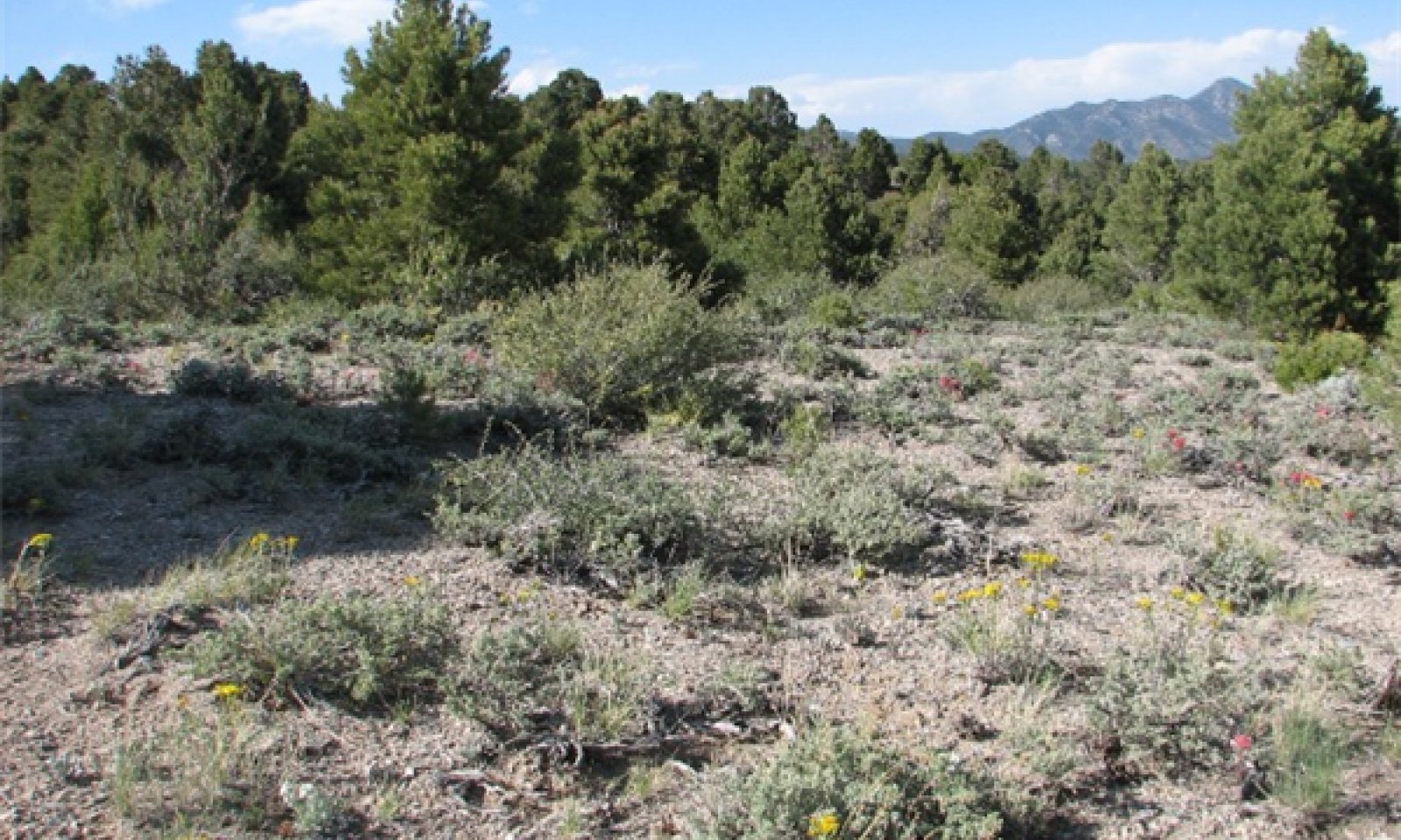
Reference Plant CommunityThe reference community is considered to be representative of this ecological site under naturally stable, pre-European settlement conditions. This community is characterized by a high diversity shrubland with a trace of mature trees. Dominant species include black sagebrush and bluebunch wheatgrass. Desert bitterbrush, wild crabapple, Indian ricegrass and Sandberg’s bluegrass are other important species associated with this site. Annual and perennial forbs including cryptantha, lobeleaf groundsel, buckwheat and penstemon are found throughout the site and especially conspicuous during years with above average annual precipitation. Potential vegetative composition is 25% grasses, 15% forbs, 60% shrubs and up to 1% trees. Approximate ground cover (basal and foliar) is 15 to 25%.
Figure 6. Annual production by plant type (representative values) or group (midpoint values)
Table 5. Annual production by plant type
Plant type Low
(lb/acre)Representative value
(lb/acre)High
(lb/acre)Shrub/Vine 260 350 425 Grass/Grasslike 190 250 310 Forb 50 100 165 Total 500 700 900 Community 1.2
Community phase 1.2This community is characterized by an early seral plant community dominated by perennial herbaceous biomass. Grasses and forbs benefit from reduced overstory competition, both vigor and reproductive capacity respond positively. Sprouting shrubs quickly recover and serve as nurse plants for other shrub seedlings, like sagebrush. Desert bitterbrush, wild crabapple, Utah serviceberry, gray horsebrush and Stansbury cliffrose increase post-fire. Black sagebrush will reestablish from an off-site seed source, during favorable climatic pulses. Recovery of sagebrush to pre-fire conditions may take a significant amount of time. Fast moving, low intensity wildfire results in the incomplete removal of sagebrush allowing for direct reestablishment and a faster recovery. This community is at-risk of invasion by non-natives. Non-native species take advantage of increased availability of critical resources following wildfire or other disturbance.
Community 1.3
Community phase 1.3This community phase is characterized by a decadent sagebrush overstory and reduced cover of perennial grasses in the understory. In the absence of disturbance, sagebrush communities turn into monotypic stands of late successional plants. This results in reduced quantity and diversity of plant species, reduced sagebrush vigor and seed production. Over-mature sagebrush plants are very competitive for water, light and nutrients, preventing recruitment and establishment of other vegetation and increasing the amount of bare ground. This community is at risk of invasion by non-native species. Non-natives can easily invade plant communities where structural and functional groups are reduced. This community phase may also have increased cover of pinyon and juniper. Pinyon and juniper are very competitive for water, light and nutrient resources contributing to the overall increase of bare ground. Increased bare ground is an indicator of site susceptibility to accelerated wind or water erosion. Periodic wildfire is required to reduce conifers. In the absence of this disturbance this community phase can persist for an extended period of time, allowing tree seedlings to increase over the long term.
Pathway 1.1a
Community 1.1 to 1.2Wildfire, disease and/or insect attack.
Pathway 1.1b
Community 1.1 to 1.3Absence of natural disturbance (fire, insect attack, disease), possibly together with prolonged drought and/or inadequate rest and recovery from defoliation.
Pathway 1.2a
Community 1.2 to 1.1Absence from natural disturbance (fire, insect attack, disease) and natural regeneration over time. In general, 15-60 years is required for black sagebrush to reach pre-fire conditions (Fryer 2009). Length of time for sagebrush communities to fully recover is dependent on ecological variables such as spring time precipitation, proximity of nearest seed source, etc.
Pathway 1.3a
Community 1.3 to 1.2Wildfire, disease and/or insect attack.
State 2
Invaded StateThe invaded state is characterized by the presence of non-native species. Compositionally, State 2 is similar to the reference state with a trace of non-native species in the understory. However, ecological resilience is reduced by the presence of non-natives, making it more difficult for this state to recover following disturbance. Low frequency, low intensity disturbances maintain the grass, shrub-grass and shrub community phases. However, non-natives are favored if disturbance regimes vary from the range of historic variation. Black sagebrush is characterized by a pronounced delay in establishment following disturbance. Therefore, frequent, repeated fire fueled by non-native species can eliminate black sagebrush from a site.
Community 2.1
Community phase 2.1Compositionally this community is similar to the reference community phase with a trace of non-native species in the understory. Ecological processes (infiltration, nutrient cycling, energy capture) have not been compromised at this time, however, ecological resilience is reduced by the presence of non-natives. Dominant shrubs (black sagebrush, desert bitterbrush, etc.) persist through invasion. However, desirable forbs and native bunchgrasses may be unsuccessful in competing with non-natives. Management should focus on reducing surface disturbances, protecting native vegetation and monitoring non-native biomass.
Community 2.2
Community phase 2.2This community is characteristic of an early seral plant community dominated by herbaceous vegetation. Early successional, post-fire plant communities in the invaded state may or may not be dominated by non-native annual grasses. Native perennial bunchgrasses respond favorably to fire and experience an increase in cover and vigor. Desert bitterbrush, wild crabapple, Utah serviceberry, gray horsebrush and Stansbury cliffrose readily sprout or reproduce from seed post-fire. Once established these shrubs serve as nurse plants for shrub seedlings. Non-native annual grasses contribute to fine fuel loading and increase the risk of reoccurring wildfire. Management should be focused on managing fuel loading and encouraging establishment of native vegetation. Black sagebrush is characterized by pulse recruitment and takes several years to establish and produce seed after fire, repeated, frequent fires can eliminate it from a site (Fryer 2009).
Community 2.3
Community phase 2.3
Figure 7. Pinyon and Juniper canopy increasing
This community is characterized by a decadent sagebrush overstory and a reduction in the perennial herbaceous understory. In the absence of disturbance, sagebrush communities turn into monotypic stands of late successional plants. This results in reduced quantity and diversity of plants species, reduced sagebrush vigor and seed production. Overmature sagebrush plants are competitive for light, water and nutrients, preventing recruitment and establishment of other vegetation and increasing the amount bare ground. Non-native annuals persist in the understory and may increase following decrease or loss of other functional and structural groups. Loss of deep rooted perennial bunchgrasses results in reduced infiltration, water holding, nutrient cycling and energy capture. Contributing to the overall reduced ecological resilience of this community phase. This community phase may also experience increased cover of pinyon and juniper. Pinyon and juniper trees are highly competitive for water, light, and nutrients resources contributing to an overall increase of bare ground. Bare ground is an indicator of site susceptibly to accelerated wind or water erosion. Periodic wildfire is required to reduce conifers. In the absence of this disturbance this community phase can persist for an extended period of time, allowing tree seedlings to increase over the long term.
Pathway 2.1a
Community 2.1 to 2.2Wildfire, disease and/or insect attack.
Pathway 2.1b
Community 2.1 to 2.3Absence of natural disturbance (fire, insect attack, disease). Possibly coupled with prolonged drought and/or inadequate rest and recovery from defoliation.
Pathway 2.2a
Community 2.2 to 2.1Absence from natural disturbance (fire, insect attack, disease) and natural regeneration over time. In general, 15-60 years is required for black sagebrush to reach pre-fire conditions (Fryer 2009). Length of time for sagebrush communities to fully recover is dependent on ecological variables such as spring time precipitation, proximity of nearest seed source, etc.
Pathway 2.3a
Community 2.3 to 2.2Wildfire, disease and/or insect attack.
State 3
Shrub StateThe shrub state is characterized by a over dominance of shrubs and reduced perennial herbaceous understory. Trace of deep-rooted perennial bunchgrasses remain in the community. Non-native annual grasses and forbs are abundant in the understory. A biotic threshold has been crossed with the loss of the deep-rooted perennial bunchgrasses, reducing ecological resilience of the site. The loss of structural and functional groups (deep-rooted perennial bunchgrasses and shrub seedlings), result in decreased herbaceous production, soil moisture and organic matter inputs. Changes in infiltration and runoff rates contribute to reduced soil moisture availability thereby reducing reproductive potential and recruitment of native species.
Community 3.1
Community phase 3.1This community phase is characterized by an decadent overstory of black sagebrush with little to no seedling recruitment. Shallow-rooted perennial bunchgrasses (Sandberg’s bluegrass) and non-native annuals dominate the understory. Deep-rooted perennial bunchgrass component is significantly reduced in both density and production. Ecological process (nutrient cycling, energy capture, soil hydrology) are controlled by non-native annuals, Sandberg’s bluegrass and sagebrush.
Community 3.2
Community phase 3.2This community phase is characterized by the dominance of disturbance tolerant shrubs. Wild crabapple, desert bitterbrush, rabbitbrush, serviceberry, and Stansbury cliffrose recover following wildfire or other disturbance by sprouting from the root crown. Black sagebrush may be present in trace amounts. Non-native annual grasses and forbs increase following disturbance and form a continuous bed of fine fuels increasing the risk of repeated wildfire. Frequent repeated wildfire may push this community across a threshold into an alternative stable state in which ecological processes are controlled by cheatgrass and other annual non-native biomass. However, this community phase exhibits relatively high ecological resilience and resistance following disturbance. High annual precipitation and the diversity of sprouting shrubs increases the level and frequency of disturbance this community phase can withstand.
Community 3.3
Community phase 3.3This community phase is characterized by an over dominance of black sagebrush together with increasing cover of pinyon and juniper trees. Perennial herbaceous understory is severely reduced due to increased competition and shading from decadent shrubs and immature trees. This results in reduced species diversity and reduced soil moisture, due to increased runoff and decreased infiltration. Non-native annuals and shallow-rooted perennials (Sandberg’s bluegrass) are the dominant herbaceous component of the understory.
Pathway 3.1a
Community 3.1 to 3.2Wildfire, insect and/or disease attack.
Pathway 3.1b
Community 3.1 to 3.3Absence from disturbance and natural recruitment over time.
Pathway 3.2a
Community 3.2 to 3.1Absence of disturbance and natural regeneration over time. In general, 15-60 years is required for black sagebrush to reach pre-fire conditions (Fryer 2009). Length of time for sagebrush communities to fully recover is dependent on ecological variables such as spring time precipitation, proximity of nearest seed source, etc.
Pathway 3.3a
Community 3.3 to 3.2Wildfire, insect and/or disease attack.
State 4
Tree StateThe tree state is characterized by the encroachment of pinyon and juniper, with tree cover greater than 20%. Lack of natural disturbances including fire, disease or insect attack allows pinyon and juniper to increase in cover, dominate and change site dynamics. Understory vegetation is reduced through shading, duff accumulation and competition for water and nutrients. Feedbacks contributing to the stability of this alternative state include, reduced infiltration resulting from reduced vegetative cover, leading to lower soil moisture preventing the establishment of vegetation, as well as, the density, the rate of spread and dominance of trees all contributing to an abiotic threshold being crossed. The ability of a site to capture, transport and store water is directly related to vegetative cover. Prolonged drought results in an overall decline of the plant community and reduced annual growth of pinyon and juniper.
Community 4.1
Community phase 4.1This community phase is characterized by an immature forest, trees constitute more than half of the plant community. Understory vegetation is moderately affected by the overstory shading. Black sagebrush, bluebunch wheatgrasses and other shrubs are decreasing. Non-natives persist in the understory. Tree canopy is greater than 20%. Ecological processes including infiltration, water storage and nutrient cycling are impacted negatively by increasing tree cover. Reduced soil moisture, nutrients and sunlight are available to understory shrubs and grasses contributes to increased bare ground, as well as, reduced vigor and reproductive capacity of perennial native species.
Community 4.2
Community phase 4.2
Figure 8. cheatgrass dominated understory
This community phase is characterized by an early seral, post fire plant community and is dominated by grasses and forbs under full sunlight. Sprouting shrubs and those that readily establish from see are the first to appear. Long-lived perennials and late successional species colonize the site with protection from large scale disturbance and abusive land use practices. Wildfire, or other major disturbance, removes the highly competitive overstory of immature trees and over mature shrubs. However, following major disturbances non-native annuals readily increase, benefitting from increased availability of critical resources (light, water, nutrients). Sagebrush will reestablish on the site provided a near by seed source and favorable weather conditions. This community phase will persist for an extended period of time. As shrubs recover and return to dominance, they serve as nurse plant for pinyon and juniper establishment. Continued absence of disturbance allows pinyon and juniper to increase in cover.
Community 4.3
Community phase 4.3This community phase is characterized by pinyon and juniper trees that have reached or are near maximal height for the site. Without disturbance, the trees on this site become very old. Remaining understory vegetation is strongly influenced or even absent due to overstory shading, competition and duff accumulation. Dead shrubs are common in the understory, perennial grasses and forbs are mostly absent. Surface erosion is common and bare ground is dominant. Non-native species are present and may or may not be the dominant herbaceous vegetation. Tree canopy may be greater than 30 percent severely impacting ecological processes including; infiltration, nutrient cycling, and energy capture. Changes in the way this site captures, stores and transports water and nutrients contributes to the lack of establishment of shrubs and bunchgrasses in the understory.
Pathway 4.1a
Community 4.1 to 4.2Wildfire, insect and/or disease attack.
Pathway 4.1b
Community 4.1 to 4.2Absence of disturbance and continued infilling by pinyon and juniper.
Pathway 4.2a
Community 4.2 to 4.1Absence from disturbance (wildfire, disease, insect attack) and natural regeneration over time.
Pathway 4.3a
Community 4.3 to 4.2Wildfire, insect and/or disease attack.
Transition T1a
State 1 to 2Trigger: Introduction of non-native species. Slow variables: Surface disturbances, changes in the kinds of animals and their grazing patterns, drought and/or changes in fire history that altered the recruitment rates of native species. Threshold: Reduction of the herbaceous understory changed soil hydrology including infiltration and runoff. Non-native invasive species cannot be easily removed from the system and have the potential to significantly alter disturbance regimes from their historic range of variation.
Transition T1a
State 1 to 2Trigger: Introduction of non-native species. Slow variables: Surface disturbances, changes in the kinds of animals and their grazing patterns, drought and/or changes in fire history that altered the recruitment rates of native species. Threshold: Reduction of the herbaceous understory changed soil hydrology including infiltration and runoff. Non-native invasive species cannot be easily removed from the system and have the potential to significantly alter disturbance regimes from their historic range of variation.
Transition T2b
State 2 to 3Trigger: Chronic inadequate rest and recovery from defoliation and/or prolonged drought. Slow variables: Changes in historic wildfire patterns and frequency. Repeated, heavy growing season grazing changes natural recruitment and recovery rates of perennial herbaceous species. Threshold: Reduction of deep and shallow-rooted perennial bunchgrasses and increased bare ground/interspaces changes soil hydrology, decreasing infiltration and increasing runoff.
Transition T2a
State 2 to 4Trigger: Infilling by pinyon and juniper may or may not be coupled with inadequate rest and recovery from defoliation and/or prolonged drought. Slow variables: Changes in historic wildfire patterns and frequency, as well as, natural recruitment of native perennials over time. Threshold: Reduction of understory (deep-rooted perennial bunchgrasses and woody perennials) and increased bare ground changes soil hydrology, decreasing infiltration and increasing runoff.
Transition T3
State 3 to 4Trigger: Encroachment by pinyon and juniper. Possibly coupled with chronic inadequate rest and recovery from defoliation and/or prolonged drought. Slow variables: Changes in historic wildfire patterns and frequency and natural recruitment over time. Threshold: Reduction of understory (deep-rooted perennial bunchgrass and woody perennials) and increased bare ground changed soil hydrology, including infiltration and runoff.
Additional community tables
Table 6. Community 1.1 plant community composition
Group Common name Symbol Scientific name Annual production () Foliar cover (%) Grass/Grasslike1 primary perennial grasses 150–225 bluebunch wheatgrass PSSPS Pseudoroegneria spicata ssp. spicata 105–140 – Indian ricegrass ACHY Achnatherum hymenoides 35–70 – Sandberg bluegrass POSE Poa secunda 14–35 – 2 secondary perennial grasses 35–70 squirreltail ELEL5 Elymus elymoides 7–20 – needle and thread HECO26 Hesperostipa comata 7–20 – muttongrass POFE Poa fendleriana 7–20 – Forb3 perennial forbs 30–105 milkvetch ASTRA Astragalus 1–14 – cryptantha CRYPT Cryptantha 1–14 – buckwheat ERIOG Eriogonum 1–14 – skeletonplant LYGOD Lygodesmia 1–14 – lobeleaf groundsel PAMU11 Packera multilobata 1–14 – beardtongue PENST Penstemon 1–14 – rock goldenrod PEPU7 Petradoria pumila 1–14 – spiny phlox PHHO Phlox hoodii 1–14 – VIDE6 Viguiera deltoidea 1–14 – 4 annual forbs 2–35 Shrub/Vine5 primary shrubs 200–350 black sagebrush ARNO4 Artemisia nova 105–175 – desert bitterbrush PUGL2 Purshia glandulosa 70–105 – wild crab apple PERA4 Peraphyllum ramosissimum 35–70 – 6 secondary shrubs 35–105 Stansbury cliffrose PUST Purshia stansburiana 2–20 – spineless horsebrush TECA2 Tetradymia canescens 2–20 – Utah serviceberry AMUT Amelanchier utahensis 2–20 – mountain big sagebrush ARTRV Artemisia tridentata ssp. vaseyana 2–20 – yellow rabbitbrush CHVI8 Chrysothamnus viscidiflorus 2–20 – slender buckwheat ERMI4 Eriogonum microthecum 2–20 – broom snakeweed GUSA2 Gutierrezia sarothrae 2–20 – Fremont's mahonia MAFR3 Mahonia fremontii 2–20 – Tree7 evergreen tress 2–40 Utah juniper JUOS Juniperus osteosperma 1–20 – singleleaf pinyon PIMO Pinus monophylla 1–20 – Table 7. Community 1.2 plant community composition
Group Common name Symbol Scientific name Annual production () Foliar cover (%) Table 8. Community 1.3 plant community composition
Group Common name Symbol Scientific name Annual production () Foliar cover (%) Table 9. Community 2.1 plant community composition
Group Common name Symbol Scientific name Annual production () Foliar cover (%) Table 10. Community 2.2 plant community composition
Group Common name Symbol Scientific name Annual production () Foliar cover (%) Table 11. Community 2.3 plant community composition
Group Common name Symbol Scientific name Annual production () Foliar cover (%) Table 12. Community 3.1 plant community composition
Group Common name Symbol Scientific name Annual production () Foliar cover (%) Table 13. Community 3.2 plant community composition
Group Common name Symbol Scientific name Annual production () Foliar cover (%) Table 14. Community 3.3 plant community composition
Group Common name Symbol Scientific name Annual production () Foliar cover (%) Table 15. Community 4.1 plant community composition
Group Common name Symbol Scientific name Annual production () Foliar cover (%) Table 16. Community 4.2 plant community composition
Group Common name Symbol Scientific name Annual production () Foliar cover (%) Table 17. Community 4.3 plant community composition
Group Common name Symbol Scientific name Annual production () Foliar cover (%) Interpretations
Animal community
Livestock: This site have limited value for livestock grazing, due lack of available water sources and limited annual production. Bluebunch wheatgrass is a desirable forage plant. However, due to it elevated growing points it cannot withstand heavy continuous grazing. Indian ricegrass benefits from grazing if it is moderately grazed in the winter and early spring. Sandberg’s bluegrass is not preferred by livestock and generally increases under normal grazing pressure. Overgrazing and severe trampling are damaging to stands of Sandberg’s bluegrass. Black sagebrush is a valuable browse plant for domestic livestock. It is considered to be more palatable to domestic sheep and goats than to cattle or horses. Cattle sparingly use black sagebrush in the fall and winter when more desirable food is unavailable. Desert bitterbrush is generally of medium palatability to livestock. It is an important forage species during the winter months. Stocking rates vary over time depending on season of use, climate variations, site and previous and current management goals. A safe stocking rate is an estimated stocking rate that is fine-tuned by the client by adaptive management throughout the year and from year to year.
Wildlife: In Nevada, eight species are predominantly dependent on sagebrush habitat for most of their life history needs including pygmy rabbit, Great Basin pocket mouse, sagebrush vole, sagebrush lizard, Greater Sage-Grouse, Sage Thrasher, Brewer’s Sparrow, and Sage Sparrow (the last three also occur as breeding species in Salt Desert scrub, but to a much lesser degree). Mule deer are also dependent on the sagebrush type to meet some of its life history requirements. Mule deer and pronghorn use black sagebrush communities extensively. However, wild ungulates may underutilize sagebrush if more palatable shrubs are available. Desert bitterbrush provides important cover and forage for a variety of wildlife. It is considered of medium palatability to mule deer and pronghorn.
The Greater Sage-Grouse is probably the species most highly adapted to the use of sagebrush itself. Sage grouse are equipped with a specially-designed grinding organ that fuses the crop and the gizzard to address the difficult challenges of digesting sagebrush herbaceous matter. Ninety-eight percent of the year-round diet of the adult sage grouse is comprised of sagebrush leaves, which gives the bird the ability to winter on sagebrush range. Sagebrush range in good condition also supports a lush understory of bunchgrasses and forbs. The presence of this highly productive understory is critical to the needs of other wildlife species, including the sagebrush vole. The various shrew species that live in sagebrush are insectivores, but they depend on the productivity of the herbaceous component for the abundant production of their prey items, as well as for cover. Several species nest on habitats adjacent to sagebrush habitat, but spend most of their hunting time over sagebrush range where they primarily prey on ground squirrels and jack rabbits (e.g., Prairie Falcons on cliffs and rimrock, and Ferruginous Hawks on the piñon-juniper edge or sometimes on rimrock). In eastern Nevada, Bald Eagles winter on sagebrush valley bottoms in widely scattered singles or pairs, preying chiefly on jack rabbits – somewhat of a deviation from their normal expected wintering strategies (fish and waterfowl).
Recreational uses
This ecological site has potential for upland game and bird hunting. It also provides wonderful vistas and opportunities to view wildflowers in the spring and early summer.
Supporting information
Type locality
Location 1: Nye County, NV Township/Range/Section T5N R58E S3 UTM zone N UTM northing 4242989 UTM easting 635147 Latitude 38° 19′ 29″ Longitude 115° 27′ 14″ Other references
Chen, J. and J.M. Stark. 2000. Plant species effect and carbon and nitrogen cycling in sagebrush-crested wheatgrass soil. Soil Biology and Biochemistry. 32:47-57.
Fryer, Janet L. 2009. Artemisia nova. In: Fire Effects Information System, [Online]. U.S. Department of Agriculture, Forest Service, Rocky Mountain Research Station, Fire Sciences Laboratory (Producer). Available: http://www.fs.fed.us/database/feis/ [2011, December 7].
Neuenschwander, L. F. 1978. The fire induced autecology of selected shrubs of the cold desert and surrounding forests: A-state-of-the-art review. Unpublished manuscript on file at: U.S. Department of Agriculture, Forest Service, Rocky Mountain Research Station, Fire Sciences Laboratory, Missoula, MT. 31 p.
Noy-Meir, I. 1973. Desert ecosystems: environment and producers. Annual Review of Ecology and Systematics. 4: 25-51.
Tirmenstein, D. 1999. Achnatherum hymenoides. In: Fire Effects Information System, [Online]. U.S. Department of Agriculture, Forest Service, Rocky Mountain Research Station, Fire Sciences Laboratory (Producer). Available: http://www.fs.fed.us/database/feis/
USDA-NRCS 2011. Plants Database [Online]. Available: http://plants.usda.gov/
Zamora, B. and P.T. Tueller. 1973. Artemisia arbuscula, A. longilobia, and A. nova habitat types in northern Nevada. Great Basin Naturalist: 33.4. p 225-242.
Zlatnik, Elena. 1999a. Purshia glandulosa. In: Fire Effects Information System, [Online]. U.S. Department of Agriculture, Forest Service, Rocky Mountain Research Station, Fire Sciences Laboratory (Producer). Available: http://www.fs.fed.us/database/feis/
Zlatnik, Elena. 1999b. Pseudoroegneria spicata. In: Fire Effects Information System, [Online]. U.S. Department of Agriculture, Forest Service, Rocky Mountain Research Station, Fire Sciences Laboratory (Producer). Available: http://www.fs.fed.us/database/feis/Contributors
E. Hourihan
PN-ERangeland health reference sheet
Interpreting Indicators of Rangeland Health is a qualitative assessment protocol used to determine ecosystem condition based on benchmark characteristics described in the Reference Sheet. A suite of 17 (or more) indicators are typically considered in an assessment. The ecological site(s) representative of an assessment location must be known prior to applying the protocol and must be verified based on soils and climate. Current plant community cannot be used to identify the ecological site.
Author(s)/participant(s) Contact for lead author P Novak-Echenique Date 10/04/2012 Approved by Approval date Composition (Indicators 10 and 12) based on Annual Production Indicators
-
Number and extent of rills:
Rills are none to rare. A few can be expected on steeper slopes in areas subjected to summer convection storms or rapid spring snowmelt. -
Presence of water flow patterns:
Water flow patterns are rare to few and can be expected in areas subjected to summer convection storms or rapid snowmelt. Short (<2m) and disconnected. -
Number and height of erosional pedestals or terracettes:
Pedestals are none to rare. Occurrence is usually limited to areas of water flow patterns. Frost heaving of shallow rooted plants should not be considered a "normal" condition. -
Bare ground from Ecological Site Description or other studies (rock, litter, lichen, moss, plant canopy are not bare ground):
Bare Ground ± 10-20% depending on amount of surface rock fragments. -
Number of gullies and erosion associated with gullies:
None -
Extent of wind scoured, blowouts and/or depositional areas:
None -
Amount of litter movement (describe size and distance expected to travel):
Fine litter (foliage from grasses and annual & perennial forbs) expected to move distance of slope length during intense summer convection storms or rapid snowmelt events. Persistent litter (large woody material) will remain in place except during large rainfall events. -
Soil surface (top few mm) resistance to erosion (stability values are averages - most sites will show a range of values):
Soil stability values should be 3 to 6 for most surface soil textures found on this site. (To be field tested.) -
Soil surface structure and SOM content (include type of structure and A-horizon color and thickness):
Surface structure is typically weak thick platy to moderate medium platy. Soil surface colors are browns and soils have an ochric epipedon. Organic matter of the surface 2 to 3 inches is typically 1 to 1.5 percent dropping off quickly below. Organic matter content can be more or less depending on micro-topography. -
Effect of community phase composition (relative proportion of different functional groups) and spatial distribution on infiltration and runoff:
Perennial herbaceous plants (especially deep-rooted bunchgrasses [i.e., bluebunch wheatgrass & Indian ricegrass] slow runoff and increase infiltration. Shrub canopy and associated litter break raindrop impact. -
Presence and thickness of compaction layer (usually none; describe soil profile features which may be mistaken for compaction on this site):
Compacted layers are none. Subsoil calcic horizons or duripans are not to be interpreted as compacted layers. -
Functional/Structural Groups (list in order of descending dominance by above-ground annual-production or live foliar cover using symbols: >>, >, = to indicate much greater than, greater than, and equal to):
Dominant:
Reference State: evergreen, low shrubs (black sagebrush) >Deep-rooted, cool season, perennial bunchgrasses (bluebunch wheatgrass & Indian ricegrass)Sub-dominant:
sprouting shrubs > > deep-rooted, cool season, perennial forbs > associated shrubs > shallow-rooted/rhizomatous, cool season, perennial bunchgrasses > fibrous, shallow-rooted, cool season, perennial and annual forbs.Other:
evergreen trees, succulents.Additional:
-
Amount of plant mortality and decadence (include which functional groups are expected to show mortality or decadence):
Dead branches within individual shrubs common and standing dead shrub canopy material may be as much as 20% of total woody canopy; some of the mature bunchgrasses (<10%) have dead centers. -
Average percent litter cover (%) and depth ( in):
Under shrubs and within plant interspaces (20-30%) and depth of litter is <¼ inch -
Expected annual annual-production (this is TOTAL above-ground annual-production, not just forage annual-production):
For normal or average growing season (through mid-June) ± 700 lbs/ac; ±900 lbs/ac and unfavorable years ±550 lbs/ac -
Potential invasive (including noxious) species (native and non-native). List species which BOTH characterize degraded states and have the potential to become a dominant or co-dominant species on the ecological site if their future establishment and growth is not actively controlled by management interventions. Species that become dominant for only one to several years (e.g., short-term response to drought or wildfire) are not invasive plants. Note that unlike other indicators, we are describing what is NOT expected in the reference state for the ecological site:
Potential invaders include cheatgrass, annual mustards and Russian thistle. -
Perennial plant reproductive capability:
All functional groups should reproduce in average (or normal) and above average growing season years. Little growth or reproduction occurs in extreme drought years.
Print Options
Sections
Font
AAAAOther
PrintThe Ecosystem Dynamics Interpretive Tool is an information system framework developed by the USDA-ARS Jornada Experimental Range, USDA Natural Resources Conservation Service, and New Mexico State University.
Accessibility statement


