
Natural Resources
Conservation Service
-
Search


Major Land Resource Area or ecological site by name and/or ID.
PreviousSectionsNextGeneral information
Draft. A draft ecological site description is either incomplete or has not undergone quality control and quality assurance review.
MLRA notes
Major Land Resource Area (MLRA): 022A–Sierra Nevada and Tehachapi Mountains
MLRA 22A
Major Land Resource Area 22A, Sierra Nevada Mountains, is located predominantly in California and a small section of western Nevada. The area lies completely within the Sierra Nevada Section of the Cascade-Sierra Mountains Province. The Sierra Nevada range has s gentle western slope, and a very abrupt eastern slope. The Sierra Nevada consists of hilly to steep mountains and occasional flatter mountain valleys. Elevation ranges between 1,500 and 9,000 ft throughout most of the range, but peaks often exceed 12,000 ft. The highest point in the continental US occurs in this MLRA (Mount Whitney, 14,494 ft). Most of the Sierra Nevada is dominated by granitic rock of the Mesozoic age, known as the Sierra Nevada Batholith. The northern half is flanked on the west by a metamorphic belt, which consists of highly metamorphosed sedimentary and volcanic rocks. Additionally, glacial activity of the Pleistocene has played a major role in shaping Sierra Nevada features, including cirques, arêtes, and glacial deposits and moraines. Average annual precipitation ranges from 20 to 80 inches in most of the area, with increases along elevational and south-north gradients. Soil temperature regime ranges from mesic, frigid, and cryic. Due to the extreme elevational range found within this MLRA, Land Resource Units (LRUs) were designated to group the MLRA into similar land units.
LRU "C" Northern Sierra Subalpine: Elevations are typically between 7,800 and 9,800 feet. The frost free period is between 30 and 90 days, MAAT is between 35 and 44 degrees, MAP is between 45 and 65 inches. Soils are typically cryic, but frigid soils may occur at lower elevations on southern aspects. Forests are dominated by whitebark pine (Pinus albicaulis), Sierra lodgepole pine (Pinus contorta spp. murrayana), mountain hemlock (Tsuga mertensiana) and/or California red fir (Abies magnifica).
Ecological site concept
This ecological site is associated with fertile, umbric or andic soils on steep, montane slopes with a xeric soil moisture regime and a cryic soil moisture regime. Elevations are typically between 7,800 and 9,000 feet and slopes range from 15 to 50 percent. Aspects are typically south-facing. Soils have relatively high natural fertility due to weathering of volcanic parent materials, or due to a high degree of soil development of granitic parent material soils. These fertile slopes support a productive shrub-grassland community dominated by mountain big sagebrush (Artemisia tridentata ssp. vaseyana) and antelope bitterbrush (Purshia tridentata). Perennial grasses make up a significant component of reference community, contributing approximately 15% annual production. Mountain brome (Bromus carinatus) is the dominant grass, and needlegrasses (Achnatherum spp.), squirreltail (Elymus spp.), needle-and-thread (Hesperostipa comata), rock melica (Melica stricta), and wildrye (Leymus cinerus) may all be abundant.
Associated sites
F022AC007CA North-Facing Cryic Loamy Mountain Slopes
Occurs on adjacent north-facing slopes with moderately deep andic soils. A mixed conifer forest is present, with mountain hemlock (Tsuga mertensiana), red fir (Abies magnifica) and western white pine (Pinus monticola).
F022AF004CA Frigid, Shallow To Deep, Sandy Mountain Slopes
Occurs on adjacent south-facing slopes with sandy soils. Jeffrey pine (Pinus jeffreyi) dominates the open forest, and shrubs may be abundant in the understory.
F022AY103NV POTR5/SYMPH/BRMA4
Occurs on adjacent mountain slopes. Aspen (Populus tremuloides) dominates.
R022AC200CA High Elevation Volcanic Mountain Slopes
Occurs on adjacent higher elevation slopes with moderately deep soils. This site occurs near treeline and is dominated by whitebark pine (Pinus albicaulis).
R022AC202CA Shallow Andesite Ridge
Occurs on adjacent ridges and slopes with very shallow to shallow soils. Low sagebrush (Artemisia arbuscula) dominates.
R022AX101CA Frigid Anastomosed System
Occurs on very deep, moist, sandy soils formed in alluvium. This site is dominated by aspen (Populus tremuloides) with a diverse herbaceous understory.
Similar sites
R022AC202CA Shallow Andesite Ridge
This site occurs on less productive, very shallow to shallow soils. Low sagebrush (Artemisia arbuscula) is dominant, and mountain big sagebrush (Artemisia tridentata ssp. vaseyana) and bitterbush (Purshia tridenata) are secondary species if present.
Table 1. Dominant plant species
Tree Not specified
Shrub (1) Artemisia tridentata ssp. vaseyana
(2) Purshia tridentataHerbaceous (1) Bromus marginatus
Physiographic features
This site is found on mountain slopes from the shoulder position to the backslope. This site may be found on all aspects, but is typically on south facing slopes. Elevations may range from 6,910 to 10,330 feet, but are more typically between 7,800 and 9,000 feet. Slopes may range from 9 to 75 percent, but are typically between 15 and 50 percent.
Table 2. Representative physiographic features
Landforms (1) Mountain slope
Flooding frequency None Ponding frequency None Elevation 6910 – 10330 ft Slope 9 – 75 % Aspect SE, S, SW Climatic features
The climate of this ecological site is characterized by cool temperatures, wet winters with most precipitation falling as snow in winters, and relatively dry summers. The mean annual precipitation ranges from 29 to 67 inches and mean annual air temperature ranges from 36 to 43 degrees F. The frost free-period is 25 to 75 days, and the freeze-free period is 60 to 120 days.
Maximum and minimum monthly climate data for this ESD were generated by the Climate Summarizer
(http://www.nm.nrcs.usda.gov/technical/handbooks/nrph/Climate_Summarizer.xls). The data from multiple weather stations were combined to most accurately reflect the climatic conditions of this ecological site. These weather stations occur at the lower elevation range of this ecological site.
Table 3 Representative climatic features
Frost-free period (average) 90 days Freeze-free period (average) 50 days Precipitation total (average) 50 in BarLineFigure 1. Monthly precipitation range
BarLineFigure 2. Monthly average minimum and maximum temperature
Figure 3. Annual precipitation pattern
Figure 4 Annual average temperature pattern
">Influencing water features
This ecological site is not influenced by wetland or riparian water features.
Soil features
The soils associated with this site may be shallow to very deep, and are derived from colluvium from andesite, tuff breccia, or granodiorite over residuum from andesite, tuff breccia, or granodiorite. These soils are relatively productive, with andic properties or a thick umbric horizon. The soil moisture regime is xeric and the soil temperature regime is cryic. Surface textures are very bouldery coarse sand, very cobbly ashy sandy loam, very stony ashy loam, very gravelly sandy loam, and medial loamy coarse sand. Subsurface textures are very bouldery and very stony coarse sand, very stony, ashy very cobbly, very stony ashy and very gravelly sandy loam, very stony and medial loamy coarse sand, very stony ashy loam, and very gravelly sandy clay loam.. Surface rock fragments smaller than 3 inches in diameter range from 25 to 65 percent, and larger rock fragments range from 7 to 40 percent. Subsurface rock fragments less than 3 inches in diameter range from 10 to 50 percent by volume and larger rock fragments range from 0 to 50 percent for a depth of 59 inches. The soils correlated with this site include Wardcreek (Ashy-skeletal, amorphic Xeric Vitricryands), Waterpeak (Sandy-skeletal, mixed Pachic Haplocryolls), Hawkinspeak (Loamy-skeletal, mixed, superactive Pachic Argicryolls), Melody (Ashy-skeletal, mixed Lithic Vitricryands), and Mountrose (Medial-skeletal, amorphic Xeric Vitricryands). Wardcreek and Hawkinspeak soils are moderately deep to hard volcanic bedrock while Watercreek soils are very deep to paralithic weathered granite. Mountrose soils are very deep and formed from volcanic rock. Melody soils are shallow to strongly cemented andesitic lahar; these soils have an organic Oi horizon on the soils surface. Hawkinspeak and Waterpeaks soils have a 20 to 40 inch thick umbric epipedon. Hawkinspeak, Wardcreek and Mountrose soils have an argillic horizon beginning approximately 9 inches below the soil surface. Wardcreek soils have andic properties to 25 inches below the soil surface, Melody soils have andic properties to 15 inches below the soil surface, and Mountrose soils have andic properties to 60 inches below the soil surface.
This ecological site has been correlated with the following mapunits and soil components in the Tahoe Basin soil survey area (CA693):
Area_sym ; Musym ; MUname ; Compname ; Local_phase ; Comp_pct
CA693 ; 9451 ; Waterpeak-Rock outcrop complex, 30 to 75 percent slopes ; Waterpeak ; ; 80
CA693 ; 9141 ; Melody-Rock Outcrop complex, 9 to 30 percent slopes ; Melody ; ; 55; Mountrose ; ; 5; Wardcreek ; ; 2
CA693 ; 9142 ; Melody-Rock Outcrop complex, 30 to 50 percent slopes ; Melody ; ; 55; Mountrose ; ; 5; Wardcreek ; ; 2
CA693 ; 9143 ; Melody-Rock outcrop complex, 50 to 70 percent slopes ; Melody ; ; 55; Mountrose ; ; 5; Wardcreek ; ; 2
CA693 ; 9164 ; Sky-Melody complex, 9 to 30 percent slopes ; Melody ; ; 40; Mountrose ; ; 4; Wardcreek ; ; 3
CA693 ; 9165 ; Sky-Melody complex, 30 to 50 percent slopes ; Melody ; ; 40; Mountrose ; ; 4; Wardcreek ; ; 3
CA693 ; 9166 ; Sky-Melody Complex, 50 To 70 Percent Slopes ; Melody ; ; 40; Mountrose ; ; 4; Wardcreek ; ; 3
CA693 ; 9171 ; Mountrose-Wardcreek-Melody complex, 50 to 70 percent slopes ; Mountrose ; 35; Wardcreek ; 25; Melody ; 20
CA693 ; 9131 ; Lithnip-Meiss-Hawkinspeak association, 30 to 75 percent slopes ; Hawkinspeak ; ; 15
CA693 ; 9161 ; Sky gravelly sandy loam, 9 to 30 percent slopes ; Melody ; ; 10; Mountrose ; ; 4; Wardcreek ; ; 3
CA693 ; 9162 ; Sky gravelly sandy loam, 30 to 50 percent slopes ; Melody ; ; 10; Mountrose ; ; 4; Wardcreek ; ; 3
CA693 ; 9163 ; Sky gravelly sandy loam, 50 to 70 percent slopes ; Melody ; ; 10
CA693 ; 7191 ; Rock outcrop, volcanic ; Melody ; ; 2
CA693 ; 9151 ; Shakespeare silt loam, 9 to 30 percent slopes ; Mountrose ; ; 4; Melody ; ; 3; Wardcreek ; ; 3
CA693 ; 9152 ; Shakespeare silt loam, 30 to 50 percent slopes, very stony ; Mountrose ; ; 4; Melody ; ; 3; Wardcreek ; ; 3
CA693 ; 9411 ; Freelpeak-Windyridge-Rock outcrop complex, 15 to 75 percent slopes ; Waterpeak ; ; 2
CA693 ; 9421 ; Jobsis-Whittell-Rock outcrop complex, cool, 8 to 30 percent slopes ; Waterpeak ; ; 1
CA693 ; 9461 ; Whittell-Jobsis-Rock outcrop complex, cool, 30 to 75 percent slopes ; Waterpeak ; ; 1
Table 4. Representative soil features
Parent material (1) Colluvium – andesite
(2) Residuum – granite
Surface texture (1) Very bouldery coarse sand
(2) Very cobbly sandy loam
(3) Very gravelly sandy loam
Family particle size (1) Loamy
Drainage class Well drained to excessively drained Permeability class Slow to moderately rapid Soil depth 10 – 0 in Surface fragment cover <=3" 25 – 65 % Surface fragment cover >3" 7 – 40 % Available water capacity
(0-40in)1.2 – 4.3 in Soil reaction (1:1 water)
(0-40in)5.1 – 7.3 Subsurface fragment volume <=3"
(Depth not specified)10 – 50 % Subsurface fragment volume >3"
(Depth not specified)0 – 50 % Ecological dynamics
Abiotic factors
This ecological site is associated with fertile, moderately to very deep soils on steep, montane slopes with a xeric soil moisture regime and a cryic soil moisture regime. Soils have relatively high natural fertility due to weathering of volcanic parent materials, or due to a high degree of soil development of granitic parent material soils with a thick umbric horizon and very deep soils. These fertile slopes support a productive shrub-grassland community dominated by mountain big sagebrush, antelope bitterbrush, mountain brome and an assortment of other perennial grass species.
Disturbance factors
Fire is the dominant natural disturbance factor driving the community dynamics of this ecological site. Pre-European settlement, mountain big sagebrush communities burned with a mean fire return interval of 10 to 50 years (Miller and Rose 1999, Miller and Heyerdahl 2008, Holmes 2010, McIver et al. 2010). Relatively short fire return intervals, and variable fire size and intensity that varied in space and time produced a mosaic of successional communities. Perennial grasses and forbs dominated after fire, giving way to a diverse herbaceous-shrub community as shrubs recolonized, and eventually returning to domination by mountain big sagebrush and antelope bitterbrush within approximately 30 years (Young and Evans 1978, Miller and Rose 1999, Miller and Heyerdahl 2008).
Intensive livestock grazing (sheep and cattle) beginning in the late 1800s changed the community composition of this site, which altered the natural fire regime and natural ecological dynamics. Overgrazing reduced and in some cases eliminated perennial grass cover, reducing the abundance of fine fuels and the flammability of the plant community (Miller and Rose 1999, Miller and Heyerdahl 2008, McIver et al. 2010). This, coupled with a policy of fire suppression in the 20th century, led to current fire return intervals that are longer than 50 years (McIver et al. 2010). In many areas this has led to a state that, instead of a mosaic of successional communities, is strongly dominated by a decadent mountain big sagebrush community without a significant perennial grass component. Forbs, especially unpalatable ones, increase in importance in grazing impacted communities.
Across much of the range of mountain sagebrush, lack of fire has led to conifer invasion, which has had severe impacts on sagebrush steppe ecological function (e.g. Miller and Rose 1999, Miller and Heyerdahl 2008, McIver et al. 2010). This has not been observed in the high elevations that this site is found in, and is not included in the state-and-transition model. Similarly, cheatgrass (Bromus tectorum) invasion has altered community dynamics in many sagebrush ecosystems across the west, increasing fire frequency and intensity so that recovery of pre-burn communities does not occur (e.g. McIver et al. 2010). Cheatgrass has not yet invaded the high elevations that this site occurs in, so is not included in the state-and-transition model. However, cheatgrass abundance has increased in recent decades at lower elevations in the Sierra Nevada, and with projected trends of global warming in the Sierra Nevada (e.g. Hayhoe et al. 2004, Safford et al. 2012), could become a problem in this ecological site in the future, as could conifer invasion.State and transition model
Custom diagramStandard diagram
Figure 5. R022AC204CA
More interactive model formats are also available. View Interactive Models
More interactive model formats are also available. View Interactive Models
Click on state and transition labels to scroll to the respective textEcosystem states
State 1 submodel, plant communities
State 2 submodel, plant communities
State 1
Reference StateThe reference state occurs with a fire return interval of 10 to 50 years, and only moderate grazing. The fire regime allows for a spatially variable succession of plant communities to co-exist, and grazing impacts are not severe enough to cross an ecological threshold to a degraded state where the natural community dynamics no longer function.
Community 1.1
Reference Community
Figure 6. Community Phase 1.1
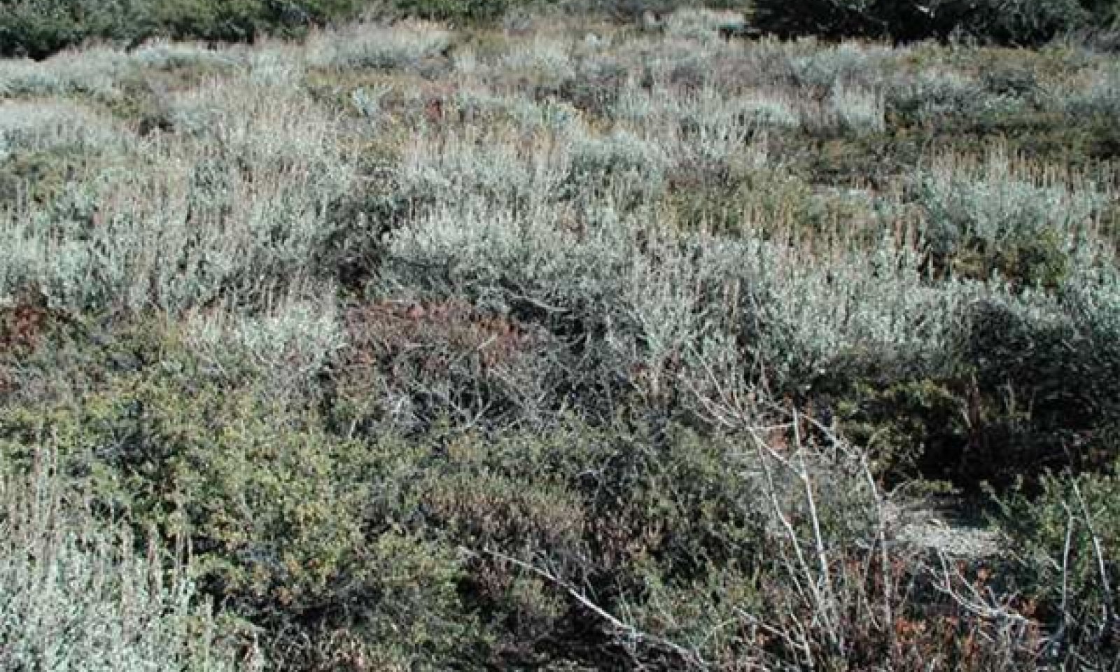
This is a productive mixed shrubland dominated by mountain big sagebrush and antelope bitterbrush. Perennial grasses provide a significant component of the plant community at approximately 15 percent of annual production. Mountain brome is the dominant grass, and big squirreltail (Elymus multisetus), squirreltail (Elymus elymoides), western needlegrass (Achnatherum occidentale) and other needlegrass species, rock melicgrass, needle and thread grass, and basin wildrye may be locally abundant. A diverse array of secondary shrubs are typically present, and may include sulphur-flower buckwheat (Eriogonum umbellatum), slender buckwheat (Eriogonum microthecum), roundleaf snowberry (Symphoricarpos rotundifolius), curl-leaf mountain mahogany (Cercocarpus ledifolius), rubber rabbitbrush (Ericameria nauseosa), oceanspreay (Holodiscus discolor), desert peach (Prunus andersonii), wax currant (Ribes cereum), and gooseberry currant (Ribes montigenum). Perennial forbs contribute significantly to the biodiversity of the community, but make up a minor component of annual production. Common forb species include mountain monardella (Monardella odoratissima), woolly mule-ears (Wyethia mollis), longspur lupine (Lupinus arbustus), spreading phlox (Phlox diffusa), arrowleaf balsamroot (Balsamorhiza sagittata), tapertip hawksbeard (Crepis acuminata), granite prickly phlox (Linanthus pungens), and Indian paintbrush species (Castilleja spp.). Trees may contribute up to four percent canopy cover on this site, and species include whitebark pine (Pinus albicaulis), Jeffrey pine (Pinus jeffreyi), and red fir (Abies magnifica), and western juniper (Juniperus grandis).
Figure 7. Annual production by plant type (representative values) or group (midpoint values)
Table 5. Annual production by plant type
Plant type Low
(lb/acre)Representative value
(lb/acre)High
(lb/acre)Shrub/Vine 975 1150 1360 Grass/Grasslike 90 200 380 Forb 0 20 50 Tree 0 0 4 Total 1065 1370 1794 Table 6. Ground cover
Tree foliar cover 0% Shrub/vine/liana foliar cover 0-10% Grass/grasslike foliar cover 0-0% Forb foliar cover 0% Non-vascular plants 0% Biological crusts 0% Litter 0-10% Surface fragments >0.25" and <=3" 20-50% Surface fragments >3" 0-30% Bedrock 0% Water 0% Bare ground 10-20% Table 7. Canopy structure (% cover)
Height Above Ground (ft) Tree Shrub/Vine Grass/
GrasslikeForb <0.5 – – – 1-5% >0.5 <= 1 – 0-2% 0-1% 0-7% >1 <= 2 0-1% 35-84% 3-15% 0-4% >2 <= 4.5 0-1% 0-13% – – >4.5 <= 13 0-1% – – – >13 <= 40 0-1% – – – >40 <= 80 0-1% – – – >80 <= 120 – – – – >120 – – – – Community 1.2
Early Fire Regeneration (Provisional)This community phase occurs in the first 0 to seven years after fire, with shrub species gradually increasing over time. Perennial grasses and forbs are strongly dominant in this plant community. Most of the perennial grasses found on the site are only top-killed by fire, and quickly become abundant on burned sites (Young and Evans 1978, Seefeldt et al. 2007, Holmes 2010). Mountain brome may be killed by high severity fire, or fire during the growing season, but will usually resprout after being topkilled by fire, will quickly recolonize from seed (Tollefson 2006). Big squirreltail and squirreltail are highly resistant to fire, and quickly become abundant on burned sites. Specific fire effect data is not available for many of the forbs that occur on this site, but some of them are known to increase after fire. Silvery lupine and tapertip hawkweed increase in vigor relative to pre-burn status by the second year after fire (Rau et al. 2008). Silvery lupine is a nitrogen fixer and thus an important colonizer of disturbed sites, and is abundant when fire return intervals are short (Schoennagel et al. 2004). Woolly mules-ears can greatly increase after fire, sometimes becoming dominant (Parker and Yoder-Williams 1989, Riegel et al. 2002). Naked buckwheat (Eriogonum nudum) may also be abundant following fire (Clements and Young 1996). Granite prickly phlox on the other hand, is killed by fire, and only slowly increases with time (Innes 2010). The native annual spreading gunsmoke (Gayophytum diffusum) may become abundant after fire (Schoennagel et al. 2004). The dominant shrubs, mountain big sagebrush and antelope bitterbrush are typically killed by fire and must regenerate from onsite seed banks, or off-site seed dispersal. Depending on the intensity and season of fire, antelope bitterbrush may have up to 50% survival; however it may also be completely killed (Blaisdell and Mueggler 1956, Blaisdell et al. 1982, Clark et al. 1982). Mountain big sagebrush returns to pre-burn cover within 30-40 years (Harniss and Murray 1973, Young and Evans 1978, Lesica et al. 2007, Holmes 2010). Several secondary shrubs that occur on this resprout after fire; these include roundleaf snowberry, desert peach, rubber rabbitbrush, sulphur-flowered buckwheat, oceanspray, bitter cherry, and currant (Young and Evans 1978, Esser 1995, Clements and Young 1996, Rau et al. 2008, Fryer 2010). Curl-leaf mountain mahogany is generally killed (Gucker 2006).
This community is vulnerable to cheatgrass invasion, if cheatgrass continues to move up in elevation. Cheatgrass may contribute to increased fire frequency, and inhibit regeneration of native species (e.g. Holmgren 1956).Community 1.3
Mid-Seral (Provisional)This community phase occurs between approximately seven to 20 years post-fire. Community composition is variable, and depends on the time since fire. It is characterized by a diverse plant community co-dominated by herbaceous and woody species. Shrubs that resprouted post-fire (see community phase 1.2) increase in abundance, and mountain big sagebrush and antelope bitterbrush cover increases. Antelope bitterbrush may recover more quickly if resprouting has occurred. Mountain big sagebrush cover has been reported to recover to one third of pre-burn levels seven years after burning (Holmes 2010), 14 to 50% recovery 12-13 years (Young and Evans 1978, Holmes 2010), 75% 19 years (Holmes 2010), 83% 30 years (Young and Evans 1978), and 100% after 32 years (Lesica et al. 2007).
Pathway 1.1a
Community 1.1 to 1.2Occurs with fire.
Pathway 1.2a
Community 1.2 to 1.3Occurs with time without additional disturbance, including fire, grazing, and severe drought.
Pathway 1.3a
Community 1.3 to 1.1Occurs with time without additional disturbance, including fire, grazing, and severe drought. The time to return to pre-burn conditions varies with climatic conditions and the severity of the fire, but on average may take thirty years, and up to fifty (Miller and Heyendahl, 2008).
Pathway 1.3b
Community 1.3 to 1.2Occurs with fire.
State 2
Degraded StateThis state develops when overgrazing and a lack of fire triggers an ecological threshold to be crossed where the natural community dynamics no longer function and cannot be restored without active intervention. Exploitative grazing practices from the 1850s to approximately 1930 caused this transition to occur in much of the range of this ecological site, especially the Lake Tahoe Basin (Elliot-Fisk et al. 1996, Taylor 2004). Heavy and pervasive sheep grazing in the Lake Tahoe Basin removed all grasses and palatable shrubs in some areas by 1900 (Sudworth, 1900, quoted in Fisk et al. 1996). Over a century later, many of these shrublands have not recovered, and remain heavily dominated by shrubs with a minimal grass component, and increased unpalatable forbs. Fire in this state is rare, and a grass-dominated community does not occur.
Community 2.1
Overgazed
Figure 8. Community Phase 2.1
This community phase is characterized by strong shrub dominance, with shrubs accounting for more than 90% of annual production. Mountain big sagebrush and antelope bitterbrush are the dominant species. There are reports of antelope bitterbrush declining in sagebrush communities with heavy grazing and a lack of fire (Zlatnik 1999), but there is no evidence of this for this ecological site. The perennial grass component is greatly reduced, contributing only 3% of annual production. Forbs account for an increased proportion of annual production than in the reference plant community, and unpalatable species such as woolly mule’s ears may be abundant.
Figure 9. Annual production by plant type (representative values) or group (midpoint values)
Table 8. Annual production by plant type
Plant type Low
(lb/acre)Representative value
(lb/acre)High
(lb/acre)Shrub/Vine 950 1100 1250 Forb 0 50 400 Grass/Grasslike 0 40 55 Tree 0 0 4 Total 950 1190 1709 Table 9. Ground cover
Tree foliar cover 0% Shrub/vine/liana foliar cover 10-10% Grass/grasslike foliar cover 0% Forb foliar cover 0-0% Non-vascular plants 0% Biological crusts 0% Litter 10-90% Surface fragments >0.25" and <=3" 0-50% Surface fragments >3" 0-20% Bedrock 0% Water 0% Bare ground 10-60% Community 2.2
Grazed + Burned (Provisional)This community is initially dominated by forbs such as spreading gunsmoke, silvery lupine, and woolly mule’s ears. With time resprouting shrubs such as rubber rabbitbrush, desert peach, bitter cherry, oceanspray, roundleaf snowberry, currant, and sulphur-flower buckwheat become more abundant. With more time, mountain big sagebrush and antelope bitterbrush recolonize and increase.
Community 2.3
Eroded Community Phase
Figure 10. Community Phase 2.3
This community phase is characterized by a prevalence of bare ground with evidence of erosion such as rills and gullies. Fertile topsoil begins to be lost, and safe sites for seedling recruitment become fewer, creating a negative feedback loop for plant recovery. Forbs dominate this community phase.
Pathway 2.1a
Community 2.1 to 2.2Occurs with fire.
Pathway 2.1b
Community 2.1 to 2.3
Overgazed
Eroded Community PhaseOccurs with continued severe overgrazing. Drought will exacerbate negative impacts.
Pathway 2.2a
Community 2.2 to 2.1Occurs with time without disturbance.
Pathway 2.2b
Community 2.2 to 2.3Occurs with overgrazing of the burned community phase. Drought will exacerbate negative impacts.
Additional community tables
Table 10. Community 1.1 plant community composition
Group Common name Symbol Scientific name Annual production () Foliar cover (%) Shrub/Vine1 Shrubs 975–1360 mountain big sagebrush ARTRV Artemisia tridentata ssp. vaseyana 275–600 15–45 antelope bitterbrush PUTR2 Purshia tridentata 325–525 10–35 sulphur-flower buckwheat ERUM Eriogonum umbellatum 0–220 0–8 slender buckwheat ERMI4 Eriogonum microthecum 0–200 0–8 roundleaf snowberry SYRO Symphoricarpos rotundifolius 5–125 1–10 curl-leaf mountain mahogany CELE3 Cercocarpus ledifolius 0–75 0–3 rubber rabbitbrush ERNA10 Ericameria nauseosa 0–50 0–2 wax currant RICE Ribes cereum 0–30 0–7 oceanspray HODI Holodiscus discolor 0–20 0–2 desert peach PRAN2 Prunus andersonii 0–1 0–1 Grass/Grasslike2 Perennial grasses 90–380 western needlegrass ACOCO Achnatherum occidentale ssp. occidentale 0–120 0–5 big squirreltail ELMU3 Elymus multisetus 0–115 0–5 mountain brome BRMA4 Bromus marginatus 5–85 2–5 needle and thread HECOC8 Hesperostipa comata ssp. comata 0–75 0–4 squirreltail ELEL5 Elymus elymoides 0–60 0–3 rock melicgrass MEST Melica stricta 0–60 0–3 basin wildrye LECI4 Leymus cinereus 0–35 0–3 Ross' sedge CARO5 Carex rossii 0–5 0–2 needlegrass ACHNA Achnatherum 0–5 0–1 Indian ricegrass ACHY Achnatherum hymenoides 0–5 0–1 melicgrass MELIC Melica 0–1 0–1 Forb3 Forbs 0–50 arrowleaf balsamroot BASA3 Balsamorhiza sagittata 0–20 0–1 granite prickly phlox LIPU11 Linanthus pungens 0–15 0–2 tapertip hawksbeard CRAC2 Crepis acuminata 0–10 0–2 woolly mule-ears WYMO Wyethia mollis 0–10 0–2 mountain monardella MOOD Monardella odoratissima 0–1 0–3 sanddune wallflower ERCA14 Erysimum capitatum 0–1 0–2 frosted buckwheat ERIN9 Eriogonum incanum 0–1 0–1 Nuttall's linanthus LENUN Leptosiphon nuttallii ssp. nuttallii 0–1 0–1 Indian paintbrush CASTI2 Castilleja 0–1 0–1 King's sandwort ARKI Arenaria kingii 0–1 0–1 pioneer rockcress ARPL Arabis platysperma 0–1 0–1 pinewoods lousewort PESE2 Pedicularis semibarbata 0–1 0–1 spreading phlox PHDI3 Phlox diffusa 0–1 0–1 catchfly SILEN Silene 0–1 0–1 silvery lupine LUAR3 Lupinus argenteus 0–1 0–1 Tree4 Trees 0–4 California red fir ABMA Abies magnifica 0–1 0–1 western juniper JUGR7 Juniperus grandis 0–1 0–1 whitebark pine PIAL Pinus albicaulis 0–1 0–1 Jeffrey pine PIJE Pinus jeffreyi 0–1 0–1 Table 11. Community 1.2 plant community composition
Group Common name Symbol Scientific name Annual production () Foliar cover (%) Table 12. Community 1.3 plant community composition
Group Common name Symbol Scientific name Annual production () Foliar cover (%) Table 13. Community 2.1 plant community composition
Group Common name Symbol Scientific name Annual production () Foliar cover (%) Shrub/Vine1 Shrubs 950–1250 mountain big sagebrush ARTRV Artemisia tridentata ssp. vaseyana 500–640 30–50 antelope bitterbrush PUTR2 Purshia tridentata 50–440 3–50 gooseberry currant RIMO2 Ribes montigenum 0–65 0–5 roundleaf snowberry SYRO Symphoricarpos rotundifolius 0–30 0–5 wax currant RICE Ribes cereum 0–30 0–5 rubber rabbitbrush ERNA10 Ericameria nauseosa 0–5 0–1 oceanspray HODI Holodiscus discolor 0–5 0–1 bitter cherry PREM Prunus emarginata 0–5 0–1 Grass/Grasslike2 Perennial grasses 0–55 squirreltail ELEL5 Elymus elymoides 0–50 0–1 needlegrass ACHNA Achnatherum 0–5 0–1 mountain brome BRMA4 Bromus marginatus 0–1 0–1 big squirreltail ELMU3 Elymus multisetus 0–1 0–1 rock melicgrass MEST Melica stricta 0–1 0–1 Forb3 Perennial Forbs 0–400 woolly mule-ears WYMO Wyethia mollis 0–350 0–30 marumleaf buckwheat ERMA4 Eriogonum marifolium 0–50 0–20 longspur lupine LUAR6 Lupinus arbustus 0–50 0–10 silvery lupine LUAR3 Lupinus argenteus 0–50 0–3 phlox PHLOX Phlox 0–30 0–1 Brewer's angelica ANBR5 Angelica breweri 0–20 0–8 arrowleaf balsamroot BASA3 Balsamorhiza sagittata 0–15 0–5 mountain monardella MOOD Monardella odoratissima 0–15 0–5 granite prickly phlox LIPU11 Linanthus pungens 0–5 0–1 naked buckwheat ERNU3 Eriogonum nudum 0–2 0–1 spreading groundsmoke GADI2 Gayophytum diffusum 0–1 0–1 Holboell's rockcress ARHO2 Arabis holboellii 0–1 0–1 wavyleaf Indian paintbrush CAAP4 Castilleja applegatei 0–1 0–1 tapertip hawksbeard CRAC2 Crepis acuminata 0–1 0–1 sanddune wallflower ERCA14 Erysimum capitatum 0–1 0–1 spreading phlox PHDI3 Phlox diffusa 0–1 0–1 waxy checkerbloom SIGL2 Sidalcea glaucescens 0–1 0–1 Tree4 Trees 0–1 whitebark pine PIAL Pinus albicaulis 0–1 0–1 Jeffrey pine PIJE Pinus jeffreyi 0–1 0–1 Table 14. Community 2.2 plant community composition
Group Common name Symbol Scientific name Annual production () Foliar cover (%) Table 15. Community 2.3 plant community composition
Group Common name Symbol Scientific name Annual production () Foliar cover (%) Interpretations
Animal community
Mountain big sagebrush - bitterbrush communities are very important for food and cover for wildlife (e.g. Blaisdell et al. 1982, Johnson, 2000). These communities have been used extensively for domestic livestock grazing, with the perennial grasses and bitterbrush considered desirable browse and forage, and mountain big sagebrush considered undesirable. Mountain big sagebrush and bitterbrush are both highly preferred winter forage species for mule deer (Zlatnik, 1999, Johnson, 2000).
Recreational uses
This ecological site is very scenic, and is suitable for properly designed hiking trails.
Supporting information
Inventory data references
Community Phase 1.1 NV782 Toiyabe National Forest Soil Survey H4 H58 H115 AB229 H7 H8 Community Phase 2.1 CA693 Tahoe Basin Soil Survey RcF03h109 (Production) Rx03041 RX03402 Rx03h119 (Production) rx03h146 (Production) rx02h70 rx02h65 rx02h64 Rx03086 sm02h43a Community Phase 2.3 Rx02043 Rx02044b
Type locality
Location 1: Placer County, CA Township/Range/Section T14N R16E S5 UTM zone N UTM northing 4330004 UTM easting 738540 General legal description Take Barker Pass Road to Barker Pass, and hike north on trail about a mile. Site is to east of trail on small spur ridge. Other references
Blaisdell, J. P. and W. F. Mueggler. 1956. Sprouting of bitterbrush (Purshia tridentata) following burning or top removal. Ecology 37:365-370.
Blaisdell, J. P., R. B. Murray, and E. D. McArthur. 1982. Managing intermountain rangelands--sagebrush-grass ranges. U.S. Department of Agriculture, Forest Service, Intermountain Forest and Range Experimental Station, Ogden, UT.
Clark, R. G., C. M. Britton, and R. A. Sneva. 1982. Mortality of bitterbrush after burning and clipping in eastern Oregon. Journal of Range Management:711-714.
Clements, C. D. and J. A. Young. 1996. Influence of rodent predation on antelope bitterbrush seedlings. Journal of Range Management 49:31-34.
Elliot-Fisk, D. L., R. Harris, R. A. Rowntree, T. C. Cahill, R. Kattelmann, P. Rucks, O. K. Davis, R. Lacey, D. A. Sharkey, L. Duan, D. Leisz, S. L. Stephens, C. R. Goldman, S. Lindstrom, D. S. Ziegler, G. E. Gruell, and D. Machida. 1996. Lake Tahoe Case Study. Pages 217-276 Sierra Nevada Ecosystem Project. University of California, Centers for Water adn Wildland Resources, Davis, CA.
Esser, L. L. 1995. Prunus emarginata. Fire Effects Information System. U.S. Department of Agriculture, Forest Service, Rocky Mountain Research Station, Fire Sciences Laboratory.
Fryer, J. L. 2010. Holodiscus discolor. Fire Effects Information System. U.S. Department of Agriculture, Forest Service, Rocky Mountain Research Station, Fire Sciences Laboratory.
Gucker, C. L. 2006. Cercocarpus ledifolius. Fire Effects Information System,. U.S. Department of Agriculture, Forest Service, Rocky Mountain Research Station, Fire Sciences Laboratory.
Harniss, R. O. and R. B. Murray. 1973. Thirty years of vegetal change following burning of sagebrush-grass range. Journal of Range Management 26:322-325.
Hayhoe, K., D. Cayan, C. B. Field, P. C. Frumhoff, E. P. Maurer, N. L. Miller, S. C. Moser, S. H. Schneider, K. N. Cahill, E. E. Cleland, L. Dale, R. Drapek, R. P. Hanemann, L. S. Kalkstein, J. Lenihan, C. K. Lunch, R. P. Neilson, S. C. Sheridan, and J. H. Verville. 2004. Emissions pathways, climate change, and impacts on California. PNAS 101.
Holmes, A. L. 2010. Small mammal and bird abundance in relation to post-fire habitat succession in mountain big sagebrush (Artemisia tridentata ssp. vaseyana) communities. Oregon State University.
Holmgren, R. C. 1956. Competition between annuals and young bitterbrush (Pushia tridentata) in Idaho. Ecology 37:370-378.
Innes, R. J. 2010. Linanthus pungens. Fire Effects Information System. U.S. Department of Agriculture, Forest Service, Rocky Mountain Research Station, Fire Sciences Laboratory.
Lesica, P., S. V. Cooper, and G. Kudray. 2007. Recovery of big sagebrush following fire in southwest Montana. Rangeland Ecology and Management 60:261-269.
McIver, J. D., M. Brunson, S. Bunting, J. Chambers, N. Devoe, P. Doescher, J. Grace, D. Johnson, S. Knick, R. Miller, M. Pellant, F. Pierson, D. Pyke, K. Rollins, B. Roundy, E. Schupp, R. Tausch, and D. Turner. 2010. The Sagebrush StepeTreatment Evaluation Project (SageSTEP): A test of State-and-Transition Theory. USDA Forest Service, Rocky Mountain Research Station, Fort Collins, CO.
Miller, R. F. and E. K. Heyerdahl. 2008. Fine-scale variation of historical fire regimes in sagebrush-steppe and juniper woodland: an example from California, USA. International Journal of Wildland Fire 17:245-254.
Miller, R. F. and J. A. Rose. 1999. Fire history and western juniper encroachment in sagebrush steppe. Journal of Range Management 52:550-559.
Parker, V. T. and M. P. Yoder-Williams. 1989. Reduction of survival and growth of young Pinus jeffreyi by an herbaceous perennial, Wyethia mollis. American Midland Naturalist 121:105-111.
Rau, B. M., J. C. Chambers, R. R. Blank, and D. W. Johnson. 2008. Prescribed fire, soil, and plants: burn effects and interactions in the central Great Basin. Rangeland Ecology and Management 61:169-181.
Riegel, G. M., T. J. Svejcar, and M. D. Busse. 2002. Does the presence of Wyethia mollis affect growth of Pinus jeffreyi seedlings? Western North American Naturalist 62:141-150.
Safford, H. D., M. North, and M. D. Meyer. 2012. Climate change and the relevance of historical forest conditions. Pages 23-45 in M. North, editor. Managing Sierra Forests. Gen. Tech. Rep. PSW-GTR-237. U.S. Department of Agriculture, Forest Service, Pacific Southwest Research Station, Albany, CA.
Schoennagel, T., D. M. Waller, M. G. Turner, and W. H. Romme. 2004. The effect of fire interval on post-fire understorey communities in Yellowstone National Park. Journal of Vegetation Science 15:797-806.
Seefeldt, S. S., M. Germino, and K. DiCristina. 2007. Prescribed fires in Artemisia tridentata ssp. vaseyana steppe have minor and transient effects on vegetation cover and composition. Applied Vegetation Science 10:249-256.
Taylor, E. H. 2004. Identifying forest reference conditions on early cut-over lands, Lake Tahoe Basin, USA. Ecological Applications 14:1903-1920.
Tollefson, J. E. 2006. Bromus carinatus. Fire Effects Information System. U.S. Department of Agriculture, Forest Service, Rocky Mountain Research Station, Fire Sciences Laboratory.
Yeo, J. L. 2005. Effects of grazing exclusion on rangeland vegetation and soils, east central Idaho. Western North American Naturalist 65:91-102.
Young, J. A. and R. A. Evans. 1978. Population dynamics after wildfires in sagebrush grasslands. Journal of Range Management 31:283-289.
Zlatnik, E. 1999. Purshia tridentata. Fire Effects Information System. U.S. Department of Agriculture, Forest Service, Rocky Mountain Research Station, Fire Sciences Laboratory.
Contributors
Alice Miller
M. MunneckeRangeland health reference sheet
Interpreting Indicators of Rangeland Health is a qualitative assessment protocol used to determine ecosystem condition based on benchmark characteristics described in the Reference Sheet. A suite of 17 (or more) indicators are typically considered in an assessment. The ecological site(s) representative of an assessment location must be known prior to applying the protocol and must be verified based on soils and climate. Current plant community cannot be used to identify the ecological site.
Author(s)/participant(s) Contact for lead author Date Approved by Approval date Composition (Indicators 10 and 12) based on Annual Production Indicators
-
Number and extent of rills:
-
Presence of water flow patterns:
-
Number and height of erosional pedestals or terracettes:
-
Bare ground from Ecological Site Description or other studies (rock, litter, lichen, moss, plant canopy are not bare ground):
-
Number of gullies and erosion associated with gullies:
-
Extent of wind scoured, blowouts and/or depositional areas:
-
Amount of litter movement (describe size and distance expected to travel):
-
Soil surface (top few mm) resistance to erosion (stability values are averages - most sites will show a range of values):
-
Soil surface structure and SOM content (include type of structure and A-horizon color and thickness):
-
Effect of community phase composition (relative proportion of different functional groups) and spatial distribution on infiltration and runoff:
-
Presence and thickness of compaction layer (usually none; describe soil profile features which may be mistaken for compaction on this site):
-
Functional/Structural Groups (list in order of descending dominance by above-ground annual-production or live foliar cover using symbols: >>, >, = to indicate much greater than, greater than, and equal to):
Dominant:
Sub-dominant:
Other:
Additional:
-
Amount of plant mortality and decadence (include which functional groups are expected to show mortality or decadence):
-
Average percent litter cover (%) and depth ( in):
-
Expected annual annual-production (this is TOTAL above-ground annual-production, not just forage annual-production):
-
Potential invasive (including noxious) species (native and non-native). List species which BOTH characterize degraded states and have the potential to become a dominant or co-dominant species on the ecological site if their future establishment and growth is not actively controlled by management interventions. Species that become dominant for only one to several years (e.g., short-term response to drought or wildfire) are not invasive plants. Note that unlike other indicators, we are describing what is NOT expected in the reference state for the ecological site:
-
Perennial plant reproductive capability:
Print Options
Sections
Font
AAAAOther
PrintThe Ecosystem Dynamics Interpretive Tool is an information system framework developed by the USDA-ARS Jornada Experimental Range, USDA Natural Resources Conservation Service, and New Mexico State University.
Accessibility statement


