
Natural Resources
Conservation Service
Ecological site BX013X01B030
Overflow
Bear River Valley
10-14" P.Z.
Last updated: 4/01/2025
Accessed: 09/13/2026
-
Search


Major Land Resource Area or ecological site by name and/or ID.
PreviousSectionsNextGeneral information
Provisional. A provisional ecological site description has undergone quality control and quality assurance review. It contains a working state and transition model and enough information to identify the ecological site.
MLRA notes
Major Land Resource Area (MLRA): 013X–Eastern Idaho Plateaus
Major Land Resource Area (MLRA) 13, Eastern Idaho Plateaus, consists of approximately 5 million acres in Idaho with a small part in Utah and Wyoming. It consists of 6 Land Resource Units (LRU). These units are divisions of the MLRA based on geology, landscape, common soils, water resources and plant community potentials. The elevation ranges from approximately 4500 to 6600 feet (1370 to 2010 m) on the plateaus and foothills to as much as 9500 feet (2895 m) on the mountains. Annual precipitation ranges from 10 to 48 inches (254 to 1220 mm), with the driest areas in the Bear River Valley on the far eastern portion and the wettest areas on the mountain summits. The Fort Hall Indian Reservation and several national forests are in this MLRA, including the Caribou, Cache, and Targhee National Forests. Yellowstone and Grand Teton National Parks occur just outside the northeast boundary.
LRU notes
The Bear River Valley LRU is located on the far eastern side of MLRA 13 between the Bear River Divide and the Monte Cristo Range, from Woodruff, Utah at the southern end to Cokeville, Wyoming at the northern end. The total area of the LRU is approximately 340,000 acres. It shares a boundary with MLRA 47 - Wasatch and Uinta Mountains, 43B - Central Rocky Mountains and 46 - Northern Rocky Mountain Foothills (proposed in Wyoming).
This LRU differs from the others in its geology, which is comprised mostly of alluvium and colluvium from the Stump Formation. Its weather patterns are such that the soil moisture regime is xeric, meaning there is a slight peak in winter precipitation in this LRU, with typical yearly precipitation between 10 to 15 inches (254-380 mm). The soil temperature regime of this LRU is frigid with mean annual soil temperatures ranging from 44 to 48 degrees Fahrenheit (6.7 to 8.8 C). The elevation range is from 5700 to 7000 feet (1730 to 2130 m). The soils in the Bear River Valley are dominated by young aged very deep soils developed from sandstone and shale parent material re-worked with recent alluvium. Soils are dominated by Alfisols with young argillic horizons and by Fluvents in more recent alluvium.
The Bear River runs through this LRU, allowing for ample amounts of irrigation water used in the lowland areas to produce hay with smaller tributaries originating from the neighboring mountains.Classification relationships
Relationship to Other Established Classification Systems
National Vegetation Classification System (NVC):
3 Semi-Desert
3.B.1 Cool Semi-Desert Scrub & Grassland
3.B.1.Ne Western North American Cool Semi-Desert Scrub & Grassland Division
M169 Great Basin & Intermountain Tall Sagebrush Shrubland & Steppe Macrogroup
G302 Intermountain Mesic Tall Sage Steppe and Shrubland Group
A3183 Basin Big Sagebrush Mesic Steppe and Shrubland Alliance
CEGL001016 Artemisia tridentata ssp. tridentata/Leymus cinereus Shrubland Association
Ecoregions (EPA):
Level I: 10 North American Deserts
Level II: 10.1 Cold Deserts
Level III: 10.1.4 Wyoming BasinEcological site concept
Overflow Bear River Valley 10-14" P.Z. (Ov-BRV) is an extra moisture ecological site found in drainageways with variable and often stratified soil surface textures within the top 6 inches and is not limited by chemistry or water holding capacity (deep to very deep with >6" AWC).
• This site receives additional water from overland flow and is located in drainageways
• The soils are:
o not saline or sodic
o are deep to very deep, 60-200 inches (152-502 cm)
o not skeletal within 20 inches (50 cm) of the soil surface; they have less than 35 percent rock fragments by volume in the top 20 inches (50 cm)
o not violently effervescent within the top 16 inches (40 cm) of mineral soil
o with surface textures including fine sandy loam, loam, silt loam, and clay loam in top 6 inches (15 cm) mineral soil
• have slopes less than 5%
Climate:
xeric moisture regime
frigid temperature regimeAssociated sites
BX013X01B004 Clayey Bear River Valley 10-14" P.Z.
This site does not receive additional water from overland flow, is located on fans not drainageways, has lower production and different species composition potential.
BX013X01B022 Loamy Bear River Valley 10-14" P.Z.
This site does not receive additional water from overland flow, is not located in drainageways, has lower production and different species composition potential.
BX013X01B024 Loamy Argillic Bear River Valley 10-14" P.Z.
This site does not receive additional water from overland flow, is not located in drainageways, has lower production and different species composition potential.
Similar sites
R034AY230WY Overflow Foothills and Basins West (Ov)
Previous version of site used in Wyoming
R034AA237UT Semi-desert Loamy Run-on (Basin big sagebrush/ Mixed bunchgrass)
Previous version of site used in Utah
Table 1. Dominant plant species
Tree Not specified
Shrub (1) Artemisia tridentata ssp. tridentata
Herbaceous (1) Leymus cinereus
Legacy ID
R013XA130WY
Physiographic features
This site occurs on drainageway landforms at elevations between 5,700 and 7,000 feet. This site occurs on all aspects. The slopes range from level to 5 percent. Flooding and ponding may occur on this site.
Landform Definition:
drainageway -- - (a) A general term for a course or channel along which water moves in draining an area. (b) [soil survey] a term restricted to relatively small, roughly linear or arcuate depressions that move concentrated water at some time, and either lack a defined channel (e.g. head slope, swale) or have a small, defined channel (e.g. low order streams).Table 2. Representative physiographic features
Landforms (1) Valley > Drainageway
Flooding duration Very brief (4 to 48 hours) to brief (2 to 7 days) Flooding frequency Rare to occasional Ponding frequency None to rare Elevation 5700 – 7000 ft Slope 0 – 5 % Water table depth 40 – 200 in Aspect Aspect is not a significant factor Climatic features
Annual precipitation in the Bear River Valley ranges from 10 to 14 inches per year. Wide fluctuations may occur in yearly precipitation and result in more below average years than those with above average precipitation. Temperatures show a wide range between summer and winter and between daily maximums and minimums. This is predominantly due to the high elevation and dry air, which permits rapid incoming and outgoing radiation. Cold air outbreaks in winter move rapidly from northwest to southeast and account for extreme minimum temperatures. Roughly 25 to 30 percent of the precipitation occurs during the critical growth period, but the majority of precipitation accumulates outside the growing season, creating xeric-like conditions. The wettest rainfall month is May. The dominant plants (sagebrush and cool season grasses) are well adapted to these conditions. Daytime winds are generally stronger than nighttime and occasional strong storms may bring brief periods of high winds with gusts to more than 50 mph. The growing season is short (60 to 90 days) and cool (critical growth period): primary growth typically occurs between May and June. Growth of native cool-season plants begins about mid-April and continues to approximately early July. Some green-up of cool-season plants usually occurs in September with adequate fall moisture.
All data is based on the 30 year average from 1981 through 2010.Table 3 Representative climatic features
Frost-free period (characteristic range) 40-90 days Freeze-free period (characteristic range) 50-110 days Precipitation total (characteristic range) 10-10 in Frost-free period (actual range) 40-90 days Freeze-free period (actual range) 30-110 days Precipitation total (actual range) 10-20 in Frost-free period (average) 60 days Freeze-free period (average) 80 days Precipitation total (average) 10 in Characteristic rangeActual rangeBarLineFigure 1. Monthly precipitation range
Characteristic rangeActual rangeBarLineFigure 2. Monthly minimum temperature range
Characteristic rangeActual rangeBarLineFigure 3. Monthly maximum temperature range
BarLineFigure 4. Monthly average minimum and maximum temperature
Figure 5. Annual precipitation pattern
Figure 6 Annual average temperature pattern
Climate stations used
-
(1) WOODRUFF [USC00429595], Woodruff, UT
-
(2) RANDOLPH [USC00427165], Randolph, UT
-
(3) SAGE 4 NNW [USC00487955], Cokeville, WY
">Influencing water features
This ecological site receives additional moisture from snow melt and runoff events from surrounding uplands. Flooding and ponding may occur, but is very brief (4 to 48 hours) to brief (2 to 7 days).
Wetland description
N/A
Soil features
The soils of this site are deep to very deep (40 to 200 inches) and formed in alluvium derived from inter-bedded sedimentary rock. Surface textures include fine sandy loam, loam, silt loam, and clay loam. Rock fragments may be found on the soil surface or in the profile and make up less than 15 percent of the soil volume. These soils are well-drained and have moderately slow to moderate permeability.
Overflow is an extra moisture ecological site found in drainageways with variable and often stratified soil surface textures within the top 6 inches and is not limited by chemistry or water holding capacity (deep to very deep with greater than 6 inches AWC).
The soil moisture regime is xeric and the soil temperature regime is frigid.
Major Soil Series correlated to this site include: Market, Clegg, and Cubby
Representative Taxonomy: Fine-loamy, mixed, superactive, frigid Pachic Argixerolls and Fine-loamy, mixed, superactive, frigid Oxyaquic HaploxerollsTable 4. Representative soil features
Parent material (1) Alluvium – interbedded sedimentary rock
Surface texture (1) Loam
(2) Silt loam
(3) Clay loam
Drainage class Moderately well drained to well drained Permeability class Moderately slow to moderate Depth to restrictive layer 60 – 200 in Soil depth 40 – 200 in Surface fragment cover <=3" 0 – 10 % Surface fragment cover >3" 0 – 5 % Available water capacity
(0-40in)6 – 9 in Calcium carbonate equivalent
(0-20in)0 – 15 % Clay content
(0-6in)16 – 38 % Electrical conductivity
(0-20in)0 – 2 mmhos/cm Sodium adsorption ratio
(0-20in)0 – 3 Soil reaction (1:1 water)
(0-20in)7 – 8 Subsurface fragment volume <=3"
(10-20in)0 – 15 % Subsurface fragment volume >3"
(10-20in)0 – 5 % Ecological dynamics
A State-and-Transition Model (STM) diagram is depicted in this section. Thorough descriptions of each state, transition, plant community phase, and pathway are found after the model in this document. This diagram is based on available experimental research, field observations, professional consensus, and interpretations. While based on the best available information, the STM will change over time as knowledge of ecological processes increases.
Plant community composition within the same ecological site has a natural range of variability across the LRU due to the naturally occurring variability in weather, soils, and aspect. Not all managers will choose the Reference Plant Community as the management goal. Other plant communities may be desired to meet land management objectives. This is valid as long as the rangeland health attributes assessment departures are none to slight or slight to moderate from the Reference State. The biological processes on this site are complex; therefore, representative values are presented in a land management context. The species lists are representative and are not botanical descriptions of all species occurring, or potentially occurring, on this site. They are not intended to cover every situation or the full range of conditions, species, and responses for the site.
Both percent species composition by weight and percent cover are used in this ESD. Most observers find it easier to visualize or estimate percent cover for woody species (trees and shrubs). Foliar cover is used to define plant community phases and states in the State-and-Transition Model. Cover drives the transitions between communities and states because of the influence of shade and interception of rainfall.
Species composition by dry weight remains an important descriptor of the herbaceous community and of site productivity as a whole and includes both herbaceous and woody species. Calculating similarity index requires data on species composition by dry weight.
Although there is considerable qualitative experience supporting the pathways and transitions within the State-and-Transition Model, no quantitative information exists that specifically identifies threshold parameters between reference states and degraded states in this ecological site. For information on STMs, see the following citations: Bestelmeyer et.al. 2003, Bestelmeyer et.al. 2004, Bestelmeyer et.al. 2010, Bestelmeyer and Brown 2005, Briske et.al. 2008, and Stringham et,al. 2003.
A resource concern risk assessment and dominant resource concerns are provided for each Land Use, State, and/or Plant Community Phase based on NRCS resource concern and planning criteria used to determine resource treatment levels during the conservation planning process. A resource concern is the resource condition that does not meet the minimum accepted levels established by planning criteria as shown in Section III of the NRCS Field Office Technical Guide (https://efotg.sc.egov.usda.gov/#/).
• Low risk means a low probability for the category of resource concerns and additional assessment is typically not necessary.
• Medium risk means that the category of resource concerns could occur, and additional assessment is recommended if the identified resource is a client concern and/or objective.
• High risk means that a resource concern in that category is likely to occur.
The resource categories are: S (soil), W (water), A (air), P (plant), A (animal), E (energy), and H (human). The dominant resource concerns further refine the resource category to a specific resource concern within that category.State and transition model
More interactive model formats are also available. View Interactive Models
Click on state and transition labels to scroll to the respective textC1A - Flood irrigation, tillage, and seeding C1B - Irrigation (improved flood or sprinkler), tillage, and seeding C2A - Sprinkler irrigation, tillage, and seeding Land use 1 submodel, ecosystem states
SWAPAEHSWAPAEHSWAPAEHSWAPAEHSWAPAEHStates 1, 5 and 2 (additional transitions)
T1A - Herbivory (continuous or season-long, low to moderate stocking) T1B - Soil disturbance (e.g. hoof action, rodents, water erosion) and high intensity fire or chemical/mechanical treatment T1C - Gully erosion T2A - Soil disturbance (e.g. hoof action, rodents, water erosion) and high intensity fire or chemical/mechanical treatment T2B - Extreme herbivory (continuous, high intensity) T2C - Gully erosion T3A - Extreme disturbance (e.g. catastrophic fire, drought, soil removal) T3B - Gully erosion T4A - Gully erosion State 1 submodel, plant communities
1.1A - Sage-thinning event (flooding, prolonged soil saturation, drought, freeze-kill, snow mold, low intensity fire, herbivory, chemical/mechanical treatment) 1.1B - Sage-killing event (severe drought, flooding, prolonged soil saturation, freeze-kill, snow mold, moderate intensity fire, herbivory, or mechanical/chemical treatment) 1.2A - Natural Succession 1.2B - Sage-killing event (severe drought, flooding, prolonged soil saturation, freeze-kill, snow mold, moderate intensity fire, herbivory, mechanical/chemical treatment) 1.3A - Natural Succession State 2 submodel, plant communities
2.1A - Sage-killing event (mechanical or chemical treatment, herbivory, flooding, prolonged soil saturation, drought, freeze-kill, snow mold) 2.2A - Natural Succession State 3 submodel, plant communities
3.1A - Sage-killing event (high intensity fire, consecutive mechanical or chemical treatments) 3.2A - Natural Succession State 4 submodel, plant communities
4.1A - Sage-killing Event (catastrophic fire, mechanical treatment) 4.2A - Natural Succession State 5 submodel, plant communities
Land use 2 submodel, ecosystem states
SWAPAEHSWAPAEHT1A - Irrigation abandonment Land use 3 submodel, ecosystem states
SWAPAEHLand use 1
RangelandRangeland is the dominant land use for this site and provides the most diverse ecosystem services. Range is land on which the historic and introduced vegetation is predominantly grasses, grass-like plants, forbs or shrubs managed as a natural ecosystem. Range may include natural grasslands, savannas, shrublands, tundra, alpine communities, marshes and meadows.
Characteristics and indicators. This land use consists of diverse native plant communities dominated by big sagebrush and perennial cool season grasses that provide for site stability, hydrologic function, and biotic integrity of the site.
State 1.1
ReferenceThe Reference State consists of three plant communities: the Big Sagebrush/Bunchgrass community (1.1.1), the Bunchgrass/Big Sagebrush community (1.1.2), and the Bunchgrass community (1.1.3). Each plant community differs in percent composition and foliar cover of bunchgrasses and shrubs. The dominant shrub is basin big sagebrush. Forbs are a minor component.
Two important processes occur in the Reference State and result in plant community changes: 1) sagebrush-killing disturbances such as fire, herbivory, drought, and flood; and 2) time without those disturbances, generally referred to as "natural succession."
Characteristics and indicators. The shift between plant community phases is dependent upon sagebrush-killing disturbances, and without them it will increase even with proper grazing management. Improper grazing management may accelerate the rate of increase for the shrub component. Management actions can and are often used to mimic the natural disturbance regime through mechanical and chemical treatments. Prescribed fire is not often used due to land use and ownership patterns, lack of fine fuels, and adequate burn windows (Clause and Randall, 2014).
Resilience management. This site has moderate resilience due to its xeric soil moisture regime and frigid temperature regime (Chambers et.al. 2014). Precipitation is typically adequate and more effective with cooler temperatures, but timing of precipitation lowers resilience. Moisture is often not present when needed to support recovery efforts. The site can usually recover after disturbance but is susceptible to delays in recovery during extreme climatic events such as drought. The site has moderately low resistance to invasion by annual grasses because of climate suitability. Winter precipitation patterns favor annual invasion while cooler temperatures provide some resistance. The site is susceptible to invasion during hotter climatic periods.
Dominant plant species
-
basin big sagebrush (Artemisia tridentata ssp. tridentata), shrub
-
slender wheatgrass (Elymus trachycaulus), grass
-
basin wildrye (Leymus cinereus), grass
Dominant resource concerns
-
Terrestrial habitat for wildlife and invertebrates
-
Inadequate livestock water quantity, quality, and distribution
State 1.2
Grazing ResistantThe Grazing Resistant State has seen a shift in under-story functional/structural group dominance. Due to herbivory pressure, there is a shift from tall and mid-stature cool-season bunchgrasses to short-stature cool-season bunchgrasses such as Sandberg bluegrass and rhizomatous wheatgrasses like thickspike wheatgrass and western wheatgrass.
Characteristics and indicators. There are fewer tall and mid-stature bunchgrasses and they are typically found under the shrub canopy where they are protected from herbivory. The shrub canopy inter-spaces are occupied by grazing tolerant grasses as well as patches of bare ground that are sometimes connected. Canopy gaps and bare ground increase, while herbaceous foliar cover decreases. Drier site conditions result in lower productivity and less herbaceous production potential. Decreased infiltration is caused by increased bare ground patch size and lack of litter that acts as mulch in retaining soil moisture and retarding runoff. In many cases, the transition to the Grazing Resistant State may have occurred many decades ago during an era of higher stocking rates and continuous grazing during the growing season. However, continual grazing during the critical growth period (roughly May through June) at proper stocking rates will facilitate the transition to this state and maintain it as a stable state.
Resilience management. Site resilience is lower than the Reference State. Site hydrology has been modified due to moisture being utilized by shallower rooting species. Therefore, the site is drier earlier in the season and unable to recover as quickly after a disturbance. This state is more drought-prone, and therefore more vulnerable to invasion by annual invasive species. However, existing sagebrush canopy and remnant perennial vegetation provide some amount of resiliency. Rhizomatous grasses form mats that provide soil protection by protecting the soil from raindrop impact, decreasing the risk of soil erosion. However, overall soil stability is lower than the Reference State, primarily due to a reduction in soil organic matter due to a reduction in litter. Site resistance to invasion by annual grasses is lower due to niches in the under-story for establishment as well as site water availability during the time suited for winter annuals such as cheatgrass (<a class="species-link" href="https://plants.usda.gov/core/profile?symbol=BRTE" target="_blank" title="Open in plants.usda.gov"><i>Bromus tectorum</i></a>). Episodic and limited moisture is more suited to annual life forms.
Dominant plant species
-
basin big sagebrush (Artemisia tridentata ssp. tridentata), shrub
-
western wheatgrass (Pascopyrum smithii), grass
-
Sandberg bluegrass (Poa secunda), grass
Dominant resource concerns
-
Sheet and rill erosion
-
Classic gully erosion
-
Plant productivity and health
-
Plant structure and composition
-
Terrestrial habitat for wildlife and invertebrates
-
Feed and forage imbalance
-
Inadequate livestock water quantity, quality, and distribution
State 1.3
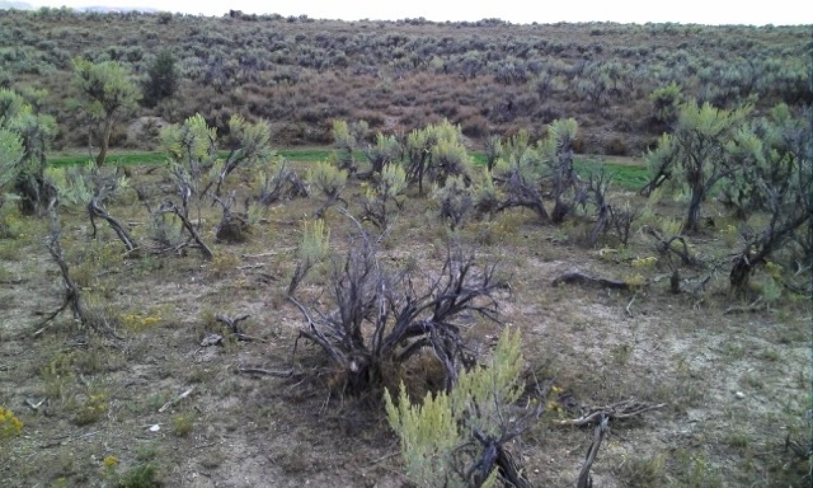
DisturbedThe Disturbed State is a result of soil-disturbing activities outside of the normal disturbance regime expected for this site. Examples are high intensity hoof action, anthropogenic activity, rodent activity, or frequent flooding, which includes occasional irrigation. It may also occur after brush management preceded or followed by improper grazing techniques that include high-intensity grazing use without appropriate recovery periods.
Brush management treatment methods include mechanical (including heavy equipment/construction or a mowing/chaining/harrow type sage treatment), chemical (including 2,4-D or tebuthiron), or biological (including browse and insects). Fire could be a factor in maintaining this plant community by stimulating sprouting shrubs (rabbitbrush) and killing sagebrush.
Removal of shrubs without proper grazing management can lead to an increase in bare ground and erosion of the upper soil horizon. Consequences of this are decreased soil organic matter and soil erosion, soil crusting, and a decrease in soil surface aggregate stability.
Characteristics and indicators. There is a shift toward sprouting shrub dominance or co-dominance with big sagebrush depending on how long it has been since the disturbance(s). Both green and rubber rabbitbrush may be present, but rubber rabbitbrush is more dominant. Along with a shift in shrub species, the herbaceous under-story also shifts toward more disturbance tolerant species such as western wheatgrass. Annual weeds such as bur buttercup, flixweed, and lambsquarter, and invasive annual grasses such as cheatgrass are are often present in small amounts (less than 5 percent composition by dry weight).
Resilience management. Site resilience is lower than the Reference State or Grazing Resistant State, but higher than the Invaded State. Site hydrology has been modified due to moisture being utilized by shallower rooting species. Therefore, the site is drier earlier in the season and unable to recover as quickly after a disturbance. However, existing sagebrush canopy and remnant perennial vegetation provide some amount of resiliency. Site resistance to invasion by annual grasses is lower due to niches in the under-story for establishment as well as site water availability during the time suited for winter annuals such as cheatgrass (<a class="species-link" href="https://plants.usda.gov/core/profile?symbol=BRTE" target="_blank" title="Open in plants.usda.gov"><i>Bromus tectorum</i></a>). Episodic and limited moisture is more suited to annual life forms during drought.
Dominant plant species
-
rubber rabbitbrush (Ericameria nauseosa), shrub
-
basin big sagebrush (Artemisia tridentata ssp. tridentata), shrub
-
western wheatgrass (Pascopyrum smithii), grass
-
Sandberg bluegrass (Poa secunda), grass
Dominant resource concerns
-
Sheet and rill erosion
-
Classic gully erosion
-
Plant productivity and health
-
Plant structure and composition
-
Plant pest pressure
-
Terrestrial habitat for wildlife and invertebrates
-
Feed and forage imbalance
-
Inadequate livestock water quantity, quality, and distribution
State 1.4
InvadedThe Invaded State has seen a shift in dominance toward annual invasive grasses. It often occurs after a disturbance that occurs in conjunction with drought conditions.
Characteristics and indicators. In this state, sagebrush canopy varies, but the under-story is dominated by annual invasive and weedy species. There will be indicators of reduced soil and site stability as well as reduced hydrologic function, mainly water flow patterns and pedestals, but potentially rills and gullies. Soil surface loss and degradation is likely. Biotic integrity is affected by functional/structural groups not expected for the site, invasive plants, and the loss of perennial species and functional/structural groups. The site is more prone to drought with large fluctuations in annual production in response to weather events. The site is less diverse with lower quality habitat for wildlife and pollinators, and the risk of wildfire is increased from fine fuel production.
Resilience management. Site resilience is lower than all other states because the site hydrology has been modified resulting in greater runoff during spring melt and rainfall events. Therefore, the site is drier and unable to recover as quickly after a disturbance. Site resistance to invasion by annual grasses is lost due to niches in the under-story for establishment as well as site water availability during the time suited for winter annuals such as cheatgrass (<a class="species-link" href="https://plants.usda.gov/core/profile?symbol=BRTE" target="_blank" title="Open in plants.usda.gov"><i>Bromus tectorum</i></a>). Episodic and limited moisture is more suited to annual life forms.
Dominant plant species
-
rubber rabbitbrush (Ericameria nauseosa), shrub
-
basin big sagebrush (Artemisia tridentata ssp. tridentata), shrub
-
cheatgrass (Bromus tectorum), grass
Dominant resource concerns
-
Sheet and rill erosion
-
Classic gully erosion
-
Plant productivity and health
-
Plant structure and composition
-
Plant pest pressure
-
Wildfire hazard from biomass accumulation
-
Terrestrial habitat for wildlife and invertebrates
-
Feed and forage imbalance
-
Inadequate livestock water quantity, quality, and distribution
State 1.5
ErodedThe Eroded State has seen a shift in functional/structural group dominance to a monotypic old-aged, decadent basin big sagebrush stand. Due to gully erosion, the ecological dynamics have been altered to prevent prolonged soil saturation, which is a major driver in sited dynamics in the reference state.
Characteristics and indicators. Site productivity is lower and is dominated by even-aged stands of old, decadent basin big sagebrush. The understory is sparse and can resemble many other states described for this site, but the defining indicator is gully erosion that effectively drains this site, changing site hydrology.
Resilience management. Site resilience is much lower than the Reference State. Site hydrology has been modified due to gully erosion. Therefore, the site is drier earlier in the season and unable to turn over sagebrush communities. This state is more drought-prone, and therefore more vulnerable to invasion by annual invasive species. Overall soil stability is much lower than the reference state due to a soil loss and a reduction in soil organic matter due to a reduction in litter. Site resistance to invasion by annual grasses is lower due to niches in the under-story for establishment as well as site water availability during the time suited for winter annuals such as cheatgrass (<a class="species-link" href="https://plants.usda.gov/core/profile?symbol=BRTE" target="_blank" title="Open in plants.usda.gov"><i>Bromus tectorum</i></a>). Episodic and limited moisture is more suited to annual life forms.
Dominant plant species
-
basin big sagebrush (Artemisia tridentata ssp. tridentata), shrub
Dominant resource concerns
-
Sheet and rill erosion
-
Classic gully erosion
-
Plant productivity and health
-
Plant structure and composition
-
Terrestrial habitat for wildlife and invertebrates
-
Feed and forage imbalance
-
Inadequate livestock water quantity, quality, and distribution
Transition T1A
State 1.1 to 1.2Herbivory pressure in excess of normal Reference State conditions. A typical scenario is continuous spring or season-long grazing with low stocking intensity.
Constraints to recovery.Recovery is inhibited by continued herbivory pressure, reduced seedbank, and drought conditions. Annual grasses are likely in small amounts.
Context dependence.Drought and annual invasion are most likely variables to prevent restoration.
Key drivers
-
Precipitation (decadal scale)
-
Wildlife grazing or browsing
-
Temperature (decadal scale)
-
Livestock grazing or browsing
Key ecosystem services affected
-
Erosion control
-
Fuel
-
Nutrient cycling
-
Primary production
-
Food and fiber: livestock forage
-
Wildlife habitat
-
Plant biodiversity
Transition T1B
State 1.1 to 1.3Soil-disturbance outside of the normal disturbance regime expected for this site. Examples include high intensity fire, high intensity hoof action, anthropogenic activity (e.g. mechanical or chemical treatments), rodent activity, or frequent flooding, which includes occasional irrigation.
Constraints to recovery.Recovery is inhibited by consecutive disturbances over a relatively short time period and drought conditions. Annual grasses are likely in small amounts, increasing with each additional disturbance.
Context dependence.Drought and annual invasion are most likely variables to prevent restoration.
Key drivers
-
Precipitation (decadal scale)
-
Fire
-
Temperature (decadal scale)
-
Mechanical soil disturbance
Key ecosystem services affected
-
Erosion control
-
Fuel
-
Primary production
-
Food and fiber: livestock forage
-
Wildlife forage
-
Wildlife habitat
-
Plant biodiversity
Transition T1C
State 1.1 to 1.5Gully erosion.
Constraints to recovery.Hydrology is altered, and the site lacks the ability to hold additional moisture. This effectively interrupts site dynamics, lowers productivity potential, and prevents sage-killing events due to prolonged soil moisture.
Context dependence.Large precipitation events that would have resulted in prolonged soil saturation and caused sagebrush mortality only result in additional soil erosion.
Key ecosystem services affected
-
Erosion control
-
Aesthetic values
-
Recreation
-
Primary production
-
Food and fiber: livestock forage
Transition T2A
State 1.2 to 1.3Soil-disturbance outside of the normal disturbance regime expected for this site. Examples include fire, high intensity hoof action, anthropogenic activity (e.g. mechanical or chemical treatments), rodent activity, or frequent flooding, which includes occasional irrigation.
Constraints to recovery.Recovery is inhibited by consecutive disturbances over a relatively short time period and drought conditions. Annual grasses are likely in small amounts, increasing with each additional disturbance.
Context dependence.Drought and annual invasion are most likely variables to prevent restoration.
Key drivers
-
Precipitation (decadal scale)
-
Fire
-
Mechanical soil disturbance
Key ecosystem services affected
-
Erosion control
-
Fuel
-
Primary production
-
Food and fiber: livestock forage
-
Wildlife forage
-
Wildlife habitat
-
Plant biodiversity
Transition T2B
State 1.2 to 1.4Extreme herbivory resulting in removal of perennial herbaceous vegetation followed by annual invasion, typically associated with post-drought conditions. It is common for this to occur without a sagebrush killing event, resulting in the shrub/annual plant community.
Constraints to recovery.Recovery is inhibited by fire risk and annual invasion.
Context dependence.Drought and annual invasion are variables that prevent restoration.
Key drivers
-
Precipitation (decadal scale)
-
Wildlife grazing or browsing
-
Temperature (decadal scale)
-
Livestock grazing or browsing
-
Nonnative plant species presence and/or establishment
Key ecosystem services affected
-
Erosion control
-
Fuel
-
Aesthetic values
-
Nutrient cycling
-
Recreation
-
Primary production
-
Food and fiber: livestock forage
-
Wildlife forage
-
Wildlife habitat
-
Animal biodiversity
-
Plant biodiversity
Transition T2C
State 1.2 to 1.5Gully erosion.
Constraints to recovery.Hydrology is altered, and the site lacks the ability to hold additional moisture on the site. This effectively interrupts site dynamics, lowers productivity potential, and prevents sage-killing events due to prolonged soil moisture.
Context dependence.Large precipitation events that would have resulted in prolonged soil saturation and caused sagebrush mortality only result in additional soil erosion.
Key ecosystem services affected
-
Erosion control
-
Aesthetic values
-
Recreation
-
Primary production
-
Food and fiber: livestock forage
Transition T3A
State 1.3 to 1.4Extreme disturbance, including catastrophic fire, drought, or other soil removal disturbance, resulting in removal of perennial vegetation followed by annual invasion, typically associated with post-drought conditions.
Constraints to recovery.Recovery is inhibited by fire risk and annual invasion.
Context dependence.Drought and annual invasion are variables that prevent restoration.
Key drivers
-
Precipitation (decadal scale)
-
Wildlife grazing or browsing
-
Fire
-
Livestock grazing or browsing
-
Mechanical soil disturbance
-
Nonnative plant species presence and/or establishment
Key ecosystem services affected
-
Erosion control
-
Fuel
-
Aesthetic values
-
Nutrient cycling
-
Recreation
-
Primary production
-
Food and fiber: livestock forage
-
Wildlife forage
-
Wildlife habitat
-
Animal biodiversity
-
Plant biodiversity
Transition T3B
State 1.3 to 1.5Gully erosion.
Constraints to recovery.Hydrology is altered, and the site lacks the ability to hold additional moisture on the site. This effectively interrupts site dynamics, lowers productivity potential, and prevents sage-killing events due to prolonged soil moisture.
Context dependence.Large precipitation events that would have resulted in prolonged soil saturation and caused sagebrush mortality only result in additional soil erosion.
Key ecosystem services affected
-
Erosion control
-
Aesthetic values
-
Recreation
-
Primary production
-
Food and fiber: livestock forage
Transition T4A
State 1.4 to 1.5Gully erosion.
Constraints to recovery.Hydrology is altered, and the site lacks the ability to hold additional moisture on the site. This effectively interrupts site dynamics, lowers productivity potential, and prevents sage-killing events due to prolonged soil moisture.
Context dependence.Large precipitation events that would have resulted in prolonged soil saturation and caused sagebrush mortality only result in additional soil erosion.
Key ecosystem services affected
-
Erosion control
-
Aesthetic values
-
Recreation
-
Primary production
-
Food and fiber: livestock forage
Land use 2
PasturelandThis is a deep to very deep site with very few limitations for agriculture production, and therefore is often converted to irrigated pasture due to high water holding capacity, low slopes, and landscape position that lends itself to tillage and irrigation practices. The site is also converted to dryland pasture to a lesser extent.
Pastureland is land composed of introduced or domesticated native forage species that is used primarily for the production of livestock. Pastures receive periodic renovation and cultural treatments, such as tillage, fertilization, mowing/haying, weed control, and may be irrigated. Pastures are not in rotation with crops.
Characteristics and indicators. Pasture on this site can be either dryland or irrigated. Irrigated pasture is the most common scenario and can be very diverse with a mixture of native and non-native forage species or as a monoculture of a highly competitive forage grass such as creeping meadow foxtail. Hay production with aftermath grazing is common, but pastures on this site can also managed for grazing throughout the growing season with some dormant season grazing as well. Dryland pasture on this site is often dominated by a monoculture crested wheatgrass and used as special use pasture for spring grazing. It is common for sagebrush to re-colonize the site over time without periodic renovation or cultural practices such as mowing or tillage.
State 2.1
Irrigated PastureSee Deep Sub-irrigated, Loamy Forage Suitability Group (FSG) for MLRA 34A LRU F
(10-14" ppt, 70-90 day growing season) for more information at
Wyoming's electronic Field Office Technical Guide, Section II, Forage Suitability Groups
https://efotg.sc.egov.usda.gov/references/public/WY/mlra34A_fsg_deep_sub_irrigated_loamy_lru_F_.pdf
This FSG covers deep to very deep soils with medium soil textures and greater than 6 inches available water-holding capacity (AWC) in the top 60 inches of the soil profile. A water table is often present at 48 to 72 inches in the soil profile. Production expected to range from 3,000 to 6,000 pounds per acre (lbs./ac.) with representative value (RV) of 4,500 lbs./ac.
Adapted species for use as irrigated pasture include native species such as Idaho fescue, prairie junegrass, Canby's bluegrass, blue wildrye, slender wheatgrass, western wheatgrass, and tufted hairgrass; introduced species including meadow brome, timothy, orchardgrass, beardless wildrye, Altai wildrye, red fescue, sheep fescue, and tall fescue, creeping meadow foxtail, Canada bluegrass, and Kentucky bluegrass; forb and shrub species such as cicer milkvetch, birdsfoot trefoil, small burnett, white clover, alsike clover, red clover, and strawberry clover.
Selection of species should be based on production goals and intended use (goals and objectives). More information regarding preferred varieties for irrigated pasture can be found at http://animalrange.montana.edu/documents/extension/mteb99.pdf AND https://www.nrcs.usda.gov/Internet/FSE_PLANTMATERIALS/publications/mtpmctn10704.pdf
Characteristics and indicators. Irrigated pasture on this site varies from a very diverse mix of native wetland plants to a monoculture of creeping meadow foxtail. Flood irrigation water management often results in hydric soil and hydrophytic vegetation.
Resilience management. Resilience on this site when in irrigated pasture is much higher than Reference State. Resistance to annual invasion is typically much higher than the Reference State. However, improper grazing or irrigation water management techniques could result in noxious weed invasion by perennials such as perennial pepperweed, musk thistle, Canada thistle, or scentless chamomile.
Dominant resource concerns
-
Inefficient irrigation water use
-
Plant productivity and health
-
Terrestrial habitat for wildlife and invertebrates
State 2.2
Dryland PastureSee Deep Sub-irrigated, Loamy Forage Suitability Group (FSG) for MLRA 34A LRU F
(10-14" ppt, 70-90 day growing season) for more information at
Wyoming's electronic Field Office Technical Guide, Section II, Forage Suitability Groups
https://efotg.sc.egov.usda.gov/references/public/WY/mlra34A_fsg_deep_sub_irrigated_loamy_lru_F_.pdf
This FSG covers deep to deep soils with medium soil textures and greater than 6 inches available water-holding capacity (AWC) in the top 60 inches of the soil profile. A water table is often present at 48 to 72 inches in the soil profile. Production is expected to range from 1,000 to 1,800 pounds per acre (lbs./ac.) with representative value (RV) of 1,400 lbs./ac.
Adapted species for use as dryland pasture include native species such as Indian ricegrass, big bluegrass, basin wildrye, slender wheatgrass, and western wheatgrass; introduced species including crested wheatgrass, Russian wildrye, sheep fescue, and intermediate or pubescent wheatgrass; and legumes such as sweetclover, dryland alfalfa, and sainfoin.
Selection of species should be based on production goals and intended use (goals and objectives). More information regarding adapted species for dryland can be found at
https://www.nrcs.usda.gov/Internet/FSE_PLANTMATERIALS/publications/mtpmspu1138.pdf
Characteristics and indicators. Dryland pasture on this site is typically dominated by a mono-culture of crested wheatgrass. It is common for sagebrush to re-colonize the site over time without periodic renovation or cultural practices such as mowing or tillage.
Resilience management. Resilience on this site when in dryland pasture is similar to the Reference State. However, it may be lower if dominated by a monoculture that lacks diversity, resulting in a plant community that is vulnerable to drastic changes following disturbance. Resistance to annual invasion is similar to reference but could be slightly higher if planted to highly competitive species such as crested wheatgrass or Russian wildrye. However, new research from the Great Basin indicates that native seedings can be as competitive as introduced species (Ott et.al. 2019).
Dominant resource concerns
-
Sheet and rill erosion
-
Classic gully erosion
-
Organic matter depletion
-
Plant productivity and health
-
Plant structure and composition
-
Terrestrial habitat for wildlife and invertebrates
-
Inadequate livestock water quantity, quality, and distribution
Transition T1A
State 2.1 to 2.2Irrigation abandonment results in transition from irrigated pasture to dryland pasture.
Land use 3
CroplandThis is a deep to very deep site with very few limitations for agriculture production, and therefore is often converted to irrigated crop due to high water holding capacity, low slopes, and landscape position that lends itself to tillage and irrigation practices.
Cropland is land used primarily for the production and harvest of annual or perennial field, forage, food, fiber, horticultural, orchard, vineyard, or energy crops.
Characteristics and indicators. Crop on this site is typically irrigated. Irrigated crop on this site is typically perennial and consists of a mixture of legume (alfalfa or clover) and a variety of cool-season perennial forage grasses in rotation with short-season annual cereal grains such as barley. The annual portion of the crop rotation is often grown as a forage (not cash) crop.
State 3.1
Irrigated CroplandSee Deep Sub-irrigated, Loamy Forage Suitability Group (FSG) for MLRA 34A LRU F (10-14" ppt, 70-90 day growing season) for more information at Wyoming's electronic Field Office Technical Guide, Section II, Forage Suitability Groups https://efotg.sc.egov.usda.gov/references/public/WY/mlra34A_fsg_deep_sub_irrigated_loamy_lru_F_.pdf
This FSG covers deep to very deep soils with medium soil textures and greater than 6 inches available water-holding capacity (AWC) in the top 60 inches of the soil profile. A water table is often present at 48 to 72 inches in the soil profile. Production expected to range from 3,000 to 6,000 pounds per acre (lbs./ac.) with representative value (RV) of 4,500 lbs./ac.
The most common crop rotation on this site is one to three years of annual grains with 7 to 9 years of perennial forage/hay crop.
Adapted species for use as annual irrigated crop includes short-season cereal grains such as barley typically grown as a forage crop.
Adapted species for use as perennial irrigated crop (hayland) includes legumes such as alfalfa, clovers, sainfoin, cicer milkvetch, and birdsfoot trefoil; and introduced cool-season forage grasses including meadow brome, timothy, and orchardgrass.
Characteristics and indicators. Irrigated crop on this site is varies from annual to perennial forage. Center pivot or side roll sprinklers are the most common form of irrigation, however improved flood irrigation such as graded borders also occurs.
Resilience management. Resilience on this site when in irrigated crop is typically high due to added irrigation water. Resistance to annual invasion is typically high as well. However, severe ground disturbance, improper aftermath grazing or irrigation water management techniques could result in noxious weed invasion by perennials such as perennial pepperweed, musk thistle, or Canada thistle.
Dominant resource concerns
-
Sheet and rill erosion
-
Ephemeral gully erosion
-
Inefficient irrigation water use
-
Plant structure and composition
-
Terrestrial habitat for wildlife and invertebrates
-
Energy efficiency of equipment and facilities
-
Energy efficiency of farming/ranching practices and field operations
Conversion C1A
Land use 1 to 2Most range conversion to pasture occurred at the end of the 19th century and was done using horse-pulled implements and hand tools. Flood irrigation infrastructure was installed and introduced species seeded such as Kentucky bluegrass and clover. Wild flood irrigation is the most common with little control and sometimes water is checked at the bottom of fields to backup water and promote extended flooded condtions that result in more hydrophytic vegetation and hydric soil development.
Conversion C1B
Land use 1 to 3Most range conversion to crop occurred at the end of the 19th century and was done using horse-pulled implements and hand tools. Flood irrigation infrastructure such as graded borders were installed and introduced species seeded such as smooth brome and alfalfa in rotation with annual cereal grains such as oats and barley. The water source is surface water from the Bear River. In recent times there have been some range conversion to crop using sprinkler irrigation to improve water efficiency and control plus reduce labor. Higher value forage grasses such as meadow brome and non-bloat legumes such as sainfoin and cicer milkvetch have also been introduced into the crop rotation.
Conversion C2A
Land use 2 to 3In more recent times, wild flood irrigation is being converted to crop under sprinkler irrigation, resulting in the ability to grow higher value forages and legumes in rotation with annual cereal grains such as oats and barley.
Additional community tables
Table 5. Community 1.1 plant community composition
Group Common name Symbol Scientific name Annual production () Foliar cover (%) Table 6. Community 1.2 plant community composition
Group Common name Symbol Scientific name Annual production () Foliar cover (%) Grass/Grasslike1 PERENNIAL TALL & MID-SIZE COOL SEASON GRASSES 225–450 basin wildrye LECI4 Leymus cinereus 150–300 10–40 slender wheatgrass ELTR7 Elymus trachycaulus 75–300 5–20 needle and thread HECO26 Hesperostipa comata 15–150 1–10 prairie Junegrass KOMA Koeleria macrantha 15–150 1–10 Indian ricegrass ACHY Achnatherum hymenoides 0–150 0–10 Letterman's needlegrass ACLE9 Achnatherum lettermanii 0–150 0–10 squirreltail ELEL5 Elymus elymoides 0–150 0–10 Sandberg bluegrass POSE Poa secunda 75–150 5–10 muttongrass POFE Poa fendleriana 0–150 0–10 bluebunch wheatgrass PSSP6 Pseudoroegneria spicata 0–150 0–10 2 RHIZOMATOUS GRASSES 125–225 thickspike wheatgrass ELLAL Elymus lanceolatus ssp. lanceolatus 0–225 0–15 western wheatgrass PASM Pascopyrum smithii 150–225 10–15 3 MISC. GRASSES/GRASSLIKES 75–150 plains reedgrass CAMO Calamagrostis montanensis 0–75 0–5 needleleaf sedge CADU6 Carex duriuscula 0–75 0–5 Sandberg bluegrass POSE Poa secunda 15–75 1–5 Forb4 PERENNIAL FORBS 75–135 spiny phlox PHHO Phlox hoodii 15–75 1–5 aster SYMPH4 Symphyotrichum 0–75 0–5 buckwheat ERIOG Eriogonum 15–75 1–5 lupine LUPIN Lupinus 0–75 0–5 meadow thistle CISC2 Cirsium scariosum 0–75 0–5 bluebells MERTE Mertensia 0–45 0–3 longleaf phlox PHLO2 Phlox longifolia 0–45 0–3 flaxleaf plainsmustard SCLI Schoenocrambe linifolia 0–45 0–3 pussytoes ANTEN Antennaria 0–45 0–3 locoweed OXYTR Oxytropis 0–45 0–3 beardtongue PENST Penstemon 0–45 0–3 western yarrow ACMIO Achillea millefolium var. occidentalis 0–45 0–3 agoseris AGOSE Agoseris 0–45 0–3 ragwort SENEC Senecio 0–45 0–3 Munro's globemallow SPMU2 Sphaeralcea munroana 0–45 0–3 stemless mock goldenweed STAC Stenotus acaulis 0–45 0–3 milkvetch ASTRA Astragalus 0–45 0–3 hoary tansyaster MACA2 Machaeranthera canescens 0–45 0–3 tapertip hawksbeard CRAC2 Crepis acuminata 0–45 0–3 scarlet globemallow SPCO Sphaeralcea coccinea 0–45 0–3 fleabane ERIGE2 Erigeron 0–45 0–3 onion ALLIU Allium 0–15 0–1 rockcress ARABI2 Arabis 0–15 0–1 sandwort ARENA Arenaria 0–15 0–1 stonecrop SEDUM Sedum 0–15 0–1 sagebrush buttercup RAGL Ranunculus glaberrimus 0–15 0–1 deathcamas ZIGAD Zigadenus 0–15 0–1 cryptantha CRYPT Cryptantha 0–15 0–1 ipomopsis IPOMO2 Ipomopsis 0–15 0–1 povertyweed IVAX Iva axillaris 0–15 0–1 desertparsley LOMAT Lomatium 0–15 0–1 clover TRIFO Trifolium 0–15 0–1 violet VIOLA Viola 0–15 0–1 Indian paintbrush CASTI2 Castilleja 0–15 0–1 larkspur DELPH Delphinium 0–15 0–1 pale bastard toadflax COUMP Comandra umbellata ssp. pallida 0–15 0–1 hollyleaf clover TRGY Trifolium gymnocarpon 0–15 0–1 western wallflower ERAS2 Erysimum asperum 0–15 0–1 5 ANNUAL FORBS 0–15 rockjasmine ANDRO3 Androsace 0–15 0–1 bushy bird's beak CORA5 Cordylanthus ramosus 0–15 0–1 Shrub/Vine6 SAGEBRUSH 225–450 silver sagebrush ARCAV2 Artemisia cana ssp. viscidula 0–450 0–20 basin big sagebrush ARTRT Artemisia tridentata ssp. tridentata 225–450 10–20 Wyoming big sagebrush ARTRW8 Artemisia tridentata ssp. wyomingensis 0–450 0–20 7 MISC. SHRUBS 35–75 Saskatoon serviceberry AMAL2 Amelanchier alnifolia 15–75 1–5 yellow rabbitbrush CHVI8 Chrysothamnus viscidiflorus 15–75 1–5 rubber rabbitbrush ERNA10 Ericameria nauseosa 0–75 0–5 Woods' rose ROWOW Rosa woodsii var. woodsii 0–75 0–5 mountain snowberry SYOR2 Symphoricarpos oreophilus 0–75 0–5 currant RIBES Ribes 0–75 0–5 slender buckwheat ERMIL2 Eriogonum microthecum var. laxiflorum 0–45 0–3 granite prickly phlox LIPU11 Linanthus pungens 0–45 0–3 Table 7. Community 1.3 plant community composition
Group Common name Symbol Scientific name Annual production () Foliar cover (%) Table 8. Community 4.1 plant community composition
Group Common name Symbol Scientific name Annual production () Foliar cover (%) Table 9. Community 4.2 plant community composition
Group Common name Symbol Scientific name Annual production () Foliar cover (%) Table 10. Community 6.1 plant community composition
Group Common name Symbol Scientific name Annual production () Foliar cover (%) Table 11. Community 6.2 plant community composition
Group Common name Symbol Scientific name Annual production () Foliar cover (%) Table 12. Community 7.1 plant community composition
Group Common name Symbol Scientific name Annual production () Foliar cover (%) Table 13. Community 7.2 plant community composition
Group Common name Symbol Scientific name Annual production () Foliar cover (%) Table 14. Community 8.1 plant community composition
Group Common name Symbol Scientific name Annual production () Foliar cover (%) Interpretations
Animal community
The following table lists suggested stocking rates for cattle under continuous season-long grazing under normal growing conditions with a harvest efficiency (HE) of 25 percent. These are conservative estimates that should be used only as guidelines in the initial stages of the conservation planning process. Often, the current plant composition does not entirely match any particular plant community (as described in this ecological site description). A field visit is required to document actual plant composition and production. More precise carrying capacity estimates, considering forage preference and accessibility (slope, distance to water, etc.), should be calculated using field data, particularly when grazers other than cattle are involved. Under more intensive grazing management, improved harvest efficiencies (up to 35 percent) can result in an increased carrying capacity, but recovery time for upland sites is much longer. If distribution problems occur, stocking rates should be reduced or facilitating conservation practices (i.e., cross-fencing, water development) implemented to maintain plant health and vigor.
Stocking rates are expressed in Animal Unit Months (AUMs) which is defined as the amount of forage consumed by a 1,000 pound cow with a less than 4 month old calf at her side.
Plant Community Production (lbs./ac.) Initial Suggested Stocking Rate (AUMs/ac.)* Ac./AUM
1.1 Big Sagebrush/Bunchgrass 900-1,500-1,900 0.12 8
1.2 Bunchgrass/Big Sagebrush 900-1,500-1,900 0.23 4
1.3 Bunchgrass 900-1,500-1,900 0.31 3
2.1 Big Sagebrush/Short-stature Grass 600-1,200-1,600 0.12 8
2.2 Short-stature Grass/Big Sagebrush 600-1,200-1,600 0.16 6
3.1 Big Sagebrush/Rabbitbrush 600-1,200-1,600 0.1 10
3.1 Rabbitbrush/Rhizomatous Wheatgrass 600-1,200-1,600 0.18 6
4.1 Big Sagebrush/Annual 400-1,000-1,400 0.1 10
4.2 Annual 400-1,000-1,400 0.1 10
Dryland Pasture 1,000-1,400-1,800 0.38 3
Irrigated Pasture 3,000-4,500-6,000 1.2 0.8
* Continuous, season-long grazing by cattle under average growing conditions.
Calculation for stocking rates are as follows: Using RV values for production, take forage palatable to grazing cattle and multiply by 0.25 HE and divide by 912.5 lbs./AUM air-dry weight (ADW) to arrive at the initial suggested stocking rate in AUMs/acre.
Not all kinds of livestock or wildlife have the same forage demand as a 1000-pound lactating cow. In addition, forage demand varies within a species depending on its class, i.e., its growth rate (e.g. heifers and steers vs. mature cow), lactating and maintenance (e.g., dry cow vs cow with calf). For this reason, animal unit equivalents (AUE) are provided in the National Range & Pasture Handbook to assist with this approximate determination of forage demand based on the kind, class and size of animal (NRPH, 2003). For cattle with a different average weight than a 1000 pound average, AUE can be adjusted (i.e., every 100 pounds of animal weight equates to about 0.10 Animals Units thus a 1200-pound cow with a calf would be 1.2 AUE .
Grazing by domestic livestock is one of the major income-producing industries in the area. Rangeland in this area may provide year-long forage for cattle, sheep, or horses. During the dormant period, the forage for livestock must be supplemented with protein because the quality does not meet minimum livestock requirements.
Distance to water, shrub density, and slope can affect grazing capacity within a management unit. Accessibility adjustments should be made for the planning area as necessary. For example, 30 percent of a management unit may have 25 percent slopes and distances of greater than one mile from water, resulting in a 50 percent reduction in grazing access; therefore, the adjustment is calculated for 30 percent of the unit (i.e. 50 percent reduction on 30 percent of the management unit). Fencing, slope length, management, access, terrain, kind and class of livestock, and breeds are all factors that can increase or decrease the percent of grazing access within a management unit. Adjustments should be made that incorporate these factors when calculating the carrying capacity of a management unit.
Wildlife Interpretations:
Sagebrush grassland habitats are critically important for wildlife. The LRU provides crucial winter range for mule deer, elk, pronghorn and moose. Portions of the LRU fall within overlapping crucial winter range delineated for three species of big game. Nearly all of the LRU in Wyoming supports a designated migration corridor and numerous associated stopover habitats, where thousands of mule deer from the Wyoming Range Herd Unit move north and south between summer and winter ranges. Healthy vegetative communities within migration stopover areas are extremely important as forage and cover where mule deer may spend several days resting and feeding to refuel before moving again. The middle segment of the LRU (east and west of the Bear River) is within sage grouse core habitat, providing breeding leks, nesting, early brood rearing, late brood rearing, and winter habitats. Maintaining intact high quality sagebrush grassland habitats with a diversity of successional stages is vitally important for meeting the needs of wildlife using this landscape.
Wildlife Habitat Threats:
Winter moisture characteristics of the BRV LRU promote environmental conditions ideal for cheatgrass establishment and persistence. Cheatgrass presence is increasing and competing with native perennial grasses and forbs to deteriorate habitat function for big game, sage grouse and other sagebrush obligate wildlife. Advanced cheatgrass invasion is expected to alter fire regimes to a short Fire Return Interval outside the natural range of variability, where sagebrush stands burn frequently resulting in a reduction of browse and cover availability for wildlife. Eventually, shrub cover dominance could revert to green (aka yellow rabbitbrush in USDA PLANTS) or rubber rabbitbrush, significantly impacting wildlife dependent on sagebrush in this landscape for survival.
Current and future anthropogenic impacts to sagebrush grasslands include agriculture expansion, energy development, water storage projects, and subdivision/residential development. Increasing demand for expanding private lands hay production has seen conversion of sagebrush stands in and near sage grouse core habitat to center pivot sprinkler irrigation. Sage grouse may use these new fields during the late brood rearing period, but there is a loss of important sagebrush cover for escape, lekking, nesting, and winter cover/forage as critical life stage habitat needs for sage grouse. Energy transmission projects have recently created interest and opportunities for solar farm development in the LRU. These solar energy projects could permanently convert site specific sagebrush-grassland habitat to industrial development locations with negative cumulative impacts for sage grouse, wintering big game, and other sagebrush dependent wildlife. Aesthetic values of the Cokeville area may attract future demand for small acreage home developments, especially in the Smith’s Fork River Valley and Raymond Mountain foothills. Increased fencing and sagebrush removal usually associated with residential development could be extremely detrimental to big game migration and migration stopover habitats.
Wildlife Habitat Uses:
This site provides deep soils supporting basin big sagebrush and tall bunch grasses including basin wildrye, which are essential thermal cover for mule deer, elk, and pronghorn during severe wind chill and winter storm conditions. The tall stature of basin big sagebrush allows big game easy access to browse in deep snow conditions while providing thermal, resting, and escape cover at the same location. Basin wildrye’s growth characteristics stand up under heavy snow and is an important forage for wintering elk. These sagebrush stands and associated under-stories are attractive habitats for sagebrush obligate songbirds. The deeper soils provide preferred niches for semi fossorial pygmy rabbits, cottontail rabbits, sagebrush voles, ground squirrels, and badgers. Healthy sites with tall bunch grasses serve as dense ground cover to cumulatively capture sediment from precipitation events and encourage infiltration for hydrologic stability of perennial streams and fisheries.
The Disturbed State can alter the structure of vertical wildlife cover as basin big sagebrush reverts to rabbitbrush and diminishes thermal cover characteristics vitally important to wintering big game. Changes in under-story composition from tall bunch grasses to smaller rhizomatous grasses, annual weeds, and annual grasses reduces habitat function for all wildlife species depending on these sites.
The Irrigated Pasture State removes sagebrush cover and forage values for many upland wildlife species. However, cultivated grasses such as Garrison creeping meadow foxtail can provide winter forage for elk depending on the juxtaposition of the field, and irrigated pastures with a mixture of legumes can provide late season sage grouse brood habitat. Flood irrigated fields can be a boon in this LRU for water birds such as sandhill cranes, American bittern, and white faced ibis.
The Dryland Pasture State with a cultivated crested wheatgrass monoculture provides little wildlife habitat value compared to the Reference State. Elk may use crested wheatgrass during the winter if adjacent native forage is diminished or unavailable. Crested wheatgrass will also be used as early spring forage by mule deer, elk, and pronghorn prior to green up of native vegetation.Hydrological functions
Water is the principal factor limiting forage production on this site, although this is considered an extra water site. This site is dominated by soils in hydrologic group B and C. Infiltration ranges from moderate to rapid. Runoff potential for this site varies from moderate to high depending on soil hydrologic group and ground cover. In many cases, areas with greater than 75 percent ground cover have the greatest potential for high infiltration and lower runoff. Areas where ground cover is less than 50 percent have the greatest potential to have reduced infiltration and higher runoff (refer to Part 630, NRCS National Engineering Handbook for detailed hydrology information).
Rills and gullies are not typically present. Water flow patterns should be barely distinguishable if at all present. Pedestals are only slightly present in association with bunchgrasses. Herbaceous and woody litter are expected to occasionally move in association with drainageway flow patterns on the landscape. Drift deposits could occur on upstream side of shrubs after normal high runoff years. Chemical and physical crusts are rare to non-existent.Recreational uses
This site provides ample recreation and hunting opportunities for upland game species. The wide variety of plants which bloom in the spring have an aesthetic value that appeals to recreationists.
Supporting information
Inventory data references
Information presented here has been derived from historic and recent clipping data and other inventory data. Field observations from range trained personnel were also used. Inventory Data Resources include: 1 National Resource Inventory (NRI) points (2008) 1 Tier I NRCS Ecological Site Inventory (NRCS-ESI) point (2013) 1 historic data set
References
-
. 2021 (Date accessed). USDA PLANTS Database. http://plants.usda.gov.
-
1980. USNVC [United States National Vegetation Classification]. 2019. United States National Vegetation Classification Database, V2.03. Federal Geographic Data Committee, Vegetation Subcommittee, Washington DC.. USNVC: http://usnvc.org/.
-
. 2003. National Range and Pasture Handbook (NRPH). United States Department of Agriculture, Natural
Resources Conservation Service, Washington, D.C.. -
Bestelmeyer, B., J.R. Brown, K.M. Havstad, B. Alexander, G. Chavez, and J.E. Herrick. 2003. Development and Use of State and Transition Models for Rangelands. Jornal of Range Management 56:114–126.
-
Bestelmeyer, B., J.R. Brown, J.E. Herrick, D.A. Trujillo, and K.M. Havstad. 2004. Land Management in the American Southwest: a state-and-transition approach to ecosystem
complexity. Environmental Management 34:38–51. -
Bestelmeyer, B. and J. Brown. 2005. State-and-Transition Models 101: A Fresh look at vegetation change.
-
Bestelmeyer, B.T., K. Moseley, P.L. Shaver, H. Sanchez, D.D. Briske, and M.E. Fernandez-Gimenez. 2010. Practical guidance for developing state-and-transition models. Rangelands 32:23–30.
-
Bonnin, G.M., D. Martin, T. Lin, M. Parzybok, M. Yekta, and D. Riley. 2011 (Date accessed). “Precipitation-Frequency Atlas of the United States” NOAA Atlas 14, Volume 1 Version 5.0. https://hdsc.nws.noaa.gov/hdsc/pfds/.
-
Briske, D.D., B.T. Bestelmeyer, T.K. Stringham, and P.L. Shaver. 2008. Recommendations for Development of Resilience-Based State-and-Transition Models. Rangeland Ecology & Management 61:359–367.
-
Chambers, J.C., J.L. Beck, T.J. Christiansen, K.J. Clause, J.B. Dinkins, K.E. Doherty, K.A. Griffin, D.W. Havlina, K.F. Henke, L.L. Kurth, J.D. Maestas, M. Manning, K.E. Mayer, B.A. Mealor, C. McCarthy, M.A. Perea, and D.A. Pyke. 2016. Using resilience and resistance concepts to manage threats to sagebrush ecosystems, Gunnison sage-grouse, and Greater sage-grouse in their eastern range: A strategic multi-scale approach.. Gen. Tech. Rep. RMRS-GTR-356.. U.S. Department of Agriculture, Forest Service, Rocky Mountain Research Station, Fort Collins, CO. 1–143.
-
Clause, K. and J. Randall. 2014. Wyoming Sagebrush Die-Off Report. Unpublished.
-
LLC, . 2009. Greater Sage-Grouse Focused Herbaceous Monitoring of Moxa Arch Sagebrush Vegetation Treatments.
-
Miller, J.F., R.H. Frederick, and R.J. Tracey. 1973. “Precipitation-Frequency Atlas of the United States” NOAA Atlas 2, Volume 5 (Idaho). National Weather Service, Silver Spring, Maryland.
-
Miller, J.F., R.H. Frederick, and R.J. Tracey. 1973. “Precipitation-Frequency Atlas of the United States” NOAA Atlas 2, Volume 2 (Wyoming). National Weather Service, Silver Spring, Maryland.
-
Ott, J., F.F. Kilkenny, and D.D. Summers. 2019. Long-term vegetation recovery and invasive annual suppression in native and introduced postfire seeding treatments.. Rangeland Ecology & Management 72:640–653.
-
Schoeneberger, P.J. and D.A. Wysocki. 2017. Geomorphic Description
System, Version 5.0.. -
Stringham, T.K., W.C. Kreuger, and P.L. Shaver. 2003. State and Transition Modeling: an ecological process approach. Journal of Range Management 56:106–113.
-
Winward, A. 2007. Boulder, Squaretop Area Field Notes. Field Notes. Unpublished.
Other references
Site concept, plant community data, and interpretations are based on ecological site descriptions (ESDs) from MLRA 34A-Foothills and Basins West (10-14W).
This ESD replaces R034AY230WY Overflow MLRA 34A-Foothills and Basins West (Ov 10-14W), but only within geographic extent of the Bear River Valley LRU.
Further data collection and ecological site refinement are ongoing until the ESD has reached "Approved" status.Contributors
Bryan Christensen
Karen ClauseApproval
Kirt Walstad, 4/01/2025
Acknowledgments
Utah State University Wyoming Game and Fish
Rangeland health reference sheet
Interpreting Indicators of Rangeland Health is a qualitative assessment protocol used to determine ecosystem condition based on benchmark characteristics described in the Reference Sheet. A suite of 17 (or more) indicators are typically considered in an assessment. The ecological site(s) representative of an assessment location must be known prior to applying the protocol and must be verified based on soils and climate. Current plant community cannot be used to identify the ecological site.
Author(s)/participant(s) Contact for lead author Date 05/01/2024 Approved by Approval date Composition (Indicators 10 and 12) based on Annual Production Indicators
-
Number and extent of rills:
-
Presence of water flow patterns:
-
Number and height of erosional pedestals or terracettes:
-
Bare ground from Ecological Site Description or other studies (rock, litter, lichen, moss, plant canopy are not bare ground):
-
Number of gullies and erosion associated with gullies:
-
Extent of wind scoured, blowouts and/or depositional areas:
-
Amount of litter movement (describe size and distance expected to travel):
-
Soil surface (top few mm) resistance to erosion (stability values are averages - most sites will show a range of values):
-
Soil surface structure and SOM content (include type of structure and A-horizon color and thickness):
-
Effect of community phase composition (relative proportion of different functional groups) and spatial distribution on infiltration and runoff:
-
Presence and thickness of compaction layer (usually none; describe soil profile features which may be mistaken for compaction on this site):
-
Functional/Structural Groups (list in order of descending dominance by above-ground annual-production or live foliar cover using symbols: >>, >, = to indicate much greater than, greater than, and equal to):
Dominant:
Sub-dominant:
Other:
Additional:
-
Amount of plant mortality and decadence (include which functional groups are expected to show mortality or decadence):
-
Average percent litter cover (%) and depth ( in):
-
Expected annual annual-production (this is TOTAL above-ground annual-production, not just forage annual-production):
-
Potential invasive (including noxious) species (native and non-native). List species which BOTH characterize degraded states and have the potential to become a dominant or co-dominant species on the ecological site if their future establishment and growth is not actively controlled by management interventions. Species that become dominant for only one to several years (e.g., short-term response to drought or wildfire) are not invasive plants. Note that unlike other indicators, we are describing what is NOT expected in the reference state for the ecological site:
-
Perennial plant reproductive capability:
Print Options
Sections
Font
AAAAOther
PrintThe Ecosystem Dynamics Interpretive Tool is an information system framework developed by the USDA-ARS Jornada Experimental Range, USDA Natural Resources Conservation Service, and New Mexico State University.
Accessibility statement


