


Natural Resources
Conservation Service
ecological site group R075XY058NE
Loamy Plains
Accessed: 09/20/2026
Ecological site group description
Key Characteristics
None specified
Provisional. A provisional ecological site description has undergone quality control and quality assurance review. It contains a working state and transition model and enough information to identify the ecological site.
Climate
Like most Great Plains landscapes, the climate in this MLRA is under the sway of the continental effect. This creates a regime of extremes, with summer highs often in the triple digits, and winter lows plunging well below zero. Blizzards can occur anytime between early fall and late spring, often dropping the temperature more than 50 degrees in just a few hours. These events can pile up several feet of snow, often driven by winds in excess of 50 miles an hour. The resulting huge snow drifts can cause serious hardship for livestock, wildlife, and humans. Winters can be open, with bare ground for most of the season, or closed, with up to several feet of snow persisting until March. Most winters have a number of warm days, interspersed with dropping temperatures, usually associated with approaching cold fronts. Spring brings violent thunderstorms, hail, and high winds. Tornadoes occur frequently.\nDaily winds range from an average of 14 miles per hour during the spring to 11 miles per hour during the late summer. Occasional strong storms may bring brief periods of high winds with gusts to more than 80 miles per hour. \n\nGrowth of native cool-season plants begins in early April and continues to about mid-June. Native warm-season plants begin growth in early June, and continue to early August. Green-up of cool-season plants may occur in September and October.
Major Land Resource Area
MLRA 075X
Central Loess Plains
Stage
Provisional
Contributors
Curtis Talbot

Add ecological site groups and Major Land Resource Areas to your briefcase by clicking on the briefcase ( ) icon wherever it occurs. Drag and drop items to reorder. Cookies are used to store briefcase items between browsing sessions. Because of this, the number of items that can be added to your briefcase is limited, and briefcase items added on one device and browser cannot be accessed from another device or browser. Users who do not wish to place cookies on their devices should not use the briefcase tool. Briefcase cookies serve no other purpose than described here and are deleted whenever browsing history is cleared.
Ecological site groups
Major Land Resource Areas
State and transition model
More interactive model formats are also available.
View Interactive Models
Click on state and transition labels to scroll to the respective text
Ecosystem states
State 1 submodel, plant communities
State 2 submodel, plant communities
State 3 submodel, plant communities
State 4 submodel, plant communities
State 1
Rangeland (Loess mixed grass prairie)
Management interpretations
Critical values |
Interpretations |
Community 1.1
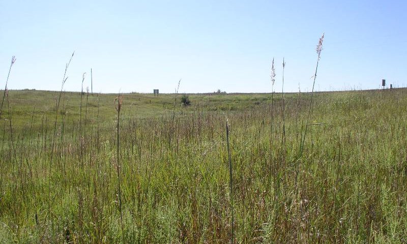
Loess Mixed Grass Prairie
Community 1.2
Native/Invaded Grass State
Community 1.3
Invaded Grass State
Community 1.4
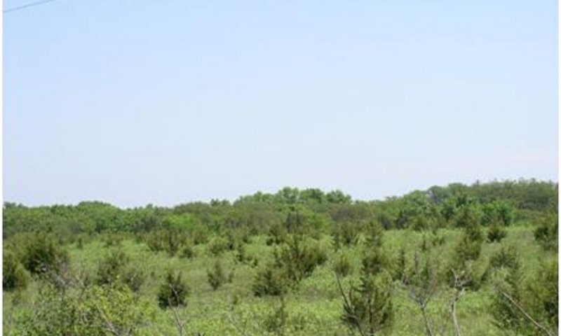
Invaded Woody State
Pathway P
Community 1.1 to 1.2
Pathway P
Community 1.1 to 1.3
Pathway P
Community 1.1 to 1.4
Pathway P
Community 1.2 to 1.1
Pathway P
Community 1.2 to 1.3
Pathway P
Community 1.2 to 1.4
Pathway P
Community 1.3 to 1.1
Pathway P
Community 1.3 to 1.2
Pathway P
Community 1.3 to 1.4
Pathway P
Community 1.4 to 1.2
State 2
Cropland (Irrigated and rain fed)
Management interpretations
Critical values |
Interpretations |
Critical values |
Interpretations |
Soil Condition IndexCritical values |
Interpretations |
|
> 0.5 SCI |
|
|
0.0 - 0.5 SCI |
|
|
< 0.0 SCI |
|
Wind ErosionCritical values |
Interpretations |
|
0.8 t/ac |
|
|
0.0 t/ac |
|
Community 2.1
Optimum Cropland State
1. Sheet and rill erosion: 0-2 tons, no ephemeral gullies in drainage courses, optimum soil properties (high organic matter), granular soil structure, no sediment deposition on and off-site, Positive SCI 0.5 or higher (optimum biodiversity and soil structure) Water: Minimal runoff, little moisture loss, excellent surface water quality (optimum water and nutrient cycles) Plants: Well above average crop yields, IPM utilized, high fertilizer use efficiency. (optimum productivity) Animals Adequate food, cover, and shelter for upland wildlife. (optimum WHI) In field Indicators: high soil organic matter (dark color), well developed surface layer, no compaction, crusting and crumbly soil structure; no gullies, no evidence of erosion/runoff and no sediment deposition; excellent crop vigor
Resilience management. Optimum Cropland State: Conservation Practices 329: Continuous No-till 328: Diverse crop rotation C-SB-W/CC rotated from perennial hayland 330: Contour Farming 340: Cover Crops 528: Prescribed Grazing 386: Field Borders 600: Terraces 412: Grassed Waterway 620: Underground Outlets 590: Nutrient Management (soil testing, zone mgt liming, 4Rs) 595: Pest Mgt (Scouting, Thresholds, Herbicide Resistance Management)
Community 2.2
Average Cropland State
2. Sheet and rill erosion: 5 tons, Some ephemeral gullies in drainage courses/repair needed, average soil conditions (average organic matter), average soil structure, some sediment deposition on and off-site, SCI 0.0 +/- 0.5 Water: Moderate runoff, some soil moisture loss Plants: Average crop yields, moderate level of IPM, average fertilizer use efficiency. Animals Average food, cover, and shelter for upland wildlife. In field Indicators: average soil organic matter (slightly dark color), average surface layer depth, moderate compaction layer, average soil structure; some evidence of sheet and rill erosion runoff and sediment deposition; average crop vigor
Community 2.3
Degraded
3. Sheet and rill erosion: 3-4 times tolerable level, ephemeral gullies in drainage courses, poor soil conditions (low organic matter), crusting, compaction layer, sediment deposition on and off-site, Negative SCI, low soil organic matter, poor soil tilth/aggregate stability Water: Excess runoff, excessive moisture loss, surface water contamination of sediment and herbicides. Plants: Low crop yields, excessive annual broadleaf and grass weeds, nutrients are not available as needed (low pH causes poor legume yield), high weed pressure. Animals: Lack of food, cover, and shelter for upland wildlife. Air: Excessive Particulate Matter (wind erosion) In field Indicators: low soil organic matter (light color), surface layer eroded away, compaction, crusting and poor soil structure; gullies, evidence of erosion runoff and sediment deposition; poor crop vigor
Community 2.4
Community 2.5
Pathway T1A
Community 2.1 to 2.2
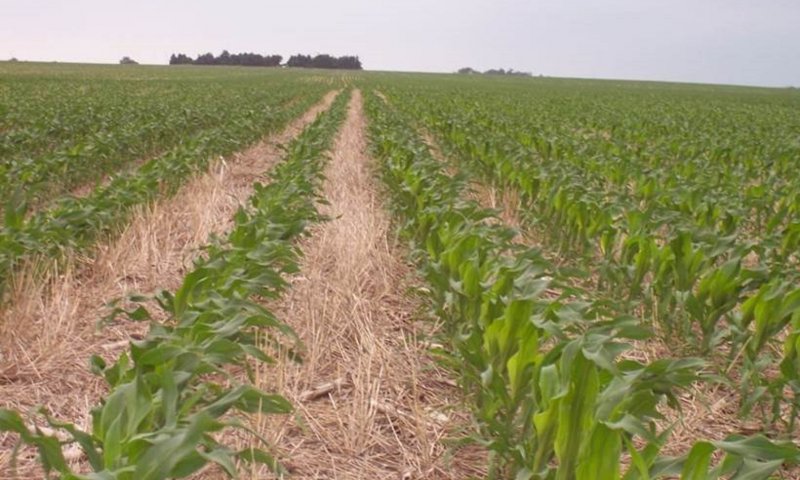
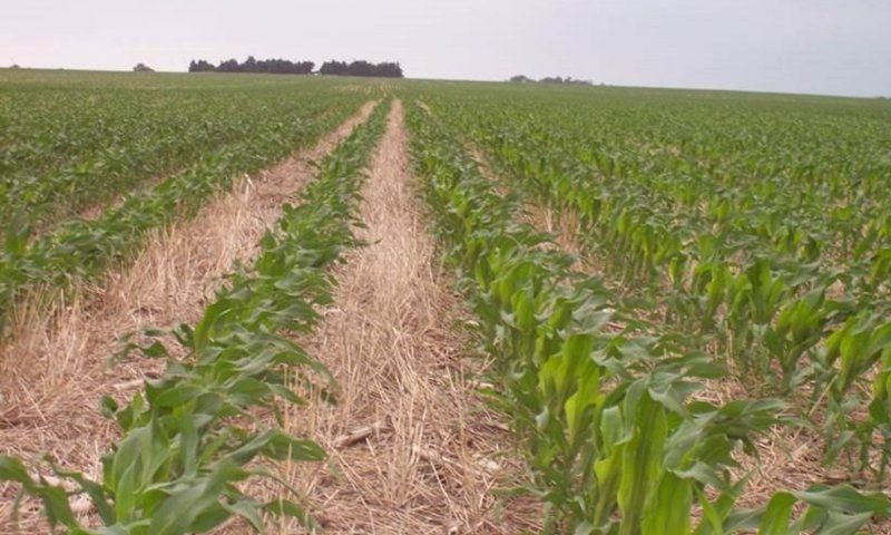
Tillage, residue removal, less crop diversity
Pathway T2A
Community 2.2 to 2.1
Long term SHMS (cover crop, cont NT, diverse rotations, livestock grazing), optimum soil moisture management and permanent gully erosion control measures
Pathway T2B
Community 2.2 to 2.3
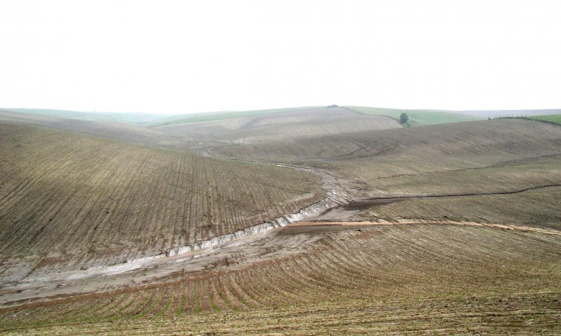
Conventional tillage, excessive fertilization, less cropping diversity, no gully erosion control measures, residue removal, poor soil moisture mgt, long term drought, or excessive rainfall
Pathway T3A
Community 2.3 to 2.2
Reduce tillage, retain all crop residue, diversify rotation
State 3
Pastureland (Irrigated and rain fed)
Management interpretations
Growth Curve - AlfalfaCritical values |
Interpretations |
|
0 |
|
|
0 |
|
|
0 |
|
|
10 |
|
|
25 |
|
|
25 |
|
|
20 |
|
|
15 |
|
|
5 |
|
|
0 |
|
|
0 |
|
|
0 |
|
Production - DrylandCritical values |
Interpretations |
|
5,700-14,300 |
|
|
2,900-11,400 |
|
|
2,900-11,400 |
|
|
3,700-10,000 |
|
|
2,900-10,000 |
|
|
3,400-9,100 |
|
Production - IrrigatedCritical values |
Interpretations |
|
8,600-20,000 |
|
|
7,100-17,100 |
|
|
7,100-23,000 |
|
|
8,600-17,100 |
|
|
5,700-15,700 |
|
|
7,100-15,700 |
|
Community 3.1
Dryland Pasture (Loamy Plains)
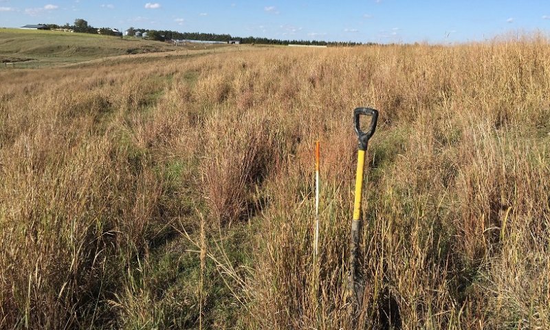
Resource Concerns in Degraded State: SOIL EROSION:Sheet and rill erosion, ephemeral erosion, concentrated flow erosion SOIL QUALITY DEGRADATION: SOM degradation, Compaction WATER QUALITY DEGRADATION: sediments, nutrients, pathogens DEGRADED PLANT CONDTION: weed infestation, over grazed, reduced yield LIVESTOCK: inadequate feed/forage, inadequate water supply WILDLIFE HABITAT: cover Adapted Cool-Season Grasses Creeping meadow foxtail Meadow brome Smooth brome Orchardgrass Canada wildrye Tall fescue Western wheatgrass Intermediate wheatgrass Tall wheatgrass Adapted Warm-Season Grasses Big bluestem Sideoats grama Switchgrass Little bluestem Indiangrass Adapted Legumes Cicer milkvetch Illinois ticktrefoil Birdsfoot deervetch Alfalfa Red clover
Community 3.2
Irrigated Pasture (Loamy Plains)
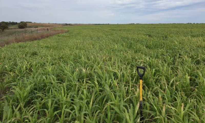
Resource Concerns in Degraded State: SOIL EROSION:Sheet and rill erosion, ephemeral erosion, concentrated flow erosion SOIL QUALITY DEGRADATION: SOM degradation, Compaction WATER QUALITY DEGRADATION: sediments, nutrients, pathogens WATER QUANTITY: inefficient use of water DEGRADED PLANT CONDTION: weed infestation, over grazed, reduced yield LIVESTOCK: inadequate feed/forage, inadequate water supply WILDLIFE HABITAT: cover Grasses adapted to mix with alfalfa (from FSGs): Meadow brome, smooth brome, orchardgrass, tall fescue, western wheatgrass, intermediate wheatgrass
Pathway P
Community 3.1 to 3.2
Pathway P
Community 3.2 to 3.1
State 4
Forest
Community 4.1
Optimum woody state
WHI high
Community 4.2
Average woody state
WHI med
Community 4.3
Degraded
WHI low Resource Concerns in Degraded State: DEGRADED PLANT CONDTION: low production value, invasive species infestation WILDLIFE HABITAT: food & cover
Pathway P
Community 4.1 to 4.2
Pathway P
Community 4.2 to 4.1
Pathway P
Community 4.2 to 4.3
Pathway P
Community 4.3 to 4.2
Transition T1
State 1 to 2
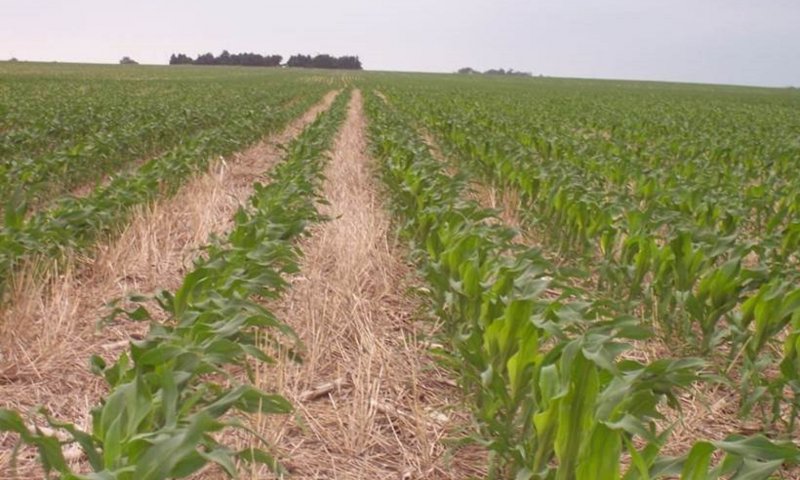
Cultivation (Irrigation Well and Irrigation Application System if irrigated)
Transition T2
State 1 to 3
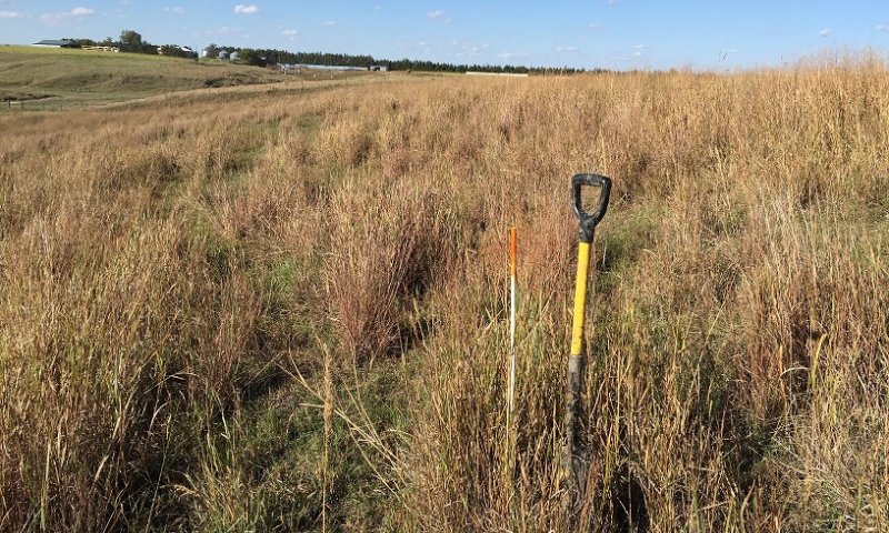
Cultivation and reseeding, abandoned, or combination of fertilizer, seeding, heavy summer grazing
Transition T3
State 1 to 4
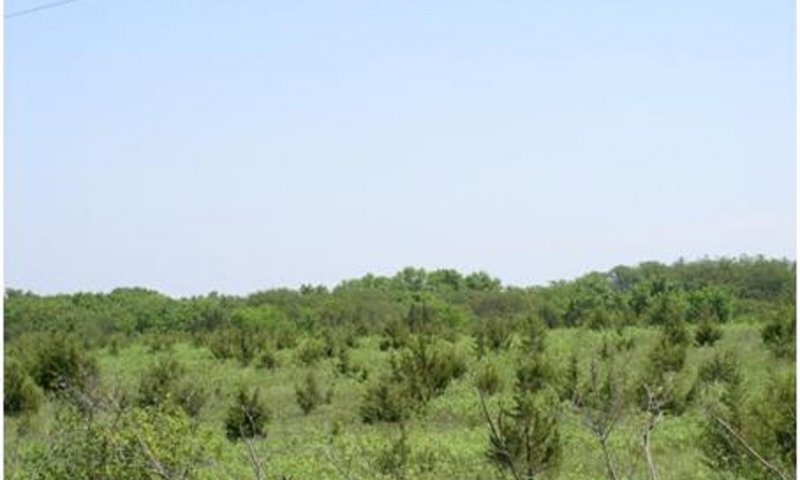
Encroachment by red cedar and lack of fire or brush management; Tree planing and Forest stand management
Transition T6
State 2 to 3
Pasture seeding
Transition T5
State 2 to 4
Abandonment and tree encroachment; Tree planting and Forest stand management
Transition T9
State 3 to 2
Cultivation, (Irrigation well and Irrigation application system if irrigated)
Transition T7
State 3 to 4
Encroachment by red cedar and lack of fire or brush management, Tree planting and Forest stand management
Transition T4
State 4 to 2
Clearing and cultivation
Restoration pathway T8
State 4 to 3
Clearing and Pasture seeding
Citations
-
No Citations
Print Options
Sections
Font
Other


The Ecosystem Dynamics Interpretive Tool is an information system framework developed by the USDA-ARS Jornada Experimental Range, USDA Natural Resources Conservation Service, and New Mexico State University.
Accessibility statement