
Natural Resources
Conservation Service
Ecological site R239XY052AK
Arctic Sedge Loamy Frozen Slopes
Last updated: 6/03/2025
Accessed: 08/30/2026
-
Search


Major Land Resource Area or ecological site by name and/or ID.
PreviousSectionsNextGeneral information
Provisional. A provisional ecological site description has undergone quality control and quality assurance review. It contains a working state and transition model and enough information to identify the ecological site.
MLRA notes
Major Land Resource Area (MLRA): 239X–Northern Bering Sea Islands
The Northern Bering Sea Islands (MLRA 239X) occurs in Western Alaska and includes Saint Lawrence (1,792 square miles), Nunivak (1,632 square miles), and Saint Matthew (137 square miles) Islands and several smaller adjacent islands all of which are surrounded by the Bering Sea. This MLRA makes up 3,705 square miles. The terrain primarily consists of nearly level to rolling plains and highlands with mostly gentle slopes. Coastal lowlands dotted with numerous small- and medium-size lakes make up a significant part of St. Lawrence Island. Steep, low-relief volcanic cones, vents, and lava flows are common throughout Nunivak Island and less common on St. Lawrence and St. Matthew Islands. Narrow, discontinuous sea cliffs, sand dunes, and sand sheets are along many stretches of the coast. Elevation ranges from sea level along the coast to 2,207 feet at the summit of Atuk Mountain, on St. Lawrence Island. The area is mostly undeveloped wild land that is sparsely populated. Residents use this remote area primarily for subsistence hunting, fishing, and gathering. Reindeer and/or muskox herding provides meat and other products to residents on Nunivak Island and St. Lawrence Islands. The largest communities on the islands are Diomede, Gambell, Mekoryuk, and Savoonga.
Geology and Soils
Across the islands, most of the landscape is mantled with late Tertiary and Quaternary alluvial, marine, and eolian surficial deposits. While a small portion of the northwest coast of St. Lawrence Island was glaciated (Patton et al. 2011), the vast majority of the MLRA was unglaciated during the Pleistocene Epoch. St. Lawrence Island is the most geologically complex of the islands in this area. The St. Lawrence Island coastal plain is dotted with numerous small- and medium-size lakes with a mosaic primarily composed of surficial deposits and volcanic and sedimentary rock, including coal beds and limestone. The highlands on this island are primarily composed of Cretaceous granitic bedrock except for Atuk Mountain which is composed of young volcanic bedrock from the Quaternary to late Tertiary. Nunivak and St. Matthew Islands are made up almost exclusively of early and late Tertiary and Quaternary volcanic rocks.
These islands are in the zone of discontinuous permafrost. Frozen soils are common across the vast extents of rolling plains and gentle sloping highlands. In these areas, the layer of permafrost is generally thin or moderately thick and occurs primarily in fine textured deposits. Permafrost generally does not occur on flood plains, in coarse textured sediments on the slopes of volcanic cones and other highlands, along the coast, or near lakes and other bodies of water. Common periglacial features include solifluction lobes, frost boils, and palsen (Swanson et al. 1986, USDA 2022).
The majority of soils are acidic, and the dominant soil order is Gelisols. Except for some non-acidic uplands on St. Lawrence Island, the vast majority of soil substrate across the MLRA is acidic (pH less than 5.5) (CAVM Team 2023). The Gelisols are shallow or moderately deep to permafrost (10 to 40 inches) and are typically very poorly to poorly drained. Common Gelisol suborders are Histels, Orthels, and Turbels. The Histels have thick accumulations of surface organic material and primarily occur in very wet coastal plain depressions and low-gradient drainageways. The Orthels and Turbels have comparably thinner surface organic material and primarily occur on the coastal lowlands and other areas with gentle slopes. The MLRA also has small areas of Andisols, Entisols, Inceptisols, and Mollisols. Andisols and Inceptisols primarily occur on volcanic cones and other slopes with coarse textured, acidic soils. Mollisols occur on areas with limestone on St. Lawrence Island (USDA 2022). Entisols primarily occur on flood plains and estuaries. Miscellaneous (non-soil) areas make up about 10 percent of the area and are primarily water, lava flows, rubble composed of volcanic rock, and beach sediments.
Climate
The presence of sea ice in the Bering Sea strongly influences the climate across the islands in this area. Sea ice in the Bering Sea historically forms in early December, increases in thickness until late April, and breaks apart in June (Zuesler 1941). When sea ice is absent, the Bering Sea and North Pacific Ocean moderate diurnal and monthly temperatures resulting in a maritime climate. As sea ice forms around the islands, temperatures decrease significantly with the area shifting to a continental climate.
Vegetation
Tidal flats and estuaries support sedge dominant communities, while drier beach dune communities support American dunegrass and seacoast angelica communities (Swanson et al. 1986). The coastal lowlands and nearly level to rolling plains have a mosaic of sedge and moss dominant wetlands and various tundra. The tundra often has dwarf shrubs like crowberry; tussock forming and non-tussock forming sedges; and a variety of forbs, lichen, and mosses. Very wet drainages and the shores of lakes support wet sedge meadows. Drier soils on flood plains commonly support low to tall willow scrub with dense grasses and forbs in the understory. Shallow soils with coarse textured rocks common on volcanic cones, mountain slopes, and ridges commonly support alpine dwarf scrub dominated by ericaceous shrubs, Dryas, and dwarf willows. These communities commonly have a considerable amount of lichen and bare ground. Bedrock exposures and barrens with lichens and scattered shrubs and herbs in pockets of fine earth dominate the highest elevations, ridges, and other windblown sites.
Introduced ungulates
Introduced herds of reindeer and muskox provide a rich history of land use across the Northern Bering Sea Islands MLRA. Of the many islands in this MLRA, Nunivak was the only island historically grazed by ungulates. Inhabited by caribou until the late 1800’s, the caribou on Nunivak Island were extirpated with the introduction of rifles (Griffin 2001).
Reindeer were introduced to St. Lawrence Island as early as 1901 (Jackson 1902), Nunivak Island in 1920, and St. Matthew Island in 1944 (Swanson and Barker 1991). Muskox were introduced to Nunivak Island in 1930 (ADFG 2024). Nunivak Island currently has managed herds of reindeer and muskox, St. Lawrence Island currently has managed herds of reindeer, and St. Matthew Island currently has no herds of reindeer. Some small islands in this MLRA are believed to have no history of natural or introduced ungulate herds (e.g. Pinnace Islands, Hall Island, and Punuk Islands).LRU notes
There are two distinct bioclimates in this MLRA resulting in slight differences in vegetation. St. Lawrence Island is more than 200 miles North of Nunivak and St. Matthew Islands. As a result, St. Lawrence Island is significantly colder. Mean annual air temperatures on Nunivak and St. Matthew Islands typically range from 30 to 34 degrees Fahrenheit and are between 24 to 28 degrees Fahrenheit on St. Lawrence Islands (PRISM 2018). More southerly islands in this area fall into the Circumpolar Arctic Vegetation Mapping (CAVM) subzone E and more northerly islands fall into CAVM subzone D (CAVM 2022). Moist and dry tundra common to the near level to rolling plains across the islands are thought to support plant communities with similar species but have different plant community structures. Subzone E supports low shrub communities and subzone D erect dwarf shrub communities (CAVM 2022). At this time, these differences in community structure are recognized but unique ecological sites for each CAVM bioclimate subzone were not developed.
This area supports two life zones defined by the physiological limits of plant communities along an elevational gradient: arctic and alpine. In this MLRA, the arctic life zone occurs below 500 feet elevation on average (Swanson et al. 1986) and is the elevational band where lowland vegetation dominates. For this MLRA, certain vascular plant species are common in the lowlands and much less common in the alpine (i.e. Salix pulchra, Salix fuscescens, Betula nana, Ledum palustre ssp. decumbens, and Calamagrostis canadensis). Above the arctic band of elevation, alpine vegetation dominates. For this MLRA, certain vascular plant and lichen species are common in the alpine and much less common in the lowlands (i.e. Dryas octopetala ssp. octopetala, Diapensia lapponica var. obovata, Anthoxanthum monticola ssp. alpinum, Oxytropis nigrescens, Alectoria ochroleuca, and Flavocetraria nivalis). The lowlands also have much higher potential for lichen biomass yields compared to the alpine (Swanson et al. 1986). The transition between arctic and alpine vegetation can occur within a range of elevations, and is highly dependent on latitude, slope, aspect, and shading from adjacent mountains.Classification relationships
Landfire BPS – 7216980 – Alaska Arctic Wet Sedge Meadow (Landfire 2009)
Wet sedge meadow tundra – III.A.3.a. (Viereck et al. 1992)
Sedge (Wet Meadow) (Swanson et al. 1986)
Peat Mounds (Swanson et al. 1986)Ecological site concept
This arctic ecological site occurs on nearly level areas of the coastal plain with wet, silty soils underlain by permafrost. These soils do not flood, pond frequently for long durations, have a high-water table at very shallow depth throughout the growing season, and are considered very poorly drained. A typical soil profile has 8 to 11 inches of peat over silty loess.
Thermokarst depressions and peat mounds are common, which result in unique soil and site properties. The thermokarst state has soils that lack permafrost and have a water table at or above the soil surface for the entire growing season. Peat mounds have drier soils that do not pond. Thermokarst depressions and peat mounds have unique vegetation, which results in alternate states for this ecological site.
The presence of introduced ungulate herds on Nunivak, St Lawrence, and St. Matthews Islands, in some places for over a century, plays an integral role in shaping vegetation across this MLRA. Islands in this MLRA without a history of introduced reindeer and muskox herds are associated with reference state vegetation, while islands with introduced herds are associated with grazing state vegetation.
The potential natural vegetation for the grazing state is characterized as wet sedge meadow tundra (Viereck et al. 1992). Common plants include Alaska bog willow, water sedge, and Sphagnum moss. The vegetative strata that characterize this community are medium graminoids (between 4 and 24 inches height) and moss.Associated sites
R239XY063AK Arctic Dwarf Scrub Loamy Frozen Slopes
Occurs on gentle slopes of hills, plains, and mountains. Ecological site 63 occurs on adjacent slopes with comparatively drier soils that support shrubby vegetation.
R239XY032AK Arctic Scrub Silty Frozen Slopes Wet
Occurs on gentle slopes of hills and plains and in broad depressions. Ecological site 32 occurs on adjacent slopes with comparatively drier soils that support shrubby vegetation.
R239XY058AK Arctic Grass Loamy Slopes
Occurs on gentle slopes of plains. Ecological site 58 occurs on adjacent slopes with dry soils that support bluejoint herbaceous meadows.
Similar sites
R239XY054AK Arctic Sedge Peat Frozen Drainageways
While ecological sites 52 and 54 are characterized as wet sedge meadow tundra (Viereck et al. 1992), there are differences in the kinds and amounts of dominant vegetation. Site 52 has different shrubby, graminoid, forb, and moss dominant species. Additionally, site 54 is not associated with peat mounds and thermokarst depressions.
R239XY057AK Arctic Sedge Peat Depressions
While ecological sites 52 and 57 are characterized as wet sedge meadow tundra (Viereck et al. 1992) there are differences in the kinds and amounts of dominant vegetation. Site 57 has different shrubby, graminoid, forb and moss dominant species. Additionally, site 57 is not associated with peat mounds and thermokarst depressions.
Table 1. Dominant plant species
Tree Not specified
Shrub (1) Salix fuscescens
Herbaceous (1) Carex aquatilis
(2) SphagnumPhysiographic features
This site occurs on nearly level surfaces of coastal plains with thermokarst depressions and peat mounds. Elevation typically occurs between 20 and 500 feet. Slopes occur on all aspects and range between 0 and 3 percent. Flooding does not occur. This site generates negligible runoff to adjacent, downslope ecological sites.
Reference and Grazing State
The reference and grazing states occur on nearly level surfaces of the coastal plain. Ponding occurs frequently for long durations of time with ponding depth ranging between 4 and 12 inches. During the growing season, a water table commonly occurs at the soil surface.
Peat Mound State
The peat mound state occurs on raised areas adjacent to the nearly level surfaces of the coastal plain and are associated with peat mounds. A peat mound is an elliptical dome-like permafrost mound containing alternating layers of ice lenses and peat or mineral soil, which are typically less than 10 feet in height. The edges of these raised features are strongly sloping. Peat mounds do not pond. Water perched on the permafrost layer occurs at moderate depths throughout the growing season. If these landforms raise high enough above the surrounding landscape, soil temperature can increase, ice-lens can melt, and these landforms can collapse.
Figure 1. A peat mound on Nunivak Island.

Figure 2. An aerial image of a peat mound on Nunivak Island. Peat mounds are raised features that have drier soils and lichen rich vegetation when compared to the surrounding tundra. A 65 foot transect was placed on the base of this peat mound on Nunivak Island.
Table 2. Representative physiographic features
Landforms (1) Coastal plain > Plain
(2) Coastal plain > Plain > Mound
(3) Coastal plain > Thermokarst depression
Runoff class Very low Flooding frequency None Ponding duration Long (7 to 30 days) Ponding frequency Frequent Elevation 20 – 500 ft Slope 0 – 3 % Ponding depth 4 – 12 in Water table depth 0 in Aspect W, NW, N, NE, E, SE, S, SW Table 3. Representative physiographic features (actual ranges)
Runoff class Not specified Flooding frequency Not specified Ponding duration Not specified Ponding frequency Not specified Elevation 20 – 1650 ft Slope 0 – 10 % Ponding depth 0 in Water table depth 0 in Climatic features
Sea ice strongly influences the climate of the islands in MLRA 239X. For the Northern Bering Sea Islands, sea ice starts forming in December and often persists through early June. In the absence of sea ice, the Bering Sea and North Pacific Ocean moderate diurnal and monthly temperatures resulting in a maritime climate. Summer temperatures (June through August) are relatively stable with mean maximum monthly temperatures ranging between 50 to 55 degrees Fahrenheit. As sea ice forms around the islands, temperatures decrease significantly with the area shifting to a continental climate. The coldest months (January through March) have mean monthly minimum temperatures ranging from 4 to 6 degrees Fahrenheit. The extent, thickness, and duration of the Bering Sea ice appears to be in flux resulting in southerly storms that can bring significantly warmer winter monthly temperatures (Stabeno et al. 2018, Gramling 2019).
The Northern Bering Sea Islands have summers that are short and cool and winters that are long and cold. Strong winds are common throughout the year. Mean annual air temperatures typically range from 26 to 32 degrees Fahrenheit with Saint Lawrence Island (mean annual air temperatures between 24 to 28 degrees Fahrenheit) being significantly colder compared to Nunivak and Saint Michael Islands (mean annual air temperatures between 30 to 34 degrees Fahrenheit) (PRISM 2018). The warmest months are June, July, and August. During these summer months, the typical freeze free period for the area ranges from 94 to 111 days. The coldest months are January, February, and March.
This area is semi-arid with mean annual precipitation typically ranging between 14 and 17 inches. The warmest months have overcast skies with frequent fog and precipitation while the coldest months have clear skies. The two wettest months are August and September where the islands typically receive a quarter of the annual precipitation. The rest of the months receive similar amounts of precipitation. Saint Michael Island receives greater mean annual precipitation (between 17 and 21 inches) compared to Nunivak and Saint Lawrence Islands (between 13 to 17 inches) (PRISM 2018). The average annual snowfall ranges from about 50 to 80 inches (USDA 2022) with the highest snowfall occurring during the months spanning November through March (USDA 1986).Table 4 Representative climatic features
Frost-free period (characteristic range) 50-80 days Freeze-free period (characteristic range) 90-110 days Precipitation total (characteristic range) 10-20 in Frost-free period (actual range) 50-90 days Freeze-free period (actual range) 90-120 days Precipitation total (actual range) 10-20 in Frost-free period (average) 60 days Freeze-free period (average) 100 days Precipitation total (average) 20 in Characteristic rangeActual rangeBarLineFigure 3. Monthly precipitation range
Characteristic rangeActual rangeBarLineFigure 4. Monthly minimum temperature range
Characteristic rangeActual rangeBarLineFigure 5. Monthly maximum temperature range
BarLineFigure 6. Monthly average minimum and maximum temperature
Figure 7. Annual precipitation pattern
Figure 8 Annual average temperature pattern
Climate stations used
-
(1) NOME MUNI AP [USW00026617], Nome, AK
-
(2) WALES [USW00026618], Wales, AK
-
(3) BETHEL AP [USW00026615], Bethel, AK
">Influencing water features
This site is classified as a Slope wetland under the Hydrogeomorphic (HGM) classification system (Smith et al. 1995; USDA-NRCS 2008). Precipitation and ground water are the main sources of water (Smith et al. 1995).<br />
<br />
Depth to the water table may decrease following summer storm events or spring snowmelt and increase during extended dry periods.Wetland description
n/a
Soil features
Soils formed in windblown loess and have permafrost. Soils on the nearly level plains are capped with 8 to 11 inches of organic material, while peat mounds are capped with 30 to 35 inches of organic material. The mineral soil below the organic material is composed of silt loam formed from wind-blown loess, which lacks rock fragments and has high water holding capacity. This loess layer is thick going to 60 inches or more depth. While soils are considered very deep, permafrost commonly occurs at shallow to moderate depths (12 to 28 inches). The pH of the soil profile commonly ranges from extremely acidic to moderately acidic. The soils are wet for long portions of the growing season and are considered very poorly drained on the nearly level plains and poorly drained on the peat mounds.
Table 5. Representative soil features
Parent material (1) Loess
Surface texture (1) Mucky silt loam
Family particle size (1) Coarse-silty
(2) Loamy
Drainage class Very poorly drained Permeability class Moderately slow Depth to restrictive layer 12 – 28 in Soil depth 60 – 0 in Surface fragment cover <=3" Not specified Surface fragment cover >3" Not specified Available water capacity
(0-40in)8.9 – 11.7 in Calcium carbonate equivalent
(10-40in)Not specified Clay content
(0-20in)5 – 10 % Electrical conductivity
(10-40in)Not specified Sodium adsorption ratio
(10-40in)Not specified Soil reaction (1:1 water)
(10-40in)3.9 – 5.9 Subsurface fragment volume <=3"
(0-60in)Not specified Subsurface fragment volume >3"
(0-60in)Not specified Table 6. Representative soil features (actual values)
Drainage class Very poorly drained to poorly drained Permeability class Moderately slow to moderately rapid Depth to restrictive layer 0 in Soil depth 0 in Surface fragment cover <=3" 0 % Surface fragment cover >3" 0 % Available water capacity
(0-40in)0 in Calcium carbonate equivalent
(10-40in)0 % Clay content
(0-20in)0 % Electrical conductivity
(10-40in)0 mmhos/cm Sodium adsorption ratio
(10-40in)0 – 3 Soil reaction (1:1 water)
(10-40in)0 Subsurface fragment volume <=3"
(0-60in)0 % Subsurface fragment volume >3"
(0-60in)0 % Ecological dynamics
The Northern Bering Sea Islands MLRA (MLRA 239X) occurs in the arctic where the harsh climate limits the composition and structure of plant communities. This area has cool and short summers and long and cold winters. Limited warmth during the short summer months, inhibits trees from occurring, and the expansive tundra is composed of a mosaic of low growing shrubs, sedges, moss, and lichen. The cold temperatures limit the vertical and horizontal structure of shrubs and other functional groups of the tundra (CAVM 2022). For instance, shrubs do not typically exceed 80 cm in height across these islands (Swanson et al. 1986; CAVM 2022). The exception is micro-climates where snow can accumulate, which protects vegetation from harsh winds and insulates soils. These micro-climates allow for shrubs to grow much taller and occur on landforms such as flood plains.
Ungulate History and Use
In this MLRA, the lack of predators paired with quality forage can lead to dramatic population growth of reindeer which in turn can lead to significant die-offs. Eighty-one reindeer were introduced to Nunivak Island in 1920. Due to a lack of predators and an abundance of high-quality forage, the reindeer population climbed to peaks of greater than 30 thousand in 1944 and 23 thousand in 1965 (Swanson and Barker 1991). After each peak in population, the reindeer herds experienced dramatic population die offs that resulted in less than 5 thousand animals (Swanson and Barker 1991). These die offs are largely attributed to lichen range depletion. Lichen forage makes up 47 percent of the March diet for reindeer herds on Nunivak Island (Swanson et al. 1986) so the depletion of lichen range can directly lead to stress and mortality of reindeer populations.
The presence of introduced ungulate herds on Nunivak, St Lawrence, and St. Matthews Islands, in some places for over a century, plays an integral role in shaping vegetation across this MLRA. Some small islands in this MLRA are believed to have no history of natural or introduced ungulate herds (e.g. Pinnace Islands, Hall Island, and Punuk Islands). On islands with introduced herds, grazing by reindeer and/or muskox has impacted the potential natural vegetation. For instance, continuous grazing of slow growing fruticose lichen can lead to changes in lichen species composition (Swanson and Barker 1991) and can lead to increases in shrub and bryophyte cover (Kautz et al. 1992). Because of the mixed history in grazing in this MLRA, the STM for this ecological site has two states. Islands in this MLRA without a history of ungulate herds are associated with reference state vegetation, while islands with introduced ungulate herds are associated with grazing state vegetation.
Peat Mounds State
Peat mound morphology and life history is complex and varied and can be read about in greater detail in the following journal articles Seppälä (1986) and Seppälä (2011).
Mound formation in this MLRA relies upon thick accumulations of peat, cold temperatures, and free water from the surrounding tundra. Mound formation starts in areas of the tundra where there are significant differences in the thickness of peat, which may result from Sphagnum moss colonization of sedge meadows (Pielou 1995). In this MLRA, the associated sedge meadows have 8 to 11 inches of peat while the mounds have 30 inches or more peat. This thick layer of peat is saturated during the fall as soils start to freeze. Saturated peat has high thermal conductivity, which allows for the soils to freeze deeper than the surrounding tundra during the long, cold Arctic winters. The peat at the soil surface thaws and partially dries out during the short summer months. This dry peat layer has low thermal conductivity and insulates a frozen core of soil. Because of the differences in thermal conductivity, areas with thicker peat have permafrost closer to the soil surface. Much like a sponge, peat also has high capillarity that can readily draw water up the soil profile. During the fall as soils start to refreeze, the peat layer draws water from the surrounding saturated tundra and the soils form segregated ice lenses.
The mounds are slowly lifted out of the surrounding tundra due to the combination of frost heave, continued building of segregated ice lenses, and the inherent buoyancy of the icy, frozen peat core (Seppala 1986). These peat mounds can reach significant heights. Peat mounds on Nunivak Island were commonly measured at 12 feet height (Swanson et al. 1986). Soil drainage improves and the vegetation shifts from wet sedge meadow tundra to ericaceous shrub bog with abundant lichen. If these landforms raise high enough above the water table, soil temperature increases, ice-lens melt, and these landforms can collapse.
Thermokarst State
These nearly level areas on the coastal plain commonly have thermokarst depressions. Thermokarst results from the thawing of ice rich permafrost, subsequent setting of ground, that can lead to thermokarst depressions. The thermokarst state lacks permafrost in the soil profile and has a water table at or above the soil surface for the entire growing season. Vegetation in thermokarst depressions on Nunivak Island are characterized as halophytic herb meadow and fresh grass marsh (Viereck et al. 1992).State and transition model
More interactive model formats are also available. View Interactive Models
Click on state and transition labels to scroll to the respective textT1 - Human introduction of reindeer and/or muskox to islands T3 - A peat mound or palsa raises up from the surrounding wet sedge meadow R1 - Long periods of time after extirpation of human introduced ungulates T2 - A peat mound or palsa raises up from the surrounding wet sedge meadow T4 - Thermokarst and collapse of peat mounds. State 1 submodel, plant communities
State 2 submodel, plant communities
2.1a - Repeatedly driving over vegetation with all terrain vehicles. 2.2a - Time without driving over vegetation and/or the use of trail hardening techniques. State 3 submodel, plant communities
3.1a - Peat mounds or palsa raise from the wet sedge meadow tundra 3.2a - Continuous grazing by reindeer and/or muskox 3.3a - Time without continuous grazing by reindeer and/or muskox State 4 submodel, plant communities
State 1
Reference StateThe historic and current use of introduced ungulates in this MLRA may have altered the potential natural vegetation on these islands. Islands in this MLRA without a history of introduced grazing have reference state vegetation, while islands with introduced herds of reindeer and/or muskox (Nunivak, St. Lawrence, and St. Matthews Islands) have grazing state vegetation.
Currently no data has been collected in areas of this MLRA in reference condition. Future targeted data collection efforts can address whether range in excellent condition within the grazing state is similar to reference state vegetation and these results could dramatically alter this provisional state and transition model.Dominant plant species
-
sedge (Carex), grass
-
cottongrass (Eriophorum), grass
Community 1.1
water sedge - tall cottongrassCommunity 1.1 is the potential natural vegetation for this state. It is characterized as crowberry tundra (Viereck et al. 1992) with crowberry the dominant dwarf shrub. Other common and abundant species include an assortment of lichen.
Dominant plant species
-
water sedge (Carex aquatilis), other herbaceous
-
tall cottongrass (Eriophorum angustifolium), other herbaceous
-
white cottongrass (Eriophorum scheuchzeri), other herbaceous
State 2
Grazing State
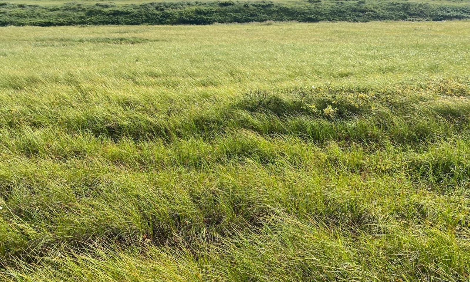
Figure 9. A wet sedge meadow on Nunivak Island.
Two plant communities occur within the grazing state and the vegetation differs in large part due human use of off road vehicles.
The data for this state is based on a mixture of recent field work conducted on Nunivak Island (2022-2023) and historical range surveys conducted on Nunivak Island (Swanson et al. 1986, Kautz et al. 1992). Future work will be required to determine if the vegetation on Nunivak Island represent the vegetation across the grazed islands of this MLRA.Community 2.1
Alaska bog willow / water sedge / Sphagnum moss - Aulacomnium moss
Figure 10. Typical vegetation associated with community 2.1.
Community 2.1 is considered the potential natural vegetation for the grazing state. This community is characterized as wet sedge meadow tundra (Viereck et al. 1992) dominated by water sedge. Additional common plants include Alaska bog willow, netleaf willow, marsh Labrador tea, lesser saltmarsh sedge, shortstalk sedge, tall cottongrass, white cottongrass, Sphagnum moss, and Aulacomnium moss. The vegetative strata that characterize this community are low shrubs (between 8 and 36 inches), medium graminoids (between 4 and 24 inches height) and moss.
Forest understory. Live lichen and moss annual production cannot be measured accurately due to a lack of information on growth rates and/or slow annual growth rates. Lichen and moss biomass data below refers to total biomass, while vascular plants biomass refers to annual production.
Dominant plant species
-
Alaska bog willow (Salix fuscescens), shrub
-
netleaf willow (Salix reticulata), shrub
-
marsh Labrador tea (Ledum palustre ssp. decumbens), shrub
-
water sedge (Carex aquatilis), grass
-
lesser saltmarsh sedge (Carex glareosa), grass
-
shortstalk sedge (Carex podocarpa), grass
-
tall cottongrass (Eriophorum angustifolium), grass
-
white cottongrass (Eriophorum scheuchzeri), grass
-
sphagnum (Sphagnum), other herbaceous
-
aulacomnium moss (Aulacomnium palustre), other herbaceous
-
arctic sweet coltsfoot (Petasites frigidus), other herbaceous
-
cloudberry (Rubus chamaemorus), other herbaceous
-
Canadian burnet (Sanguisorba canadensis), other herbaceous
-
ledge stonecrop (Rhodiola integrifolia), other herbaceous
Figure 11. Annual production by plant type (representative values) or group (midpoint values)
Table 7. Annual production by plant type
Plant type Low
(lb/acre)Representative value
(lb/acre)High
(lb/acre)Moss 1000 2050 3100 Grass/Grasslike 300 500 700 Shrub/Vine 270 450 630 Forb 30 50 70 Lichen 0 0 0 Total 1600 3050 4500 Table 8. Ground cover
Tree foliar cover 0% Shrub/vine/liana foliar cover 10-30% Grass/grasslike foliar cover 50-80% Forb foliar cover 0-10% Non-vascular plants 30-50% Biological crusts 0% Litter 50-80% Surface fragments >0.25" and <=3" 0% Surface fragments >3" 0% Bedrock 0% Water 0-10% Bare ground 0% Table 9. Canopy structure (% cover)
Height Above Ground (ft) Tree Shrub/Vine Grass/
GrasslikeForb <0.5 – 5-15% – 0-5% >0.5 <= 1 – – – – >1 <= 2 – – 50-75% – >2 <= 4.5 – 5-10% – – >4.5 <= 13 – – – – >13 <= 40 – – – – >40 <= 80 – – – – >80 <= 120 – – – – >120 – – – – Community 2.2
water sedge
Figure 12. Wet sedge meadow vegetation impacting by off road vehicles on Nunivak Island.

Figure 13. Community 2.1 appears to be susceptible to damage from off road vehicles.
Community 2.2 has been disturbed by the repeated use of off road vehicles. Vegetation species composition is similar to community 2.1. However, vegetation cover decreases and exposed soil and surface water cover increases.
Dominant plant species
-
Alaska bog willow (Salix fuscescens), shrub
-
water sedge (Carex aquatilis), grass
-
cottongrass (Eriophorum), grass
-
sphagnum (Sphagnum), other herbaceous
Figure 14. Annual production by plant type (representative values) or group (midpoint values)
Table 10. Ground cover
Tree foliar cover 0% Shrub/vine/liana foliar cover 0-10% Grass/grasslike foliar cover 10-50% Forb foliar cover 0-10% Non-vascular plants 10-50% Biological crusts 0% Litter 0% Surface fragments >0.25" and <=3" 0% Surface fragments >3" 0% Bedrock 0% Water 0-20% Bare ground 0-50% Table 11. Canopy structure (% cover)
Height Above Ground (ft) Tree Shrub/Vine Grass/
GrasslikeForb <0.5 – – – 0-5% >0.5 <= 1 – – – – >1 <= 2 – – 10-50% – >2 <= 4.5 – – – – >4.5 <= 13 – – – – >13 <= 40 – – – – >40 <= 80 – – – – >80 <= 120 – – – – >120 – – – – Pathway 2.1a
Community 2.1 to 2.2
Alaska bog willow / water sedge / Sphagnum moss - Aulacomnium moss
water sedgeRepeatedly driving over vegetation with all terrain vehicles. This disturbance reduces graminoid and moss cover and increases exposed organic soil and surface water cover.
Pathway 2.2a
Community 2.2 to 2.1
water sedge
Alaska bog willow / water sedge / Sphagnum moss - Aulacomnium mossTime without driving over vegetation and/or the use of trail hardening techniques. Sedge and moss ground cover increases.
State 3
Peat Mound State
Figure 15. Peat mounds on Nunivak Island.
Peat mounds develop from the surrounding wet sedge meadows associated with the reference and grazing states. A peat mound is an elliptical dome-like permafrost mound containing alternating layers of ice lenses and peat or mineral soil, which are typically less than 10 feet in height. The edges of these raised features are strongly sloping.
Peat mounds can raise significantly above the water table and soil drainage can improve. If these landforms raise high enough above the water table, soil temperature increases, and eventually ice-lens melt. As soils thaw and ice melts, these peat mounds eventually collapse (Seppälä 1986; Pielou 1995). After collapse, the soils are thought to revert to thermokarst state conditions.
Two plant communities occur within the peat mound state and the vegetation differs in large part due to the degree of ungulate use.Dominant plant species
-
marsh Labrador tea (Ledum palustre ssp. decumbens), shrub
-
black crowberry (Empetrum nigrum), shrub
-
reindeer lichen (Cladina), other herbaceous
-
cloudberry (Rubus chamaemorus), other herbaceous
Community 3.1
willow / sedge / Sphagnum moss
Figure 16. Typical vegetation associated with community 3.1.
Community 3.1 occurs directly adjacent to the peat mound. This community is characterized as wet sedge meadow tundra (Viereck et al. 1992) dominated by water sedge. Additional common plants include Alaska bog willow, cottongrass, and Sphagnum moss. The vegetative strata that characterize this community are low shrubs (between 8 and 36 inches), medium graminoids (between 4 and 24 inches height) and moss.
Forest understory. Production and cover data by functional groups and by species are similar to community 2.1 and should be used when looking for more detailed information on community 3.1.
Dominant plant species
-
Alaska bog willow (Salix fuscescens), shrub
-
sedge (Carex), grass
-
cottongrass (Eriophorum), grass
-
sphagnum (Sphagnum), other herbaceous
Community 3.2
marsh Labrador tea - crowberry / cloudberry / reindeer lichen - Flavocetraria lichen
Figure 17. Typical vegetation associated with community 3.2.
This is the potential natural vegetation on peat mounds and palsa for this state. This community is characterized as ericaceous shrub bog (Viereck et al. 1992). Common and abundant plants include marsh Labrador tea, crowberry, dwarf birch, Alaska bog willow, bog blueberry, lingonberry, cloudberry, Sphagnum moss, Flavocetraria lichen, various reindeer lichen, Cetraria lichen, and white worm lichen.
Forest understory. Live lichen and moss annual production cannot be measured accurately due to a lack of information on growth rates and/or slow annual growth rates. Lichen and moss biomass data below refers to total biomass, while vascular plants biomass refers to annual production.
Dominant plant species
-
marsh Labrador tea (Ledum palustre ssp. decumbens), shrub
-
black crowberry (Empetrum nigrum), shrub
-
dwarf birch (Betula nana), shrub
-
Alaska bog willow (Salix fuscescens), shrub
-
lingonberry (Vaccinium vitis-idaea), shrub
-
bog blueberry (Vaccinium uliginosum), shrub
-
beauverd spirea (Spiraea stevenii), shrub
-
greygreen reindeer lichen (Cladina rangiferina), other herbaceous
-
reindeer lichen (Cladina arbuscula), other herbaceous
-
(Flavocetraria cucullata), other herbaceous
-
island cetraria lichen (Cetraria islandica), other herbaceous
-
cloudberry (Rubus chamaemorus), other herbaceous
-
sphagnum (Sphagnum), other herbaceous
-
cup lichen (Cladonia gracilis), other herbaceous
-
globe ball lichen (Sphaerophorus globosus), other herbaceous
-
whiteworm lichen (Thamnolia vermicularis), other herbaceous
Figure 18. Annual production by plant type (representative values) or group (midpoint values)
Table 12. Annual production by plant type
Plant type Low
(lb/acre)Representative value
(lb/acre)High
(lb/acre)Lichen 3500 5000 6500 Shrub/Vine 350 425 500 Grass/Grasslike 270 325 385 Forb 70 85 100 Moss 0 50 100 Total 4190 5885 7585 Table 13. Ground cover
Tree foliar cover 0% Shrub/vine/liana foliar cover 30-50% Grass/grasslike foliar cover 0-10% Forb foliar cover 10-20% Non-vascular plants 60-80% Biological crusts 0% Litter 0-10% Surface fragments >0.25" and <=3" 0% Surface fragments >3" 0% Bedrock 0% Water 0% Bare ground 0-0% Table 14. Canopy structure (% cover)
Height Above Ground (ft) Tree Shrub/Vine Grass/
GrasslikeForb <0.5 – 15-30% – 5-15% >0.5 <= 1 – – – – >1 <= 2 – 10-20% 0-5% – >2 <= 4.5 – – – – >4.5 <= 13 – – – – >13 <= 40 – – – – >40 <= 80 – – – – >80 <= 120 – – – – >120 – – – – Community 3.3
marsh Labrador tea - crowberry / cloudberry / Polytrichum moss - white worm lichenCommunity 3.3 has been continuously grazed. Cover of crowberry, marsh Labrador tea, dwarf birch, Polytrichum moss, and less preferred lichen species increase, while cover of willow and preferred lichen species decrease significantly. Lichen biomass goes from 5000 pounds per acre for community 3.2 down to 500 pounds per acre or less for community 3.3.
Preferred lichen for this community include reindeer lichen (Cladina sp.), Cetraria lichen , and Flavocetraria lichen. The less preferred lichen include globe ball lichen, white worm lichen, cup lichen, witch's hair lichen, and crustose lichens.Dominant plant species
-
marsh Labrador tea (Ledum palustre ssp. decumbens), shrub
-
black crowberry (Empetrum nigrum), shrub
-
cloudberry (Rubus chamaemorus), other herbaceous
-
dicranum moss (Dicranum), other herbaceous
-
polytrichum moss (Polytrichum), other herbaceous
-
globe ball lichen (Sphaerophorus globosus), other herbaceous
-
whiteworm lichen (Thamnolia vermicularis), other herbaceous
-
reindeer lichen (Cladina), other herbaceous
-
(Flavocetraria cucullata), other herbaceous
-
witch's hair lichen (Alectoria), other herbaceous
-
peppermint drop lichen (Icmadophila), other herbaceous
Pathway 3.1a
Community 3.1 to 3.2
willow / sedge / Sphagnum moss
marsh Labrador tea - crowberry / cloudberry / reindeer lichen - Flavocetraria lichenPeat mounds or palsa raise from the wet sedge meadow tundra. Soil drainage improves and vegetation shifts to ericaceous shrub bog.
Pathway 3.2a
Community 3.2 to 3.3Continuous grazing by reindeer and/or muskox. Continuous grazing reduces the cover and abundance of desirable forage lichen and increases the cover and abundance of dwarf shrubs, forbs, and less desirable forage lichen.
Pathway 3.3a
Community 3.3 to 3.2Time without continuous grazing by reindeer and/or muskox. The cover and abundance of desirable forage lichen increases, competing and reducing the cover of dwarf shrubs, forbs, and less desirable forage lichen.
State 4
Thermokarst State
Figure 19. Aerial image of a complex of sedge meadows and peat mounds on Nunivak Island. Thermokarst depressions are common in this mosaic of vegetation and are represented by open water with aquatic vegetation..

Figure 20. Thermokarst adjacent to a collapsing peat mound on Nunivak Island.
Thermokarst results from the thawing of ice rich permafrost and subsequent setting of ground, which can lead to thermokarst depressions. This is a natural event that was commonly observed in areas with peat mounds and sedge meadows (see associated state photo). Thermokarst can also result from disturbance such as land clearing. While thermokarst can be readily observed, details related to thermokarst succession are poorly understood. After an unknown timeframe, thermokarst depressions could theoretically revert back to plant communities associated with the reference state (Myers-Smith et al. 2008). However, the timeframe for recovery is likely outside the scope of typical land management priorities. At this time, restoration back to reference conditions is not considered within the state-and-transition model.
The thermokarst plant community is characterized as either halophytic herb meadow or fresh grass marsh (Viereck et al. 1992). (Viereck et al. 1992). Associated soils pond and have a persistent high water table. The thermokarst state has one documented plant community.
Future data collection efforts and research would likely enhance information about existing plant communities within this state and allow for better understanding of the potential transitions from one community or state to another.Dominant plant species
-
pendantgrass (Arctophila fulva), grass
-
common mare's-tail (Hippuris vulgaris), other herbaceous
Community 4.1
pendant grass / common mare's-tail - purple marshlocks
Figure 21. Typical vegetation associated with community 4.1.
Community 4.1 is the vegetation that occurs in thermokarst depressions. This community is characterized as either halophytic herb meadow or fresh grass marsh (Viereck et al. 1992). Common plants include pendant grass, water sedge, common mare's-tail, purple marshlocks, Pallas' buttercup, and Sphagnum moss. The vegetative strata that characterize this community are medium graminoids (between 4 and 24 inches height) and medium forbs (between 4 and 24 inches height).
Dominant plant species
-
pendantgrass (Arctophila fulva), grass
-
water sedge (Carex aquatilis), grass
-
common mare's-tail (Hippuris vulgaris), other herbaceous
-
purple marshlocks (Comarum palustre), other herbaceous
-
Pallas' buttercup (Ranunculus pallasii), other herbaceous
Table 15. Ground cover
Tree foliar cover 0% Shrub/vine/liana foliar cover 0-0% Grass/grasslike foliar cover 10-50% Forb foliar cover 10-50% Non-vascular plants 0-30% Biological crusts 0% Litter 0-20% Surface fragments >0.25" and <=3" 0% Surface fragments >3" 0% Bedrock 0% Water 80-100% Bare ground 0% Transition T1
State 1 to 2Human introduction of reindeer and/or muskox to islands.
Transition T3
State 1 to 3A peat mound or palsa raises up from the surrounding wet sedge meadow. This raised feature is large enough to result in a mosaic of vegetation.
Restoration pathway R1
State 2 to 1Long periods of time after extirpation of human introduced ungulates.
Transition T2
State 2 to 3
Grazing State
Peat Mound StateA peat mound or palsa raises up from the surrounding wet sedge meadow. This raised feature is large enough to result in a mosaic of vegetation.
Transition T4
State 3 to 4
Peat Mound State
Thermokarst StateThermokarst and collapse of peat mounds.
Additional community tables
Table 16. Community 1.1 plant community composition
Group Common name Symbol Scientific name Annual production () Foliar cover (%) Table 17. Community 2.1 plant community composition
Group Common name Symbol Scientific name Annual production () Foliar cover (%) Shrub/Vine2 Shrubs Annual Production 270–630 Alaska bog willow SAFU Salix fuscescens 120–560 – netleaf willow SARE2 Salix reticulata 36–140 – marsh Labrador tea LEPAD Ledum palustre ssp. decumbens 30–110 – alpine bearberry ARAL2 Arctostaphylos alpina 0–15 – dwarf birch BENA Betula nana 0–15 – black crowberry EMNI Empetrum nigrum 0–15 – arctic willow SAAR27 Salix arctica 0–15 – oval-leaf willow SAOV Salix ovalifolia 0–15 – lingonberry VAVI Vaccinium vitis-idaea 0–15 – Grass/Grasslike3 Graminoid Annual Production 300–700 water sedge CAAQ Carex aquatilis 120–420 – lesser saltmarsh sedge CAGL4 Carex glareosa 60–280 – tall cottongrass ERAN6 Eriophorum angustifolium 24–100 – shortstalk sedge CAPO Carex podocarpa 12–85 – white cottongrass ERSC2 Eriophorum scheuchzeri 0–15 – Forb4 Fob Annual Production 30–70 ledge stonecrop RHIN11 Rhodiola integrifolia 24–110 – boreal sagebrush ARAR9 Artemisia arctica 18–100 – Canadian burnet SACA14 Sanguisorba canadensis 12–85 – lousewort PEDIC Pedicularis 10–60 – seacoast angelica ANLU Angelica lucida 6–40 – dwarf raspberry RUARA2 Rubus arcticus ssp. acaulis 6–30 – arctic sweet coltsfoot PEFR5 Petasites frigidus 0–15 – cloudberry RUCH Rubus chamaemorus 0–15 – arctic starflower TREU Trientalis europaea 0–15 – Aleutian violet VILA6 Viola langsdorffii 0–15 – Moss5 Total Bryophyte Biomass 1000–3100 aulacomnium moss AUPA70 Aulacomnium palustre 700–2790 – sphagnum SPHAG2 Sphagnum 100–620 – Lichen6 Total Lichen Biomass 0 Table 18. Community 2.2 plant community composition
Group Common name Symbol Scientific name Annual production () Foliar cover (%) Shrub/Vine1 Shrubs Annual Production 0 Grass/Grasslike2 Grass/Grasslike Annual Production 1080–1890 bluejoint CACA4 Calamagrostis canadensis 900–1785 – common woodrush LUMU2 Luzula multiflora 25–125 – sedge CAREX Carex 0–40 – Altai fescue FEAL Festuca altaica 0–40 – American dunegrass LEMOV Leymus mollis ssp. villosissimus 0–20 – Forb3 Fob Annual Production 120–210 field horsetail EQAR Equisetum arvense 2–125 – Canadian burnet SACA14 Sanguisorba canadensis 25–85 – purple marshlocks COPA28 Comarum palustre 10–65 – tall Jacob's-ladder POAC Polemonium acutiflorum 0–40 – ledge stonecrop RHIN11 Rhodiola integrifolia 10–40 – silverweed cinquefoil ARAN7 Argentina anserina 0–20 – cloudberry RUCH Rubus chamaemorus 0–20 – woolly geranium GEER2 Geranium erianthum 0–20 – tall bluebells MEPA Mertensia paniculata 0–20 – Fremont's beardtongue PEFR Penstemon fremontii 0–20 – arctic sweet coltsfoot PEFRF Petasites frigidus var. frigidus 0–20 – Tilesius' wormwood ARTI Artemisia tilesii 0–20 – Sierra larkspur DEGL3 Delphinium glaucum 0–20 – Moss4 Total Bryophyte Biomass 0 Lichen5 Total Lichen Biomass 0 Table 19. Community 3.1 plant community composition
Group Common name Symbol Scientific name Annual production () Foliar cover (%) Table 20. Community 3.2 plant community composition
Group Common name Symbol Scientific name Annual production () Foliar cover (%) Shrub/Vine1 Total Annual Shrub Production – dwarf birch BENA Betula nana 50–150 – marsh Labrador tea LEPAD Ledum palustre ssp. decumbens 50–150 – black crowberry EMNI Empetrum nigrum 35–100 – lingonberry VAVI Vaccinium vitis-idaea 20–75 – Alaska bog willow SAFU Salix fuscescens 20–50 – bog blueberry VAUL Vaccinium uliginosum 20–50 – alpine bearberry ARAL2 Arctostaphylos alpina 15–50 – red fruit bearberry ARRU Arctostaphylos rubra 5–25 – beauverd spirea SPST3 Spiraea stevenii 5–25 – oval-leaf willow SAOV Salix ovalifolia 0–10 – arctic willow SAAR27 Salix arctica 0–10 – Grass/Grasslike2 Total Annual Graminoid Production – water sedge CAAQ Carex aquatilis 0–5 – Bigelow's sedge CABI5 Carex bigelowii 0–5 – sedge CAREX Carex 0–5 – white cottongrass ERSC2 Eriophorum scheuchzeri 0–5 – woodrush LUZUL Luzula 0–5 – Forb3 Total Annual Forb Production – cloudberry RUCH Rubus chamaemorus 20–50 – Moss4 Total Bryophyte Biomass – dicranum moss Dicra8 Dicranum 0–40 – juniper polytrichum moss POJU70 Polytrichum juniperinum 0–40 – sphagnum SPHAG2 Sphagnum 0–10 – Lichen5 Total Lichen Biomass – greygreen reindeer lichen CLRA60 Cladina rangiferina 1750–4550 – reindeer lichen CLAR60 Cladina arbuscula 525–1950 – FLCU Flavocetraria cucullata 350–1300 – island cetraria lichen CEIS60 Cetraria islandica 175–650 – reindeer lichen CLMI60 Cladina mitis 175–650 – cup lichen CLGR13 Cladonia gracilis 35–325 – cup lichen CLADO3 Cladonia 0–195 – globe ball lichen SPGL60 Sphaerophorus globosus 35–195 – whiteworm lichen THVE60 Thamnolia vermicularis 35–130 – witch's hair lichen ALOC60 Alectoria ochroleuca 35–130 – FLNI Flavocetraria nivalis 0–130 – witch's hair lichen ALNI60 Alectoria nigricans 0–65 – peppermint drop lichen ICMAD Icmadophila 0–65 – Table 21. Community 3.3 plant community composition
Group Common name Symbol Scientific name Annual production () Foliar cover (%) Table 22. Community 4.1 plant community composition
Group Common name Symbol Scientific name Annual production () Foliar cover (%) Interpretations
Animal community
The principal use of ·this site by wildlife is as feeding grounds for a variety of shorebirds and waterfowl. Sandhill cranes, Canada geese, emperor geese, and pomarine jaeger use this site for feeding and nesting, while a large variety of other bird species may forage and rest in these areas. Muskoxen and reindeer may also use these areas for winter feeding grounds since most of the mounds are snow-free (due to winds) allowing lichens and low-growing shrubs to become available.
Hydrological functions
n/a
Recreational uses
Because this site is often in association with other sites, such as beach dunes, drainageways, wet sedge meadows, etc., this site provides many recreational activities. Berry picking for cloudberries, crowberries, and blueberries can be quite successful. Near beach sites, birdwatching, shell collecting, boating, fishing, trapping, and hunting can be available.
Wood products
No wood products available from this site.
Other products
Reindeer Grazing
This site is best suited for winter range; it can support excellent winter forage of lichens. Lichens can become quite brittle during dry periods of the year; excessive trampling can deplete lichen growth on ·this site if it is grazed other than in the winter. Sedges are also available along the border of these mounds when this site is in association with the wet sedge meadow site. During the fall, the mounds make herding difficult due to the microrelief of the topography.Other information
These interpretive narratives were all developed in a report for range sites on Nunivak Island (Swanson et al. 1986).
Supporting information
Inventory data references
Tier 2 sampling plots used to develop the following states: grazing (state 2), peat mound (state 3), and thermokarst (state 4). Plot numbers as recorded in NASIS with associated community phase. Community 2.1 2023AK050002, 2023AK050005 Community 2.2 2023AK050012, 2023AK050014 Community 3.1 894601, 894602, 2023AK050006 Community 4.1 2023AK050008 Plant species and production information are based on historic range surveys on Nunivak Island (Swanson et al. 1986; Kautz et al. 1992).
References
-
Alaska Department of Fish and Game Staff. 2024 (Date accessed). Muskox (Ovibos moschatus). https://www.adfg.alaska.gov/index.cfm?adfg=muskox.main.
-
CAVM Team. 2023. Raster Circumpolar Arctic Vegetation Map. Scale 1:7,000,000. Conservation of Arctic Flora and Fauna, Akureyri.
-
Gramling, C. 2019. What happens when the Bering Sea’s ice disappears?.
-
Griffin, D. 2001. Nunivak Island, Alaska: A history of contact and trade.
-
Jackson, S. 1902. Eleventh Annual Report on Introduction of Domestic Reindeer into Alaska, with Map and Illustrations, 1901. Senate of the United States, 54th Congress, 1st Session. Document No. 98..
-
Kautz RD, Swanson JD, Barker M, and Morgart J. 1992. Nunivak Island Trend Study, 1989-1990 Nunivak Island, AK. USDA NRCS.
-
Landfire. 2009. Biophysical Setting. LANDFIRE National Vegetation Dynamics Models. USDA Forest Service and US Department of Interior, Washington, DC..
-
Patton Jr, W., F. Wilson, and T. Taylor. 2011. Geologic Map of Saint Lawrence Island.
-
Pielou, E.C. 2012. A naturalist's guide to the Arctic. University of Chicago Press.
-
Seppälä, M. 1986. The origin of palsas. Geografiska Annaler: Series A, Physical Geography 68:141–147.
-
Seppälä, M. 2011. Synthesis of studies of palsa formation underlining the importance of local environmental and physical characteristics. Quaternary Research 75:366–370.
-
Smith, R.D., A.P. Ammann, C.C. Bartoldus, and M.M. Brinson. 1995. An approach for assessing wetland functions using hydrogeomorphic classification, reference wetlands, and functional indices.
-
Stabeno, P.J., C.A. Ladd, C. Mordy, and R.M. McCabe. 2018. How the Absence of Sea Ice Altered the Physical Oceanography of the Northern Bering Sea. AGU Fall Meeting Abstracts 2018:OS53B–04.
-
Swanson, J.D., D. Lehner, J. Zimmerman, and D. Pauling. 1986. Range survey of Nunivak Island, Alaska.
-
Swanson, J. and M. Barker. 1992. Assessment of Alaska reindeer populations and range conditions. Rangifer 12:33–43.
-
United States Department of Agriculture, . 2022. Land Resource Regions and Major Land Resource Areas of the United States, the Caribbean, and the Pacific Basin.
-
Viereck, L.A., C. T. Dyrness, A. R. Batten, and K. J. Wenzlick. 1992. The Alaska vegetation classification. U.S. Department of Agriculture, Forest Service, Pacific Northwest Forest and Range Experiment Station General Technical Report PNW-GTR-286..
-
Wald, E.J. 2009. Nunivak Island Reindeer and Muskoxen Survey, 2009. US Fish & Wildlife Service, Yukon Delta National Wildlife Refuge.
-
Zeusler, F1980. Ice in the Bering Sea and Arctic Ocean.
Other references
PRISM Climate Group. 2018. Alaska – average monthly and annual precipitation and minimum, maximum, and mean temperature for the period 1981-2010. Oregon State University, Corvallis, Oregon. https://prism.oregonstate.edu/projects/alaska.php. (Accessed 4 September 2019).
Scenarios network for Alaska and arctic planning (SNAP). Historical Monthly Temperature – 1km, 1901-2009. http://ckan.snap.uaf.edu/dataset/. (Accessed 5 May 2021).
SNAP. Historical monthly and derived precipitation products downscaled from CRU TS data via the delta methods – 2km, 1901-2009. http://ckan.snap.uaf.edu/dataset/. (Accessed 5 May 2021).Contributors
Blaine Spellman
Approval
Blaine Spellman, 6/03/2025
Acknowledgments
Phillip Barber, Stephanie Schmit, Michael Singer, Jamin Johanson and Marji Patz are acknowledged for their feedback on the ecological sites of this MLRA and suggestion on soil component correlation. Karin Sonnen is acknowledged for her excellent technical review to make this ecological site description report a much better product.
Rangeland health reference sheet
Interpreting Indicators of Rangeland Health is a qualitative assessment protocol used to determine ecosystem condition based on benchmark characteristics described in the Reference Sheet. A suite of 17 (or more) indicators are typically considered in an assessment. The ecological site(s) representative of an assessment location must be known prior to applying the protocol and must be verified based on soils and climate. Current plant community cannot be used to identify the ecological site.
Author(s)/participant(s) Contact for lead author Date 06/03/2025 Approved by Approval date Composition (Indicators 10 and 12) based on Annual Production Indicators
-
Number and extent of rills:
-
Presence of water flow patterns:
-
Number and height of erosional pedestals or terracettes:
-
Bare ground from Ecological Site Description or other studies (rock, litter, lichen, moss, plant canopy are not bare ground):
-
Number of gullies and erosion associated with gullies:
-
Extent of wind scoured, blowouts and/or depositional areas:
-
Amount of litter movement (describe size and distance expected to travel):
-
Soil surface (top few mm) resistance to erosion (stability values are averages - most sites will show a range of values):
-
Soil surface structure and SOM content (include type of structure and A-horizon color and thickness):
-
Effect of community phase composition (relative proportion of different functional groups) and spatial distribution on infiltration and runoff:
-
Presence and thickness of compaction layer (usually none; describe soil profile features which may be mistaken for compaction on this site):
-
Functional/Structural Groups (list in order of descending dominance by above-ground annual-production or live foliar cover using symbols: >>, >, = to indicate much greater than, greater than, and equal to):
Dominant:
Sub-dominant:
Other:
Additional:
-
Amount of plant mortality and decadence (include which functional groups are expected to show mortality or decadence):
-
Average percent litter cover (%) and depth ( in):
-
Expected annual annual-production (this is TOTAL above-ground annual-production, not just forage annual-production):
-
Potential invasive (including noxious) species (native and non-native). List species which BOTH characterize degraded states and have the potential to become a dominant or co-dominant species on the ecological site if their future establishment and growth is not actively controlled by management interventions. Species that become dominant for only one to several years (e.g., short-term response to drought or wildfire) are not invasive plants. Note that unlike other indicators, we are describing what is NOT expected in the reference state for the ecological site:
-
Perennial plant reproductive capability:
Print Options
Sections
Font
AAAAOther
PrintThe Ecosystem Dynamics Interpretive Tool is an information system framework developed by the USDA-ARS Jornada Experimental Range, USDA Natural Resources Conservation Service, and New Mexico State University.
Accessibility statement


