
Natural Resources
Conservation Service
Ecological site R236XY136AK
Subarctic Low Scrub Loamy Plain Drainages
Last updated: 2/13/2024
Accessed: 09/21/2026
-
Search


Major Land Resource Area or ecological site by name and/or ID.
General information
Provisional. A provisional ecological site description has undergone quality control and quality assurance review. It contains a working state and transition model and enough information to identify the ecological site.
Click to explore map
Figure 1. Mapped extent
Areas shown in blue indicate the maximum mapped extent of this ecological site. Other ecological sites likely occur within the highlighted areas. It is also possible for this ecological site to occur outside of highlighted areas if detailed soil survey has not been completed or recently updated.
MLRA notes
Major Land Resource Area (MLRA): 236X–Bristol Bay-Northern Alaska Peninsula Lowlands
The Bristol Bay-Northern Alaska Peninsula Lowland Major Land Resource Area (MLRA 236) is located in Western Alaska. This MLRA covers approximately 19,500 square miles and is defined by an expanse of nearly level to rolling lowlands, uplands and low to moderate hills bordered by long, mountain footslopes. Major rivers include the Egegik, Mulchatna, Naknek, Nushagak, and Wood River. MLRA 236 is in the zone of discontinuous permafrost. It is primarily in areas with finer textured soils on terraces, rolling uplands and footslopes. This MLRA was glaciated during the early to middle Pleistocene. Moraine and glaciofluvial deposits cover around sixty percent of the MLRA. Alluvium and coastal deposits make up a large portion of the remaining area (Kautz et al., 2012; USDA, 2006).
Climate patterns across this MLRA shift as one moves away from the coast. A maritime climate is prominent along the coast, while continental weather, commonly associated with Interior Alaska, is more influential inland. Across the MLRA, summers are general short and warm while winters are long and cold. Mean annual precipitation is 13 to 50 inches, with increased precipitation at higher elevations and areas away from the coast. Mean annual temperatures is between 30 and 36 degrees F (USDA, 2006).
The Bristol Bay-Northern Alaska Peninsula MLRA is principally undeveloped wilderness. Federally managed land includes parts of the Katmai and Aniakchak National Parks, and the Alaska Peninsula, Becharof, Togiak and Alaska Maritime National Wildlife Refuges. The MLRA is sparsely populated. Principal communities include Dillingham, Naknek, and King Salmon. Commercial fishing in Bristol Bay and the Bering Sea comprises a major part of economic activity in the MLRA. Other land uses include subsistence activities (fishing, hunting, and gathering) and sport hunting and fishing (USDA, 2006).Ecological site concept
This site is in narrow (less than 35 feet wide) lowland drainageways. Site elevation ranges from 30 to 340 feet above sea level. Slopes are nearly level to gentle (0 – 4 percent). Soil and site hydrology shape the vegetation on this landform. Soils are very poorly drained and this site undergoes frequent, long flooding with a year-round water table.
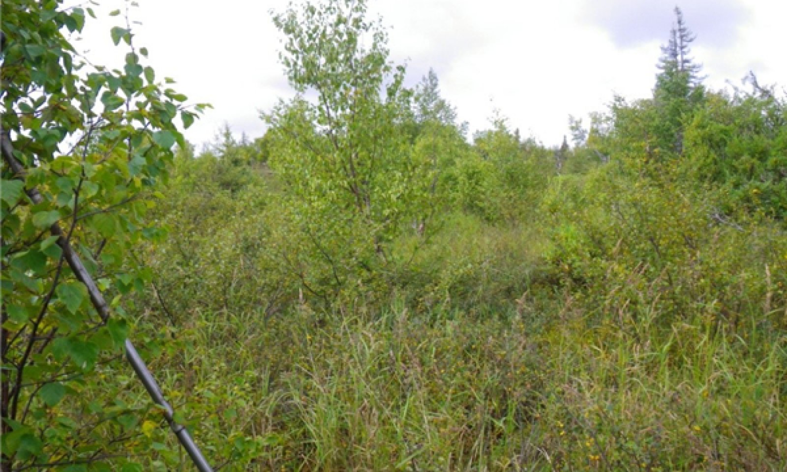
The reference state supports two communities. The reference plant community is characterized as an open tall scrubland (Viereck et al., 1992). It is composed of one or more willow species with an understory of graminoids and forbs. The second community is wetter and comprised of facultative wet to obligate wetland species.Associated sites
R236XY144AK Subarctic Scrub Peat Terraces
R236XY144AK describes terrace treads. These areas are located at higher elevations within a drainageway than the talfs described by this site.
R236XY175AK Subarctic Scrub Loamy Steep Coastal Bluffs
R236XY175AK describes the steeply sloped bluffs lining the drainageways described by this site. Differences in site hydrology and flooding disturbances due to slope and soil characteristics are reflected in the different vegetation between these sites.
R236XY130AK Subarctic Scrub Scrub Tundra Loamy Plains and Hills
R236XY130AK describe well drained linear and convex positions on hills and rolling plains. These plains are dissected by the drainageways described by R236XY136AK. Differences in site and soil hydrology are reflected in different reference plant communities.
Similar sites
R236XY107AK Western Alaska Maritime Scrub Gravelly Drainages
Both sites describe drainages. R236XY107AK is surrounded by slopes of less than 10 percent and R236XY136AK typically is surrounded by slopes of more than 10 percent. The resulting differences in soil and disturbance regime are reflected in the vegetation.
R236XY109AK Subarctic Low Scrub Peat Drainages
Both sites describe drainages. Drainages described by R236XY109AK are typically wider than 25 feet, while those described here are narrower than 35 feet. Resulting differences in site characteristics, soils and disturbance regime result in different reference plant communities.
Table 1. Dominant plant species
Tree Not specified
Shrub (1) Salix pulchra
(2) Vaccinium uliginosumHerbaceous (1) Calamagrostis canadensis
(2) Equisetum arvense


