
Natural Resources
Conservation Service
Ecological site R236XY119AK
Boreal Scrubland Sandy Flood Plains
Last updated: 2/13/2024
Accessed: 10/03/2026
-
Search


Major Land Resource Area or ecological site by name and/or ID.
PreviousSectionsNextGeneral information
Provisional. A provisional ecological site description has undergone quality control and quality assurance review. It contains a working state and transition model and enough information to identify the ecological site.
Click to explore map
Figure 1. Mapped extent
Areas shown in blue indicate the maximum mapped extent of this ecological site. Other ecological sites likely occur within the highlighted areas. It is also possible for this ecological site to occur outside of highlighted areas if detailed soil survey has not been completed or recently updated.
MLRA notes
Major Land Resource Area (MLRA): 236X–Bristol Bay-Northern Alaska Peninsula Lowlands
The Bristol Bay-Northern Alaska Peninsula Lowland Major Land Resource Area (MLRA 236) is located in Western Alaska. This MLRA covers approximately 19,500 square miles and is defined by an expanse of nearly level to rolling lowlands, uplands and low to moderate hills bordered by long, mountain footslopes. Major rivers include the Egegik, Mulchatna, Naknek, Nushagak, and Wood River. MLRA 236 is in the zone of discontinuous permafrost. It is primarily in areas with finer textured soils on terraces, rolling uplands and footslopes. This MLRA was glaciated during the early to middle Pleistocene. Moraine and glaciofluvial deposits cover around sixty percent of the MLRA. Alluvium and coastal deposits make up a large portion of the remaining area (Kautz et al., 2012; USDA, 2006).
Climate patterns across this MLRA shift as one moves away from the coast. A maritime climate is prominent along the coast, while continental weather, commonly associated with Interior Alaska, is more influential inland. Across the MLRA, summers are general short and warm while winters are long and cold. Mean annual precipitation is 13 to 50 inches, with increased precipitation at higher elevations and areas away from the coast. Mean annual temperatures is between 30 and 36 degrees F (USDA, 2006).
The Bristol Bay-Northern Alaska Peninsula MLRA is principally undeveloped wilderness. Federally managed land includes parts of the Katmai and Aniakchak National Parks, and the Alaska Peninsula, Becharof, Togiak and Alaska Maritime National Wildlife Refuges. The MLRA is sparsely populated. Principal communities include Dillingham, Naknek, and King Salmon. Commercial fishing in Bristol Bay and the Bering Sea comprises a major part of economic activity in the MLRA. Other land uses include subsistence activities (fishing, hunting, and gathering) and sport hunting and fishing (USDA, 2006).Ecological site concept
This site is on mid flood plain talfs dissected by a river channel. Mid flood plains are part of the riparian complex of river channels. They are relatively higher and less frequently flooded than low flood plains, and relatively lower and more frequently flooded than high flood plains. Site elevation ranges from sea level to 150 feet. Slopes are nearly level (0 – 2 percent). Site and soil hydrology and ponding and flooding disturbances shape the vegetation on this landform.
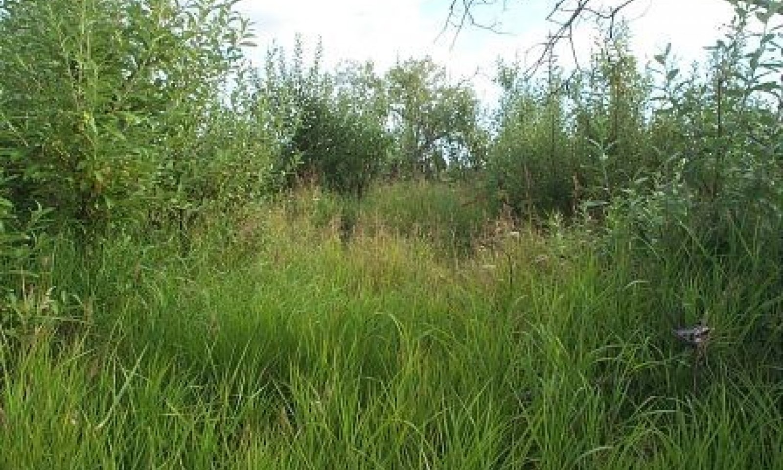
The reference state supports three communities. The reference plant community is characterized as an open willow scrubland (Viereck et al., 1992). It is composed of one or more willow species with bluejoint (Calamagrostis canadensis) and various diverse forbs throughout. The other two communities co-occur on this site and their presence is dependent on specific site characteristics and periods of disturbance/recovery.Associated sites
R236XY120AK Boreal Open Scrub Loamy Mid Flood Plains
R236XY120AK describes mid flood plains with moderately well drained soils. The water table is deeper and the flood duration is much longer compared with R236XY119AK. These sites can be found along the same river system, but differences in soil and disturbance factors create distinct ecological sites.
F236XY111AK Boreal Forest Loamy Flood Plains
F236XY111AK describes high flood plains. These high flood plains are rarely flooded or ponded. Partly as a result, they support a forested reference plant community. Trees are absent on the poorly drained, occasionally flooded and ponded areas described by R236XY119AK.
Similar sites
R236XY120AK Boreal Open Scrub Loamy Mid Flood Plains
Both sites are flood plains. The poorly drained soils of R236XY119AK do not support the same closed scrubland that is supported on the moderately well drained soils associated with R236XY120AK.
Table 1. Dominant plant species
Tree Not specified
Shrub (1) Salix pulchra
(2) Salix alaxensisHerbaceous (1) Calamagrostis canadensis
(2) Galium borealePhysiographic features
This site is on linear flood plain talfs. Elevation ranges from sea level to 150 feet. Slopes are nearly level (0 – 2 percent). Ponding is occasional and brief during the growing season, and flooding is occasional and very brief. A water table ranges between 1 and 60 inches. This site is found at all aspects.
Table 2. Representative physiographic features
Landforms (1) Valley > Flood plain
(2) Alluvial plain > Flood plain
Runoff class Negligible to low Flooding duration Very brief (4 to 48 hours) Flooding frequency Occasional Ponding duration Brief (2 to 7 days) Ponding frequency Occasional Elevation 0 – 150 ft Slope 0 – 2 % Water table depth 1 – 60 in Aspect W, NW, N, NE, E, SE, S, SW Table 3. Representative physiographic features (actual ranges)
Runoff class Negligible to low Flooding duration Very brief (4 to 48 hours) Flooding frequency Occasional Ponding duration Brief (2 to 7 days) Ponding frequency Occasional Elevation 0 – 220 ft Slope 0 – 2 % Water table depth 1 – 60 in Climatic features
The climate of this site reflects that of the MLRA, which is described as maritime polar (EPA, 2013). Temperatures are moderated by the nearby Bristol Bay and norther Pacific bodies of water. Annual precipitation ranges from 21 – 34 inches with approximately 40 percent occurring during the June-September growing season (PRISM, 2018).
Table 4 Representative climatic features
Frost-free period (characteristic range) 80-100 days Freeze-free period (characteristic range) 70-90 days Precipitation total (characteristic range) 20-30 in Frost-free period (actual range) 80-100 days Freeze-free period (actual range) 70-90 days Precipitation total (actual range) 20-40 in Frost-free period (average) 90 days Freeze-free period (average) 80 days Precipitation total (average) 30 in Characteristic rangeActual rangeBarLineFigure 2. Monthly precipitation range
Characteristic rangeActual rangeBarLineFigure 3. Monthly minimum temperature range
Characteristic rangeActual rangeBarLineFigure 4. Monthly maximum temperature range
BarLineFigure 5. Monthly average minimum and maximum temperature
Figure 6. Annual precipitation pattern
Figure 7 Annual average temperature pattern
">Influencing water features
This site is influenced by riparian water features. A single, unbraided channel typically dissects this flood plain site. Precipitation and seasonal snow melt are the main sources of water. The water system site is best described as a riverine, lower perennial system with a rock or unconsolidated bottom (Cowardin et al., 1979).
Soil features
Soils are Entisols with little to no developed horizons (Soil Survey Staff, 2013). Soils are very deep and poorly drained. They support a cryic temperature regime and an aquic moisture regime. Parent material is grassy organic material over coarse-loamy alluvium over sandy and gravelly alluvium.
Soil hydrology and development affect vegetation on this site. A water table is present at depths between one and two inches during the early growing season. Aquic conditions are present below 14 inches and redox concentrations (2 – 41 inches) are present. Wet soils influence vegetation by restricting species to those that can establish and grow during the important early growing season months. Soil is minimally developed with a cambic horizon from two to forty-one inches. Organic matter content is also relatively low. Minimal soil development conditions and a lack of organic material favor species capable of colonizing and reproducing in poor conditions.
Correlated soil components in MLRA 236: D36-Boreal grass loamy flood plainsTable 5. Representative soil features
Parent material (1) Alluvium
Surface texture (1) Silt loam
Drainage class Poorly drained Permeability class Moderate Soil depth 60 – 0 in Surface fragment cover <=3" Not specified Surface fragment cover >3" Not specified Available water capacity
(0-10in)1.8 – 2.2 in Soil reaction (1:1 water)
(0-10in)4.8 – 5.9 Subsurface fragment volume <=3"
(Depth not specified)0 – 4 % Subsurface fragment volume >3"
(Depth not specified)Not specified Table 6. Representative soil features (actual values)
Drainage class Poorly drained Permeability class Moderate Soil depth 60 – 0 in Surface fragment cover <=3" 0 % Surface fragment cover >3" 0 % Available water capacity
(0-10in)1.8 – 2.2 in Soil reaction (1:1 water)
(0-10in)4.8 – 5.9 Subsurface fragment volume <=3"
(Depth not specified)0 – 4 % Subsurface fragment volume >3"
(Depth not specified)0 % Ecological dynamics
This site is on mid flood plains dissected by a deep river channel. Local site factors including local flooding and ponding dynamics and soil characteristics support three co-occurring plant communities. The reference plant community is an open tall scrubland (Viereck et al., 1992). Plant species are facultative to obligate wetland species resistant to occasional ponding and flooding. Common species are also tolerant of the poorly developed soils associated with this site.
Spatial and temporal patterns in hydrology support three flood plain communities. Flooding intensity and frequency are critical in the distribution and abundance of vegetation in Alaskan riverine systems (Wohl, 2007). Flooding can lead to plant succession by creating barren, moist areas for colonization, burying organic layers, adding nutrients to the soil, and depositing seed banks (Rood et al., 2007; Yarie et al., 1998). Areas near the river channel that are more prone to scouring from flooding and ice bulldozing than distal areas. Lower areas support a higher water table and are more prone to longer periods of ponding. Better drained areas with lower water tables further typically support the reference plant community. Areas with high water tables that experience soil scouring and sediment deposition are more likely to support community 1.3. Community 1.2 is an intermediate assemblage.
Changes in site hydrology due to shifts in the water table and flooding and ponding frequency and duration may affect plant composition. Scouring and sediment deposition can transform an existing community to community 1.3. Decreased flooding pressure and subsequent ponding can allow an older community to develop, eventually reaching the reference plant community. These changes are slow. Annual changes in precipitation or flow rate are likely to affect site hydrology.
Slight to severe browsing of willows and forbs by moose in summer occurs in the reference community phase. Browsing does not significantly affect the structure and function of the reference community phase or the ecological site.
Beaver-affected areas are described by an alternate state. In these areas, hydrophilic forbs, graminoids, and willows typically surround beaver ponds and upstream areas. It is unknown if the pond will naturally return to the reference state after dam removal.
The information in this Ecological Dynamics section, including the state-and-transition model (STM), was developed based on current field data, professional experience, and a review of the scientific literature. As a result, all possible scenarios or plant species may not be included. Key indicator plant species, disturbances, and ecological processes are described to inform land management decisions.State and transition model
More interactive model formats are also available. View Interactive Models
Click on state and transition labels to scroll to the respective textEcosystem states
T1A - Beaver activity. R2A - Dam removal State 1 submodel, plant communities
1.1a - Increased flooding energy and/or raised water table 1.2a - Lowered water table or decrease in flood frequency or intensity 1.2b - Increased flooding energy and/or raised water table 1.3a - Lowered water table or decrease in flood frequency or intensity State 2 submodel, plant communities
State 1
Reference StateThe reference state supports three community phases, which are grouped by the structure and dominance of the vegetation (e.g., graminoids, shrubs, and forbs) and by their ecological function and stability. The presence of these communities is temporally dictated by the occasional periods of flooding. The reference community phase is represented by open scrubland that has graminoids and forbs throughout. A transition to an alternate state is caused by the damming of a nearby waterway by beavers (Castor canadensis).
Community 1.1
Bluejoint grass/fireweed-purple marshlocks/tealeaf willow-feltleaf willow scrubland
Figure 8. Typical area of community 1.1.

Figure 9. Constancy and canopy cover of plants in community 1.1.
The reference community phase is characterized by open willow scrubland that has areas of grass and diverse forbs throughout. Typically, this community phase consists of patchy medium and tall tealeaf willow (Salix pulchra) and feltleaf willow (Salix alaxensis) and open areas of bluejoint grass (Calamagrostis canadensis), arctic raspberry (Rubus arcticus), and various forbs, including fireweed (Chamerion angustifolium), purple marshlocks (Comarum palustre), and northern bedstraw (Galium boreale). Other species may include tall Jacob’s-ladder (Polemonium acutiflorum), kneeling angelica (Angelica genuflexa), Canada goldenrod (Solidago canadensis), fewflower meadow-rue (Thalictrum sparsiflorum), and horsetails (Equisetum spp.). Individual trees in the medium stratum or regenerative trees, including balsam poplar (Populus balsamifera), paper birch (Betula papyrifera), and white spruce (Picea glauca), may be present. Mosses commonly are in the ground cover (about 30 percent total mean cover). Other ground cover generally includes herbaceous litter (about 80 percent cover) and woody litter (about 4 percent).
Community 1.2
Bluejoint grass/arctic raspberry/Canada goldenrod-northern bedstraw/willow grassland
Figure 10. Typical area of community 1.2.

Figure 11. Constancy and canopy cover of plants in community 1.2.
The late flooding community phase is characterized by grassland that has various forbs throughout. Typically, this community consists dominantly of dense bluejoint grass (Calamagrostis canadensis) with arctic raspberry (Rubus arcticus) and scattered forbs throughout. Forbs may include northern bedstraw (Galium boreale), tall Jacob’s-ladder (Polemonium acutiflorum), Canada goldenrod (Solidago canadensis), marsh pea (Lathyrus palustris), and horsetails (Equisetum spp.). Mosses generally are in the ground cover (about 25 percent total mean cover). The ground cover commonly includes herbaceous litter (about 90 percent) and woody litter (about 2 percent). About 15 percent is bare soil.
Community 1.3
Canada goldenrod-woodland horsetail-northern bedstraw-fireweed/bluejoint grass meadow
Figure 12. Typical area of community 1.3.

Figure 13. Constancy and canopy cover of plants in community 1.3.
The early flooding community phase is characterized by a forb meadow that has interspersed graminoids. Typically, this community consists of various forbs such as Canada goldenrod (Solidago canadensis), northern bedstraw (Galium boreale), woodland horsetail (Equisetum sylvaticum), and fireweed (Chamerion angustifolium) with bluejoint grass (Calamagrostis canadensis) throughout. Rough bentgrass (Agrostis scabra), arctic raspberry (Rubus arcticus), larkspurleaf monkshood (Aconitum delphiniifolium), fewflower meadow-rue (Thalictrum sparsiflorum), and tall bluebells (Mertensia paniculata) may be present. Mosses generally are in the ground cover (about 65 percent total mean cover). The ground cover also commonly includes herbaceous litter (about 65 percent) and a trace of woody litter. Areas of bare soil typically are present. Individual trees in the medium stratum and regenerative trees may be in this community, particularly in areas adjacent to forested or woodland ecological sites that are not affected by flooding.
Pathway 1.1a
Community 1.1 to 1.3
Bluejoint grass/fireweed-purple marshlocks/tealeaf willow-feltleaf willow scrubland
Canada goldenrod-woodland horsetail-northern bedstraw-fireweed/bluejoint grass meadowFlooding scours vegetation and soil. Post-flood sites are bare and are ideal for fast growing, hydrophytic forbs and graminoids. Additionally, a raised water table stresses extant species of the reference plant community. Less tolerant species die back to be replaced by more tolerant forbs and graminoids. Water table increases are the result of increased water input to an area. This could be caused by increased precipitation, including more snow during the winter or more rain during the growing season. A raised water table could also be a result of an upstream disturbance such as a fire, which increases run off rates.
Pathway 1.2a
Community 1.2 to 1.1
Bluejoint grass/arctic raspberry/Canada goldenrod-northern bedstraw/willow grassland
Bluejoint grass/fireweed-purple marshlocks/tealeaf willow-feltleaf willow scrublandA lowered water table allows less resilient, slower growing species to colonize. A lowered water table could be a result of a decrease in precipitation, a decrease in upstream run off into the site or improved drainage in the flood plain site.
Pathway 1.2b
Community 1.2 to 1.3
Bluejoint grass/arctic raspberry/Canada goldenrod-northern bedstraw/willow grassland
Canada goldenrod-woodland horsetail-northern bedstraw-fireweed/bluejoint grass meadowA raised water table stresses extant species. Less tolerant species die back to be replaced by more tolerant wetland forb and graminoid species. Increased water input to an area raises the water table. This can be caused by increased precipitation, including more snow during the winter or more rain during the growing season. A raised water table could also be a result of an upstream disturbance such as a fire, which increases run off rates.
Pathway 1.3a
Community 1.3 to 1.2
Canada goldenrod-woodland horsetail-northern bedstraw-fireweed/bluejoint grass meadow
Bluejoint grass/arctic raspberry/Canada goldenrod-northern bedstraw/willow grasslandA lowered water table allows less resilient, slower growing species to colonize. A lowered water table could be a result of a decrease in precipitation, a decrease in upstream run off into the site or improved drainage in the flood plain site.).
State 2
Beaver-Affected AreasThis alternate state results from ponding near beaver dams. Beavers (Castor canadensis) directly kill trees and large shrubs for food and dam construction, and they also indirectly kill these species and others by causing a rise in the water table (USDA–FS, 2013). Ponding of the site results in a plant community different from that normally on these flood plains. This alternate plant community commonly includes resilient individuals and extant species in the reference community phase as well as pioneer hydrophilic species. The permanent ponding associated with areas upstream from beaver dams can negate the influence of flooding on the soils and vegetation. The plant community likely will remain relatively stable until the dam is removed. When the dam is removed by natural blowout, abandonment by beaver, or human intervention, the plant community likely will revert back to the reference state. Further research is needed to quantify this process in situ.
Browsing of willow by moose may be severe. This may maintain the open scrubland by preventing willows from becoming dominant in the community.Community 2.1
Tealeaf willow/bluejoint grass-Northwest Territory sedge/purple marshlocks-water horsetail open scrubland
Figure 14. Typical area of community 2.1.

Figure 15. Constancy and canopy cover of plants in community 2.1.
This community phase is associated with areas surrounding beaver ponds. It is characterized by open scrubland that has facultative or obligate graminoids and forbs throughout. Typically, the community consists of patchy tealeaf willow (Salix pulchra) and ubiquitous bluejoint grass (Calamagrostis canadensis), Northwest Territory sedge (Carex utriculata), purple marshlocks (Comarum palustre), and water horsetail (Equisetum fluviatile). Other species include silvery sedge (Carex canescens), Lyngbye’s sedge (Carex lyngbyei), cottongrasses (Eriophorum spp.), arctic raspberry (Rubus arcticus), and Mackenzie’s water hemlock (Cicuta virosa). The ground cover commonly consists of mosses, herbaceous litter, and woody litter. Areas of open water and bare soil generally are present.
Note: The vegetation and soils for this plant community phase were sampled at one location. Due to the limited data available, personal field observations were used to aid in describing this plant community.Transition T1A
State 1 to 2Beaver ponds raise the upstream water table and increase ponding length and depth in affected areas. Flooding is less likely to be disruptive to the vegetation.
Constraints to recovery.It is currently unknown whether the removal of a beaver population and the associated network of dams will restore an drainage to the reference state.
Restoration pathway R2A
State 2 to 1It is unknown if the alternate state will naturally return to the reference states natural upon removal of a beaver dam. Various factors, such as site hydrology, extant species, propagule pressure, will influence the restoration pathway. Further research and in situ documentation is needed to fully describe this transition.
Additional community tables
Table 7. Community 1.1 plant community composition
Group Common name Symbol Scientific name Annual production () Foliar cover (%) Table 8. Community 1.2 plant community composition
Group Common name Symbol Scientific name Annual production () Foliar cover (%) Table 9. Community 1.3 plant community composition
Group Common name Symbol Scientific name Annual production () Foliar cover (%) Table 10. Community 2.1 plant community composition
Group Common name Symbol Scientific name Annual production () Foliar cover (%) Interpretations
Supporting information
Inventory data references
Modal points for Community 1.1 08SS12402 09AO10106 09AO11508 09AO12705 09AO13406 09SS12607 Modal points for community 1.2 09SS11504 09SS12703 Modal points for community 1.3 09AO14103 09SS10905 09SS12702 Modal points for community 2.1 09SS13506
References
-
Viereck, L.A., C. T. Dyrness, A. R. Batten, and K. J. Wenzlick. 1992. The Alaska vegetation classification. U.S. Department of Agriculture, Forest Service, Pacific Northwest Forest and Range Experiment Station General Technical Report PNW-GTR-286..
Other references
Cowardin, L.M., V. Carter V., F.C. Golet, E.T. LaRoe. 1979. Classification of Wetlands and Deepwater Habitats of the United States. U.S. Fish and Wildlife Service Report No. FWS/OBS/-79/31.Washington, D.C.
Kautz, D.R., P. Taber, and S. Nield, editors. 2012. Land Resource Regions and Major Land Resource Areas of Alaska. United States Department of Agriculture, Natural Resources Conservation Service (USDA–NRCS).
PRISM Climate Group. (PRISM) Oregon State University. https://prism.oregonstate.edu. Date created October 2018. Accessed 3 Mar 2023.
Rood, S.B., L.A. Goater, J.M. Mahoney, C.M. Pearce, and D.G. Smith. 2007. Floods, fire, and ice: Disturbance ecology of riparian cottonwoods. Canadian Journal of Botany 85(11): 1,019-1,032.
Scenarios Network for Alaska and Arctic Planning (SNAP). Historical Monthly Temperature – 1km, 1901-2009. http://ckan.snap.uaf.edu/dataset/. Accessed 20 Mar 2023.
Scenarios Network for Alaska and Arctic Planning (SNAP). Historical monthly and derived precipitation products downscaled from CRU TS data via the delta methods – 2km, 1901-2009. http://ckan.snap.uaf.edu/dataset/. Accessed 20 Mar 2023.
Soil Survey Staff. 2013. Simplified Guide to Soil Taxonomy. USDA-Natural Resources Conservation Service, National Soil Survey Center, Lincoln, NE.
United States Department of Agriculture, Forest Service, Alaska Region. 2013. Forest health conditions in Alaska - 2012. Publication R10-PR-32.
United States Department of Agriculture, Natural Resources Conservation Service. 2006. Land Resource Regions and Major Land Resource Areas of the United States, the Caribbean, and the Pacific Basin. U.S. Department of Agriculture Handbook 296.
US Environmental Protection Agency (EPA). Level III Ecoregions of the Conterminous United States. UP ESP Office of Research and Development. Corvallis, OR. http://edg.epa.gov/. Created 16 Apr 2013. Accessed 20 Mar 2023.
Wohl, E.E. 2007. Review of effects of large floods in resistant-boundary channels. In Gravel-Bed Rivers VI: From Process Understanding to River Restoration, Volume 11. H. Habersack, H. Piégay, and M. Rinaldi, editors. Elsevier Science, Amsterdam. Pages 181-211.
Yarie, J., L. Viereck, K. Van Cleve, and P. Adams. 1998. Flooding and ecosystem dynamics along the Tanana River. BioScience 48(9): 690-695.Contributors
Sue Tester
Steph Schmit
Michael Margo
Kendra Moseley
Phil BarberApproval
Kirt Walstad, 2/13/2024
Rangeland health reference sheet
Interpreting Indicators of Rangeland Health is a qualitative assessment protocol used to determine ecosystem condition based on benchmark characteristics described in the Reference Sheet. A suite of 17 (or more) indicators are typically considered in an assessment. The ecological site(s) representative of an assessment location must be known prior to applying the protocol and must be verified based on soils and climate. Current plant community cannot be used to identify the ecological site.
Author(s)/participant(s) Contact for lead author Date 10/03/2026 Approved by Approval date Composition (Indicators 10 and 12) based on Annual Production Indicators
-
Number and extent of rills:
-
Presence of water flow patterns:
-
Number and height of erosional pedestals or terracettes:
-
Bare ground from Ecological Site Description or other studies (rock, litter, lichen, moss, plant canopy are not bare ground):
-
Number of gullies and erosion associated with gullies:
-
Extent of wind scoured, blowouts and/or depositional areas:
-
Amount of litter movement (describe size and distance expected to travel):
-
Soil surface (top few mm) resistance to erosion (stability values are averages - most sites will show a range of values):
-
Soil surface structure and SOM content (include type of structure and A-horizon color and thickness):
-
Effect of community phase composition (relative proportion of different functional groups) and spatial distribution on infiltration and runoff:
-
Presence and thickness of compaction layer (usually none; describe soil profile features which may be mistaken for compaction on this site):
-
Functional/Structural Groups (list in order of descending dominance by above-ground annual-production or live foliar cover using symbols: >>, >, = to indicate much greater than, greater than, and equal to):
Dominant:
Sub-dominant:
Other:
Additional:
-
Amount of plant mortality and decadence (include which functional groups are expected to show mortality or decadence):
-
Average percent litter cover (%) and depth ( in):
-
Expected annual annual-production (this is TOTAL above-ground annual-production, not just forage annual-production):
-
Potential invasive (including noxious) species (native and non-native). List species which BOTH characterize degraded states and have the potential to become a dominant or co-dominant species on the ecological site if their future establishment and growth is not actively controlled by management interventions. Species that become dominant for only one to several years (e.g., short-term response to drought or wildfire) are not invasive plants. Note that unlike other indicators, we are describing what is NOT expected in the reference state for the ecological site:
-
Perennial plant reproductive capability:
Print Options
Sections
Font
AAAAOther
PrintThe Ecosystem Dynamics Interpretive Tool is an information system framework developed by the USDA-ARS Jornada Experimental Range, USDA Natural Resources Conservation Service, and New Mexico State University.
Accessibility statement


