
Natural Resources
Conservation Service
Ecological site VX163X01X002
Sandy Shrubland
Last updated: 5/08/2025
Accessed: 10/30/2026
-
Search


Major Land Resource Area or ecological site by name and/or ID.
PreviousSectionsNextGeneral information
Provisional. A provisional ecological site description has undergone quality control and quality assurance review. It contains a working state and transition model and enough information to identify the ecological site.
MLRA notes
Major Land Resource Area (MLRA): 163X–Alluvial Fans and Coastal Plains
This MLRA is in the State of Hawaii on the islands of Maui, Lanai, Molokai, Oahu, and Kauai. Elevation ranges from sea level to 800 feet (0 to 244 meters) with elevation extremes up to 1,600 feet (488 meters). The terrain is nearly level and gently sloping coastal plains and adjacent alluvial fans. Beneath the unconsolidated sediments are basalt, coral limestone, calcareous sand deposits, volcanic ash, coral sand, and fill. Average annual precipitation ranges from 10 to 40 inches (254 to 1,016 millimeters) with precipitation extremes up to 122 inches (3,099 millimeters) in select places on Oahu and Kauai (Giambelluca et al., 2013). Most of the rainfall occurs from November through March during kona storms that come in from the leeward side of the islands. Average annual temperatures range from 68 to 82 degrees F (20 to 28 degrees C) with little seasonal variation (Giambelluca et al., 2014). Dominant soils are Mollisols, Aridisols, Entisols, and Vertisols with an isohyperthermic soil temperature regime and aquic or aridic (torric) to ustic soil moisture regimes. Vegetation consists of forbs, grasses, and shrubs with some trees. Almost all the plant species typically encountered are introduced species that have become naturalized in Hawaii (USDA-NRCS, 2006).
Classification relationships
This ecological site occurs within Major Land Resource Area (MLRA) 163 - Alluvial Fans and Coastal Plains.
The Aha Moku System, which dates back to the 9th century and has been passed down through oral tradition and generational wisdom, effectively sustains Hawaii's natural ecosystems and environment (DLNR, 2024). This site-specific and resource-based approach balances land and ocean resources essential for fostering healthy, thriving communities. Grounded in Native Hawaiian generational knowledge, the Aha Moku System emphasizes community consultation to prioritize the health and welfare of Hawaii's natural and cultural resources. It is rooted in the concept of 'ahupua'a, the traditional system of land and ocean management in Hawaii. For collaboration, this ecological framework encompasses the following mokus:
Maui Moku Acres: Pu’ali Komohana (7,329), Kula (936), Lahaina (55), and Ka’anapali (25).
Kauai Moku Acres: Kona (4,045), and Puna (49).
Oahu Moku Acres: Ko’olaupoko (2,260), Ko’olauloa (1,463), Waialua (831), Kona (476), Ewa (97), and Wai’anae (28).
Molokai Moku Aces: Kona (1,497) and Ko’olau (103).
Lanai Moku Acres: Lahaina (817).Ecological site concept
This ecological site supports a mix of forbs, grasses, shrubs, and, in the Weed Invaded State, trees. It occurs on coastal beaches above high tide and on sand hills, primarily on the “neck” between east and west Maui, on the northwest coast of Molokai, the westernmost coast of Kauai, and small areas on Oahu and Lanai. A protected example is on The Nature Conservancy’s Mo`omomi Preserve on the northwest coast of Molokai. Much of the total area has been in agriculture, primarily for sugarcane, or has been developed for urban use (USDI-USGS, 2006).
The central concept of the Sandy Shrubland is of somewhat excessively to excessively drained, moderately deep to deep soils formed in calcareous sand at elevations from sea level to 650 feet (0 to 198 meters) (USDA-SCS, 1972). Annual air temperatures and low rainfall create warm (isohyperthermic), dry (torric) and seasonally dry (ustic) soil conditions. Average annual precipitation ranges from 15 to 39 inches (381 to 991 millimeters), although the small area on Oahu can receive up to 73 inches (1,854 millimeters) (Giambelluca et al., 2013). Vegetation consists of forbs, grasses, shrubs, and some trees. These growth forms can form unique communities within the ecological site that are smaller than the resolution possible at the scale of the soil map.Associated sites
VX158X01X002 Isohyperthermic Torric Naturalized Grassland Kiawe/buffelgrass (Prosopis pallida/Pennisetum ciliare)
The Isohyperthermic Torric Naturalized Grassland Ecological Site has a similar climate to this ecological site, but its soils are very different. It does not have sandy soils, has more water-holding capacity, and supports a different set of plant species.
VX163X01X003 East Aspect Isohyperthermic Naturalized Grassland
The East Aspect Isohyperthermic Naturalized Grassland Ecological Site has a moister and slightly cooler climate than this ecological site. It does not have sandy soils and has greater water-holding capacity. It has a different suite of plant species adapted to a moister environment.
VX163X01X005 Aquic Coastal Wetland
The Aquic Coast Wetland Ecological Site has a similar climate to this ecological site, but it has wet, poorly and very poorly drained soils and, unless artificially drained, supports wetlands rather than dry rangeland.
Table 1. Dominant plant species
Tree Not specified
Shrub (1) Scaevola sericea
(2) Heliotropium anomalum var. argenteumHerbaceous (1) Heliotropium curassavicum
(2) Sporobolus virginicusLegacy ID
R163XY002HI
Physiographic features
This ecological site occurs on coastal plains on beaches and sand dunes deposited on deep layers of coral and shells that have been exposed by a drop in sea level since the last glacial period (USDA-SCS, 1972).
Table 2. Representative physiographic features
Landforms (1) Coastal plain > Dune
(2) Coastal plain > Beach
Runoff class Very low to low Flooding frequency None to rare Ponding frequency None Elevation 0 – 650 ft Slope 0 – 15 % Water table depth 72 in Aspect Aspect is not a significant factor Table 3. Representative physiographic features (actual ranges)
Runoff class Very low to medium Flooding frequency Not specified Ponding frequency Not specified Elevation 0 – 1141 ft Slope 0 % Water table depth 42 – 72 in Climatic features
Summary for this ecological site
Rainfall statistics were determined from University of Hawaii's Rainfall Atlas Raster Data (Giambelluca et al., 2013). Most of the precipitation falls from October through April. Representative (20th and 80th percentiles) values for annual average precipitation range from 17 to 33 inches (432 to 838 millimeters) while actual (10th and 90th percentiles) values for annual average precipitation range from 15 to 39 inches (381 to 991 millimeters). Extreme values range from 10 to 73 inches (254 to 1,854 millimeters). The mean annual precipitation is 24 inches (610 millimeters) and the median annual average precipitation is 19 inches (483 millimeters).
Temperature statistics were determined from University of Hawaii's Surface Temperature Raster Data (Giambelluca et al., 2014). Representative (20th and 80th percentiles) values for annual temperatures range from 75 to 82 degrees F (24 to 28 degrees C) while actual (10th and 90th percentiles) values for annual temperatures range from 75 to 82 degrees F (24 to 28 degrees C). Extreme values range from 73 to 82 degrees F (23 to 28 degrees C). The mean annual temperature is 79 degrees F (26 degrees C) and the median annual temperature is 77 degrees F (25 degrees C).
The data presented in the climate normals tables below are from the Western Region Climate Center (Western Regional Climate Center, 2020). The available climate station data are most representative of the low and moderate precipitation areas of this ecological site. I used these data because they provide a reasonable approximation of the University of Hawaii data presented above.
Low-elevation (to about 2,000 feet or 610 meters) areas on the leeward sides of the islands are very warm, sunny, and dry. The central valley of Maui, between Haleakala and the West Maui mountains, is very warm and dry; this valley is also windy due to trade winds passing around the northwest corner of Haleakala (USDA-SCS, 1972; Western Regional Climate Center, 2020).
General principles
Air temperature in the Hawaiian Islands is buffered by the surrounding ocean so that the range in temperature through the year is narrow. This creates “iso" - soil temperature regimes in which mean summer and winter temperatures differ by less than 6 degrees C (11 degrees F).
The islands lie within the trade wind zone. Significant amounts of moisture are picked up from the ocean by trade winds up to an altitude of more than about 6,000 feet (1,850 meters). As the trade winds from the northeast are forced up the mountains of the islands their moisture condenses, creating rain on the windward slopes; the leeward sides of the island receive little of this moisture (USDA-SCS, 1972; Western Regional Climate Center, 2020).
Hawaiian indigenous understanding recognized two seasons: Kau or Kauwela (dry season), and Ho`oilo (wet season). During Kau, the sun is directly overhead, days are long and warm, and the trade winds are stronger and more consistent; Kau started on the first new moon in May when the Pleiades set at sunrise (Handy et al., 1991). During Ho’oilo (wet season) the sun is declined toward the south, days are shorter, temperatures cooler and winds more variable and generally started with the first new moon in November. Ho’oilo is also the season when extensive low-pressure systems often approach the islands from the west, producing heavy rainstorms that primarily affect the leeward sides, but can envelope the entire island. (Malo, 1903; Handy et al., 1991; Sanderson, 1993). Differences in rainfall amounts between winter and summer are most marked in low elevation dry areas; wetter areas exhibit less seasonal variation in rainfall (USDA-SCS, 1972; Western Regional Climate Center, 2020).
On the windward sides of the island, cool, moist air at higher elevations descends toward the ocean where it meets the trade winds; this process brings rainfall, often at night, to lower elevation areas (USDA-SCS, 1972).
Extensive low-pressure systems often approach the islands from the west, producing heavy rainstorms that primarily affect the leeward sides, but can envelope the entire island. These major storms occur most frequently between October and March (USDA-SCS, 1972).Table 4 Representative climatic features
Frost-free period (characteristic range) 370 days Freeze-free period (characteristic range) 370 days Precipitation total (characteristic range) 20-30 in Frost-free period (actual range) 370 days Freeze-free period (actual range) 370 days Precipitation total (actual range) 20-40 in Frost-free period (average) 370 days Freeze-free period (average) 370 days Precipitation total (average) 20 in Characteristic rangeActual rangeBarLineFigure 1. Monthly precipitation range
Characteristic rangeActual rangeBarLineFigure 2. Monthly minimum temperature range
Characteristic rangeActual rangeBarLineFigure 3. Monthly maximum temperature range
BarLineFigure 4. Monthly average minimum and maximum temperature
Figure 5. Annual precipitation pattern
Figure 6 Annual average temperature pattern
Climate stations used
-
(1) BARKING SANDS [USW00022501], Kekaha, HI
-
(2) WAIMEA 947 [USC00519629], Kekaha, HI
-
(3) WAIKIKI 717.2 [USC00519397], Honolulu, HI
-
(4) HONOLULU INTL AP [USW00022521], Honolulu, HI
-
(5) WAIMANALO EXP F 795.1 [USC00519523], Waimanalo, HI
-
(6) KII-KAHUKU 911 [USC00514500], Kahuku, HI
-
(7) MAKAHA CTRY CLUB 800.3 [USC00515758], Waianae, HI
">Influencing water features
Depressions within this ecological site near the coast on Maui and Oahu can have shallow, brackish water tables that support salinity-adapted plant species. On Maui, these depressions are classified in the National Wetlands Inventory as seasonally and semi permanently flooded, palustrine wetlands with forest, scrub-shrub, or persistent emergent vegetation. On Oahu, they are classified as estuarine intertidal wetlands with emergent persistent vegetation (USFWS, 2023).<br />
<br />
Number of National Wetland Inventory (NWI) features overlapping ecological site: estuarine and marine wetland (306), riverine (139), freshwater pond (107), estuarine and marine deepwater (93), freshwater/forest shrub wetland (59), and lake (3). (USFWS, 2023).<br />
<br />
Number of National Hydrologic Dataset (NHD) features overlapping ecological site: lake/pond (77), foreshore (20), reservoir (19), swamp/marsh (13), stream/river (9), sea/ocean (5), and canal/ditch (3). (USGS, 2019).Soil features
The soil components associated with this ecological site are Jaucas, Jaucas dark variant, and Puuone.
These soils formed in sand derived mostly from coral and shells. They are in the soil order Entisols, which are soils predominantly consisting of mineral materials and lacking distinct pedogenic soil horizons. They are in the suborder Psamments, which are Entisols formed in sand (USDA-SCS, 1972).
The soils within the ecological site have an isohyperthermic (very warm) soil temperature regime and an ustic (seasonally dry) or torric (drier than ustic) soil moisture regime. Typically, they are moderately deep to very deep, and somewhat excessively to excessively drained. Surface horizons from 0 to 10 inches (0 to 254 millimeters) have pH values ranging from 7.0 to 8.2, while pH values from 10 to 20 inches (254 to 508 millimeters) also range from 7.0 to 8.2. Their available water capacity is low, making them too dry for many plants. Plant species that thrive in these conditions are short-lived annuals, species capable of seasonal dormancy, or deep-rooted perennials. The high soil pH levels reduce availability of most soil nutrients to plants.
The component Jaucas, dark variant has a surface layer is colored dark brown due to accumulation of organic matter and alluvium. The map unit Jaucas sand, saline, 0 to 12 percent slopes, MLRA 163 is excessively drained on knolls and somewhat poorly drained in depressions. At 8.00 to 32.00 mmhos/cm this soil has a much higher electrical conductivity than the other soils in this ecological site. This map unit occurs near the ocean where the water table is near the surface (42 inches or 107 centimeters). In some places the soil surface can be flooded at times (USDA-SCS, 1972).
Puuone soils have a thick layer of sand cemented by calcium carbonate at a depth of about 20 inches (50 centimeters). This layer slows percolation of water to greater depths, making Puuone soils somewhat excessively, rather than excessively, drained. Plant roots can penetrate the cemented layer in places.
Figure 7. Jaucas sand, saline, 0 to 2 percent slopes, MLRA 163. Kanaha State Wildlife Refuge. Elevation 20 feet (6.1 meters). John Proctor, 11/15/23.

Figure 8. Akiaki or seashore dropseed grass (Sporabolus virginicus) in Jaucas sand, saline, 0 to 2 percent slopes, MLRA 163. Kanaha State Wildlife Refuge. Elevation 20 feet (6.1 meters). John Proctor, 11/15/23.
Table 5. Representative soil features
Parent material (1) Eolian sands – sedimentary rock
(2) Marine deposits
Surface texture (1) Sand
(2) Loamy fine sand
Drainage class Somewhat excessively drained to excessively drained Permeability class Rapid Depth to restrictive layer 72 in Soil depth 72 in Surface fragment cover <=3" Not specified Surface fragment cover >3" Not specified Available water capacity
(0-40in)1 – 2 in Calcium carbonate equivalent
(0-40in)80 – 100 % Electrical conductivity
(0-40in)0 – 2 mmhos/cm Sodium adsorption ratio
(0in)Not specified Soil reaction (1:1 water)
(0-10in)7 – 8.2 Subsurface fragment volume <=3"
(0-40in)5 – 10 % Subsurface fragment volume >3"
(0-40in)2 % Table 6. Representative soil features (actual values)
Drainage class Not specified Permeability class Moderately slow to rapid Depth to restrictive layer 20 – 72 in Soil depth 20 – 72 in Surface fragment cover <=3" 0 % Surface fragment cover >3" 0 % Available water capacity
(0-40in)0 in Calcium carbonate equivalent
(0-40in)10 – 100 % Electrical conductivity
(0-40in)0 – 32 mmhos/cm Sodium adsorption ratio
(0in)0 Soil reaction (1:1 water)
(0-10in)0 Subsurface fragment volume <=3"
(0-40in)0 % Subsurface fragment volume >3"
(0-40in)0 % Ecological dynamics
The information in this ecological site description (ESD), including the state-and-transition model (STM), was developed using archaeological and historical data, professional experience, and scientific studies. The information is representative of a complex set of plant communities. Not all scenarios or plants are included. Key indicator plants, animals, and ecological processes are described to inform land management decisions.
Natural Disturbances
The main natural (not human-related) disturbance in this ecological site is probably eolian (wind-carried) movement of sand. This would result in shifting patterns of vegetation due to erosion around roots, burial by dunes, and localized changes in depth to ground water.
Before the arrival of humans, the only grazing animals on the island were land birds up to the size of large geese (Kirch, 1982).
Human Disturbances
Human-related disturbances have been much more important than natural disturbances in this ecological site since the arrival of Polynesians and, later, Europeans. This is reflected in the state-and-transition model diagram.
Humans arrived in the Hawaiian Islands 1,200 to 1,500 years ago. Their population gradually increased so that by 1,600 A.D. at least 80 percent of all the lands in Hawaii below about 1,500 feet (roughly 500 meters) in elevation had been extensively altered by humans (Kirch, 1982); some pollen core data suggest that up to 100 percent of lowlands may have been altered (Athens, 1997). By the time of European contact late in the 18th century, the Polynesians had developed high population densities and placed extensive areas under intensive agriculture (Cuddihy and Stone, 1990).
It seems unlikely that this droughty ecological site would have been much affected by direct land use by the Polynesians. There may have been impacts caused by factors such as inadvertently introduced plant diseases and seed predation by the introduced Pacific rat (Athens, 1997).
After the arrival of Europeans, documentary evidence attests to accelerated and extensive deforestation, erosion, siltation, and changes in local weather patterns (Kirch, 1983) due to more intensive land use, modern tools, and introduction of more plant, animal, and microbe species.
The Polynesians introduced dogs, Pacific rats, and small pigs to the islands. Cattle, sheep, horses, goats, and larger European pigs were introduced in the final decades of the 18th century. These animals ranged free on the islands, becoming very numerous and destructive by the early decades of the 19th century. By 1851, records reported severe overstocking of pastures, lack of fences, and large numbers of feral livestock (Henke, 1929). Foraging of native plants and increased soil erosion, due to physical disturbance by hooves and reduced plant cover, would have altered this ecological site.
Through the 20th and into the 21st centuries, increases in human populations with attendant land development, as well as accelerated introduction of non-native mammals, birds, reptiles, amphibians, invertebrates, plants, and microorganisms, have brought about dramatic changes to wild ecosystems in Hawaii.
The broadest impacts in this ecological site have been brought about by urban development and cultivation of the soil for irrigated agriculture. Formerly cultivated areas that were abandoned have been revegetated by introduced grasses, trees, and shrubs and are now used for raising domestic livestock. Buffelgrass (Pennisetum ciliare), an introduced forage species, is capable of carrying intense wildfires. Outside of reserves, almost all native vegetation has been replaced by introduced plant species.State and transition model
Custom diagramStandard diagram
Figure 9. State-and-transition model diagram for the Sandy Shrubland (R163XY002HI)
More interactive model formats are also available. View Interactive Models
More interactive model formats are also available. View Interactive Models
Click on state and transition labels to scroll to the respective textEcosystem states
T1A - Reference State (1) transitions to the Weed Invaded State (2) by reduction or loss of native species due to grazing and browsing by introduced or domestic ungulates and by gradual invasion by introduced plant species. It also occurs when agricultural land is abandoned. R2A - The Weed Invaded State (1) may be restored to the Reference State (2) by excluding all ungulates with a suitably designed fence. Although all introduced vegetation must eventually be removed, it is probably desirable to do so gradually to protect against wind erosion. Use of mulch is also recommended to hold the soil until native plants have been reestablished. Irrigation will probably be necessary in the early stages of native plant reestablishment, as the soils drain very rapidly and have low water holding capacity. State 2 submodel, plant communities
State 1
Reference StateThe Reference State (1) consists of one community phase. It is of marginal value as grazing land. The presence of introduced feral or domestic ungulates cause soil disturbance and loss of native species or reductions in their abundance that facilitate the transition to the Weed Invaded State (2).
Community 1.1
Beach Naupaka (Naupaka Kahakai) – Polynesian Heliotrope (Hinahina Ku Kahakai)/ Salt Heliotrope (Kipukai) – Anena/Seashore Dropseed (Akiaki) – Kawelu
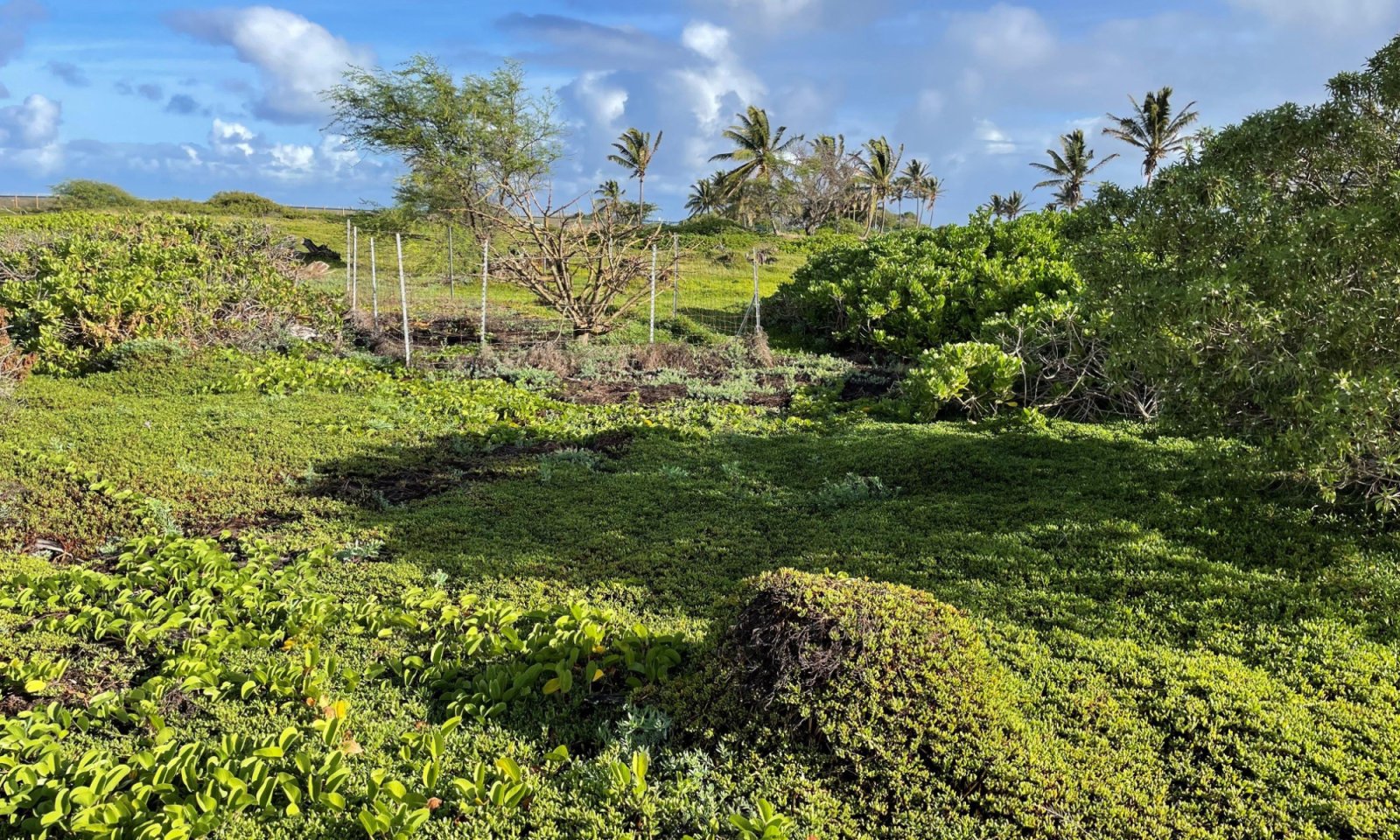
Figure 10. Reference State (1) at Kanaha State Wildlife Refuge in Kahuli, Maui. Elevation 20 feet (6.1 meters). Some of the visible plants are Naio, wili wili, beach naupaka, salt heliotrope, pauohiiaka, and akulikuli. John Proctor 11/14/2024.
On the scale of the soil survey, this ecological site is shrubland with grasses and forbs. However, due to variations in soil depth, microtopography, and proximity to the ocean, there are definable plant communities within this community phase that can be classified as grasslands or herblands. Additionally, the dominant shrub species may vary from location to location. The following description is based on the more general concept that exists at the scale of the soil survey of the Islands of Kauai, Oahu, Maui, Molokai, and Lanai (USDA-SCS, 1972).
While Naio (Myoporum sandwicense) and Tahitian screwpine or hala (Pandanus tectorius) may be present, there are typically no trees in this community phase, based on the small intact area that remains. Dominant shrub species are beach naupaka or naupaka kahakai (Scaevola sericea), Polynesian heliotrope or hinahina ku kahakai (Heliotropium anomalum var. argenteum), and yellow 'ilima (sida fallax). Each of those species may locally dominate and define a fine-scale plant community. Other common shrubs include ohelo kai or Hawai’i desert-thorn (Lycium sandwicense), Nelson’s horsenettle or popolo (Solanum nelsonii), roundleaf chastetree or kolokolo kahakai (Vitex rotundifolia), and beach sandmat or akoko (Chamaesyce degeneri). Dominant grass species that may locally define a fine-scale community are seashore dropseed or akiaki (Sporobolus virginicus) and kawelu (Eragrostis variabilis). Hurricanegrass or mau’u ‘aki’aki sedge (Fimbristylis cymosa) is common. The forb hinahina kahakai (Nama sandwicense) is abundant in some protected sites. Other common forbs are anena (Boerhavia repens), salt heliotrope or kipukai (Heliotropium curassavicum), Kunana pepperwort or anaunau (Lepidium bidentatum var. owaihiense), and ‘ena’ena (Pseudognaphalium sandwicensium). Several vines are common, including queen coralbead or huehue (Cocculus orbiculatus), oval-leaf clustervine or pauohiiaka (Jacquemontia ovalifolia ssp. sandwicensis), Brazilian bayhops or pohuehue (Ipomoea pes-caprae ssp. brasiliensis), and oceanblue morning-glory or koali awa (Ipomoea indica) (Rock, 1913; Wagner et al., 1999).Dominant plant species
-
beach naupaka (Scaevola sericea), shrub
-
Polynesian heliotrope (Heliotropium anomalum var. argenteum), shrub
-
seashore dropseed (Sporobolus virginicus), grass
-
kawelu (Eragrostis variabilis), grass
-
salt heliotrope (Heliotropium curassavicum), other herbaceous
-
anena (Boerhavia repens), other herbaceous
State 2
Weed Invaded StateThe Weed Invaded State (2) consists of one community phase. It some value as grazing land due to presence of introduced forages, including kiawe (Prosopis pallida) for pods, buffelgrass (Pennisetum ciliare), and Australian saltbush (Atriplex semibaccata). Native plant species are rare or nonexistent. The vegetation structure has changed from the shrubland/grassland of the Reference State to savanna of introduced trees, shrubs, grasses, and forbs.
Community 2.1
Kiawe/Indian Camphorweed (Indian Fleabane)/Bermudagrass – BuffelgrassThis community phase is a savanna of introduced trees, shrubs, grasses, and forbs. It supports some desirable forages, but damage to vegetation cover and soils must be carefully managed to avoid increased wind erosion. Density of introduced grasses and trees can carry wildfire, requiring construction and maintenance of firebreaks at the wild/urban interface.
The overstory consists of kiawe (Prosopis pallida) trees ranging in height from 10 to 25 feet (3 to 8 meters). They may grow singly across the landscape or in dense clumps. Few if any native plant species are typically encountered. Common shrubs are Indian camphorweed or Indian fleabane (Pluchea indica), Brazilian peppertree or christmasberry (Schinus terebinthifolius), and Australian saltbush (Atriplex semibaccata). Buffelgrass (Pennisetum ciliare) is abundant in many locations. Other common grasses are Bermudagrass (Cynodon dactylon), southern sandbur (Cenchrus echinatus), and Egyptian grass or beach wiregrass (Dactyloctenium aegyptium). Common forbs are little hogweed (Portulaca oleracea), pillpod sandmat or garden spurge (Chamaesyce hirta), graceful sandmat or graceful spurge (C. hypericifolia), hyssopleaf sandmat (C. hyssopifolia), and prostrate sandmat or spurge (C. prostrata).Dominant plant species
-
kiawe (Prosopis pallida), tree
-
Indian camphorweed (Pluchea indica), shrub
-
Bermudagrass (Cynodon dactylon), grass
-
buffelgrass (Pennisetum ciliare), grass
Transition T1A
State 1 to 2Reference State (1) transitions to the Weed Invaded State (2) by reduction or loss of native species due to grazing and browsing by introduced or domestic ungulates and by gradual invasion by introduced plant species. It also occurs when agricultural land is abandoned.
Restoration pathway R2A
State 2 to 1The Weed Invaded State (1) may be restored to the Reference State (2) by excluding all ungulates with a suitably designed fence. Although all introduced vegetation must eventually be removed, it is probably desirable to do so gradually to protect against wind erosion. Use of mulch is also recommended to hold the soil until native plants have been reestablished. Irrigation will probably be necessary in the early stages of native plant reestablishment, as the soils drain very rapidly and have low water holding capacity.
Additional community tables
Table 7. Community 1.1 plant community composition
Group Common name Symbol Scientific name Annual production () Foliar cover (%) Table 8. Community 2.1 plant community composition
Group Common name Symbol Scientific name Annual production () Foliar cover (%) Interpretations
Supporting information
Other references
REFERENCES for R163XY002HI Sandy Shrubland
Athens, J.S. (1997). Prehistoric environmental and landscape change. In Kirch, P.V. & T.L. Hunt (Eds.), Hawai’ian native lowland vegetation in the Pacific Islands (Pgs. 248 -270). Yale University Press. [https://www.pelagicos.net/BIOL3010/readings/Athens_1997.pdf].
Cuddihy, L.W., & C.P. Stone. (1990). Alteration of native Hawai’ian vegetation: Effects of humans, their activities and introductions. University of Hawaii Cooperative National Park Resources Study Unit.
Department of Land and Natural Resources (2024). Hawai’i State Aha Moku. [https://dlnr.hawaii.gov/ahamoku/councils/].
Giambelluca, T.W., Q. Chen, A.G. Frazier, J.P. Price, Y.L. Chen, P.-S. Chu, J.K. Eischeid, & D.M. Delparte. (2013): Online rainfall atlas of Hawai’i. Bull. Amer. Meteor. Soc. 94, 313-316, DOI: [https://doi.org/10.1175/BAMS-D-11-00228.1].
Giambelluca, T.W., X. Shuai, M.L. Barnes, R.J. Alliss, R.J. Longman, T. Miura, Q. Chen, A.G. Frazier, R.G. Mudd, L. Cuo, & A.D. Businger. (2014). Evapotranspiration of Hawai’i. Final report submitted to the U.S. Army Corps of Engineers - Honolulu District, and the Commission on Water Resource Management, State of Hawai’i. [https://www.hawaii.edu/climate-data-portal/evapotranspiration-atlas/].
Handy, E.S.C., E.G. Handy, & Pukui, M.K. (First Edition 1972, Revised Edition 1991). Native planters in old Hawai’i: Their life, lore, and environment. Bishop Museum Press.
Henke, L.A. (1929). A survey of livestock in Hawai’i. Research Publication No. 5. University of Hawai’i, Honolulu. [https://www.ctahr.hawaii.edu/oc/freepubs/pdf/RP-5.pdf].
Kirch, P.V. (1982). The impact of the prehistoric Polynesians in the Hawaiian ecosystem. Pacific Science 36 (1):1-14.
Kirch, P.V. (1982). The impact of the prehistoric Polynesians in the Hawai’ian ecosystem. Pacific Science 36 (1):1-14.
Kirch, P.V. (1983). Introduction. In Archaeological investigations of the Mudlane-Waimea-Kawaihae Road Corridor, Island of Hawai’i: An Interdisciplinary Study of an Environmental Transect. Clark, J.T. and Kirch, P.V., eds. Dept. of Anthropology, Bernice Pauahi Bishop Museum, Report 83-1, Honolulu, HI.
Leopold, L.B. (1949). The interaction of trade wind and sea breeze, Hawai’i. Journal of Meteorology 6: 312-320.
Malo, D. (1903). Hawaiian antiquities. N.B. Emerson (trans.). Bishop Museum Special Publication 2. Honolulu.
Rock, J.F. (1st edition 1913, reprinted 1974). The Indigenous trees of the Hawai’ian Islands. C. E. Tuttle Company, Rutland, V.T. & Tokyo, Japan.
Sanderson, M. (ed.). (1993). Prevailing trade winds, weather and climate in Hawai’i. University of Hawai’i Press. Honolulu.
U.S. Department of Agriculture, Natural Resources Conservation Service. (2006). Land resource regions and major land resource areas of the United States, the Caribbean, and the Pacific Basin. United States Department of Agriculture, Agriculture Handbook 296. [https://www.nrcs.usda.gov/sites/default/files/2022-10/AgHandbook296_text_low-res.pdf].
U.S. Department of Agriculture, Soil Survey Conservation Service. (1972). Soil survey of Islands of Kauai, Oahu, Maui, Molokai, and Lanai, State of Hawai’i. Foote D.E., Hill E.L., Nakamura S., & F. Stephens, in cooperation with The University of Hawai’i Agricultural Experiment Station.
U. S. Department of Interior, Fish & Wildlife Service. (2023). Download seamless wetlands data by state. National Wetlands Inventory website. U.S. Department of the Interior, Fish and Wildlife Service, Washington, D.C. Accessed April 24, 2024. [https://www.fws.gov/program/national-wetlands-inventory/download-state-wetlands-data].
U.S. Department of Interior, Geological Survey. (2006). A Gap analysis of Hawai’i: February 2006 final report. National gap analysis program. [https://catalog.lib.uchicago.edu/vufind/Record/6329681/Details].
U.S. Department of Interior, Geological Survey. (2019). National Hydrography Dataset (NHD) – USGS national map downloadable data collection: USGS – National Geospatial Technical Operations Center (NGTOC). [https://www.usgs.gov/national-hydrography/access-national-hydrography-products].
Wagner, W.L., D.R. Herbst, & S.H. Sohmer. (1999). Manual of the flowering plants of Hawai’i, Revised Edition. Bishop Museum Press, Honolulu.
Western Regional Climate Center, (2020). Climate of Hawai’i. Available: [https://wrcc.dri.edu/Climate/narrative_hi.php].
DEFINITIONS
Alluvial: Materials or processes associated with transportation and/or deposition by running water.
Aquic soil moisture regime: A regime in which the soil is free of dissolved oxygen because it is saturated by water. This regime typically exists in bogs or swamps.
Aridic soil moisture regime: A regime in which defined parts of the soil are, in normal years, dry for more than half of the growing season and moist for less than 90 consecutive days during the growing season. In Hawaii it is associated with hot, dry areas with plants such as kiawe, wili wili, and buffelgrass. The terms aridic and torric are basically the same.
Available water capacity: The amount of soil water available to plants to the depth of the first root-restricting layer.
CaCO3 equivalent: The amount of free lime in a soil. Free lime exists as solid material and typically occurs in regions with a dry climate.
Community pathway: A description of the causes of shifts between community phases. A community pathway is reversible and is attributable to succession, natural disturbances, short-term climatic variation, and facilitating practices, such as grazing management.
Community phase: A unique assemblage of plants and associated dynamic soil properties within a state.
Drainage class: The frequency, duration, and depth of a water table in a soil. There are seven drainage classes, ranging from “excessively drained” (soils with very rare or very deep water tables) to “well drained” (soils that provide ample water for plant growth but are not so wet as to inhibit root growth) to “very poorly drained” (soils with a water table at or near the surface during much of the growing season that inhibits growth of most plants).
Electrical conductivity (EC): A measure of the salinity of a soil. The standard unit is deciSiemens per meter (dS/m), which is numerically equivalent to millimhos per centimeter (mmhos/cm). An EC greater than about 4 dS/m indicates a salinity level that is unfavorable to growth of most plants.
Major Land Resource Area (MLRA): A geographic area defined by NRCS that is characterized by a particular pattern of soils, climate, water resources, and land uses. The island of Hawaii contains nine MLRAs, some of which also occur on other islands in the state.
Medial: A “soil texture modifier” for volcanic ash soils having a water content at the crop wilting point of 30 to 100 percent; a soil that holds an amount of water intermediate to “hydrous” or “ashy” soils.
Mollisols: Soils with relatively thick, dark surface horizons, high cation-exchange capacity, high calcium content, that do not become hard or very hard when dry. Mollisols are conducive to plant growth. They characteristically form under grass in climates that are seasonally dry but can form under forests.
Naturalized plant community: A community dominated by adapted, introduced species. It is a relatively stable community resulting from secondary succession after disturbance. Most grasslands in Hawaii are in this category.
pH: The numerical expression of the relative acidity or alkalinity of a soil sample. A pH of 7 is neutral; a pH below 7 is acidic and a pH above 7 is basic.
Psamments: Sandy soils that have low water-holding capacity, are susceptible to wind erosion, and typically have ground water deeper than 20 inches (50 centimeters).
Reference community phase: The phase exhibiting the characteristics of the reference state and containing the full complement of plant species that historically occupied the site. It is the community phase used to classify an ecological site.
Reference state: A state that describes the ecological potential and natural or historical range of variability of an ecological site.
Restoration pathway: A term describing the environmental conditions and practices that are required to recover a state that has undergone a transition.
Sodium adsorption ratio (SAR): A measure of the amount of dissolved sodium relative to calcium and magnesium in the soil water. SAR values higher than 13 create soil conditions unfavorable to most plants.
Soil moisture regime: A term referring to the presence or absence either of ground water or of water held at a tension of less than 1,500 kPa (the crop wilting point) in the soil or in specific horizons during periods of the year.
Soil temperature regime: A defined class based on mean annual soil temperature and on differences between summer and winter temperatures at a specified depth.
Soil reaction: Numerical expression in pH units of the relative acidity or alkalinity or a soil.
State: One or more community phases and their soil properties that interact with the abiotic and biotic environment to produce persistent functional and structural attributes associated with a characteristic range of variability.
State-and-transition model: A method used to display information about relationships between vegetation, soil, animals, hydrology, disturbances, and management actions on an ecological site.
Torric soil moisture regime: See Aridic soil moisture regime.
Transition: A term describing the biotic or abiotic variables or events that contribute to loss of state resilience and result in shifts between states.
Ustic soil moisture regime: A regime in which moisture is limited but present at a time when conditions are suitable for plant growth. In Hawaii it usually is associated with dry forests and subalpine shrublands.Contributors
Daniel Bowman
Sarah Quitsberg
David Clausnitzer PhD
John Proctor
Ann Tan
Carolyn Auweloa
Kendra Moseley
Amy Koch
Jennifer FedenkoApproval
Kendra Moseley, 5/08/2025
Acknowledgments
Assistance, advice, review, and/or insights: Randy Bartlett, Puu Kukui Watershed Preserve Alison Cohan, The Nature Conservancy Michael Constantinides, NRCS-PIA Gordon Cran, Kapapala Ranch Diana Crow, Ulupalakua Ranch Lance DeSilva, Hawaii DLNR Kerri Fay, Waikamoi Preserve, The Nature Conservancy Alex Franco, Kaupo Ranch Ranae Ganske-Cerizo, NRCS Carl Hashimoto, NRCS Bob Hobdy, consultant, Maui Wallace Jennings, NRCS Mike Kolman, NRCS Jennifer Higashino, NRCS Mel Johansen, The Nature Conservancy Jordan Jokiel, Haleakala Ranch David Leonard, volunteer Penny Levin Reese Libby, GIS - NRCS Hannah Lutgen, Maui SWCD Joseph May, NRCS Scott Meidel, Haleakala Ranch Anna Palomino, Hoolawa Farms Inc. Jon Price, USGS Tamara Sherrill, USFWS, Maui Nui Botanical Garden Amber Starr, Hana Ranch Kahana Stone, NRCS Mark Vaught, Water Resources, Alexander & Baldwin Jacqueline Vega, NRCS Rich von Wellsheim, Whispering Bamboos, Kipahulu
Rangeland health reference sheet
Interpreting Indicators of Rangeland Health is a qualitative assessment protocol used to determine ecosystem condition based on benchmark characteristics described in the Reference Sheet. A suite of 17 (or more) indicators are typically considered in an assessment. The ecological site(s) representative of an assessment location must be known prior to applying the protocol and must be verified based on soils and climate. Current plant community cannot be used to identify the ecological site.
Author(s)/participant(s) Contact for lead author Date 10/30/2026 Approved by Approval date Composition (Indicators 10 and 12) based on Annual Production Indicators
-
Number and extent of rills:
-
Presence of water flow patterns:
-
Number and height of erosional pedestals or terracettes:
-
Bare ground from Ecological Site Description or other studies (rock, litter, lichen, moss, plant canopy are not bare ground):
-
Number of gullies and erosion associated with gullies:
-
Extent of wind scoured, blowouts and/or depositional areas:
-
Amount of litter movement (describe size and distance expected to travel):
-
Soil surface (top few mm) resistance to erosion (stability values are averages - most sites will show a range of values):
-
Soil surface structure and SOM content (include type of structure and A-horizon color and thickness):
-
Effect of community phase composition (relative proportion of different functional groups) and spatial distribution on infiltration and runoff:
-
Presence and thickness of compaction layer (usually none; describe soil profile features which may be mistaken for compaction on this site):
-
Functional/Structural Groups (list in order of descending dominance by above-ground annual-production or live foliar cover using symbols: >>, >, = to indicate much greater than, greater than, and equal to):
Dominant:
Sub-dominant:
Other:
Additional:
-
Amount of plant mortality and decadence (include which functional groups are expected to show mortality or decadence):
-
Average percent litter cover (%) and depth ( in):
-
Expected annual annual-production (this is TOTAL above-ground annual-production, not just forage annual-production):
-
Potential invasive (including noxious) species (native and non-native). List species which BOTH characterize degraded states and have the potential to become a dominant or co-dominant species on the ecological site if their future establishment and growth is not actively controlled by management interventions. Species that become dominant for only one to several years (e.g., short-term response to drought or wildfire) are not invasive plants. Note that unlike other indicators, we are describing what is NOT expected in the reference state for the ecological site:
-
Perennial plant reproductive capability:
Print Options
Sections
Font
AAAAOther
PrintThe Ecosystem Dynamics Interpretive Tool is an information system framework developed by the USDA-ARS Jornada Experimental Range, USDA Natural Resources Conservation Service, and New Mexico State University.
Accessibility statement


