
Natural Resources
Conservation Service
Ecological site VX159A01X403
Isohyperthermic Udic Naturalized Grassland
(Guineagrass / Desmodium)
Last updated: 4/17/2025
Accessed: 09/22/2026
-
Search


Major Land Resource Area or ecological site by name and/or ID.
PreviousSectionsNextGeneral information
Provisional. A provisional ecological site description has undergone quality control and quality assurance review. It contains a working state and transition model and enough information to identify the ecological site.
MLRA notes
Major Land Resource Area (MLRA): 159A–Humid and Very Humid Volcanic Ash Soils on Low and Intermediate Rolling Mountain Slopes
This MLRA occurs in the State of Hawaii on the windward, wetter sides of the islands of Hawaii and Maui. Elevation ranges from near sea level to 6000 feet (0 to 1830 meters). Topography is rolling mountain slopes that have been eroded by steep-sided gulches. In most of the area, volcanic ash is underlain by basic igneous rocks, although in some areas volcanic ash was deposited over cinders. Average annual precipitation in most of the area ranges from 120 to 200 inches (3050 to 5080 millimeters); extremes range from 70 inches to 300 inches (1780 to 7500 millimeters). Rainfall is well-distributed throughout the year with an enhanced rainy season from November through April. Average annual air temperatures range from 54 to 73 degrees F (12 to 23 degrees C) with little seasonal variation. The dominant soil order is Andisols with an isothermic or isohyperthermic soil temperature regime and udic or perudic soil moisture regime. Native vegetation consists of medium to tall statured rain forest and open bogs.
Classification relationships
This ecological site occurs within Major Land Resource Area (MLRA) 159A - Humid and Very Humid Volcanic Ash Soils on Low and Intermediate Rolling Mountain Slopes.
Ecological site concept
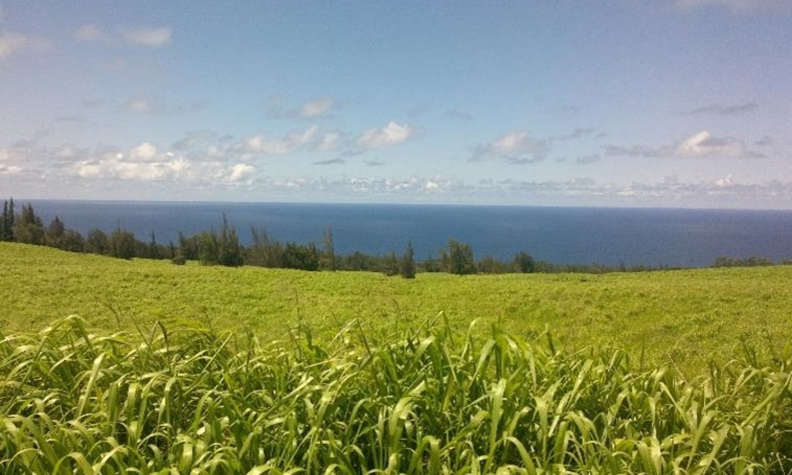
This ecological is situated on the southeastern extreme of the island of Maui and northern extreme of the island of Hawaii between elevations of 0 to 1800 feet (0 to 549 meters). Much of the land is in private ownership; some of the area is within Haleakala National Park. Parts of it are visible or accessible along Piilani Highway between Hana and Kaupo on Maui and at the end of Route 270 near Pololu Valley, along the northern part of Route 250, and along Route 240 between Honokaa and Waipio Valley on Hawaii.
The central concept of the Isohyperthermic Udic Naturalized Grassland is of well drained, moderately deep and deep soils formed in volcanic ash. Annual air temperatures and rainfall are associated with very warm (isohyperthermic) soils that are moist for most of the year (udic to ustic soil moisture regimes). Because very little of the original native vegetation remains, the reference sate of this ecological site consists of the dominant naturalized vegetation which includes guineagrass (Megathyrsus maximus syn. Urochloa maximus), haole koa (Leucaena leucocephala) and desmodium (Desmodium spp). Kikuyugrass (Cenchrus clandestinus) and white clover (Trifolium repens) are prevalent at higher elevations where this ecological site grades into the adjoining, wetter ecological sites. In the absence of disturbance (grazing is most typical), these naturalized grasslands convert to invasive forest.
Forested areas contain many introduced species, with strawberry guava (Psidium cattleianum), Java plum (Syzygium javanicum), christmasberry (Schinus terebinthifolius), ironwood (Causurina spp.), silver oak (Grevillea robusta), and, on Hawaii, poison devil’s pepper (Rauvolfia vomitoria) among the more common species. These non-native trees and shrubs often become monotypic stands with low diversity and allelopathic properties.
Historically, this site would have been native tropical forest, however the composition and production are unknown due to significant alterations by humans over the past 150+ years including land clearing, intensive agricultural practices, and urbanization. Native plant species still present in this site are those transitional between dry leeward and moist windward environments. These areas are often referred to as “Mesic Forests” in botanical sources. These native forests can no longer re-establish naturally due to the significant site alterations and lack of seed source and native pollinators.Associated sites
VX159A01X002 Rocky Alluvium Naturalized Grassland (Koa haole/guineagrass/glycine)
The Rocky Alluvial Naturalized Grassland borders on this ecological site at its relatively dry southwestern boundary on the island of Maui. It receives less annual rainfall and supports more typical dry forest tree species and the same dominant introduced grass species.
VX159A01X003 Isohyperthermic Perudic Naturalized Grassland (Guineagrass - Californiagrass)
The Isohyperthermic Perudic Naturalized Grassland borders the wettest part of this ecological site on the islands of Maui and Hawaii. It receives more annual rainfall and has the same temperature regime, resulting in introduced grass species that overlap near the boundary but are different at the extremes and a forest with typical moist habitat species rather than the mix of dry and moist habitat species found in this ecological site.
VX158X01X401 Isohyperthermic Ustic Naturalized Grassland Koa haole/guineagrass/glycine (Leucaena leucocephala/Urochloa maxima/Neonotonia wightii)
The Isohyperthermic Ustic Naturalized Grassland borders the lowest, driest parts of this ecological site on the island of Hawaii. It has a warmer, drier climate, resulting in different introduced grass species and a native forest of typical dry habitat species rather than the mix of dry and moist habitat species found in this ecological site.
VX164X01X500 Volcanic Ash Forest
The Volcanic Ash Forest borders the highest elevations of this ecological site on the island of Hawaii. It has cooler temperatures and equal or greater rainfall, resulting in a forest of similar medium stature but having a mix of dry and moist habitat native species rather than just moist habitat species, and different introduced grass species.
VX164X01X002 Organic Surface Forest
The Acidic Volcanic Ash Forest borders the highest elevations of this ecological site on the island of Maui. It has cooler temperatures and equal or greater rainfall, resulting in a forest of similar medium stature but having more koa trees, tree ferns, and typical moist forest species and lacking pandanus and lama trees.
Similar sites
VX158X01X005 Naturalized Grassland 50 to 90 inch PZ Ohia lehua/kikuyugrass (Metrosideros polymorpha/Pennisetum clandestinum)
The Naturalized Grassland, 50 to 90 Inch Precipitation Zone borders the higher, moister parts of this ecological site on the islands of Maui, Molokai, Oahu, and Kauai. It has very similar climate and soils but is in a different MLRA. Vegetation and annual production are very similar in both ecological sites.
Table 1. Dominant plant species
Tree Not specified
Shrub Not specified
Herbaceous (1) Urochloa maxima
(2) DesmodiumLegacy ID
R159AY403HI
Physiographic features
This ecological site primarily occurs on volcanic ash fields on sloping mountainsides of shield volcanoes. Ash fields range from deep to very deep on the underlying lava. Lava flows are aa (loose, cobbly) or pahoehoe (smooth, relatively unbroken). This area is dissected by steep-walled gulches.

Figure 1.
Table 2. Representative physiographic features
Landforms (1) Shield volcano > Ash field
(2) Lava flow
Runoff class Low to high Flooding frequency None Ponding frequency None Elevation 0 – 1800 ft Slope 0 – 35 % Water table depth 60 in Aspect NW, N, SE Table 3. Representative physiographic features (actual ranges)
Runoff class Low to very high Flooding frequency None Ponding frequency None Elevation 0 – 1800 ft Slope 0 – 70 % Water table depth 60 in Climatic features
Average annual precipitation ranges from 81 to 92 inches (2057 to 2336 millimeters). Extremes of average annual precipitation range from 60 inches to over 150 inches (1524 to 3810 millimeters) where this ecological site grades into the adjoining, wetter ecological sites. Most of the precipitation falls from October through April. Average annual temperature is 74 degrees F (23 degrees C).
Table 4 Representative climatic features
Frost-free period (characteristic range) 370 days Freeze-free period (characteristic range) 370 days Precipitation total (characteristic range) 80-90 in Frost-free period (actual range) 370 days Freeze-free period (actual range) 370 days Precipitation total (actual range) 60-150 in Frost-free period (average) 370 days Freeze-free period (average) 370 days Precipitation total (average) 90 in Characteristic rangeActual rangeBarLineFigure 2. Monthly precipitation range
Characteristic rangeActual rangeBarLineFigure 3. Monthly minimum temperature range
Characteristic rangeActual rangeBarLineFigure 4. Monthly maximum temperature range
BarLineFigure 5. Monthly average minimum and maximum temperature
Figure 6. Annual precipitation pattern
Figure 7 Annual average temperature pattern
Climate stations used
-
(1) OHE'O 258.6 [USC00517000], Hana, HI
-
(2) PAAUILO 221 [USC00517312], Paauilo, HI
-
(3) HANA AP 355 [USC00511125], Hana, HI
">Influencing water features
This ecological site is intersected by many small to medium size streams that have cut gulches into the landscape. The gulches contain plant species found in the rest of the ecological site.
Soil features
The soils in this ecological site all formed in volcanic ash deposited over aa or pahoehoe lava. On Hawaii, the soils are classified as Dystric Haplustands, which are Andisols with relatively low base saturation. On Maui, the soils are Andic Dystrudepts, which are Inceptisols (soils with moderate weathering of parent materials) with relatively low base saturation. Essentially, all the soils are taxonomically similar, having andic properties.
The volcanic ash soils of the Hawaiian Islands are derived mostly from basaltic ash that varies relatively little in chemical composition (Hazlett and Hyndman 1996; Vitousek 2004)). Most of these volcanic ash soils are classified today as Andisols. Andisols and other soils with andic properties have these general management characteristics: ion exchange capacity that varies with pH, but mostly retaining anions such as nitrate; high phosphorus adsorption, which restricts phosphorus availability to plants; excellent physical properties (low bulk density, good friability, weak stickiness, stable soil aggregates) for cultivation, seedling emergence, and plant root growth; resistance to compaction and an ability to recover from compaction following repeated cycles of wetting and drying; and high capacity to hold water that is available to plants relative to their apparent texture. These characteristics are due to the properties of the parent material, the clay-size noncrystalline materials formed by weathering, and the soil organic matter accumulated during soil formation (Shoji et al. 1993).
Soil depths are moderately deep to deep, with typical depths ranging from 30 to 46 inches (762 to 1168 millimeters). Soil temperature regimes are isohypothermic (very warm). Soil moisture regimes are udic (in which the soil is not dry in any part for as long as 90 cumulative days in normal years) or ustic (in which moisture is limited but present at a time when conditions are suitable for plant growth) but at the wetter extreme of ustic and nearly udic.
Surface horizons have pH ranging from 5.5 to 5.7. The exception is soils in the Ainakea series, which have pH of 4.4 in the 10 inch (25 centimeter) deep A horizon. However, the A horizon is umbric, meaning it contains a relatively high amount of organic matter, which probably binds up much of the toxic solubilized aluminum expected to occur at this low pH. In all the soils, extreme pH in subsurface horizons within 30 inches (75 centimeters) of the surface ranges from 5.6 to 6.6. Surface textures range from silty clay or clay. All the soils are well drained.Table 5. Representative soil features
Parent material (1) Basic volcanic ash – aa lava
(2) Basaltic volcanic ash – pahoehoe lava
Surface texture (1) Medial silty clay loam
(2) Clay
(3) Extremely stony silty clay
(4) Silty clay
Drainage class Well drained Permeability class Very slow to slow Depth to restrictive layer 30 – 46 in Soil depth 30 – 46 in Surface fragment cover <=3" 5 % Surface fragment cover >3" 2 – 10 % Available water capacity
(0-40in)4 – 10 in Soil reaction (1:1 water)
(0-10in)5.5 – 5.7 Subsurface fragment volume <=3"
(0-46in)10 – 40 % Subsurface fragment volume >3"
(0-46in)5 – 36 % Table 6. Representative soil features (actual values)
Drainage class Well drained Permeability class Very slow to moderately slow Depth to restrictive layer 30 – 46 in Soil depth 30 – 72 in Surface fragment cover <=3" 5 % Surface fragment cover >3" 2 – 10 % Available water capacity
(0-40in)4 – 10 in Soil reaction (1:1 water)
(0-10in)4.4 – 5.7 Subsurface fragment volume <=3"
(0-46in)10 – 40 % Subsurface fragment volume >3"
(0-46in)2 – 40 % Ecological dynamics
The information in this ecological site description (ESD), including the state-and-transition model (STM), was developed using archaeological and historical data, professional experience, and scientific studies. The information is representative of a complex set of plant communities. Not all scenarios or plants are included. Key indicator plants, animals, and ecological processes are described to inform land management decisions.
States and community phases within this ecological site were differentiated by inspection of data; ordination programs were not available. They were verified by professional consensus and observation of examples in the field.
Humans have altered this site considerably, starting with the native Hawaiian settlers as they brought plants with them and opened lands up for agriculture. More recently, starting in the mid-1800s, lands began being used for sugar cultivation. With the removal of the forest, introduction of non-native species, and then the later practices of industrial sugar production, the site has undergone many changes over the last 150 years. These alterations changed the site with fertilizer inputs, herbicides, and by removing the fertile topsoil and native plants resulting in lasting negative impacts to the soil-plant-water cycle.
This ecological site is currently a patchwork of naturalized species that reflect either grassland or forest depending on the pattern of disturbance and/or management. Today this site supports diversified agriculture including grazing lands, various orchards, annually tilled crops and some Eucalyptus plantations. The primary land use at this time is grazing land and these grasslands consist of tall warm-season species that are primarily naturalized to the site.
Historically, this ecological site would have been some form of lowland native tropical forest, however the composition and production are unknown due to significant alterations by humans including land clearing, intensive agricultural practices, and urbanization. Native plant species still present in this site are those transitional between dry leeward and moist windward environments. These areas are often referred to as “Mesic Forests” in botanical sources. These native forests can no longer re-establish naturally due to the significant site alterations and lack of seed source and native pollinators.
Because very little of the original native vegetation remains, the reference state of this ecological site consists of the dominant naturalized vegetation which includes guineagrass (Megathyrsus maximus syn. Urochloa maximus), haole koa (Leucaena leucocephala) and desmodium (Desmodium spp). Kikuyugrass (Cenchrus clandestinus) and white clover (Trifolium repens) are prevalent at higher elevations where this ecological site grades into the adjoining, wetter ecological sites. In the absence of disturbance (grazing is most typical), these naturalized grasslands convert to invasive forest.
Forested areas contain many introduced species, with strawberry guava (Psidium cattleianum), Java plum (Syzygium javanicum), christmasberry (Schinus terebinthifolius), ironwood (Causurina spp.), silver oak (Grevillea robusta), and, on Hawaii, poison devil’s pepper (Rauvolfia vomitoria) among the more common species. These non-native trees and shrubs often become monotypic stands with low diversity and allelopathic properties.
Natural Disturbances
The natural (not human-caused) disturbances most important for discussion in this ecological site are extended periods of drought (10-15 year cycle), periods of excessive rain, windthrow, and natural fire. Wind throw of vegetation can occur during hurricanes or other high wind events. Natural fires caused by lightning are very rare.
The naturalized grasses are very vulnerable to drought. These grasses rely on yearly moisture to meet their production and reproductive energy requirements, which results in root dieback within the soil profile and potentially some plant mortality, especially if they are also under grazing pressures which contribute to the stresses of a drought. This may result in the site becoming open to opportunistic herbs, brush and other woody species from the surrounding landscape to gain a foothold and begin to compete with the grasses. If not managed, these species can easily take over the site, as they are competitive and fast-growing.
Human Disturbances
Human-related disturbances have been much more important than natural disturbances in this ecological site since the arrival of Polynesians and, later, Europeans. These are reflected in the State and Transition Model Diagram.
Humans arrived in the Hawaiian Islands 1200 to 1500 years ago. Their population gradually increased so that by 1600 AD at least 80 percent of all the lands in Hawaii below about 1500 feet (roughly 500 meters) in elevation had been extensively altered by humans (Kirch 1982); some pollen core data suggest that up to 100 percent of lowlands may have been altered (Athens 1997). By the time of European contact late in the 18th century, the Polynesians had developed high population densities and placed extensive areas under intensive agriculture (Cuddihy and Stone 1990, Lincoln 2020).
Prehistoric native lowland forest disturbance can be attributed to clearing for agriculture by hand or by fire, introduction of new plants and animals, and wood harvesting. Less accessible areas may have been affected by factors such as inadvertently introduced plant diseases and seed predation by the introduced Pacific rat (Athens 1997).
Native Hawaiians intensified virtually every arable habitat, made extremely marginal environments productive, developed innovative farming methods, and sustained production for hundreds of years without the use of external inputs, metals, draft animals, legumes or cover crops (Lincoln 2020, Handy et al., 1972; Lincoln and Vitousek, 2017). Two distinct Hawaiian agroforestry systems were utilized in this ecological site along the Hamakua coast on the island of Hawaii: A permanent arboricultural system with substantial breadfruit (Artocarpus altilis (Parkinson) Fosberg) and a shifting cultivation system based on candlenut (Aleurites moluccanus (L.) Willd). The distributions of these systems on the landscape appear to be constrained by soil fertility and temperature, with the swidden agricultural system occurring on the more fertile portion of the landscape and the permanent arboricultural system occupying the less fertile lands. These achievements, yet to be widely recognized, should inform the intelligent design of future alternative agricultural within this and similar ecological sites in Hawaii.
After the arrival of Europeans, documentary evidence attests to accelerated and extensive deforestation, erosion, siltation, and changes in local weather patterns (Kirch 1983) due to more intensive land use, modern tools, and introduction of more plant, animal, and microbe species.
The Polynesians introduced dogs, Pacific rats, and small pigs to the islands. Cattle, sheep, horses, goats, and larger European pigs were introduced in the final decade the 18th century. These animals ranged free on the islands, becoming very numerous and destructive by the early decades of the 19th century.
Through the 20th and into the 21st centuries, increases in human populations with attendant land development, as well as accelerated introduction of non-native mammals, birds, reptiles, amphibians, invertebrates, plants, and microorganisms, have brought about dramatic changes to wild ecosystems in Hawaii. This ecological site evolved without the presence of large mammals or human-caused fires.
The most important human disturbances in the ecological site are clearing for agriculture, domestic and feral ungulate foraging, and invasion by introduced plant and animal species. Much of the area is currently used for agriculture and pasture. Some areas had been cleared in the past and then abandoned; these areas are now dominated by forests of introduced species.State and transition model
Custom diagramStandard diagram
Figure 8. State and Transition Model.

Figure 9. Transitions and Pathways.

Figure 10. Community Pathways (State 1 Reference).
More interactive model formats are also available. View Interactive Models
More interactive model formats are also available. View Interactive Models
Click on state and transition labels to scroll to the respective textEcosystem states
States 1 and 5 (additional transitions)
T1A - State 1 Reference transitions to State 5 Weed Invaded Grassland by long-term continuous grazing and lack of weed control measures. Remnant desirable forages have been grazed out and replaced entirely by weedy grasses, forbs, shrubs, and small trees. R2B - State 2 Invaded Understory can be restored to State 1 Reference by clearing the forest with heavy machinery. Seed or plant desired perennial grasses as needed. Once cleared it is likely that weed species released from the soil seed bank will require invasive plant species control measures. T2A - State 2 Invaded Understory transitions to State 3 Invaded Over and Understory through the process of fast-growing weeds inhibiting reproduction of native plants and gradually replacing them. This process is accelerated by feral pigs and cattle directly damaging native plants and promoting the spread of weeds by disturbing the soil and spreading weed seeds. R2A - State 2 Invaded Understory may be restored to a facsimile of State 4 Native Forest. Exclusion of all ungulates is required; in many cases construction of a suitable fence will be necessary. Intensive weed control must then be initiated and maintained in the long term. In some cases, large amounts of dead weed biomass must be dealt with by removal or decomposition. Reintroduction of missing native species will be necessary. R3A - State 3 Invaded Over and Understory can be converted to State 1 Reference by clearing vegetation using heavy machinery, applying aggressive weed control measures, and planting desirable forage species as needed. T4B - State 4 Native Forest can transition to State 1 Reference by clearing the forest with heavy machinery and planting desirable pasture species as needed. Native forest may be cleared gradually by allowing cattle access to the forest. Cattle eventually eat or destroy understory ferns, forbs, shrubs, and saplings, opening the forest so that introduced grasses will thrive. T4A - State 4 Native Forest transitions to State 2 Invaded Understory by the very aggressive, introduced weed species present in this ecological site invading intact native forest and gradually replacing native species in the understory. This invasion is greatly facilitated by feral pigs and cattle that damage and consume native plants, disturb the soil, and spread weed seeds. R5A - State 5 Weed Invaded Grassland can be restored to State 1 Reference by brush management, re-establishment of desirable forage species, persistent weed control, and prescribed grazing. T5A - State 5 Weed Invaded Grassland transitions to State 3 Invaded Over and Understory due to the presence of fast-growing, introduced tree species; wildfire may prevent this from occurring. State 1 submodel, plant communities
P1.1A - Phase 1.1 changes to phase 1.2 by long-term continuous grazing. Remnant high-quality forages have been greatly reduced in abundance and largely replaced by lower-value species. Weedy forbs and shrubs are increasing. P1.2A - A grazing plan is needed that provides for intensive but temporary grazing of pastures to ensure that cattle consume some low-value forage species along with preferred forages and to allow preferred forages time to recover from defoliation. Desirable grass species are competitive and able to recover with proper management. The grazing plan may require splitting the herd, creating additional water sources, and creating multiple pastures by cross-fencing. Weed control may be necessary to eliminate some species such as inedible shrubs. State 4 submodel, plant communities
State 1
Reference StateThis state consists of two community phases dominated by introduced grass species. This state is considered to be the Reference State because no intact examples of native forest remain, and the species compositions of the forests consisting of introduced species are extremely variable.
Continuous grazing results in increased abundance of less desirable forage species, as represented by the phase change from 1.1 Guineagrass /desmodium to 1.2 Hilograss – broomsedge bluestem/shameplant. Longer-term overgrazing and lack of weed control measures results in a transition to State 5 Weed-Invaded Grassland.Community 1.1
Guineagrass /desmodium (ticktrefoil) (Urochloa maxima /Desmodium spp.)
Figure 11. Naturalized grassland with guinea grass and scattered ironwood trees. Carolyn Wong.
Dominance of desired forage species is maintained by prescribed grazing techniques that allow desired species time to recover from grazing and trampling but includes periods of grazing of sufficient intensity to suppress invasion of weedy shrubs and trees. Failure to properly maintain the selected forage species results in this community phase shifting to community phase 1.2.
Resilience management. Proper grazing of the guinea grass community will maintain this reference community in a grassland state. Allowing a scattered tree cover (~25% shade) to persist on the site can help to conserve soil moisture through the reduction of solar radiation (shade) and wind exposure (wind breaks). This may help increase pasture resilience under droughty conditions.
Forest overstory.There typically is no overstory in this community.
Forest understory. The common forage species is guineagrass (Urochloa maxima) in mixture with leguminous desmodium species (Desmodium spp.). Kikuyugrass (Cenchrus clandestinus) and white clover (Trifolium repens) are prevalent at higher elevationswhere this ecological site grades into the adjoining, wetter ecological sites. Koa haole (Leucaena leucocephala) is a useful leguminous browse species in the drier areas.
Dominant plant species
-
white leadtree (Leucaena leucocephala), tree
-
guineagrass (Urochloa maxima), grass
-
ticktrefoil (Desmodium), other herbaceous
Community 1.2
Hilograss – broomsedge bluestem/shameplant (Paspalum conjugatum – Andropogon virginicus/Mimosa pudica)
Figure 12. Overgrazed guinea grassland with increasing undesirable forbs and stoloniferous grass. Carolyn Wong.
This community phase is dominated by grasses of lower forage value. Desirable forage legumes largely have been grazed out, and weedy forbs and shrubs have increased. It can be shifted back to phase 1.1 by using a prescribed grazing plan.
Forest overstory.None.
Forest understory. Hilograss (Paspalum conjugatum), broadleaf carpet grass (Axonopus compressus), sour grass (Digitaria insularis), and broomsedge bluestem (Andropogon virginicus) are typically the most abundant grasses. Weedy forbs such as shameplant or sensitive plant (Mimosa pudica), wedelia (Sphagneticola trilobata), horseweed (Conyza canadensis), Spanish needle (Bidens pilosa), and spiny amaranth (Amaranthus spinosus) also are common. Desmodium species have decreased in abundance. Where it occurs at higher elevations, white clover has also decreased in abundance.
Dominant plant species
-
hilograss (Paspalum conjugatum), grass
-
broomsedge bluestem (Andropogon virginicus), grass
-
shameplant (Mimosa pudica), other herbaceous
Pathway P1.1A
Community 1.1 to 1.2
Guineagrass /desmodium (ticktrefoil) (Urochloa maxima /Desmodium spp.)
Hilograss – broomsedge bluestem/shameplant (Paspalum conjugatum – Andropogon virginicus/Mimosa pudica)Phase 1.1 changes to phase 1.2 by long-term continuous grazing. Remnant high-quality forages have been greatly reduced in abundance and largely replaced by lower-value species. Weedy forbs and shrubs are increasing.
Pathway P1.2A
Community 1.2 to 1.1
Hilograss – broomsedge bluestem/shameplant (Paspalum conjugatum – Andropogon virginicus/Mimosa pudica)
Guineagrass /desmodium (ticktrefoil) (Urochloa maxima /Desmodium spp.)A grazing plan is needed that provides for intensive but temporary grazing of pastures to ensure that cattle consume some low-value forage species along with preferred forages and to allow preferred forages time to recover from defoliation. Desirable grass species are competitive and able to recover with proper management. The grazing plan may require splitting the herd, creating additional water sources, and creating multiple pastures by cross-fencing. Weed control may be necessary to eliminate some species such as inedible shrubs.
State 2
Invaded Understory StateThis state consists of one community phase. Native ohia lehua and pandanus trees may be present in some locations. However, introduced trees, shrubs, vines, and ferns produce a dense layer of low, competitive vegetation that severely inhibits reproduction of native species. Activity of feral pigs and cattle further reduces native plant abundance and produces bare, disturbed soil patches that promote weed invasion. Eventually, this state transitions to State 3 Invaded Overstory and Understory through growth of introduced tree species.
Community 2.1
Ohia lehua/Kahila garland-lily (kahili ginger)/broomsedge bluestem (Metrosideros polymorpha/Hedychium gardnerianum/Andropogon virginicus)While native trees may be present, introduced tree species have invaded the overstory. Smaller, shade-tolerant introduced trees and shrubs gradually produce extremely dense canopies and root systems that exclude other species. Dense stands of introduced ferns form a layer that inhibits reproduction of native species.
Forest overstory.Ohia lehua (Metrosideros polymorpha) and pandanus or Tahitian screwpine (Pandanus tectorius) are typically present. Introduced tree species with the potential to grow tall, such as African tulip tree (Spathodea campanulata), Formosan koa or small Philippine acacia (Acacia confusa), kukui or Indian walnut (Aleurites moluccana), ironwood or beach sheoak (Casuarina equisetifolia), silkoak (Grevillea robusta), albizia or peacocks plume (Falcataria moluccana), and Java plum (Syzygium javanicum) are abundant. On the island of Hawaii, poison devil’s-pepper (Rauvolfia vomitoria) is very abundant.
Forest understory. Strawberry guava (Psidium cattleianum), common guava (Psidium guajava), and Java plum (Syzygium javanicum) are increasingly abundant, gradually forming extremely dense stands. The introduced ferns Asian swordfern (Nephrolepis minutiflora syn. N. brownii), maile-scented or musk fern (Phymatosorus grossus), and downy maiden fern (Cyclosorus dentatus; Christella dentata or Thelypteris dentatus in some references) form stands under 3 feet (about 1 meter) tall. Native uluhe fern or Old World forkedfern (Dicranopteris linearis) occurs in some locations. Koster’s curse or soapbush (Clidemia hirta) and kahili ginger or Kahila garland-lily (Hedychium gardnerianum) are present and increasing in abundance.
Dominant plant species
-
'ohi'a lehua (Metrosideros polymorpha), tree
-
broomsedge bluestem (Andropogon virginicus), grass
-
Kahila garland-lily (Hedychium gardnerianum), other herbaceous
State 3
Invaded Over and Understory StateThis state consists of one community phase dominated by introduced species in both the overstory and understory. Some individual native trees may persist for their lifetime. The diversity of weedy trees, shrubs, vines, ferns, and herbs is high, and the species mix is variable. Conversion to State 1 Reference is possible by using heavy machinery and applying aggressive weed control and ungulate-exclusion measures.
Community 3.1
Christmasberry/Kahila garland-lily (kahili ginger)/broomsedge bluestem (Schinus terebinthifolius/Hedychium gardnerianum/Andropogon virginicus)Ohia lehua (Metrosideros polymorpha) and pandanus (Pandanus tectorius) trees persist until they die, but do not successfully reproduce. The introduced species present on different sites varies.
Forest overstory.Monotypic or mixed stands of christmasberry (Schinus terebinthifolius), strawberry guava (Psidium cattleianum), African tulip tree (Spathodea campanulata), Formosan koa or small Philippine acacia (Acacia confusa), kukui or Indian walnut (Aleurites moluccana), ironwood or beach sheoak (Casuarina equisetifolia), and Java plum (Syzygium javanicum) may develop. Fast-growing albizia or peacock’s plume (Falcataria moluccana) may eventually overtop all other species. On the island of Hawaii, poison devil’s-pepper (Rauvolfia vomitoria) is very abundant.
Forest understory. The understory varies among locations. Dense overstories of christmasberry, strawberry guava, or ironwood (with its allelopathic properties) may allow only a sparse understory to grow. Otherwise, Koster’s curse or soapbush (Clidemia hirta), lantana (Lantana camara), common guava (Psidium guajava), and kahili ginger (Hedychium gardnerianum) may be abundant. Introduced ferns (see Community 2.1) are typically present, and grass species such as broomsedge bluestem and guineagrass (Urochloa maxima) grow abundantly where enough light penetrates the overstory.
Dominant plant species
-
Brazilian peppertree (Schinus terebinthifolius), tree
-
broomsedge bluestem (Andropogon virginicus), grass
-
Kahila garland-lily (Hedychium gardnerianum), other herbaceous
State 4
Native Forest StateThis state consists of one community phase. Because no intact examples of this state remain, the following description is hypothetical, based on observations of similar ecological sites and on the known ranges and environmental preferences of likely native plant species.
When cleared by machinery, fire, or long-term, heavy ungulate browsing, this state transitions to State 1 Reference. Gradual invasion by weedy, introduced plant species brings a transition to State 2 Invaded Understory.Community 4.1
Ohia lehua – hame (Metrosideros polymorpha – Antidesma pulvinatum)The hypothetical community is a diverse forest of medium stature (40 to 60 feet or 12 to 18 meters) with closed to open overstory, a secondary canopy of smaller trees, and an understory of shrubs, vines, and ferns. Species composition varies from drier low elevations to moister high elevations. The combination of elevations and rainfall amounts creates a forest in which species characteristic of both dry and moist environments occur; in many references, this forest type is referred to as “Mesic Forest.”
Forest overstory.The dominant overstory species would have been ohia lehua (Metrosideros polymorpha). Koa (Acacia koa) occurs in this ecological site on Maui but is not abundant.
Forest understory. The secondary tree canopy likely would have included pandanus (Pandanus tectorius), kolea lau nui (Myrsine lessertiana), papala kepau (Pisonia brunoniana), manono (Kadua affinis), hoawa (Pittosporum confertiflorum), mamaki (Pipturus albidus), and kopiko (Psychotria hawaiiensis and P. mauiensis). In the drier parts of the ecological site, olopua (Nestegis sandwicensis), lama (Diospyros sandwicensis), hame (Antidesma pulvinatum), and even wiliwili (Erythrina sandwicensis) may have been present.<br /> <br /> Tree ferns, or hapuu (Cibotium glaucum) and hapuu li (Cibotium menziesii) would have been present in the wetter parts of the ecological site, as would shrubs of the genera Cyanea, Clermontia, and Labordia. Likely vine species are huehue (Cocculus orbiculatus) and hoi kuahiwi (Smilax melastomifolia). Uluhe fern (Dicranopteris linearis) would have been common, along with many small fern species.
Dominant plant species
-
'ohi'a lehua (Metrosideros polymorpha), tree
-
hame (Antidesma pulvinatum), tree
State 5
Weed Invaded Grassland StateThis state consists of one community phase consisting primarily of weedy shrubs and small trees. Weedy grasses and forbs dominate between shrub patches. Introduced tree species are present and will attain dominance if fire does not set them back.
Community 5.1
Common guava – christmasberry/broomsedge bluestem – yellow foxtail (Psidium guajava – Schinus terebinthifolius/Andropogon virginicus – Setaria pumila)This community phase contains a wide diversity of mostly introduced species.
Forest overstory.The overstory is typically sparse to absent.
Forest understory. This state transitions to State 3 Invaded Over and Understory due to the presence of fast-growing, introduced tree species; wildfire may prevent this from occurring.
Dominant plant species
-
guava (Psidium guajava), tree
-
Brazilian peppertree (Schinus terebinthifolius), tree
-
broomsedge bluestem (Andropogon virginicus), grass
-
yellow foxtail (Setaria pumila), grass
Transition T1A
State 1 to 5State 1 Reference transitions to State 5 Weed Invaded Grassland by long-term continuous grazing and lack of weed control measures. Remnant desirable forages have been grazed out and replaced entirely by weedy grasses, forbs, shrubs, and small trees.
Restoration pathway R2B
State 2 to 1State 2 Invaded Understory can be restored to State 1 Reference by clearing the forest with heavy machinery. Seed or plant desired perennial grasses as needed. Once cleared it is likely that weed species released from the soil seed bank will require invasive plant species control measures.
Transition T2A
State 2 to 3State 2 Invaded Understory transitions to State 3 Invaded Over and Understory through the process of fast-growing weeds inhibiting reproduction of native plants and gradually replacing them. This process is accelerated by feral pigs and cattle directly damaging native plants and promoting the spread of weeds by disturbing the soil and spreading weed seeds.
Restoration pathway R2A
State 2 to 4State 2 Invaded Understory may be restored to a facsimile of State 4 Native Forest. Exclusion of all ungulates is required; in many cases construction of a suitable fence will be necessary. Intensive weed control must then be initiated and maintained in the long term. In some cases, large amounts of dead weed biomass must be dealt with by removal or decomposition. Reintroduction of missing native species will be necessary.
Context dependence.It should be stated, that the most desirable ecological conditions would be to return this site to a native forest, as it would provide the highest levels of biodiversity and ecological function. Doing so will require significant inputs of time, money, and historical information not currently available.
Restoration pathway R3A
State 3 to 1State 3 Invaded Over and Understory can be converted to State 1 Reference by clearing vegetation using heavy machinery, applying aggressive weed control measures, and planting desirable forage species as needed.
Transition T4B
State 4 to 1State 4 Native Forest can transition to State 1 Reference by clearing the forest with heavy machinery and planting desirable pasture species as needed. Native forest may be cleared gradually by allowing cattle access to the forest. Cattle eventually eat or destroy understory ferns, forbs, shrubs, and saplings, opening the forest so that introduced grasses will thrive.
Constraints to recovery.Converting State 4 Native Forest to State 1 Reference would result in an irreplaceable and irretrievable action. Restoration to the site's former Native state would be unlikely without significant inputs of time, money, and historical information not currently available.
Transition T4A
State 4 to 2State 4 Native Forest transitions to State 2 Invaded Understory by the very aggressive, introduced weed species present in this ecological site invading intact native forest and gradually replacing native species in the understory. This invasion is greatly facilitated by feral pigs and cattle that damage and consume native plants, disturb the soil, and spread weed seeds.
Constraints to recovery.Converting State 2 Invaded Understory back to State 4 Native Forest would require significant inputs of time, money, and historical information not currently available.
Restoration pathway R5A
State 5 to 1State 5 Weed Invaded Grassland can be restored to State 1 Reference by brush management, re-establishment of desirable forage species, persistent weed control, and prescribed grazing.
Restoration pathway T5A
State 5 to 3State 5 Weed Invaded Grassland transitions to State 3 Invaded Over and Understory due to the presence of fast-growing, introduced tree species; wildfire may prevent this from occurring.
Additional community tables
Table 7. Community 1.1 plant community composition
Group Common name Symbol Scientific name Annual production () Foliar cover (%) Table 8. Community 1.2 plant community composition
Group Common name Symbol Scientific name Annual production () Foliar cover (%) Table 9. Community 2.1 plant community composition
Group Common name Symbol Scientific name Annual production () Foliar cover (%) Table 10. Community 3.1 plant community composition
Group Common name Symbol Scientific name Annual production () Foliar cover (%) Table 11. Community 4.1 plant community composition
Group Common name Symbol Scientific name Annual production () Foliar cover (%) Table 12. Community 5.1 plant community composition
Group Common name Symbol Scientific name Annual production () Foliar cover (%) Interpretations
Supporting information
Other references
Definitions
These definitions have been greatly simplified for brevity and do not cover every aspect of each topic.
Aa lava: A type of basaltic lava having a rough, jagged, clinkery surface and a vesicular interior.
Alluvial: Materials or processes associated with transportation and/or deposition by running water.
Andic Dystrudepts: Inceptisol soils (soils with moderate weathering of parent materials) with relatively low base saturation.
Ash field: a land area covered by a thick or distinctive deposit of volcanic ash that can be traced to a specific source and has well defined boundaries. The term “ash flow” is erroneously used in the Physiographic section of this ESD due to a flaw in the national database.
Ashy: A “soil texture modifier” for volcanic ash soils having a water content at the crop wilting point of less than 30 percent; a soil that holds relatively less water than “medial” and “hydrous” soils.
Available water capacity: The amount of soil water available to plants to the depth of the first root-restricting layer.
Basal area or basal cover: The cross-sectional area of the stem or stems of a plant or of all plants in a stand.
Bulk density: the weight of dry soil per unit of volume. Lower bulk density indicates a greater amount of pore space that can hold water and air in a soil.
CaCO3 equivalent: The amount of free lime in a soil. Free lime exists as solid material and typically occurs in regions with a dry climate.
Canopy cover: The percentage of ground covered by the vertical projection downward of the outermost perimeter of the spread of plant foliage. Small openings within the canopy are included.
Community pathway: A description of the causes of shifts between community phases. A community pathway is reversible and is attributable to succession, natural disturbances, short-term climatic variation, and facilitating practices, such as grazing management.
Community phase: A unique assemblage of plants and associated dynamic soil properties within a state.
Dominant species: Plant species or species groups that exert considerable influence upon a community due to size, abundance, or cover.
Drainage class: The frequency, duration, and depth of a water table in a soil. There are seven drainage classes, ranging from “excessively drained” (soils with very rare or very deep water tables) to “well drained” (soils that provide ample water for plant growth but are not so wet as to inhibit root growth) to “very poorly drained” (soils with a water table at or near the surface during much of the growing season that inhibits growth of most plants).
Dystric Haplustands: Andisol soils with relatively low base saturation.
Electrical conductivity (EC): A measure of the salinity of a soil. The standard unit is deciSiemens per meter (dS/m), which is numerically equivalent to millimhos per centimeter (mmhos/cm). An EC greater than about 4 dS/m indicates a salinity level that is unfavorable to growth of most plants.
Friability: A soil consistency term pertaining to the ease of crumbling of soils.
Ion exchange capacity: The ability of soil materials such as clay or organic matter to retain ions (which may be plant nutrients) and to release those ions for uptake by roots.
Isohyperthermic soil temperature regime: A regime in which mean annual soil temperature is 72 degrees F (22 degrees C) or higher and mean summer and mean winter soil temperatures differ by less than 11 degrees F (6 degrees C) at a specified depth.
Isothermic soil temperature regime: A regime in which mean annual soil temperature is 59 degrees F (15 degrees C) or higher but lower than 72 degrees F (22 degrees C) and mean summer and mean winter soil temperatures differ by less than 11 degrees F (6 degrees C) at a specified depth.
Major Land Resource Area (MLRA): A geographic area defined by NRCS that is characterized by a particular pattern of soils, climate, water resources, and land uses. The island of Hawaii contains nine MLRAs, some of which also occur on other islands in the state.
Medial: A “soil texture modifier” for volcanic ash soils having a water content at the crop wilting point of 30 to 100 percent; a soil that holds an amount of water intermediate to “hydrous” or “ashy” soils.
Naturalized plant community: A community dominated by adapted, introduced species. It is a relatively stable community resulting from secondary succession after disturbance. Most grasslands in Hawaii are in this category.
Pahoehoe lava: A type of basaltic lava with a smooth, billowy, or rope-like surface and vesicular interior.
Parent material: Unconsolidated and chemically weathered material from which a soil is developed.
Perudic soil moisture regime: A very wet regime found where precipitation exceeds evapotranspiration in all months of normal years. On the island of Hawaii, this regime is found on top of Kohala and on parts of the windward side of Mauna Kea.
pH: The numerical expression of the relative acidity or alkalinity of a soil sample. A pH of 7 is neutral; a pH below 7 is acidic and a pH above 7 is basic.
Reference community phase: The phase exhibiting the characteristics of the reference state and containing the full complement of plant species that historically occupied the site. It is the community phase used to classify an ecological site.
Reference state: A state that describes the ecological potential and natural or historical range of variability of an ecological site.
Restoration pathway: A term describing the environmental conditions and practices that are required to recover a state that has undergone a transition.
Sodium adsorption ratio (SAR): A measure of the amount of dissolved sodium relative to calcium and magnesium in the soil water. SAR values higher than 13 create soil conditions unfavorable to most plants.
Soil moisture regime: A term referring to the presence or absence either of ground water or of water held at a tension of less than 1500 kPa (the crop wilting point) in the soil or in specific horizons during periods of the year.
Soil temperature regime: A defined class based on mean annual soil temperature and on differences between summer and winter temperatures at a specified depth.
Soil reaction: Numerical expression in pH units of the relative acidity or alkalinity or a soil.
State: One or more community phases and their soil properties that interact with the abiotic and biotic environment to produce persistent functional and structural attributes associated with a characteristic range of variability.
State-and-transition model: A method used to display information about relationships between vegetation, soil, animals, hydrology, disturbances, and management actions on an ecological site.
Transition: A term describing the biotic or abiotic variables or events that contribute to loss of state resilience and result in shifts between states.
Udic soil moisture regime: A regime in which the soil is not dry in any part for as long as 90 cumulative days in normal years, and so provides ample moisture for plants. In the Hawaiian Islands, it is associated with forests in which hapuu (tree ferns) are usually moderately to highly abundant.
Ustic soil moisture regime: A regime in which moisture is limited but present at a time when conditions are suitable for plant growth. In Hawaii it usually is associated with dry forests and subalpine shrublands.
Annotated References:
Abrahamson I. 2013. Fire regimes in Hawaiian plant communities. In: Fire Effects Information System, US Dept. of Agriculture, Forest Service, Rocky Mountain Research Station, Fire Sciences Laboratory. Available" www.fs.fed.us/database/feis/fire_regimes/Hawaii/all.html Review of fire regimes and history for multiple generalized plant communities in the Hawaiian Islands.
Armstrong RW. 1973. Atlas of Hawaii. University of Hawaii Press, Honolulu. General reference for climate, land use, land forms, etc.
Athens JS. Ch. 12 Hawaiian Native Lowland Vegetation, IN Prehistory in Historical Ecology in the Pacific Islands – Prehistoric Environmental and Landscape Change. Kirch, PV and TL Hunt, eds. 1997. Yale U. Press, New Haven. General discussion of effects of prehistoric Polynesians on native lowland vegetation.
Burney DA, HF James, LP Burney, SL Olson, W Kikuchi, WL Wagner, M Burney, D McCloskey, D Kikuchi, FV Grady, R Gage II, and R Nishek. 2001. Fossil evidence for a diverse biota from Kauai and its transformation since human arrival. Ecological Monographs 71:615-641. General discussion of effects of prehistoric Polynesians on native vegetation.
Christensen CC. 1983. Report 17: Analysis of land snails. In Archaeological investigations of the Mudlane-Waimea-Kawaihae Road Corridor, Island of Hawaii: an Interdisciplinary Study of an Environmental Transect. Clark JT. and Kirch PV, eds. Dept. of Anthropology, Bernice Pauahi Bishop Museum, Report 83-1, Honolulu, HI. Native land snails as indicators of original vegetation and environment along a climatic transect. Specific to Kohala, Island of Hawaii, but information can be generally applied to other islands.
Clark JT. 1983. Report 3: The Waimea-Kawaihae Region: Historical Background. In Archaeological investigations of the Mudlane-Waimea-Kawaihae Road Corridor, Island of Hawaii: an Interdisciplinary Study of an Environmental Transect. Clark JT and Kirch PV, eds. Dept. of Anthropology, Bernice Pauahi Bishop Museum, Report 83-1, Honolulu, HI. Historical landuse along a climatic transect. Specific to Kohala, Island of Hawaii, but information can be generally applied to other islands.
Clark JT. 1983. Report 7: Archaeological investigations in Section 4. In Archaeological investigations of the Mudlane-Waimea-Kawaihae Road Corridor, Island of Hawaii: an Interdisciplinary Study of an Environmental Transect. Clark JT and Kirch PV, eds. Dept. of Anthropology, Bernice Pauahi Bishop Museum, Report 83-1, Honolulu, HI. Prehistoric landuse along a climatic transect. Specific to Kohala, Island of Hawaii, but information can be generally applied to other islands.
Clark JT. 1983. Report 8: Archaeological investigations of agricultural sites in the Waimea area. In Archaeological investigations of the Mudlane-Waimea-Kawaihae Road Corridor, Island of Hawaii: an Interdisciplinary Study of an Environmental Transect. Clark JT and Kirch PV, eds. Dept. of Anthropology, Bernice Pauahi Bishop Museum, Report 83-1, Honolulu, HI. Prehistoric landuse along a climatic transect. Specific to Kohala, Island of Hawaii, but information can be generally applied to other islands.
Craighill ES and EG Handy. 1991. Native Planters in Old Hawaii – Their Life, Lore, and Environment. Bernice P. Bishop Museum Bulletin 233, Bishop Museum Press, Honolulu, HI Discussion of early agriculture in Hawaii.
Cuddihy LW and CP Stone. 1990. Alteration of Native Hawaiian Vegetation: Effects of Humans, Their Activities and Introductions. Honolulu: University of Hawaii Cooperative National Park Resources Study Unit. General account of human effects on native Hawaiian vegetation.
Deenik J and AT McClellan. 2007. Soils of Hawaii. Soil and Crop Management, Sept. 2007, SCM-20. Cooperative Extension Service, College of Tropical Agriculture and Human Resources. University of Hawaii at Manoa. Available online at: https://www.ctahr.hawaii.edu/oc/freepubs/pdf/SCM-20.pdf Discussion of soil orders and their practical implications in Hawaii.
Dixon JB and Schulze DG, eds. 2002. Soil Mineralogy with Environmental Applications. Volume 7. Soil Science Society of America. Available online at: https://acsess.onlinelibrary.wiley.com/doi/book/10.2136/sssabookser7 Exhaustive treatment of basics of soil mineralogy and implications for environmental management.
Giambelluca TW and TA Schroeder. 1998. Climate. In Atlas of Hawaii, 3rd edition. SP Juvik, JO Juvik, and RR Paradise, eds. pp. 49-59. Honolulu: University of Hawaii Press. Standard geographical reference work for Hawaii.
Gil CR. 2016-2017. Ananas comosus. Colegio Bolivar Agricultural Science. Available online at: https://www.colegiobolivar.edu.co/garden/wp-content/uploads/2017/06/Crosas-Ananas-comosus-2017.pdf Discusses effects of pineapple monoculture on soil condition.
Handy ESC Handy EG and Pukui MK. 1972. Native Planters in Old Hawaii Their Life, Lore, and Environment. (Revised Edition,1991).Bernice P. Bishop Museum Bulletin 233. Honolulu. Hawaiian understanding of climate, weather and seasons.
Hazlett RW and DW Hyndman. 1996. Roadside Geology of Hawaii. Mountain Press Publishing Company, Missoula MT. General account of geologic history of Hawaii.
Henke LA. 1929. A Survey of Livestock in Hawaii. Research Publication No. 5. University of Hawaii, Honolulu. Provides early accounts of introduction and spread of ungulates in Hawaii.
Horrocks M. 2009. Sweet potato (Ipomoea batatas) and banana (Musa sp.) microfossils in deposits from the Kona Field System, Island of Hawaii. Journal of Archaeological Science, May 2009. Specific to Kona on the Island of Hawaii, but useful information about early Hawaiian land use and agriculture.
Imada, C. 2012. Hawaiian Native and Naturalized Vascular Plants Checklist (December 2012 update). Bishop Museum Technical Report 60. Bishop Museum Press, Honolulu. Constantly-updated list of vascular plants of Hawaii, including latest nomenclature and species occurrences on each island.
Juvik JO and D Nullet. 1993. Relationships between rainfall, cloud-water interception, and canopy throughfall in a Hawaiian montane forest. IN: Tropical Montane Cloud Forests. Proc. Int. Sym., San Juan, PR. Hamilton LS, JO Juvik, and FN Scatena, eds. East-West Center. Field study of fog drip on Mauna Kea.
Kirch PV. 1982. The impact of the prehistoric Polynesians in the Hawaiian ecosystem. Pacific Science 36(1):1-14. General discussion of effects of prehistoric Polynesians on native vegetation.
Kirch PV. 1983. Introduction. In Archaeological investigations of the Mudlane-Waimea-Kawaihae Road Corridor, Island of Hawaii: An Interdisciplinary Study of an Environmental Transect. Clark JT and Kirch PV, eds. Dept. of Anthropology, Bernice Pauahi Bishop Museum, Report 83-1, Honolulu, HI. Generalized account of land use and vegetation along a climatic transect. Specific to Kohala on the Island of Hawaii, but generally applicable to other islands.
Kirch PV. 1985. Feathered Gods and Fishhooks: An Introduction to Hawaiian Archaeology and Prehistory. Honolulu: University of Hawaii Press. General discussion of effects of prehistoric Polynesians on native vegetation.
Kirch PV. 2000. On the Road of the Winds: An Archaeological History of the Pacific Islands Before European Contact. Berkeley: University of California Press. General discussion of effects of prehistoric Polynesians on native vegetation.
Leopold LB. 1949. The interaction of trade wind and sea breeze, Hawaii. Journal of Meteorology 6: 312-320. Study of the naulu winds that operate on the west slope of Haleakala.
Lincoln, NK. 2020. Agroforestry form and ecological adaptation in ancient Hawai'i: Extent of the pākukui swidden system of Hāmākua, Hawai'i Island. Agricultural Systems, Volume 181, 2020. https://doi.org/10.1016/j.agsy.2020.102808.
(https://www.sciencedirect.com/science/article/pii/S0308521X19309576).
Lincoln, N.K., Vitousek, P.M., 2017. Indigenous Polynesian agriculture in Hawaii. In:
Oxford Research Encyclopedia of Environmental Science March (2017). Oxford
University Press, Oxford, UK. https://doi.org/10.1093/acrefore/9780199389414.
013.376.
Little EL Jr. and RG Skolmen. 1989. Common Forest Trees of Hawaii (Native and Introduced). US Department of Agriculture-US Forest Service Agriculture Handbook No. 679. (out of print). Available at www.fs.fed.us/psw/publications/documents/misc/ah679.pdf Information on common native and introduced tree species in Hawaii. Especially useful for introduced species.
Maly K and O Maly. 2004. He Moolelo Aina: A Cultural Study of the Puu O Umi Natural Area Reserve and Kohala-Hamakua Mountain Lands, Districts of Kohala and Hamakua, Island of Hawaii. Kumu Pono Associates, Hilo HI. Account of natural vegetation and human effects that can be applied to all related ecological sites.
McEldowney H. 1983. Report 16: A description of major vegetation patterns in the Waimea-Kawaihae region during the early historic period. Archaeological investigations of the Mudlane-Waimea-Kawaihae Road Corridor, Island of Hawaii: An Interdisciplinary Study of an Environmental Transect. Clark JT and Kirch PV, eds. Dept. of Anthropology, Bernice Pauahi Bishop Museum, Report 83-1, Honolulu, HI. Generalized account of land use and vegetation along a climatic transect. Specific to Kohala on the Island of Hawaii, but generally applicable to other islands.
Mubyana T. 1997/98. Effects of continuous sugarcane and pineapple cropping on organic matter and soil microbial biomass. Journal of African Research and Development 27&28:258-269. Comparison of effects of pineapple cropping on soils compared with sugarcane and virgin uncropped soils. Pineapple cropping decrease pH, exchangeable cations, OM, biomass C, and flush of N.
Mueller-Dombois D and FR Fosberg. 1998. Vegetation of the Tropical Pacific Islands. Springer-Verlag New York, Inc. General account of tropical Pacific Island vegetation, with section on Hawaii. Discussion of likely effect of stoniness on soil moistue storage in dry habitats.
Palmer DD. 2003. Hawaii’s Ferns and Fern Allies. University of Hawaii Press, Honolulu. Standard reference for Hawaiian ferns and fern allies.
Pratt HD. 1998. A Pocket Guide to Hawaii’s Trees and Shrubs. Mutual Publishing, Honolulu. Useful guide to common tree and plant species, with color photos.
Puttock CF, C Imada, M Le Grande, S Jansen, and B Kennedy. 2003. Botanical Survey of 1325 acres of Hana Ranch, Est Maui District, County of Maui. Prepared for Natural Resources Conservation, Hawaii. Intensive survey of forested areas in the higher elevations of Hana Ranch.
Reppun F, Silva JHS, Wong K, and Deenik JL. 2017. A Soil Phosphorus Primer for Hawaiian Soils. Soil and Crop Management, August 2017, SCM-33. College of Tropical Agriculture and Human Resources, University of Hawaii at Manoa. Available online at: https://www.ctahr.hawaii.edu/oc/freepubs/pdf/SCM-33.pdf Practical discussion of soil phosphorus for Hawaii.
Ripperton JC and EY Hosaka. 1942. Vegetation zones of Hawaii. Hawaii Agricultural Experiment Station Bulletin 89:1-60. Broad-scale map of vegetation zones in Hawaii.
Rock JF. The Indigenous Trees of the Hawaiian Islands. 1st edition 1913, reprinted 1974, Charles E. Tuttle Company, Rutland, VT and Tokyo, Japan. Very useful account observations of native vegetation in Hawaii from early 20th century. Can be paired with GIS layer of place names to locate species observations.
Schroeder TA. 1981. Characteristics of local winds in northwest Hawaii. Journal of Applied Meteorology 20: 874-881. Study of naulu winds in Kohala, Island of Hawaii.
Sherman LA and KR Brye. 2019. Soil chemical property changes in response to long-term pineapple cultivation in Costa Rica. Agrosystems, Geosciences and Environment. Available online at: https://acsess.onlinelibrary.wiley.com/doi/full/10.2134/age2019.07.0052 Discusses deleterious effects of pineapple cultivation on soil chemical properties.
Shoji SD, M Nanzyo, and R Dahlgren. 1993. Volcanic Ash Soils: Genesis, Properties and Utilization. Elsevier, New York. Detailed discussion of volcanic ash soils. Not specific to Hawaii, but very informative.
Silva JA and R Uchida, eds. 2000. Plant Nutrient Management in Hawaii’s Soils, Approaches for Tropical and Subtropical Agriculture. College of Tropical Agriculture and Human Resources, University of Hawaii at Manoa. Available online at: https://www.ctahr.hawaii.edu/oc/freepubs/pdf/pnm0.pdf Practical discussion of plant nutrient management for Hawaii.
Sohmer SH and R Gustafson. 2000. Plants and Flowers of Hawaii. University of Hawaii Press, Honolulu. A good general discussion, with color photographs, primarily of native Hawaiian plants and vegetation types.
Soil Survey Staff. 2014. Soil Taxonomy, Twelfth Edition. USDA – NRCS. Standard book of soil taxonomy; useful for terminology and interpretation of soils, also.
Steadman DW. 1995. Prehistoric extinctions of Pacific island birds: biodiversity meets zooarchaeology. Science 267:1123-1131. Discussion of loss of many bird species, including flightless birds, with information about disturbances and vegetation changes.
USDA-NRCS-PIA Threatened & Endangered Species GIS files. Not publicly available. Specific locations of observations of many native Hawaiian plant species.
USDA-NRCS. 2011. Soil Survey Laboratory Information Manual. Soil Survey Investigations Report No. 45, Version 2.0. National Soil Survey Center, Lincoln, Nebraska. Detailed information about interpretation of soil laboratory results.
USDA-NRCS. 2006. Major Land Resource Regions. USDA Agriculture Handbook 296. http://soils.usda.gov/MLRAExplorer Description of MLRAs of Hawaii.
USDA-NRCS. Island of Hawaii Soil Surveys 801 and 701. Available online at https://websoilsurvey.sc.egov.usda.gov/App/HomePage.htm The latest NRCS soil survey for the island of Hawaii.
USDA-SCS. 1972. Soil Survey of Islands of Kauai, Oahu, Maui, Molokai, and Lanai, State of Hawaii. Foote DE, Hill EL, Nakamura S, and F Stephens, in cooperation with The University of Hawaii Agricultural Experiment Station. The latest NRCS soil survey for these islands. Some of the taxonomic names are outdated.
USDI-USGS. 2006. A GAP Analysis of Hawaii. Final Report and Data. GIS map of vegetation types and land use in Hawaii based on remote sensing. Very general, occasionally inaccurate, but useful.
Vitousek P. 2004. Nutrient Cycling and Limitation: Hawai`i as a Model Ecosystem. Princeton University Press, Princeton and Oxford. Discussion of development of soils, soil nutrients, and plant species in Hawaiian Archipelago.
Wagner WL, DR Herbst, and SH Sohmer. 1999. Manual of the Flowering Plants of Hawaii, Revised Edition. Bishop Museum Press, Honolulu. Standard reference of flowering plants of Hawaii.
Welch DJ 1983. Report 5: Archaeological investigations in Section 2. In Archaeological investigations of the Mudlane-Waimea-Kawaihae Road Corridor, Island of Hawaii: An Interdisciplinary Study of an Environmental Transect. Clark JT and Kirch PV, eds. Dept. of Anthropology, Bernice Pauahi Bishop Museum, Report 83-1, Honolulu, HI. Prehistoric landuse along a climatic transect. Specific to Kohala, Island of Hawaii, but information can be generally applied to other islands.
Western Regional Climate Center, cited 2020. Climate of Hawaii. Available: https://wrcc.dri.edu/Climate/narrative_hi.php Detailed summary of climate of Hawaiian Islands.
Whistler, WA. 1995. Wayside Plants of the Islands: A Guide to the Lowland Flora of the Pacific Islands. Isle Botanica, Honolulu. Reference of common introduced plant species in lowland areas of the Pacific Islands including Hawaii; with color photographs.Contributors
David Clausnitzer
John Proctor
Mike Kolman
Carolyn Wong
Amy Koch
Mathew Cocking
Jennifer Higashino
Kendra Moseley
Loretta J. MetzApproval
Kendra Moseley, 4/17/2025
Acknowledgments
Assistance, advice, review, and/or insights: Randy Bartlett, Puu Kukui Watershed Preserve Alison Cohan, The Nature Conservancy Michael Constantinides, NRCS-PIA Gordon Cran, Kapapala Ranch Diana Crow, Ulupalakua Ranch Lance DeSilva, Hawaii DLNR Kerri Fay, Waikamoi Preserve, The Nature Conservancy Alex Franco, Kaupo Ranch Ranae Ganske-Cerizo, NRCS Carl Hashimoto, NRCS Bob Hobdy, consultant, Maui Wallace Jennings, NRCS Mel Johansen, The Nature Conservancy Jordan Jokiel, Haleakala Ranch David Leonard, volunteer Penny Levin Reese Libby, NRCS Hannah Lutgen, Maui SWCD Joseph May, NRCS Scott Meidel, Haleakala Ranch Anna Palomino, Hoolawa Farms Inc. Jon Price, USGS Tamara Sherrill, USFWS, Maui Nui Botanical Garden Amber Starr, Hana Ranch Kahana Stone, NRCS Mark Vaught, Water Resources, Alexander & Baldwin Jacqueline Vega, NRCS Rich von Wellsheim, Whispering Bamboos, Kipahulu
Rangeland health reference sheet
Interpreting Indicators of Rangeland Health is a qualitative assessment protocol used to determine ecosystem condition based on benchmark characteristics described in the Reference Sheet. A suite of 17 (or more) indicators are typically considered in an assessment. The ecological site(s) representative of an assessment location must be known prior to applying the protocol and must be verified based on soils and climate. Current plant community cannot be used to identify the ecological site.
Author(s)/participant(s) Contact for lead author Date 09/22/2026 Approved by Approval date Composition (Indicators 10 and 12) based on Annual Production Indicators
-
Number and extent of rills:
-
Presence of water flow patterns:
-
Number and height of erosional pedestals or terracettes:
-
Bare ground from Ecological Site Description or other studies (rock, litter, lichen, moss, plant canopy are not bare ground):
-
Number of gullies and erosion associated with gullies:
-
Extent of wind scoured, blowouts and/or depositional areas:
-
Amount of litter movement (describe size and distance expected to travel):
-
Soil surface (top few mm) resistance to erosion (stability values are averages - most sites will show a range of values):
-
Soil surface structure and SOM content (include type of structure and A-horizon color and thickness):
-
Effect of community phase composition (relative proportion of different functional groups) and spatial distribution on infiltration and runoff:
-
Presence and thickness of compaction layer (usually none; describe soil profile features which may be mistaken for compaction on this site):
-
Functional/Structural Groups (list in order of descending dominance by above-ground annual-production or live foliar cover using symbols: >>, >, = to indicate much greater than, greater than, and equal to):
Dominant:
Sub-dominant:
Other:
Additional:
-
Amount of plant mortality and decadence (include which functional groups are expected to show mortality or decadence):
-
Average percent litter cover (%) and depth ( in):
-
Expected annual annual-production (this is TOTAL above-ground annual-production, not just forage annual-production):
-
Potential invasive (including noxious) species (native and non-native). List species which BOTH characterize degraded states and have the potential to become a dominant or co-dominant species on the ecological site if their future establishment and growth is not actively controlled by management interventions. Species that become dominant for only one to several years (e.g., short-term response to drought or wildfire) are not invasive plants. Note that unlike other indicators, we are describing what is NOT expected in the reference state for the ecological site:
-
Perennial plant reproductive capability:
Print Options
Sections
Font
AAAAOther
PrintThe Ecosystem Dynamics Interpretive Tool is an information system framework developed by the USDA-ARS Jornada Experimental Range, USDA Natural Resources Conservation Service, and New Mexico State University.
Accessibility statement


