
Natural Resources
Conservation Service
Ecological site VX159A01X002
Rocky Alluvium Naturalized Grassland
(Koa haole/guineagrass/glycine)
Last updated: 4/17/2025
Accessed: 09/18/2026
-
Search


Major Land Resource Area or ecological site by name and/or ID.
PreviousSectionsNextGeneral information
Provisional. A provisional ecological site description has undergone quality control and quality assurance review. It contains a working state and transition model and enough information to identify the ecological site.
MLRA notes
Major Land Resource Area (MLRA): 159A–Humid and Very Humid Volcanic Ash Soils on Low and Intermediate Rolling Mountain Slopes
This MLRA occurs in the State of Hawaii on the windward, wetter sides of the islands of Hawaii and Maui. Elevation ranges from near sea level to 6000 feet (0 to 1830 meters). Topography is rolling mountain slopes that have been eroded by steep-sided gulches. In most of the area, volcanic ash is underlain by basic igneous rocks, although in some areas volcanic ash was deposited over cinders. Average annual precipitation in most of the area ranges from 120 to 200 inches (3050 to 5080 millimeters); extremes range from 70 inches to 300 inches (1780 to 7500 millimeters). Rainfall is well-distributed throughout the year with an enhanced rainy season from November through April. Average annual air temperatures range from 54 to 73 degrees F (12 to 23 degrees C) with little seasonal variation. The dominant soil order is Andisols with an isothermic or isohyperthermic soil temperature regime and udic or perudic soil moisture regime. Native vegetation consists of moderate to tall stature rain forests, low to medium stature dry forests, and “savannas” dominated by dense thickets of uluhe ferns.
Classification relationships
MLRA 159AY – Humid and Very Humid Volcanic Ash Soils on Low and Intermediate Rolling Mountain Slopes.
Ecological site concept
This ecological site is largely naturalized grassland at low elevations on the southern slope of Haleakala, near Kaupo Gap, on the Island of Maui. Much of the area is used for livestock grazing. Principal landowners are a large private ranch and numerous smaller, private holdings.
The central concept of the Ustic Naturalized Grassland is well drained, moderately deep soils with mollic (high organic matter and high base saturation) properties that formed in volcanic ash or alluvium from basic igneous rock deposited over aa lava. Rock content (cobbles, stones, and gravel) is high throughout the soil profile. Annual air temperatures and rainfall create very warm (isohyperthermic), seasonally dry (ustic) soil conditions. Elevations range from sea level (0 meters) to about 1,800 feet (555 meters).
Because very little of the original native vegetation remains, the reference state of this ecological site consists of the dominant, naturalized grassland vegetation. The dominant grass species is guineagrass (Urochloa maxima). Common naturalized trees are koa haole (Leucaena leucocephala) and christmasberry (Schinus terebinthifolius). The original native vegetation was dry forest. Common species, based on the environment and remnant occurrences, were lama (Diospyros sandwicense), alahee (Psydrax odorata), ohe makai (Polyscias sandwicensis), wiliwili (Erythrina sandwicensis), naio (Myoporum sandwicense), koaia (Acacia koaia), aalii (Dodonaea viscosa), ulei (Osteomeles anthyllidifolia), huehue (Cocculus orbiculatus), and native grasses.Associated sites
VX158X01X004 Rocky Isohyperthermic Torric Naturalized Grassland Kiawe/uhaloa/buffelgrass (Prosopis pallida/Waltheria indica/Pennisetum ciliare)
The Rocky Isohyperthermic Torric Naturalized Grassland borders this ecological site to the west. It receives less rainfall than this ecological site, resulting in different dominant introduced grass species and lower annual production than this ecological site. Both support typical native dry forest species
VX159A01X403 Isohyperthermic Udic Naturalized Grassland (Guineagrass / Desmodium)
The Isohyperthermic Udic Naturalized Grassland borders this ecological site to the east. It receives more rainfall than this ecological site, resulting in the same dominant introduced grass species but with higher annual production than this ecological site. It supports a mix of native species typical to both dry and moist habitats.
Table 1. Dominant plant species
Tree (1) Leucaena leucocephala
Shrub Not specified
Herbaceous (1) Urochloa maxima
(2) Neonotonia wightiiLegacy ID
R159AY002HI
Physiographic features
This ecological site occurs on alluvial fans on sloping mountainsides of shield volcanoes. Lava flows are aa (loose, cobbly).
Table 2. Representative physiographic features
Landforms (1) Shield volcano > Alluvial fan
Runoff class Low to medium Flooding frequency None Ponding frequency None Elevation 0 – 1800 ft Slope 3 – 25 % Water table depth 60 in Aspect S Table 3. Representative physiographic features (actual ranges)
Runoff class Low to medium Flooding frequency None Ponding frequency None Elevation 0 – 1800 ft Slope 3 – 25 % Water table depth 60 in Climatic features
(Unless otherwise cited, the information in this section is derived from Western Regional Climate Center, cited 2020).
Summary for this ecological site
Average annual precipitation is 50 inches (1270 millimeters). Extremes of average annual precipitation range from 35 inches to 65 inches (889 to 1651 millimeters). Most precipitation occurs from October through April. Average annual temperature is 75 degrees F (24 degrees C).Table 4 Representative climatic features
Frost-free period (characteristic range) 370 days Freeze-free period (characteristic range) 370 days Precipitation total (characteristic range) 40-70 in Frost-free period (average) Freeze-free period (average) Precipitation total (average) 50 in ">Influencing water features
Ephemeral streams run in gulches after heavy rainfall.
Soil features
One soil series, Kaupo, is correlated with this small ecological site. It consists of well drained soils on alluvial fans. These soils developed in a mixture of volcanic ash and alluvium derived from basic igneous rock. The soil temperature regime is isohyperthermic (very warm). The soil moisture regime is ustic (in normal years, dry for more than 90 cumulative days but less than 180 days). Kaupo soils are moderately deep (20 to 40 inches or 50 to 100 centimeters). Soil pH is 6.4 in the surface horizon; subsurface soils within 30 inches (75 centimeters) of the surface have an extreme pH of 6.9.
The amounts of stones, cobbles, and gravel in these soils take up 35 to 50 percent of the whole soil volume in the upper 19 inches (47 centimeters) of the profile and 60 to 70 percent of the volume between depths of 19 to 27 inches (47 to 67 centimeters). Roots are described as “many” in the fine soil portion of the volume throughout these depths. The deepest horizon, starting at about 27 inches (67 centimeters) depth, consists of aa lava rock with very little soil material between the aa lava stones.
Kaupo soils are classified as Pachic Haplustolls (Mollisols soil order). Some of the important properties of Mollisols are a combination of a relatively thick, dark surface horizon (mollic epipedon) that does not become hard when dry, a dominance of calcium among the extractable cations, high organic matter content, and a dominance of crystalline clay minerals of moderate to high cation-exchange capacity. Kaupo soils have thicker (“pachic”) mollic epipedons than other Haplustolls. These properties mean that plant nutrients are abundant, conditions for root penetration are favorable, and water holding capacity is good. Although Mollisols usually form under grass in seasonally-dry climates, Kaupo soils probably formed under a dry forest ecosystem.Table 5. Representative soil features
Parent material (1) Volcanic ash – igneous rock
(2) Alluvium – igneous rock
Surface texture (1) Extremely stony silty clay
(2) Very stony silty clay loam
Drainage class Well drained Permeability class Moderately rapid Depth to restrictive layer 27 in Soil depth 20 – 40 in Surface fragment cover <=3" Not specified Surface fragment cover >3" 1 – 14 % Available water capacity
(0-40in)2.7 in Soil reaction (1:1 water)
(0-10in)6.4 Subsurface fragment volume <=3"
(0-40in)15 % Subsurface fragment volume >3"
(0-40in)95 % Table 6. Representative soil features (actual values)
Drainage class Not specified Permeability class Not specified Depth to restrictive layer 0 in Soil depth 0 in Surface fragment cover <=3" 0 % Surface fragment cover >3" 1 – 14 % Available water capacity
(0-40in)2.7 in Soil reaction (1:1 water)
(0-10in)0 Subsurface fragment volume <=3"
(0-40in)15 % Subsurface fragment volume >3"
(0-40in)95 % Ecological dynamics
The information in this ecological site description (ESD), including the state-and-transition model (STM), was developed using archaeological and historical data, professional experience, and scientific studies. The information is representative of a complex set of plant communities. Not all scenarios or plants are included. Key indicator plants, animals, and ecological processes are described to inform land management decisions.
Natural Disturbances
There have been no lava flows or heavy volcanic ash flows on this ecological site that are recent enough to have affected the current vegetation and soils. Young lava flows 750 to 1500 years old adjoin this site, and 3000 to 5000 year old flows are within the site. Future flows within the site are possible that may start wildfires that could be carried by some of the introduced grass, fern, and shrub species present. Strong storms may sometimes cause minor windthrow of trees. Wildfires started by lightning rarely may affect this ecological site.
Human Disturbances
Human-related disturbances have been more important than natural disturbances in this ecological site since the arrival of Polynesians and, later, Europeans. This is reflected in the State and Transition Model Diagram.
Humans arrived in the Hawaiian Islands 1200 to 1500 years ago. Their population gradually increased so that by 1600 AD at least 80% of all the lands in Hawaii below about 1500 feet (roughly 500 meters) in elevation had been extensively altered by humans (Kirch 1982); some pollen core data suggest that up to 100 percent of lowlands may have been altered (Athens 1997). By the time of European contact late in the 18th century, the Polynesians had developed high population densities and placed large areas under intensive agriculture (Cuddihy and Stone 1990).
Prehistoric native lowland forest disturbance can be attributed to clearing for agriculture by hand or by fire, introduction of new plants, animals, possibly plant diseases, and wood harvesting. The introduced Pacific rat would have eaten bird eggs, invertebrates, and the seeds of native plants (Athens 1997).
After the arrival of Europeans, documentary evidence attests to accelerated and extensive deforestation, erosion, siltation, and changes in local weather patterns (Kirch 1983) due to more intensive land use, modern tools, and introduction of more plant, animal, and microbe species.
The Polynesians introduced dogs, Pacific rats, and small pigs to the islands. After European discovery, cattle, sheep, horses, goats, and larger European pigs were introduced in the final decades of the 18th century. These animals ranged free on the islands, becoming very numerous and destructive by the early decades of the 19th century. Additionally, packs of feral dogs had become established, as confirmed by reports of their depredations on sheep. By 1851, records reported severe overstocking of pastures, lack of fences, and large numbers of feral livestock (Henke 1929).
Through the 20th and into the 21st centuries, increases in human populations with attendant land development, as well as accelerated introduction of non-native mammals (including deer), birds, reptiles, amphibians, invertebrates, plants, and microorganisms, have brought about dramatic changes to wild ecosystems in Hawaii. Much of the original forest of this ecological site was cleared and converted to grazing land, and the remaining native plant communities have been highly disturbed.
The most important disturbances currently affecting this ecological site are domestic livestock, introduced mammals, and introduced, weedy plant species.State and transition model
Custom diagramStandard diagram
Figure 1. STM for R159AY002HI Rocky Alluvium Naturalized Grassland
More interactive model formats are also available. View Interactive Models
More interactive model formats are also available. View Interactive Models
Click on state and transition labels to scroll to the respective textEcosystem states
States 1, 5 and 2 (additional transitions)
R1A - It may be possible to restore State 1 to a plant community resembling State 3 Native Forest. Weed control would be applied to forage species and the many opportunistic plant species that would invade the site. Weed control would be a perpetual process to maintain the site. A firebreak must be created and maintained, and domestic and feral ungulates must be excluded by a suitable fence. Extensive planting of native species would follow. T1A - State 1 transitions to State 4 Shrub Invaded Grassland after abandonment and, if wildfires do not occur, gradual invasion of weedy shrubs and small trees. If the site contained abundant koa haole before abandonment, these small trees will overtop the guineagrass and greatly increase their cover. T2A - State 2 transitions to State 1 Reference by land clearing with heavy machinery followed up by weed control. Land clearing would probably promote germination of the weed seed bank in the soil, requiring herbicidal control. After clearing and weed control, the site would be planted to forage species. R2A - State 2 Invaded Understory may be restored to a facsimile of State 3 Native Forest, by removal of the introduced understory through application of herbicides and/or hand weeding. Reintroduction of native understory species is required. The site must be fenced securely to exclude ungulates, and a firebreak is needed to protect against wildfire. T2B - State 2 transitions to State 5 Exotic Tree Invaded by growth of introduced tree species through and above the native canopy. Lack of reproduction leads to gradual loss of most native tree species. T3B - State 3 Native Forest transitions to State 1 Reference (Naturalized Grassland) by clearing the forest with heavy machinery and planting desirable forage species. R4A - State 4 Shrub Invaded Grassland can be restored to State 1 Reference by brush management with follow-up control of resprouting shrubs and emerging weedy forbs. Forage species may then be replanted and maintained by prescribed grazing. For large, densely weedy sites or if fast results are not required, it is possible to eliminate invasive small trees, shrubs, and undergrowth by planting glycine (Neonotonia wightii) to overtop and shade out weeds; this is done in conjunction with foraging by sheep and goats to consume smaller weeds. Eventually, the dead trees and shrubs collapse under the weight of the glycine; the glycine is then eaten by the livestock. This process takes about eight years (Gordon Cran, Kapapala Ranch, personal communication, 2006). T4A - State 4 Shrub Invaded Grassland transitions to State 5 Exotic Tree Invaded in the absence of disturbance such as fire. Fast-growing introduced tree species invade Shrub Invaded Grassland and quickly overtop shrubs. R5B - State 5 Exotic Tree Invaded may be restored to State 1 Reference. Total clearing of the site would be necessary. If clearing is done by heavy machinery, soil disturbance would occur. This would induce germination of the weed seed bank and increase the potential for soil erosion. Weed control and brush management must then be applied multiple times to control new weed germination and resprouting. After clearing and weed control, the site would be planted to forage species. Ungulates would have to be excluded until forages are well established; prescribed grazing must then be applied. R5A - It may be possible to restore State 5 Exotic Tree Invaded to a community resembling State 3 Native Forest . Total clearing of the site would be necessary. Alternatively, it may be worthwhile to kill taller weed species in place by herbicide applications in order to provide some shelter from the sun. If clearing is done by heavy machinery, soil disturbance would occur. This would induce germination of the weed seed bank and increase the potential for soil erosion. Weed control and brush management would be long-term. A firebreak must be created and maintained, and ungulates would have to be excluded by a suitable fence. State 1 submodel, plant communities
P1.1A - Community phase 1.1 converts to phase 1.2 by wildfire that reduces competitiveness of guineagrass and allows invasion of weeds, particularly undesirable grasses. Continuous grazing without adequate rest for preferred forages will have the same result. This conversion by either factor can be avoided if timely application of deferred and/or prescribed grazing is carried out to control guineagrass stature and canopy cover and to allow recovery of desirable species before weeds become dominant. P1.2A - Community phase 1.2 can be converted to phase 1.1 by removing undesirable species and favoring and/or reestablishing desirable pasture species. If adequate stands of guineagrass remain, prescribed grazing may eventually bring about this conversion. Pitted beardgrass and Natal red top have some value as forage. However, barbwire grass, Colombian bluestem, and broomsedge beardgrass are very unpalatable to livestock and therefore difficult to control by grazing. If pasture condition is very poor, weed control followed by reestablishment of guineagrass will be necessary. State 3 submodel, plant communities
State 5 submodel, plant communities
State 1
Reference StateThis state consists of two community phases. It is naturalized grassland with introduced grasses, forbs, and trees. Scattered, large trees are often present.
Community 1.1
Koa haole (white leadtree)/guineagrass/glycine (Leucaena leucocephala)/Urochloa maxima/Neonotonia wightii)
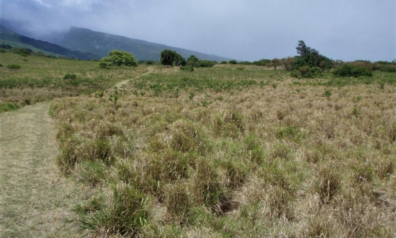
Figure 2. Reference State, Phase 1.1. Guineagrass grassland. Kaupo very stony silty clay loam, 3 to 25% slopes (KLUD), elevation 400 feet, annual rainfall 40 inches. David Clausnitzer, 7/28/08.
Preferred forage species are guineagrass (Urochloa maxima), the small leguminous tree koa haole or white leadtree (Leucaena leucocephala), and the leguminous vine glycine (Neonotonia wightii).
With continuous heavy grazing (cattle, horses, goats or deer), preferred forage grasses decrease, as will preferred small trees, vines, and shrubs. Less preferred grass, forb, and shrub species increase under such circumstances. With severe deterioration, shrubby species can increase to eventually dominate.
Christmasberry (Schinus terebinthifolius) is common.Dominant plant species
-
white leadtree (Leucaena leucocephala), tree
-
guineagrass (Urochloa maxima), grass
-
perennial soybean (Neonotonia wightii), other herbaceous
Community 1.2
Barbwire grass – guineagrass Cymbopogon refractus – Urochloa maximaChristmasberry (Schinus terebinthifolius) has increased in comparison with community phase 1.1. Guineagrass is present in minor amounts. Primary increaser grass species that dominate under heavy grazing include pitted beardgrass (Bothriochloa pertusa), Natal redtop (Melinis repens), barbwiregrass (Cymbopogon refractus), sour grass (Digitaria insularis), feather fingergrass (Chloris virgata), Rhodesgrass (Chloris gayana), and wiregrass or Indian goosegrass (Eleusine indica), rat-tail grass (Sporobolus africanus syn. S. indicus var. capensis), crabgrass (Digitaria spp.), Bermudagrass (Cynodon dactylon), Colombian bluestem (Schizachyrium condensatum), and broomsedge beardgrass (Andropogon virginicus). Unpalatable, increaser forbs include sensitive partridge pea (Chamaecrista nictitans), sensitive plant or shameplant (Mimosa pudica), rattlepod (Crotalaria mucronata), red pualele or lilac tasselflower (Emilia sonchifolia), chenopodium (Dysphania carinata), vervain (Stachytarpheta spp), common sow thistle (Sonchus oleraceus), lion’s ear mint (Leonotis nepetifolia), and spiny amaranth (Amaranthus spinosus). Shrubby species include lantana (Lantana camara), apple of Sodom (Solanum linnaeaum), false mallow (Malvastrum coromandelianum), cocklebur (Xanthium saccharatum), Sacramento bur (Triumfetta semitriloba), balloon plant (Asclepias physocarpa), christmasberry (Schinus terebinthifolius), hairy mallow (Abutilon grandifolia), and castor bean (Ricinus communis).
Dominant plant species
-
barbwire grass (Cymbopogon refractus), grass
-
guineagrass (Urochloa maxima), grass
Pathway P1.1A
Community 1.1 to 1.2Community phase 1.1 converts to phase 1.2 by wildfire that reduces competitiveness of guineagrass and allows invasion of weeds, particularly undesirable grasses. Continuous grazing without adequate rest for preferred forages will have the same result. This conversion by either factor can be avoided if timely application of deferred and/or prescribed grazing is carried out to control guineagrass stature and canopy cover and to allow recovery of desirable species before weeds become dominant.
Pathway P1.2A
Community 1.2 to 1.1Community phase 1.2 can be converted to phase 1.1 by removing undesirable species and favoring and/or reestablishing desirable pasture species. If adequate stands of guineagrass remain, prescribed grazing may eventually bring about this conversion. Pitted beardgrass and Natal red top have some value as forage. However, barbwire grass, Colombian bluestem, and broomsedge beardgrass are very unpalatable to livestock and therefore difficult to control by grazing. If pasture condition is very poor, weed control followed by reestablishment of guineagrass will be necessary.
State 2
Invaded Understory StateThis state consists of one community phase having an open canopy of common native trees with an understory of introduced grasses, ferns, vines, small trees, and shrubs. Foraging by feral or domestic ungulates removes native understory plants and prevents regeneration of overstory species, resulting in a mature and diminishing canopy of native trees. This may occur more gradually by weed invasion into intact native forest. The understory of this plant community contains fine fuels that are susceptible to wildfire.
Community 2.1
Lama – ohia lehua/pukiawe/barbwire grass/Asian swordfern (Diospyros sandwicensis – Metrosideros polymorpha/Styphelia tameiameiae/Nephrolepis multiflora)Native tree species dominate the overstory. The understory consists of a variable array of introduced plant species along with remnant native species.
The overstory is dominated by lama, ohia lehua, or a combination of these species. Tree species diversity varies from widely among locations. Higher elevation areas may be dominated by olopua (Nestegis sandwicensis).
Among native shrubs, aalii (Dodonaea viscosa) and pukiawe (Styphelia tameiameiae) may still be present. The introduced shrub lantana (Lantana camara) can be very abundant, producing stands that make foot transit difficult. The introduced vine huehue haole or corkystem passionflower (Passiflora suberosa) can become very abundant, covering the canopies of remnant native understory plants. Asian swordfern (Nephrolepis multiflora syn. N. brownii) is a weedy introduced fern that may be abundant. Introduced grasses are abundant where sufficient light penetrates the canopy. Christmasberry or Brazilian pepper tree (Schinus terebinthifolius), an introduced small tree that produces a dense, shady canopy, may be abundant.Dominant plant species
-
lama (Diospyros sandwicensis), tree
-
'ohi'a lehua (Metrosideros polymorpha), tree
-
pukiawe (Styphelia tameiameiae), shrub
-
barbwire grass (Cymbopogon refractus), grass
-
Asian swordfern (Nephrolepis multiflora), other herbaceous
State 3
Native Forest StateThis state consists of one community phase. This description is partly hypothetical, because little native vegetation remains in this ecological site. The following description is based on similar ecological sites on the Island of Hawaii. The general appearance of this ecological site is an open to nearly closed canopy of lama (Diospyros sandwicensis), an understory of shrubs and small trees, and a ground layer of vines, forbs, and grasses. The canopy becomes shorter and sparser where the forest grades into drier and/or windier areas near the coast.
Community 3.1
Lama – wiliwili/alahee (Diospyros sandwicensis – Erythrina sandwicensis/Psydrax odorata)The tree canopy is dominated by lama (Diospyros sandwicensis) and ohia lehua (Metrosideros polymorpha). Alahee (Psydrax odorata), a small tree, is the most abundant species in the understory. Common shrubs are aalii (Dodonaea viscosa), ilima (Sida fallax), ulei (Osteomeles anthyllidifolia), and akia (Wikstroemia sandwicensis). Huehue (Cocculus orbiculatus) is the most common vine. Native forbs, grasses, and ferns are present but not abundant.
Dominant plant species
-
lama (Diospyros sandwicensis), tree
-
wili wili (Erythrina sandwicensis), tree
-
alahe'e (Psydrax odorata), shrub
State 4
Shrub Invaded Grassland StateThis state consists of one community phase. It may have developed from abandoned grazing land, land cleared by wildfire, or abandoned farmland. Shrubs are dominant in canopy cover and stature. Typically, an array of introduced grass species is present. There is a moderate but increasing cover of small trees, some which potentially can grow to large stature. This tree cover creates the potential for a transition to State 5 Exotic Tree Invaded.
Community 4.1
Christmasberry (Brazilian peppertree)/aalii – lantana/Asian swordfern Schinus terebinthifolius/Dodonaea viscosa – Lantana camara/Nephrolepis multiflora syn. N. brownii
Figure 3. State 4 Shrub Invaded Grassland, Phase 4.1. Guineagrass grassland invaded by christmasberry and lantana. Kaupo extremely stony silty clay loam, 3 to 25% slopes, elevation 900 feet, annual rainfall 40 inches. David Clausnitzer, 7/28/08.
The shrub community can be a mix of native and introduced species. The most common introduced trees present are christmasberry (Schinus terebinthifolius) and koa haole (Leucaena leucocephala). When managed pastures have been abandoned and wildfires have not yet occurred, the plant community consists of very tall guineagrass and a dense stand of koa haole trees. In some cases, native shrubs are abundant.
The overstory most typically contains christmasberry (Schinus terebinthifolius). Small trees that may be present are the introduced species koa haole (Leucaena leucocephala), klu (Vachellia farnesiana), and common guava (Psidium guajava). Lantana (Lantana camara) is the most common shrub. Introduced Asian swordfern (Nephrolepis multiflora syn. N. brownii) is usually abundant. The most common grasses are broomsedge bluestem (Andropogon virginicus) and molassesgrass (Melinis minutiflora), although guineagrass is dominant in some sites.Dominant plant species
-
Brazilian peppertree (Schinus terebinthifolius), tree
-
Florida hopbush (Dodonaea viscosa), shrub
-
lantana (Lantana camara), shrub
-
Asian swordfern (Nephrolepis multiflora), other herbaceous
State 5
Exotic Tree Invaded StateThis state is comprised of one community phase dominated by introduced trees. Density and composition of understory shrubs, forbs, and grasses varies greatly with overstory closure and height, which affects the susceptibility of this plant community to fire. The density, vigor, and biomass of introduced vegetation can be very high, making restoration to other states expensive and difficult.
Community 5.1
Christmasberry (Brazilian peppertree)/lantana (Schinus terebinthifolius/Lantana camara)In many cases, the overstory consists of very dense christmasberry that is 15 to 25 feet (4.5 to 3.25 meters) tall with very little understory. Introduced tree species such as silk oak (Grevillea robusta), autograph tree (Clusia rosea), kukui (Aleurites moluccana), and octopus tree (Schefflera actinophylla) that have greater height potentials than christmasberry are often able to grow up through the christmasberry canopy and eventually dominate the site. Remnant, mature ohia lehua (Metrosideros polymorpha) trees may be present but are not able to regenerate. Native alahee (Psydrax odorata) trees sometimes are able to reproduce and maintain a sparse population in the understory.
The overstory composition can be highly variable from site to site, but christmasberry is typically the most abundant species. Christmasberry often dominates the understory (Dominant plant species
-
Brazilian peppertree (Schinus terebinthifolius), tree
-
lantana (Lantana camara), shrub
Restoration pathway R1A
State 1 to 3It may be possible to restore State 1 to a plant community resembling State 3 Native Forest. Weed control would be applied to forage species and the many opportunistic plant species that would invade the site. Weed control would be a perpetual process to maintain the site. A firebreak must be created and maintained, and domestic and feral ungulates must be excluded by a suitable fence. Extensive planting of native species would follow.
Transition T1A
State 1 to 4State 1 transitions to State 4 Shrub Invaded Grassland after abandonment and, if wildfires do not occur, gradual invasion of weedy shrubs and small trees. If the site contained abundant koa haole before abandonment, these small trees will overtop the guineagrass and greatly increase their cover.
Transition T2A
State 2 to 1State 2 transitions to State 1 Reference by land clearing with heavy machinery followed up by weed control. Land clearing would probably promote germination of the weed seed bank in the soil, requiring herbicidal control. After clearing and weed control, the site would be planted to forage species.
Restoration pathway R2A
State 2 to 3State 2 Invaded Understory may be restored to a facsimile of State 3 Native Forest, by removal of the introduced understory through application of herbicides and/or hand weeding. Reintroduction of native understory species is required. The site must be fenced securely to exclude ungulates, and a firebreak is needed to protect against wildfire.
Transition T2B
State 2 to 5State 2 transitions to State 5 Exotic Tree Invaded by growth of introduced tree species through and above the native canopy. Lack of reproduction leads to gradual loss of most native tree species.
Transition T3B
State 3 to 1State 3 Native Forest transitions to State 1 Reference (Naturalized Grassland) by clearing the forest with heavy machinery and planting desirable forage species.
Restoration pathway T3A
State 3 to 2State 3 Native Forest transitions to State 2 Invaded Understory through grazing, browsing, rooting, and trampling by domestic or feral ungulates (cows, sheep, deer, goats, and pigs). These activities destroy small native plant species and seedlings and saplings of large species. Regeneration of the native forest is prevented, leading to tree populations consisting almost entirely of mature plants. Lack of competition from native plants, introduction of weed seeds, and disturbance of the soil lead to an understory dominated by introduced plant species. Weeds can invade intact native forest even in the absence of ungulates and gradually bring about the transition. Invasive vines, shrubs, and small trees will grow under intact native canopies and begin to degrade the forest. Eventually, introduced grasses provide fine fuels that can carry wildfires that destroy the native tree canopy. This transition may be avoided by excluding domestic livestock and feral ungulates from the site with fencing or animal control measures and by implementing invasive plant species control.
Restoration pathway R4A
State 4 to 1State 4 Shrub Invaded Grassland can be restored to State 1 Reference by brush management with follow-up control of resprouting shrubs and emerging weedy forbs. Forage species may then be replanted and maintained by prescribed grazing. For large, densely weedy sites or if fast results are not required, it is possible to eliminate invasive small trees, shrubs, and undergrowth by planting glycine (<a class="species-link" href="https://plants.usda.gov/core/profile?symbol=NEWI2" target="_blank" title="Open in plants.usda.gov"><i>Neonotonia wightii</i></a>) to overtop and shade out weeds; this is done in conjunction with foraging by sheep and goats to consume smaller weeds. Eventually, the dead trees and shrubs collapse under the weight of the glycine; the glycine is then eaten by the livestock. This process takes about eight years (Gordon Cran, Kapapala Ranch, personal communication, 2006).
Transition T4A
State 4 to 5State 4 Shrub Invaded Grassland transitions to State 5 Exotic Tree Invaded in the absence of disturbance such as fire. Fast-growing introduced tree species invade Shrub Invaded Grassland and quickly overtop shrubs.
Restoration pathway R5B
State 5 to 1State 5 Exotic Tree Invaded may be restored to State 1 Reference. Total clearing of the site would be necessary. If clearing is done by heavy machinery, soil disturbance would occur. This would induce germination of the weed seed bank and increase the potential for soil erosion. Weed control and brush management must then be applied multiple times to control new weed germination and resprouting. After clearing and weed control, the site would be planted to forage species. Ungulates would have to be excluded until forages are well established; prescribed grazing must then be applied.
Restoration pathway R5A
State 5 to 3It may be possible to restore State 5 Exotic Tree Invaded to a community resembling State 3 Native Forest . Total clearing of the site would be necessary. Alternatively, it may be worthwhile to kill taller weed species in place by herbicide applications in order to provide some shelter from the sun. If clearing is done by heavy machinery, soil disturbance would occur. This would induce germination of the weed seed bank and increase the potential for soil erosion. Weed control and brush management would be long-term. A firebreak must be created and maintained, and ungulates would have to be excluded by a suitable fence.
Additional community tables
Table 7. Community 1.1 plant community composition
Group Common name Symbol Scientific name Annual production () Foliar cover (%) Table 8. Community 1.2 plant community composition
Group Common name Symbol Scientific name Annual production () Foliar cover (%) Table 9. Community 2.1 plant community composition
Group Common name Symbol Scientific name Annual production () Foliar cover (%) Table 10. Community 3.1 plant community composition
Group Common name Symbol Scientific name Annual production () Foliar cover (%) Table 11. Community 4.1 plant community composition
Group Common name Symbol Scientific name Annual production () Foliar cover (%) Table 12. Community 5.1 plant community composition
Group Common name Symbol Scientific name Annual production () Foliar cover (%) Interpretations
Supporting information
Other references
Definitions
These definitions have been greatly simplified for brevity and do not cover every aspect of each topic.
Aa lava: A type of basaltic lava having a rough, jagged, clinkery surface and a vesicular interior.
Alluvial: Materials or processes associated with transportation and/or deposition by running water.
Ash field: a land area covered by a thick or distinctive deposit of volcanic ash that can be traced to a specific source and has well defined boundaries. The term “ash flow” is erroneously used in the Physiographic section of this ESD due to a flaw in the national database.
Ashy: A “soil texture modifier” for volcanic ash soils having a water content at the crop wilting point of less than 30 percent; a soil that holds relatively less water than “medial” and “hydrous” soils.
Available water capacity: The amount of soil water available to plants to the depth of the first root-restricting layer.
Canopy cover: The percentage of ground covered by the vertical projection downward of the outermost perimeter of the spread of plant foliage. Small openings within the canopy are included.
Community pathway: A description of the causes of shifts between community phases. A community pathway is reversible and is attributable to succession, natural disturbances, short-term climatic variation, and facilitating practices, such as grazing management.
Community phase: A unique assemblage of plants and associated dynamic soil properties within a state.
Dominant species: Plant species or species groups that exert considerable influence upon a community due to size, abundance, or cover.
Drainage class: The frequency, duration, and depth of a water table in a soil. There are seven drainage classes, ranging from “excessively drained” (soils with very rare or very deep water tables) to “well drained” (soils that provide ample water for plant growth but are not so wet as to inhibit root growth) to “very poorly drained” (soils with a water table at or near the surface during much of the growing season that inhibits growth of most plants).
Electrical conductivity (EC): A measure of the salinity of a soil. The standard unit is deciSiemens per meter (dS/m), which is numerically equivalent to millimhos per centimeter (mmhos/cm). An EC greater than about 4 dS/m indicates a salinity level that is unfavorable to growth of most plants.
Ion exchange capacity: The ability of soil materials such as clay or organic matter to retain ions (which may be plant nutrients) and to release those ions for uptake by roots.
Isohyperthermic soil temperature regime: A regime in which mean annual soil temperature is 72 degrees F (22 degrees C) or higher and mean summer and mean winter soil temperatures differ by less than 11 degrees F (6 degrees C) at a specified depth.
Isothermic soil temperature regime: A regime in which mean annual soil temperature is 59 degrees F (15 degrees C) or higher but lower than 72 degrees F (22 degrees C) and mean summer and mean winter soil temperatures differ by less than 11 degrees F (6 degrees C) at a specified depth.
Major Land Resource Area (MLRA): A geographic area defined by NRCS that is characterized by a particular pattern of soils, climate, water resources, and land uses. The island of Hawaii contains nine MLRAs, some of which also occur on other islands in the state.
Mollisols: Soils with relatively thick, dark surface horizons, high cation-exchange capacity, high calcium content, that do not become hard or very hard when dry. Mollisols are conducive to plant growth. They characteristically form under grass in climates that are seasonally dry, but can form under forests.
Naturalized plant community: A community dominated by adapted, introduced species. It is a relatively stable community resulting from secondary succession after disturbance. Most grasslands in Hawaii are in this category.
Pachic Haplustolls: These soils have a thick mollic epipedon. Some of the soils receive runoff but little sediment from the higher adjacent soils.
Parent material: Unconsolidated and chemically weathered material from which a soil is developed.
Perudic soil moisture regime: A very wet regime found where precipitation exceeds evapotranspiration in all months of normal years. On the island of Hawaii, this regime is found on top of Kohala and on parts of the windward side of Mauna Kea.
pH: The numerical expression of the relative acidity or alkalinity of a soil sample. A pH of 7 is neutral; a pH below 7 is acidic and a pH above 7 is basic.
Reference community phase: The phase exhibiting the characteristics of the reference state and containing the full complement of plant species that historically occupied the site. It is the community phase used to classify an ecological site.
Reference state: A state that describes the ecological potential and natural or historical range of variability of an ecological site.
Restoration pathway: A term describing the environmental conditions and practices that are required to recover a state that has undergone a transition.
Sodium adsorption ratio (SAR): A measure of the amount of dissolved sodium relative to calcium and magnesium in the soil water. SAR values higher than 13 create soil conditions unfavorable to most plants.
Soil moisture regime: A term referring to the presence or absence either of ground water or of water held at a tension of less than 1500 kPa (the crop wilting point) in the soil or in specific horizons during periods of the year.
Soil temperature regime: A defined class based on mean annual soil temperature and on differences between summer and winter temperatures at a specified depth.
Soil reaction: Numerical expression in pH units of the relative acidity or alkalinity or a soil.
State: One or more community phases and their soil properties that interact with the abiotic and biotic environment to produce persistent functional and structural attributes associated with a characteristic range of variability.
State-and-transition model: A method used to display information about relationships between vegetation, soil, animals, hydrology, disturbances, and management actions on an ecological site.
Transition: A term describing the biotic or abiotic variables or events that contribute to loss of state resilience and result in shifts between states.
Udic soil moisture regime: A regime in which the soil is not dry in any part for as long as 90 cumulative days in normal years, and so provides ample moisture for plants. In Hawaii it is associated with forests in which hapuu (tree ferns) are usually moderately to highly abundant.
Ustic soil moisture regime: A regime in which moisture is limited but present at a time when conditions are suitable for plant growth. In Hawaii it usually is associated with dry forests and subalpine shrublands.
Annotated References for R159AY002HI Rocky Alluvial Naturalized Grassland
Abrahamson I. 2013. Fire regimes in Hawaiian plant communities. In: Fire Effects Information System, US Dept. of Agriculture, Forest Service, Rocky Mountain Research Station, Fire Sciences Laboratory. Available" www.fs.fed.us/database/feis/fire_regimes/Hawaii/all.html Review of fire regimes and history for multiple generalized plant communities in the Hawaiian Islands.
Armstrong RW. 1973. Atlas of Hawaii. University of Hawai`i Press, Honolulu. General reference for climate, land use, land forms, etc.
Athens JS. Ch. 12 Hawaiian Native Lowland Vegetation, IN Prehistory in Historical Ecology in the Pacific Islands – Prehistoric Environmental and Landscape Change. Kirch, PV and TL Hunt, eds. 1997. Yale U. Press, New Haven. General discussion of effects of prehistoric Polynesians on native lowland vegetation.
Burney DA, HF James, LP Burney, SL Olson, W Kikuchi, WL Wagner, M Burney, D McCloskey, D Kikuchi, FV Grady, R Gage II, and R Nishek. 2001. Fossil evidence for a diverse biota from Kauai and its transformation since human arrival. Ecological Monographs 71:615-641. General discussion of effects of prehistoric Polynesians on native vegetation.
Christensen CC. 1983. Report 17: Analysis of land snails. In Archaeological investigations of the Mudlane-Waimea-Kawaihae Road Corridor, Island of Hawaii: an Interdisciplinary Study of an Environmental Transect. Clark JT. and Kirch PV, eds. Dept. of Anthropology, Bernice Pauahi Bishop Museum, Report 83-1, Honolulu, HI. Native land snails as indicators of original vegetation and environment along a climatic transect. Specific to Kohala, Island of Hawaii, but information can be generally applied to other islands.
Clark JT. 1983. Report 3: The Waimea-Kawaihae Region: Historical Background. In Archaeological investigations of the Mudlane-Waimea-Kawaihae Road Corridor, Island of Hawaii: an Interdisciplinary Study of an Environmental Transect. Clark JT and Kirch PV, eds. Dept. of Anthropology, Bernice Pauahi Bishop Museum, Report 83-1, Honolulu, HI. Historical landuse along a climatic transect. Specific to Kohala, Island of Hawaii, but information can be generally applied to other islands.
Clark JT. 1983. Report 7: Archaeological investigations in Section 4. In Archaeological investigations of the Mudlane-Waimea-Kawaihae Road Corridor, Island of Hawaii: an Interdisciplinary Study of an Environmental Transect. Clark JT and Kirch PV, eds. Dept. of Anthropology, Bernice Pauahi Bishop Museum, Report 83-1, Honolulu, HI. Prehistoric landuse along a climatic transect. Specific to Kohala, Island of Hawaii, but information can be generally applied to other islands.
Clark JT. 1983. Report 8: Archaeological investigations of agricultural sites in the Waimea area. In Archaeological investigations of the Mudlane-Waimea-Kawaihae Road Corridor, Island of Hawaii: an Interdisciplinary Study of an Environmental Transect. Clark JT and Kirch PV, eds. Dept. of Anthropology, Bernice Pauahi Bishop Museum, Report 83-1, Honolulu, HI. Prehistoric landuse along a climatic transect. Specific to Kohala, Island of Hawaii, but information can be generally applied to other islands.
Craighill ES and EG Handy. 1991. Native Planters in Old Hawaii – Their Life, Lore, and Environment. Bernice P. Bishop Museum Bulletin 233, Bishop Museum Press, Honolulu, HI Discussion of early agriculture in Hawaii.
Cuddihy LW and CP Stone. 1990. Alteration of Native Hawaiian Vegetation: Effects of Humans, Their Activities and Introductions. Honolulu: University of Hawaii Cooperative National Park Resources Study Unit. General account of human effects on native Hawaiian vegetation.
Deenik J and AT McClellan. 2007. Soils of Hawaii. Soil and Crop Management, Sept. 2007, SCM-20. Cooperative Extension Service, College of Tropical Agriculture and Human Resources. University of Hawaii at Manoa. Available online at: https://www.ctahr.hawaii.edu/oc/freepubs/pdf/SCM-20.pdf Discussion of soil orders and their practical implications in Hawaii.
Dixon JB and Schulze DG, eds. 2002. Soil Mineralogy with Environmental Applications. Volume 7. Soil Science Society of America. Available online at: https://acsess.onlinelibrary.wiley.com/doi/book/10.2136/sssabookser7 Exhaustive treatment of basics of soil mineralogy and implications for environmental management.
Giambelluca TW and TA Schroeder. 1998. Climate. In Atlas of Hawaii, 3rd edition. SP Juvik, JO Juvik, and RR Paradise, eds. pp. 49-59. Honolulu: University of Hawaii Press. Standard geographical reference work for Hawaii.
Gil CR. 2016-2017. Ananas comosus. Colegio Bolivar Agricultural Science. Available online at: https://www.colegiobolivar.edu.co/garden/wp-content/uploads/2017/06/Crosas-Ananas-comosus-2017.pdf Discusses effects of pineapple monoculture on soil condition.
Hazlett RW and DW Hyndman. 1996. Roadside Geology of Hawaii. Mountain Press Publishing Company, Missoula MT. General account of geologic history of Hawaii.
Henke LA. 1929. A Survey of Livestock in Hawaii. Research Publication No. 5. University of Hawaii, Honolulu. Provides early accounts of introduction and spread of ungulates in Hawaii.
Horrocks M. 2009. Sweet potato (Ipomoea batatas) and banana (Musa sp.) microfossils in deposits from the Kona Field System, Island of Hawaii. Journal of Archaeological Science, May 2009. Specific to Kona on the Island of Hawaii, but useful information about early Hawaiian land use and agriculture.
Imada, C. 2012. Hawaiian Native and Naturalized Vascular Plants Checklist (December 2012 update). Bishop Museum Technical Report 60. Bishop Museum Press, Honolulu. Constantly-updated list of vascular plants of Hawaii, including latest nomenclature and species occurrences on each island.
Juvik JO and D Nullet. 1993. Relationships between rainfall, cloud-water interception, and canopy throughfall in a Hawaiian montane forest. IN: Tropical Montane Cloud Forests. Proc. Int. Sym., San Juan, PR. Hamilton LS, JO Juvik, and FN Scatena, eds. East-West Center. Field study of fog drip on Mauna Kea.
Kirch PV. 1982. The impact of the prehistoric Polynesians in the Hawaiian ecosystem. Pacific Science 36(1):1-14. General discussion of effects of prehistoric Polynesians on native vegetation.
Kirch PV. 1983. Introduction. In Archaeological investigations of the Mudlane-Waimea-Kawaihae Road Corridor, Island of Hawaii: An Interdisciplinary Study of an Environmental Transect. Clark JT and Kirch PV, eds. Dept. of Anthropology, Bernice Pauahi Bishop Museum, Report 83-1, Honolulu, HI. Generalized account of land use and vegetation along a climatic transect. Specific to Kohala on the Island of Hawaii, but generally applicable to other islands.
Kirch PV. 1985. Feathered Gods and Fishhooks: An Introduction to Hawaiian Archaeology and Prehistory. Honolulu: University of Hawaii Press. General discussion of effects of prehistoric Polynesians on native vegetation.
Kirch PV. 2000. On the Road of the Winds: An Archaeological History of the Pacific Islands Before European Contact. Berkeley: University of California Press. General discussion of effects of prehistoric Polynesians on native vegetation.
Leopold LB. 1949. The interaction of trade wind and sea breeze, Hawaii. Journal of Meteorology 6: 312-320. Study of the naulu winds that operate on the west slope of Haleakala.
Little EL Jr. and RG Skolmen. 1989. Common Forest Trees of Hawaii (Native and Introduced). US Department of Agriculture-US Forest Service Agriculture Handbook No. 679. (out of print). Available at www.fs.fed.us/psw/publications/documents/misc/ah679.pdf Information on common native and introduced tree species in Hawaii. Especially useful for introduced species.
Maly K and O Maly. 2004. He Moolelo Aina: A Cultural Study of the Puu O Umi Natural Area Reserve and Kohala-Hamakua Mountain Lands, Districts of Kohala and Hamakua, Island of Hawaii. Kumu Pono Associates, Hilo HI. Account of natural vegetation and human effects that can be applied to all related ecological sites.
McEldowney H. 1983. Report 16: A description of major vegetation patterns in the Waimea-Kawaihae region during the early historic period. Archaeological investigations of the Mudlane-Waimea-Kawaihae Road Corridor, Island of Hawaii: An Interdisciplinary Study of an Environmental Transect. Clark JT and Kirch PV, eds. Dept. of Anthropology, Bernice Pauahi Bishop Museum, Report 83-1, Honolulu, HI. Generalized account of land use and vegetation along a climatic transect. Specific to Kohala on the Island of Hawaii, but generally applicable to other islands.
Mubyana T. 1997/98. Effects of continuous sugarcane and pineapple cropping on organic matter and soil microbial biomass. Journal of African Research and Development 27&28:258-269. Comparison of effects of pineapple cropping on soils compared with sugarcane and virgin uncropped soils. Pineapple cropping decrease pH, exchangeable cations, OM, biomass C, and flush of N.
Mueller-Dombois D and FR Fosberg. 1998. Vegetation of the Tropical Pacific Islands. Springer-Verlag New York, Inc. General account of tropical Pacific Island vegetation, with section on Hawaii. Discussion of likely effect of stoniness on soil moistue storage in dry habitats.
Palmer DD. 2003. Hawaii’s Ferns and Fern Allies. University of Hawaii Press, Honolulu. Standard reference for Hawaiian ferns and fern allies.
Pratt HD. 1998. A Pocket Guide to Hawaii’s Trees and Shrubs. Mutual Publishing, Honolulu. Useful guide to common tree and plant species, with color photos.
Reppun F, Silva JHS, Wong K, and Deenik JL. 2017. A Soil Phosphorus Primer for Hawaiian Soils. Soil and Crop Management, August 2017, SCM-33. College of Tropical Agriculture and Human Resources, University of Hawaii at Manoa. Available online at: https://www.ctahr.hawaii.edu/oc/freepubs/pdf/SCM-33.pdf Practical discussion of soil phosphorus for Hawaii.
Ripperton JC and EY Hosaka. 1942. Vegetation zones of Hawaii. Hawaii Agricultural Experiment Station Bulletin 89:1-60. Broad-scale map of vegetation zones in Hawaii.
Rock JF. The Indigenous Trees of the Hawaiian Islands. 1st edition 1913, reprinted 1974, Charles E. Tuttle Company, Rutland, VT and Tokyo, Japan. Very useful account observations of native vegetation in Hawaii from early 20th century. Can be paired with GIS layer of place names to locate species observations.
Schroeder TA. 1981. Characteristics of local winds in northwest Hawaii. Journal of Applied Meteorology 20: 874-881. Study of naulu winds in Kohala, Island of Hawaii.
Sherman LA and KR Brye. 2019. Soil chemical property changes in response to long-term pineapple cultivation in Costa Rica. Agrosystems, Geosciences and Environment. Available online at: https://acsess.onlinelibrary.wiley.com/doi/full/10.2134/age2019.07.0052 Discusses deleterious effects of pineapple cultivation on soil chemical properties.
Shoji SD, M Nanzyo, and R Dahlgren. 1993. Volcanic Ash Soils: Genesis, Properties and Utilization. Elsevier, New York. Detailed discussion of volcanic ash soils. Not specific to Hawaii, but very informative.
Silva JA and R Uchida, eds. 2000. Plant Nutrient Management in Hawaii’s Soils, Approaches for Tropical and Subtropical Agriculture. College of Tropical Agriculture and Human Resources, University of Hawaii at Manoa. Available online at: https://www.ctahr.hawaii.edu/oc/freepubs/pdf/pnm0.pdf Practical discussion of plant nutrient management for Hawaii.
Sohmer SH and R Gustafson. 2000. Plants and Flowers of Hawaii. University of Hawaii Press, Honolulu. A good general discussion, with color photographs, primarily of native Hawaiian plants and vegetation types.
Soil Survey Staff. 2014. Soil Taxonomy, Twelfth Edition. USDA – NRCS. Standard book of soil taxonomy; useful for terminology and interpretation of soils, also.
Steadman DW. 1995. Prehistoric extinctions of Pacific island birds: biodiversity meets zooarchaeology. Science 267:1123-1131. Discussion of loss of many bird species, including flightless birds, with information about disturbances and vegetation changes.
USDA-NRCS-PIA Threatened & Endangered Species GIS files. Not publicly available. Specific locations of observations of many native Hawaiian plant species.
USDA-NRCS. 2011. Soil Survey Laboratory Information Manual. Soil Survey Investigations Report No. 45, Version 2.0. National Soil Survey Center, Lincoln, Nebraska. Detailed information about interpretation of soil laboratory results.
USDA-NRCS. 2006. Major Land Resource Regions. USDA Agriculture Handbook 296. http://soils.usda.gov/MLRAExplorer Description of MLRAs of Hawaii.
USDA-NRCS. Island of Hawaii Soil Surveys 801 and 701. Available online at https://websoilsurvey.sc.egov.usda.gov/App/HomePage.htm The latest NRCS soil survey for the island of Hawaii.
USDA-SCS. 1972. Soil Survey of Islands of Kauai, Oahu, Maui, Molokai, and Lanai, State of Hawaii. Foote DE, Hill EL, Nakamura S, and F Stephens, in cooperation with The University of Hawaii Agricultural Experiment Station. The latest NRCS soil survey for these islands. Some of the taxonomic names are outdated.
USDI-USGS. 2006. A GAP Analysis of Hawaii. Final Report and Data. GIS map of vegetation types and land use in Hawaii based on remote sensing. Very general, occasionally inaccurate, but useful.
Vitousek P. 2004. Nutrient Cycling and Limitation: Hawai`i as a Model Ecosystem. Princeton University Press, Princeton and Oxford. Discussion of development of soils, soil nutrients, and plant species in Hawaiian Archipelago.
Wagner WL, DR Herbst, and SH Sohmer. 1999. Manual of the Flowering Plants of Hawaii, Revised Edition. Bishop Museum Press, Honolulu. Standard reference of flowering plants of Hawaii.
Welch DJ 1983. Report 5: Archaeological investigations in Section 2. In Archaeological investigations of the Mudlane-Waimea-Kawaihae Road Corridor, Island of Hawaii: An Interdisciplinary Study of an Environmental Transect. Clark JT and Kirch PV, eds. Dept. of Anthropology, Bernice Pauahi Bishop Museum, Report 83-1, Honolulu, HI. Prehistoric landuse along a climatic transect. Specific to Kohala, Island of Hawaii, but information can be generally applied to other islands.
Western Regional Climate Center, cited 2020. Climate of Hawaii. Available: https://wrcc.dri.edu/Climate/narrative_hi.php Detailed summary of climate of Hawaiian Islands.
Whistler, WA. 1995. Wayside Plants of the Islands: A Guide to the Lowland Flora of the Pacific Islands. Isle Botanica, Honolulu. Reference of common introduced plant species in lowland areas of the Pacific Islands including Hawaii; with color photographs.Contributors
David Clausnitzer
John Proctor
Amy Koch
Mike Kolman
Mathew Cocking
Kendra Moseley
Jennifer HigashinoApproval
Kendra Moseley, 4/17/2025
Acknowledgments
Assistance, advice, review, and/or insights: Randy Bartlett, Puu Kukui Watershed Preserve Alison Cohan, The Nature Conservancy Michael Constantinides, NRCS-PIA Gordon Cran, Kapapala Ranch Diana Crow, Ulupalakua Ranch Lance DeSilva, Hawaii DLNR Kerri Fay, Waikamoi Preserve, The Nature Conservancy Alex Franco, Kaupo Ranch Ranae Ganske-Cerizo, NRCS Carl Hashimoto, NRCS Jennifer Higashino, USFWS and NRCS Bob Hobdy, consultant, Maui Wallace Jennings, NRCS Mel Johansen, The Nature Conservancy Jordan Jokiel, Haleakala Ranch David Leonard, volunteer Penny Levin Reese Libby, GIS - NRCS Hannah Lutgen, Maui SWCD Joseph May, NRCS Scott Meidel, Haleakala Ranch Anna Palomino, Hoolawa Farms Inc. Jon Price, USGS Tamara Sherrill, USFWS, Maui Nui Botanical Garden Amber Starr, Hana Ranch Kahana Stone, NRCS Mark Vaught, Water Resources, Alexander & Baldwin Jacqueline Vega, NRCS Rich von Wellsheim, Whispering Bamboos, Kipahulu
Rangeland health reference sheet
Interpreting Indicators of Rangeland Health is a qualitative assessment protocol used to determine ecosystem condition based on benchmark characteristics described in the Reference Sheet. A suite of 17 (or more) indicators are typically considered in an assessment. The ecological site(s) representative of an assessment location must be known prior to applying the protocol and must be verified based on soils and climate. Current plant community cannot be used to identify the ecological site.
Author(s)/participant(s) Contact for lead author Date 09/18/2026 Approved by Approval date Composition (Indicators 10 and 12) based on Annual Production Indicators
-
Number and extent of rills:
-
Presence of water flow patterns:
-
Number and height of erosional pedestals or terracettes:
-
Bare ground from Ecological Site Description or other studies (rock, litter, lichen, moss, plant canopy are not bare ground):
-
Number of gullies and erosion associated with gullies:
-
Extent of wind scoured, blowouts and/or depositional areas:
-
Amount of litter movement (describe size and distance expected to travel):
-
Soil surface (top few mm) resistance to erosion (stability values are averages - most sites will show a range of values):
-
Soil surface structure and SOM content (include type of structure and A-horizon color and thickness):
-
Effect of community phase composition (relative proportion of different functional groups) and spatial distribution on infiltration and runoff:
-
Presence and thickness of compaction layer (usually none; describe soil profile features which may be mistaken for compaction on this site):
-
Functional/Structural Groups (list in order of descending dominance by above-ground annual-production or live foliar cover using symbols: >>, >, = to indicate much greater than, greater than, and equal to):
Dominant:
Sub-dominant:
Other:
Additional:
-
Amount of plant mortality and decadence (include which functional groups are expected to show mortality or decadence):
-
Average percent litter cover (%) and depth ( in):
-
Expected annual annual-production (this is TOTAL above-ground annual-production, not just forage annual-production):
-
Potential invasive (including noxious) species (native and non-native). List species which BOTH characterize degraded states and have the potential to become a dominant or co-dominant species on the ecological site if their future establishment and growth is not actively controlled by management interventions. Species that become dominant for only one to several years (e.g., short-term response to drought or wildfire) are not invasive plants. Note that unlike other indicators, we are describing what is NOT expected in the reference state for the ecological site:
-
Perennial plant reproductive capability:
Print Options
Sections
Font
AAAAOther
PrintThe Ecosystem Dynamics Interpretive Tool is an information system framework developed by the USDA-ARS Jornada Experimental Range, USDA Natural Resources Conservation Service, and New Mexico State University.
Accessibility statement


