
Natural Resources
Conservation Service
Ecological site R156AY220FL
Subtropical Freshwater Non-Forested Glades Marshes and Slough Wetlands of Everglades
Last updated: 4/14/2025
Accessed: 09/18/2026
-
Search


Major Land Resource Area or ecological site by name and/or ID.
PreviousSectionsNextGeneral information
Provisional. A provisional ecological site description has undergone quality control and quality assurance review. It contains a working state and transition model and enough information to identify the ecological site.
MLRA notes
Major Land Resource Area (MLRA): 156A–Florida Everglades and Associated Areas
This area makes up about 7,749 square miles (20,071 square kilometers) and is entirely in Florida. It is located at the southern tip of the State and has shoreline on both the Atlantic Ocean and the Gulf of America. Lake Okeechobee borders the MLRA to the north. Aside from sugar cane plantations in the north, the Everglades National Park, Big Cypress National Preserve, and the Big Cypress Seminole Indian Reservation comprise this area. Historical ditching, berming, and canals prevent natural water flow through this delicate ecosystem. To mitigate this, extensive restoration efforts have been implemented. Urban sprawl from Miami and cities to its north on the Atlantic Ridge has encroached along the eastern boundary of this area. Most of the MLRA has resisted urbanization because of a water table that is at or near the surface, a considerable acreage of unstable organic soils, and its identity as a national treasure.
About one-third of this area is in Native American reservations, national parks, game refuges, or other large holdings. Cypress forests are extensive in the area, but mangrove forests are widespread along the eastern and southern coasts. A large part of the area is open marsh. Much of the area is used for hunting, fishing, and other recreational activities. The cropland in the area is used mainly for winter vegetables, but citrus fruits, avocado, and papaya are grown on the better drained soils. Sugarcane is an important crop on the organic soils south of Lake Okeechobee. The acreage of improved pasture is increasing. Beef cattle are the principal kind of livestock, but dairying is an important enterprise locally. Urbanization is extensive along the eastern coast.
The major soil resource concerns are wind erosion, maintenance of the content of organic matter and productivity of the soils, and management of soil moisture and soil subsidence. Conservation practices on cropland generally include conservation crop rotations, cover crops, nutrient management, pest management, water-control structures, surface drainage systems (field ditches, mains, and laterals), pumping plants, and irrigation water management (including micro irrigation systems and surface and subsurface irrigation systems). Conservation practices on pasture and rangeland generally include prescribed grazing, brush management, pest management, prescribed burning, and watering facilities. Conservation practices on forestland generally include forest stand improvement, firebreaks, pest management, prescribed burning, and management of upland and wetland wildlife habitat.LRU notes
There is not an official LRU for the MLRA 156A area. For the time being the technical team recommended to add the four terrestrial physiographic provinces ecoregions (Big Cypress, Everglades, Southern Coast and Islands, and Miami Ridge / Atlantic Coastal Strip) and one subaqueous ecoregion (Coastal Marine and Estuarine) on this section. This PES occurs within the Everglades ecoregion.
The Everglades region, 1 to 7 m (3 to 23 ft) in elevation and begins south of Lake Okeechobee to include the Everglades Agricultural Area, the water conservation areas, and the sawgrass and sloughs of the national park. The flat plain of saw-grass marshes, tree-islands, and marsh prairies, with cropland in the north, ranges in elevation from sea level to twenty feet. Peat, muck, and some clay are the main surficial materials over the limestone. Wide sloughs, marshes, and some small ponds contain most of the surface waters in this "River of Grass" region. Canals drain much of the water in some areas.Classification relationships
All portions of the geographical range of this site falls under the following ecological / land classifications including:
-Environmental Protection Agency's Level 3 and 4 Ecoregions of Florida: 76 Southern Florida Coastal Plain; 76A Everglades (Griffith, G. E., Omernik, J. M., & Pierson, S. M., 2013)
-Florida Natural Area Inventory, 2010 Edition: Freshwater Non-Forested Wetlands: Glades Marsh, Slough (FNAI ,2010)
-Soil Conservation Service, 26 Ecological Communities of Florida: 24- Sawgrass Marsh, 26- Slough (Florida Chapter Soil and Water Conservation Society, 1989)
-Everglades National Park Ecosystems, National Park Service: Freshwater Slough (National Park Service, 2021)Ecological site concept
The Subtropical Freshwater Non-Forested Glades Marsh and Slough Wetlands of Everglades are non-forested herbaceous dominant communities that occurs as low broad flats (Glades Marsh) and dips and depressions (Sloughs) in a low broad flat. This is a vast community that is characteristic of the Everglades "River of Grass". It is influenced via freshwater inputs from summer rainfall as well as ponding and flooding conditions from overland flow from Lake Okeechobee. Water will begin to pond in the early summer and will begin to flow in a north to south direction as enough water enters the system. These are highly organic soils that occur directly on limestone bedrock. Major threats to this community are hydrologic alterations, in which canals and other urban developments may impede the natural hydrologic flow of the system. Much of this area remains in a natural state and is protected within the Everglades National Park boundary.
Associated sites
R156AY110FL Subtropical Tidal Saline Wetlands of Southern Coast and Islands
The Subtropical Tidal Saline Wetlands of Southern Coast and Islands occur in similar landscape positions along tidally influenced soils. This site will be found in the southern portion of the MLRA where the associated site flows out into the gulf.
F156AY210FL Subtropical Freshwater Forested Wetlands of Everglades
The Subtropical Freshwater Forested Wetlands of Everglades occur in higher landscape position as knolls (tree islands). These communities will be forested and occur sporadically throughout the landscape in a north to south direction due to water flow.
R156AY230FL Subtropical Marl Prairies of Everglades
The Subtropical Marl Prairies of Everglades occur in slightly higher landscape position as prairies. This is more commonly seen in the south east portion of the Everglades ecoregion and is dominated by marl surficial texture due to the presence of periphyton. Hydroperiods are often shorter than the surrounding glades marshes and sloughs.
Similar sites
R156AY040FL Subtropical Freshwater Non-Forested Wetlands of Big Cypress
The Subtropical Freshwater Non-Forested Wetlands of Big Cypress is found in a separate ecoregion where elevation is greater, this community is in lesser extent, and resource concerns are different and require unique management needs. Species composition and structure may be similar.
R156AY320FL Subtropical Freshwater Non-Forested Wetlands of Miami Ridge/ Atlantic Coastal Strip
The Subtropical Freshwater Non-Forested Wetlands of Miami Ridge / Atlantic Coastal Strip is found in a separate ecoregion where elevation is greater, this community is in lesser extent, and resource concerns are different and require unique management needs. Species composition and structure may be similar.
R156AY110FL Subtropical Tidal Saline Wetlands of Southern Coast and Islands
The Subtropical Tidal Saline Wetlands of Southern Coast and Islands can be confused with the salt marsh state of the tidal wetlands. It will differ by the presence of halophytic species in the community and tidally influenced soil.

Figure 1. Similar and Associated Sites usually found in conjunction with this ESD.

Figure 2. Associated site aerial Google Earth snippet of tree islands (F156AY210FL) in surrounding glades marsh (R156AY220FL) near Shark Valley in Everglades National Park.
Table 3. Dominant plant species
Tree Not specified
Shrub Not specified
Herbaceous (1) Cladium mariscus ssp. jamaicense
(2) Typha domingensisPhysiographic features
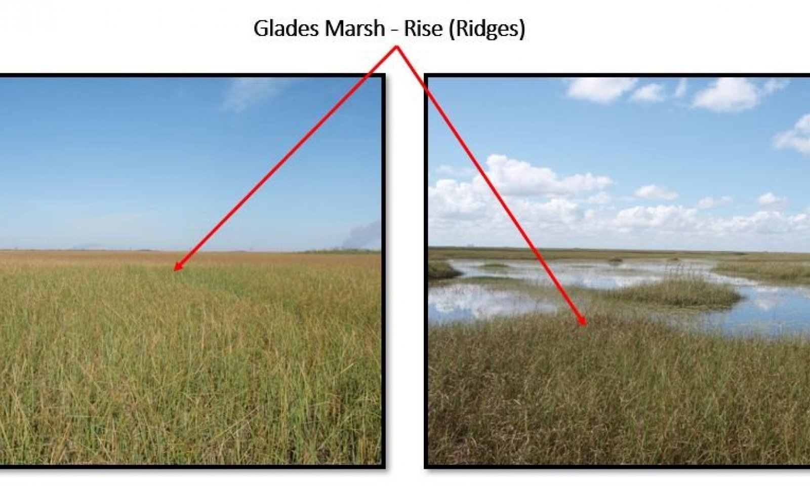
There are two main microfeatures on the low broad flats landform in which these communities exist; Rises and Dips. Each microfeature exhibits a different vegetative community and hydroperiod duration. On rises, ponding and flooding is frequent 3 to 9 months with water depths 25 to 91 cm (10" to 36"), and in dips ponding and flooding is frequent 6 to 11 months with water depths 61 to 122 cm (24" to 48"). We have not detected major differences on the soil types between the rises, and/or dips described above. The rises are slightly higher positions but lower than the tree islands with constant flooding and longer hydroperiods. These conditions contribute to the dominant establishment of grasses described on the Sawgrass Marsh vegetative community (Phase 1.1). The dip areas are in the lowest landscape position within the Everglades ecoregion in comparison to the Tree Island (F156AY210FL) and Marl Prairies (R156AY230FL). These areas are subject to year round hydroperiods (ponding & flooding conditions) and serve as refuge and corridors for wildlife during extended periods of drought. Areas with deeper water depths will allow for herbaceous floating plants to be dominantly established, these plants are described on the Slough vegetative community (Phase 1.2).
The geology of the Everglades ecoregion falls under two separate geologic formations: the Pliocene epochs shell-bearing sediments and the most recent Pleistocene epochs Miami Limestone. These Pliocene shell-bearing sediments are complex, varying from unconsolidated, variably calcareous and fossiliferous quartz sands to well indurated, sandy, fossiliferous limestones (both marine and freshwater). Clayey sands and sandy clays are present. The Miami Limestone consists of two facies, an oolitic facies and a bryozoan facies. The oolitic facies consists of white to orangish gray, poorly to moderately indurated, sandy, oolitic limestone (grainstone) with scattered concentrations of fossils. The bryozoan facies consists of white to orangish gray, poorly to well indurated, sandy, fossiliferous limestone (grainstone and packstone). Beds of quartz sand are also present as un-indurated sediments and indurated limey sandstones. Fossils present include mollusks, bryozoans, and corals. Molds and casts of fossils are common (Scott, 2001).
Figure 1. The Everglades ecoregion, extending from the Everglades Agriculture Area (EAA) in the north to the tidal extent of Everglades National Park in the south.
Table 4. Representative physiographic features
Geomorphic position, flats (1) Rise
(2) Dip
Slope shape across (1) Concave
Slope shape up-down (1) Linear
(2) Concave
Geomorphic position, terraces (1) Tread
Landforms (1) Coastal plain
(2) Everglades > Flat > Rise
(3) Everglades > Flat
(4) Everglades > Slough
(5) Everglades > Drainageway
(6) Everglades > Marsh
Runoff class Very low to low Flooding duration Very long (more than 30 days) Flooding frequency Frequent Ponding duration Very long (more than 30 days) Ponding frequency Frequent Elevation 3 – 23 ft Slope 0 – 1 % Ponding depth 10 – 48 in Water table depth 0 – 6 in Aspect Aspect is not a significant factor Climatic features
The climate of MLRA 156A is subtropical, with mild winters and hot wet summers. The average annual precipitation of this MLRA is 37 to 62 inches (950 to 1,565 millimeters). About 60 percent of the precipitation occurs from June through September. Most of the rainfall occurs during moderate intensity, tropical storms that produce large amounts of rain from late spring through early autumn. Late autumn and winter are relatively dry. The average annual temperature of the MLRA is 74 to 78 degrees F (23 to 26 degrees C). The freeze-free period of the MLRA averages 355 days and ranges from 345 to 365 days.
The following tables and graphs consist of specific climate stations found within the range of this ecological site within this MLRA.Table 5 Representative climatic features
Frost-free period (characteristic range) 370 days Freeze-free period (characteristic range) 370 days Precipitation total (characteristic range) 50-60 in Frost-free period (actual range) 370 days Freeze-free period (actual range) 370 days Precipitation total (actual range) 40-60 in Frost-free period (average) 370 days Freeze-free period (average) 370 days Precipitation total (average) 50 in Characteristic rangeActual rangeBarLineFigure 2. Monthly precipitation range
Characteristic rangeActual rangeBarLineFigure 3. Monthly minimum temperature range
Characteristic rangeActual rangeBarLineFigure 4. Monthly maximum temperature range
BarLineFigure 5. Monthly average minimum and maximum temperature
Figure 6. Annual precipitation pattern
Figure 7 Annual average temperature pattern
Climate stations used
-
(1) TAMIAMI TRL 40 MI BEND [USC00088780], Miami, FL
-
(2) DRY TORTUGAS [USC00082418], Key West, FL
-
(3) ISLAMORADA [USC00084320], Islamorada, FL
-
(4) OASIS RS [USC00086406], Ochopee, FL
-
(5) EVERGLADES [USC00082850], Naples, FL
-
(6) SOUTH BAY 15 S [USC00088368], Southwest Palm Beach Co, FL
-
(7) CANAL POINT USDA [USC00081276], Belle Glade, FL
-
(8) HOMESTEAD GEN AVIATION [USC00084095], Homestead, FL
-
(9) HOLLYWOOD NORTH PERRY AP [USW00092809], Hollywood, FL
-
(10) MIAMI WSO CITY [USW00012859], Miami, FL
">Influencing water features
The non-forested glades marshes are an open expanse of dominantly sawgrass in areas where the soil is saturated or covered with surface water 3 to 9 months during the year. Areas that have been impacted by longer hydroperiods (6 to 11 months), will be observed with faster (overland) water flow and less sawgrass, mainly dominated by floating aquatic herbaceous plants, known locally as sloughs, or drainageways. <br />
<br />
This site is defined by long hydroperiods resulting from high rainfall inputs during the summer months and overland flow. Rainfall is most dominant during the summer months (June to October), creating ponding conditions throughout. Water will fill the sloughs before the flats become inundated, with sloughs often retaining water for most of the year, except during periods of extreme drought. These constant saturated conditions attribute to the high sapric materials, and will often protect these soils from peat fires, allowing fire to spread over the living biomass. Once these areas become ponded deep enough to connect other sloughs and sawgrass ridges, they may begin to slowly flow, moving about 1 meter per hour. This shifts the local hydrologic phase from a ponded phase to a flooded phase. Much of this area is impacted by the hydrology of upland watersheds, primarily Lake Okeechobee. Lake Okeechobee would historically overflow due to seasonal high water flows from the Kissimmee River, and attribute to flooding conditions of the sawgrass marshes and tree islands. This massive sheet water flow historically moved in a north to south direction, but much of the area has been altered by canal diversions and road divisions. This north to south flow is the main driver for the shapes of the tree islands (F156AY210FL) and often gives the Everglades area a streaked look from aerial photos.<br />
<br />
The Everglades were often only accessible by boat during the summer seasons, and were used primarily during the dry season by Native Americans and wildlife. During the dry season, the marshes may still retain standing water, whereas the tree islands may be wet but not inundated under natural conditions. However, much of these areas towards the headwaters of the Everglades have been drained and/ or channelized, altering the natural hydrologic flows of the area. Many projects are underway, including those from the National Park System and US Army Corp of Engineers to restore natural hydroperiods and maintain community structure. These include removing the roads, which block water flow except for a few culverts, and replacing them with low bridges expanding across large areas, or filling in canals and creating large berms to restore natural hydrologic conditions.Wetland description
Wetland Description: Cowardin<br />
System: Palustrine<br />
Subsystem: N/A<br />
Class: Emergent Wetland
Figure 8. Past Water Flow of the Everglades Ecoregion and MLRA 156A before anthropogenic interference.

Figure 9. Current Water Flow of the Everglades Ecoregion and MLRA 156A.

Figure 10. Future Water Flow of the Everglades Ecoregion and MLRA 156A following hydrologic restoration proposals.

Figure 11. Conceptual hydrologic system model of South Florida. Image modified from Swain et al. 2019.
Soil features
Soils associate with this ecological site occur in the isohyperthermic soil temperature regime of MLRA 156A. The isohyperthermic soil temperature regime has mean annual soil temperatures of 22 °C (72⁰F) or more and a difference between mean summer and mean winter soil temperatures of less than 5 °C (41⁰F) at 50 cm (20 inches) below the surface.
Much of the Florida peninsula south of Lake Okeechobee is a flat limestone plain of recent (Pliocene/Pleistocene) origin with peat and marl (calcitic materials) substrates deposited directly on the limestone platform. Dominantly shallow to very deep, nearly level, soils formed in organic sapric materials range from 18 to 300 centimeters (7 to 120 inches) thick. Sapric materials fiber content range from 30 to 60% of unrubbed fiber content and from 1 to 17% of rubbed fiber content. Drainage is very poorly drained. Unless limed, the reaction in the surface layer ranges from extremely acid to slightly alkaline. In many areas the mineral soil materials are sandy, loamy, and/or marl materials may be present between the organic material and the limestone bedrock and range from 3 to 51 cm (1 to 20 inches) thick where present, but some marshes may be found with marl. Texture of these mineral horizons ranges from fine sand, loamy fine sand, sand, loamy sand, silt, loamy, sandy loam, fine sandy loam and sandy clay loam. Coral limestone bedrock underlies most of the area, which is Karstic in nature, the depth to the bedrock ranged from 7 to greater than 204 cm (3 to 80+ inches). Representative soils may include Loxahatche, BuffaloTiger, Macks Camp, Shark Valley, Gator Lake, and Cooper Town.
Figure 12. Buffalo Tiger - Macks Camp - Plantation soils

Figure 13. Gator Lake - Hallandale - Tamiami soils

Figure 14. Shark Valley Soils
Table 6. Representative soil features
Parent material (1) Herbaceous organic material
(2) Marine deposits – limestone
Surface texture (1) Peaty fine sand
(2) Mucky fine sand
Drainage class Very poorly drained Permeability class Rapid to very rapid Depth to restrictive layer 10 – 90 in Soil depth 10 – 90 in Surface fragment cover <=3" Not specified Surface fragment cover >3" Not specified Available water capacity
(0-30in)1 – 34 in Clay content
(0-80in)0 – 5 % Electrical conductivity
(0-80in)0 – 8 mmhos/cm Sodium adsorption ratio
(0-80in)0 – 5 Soil reaction (1:1 water)
(0-80in)3.5 – 7.8 Subsurface fragment volume <=3"
(0-80in)Not specified Subsurface fragment volume >3"
(0-80in)Not specified Ecological dynamics
The information presented in this ecological site description (ESD) and state-and-transition model (STM) were developed using archaeological and historical information, published and unpublished scientific reports, professional experience, consultation with technical experts, and NRCS inventories and studies. The information presented represents a complex set of plant community dynamic and environmental variables. Not all scenarios or plants are represented and included. Key indicator plants, animals, and ecological processes are described to help guide land management decisions and actions.
The natural (native) vegetation of this community is mainly dominated by Jamaica sawgrass (Cladium jamaisence). Other grasses can become obvious when the sawgrass is repeatedly exposed to fire and / or the hydroperiod is shortened. Under natural conditions the sawgrass can be 6 to 10 feet tall and of such density that few other plants can survive. Other marsh plants invade the sawgrass where marginal conditions occur for sawgrass growth. These condition may include changes in hydroperiod, water flow, wildlife altered habitat (gator holes- see below), fire, and anthropogenic activities. Trees are not dominant, occuring in areas with lowered hydroperiods, often found on slightly higher rises or knolls (tree islands). In areas with relatively sparse vegetation, mats of algae called periphyton are commonly attached to plants in the water column. This periphyton is often considered calcareous due to the dominance of certain filamentous blue-green algae species.
There are two dominant vegetative communities groups interacting with the geomorphic positions of the area;
1. Glades Marsh - The dominant herbaceous plant that occurs in these areas are grasses such as Jamaica sawgrass (Cladium jamaicense). Other herbaceous plants that occur are giant bristlegrass (Setaria magna), gulf muhly (Muhlenbergia capillaris), broomsedges (Andropogon spp.), sugarcane plumegrass (Saccharum giganteum), plume grass (Erianthus spp.), maidencane (Panicum hemitomon), Tracy’s beaksedge (Rhynchospora tracyi), and Gulf Coast spikerush (Eleocharis cellulosa). Various other herbs are common, particularly shortbristle horned beaksedge (R. corniculata), slim spikerush (E. elongata), string lily (Crinum americanum), alligatorlily (Hymenocallis palmeri), creeping primrosewillow (Ludwigia repens), bulltongue arrowhead (Sagittaria lancifolia), pickerelweed (Pontederia cordata), and American cupscale (Sacciolepis striata). During periods of high water and in areas transitional to deeper conditions floating plants such as big floatingheart (Nymphoides aquatica), American water lily (Nymphaea odorata) and bladderworts (Utricularia spp.) may be common. Cattails (Typha spp.) are increasingly abundant in areas of the Everglades where water quality is degraded by agricultural run-off or where water is impounded by roads and canals. Drought conditions may allow other herbs to temporarily gain importance, such as southern amaranth (Amaranthus australis), dogfennel (Eupatorium capillifolium), camphorweeds (Pluchea spp.), thistles (Cirsium spp.), asters (Symphyotrichum spp.), knotweeds (Polygonum spp.), morning glory (Ipomoea sagittata), and white twinevine (Sarcostemma clausum) may be found climbing sawgrass blades. Periphyton is found in these areas and can form mats that contribute food and oxygen.
2. Slough - Dip / Depressions - The dominant herbaceous plants that occurs in these areas are Gulf Coast spikerush (Eleocharis cellulosa), American water lily (Nymphaea odorata), bladderworts (Utricularia spp.), big floatingheart (Nymphoides aquatica) and yellow pondlily (Nuphar advena). Other herbaceous plants that occur are frog’s bit (Limnobium spongia), duckweeds (Lemna spp.), alligatorflag (Thalia geniculata), bandana-of-the-Everglades (Canna flaccida), pickerelweed (Pontederia cordata), bulltongue arrowhead (Sagittaria lancifolia), giant cutgrass (Zizaniopsis miliacea), and lizard’s tail (Saururus cernuus) are common. Periphyton is found in these areas and can form mats that contribute food and oxygen.
Natural Processes of the sites: The Glades Marsh occurs with near constant flooding of glades marshes, combined with the warm subtropical climate, contributes to a lush growth of sawgrass on slightly higher “ridges” and waterlily (Nymphaea sp.) in the lowest dips\sloughs. The long hydroperiod (3 to 9 months) creates an anaerobic soil environment in which the breakdown of sapric organic material is impeded, and sediments from dead vegetation continually accumulates, forming the characteristic sapric organic material. Although most of the glades marsh is located on accumulated sapric organic soil materials, sometimes several meters thick, the substrate may vary due to soil oxidation, fire, or other factors. Fire is a natural component of this landscape. Dominant herbaceous plants in the Everglades, particularly sawgrass, maidencane, and bulltongue arrowhead, grow vigorously following fire under normal conditions, i.e. when water levels are still near the soil surface and shorter hydroperiods (3 to 6 months). The porous limestone surface underlying the basin allows for some interaction between surface water and ground water within the limestone, leading to a slightly basic surface water environment with high calcium levels. These conditions lower phosphorus bioavailability and tend to perpetuate sawgrass dominance.
The water in these dips\sloughs is slow moving, and sloughs may dry completely during droughts. In South Florida, some of these areas have formed from the burning of underlying sapric organic soil materials layers in strand swamps and glades marsh during droughts. These sloughs\dips also known as depressions then fill with water when the site is once again flooded causing longer hydroperiods (6 to 11 months) allowing water emergent vegetation communities to be established. As such, these can be shifting communities, with old sloughs eventually filling in with peat while new ones are created by peat fires which cannot be mapped and are part of the system. Coastal plain willow is a common colonizer when fires have consumed soils in the Everglades Ecoregion. Alligators further create heterogeneity in sloughs by wallowing and digging in the peat substrate, excavating “gator holes” which will elongate the hydroperiods (6 to 11 months) and resulting in the creation of refuge for wildlife during droughts. Under drought conditions, wildfires may burn down the peat layer, destroying sawgrass roots and converting these areas to lower elevation creating longer hydroperiods (6 to 11 months) allowing emergent communities or to deeper water (sloughs\dips). Topographic variation may result not only from severe fires, but also from highs and lows in the underlying limestone bedrock, or from the formation of sapric organic materials tree islands, or batteries . These batteries are most common in the northeastern Everglades where solid masses of peat become dislodged from the floor of the marsh and drift to a new location, eventually reattaching to the bottom. The topographic high created by the sapric organic materials formation may become colonized with woody vegetation, especially swamp bay (Persea palustris), and can ultimately become a tree island (F156AY210FL), while the hole left behind will become a much deeper allowing water emergent communities vegetation (slough\dips).State and transition model
More interactive model formats are also available. View Interactive Models
Click on state and transition labels to scroll to the respective textEcosystem states
T1A - Organic Matter Loss T1B - Water Drainage Control Infrastructure / Desired Forage Establishment T1C - Water Drainage Control Infrastructure / Commodity Crop Establishment R2A - Reestablished Natural Hydroperiod / Organic Matter Accumulation / Sawgrass Development T2A - Water Drainage Control Infrastructure / Desired Forage Establishment T2B - Water Drainage Control Infrastructure / Commodity Crop Establishment T3A - Commodity Crop Establishment R3A - Natural Hydroperiod Restoration / Landscape Modification / Native Species Planting T3B - Human Alteration Human Transportation of Materials T4A - Desired Forage Establishment R4A - Natural Hydroperiod Restoration / Landscape Modification / Native Species Planting T4B - Human Alteration Human Transportation of Materials R6A - Natural Hydroperiod Restoration / Landscape Modification / Native Species Planting State 1
Glades Marsh
Figure 15. Representative glades marsh dominated by sawgrass.
Glades Marsh is an open expanse of grass in areas where the soil is saturated or covered with surface water 6 to 9 months or more during the year. The natural (native) vegetation of this community is mainly dominated by Jamaica sawgrass (Cladium jamaisence).
Characteristics and indicators. Under natural conditions the sawgrass can be 6 to 10 feet tall and of such density that few other plants can survive. The soil is saturated or covered with surface water 6 to 9 months or more during the year.
Resilience management. Soils need to be saturated for 6 to 9 months or more during the year. Controlled fire during the wet season is needed. Desirable water labels should be around 12 to 16 inches (30 centimeters to 41 centimeters).
Dominant plant species
-
Jamaica swamp sawgrass (Cladium mariscus ssp. jamaicense), grass
-
sugarcane plumegrass (Saccharum giganteum), other herbaceous
-
Gulf Coast spikerush (Eleocharis cellulosa), other herbaceous
-
seven sisters (Crinum americanum), other herbaceous
-
alligatorlily (Hymenocallis palmeri), other herbaceous
-
bulltongue arrowhead (Sagittaria lancifolia), other herbaceous
-
tropical pickerelweed (Pontederia rotundifolia), other herbaceous
-
American white waterlily (Nymphaea odorata), other herbaceous
-
bladderwort (Utricularia), other herbaceous
-
southern cattail (Typha domingensis), other herbaceous
-
saltmarsh morning-glory (Ipomoea sagittata), other herbaceous
-
maidencane (Panicum hemitomon), other herbaceous
Dominant resource concerns
-
Wind erosion
-
Subsidence
-
Organic matter depletion
-
Seasonal high water table
State 2
Slough
Figure 16. Representative slough march characterized by floating emergents and open water.
Sloughs are the deepest drainageways within swamps and marsh systems. They are broad channels inundated with slow moving or nearly stagnant water, except during extreme droughts. The vegetation structure is variable with some sloughs dominated by floating aquatics, others by large emergent herbs, and still others by a low or sparse canopy. The water in these dips\sloughs is slow moving, and sloughs may dry completely during droughts. Under natural conditions these areas exhibit longer hydroperiods (6 to 11 months). In south Florida, submerged plants and algae (including cyanobacteria, known as periphyton, found in more alkaline waters) can form mats in sloughs that contribute food and oxygen.
Characteristics and indicators. Under natural conditions these areas exhibit longer hydroperiods (6 to 11 months), the vegetation is dominated by floating aquatics, others by large emergent herbs, and still others by a low or sparse canopy. During extended periods of droughts these areas become a refuge for wildlife.
Resilience management. Maintain the natural drainage and surface water flow that sustained a adequate balance of ponding levels, duration and soil saturation. These areas are sensitive to fire and don't benefit from prescribe fire.
Dominant plant species
-
pond cypress (Taxodium ascendens), tree
-
pond apple (Annona glabra), tree
-
coastal plain willow (Salix caroliniana), shrub
-
common buttonbush (Cephalanthus occidentalis), shrub
-
giant cutgrass (Zizaniopsis miliacea), grass
-
Gulf Coast spikerush (Eleocharis cellulosa), other herbaceous
-
American white waterlily (Nymphaea odorata), other herbaceous
-
bladderwort (Utricularia), other herbaceous
-
pickerelweed (Pontederia cordata), other herbaceous
-
lizard's tail (Saururus cernuus), other herbaceous
-
bulltongue arrowhead (Sagittaria lancifolia), other herbaceous
Dominant resource concerns
-
Wind erosion
-
Subsidence
-
Organic matter depletion
-
Concentration of salts or other chemicals
State 3
Drained PasturelandThe land use on these areas are known as improve pastures areas and are mainly dedicated to the cattle industry. The major impact of the drained areas for cattle is soil subsidence due to the oxidation of the Sapric Soils materials. However, when these areas are well maintained these pastures contribute to the native plant and animal habitat as well as aquifer recharge. Birds and other wildlife thrive on lands used for cattle production. These areas require water management to control seasonal flooding of the fields; presence of drainages ditches and canals are abundant. These canals act as a water source for the cattle and as wildlife refuge. These pastures are open and have few to no trees, with existing trees (primarily oak and palms) serving as areas for shade.
Characteristics and indicators. Presence of drainages ditches and canals. Absence of Jamaica sawgrass (Cladium jamaicense). Land is leveled with none to few areas that can sustain herbaceous plants like Gulf Coast spikerush (<a class="species-link" href="https://plants.usda.gov/core/profile?symbol=ELCE" target="_blank" title="Open in plants.usda.gov"><i>Eleocharis cellulosa</i></a>), American water lily (<a class="species-link" href="https://plants.usda.gov/core/profile?symbol=NYOD" target="_blank" title="Open in plants.usda.gov"><i>Nymphaea odorata</i></a>), bladderworts (Utricularia spp.). Soil surface is not exposed and will be mainly covered by forage plants like Limpograss (<a class="species-link" href="https://plants.usda.gov/core/profile?symbol=HEAL5" target="_blank" title="Open in plants.usda.gov"><i>Hemarthria altissima</i></a> - introduced), St. Augustinegrass (Stenotaphrum secunda-tum - introduced), Maidencane (<a class="species-link" href="https://plants.usda.gov/core/profile?symbol=PAHE2" target="_blank" title="Open in plants.usda.gov"><i>Panicum hemitomon</i></a> - native), Blue Maidencane (Amphicarpum muhlenber-gianum - native).
Resilience management. To keep the pasture at a desirable stage these areas require water management to control seasonal flooding and ponding. A proper grazing plan is needed to prevent overgrazing and loss of the soil resource.
Dominant plant species
-
live oak (Quercus virginiana), tree
-
cabbage palmetto (Sabal palmetto), tree
-
limpograss (Hemarthria altissima), grass
-
St. Augustine grass (Stenotaphrum secundatum), grass
-
maidencane (Panicum hemitomon), grass
-
Muhlenberg maidencane (Amphicarpum muehlenbergianum), grass
-
Japanese millet (Echinochloa esculenta), grass
-
shyleaf (Aeschynomene americana), grass
-
crowngrass (Paspalum), grass
-
sedge (Abildgaardia), other herbaceous
-
tropical soda apple (Solanum viarum), other herbaceous
-
pigweed (Amaranthus), other herbaceous
Dominant resource concerns
-
Sheet and rill erosion
-
Wind erosion
-
Subsidence
-
Compaction
-
Organic matter depletion
-
Ponding and flooding
-
Seasonal high water table
-
Nutrients transported to surface water
-
Nutrients transported to ground water
-
Aquatic habitat for fish and other organisms
-
Inadequate livestock water quantity, quality, and distribution
State 4
Drained Horticulture Land
Figure 17. Drained Horticulture Land in the Everglades Agriculture Area.
These areas serve to provide cane sugar, grains and vegetables. These areas provide primarily winter vegetables including sweet corn, radishes, green beans, lettuce and other leafy greens, as well as rice and sugarcane. The areas have been drained and laser leveled to accommodate to the horticulture crops.
Characteristics and indicators. Presence of drainages ditches, water control structures, and canals. Absence of Jamaica sawgrass (Cladium jamaicense), Gulf Coast spikerush (<a class="species-link" href="https://plants.usda.gov/core/profile?symbol=ELCE" target="_blank" title="Open in plants.usda.gov"><i>Eleocharis cellulosa</i></a>), American water lily (<a class="species-link" href="https://plants.usda.gov/core/profile?symbol=NYOD" target="_blank" title="Open in plants.usda.gov"><i>Nymphaea odorata</i></a>), bladderworts (Utricularia spp.). Winter vegetables including sweet corn, radishes, green beans, lettuce and other leafy greens, as well as rice and sugarcane are commonly seen through the year. Parcels under rest or under crop rotation process will be artificially inundated to reduce soil subsidence. During the crop rotation or resting period if the area is not well maintain invasive plants like Cogon grass (<a class="species-link" href="https://plants.usda.gov/core/profile?symbol=IMCY" target="_blank" title="Open in plants.usda.gov"><i>Imperata cylindrica</i></a>), Amaranthus (<a class="species-link" href="https://plants.usda.gov/core/profile?symbol=AMAL" target="_blank" title="Open in plants.usda.gov"><i>Amaranthus albus</i></a>), Elephant grass ( <a class="species-link" href="https://plants.usda.gov/core/profile?symbol=PEPU2" target="_blank" title="Open in plants.usda.gov"><i>Pennisetum purpureum</i></a>), Higuereta (<a class="species-link" href="https://plants.usda.gov/core/profile?symbol=RICO3" target="_blank" title="Open in plants.usda.gov"><i>Ricinus communis</i></a>), etc., can grow. Along the side of the canals banks if is not well maintained Brazilian peppertree (Schinus teredinthifolia) and Melaleuca (<a class="species-link" href="https://plants.usda.gov/core/profile?symbol=MEQU" target="_blank" title="Open in plants.usda.gov"><i>Melaleuca quinquenervia</i></a>) can grow. Evidence of organic soil subsidence can be seen.
Resilience management. The hydrology of these areas are very resilient, if proper water control is not managed correctly these areas will remain inundated during the raining season causing the loss of the crops. If not controlled Typha (Typha sp.), Brazilian peppertree (Schinus teredinthifolia), and Melaleuca (<a class="species-link" href="https://plants.usda.gov/core/profile?symbol=MEQU" target="_blank" title="Open in plants.usda.gov"><i>Melaleuca quinquenervia</i></a>) will grow at a fast rate suppressing the native vegetation.
Dominant plant species
-
sugarcane (Saccharum), grass
-
rice (Oryza), grass
-
limpograss (Hemarthria altissima), grass
-
maidencane (Panicum hemitomon), grass
-
Muhlenberg maidencane (Amphicarpum muehlenbergianum), grass
-
mustard (Brassica), other herbaceous
-
corn (Zea), other herbaceous
-
lettuce (Lactuca), other herbaceous
Dominant resource concerns
-
Sheet and rill erosion
-
Wind erosion
-
Compaction
-
Organic matter depletion
-
Ponding and flooding
-
Seasonal high water table
-
Nutrients transported to surface water
-
Nutrients transported to ground water
-
Pesticides transported to surface water
-
Pesticides transported to ground water
State 5
Reconstructed Slough and Glades Marsh
Figure 18. Reconstructed wetlands found in the WCA areas.
This state can be defined as the manipulation of a former or degraded wetland's physical, chemical, or biological characteristics to return its natural functions. The State 3: "Drained Pastureland" and State 4: "Drained Horticulture Land" can transition to this reconstructed state if the correct practices and management are put in place. Some general guiding principles are; Restore the natural function, restore natural structure, restore ecological integrity, restore native species avoiding non-native species, etc.
Characteristics and indicators. A reconstructed state will be easy to recognize through the landscape because it will create a boundary between two different habitat types. Wildlife diversity is greater along edges due to the different habitat types. After restoring the water flow from a drained condition to a more natural water flow and right ponding duration, the succession or progression of plant communities over time a freshwater marsh may gradually fill in with dense emergent and shrubs. Some invasive species (Melaleuca - <a class="species-link" href="https://plants.usda.gov/core/profile?symbol=MEQU" target="_blank" title="Open in plants.usda.gov"><i>Melaleuca quinquenervia</i></a>, Brazilian pepper - Schinus terebinthifolia, and Cattail – Typha .spp) will grow. Areas with long to very long hydroperiods (6 to 11 months) will promote submerge and emergent vegetation, increasing the possibility of a slough vegetative community reestablishment. Glades marshes will require shorter hydroperiods but longer duration (6 to 9 months) and in many cases replanting is needed to speed up the reestablishment of the Jamaica sawgrass (Cladium jamaisence), suppress other type of grasses and aquatic emergent vegetation.
Dominant plant species
-
pond cypress (Taxodium ascendens), tree
-
Florida slash pine (Pinus elliottii var. densa), tree
-
cabbage palmetto (Sabal palmetto), tree
-
pond apple (Annona glabra), tree
-
coastal plain willow (Salix caroliniana), shrub
-
common buttonbush (Cephalanthus occidentalis), shrub
-
wax myrtle (Morella cerifera), shrub
-
Jamaica swamp sawgrass (Cladium mariscus ssp. jamaicense), grass
-
maidencane (Panicum hemitomon), grass
-
blue maidencane (Amphicarpum purshii), grass
-
wiregrass gentian (Gentiana pennelliana), grass
-
giant cutgrass (Zizaniopsis miliacea), grass
-
sedge (Abildgaardia), other herbaceous
-
sedge (Carex), other herbaceous
-
Gulf Coast spikerush (Eleocharis cellulosa), other herbaceous
-
American white waterlily (Nymphaea odorata), other herbaceous
-
yellow waterlily (Nymphaea mexicana), other herbaceous
-
bladderwort (Utricularia), other herbaceous
-
pickerelweed (Pontederia cordata), other herbaceous
-
lizard's tail (Saururus cernuus), other herbaceous
-
bulltongue arrowhead (Sagittaria lancifolia), other herbaceous
Dominant resource concerns
-
Wind erosion
-
Subsidence
-
Compaction
-
Organic matter depletion
-
Ponding and flooding
-
Nutrients transported to surface water
-
Nutrients transported to ground water
-
Wildfire hazard from biomass accumulation
-
Aquatic habitat for fish and other organisms
State 6
Human Transported or Human Altered Materials
Figure 19. Human Transported or Human Altered Areas
Human Transported and Human Altered (HTHA) refer to all the vegetative communities that exist on soils that has been modified by anthropogenic activities. These HTHA areas are widespread across the MLRA 156A and are concentrated near where people live and work. These areas exist on soils that has been altered by humans. The two types of soils that fits this concept; Human-altered soils formed in human-altered materials from the soil surface to 50 cm (20 inches) (or to bedrock if shallower) or more, and human-transported soils formed in human-transported materials from the soil surface to 50 cm (20 inches) (or to bedrock if shallower) or more. The HTHA soils mainly occur in urban areas, transportation corridors, mined lands, landfills, filled shallow water, and agricultural areas on anthropogenic landforms. Dominant vegetation in areas well maintain will be ornamentals herbaceous and trees. Areas that aren’t well maintain will be overgrow by invasive grasses and trees. Reservoirs and anthropogenic ponded areas may support slough vegetation and can provide some wetland benefits. HTHA are extensive, and their extent is growing.
Characteristics and indicators. The existing vegetation will be located between sidewalks and roads, in home sites development, public gardens, botanical gardens, retention ponds, water reservoirs and parks. Areas with vegetation represent a percent of pervious surface that can range from 10 to 70 percent throughout the areas that people live and work. Landscapes are typically flat, with man made rises and knolls to elevate the surface above flood zones for home or urban development. Lower areas / depressions are often utilized for surface water control during the wet season.
Resilience management. Some open areas that were once altered and prepared for urban development that have been purchased by conservation programs exist, these areas are potential sites for restoration.
Dominant plant species
-
melaleuca (Melaleuca), tree
-
Florida slash pine (Pinus elliottii var. densa), tree
-
pond cypress (Taxodium ascendens), tree
-
royal palm (Roystonea regia), tree
-
cabbage palmetto (Sabal palmetto), tree
-
laurel oak (Quercus laurifolia), tree
-
water oak (Quercus nigra), tree
-
white cedar (Tabebuia heterophylla), tree
-
coconut palm (Cocos nucifera), tree
-
bucida (Bucida), tree
-
Brazilian peppertree (Schinus terebinthifolius), shrub
-
coco plum (Chrysobalanus icaco), shrub
-
seagrape (Coccoloba uvifera), shrub
-
castorbean (Ricinus communis), shrub
-
prostrate pigweed (Amaranthus albus), shrub
-
southern cattail (Typha domingensis), grass
-
St. Augustine grass (Stenotaphrum secundatum), grass
-
limpograss (Hemarthria altissima), grass
-
bahiagrass (Paspalum notatum), grass
-
cogongrass (Imperata cylindrica), grass
-
maidencane (Panicum hemitomon), grass
-
elephant grass (Pennisetum purpureum), grass
-
Gulf Coast spikerush (Eleocharis cellulosa), other herbaceous
-
American white waterlily (Nymphaea odorata), other herbaceous
-
bladderwort (Utricularia), other herbaceous
-
bulltongue arrowhead (Sagittaria lancifolia), other herbaceous
-
lizard's tail (Saururus cernuus), other herbaceous
-
pickerelweed (Pontederia cordata), other herbaceous
Dominant resource concerns
-
Wind erosion
-
Subsidence
-
Ponding and flooding
-
Seasonal high water table
-
Inefficient irrigation water use
-
Nutrients transported to surface water
-
Nutrients transported to ground water
-
Pesticides transported to surface water
-
Pesticides transported to ground water
-
Petroleum, heavy metals, and other pollutants transported to surface water
-
Petroleum, heavy metals, and other pollutants transported to ground water
-
Sediment transported to surface water
-
Terrestrial habitat for wildlife and invertebrates
-
Aquatic habitat for fish and other organisms
Transition T1A
State 1 to 2
Glades Marsh
SloughThe Glades Marshes can transition to a Slough due to wildfires if they occur when water levels are too low causing an entire burn of the Jamaica sawgrass (Cladium jamaisence). If the entire plant burns the surface sapric material (muck\ mucky peat) burns as well creating a lower depression or dip. When the water levels get back to normal, floating aquatics and others by large emergent herbs rapidly colonize and suppress the stressed Jamaica sawgrass. If hydroperiods are not properly balanced after a wildfire takes place the chance for Glades Marsh vegetation to recover are very low. Anthropogenic activities like hunting, airboat, and swam buggy activities contribute to the Jamaica sawgrass displacement and the Sloughs establishment by causing soil surface erosion. In dry seasons alligators may displace the vegetation creating a slough by creating gator holes to reach available water.
Constraints to recovery.Proper water levels control. Proper water flow. Removal of any anthropogenic activities. Dominant species replanting / recolonization. Control of wildlife. Surface erosion control.
Context dependence.Loss of sapric material due to fire, wildlife, and anthropogenic activities'. Hydroperiods elongation due to a change of the geomorphology of the area affected.
Key drivers
-
Fire
-
Climate
-
Precipitation (annual scale)
-
Mechanical soil disturbance
-
Temperature (annual scale)
-
Nonnative pest presence and/or establishment
-
Nonnative plant species presence and/or establishment
-
Fire frequency
-
Hydroperiod duration. Ponding water depths.
Key ecosystem services affected
-
Erosion control
-
Water purification and waste treatment
-
Air quality maintenance
-
Climate regulation: carbon cycling and storage
-
Fresh water
-
Wildlife habitat
-
Storm protection
-
Soil formation
-
Animal biodiversity
-
Plant biodiversity
-
Climate regulation
Transition T1B
State 1 to 3The Glades Marshes state can transition to Drained Pastureland state by establishing water drainage control infrastructure. These practices include; constructing canals to drain the soils up to 20 inches (50 cm) from the surface, construction of water control gates to move the water from one parcel to another, removal of all native existing vegetation, land leveling, introduction of desirable forages to establish a pasture, and construction of roads.
Key drivers
-
Fire
-
Climate
-
Precipitation (annual scale)
-
Mechanical soil disturbance
-
Temperature (annual scale)
-
Nonnative pest presence and/or establishment
-
Nonnative plant species presence and/or establishment
-
Seeding
-
Hydroperiod duration. Ponding water depths.
Key ecosystem services affected
-
Erosion control
-
Air quality maintenance
-
Climate regulation: carbon cycling and storage
-
Fresh water
-
Wildlife habitat
-
Storm protection
-
Soil formation
-
Animal biodiversity
-
Plant biodiversity
-
Climate regulation
Transition T1C
State 1 to 4
Glades Marsh
Drained Horticulture LandThe Glades Marshes state can transition to Drained Horticulture Land state by establishing water drainage control infrastructure. These practices include; constructing canals to drain the soils up to 20 inches (50 cm) from the surface, construction of water control gates to move the water from one parcel to another, removal of all native existing vegetation, land leveling, introduction of desirable commodity crops and construction of roads.
Key drivers
-
Fire
-
Climate
-
Precipitation (annual scale)
-
Mechanical soil disturbance
-
Temperature (annual scale)
-
Nonnative pest presence and/or establishment
-
Nonnative plant species presence and/or establishment
-
Seeding
-
Hydroperiod duration. Ponding water depths.
Key ecosystem services affected
-
Erosion control
-
Air quality maintenance
-
Climate regulation: carbon cycling and storage
-
Fresh water
-
Wildlife habitat
-
Storm protection
-
Soil formation
-
Animal biodiversity
-
Plant biodiversity
-
Climate regulation
Restoration pathway R2A
State 2 to 1
Slough
Glades MarshTo restore from a Slough to Glades Marshes, an effective water level and ponding period (approximately 6 to 9 months) needs to be established. Normally with a natural water flow reestablishment these conditions can be achieved. A reestablished hydroperiod will allow for the accumulation of new organic mater in the soil profile, raising the soil surface and creating suitable habitat for sawgrass growth. Wildlife (Alligator) control is needed to prevent eroding activities for nesting and gator habitat development (gator holes are commonly described as sloughs). Airboat activity needs to be suspended or monitored because the erosion to the soil surface and because the airboat friction can kill the grass. Reseeding and planting may be needed to increase the grass population, coverage, and grass thickness to suppress any other plants. An aggressive invasive plants control is needed to prevent or reduce the establishment of Typha sp. and Melaleuca (<a class="species-link" href="https://plants.usda.gov/core/profile?symbol=MEQU" target="_blank" title="Open in plants.usda.gov"><i>Melaleuca quinquenervia</i></a>) plants.
Context dependence.Without the correct water flow, correct water levels, and ponding period (approximately 6 to 9 months), the chances of the Glades Marches to recover and thrive are low. The lack of wildlife, airboat, and invasive plants can encourage new Sawgrass growth. Because of the slow reestablishment of the sawgrass, if a reseeding and planting step is not added to the restoration effort the chance of other herbaceous vegetation take over are high.
Transition T2A
State 2 to 3The Slough state can transition to Drained Pastureland state by establishing water drainage control infrastructure. These practices include; constructing canals to drain the soils up to 20 inches (50 cm) from the surface, construction of water control gates to move the water from one parcel to another, removal of all native existing vegetation, land leveling, introduction of desirable forages to establish a pasture, and construction of roads.
Key drivers
-
Fire
-
Climate
-
Precipitation (annual scale)
-
Mechanical soil disturbance
-
Temperature (annual scale)
-
Nonnative plant species presence and/or establishment
-
Hydroperiod duration. Ponding water depths.
Key ecosystem services affected
-
Erosion control
-
Air quality maintenance
-
Climate regulation: carbon cycling and storage
-
Fresh water
-
Wildlife habitat
-
Storm protection
-
Soil formation
-
Animal biodiversity
-
Plant biodiversity
-
Climate regulation
Transition T2B
State 2 to 4
Slough
Drained Horticulture LandThe Slough state can transition to Drained Horticulture Land state by establishing water drainage control infrastructure. These practices include; constructing canals to drain the soils up to 20 inches (50 cm) from the surface, construction of water control gates to move the water from one parcel to another, removal of all native existing vegetation, land leveling, introduction of desirable commodity crops and construction of roads.
Key drivers
-
Fire
-
Climate
-
Precipitation (annual scale)
-
Mechanical soil disturbance
-
Temperature (annual scale)
-
Nonnative pest presence and/or establishment
-
Nonnative plant species presence and/or establishment
-
Hydroperiod duration. Ponding water depths.
Key ecosystem services affected
-
Erosion control
-
Air quality maintenance
Transition T3A
State 3 to 4The Drained Pastureland can transition to Drained Horticulture Land state by the removal of all established forages and introduction of desirable commodity crops. Establishment of water drainage control infrastructure is needed if not already present. These practices include; constructing canals to drain the soils up to 20 inches (50 cm) from the surface, construction of water control gates to move the water from one parcel to another, and construction of roads.
Constraints to recovery.To recover or reconstruct back to a Drained Pastureland state from a Drained Horticulture Land state all commodity crops needs to be removed and all desirable forages will need to be reintroduced. Land leveling and keeping drainage control infrastructure is needed. An aggressive invasive species control program will need to be put in place to prevent the establishment of Typha (Typha sp.), Brazilian peppertree (Schinus teredinthifolia), and Melaleuca (<a class="species-link" href="https://plants.usda.gov/core/profile?symbol=MEQU" target="_blank" title="Open in plants.usda.gov"><i>Melaleuca quinquenervia</i></a>).
Key drivers
-
Fire
-
Climate
-
Precipitation (annual scale)
-
Mechanical soil disturbance
-
Temperature (annual scale)
-
Nonnative pest presence and/or establishment
-
Nonnative plant species presence and/or establishment
-
Seeding
Key ecosystem services affected
-
Erosion control
-
Air quality maintenance
-
Wildlife habitat
-
Animal biodiversity
-
Plant biodiversity
-
Climate regulation
Restoration pathway R3A
State 3 to 5To reconstruct from a Drained Pastureland to a Reconstructed Slough and Glades Marsh state, the natural water flow and hydroperiod of the area needs to be restored. All water control and drainages infrastructure need to be removed. Landscape modification will be needed to mimic or simulate the original geomorphic positions to establish the correct hydroperiod durations of the Slough and Glades Marsh States. Replanting native vegetation may be needed.
Context dependence.Adequate water levels, mimic the correct hydroperiods duration, and establish a consistent invasive species control to reduce or eliminate the presence of grasses (forages and other invasive plants like Brazilian peppertree (Schinus teredinthifolia), Typha sp. and Melaleuca (<a class="species-link" href="https://plants.usda.gov/core/profile?symbol=MEQU" target="_blank" title="Open in plants.usda.gov"><i>Melaleuca quinquenervia</i></a>). Establish reseeding and replanting procedures.
Transition T3B
State 3 to 6To transition from a Drained Pastureland to a Human Transported or Human Altered state, a more aggressive water control and drainages infrastructure will be put in place. Land leveling will occur and will change the entire natural landscape. Most of the original vegetation will be removed. Transportation and removal of soils materials will occur to meet urban development needs. These practices will affect the natural physical, chemical and biological conditions of the soils affected. The percent of impervious surfaces will range from 0 % to 100 %. Dominant vegetation in areas that are well maintained will be ornamentals evergreen shrubs, ornamental herbaceous species, and trees. Areas that aren’t well maintained will be overgrow by native vegetation and invasive species. Reservoirs and anthropogenic ponded areas may support slough vegetation and can provide some wetland benefits.
Constraints to recovery.To recover or reconstruct to Drainage Horticulture Land, all desirable forages will need to be reintroduced. The land needs to be cleaned and free of any non-natural solid waste. All water control and drainages infrastructure will remain. An invasive species control program will need to be put in place to prevent the establishment of undesirable grasses, and other plants.
Key drivers
-
Fire
-
Climate
-
Precipitation (annual scale)
-
Mechanical soil disturbance
-
Temperature (annual scale)
-
Nonnative pest presence and/or establishment
-
Nonnative plant species presence and/or establishment
-
Seeding
Key ecosystem services affected
-
Erosion control
-
Air quality maintenance
-
Wildlife habitat
-
Animal biodiversity
-
Plant biodiversity
-
Climate regulation
Transition T4A
State 4 to 3To reconstruct from Drained Horticulture Land to Drained Pastureland, all commodity crops needs to be removed and the reintroduction of the desirable forages are needed. Water control and drainages infrastructure will remain. Minor land leveling and manipulation may be needed to promote the forage growth. An aggressive invasive species control program will need to be put in place to prevent the establishment of Typha (Typha sp.), Brazilian peppertree (Schinus teredinthifolia), and Melaleuca (<a class="species-link" href="https://plants.usda.gov/core/profile?symbol=MEQU" target="_blank" title="Open in plants.usda.gov"><i>Melaleuca quinquenervia</i></a>).
Context dependence.Keep adequate water control and drainages infrastructure. Establish species control program to prevent the establishment of undesirable grasses (forages), and other plants.
Restoration pathway R4A
State 4 to 5
Drained Horticulture Land
Reconstructed Slough and Glades MarshTo reconstruct from a Drained Horticulture Land to a Reconstructed Slough and Glades Marsh state, the natural water flow and hydroperiod of the area needs to be restored. All water control and drainages infrastructure need to be removed. Commodity crops will need to be removed, reseeding and replanting of desirable native species will be needed. Landscape modification will be needed to mimic or simulate the original geomorphic positions to establish the correct hydroperiod durations of the Slough and Glades Marsh States. Replanting native vegetation may be needed.
Context dependence.Adequate water levels, mimic the correct hydroperiods duration, and establish a consistent invasive species control to reduce or eliminate the presence of grasses (forages and other invasive plants like Brazilian peppertree (Schinus teredinthifolia), Typha sp. and Melaleuca (<a class="species-link" href="https://plants.usda.gov/core/profile?symbol=MEQU" target="_blank" title="Open in plants.usda.gov"><i>Melaleuca quinquenervia</i></a>). Establish reseeding and replanting procedures.
Transition T4B
State 4 to 6
Drained Horticulture Land
Human Transported or Human Altered MaterialsTo transition from a Drained Horticulture Land to a Human Transported or Human Altered state, a more aggressive water control and drainages infrastructure will be put in place. Land leveling will occur and will change the entire natural landscape. Most of the original vegetation will be removed. Transportation and removal of soils materials will occur to meet urban development needs. These practices will affect the natural physical, chemical and biological conditions of the soils affected. The percent of impervious surfaces will range from 0 % to 100 %. Dominant vegetation in areas that are well maintained will be ornamentals evergreen shrubs, ornamental herbaceous species, and trees. Areas that aren’t well maintained will be overgrow by native vegetation and invasive species. Reservoirs and anthropogenic ponded areas may support slough vegetation and can provide some wetland benefits.
Constraints to recovery.To recover or reconstruct to a Drainage Horticulture Land, all desirable forages will need to be reintroduced. The land needs to be cleaned and free of any non-natural solid waste. All water control and drainages infrastructure will remain. An invasive species control program will need to be put in place to prevent the establishment of undesirable plants. Re introduce all the desirable commodity crops.
Context dependence.Keep adequate water control and drainages infrastructure. The land needs to be cleaned and free of any non-natural solid waste. All water control and drainages infrastructure will remain. Establish species control program to prevent the establishment of undesirable plants.
Key drivers
-
Fire
-
Climate
-
Precipitation (annual scale)
-
Mechanical soil disturbance
-
Temperature (annual scale)
-
Nonnative pest presence and/or establishment
-
Nonnative plant species presence and/or establishment
-
Seeding
-
Hydroperiod duration. Ponding water depths.
Key ecosystem services affected
-
Erosion control
-
Air quality maintenance
-
Wildlife habitat
-
Animal biodiversity
-
Plant biodiversity
-
Climate regulation
Restoration pathway R6A
State 6 to 5
Human Transported or Human Altered Materials
Reconstructed Slough and Glades MarshTo reconstruct from a Human Transported or Human Altered state to a Reconstructed Slough and Glades Marsh state, the natural water flow and hydroperiod of the area needs to be restored. All water control and drainages infrastructure need to be removed. Urban structures will need to be removed, reseeding and replanting of desirable native species will be needed. Landscape modification will be needed to mimic or simulate the original geomorphic positions to establish the correct hydroperiod durations of the Slough and Glades Marsh States. Replanting native vegetation may be needed.
Context dependence.Adequate water levels, mimic the correct hydroperiods duration, and establish a consistent invasive species control to reduce or eliminate the presence of grasses (forages and other invasive plants like Brazilian peppertree (Schinus teredinthifolia), Typha sp. and Melaleuca (<a class="species-link" href="https://plants.usda.gov/core/profile?symbol=MEQU" target="_blank" title="Open in plants.usda.gov"><i>Melaleuca quinquenervia</i></a>). Establish reseeding and replanting procedures. The land needs to be cleaned and free of any non-natural solid waste.
Additional community tables
Interpretations
Animal community
This is a very diverse ecosystem and important habitat for the American alligator (Alligator mississippiensis). Alligators are considered a keystone species in this community, as the small ponds created or maintained by alligators provide a refuge for fish and invertebrates during droughts. The Glades Marsh is a critical habitat for the federally endangered snail kite (Rostrhamus sociabilis plumbeus) in Florida, which feeds almost exclusively on apple snails. Other rare birds, such as limpkin (Aramus guarauna), and wading birds, particularly great egret (Ardea alba), white ibis (Eudocimus albus), little blue heron (Egretta caerulea), snowy egret (Egretta thula), tricolored heron (Egretta tricolor), least bittern (Ixobrychus exilis), wood stork (Mycteria americana), black-crowned night-heron (Nycticorax nycticorax), and glossy ibis (Plegadis falcinellus), and two rare mammals, southern mink (Neovison vison, southern Florida population) and round-tailed muskrat (Neofiber alleni), utilize glades marsh for foraging and nesting. Glades marsh in the Everglades is the major habitat of at least one rare invertebrate, the Everglades sprite (Nehalennia pallidula).
Hydrological functions
These areas serve as a filtering system for water and primary foundation for a very diverse subtropical freshwater feed ecosystem. These areas will retain water during drought and also will help to slow down the water during flood events. The principal environmental value are related to water quality. The principal environmental value are related to water quality, wildlife diversity, aquatic sub-tropical vegetation diversity, histosol preservation, and water quantity.
Recreational uses
The majority of this ecological site falls under the Everglades National Park boundary and is considered a paradise for recreation users who enjoy birdwatching. Other eco-tourism activities such as hiking, photography, and airboat tours are major uses for this area.
Other products
Much of the Sawgrass Marsh and Sloughs are now included in the Everglades National Park and is not available for urban development. Areas in the northern area of this ecoregion have been drained and converted to pastureland and agriculture and are classified as farmland of unique importance (Everglades Agricultural Area).
Supporting information
Inventory data references
Information presented was derived from NRCS clipping data, current and historical literature, field observations, and personals contacts with local, state and federal partners. This is a provisional level ESD and is subject to change as more information becomes available, for any questions please contact your local NRCS office. The WCA \ FL615 initial soil survey filed data collection started in FY 2009 and ended in FY 2019. The entire soil survey area is inside of the Everglades Ecoregion. We have collected over 2,500-point data sites, which at least 75 percent are full Pedon descriptions and 25 percent are filed notes including dominant existing vegetation, landscape, landform, and correlated soil name. Using collected field documentation in conjunction with reference information from partner agencies (EPA, WMD and DEP); we have developed a soil survey of the initial mapped areas to date. Using the historical information of the 26 Ecological Communities of Florida Publication, Florida Natural Areas Inventory Natural Communities Guide and field data collected; the MLRA 7-FOR Staff developed the PESD for the Soil survey area and the Everglades Ecoregion. The areas visited or surveyed are inside of the Initial Soil Survey Project of the Water Conservation Area and will include those areas that remain within the Everglades Ecoregion. This area is South of the Everglades Agricultural Areas, East of Big Cypress National Park, west of US 27 and North of the Everglades National Park.
References
-
1980. Fire Effects Information System. http://www.fs.fed.us/database/feis/.
-
. 2021 (Date accessed). USDA PLANTS Database. http://plants.usda.gov.
-
Cowardin, L.M., V. Carter, F.C. Golet, and E.T. LaRoe. 1979. Classification of wetlands and deep water habitats of the United States.. U.S. Dept. of Interior, Fish & Wildlife Service, Office of Biological Services, Washington DC. FWS/OBS-79/31 1–142.
Other references
Armentano, T. V., Jones, D. T., Ross, M. S., & Gamble, B. W. 2002. Vegetation pattern and process in tree islands of the southern Everglades and adjacent areas. In Tree islands of the Everglades (pp. 225-281). Springer, Dordrecht.
Bachoon, D., & Jones, R. D. 1992. Potential rates of methanogenesis in sawgrass marshes with peat and marl soils in the Everglades. Soil Biology and Biochemistry, 24(1), 21-27.
Bazante, J., Jacobi, G., Solo-Gabriele, H. M., Reed, D., Mitchell-Bruker, S., Childers, D. L., ... & Ross, M. 2006. Hydrologic measurements and implications for tree island formation within Everglades National Park. Journal of Hydrology, 329(3-4), 606-619.
Conrads, P., & Roehl Jr, E. A. 2007. Hydrologic Record Extension of Water-Level Data in the Everglades Depth Estimation Network (EDEN) using Artificial Neural Network Models, 2000-2006 (No. 2007-1350). Geological Survey (US).
Davis, S. M., Gunderson, L. H., Park, W. A., Richardson, J. R., & Mattson, J. E. 1994. Landscape dimension, composition, and function in a changing Everglades ecosystem. Everglades: the ecosystem and its restoration, 419-444.
Florida Chapter Soil and Water Conservation Society. 1989. 26 Ecological Communities of Florida.
Florida Natural Areas Inventory (FNAI). 2010. Guide to the natural communities of Florida: 2010 edition. Florida Natural Areas Inventory, Tallahassee, FL
Griffith, G. E., Omernik, J. M., & Pierson, S. M. 2013. Level III and IV ecoregions of Florida.
Larsen, L., Aumen, N., Bernhardt, C., Engel, V., Givnish, T., Hagerthey, S., ... & Willard, D. 2011. Recent and historic drivers of landscape change in the Everglades ridge, slough, and tree island mosaic. Critical reviews in environmental science and technology, 41(S1), 344-381.
McNab, W.H.; Cleland, D.T.; Freeouf, J.A.; Keys, Jr., J.E.; Nowacki, G.J.; Carpenter, C.A., comps. 2007. Description of ecological subregions: sections of the conterminous United States [CD-ROM]. Gen. Tech. Report WO-76B. Washington, DC: U.S. Department of Agriculture, Forest Service. 80 p
Natural Resources Conservation Service. 1996. Soil Survey of Dade County Florida. Legacy Soil Survey.
Natural Resources Conservation Service. 1995. Soil Survey of Monroe County Florida. Legacy Soil Survey.
Sklar, F. H., & van der Valk, A. (Eds.). 2012. Tree islands of the Everglades. Springer Science & Business Media.
Soil Conservation Service. 1984. Soil Survey of Broward County Florida, Eastern Part. Legacy Soil Survey.
Soil Conservation Service. 1978. Soil Survey of Palm Beach County Area Florida. Legacy Soil Survey.
Swain, E. D., Lohmann, M. A., & Goodwin, C. R. 2019. The hydrologic system of the south Florida peninsula—Development and application of the Biscayne and Southern Everglades Coastal Transport (BISECT) model (No. 2019-5045). US Geological Survey.
Willard, D. A., Bernhardt, C. E., Holmes, C. W., Landacre, B., & Marot, M. 2006. Response of Everglades tree islands to environmental change. Ecological Monographs, 76(4), 565-583.
White, W.A. 1970. The Geomorphology of The Florida Peninsula.Contributors
Martin Figueroa
Craig Prink
Jack Ferrara
Jamie BeanApproval
Matthew Duvall, 4/14/2025
Acknowledgments
Everglades National Park Staff Big Cypress Reservation Tribal Members Miccosukee Reservation Tribal Members Southwest Florida Water Management District Florida Natural Areas Inventory
Rangeland health reference sheet
Interpreting Indicators of Rangeland Health is a qualitative assessment protocol used to determine ecosystem condition based on benchmark characteristics described in the Reference Sheet. A suite of 17 (or more) indicators are typically considered in an assessment. The ecological site(s) representative of an assessment location must be known prior to applying the protocol and must be verified based on soils and climate. Current plant community cannot be used to identify the ecological site.
Author(s)/participant(s) Contact for lead author Date 04/14/2025 Approved by Approval date Composition (Indicators 10 and 12) based on Annual Production Indicators
-
Number and extent of rills:
-
Presence of water flow patterns:
-
Number and height of erosional pedestals or terracettes:
-
Bare ground from Ecological Site Description or other studies (rock, litter, lichen, moss, plant canopy are not bare ground):
-
Number of gullies and erosion associated with gullies:
-
Extent of wind scoured, blowouts and/or depositional areas:
-
Amount of litter movement (describe size and distance expected to travel):
-
Soil surface (top few mm) resistance to erosion (stability values are averages - most sites will show a range of values):
-
Soil surface structure and SOM content (include type of structure and A-horizon color and thickness):
-
Effect of community phase composition (relative proportion of different functional groups) and spatial distribution on infiltration and runoff:
-
Presence and thickness of compaction layer (usually none; describe soil profile features which may be mistaken for compaction on this site):
-
Functional/Structural Groups (list in order of descending dominance by above-ground annual-production or live foliar cover using symbols: >>, >, = to indicate much greater than, greater than, and equal to):
Dominant:
Sub-dominant:
Other:
Additional:
-
Amount of plant mortality and decadence (include which functional groups are expected to show mortality or decadence):
-
Average percent litter cover (%) and depth ( in):
-
Expected annual annual-production (this is TOTAL above-ground annual-production, not just forage annual-production):
-
Potential invasive (including noxious) species (native and non-native). List species which BOTH characterize degraded states and have the potential to become a dominant or co-dominant species on the ecological site if their future establishment and growth is not actively controlled by management interventions. Species that become dominant for only one to several years (e.g., short-term response to drought or wildfire) are not invasive plants. Note that unlike other indicators, we are describing what is NOT expected in the reference state for the ecological site:
-
Perennial plant reproductive capability:
Print Options
Sections
Font
AAAAOther
PrintThe Ecosystem Dynamics Interpretive Tool is an information system framework developed by the USDA-ARS Jornada Experimental Range, USDA Natural Resources Conservation Service, and New Mexico State University.
Accessibility statement


