
Natural Resources
Conservation Service
Ecological site F156AY050FL
Subtropical Freshwater Cypress Swamps of Big Cypress
Last updated: 4/14/2025
Accessed: 08/28/2026
-
Search


Major Land Resource Area or ecological site by name and/or ID.
PreviousSectionsNextGeneral information
Provisional. A provisional ecological site description has undergone quality control and quality assurance review. It contains a working state and transition model and enough information to identify the ecological site.
MLRA notes
Major Land Resource Area (MLRA): 156A–Florida Everglades and Associated Areas
This area makes up about 7,749 square miles (20,071 square kilometers) and is entirely in Florida. It is located at the southern tip of the State and has shoreline on both the Atlantic Ocean and the Gulf of America. Lake Okeechobee borders the MLRA to the north. Aside from sugar cane plantations in the north, the Everglades National Park, Big Cypress National Preserve, and the Big Cypress Seminole Indian Reservation comprise this area. Historical ditching, berming, and canals prevent natural water flow through this delicate ecosystem. To mitigate this, extensive restoration efforts have been implemented. Urban sprawl from Miami and cities to its north on the Atlantic Ridge has encroached along the eastern boundary of this area. Most of the MLRA has resisted urbanization because of a water table that is at or near the surface, a considerable acreage of unstable organic soils, and its identity as a national treasure.
About one-third of this area is in Native American reservations, national parks, game refuges, or other large holdings. Cypress forests are extensive in the area, but mangrove forests are widespread along the eastern and southern coasts. A large part of the area is open marsh. Much of the area is used for hunting, fishing, and other recreational activities. The cropland in the area is used mainly for winter vegetables, but citrus fruits, avocado, and papaya are grown on the better drained soils. Sugarcane is an important crop on the organic soils south of Lake Okeechobee. The acreage of improved pasture is increasing. Beef cattle are the principal kind of livestock, but dairying is an important enterprise locally. Urbanization is extensive along the eastern coast.
The major soil resource concerns are wind erosion, maintenance of the content of organic matter and productivity of the soils, and management of soil moisture and soil subsidence. Conservation practices on cropland generally include conservation crop rotations, cover crops, nutrient management, pest management, water-control structures, surface drainage systems (field ditches, mains, and laterals), pumping plants, and irrigation water management (including micro irrigation systems and surface and subsurface irrigation systems). Conservation practices on pasture and rangeland generally include prescribed grazing, brush management, pest management, prescribed burning, and watering facilities. Conservation practices on forestland generally include forest stand improvement, firebreaks, pest management, prescribed burning, and management of upland and wetland wildlife habitat.LRU notes
There is not an official LRU for the MLRA 156A area. For the time being the technical team recommended to add the four terrestrial physiographic provinces ecoregions (Big Cypress, Everglades, Southern Coast and Islands, and Miami Ridge / Atlantic Coastal Strip) and one subaqueous ecoregion (Coastal Marine and Estuarine) on this section. This PES occurs within the Big Cypress ecoregion.
The Big Cypress Ecoregion, 3 to 7 m (10 to 25 ft) in elevation and include the Big Cypress National Preserve, Big Cypress and Miccosukee Reservations, and Fakahatachee Strand State Preserve. It is an area slightly higher in elevation than the Everglades, covered by pine flatwoods, open scrub cypress, prairie type grasslands, and extensive marsh and wetlands. Poorly drained soils overlie limestone, calcareous sandstones, marls, swamp deposit mucks, and algal muds. Lakes are generally absent from the region.Classification relationships
All portions of the geographical range of this site falls under the following ecological / land classifications including:
-Environmental Protection Agency's Level 3 and 4 Ecoregions of Florida: 76 Southern Florida Coastal Plain; 76B Big Cypress (Griffith, G. E., Omernik, J. M., & Pierson, S. M., 2013)
-Florida Natural Area Inventory, 2010 Edition: Freshwater Forested Wetlands; Dome Swamp, Strand Swamp, Baygall (FNAI ,2010)
-Soil Conservation Service, 26 Ecological Communities of Florida: 16- Scrub Cypress, 21- Swamp Hardwoods (Florida Chapter Soil and Water Conservation Society, 1989)
-Big Cypress National Preserve Ecosystems, National Park Service: Cypress Swamps (National Park Service, 2021)Ecological site concept
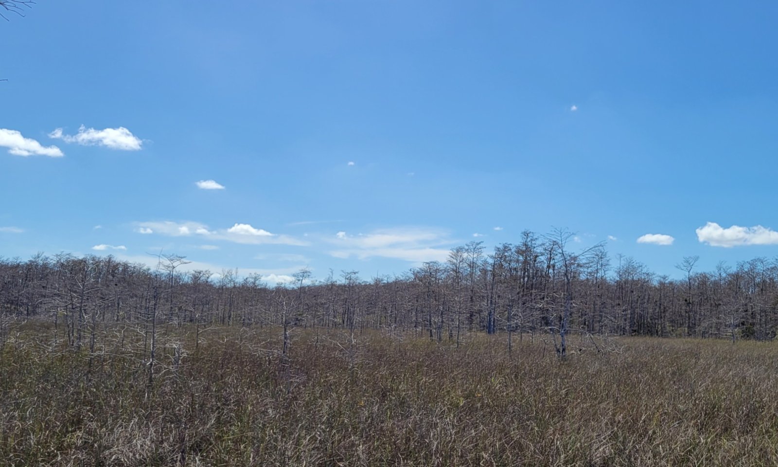
The Subtropical Freshwater Cypress Swamps of Big Cypress ecological community is very poorly drained where water is at or above ground level 200 to 300 days out of the year. This community is dominated primarily by cypress with younger smaller trees along the outer edges, grading into larger and older trees towards the interior, giving the community a distinctively rounded cross-section profile. In the deepest areas of a cypress swamp unable to support woody vegetation, open water with submerged aquatic vegetation and floating species may be present, and can support herbaceous species during the short dry periods. The main source of water in this community comes from rainfall and drains from the outer pyrogenic communities through the swamps into the lowest point of the landscape. The normal fire cycle might be as short as 3 to 5 years along the outer edges burning in from surrounding pyrogenic communities, and as long as 100 to 200 years towards the center except during periods of extreme drought. The submerged or saturated condition of the soil and general absence of fire help reduce competition and keep the community from a successional change to hardwood vegetation. These can exist as small isolated swamps or large expansive areas. This community is mainly used for recreation and includes the Big Cypress Natural Preserve, but other activities such as logging was once a major industry in cypress swamps.
Associated sites
F156AY020FL Subtropical Forested Rocklands of Big Cypress
The Subtropical Forested Rocklands of Big Cypress occur in higher landscape positions and may grade into a cypress swamp, with pine and other tropical species being co-dominants with cypress before becoming a monostand of cypress. Hydroperiods are shorter and will contribute to the hydroperiod of cypress swamps via overland sheet flow.
F156AY030FL Subtropical Moist Hammocks of Big Cypress
The Subtropical Moist Hammocks of Big Cypress occur in slightly higher landscape positions and may grade into a cypress swamp, with a closed oak canopy and cypress emergent before becoming a monostand of cypress. Hydroperiods are slightly shorter and will contribute to the hydroperiod of cypress swamps via overland sheet flow.
R156AY040FL Subtropical Freshwater Non-Forested Wetlands of Big Cypress
The Subtropical Freshwater Non-Forested Wetlands of Big Cypress occurs in slightly higher landscape positions and may grade into a cypress swamp, with stunted cypress being present in a prairie complex along the gradient.
F156AY010FL Subtropical Pine Flatwoods and Palmetto Prairie of Big Cypress
The Subtropical Pine Flatwoods and Palmetto Prairies of Big Cypress occur in higher landscape positions and may grade into a cypress swamp, with pine trees being co-dominants in wet flatwoods systems with cypress before becoming a monostand of cypress. Hydroperiods are shorter and will contribute to the hydroperiod of cypress swamps via overland sheet flow.
Similar sites
F156AY330FL Subtropical Freshwater Cypress Swamps of Miami Ridge / Atlantic Coastal Strip
The Subtropical Freshwater Cypress Swamps of Miami Ridge / Atlantic Coastal Strip occur in a separate ecoregion which have greater amounts of urbanization and slightly higher amounts of rainfall and greater elevation. Species composition and vegetative structure are similar. Resource concerns are reflected differently and require different management needs.
R156AY040FL Subtropical Freshwater Non-Forested Wetlands of Big Cypress
The Subtropical Freshwater Non-Forested Wetlands of Big Cypress may be confused with this site in prairies where stunted cypress trees may be present. It can be distinguished by the presences of dense understory grasses found in this concept compared to an open to sparse understory of the Cypress Swamps.
F156AY030FL Subtropical Moist Hammocks of Big Cypress
The Subtropical Moist Hammocks of Big Cypress may be confused with the mixed hardwood swamp state due to the presence of deciduous hardwood species. Vegetative community will be primarily driven by the accumulation of organic matter which slightly raises the landscape over time rather than consisting of sand with little to no organic matter.
F156AY210FL Subtropical Freshwater Forested Wetlands of Everglades
The Subtropical Freshwater Forested Wetlands of Everglades in a separate ecoregion found primarily as rises (tree islands) in a surrounding low broad flat (Subtropical Freshwater Non-Forested Glades Marsh and Slough Wetlands of Everglades). These are generally small in extent and will have extended hydroperiods due to the freshwater inputs to the surrounding system. Resource concerns are reflected differently and require different management needs.
Table 1. Dominant plant species
Tree (1) Taxodium distichum
(2) Taxodium ascendensShrub (1) Morella cerifera
(2) HypericumHerbaceous (1) Panicum hemitomon
(2) RhynchosporaPhysiographic features
These sites occur on linear concave areas that are highly protected and subject to extended hydroperiods, such that undecomposed organic matter accumulates in depressions allowing water to accumulate and excludes hardwood vegetation. Cypress swamps occur in the lowest position of this landscape and hold water for the majority of the year, except in extreme droughts. Cypress swamps form with the dissolving of limestone cap rocks (crust like upper zones of rock that have been solidified (indurated) through exposure) that collapse over time, resulting in long hydroperiods what support anaerobic decomposition and peat accumulation . This site occurs mostly on very gentle slopes (0-2%).
Geology: With its low-laying landmass, this area has been repeatedly submerged and exposed with variations in sea level over the past 50,000 years, creating thousands of feet of roughly horizontal geological layers rich in carbonates. The whole of Big Cypress ecoregion falls over the Pliocene series Tamiami Formation, a poorly defined lithostratigraphic unit containing a wide range of mixed carbonate-siliciclastic lithologies and associated faunas occurring at or near the surface. Fossils present in the Tamiami occur as molds, casts and original material. The fossils present include barnacles, mollusks, corals, echinoids, foraminifers and calcareous nannoplankton. The Tamiami Formation has highly permeable to impermeable lithologies that form a complex aquifer. Locally, it is part of the surficial aquifer system. In other areas, it forms a part of the intermediate confining unit/aquifer system (Scott, 2001).
Figure 1. Geologic aspects of cypress swamp formations in Big Cypress. Image modified from Duever et al. 1979.
Table 2. Representative physiographic features
Geomorphic position, flats (1) Dip
(2) Talf
Geomorphic position, terraces (1) Tread
Slope shape across (1) Concave
Slope shape up-down (1) Linear
(2) Concave
Landforms (1) Coastal plain
(2) Marine terrace > Depression > Open depression
(3) Marine terrace > Trough
(4) Marine terrace > Swamp
(5) Marine terrace > Drainageway
Runoff class Very low to low Flooding duration Extremely brief (0.1 to 4 hours) to very long (more than 30 days) Flooding frequency None to frequent Ponding duration Brief (2 to 7 days) to very long (more than 30 days) Ponding frequency Occasional to frequent Elevation 0 – 25 ft Slope 0 – 2 % Ponding depth 0 – 48 in Water table depth 0 – 18 in Aspect Aspect is not a significant factor Climatic features
The climate of MLRA 156A is subtropical, with mild winters and hot wet summers. The average annual precipitation of this MLRA is 37 to 62 inches (950 to 1,565 millimeters). About 60 percent of the precipitation occurs from June through September. Most of the rainfall occurs during moderate intensity, tropical storms that produce large amounts of rain from late spring through early autumn. Late autumn and winter are relatively dry. The average annual temperature of the MLRA is 74 to 78 degrees F (23 to 26 degrees C). The freeze-free period of the MLRA averages 355 days and ranges from 345 to 365 days.
The following tables and graphs consist of specific climate stations found within the range of this ecological site within this MLRA.Table 3 Representative climatic features
Frost-free period (characteristic range) 370 days Freeze-free period (characteristic range) 370 days Precipitation total (characteristic range) 50-60 in Frost-free period (actual range) 370 days Freeze-free period (actual range) 370 days Precipitation total (actual range) 50-60 in Frost-free period (average) 370 days Freeze-free period (average) 370 days Precipitation total (average) 60 in Characteristic rangeActual rangeBarLineFigure 2. Monthly precipitation range
Characteristic rangeActual rangeBarLineFigure 3. Monthly minimum temperature range
Characteristic rangeActual rangeBarLineFigure 4. Monthly maximum temperature range
BarLineFigure 5. Monthly average minimum and maximum temperature
Figure 6. Annual precipitation pattern
Figure 7 Annual average temperature pattern
Climate stations used
-
(1) EVERGLADES [USC00082850], Naples, FL
-
(2) OASIS RS [USC00086406], Ochopee, FL
-
(3) TAMIAMI TRL 40 MI BEND [USC00088780], Miami, FL
-
(4) BIG CYPRESS [USC00080737], Clewiston, FL
-
(5) IMMOKALEE [USC00084210], Immokalee, FL
-
(6) NAPLES [USC00086078], Naples, FL
">Influencing water features
Typical cypress swamps within the Big Cypress ecoregion derive much of their water through runoff from surrounding upland communities as sheet flow from rainfall, with normal hydroperiods extending from 200 to 300 days per year. Water levels rise with increasing rainfall around June and then decrease to their lowest levels during late winter and early spring. Water is the deepest and remains the longest in the center of the swamps where the trees are biggest.
Wetland description
Wetland Description: Cowardin<br />
System: Palustrine<br />
Subsystem: NA<br />
Class: Forested Wetland
Figure 8. Conceptual hydrologic system model of South Florida. Image modified from Swain et al. 2019.

Figure 9. Historical development of South Florida canal systems from 1900 - 1920 before the establishment of Big Cypress National Preserve in 1974. Image modified from Duever et al. 1979.

Figure 10. Historical development of South Florida canal systems from 1930 - 1950 before the establishment of Big Cypress National Preserve in 1974. Image modified from Duever et al. 1979.

Figure 11. Historical development of South Florida canal systems from 1960 - 1970 before the establishment of Big Cypress National Preserve in 1974. Image modified from Duever et al. 1979.
Soil features
Soils associate with this ecological site occur in the isohyperthermic soil temperature regime of MLRA 156A. The isohyperthermic soil temperature regime has mean annual soil temperatures of 22 °C (72⁰F) or more and a difference between mean summer and mean winter soil temperatures of less than 5 °C (41⁰F) at 50 cm (20 inches) below the surface.
These soils are deep, very poorly drained soils that were historically formed in sandy and loamy marine deposits over limestone troughs which over time began to accumulate organic matter. The swamp will be typically composed of a layer of peat of variable thickness underlain with acidic sands over limestone bedrock or a clay lens. The largest layers of peat accumulate in the deepest areas over thin layers of sand, and smaller peat layers with larger sand layers increasing towards the periphery, illustrating flat topography. Representative soils within this ecoregion may include Big Cypress, Gator, Goddens Strand, Macks Camp, Perrine, Plantation, Romar Ranch, and Tarpans. Rock outcrops of exposed limestone bedrock may be present within this community.Table 4. Representative soil features
Parent material (1) Marine deposits
(2) Residuum – limestone
(3) Herbaceous organic material
Surface texture (1) Highly organic, mucky fine sand
(2) Highly organic, mucky fine sandy loam
Drainage class Very poorly drained to poorly drained Permeability class Slow to rapid Depth to restrictive layer 54 in Soil depth 10 – 54 in Surface fragment cover <=3" Not specified Surface fragment cover >3" Not specified Available water capacity
(0-54in)0.8 – 6.4 in Calcium carbonate equivalent
(0-54in)0 – 10 % Electrical conductivity
(0-54in)0 – 1 mmhos/cm Sodium adsorption ratio
(0-54in)1 Soil reaction (1:1 water)
(0-54in)5.8 – 8.2 Subsurface fragment volume <=3"
(0-54in)0 – 5 % Subsurface fragment volume >3"
(0-54in)Not specified Ecological dynamics
The information presented in this ecological site description (ESD) and state-and-transition model (STM) were developed using archaeological and historical information, published and unpublished scientific reports, professional experience, consultation with technical experts, and NRCS inventories and studies. The information presented represents a complex set of plant community dynamic and environmental variables. Not all scenarios or plants are represented and included. Key indicator plants, animals, and ecological processes are described to help guide land management decisions and actions.
This site is found in depressions dominated by hydrophytic trees within the Big Cypress ecoregion. These are wet sites with long hydroperiods and rare fires that produce sparse understory vegetation and allow both deciduous and coniferous tree species. Cypress species are tolerant of long hydroperiods but do not grow when inundated, slowing cypress growth to only a few months during the dry season. During the dry season herbaceous species may be present on the surface when water is drained from the system. Extended hydroperiods may prevent reproduction by inhibiting seed germination or drowning seedlings. For new cypress trees to survive they must grow enough to survive inundation of the next wet season. Slow moving water from the northeast (Lake Okeechobee / Okalaocoochee Slough) to the southwest (gulf) allows cypress to grow much better than in standing water due to increased aeration and nutrient availability. During periods of extended drought, invasion of long hydroperiod intolerant hardwood species might occur, assisting transition to an altered ecological state in the absence of fire as well.
Infrequent to occasional fires are common in these communities, preventing hardwood invasion and peat accumulation that would convert the cypress swamp to a bayhead. Cypress swamps dominated by bays are close to this transition. Fire frequency is greatest at the periphery of the dome and least in the interior, where long hydroperiods and deep peat maintain high moisture levels for most of the year. The normal fire cycle might be as short as 3 to 5 years along the outer edge and as long as 100 to 150 years towards the center. The profile of a cypress swamp (i.e., smaller trees at the periphery and largest trees near the center) is attributable to this fire regime. The shorter hydroperiods along the periphery permit fires to burn into the edge more often, occasionally killing the outer trees and burning surficial organic matter, preventing accumulation. Cypress is very tolerant of light surface fires, but muck fires burning into the peat can kill them, lowering the ground surface, and transform a swamp into a shrub dominated wetland. Where severe fires have killed cypress, coastalplain willow and bay species commonly establishes as a thicket.
Within cypress swamps, topographic microsites can be found building on cypress knees and buttressed trunks, providing important habitat for trees, shrubs, and other herbaceous seedlings. Raised mats of root fibers and peat form hummocks at the bases of trees and shrubs or on old tree stumps, allowing a more diverse and mesic microsite to establish above the seasonally high-water levels. Buttresses of the cypress trunks are typical indicators within cypress swamps of prolonged periods of inundation mixed with periods of aeration. The function of cypress knees is still widely not understood but are theorized to assist in gas exchange to roots during periods of inundation. Dome swamps are typically small (compared to other swamp types) and circular or elliptical in shape but can occur in any size or shape on the landscape, especially if the swamp is shallow, and can be seen as isolated swamps or within a larger strand. Dome swamps can completely surround or appear as fringes on the edge of depression marshes, and often have marsh vegetation within the center area due to the consistent flooded conditions in the lowest point of the landscape where cypress vegetation is unable to establish. Strand swamps may be similar to other swamps in Florida, but dome swamps occur in relatively closed depressions with little water flow except during heavy rainfall. However, with additional subsidence in the limestone substrate, these domes can grow together, forming an irregular strand.
The hydrologic flow may be altered in cypress swamps due to roads and old logging trams running perpendicular to water flow can impede water, causing unnatural ponding on the upstream side and droughty conditions on the downstream side. Exotic pest plants that show the greatest potential for disrupting strand swamp communities include old world climbing fern (Lygodium microphyllum), Java plum (Syzygium cumini), and Peruvian primrosewillow (Ludwigia peruviana). Brazilian pepper (Schinus terebinthifolius) and melaleuca (Melaleuca quinquenervia) can also invade artificially drained sites and drier edges. These species have the potential to crowd out native plants and form large monocultures. Old world climbing fern can cover trees and create a ladder for fires to burn into the canopy. Human alterations to surrounding communities can inadvertently drain these sites, making them susceptible to catastrophic fires, in which the organic matter accumulation will be lost, reverting the community back to cypress swamp vegetation or to shrub thickets, depending on the root damage from the fire. Drainage will allow for invasive species to become established that can outcompete the native vegetation. This state is easy to distinguish from cypress swamps by going from an open understory to thick dense vegetation due to hardwood growth.
Maintenance or restoration of natural hydroperiods is critical to wetland communities and artificial drainage creates opportunity for catastrophic peat fires. Historic photographs within the Big Cypress ecoregion show that increased logging during the 1900s led to a shift in baygall vegetation from cypress swamps as well as flatwood communities, with shrub layers limiting pine regeneration but not limiting bay species growth.State and transition model
More interactive model formats are also available. View Interactive Models
Click on state and transition labels to scroll to the respective textEcosystem states
States 1, 5 and 2 (additional transitions)
T1A - Organic Matter Accumulation / Logging of Overstory Cypress T1B - Invasion of Non-Native / Exotic Species T1C - Decrease in Localized Long Term Hydroperiod and Modify for Desired Land Use T1D - Decrease in Localized Long Term Hydroperiod and Human Alteration / Transportation of Soil Materials T2A - Cypress Regeneration / Light Surface Fire T2B - Invasion of Non-Native / Exotic Species T2C - Decrease in Localized Long Term Hydroperiod and Modify for Desired Land Use T2D - Decrease in Localized Long Term Hydroperiod and Human Alteration / Transportation of Soil Materials R3A - Mechanical / Biological / Chemical Removal of Species R3B - Mechanical / Biological / Chemical Removal of Species R3C - Mechanical / Biological / Chemical Removal of Undesirable Species T3A - Decrease in Localized Long Term Hydroperiod and Human Alteration / Transportation of Soil Materials R4A - Landscape and Habitat Restoration R4B - Landscape and Habitat Restoration T4A - Invasion of Non-Native / Exotic Species T4B - Decrease in Localized Long Term Hydroperiod and Human Alteration / Transportation of Soil Materials State 1 submodel, plant communities
1.1A - Swamp Expansion State 2 submodel, plant communities
2.1A - Root Killing Peat Fire 2.2A - Organic Matter Accumulation over Time State 4 submodel, plant communities
Communities 2 and 5 (additional pathways)
4.1A - Land Clearing Practices 4.2A - Landscape and Habitat Restoration 4.2B - Pasture Preparation 4.2C - Agricultural Preparation 4.2D - Silvicultural Preparation 4.3A - Land Clearing Practices 4.3B - Agricultural Preparation 4.3C - Silvicultural Preparation 4.4A - Land Clearing Practices 4.4B - Silvicultural Preparation 4.5A - Land Clearing Practices State 5 submodel, plant communities
5.1A - Urban Development 5.1B - Waste Accumulation 5.2A - Land Reclamation 5.2B - Industrial / Urban Development 5.2C - Waste Accumulation 5.3A - Land Reclamation State 1
Cypress Swamps
Figure 12. Interior cypress swamp in Big Cypress National Preserve during the wet season. Standing water will collect from rainfall and overland flow from upland communities until it may flow out of the swamp as slow sheet water flow.

Figure 13. Buttressed trunks resulting from long hydroperiods found in interior cypress swamp in Big Cypress National Preserve. When water is absent from the system during the dry season sparse perennial hydrophytic species may grow in the understory.

Figure 14. Understory of interior cypress swamp in April in the Big Cypress National Preserve. As standing water collects from rainfall, sparse perennial hydrophytic species not found on micro highs will become inundated for the wet season.
The natural (native) vegetation of this state is mainly dominated by Bald Cypress and Pond Cypress (Taxodium distichum and T. ascendens, respectfully). Occasional fire contributes to the maintenance of a cypress dominated community; without fire, hardwood invasion and peat accumulation create a mixed hardwood and cypress swamp, and under certain conditions the strand may convert to a hardwood forest. In the center of the swamp, there may be open marshes or deeper sloughs. Cypress Swamps have small young trees towards their outer edges, grading into larger and older stands towards the interior, giving the community a distinctively rounded cross -section profile. This site occurs when organic soils accumulate in depressions that are inundated for much of the year, particularly during summer months when litter decomposition rates are high. These organic soils create a unique environment that increases species diversity and structural development in South Florida wetland communities.
Characteristics and indicators. This state is characterized by nearly pure stands of cypress trees (Taxodium spp.) that are distinguished by buttressed trunks. They have smaller, younger trees along the periphery of the swamps, grading into larger and older trees in the center. This gives the community a distinctively rounded cross-section profile.
Resilience management. This state is maintained by both stressors from water and fire. Hydroperiods range from 200 to 300 days per year which only allow flooding tolerant species to survive. Drainage of this site can allow for the invasion of non-native and exotic species and transition the site to a more mesic hardwood community. Fire is another major stressor in this state, with interior swamps burning at long time periods up to every 100 to 150 years, and the edges every 3 to 5 years. The stress from fire prevents the accumulation of organic matter and transition into a hardwood community.
Dominant plant species
-
pond cypress (Taxodium ascendens), tree
-
bald cypress (Taxodium distichum), tree
-
coastal plain willow (Salix caroliniana), shrub
-
Jamaica swamp sawgrass (Cladium mariscus ssp. jamaicense), grass
-
toothed midsorus fern (Blechnum serrulatum), other herbaceous
-
royal fern (Osmunda regalis var. spectabilis), other herbaceous
-
airplant (Tillandsia), other herbaceous
Dominant resource concerns
-
Sheet and rill erosion
-
Subsidence
-
Organic matter depletion
-
Ponding and flooding
-
Seasonal high water table
Community 1.1
Dome Swamp
Figure 15. Isolated Cypress Dome as seen from above within pyrogenic flatwoods community. While it looks like a dome from afar on the ground, dome swamps may have open depressions in the center, giving it a doughnut appearance.

Figure 16. Cypress dome seen from afar in summer. Oldest tallest trees grow in the center while younger smaller trees grow on the periphery, giving it a characteristic dome shape.

Figure 17. Cypress dome seen from afar in winter. Cypress are deciduous conifers which drop their needles in the winter months.
Typically defined as an isolated, forested, depression wetland occurring within a fire-maintained community. These swamps are generally small but may also be large and shallow. They occur when acid byproducts of organic matter decomposition dissolve limestone bedrock causing the soil to slump over the sinkhole, creating a conical depression. These domes have thick layers of peat in the center which is able to hold water for the majority of the year, with the tallest, biggest cypress trees in the center of the dome and smallest, youngest cypress trees on the outskirts. This gives the dome a distinctly rounded cross-sectional profile. Isolated freshwater marshes in the center of the dome can also give it a doughnut shape from aerial views. The isolated deep center zone of a dome swamp will have open water support submerged aquatic vegetation and floating species in the wet season, and can support herbaceous grasses and forbs during the short dry periods.
Resilience management. These wetlands function as reservoirs that recharge the aquifer when adjacent water tables drop and fluctuate with seasonal rainfall. The normal hydroperiod is 200 to 300 days out of the year which acts as a stressor to maintain this community to prevent transition to another community. Normal fire return intervals range anywhere form 3 to 5 years along the outer edge to as long as 100 to 150 years along the inner dome. Fire is used to maintain this community, without periodic fires hardwood invasion and peat accumulation would convert the dome to a hardwood forest. Depending on the extent of limestone trough or sinkhole, the dome swamp may expand into an irregular formed strand swamp.
Dominant plant species
-
pond cypress (Taxodium ascendens), tree
-
red maple (Acer rubrum), tree
-
dahoon (Ilex cassine), tree
-
swamp bay (Persea palustris), tree
-
Florida slash pine (Pinus elliottii var. densa), tree
-
sweetbay (Magnolia virginiana), tree
-
loblolly bay (Gordonia lasianthus), tree
-
coco plum (Chrysobalanus icaco), tree
-
pond apple (Annona glabra), tree
-
Virginia sweetspire (Itea virginica), shrub
-
fetterbush lyonia (Lyonia lucida), shrub
-
common buttonbush (Cephalanthus occidentalis), shrub
-
coastal plain willow (Salix caroliniana), shrub
-
wax myrtle (Morella cerifera), shrub
-
St. Johnswort (Hypericum), shrub
-
maidencane (Panicum hemitomon), grass
-
Jamaica swamp sawgrass (Cladium mariscus ssp. jamaicense), grass
-
beaksedge (Rhynchospora), grass
-
Virginia chainfern (Woodwardia virginica), other herbaceous
-
royal fern (Osmunda regalis var. spectabilis), other herbaceous
-
cinnamon fern (Osmunda cinnamomea), other herbaceous
-
toothed midsorus fern (Blechnum serrulatum), other herbaceous
-
lizard's tail (Saururus cernuus), other herbaceous
-
Carolina redroot (Lachnanthes caroliana), other herbaceous
-
taperleaf water horehound (Lycopus rubellus), other herbaceous
-
false nettle (Boehmeria), other herbaceous
-
knotweed (Polygonum), other herbaceous
-
sphagnum (Sphagnum), other herbaceous
-
eastern poison ivy (Toxicodendron radicans), other herbaceous
-
white twinevine (Funastrum clausum), other herbaceous
-
airplant (Tillandsia), other herbaceous
-
bent alligator-flag (Thalia geniculata), other herbaceous
-
bulltongue arrowhead (Sagittaria lancifolia), other herbaceous
Community 1.2
Strand Swamp
Figure 18. Exterior of a Strand Swamp in the Big Cypress National Preserve seen from afar in the winter.

Figure 19. Strand Swamp in the Big Cypress National Preserve. These wetlands have long hydroperiods and can hold water for 200 to 300 days per year.

Figure 20. Center of a Strand Swamp in the Big Cypress Ecoregion. This area has the deepest organic material with hydroperiods that often last throughout the year. It is dominated by floating aquatic emergent vegetation or open water.
Strand Swamps are shallow, forested, usually elongated depression or channel situated in a trough within a flat limestone plain, with small, young, cypress trees at the outer edge grading into large, old cypress trees in the interior. The strand has a distinctly rounded cross-sectional profile. Strand swamps are deepest and have peat towards the center, with the edges having little organic matter over sand. Microsites found on cypress knees or slight topographic highs permit for more mesic species to be found in this highly diverse community. This community will often form from continuing lowering of bedrock surface by dissolution and mechanical break up of cap rocks by trees, connecting isolated dome swamps into a larger isolated swamp system.
Resilience management. These wetlands function as reservoirs that recharge the aquifer when adjacent water tables drop and fluctuate with seasonal rainfall. The normal hydroperiod is 200 to 300 days out of the year which acts as a stressor to maintain this community to prevent transition to another community. Normal fire return intervals range anywhere form 3 to 5 years along the outer edge to as long as 100 to 150 years along the inner swamp. Fire is used to maintain this community, without periodic fires hardwood invasion and peat accumulation would convert the dome to a hardwood forest.
Dominant plant species
-
pond cypress (Taxodium ascendens), tree
-
bald cypress (Taxodium distichum), tree
-
red maple (Acer rubrum), tree
-
pond apple (Annona glabra), tree
-
laurel oak (Quercus laurifolia), tree
-
cabbage palmetto (Sabal palmetto), tree
-
Florida strangler fig (Ficus aurea), tree
-
swamp bay (Persea palustris), shrub
-
sweetbay (Magnolia virginiana), shrub
-
coastal plain willow (Salix caroliniana), shrub
-
wax myrtle (Morella cerifera), shrub
-
common buttonbush (Cephalanthus occidentalis), shrub
-
Jamaica swamp sawgrass (Cladium mariscus ssp. jamaicense), grass
-
seven sisters (Crinum americanum), other herbaceous
-
inland leatherfern (Acrostichum danaeifolium), other herbaceous
-
toothed midsorus fern (Blechnum serrulatum), other herbaceous
-
royal fern (Osmunda regalis var. spectabilis), other herbaceous
-
airplant (Tillandsia), other herbaceous
-
white twinevine (Funastrum clausum), other herbaceous
-
waterhyssop (Bacopa), other herbaceous
Pathway 1.1A
Community 1.1 to 1.2
Dome Swamp
Strand SwampSwamp expansion occurs via seeding from trees and seed dispersal from birds or other animals. If the conditions are met for dome swamps to expand then they will grow out to form a strand swamp over a long period of time.
Context dependence.Swamp expansion can occur if the depression in the limestone bedrock that formed the dome swamp extends further out. If the dome swamp exists within a limestone trough it may extend to form a fully developed strand swamp. This is not only a spatially depending process, depending on the depressions formed in limestone bedrock that allows peat accumulation, but temporally dependent as well. For the swamp to expand larger it would take centuries to achieve full growth in the representative landscape. This is also depending on the natural landscape remaining the same with no alterations in land use changes or hydrologic flow.
Key drivers
-
Fire
-
Seeding
-
Hydrology
State 2
Mixed Hardwood SwampsHardwood swamps are dominated by a mix of hydrophytic hardwood trees including bays and cabbage palms. This state occurs on low, wet sites and has short hydroperiods that are inundated seldom over 60 days per year, but are maintained on a consistently saturated peat substrate. These communities form within the Big Cypress region when fire is excluded from cypress swamps for an extended period, allowing organic matter accumulation to create shallower depressions in the landscape, shortening the hydroperiod. With greater accumulation of organic matter and a shortened hydroperiod, hardwood vegetation can become established and, over time, shade out the existing vegetation. Shading from the newly established hardwood species will perpetuate organic matter accumulation and moist soil conditions, favoring this state, continuing the expansion of these communities.
Characteristics and indicators. Hardwood swamps are characterized by hardwood hydrophytic species such as bays and cabbage palms as well as cypress. They are constantly saturated but only inundated for about 60 days per year during the wet season of the summer months (June- October).
Resilience management. The main influencing factors in this state consist of infrequent to occasional fires and long term hydroperiods. Human alterations to surrounding communities can inadvertently drain these sites, making them susceptible to catastrophic fires, in which the organic matter accumulation will be lost, reverting the community back to cypress swamp vegetation or to shrub thickets, depending on the root damage from the fire. Increases in long term hydroperiods will shift the community back towards a cypress swamp as the hardwood species can tolerate some flooding but not the same amount as cypress. Drainage will allow for invasive species to become established that can outcompete the native vegetation.
Dominant plant species
-
sweetbay (Magnolia virginiana), tree
-
loblolly bay (Gordonia lasianthus), tree
-
swamp bay (Persea palustris), tree
-
cabbage palmetto (Sabal palmetto), tree
Dominant resource concerns
-
Subsidence
-
Organic matter depletion
-
Ponding and flooding
-
Seasonal high water table
-
Nutrients transported to surface water
-
Plant productivity and health
-
Plant structure and composition
Community 2.1
Cypress Dominated BaygallBaygall, also referred to as bay swamps or bay heads, are evergreen forested wetlands of bay species in a large basin with deep peat soils that are acidic within a well developed forest. They typically develop on wet soils in depressions and in stagnant drainages that maintain a saturated peat substrate via seepage, rainfall, or capillary action. This community varies in size and can range from small tree islands within marsh or prairie communities to many acres within a mature forest. Within the Big Cypress ecoregion this community is restricted to pockets on tree islands and within mature cypress swamps. They develop when fire has been excluded from cypress swamps, allowing organic matter to accumulate and creating a positive feedback that allows the establishment of bays. Cypress swamps are very similar to baygalls, with many instances of intermediate stages between these communities primarily caused by fire and logging history. However, cypress swamps experience greater water fluctuation and greater water depths than baygalls
Resilience management. As the bay species grow, the shade intolerant cypress species are inhibited which shifts vegetation and soil conditions to favor shade intolerant species to germinate and grow in low light conditions.
Community 2.2
Shrub ThicketThis community is the result from a peat fire that killed the existing root system of the dominant hardwood species. Where the peat layer and root systems are destroyed, the area may be lowered and dominant hardwood and regenerating cypress killed. The area may then be replaced by a monospecific stand of willow or pop ash, which have readily dispersible seeds.
Resilience management. Lack of fire is used to maintain this community and what differentiates it from shrub bogs. Over time the lack of fire will cause a transition back to a baygall community as accumulation of organic matter raises the surface of the ground above the seasonal high water table and allow for hardwood species to regrow. Due to their low position in the landscape this can be anywhere from a few centimeters to a few inches difference from seasonal flooding to being dry.
Pathway 2.1A
Community 2.1 to 2.2A deep peat burn consumes the medium in which roots grow and thus eliminates recovery by resprout. Trees that survive with fire-damaged roots may later be blown over in high intensity storm events. Depending on the amount of peat burned, the ground level may be lowered so much the hydroperiod may be too long for cypress regeneration. The lowered peat and longer hydroperiod allow for the growth of shrub thickets such as willow heads or bays. If the ground level is lowered far enough, open water may create an open lake.
Context dependence.Fires that can destroy the peat layer typically happen during periods of drought, when the water table is lowered enough for the peat to begin to dry out and readily burn. Fires can be devastating and burn very rapidly through this area or can smolder for long periods of time.
Key drivers
-
Fire
-
Temperature (decadal scale)
-
Fire frequency
Pathway 2.2A
Community 2.2 to 2.1The main driver in this transition is the absence of fire which allows the accumulation of organic matter. This can raise the surface of the ground by a few centimeters or inches which will change the depth to the seasonal high water table allowing for the full development of bay species.
Context dependence.Growth of hardwood species can cause a positive feedback loop in which the ground layer becomes shaded and remains moist for longer periods, excluding fire from the system and allowing for the accumulation of organic matter which can raise the ground surface over time.
Key drivers
-
Fire
-
Time
State 3
Invasive Non-Native CommunityThis state consists of Florida Department of Agriculture and Consumer Services (FDACS) Non-Native Category 1 Species list . More information on these species list can be found:
https://www.fdacs.gov/content/download/63140/file/Florida%E2%80%99s_Pest_Plants.pdf
or by contacting the UF / IFAS Center for Aquatic and Invasive Plants (http://plants.ifas.ufl.edu/),
the UF / IFAS Assessment of Non-native Plants in Florida's Natural Areas (https://assessment.ifas.ufl.edu/),
or the FWC Invasive Plant Management Section (http://myfwc.com/wildlifehabitats/invasive-plants/).
This community will not represent every possibility of invasive species but rather the most common in these areas.
Characteristics and indicators. Non-Native species include species that exist outside of Florida's natural range and are introduced to the state via people, weather events, or any other means.
Resilience management. This state can be found as a part of any other state or community and can completely destroy the native habitat if not properly managed. Restoration to natural communities after exotic invasion include practices such as mechanical and chemical removal.
Dominant resource concerns
-
Subsidence
-
Concentration of salts or other chemicals
-
Nutrients transported to surface water
-
Plant productivity and health
-
Plant structure and composition
State 4
Managed Resource AreasThe following communities comprise the major land uses in the United States and the land uses receiving the majority of the conservation treatment that address soil, water, air, plant, and animal resources within the USDA.
Characteristics and indicators. These land uses consist of areas that are not completely naturalized (i.e. native habitat) but are not completely altered by anthropogenic means.
Dominant resource concerns
-
Sheet and rill erosion
-
Wind erosion
-
Subsidence
-
Organic matter depletion
-
Concentration of salts or other chemicals
-
Seasonal high water table
-
Nutrients transported to surface water
-
Inadequate livestock shelter
Community 4.1
RangelandRangelands are described as lands on which the indigenous vegetation is predominately grasses, grass-like plants, forbs, and possibly shrubs or dispersed trees. Existing plant communities can include both native and introduced plants. Primary export from Florida ranges are cattle and have been present in the state since their first introduction by Spanish explorers in 1521. This is the reference community for this state because it requires very little alterations to the landscape for grazing species.
Rangelands provide a diversity of ecosystems and also provide a diverse and significant production of economic benefits and ecosystem goods and services. Livestock production along with sustainable wildlife populations provide for the major direct economic benefits, but also tourism, recreational uses, minerals/energy production, renewable energy, and other natural resource uses can be very significant. Vital ecosystem contributions include clean water, clean air, fish/wildlife habitat, as well as intangible considerations such as historical, cultural, aesthetic and spiritual values.
Resilience management. Grazing, by both domestic livestock and wildlife, is the most common ecological management process, with fire and weather extremes also being significant ecological factors. For information regarding specific cattle grazing techniques please contact your local NRCS office.
Community 4.2
Open Transitional Managed CommunitiesThis is an area that is managed to maintain open land before shifting to another community. These communities are often used as transitional periods from one practice to another and could lead to an abandoned / fallow field.
Community 4.3
Improved PasturePasture is a land use type having vegetation cover comprised primarily of introduced or enhanced native forage species that is used for livestock grazing. Pasture vegetation can consist of grasses, legumes, other forbs, shrubs or a mixture. The majority of these forages are introduced, having originally come from areas in other states or continents. Most are now naturalized and are vital components of pasture based grazing systems.
Pasture lands provide many benefits other than forage for livestock. Wildlife use pasture as shelter and for food sources. Well managed pasture captures rainwater that is slowly infiltrated into the soil which helps recharge groundwater. Many small pasture livestock operations are near urban areas providing vistas for everyone to enjoy.
Resilience management. Pastures receive periodic renovation and cultural treatments such as tillage, fertilization, mowing, weed control, and may be irrigated. For more information regarding specific pasture management please contact your local NRCS office.
Community 4.4
AgricultureThe agriculture industry includes cultivated crops, aquaculture, and apiculture. Cultivated cropland includes areas used for the production of adapted crops for harvest. These areas comprises land in row crops or close-grown crops that are in a rotation with row or close-grown crops. Primary export from Florida consists of fruits, greenhouse and nursery products, sugar cane, and the signature export of citrus. Aquaculture includes the cultivation and maintenance of aquatic plants, aquatic reptiles, crustaceans, food/ ornamental fish, shellfish, and other miscellaneous species for harvesting. Apiculture includes the maintenance of honeybees and hives to provide beeswax, honey/ other edible bee products, crop pollination services, and sales of bees to other beekeepers. These areas have been modified resulting in land clearing practices and hydrologic management to fit the growers needs.
Resilience management. Major natural resource concerns facing cropland include: (1) erosion by wind and water, (2) maintaining and enhancing soil quality, (3) water quality from nutrient and pesticides runoff and leaching, and (4) managing the quantity of water available for irrigation. For more specific information regarding cropland please contact your local NRCS office.
Community 4.5
SilvicultureSilviculture is land used in controlling the establishment, growth, composition, health, and quality of forests and woodlands to meet the diverse needs and values of landowners and society such as wildlife habitat, timber, water resources, restoration, and recreation on a sustainable basis. These are forestry practices that include thinning, harvesting, planting, pruning, prescribed burning and site preparation, for managed goals such as wildlife habitat creation or harvesting. Many managed silvicultural lands in Florida include tree plantations for growth of tropical ornamental species such as palms; and lumber, pulp, and paper species such as slash pine, longleaf pine, cypress, and eucalyptus.
This community also include management practices of agroforestry, the intentional mixing
of trees and shrubs into crop and/or animal production systems to create environmental, economic and social benefits. This is included in this community and not any other state because the primary management is for tree species. This may include practices such as riparian forest buffers, windbreaks, forest farming, silvopasture, and alley cropping.
Resilience management. Management of silvicultural lands require specific prescriptions based on the management goals for the stand, and may include thinning, harvesting, planting, pruning, prescribed burning and site preparation. For more information regarding specific management for silviculture practices please contact your local NRCS office.
Pathway 4.1A
Community 4.1 to 4.2This pathway is driven by land clearing practices that consists of removing the existing vegetation from the habitat and altering the habitat to prepare for modified land use.
Pathway 4.2A
Community 4.2 to 4.1This pathway is driven by the restoration of the native habitat for the use of rangeland. This includes restoration of both the natural hydroperiod and landscape in advance of replanting native species. This is a time-consuming process and often results in second-hand community structure. Once restored to a natural capacity the introduction of grazing species to the system creates a managed rangeland.
Pathway 4.2B
Community 4.2 to 4.3This pathway is driven by preparing the land for pasteurization. This includes the planting of vegetation consisting of grasses, legumes, other forbs, shrubs or a mixture that will provide preferred forage for managed grazing species.
Pathway 4.2C
Community 4.2 to 4.4This pathway is driven by the preparation of land for agricultural uses. This change is dependent on the type of agricultural community is being created, but often depends on the growing, maintenance, and cultivation of an agricultural product for consumers. This community may require modification to the land to fit the hydrologic requirement of the growing crop.
Pathway 4.2D
Community 4.2 to 4.5This pathway is driven by the preparation of the land for silvicultural purposes. This change is dependent on the type of silvicultural product being cultivated, as many different practices require different growth requirements.
Pathway 4.3A
Community 4.3 to 4.2This pathway is driven by land clearing practices that consists of removing the existing vegetation from the habitat and altering the habitat to prepare for modified land use.
Pathway 4.3B
Community 4.3 to 4.4This pathway is driven by the preparation of land for agricultural uses. This change is dependent on the type of agricultural community is being created, but often depends on the growing, maintenance, and cultivation of an agricultural product for consumers. This community may require modification to the land to fit the hydrologic requirement of the growing crop.
Pathway 4.3C
Community 4.3 to 4.5This pathway is driven by the preparation of the land for silvicultural purposes. This change is dependent on the type of silvicultural product being cultivated, as many different practices require different growth requirements.
Pathway 4.4A
Community 4.4 to 4.2This pathway is driven by land clearing practices that consists of removing the existing vegetation from the habitat and altering the habitat to prepare for modified land use.
Pathway 4.4B
Community 4.4 to 4.5This pathway is driven by the preparation of the land for silvicultural purposes. This change is dependent on the type of silvicultural product being cultivated, as many different practices require different growth requirements.
Pathway 4.5A
Community 4.5 to 4.2This pathway is driven by land clearing practices that consists of removing the existing vegetation from the habitat and altering the habitat to prepare for modified land use.
State 5
Human Altered and Human Transported Areas
Figure 21. Human Altered / Transported Areas such as this old canal in the Big Cypress National Preserve was used to drain water out of the system in the mid 1900s to urbanize and log the area.
These areas include soils that were intentionally and substantially modified by humans for an intended purpose, commonly for terraced agriculture, building support, mining, transportation, and commerce. The alteration is of sufficient magnitude to result in the introduction of a new parent material (human-transported material) or a profound change in the previously existing parent material (human-altered material). They do not include soils modified through standard agricultural practices or formed soils with unintended wind and water erosion. When a soil is on or above an anthropogenic landform or microfeature, it can be definitely associated with human activity and is assigned to a unique taxa, usually found as an "Urban land complex" within that communities' natural soil properties (e.g., Immokalee sand-Urban land complex, 0 to 2 percent slopes).
Resilience management. Evidence of these areas include soils with manufactured items (e.g. artifacts) present in the profile, human altered-materials (e.g., deeply excavated or deeply plowed soil) or human-transported material (e.g., fill), and position on or above anthropogenic landforms (e.g., flood-control levees) and microfeatures (e.g., drainage ditches). Detailed criteria regarding the identification of anthropogenic (artificial) landforms, human-altered materials, and human-transported material are in the "Keys to Soil Taxonomy" (Soil Survey Staff, 2014).
Dominant resource concerns
-
Compaction
-
Ponding and flooding
-
Seasonal high water table
-
Emissions of greenhouse gases (GHGs)
-
Objectionable odors
-
Plant productivity and health
-
Plant structure and composition
Community 5.1
Reclaimed AreasReclaimed areas are areas that have been modified through anthropogenic means that are restored to a natural or second-hand natural community. Areas that can be reclaimed are any intensity urban areas, and may be required to be reclaimed after urban use (e.g., active mines must be reclaimed). These practices include the identification, removal, and stockpiling soil materials before altering the land, and revegetation and replacement of soil materials after altering the land. This also applies to nearby urban areas that have been adversely affected by the anthropogenic activities.
Community 5.2
UrbanThis urban community consists of development for human use. Urban areas include a variety of land uses, e.g., inner city or urban core, industrial and residential areas, cemeteries, parks, and other open spaces; the overall function which may benefit the quality of human life. These often form an urban soil mosaic, where the natural landscape has been fragmented into parcels with distinctive disturbance and management regimes and, as a result, distinctive characteristic soil properties.
Within this community there are three different levels of urbanization, based off population dynamics, residential density, and intensity of development. These are labeled as low-intensity, medium-intensity, and high-intensity urban areas, which can eventually be split apart into its own separate state. Low-intensity urban areas may consist of single dwelling homes with little impact on the surrounding community which still somewhat represents the natural community (e.g., represents natural landscape, hydrology, and vegetation) , other examples of this are urban parks, cemeteries, or campgrounds with little urban development. Medium-intensity urban areas consist of larger urban dwellings with some natural features, but have been modified to meet urban needs (e.g., towns). High-intensity urban areas are areas of heavily modified areas with complete alterations of the natural landscape, hydrology, and vegetation to support a very large population, which once constructed is permanently altered (e.g., metropolis areas/ active mines).Community 5.3
Non-Reclaimed AreasNon-reclaimed areas are areas that have been modified through anthropogenic means that are unable to be restored to a natural or second-hand natural community. Areas that cannot be reclaimed are areas under active mining status or mined areas before the Phosphate Land Reclamation Act in 1975, which leaves shut down operations alone. These areas also include fallow mines that have been flooded and are now permanent bodies of water.
Community 5.4
LandfillsThis is an anthropogenic site for the disposal of waste material. It includes manufactured layers (artificial, root limiting layer below the soil surface) that are representative of human altered and human transported sites. These layers are often alternative between natural fill material and geotextile liners, asphalt, concrete, rubber or plastic that are built up and can rise above the surrounding landscape by 30 meters or more often impeding water, gas, or roots from moving through the profile.
Pathway 5.1A
Community 5.1 to 5.2This shift in communities is driven by clearing and developing the land for the desired community.
Pathway 5.1B
Community 5.1 to 5.4This transition is driven by the deposition of manufactured layers along with anthropogenic waste which is consistently built upon.
Pathway 5.2A
Community 5.2 to 5.1This transition is driven by the revegetation, reestablished hydroperiods, and replacement of displaced soil materials after altering the land.
Pathway 5.2B
Community 5.2 to 5.3This transition is driven from heavy industrial or urban development which causes the land to become non-reclaimable. This transition is rare due to the many environmental laws and regulations that must be followed when developing.
Pathway 5.2C
Community 5.2 to 5.4This transition is driven by the deposition of manufactured layers along with anthropogenic waste which is consistently built upon.
Pathway 5.3A
Community 5.3 to 5.1This transition is driven by the revegetation, reestablished hydroperiods, and replacement of displaced soil materials after altering the land.
Transition T1A
State 1 to 2Cypress swamps are dependent on light surface fires as well as long hydroperiods to help maintain community structure and composition. These fires should be allowed to burn naturally within the swamp and be extinguished along natural breaks. In areas where fire has been removed for long periods of time accumulation of organic matter can accumulate and raise the ground surface to allow for the growth of hardwood species. This transition is also driven by logging, where the cut stumps of cypress may coppice readily. During the period of cypress regrowth other hydrophytic hardwood species may become established in the canopy, and form a mixed hardwood cypress swamp when the cypress return to maturity.
Constraints to recovery.Growth of hardwood species can cause a positive feedback loop in which the ground layer becomes shaded and remains moist for longer periods, excluding fire from the system and allowing for the accumulation of organic matter which can raise the ground surface over time.
Context dependence.This is a long transitional process if occurring naturally, as cypress swamps have fire return intervals ranging from 3 to 5 years along the periphery to over 150 years towards the center of the swamp. Cypress swamps that have bay species in the sub canopy are close to this transition. Much of the cypress swamps in the Big Cypress eco region were logged during the mid-20th century, during the second World War. Many of the old growth cypress trees were sought due to their decay resistant properties for the development of housing during and after the war.
Transition T1B
State 1 to 3The invasion of non-native or exotic species can be driven by a multitude of different environmental factors such as changes in natural hydroperiods or in fire regimes. Typically once a change in one of the two factors mentioned above occurs, non-native or exotic invasive species become established and begin to compete with native species for habitat and nutrients.
Constraints to recovery.Recovery from non-native or exotic invasive species may be difficult due to many adaptations which allow them to outcompete and survive in altered conditions. Localized knowledge for each species must be known for best removal of it without harming the native environment, and often different treatments must be applied over one given area.
Context dependence.Growth of non-native and exotic invasive species can be rapid following a change in a natural stressor such as fire frequency or natural hydroperiods which might have once kept the invasive species at bay.
Key drivers
-
Mechanical soil disturbance
Transition T1C
State 1 to 4This transition is driven by the decrease in localized long term hydroperiods and modifying the land for the desired land use. This may include the establishment of grazing species or the modification of land for the cultivation of crops of other desired products.
Transition T1D
State 1 to 5
Cypress Swamps
Human Altered and Human Transported AreasThis transition is driven by the decrease in localized long term hydroperiod and the alteration and/ or transportation of soils materials via anthropogenic means.
Transition T2A
State 2 to 1Transition from mixed hardwood dominated swamps to cypress swamps is mainly influenced by hydroperiods, climate, and fire. Fire must be reestablished within the system to slightly lower the ground level, increasing the hydroperiod and slowly weakening and eventually killing the hardwood species. Available space allows cypress to regenerate with tolerable hydroperiod and fire conditions.
Constraints to recovery.Fire must be reestablished into the system and is dependent on climatic variables as well influences from surrounding pyrogenic communities.
Context dependence.Cypress species are tolerant of light surface fires, helping maintain species composition, but hardwoods and upland conifers are not. These species are killed by surface fires by not only slightly lowering the ground level and increasing the hydroperiods, but through their root systems. The high water tables in cypress swamps forces these species to maintain shallow root systems, which would be weaken and eventually kill these species.
Transition T2B
State 2 to 3The invasion of non-native or exotic species can be driven by a multitude of different environmental factors such as changes in natural hydroperiods or in fire regimes. Typically once a change in one of the two factors mentioned above occurs, non-native or exotic invasive species become established and begin to compete with native species for habitat and nutrients.
Constraints to recovery.Recovery from non-native or exotic invasive species may be difficult due to many adaptations which allow them to survive and outcompete in intolerable conditions. Localized knowledge for each species must be known for best removal of it without harming the native environment, and often different treatments must be applied over one given area.
Context dependence.Growth of non-native and exotic invasive species can be rapid following a change in a natural stressor such as fire frequency or natural hydroperiods which might have once kept the invasive species at bay.
Key drivers
-
Mechanical soil disturbance
Transition T2C
State 2 to 4This transition is driven by the decrease in localized long term hydroperiods and modifying the land for the desired land use. This may include the establishment of grazing species or the modification of land for the cultivation of crops of other desired products.
Transition T2D
State 2 to 5This transition is driven by the decrease in localized long term hydroperiod and the alteration and/ or transportation of soils materials via anthropogenic means.
Restoration pathway R3A
State 3 to 1Mechanical, biological, and chemical removal strategies include removing the non-native and exotic invasive species through various mechanisms. Localized knowledge for individual non-native or exotic invasive species is needed for specific management. Sometimes introduction of fire regimes may prevent or stop the growth of non-native or exotic invasive species, but many species are fire tolerant. Mechanical removal might include roller chopping, harvesting, or cutting and removal of invasive species. Chemical removal might include aerial dispersal from planes, or basal bark injection treatments.
Context dependence.Mechanical, biological, and chemical removal of non-native and exotic invasive species is a time dependent process, with both removal types taking long times to be considered effective.
Restoration pathway R3B
State 3 to 2Mechanical, biological, and chemical removal strategies include removing the non-native and exotic invasive species through various mechanisms. Localized knowledge for individual non-native or exotic invasive species is needed for specific management. Sometimes introduction of fire regimes may prevent or stop the growth of non-native or exotic invasive species, but many species are fire tolerant. Mechanical removal might include roller chopping, harvesting, or cutting and removal of invasive species. Chemical removal might include aerial dispersal from planes, or basal bark injection treatments.
Context dependence.Mechanical, biological, and chemical removal of non-native and exotic invasive species is a time dependent process, with both removal types taking long times to be considered effective.
Restoration pathway R3C
State 3 to 4Mechanical, biological, and chemical removal strategies include removing the non-native and exotic invasive species through various mechanisms. Localized knowledge for individual non-native or exotic invasive species is needed for specific management. Sometimes introduction of fire regimes may prevent or stop the growth of non-native or exotic invasive species, but many species are fire tolerant. Mechanical removal might include roller chopping, harvesting, or cutting and removal of invasive species. Chemical removal might include aerial dispersal from planes, or basal bark injection treatments.
Context dependence.Mechanical, biological, and chemical removal of non-native and exotic invasive species is a time dependent process, with both removal types taking long times to be considered effective.
Transition T3A
State 3 to 5This transition is driven by the decrease in localized long term hydroperiod and the alteration and/ or transportation of soils materials via anthropogenic means.
Restoration pathway R4A
State 4 to 1These practices include the restoration of both the natural hydroperiod and landscape in advance of revegetating the area (if needed).
Restoration pathway R4B
State 4 to 2These practices include the restoration of both the natural hydroperiod and landscape in advance of revegetating the area (if needed).
Transition T4A
State 4 to 3The invasion of non-native or exotic species can be driven by a multitude of different environmental factors such as changes in natural hydroperiods or in fire regimes. Typically once a change in one of the two factors mentioned above occurs, non-native or exotic invasive species become established and begin to compete with native species for habitat and nutrients.
Context dependence.Recovery from non-native or exotic invasive species may be difficult due to many adaptations which allow them to outcompete and survive in intolerable conditions. Localized knowledge for each species must be known for best management of it it without harming the natural habitat, and often different treatments must be applied over one given area. Growth of non-native and exotic invasive species can be rapid following a change in a natural stressor such as fire frequency or natural hydroperiods which might have once kept the invasive species at bay.
Transition T4B
State 4 to 5This transition is driven by the decrease in localized long term hydroperiod and the alteration and/ or transportation of soils materials via anthropogenic means.
Additional community tables
Table 5. Community 1.1 plant community composition
Group Common name Symbol Scientific name Annual production () Foliar cover (%) Table 6. Community 1.2 plant community composition
Group Common name Symbol Scientific name Annual production () Foliar cover (%) Table 7. Community 2.1 plant community composition
Group Common name Symbol Scientific name Annual production () Foliar cover (%) Table 8. Community 2.2 plant community composition
Group Common name Symbol Scientific name Annual production () Foliar cover (%) Table 9. Community 4.1 plant community composition
Group Common name Symbol Scientific name Annual production () Foliar cover (%) Table 10. Community 4.2 plant community composition
Group Common name Symbol Scientific name Annual production () Foliar cover (%) Table 11. Community 4.3 plant community composition
Group Common name Symbol Scientific name Annual production () Foliar cover (%) Table 12. Community 4.4 plant community composition
Group Common name Symbol Scientific name Annual production () Foliar cover (%) Table 13. Community 4.5 plant community composition
Group Common name Symbol Scientific name Annual production () Foliar cover (%) Table 14. Community 5.1 plant community composition
Group Common name Symbol Scientific name Annual production () Foliar cover (%) Table 15. Community 5.2 plant community composition
Group Common name Symbol Scientific name Annual production () Foliar cover (%) Table 16. Community 5.3 plant community composition
Group Common name Symbol Scientific name Annual production () Foliar cover (%) Table 17. Community 5.4 plant community composition
Group Common name Symbol Scientific name Annual production () Foliar cover (%) Interpretations
Animal community
This habitat provides shelter and forage for multiple species. Many birds use these swamps for nesting, while larger animals use the understory for forage. During the wet season, fish may swim into the swamp if connected to a larger waterbody. Many of the bird species act as repopulating species for cypress swamps as they disperse the seed through digestion. Species commonly found in this community are:
Mammals: White-tailed deer (Odocoileus virginianus), gray squirrel (Sciurus carolinensis), raccoon (Procyon lotor), river otter (Lutra canadensis), opossum (Didelphis virginianus), wood rat (Neotoma floridana), bobcat (Felis lynx), mink (Mustela vison evergladensis), and marsh rabbit (Sylvilagus palustris).
Birds: Little blue heron (Egretta caerulea), great egret (Casmerodius albus), blue-grey gnatcatcher (Polioptila caerulea), wood duck (Aix sponsa), red-winged blackbird (Agelaius phoeniceus), wood stork (Mycteria americana), swallow-tailed kite (Elanoides forficatus) common grackle (Quiscalus quiscala), boat-tailed grackle (Quiscalus major), limpkin (Aramus guarauna), red-shouldered hawk (Buteo lineatus), barred owl (Strix varia), pileated woodpecker (Drycopus pileatus), great crested flycatcher (Myiarchus crinitis), and rusty blackbird (Euphagus carolinus).
Reptiles: American alligator (Alligator mississippiensis), Florida banded water snake (Nerodia fasciata pictiventris), soft shelled turtle (Apalone ferox), striped mud turtle (Kinosternon bauri), eastern mud turtle (Kinosternon subrubrum), eastern mud snake (Farancia a. abacura), ribbon snake (Thamnophis sauritus sackenii), and cottonmouth (Agkistrodon piscivorus).
Amphibians: Southern leopard frog (Rana sphenocephala), green treefrog (Hyla cinerea), barking treefrog (Hyla gratiosa), squirrel tree frog (Hyla squirella), southern dusky salamander (Desmognathus auriculatus), lesser siren (Siren intermedia), two-toed amphiuma (Amphiuma m. means), oak toad (Bufo quercicus), southern cricket frog (Acris gryllus dorsalis), pinewoods treefrog (Hyla femoralis), little grass frog (Pseudacris ocularis), and narrowmouth toad (Gastrophryne carolinensis).
Fish: Mosquito fish (Gambusia spp.), yellow bullhead (Ameiurus natalis), swamp darter (Etheostoma barratti), sailfin molly (Mollienesia latipinna), flagfish (Jordanella floridae), least killifish (Heterandria formosa), bowfin (Amia calva), warmouth (Chaenobryttus coronarius), Florida gar (Lepisosteus spp.), and bluespotted sunfish (Enneacanthus gloriosus).
This community is very important for wildlife refuge area. It is well suited for waterfowl and wading birds. Aquatic animals may be found in large numbers and fish can be found throughout during the wet season. The permanent residents of cypress heads are relatively few, but much of the wildlife of the surrounding communities are dependent for these wetlands for breeding purposes and during periods of drought.Hydrological functions
This ecological site derives much of its water through runoff from surrounding uplands, but they may also connect to underground channels in which case subterranean flows would dominate the hydrological regime. These wetlands generally function as reservoirs that recharge the aquifer when adjacent water tables drop during drought periods. Swamps with larger cypress and a more diverse understory are on deep peat that acts as a wick to draw moisture from groundwater up into the root zone during droughts. The normal hydroperiod for cypress swamps is 200 to 300 days per year with water being deepest and remaining longest near the center of the swamp where trees are also the largest. Swamp edges, however, often have little organic matter over deep sand. Water levels rise with increasing rainfall around June and then decrease to their lowest levels during winter and early spring. Cypress grows much better in flowing water than in standing water, probably due to increased aeration and nutrient availability. In a flowing water swamp, cypress may grow to twice the height and produce two to five times the biomass (dry weight) as in a similar stagnant swamp. Evapotranspiration (ET) rates in cypress swamps are relatively low compared to freshwater marshes and prairies and pine flatwoods within the Big Cypress ecoregion. Largest ET rates coincide with annual leaf-in growth stage of cypress trees before summer in May, losing their leaves in the early winter until the end of the hurricane season. ET is important in the hydrologic cycle of Southern Florida, transporting as much as 80 to over 100 percent of rainfall back into the atmosphere as water (USGS).
Since the 1950s, agriculture and urban development have increased in southwest Florida, both requiring extensive drainage of the developed landscape and the withdrawal of large quantities of water for irrigated and domestic water supplies from the surficial aquifer underlaying the region. In areas of relief, systems of ditches drain areas directly into major wetlands, while areas with little relief use pumps to remove water from fields and lower groundwater to depths of 45 to 60cm below ground to provide sufficient aeration for the roots of vegetable and tree crops (Clem & Duever, 2019). This results in a lower wet season water table, restricting the range and growth of hydrophytic species, as well as creating drier conditions for fires to burn into the swamps, making species succession possible from more intense fires. The hydroperiod may also be substantially increased via impoundment or runoff from urban development closer to the swamps. An extended hydroperiod can limit tree growth and prevent reproduction by inhibiting seed germination or drowning seedlings. This is especially true when inundation occurs during the growing season.Recreational uses
This area provides a variety of opportunities for recreation including canoeing, kayaking, hunting, hiking, driving tours, bird watching, camping, fishing, photography, and off-roading vehicle (ORV) use. The use of ORVs has sparked many debates in this area due to the impact it has on the natural community, with extensive use and off trail driving decreasing ground cover in vegetative communities and makes the area more susceptible to invasive species. Rutting from ORV trails can also lead to habitat fragmentation that could negatively impact behavioral changes in small mammals (Jeffery, 2009). However, larger wildlife species such as the Florida panther and American alligator can use the trails to travel more freely.
Wood products
Extensive drainage would be required to create timber plantations, thereby destroying this community. However, mature cypress was extensively logged and especially valuable for their resistance to decay from the 1920s to the 1950s, with the logging boom peaking in the 1940s. Much of the area in the Big Cypress ecoregion is second growth cypress. The second growth trees currently available do not produce the same quality of decay- resistant lumber as the old-growth trees did; and instead they are used for fenceposts, stakes, mulch and pulp (Terrwilliger & Ewel, 1986). It is estimated that prior to 1845 when Florida became a state; there was still 27 million acres of virgin timber in the state. By that date only 15 million remained. In the 1920s train tracks were laid down, allowing logging companies to enter previously inaccessible areas, which became a major logging operation during WWII where the cypress was used pickle barrels, stadium seats, and to build PT Boats. Once the war ended cypress was used in the rebuilding process of Europe as well as the boom in housing development in America. It was estimated roughly 100 cypress trees a day were cut with hand saws, until the invention of the power saw, then harvesting lasted 12 years more until 1955 (NPS 2020).
Other information
Much of this area of western Big Cypress ecoregion has undergone extensive urbanization, and much of it is now under restoration, including the once Golden Gates Estates. This was a project to restore hydrology to near pre-development (pre-1960s) conditions. It involved the removal or 113 square miles of roads, trams, pump stations, plugging canals, and other efforts to restore the natural hydrology to this area. Scars can still be seen from aerial views over Picayune Strand State Forest. The goal was to raise groundwater levels by one foot over existing conditions, providing additional groundwater storage amounting for 25 billion gallons.
Supporting information
Inventory data references
Information presented was derived from NRCS clipping data, current and historical literature, field observations, and personals contacts with local, state and federal partners. This is a provisional level ESD and is subject to change as more information becomes available, for any questions please contact your local NRCS office.
References
-
1980. Fire Effects Information System. http://www.fs.fed.us/database/feis/.
-
. 2021 (Date accessed). USDA PLANTS Database. http://plants.usda.gov.
-
. 1998. NRCS National Forestry Manual.
-
Cowardin, L.M., V. Carter, F.C. Golet, and E.T. LaRoe. 1979. Classification of wetlands and deep water habitats of the United States.. U.S. Dept. of Interior, Fish & Wildlife Service, Office of Biological Services, Washington DC. FWS/OBS-79/31 1–142.
Other references
Abbott, G. C., & Nath, A. K. 1996. Hydrologic Restoration of Southern Golden Gate Estates: Conceptual Plan. Big Cypress Basin Board, South Florida Water Management District.
Clem, Shawn & Duever, Michael. 2019. Hydrologic changes over 60 years (1959-2019) in an old-growth bald cypress swamp on a rapidly developing landscape. 36. 362-372.
Duever, M. J., Carlson, J. E., Meeder, J. F., Duever, L. C., Gunderson, L. H., Riopelle, L. A., ... & Spangler, D. P. 1979. Resource inventory and analysis of the Big Cypress National Preserve. Final report to the US Department of the Interior, National Park Service. Center for Wetlands, University of Florida, Gainesville and National Audubon Society, Naples, Florida.
Duever, M.J. 2005. Big Cypress regional ecosystem conceptual ecological model. Wetlands 25, 843 . https://doi.org/10.1672/0277-5212(2005)025[0843:BCRECE]2.0.CO;2
Florida Chapter Soil and Water Conservation Society. 1989. 26 Ecological Communities of Florida
Florida Natural Areas Inventory (FNAI). 2010. Guide to the natural communities of Florida: 2010 edition. Florida Natural Areas Inventory, Tallahassee, FL
Harshberger, John W. 1914. The Vegetation of South Florida South of 27 30 North, Exclusive of the Florida Keys. Philadelphia, Wagner Free Institute of Science, 1914.
Jeffery, B. M. 2009. Effects of Off-road Vehicles on Small Mammals in Big Cypress National Preserve (Doctoral dissertation, University of Florida).
Kambly, Steven, and Moreland, T.R., 2009, Land cover trends in the Southern Florida Coastal Plain: U.S. Geological Survey Scientific Investigations Report 2009–5054, 16 p.
Krinard, R. M., & Johnson, R. L. 1976. 21-year growth and development of bald cypress planted on a flood-prone site (Vol. 217). Department of Agriculture, Forest Service, Southern Forest Experiment Station.
McNab, W.H.; Cleland, D.T.; Freeouf, J.A.; Keys, Jr., J.E.; Nowacki, G.J.; Carpenter, C.A., comps. 2007. Description of ecological subregions: sections of the conterminous United States [CD-ROM]. Gen. Tech. Report WO-76B. Washington, DC: U.S. Department of Agriculture, Forest Service. 80 p
Muss, J., Austin, D., & Snyder, J. 2003. Plants of the Big Cypress National Preserve, Florida. The Journal of the Torrey Botanical Society, 130(2), 119-142. doi:10.2307/3557535
National Park Service. 2020. African Americans and the Sawmills of Big Cypress- A Brief History. Contract #P5120021078. Prepared by Earthwise Productions, Inc.
National Park Service. 2021. Big Cypress National Preserve.
Scott, Thomas M. 2001. Text to accompany the geologic map of Florida. Florida Geologic Survey, Tallahassee, Florida.
Shoemaker, W. B., Lopez, C. D., & Duever, M. J. 2011. Evapotranspiration over spatially extensive plant communities in the Big Cypress National Preserve, southern Florida, 2007–2010. US Geological Survey Scientific Investigations Report, 5212, 46.
Swain, E. D., Lohmann, M. A., & Goodwin, C. R. 2019. The hydrologic system of the south Florida peninsula—Development and application of the Biscayne and Southern Everglades Coastal Transport (BISECT) model (No. 2019-5045). US Geological Survey.
Terwilliger, V.J., Ewel, K.C. 1986. Regeneration and Growth After Logging Florida Pond cypress Domes, Forest Science, Volume 32, Issue 2, June 1986, Pages 493–506, https://doi.org/10.1093/forestscience/32.2.493
Thornberry-Ehrlich T. 2008. Big Cypress National Preserve Geologic Resource Evaluation Report. Natural Resource Report. NPS/NRPC/GRD/NRR—2008/021. NPS Geologic Resources Division. Denver, Colorado
U.S. Fish & Wildlife Service Southeast Region (FWS). 1998. Floating Water Swamps. Multi-Species Recovery Plan for South Florida.
U.S. Fish & Wildlife Service Southeast Region (FWS). 1998. Freshwater Marshes and Wet Prairies. Multi-Species Recovery Plan for South Florida.
U.S. Fish & Wildlife Service Southeast Region (FWS). 1998. Pond Swamps. Multi-Species Recovery Plan for South Florida.
Whelan KR, Prats M, Atkinson AJ. 2020. Western Big Cypress National Preserve Vegetation Map.Contributors
Jack Ferrara
Martin Figueroa
Craig Prink
Jamie BeanApproval
Matthew Duvall, 4/14/2025
Acknowledgments
Big Cypress National Preserve Staff Florida Panther National Wildlife Refuge Staff Picayune Strand State Forest Staff Big Cypress Reservation Tribal Members Miccosukee Reservation Tribal Members Southwest Florida Water Management District Florida Natural Areas Inventory
Rangeland health reference sheet
Interpreting Indicators of Rangeland Health is a qualitative assessment protocol used to determine ecosystem condition based on benchmark characteristics described in the Reference Sheet. A suite of 17 (or more) indicators are typically considered in an assessment. The ecological site(s) representative of an assessment location must be known prior to applying the protocol and must be verified based on soils and climate. Current plant community cannot be used to identify the ecological site.
Author(s)/participant(s) Contact for lead author Date 04/14/2025 Approved by Approval date Composition (Indicators 10 and 12) based on Annual Production Indicators
-
Number and extent of rills:
-
Presence of water flow patterns:
-
Number and height of erosional pedestals or terracettes:
-
Bare ground from Ecological Site Description or other studies (rock, litter, lichen, moss, plant canopy are not bare ground):
-
Number of gullies and erosion associated with gullies:
-
Extent of wind scoured, blowouts and/or depositional areas:
-
Amount of litter movement (describe size and distance expected to travel):
-
Soil surface (top few mm) resistance to erosion (stability values are averages - most sites will show a range of values):
-
Soil surface structure and SOM content (include type of structure and A-horizon color and thickness):
-
Effect of community phase composition (relative proportion of different functional groups) and spatial distribution on infiltration and runoff:
-
Presence and thickness of compaction layer (usually none; describe soil profile features which may be mistaken for compaction on this site):
-
Functional/Structural Groups (list in order of descending dominance by above-ground annual-production or live foliar cover using symbols: >>, >, = to indicate much greater than, greater than, and equal to):
Dominant:
Sub-dominant:
Other:
Additional:
-
Amount of plant mortality and decadence (include which functional groups are expected to show mortality or decadence):
-
Average percent litter cover (%) and depth ( in):
-
Expected annual annual-production (this is TOTAL above-ground annual-production, not just forage annual-production):
-
Potential invasive (including noxious) species (native and non-native). List species which BOTH characterize degraded states and have the potential to become a dominant or co-dominant species on the ecological site if their future establishment and growth is not actively controlled by management interventions. Species that become dominant for only one to several years (e.g., short-term response to drought or wildfire) are not invasive plants. Note that unlike other indicators, we are describing what is NOT expected in the reference state for the ecological site:
-
Perennial plant reproductive capability:
Print Options
Sections
Font
AAAAOther
PrintThe Ecosystem Dynamics Interpretive Tool is an information system framework developed by the USDA-ARS Jornada Experimental Range, USDA Natural Resources Conservation Service, and New Mexico State University.
Accessibility statement


