Natural Resources
Conservation Service
Ecological site R155XY220FL
Sandy Coastal Beach Dunes
Last updated: 4/14/2025
Accessed: 08/28/2026
-
Search
Major Land Resource Area or ecological site by name and/or ID.
PreviousSectionsNextGeneral information
Provisional. A provisional ecological site description has undergone quality control and quality assurance review. It contains a working state and transition model and enough information to identify the ecological site.
MLRA notes
Major Land Resource Area (MLRA): 155X–Southern Florida Flatwoods
This MLRA makes up about 19,973 square miles (51,731 square kilometers) and is entirely in Florida. It stretches across the mid-section of the State, from the Gulf of America to the Atlantic Ocean, and north and south from the Everglades (MLRA 156A) to Jacksonville. This MLRA consists of a young sandy marine plain of Pleistocene age that is underlain by Tertiary-age limestone bedrock. The terrain is nearly level to gently sloping with large areas of swamp and marsh. Sinkholes affect land use and management.
The landscape consists of nearly level to gently sloping marine terraces that have large areas of wetlands and marshes. Streams and lakes are common. Low-lying wet areas are flat with some hummocks that rise 3 feet (1 meter) above the general level of the landscape. Coastal areas consist of low beach ridges and dunes that rise 6 to 10 feet (2 to 3 meters) above the lower inland areas. Elevation ranges from sea level to less than 196 feet (60 meters), increasing gradually from the coast to inland areas.
This MLRA is underlain by sediments of the Quaternary Period (present to 2.58 million years ago) which overlie Neogene (2.53 to 23.03 million years ago) and Paleogene (23.03 to 66 million years ago) formations, including those of the Hawthorn Group. The older rocks are exposed in the north-central part of this area. The Quaternary sediments are largely undifferentiated marine deposits consisting of fine to coarse sands that are poorly to moderately sorted with variable admixtures of clay and organic material. Undifferentiated Holocene (present to 0.0117 million years ago) sediments, which include quartz sands, marls, organic material, and minor carbonate sands and mud, are in the northeast part of this MLRA. The sediments may also include freshwater gastropods. Near the southeastern coastline, the Anastasia Formation and Miami Limestone are exposed. The Anastasia Formation is made up of a variably lithified coquina of shells and sands and unlithified fossiliferous sand. The Miami Limestone is white to light gray, variably fossiliferous, oolitic and pelletal with variable percentages of quartz sand, ranging from sandy limestone to calcareous quartz sand (Scott, 1993a, 1993b; Duncan, 1993a, 1993b). Quaternary beach ridge and dune sediments, which are mapped based on topographic expression, occur throughout the MLRA, becoming more abundant toward the coast.
The average annual precipitation is 38 to 61 inches (973 to 1,559 millimeters). About 60 percent of the precipitation occurs from June through September. Most of the rainfall occurs during moderate-intensity, tropical storms that produce large amounts of rain from late spring through early autumn. Late autumn and winter are relatively dry. The average annual temperature is 69 to 76 degrees F (21 to 24 degrees C). The freeze-free period averages 335 days and ranges from 300 to 365 days.
The dominant soil orders are Alfisols, Entisols, and Spodosols. The soils in the area dominantly have a hyperthermic temperature regime, an aquic moisture regime, and siliceous mineralogy. They generally are deep or very deep; poorly drained, very poorly drained, or somewhat poorly drained; and sandy or loamy, or both. Anthroportic soils throughout the area are a result of cut-and-fill activities associated with construction and urbanization.
This area supports flatwood forest vegetation. Slash pine, longleaf pine, loblolly pine, cabbage palm, bald cypress, laurel oak, water oak, and live oak are the main species. Saw palmetto, wax myrtle, gallberry, and grasses such as bluestems, threeawns, maidencane, and wiregrasses characterize the understory. Along the coastline and around the city of Orlando, this MLRA has been heavily urbanized. However, a significant acreage remains in agriculture for the production of citrus, specialty crops, and cattle. Surface water runoff from agriculture and urbanization are carefully monitored to help mitigate sinkhole development.
The major soil resource concerns are wind erosion, maintenance of the content of organic matter and productivity of the soils, and management of soil moisture. Conservation practices on cropland generally include conservation crop rotations, cover crops, irrigation water management (including micro irrigation systems), nutrient management, and pest management. Conservation practices on pasture and rangeland generally include prescribed grazing, brush management, pest management, prescribed burning, and watering facilities. Conservation practices on forestland generally include forest stand improvement, forest site preparation, prescribed burning, firebreaks, establishment of trees and shrubs, pest management, and management of upland wildlife habitat.Classification relationships
All portions of the geographical range of this site falls under the following ecological / land classifications including:
-Environmental Protection Agency’s Level 3 and 4 Ecoregions of Florida: 75 Southern Coastal Plain; 75b Southwestern Florida Flatwoods,75d Eastern Florida Flatwoods (Griffith, G. E., Omernik, J. M., & Pierson, S. M., 2013)
-Florida Natural Area Inventory, 2010 Edition: Coastal Dunes (FNAI, 2010)
-Soil Conservation Service, 26 Ecological Communities of Florida: 1- North Florida Coastal Strand, 2- South Florida Coastal Strand (Florida Chapter Soil and Water Conservation Society, 1989)
-LandFire Existing Vegetation Type, 2020: Southern Atlantic Coastal Plain Florida Beach, Southwest Florida Beach, Southwest Florida Dune and Coastal Grassland
-Myers and Ewel, 1990: Coastal StrandEcological site concept
This ecological site is associated with very deep, excessively drained soils formed in sandy aeolian deposits. These are dune systems that form immediately adjacent to the Atlantic Ocean and gulf where there is sufficient wave and wind energy to deposit sandy materials. These are dynamic systems that actively move across the landscape, unless stabilized by vegetation. As these communities begin to stabilize and built in height and width, they begin to protect adjacent coastal communities found behind the dune system from intensive salt spray and tidal influences.
Reference plant community 1.1 is primarily composed of salt-tolerant grasses and forbs that are able to rapidly colonize and outgrow sand deposition. Periodic disturbance events such as hurricanes may destroy the reference community and revert it to areas of open sand susceptible to wind movement until recolonization of vegetation. In the absence of disturbances these dunes may support more woody species along the backdune, stabilizing the dune. These areas are highly susceptible to erosion and are often traversed over by recreationalists to get to the ocean or developed for beachfront property. Intense urbanization of these areas may leave remaining habitats at risk for degradation or total loss of the community.Associated sites
F155XY200FL Shallow to Moderately Deep Sandy over Loamy Maritime Forests
These sites are well drained communities that occur in more stabilized upland coastal landscape positions. The vegetation and dunes associated with this site protects 200 from intense salt spray and sand burial.
R155XY170FL Sandy Coastal Grasslands and Forests
These sites are somewhat poorly to moderately well drained communities that occur at greater distances from the ocean and has less tidal influences. The Sandy Coastal Grasslands and Forests often depend on the associated site for protection from intense salt spray and sand burial.
F155XY210FL Deep Sandy over Loamy Maritime Forests
These sites are well drained communities that occur in more stabilized upland coastal landscape positions. The vegetation and dunes associated with this site protects 210 from intense salt spray and sand burial.
R155XY230FL Sandy Scrub on Ridges, Knolls, and Dunes of Xeric Uplands
These sites are excessively drained communities that occur in more stabilized upland coastal landscape positions. The Sandy Scrub on Ridges, Knolls, and Dunes of Xeric Uplands often mark a ridge system from from variable shoreline development during periods of higher sea level.
Similar sites
R155XY170FL Sandy Coastal Grasslands and Forests
These sites will be further in distance from ocean influence on flats and ridges rather than dunes. These will be more extensive grasslands that support more freshwater tolerant species.
R155XY230FL Sandy Scrub on Ridges, Knolls, and Dunes of Xeric Uplands
These sites occurs on more stabilized geologic dune systems found on sites outside of tidal influence that support a diverse set of freshwater tolerant xeric shrubs and trees.
Figure 1. R155XY220FL is found along the high energy coastline(Atlantic Ocean), building dune systems which allow the establishment of coastal grasslands and forests (R155XY170FL) behind it and for intertidal swamps and marshes (R155XY020FL) on protected shorelines
Table 2. Dominant plant species
Tree Not specified
Shrub Not specified
Herbaceous (1) Uniola paniculata
(2) Ipomoea pes-caprae ssp. brasiliensisPhysiographic features
This ecological site and its associated plant communities occur on dunes and beaches in coastal areas. These areas form on backslopes and summits of fluctuating dunes systems.
These sites are subject to infrequent flooding from storm surge during tropical storms and hurricanes.Table 3. Representative physiographic features
Hillslope profile (1) Summit
(2) Backslope
Geomorphic position, terraces (1) Riser
Slope shape up-down (1) Convex
(2) Linear
Slope shape across (1) Convex
Landforms (1) Coastal plain > Marine terrace
(2) Marine terrace > Dune
(3) Marine terrace > Beach
Runoff class Negligible to very low Flooding duration Not specified
Flooding frequency None Ponding frequency None Elevation 10 – 20 ft Slope 0 – 8 % Water table depth 80 in Aspect Aspect is not a significant factor Table 4. Representative physiographic features (actual ranges)
Runoff class Negligible to low Flooding duration Very brief (4 to 48 hours) Flooding frequency None to rare Ponding frequency None Elevation 0 – 30 ft Slope 0 – 8 % Water table depth 80 in Climatic features
The climate of central and south Florida is warm to hot and temperate to subtropical, with this site getting an average annual precipitation of 51 to 59 inches (1295.4 to 1498.6 millimeters). About 60 percent of the precipitation occurs from June through September. Most rainfall occurs during moderate tropical storms that produce large amounts of rain from late spring through early autumn. Late autumn and winter are relatively dry. The average annual temperature is 69 to 76 degrees F (21 to 24 degrees C).
The following tables and graphs consist of specific climate stations found within the range of this ecological site within this MLRA.Table 5 Representative climatic features
Frost-free period (characteristic range) 340-370 days Freeze-free period (characteristic range) 370 days Precipitation total (characteristic range) 50-60 in Frost-free period (actual range) 280-370 days Freeze-free period (actual range) 370 days Precipitation total (actual range) 50-60 in Frost-free period (average) 350 days Freeze-free period (average) 370 days Precipitation total (average) 60 in Characteristic rangeActual rangeBarLineFigure 1. Monthly precipitation range
Characteristic rangeActual rangeBarLineFigure 2. Monthly minimum temperature range
Characteristic rangeActual rangeBarLineFigure 3. Monthly maximum temperature range
BarLineFigure 4. Monthly average minimum and maximum temperature
Figure 5. Annual precipitation pattern
Figure 6 Annual average temperature pattern
Climate stations used
-
(1) VERO BEACH 4SE [USC00089219], Vero Beach, FL
-
(2) TITUSVILLE [USC00088942], Titusville, FL
-
(3) PONCE INLET [USC00087261], Port Orange, FL
-
(4) DAYTONA BEACH [USC00082150], Daytona Beach, FL
-
(5) PALM COAST 6NE [USC00086767], Palm Coast, FL
-
(6) ST AUGUSTINE LH [USC00087826], Saint Augustine, FL
-
(7) NAPLES MUNI AP [USW00012897], Naples, FL
-
(8) VENICE [USC00089176], Venice, FL
-
(9) SARASOTA BRADENTON AP [USW00012871], Sarasota, FL
-
(10) TARPON SPGS SEWAGE PL [USC00088824], Tarpon Springs, FL
-
(11) FT LAUDERDALE BEACH [USC00083168], Fort Lauderdale, FL
-
(12) POMPANO BEACH AIRPARK [USW00092805], Pompano Beach, FL
-
(13) JUNO BEACH [USC00084461], North Palm Beach, FL
">Influencing water features
These areas are entirely dependent on rainfall for their supply of freshwater. Salt that enters the system via wind / wave deposition will be flushed out via rainfall.
Wetland description
NA
Soil features
These soils consist of very deep, excessively drained, rapid permeability soils that formed in sandy aeolian and /or sandy and shelly marine sediments deposited by wind and wave action. These soils have 60 inches to greater than 80 inches of sand or fine sand with variable volumes of sand-sized shell fragments found throughout. These are uncoated Typic Quartzipsamments (Palm Beach) and unconsolidated beach sands. Soil mineralogy is siliceous.
Table 6. Representative soil features
Parent material (1) Eolian deposits
(2) Marine deposits
Surface texture (1) Sand
(2) Gravelly sand
Drainage class Excessively drained Permeability class Very rapid Depth to restrictive layer 80 in Soil depth 80 in Surface fragment cover <=3" Not specified Surface fragment cover >3" Not specified Available water capacity
(0-40in)0.8 – 2 in Calcium carbonate equivalent
(0-40in)0 – 30 % Electrical conductivity
(0-40in)0 – 2 mmhos/cm Sodium adsorption ratio
(0-40in)1 – 4 Soil reaction (1:1 water)
(0-40in)7.4 – 8.4 Subsurface fragment volume <=3"
(0-40in)0 – 22 % Subsurface fragment volume >3"
(0-40in)Not specified Table 7. Representative soil features (actual values)
Drainage class Excessively drained Permeability class Very rapid Depth to restrictive layer 80 in Soil depth 60 – 80 in Surface fragment cover <=3" 0 % Surface fragment cover >3" 0 % Available water capacity
(0-40in)0.4 – 3.1 in Calcium carbonate equivalent
(0-40in)0 – 30 % Electrical conductivity
(0-40in)0 – 2 mmhos/cm Sodium adsorption ratio
(0-40in)0 – 4 Soil reaction (1:1 water)
(0-40in)5.6 – 9 Subsurface fragment volume <=3"
(0-40in)0 – 72 % Subsurface fragment volume >3"
(0-40in)0 % Ecological dynamics
Water Table Dynamics
These areas are influenced by both freshwater and saltwater dynamics. Rainfall will replenish the shallow subsurface freshwater lens which sits above the denser salt water. These specialized dune plants root systems will often not be able to reach the freshwater lens during the dry season and often be subject to periodic drought conditions. Increased urbanization may lead to excessive withdrawals from the freshwater lens and coastal aquifers, lowering the water table and intensifying localized drought conditions.
Salt Water Influence
Sea spray or salt spray caused by breaking waves is generally greatest near the surf, often attributing to saline tolerant species colonizing these habitats. Periods of drought and intense constant spray as well as the poor moisture retention of sand makes these areas highly stressful for vegetative growth and typically dominated by a few hardy dune grasses and forbs. The zonation of intense, moderate, and minor salt spray is often dependent on local environmental conditions and distance from the shoreline.
Areas closer to the surf will have a higher intensity zone of pruning and salt tolerant speciation due to intense salt spray, whereas further habitats from shore will be able to have a higher diversity of less salt tolerant vegetation due to a lower moderate and minor zone of spray. The foredune and summit of the dune systems will often hold the most salt tolerant grasses and forbs, as these species are adapted to constant spray and sand burial. More protected backdune systems will allow for the growth of shrubby species once the dune system become stabilized.
Dune Dynamics
These are highly fluctuating sediments deposited by wave and wind action from offshore bars, the tidal beach, the back beach above the high tide mark, and in existing dune systems. These active dune systems can rise higher than the surrounding habitat, being constantly built by sediment trapped and stabilized by growing vegetation (Davis, 1975). The vegetation which grows closest to the water is typically found at the base of the foredune system and are often the first species to colonize a beach community. These will help reduce the wind velocity and trap the sand, keeping it stable long enough for grasses to begin growing and forming a dune system. The reference community 1.1 is dominated by seaoats (Uniola paniculata) and other dune building perennial rhizomatous grasses, whose stems trap the sand grains blown off the beach, building up the dune by growing upward to keep pace with sand burial. These species are highly tolerant to the salt spray caused by breaking waves, and often expand by both seeds and lateral spread of rhizomes for the highest chance of survival. As vegetation increases on the dune system, these species will shade the soil, decreasing soil temperature and retaining more water from evaporation loss, allowing for the stabilization and succession of the backdune system. This is the development of the Palm Beach soil series from unconsolidated beach materials. Once a dune is stabilized by vegetation it can provide shelter for coastal grasslands and forest sites further inland to grow due to reduced stress from salt spray.
Disturbances
These systems are highly susceptible to wind and wave erosion. Hurricane force winds can scour beach sand from the dune making it more susceptible to wave actions (Sallenger et. al, 2006). Extensive breaches may be widened and deepened by these severe storms and can often break through the dune system. These breakthroughs can destroy part of the dune system and may briefly flood the remaining dune system and habitats behind the dune dependent on its protection for their formation. Dune breakthroughs will often deposit outwash layers of sands and shells which may be rapidly colonized after water recession (Miller et. al, 2010). Water will recede after the storm back through the breakthrough, by evaporation, or through percolation. The intense input of salt water will stress and possibly kill the dune species, further making the dune more susceptible to erosion.
Fire is naturally rare in this community due to constant sea spray as well as lacking the necessary fuel load to carry fire.
Anthropogenic Activities / Resource Concerns
The major resource concerns for this ecological site are damage to the dune systems and its vegetation. The vegetative cover stabilizes the dune, preventing the movement of mobile sand. These areas are highly impacted by anthropogenic uses such as off-road vehicles and pedestrian foot traffic. Devegetated paths perpendicularly over the dune can funnel the wind and transport sand which may produce large dune blowouts. Degraded dune systems are more susceptible to erosion during storm events which can destroy interior coastal environments, subjecting them to excessive salt water flooding and sand burial. When dune systems become damaged restoration efforts may include human altered structures such as seawalls, ripraps, and dikes to prevent coastal erosion and deposition. Rebuilding the dune system artificially can include deposition of sand to extent the beach further out but is often an expensive process (Williams, 2007). Natural restoration of dune systems is often used when artificial building of dunes or structures is unfeasible and include replanting of native species (Miller et. al, 2010). Sand fences assist in more rapid sand deposition and dune grass planting generally speeds the natural revegetation process. Dune systems should be managed to avoid degradation via parallel paths over the dunes or boardwalks which reduce foot traffic. Intense urbanization along the coastline have halted dune migration, a natural process in which dunes will shift and fluctuate over time due to storm events and wind, making dunes more susceptible to destruction from storms and with lower chances of naturally restoring themselves without anthropogenic interference.
Latitudinal / Longitudinal Changes
There may be a slight change in vegetative composition and structure along the two coastlines as well as slight shifts from temperate to subtropical species found in the north to south gradient. This site will appear in lesser extent along the Gulf coast due to a lack of sand deposition, a shallow coastline with underling limestone bedrock, and an absence of longshore currents and weaker wind action. The gulf coast tends to be more prominent in lower wave energy habitats such as mangrove swamps and salt marshes, as well as sandy coastal grasslands and maritime forests. This ecosite reflects the range of general characteristics of these communities despite slight changes in latitudinal and longitudinal gradients. This split may be addressed in future NRCS projects.State and transition model
More interactive model formats are also available. View Interactive Models
Click on state and transition labels to scroll to the respective textEcosystem states
T1A - Introduction and Establishment of Invasive / Non-Native / Undesirable Species T1B - Human Alteration & Human Transportation of Soils Materials R2A - Invaded / Non-Native / Undesirable Species Removal & Restoration T2A - Human Alteration & Human Transportation of Soils Materials State 1 submodel, plant communities
1.1A - Dune Stabilization (Backdune) 1.1B - Dune Disturbance Event 1.2A - Dune Disturbance Event 1.3A - Dune Formation / Restoration State 2 submodel, plant communities
State 3 submodel, plant communities
Sandy Beach Dune STM Key
I. Natural Stable Reference States- the ecological state that is most resistant to change, offers the most options to achieve management objectives, and reflects a defined “natural” disturbance regime.A. Stabilized Vegetated Dune Systems - a stabilized active beach dune community immediately adjacent to high energy coastlines. These occur as dunes, foredunes, and beaches immediately above the high tide water line. The dunes are stabilized initially by salt and drought tolerant herbaceous species which will outgrow the rate at which sediment is deposited.Sandy Beach Dune STM Key
I. Natural Stable Reference States- the ecological state that is most resistant to change, offers the most options to achieve management objectives, and reflects a defined “natural” disturbance regime.A. Stabilized Vegetated Dune Systems - a stabilized active beach dune community immediately adjacent to high energy coastlines. These occur as dunes, foredunes, and beaches immediately above the high tide water line. The dunes are stabilized initially by salt and drought tolerant herbaceous species which will outgrow the rate at which sediment is deposited.1 The grassy stabilized vegetated dune system consists of grasses and forbs on a stabilized, fully mature dune system. This community is usually built by seaoats, a perennial rhizomatous grass, whose stems trap the sand grains blown off the beach, building up the dune by growing upward to keep pace with sand burial. This community encompasses both the foredune (seaward side of dune), the back dune (behind the dune), and interfluve (the top of the dune).2 The shrubby stabilized vegetated dune systems consist of an evergreen shrub community on a stabilized mature dune system. These will often have low, evenly pruned canopies due to intense salt spray. These communities form when there is an absence of disturbance events from a grassy dune system and woody shrubs can become established. These will often form on the back side of the dune first, where stressors are lower.B. Degraded Dune Systems - degraded and unstable beach dune community due to erosional actions caused naturally or anthropogenically. Species composition will be similar to exact to the Sandy Coastal Beach Dune state but will include greater areas of exposed sand susceptible to erosion.1 The degraded dune system consists of grassy and/ or shrubby dune systems which have undergone soil degradation which negatively affect their ability to stabilize dune systems. Species composition will be similar to exact to the reference state. This is often seen as wind blown trails running perpendicular to the dune system, causing large blowouts, or by scours to the dune face.C. Unconsolidated Beach Substrates - unconsolidated loose beach substrates, often sand and shells found above the high tide mark deposited by wind and wave action. These are the foundation for dune development and may develop pioneer dune species such as annual grasses and forbs and trailing vine species which will begin soil stabilization.1 This community encompasses unconsolidated unvegetated beach substrate. It primarily consists of sand and shell fragments. This community obtains its substrate primarily from offshore bars and is stored on the tidal beach. The amount of substrate in this community will vary annually dependent on local environmental factors as well as seasonally.2 This community describes the pioneer habitat of a dune system. These species are often found as the first species in a newly developing dune system or at the seaward base of an existing foredune. These are less stable habitats that may be disturbed annually by high spring tides or storm tides but will recolonize rapidly.II. Alternative Ecological States- one of several potential states of an ES that is functionally different from the reference state in terms of important ecological processes, kinds and amounts of ecosystem services, and management requirements.A. Invaded State - consists of Florida Department of Agriculture and Consumer Services (FDACS) Non-Native Category 1 Species list.1 This phase describes the introduction and establishment of common invasive species to this ecological site; Australian pine (Casuarina equisetifolia), Beach vitex (Vitex rotundifolia), beach naupaka (Scaevola taccada).B. Human Altered and Human Transported Areas - areas that were intentionally and substantially modified by humans for an intended purpose, commonly for terraced agriculture, building support, mining, transportation, and commerce. The alteration is of sufficient magnitude to result in the introduction of a new parent material (human-transported material) or a profound change in the previously existing parent material (human-altered material).1 Areas developed for human use. These include a variety of land uses, e.g., inner city or urban core, industrial and residential areas, cemeteries, parks, and other open spaces; the overall function which may benefit the quality of human life2 Manmade structures designed to prevent erosion of upland communities or protect structures and beach communities from the effects of coastal waves and current actions. Examples include seawalls, revetments, bulkheads, retaining walls, sloped boulder revetments, sloped geotextile revetments, geotextile dune scour protection, or similar structures.State 1
Reference Dune SystemThis state consists of having a dynamic dune system communities immediately adjacent to high-energy coastlines.
Characteristics and indicators. The reference plant community (1.1) will occur as stabilized vegetated dunes consisting of drought and salt tolerant herbaceous species that are able to outgrow the rate of sediment deposition, rising above the adjacent landscape. They will form parallel to the ocean and are variable in size and extent.
Community 1.1
Grassy Dune System
Figure 7. Grassy dune system stabilized by patches seaoats and bitter panicgrass. Bare sand and shell fragments occupy open ground.
This community describes a dune system in which the dominant vegetative functional group consists of graminoids and herbaceous species.
This community correlated with the Florida Natural Area Inventory Community "Beach Dune" (FNAI, 2010).
Forest understory. The understory will often form a patchy layer consisting of grasses and occasional trailing species. Seaoats (Uniola paniculata) are the dominant dune building species and will often form large colonies by extending culms upright and forming horizontal rhizomes as sand accumulates around the culm and may reach over 6 ft. in height. Other grasses which may be present and can tolerate the drought conditions and sand burial include bitter panicgrass (Panicum amarum) and saltmeadow cordgrass (Spartina patens). Other herbaceous species may include camphorweed (Heterotheca subaxillaris), seacoast marsh elder (Iva imbricata), and sunflowers (Helianthus spp.).
Community 1.2
Shrubby Dune System (Backdune Only)This community describes the backdune system which has been protected from disturbance events that has allowed for the establishment of woody shrubs. These will be protected from the harsh environmental conditions of the foredune but often have low, evenly pruned canopies due to salt spray .As salt spray is combed out of the wind and becomes less intense, shrubs will grow taller inland, producing a canopy which will slant up away from the coast.
This community correlated with the Florida Natural Area Inventory Community "Coastal Strand" (FNAI, 2010).
Forest understory. The understory will often form a dense, low, evenly pruned layer consisting of shrubby species. Species may vary along north to south temperature gradients but will often include saw palmetto (Serenoa repens) and scattered dwarfed cabbage palm(Sabal palmetto) on the seaward edge, which are gradually joined inland by taller shrubs, including tough bully (Sideroxylon tenax), yaupon(Ilex vomitoria), Hercules’ club (Zanthoxylum clava-herculis), and shrubby forms of red bay (Persea borbonia), red cedar (Juniperus virginiana), and live oak (Quercus virginiana).<br /> <br /> In more subtropical areas species may include seagrape (Coccoloba uvifera) nearest the coast, joined further inland by Florida swamp privet (Forestiera segregata), myrsine (Rapanea punctata), button sage (Lantana involucrata), white indigoberry (Randia aculeata),snowberry (Chiococca alba), Spanish stopper (Eugenia foetida), blolly (Guapira discolor), wild lime (Zanthoxylum fagara), coco plum(Chrysobalanus icaco), coinvine (Dalbergia ecastaphyllum), yellow necklacepod (Sophora tomentosa var. truncata), and gray nicker (Caesalpinia bonduc).
Community 1.3
Unconsolidated Sand / Pioneer Dune SystemThis community describes areas that are unconsolidated beach sands found above the high tide mark deposited by wind and / or wave action. These are the foundation for dune development and may support pioneer dune species such as annual grasses and forbs and trailing vine species which begin soil stabilization. These are less stable habitats that may be subject to frequent disturbances but will rapidly recolonize an area, serving as the foundation for the reference community 1.1.
Forest understory. In areas where vegetation may be present (<15% cover), early colonizers of annual grasses and forbs as well as trailing species will be present. Common species include sea rocket (Cakile spp.), crested saltbush (Atriplex cristata), dixie sandmat (Chamaesyce bombensis), beach morning glory (Ipomoea imperati), railroad vine (Ipomoea pes-caprae ssp. brasiliensis),seashore paspalum (Paspalum vaginatum) and seashore dropseed (Sporobolus virginicus).
Pathway 1.1A
Community 1.1 to 1.2This transition is driven by the absence of periodic dune disturbances which would otherwise prevent the establishment of shrubby woody species on the backdune.
Pathway 1.1B
Community 1.1 to 1.3This transition is driven by the degradation of a dune system through disturbance events. This can be a system-wide or local disturbance that may degrade or destroy the reference community. This may be caused naturally through storm events such as hurricanes and tropical storms, where high wave energy and wind action will transport sediment off the dune system, devegetating, degrading, and possibly destroying the system. This makes the dune system more susceptible to erosion during future events and may risk the destruction of the entire dune. It may also be caused by human recreational traffic and urbanization. Foot paths and off-road vehicles traveling over the dune perpendicularly can devegetate the area, making it more susceptible to blowouts from wind erosion, creating high risk of wash over during future storm events. Urbanization near the dune system can also degrade the system, leaving less room for natural migration of dunes as they stabilize and create new dune systems.
Pathway 1.2A
Community 1.2 to 1.3This transition is driven by the degradation of a dune system through disturbance events. This can be a system-wide or local disturbance that may degrade or destroy the reference community. This may be caused naturally through storm events such as hurricanes and tropical storms, where high wave energy and wind action will transport sediment off the dune system, devegetating, degrading, and possibly destroying the system. This makes the dune system more susceptible to erosion during future events and may risk the destruction of the entire dune. It may also be caused by human recreational traffic and urbanization. Foot paths and off-road vehicles traveling over the dune perpendicularly can devegetate the area, making it more susceptible to blowouts from wind erosion, creating high risk of wash over during future storm events. Urbanization near the dune system can also degrade the system, leaving less room for natural migration of dunes as they stabilize and create new dune systems.
Pathway 1.3A
Community 1.3 to 1.1Revegetation or restoration of a dune system can be done naturally or with anthropogenic assistance. This can be done via replanting of native grasses such as seaoats and bitter panicum in the degraded areas to re-stabilize the dune (Miller et. al, 2003). If needed, beach re-nourishment, depositing sand mechanically into the system, may be used to extend the beach and replenish sand lost to erosion (Lithgow et. al, 2013; Williams, 2007). However, these are expensive processes and require a permit. Mitigation to prevent further erosional loss may be used if degradation has not impacted the dune drastically. Mitigation efforts may include sand fences to help capture sand in the dune system quicker, or preventative dune crossing fences and signs to deter dune crossing at undesirable locations. Dune reconstruction is a rather lengthy process, and before any steps are taken one must have the proper funds, permits, support, and restoration plan. For beach re-nourishment and transplanting dune species it is imperative to wait for the right time of year when the vegetation cycle may have less stress when transplanted or when there is less chance for storm events to wash out new sand and seedlings. A detailed plan is needed to assess the local areas biological content before choosing and planting new species (Williams, 2007). Natural formation and restoration of dunes may take up to several years and may be slightly sped up but overall requires patience. Plans for dune rebuilding must include protection of the growing dune system to prevent damage to the newly established dune.
State 2
Invasive Non-Native CommunitiesThis state represents the dominance of one or multiple non-native or exotic species which outcompetes the native natural community and may significantly alter the composition and structure of the invaded stand by overshading the canopy and understory components and preventing regeneration of native species.
Community 2.1
Australian Pine - Beach Vitex -Beach NaupakaThis phase describes the introduction and establishment of common invasive species to this ecological site; Australian pine (Casuarina equisetifolia), Beach vitex (Vitex rotundifolia), beach naupaka (Scaevola taccada). These species are adapted to droughty conditions and has high salt tolerance. These may typically become prevalent along the gulf coast following storm disturbances and will often outcompete against sand burial process of dune formation. Australian pines may kill or displace native vegetation by creating dense shade and litter in habitats which frequently have all day sun, as well as dropping leave which have allelopathic properties which suppress the growth of other plant life. Beach vitex and beach naupaka is similar in its ability to smother native vegetation and reduce light availability. These may also encourage beach erosion due to shallow roots that are not as effective as stabilizing the soil as the deep-rooted dune grasses. These may also displace wildlife due to the shallow root system which may affect some animal's ability to nest in the sand and displace native habitats. Other undesirable species may be present in this community that have not been mentioned,
Resilience management. Restoring native habitat may be very difficult with these species. These species responds to herbicide application strategies such as frill/ girdle, basal bark, foliar, and soil herbicide application methods. Mechanical removal can be used with mulchers and stump grinders to eliminate and remove these species.
Dominant plant species
-
beach sheoak (Casuarina equisetifolia), tree
-
roundleaf chastetree (Vitex rotundifolia), other herbaceous
-
beach naupaka (Scaevola sericea var. taccada), other herbaceous
State 3
Human Altered & Human Transported Soils Materials AreasThese areas include soils that were intentionally and substantially modified by humans for an intended purpose, commonly for erosion control, building support, transportation, and commerce. The alteration is of sufficient magnitude to result in the introduction of a new parent material (human-transported material) or a profound change in the previously existing parent material (human-altered material).They do not include soils modified through standard agricultural practices or farmed soils with unintended wind and water erosion. When a soil is on or above an anthropogenic landform or microfeature, it can be definitely be associated with human activity and is assigned to a unique taxa, usually found as an "Urban land complex" within that communities' natural soil properties (e.g., Palm Beach fine sand-Urban land complex, 0 to 2 percent slopes).
Characteristics and indicators. Evidence of these areas include soils with manufactured items (e.g. artifacts) present in the profile, human altered-materials (e.g., deeply excavated or deeply plowed soil) or human-transported material (e.g., fill), and position on or above anthropogenic landforms (e.g., flood-control levees) and microfeatures (e.g., drainage ditches). Detailed criteria regarding the identification of anthropogenic (artificial) landforms, human-altered materials, and human-transported material are in the "Keys to Soil Taxonomy" (Soil Survey Staff, 2014).
Community 3.1
Urban AreasThis urban community consists of development for human use. Urban areas include a variety of land uses, e.g., inner city or urban core, industrial and residential areas, cemeteries, parks, and other open spaces; the overall function which may benefit the quality of human life. These often form an urban soil mosaic, where the natural landscape has been fragmented into parcels with distinctive disturbance and management regimes and, as a result, distinctive characteristic soil properties.
Resilience management. Within this community there are three different levels of urbanization, based off population dynamics, residential density, and intensity of development. These are labeled as low-intensity, medium-intensity, and high-intensity urban areas, which can eventually be split apart into its own separate state. Low-intensity urban areas may consist of single dwelling homes with little impact on the surrounding community which still somewhat represents the natural community (e.g., represents natural landscape, hydrology, and vegetation) , other examples of this are urban parks, cemeteries, or campgrounds with little urban development. Medium-intensity urban areas consist of larger urban dwellings with some natural features, but have been modified to meet urban needs (e.g., towns). High-intensity urban areas are areas of heavily modified areas with complete alterations of the natural landscape, hydrology, and vegetation to support a very large population, which once constructed is permanently altered (e.g., metropolis areas).
Community 3.2
Artificial Shoreline Structures
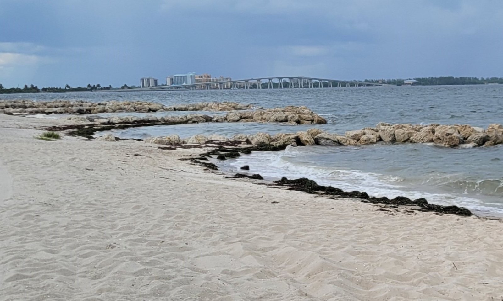
Figure 8. Artificial structure designed to prevent erosion of beach sand.
This community consists of manmade structures designed to prevent erosion of upland communities or protect structures and beach communities from the effects of coastal waves and current actions. Examples include seawalls, revetments, bulkheads, retaining walls, sloped boulder revetments, sloped geotextile revetments, geotextile dune scour protection, or similar structures. Florida Department of Environmental Protection has set policies and guidelines for the establishment of coastal armoring.
Resilience management. Upland structures must be sited as far landward as practicable to minimize adverse impacts to the beach and dune systems, native vegetative communities, dependent wildlife, and existing upland and adjacent structures while not interfering with public beach access. Structures designed to prevent beach erosion may be seen immediately adjacent to the water. These structures should be designed to provide protection while minimizing adverse impacts to surrounding communities.
Transition T1A
State 1 to 2This transition represents proliferation and dominance of an invasive species. Soil mechanical disturbances can compound this effect and create suitable conditions for invasive species.
Transition T1B
State 1 to 3This transition is driven by the alteration and transportation of soils materials via anthropogenic means to create areas which are no longer representative of the natural communities for human use and development.
Restoration pathway R2A
State 2 to 1The establishment of, or a return to, natural habitat conditions following a previous invasive / non-native / undesirable species infestation may be possible in some areas. Successful actions will require relentless efforts that include removal of the species via chemical, mechanical, or biological means. In some extreme cases, restoration attempts could result in greater erosion and worsening of local conditions. Please consult with District and Soil Conservationists at local NRCS Field Offices for advice and guidance on land restoration attempts on invaded areas.
Transition T2A
State 2 to 3This transition is driven by the alteration and transportation of soils materials via anthropogenic means to create areas which are no longer representative of the natural communities for human use and development.
Additional community tables
Table 8. Community 1.1 plant community composition
Group Common name Symbol Scientific name Annual production () Foliar cover (%) Table 9. Community 1.2 plant community composition
Group Common name Symbol Scientific name Annual production () Foliar cover (%) Table 10. Community 1.3 plant community composition
Group Common name Symbol Scientific name Annual production () Foliar cover (%) Table 11. Community 2.1 plant community composition
Group Common name Symbol Scientific name Annual production () Foliar cover (%) Table 12. Community 3.1 plant community composition
Group Common name Symbol Scientific name Annual production () Foliar cover (%) Table 13. Community 3.2 plant community composition
Group Common name Symbol Scientific name Annual production () Foliar cover (%) Interpretations
Animal community
These beach and dune systems provide critical habitat for both terrestrial and aquatic species. Many of these populations are rare, threatened, and/ or endangered due to increased urbanization. Aquatic species such as loggerhead sea turtles (Caretta caretta), green sea turtles (Chelonia mydas), and leatherback sea turtles (Derrmochelys coriacea) will utilize beach habitats during the nesting season (April through September). Mammals such as the southeastern beach mouse (Peromyscus polionotus niveicentris) utilize dune systems for habitat. These habitats also are very important for local and migratory bird species such as snowy plovers (Charadrius melodus), piping plovers (C. tenuirostris), and Wilson’s plover (C. wilsonia), which utilize the open sand and dune systems for nesting and breeding habitat as well as utilizing washed onshore wrack for forage. Other rare shorebirds include the American oystercatcher (Haematopus palliates), black skimmer (Rynchops niger), least tern (Sterna antillarum), and roseate tern (S. dougallii).
Hydrological functions
The zonation of coastal communities at right angles to the shore reflects the decrease in type and intensity of coastal stresses as one moves away from the coast. Plants of the upper beach must be able to rapidly re-colonize this habitat after frequent periodic destruction by seasonal high tides or storm waves. Waves breaking at other than right angles to the beach tend to move sand along the coast, a process called longshore drift. If jetties interrupt this wave conveyor belt, sand will accumulate on the updrift side of the obstruction and be carried away from the downside drift, producing erosion, especially when storms occur. This disturbs the natural process of dune formation and could lead to increased damage during large storm events such as hurricanes and tropical storms.
Recreational uses
In Florida, coastal habitats are one of the most attractive areas for people to live, work, and recreate. While dune systems are generally not recreated on due to their protective status placed by local and state legislature, the unconsolidated beach substrates are used my many for beachgoers. Many birdwatches utilize these habitats to spot and identify numerous rare and endangered wading and migratory bird species. Many dune systems have disappeared due to urbanization and have been replaced by hotels and other high density urban centers to support the large tourism economy in Florida.
Wood products
This site is not suitable for timber production.
Other products
This area has no value as rangeland or agricultural land due to high desired for urbanization in these habitats.
Other information
Formation of upland coastal communities such as coastal grasslands and forests and coastal scrub are dependent on dune formation and succession. The beach dune formation acts as a barrier as sea oats and other dune forming grasses stabilize and grow, allowing them to tolerate higher intensity coastal stressors. High energy wave action acts as a method of deposition for sand from underwater bars which helps build beach dunes and the upland communities following it such as coastal strands, coastal grasslands and coastal interdunal swales, and eventually the transition into a maritime hammock community. Coastal scrub formation requires dune stabilization and recession of the shoreline, creating a higher drier xerophytic community as new dunes form closer to the shoreline. These habitats often reflect differences in management and geologic time as soil chemical and physical properties have changed with formation of these systems.
Supporting information
Inventory data references
Information presented was derived from NRCS clipping data, current and historical literature, field observations, and personals contacts with local, state and federal partners. This is a provisional level ESD and is subject to change as more information becomes available, for any questions please contact your local NRCS office.
References
-
. 2021 (Date accessed). USDA PLANTS Database. http://plants.usda.gov.
Other references
Craig, R. M. 1976. Grasses for coastal dune areas. In Proceedings-Florida State Horticultural Society (Vol. 89, pp. 353-355).
Craig, R. M. 1984. Plants for coastal dunes of the Gulf and South Atlantic coasts and Puerto Rico (No. 1474-2021-544).
Craighead, F. C., & Gilbert, V. C. 1962. The effects of Hurricane Donna on the vegetation of southern Florida. Quarterly Journal of the Florida Academy of Sciences, 25(1), 1-28.
Davis, J. H. 1975. Stabilization of beaches and dunes by vegetation in Florida. NOAA. Report (Florida Sea Grand Program); no. 7.
Florida Chapter Soil and Water Conservation Society. 1989. 26 Ecological Communities of Florida.
Florida Natural Areas Inventory (FNAI). 2010. Guide to the natural communities of Florida: 2010 edition. Florida Natural Areas Inventory, Tallahassee, FL.
Giles, R. T., & Pilkey, O. H. 1965. Atlantic beach and dune sediments of the southern United States. Journal of Sedimentary Research, 35(4), 900-910.
Kambly, S., and Moreland, T.R., 2009, Land cover trends in the Southern Florida Coastal Plain: U.S. Geological Survey Scientific Investigations Report 2009–5054, 16 p.
Lithgow, D., Martínez, M. L., Gallego-Fernández, J. B., Hesp, P. A., Flores, P., Gachuz, S., ... & Álvarez-Molina, L. L. (2013). Linking restoration ecology with coastal dune restoration. Geomorphology, 199, 214-224.
McNab, W.H.; Cleland, D.T.; Freeouf, J.A.; Keys, Jr., J.E.; Nowacki, G.J.; Carpenter, C.A., comps. 2007. Description of ecological subregions: sections of the conterminous United States [CD-ROM]. Gen. Tech. Report WO-76B. Washington, DC: U.S. Department of Agriculture, Forest Service. 80 p.
Miller, D. L., Yager, L., Thetford, M., & Schneider, M. 2003. Potential use of Uniola paniculata rhizome fragments for dune restoration. Restoration Ecology, 11(3), 359-369.
Miller, T. E., Gornish, E. S., & Buckley, H. L. 2010. Climate and coastal dune vegetation: disturbance, recovery, and succession. Plant ecology, 206(1), 97-104.
Pawelek, J. C., & Kimball, M. E. 2014. Gopher Tortoise ecology in coastal upland and beach dune habitats in northeast Florida. Chelonian Conservation and Biology, 13(1), 27-34.
Rosalsky, M. B. 1960. The physiography of Cape Canaveral, Florida. Rocks & Minerals, 35(3-4), 99-102.
Sallenger, A. H., Stockdon, H. F., Fauver, L., Hansen, M., Thompson, D., Wright, C. W., & Lillycrop, J. 2006. Hurricanes 2004: An overview of their characteristics and coastal change. Estuaries and Coasts, 29(6), 880-888.
Schoeneberger, P.J., and Wysocki, D.A. 2017. Geomorphic Description System, Version 5.0. Natural Resources Conservation Service, National Soil Survey Center, Lincoln, NE.
Scott, T. M. 2001. Text to accompany the geologic map of Florida. Florida Geologic Survey, Tallahassee, Florida.
Stapor Jr, F. W., Mathews, T. D., & Lindfors-Kearns, F. E. 1991. Barrier-island progradation and Holocene sea-level history in southwest Florida. Journal of Coastal Research, 815-838.
Stapor, F. W., & Tanner, W. F. 1975. Hydrodynamic implications of beach, beach ridge and dune grain size studies. Journal of Sedimentary Research, 45(4), 926-931.
Williams, M.J. 2007. Native Plants for Coastal Restoration: What, When, and How for Florida.
USDA, NRCS, Brooksville Plant Materials Center, Brooksville, FL. 51p.Contributors
Jack Ferrara, USDA-NRCS
Approval
Matthew Duvall, 4/14/2025
Rangeland health reference sheet
Interpreting Indicators of Rangeland Health is a qualitative assessment protocol used to determine ecosystem condition based on benchmark characteristics described in the Reference Sheet. A suite of 17 (or more) indicators are typically considered in an assessment. The ecological site(s) representative of an assessment location must be known prior to applying the protocol and must be verified based on soils and climate. Current plant community cannot be used to identify the ecological site.
Author(s)/participant(s) Contact for lead author Date 04/14/2025 Approved by Approval date Composition (Indicators 10 and 12) based on Annual Production Indicators
-
Number and extent of rills:
-
Presence of water flow patterns:
-
Number and height of erosional pedestals or terracettes:
-
Bare ground from Ecological Site Description or other studies (rock, litter, lichen, moss, plant canopy are not bare ground):
-
Number of gullies and erosion associated with gullies:
-
Extent of wind scoured, blowouts and/or depositional areas:
-
Amount of litter movement (describe size and distance expected to travel):
-
Soil surface (top few mm) resistance to erosion (stability values are averages - most sites will show a range of values):
-
Soil surface structure and SOM content (include type of structure and A-horizon color and thickness):
-
Effect of community phase composition (relative proportion of different functional groups) and spatial distribution on infiltration and runoff:
-
Presence and thickness of compaction layer (usually none; describe soil profile features which may be mistaken for compaction on this site):
-
Functional/Structural Groups (list in order of descending dominance by above-ground annual-production or live foliar cover using symbols: >>, >, = to indicate much greater than, greater than, and equal to):
Dominant:
Sub-dominant:
Other:
Additional:
-
Amount of plant mortality and decadence (include which functional groups are expected to show mortality or decadence):
-
Average percent litter cover (%) and depth ( in):
-
Expected annual annual-production (this is TOTAL above-ground annual-production, not just forage annual-production):
-
Potential invasive (including noxious) species (native and non-native). List species which BOTH characterize degraded states and have the potential to become a dominant or co-dominant species on the ecological site if their future establishment and growth is not actively controlled by management interventions. Species that become dominant for only one to several years (e.g., short-term response to drought or wildfire) are not invasive plants. Note that unlike other indicators, we are describing what is NOT expected in the reference state for the ecological site:
-
Perennial plant reproductive capability:
Print Options
Sections
Font
AAAAOther
PrintThe Ecosystem Dynamics Interpretive Tool is an information system framework developed by the USDA-ARS Jornada Experimental Range, USDA Natural Resources Conservation Service, and New Mexico State University.
Accessibility statement