
Natural Resources
Conservation Service
Ecological site R155XY020FL
Haline Intertidal Marshes and Swamps
Last updated: 4/14/2025
Accessed: 09/14/2026
-
Search


Major Land Resource Area or ecological site by name and/or ID.
PreviousSectionsNextGeneral information
Provisional. A provisional ecological site description has undergone quality control and quality assurance review. It contains a working state and transition model and enough information to identify the ecological site.
MLRA notes
Major Land Resource Area (MLRA): 155X–Southern Florida Flatwoods
This MLRA makes up about 19,973 square miles (51,731 square kilometers) and is entirely in Florida. It stretches across the mid-section of the State, from the Gulf of America to the Atlantic Ocean, and north and south from the Everglades (MLRA 156A) to Jacksonville. This MLRA consists of a young sandy marine plain of Pleistocene age that is underlain by Tertiary-age limestone bedrock. The terrain is nearly level to gently sloping with large areas of swamp and marsh. Sinkholes affect land use and management.
The landscape consists of nearly level to gently sloping marine terraces that have large areas of wetlands and marshes. Streams and lakes are common. Low-lying wet areas are flat with some hummocks that rise 3 feet (1 meter) above the general level of the landscape. Coastal areas consist of low beach ridges and dunes that rise 6 to 10 feet (2 to 3 meters) above the lower inland areas. Elevation ranges from sea level to less than 196 feet (60 meters), increasing gradually from the coast to inland areas.
This MLRA is underlain by sediments of the Quaternary Period (present to 2.58 million years ago) which overlie Neogene (2.53 to 23.03 million years ago) and Paleogene (23.03 to 66 million years ago) formations, including those of the Hawthorn Group. The older rocks are exposed in the north-central part of this area. The Quaternary sediments are largely undifferentiated marine deposits consisting of fine to coarse sands that are poorly to moderately sorted with variable admixtures of clay and organic material. Undifferentiated Holocene (present to 0.0117 million years ago) sediments, which include quartz sands, marls, organic material, and minor carbonate sands and mud, are in the northeast part of this MLRA. The sediments may also include freshwater gastropods. Near the southeastern coastline, the Anastasia Formation and Miami Limestone are exposed. The Anastasia Formation is made up of a variably lithified coquina of shells and sands and unlithified fossiliferous sand. The Miami Limestone is white to light gray, variably fossiliferous, oolitic and pelletal with variable percentages of quartz sand, ranging from sandy limestone to calcareous quartz sand (Scott, 1993a, 1993b; Duncan, 1993a, 1993b). Quaternary beach ridge and dune sediments, which are mapped based on topographic expression, occur throughout the MLRA, becoming more abundant toward the coast.
The average annual precipitation is 38 to 61 inches (973 to 1,559 millimeters). About 60 percent of the precipitation occurs from June through September. Most of the rainfall occurs during moderate-intensity, tropical storms that produce large amounts of rain from late spring through early autumn. Late autumn and winter are relatively dry. The average annual temperature is 69 to 76 degrees F (21 to 24 degrees C). The freeze-free period averages 335 days and ranges from 300 to 365 days.
The dominant soil orders are Alfisols, Entisols, and Spodosols. The soils in the area dominantly have a hyperthermic temperature regime, an aquic moisture regime, and siliceous mineralogy. They generally are deep or very deep; poorly drained, very poorly drained, or somewhat poorly drained; and sandy or loamy, or both. Anthroportic soils throughout the area are a result of cut-and-fill activities associated with construction and urbanization.
This area supports flatwood forest vegetation. Slash pine, longleaf pine, loblolly pine, cabbage palm, bald cypress, laurel oak, water oak, and live oak are the main species. Saw palmetto, wax myrtle, gallberry, and grasses such as bluestems, threeawns, maidencane, and wiregrasses characterize the understory. Along the coastline and around the city of Orlando, this MLRA has been heavily urbanized. However, a significant acreage remains in agriculture for the production of citrus, specialty crops, and cattle. Surface water runoff from agriculture and urbanization are carefully monitored to help mitigate sinkhole development.
The major soil resource concerns are wind erosion, maintenance of the content of organic matter and productivity of the soils, and management of soil moisture. Conservation practices on cropland generally include conservation crop rotations, cover crops, irrigation water management (including micro irrigation systems), nutrient management, and pest management. Conservation practices on pasture and rangeland generally include prescribed grazing, brush management, pest management, prescribed burning, and watering facilities. Conservation practices on forestland generally include forest stand improvement, forest site preparation, prescribed burning, firebreaks, establishment of trees and shrubs, pest management, and management of upland wildlife habitat.Classification relationships
All portions of the geographical range of this site falls under the following ecological / land classifications including:
-Environmental Protection Agency's Level 3 and 4 Ecoregions of Florida: 75 Southern Coastal Plain; 75B Southwestern Florida Flatwoods; 75D, Eastern Florida Flatwoods(Griffith, G. E., Omernik, J. M., & Pierson, S. M., 2013)
-Florida Natural Area Inventory, 2010 Edition: Marine and Estuarine Vegetative Wetlands; Salt Marsh, Mangrove Swamp (FNAI ,2010)
-Soil Conservation Service, 26 Ecological Communities of Florida: 18- Salt Marsh, 19- Mangrove Swamp (Florida Chapter Soil and Water Conservation Society, 1989)
-LandFire Existing Vegetation Type, 2020: Caribbean Coastal Mangrove, Florida Big Bend Salt and Brackish Tidal Marsh, Atlantic Coastal Plain Indian River Lagoon Tidal Marsh
-LandFire Biophysical Settings, 2020: Gulf and Atlantic Coastal Plain Tidal Marsh Systems, Coastal Caribbean Wetland SystemsEcological site concept
This ecological site is associated with very poorly drained soils found in intertidal landscape positions along low-wave energy coastlines. These sites are subject to very frequent tidal flooding (astronomical or meteorological tides) for very brief to brief durations.
Dominant vegetation is dependent on abiotic factors within this site and correlates with Florida Natural Area Inventory communities "Salt Marshes" and "Mangrove Swamps". These sites are perched between terrestrial and marine environments, leading to biologically diverse communities adapted for harsh environmental conditions including flooding, low oxygen (anoxia), salinity fluctuations and extreme temperatures.
Small variations in tidal dynamics and topography will drive the distribution of the two dominant vegetative states and their corresponding communities in this site and currently cannot be mapped separately within SSURGO resolution. This may be split following future projects addressing intertidal soil map units, but for now we must consider salt marshes and mangrove swamps as their own naturalized states.Associated sites
R155XY050FL Loamy and Clayey Freshwater Floodplain Marshes and Swamps
These sites are very poorly drained freshwater floodplain concepts that may occur at the upper limit of tidal influence in a tidal river. This change in salinity will often be marked by shifts in vegetation such as the absence of mangrove species.
R155XY600FL Subaqueous Haline Indian River Estuarine Washover-Fan Flats / Relict Flood-Tidal Delta-Flats 0.5-1m
These sites are subaqueous concepts found along the adjacent shoreline of the Indian River Lagoon. These low wave energy permanently submerged sites will support subaqueous aquatic vegetation rather than terrestrial vegetation, with the exception of extending prop roots of Rhizophora mangle.
R155XY030FL Sandy Freshwater Floodplain Marshes and Swamps
These sites are very poorly drained freshwater floodplain concepts that may occur at the upper limit of tidal influence in a tidal river. This change in salinity will often be marked by shifts in vegetation such as the absence of mangrove species.
R155XY040FL Sandy over Loamy Freshwater Floodplain Marshes and Swamps
These sites are very poorly drained freshwater floodplain concepts that may occur at the upper limit of tidal influence in a tidal river. This change in salinity will often be marked by shifts in vegetation such as the absence of mangrove species.
R155XY060FL Organic Freshwater Floodplain Marshes and Swamps
These sites are very poorly drained freshwater floodplain concepts that may occur at the upper limit of tidal influence in a tidal river. This change in salinity will often be marked by shifts in vegetation such as the absence of mangrove species.
R155XY610FL Subaqueous Haline Indian River Estuarine Submerged Wave Cut Platform / Barrier Cove 0.5-1m
These sites are subaqueous concepts found along the adjacent shoreline of the Indian River Lagoon. These low wave energy permanently submerged sites will support subaqueous aquatic vegetation rather than terrestrial vegetation, with the exception of extending prop roots of Rhizophora mangle.
R155XY700FL Subaqueous Haline Gulf Estuarine Systems
These sites are subaqueous concepts found along the adjacent shoreline of the gulf. These low wave energy permanently submerged sites will support subaqueous aquatic vegetation rather than terrestrial vegetation, with the exception of extending prop roots of Rhizophora mangle.
R155XY170FL Sandy Coastal Grasslands and Forests
These sites are somewhat poorly to moderately well drained sandy soils which support vegetation adjacent to high-wave energy coastlines. On barrier island systems this site will often be present facing the high-wave energy system with the Haline Intertidal Marshes and Swamps site found along the protected side.
Similar sites
R154XX017FL Wet Saline Marshes And Swamps
These sites occur in the range of MLRA 154, South-Central Florida Ridge, where the climate reflects less freeze- and frost-free days than MLRA 155, highly influencing the dominant vegetative communities. Salt marsh vegetation is more common, and black mangrove being the dominant woody species due to its better cold tolerance. Please note that following boundary changes of MLRA 154, this site may become obsolete and consolidated into the 155 site concept.
R156AY110FL Subtropical Tidal Saline Wetlands of Southern Coast and Islands
These sites occur in the range of MLRA 156A, Everglades and Associated Areas, where the soil temperature regime is isohyperthermic rather than MLRA 155 (hyperthermic). This will influence length of growing season and will allow for more subtropical species composition. This site is situated in the Southern Coast and Islands LRU, along the western (gulf) side of MLRA 156A, where the low-wave energy coastline and flat topography allows for extensive growth of these communities.
R156AY310FL Subtropical Tidal Saline Wetlands of Miami Ridge/ Atlantic Coastal Strip
These sites occur in the range of MLRA 156A, Everglades and Associated Areas, where the soil temperature regime is isohyperthermic rather than MLRA 155 (hyperthermic). This will influence length of growing season and will allow for more subtropical species composition. This site is situated in the Miami Ridge / Atlantic Coastal Strip LRU, along the eastern (Atlantic) side of MLRA 156A, where the high-wave energy coastline and variable topography restricts this site to protected channels and undeveloped coastlines.
Table 1. Dominant plant species
Tree (1) Rhizophora mangle
(2) Avicennia germinansShrub (1) Conocarpus erectus
(2) BorrichiaHerbaceous (1) Spartina
(2) Juncus roemerianusPhysiographic features
The ecological site and its associated plant communities occur on intertidal landscape positions (Mangrove Swamps, Tidal Marshes, Tidal Flats). These occur in low-wave energy estuarine systems or along the protected side of barrier islands, areas that are protected from high energy waves and intense salt spray. They are subject to very frequent (daily) and very brief (4 to 48 hours) tidal flooding. Higher intertidal areas may be subject to less frequent flooding during astronomical or perigean spring tides and/or storm events.
Table 2. Representative physiographic features
Geomorphic position, terraces (1) Tread
Slope shape across (1) Linear
(2) Concave
Slope shape up-down (1) Linear
Landforms (1) Marine terrace > Mangrove swamp
(2) Marine terrace > Tidal marsh
(3) Marine terrace > Tidal flat
Runoff class Negligible to high Flooding duration Very brief (4 to 48 hours) Flooding frequency Very frequent Ponding duration Not specified
Ponding frequency None Elevation 0 – 5 ft Slope 0 – 1 % Ponding depth 0 in Water table depth 0 – 6 in Aspect Aspect is not a significant factor Table 3. Representative physiographic features (actual ranges)
Runoff class Negligible to high Flooding duration Long (7 to 30 days) Flooding frequency None to very frequent Ponding duration Very long (more than 30 days) Ponding frequency None to frequent Elevation 0 – 20 ft Slope 0 – 2 % Ponding depth 0 – 24 in Water table depth 0 – 6 in Climatic features
The climate of central and south Florida is warm to hot and temperate to subtropical, with this site getting an average annual precipitation of 51 to 56 inches (1295.4 to 1422.4 millimeters). About 60 percent of the precipitation occurs from June through September. Most rainfall occurs during moderate tropical storms that produce large amounts of rain from late spring through early autumn. Late autumn and winter are relatively dry. The average annual temperature is 69 to 76 degrees F (21 to 24 degrees C).
The following tables and graphs consist of specific climate stations found within the range of this ecological site within this MLRA.Table 4 Representative climatic features
Frost-free period (characteristic range) 370 days Freeze-free period (characteristic range) 370 days Precipitation total (characteristic range) 50-60 in Frost-free period (actual range) 290-370 days Freeze-free period (actual range) 370 days Precipitation total (actual range) 50-60 in Frost-free period (average) 350 days Freeze-free period (average) 370 days Precipitation total (average) 50 in Characteristic rangeActual rangeBarLineFigure 1. Monthly precipitation range
Characteristic rangeActual rangeBarLineFigure 2. Monthly minimum temperature range
Characteristic rangeActual rangeBarLineFigure 3. Monthly maximum temperature range
BarLineFigure 4. Monthly average minimum and maximum temperature
Figure 5. Annual precipitation pattern
Figure 6 Annual average temperature pattern
Climate stations used
-
(1) NAPLES MUNI AP [USW00012897], Naples, FL
-
(2) VENICE [USC00089176], Venice, FL
-
(3) SARASOTA BRADENTON AP [USW00012871], Sarasota, FL
-
(4) ST PETERSBURG AP [USW00092806], Saint Petersburg, FL
-
(5) ST PETERSBURG INTL AP [USW00012873], Clearwater, FL
-
(6) TAMPA INTL AP [USW00012842], Tampa, FL
-
(7) TARPON SPGS SEWAGE PL [USC00088824], Tarpon Springs, FL
-
(8) ST AUGUSTINE LH [USC00087826], Saint Augustine, FL
-
(9) PALM COAST 6NE [USC00086767], Palm Coast, FL
-
(10) DAYTONA BEACH [USC00082150], Daytona Beach, FL
-
(11) PONCE INLET [USC00087261], Port Orange, FL
-
(12) TITUSVILLE [USC00088942], Titusville, FL
-
(13) MELBOURNE INTL AP [USW00012838], Melbourne, FL
-
(14) VERO BEACH 4SE [USC00089219], Vero Beach, FL
-
(15) FT PIERCE [USC00083207], Fort Pierce, FL
-
(16) STUART [USC00088620], Stuart, FL
-
(17) JUNO BEACH [USC00084461], North Palm Beach, FL
-
(18) FT LAUDERDALE BEACH [USC00083168], Fort Lauderdale, FL
">Influencing water features
These communities are influenced by both freshwater and saltwater dynamics. Daily and seasonal tides, overland sheet flow, and rainfall flush these systems and bring in new nutrients. Water dynamics include transporting oxygen to the root systems, physical exchange of the soil water solution with the overlaying water mass reducing the total salt content and removing toxic sulfides. Influencing water features also help in determining the rate of sediment deposition or erosion dependent on the surface water particulate load, and vertical motion of the groundwater table transporting nutrients regenerated by detrital food chains.
Wetland description
Classification System: Cowardin<br />
System: Estuarine<br />
Subsystem: Intertidal<br />
Class: Forested Wetlands / Emergent Wetlands / Unconsolidated ShoresSoil features
These are deep, very poorly drained, nearly level soils formed in a variety of ways. Parent material has little to no influence in the development of this site due to the natural vegetations adaptations to physically and chemically alter the substrate they grow on. These sites alter the sediment through organic matter accumulation of fibric material (leaf litter) and may find up to several meters of thick organics under well-established systems. In newly established systems, these communities may form on mineral deposits, building up an organic layer over time.
There is a diverse set of soil taxa associated with this site and is most influenced by hydrologic regime of daily water table fluctuations on tidally influenced land. Soils These include Terric Sulfisaprists (Wulfert), Typic Hydraquents (Turnbull, Riomar, McKee), Typic Sulfaquents (Pellicer, Peckish, Homosassa), Spodic Psammaquents (Moultrie), Typic Psammaquents (Kesson), Arenic Endoaqualfs (Isles), Typic Alaquods (Estero), Typic Sulfisaprists (Durbin) and Terric Haplosaprists (Bessie). Other soil taxa may be present, often upland terrestrial soils found in a tidal phase (Myakka, Brynwood, etc.), often as a result of rise in sea-levels.Table 5. Representative soil features
Parent material (1) Marine deposits
(2) Estuarine deposits
(3) Residuum – limestone
(4) Herbaceous organic material
Surface texture (1) Mucky peat
(2) Mucky fine sand
(3) Mucky silty clay loam
(4) Mucky clay
(5) Mucky fine sandy loam
(6) Mucky sandy clay loam
(7) Mucky clay loam
Drainage class Very poorly drained Permeability class Very slow to rapid Depth to restrictive layer 80 in Soil depth 80 in Surface fragment cover <=3" Not specified Surface fragment cover >3" Not specified Available water capacity
(0-40in)3.1 – 8.9 in Calcium carbonate equivalent
(0-40in)0 – 10 % Electrical conductivity
(0-40in)8 – 24 mmhos/cm Sodium adsorption ratio
(0-40in)20 – 65 Soil reaction (1:1 water)
(0-40in)6.1 – 8.4 Subsurface fragment volume <=3"
(0-40in)0 – 1 % Subsurface fragment volume >3"
(0-40in)Not specified Table 6. Representative soil features (actual values)
Drainage class Very poorly drained Permeability class Very slow to rapid Depth to restrictive layer 40 – 80 in Soil depth 40 – 80 in Surface fragment cover <=3" 0 % Surface fragment cover >3" 0 % Available water capacity
(0-40in)0.5 – 19.7 in Calcium carbonate equivalent
(0-40in)0 – 10 % Electrical conductivity
(0-40in)0 – 24 mmhos/cm Sodium adsorption ratio
(0-40in)0 – 65 Soil reaction (1:1 water)
(0-40in)3.5 – 9 Subsurface fragment volume <=3"
(0-40in)0 – 35 % Subsurface fragment volume >3"
(0-40in)0 % Ecological dynamics
Water Table Dynamics
Salinity in these systems also drive speciation, reducing competition for halophytic species such as mangroves and salt marsh grasses. Variations in daily and seasonal tides combined with the general flat topography of this MLRA allow these species to create extensive community sizes. Tidal and freshwater flushing also help prevent soil salinities from reaching lethal levels to even halophytes in areas of high evaporation. While they can survive and grow in freshwater, mangroves and other saline tolerant grasses are usually not found in large stands under such conditions in nature because they succumb to competition. Freshwater, through runoff from adjacent uplands or from rivers, flushes salt and delivers needed nutrients, while tidewaters push propagules landward and reduce competition by freshwater tolerant species. However, reducing estuarine salinity by increasing freshwater inputs and flushing chemical pollutants from adjacent uplands have resulted in the destruction of some natural areas and the invasion by undesirable and non-native species. These communities are sensitive to colonization by exotic species such as Brazilian pepper (Schinus terebitnthifolius), carrotwood (Cupaniopsis anacardioides), seaside mahoe (Thespesia populnea), latherleaf (Colubrina asiatica), and Australian pine (Casuarina equisetifolia).
Controlling Abiotic Factors / Succession
Mangroves require an average annual water temperature above 66°F (19°C) to survive. They also struggle to tolerate air temperatures below freezing or temperatures that fluctuate widely over the course of a year. In areas which may occasionally freeze or have frost, salt marshes become the dominant wetland community. Absence of freeze events may allow for the encroachment of mangrove species into salt marsh environments. In areas of changing sea levels, mangroves and salt marsh vegetation will "migrate" upward and inland with the changing salinity levels and grow without much change in composition. If rates are too high, the salt marsh may be overgrown by other species, particularly mangroves, or converted to open bodies of water. If there is no accretion of inorganic sediment or peat, the seaward portions of these communities may become flooded so that species drown from long inundation of saltwater and erode the landscape, destroying the community.
Plant Community Types
There are four different community types within a mangrove swamp community that exist based on slight variations in topography and drainages throughout these sites: Fringe Forests, Riverine Forests, Overwash Forests, and Basin Forests. Fringe Forests occur along the fringes of protected shorelines and islands, whose elevations are higher than the surrounding mean high tide. Riverine Forests occur along floodplains of tidal creeks and rivers and are flushed by daily tides. Overwash Forests occur as smaller low islands and finger-like projections of larger land masses in shallow bays and estuaries and will be overwashed during high tides. Basin Forests occur in inland areas along drainage depressions channeling terrestrial runoff towards the coast.
There are four different community types within a salt marsh community that exist based on slight variations in topography and drainages: Intertidal Marsh, Salt Pans, High Marsh, and Buttonwood Transitional Zones. Intertidal Marshes occur along the lowest elevation zones that are flooded by daily tidal fluctuations. Salt Pans occur in high marshes where evaporation concentrates large amounts of salt in the substrate or in depressions of the intertidal zone, retaining water during low tide and support halophytes. High Marshes occur in slightly higher elevations than intertidal marshes and are flooded primarily by spring or storm tides. And Buttonwood Transitional Zones occur at the highest elevations within a salt marsh and primarily during storm tides, acting as a transitional area to more terrestrial communities.
Plant Adaptations
The species found in these communities are facultative halophytes; they do not require saltwater for growth but are able to tolerate high salinity and outcompete vascular plants that do not have similar salt tolerances. Mangroves have adapted to saltwater environments by either excluding or excreting salt from plant tissues. These specializations allow mangroves to flourish in a competition-free habitat where other woody plants are excluded by their sensitivity to salt. Red mangroves are unable to grow in soil salinities greater than 60 parts per thousand (ppt).These species utilize a variety of mechanisms to maintain suitable salt balance, including salt-exclusion, where freshwater is separated at the root via reverse osmosis, and salt-secretion, where salt glands on the leaf surface excrete excess salt (Odum et. al,1982). Constant movement of water through these systems also assist in the dispersal of seedlings, which are adapted to float in the water column until finding suitable stable habitat for growth. The long-lived floating red mangrove propagules are dispersed by water and require a relatively short time for root development allowing them to establish quickly in new areas. The prop-roots of red mangroves, the extensive pneumatophores (roots above the ground to assist in gas exchange) of black mangroves, and the dense root mats of the white mangrove help to trap sediments and organic litter and recycle nutrients both from upland areas and from tidal import. Salt marshes are also very biologically productive communities as well, but greater biomass is usually produced at lower salinities (10 to 20 ppt), with marsh salinity ranging from 0.5 ppt to that of seawater (35 ppt) normally but can fluctuate due to high or low tide levels. The base of the food chain is supplied not only by the rooted plant matter of these systems, but also by algae and detritus found on the stems of plants, on the sediment surface, and suspended in the water column of pools and tidal creeks. This, along with the continuous shedding of mangrove leaves and other plant components, produce as much as 80 percent of the total organic material available in the aquatic food web. Through these root adaptations, these communities serve to protect further inland communities from storm events by absorbing the brunt of storm surges and off-shore winds.State and transition model
More interactive model formats are also available. View Interactive Models
Click on state and transition labels to scroll to the respective textEcosystem states
States 1, 5, 2 and 6 (additional transitions)
T1A - Large Scale Disturbance Events T1B - Introduction and Establishment of Noxious Non-Native or Undesirable Invasive Plant Species T1C - Human Alteration / Transportation of Soils Material T2A - Mangrove Establishment T2B - Large Scale Disturbance Events T2C - Introduction and Establishment of Noxious Non-Native or Undesirable Invasive Plant Species T2D - Human Alteration / Transportation of Soils Material T2E - Increase in Long Term Hydroperiod R3A - Remediation, Seedbank Establishment/ Propagation R3B - Remediation, Seedbank Establishment/ Propagation T3A - Increase in Long Term Hydroperiod R4A - Removal of Undesirable Species R4B - Removal of Undesirable Species R5A - Living Shoreline Restoration R5B - Living Shoreline Restoration State 1 submodel, plant communities
1.2A - Mangrove Establishment over Time State 2 submodel, plant communities
2.1A - Shrub Invasion 2.2A - Hydrological Restoration / Shrub Species Removal State 3 submodel, plant communities
3.1A - Acid Sulfate Dynamics State 4 submodel, plant communities
State 5 submodel, plant communities
Haline Intertidal Marshes and Swamps Provisional STM Key
I. Natural Stable Reference States- the ecological state that is most resistant to change, offers the most options to achieve management objectives, and reflects a defined “natural” disturbance regimeA. These are dense coastal forests occurring along relatively flat, low-wave energy, marine and estuarine shorelines. These species are dominated by mangroves.1 Dense mature closed canopy forest dominated by mangrove species ranging from 20 feet to over 80 feet tall2 Sparse to dense immature shrubland or forest dominated by mangrove species less than 20 feet tall. These species are not yet mature trees and reflect the succession of a mangrove forest or a forest recovering from a high-energy disturbance event (hurricane, tropical storm, freeze event, etc).B. These are dense coastal marshlands occurring along relatively flat, low-wave energy, marine and estuarine shorelines. These areas are dominated by distinct zones of vegetation, each dominated by one or more species of grass or rush.1 Dense marshland dominated by grasses and rushes, including but not limited to Spartina and Juncus, influenced by tidal flooding and high soil salinities.2 Dense marshland dominated by grasses and rushes, including but not limited to Spartina and Juncus, undergoing environmental change allowing for the encroachment of dense, low-growing woody vegetation less than 20 feet tall.II. Alternative Ecological States- one of several potential states of an ES that is functionally different from the reference state in terms of important ecological processes, kinds and amounts of ecosystem services, and management requirements.A. These communities are degraded forests and herbaceous wetlands where changes in hydroperiods will alter and possibly destroy the reference community.1 These are the remains of a wooded vegetated community after changes in the long term hydroperiod (primarily sea level rise or artificial impoundment) permanently saturate the root system and becomes too saline for the species tolerance. They appear as standing dead wood representing where once the living vegetation stood.2 These are expansive, relatively open areas of intertidal and supratidal zones which lack dense populations of sessile plant and animal species.B. This community consists of Florida Department of Agriculture and Consumer Services (FDACS) Non-Native Category 1 Species list.1 This phase describes the introduction and establishment of invasive species common to this ecological site; Brazilian peppertree (Schinus terebinthifolia), carrotwood (Cupaniopsis anacardioides), seaside mahoe (Thespesia populnea), and Australian Pine (Casuarina equisetifolia). These are saline tolerant shrubs and trees that will outcompete native plants of this ecological site.C. These areas include soils that were intentionally and substantially modified by humans for an intended purpose, commonly for building support, transportation, and commerce. The alteration is of sufficient magnitude to result in the introduction of a new parent material (human-transported material) or a profound change in the previously existing parent material (human-altered material).1 This community consists of developed mangrove forests and herbaceous wetlands designed for human use.D. This state describes the impact of increased hydroperiods from anthropogenic or natural causes that creates an altered hydrologic state resulting in permanent flooding. The impact of this causes destruction of the intertidal community and may in time shift to a subaqueous community.1 This is the final state and is when alteration of the natural hydroperiod has left an area permanently flooded.State 1
Saline Mangrove Forests
Figure 7. Mangrove Forest dominated by red mangrove with expansive prop roots
These are dense forests occurring along relatively flat, low-wave energy, marine and estuarine shorelines.
Community 1.1
Mature Mangrove Swamp
Figure 8. Mangrove forest dominated by red and black mangrove in the overstory and an open understory of saline tolerant herbaceous species

Figure 9. Expansive prop roots of red mangroves along a tidal creek. The black mud present on the roots shows the extent of high tide in this community.
These are dominantly woody intertidal wetlands dominated by trees.
This community correlated with the Florida Natural Area Inventory Community "Mangrove Swamps" (FNAI, 2010).Forest overstory.These four mangrove species can occur either in mixed stands or often in differentiated, monospecific zones that reflect varying degrees of tidal influence, levels of salinity, and types of substrate. Red mangrove often dominates the lowest (or deep-water) zone, followed by black mangrove in the intermediate zone, and white mangrove and buttonwood in the highest, least tidally influenced zone. Buttonwood often occupies an ecotone, or transition zone, to the adjacent upland community. The density and height of mangroves and the diversity of associated herbaceous species can vary considerably within a mangrove swamp. Mangroves typically occur in dense stands but may be sparse, particularly in upper tidal reaches where salt marsh species predominate or the area transitions to upland freshwater communities. Mangroves may range from trees more than 80 feet (25 m) tall to dwarf shrubs growing on solid limestone rock, but most commonly exist at intermediate heights of 20 to 30 feet tall (6 to 9 m).
Forest understory. The understory will consist of very sparsely vegetated herbaceous vines, ferns, shrubs, and other perennial species. Extensive root systems of existing mangrove species will be present taking up much space, making traveling through these swamps by land very difficult. Most of the groundcover will be decomposed plant material, most often leaves from surrounding mangroves.
Dominant plant species
-
red mangrove (Rhizophora mangle), tree
-
black mangrove (Avicennia africana), tree
-
white mangrove (Laguncularia racemosa), tree
-
button mangrove (Conocarpus erectus), tree
-
tree seaside tansy (Borrichia arborescens), shrub
-
bushy seaside tansy (Borrichia frutescens), shrub
-
shoregrass (Monanthochloe littoralis), grass
-
gray nicker (Ticanto nuga), other herbaceous
-
coinvine (Dalbergia ecastaphyllum), other herbaceous
-
mangrovevine (Rhabdadenia biflora), other herbaceous
-
turtleweed (Batis maritima), other herbaceous
-
chickenclaws (Sarcocornia perennis), other herbaceous
-
inland leatherfern (Acrostichum danaeifolium), other herbaceous
Community 1.2
Shrubby Immature Mangrove Swamp
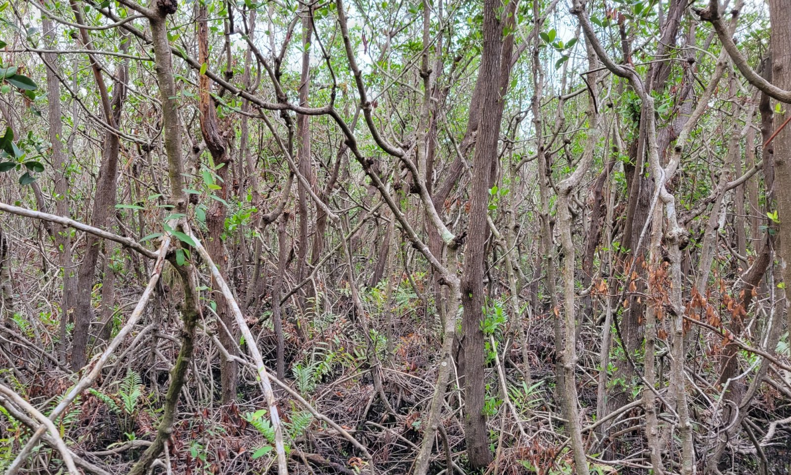
Figure 10. Shrubby immature patch of red mangroves rapidly recolonizing after a hurricane event. These species do not have a well established root system similar to a mature mangrove tree, making them more susceptible to wind damage.
This community describes a mangrove forest that is recovering from disturbance. These will be dense, low-growing woody vegetation that are less than 20 feet (6 meters) tall. These shrubs will consist of young mangrove trees that are not yet fully matured into taller trees with established root systems. The seedbank present will be dependent on surrounding species as well as deposition from aerial dispersion from birds and from tidal flood pulses. There will be no plants in the overstory, with a midcanopy of young trees, and an open understory, often densely packed with mangrove prop roots and pneumatophores. These root systems are not well established, and are more susceptible to disturbance events which may destroy these communities.
Forest understory. Woody species will be low-growing and densely packed, shading out any understory herbaceous species. These shrubby immature trees will be less than 20 feet (6 meters) in height. Common species which will encroach and become established include mangroves (Rhizophora mangle, Avicennia germinans, Laguncularia racemosa, Conocarpus erectus), depending on salinity levels and the surrounding seedbank present.
Dominant plant species
-
red mangrove (Rhizophora mangle), shrub
-
black mangrove (Avicennia germinans), shrub
-
white mangrove (Laguncularia racemosa), shrub
-
button mangrove (Conocarpus erectus), shrub
-
tree seaside tansy (Borrichia arborescens), shrub
-
bushy seaside tansy (Borrichia frutescens), shrub
Pathway 1.2A
Community 1.2 to 1.1
Shrubby Immature Mangrove Swamp
Mature Mangrove SwampThis transition is dependent on time without a disturbance which will remove these shrubby trees before they become mature in the overstory. If a disturbance were to occur such as a hurricane, tropical storm, or freeze event; these areas will often transition to an area of open unconsolidated substrates. Mangroves in the Caribbean are reported to reach maturity at around 20 to 25 years, and will require absence of high-energy disturbance events to become fully established as a mature mangrove forest.
State 2
Saline Herbaceous WetlandsThese are largely herbaceous communities that occurs in the portion of the coastal zone affected by tides and seawater and protected from large waves, either by the broad, gently sloping topography of the shore, by a barrier island, or by location along a bay or estuary.
Community 2.1
Salt Marshes
Figure 11. Salt marsh dominated by Juncus roemerianus
These are dominantly herbaceous intertidal wetlands dominated by graminoids and forbs.
This community correlated with the Florida Natural Area Inventory Community "Salt Marsh" (FNAI, 2010).
Resilience management. Salt marshes have gradual slopes of 0 to 1% that determine the extent of the intertidal zone, with gentle slopes reducing wave energy and providing greater areas for plants to colonize. Slopes too flat can cause poor surface drainage resulting in pooling and high salinities, preventing the establishment of seedlings and inhibiting plant growth, whereas slopes too steep can promote erosion and the transport of fine-grained sediments from uplands to marsh areas. Situated between the land and the sea, salt marshes experience the effects of both salt and fresh water. As tide water floods over a marsh, suspended sediment settles out and accumulates around the stems of plants. Rivers and other upland sources also contribute sediments to the marsh by continually transporting and redepositing sediment. Tidal flushing is important in maintaining the exchange of saline waters in salt marshes, with oligotrophic conditions leading to invasion of cattails, while hypersaline conditions can stress plants and inhibit growth or cause plant death. Flooding frequency and soil salinity are the two major environmental factors that influence salt marsh vegetation. Needle rush and saltmarsh cordgrass both tolerate a wide range of salinities, but cordgrass is found where the marsh is flooded almost daily, whereas needle rush is found where the marsh is flooded less frequently. Saltmarsh cordgrass dominates the low marsh (portion below mean high water level), whereas needle rush occupies the high marsh (portion above mean high water level). Both species tend to form taller stands along tidal creeks where salinity is lower and shorter stands where salinity is higher.
Forest understory. The dominant plants of salt marshes include saltmarsh cordgrass (Spartina alterniflora) along the seaward edge and borders of tidal creeks, in areas most frequently inundated by the tides. Needle rush (Juncus roemerianus) dominates higher, less frequently flooded areas. Other characteristic species include Carolina sea lavender (Limonium carolinianum), perennial saltmarsh aster (Symphyotrichum tenuifolium), wand loosestrife (Lythrum lineare), marsh fimbry (Fimbristylis spadicea), and shoreline seapurslane (Sesuvium portulacastrum). The landward edge of the marsh is influenced by freshwater influx from the uplands and may be colonized by a mixture of high marsh and inland species, including needle rush, sawgrass (Cladium jamaicense), saltmeadow cordgrass (Spartina patens), Gulf cordgrass (Spartina spartinae), and sand cordgrass (Spartina bakeri), among others. A border of salt-tolerant shrubs, such as groundsel tree (Baccharis halimifolia), saltwater falsewillow (Baccharis angustifolia), marshelder (Iva frutescens), and christmasberry (Lycium carolinianum), often marks the transition to upland vegetation or low berms along the seaward marsh edge. In areas of bare, exposed, or water-filled depressions in a salt marsh in which salinity levels are too extreme to support most vascular vegetation growth, haplophytes including glasswort (Batis maritima) and saltworts (Sarcocornia perennis) will thrive.
Dominant plant species
-
eastern baccharis (Baccharis halimifolia), shrub
-
saltwater false willow (Baccharis angustifolia), shrub
-
Jesuit's bark (Iva frutescens), shrub
-
Carolina desert-thorn (Lycium carolinianum), shrub
-
smooth cordgrass (Spartina alterniflora), grass
-
saltmeadow cordgrass (Spartina patens), grass
-
gulf cordgrass (Spartina spartinae), grass
-
sand cordgrass (Spartina bakeri), grass
-
Jamaica swamp sawgrass (Cladium mariscus ssp. jamaicense), grass
-
needlegrass rush (Juncus roemerianus), other herbaceous
-
lavender thrift (Limonium carolinianum), other herbaceous
-
perennial saltmarsh aster (Symphyotrichum tenuifolium), other herbaceous
-
wand lythrum (Lythrum lineare), other herbaceous
-
(Fimbristylis spadicea), other herbaceous
-
shoreline seapurslane (Sesuvium portulacastrum), other herbaceous
-
turtleweed (Batis maritima), other herbaceous
-
chickenclaws (Sarcocornia perennis), other herbaceous
Community 2.2
Shrubby Salt MarshesThis community describes a herbaceous salt marsh that is undergoing environmental change due to disturbance. These will be dense, low-growing woody vegetation that are less than 20 feet (6 meters) tall. These shrubs will consist of both true shrubs that never attain a greater height, and young trees of other species that may never obtain their maximum height due to the harsh environmental conditions. Some shrubby saline herbaceous marshes are a result of encroaching mangrove forests due to sea level rises. The seedbank present will be dependent on existing shrub species as well as deposition from aerial dispersion from birds and from tidal flood pulses. Other shrubby marshes may be stable communities and never transition to a mangrove forest community, but rather stay shrubby until restored. There will be no plants in the overstory, with a midcanopy of shrubs and young trees, and a dense to sparse understory of grasses and herbaceous species typical of the naturized community it transitioned from.
Forest understory. Woody shrubs will be low-growing and densely packed, which may or may not shade out the reference community understory species. These trees and shrubs will be less than 20 feet (6 meters) in height. Common species which will encroach and become established include mangroves (Rhizophora mangle, Avicennia germinans, Laguncularia racemosa, Conocarpus erectus), cabbage palm (Sabal palmetto), groundsel tree (Baccharis halimifolia), saltwater falsewillow (B. angstifolia), marshelder (Iva frutescens), christmasberry (Lycium carolinianum), and wax myrtle (Morella cerifera). Sparse reference community understory grasses and rushes such as cordgrass (Spartina alterniflora, S. patens, S. spartinae, S. bakeri) and needle rush (Juncus roemerianus) may be present.
Dominant plant species
-
red mangrove (Rhizophora mangle), shrub
-
black mangrove (Avicennia germinans), shrub
-
white mangrove (Laguncularia racemosa), shrub
-
button mangrove (Conocarpus erectus), shrub
-
cabbage palmetto (Sabal palmetto), shrub
-
eastern baccharis (Baccharis halimifolia), shrub
-
saltwater false willow (Baccharis angustifolia), shrub
-
Jesuit's bark (Iva frutescens), shrub
-
Carolina desert-thorn (Lycium carolinianum), shrub
-
wax myrtle (Morella cerifera), shrub
-
smooth cordgrass (Spartina alterniflora), grass
-
saltmeadow cordgrass (Spartina patens), grass
-
gulf cordgrass (Spartina spartinae), grass
-
sand cordgrass (Spartina bakeri), grass
-
needlegrass rush (Juncus roemerianus), other herbaceous
Pathway 2.1A
Community 2.1 to 2.2This transition is driven by a shift in ecological stressors. This may include a decrease in the hydroperiod, allowing for the establishment and encroachment of shrubby woody species to become established in a herbaceous wetland. In tidal landscapes, this transition is often seen via anthropogenic drawdown of the water table, often seen as the creation of mosquito ditches in marshes. These were often done in the early 1900s as an attempt to drain coastal marshes and control the breeding salt marshes, and can often be seen in aerial images as straight cuts running through a marsh system. In larger marsh systems where fire plays a role in maintaining community structure and composition, the absence of fire may allow for the growth of shrubby species. In areas where salt marshes are adjacent to mangrove forests, mangrove species may encroach into the marsh, shifting species composition following a storm event or with the absence of freeze events over time.
Pathway 2.2A
Community 2.2 to 2.1This restoration is driven by restoring the natural ecological stressors to a marsh system and removing the undesirable woody species. Restoration of the natural hydroperiod often includes filling in man-made mosquito ditches or other channelized systems meant to drain water from the system. Removal of woody species actions will require relentless efforts using chemical, mechanical, or biological means.
State 3
Tidal FlatsThis state serves as the foundation for the development of other subaqueous and intertidal natural communities when conditions become appropriate. This is a highly fluctuating community and is altered by storm events and can originate from organic sources, such as decaying plant tissues (e.g., mud) or from calcium carbonate depositions of plants or animals (e.g., coralgal, marl and shell substrates).
Community 3.1
Ghost Forest (If wooded)
Figure 12. Ghost forest found along edge of mangrove swamp with estuarine environment
Ghost forests are the remains of a wooded vegetated community after changes in the long term hydroperiod (primarily sea level rise or artificial impoundment) permanently saturate the root system and becomes too saline for the species tolerance. They appear as standing dead wood representing where once the living vegetation stood. Evidence of previous shorelines may be found in subaqueous soil cores as root matter or a buried organic horizon.
Community 3.2
Unconsolidated SubstratesThese are expansive, relatively open areas of intertidal and supratidal zones which lack dense populations of sessile plant and animal species, Unconsolidated Substrates are unsolidified material and include marl, mud, mud/sand, sand or shell.
Pathway 3.1A
Community 3.1 to 3.2This transition is driven by acid sulfate dynamics which causes a shift from a ghost forest to an area of unconsolidated substrates. This often occurs after a disturbance event creates an open area within a mangrove forest, allowing for the waterlogged soils under the forest to become exposed to air long enough for the soil to oxidize, forming sulfuric acid (pH <4.5). This will significantly alter the composition of the soil matrix and result in a highly acidic environment in which vegetation is unable to grow.
State 4
Invaded / Non-Native / Undesirable StateThis state represents the dominance of one or multiple non-native or exotic species which outcompetes the native natural community and may significantly alter the composition and structure of the invaded stand by overshading the canopy and understory components and preventing regeneration of forest species.
Community 4.1
Brazilian peppertree - Carrotwood - Seaside Mahoe - Latherleaf - Australian PineThis phase describes the introduction and establishment of invasive species common to this ecological site; Brazilian peppertree (Schinus terebinthifolia), carrotwood (Cupaniopsis anacardioides), seaside mahoe (Thespesia populnea), and Australian Pine (Casuarina equisetifolia). These are saline tolerant shrubs and trees that will outcompete native plants of this ecological site by having characteristics such as higher growth rates, high seed production, continuous growth, resprouting after damage, tolerance of a wide range of growing conditions, and even producing allelopathic compounds to inhibit native species growth.
Resilience management. Restoring native habitat may be very difficult with these species. Specific management plans may be required to identify and manage these species. It is strongly advised that consultation with State Resource Conservationist and District Conservationists at local NRCS Service Centers be sought when assistance is needed in developing management recommendations or invasive control practices.
Dominant plant species
-
beach sheoak (Casuarina equisetifolia), tree
-
Portia tree (Thespesia populnea), tree
-
carrotwood (Cupaniopsis anacardioides), tree
-
Brazilian peppertree (Schinus terebinthifolius), shrub
State 5
Human Altered / Human Transported Soils MaterialsThese areas include soils that were intentionally and substantially modified by humans for an intended purpose, commonly for building support, transportation, and commerce. The alteration is of sufficient magnitude to result in the introduction of a new parent material (human-transported material) or a profound change in the previously existing parent material (human-altered material). They do not include soils modified or farmed with unintended wind and water erosion. When a soil is on or above an anthropogenic landform or microfeature, it can be definitely be associated with human activity and is assigned to a unique taxon, usually found as an "Urban land complex" within that communities' natural soil properties (e.g, Wulfert muck, tidal-Urban land complex, 0 to 1 percent slopes).
Characteristics and indicators. Evidence of these areas include soils with manufactured items (e.g. artifacts) present in the profile, human altered-materials (e.g., deeply excavated soil) or human-transported material (e.g., fill), and position on or above anthropogenic landforms (e.g., flood-control levees) and microfeatures (e.g., drainage ditches). Detailed criteria regarding the identification of anthropogenic (artificial) landforms, human-altered materials, and human-transported material are in the "Keys to Soil Taxonomy" (Soil Survey Staff, 2014).
Community 5.1
Developed ShorelinesThis community consists of developed mangrove forests and herbaceous wetlands designed for human use. These urban areas include a variety of land uses, e.g., inner city or urban core, industrial and residential areas, parks, marinas, and other open spaces; the overall function which may benefit the quality of human life. These often form an urban soil mosaic, where the natural landscape has been fragmented into parcels with distinctive disturbance and management regimes and, as a result, distinctive characteristic soil properties.
Resilience management. Within this community there are three different levels of urbanization, based off population dynamics, residential density, and intensity of development. These are labeled as low-intensity, medium-intensity, and high-intensity urban areas. Low-intensity urban areas may consist of single dwelling homes with little impact on the surrounding community which still somewhat represents the natural community (e.g., represents natural landscape, hydroperiods, and vegetation), other examples of this are urban parks, cemeteries, or campgrounds with little urban development. Medium-intensity urban areas consist of larger urban dwellings with some natural features but have been modified to meet urban needs (e.g., towns). High-intensity urban areas are areas of heavily modified areas with complete alterations of the natural landscape, hydroperiods, and vegetation to support a very large population, which once constructed is permanently altered (e.g., metropolis areas/ active mines).
State 6
Altered Hydroperiod: Permanently FloodedThis state describes the impact of increased hydroperiods from anthropogenic or natural causes that creates an altered hydrologic state resulting in permanent flooding. The impact of this causes destruction of the intertidal community and may in time shift to a subaqueous community.
Transition T1A
State 1 to 3This transition is driven by a large scale disturbance event which may shift the woody forest to either a ghost forest of standing dead wood or an area of unconsolidated substrates. A relatively low energy disturbance event, such as sea-level rise or creation of artificial impoundments, may extend the hydroperiod and will permanently saturate the root system and become too saline for the species tolerance. As this occurs, remaining mangrove species may encroach further inland, often at the expense of other ecological communities. Whereas a relatively high energy disturbance event, such as a hurricane or tropical storm, a freeze event, mosquito ditching, herbicides, etc. the naturalized communities may be destroyed, creating an area of unconsolidated substrates which will remain in an unvegetated state until a seedbank (either woody species or herbaceous species) becomes established and propagates. This transition may be a rapid shift from a woody forest to unconsolidated species to a herbaceous wetland or vice versa, dependent on the seedbank present and disturbance intensity to the sediment.
Transition T1B
State 1 to 4This transition represents proliferation and dominance of an invasive species. Soil mechanical disturbances can compound this effect and create suitable conditions for invasive species.
Key drivers
-
Nonnative plant species presence and/or establishment
Transition T1C
State 1 to 5This transition is driven by the alteration and/ or transportation of soil materials via anthropogenic means. In these sites, it is often done to provide shoreline protection by replacing the native communities with a seawall or other shoreline protection strategies (Riprap, jetties, seawalls, etc.) to protect inland infrastructure.
Transition T2A
State 2 to 1This transition is driven by mangrove encroachment into a herbaceous wetland, replacing the dense understory of grasses with a mangrove forest. Salt marsh vegetation cannot grow in the shade of mangrove trees and will often degrade and become replaced. This is considered a transition rather than a restoration pathway as mangrove forests and herbaceous wetlands are two naturalized states, with unmeasurable slight variations in hydrologic regimes, elevation, and soil salinity being the main drivers for compositional and structural changes. An encroaching mangrove forest is often the result of and change in shoreline elevation, with the seaward edge of a mangrove forest slowly succumbing to an open water habitat while the landward edge migrates inland, at the expense of a herbaceous wetland. Absence of freeze events may also allow for the encroachment of mangroves into salt marsh habitats.
Key drivers
-
Seeding
Transition T2B
State 2 to 3This transition is driven by a large scale disturbance event which may shift the herbaceous wetland into an area of unconsolidated substrates. A relatively low energy disturbance event, such as sea-level rise or creation of artificial impoundments, may extend the hydroperiod and will permanently saturate the root system and become too saline for the species tolerance. As this occurs, remaining mangrove species may encroach further inland, often at the expense of other ecological communities. Whereas a relatively high-energy disturbance event, such as a hurricane or tropical storm, may deposit sediment that, once exposed to air, undergoes rapid acid sulfate dynamics, lowering the pH. This may create an area of unconsolidated substrates which will remain in an unvegetated state until the systems pH is stabilized and a seedbank (either woody species or herbaceous species) becomes established and propagates.
Key drivers
-
Climate
Transition T2C
State 2 to 4This transition represents proliferation and dominance of an invasive species. Soil mechanical disturbances can compound this effect and create suitable conditions for invasive species.
Key drivers
-
Nonnative plant species presence and/or establishment
Transition T2D
State 2 to 5This transition is driven by the alteration and/ or transportation of soil materials via anthropogenic means. In these sites, it is often done to provide shoreline protection by replacing the native communities with a seawall or other shoreline protection strategies (Riprap, jetties, seawalls, etc.) to protect inland infrastructure.
Transition T2E
State 2 to 6This is driven by increased hydroperiods, both anthropogenic and natural, which causes long term flooding permanently altering the site.
Restoration pathway R3A
State 3 to 1This restoration is driven by remediation techniques to restore hydrologic flow of the area, which will reduce the volume of acidic water by diluting it with a larger volume of neutral water. This is often done naturally as a system recovers from a high energy natural disturbance event such as a hurricane or tropical storm or freeze event, or may be done anthropogenically from a man-made disturbance event such as filling in mosquito ditches. Natural recovery is often seen due to the high tidal buffering potential of a natural supply of alkaline agents (bicarbonates/ carbonates) and daily tides. Once the unconsolidated substrate recovers from a low pH to an acceptable level for vegetative growth, a seedbank of either herbaceous or woody species must be present to restore the natural community. If a seedbank is absent, recovery efforts such as replanting seedlings (mangrove propagules) can be done by local, state, federal, and/ or private entities.
Restoration pathway R3B
State 3 to 2This restoration is driven by remediation techniques to restore hydrologic flow of the area, which will reduce the volume of acidic water by diluting it with a larger volume of neutral water. This is often done naturally as a system recovers from a high energy natural disturbance event such as a hurricane or tropical storm or freeze event, or may be done anthropogenically from a man-made disturbance event such as filling in mosquito ditches. Natural recovery is often seen due to the high tidal buffering potential of a natural supply of alkaline agents (bicarbonates/ carbonates) and daily tides. Once the unconsolidated substrate recovers from a low pH to an acceptable level for vegetative growth, a seedbank of either herbaceous or woody species must be present to restore the natural community. If a seedbank is absent, recovery efforts such as replanting seedlings (salt marsh grass "plugs") can be done by local, state, federal, and/ or private entities.
Transition T3A
State 3 to 6This is driven by increased hydroperiods, both anthropogenic and natural, which causes long term flooding and permanently altering the state.
Restoration pathway R4A
State 4 to 1The establishment of, or a return to, natural habitat conditions following a previous invasive / non-native / undesirable species infestation may be possible in some areas. Successful actions will require relentless efforts that include removal of the species via chemical, mechanical, or biological means. In some extreme cases, restoration attempts could result in greater erosion and worsening of local conditions. Please consult with District and Soil Conservationists at local NRCS Field Offices for advice and guidance on land restoration attempts on invaded areas.
Restoration pathway R4B
State 4 to 2The establishment of, or a return to, natural habitat conditions following a previous invasive / non-native / undesirable species infestation may be possible in some areas. Successful actions will require relentless efforts that include removal of the species via chemical, mechanical, or biological means. In some extreme cases, restoration attempts could result in greater erosion and worsening of local conditions. Please consult with District and Soil Conservationists at local NRCS Field Offices for advice and guidance on land restoration attempts on invaded areas.
Restoration pathway R5A
State 5 to 1This restoration involves removing a man-made shoreline structures used for shoreline protection or other anthropogenic activities and restoring the native ecological community. Anthropogenic infrastructure must be completely removed and mineral soil materials representative of the natural communities must be replaced as well as planting mangrove propagules or salt marsh plugs. In low to moderated wave energy areas with gradual slopes, native plants can stabilize the shoreline with their roots. Faunal communities such as oyster reefs may be used at the base of the plant slope to provide a wave break, water filtration, and habitat for aquatic species. In sites with relatively steep slopes, the steepness may be broken or interrupted by installing terraces containing native plants, designed to prevent soil erosion and collect runoff. A hybrid of these restoration efforts may be used and should be depend on local conditions. Please consult your local NRCS office for more information regarding these practices.
Restoration pathway R5B
State 5 to 2This restoration involves removing a man-made shoreline structures used for shoreline protection or other anthropogenic activities and restoring the native ecological community. Anthropogenic infrastructure must be completely removed and mineral soil materials representative of the natural communities must be replaced as well as planting mangrove propagules or salt marsh plugs. In low to moderated wave energy areas with gradual slopes, native plants can stabilize the shoreline with their roots. Faunal communities such as oyster reefs may be used at the base of the plant slope to provide a wave break, water filtration, and habitat for aquatic species. In sites with relatively steep slopes, the steepness may be broken or interrupted by installing terraces containing native plants, designed to prevent soil erosion and collect runoff. A hybrid of these restoration efforts may be used and should be depend on local conditions. Please consult your local NRCS office for more information regarding these practices.
Additional community tables
Table 7. Community 1.1 plant community composition
Group Common name Symbol Scientific name Annual production () Foliar cover (%) Table 8. Community 1.2 plant community composition
Group Common name Symbol Scientific name Annual production () Foliar cover (%) Table 9. Community 2.1 plant community composition
Group Common name Symbol Scientific name Annual production () Foliar cover (%) Table 10. Community 2.2 plant community composition
Group Common name Symbol Scientific name Annual production () Foliar cover (%) Table 11. Community 3.1 plant community composition
Group Common name Symbol Scientific name Annual production () Foliar cover (%) Table 12. Community 3.2 plant community composition
Group Common name Symbol Scientific name Annual production () Foliar cover (%) Table 13. Community 4.1 plant community composition
Group Common name Symbol Scientific name Annual production () Foliar cover (%) Table 14. Community 5.1 plant community composition
Group Common name Symbol Scientific name Annual production () Foliar cover (%) Interpretations
Animal community
This ecological site supports many organisms through the supporting vegetation both above and below the water.
In mangrove swamps, the extensive root systems, muddy bottoms, and open waters are home to multiple species that are well adapted to the variations in water levels, temperature, and salinity. Salt Marshes support more upland species that are both present in lowland and adjacent terrestrial habitats. These species include:
Invertebrates: snails, barnacles, bryozoans, tunicates, mollusks, sponges, polychaetae worms, isopods, amphipods, shrimps, crabs, and jellyfish all live on or in close proximity of the mangrove root system. The mangrove tree crab (Aratus pisoni) lives in the canopy of primarily red mangrove trees and feeds on the leaves. Horseshoe crabs (Limulus polyphemus) can also be found in this system as they are adapted to low oxygen waters, and seen feeding on algae, other invertebrates, and dead organisms.
Fish: Mangrove roots and shallow waters provide important nursery habitats for fish, providing shelter from predators until juveniles are large enough to avoid predators. Some species move in and out of the mangrove swamps as seasonal changes of water alter the levels of salinity. Species found in this system include common snook (Centropomus undecimalis), Jacks (Caranx spp.), sheepshead (Archosargus probatocephalus), grunts (Haemulon spp.), gobies (Gobiosoma spp.), schoolmasters (Lutjanus apodus), gray snappers (Lutjanus griseus), and small goliath grouper (Epinephelus itajara) as well as many other species of fish can be found among the tangled roots of red mangroves. Tarpon (Megalops atlanticus) cruise in waters adjacent to mangrove roots. The spotted seatrout (Cynoscion nebulosus) also thrive in mangroves and can tolerate high turbidity, taking advantage of the prey fish in the mangroves and seagrass beds. The Florida gar (Lepisosteus platyrhincus) is a top-level carnivore, feeding on a variety of smaller fishes. Gray snapper (Lutjanus griseus), spotted seatrout, and red drum (Sciaenops ocellatus) are among the species that utilize this area as nursery areas.
Reptiles: American Alligator (Alligator mississippiensis) are residents of mangrove/ salt marsh habitats, relying on upland marshes for nesting. Snakes include mangrove water snake (Nerodia clarkia compressicauda), Eastern indigo snake (Drymarchon coaris couperi), rough green snake (Opheodrys aestivus carinatus), Florida green water snake (Nerodia floridana), rosy rat snake (Elaphe guttata rosacea), Florida king snake (Lampropeltis getula floridana), and Atlantic saltmarsh snake (Nerodia clarkia taeniata). Anoles include the green anole (Anolis carolinensis), brown anole (Anolis sagrei), and the bark anole (Anolis distichus), all of which reside within mangroves and feed on insects. Freshwater species of turtles are found near the headwater of riverine mangrove systems, while sea turtles are found further out towards fringe and overwash forests. These turtles use mangrove swamps as juvenile nurseries, receiving protection from predators as well as an area rich in food. These species include: the ornate diamondback terrapin (Malaclemys terrapin macrospilota and M. t. rhizophorarum), the loggerhead turtle (Caretta caretta), green sea turtle (Chelonia mydas), hawksbill sea turtle (Eretmochelys imbricata) and the Atlantic ridley sea turtle (Lepidochelys kempii).
Amphibians: Only three amphibians are known to occur in this community due to the inability of osmoregulation in saltwater as well as lack of detailed surveys in low salinity regions. These species include the giant toad, squirrel treefrog (Hyla squirella), and the introduced Cuban treefrog (Osteopilus septentrionalis).
Birds: This community provides a habitat for many bird species, including open water for predatory birds, mudflats for probing shoreline birds, and deep water for long-legged birds to wade in. Some species include great egret (Casmerodius albus), roseate spoonbill (Platalea ajaja), limpkin (Aramus guarauna), American bittern (Botaurus lentiginosus), white ibis (Eudocimus albus), great blue heron (Ardea herodias), yellow-crowned night heron (Nyctasnassa violacea), canvasback (Aythya valisineria), double-crested cormorant (Phalacrocorax auritus), purple gallinule (Porphyrula martinica), anhinga (Anhinga anhinga), brown pelican (Pelecanus occidentalis), mallard (Anas platyrhynchos), pintail (Anas acuta), and lesser scaup (Aythya affinis). Birds of prey include permanent and seasonal residents, including the southern bald eagle (Haliaeetus leucocephalus leucocephalus), osprey ( Pandion haliaetus), Peregrine falcon (Falco columbarius), barred owl (Strix varia), Barn owl (Tyto alba), great horned owl (Bubo virginianus), American kestrel (Falco sparverius), red-shouldered hawk (Buteo lineatus), red-tailed hawk (Buteo jamaicensis), black vulture (Coragyps atratus), turkey vulture (Cathartes aura), Cooper’s hawk (Accipter cooperii), and the marsh hawk (Circus cyaneus).
Mammals: Mammals in this system contain permanent and seasonal residents. They may include the striped skunk (Mephitis mephitis), raccoons (Procyon lotor), mink (Mustela vision), river otter (Lutra canadensis), bobcat (Lynx rufus), cotton rats (Sigmodon hispidus), marsh rice rat (Oryzomys palustris) and silver rice rats (O. argentatus). Marine mammals are found along the waterways surrounding this community, these species include bottlenose dolphins (Tursiops truncates) and manatees (Trichechus manatus), feeding on fishes and seagrasses or other submerged aquatic plants adjacent to this community.Hydrological functions
During periods of storm events such as hurricanes and tropical storms, mangrove swamps and salt marshes absorb much of the impact of the waves and wind, protecting inland communities. During these events, waves lose energy as they pass through the tangled above-ground roots, grasses, and branches, losing their ability to remove sediments from the system. These areas are highly sensitive to changes in the water cycle and should be managed to protect hydrologic flow to maintain ecological integrity.
Recreational uses
These areas are highly recreated for outdoor uses such as kayaking, hiking, birdwatching, eco-tours, wildlife viewing and photography, and recreational fishing.
Wood products
These areas are not subject to commercial wood production. Mangrove species are protected via the Sections 403.9321-403.9333, Florida Statutes, known as the “1996 Mangrove Trimming and Preservation Act”. This recognizes the important ecological role as habitat for various species of marine and estuarine vertebrates, invertebrates, and other wildlife, including mammals, birds, and reptiles; as shoreline stabilization and storm protection; and for water quality protection and maintenance, and as food-web support. This law is passed to protect and preserve mangrove resources value to the environmental and economy from unregulated removal, defoliation, and destruction.
Other products
Due to the proximity of the ocean and salinity levels, this area has little to no value as agriculture or rangeland. Historically salt marshes were able to be used as range, and correlate with the NRCS 1994 Range Site Description "Salt Marsh" (155XY009FL). Many of these areas within this MLRA are now protected and not subject to grazing.
Other information
Cultural Resources:
Native American shell mounds may be found within these map units and are considered an archeological resource and protected. The formation of a shell mound is largely the result of human activities instead of natural and physical processes. Shell mounds are small hills or mounds made up almost entirely of mollusk shells discarded by Native Americans. The soils will be circumneutral to slightly alkaline, contain minimal organic material, and are very well drained. Undisturbed shell mounds can support a variety of hardwood trees and shrubs which may include white stopper (Eugenia axillaris), live oak (Quercus virginiana), cabbage palm (Sabal palmetto), red cedar (Juniperus virginiana), torchwood (Amyris elemifera), wild lime (Zanthoxylum fagara), saffron plum (Sideroxylon celastrinum), soapberry (Sapindus saponaria), snowberry (Chiococca alba), and false mastic (Sideroxylon foetidissimum). These communities are not limited to one soil component type and are often seen throughout the state within protected parks and preserves where Native American settlements once were.Supporting information
Inventory data references
Information presented was derived from NRCS clipping data, current and historical literature, field observations, and personals contacts with local, state and federal partners. This is a provisional level ESD and is subject to change as more information becomes available, for any questions please contact your local NRCS office.
References
-
. 2021 (Date accessed). USDA PLANTS Database. http://plants.usda.gov.
-
Cowardin, L.M., V. Carter, F.C. Golet, and E.T. LaRoe. 1979. Classification of wetlands and deep water habitats of the United States.. U.S. Dept. of Interior, Fish & Wildlife Service, Office of Biological Services, Washington DC. FWS/OBS-79/31 1–142.
Other references
Carlson, D. B., O'Bryan, P. D., & Rey, J. R. 1991. A review of current salt marsh management issues in Florida. Journal of the American Mosquito Control Association, 7(1), 83-88.
Dawkins, K., & Esiobu, N. 2016. Emerging insights on Brazilian pepper tree (Schinus terebinthifolius) invasion: the potential role of soil microorganisms. Frontiers in plant science, 712.
Donnelly, Melinda, "Is The Exotic Brazilian Pepper, Schinus Terebinthifolius, A Threat To Mangrove Ecosystems In Florida?" 2006. Electronic Theses and Dissertations, 2004-2019. 801. https://stars.library.ucf.edu/etd/801
Florida Chapter Soil and Water Conservation Society. 1989. 26 Ecological Communities of Florida
Florida Natural Areas Inventory (FNAI). 2010. Guide to the natural communities of Florida: 2010 edition. Florida Natural Areas Inventory, Tallahassee, FL
Fretwell, J. D., Williams, J. S., & Redman, P. J. 1996. National water summary on wetland resources (Vol. 2425). US Government Printing Office.
Gann, G.D., K.A. Bradley, and S.W. Woodmansee. 2009. Floristic Inventory of South Florida Database. Institute for Regional Conservation.
Gilmore, R. G., Cooke, D. W., & Donohoe, C. J. 1982. A comparison of the fish populations and habitat in open and closed salt marsh impoundments in east-central Florida. Gulf of Mexico Science, 5(2), 2.
Harshberger, John W. 1914. The Vegetation of South Florida South of 27 30 North, Exclusive of the Florida Keys. Philadelphia, Wagner Free Institute of Science, 1914.
Jin-Eong, O. 1995. The ecology of mangrove conservation & management. Hydrobiologia, 295(1), 343-351.
Kambly, S. and Moreland, T.R., 2009, Land cover trends in the Southern Florida Coastal Plain: U.S. Geological Survey Scientific Investigations Report 2009–5054, 16 p.
Krauss, K. W., Demopoulos, A. W., Cormier, N., From, A. S., McClain-Counts, J. P., & Lewis III, R. R. 2018. Ghost forests of Marco Island: Mangrove mortality driven by belowground soil structural shifts during tidal hydrologic alteration. Estuarine, Coastal and Shelf Science, 212, 51-62.
Krauss, K. W., Doyle, T. W., Doyle, T. J., Swarzenski, C. M., From, A. S., Day, R. H., & Conner, W. H. 2009. Water level observations in mangrove swamps during two hurricanes in Florida. Wetlands, 29(1), 142-149.
Lugo, A. E., & Snedaker, S. C. 1974. The ecology of mangroves. Annual review of ecology and systematics, 5(1), 39-64.
Marchio, D. A., Savarese, M., Bovard, B., & Mitsch, W. J. 2016. Carbon sequestration and sedimentation in mangrove swamps influenced by hydrogeomorphic conditions and urbanization in Southwest Florida. Forests, 7(6), 116.
McNab, W.H.; Cleland, D.T.; Freeouf, J.A.; Keys, Jr., J.E.; Nowacki, G.J.; Carpenter, C.A., comps. 2007. Description of ecological subregions: sections of the conterminous United States [CD-ROM]. Gen. Tech. Report WO-76B. Washington, DC: U.S. Department of Agriculture, Forest Service. 80 p
McPherson, B. F., Hendrix, G. Y., Klein, H., & Tyus, H. M. 1976. The environment of south Florida: a summary report (Vol. 1011). US Government Printing Office.
Odum, W. E., McIvor, C. C., & Smith, T. J. 1982. The ecology of the mangroves of south Florida: a community profile. The Service.
Radabaugh, K. R., Moyer, R. P., Chappel, A. R., Powell, C. E., Bociu, I., Clark, B. C., & Smoak, J. M. 2018. Coastal blue carbon assessment of mangroves, salt marshes, and salt barrens in Tampa Bay, Florida, USA. Estuaries and Coasts, 41(5), 1496-1510.
Ruprecht, J. E., Glamore, W. C., & Rayner, D. S. 2018. Estuarine dynamics and acid sulfate soil discharge: Quantifying a conceptual model. Ecological Engineering, 110, 172-184.
Saha, A. K., Saha, S., Sadle, J., Jiang, J., Ross, M. S., Price, R. M., ... & Wendelberger, K. S. 2011. Sea level rise and South Florida coastal forests. Climatic Change, 107(1), 81-108.
Schoeneberger, P.J., and Wysocki, D.A. 2017. Geomorphic Description System, Version 5.0. Natural Resources Conservation Service, National Soil Survey Center, Lincoln, NE.
Scholl, D.W. 1964. Recent Sedimentary Record in Mangrove Swamps and Rise in Sea Level Over the Southwestern Coast of Florida: Part 1. Earth and Planetary Sciences Division, U.S. Naval Ordinance Test Station, China Lake, Calif. (U.S.A.). Marine Geology, 1, 344 – 366.
Scholl, D.W. 1964. Recent Sedimentary Record in Mangrove Swamps and Rise in Sea Level Over the Southwestern Coast of Florida: Part 2. Earth and Planetary Sciences Division, U.S. Naval Ordinance Test Station, China Lake, Calif. (U.S.A.). Marine Geology, 2, 343 – 364.
Scott, T. M. 2001. Text to accompany the geologic map of Florida. Florida Geologic Survey, Tallahassee, Florida.
Stevens, P. W., Fox, S. L., & Montague, C. L. 2006. The interplay between mangroves and saltmarshes at the transition between temperate and subtropical climate in Florida. Wetlands Ecology and management, 14(5), 435-444.
U.S. Fish & Wildlife Service Southeast Region (FWS). 1998. Mangroves. Multi-Species Recovery Plan for South Florida.Contributors
Jack Ferrara, USDA-NRCS
Approval
Matthew Duvall, 4/14/2025
Rangeland health reference sheet
Interpreting Indicators of Rangeland Health is a qualitative assessment protocol used to determine ecosystem condition based on benchmark characteristics described in the Reference Sheet. A suite of 17 (or more) indicators are typically considered in an assessment. The ecological site(s) representative of an assessment location must be known prior to applying the protocol and must be verified based on soils and climate. Current plant community cannot be used to identify the ecological site.
Author(s)/participant(s) Contact for lead author Date 04/14/2025 Approved by Approval date Composition (Indicators 10 and 12) based on Annual Production Indicators
-
Number and extent of rills:
-
Presence of water flow patterns:
-
Number and height of erosional pedestals or terracettes:
-
Bare ground from Ecological Site Description or other studies (rock, litter, lichen, moss, plant canopy are not bare ground):
-
Number of gullies and erosion associated with gullies:
-
Extent of wind scoured, blowouts and/or depositional areas:
-
Amount of litter movement (describe size and distance expected to travel):
-
Soil surface (top few mm) resistance to erosion (stability values are averages - most sites will show a range of values):
-
Soil surface structure and SOM content (include type of structure and A-horizon color and thickness):
-
Effect of community phase composition (relative proportion of different functional groups) and spatial distribution on infiltration and runoff:
-
Presence and thickness of compaction layer (usually none; describe soil profile features which may be mistaken for compaction on this site):
-
Functional/Structural Groups (list in order of descending dominance by above-ground annual-production or live foliar cover using symbols: >>, >, = to indicate much greater than, greater than, and equal to):
Dominant:
Sub-dominant:
Other:
Additional:
-
Amount of plant mortality and decadence (include which functional groups are expected to show mortality or decadence):
-
Average percent litter cover (%) and depth ( in):
-
Expected annual annual-production (this is TOTAL above-ground annual-production, not just forage annual-production):
-
Potential invasive (including noxious) species (native and non-native). List species which BOTH characterize degraded states and have the potential to become a dominant or co-dominant species on the ecological site if their future establishment and growth is not actively controlled by management interventions. Species that become dominant for only one to several years (e.g., short-term response to drought or wildfire) are not invasive plants. Note that unlike other indicators, we are describing what is NOT expected in the reference state for the ecological site:
-
Perennial plant reproductive capability:
Print Options
Sections
Font
AAAAOther
PrintThe Ecosystem Dynamics Interpretive Tool is an information system framework developed by the USDA-ARS Jornada Experimental Range, USDA Natural Resources Conservation Service, and New Mexico State University.
Accessibility statement


