
Natural Resources
Conservation Service
-
Search


Major Land Resource Area or ecological site by name and/or ID.
PreviousSectionsNextGeneral information
Provisional. A provisional ecological site description has undergone quality control and quality assurance review. It contains a working state and transition model and enough information to identify the ecological site.
MLRA notes
Major Land Resource Area (MLRA): 143X–Northeastern Mountains
MLRA 143, known as the Northeastern Mountains, covers approximately 23 million acres of mountains, hills, and valleys in northern Maine, New Hampshire, Vermont, New York, and Massachusetts. The area is sparsely populated, with less than five percent of the land area developed for agriculture, residential, and urban development. About 90 percent of the area is forested, most of which is actively managed for timber. Elevations are mostly between 1,000 to 4,000 feet, with a few isolated peaks more than 5,000 feet above sea level. The present day mountains are but remnants of a much larger ancient range that has been eroding for approximately 500 million years. Bedrock consists of mostly very old metamorphic rock (gneiss, schist, slate, marble, quartzite, etc.) with younger intrusions of igneous rock (e.g. granite and granodiorite) from the Triassic and Cretaceous periods. MLRA 143 differs somewhat geologically from its neighboring MLRAs (142, 144A, 144B, 145, and 146), which have greater amounts of nutrient-rich sedimentary rock. Compared to MLRA 143, they are all lower in elevation, with longer growing seasons large areas that were once submerged by the ocean following glaciation.
The characteristic landforms and soils of northern New England were derived from the massive continental ice sheet that engulfed the region during North America’s most recent glaciation. Mighty glaciers, embedded with sediment and rock fragments, scoured bedrock and compacted mineral beds in a steady march south and east toward the Atlantic Ocean. The softer sedimentary rocks were pulverized into fine silts and clays under the immense weight of ice a mile thick, while the more resistant igneous and metamorphic rocks were sculpted into steep mountains and hills or plucked and dragged along the base of the glacier. With a warming climate, the ice retreated northward, depositing a thin layer of unsorted glacial till sediment atop the newly-exposed bedrock and compacted mineral beds. Deeper mounds of unsorted till formed small hills, kames, moraines and drumlins. Enormous chunks of ice detached as the glacier retreated, melting slowly in place and forming many kettle lakes and basins where water and fine sediments collect. Raging torrents of glacial meltwater dissected much of the barren landscape, entraining coarse and fine sediments, carving river valleys, and leaving well-sorted deposits of mostly sand and gravel along the watercourse. By 10,000 years ago the ice sheet had fully receded from MLRA 143. Silty floodplains developed along perennial rivers, many of which occupy the same channels that once gushed with sediment-rich glacial meltwater. Over time, wet basins accumulated fine sediment, some dried out, and still others became acidified by organic matter inputs from colonizing vegetation.
In terms of climate, MLRA 143 is distinguished from neighboring MLRAs by a shorter growing season and the occurrence of cryic soil temperature regimes at high elevations. The majority of MLRA 143 averages 32 to 44 inches of precipitation annually with a five to six month growing season and frigid winter temperatures. However, the higher elevations may receive up to double the annual precipitation of the lower elevations, and have a three to four month growing season with extremely cold winters. As the northernmost MLRA in the region with the coldest temperatures and shortest growing season, the Northeastern Mountains have less overall tree diversity, fewer pine and oak trees, and more abundant spruce and fir trees than neighboring MLRAs.Classification relationships
This site occurs in Ecological Site Group 5 (Loamy Forests) of MLRA 143 (The Northeastern Mountains), in the Northeastern Forage and Forest Region (Land Resource Region R).
The Northeastern Forage and Forest LRR includes all of Maine, New Hampshire, Vermont, Rhode Island, and Connecticut, as well as large portions of Massachusetts, New York, New Jersey, Pennsylvania, and Ohio. Its southern boundary marks the extent of the Wisconsin ice sheet, which engulfed the entire LRR as recently as 10,000 to 15,000 years ago. Erosional and depositional processes associated with glaciation created many of the topographic patterns that distinguish MLRAs within the Northeastern region. Harder granitic and metamorphic bedrock to the north were more resistant to glacial erosion, resulting in the relatively nutrient poor mountains of MLRA 143; whereas nutrient-rich sedimentary bedrock of MLRAs 139, 140, and 146 resulted in relatively flat, fertile landscapes ideal for cultivation. Other areas were depressed below sea-level by the sheer mass of the glacier, resulting in pockets of marine sediments which distinguish MLRAs 142, 144A, 144B, and 145.
Precipitation is sufficient to support productive forestland throughout the Northeastern region. Still, a latitudinal temperature gradient from mesic to frigid soil temperatures results in a general transition from central hardwoods and pine in the southern MLRAs to northern hardwoods and spruce-fir forests farther north (no true boreal forests exist in the region). Elevations are generally low throughout the Northeastern region, with the exception of MLRA 143 which has many high mountain ecosystems with cryic temperature regimes and alpine vegetation above the tree line.Ecological site concept
This site occurs on relatively flat (0 to 5 percent slopes) till plains and ground moraines at elevations between 120 and 2,500 feet. It has a seasonally-high water table from November through May that is within 12 inches (30 centimeters) of the soil surface. From June through October the water table often drops below 12 inches (30 centimeters) except following large rain events. This site may exhibit pit and mound topography from a history of blowdowns that excavated pits as tree roots tip up and deposit mounds of soil next to the pit.
Soils of this site are poorly- and somewhat-poorly-drained complexes of lodgment till characterized by a densely-compacted layer within 40 inches (100 centimeters) below the surface. This dense layer is hard to dig through and often has about 15 percent rock fragments by volume. Importantly, it perches water in the upper soil layers, resulting in redoximorphic features near the soil surface. These are mineral soils, but they may have a thin layer of mucky peat material on the surface, particularly in poorly-drained components.
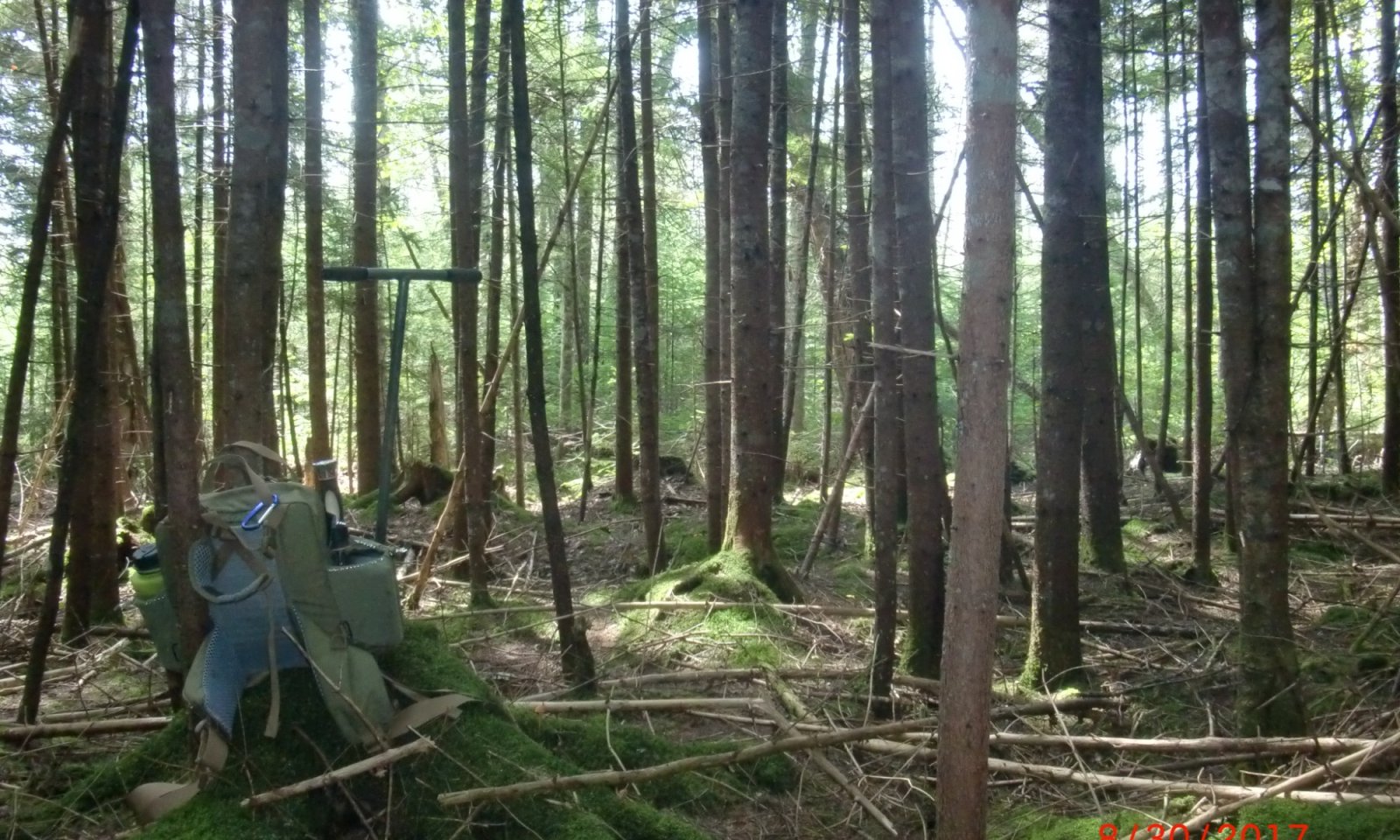
This site is dominated by red spruce, often with balsam fir occurring in younger patches. The understory is typically sparse, though wild raspberries and other early seral species may occupy large areas when trees are removed by logging, blowdowns, insects, or disease.
This site is often managed for spruce-pine-fir (SPF) timber products, and as such may produce more fir than spruce in a managed state. However, historically these sites were likely dominated by red spruce with a limited understory.Associated sites
RX143X00Y302 Mucky Swamp
The Loamy Till Swamp site can be found downslope of the Loamy Flat site site as soil moisture increases farther down the watershed. The Loamy Till Swamp site will generally receive more subsurface water flow (seepage) that promotes the dominance of northern white cedar rather than spruce.
RX143X00Y304 Wet Flat
The Wet Flat site can be found downslope of the Loamy Flat site as soil moisture increases farther down the watershed. The Wet Flat site will generally be absent of very poorly- or somewhat-poorly drained components that is more typical of wetter sites (Acidic Swamps) and drier sites (Loamy Flat).
RX143X00Y502 Loamy Till Toeslope
The Loamy Till Toeslope site can be found upslope of the Loamy Flat site as slope ranges increase, promoting the growth of hardwood species intermixed with spruce.
Similar sites
RX143X00Y304 Wet Flat
The Wet Flat site is wetter than the Loamy Flat site, with all components being poorly-drained rather than a mix of poorly- and somewhat poorly-drained soils. Both sites will support the growth of red spruce with Wet Flat supporting more black spruce and / or red/black spruce hybrids.
RX143X00Y502 Loamy Till Toeslope
The Loamy Till Toeslope site is found on slopes greater than 5 percent and is typically more hardwood-dominated, whereas the Loamy Flat site is found on slopes less than 5 percent and is typically softwood-dominated.
RX143X00Y303 Acidic Swamp
The Acidic Swamp site is wetter than the Loamy Flat site, with all components being very poorly- and poorly-drained rather than a mix of poorly- and somewhat poorly-drained soils. Both sites will support the growth of spruce with the Acidic Swamp supporting more black spruce rather than red spruce.
Table 1. Dominant plant species
Tree (1) Picea rubens
(2) Abies balsameaShrub Not specified
Herbaceous Not specified
Legacy ID
F143XY503ME
Physiographic features
This site occurs on relatively flat (0 to 5 percent slopes) till plains and ground moraines at elevations between 120 and 2,500 feet. It has a seasonally-high water table from November through May that is within 12 inches (30 centimeters) of the soil surface. From June through October the water table often drops below 12 inches (30 centimeters) except following large rain events. This site may exhibit pit and mound topography from a history of blowdowns that excavated pits as tree roots tip up and deposit mounds of soil next to the pit.
Table 2. Representative physiographic features
Hillslope profile (1) Footslope
(2) Toeslope
Geomorphic position, flats (1) Talf
Geomorphic position, terraces (1) Tread
Slope shape across (1) Linear
Slope shape up-down (1) Linear
Landforms (1) Ground moraine
(2) Till plain
Runoff class Low to medium Flooding frequency None Ponding frequency None Elevation 120 – 2500 ft Slope 0 – 5 % Ponding depth 0 in Water table depth 0 – 12 in Aspect Aspect is not a significant factor Table 3. Representative physiographic features (actual ranges)
Runoff class Low to high Flooding frequency None Ponding frequency None Elevation 120 – 2500 ft Slope 0 – 8 % Ponding depth 0 in Water table depth 0 – 24 in Climatic features
The climate of this site is typical of MLRA 143, with very cold snowy winters, warm rainy summers, and a relatively short growing season. Precipitation is fairly constant from month to month and averages about 44 inches (112 centimeters) annually. Growing degree days ranges from 106 -130 days from June to September.
Table 4 Representative climatic features
Frost-free period (characteristic range) 80-100 days Freeze-free period (characteristic range) 120-130 days Precipitation total (characteristic range) 40-50 in Frost-free period (actual range) 80-100 days Freeze-free period (actual range) 110-140 days Precipitation total (actual range) 40-50 in Frost-free period (average) 90 days Freeze-free period (average) 120 days Precipitation total (average) 40 in Characteristic rangeActual rangeBarLineFigure 1. Monthly precipitation range
Characteristic rangeActual rangeBarLineFigure 2. Monthly minimum temperature range
Characteristic rangeActual rangeBarLineFigure 3. Monthly maximum temperature range
BarLineFigure 4. Monthly average minimum and maximum temperature
Figure 5. Annual precipitation pattern
Figure 6 Annual average temperature pattern
Climate stations used
-
(1) RANGELEY 2 NW [USC00177039], Rangeley, ME
-
(2) SPRINGFIELD [USC00178353], Springfield, ME
-
(3) DANFORTH [USC00171833], Danforth, ME
-
(4) WOODLAND [USC00179891], Baileyville, ME
-
(5) BLANCHARD [USC00170655], Abbot, ME
-
(6) BRASSUA DAM [USC00170814], Rockwood, ME
-
(7) ISLAND POND [USC00434120], Island Pond, VT
-
(8) YORK POND [USC00279966], Berlin, NH
-
(9) CLAYTON LAKE [USC00171472], Northwest Aroostook, ME
-
(10) PITTSTON FARM [USC00176721], North Somerset County, ME
-
(11) NEWCOMB [USC00305714], Newcomb, NY
-
(12) TUPPER LAKE SUNMOUNT [USC00308631], Tupper Lake, NY
">Influencing water features
Though soils are poorly drained with a seasonally high-water table ranging close to the soil surface, this site does not regularly experience ponding water on the soil surface. During dry periods from June to September the water table may drop below 18 inches (45 centimeters) below the soil surface.
Wetland description
NA
Soil features
Soils of this site are poorly- and somewhat-poorly-drained complexes of lodgment till characterized by a densely-compacted layer within 40 inches (100 centimeters) below the surface. This dense layer is hard to dig through and often has about 15 percent rock fragments by volume. Importantly, it perches water in the upper soil layers, resulting in redoximorphic features near the soil surface. These are mineral soils, but they may have a thin layer of mucky peat material on the surface, particularly in poorly-drained components.
Representative soils include the Adirondack (Typic Endoaquods), Aurelie (Aeric Endoaquepts), Brayton (Aeric Endoaquepts), Colonel (Aquic Haplorthods), Cabot (Typic Humaquepts), Daigle (Aquic Haplorthods), and Wilmington (Typic Endoaquods). Other series may be locally representative in some cases, a result of local physiography compared to solely soil characteristics.
Figure 7. Wilmington series present in the Nullhegan Basin of Silvio O. Conte National Wildlife Refuge, Vermont. NASIS Pedon ID 2017VT009001.
Table 5. Representative soil features
Parent material (1) Lodgment till
Surface texture (1) Fine sandy loam
(2) Silt loam
Family particle size (1) Loamy
Drainage class Poorly drained to somewhat poorly drained Depth to restrictive layer 0 – 40 in Soil depth 80 in Surface fragment cover <=3" Not specified Surface fragment cover >3" 0 – 2 % Available water capacity
(0-40in)4 – 13 in Calcium carbonate equivalent
(0-40in)Not specified Electrical conductivity
(0-40in)Not specified Sodium adsorption ratio
(0-40in)Not specified Soil reaction (1:1 water)
(0-40in)3.6 – 6.5 Subsurface fragment volume <=3"
(0-40in)0 – 14 % Subsurface fragment volume >3"
(0-40in)0 – 9 % Table 6. Representative soil features (actual values)
Drainage class Poorly drained to somewhat poorly drained Depth to restrictive layer 0 – 40 in Soil depth 60 – 80 in Surface fragment cover <=3" 0 % Surface fragment cover >3" 0 – 2 % Available water capacity
(0-40in)0 – 15 in Calcium carbonate equivalent
(0-40in)0 % Electrical conductivity
(0-40in)0 mmhos/cm Sodium adsorption ratio
(0-40in)0 Soil reaction (1:1 water)
(0-40in)3 – 7 Subsurface fragment volume <=3"
(0-40in)0 – 30 % Subsurface fragment volume >3"
(0-40in)0 – 20 % Ecological dynamics
The vegetation groupings described in this section are based on the terrestrial ecological system classification and vegetation associations developed by NatureServe (Comer et al., 2003) and localized associations provided by the New York Natural Heritage Program (Edinger et al., 2014), Maine Natural Areas Program (Gawler and Cutko, 2010), New Hampshire Natural Heritage Program (Sperduto and Nichols, 2011), and Vermont Fish and Wildlife Department Natural Heritage Inventory (Sorenson and Zaino, 2019).
Relationships to other classification systems include:
• Picea mariana – Picea rubens / Pleurozium schreberi Forest (CEGL006361)
• Picea rubens – Abies balsamea – Betula papyrifera Forest (CEGL006273)
• Picea rubens – Abies balsamea – Betula spp. – Acer rubrum Forest (CEGL006505)
• [ME] Lower-elevation Spruce-Fir Forest (Gawler and Cutko, 2010)
• [NH] Lowland spruce – fir forest (Sperduto and Nichols, 2011)
• [NY] Spruce flats, Balsam flats (Edinger et al., 2014)
• [VT] Lowland Spruce – Fir Forest (Thompson and Sorrenson, 2010)
This community matrix is described as a closed canopy forest dominated by red spruce (Picea rubens) and / or balsam fir (Abies balsamea) with northern hardwood species such as red maple (Acer rubra), yellow birch (Betula alleghaniensis), and paper birch (B. papyrifera) in smaller amounts. The shrub layer is often sparse to absent and will typically have variable amounts of softwood regeneration. Herbaceous and bryophyte plant cover is closely correlated with light availability; canopy gaps tend to have greater understory plant cover, whereas dense, closed canopies tend to reduce it. The ground surface cover of mosses and liverworts appears to be closely correlated with high moisture availability and moderate light levels (e.g., a more open canopy may produce drier conditions that impede bryophyte growth) (Sperduto 2000). These communities are often found in cold pockets where cool air settles and creates cold microclimates, keeping the soil moist for extended periods of time.
Due to the presence of a restrictive layer close to the soil surface and increased soil moisture as a result, small tree throw gaps are one of the most common disturbances in these communities. Shallow rooting contributes to individual tip ups, leaving a microtopography of hummocks and hollows. Other small-scale disturbances may occur during localized windstorms, from ice shearing, snow loading, selective harvest, insect disease, from old age or any number of small disturbance events. This site is resilient following these small disturbances and will often succeed through a localized herbaceous and shrubby phase prior to tree establishment and return to the reference condition. Rarer large-scale disturbances such as severe windstorm damage may occur naturally, whereas human influenced large scale disturbances such as large scale logging are more common. Fire is uncommon in these communities with an average return interval of 556 to 1,111 years but have been known to occur during periods of extended drought. Replacement-severity fires (causing >75% kill or top kill of the upper canopy) occurs as 18 to 100 percent of fires and mixed-severity fires (26-75% kill or top kill of the upper canopy) occur as 0 to 64 percent of fires and low-severity fires (State and transition model
More interactive model formats are also available. View Interactive Models
Click on state and transition labels to scroll to the respective textEcosystem states
T1A - Natural Vegetation Clearing, Site Preparation, Planting of Crops T1B - Natural Vegetation Clearing, Site Preparation, Introduction of Native and Non-Native Pasture Grasses and Legumes T2A - Removal of Crops, Seeding of Desirable Pasture Grasses & Legumes T2B - Long-Term Field Abandonment T3A - Removal of Grasses Through Tillage, Introduction of Crops T3B - Long-Term Field Abandonment T4A - Time, Pine Mortality, Spruce/Fir Regeneration and Dominance State 1 submodel, plant communities
Communities 1, 5 and 2 (additional pathways)
1.1A - Patch Cut, Clearcut, or Blowdown that Increases Light Availability 1.2A - Softwood (spruce/ fir) Regeneration, Seedling Planting (post harvest) 1.2B - Mixed (softwood and hardwood) Regeneration 1.3A - Patch Cut, Clearcut, or Blowdown that Increases Light Availability 1.3B - Time (20 - 150 years), Natural Regeneration OR Selective Cuts for Softwood Dominance 1.4A - Time (>150 years), Minimal Management 1.4B - Patch Cut, Clearcut, or Blowdown that Increases Light Availability 1.4C - Shelterwood Removal Cut 1.5A - Time (>150 years), Minimal Management 1.5B - Patch Cut, Clearcut, or Blowdown that Increases Light Availability 1.5C - Softwood Release through Forest Management Practives State 2 submodel, plant communities
2.1A - Reduced or Eliminated Tillage Operations, Crop Rotations Occur at Regular Intervals, Crop Residue and Amendments Remain on the Soil Surface, Planting of Cover Crops 2.2A - Intensive Tillage Operations, Monoculture of Row Cropping Establishment State 3 submodel, plant communities
3.1A - Reduced or Eliminated Grassland Management Operations, Natural Succession to Predominantly Invasive and Incursive Shrubs 3.2A - Removal of Undesirable Species via Management Practices (Brush, Chemical, etc.) State 4 submodel, plant communities
State 1
Spruce - Fir ForestsThis state represents the range of variability that dominates the dynamics of this site. The canopy will typically have a strong dominance of conifers, particularly red and white spruce, mixed with variable amounts of balsam fir. Scattered hardwoods may be infrequent or completely absent. The understory will have variable coverage depending on the stage of succession.
Resilience management. Silvicultural methods for these forest types include clear cutting, selective harvesting, and shelterwood cuttings. In natural systems, stand-replacing disturbances were rare and were dominated by small-scale disturbances, resulting in most forests being multi-aged.
Dominant plant species
-
red spruce (Picea rubens), tree
-
white spruce (Picea glauca), tree
-
balsam fir (Abies balsamea), tree
-
striped maple (Acer pensylvanicum), shrub
-
hobblebush (Viburnum lantanoides), shrub
-
catberry (Ilex mucronata), shrub
-
withe-rod (Viburnum nudum var. cassinoides), shrub
-
sheep laurel (Kalmia angustifolia), shrub
-
sedge (Carex), grass
-
bluebead (Clintonia borealis), other herbaceous
-
bunchberry dogwood (Cornus canadensis), other herbaceous
-
shining clubmoss (Huperzia lucidula), other herbaceous
-
intermediate woodfern (Dryopteris intermedia), other herbaceous
-
Schreber's big red stem moss (Pleurozium schreberi), other herbaceous
-
splendid feather moss (Hylocomium splendens), other herbaceous
-
knights plume moss (Ptilium crista-castrensis), other herbaceous
-
delicate thuidium moss (Thuidium delicatulum), other herbaceous
-
dicranum moss (Dicranum), other herbaceous
-
(Bazzania trilobata), other herbaceous
Dominant resource concerns
-
Plant productivity and health
-
Plant structure and composition
-
Plant pest pressure
-
Terrestrial habitat for wildlife and invertebrates
Community 1.1
Late Successional Uneven-Aged Spruce ForestThe reference phase consists of a closed canopy (>75% closure) of spruce (>60% cover) with a minor to moderate amount of balsam fir (often up to 20% cover). Scattered hardwoods may be present but generally do not make up much cover (
Resilience management. Group selection or irregular shelterwood harvest methods may assist with advanced spruce regeneration to maintain a multi-aged stand that minimizes forest disturbance as well as promoting spruce over other softwood species. This will establish new cohorts of red spruce and expose residual overstory trees to promote wind-firmness.
Forest overstory.The canopy is dominated by some combination of red spruce, white spruce, and balsam fir. Associates include yellow birch (Betula alleghaniensis), eastern hemlock (Tsuga canadensis), white pine (Pinus strobus), tamarack (Larix laricina), red maple (Acer rubrum), black cherry (Prunus serotina), or northern white cedar (Thuja occidentalis). Balsam fir is often found in open gaps or in younger stands.
Forest understory. The forest understory is often sparse or patchy, consisting of mostly tree regeneration. Shrubs are typically dwarfed and sparse to absent. Herbaceous species will often be less than 10% cover. Conifer litter is present in moderate to high amounts on the ground surface, with bryophytes forming partial to full cover beneath. These bryophytes provide good nurse habitats for tree regeneration and low forbs. Characteristic species may include Schreber’s big red stem moss (Pleurozium schreberi), stair-step moss (Hylocomium splendens), knights plume moss (Ptilium crista-castrensis), greater whipwort (Bazzania trilobata), windswept moss (Dicranum spp), and species of Sphagnum.
Dominant plant species
-
red spruce (Picea rubens), tree
-
white spruce (Picea glauca), tree
-
balsam fir (Abies balsamea), tree
-
catberry (Ilex mucronata), shrub
-
striped maple (Acer pensylvanicum), shrub
-
wild sarsaparilla (Aralia nudicaulis), shrub
-
sheep laurel (Kalmia angustifolia), shrub
-
hobblebush (Viburnum lantanoides), shrub
-
possumhaw (Viburnum nudum), shrub
-
blueberry (Vaccinium), shrub
-
sedge (Carex), grass
-
cinnamon fern (Osmunda cinnamomea), other herbaceous
-
interrupted fern (Osmunda claytoniana), other herbaceous
-
creeping snowberry (Gaultheria hispidula), other herbaceous
-
Canada mayflower (Maianthemum canadense), other herbaceous
-
bunchberry dogwood (Cornus canadensis), other herbaceous
-
threeleaf goldthread (Coptis trifolia), other herbaceous
-
bluebead (Clintonia borealis), other herbaceous
-
shining clubmoss (Huperzia lucidula), other herbaceous
-
red trillium (Trillium erectum), other herbaceous
-
robin runaway (Dalibarda repens), other herbaceous
Dominant resource concerns
-
Plant productivity and health
-
Plant structure and composition
-
Plant pest pressure
-
Terrestrial habitat for wildlife and invertebrates
Community 1.2
Early Successional Herbaceous Phase (Temporary Dominance)This phase occurs after large scale disturbances such as heavy logging or a stand replacing natural event such as windstorm damage, fire, insect damage, disease, etc. resulting in an open stand. Remnant living overstory species, standing dead snags, understory downed woody debris, and remaining groundcover may vary depending on the nature and severity of the disturbance. Large accumulations of slash and the development of heavy herbaceous cover may inhibit natural regeneration, perpetuating this phase.
Forest overstory.The canopy will often be sparse to absent, with leave trees or standing dead trees remaining for wildlife habitat.
Forest understory. Annual grasses and forbs and perennial shrubs take temporary dominance while tree regeneration occurs. Saplings will tend to be less than 1.5 feet in height, whereas shrubs can range up to 15 feet in some areas but will often be less than 6 feet. The once dominant groundcover of bryophytes is likely to be all but replaced with herbaceous litter of these species.
Dominant plant species
-
pin cherry (Prunus pensylvanica), shrub
-
blackberry (Rubus), shrub
-
viburnum (Viburnum), shrub
-
blueberry (Vaccinium), shrub
-
sedge (Carex), grass
-
goldenrod (Solidago), other herbaceous
-
aster (Symphyotrichum), other herbaceous
Dominant resource concerns
-
Plant productivity and health
-
Plant structure and composition
-
Wildfire hazard from biomass accumulation
-
Terrestrial habitat for wildlife and invertebrates
Community 1.3
Early Successional Even-Aged Spruce-Fir Forest (Doghair Forest)This phase consists of spruce and balsam fir saplings that are the dominant species growing extremely close together. This forested phase will often be extremely dense and greater than 1.5 feet but less than 15 feet in height, with average diameters less than 1.6 inches at breast height (DBH). As these trees grow, competition will weed out individual trees until a balanced density is achieved. Mixed in with the highly dense spruce-fir forest will often be other early successional forest species such as paper birch, aspen, and pine. As the ground surface becomes more shaded and more deposits of downed woody debris occur, bryophyte cover may begin to reestablish. Overstocked areas of spruce and / or fir may result in slow growth rates, resulting in overtopping by faster growing hardwood species that can suppress conifer growth, resulting in a temporary hardwood or mixed forest.
Resilience management. Applying herbivore browse protection (e.g. snowshoe hare) for seedlings using tree tubes may assist in the regeneration and establishment of regenerative spruce-fir forests.
Dominant plant species
-
balsam fir (Abies balsamea), tree
-
red spruce (Picea rubens), tree
-
white spruce (Picea glauca), tree
-
eastern white pine (Pinus strobus), tree
-
paper birch (Betula papyrifera), tree
-
quaking aspen (Populus tremuloides), tree
-
bigtooth aspen (Populus grandidentata), tree
Dominant resource concerns
-
Plant productivity and health
-
Plant structure and composition
-
Terrestrial habitat for wildlife and invertebrates
Community 1.4
Mid Successional Even-Aged Spruce-Fir Forest
Figure 8. Red spruce forest in the Nullhegan Basin of Silvio O. Conte National Fish and Wildlife Refuge near Brighton, VT. Closed canopy overstory of red spruce prior to any preparatory or establishment cuts. NASIS Vegetation Plot ID .....

Figure 9. Managed red spruce forest in the White Mountain National Forest near Five Corners, NH. Partially open overstory of red spruce to allow for understory regeneration of spruce, fir, and pine. NASIS Vegetation Plot ID 2024NH009023.

Figure 10. Managed even-age red spruce forest canopy view from the ground in Groton State Forest near Peacham, VT. Spruce is the dominant canopy species and makes up the dominant age and heigh class. NASIS Vegetation Plot ID 2025VT005003.
This phase consists of variable canopy closure in which spruce and fir are mixed with early successional and other hardwood species (often less than 25% cover) in a similar age class (typically less than 150 years). The understory will often range from sparse to absent in natural stands to having large amounts of regeneration in managed stands. This community may slightly reflect the microtopography of the reference state caused by tip ups. These even age stands will often have one to two distance age classes present, often seen as regeneration and pole (immature trees) or sawtimber (mature trees) wood.
Resilience management. In natural settings, as the larger early successional species become removed, canopy gaps will allow for the development of a multi-aged stand of dominantly spruce, with some fir and hardwood species being present in under lower canopy layers (transition to 1.5). In managed settings, preparatory and establishment cuts (extended / irregular shelterwood methods) can be used to increase the vitality and health of the intended residual trees while simultaneously open growing space in the canopy to encourage the establishment of regrowth in the understory before removal of the remaining overstory species.
Forest overstory.The forest overstory will generally consist of a monoculture or mixed stand of red spruce, white spruce, and / or balsam fir that are part of a similar height and age class. In natural stands, these will often be growing close together and will create a shaded understory with minimal development. In managed stands, these will often be more evenly spaced to allow light to reach the understory and promote regeneration. <br /> <br /> Less common are hardwoods, often mature early succession species, including as red maple (Acer rubrum), quaking aspen (Populus tremuloides), bigtooth aspen (P. grandidentata), paper birch (Betula papyrifera), yellow birch (Betula alleghaniensis), or black cherry (Prunus serotina).
Forest understory. In natural settings or stands prior to preparatory or establishment cuts the understory will often be highly shaded with little to no understory species or regeneration. In managed stands (post preparatory or establishment cuts), the understory will often consist of large amounts of spruce regeneration. Beneath the tree regeneration bryophytes may make a large portion of the ground cover with scattered forbs.
Dominant plant species
-
red spruce (Picea rubens), tree
-
white spruce (Picea glauca), tree
-
balsam fir (Abies balsamea), tree
-
velvetleaf huckleberry (Vaccinium myrtilloides), other herbaceous
-
lowbush blueberry (Vaccinium angustifolium), other herbaceous
-
western brackenfern (Pteridium aquilinum), other herbaceous
-
starflower (Trientalis borealis), other herbaceous
-
bunchberry dogwood (Cornus canadensis), other herbaceous
-
Canada mayflower (Maianthemum canadense), other herbaceous
-
cinnamon fern (Osmunda cinnamomea), other herbaceous
-
(Bazzania trilobata), other herbaceous
-
dicranum moss (Dicranum polysetum), other herbaceous
-
leucobryum moss (Leucobryum glaucum), other herbaceous
-
hypnum moss (Hypnum imponens), other herbaceous
-
Schreber's big red stem moss (Pleurozium schreberi), other herbaceous
-
sphagnum (Sphagnum), other herbaceous
Dominant resource concerns
-
Plant productivity and health
-
Plant structure and composition
Community 1.5
Mid Successional Even-Aged Mixedwood Forest
Figure 11. Even-aged stand of red maple, balsam fir, and red spruce in Groton State Forest near Peacham, VT. The understory is dominantly leaf litter and the overstory is mostly deciduous with some mature softwood canopy trees. NASIS Vegetation Plot ID 2025VT005002.

Figure 12. Even-aged mixedwood forest canopy view from the ground in Groton State Forest near Peacham, VT. Maple, spruce, and fir are the dominant canopy species and makes up the dominant age and heigh class. NASIS Vegetation Plot ID 2025VT005002.
Repetitive harvesting of softwoods for pulp may exhaust the natural conifer seedbank and allow for a higher density of hardwood species, particularly those representative of a mixed northern hardwoods forest. Eventually softwood regeneration, dominantly spruce and fir, may occur and return to a place of dominance, but this process is thought to take a long time. The ground surface will often lose the bryophyte cover and be replaced with herbaceous leaf litter. Shrubs and forbs may become more dominant in the understory during this time.
Dominant plant species
-
yellow birch (Betula alleghaniensis), tree
-
red maple (Acer rubrum), tree
-
sugar maple (Acer saccharum), tree
-
American beech (Fagus grandifolia), tree
-
red spruce (Picea rubens), tree
-
white spruce (Picea glauca), tree
-
balsam fir (Abies balsamea), tree
Pathway 1.1A
Community 1.1 to 1.2This may occur through intensive harvesting practices such as clearcutting for pulp and lumber. Immediate loss of mature canopy trees increases light availability for understory vegetation and disturbs the seedbank, shifting dominant species composition and structure. Natural mortality from windstorms, insects, diseases, ice or snow damage may also reflect a similar transition, opening the canopy and allowing for the temporary dominance of grasses and forbs, but will leave behind large pieces of woody material for nurse logs. Loss of characteristic groundcover mosses is common as more light availability and altered soil conditions favor faster-growing species. Harvesting during winter months is recommended to prevent extensive rutting and hydrologic instability that may lead to issues such as erosion, loss of moisture retention, and changes in groundwater flow.
Key drivers
-
Mechanical soil disturbance
-
Timber management
-
Windstorm damage
Key ecosystem services affected
-
Food and fiber: wood products
-
Plant biodiversity
Pathway 1.2A
Community 1.2 to 1.3This transition can occur if the basic requirements for tree regeneration are met, primarily an adequate seed supply, proper seedbed, and light, temperature, and moisture conditions are conductive for seed germination and survival. This transition will often occur in less than but no greater than 20 years post-canopy disturbance. Planting spruce can help accelerate the restoration of the natural vegetation of harvested areas.
Key drivers
-
Timber management
-
Seeding
Key ecosystem services affected
-
Food and fiber: wood products
-
Wildlife forage
-
Wildlife habitat
-
Plant biodiversity
Pathway 1.2B
Community 1.2 to 1.5This transition may occur if there is no longer a viable seedbank of spruce or fir present in the system and it has not been replanted. This may occur as the result of repetitive harvesting of spruce and fir for pulpwood. This may also occur following extensive clearcutting, as spruce and balsam fir seedlings are commonly rooted in the upper part of the organic layer, which dries out after heavy logging, resulting in extensive seedling mortality (Pothier and Prevost, 2006). These species are also sensitive to full light and to temperature extremes at their juvenile stage, causing mortality of seedlings and can result in rapid hardwood establishment with spruce and balsam fir in the regeneration stratum beneath a low, closed density canopy.
Conservation practices
Forest Stand Improvement Hardwood Crop Tree Release Creating forest openings to improve hardwood stands Key drivers
-
Timber management
-
Seeding
Key ecosystem services affected
-
Food and fiber: wood products
-
Wildlife forage
-
Wildlife habitat
-
Plant biodiversity
Pathway 1.3A
Community 1.3 to 1.2This may occur through intensive harvesting practices such as clearcutting for pulp and lumber. Immediate loss of mature canopy trees increases light availability for understory vegetation and disturbs the seedbank, shifting dominant species composition and structure. Natural mortality from windstorms, insects, diseases, ice or snow damage may also reflect a similar transition, opening the canopy and allowing for the temporary dominance of grasses and forbs, but will leave behind large pieces of woody material for nurse logs. Loss of characteristic groundcover mosses is common as more light availability and altered soil conditions favor faster-growing species. Harvesting during winter months is recommended to prevent extensive rutting and hydrologic instability that may lead to issues such as erosion, loss of moisture retention, and changes in groundwater flow.
Key drivers
-
Mechanical soil disturbance
-
Timber management
-
Windstorm damage
Key ecosystem services affected
-
Food and fiber: wood products
-
Plant biodiversity
Pathway 1.3B
Community 1.3 to 1.4This transition will occur over time, typically greater than 20 years but less than 100 years into a stand’s lifecycle. The early successional stand will thin in density either naturally (treefall, disease, etc.) and with human interference (forest stand improvement [FSI]). This will lead to an even-aged stand in which spruce is typically the dominant species. Selective cuts and thinning through FSI methods can allow for the regeneration of understory vegetation, including saplings, while encouraging the growth of the desired species. FSI during winter months is recommended and will differ from clearcutting or selecting harvesting methods through the limited disturbance to the local hydrology.
Conservation practices
Forest Stand Improvement Forest Land Management Prescribed Forestry Key drivers
-
Timber management
-
Time (decadal scale)
Key ecosystem services affected
-
Food and fiber: wood products
-
Wildlife habitat
-
Plant biodiversity
Pathway 1.4A
Community 1.4 to 1.1This transition will over time, often greater than 150 years, in which the main stand remains relatively undisturbed. This will allow the spruce stand to mature in its size, age, and height classes, creating a more uneven aged stand with a well-developed overstory and a dark, cool understory that limits regeneration. Balsam fir and other mixed in hardwoods will reach the end of their natural life expectancy and will revert the canopy to spruce dominance. This transition may be assisted with forest stand improvement (FSI) practices, often seen as single tree removal. Red spruce will become the dominant canopy, and the understory will reflect more variation in microtopography (hummocks and hollows) due to natural disturbance tip ups.
Conservation practices
Forest Stand Improvement Key drivers
-
Timber management
-
Time (decadal / centurial scale)
Key ecosystem services affected
-
Food and fiber: wood products
-
Soil formation
-
Plant biodiversity
Pathway 1.4B
Community 1.4 to 1.2This may occur through intensive harvesting practices such as clearcutting for pulp and lumber. Immediate loss of mature canopy trees increases light availability for understory vegetation and disturbs the seedbank, shifting dominant species composition and structure. Natural mortality from windstorms, insects, diseases, ice or snow damage may also reflect a similar transition, opening the canopy and allowing for the temporary dominance of grasses and forbs, but will leave behind large pieces of woody material for nurse logs. Loss of characteristic groundcover mosses is common as more light availability and altered soil conditions favor faster-growing species. Harvesting during winter months is recommended to prevent extensive rutting and hydrologic instability that may lead to issues such as erosion, loss of moisture retention, and changes in groundwater flow.
Key drivers
-
Mechanical soil disturbance
-
Timber management
-
Windstorm damage
Key ecosystem services affected
-
Food and fiber: wood products
-
Wildlife habitat
-
Plant biodiversity
Pathway 1.4C
Community 1.4 to 1.3This is often seen in shelterwood systems and used to release the established seedlings by removing the remaining overstory to allow the understory more growing space. This will revert the forest back to a doghair forest phase where tree regeneration is abundant with the absence of an overstory component.
Conservation practices
Forest Stand Improvement Forest Land Management Key drivers
-
Timber management
Key ecosystem services affected
-
Food and fiber: wood products
-
Plant biodiversity
Pathway 1.5A
Community 1.5 to 1.1This transition will over time, often greater than 150 years, in which the main stand remains relatively undisturbed. This will allow any spruce in the overstory to mature in its size, age, and height classes and seed in new saplings, creating a more uneven aged stand with a well-developed overstory and a dark, cool understory that limits regeneration. Balsam fir and other mixed in hardwoods will reach the end of their natural life expectancy and will revert the canopy to spruce dominance. This transition may be assisted with forest stand improvement (FSI) practices, often seen as single tree removal. Red spruce will become the dominant canopy, and the understory will reflect more variation in microtopography (hummocks and hollows) due to natural disturbance tip ups.
Pathway 1.5B
Community 1.5 to 1.2This may occur through intensive harvesting practices such as clearcutting for pulp and lumber. Immediate loss of mature canopy trees increases light availability for understory vegetation and disturbs the seedbank, shifting dominant species composition and structure. Natural mortality from windstorms, insects, diseases, ice or snow damage may also reflect a similar transition, opening the canopy and allowing for the temporary dominance of grasses and forbs, but will leave behind large pieces of woody material for nurse logs. Loss of characteristic groundcover mosses is common as more light availability and altered soil conditions favor faster-growing species. Harvesting during winter months is recommended to prevent extensive rutting and hydrologic instability that may lead to issues such as erosion, loss of moisture retention, and changes in groundwater flow.
Key drivers
-
Mechanical soil disturbance
-
Timber management
Key ecosystem services affected
-
Food and fiber: wood products
-
Wildlife habitat
-
Plant biodiversity
Pathway 1.5C
Community 1.5 to 1.4
Mid Successional Even-Aged Mixedwood Forest
Mid Successional Even-Aged Spruce-Fir ForestSoftwood release through hardwood thinning methods (cutting, ringing, or herbicide application) can assist in the restoration of a softwood dominated forest, as well as creating scarified seedbeds for its establishment.
Conservation practices
Forest Stand Improvement Key drivers
-
Timber management
-
Seeding
Key ecosystem services affected
-
Food and fiber: wood products
State 2
Agricultural Row CropsThis state represents a once forested area now cleared for cropland. This will typically only occur on gentler slopes (less than15 percent) due to potential for water erosion. Corn and potatoes are the dominant agricultural row crop on this site.
Dominant resource concerns
-
Sheet and rill erosion
-
Wind erosion
-
Ephemeral gully erosion
-
Compaction
-
Organic matter depletion
-
Aggregate instability
-
Nutrients transported to surface water
-
Nutrients transported to ground water
-
Plant productivity and health
Community 2.1
Conventionally Tilled Row CropsThis phase consists of cleared and cultivated fields for annual or perennial crops that are heavily managed with regular soil disturbances.
Dominant resource concerns
-
Sheet and rill erosion
-
Ephemeral gully erosion
-
Subsidence
-
Compaction
-
Organic matter depletion
-
Nutrients transported to surface water
-
Nutrients transported to ground water
-
Plant productivity and health
-
Plant structure and composition
Community 2.2
Conservation Till Row CropsThis phase consists of cleared and cultivated fields for annual or perennial crops that are managed with a conservation focus on tilling practices. These methods include strip till, vertical till, or no till systems. These methods may improve soil ecosystem function over time.
Dominant resource concerns
-
Plant productivity and health
-
Plant structure and composition
Pathway 2.1A
Community 2.1 to 2.2This transition can occur through the reduction or elimination of conventional tillage practices and the implementation of conservation practices. Conservation strategies may vary depending on local site conditions and should be addressed with management planners. Through the long term conservation practices, soil physical and chemical properties should improve and pose less of a risk with land management issues.
Conservation practices
Conservation Cover Conservation Crop Rotation Cover Crop Long Term No. Till Residue and Tillage Management, No-Till/Strip Till/Direct Seed Key ecosystem services affected
-
Wildlife forage
-
Soil formation
Pathway 2.2A
Community 2.2 to 2.1This transition can occur through the use of intensive, regular mechanical soil disturbances.
Conservation practices
Deep Tillage Key ecosystem services affected
-
Wildlife forage
-
Soil formation
State 3
Managed GrasslandThis state represents a once forested area now cleared and managed as pasture or hay fields. This will typically only occur on gentler slopes (less than15 percent) due to potential for water erosion. Pasture vegetation can consist of grasses, legumes, other forbs, shrubs or a mixture. Many of these forages are introduced, having originally come from areas in other states or continents. Overgrazed pastures can lead to soil compaction and numerous bare spots, which may then become focal points of accelerated erosion and colonization sites of undesirable plants or weeds.
Dominant plant species
-
orchardgrass (Dactylis glomerata), grass
-
sweet vernalgrass (Anthoxanthum odoratum), grass
-
timothy (Phleum pratense), grass
-
Kentucky bluegrass (Poa pratensis), grass
-
sheep fescue (Festuca ovina), grass
-
alfalfa (Medicago sativa), other herbaceous
-
red clover (Trifolium pratense), other herbaceous
-
milkvetch (Astragalus), other herbaceous
-
bedstraw (Galium), other herbaceous
-
goldenrod (Solidago), other herbaceous
-
plantain (Plantago), other herbaceous
-
buttercup (Ranunculus), other herbaceous
Dominant resource concerns
-
Sheet and rill erosion
-
Wind erosion
-
Ephemeral gully erosion
-
Compaction
-
Organic matter depletion
-
Aggregate instability
-
Nutrients transported to surface water
-
Nutrients transported to ground water
-
Plant productivity and health
-
Plant structure and composition
-
Feed and forage imbalance
Community 3.1
Desirable Pasture ConditionsThis community phase represents commonly planted forage species on pastureland and hay land. The suite of plants established on any given site may vary considerably depending upon purpose, management goals, and usage (e.g., horse vs. cattle). Most systems include a mixture of non-native cool-season grasses and legumes that provide forage throughout the growing season. Several additional plants and/or species combinations maybe present depending on the objectives and management approaches of the land manager/owner. This may also be the result of bare soil after cessation of agriculture, and will be short-lived without annual mowing, but can persist indefinitely when actively managed.
Resilience management. Mechanical mowing, at least annually but ranging up to four times during the growing season, helps maintain these areas as dominant grasslands
Dominant plant species
-
timothy (Phleum pratense), grass
-
sweet vernalgrass (Anthoxanthum odoratum), grass
-
Kentucky bluegrass (Poa pratensis), grass
-
annual bluegrass (Poa annua), grass
-
orchardgrass (Dactylis glomerata), grass
-
smooth brome (Bromus inermis), grass
-
red fescue (Festuca rubra), grass
-
sheep fescue (Festuca ovina), grass
-
perennial ryegrass (Lolium perenne), grass
-
redtop (Agrostis gigantea), grass
-
festulolium (×Festulolium), grass
-
alfalfa (Medicago sativa), other herbaceous
-
red clover (Trifolium pratense), other herbaceous
-
white clover (Trifolium repens), other herbaceous
-
milkvetch (Astragalus), other herbaceous
-
bedstraw (Galium), other herbaceous
-
buttercup (Ranunculus), other herbaceous
Dominant resource concerns
-
Plant productivity and health
-
Plant structure and composition
-
Feed and forage imbalance
Community 3.2
Undesirable Pasture ("Old Field") ConditionsThis phase represents a more degraded phase for livestock. While some utilization of desirable pasture plants will occur, undesirable species are prolific and will make up more than 50 percent cover. As undesirable pasture species grow, desirable pasture grasses and forbs will decrease in cover. Small trees and shrubs are often present but do not form great amounts of canopy cover. As time progresses if left neglected, these fields become colonized by pioneer tree species, often white pine, but may include species such as eastern redcedar, birch, or spruce. These abandoned fields can persist for many years and may remain for up to 30 years before reverting to forested conditions.
Dominant plant species
-
eastern white pine (Pinus strobus), tree
-
paper birch (Betula papyrifera), tree
-
red maple (Acer rubrum), tree
-
chokecherry (Prunus virginiana), tree
-
blackhaw (Viburnum prunifolium), shrub
-
multiflora rose (Rosa multiflora), shrub
-
sumac (Rhus), shrub
-
blackberry (Rubus), shrub
-
wrinkleleaf goldenrod (Solidago rugosa), other herbaceous
-
giant goldenrod (Solidago gigantea), other herbaceous
-
gray goldenrod (Solidago nemoralis), other herbaceous
-
common milkweed (Asclepias syriaca), other herbaceous
-
false baby's breath (Galium mollugo), other herbaceous
-
common yarrow (Achillea millefolium), other herbaceous
-
Queen Anne's lace (Daucus carota), other herbaceous
-
Canada thistle (Cirsium arvense), other herbaceous
-
tall buttercup (Ranunculus acris), other herbaceous
-
nightshade (Solanum), other herbaceous
-
common sheep sorrel (Rumex acetosella), other herbaceous
Dominant resource concerns
-
Plant productivity and health
-
Plant structure and composition
-
Feed and forage imbalance
Pathway 3.1A
Community 3.1 to 3.2This may occur when grassland management operations are reduced or eliminated, allowing for succession to predominately undesirable and incursive forbs, grasses, shrubs, and trees. Desirable species may remain but will often be less than 50 percent total cover.
Key drivers
-
Livestock grazing or browsing
-
Mechanical soil disturbance
-
Nonnative plant species presence and/or establishment
Key ecosystem services affected
-
Food and fiber: livestock forage
-
Plant biodiversity
Pathway 3.2A
Community 3.2 to 3.1This may occur through the removal of undesirable species in a managed grassland and return to specific management practices for pasture or hay production. The amount of energy required to restore an old field is dependent on the amount of time it has been out of production, with longer periods of abandonment requiring more energy. Brush management or tilling operations may be needed to control undesirable species before reseeding with a desirable species mix using the correct rate and methods.
Conservation practices
Brush Management Prescribed Grazing Invasive Plant Species Control Grazing Management Plan Managed Haying/Grazing Biological suppression and other non-chemical techniques to manage brush, weeds and invasive species Biological suppression and other non-chemical techniques to manage herbaceous weeds invasive species Key drivers
-
Mechanical soil disturbance
-
Seeding
Key ecosystem services affected
-
Food and fiber: livestock forage
-
Plant biodiversity
State 4
Post-Agricultural Successional ForestsThis state represents a once cleared forest that had been under pasture or crop management that has been abandoned over long periods of time (often greater than 30 but less than 200 years).
Characteristics and indicators. Vegetative indicators typically include a young to mature forest, most often eastern white pine (<a class="species-link" href="https://plants.usda.gov/core/profile?symbol=PIST" target="_blank" title="Open in plants.usda.gov"><i>Pinus strobus</i></a>), of a singular age and height class (at least 16 feet tall). If aged, these will often range from 30 years to over 100 years old, and will often reflect the time since abandonment. The understory is typically sparse and open due to the acidic nature of pine needles. Soil indicators include the absence of surface fragments and the presence of a plowed horizon (Ap). Physiographic identifiers often include relatively flat sloped areas with smooth microtopography, becoming more complex as the forest develops and natural tip ups occur.
Dominant plant species
-
eastern white pine (Pinus strobus), tree
Community 4.1
Even Age Eastern White Pine StandsFollowing long-term agricultural abandonment, eastern white pine (Pinus strobus) typically forms an even aged monoculture, being the dominant overstory species. Understory vegetation will often be sparse but may support scattered forbs and woody regeneration reflective of the reference condition. The height and age of a stand will be dependent on time since abandonment. These stands are commonly seen throughout New England, where early European settlements previously cleared an area but has since been abandoned.
Resilience management. These forests are typically not seen as the climax, or reference, community, and rather classified as disturbance-dependent. Over time, species representative of the reference conditions, such as spruce and fir, may begin to form in the subcanopy under the tall pines if a seed source is present and conditions are optimal.
Dominant plant species
-
eastern white pine (Pinus strobus), tree
Dominant resource concerns
-
Plant productivity and health
-
Plant structure and composition
-
Wildfire hazard from biomass accumulation
-
Terrestrial habitat for wildlife and invertebrates
Transition T1A
State 1 to 2Converted forested communities have often undergone the clearing of native vegetation and site preparation before conversion to agricultural fields is complete. Due to the complex microtopography of the native site, land smoothing and / or leveling may be required, as well as undergoing practices such as tilling for the field to be ready to plant. Planting of desired crops can be done by hand or machine at desired spacing and intervals. Historically cleared land may have had water control structures installed to manage seasonal high water tables.
Key drivers
-
Mechanical soil disturbance
-
Seeding
Key ecosystem services affected
-
Food and fiber: livestock forage
-
Food and fiber: wood products
-
Soil formation
-
Plant biodiversity
Transition T1B
State 1 to 3Converted forested communities have often undergone the clearing of native vegetation and site preparation before conversion to a managed grassland state is complete. Due to the complex microtopography of the native site, land smoothing and / or leveling may be required. Planting of desired mixtures of grasses and / or legumes can be done by hand or machine at desired densities. Historically cleared land may have had water control structures installed to manage seasonal high water tables.
Key drivers
-
Mechanical soil disturbance
-
Seeding
Key ecosystem services affected
-
Food and fiber: livestock forage
-
Food and fiber: wood products
-
Soil formation
-
Plant biodiversity
Transition T2A
State 2 to 3Cropland can be converted to managed grasslands following the removal of the crop and the planting of desired mixtures of grasses and / or legumes at the desired density. Short term abandonment of crop fields may also give rise to ruderal shrublands and undesirable grasses and forbs that, if managed correctly, can be converted into a persistently managed grassland.
Conservation practices
Managed Haying/Grazing Key drivers
-
Livestock grazing or browsing
-
Seeding
Key ecosystem services affected
-
Food and fiber: livestock forage
-
Soil formation
-
Plant biodiversity
Transition T2B
State 2 to 4This state transitions to a post-agricultural successional forest following the long-term abandonment of converted fields. While short-term abandonment of fields may allow for dominance of undesirable species they can revert to a commodity field with proper management. Long-term abandonment is accepted as the establishment of a single age stand of closed canopy forest.
Key ecosystem services affected
-
Food and fiber: livestock forage
-
Plant biodiversity
Transition T3A
State 3 to 2Managed grassland can be converted to agricultural fields following the removal of the grasses / legumes (typically achieved by tilling) and planting the desired crop at the desired spacing and intervals.
Conservation practices
Deep Tillage Crop management system on crop land acres recently converted Key drivers
-
Mechanical soil disturbance
-
Seeding
Key ecosystem services affected
-
Food and fiber: livestock forage
-
Soil formation
-
Plant biodiversity
Transition T3B
State 3 to 4This state transitions to a post-agricultural successional forest following the long-term abandonment of converted fields. While short-term abandonment of fields may allow for dominance of undesirable species they can revert to a commodity field with proper management. Long-term abandonment is accepted as the establishment of a single age stand of closed canopy forest.
Key ecosystem services affected
-
Food and fiber: livestock forage
-
Plant biodiversity
Transition T4A
State 4 to 1Following the establishment of post-agricultural successional forests the system is expected to increase in physical and chemical stability as the stand age increases. Over time as more natural disturbances occur and the forest soils are stable, species representative of the reference community can become dominant as pine mortality occurs. Individual mortality and tip ups will reform the complex microtopography (pit and mound) seen in the reference conditions.
Constraints to recovery.Forest operations, such as thinning and selective harvesting, can be used to assist in recreating reference conditions. Natural mortality from insects (pine weevil [Hylobius abietis]) or tree throw can serve to open the canopy and promote new growth. Available seedbanks must be present for spruce and fir regeneration.
Conservation practices
Forest Stand Improvement Forest stand improvement for habitat and soil quality Key drivers
-
Timber management
-
Time (decadal / centurial scale)
Key ecosystem services affected
-
Food and fiber: wood products
-
Plant biodiversity
Additional community tables
Table 7. Community 1.1 plant community composition
Group Common name Symbol Scientific name Annual production () Foliar cover (%) Table 8. Community 1.2 plant community composition
Group Common name Symbol Scientific name Annual production () Foliar cover (%) Table 9. Community 1.3 plant community composition
Group Common name Symbol Scientific name Annual production () Foliar cover (%) Table 10. Community 1.4 plant community composition
Group Common name Symbol Scientific name Annual production () Foliar cover (%) Table 11. Community 1.5 plant community composition
Group Common name Symbol Scientific name Annual production () Foliar cover (%) Table 12. Community 2.1 plant community composition
Group Common name Symbol Scientific name Annual production () Foliar cover (%) Table 13. Community 2.2 plant community composition
Group Common name Symbol Scientific name Annual production () Foliar cover (%) Table 14. Community 3.1 plant community composition
Group Common name Symbol Scientific name Annual production () Foliar cover (%) Table 15. Community 3.2 plant community composition
Group Common name Symbol Scientific name Annual production () Foliar cover (%) Table 16. Community 4.1 plant community composition
Group Common name Symbol Scientific name Annual production () Foliar cover (%) Interpretations
Animal community
**DRAFT**
The following information is provided from University of New Hampshire’s “Dirt to Trees to Wildlife”. Asterisks denotes Species of Greatest Conservation Need and hyperlinks will take you to recommendations specific to those species.
Common animals found in Spruce-Fir Forest Types at ANY elevation may include:
Snowshoe hare (Lepus americanus), Red squirrel (Sciurus vulgaris), Southern red-backed vole (Myodes gapperi), Long-tailed shrew (Sorex dispar)*, American marten (Martes americana)*, Boreal chickadee (Poecile hudsonicus), Dark-eyed junco (Junco hyemalis), Pine siskin (Spinus pinus), Spruce grouse (Canachites canadensis )*, and Red-breasted nuthatch (Sitta canadensis).
Common animals found in Spruce-Fir Forest Types at low-elevation (generally below 2,500 feet) only may include
Northern flying squirrel (Glaucomys sabrinus), Deer mouse (Peromyscus maniculatus), Hoary bat (Lasiurus cinereus)*, Tri-colored bat (Perimyotis subflavus)*, Little brown bat (Myotis lucifugus)*, Silver-haired bat (Lasionycteris noctivagans)*, Northern long-eared bat (Myotis septentrionalis)*, Indiana bat (Myotis sodalis)*, Red bat (Lasiurus borealis)*, Red fox (Vulpes vulpes), Bobcat (Lynx rufus)*, Moose (Alces alces)*, Bay-breasted warbler (Setophaga castanea)*, Blackburnian warbler (Setophaga fusca), Cape May warbler (Setophaga tigrina)*, Common goldeneye (Bucephala clangula), Magnolia warbler (Setophaga magnolia), Olive-sided flycatcher (Contopus cooperi)*, Purple finch (Haemorhous purpureus)*, Rusty blackbird (Euphagus carolinus)*, Sharp-shinned hawk (Accipiter striatus)*, Swainsons thrush (Catharus ustulatus), Three-toed woodpecker (Picoides dorsalis)*, Yellow-bellied flycatcher (Empidonax flaviventris), Blackpoll warbler (Setophaga striata), Blue-headed vireo (Vireo solitarius), Northern parula (Setophaga americana), evening grosbeak (Coccothraustes vespertinus), Northern saw-whet owl (Aegolius acadicus), Hermit thrush (Catharus guttatus), Merlin (Falco columbarius), and the Nashville warbler (Leiothlypis ruficapilla).
Silvicultural recommendations for managing wildlife habitat:
-Use uneven-aged management - group selection with group sizes of less than 1 acre.
-Rotation age - 120 years
-Entry cycle every 15 to 20 years
-Avoid entry during nesting season (April to June)
-Whole-tree harvest or cut-to-length is preferred.Wood products
This ecological site is included in the Spruce-Pine-Fir (SPFs) commercial lumber category [eastern species of SPF group produced from logs harvested in the USA]. These species share similar characteristics, making them suitable for the same construction purposes and are often popular choices for framing, trusses, and other structural components in residential and commercial buildings.
Supporting information
Inventory data references
Future work is needed, as described in a future project plan, to validate the information presented in this provisional ecological site description. Future work includes field sampling, data collection and analysis by qualified vegetation ecologists and soil scientists. As warranted, annual reviews of the project plan can be conducted by the Ecological Site Technical Team. A final field review, peer review, quality control, and quality assurance reviews of the ESD are necessary to approve a final document.
Other references
Abrams, M. D. (2001). Eastern white pine versatility in the presettlement forest: this eastern giant exhibited vast ecological breadth in the original forest but has been on the decline with subsequent land-use changes. BioScience, 51(11), 967-979.
Barton, A. M., A. S. White, and C. V. Cogbill. 2012. The Changing Nature of the Maine Woods. University Press of New England, Lebanon, NH.
Bennett, Karen P. editor. 2010. Good Forestry in the Granite State: Recommended Voluntary Forest Management Practices for New Hampshire (second edition). University of New Hampshire Cooperative Extension, Durham, N.H.
Blum, B. M., Benzie, J. W., & Merski, E. (1983). Eastern spruce-fir. Silvicultural systems for the major timber types of the US Agr Hardbook, 445, 128-130.
Coladonato, Milo. 1991. Fagus grandifolia. In: Fire Effects Information System, [Online]. U.S. Department of Agriculture, Forest Service, Rocky Mountain Research Station, Fire Sciences Laboratory (Producer). Available: https://www.fs.usda.gov/database/feis/plants/tree/faggra/all.html [2024, July 12].
DeGraaf, R., M. Yamasaki, W. B. Leak, and A. M. Lester. 2006. Technical Guide to Forest Wildlife Habitat Management in New England. University of Vermont Press and University Press of New England, Burlington, Vt. 305 p.
Frank, R. M., & Bjorkbom, J. C. (1973). A silvicultural guide for spruce-fir in the Northeast (Vol. 6). Forest Service, US Department of Agriculture, Northeastern Forest Experiment Station.
Gawler, S. and A. Cutko. 2010. Natural Landscapes of Maine: A Guide to Natural Communities and Ecosystems. Maine Natural Areas Program, Maine Department of Conservation, Augusta, Maine.
Griffith, Randy Scott. 1991. Fraxinus americana. In: Fire Effects Information System, [Online]. U.S. Department of Agriculture, Forest Service, Rocky Mountain Research Station, Fire Sciences Laboratory (Producer). Available: https://www.fs.usda.gov/database/feis/plants/tree/fraame/all.html [2024, July 12].
Hughes, J. W., & Bechtel, D. A. (1997). Effect of distance from forest edge on regeneration of red spruce and balsam fir in clearcuts. Canadian Journal of Forest Research, 27(12), 2088-2096.
Janowiak, Maria K.; DAmato, Anthony W.; Swanston, Christopher W.; Iverson, Louis; Thompson, Frank R., III; Dijak, William D.; Matthews, Stephen; Peters, Matthew P.; Prasad, Anantha; Fraser, Jacob S.; Brandt, Leslie A.; Butler-Leopold, Patricia; Handler, Stephen D.; Shannon, P. Danielle; Burbank, Diane; Campbell, John; Cogbill, Charles; Duveneck, Matthew J.; Emery, Marla R.; Fisichelli, Nicholas; Foster, Jane; Hushaw, Jennifer; Kenefic, Laura; Mahaffey, Amanda; Morelli, Toni Lyn; Reo, Nicholas J.; Schaberg, Paul G.; Simmons, K. Rogers; Weiskittel, Aaron; Wilmot, Sandy; Hollinger, David; Lane, Erin; Rustad, Lindsey; Templer, Pamela H. 2018. New England and northern New York forest ecosystem vulnerability assessment and synthesis: a report from the New England Climate Change Response Framework project. Gen. Tech. Rep. NRS-173. Newtown Square, PA: U.S. Department of Agriculture, Forest Service, Northern Research Station. 234 p. https://doi.org/10.2737/nrs-gtr-173
Johanson, J. K., Butler, N. R. and C. Bickford. 2016. Classifying Northern New England Landscapes for Improved Conservation. Rangelands 38:6.
Leak, William B.; Riddle, Jane R. 1979. Why trees grow where they do in New Hampshire Forests. NE-INF-37-79. Broomall, Pennsylvania: U.S. Department of Agriculture, Forest Service, Northeastern Research Station. 26p.
Moores, A. R., Seymour, R. S., & Kenefic, L. S. (2007). Height development of shade-tolerant conifer saplings in multiaged Acadian forest stands. Canadian Journal of Forest Research, 37(12), 2715-2723.
Pothier, D., & Prevost, M. (2008). Regeneration development under shelterwoods in a lowland red spruce–balsam fir stand. Canadian Journal of Forest Research, 38(1), 31-39.
Sperduto, D. and B. Kimball. 2011. The Nature of New Hampshire: Natural Communities of the Granite State. The Nature Conservancy and The New Hampshire Heritage Bureau. University Press of New England, Lebanon, NH.
Sullivan, Janet. 1994. Betula alleghaniensis. In: Fire Effects Information System, [Online]. U.S. Department of Agriculture, Forest Service, Rocky Mountain Research Station, Fire Sciences Laboratory (Producer). Available: https://www.fs.usda.gov/database/feis/plants/tree/betall/all.html [2024, July 12].
Sullivan, Janet. 1993. Picea rubens. In: Fire Effects Information System, [Online]. U.S. Department of Agriculture, Forest Service, Rocky Mountain Research Station, Fire Sciences Laboratory (Producer). Available: https://www.fs.usda.gov/database/feis/plants/tree/picrub/all.html [2024, August 5].
Thompson, E. H. and E. R. Sorenson. 2000. Wetland, Woodland, Wildland: A Guide to the Natural Communities of Vermont. The Nature Conservancy and the Vermont Department of Fish and Wildlife. University Press of New England, Hanover, NH.
Tirmenstein, D. A. 1991. Acer saccharum. In: Fire Effects Information System, [Online]. U.S. Department of Agriculture, Forest Service, Rocky Mountain Research Station, Fire Sciences Laboratory (Producer).
Tirmenstein, D. A. 1991. Acer rubrum. In: Fire Effects Information System, [Online]. U.S. Department of Agriculture, Forest Service, Rocky Mountain Research Station, Fire Sciences Laboratory (Producer). Available: https://www.fs.usda.gov/database/feis/plants/tree/acerub/all.html [2024, July 12].
Uchytil, Ronald J. 1991. Abies balsamea. In: Fire Effects Information System, [Online]. U.S. Department of Agriculture, Forest Service, Rocky Mountain Research Station, Fire Sciences Laboratory (Producer). Available: https://www.fs.usda.gov/database/feis/plants/tree/abibal/all.html [2024, August 5].
Uchytil, Ronald J. 1991. Betula papyrifera. In: Fire Effects Information System, [Online]. U.S. Department of Agriculture, Forest Service, Rocky Mountain Research Station, Fire Sciences Laboratory (Producer). Available: https://www.fs.usda.gov/database/feis/plants/tree/betpap/all.html [2024, July 12].
Uchytil, Ronald J. 1991. Prunus serotina. In: Fire Effects Information System, [Online]. U.S. Department of Agriculture, Forest Service, Rocky Mountain Research Station, Fire Sciences Laboratory (Producer). Available: https://www.fs.usda.gov/database/feis/plants/tree/pruser/all.html [2024, July 12].
USDA Natural Resources Conservation Service. 2006. Land Resource Regions and Major Land Resource Areas of the United States, the Caribbean, and the Pacific Basin. U.S. Department of Agriculture Handbook 296.
U.S. Department of Agriculture, Forest Service, Missoula Fire Sciences Laboratory. 2012. Information from LANDFIRE on fire regimes of northeastern spruce-fir communities. In: Fire Effects Information System, [Online]. U.S. Department of Agriculture, Forest Service, Rocky Mountain Research Station, Missoula Fire Sciences Laboratory (Producer). Available: www.fs.usda.gov/database/feis/fire_regimes/NE_spruce_fir/all.html [2024, September 20].
White, P. S., & Cogbill, C. V. (1992). Spruce-fir forests of eastern North America. In Ecology and decline of red spruce in the eastern United States (pp. 3-39). New York, NY: Springer New York.Contributors
Jack Ferrara, Provisional to Verified 2025
Christopher Mann, Revisions 2024
Jamin Johanson, Original Author 2016Approval
Greg Schmidt, 5/15/2025
Acknowledgments
Nels Barrett, Northeast Regional Ecologist, USDA-NRCS, Tolland, CT Greg Schmidt, Northeast Ecological Data Quality Specialist, USDA-NRCS, Grand Rapids, MI Lucy Zendzian, Soil Scientist, USDA-NRCS, St. Johnsbury, VT Paul Gadecki, Soil Scientist, USDA-NRCS, St. Johnsbury, VT
Rangeland health reference sheet
Interpreting Indicators of Rangeland Health is a qualitative assessment protocol used to determine ecosystem condition based on benchmark characteristics described in the Reference Sheet. A suite of 17 (or more) indicators are typically considered in an assessment. The ecological site(s) representative of an assessment location must be known prior to applying the protocol and must be verified based on soils and climate. Current plant community cannot be used to identify the ecological site.
Author(s)/participant(s) Contact for lead author Date 04/28/2025 Approved by Approval date Composition (Indicators 10 and 12) based on Annual Production Indicators
-
Number and extent of rills:
-
Presence of water flow patterns:
-
Number and height of erosional pedestals or terracettes:
-
Bare ground from Ecological Site Description or other studies (rock, litter, lichen, moss, plant canopy are not bare ground):
-
Number of gullies and erosion associated with gullies:
-
Extent of wind scoured, blowouts and/or depositional areas:
-
Amount of litter movement (describe size and distance expected to travel):
-
Soil surface (top few mm) resistance to erosion (stability values are averages - most sites will show a range of values):
-
Soil surface structure and SOM content (include type of structure and A-horizon color and thickness):
-
Effect of community phase composition (relative proportion of different functional groups) and spatial distribution on infiltration and runoff:
-
Presence and thickness of compaction layer (usually none; describe soil profile features which may be mistaken for compaction on this site):
-
Functional/Structural Groups (list in order of descending dominance by above-ground annual-production or live foliar cover using symbols: >>, >, = to indicate much greater than, greater than, and equal to):
Dominant:
Sub-dominant:
Other:
Additional:
-
Amount of plant mortality and decadence (include which functional groups are expected to show mortality or decadence):
-
Average percent litter cover (%) and depth ( in):
-
Expected annual annual-production (this is TOTAL above-ground annual-production, not just forage annual-production):
-
Potential invasive (including noxious) species (native and non-native). List species which BOTH characterize degraded states and have the potential to become a dominant or co-dominant species on the ecological site if their future establishment and growth is not actively controlled by management interventions. Species that become dominant for only one to several years (e.g., short-term response to drought or wildfire) are not invasive plants. Note that unlike other indicators, we are describing what is NOT expected in the reference state for the ecological site:
-
Perennial plant reproductive capability:
Print Options
Sections
Font
AAAAOther
PrintThe Ecosystem Dynamics Interpretive Tool is an information system framework developed by the USDA-ARS Jornada Experimental Range, USDA Natural Resources Conservation Service, and New Mexico State University.
Accessibility statement


