
Natural Resources
Conservation Service
Ecological site F131AY504LA
Delta Plain - Natural Levees and Ridge Hardwoods
Last updated: 6/10/2025
Accessed: 08/19/2026
-
Search


Major Land Resource Area or ecological site by name and/or ID.
PreviousSectionsNextGeneral information
Provisional. A provisional ecological site description has undergone quality control and quality assurance review. It contains a working state and transition model and enough information to identify the ecological site.
MLRA notes
Major Land Resource Area (MLRA): 131A–Southern Mississippi River Alluvium
The Southern Mississippi River Alluvium (MLRA 131A) is the largest of 4 MLRAs within Land Resource Region O, the Mississippi Delta Cotton and Feed Grains Region. It occurs in portions of 7 states including Louisiana (32 percent), Arkansas (26 percent), Mississippi (26 percent), Missouri (12 percent), Tennessee (3 percent), Kentucky (1 percent), and Illinois (less than 1 percent). The MLRA is comprised of 29,555 square miles and extends roughly 650 miles from an area near Cape Girardeau, Missouri in the north to the MLRA’s transition to the Gulf Coast Marsh (MLRA 151) in the south. Average elevations range from 330 feet in the north to sea level in the southern part of the area. For much of the north-south distance, the MLRA is bounded to the east by an abrupt rise in elevation of loess-capped bluffs and hills, the Southern Mississippi Valley Loess (MLRA 134). West of the Mississippi River, the boundary is less distinct except to the northwest where the MLRA abuts the Ozark Plateaus and Ouachita province (MLRAs 116A, 117, and 118A). South of the Ozark and Ouachita escarpment, the MLRA adjoins the Southern Mississippi River Terraces (MLRA 131D), which includes the fabled Grand Prairie and merges with the valleys of the Arkansas and Ouachita rivers (MLRA 131B) and the Red River (MLRA 131C). Occurring within or bordering the Southern Mississippi River Alluvium are three separate loess-capped, upland remnants: Crowley’s Ridge, Macon Ridge, and Lafayette Loess Plain, which are western units of MLRA 134 (USDA-NRCS, 2006a).
MLRA 131A is characterized by landscapes that were created and influenced by the current and earlier paths of the Mississippi River and its tributaries. Waters transporting the materials that formed the area originate from as far west as the east slope of the Continental Divide to the western edge of the Appalachian Divide in the east. This comprises a drainage basin of roughly 1,245,000 square miles and includes all or parts of thirty-one U.S. states and two Canadian provinces (Elliott, 1932). The drainage basin of the Mississippi River roughly resembles a funnel which has its spout at the Gulf of America. Waters from as far east as New York and as far west as Montana contribute to flows in the lower extent of the river (USACE, 2017). The soils of these alluvial landscapes are very deep, dominantly poorly and somewhat poorly drained, and have textures that are mostly loamy or clayey. Principal soil orders are Alfisols, Vertisols, Inceptisols, and Entisols (USDA-NRCS, 2006a).
The fluvial processes that shaped the area were highly dynamic, diverse, and complex. During the Pleistocene epoch, multiple continental glacial-interglacial cycles resulted in extreme fluctuations in river discharge and sediment loads. A braided river regime characterized the fluvial dynamics of the Mississippi River through much of the last glacial cycle (Autin et al., 1991; Rittenhour et al., 2007). Rapid aggradation of glacial outwash led to the development of prominent valley train features over a large portion of the area (Autin et al., 1991; Saucier, 1994; Aslan and Autin, 1999; Blum et al., 2000; Rittenour et al., 2007). A changing climate, meltwater withdrawal, and sea-level change induced a transition from a braided river regime to a predominantly single-channeled, laterally migrating river system during the Holocene epoch (Rittenhour et al., 2007; Shen et al., 2012) – characteristics that continue today. Fluvial dynamics of the migrating river resulted in the development of broad meander belts, backswamp environments, and extensive deltaic complexes (Saucier, 1994; Klimas et al., 2011).
Tremendous expanses of bottomland hardwood forests once covered much of the area. Today, the land base is largely in agriculture production, and soybeans, cotton, corn, and rice are the principal crops with sugarcane rising in importance in the southernmost portion of the MLRA (USDA-NRCS, 2022).
Due to its size and biophysical variability, the technical team advised subdividing the MLRA into six subregions: Western Lowlands, St. Francis Basin, Yazoo Basin, Tensas Basin, Delta Plain, and Batture.LRU notes
The Deltaic Plain of MLRA 131A is located in Louisiana, south of the Old River Control Structure on the Mississippi River. This portion of the MLRA is greatly affected by changes in hydrology over time, by both natural and anthropogenic forces. The landscape was built by the flooding of the Mississippi River with influences of the entire drainage basin.
The Mississippi River built the Deltaic Plain landscape through its multiple meandering channel belts and sediment deposition. The geologic development of coastal Louisiana is closely related to shifting Mississippi River courses. The Mississippi River Deltaic Plain developed as the Mississippi River changed its course multiple times throughout the Holocene Age. The Deltaic Plain is composed of six major delta complexes, two of which are prograding and four are degrading. Recognition that the Deltaic Plain is formed by an orderly progression of events related to shifting Mississippi River courses led to the identification and characterization of the deltaic cycle. The delta cycle is a dynamic and episodic process alternating between periods of seaward progradation of deltas (regressive deposition) and the subsequent landward retreat of deltaic headlands as deltas are abandoned, reworked, and submerged by marine waters (transgressive deposition) (USACE 2004). Within these shifts in land building and subsiding, the complexity of the ecological sites are realized. The interacting relationship between the alluvial landscape of MLRA 131A and the marsh landscape of MLRA 151 provides a gradual transition that obscures the boundary of these two regions. For the purposes of describing ecological sites, MLRA 131A sites are confined to those that are regarded as historically containing forested conditions and MLRA 151 sites confined to areas historically dominated by herbaceous marsh species. In addition to the interaction with MLRA 151 marshes, transitions from the Deltaic Plain into the adjacent MLRA 134 Southern Mississippi Valley Loess are abrupt in most places and are marked by loess covered plains to the east and west of the Deltaic Plain.Classification relationships
Major Land Resource Area (MLRA) and Land Resource Unit (LRU) (USDA-NRCS, 2006) MLRA 131A Southern Mississippi River Alluvium
The Natural Communities of Louisiana - (Louisiana Natural Heritage Program - Louisiana Department of Wildlife and Fisheries)
EPA Level IV Ecoregion (73n - Inland Swamps, Portions of 73k - Southern Holocene Meander Belts & 73m Southern Backswamps)Ecological site concept
This site is alluvial plain forests that are rarely to occasionally flooded generally outside of the growing season. These very deep, well to moderately well drained, moderately permeable soils formed in silty and loamy alluvium and occur on natural levees, loamy splays, crevasse ridges, or meander scroll ridges in the Mississippi River Deltaic Plain. This site concept is the highest elevation on the local landscape and prior to levee construction it would flood at times providing additional coarse-textured sediment.
This site is on flood plains in Level IV EPA Ecoregion 73n Inland Swamps, 73K Southern Holocene Meander Belts, and portions of 73m Southern Backswamps, of the Southern Mississippi River Alluvium Major Land Resource Area. Within the southernmost reach of the MLRA is the Deltaic Plain which extends from approximately where the Red River influence begins within the MLRA and to the south.
Of note, this site occurs on the protected side of the extensive Mississippi River levee system and is distinguished from similar landforms within the batture lands (i.e., the alluvial land between the river channel and the constructed levee system). Some locations of this site will receive Mississippi River flood waters at times within the Atchafalaya Floodway system and is similar to the flooding that would have occurred historically however the frequency and magnitude will be altered due to control structures and management.Associated sites
F131AY503LA Delta Plain - Somewhat Poorly Drained Bottomland Hardwoods
The Somewhat poorly drained bottomland hardwood site will fit on the landscape at the next lower elevation of the local landscape and there will be a transition between these sites that is gradual in some locations.
Similar sites
F131AY406LA Tensas Basin - Natural Levees and Ridge Hardwoods
The Tensas Basin - Natural Levee and Ridge site will occupy the same position on the landscape however it will be found further north in the MLRA above where the Red River enters the MLRA.

Figure 1. 131AY504 ES Extent Map
Table 2. Dominant plant species
Tree Not specified
Shrub Not specified
Herbaceous Not specified
Physiographic features
This Site occurs on natural levee and ridge positions.
Table 3. Representative physiographic features
Landforms (1) Natural levee
(2) Ridge
Runoff class Negligible to low Flooding duration Long (7 to 30 days) Flooding frequency None to occasional Ponding frequency None Elevation 20 – 200 ft Slope 0 – 5 % Ponding depth 0 in Water table depth 60 in Aspect Aspect is not a significant factor Climatic features
South Louisiana has a warm, humid climate, with fairly long summers and relatively short winters. The result is a long growing season and abundant plant growth. Water is a definitive part of the southern Louisiana landscape, largely due to the combination of low elevation and fairly abundant rainfall in most years. Mean annual precipitation ranges from 51 to 67 inches over this region and is fairly well distributed throughout the year. There have been very few years when less than 50 inches of precipitation has fallen. Snow is a rarity, and little more than 1 inch typically falls every few years. Growing seasons are long, typically from late February to late November. Along the gulf coast, it is not unusual for the lowest winter temperature to be above 30 degrees. Inland, there have been occasional blasts of cold air that have dropped temperatures into the teens and 20s, but these are rare. Hurricanes and tropical storms are an important part of the climate of southern Louisiana, with some impact occurring nearly every year in some part of the region. However, devastating storms do not occur too often, and heavy rain and storm surge are usually the biggest concerns, compared to wind damage. The following climatic data are averages from the weather stations listed below. Temperature and precipitation may vary considerably from that listed for each month. Site specific weather data should be used for land management decisions. For site specific weather conditions, obtain data from a weather station close to the site.
Information can be accessed from specific weather stations at http://www.wrcc.dri.edu/coopmap/ or http://www.wrcc.dri.edu/summary/climsmla.html.Table 4 Representative climatic features
Frost-free period (characteristic range) 230-270 days Freeze-free period (characteristic range) 270-370 days Precipitation total (characteristic range) 60-60 in Frost-free period (actual range) 220-300 days Freeze-free period (actual range) 260-370 days Precipitation total (actual range) 60-60 in Frost-free period (average) 260 days Freeze-free period (average) 340 days Precipitation total (average) 60 in Characteristic rangeActual rangeBarLineFigure 1. Monthly precipitation range
Characteristic rangeActual rangeBarLineFigure 2. Monthly minimum temperature range
Characteristic rangeActual rangeBarLineFigure 3. Monthly maximum temperature range
BarLineFigure 4. Monthly average minimum and maximum temperature
Figure 5. Annual precipitation pattern
Figure 6 Annual average temperature pattern
Climate stations used
-
(1) JEANERETTE 5 NW [USC00164674], Jeanerette, LA
-
(2) ST MARTINVILLE 3 SW [USC00168181], Saint Martinville, LA
-
(3) HOUMA [USC00164407], Houma, LA
-
(4) LSU CITRUS RSCH STN [USC00165624], Port Sulphur, LA
-
(5) MORGAN CITY [USC00166394], Berwick, LA
-
(6) NEW ROADS 5 NE [USC00166686], Ventress, LA
-
(7) CARVILLE 2 SW [USC00161565], Carville, LA
-
(8) LSU BEN-HUR FARM [USC00165620], Baton Rouge, LA
-
(9) RESERVE [USC00167767], Reserve, LA
-
(10) NEW ORLEANS AUDUBON [USW00012930], Marrero, LA
-
(11) BRUSLY 2 W [USC00161246], Brusly, LA
-
(12) DONALDSONVILLE 4 SW [USC00162534], Donaldsonville, LA
-
(13) FRANKLIN 3 NW [USC00163313], Baldwin, LA
-
(14) ST BERNARD [USC00168108], Saint Bernard, LA
-
(15) BOOTHVILLE ASOS [USW00012884], Buras, LA
">Influencing water features
This is a Ridge site on the Alluvial plain and is the highest on the local landscape. The site is subject to overflow during large flooding events, however, it is not influenced by wetland or riparian water features. This site is generally described as a runoff site, where rainfall flows off of the site. This site has areas of minor relief with slow runoff and in places will allow some accumulation of water. Water table depths will fluctuate according to the season of the year and will be highest during the winter and early spring when warm season vegetation is not drawing moisture from the soil.
Soil features
Please note that the soils listed in this section of the description may not be all inclusive. There may be additional soils that fit the site’s concepts. Additionally, the soils that provisionally form the concepts of this site may occur elsewhere, either within or outside of the MLRA and may or may not have the same geomorphic characteristics or support similar vegetation. Some soil map units and soil series included in this “provisional” ecological site were used as a “best fit” for a particular soil – landform catena during a specific era of soil mapping, regardless of the origin of parent material or the location of MLRA boundaries. Therefore, the listed soils may not be typical for MLRA 131A or a specific location, and the associated soil map units may warrant further investigation in a joint ecological site inventory – soil survey project. When utilizing this provisional description, the user is encouraged to verify that the area of interest meets the appropriate ecological site concepts by reviewing the soils, landform, vegetation, and physical location. If the site concepts do not match the attributes of the area of interest, please review the Similar or Associated Sites listed in the Supporting Information section of this description to determine if another site may be a better fit for your area of interest.
The principal (or modal) soils of this site are very deep, well to moderately well drained soils that formed in silty and loamy alluvium on natural levees and meander scroll ridges in recent Mississippi River and Red River meander belts. Dominant slope gradient is between 1 and 3 percent with the many undulating meander scroll ridges. Permeability is moderate to moderately rapid and runoff is slow. The soils of the sites within this sub-region of MLRA 131A are influenced by the tributaries of the Mississippi River as well as direct influence from the Red River which enters the alluvial plain at the Northern extent of this sub-region. This influence warrants the inclusion of Red River parent material soils within this Ecological Site concept.
Principal soils of this site formed in silty and loamy alluvium and include Bruin (Coarse-silty, mixed, superactive, thermic Oxyaquic Eutrudepts), Gallion (Fine-silty, mixed, superactive, thermic Typic Hapludalfs), and Robinsonville (Coarse-loamy, mixed, superactive, nonacid, thermic Typic Udifluvents) soil series. Bruin soils have a water table below 2.5 to 4 feet in the winter and spring, while Robinsonville soils have a water table between 4 to 6 feet deep, and Gallion soils do not have a water table within 6 feet. Reaction in the Bruin soils in the surface ranges from strongly acid through slightly alkaline, with the subsoil ranging from slightly acid through moderately alkaline. Reaction in the Gallion and Robinsonville soils in the surface ranges from moderately through slightly acid, with the subsoil ranging from slightly acid through moderately alkaline. Gallion soils occur mainly on Red River meander belts and where the Red and Mississippi River may have shared recent meander belts. Bruin and Robinsonville soils occur only on the most recent Mississippi River meander belt. Gallion soils have more than 18 percent clay in the particle size control section, while Bruin and Robinsonville soils have less than 18 percent clay in the particle size control section. Other soils include the Sterlington series (Coarse-silty, mixed, superactive, thermic Typic Hapludalfs), which occupy older channels of the Red and Arkansas Rivers. Reaction in the Sterlington soils in the surface ranges from very strongly acid to moderately acid, with the subsoil ranging from very strongly acid through neutral.Table 5. Representative soil features
Parent material (1) Alluvium
Surface texture (1) Very fine sandy loam
(2) Silt loam
(3) Loam
(4) Silty clay loam
Family particle size (1) Loamy
Drainage class Moderately well drained to well drained Permeability class Moderate to moderately rapid Soil depth 80 in Surface fragment cover <=3" Not specified Surface fragment cover >3" Not specified Available water capacity
(0-40in)Not specified Calcium carbonate equivalent
(0-40in)Not specified Electrical conductivity
(0-40in)Not specified Sodium adsorption ratio
(0-40in)Not specified Soil reaction (1:1 water)
(0-40in)5.6 – 8.4 Subsurface fragment volume <=3"
(Depth not specified)Not specified Subsurface fragment volume >3"
(Depth not specified)Not specified Ecological dynamics
Information contained in this section was adapted from several sources. The information presented is representative of very complex vegetation communities. Key indicator plants, animals and ecological processes are described to help inform land management decisions. Plant communities will differ across the MLRA because of the naturally occurring variability in weather, soils, and hydrology. The reference plant community is not necessarily the management goal. The species lists are representative and are not botanical descriptions of all species occurring, or potentially occurring, on this site. They are not intended to cover every situation or the full range of conditions, species, and responses for the site.
This site is found in the Delta Basin of MLRA 131A which is in the Mississippi Alluvial Plain Section of the EPA Ecoregions in sub-sections 73n - Inland Swamps, portions of 73k - Southern Holocene Meander Belts & portions of 73m Southern Backswamps. The dissected plains in this portion of the MLRA have mixed soil minerology with influences from the majority of the Drainage Area of the Mississippi River.
The historic forests of this region once consisted entirely of bottom-land hardwood deciduous forests, mixed hardwood, and cypress swamps. The major tree species in the native plant communities in the areas of bottom-land hardwoods formerly were and currently are water oak, Nuttall oak, cherrybark oak, native pecan, red maple, sweetgum, eastern cottonwood, and hickory. The major tree species in the native plant communities in the swamps formerly were and currently are cypress, water tupelo, water oak, green ash, red maple, and black willow. The important native understory species are palmetto, greenbrier, wild grape, and poison ivy in the areas of bottom-land hardwoods and buttonbush, lizardtail, waterlily, water hyacinth, sedges, and rushes in the swamps. Land cover in many portions are now in farms, which produce mainly cash crops. Cotton, soybeans, milo, and corn are the main crops, and sugarcane is a major crop in the southernmost part of the area. Transitions from the Alluvial Plain into the Adjacent Loess is abrupt in most places and is marked by Loess bluffs to the East and West of the MLRA.
The majority of the MLRA has been converted to agricultural production; minimal areas contain stands of historic plant communities, and many of these areas that have native vegetation has had significant hydrologic alteration. At the northern end of this Sub-region of the MLRA, where the Red River, Atchafalaya River and Mississippi River converge are the Old River Control structures. These Structures are operated to maintain the distribution of flow between the Mississippi River and the Atchafalaya River, and also prevent the Atchafalaya River from capturing the flow of the Mississippi River. The Lower Atchafalaya Basin Floodway System is located within the bounds of this sub-region of the MLRA and includes six requirements - water management, recreation, public access, environmental protection, flood control, and water circulation/canal closure. The flood control component provides safety and livelihood protection to the surrounding communities; it limits the natural reach of the Mississippi River during overbank flow.
As mentioned previously this sub-region's northern extent is found at the Old River Control Structures which regulate the flows of the Mississippi, Red and Atchafalaya Rivers. Additional components in the system are the River levee systems which further regulate the flows and flooding of these river systems. These manmade constraints to the system have substantially altered the hydrologic functions of the sites found within the whole of MLRA 131A. Areas within the confines of the levee systems, unprotected areas, have increased frequency, duration, depth and force of flooding and the area outside of the levee systems, protected areas, have reduced total flooding other than catastrophic events. These Hydrologic alterations have changed ecological sites within the MLRA to where attempts at describing historic communities are best scientific concepts, so most sites are described based on current regimes. The current Atchafalaya River was initiated in the 18th century and by 1765 was well established and in 1831 the Shreve cutoff, near the location of the Old River Control Structure, minimized the flow between the Mississippi river and the Atchafalaya. These natural and anthropogenic hydrologic impacts have occurred within the timeframe that is considered to define the Historic community of the site, so the transitions between Ecological States and other Ecological Sites are very dynamic.
This sub-region of the MLRA has its southernmost portion being positioned at the gulf and it is influenced by tidal forces. The Mississippi River built this landscape through its multiple meandering channel belts and sediment deposition. The geologic development of coastal Louisiana is closely related to shifting Mississippi River courses. The Mississippi River has changed its course several times during the last 7,000 years, leading to the development of the Mississippi River Deltaic and Chenier Plains. The Delta Plain is comprised of six major delta complexes, two of which are prograding and four are degrading. Recognition that the Delta Plain is formed by an orderly progression of events related to shifting Mississippi River courses led to the identification and characterization of the deltaic cycle. The delta cycle is a dynamic and episodic process alternating between periods of seaward progradation of deltas (regressive deposition) and the subsequent landward retreat of deltaic headlands as deltas are abandoned, reworked, and submerged by marine waters (transgressive deposition). Within these shifts in land building and subsiding the complexity of the ecological sites are realized, with transitions from the alluvial landscape of MLRA 131A to the Marshes of MLRA 151. These close relationships and transitions between the alluvial landscape and the marsh landscape provides a gradual transition found in the southern most portion of the MLRA which is almost obscured. For the purposes of describing Ecological Sites, MLRA 131A sites are confined to those that are regarded as historically containing Forested conditions and those that were historically dominated by herbaceous marsh species are considered MLRA 151 Ecological Sites.
This site is described as wetland forests occurring on Natural Levees and Ridge positions on the Alluvial Plain. It was formed by flood events that overtopped the banks of the river and deposited fresh sediment adjacent to the channel forming natural levees or ridges. The soils are rarely inundated or saturated however hydrology is a driver on this site providing internal moisture for forest production even during long dry cycles. The level (0 to 2 percent), to convex shaped slopes create water-shedding landform positions. These alluvial soils are deep to very deep, moderately well to well drained and have moderate to moderately rapid permeability.
Of note, this site occurs on the protected side of the Mississippi River levee system and is distinguished from similar landforms within the batture lands (i.e., the alluvial land between the river channel and the constructed levee system). Some locations of this site will receive Mississippi River flood waters at times within the Atchafalaya Floodway system. This is similar to the flooding that would have been received historically; however, the frequency will be altered due to control structures and management.State and transition model
Custom diagramStandard diagram
Figure 7. 131AY504 STM - 6-2020

Figure 8. 131AY504 STM Legend - 6-2020
More interactive model formats are also available. View Interactive Models
More interactive model formats are also available. View Interactive Models
Click on state and transition labels to scroll to the respective textEcosystem states
SWAPAEHSWAPAEHSWAPAEHStates 2, 5 and 7 (additional transitions)
States 3, 7 and 4 (additional transitions)
T1A - Wind or water Force causing canopy gaps. T2A - Regeneration of Hardwood species. T1B - Clear and established the desired Community T1B - Clear and established the desired Community T1B - Clear and established the desired Community T1B - Clear and established the desired Community T*4 - Establish desired forage species and manage for grazing. T*7 - Construct and maintain urban infrastructure. T*3 - Establish and manage crop rotation. T*5 - Plant or natural regeneration of woody species. T*7 - Construct and maintain urban infrastructure. T5A - Heavy Brush mgmt. T5B - Manage succession for historic community. T*7 - Construct and maintain urban infrastructure. State 1 submodel, plant communities
State 2 submodel, plant communities
State 3 submodel, plant communities
3.1A - Soil disturbance (Tillage) which reduces Soil Health. 3.1B - Conventional tillage, seeding, and fertility Management for crops. 3.2A - No-till, Cover crops, Reduced Till - Soil Health Improvements 3.2B - Conventional tillage, seeding, and fertility Management for crops. 3.3A - No-till, Cover crops, Reduced Till with Soil Health Improvements as a goal. State 4 submodel, plant communities
4.1A - Seeding and/or Management for desired species composition. 4.1B - Species Management without overseeding. 4.2A - Seeding and/or Management for desired species composition. 4.2B - Seeding and/or Management for desired species composition. 4.3A - Seeding, fertilizing, management/ removal of unwanted species. 4.3B - Seeding and/or Management for desired species composition. 4.3C - Lack of disturbance: No or minimal Mowing, burning, herbivory or Brush Mgmt. and/or Plant or natural regeneration of woody species. 4.4A - Brush management / removal of unwanted plants. State 5 submodel, plant communities
State 6 submodel, plant communities
State 7 submodel, plant communities
State 1
Historic Community Hardwood - Pecan, Cow Oak, Cherrybark Oak, Water OakThe historic community of the site would contain an overstory of Pecan (Carya illinoinensis), Cow Oak (Quercus michauxii), Cherrybark Oak (Quercus pagoda), Water Oak (Quercus nigra).
Dominant plant species
-
pecan (Carya illinoinensis), tree
-
swamp chestnut oak (Quercus michauxii), tree
-
cherrybark oak (Quercus pagoda), tree
-
water oak (Quercus nigra), tree
Dominant resource concerns
-
Ephemeral gully erosion
-
Classic gully erosion
-
Bank erosion from streams, shorelines, or water conveyance channels
-
Wildfire hazard from biomass accumulation
Community 1.1
Mixed HardwoodPecan, Cow Oak, Cherry bark Oak, Water Oak
State 2
Disaster cleared - Wind or Water Throws of Trees, Canopy Gap (Food Plot)Forest Canopy opening created by potentially several ways that allows the understory community to receive adequate sunlight. This State will have a continuum from sparse herbaceous due to recent opening occurring to regeneration of Woody species with dense herbaceous species to the stage where the woody regeneration overtops the herbaceous and begins to shade them out. This continuum of colonization can be delineated as multiple phases depending on needs, and succession can be set back along the continuum.
Dominant resource concerns
-
Sheet and rill erosion
-
Ephemeral gully erosion
-
Classic gully erosion
-
Bank erosion from streams, shorelines, or water conveyance channels
-
Compaction
-
Plant productivity and health
-
Plant structure and composition
-
Plant pest pressure
-
Terrestrial habitat for wildlife and invertebrates
Community 2.1
Wind or Water Throws of Trees (Food Plot)Some of the potential mechanisms to create Canopy Gaps in a forest community are water and/or wind from a storm or catastrophic event. The furthest southern reach of the site near the gulf can be affected by both forces simultaneously during a Tropical Storm or Hurricane. The northern extent of the site may be affected by similar forces as well as by River flood events. Anthropogenic forces that could cause similar state conditions may be from the creation of food plots in managed hunting locations or clear-cut forest harvest. Food plots may function similarly to Cropland or Pasture states depending on how they are managed, but when initially created they may be similar to this state. The transition back to woodlands or food plots may not transition similarly to agricultural production fields due to size and proximity to the natural community to provide a seed source. If an opening is large enough or adjacent seed sources are not present, they will progress through succession similar to agriculture fields.
State 3
Converted State - Cropland
This state represents a crop production field. Annual plantings for forage production would also be included in this phase, which may include cool season annual grasses and legumes and warm season forage species. Vegetable crops are grown on this site and are generally on a small scale. Sugarcane, Corn and Soybeans are dominant crops and can be planted on fields with adequate management. Wheat may be included in the rotation or as a standalone crop. Other row crop species have been produced on these sites. Often two or more crops will be grown in a multiyear rotation, this breaks pest cycles and some crops produce higher amounts of residue, which is left on the soil to improve soil health. Maintenance of monoculture crop stands also requires the control of unwanted species, which will require Pest Management and Nutrient Management to maintain the needed fertility for production of the desired species. Refer to E-Field Office Technical Guide and the local NRCS Field Office for management assistance.
Dominant resource concerns
-
Sheet and rill erosion
-
Ephemeral gully erosion
-
Classic gully erosion
-
Bank erosion from streams, shorelines, or water conveyance channels
-
Compaction
-
Organic matter depletion
-
Aggregate instability
-
Nutrients transported to surface water
-
Nutrients transported to ground water
-
Pesticides transported to surface water
-
Pesticides transported to ground water
-
Plant productivity and health
-
Plant pest pressure
-
Energy efficiency of farming/ranching practices and field operations
Community 3.1
Conservation ManagementThis cropland phase utilizes long term continuous conservation management systems including reduced till and cover crops, no-till with cover crops, and perennial cropping systems. Indicators of these systems take place in the soil and impacts how it functions, the state change can only be quantified using soil health indicator tests. The above-ground Crop growth is not the best tracking mechanism for this phase. Implementation of tillage even after long term no-till will reset the system back to conventional cropping systems, however returning to a conservation management system is achievable. There are instances where due to climatic conditions in a given crop year, tillage may be considered and/or needed to repair previous damage. These instances should be considered critically prior to implementing tillage if the desired outcome is aesthetics opposed to production.
Critical conservation practices associated with this phase include Cover Crops, No-Till, and Reduced Till as the bedrock practices. There could also be associated supporting and site-specific practices that are needed to address specific conservation needs in a given management unit.Dominant plant species
-
sugarcane (Saccharum), other herbaceous
-
corn (Zea mays), other herbaceous
-
soybean (Glycine max), other herbaceous
-
cotton (Gossypium), other herbaceous
Community 3.2
Transitional Conservation ManagementThis cropland phase is a common scenario and could be in a continuous ‘transitional’ phase of conservation management state forever. Getting past years 1-2 will reduce the need to apply pesticides that call for bare soil for activation. Sugarcane is the most common perennial crop that would be a continuous transitional phase where intense tillage is implemented at the time of planting and then reduced tillage during the rotation. Planted forage crops could also be included in this phase when part of a crop rotation, as well as when part of a rotation where reduced tillage is implemented for one crop and then tillage is utilized for another crop in the rotation.
Conservation Practices are included with this phase and include Nutrient Management, Pest Management, Reduced Till, Strip Till and the inclusion of Cover Crops. There could also be associated supporting and site-specific practices that are needed to address specific conservation needs in a given management unit.Dominant plant species
-
sugarcane (Saccharum), other herbaceous
-
cotton (Gossypium), other herbaceous
-
corn (Zea mays), other herbaceous
-
soybean (Glycine max), other herbaceous
Dominant resource concerns
-
Sheet and rill erosion
-
Ephemeral gully erosion
-
Classic gully erosion
-
Compaction
-
Organic matter depletion
Community 3.3
Conventional ManagementThis Cropland phase is typical conventional cropland where tillage is implemented as an annual part of the production system. When conventional annual tillage is part of the production system Sugarcane is placed with conventional annual cropping. This system is productive and will require the utilization of conservation practices such as Nutrient and Pest Management to address fertility needs and pest concerns within the crop production cycle. This phase may occur when tillage is implemented to address damage due to climatic conditions during a previous crop cycle in a conservation management system and the intention is to return to the conservation management system.
There could also be associated, supporting, and site-specific practices that are needed to address specific conservation needs in a given management unit. Specific needs may include grade stabilization structures to control gully erosion, grassed waterways to trap sediment from sheet and rill erosion, or Reduced Till.Dominant plant species
-
sugarcane (Saccharum), other herbaceous
-
corn (Zea mays), other herbaceous
-
cotton (Gossypium), other herbaceous
-
soybean (Glycine max), other herbaceous
Dominant resource concerns
-
Sheet and rill erosion
-
Ephemeral gully erosion
-
Classic gully erosion
-
Compaction
-
Organic matter depletion
-
Sediment transported to surface water
Pathway 3.1A
Community 3.1 to 3.2Soil disturbance (Tillage) which reduces Soil Health.
Conservation practices
Conservation Cover Conservation Crop Rotation Residue Management, Mulch Till Residue Management, Ridge Till Residue Management, Seasonal Grade Stabilization Structure Row Arrangement Nutrient Management Integrated Pest Management (IPM) Record Keeping Key drivers
-
Precipitation (monthly scale)
-
Precipitation event
-
Mechanical soil disturbance
Key ecosystem services affected
-
Erosion control
-
Fuel
-
Soil formation
-
Animal biodiversity
-
Plant biodiversity
Pathway 3.1B
Community 3.1 to 3.3Conventional tillage, seeding, and fertility Management for crops.
Conservation practices
Deep Tillage Conservation Crop Rotation Residue Management, Mulch Till Residue Management, Ridge Till Residue Management, Seasonal Grade Stabilization Structure Precision Land Forming Land Smoothing Row Arrangement Nutrient Management Integrated Pest Management (IPM) Upland Wildlife Habitat Management Land Grading Record Keeping Key drivers
-
Precipitation (monthly scale)
-
Precipitation event
-
Mechanical soil disturbance
Key ecosystem services affected
-
Erosion control
-
Fuel
-
Soil formation
-
Animal biodiversity
-
Plant biodiversity
Pathway 3.2A
Community 3.2 to 3.1Soil Health Improvements - No-till, Cover crops, Reduced Tillage. This transition will require Soil Heath testing to determine reaching the Conservation Management phase and achieving this level of continuous soil health improvements.
Conservation practices
Conservation Crop Rotation Residue Management, No-Till/Strip Till Residue Management, Mulch Till Residue Management, Ridge Till Cover Crop Grade Stabilization Structure Nutrient Management Integrated Pest Management (IPM) Upland Wildlife Habitat Management Record Keeping Long Term No. Till Key ecosystem services affected
-
Erosion control
-
Fuel
-
Soil formation
-
Animal biodiversity
-
Plant biodiversity
Pathway 3.2B
Community 3.2 to 3.3Conventional tillage, seeding, and fertility Management for crops.
Conservation practices
Deep Tillage Conservation Crop Rotation Residue Management, Mulch Till Residue Management, Ridge Till Residue Management, Seasonal Grade Stabilization Structure Precision Land Forming Land Smoothing Row Arrangement Nutrient Management Integrated Pest Management (IPM) Upland Wildlife Habitat Management Land Grading Record Keeping Key drivers
-
Precipitation (monthly scale)
-
Precipitation event
-
Mechanical soil disturbance
Key ecosystem services affected
-
Erosion control
-
Fuel
-
Soil formation
-
Animal biodiversity
-
Plant biodiversity
Pathway 3.3A
Community 3.3 to 3.2Soil Health Improvements - No-till, Cover crops, Reduced Tillage. This transition will require Soil Heath testing to determine reaching the Conservation Management phase and achieving this level of continuous soil health improvements.
Conservation practices
Conservation Crop Rotation Residue Management, No-Till/Strip Till Residue Management, Mulch Till Residue Management, Ridge Till Cover Crop Grade Stabilization Structure Nutrient Management Integrated Pest Management (IPM) Upland Wildlife Habitat Management Record Keeping Long Term No. Till Key ecosystem services affected
-
Erosion control
-
Fuel
-
Soil formation
-
Animal biodiversity
-
Plant biodiversity
State 4
Converted State - Pasture or Grassland
Pasture or Grassland
This state is characterized by a monoculture or a mixture of forage species planted or allowed to establish from naturalized species managed for forage production or as herbaceous ground cover.
This Site fits into Pasture and Hayland Group: 2C
Of note: the soils of this ecological site fits the better drained soils of this Pasture and Hayland group.
2C - Deep bottomland soils with loamy surface layers and loamy subsoils. Somewhat poorly drained to well drained alkaline bottomland soils of high natural fertility. 0-8% slopes. Most slopes are 0-3%. Only a few soils occur on 3-5% slopes.
This site is suited for forage production, however, it may some wetness limitations. When the site hydrology has been altered with drainage systems forage species may be established and the site utilized for forage production. Maintenance of hydrologic control must be continued to maintain production and if control is abandoned or lost, wet conditions will reduce forage production and limit the ability of livestock to graze. When the site is utilized for forage production wetness and/or flooding must be monitored to prevent loss of livestock or forage crop. Additionally, adjacent higher elevation areas or protected areas may be needed for the storage of harvested forage or holding of livestock when wet or flooded conditions occur. Some forage operations on this site may not experience extreme wetness events in any year, however, preplanning and resources to meet the needs of the livestock should be part of the operational plan.
Most soils need nitrogen fertilization for higher levels of production when grasses are grown alone. It is not practical to apply high rates of fertilizer due to the wetness limitation potential of the site which normally occurs from December through June. To prevent extreme acidity in the subsoil when high rates of acidifying nitrogen is used, the surface soil should not be allowed to become more acid than 5.0 pH and lime should be applied at more frequent intervals.
Adapted Grasses and Legumes
Hybrid bermudagrass, common bermudagrass, dallisgrass, bahiagrass, and johnsongrass are the better adapted warm season perennials. Overflow hazards should be controlled to reduce the limitations of forage species. White clover, vetch, winter peas, and red clover are adapted cool season legumes. Periodic brush control is needed to prevent the area from reverting to woodland.Dominant resource concerns
-
Classic gully erosion
-
Compaction
-
Organic matter depletion
-
Aggregate instability
-
Nutrients transported to surface water
-
Pesticides transported to surface water
-
Objectionable odors
-
Plant productivity and health
-
Plant structure and composition
-
Plant pest pressure
-
Feed and forage imbalance
-
Inadequate livestock shelter
-
Inadequate livestock water quantity, quality, and distribution
Community 4.1
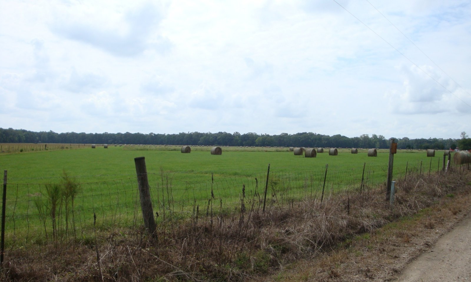
Managed monoculture grasslandTypically, this phase is characterized by planting forage species for hay production. Forage plantings generally consist of a single grass species. Introduced native and/or non-native forage species can be seeded. Forage is usually harvested as hay or haylage, although grazing may occur periodically. These sites are highly productive for forage and can provide ecological benefits to control soil erosion. Allowing for adequate rest and regrowth of desired species is required to maintain productivity. Maintenance of monoculture stands also requires control of unwanted species which will require Pest Management and Nutrient Management to maintain the needed fertility for production of the species.
Generally, application of fertilizer and lime, is needed to establish and maintain improved desirable pastures. The exception to this is for bahiagrass and common bermudagrass can be sustained under natural fertility and pH levels. Introduced legumes require higher pH, phosphorus, and potassium levels than most grasses. Introduced grasses, such as hybrid bermudagrass, require a higher level of sustained fertility, maintain pH above 6.0, and good surface drainage, to persist. Implementation of prescribed grazing of grass species with a specific goal of growing roots deeper in the soil profile, in order to tap into the reservoir of available nutrients and moisture, to increase production and sustain desirable forages.
Conservation practices should include Prescribed Grazing, or Forage Harvest Management, Nutrient and Pest Management and other site-specific facilitating practices.Dominant plant species
-
Bermudagrass (Cynodon dactylon), grass
-
bahiagrass (Paspalum notatum), grass
-
dallisgrass (Paspalum dilatatum), grass
Dominant resource concerns
-
Plant productivity and health
-
Plant structure and composition
-
Feed and forage imbalance
Figure 9. Annual production by plant type (representative values) or group (midpoint values)
Table 6. Annual production by plant type
Plant type Low
(lb/acre)Representative value
(lb/acre)High
(lb/acre)Grass/Grasslike 6000 8000 10000 Total 6000 8000 10000 Figure 10. Plant community growth curve (percent production by month). LA0016 , Dallisgrass. Dallisgrass.
Jan Feb Mar Apr May Jun Jul Aug Sep Oct Nov Dec J F M A M J J A S O N D 0 0 0 4 16 31 35 8 4 2 0 0 Figure 11. Plant community growth curve (percent production by month). LA0006 , Common Bermudagrass. Common Bermudagrass.
Jan Feb Mar Apr May Jun Jul Aug Sep Oct Nov Dec J F M A M J J A S O N D 3 15 32 31 12 5 2 Figure 12. Plant community growth curve (percent production by month). LA0012 , Bahia. Bahiagrass.
Jan Feb Mar Apr May Jun Jul Aug Sep Oct Nov Dec J F M A M J J A S O N D 0 0 0 5 15 24 27 17 10 2 0 0 Community 4.2
Mixed Species Managed System
This community is characterized by mixed species composition of grasses and legumes, which is planted or naturally establishes. Typically, perennial warm season grasses are the foundation of the stand which is periodically over seeded with adapted cool season forages to extend the grazing season. This community phase can be highly productive for grazing and haying operations and can provide beneficial habitat for some wildlife species.
Maintenance of grass stands also requires a collection of management practices such as Prescribed Grazing, Brush Management, Pest Management, and Nutrient Management to maintain production of the desired species. Prescribed Grazing includes maintaining proper grazing heights, timing, and stocking rates. Supporting or Facilitating practices including fences, water lines and watering facilities could be part of the system that maintains this phase.Dominant resource concerns
-
Compaction
-
Inadequate livestock water quantity, quality, and distribution
Community 4.3
Mixed Species, Non-seeded
This community is characterized by a stand where mixtures of native and naturalized non-native species occur, this could also include abandonment of cropping i.e., idle cropland that is not being utilized for forage production. This state represents low inputs after cropping, no initial seeding of pasture species or periodic over seeding of adapted forage species. Forage is usually grazed and/or harvested as stored forage, hay or haylage. Common established species may include Bermudagrass, Bahia grass, Vasey grass, and carpet grass. This state is productive, forage and grazing management can maintain forage stands and protect soils from excessive runoff and erosion. A common peril associated with this phase is overgrazing which favors less productive and less palatable weedy species, especially in areas where livestock congregate. Proper stocking rates and/or grazing systems that allow for adequate rest and plant regrowth are required to maintain productivity.
When forage species are afforded adequate recovery time between grazing intervals, they will develop deeper root systems and greater leaf area allowing for the capture of greater solar energy, where photosynthesis fixes carbohydrates for plant growth. Conversely when plants are not allowed to recover adequately, root development will be restricted, forage and biomass production will be reduced. Maintenance of grass stands also requires Pest Management for control of unwanted weedy and woody species.Dominant resource concerns
-
Sheet and rill erosion
-
Compaction
-
Plant productivity and health
-
Plant structure and composition
-
Feed and forage imbalance
Community 4.4
Early Woody Succession
This community is characterized by a diverse species composition of grasses and forbs with an increasing composition of woody species (native and non-native) that are immature and low stature. If this community phase is not managed, and no brush management measures are taken, the plant community will transition to the Woodland encroached State (5). Control of woody species will require input of extensive resources to return to a Grassland or Cropland state. This phase is generally limited in woody species composition and size to the point where normal agricultural equipment is no longer able to return the site to a cropland phase, mowing or disking. When the threshold is crossed to where the stem diameter exceeds 2 - 3 inches and the percent cover exceeds 100 - 300 stems per acre, the site has transitioned to the Woody Encroached State.
If the restored hardwood community is desired, proper management is required. This phase can be beneficial habitat for some wildlife species. Woody invasive species grow quickly and can be difficult and expensive to control. Some Invasive woody species, such as tallow trees (Triadica sebifera), will invade and grow to produce seeds in as few as 3 years.Dominant resource concerns
-
Sheet and rill erosion
-
Compaction
-
Plant productivity and health
-
Feed and forage imbalance
Pathway 4.1A
Community 4.1 to 4.2Seeding and/or Management for desired species composition.
Conservation practices
Fence Grade Stabilization Structure Forage Harvest Management Forage and Biomass Planting Livestock Pipeline Prescribed Grazing Heavy Use Area Protection Watering Facility Water Well Livestock Shade Structure Key drivers
-
Livestock grazing or browsing
-
Seed dispersal by livestock
-
Mechanical soil disturbance
-
Seeding
-
Management
Key ecosystem services affected
-
Erosion control
-
Pollination
-
Aesthetic values
-
Nutrient cycling
-
Food and fiber: livestock forage
-
Wildlife forage
-
Wildlife habitat
-
Animal biodiversity
-
Plant biodiversity
Pathway 4.1B
Community 4.1 to 4.3Species Management without overseeding.
Conservation practices
Prescribed Burning Fence Grade Stabilization Structure Forage Harvest Management Livestock Pipeline Prescribed Grazing Heavy Use Area Protection Watering Facility Water Well Wetland Wildlife Habitat Management Upland Wildlife Habitat Management Livestock Shade Structure Key drivers
-
Livestock grazing or browsing
-
Seed dispersal by livestock
-
Mechanical soil disturbance
-
Seeding
-
Management
Key ecosystem services affected
-
Erosion control
-
Pollination
-
Aesthetic values
-
Nutrient cycling
-
Food and fiber: livestock forage
-
Wildlife forage
-
Wildlife habitat
-
Animal biodiversity
-
Plant biodiversity
Pathway 4.2A
Community 4.2 to 4.1Seeding and/or Management for desired species composition.
Conservation practices
Fence Grade Stabilization Structure Forage Harvest Management Forage and Biomass Planting Livestock Pipeline Prescribed Grazing Heavy Use Area Protection Watering Facility Water Well Livestock Shade Structure Key drivers
-
Nonnative plant species presence and/or establishment
-
Seeding
-
Management
Key ecosystem services affected
-
Erosion control
-
Pollination
-
Aesthetic values
-
Nutrient cycling
-
Food and fiber: livestock forage
-
Wildlife forage
-
Wildlife habitat
-
Animal biodiversity
-
Plant biodiversity
Pathway 4.2B
Community 4.2 to 4.3
Mixed Species Managed System
Mixed Species, Non-seededSeeding and/or Management for desired species composition.
Conservation practices
Fence Grade Stabilization Structure Forage Harvest Management Forage and Biomass Planting Livestock Pipeline Prescribed Grazing Heavy Use Area Protection Watering Facility Water Well Livestock Shade Structure Key drivers
-
Livestock grazing or browsing
-
Seed dispersal by livestock
-
Mechanical soil disturbance
-
Nonnative plant species presence and/or establishment
-
Management
Key ecosystem services affected
-
Erosion control
-
Pollination
-
Aesthetic values
-
Nutrient cycling
-
Food and fiber: livestock forage
-
Wildlife forage
-
Wildlife habitat
-
Animal biodiversity
-
Plant biodiversity
Pathway 4.3A
Community 4.3 to 4.1Seeding, fertilizing, management/ removal of unwanted species.
Conservation practices
Fence Grade Stabilization Structure Forage Harvest Management Forage and Biomass Planting Livestock Pipeline Prescribed Grazing Grazing Land Mechanical Treatment Heavy Use Area Protection Watering Facility Water Well Livestock Shade Structure Key drivers
-
Nonnative plant species presence and/or establishment
-
Seeding
-
Management
Key ecosystem services affected
-
Erosion control
-
Pollination
-
Aesthetic values
-
Nutrient cycling
-
Food and fiber: livestock forage
-
Wildlife forage
-
Wildlife habitat
-
Animal biodiversity
-
Plant biodiversity
Pathway 4.3B
Community 4.3 to 4.2
Mixed Species, Non-seeded
Mixed Species Managed SystemSeeding and/or Management for desired species composition.
Conservation practices
Prescribed Burning Fence Grade Stabilization Structure Land Smoothing Forage Harvest Management Forage and Biomass Planting Livestock Pipeline Prescribed Grazing Grazing Land Mechanical Treatment Heavy Use Area Protection Nutrient Management Integrated Pest Management (IPM) Watering Facility Water Well Upland Wildlife Habitat Management Livestock Shade Structure Key drivers
-
Livestock grazing or browsing
-
Seed dispersal by livestock
-
Mechanical soil disturbance
-
Nonnative plant species presence and/or establishment
-
Seeding
-
Management
Key ecosystem services affected
-
Erosion control
-
Fuel
-
Pollination
-
Aesthetic values
-
Nutrient cycling
-
Food and fiber: livestock forage
-
Wildlife forage
-
Wildlife habitat
-
Animal biodiversity
-
Plant biodiversity
Pathway 4.3C
Community 4.3 to 4.4
Mixed Species, Non-seeded
Early Woody SuccessionLack of disturbance: No or minimal Mowing, burning, herbivory or Brush Mgmt. and/or Plant or natural regeneration of woody species.
Conservation practices
Pond Fence Grade Stabilization Structure Tree/Shrub Site Preparation Livestock Pipeline Prescribed Grazing Heavy Use Area Protection Tree/Shrub Establishment Watering Facility Water Well Upland Wildlife Habitat Management Livestock Shade Structure Key drivers
-
Wildlife grazing or browsing
-
Livestock grazing or browsing
-
Mechanical soil disturbance
-
Timber management
-
Nonnative plant species presence and/or establishment
-
Seeding
-
Management
Key ecosystem services affected
-
Erosion control
-
Fuel
-
Pollination
-
Aesthetic values
-
Nutrient cycling
-
Food and fiber: livestock forage
-
Food and fiber: wood products
-
Wildlife forage
-
Wildlife habitat
-
Animal biodiversity
-
Plant biodiversity
Pathway 4.4A
Community 4.4 to 4.3
Early Woody Succession
Mixed Species, Non-seededBrush management / removal of unwanted plants.
Conservation practices
Brush Management Prescribed Burning Fence Grade Stabilization Structure Livestock Pipeline Prescribed Grazing Grazing Land Mechanical Treatment Heavy Use Area Protection Watering Facility Water Well Livestock Shade Structure Key drivers
-
Fire
-
Livestock grazing or browsing
-
Mechanical soil disturbance
-
Management
Key ecosystem services affected
-
Erosion control
-
Fuel
-
Pollination
-
Aesthetic values
-
Nutrient cycling
-
Food and fiber: livestock forage
-
Food and fiber: wood products
-
Wildlife forage
-
Wildlife habitat
-
Animal biodiversity
-
Plant biodiversity
State 5
Woody Encroached
Dominant resource concerns
-
Classic gully erosion
-
Plant productivity and health
-
Plant structure and composition
-
Plant pest pressure
-
Feed and forage imbalance
-
Inadequate livestock shelter
-
Inadequate livestock water quantity, quality, and distribution
Community 5.1
Old field or planted hardwoodsThis phase occurs when cropland or pastureland has been allowed to naturally regenerate without succession manipulation and also when Artificial regeneration is planned to re-introduce hardwoods to the site. This state will have succession similar to the Canopy gap state of the historic community however species composition may be very different depending on the available seed source. When this occurs from a cropland or pasture state species composition may be dominated by introduced species but desired hardwood species can be established to regenerate the state to that desired community.
Dominant resource concerns
-
Classic gully erosion
-
Plant productivity and health
-
Plant structure and composition
-
Plant pest pressure
-
Feed and forage imbalance
-
Inadequate livestock shelter
-
Inadequate livestock water quantity, quality, and distribution
State 6
Restored HardwoodsDominant plant species
-
pecan (Carya illinoinensis), tree
-
swamp chestnut oak (Quercus michauxii), tree
-
cherrybark oak (Quercus pagoda), tree
-
water oak (Quercus nigra), tree
Dominant resource concerns
-
Ephemeral gully erosion
-
Classic gully erosion
-
Compaction
-
Plant productivity and health
-
Plant structure and composition
-
Wildfire hazard from biomass accumulation
Community 6.1
Restored Hardwood CommunityThis phase occurs when cropland or pastureland has been regenerated to re-introduce hardwoods to the site. This state will have succession similar to the Canopy gap state of the historic community where the hardwood canopy has begun to shade herbaceous competition. Species composition may be very different depending on the local available seed source and species that are planted. Desired hardwood species can be established to reach the community that fits the site conditions.
This phase is characterized by a stand of Hardwood species planted or allowed to regenerate from seed trees managed for wood production, conservation or restoration.
This Site fits into multiple Woodland Suitability Groups (1o4 or 2o4) depending on the soil Mapunit. The first part of the symbol indicates potential productivity of the soils for important trees, very high (1); high (2). The second part, a letter, indicates the major kind of soil limitation, no serious management problems (o). The third part of the symbol, a numeral, indicates the kind of trees for which the soils are best suited and the severity of the hazard or limitation. The numeral 4 indicates slight limitations, and suitability for broadleaf trees.
These groups would generally describe this site as having a range of productivity from high to very high, with slight for the production of broadleaf species.
WS 1o 4 Well drained, loamy soils with very high potential productivity, no serious management problems, suitable for southern hardwoods. Site index for green ash 90, cottonwood 110, sweetgum 100 -110, oaks 90 - 110. Grazing not recommended. Potential is high for management of deer, squirrels, and turkey.
WS 2 o 4 Well drained, loamy soils with high potential productivity; no serious management problems; best suited for southern hardwoods. Site index for green ash 80, cottonwood 100, oaks and sweetgum 90. Grazing not recommended. Potential is high for management of deer, turkey, and squirrels.Dominant resource concerns
-
Ephemeral gully erosion
-
Classic gully erosion
-
Compaction
-
Plant productivity and health
-
Plant structure and composition
-
Wildfire hazard from biomass accumulation
State 7
Urban DevelopmentThis state represents an area that has been altered to provide locations for homes, businesses, and infrastructure where people live, work, and recreate. The human population is higher than in the surrounding rural area. It is where buildings are close together and are usually considered cities and towns. This state may be found in small clusters in rural areas where multiple buildings are in close proximity with roads and infrastructure that support a rural population.
The changes to the landscape will not generally return to the historic community of Hardwood trees, however, some of this landcover may be present in areas. There are generally many introduced and potentially invasive species located in these areas and managed as ornamentals. These non-native species should be managed to prevent infestation and invasion into other areas where they can become a problem.
Within this land use, there are expansive networks of infrastructure both above and below ground for use by the inhabitants of the area. These include roads, drainage channels and structures, electrical distribution systems, telecommunications systems, drinking water distribution systems, and many other components that contribute to the quality of human life.Dominant resource concerns
-
Ephemeral gully erosion
-
Classic gully erosion
-
Compaction
-
Concentration of salts or other chemicals
-
Ponding and flooding
-
Nutrients transported to surface water
-
Nutrients transported to ground water
-
Pesticides transported to surface water
-
Pesticides transported to ground water
-
Pathogens and chemicals from manure, biosolids, or compost applications transported to surface water
-
Petroleum, heavy metals, and other pollutants transported to surface water
-
Petroleum, heavy metals, and other pollutants transported to ground water
-
Sediment transported to surface water
-
Emissions of greenhouse gases (GHGs)
-
Objectionable odors
-
Plant structure and composition
Community 7.1
Homes, buildings, and infrastructureThis phase is described as homes, buildings, and infrastructure as part of an urban setting. This Subregion of the MLRA contains some fairly dense population centers, there are large cities, towns, and villages within this area. The idea of "concrete jungles" of large metropolitan centers is not typical for this phase, because many of the urbanized areas will include open spaces of semi-natural areas, gardens, and habitat for local wildlife. Areas that are typical for this site include recreational areas intermingled within the urban areas. These intermingled spaces will resemble and function very similar to other phases included within this site concept and should be referenced.
To describe this phase requires several potential types of vegetative communities as well as many surfaces that have been altered by excavation, deposition, and covering. The range of this state could be defined by many parameters, but for this purpose is maintained as a single broad phase. Many soil properties have been altered, hydrologic functions have been altered, and most of the vegetation within this phase is gardened and may not fit the norms of the site concept. The inclusion of this phase within this Ecological Site Description is to acknowledge its presence and direct the users to qualified professionals for any work that is planned. The infrastructure within this State of the site will include pipelines, wires, and other potential hazards which will require contact of services to locate these to prevent damage if any soil disturbing activity is planned.Dominant resource concerns
-
Ephemeral gully erosion
-
Classic gully erosion
-
Bank erosion from streams, shorelines, or water conveyance channels
-
Compaction
-
Concentration of salts or other chemicals
-
Ponding and flooding
-
Ground water depletion
-
Nutrients transported to surface water
-
Nutrients transported to ground water
-
Pesticides transported to surface water
-
Pesticides transported to ground water
-
Petroleum, heavy metals, and other pollutants transported to surface water
-
Petroleum, heavy metals, and other pollutants transported to ground water
-
Sediment transported to surface water
-
Emissions of particulate matter (PM) and PM precursors
-
Emissions of greenhouse gases (GHGs)
Transition T1A
State 1 to 2Wind or water Force causing canopy gaps.
Conservation practices
Clearing and Snagging Land Clearing Key drivers
-
Precipitation (monthly scale)
-
Fire
-
Climate
-
Precipitation event
-
Precipitation (annual scale)
-
Mechanical soil disturbance
-
Temperature (annual scale)
-
Nonnative disease presence and/or establishment
-
Timber management
-
Nonnative plant species presence and/or establishment
-
Seeding
Key ecosystem services affected
-
Aesthetic values
-
Primary production
-
Food and fiber: wood products
-
Wildlife forage
-
Water regulation
-
Climate regulation: carbon cycling and storage
-
Wildlife habitat
-
Soil formation
-
Animal biodiversity
-
Plant biodiversity
Transition T2A
State 2 to 1Regeneration of Hardwood species.
Conservation practices
Tree/Shrub Site Preparation Tree/Shrub Establishment Key drivers
-
Precipitation (decadal scale)
-
Temperature (decadal scale)
-
Seeding
Key ecosystem services affected
-
Aesthetic values
-
Primary production
-
Food and fiber: wood products
-
Wildlife forage
-
Water regulation
-
Climate regulation: carbon cycling and storage
-
Wildlife habitat
-
Soil formation
-
Animal biodiversity
-
Plant biodiversity
Transition T1B
State 2 to 3Clear and established the desired Community
Conservation practices
Brush Management Clearing and Snagging Land Smoothing Key drivers
-
Fire
-
Livestock grazing or browsing
-
Seed dispersal by livestock
-
Mechanical soil disturbance
-
Nonnative plant species presence and/or establishment
-
Seeding
Key ecosystem services affected
-
Aesthetic values
-
Food and fiber: livestock forage
-
Soil formation
-
Plant biodiversity
Transition T1B
State 2 to 4Clear and established the desired Community
Conservation practices
Brush Management Clearing and Snagging Land Smoothing Key drivers
-
Fire
-
Livestock grazing or browsing
-
Seed dispersal by livestock
-
Mechanical soil disturbance
-
Nonnative plant species presence and/or establishment
-
Seeding
Key ecosystem services affected
-
Aesthetic values
-
Food and fiber: livestock forage
-
Soil formation
-
Plant biodiversity
Transition T1B
State 2 to 5Clear and established the desired Community
Conservation practices
Brush Management Clearing and Snagging Land Smoothing Key drivers
-
Fire
-
Livestock grazing or browsing
-
Seed dispersal by livestock
-
Mechanical soil disturbance
-
Nonnative plant species presence and/or establishment
-
Seeding
Key ecosystem services affected
-
Aesthetic values
-
Food and fiber: livestock forage
-
Soil formation
-
Plant biodiversity
Transition T1B
State 2 to 7Clear and established the desired Community
Conservation practices
Brush Management Clearing and Snagging Land Smoothing Key drivers
-
Fire
-
Livestock grazing or browsing
-
Seed dispersal by livestock
-
Mechanical soil disturbance
-
Nonnative plant species presence and/or establishment
-
Seeding
Key ecosystem services affected
-
Aesthetic values
-
Food and fiber: livestock forage
-
Soil formation
-
Plant biodiversity
Transition T*4
State 3 to 4
Converted State - Cropland
Converted State - Pasture or GrasslandEstablish desired forage species and manage for grazing.
Conservation practices
Fence Grade Stabilization Structure Land Clearing Land Smoothing Forage and Biomass Planting Livestock Pipeline Prescribed Grazing Heavy Use Area Protection Nutrient Management Integrated Pest Management (IPM) Watering Facility Water Well Key drivers
-
Fire
-
Livestock grazing or browsing
-
Seed dispersal by livestock
-
Mechanical soil disturbance
-
Nonnative plant species presence and/or establishment
-
Seeding
Key ecosystem services affected
-
Aesthetic values
-
Food and fiber: livestock forage
-
Soil formation
-
Plant biodiversity
Transition T*7
State 3 to 7Construct and maintain urban infrastructure.
Transition T*3
State 4 to 3
Converted State - Pasture or Grassland
Converted State - CroplandEstablish and manage crop rotation.
Conservation practices
Conservation Crop Rotation Land Smoothing Nutrient Management Integrated Pest Management (IPM) Key drivers
-
Fire
-
Livestock grazing or browsing
-
Seed dispersal by livestock
-
Mechanical soil disturbance
-
Nonnative plant species presence and/or establishment
-
Seeding
Key ecosystem services affected
-
Aesthetic values
-
Soil formation
-
Plant biodiversity
Transition T*5
State 4 to 5
Converted State - Pasture or Grassland
Woody EncroachedPlant or natural regeneration of woody species.
Conservation practices
Conservation Cover Tree/Shrub Site Preparation Tree/Shrub Establishment Key drivers
-
Fire
-
Livestock grazing or browsing
-
Seed dispersal by livestock
-
Mechanical soil disturbance
-
Nonnative plant species presence and/or establishment
-
Seeding
Key ecosystem services affected
-
Aesthetic values
-
Food and fiber: livestock forage
-
Climate regulation: carbon cycling and storage
-
Wildlife habitat
-
Soil formation
-
Plant biodiversity
Transition T*7
State 4 to 7Construct and maintain urban infrastructure.
Transition T5A
State 5 to 4
Woody Encroached
Converted State - Pasture or GrasslandHeavy Brush mgmt.
Conservation practices
Brush Management Clearing and Snagging Fence Grade Stabilization Structure Land Smoothing Forage and Biomass Planting Livestock Pipeline Grazing Land Mechanical Treatment Heavy Use Area Protection Nutrient Management Integrated Pest Management (IPM) Watering Facility Water Well Key drivers
-
Fire
-
Livestock grazing or browsing
-
Seed dispersal by livestock
-
Mechanical soil disturbance
-
Nonnative disease presence and/or establishment
Key ecosystem services affected
-
Aesthetic values
-
Recreation
-
Food and fiber: livestock forage
-
Food and fiber: wood products
-
Wildlife forage
-
Water regulation
-
Climate regulation: carbon cycling and storage
-
Wildlife habitat
-
Soil formation
-
Animal biodiversity
-
Plant biodiversity
Transition T5B
State 5 to 6Manage succession for historic community.
Transition T*7
State 5 to 7Construct and maintain urban infrastructure.
Additional community tables
Table 7. Community 1.1 plant community composition
Group Common name Symbol Scientific name Annual production () Foliar cover (%) Table 8. Community 2.1 plant community composition
Group Common name Symbol Scientific name Annual production () Foliar cover (%) Table 9. Community 3.1 plant community composition
Group Common name Symbol Scientific name Annual production () Foliar cover (%) Table 10. Community 3.2 plant community composition
Group Common name Symbol Scientific name Annual production () Foliar cover (%) Table 11. Community 3.3 plant community composition
Group Common name Symbol Scientific name Annual production () Foliar cover (%) Table 12. Community 4.1 plant community composition
Group Common name Symbol Scientific name Annual production () Foliar cover (%) Grass/Grasslike1 Warm Season Grasses 6000–10000 Bermudagrass CYDA Cynodon dactylon 6000–10000 60–100 bahiagrass PANO2 Paspalum notatum 6000–10000 60–100 dallisgrass PADI3 Paspalum dilatatum 6000–10000 60–100 Table 13. Community 4.2 plant community composition
Group Common name Symbol Scientific name Annual production () Foliar cover (%) Table 14. Community 4.3 plant community composition
Group Common name Symbol Scientific name Annual production () Foliar cover (%) Table 15. Community 4.4 plant community composition
Group Common name Symbol Scientific name Annual production () Foliar cover (%) Table 16. Community 5.1 plant community composition
Group Common name Symbol Scientific name Annual production () Foliar cover (%) Table 17. Community 6.1 plant community composition
Group Common name Symbol Scientific name Annual production () Foliar cover (%) Table 18. Community 7.1 plant community composition
Group Common name Symbol Scientific name Annual production () Foliar cover (%) Interpretations
Supporting information
Inventory data references
The information provided on the states and community phases in this provisional description report were generated from literature reviews, conversations with technical specialists, and limited personal observations and experience on this soil-site environment. Intensive vegetation inventories were not conducted during the development of this provisional report. Those tasks will occur during future phases of ecological site development.
Other references
Aslan, A. and W.J. Autin. 1999. Evolution of the Holocene Mississippi River floodplain, Ferriday, Louisiana: Insights on the origin of fine-grained floodplains. Journal of Sedimentary Research 69: 800-815.
Aslan, A., W. J. Autin, and M. D. Blum. 2005. Causes of river avulsion: insights from the late Holocene avulsion history of the Mississippi River, USA. Journal of Sedimentary Research, 75(4), 650-664.
Autin, W.J., S.F. Burns, B.J. Miller, R.T. Saucier, and J.I. Snead. 1991. Quaternary geology of the Lower Mississippi Valley. p. 547-582. In R.B. Morrison (Editor). Quaternary Nonglacial Geology: Conterminous U.S. Geological Society of America. The Geology of North America, Volume K-2. Boulder, CO.
Autin, W. J. 1996. Pleistocene stratigraphy in the southern Lower Mississippi Valley. Engineering Geology, 45(1), 87-112.
Blum, M.D., M.J. Guccione, D.A. Wysocki, P.C. Robnett, and E.M. Rutledge. 2000. Late Pleistocene evolution of the lower Mississippi River valley, southern Missouri to Arkansas. Geological Society of America Bulletin, 112(2), 221-235.
Broadfoot, Walter M. 1976. Hardwood suitability for and properties of important midsouth soils. Res. Pap. SO-127. New Orleans, LA: U.S. Department of Agriculture, Forest Service, Southern Forest Experiment Station. 84 p.
Brown, D. A., V. E. Nash, A. G. Caldwell, L. J. Bartelli, R. C. Carter, and O. R. Carter. 1970. A monograph of the soils of the southern Mississippi River Valley alluvium. Southern Cooperative Series Bulletin, 178, 112.
Chapman, S.S, G.E. Griffith, J.M. Omernik, J.A. Comstock, Beiser, M.C., and D. Johnson. 2004. Ecoregions of Mississippi, (color poster with map, descriptive text, summary tables, and photographs): Reston, Virginia, U.S. Geological Survey (map scale 1:1,000,000).
Cowardin, L. M., V. Carter, F. C. Golet, and E. T. LaRoe. 1979. Classification of wetlands and deepwater habitats of the United States. US Fish and Wildlife Service FWS/OBS, 79(31), 131.
Cowdrey, A. E. 1977. Land’s End: A history of the New Orleans District. US Army Corps of Engineers, and Its Lifelong Battle with the Lower Mississippi and Other Rivers Wending Their Way to the Sea.
Daigle, J.J., G.E. Griffith, J.M. Omernik, P.L. Faulkner, R.P. McCulloh, et al. 2006. Ecoregions of Louisiana (color poster with map, descriptive text, summary tables, and photographs): Reston, Virginia, U.S. Geological Survey (map scale 1:1,000,000).
Ezell, A.W. 2016. Evaluating high-graded hardwood stands. Publication-Cooperative Extension Service, Mississippi State University (USA).
Fisk, H. N. 1944. Geological investigation of the alluvial valley of the lower Mississippi River: US Dept. Army, Mississippi River Comm.
Foti, T., C. Klimas, J. Pagan, and A. Keister. 2011. Potential natural vegetation of the Mississippi Alluvial Valley: Tensas Basin, Northeastern Louisiana. U.S. Fish and Wildlife Service, Lower Mississippi Valley Joint Venture; Vicksburg, MS.
Gardiner, E. S., and J. M. Oliver. 2005. Restoration of bottomland hardwood forests in Lower Mississippi Aluvial Valey, USA. In: Stanturf, JA; Madsen, P. eds. Restoration of boreal and temperate forests. Restoration of bottomland hardwood forests in the Lower Mississippi Alluvial Valley, USA Boca Raton, FL: CRC Press. 235-251.
Grigar, J., J.L. Hatfield, and R. Reeder, 2018. Transitional no-till: What is it and how does it differ from ‘true’no-till?. Crops and Soils 51, no. 6:28–36.
Kemp, K. 2000. The Mississippi Levee System and the Old River Control Structure. Available online: http://www.tulane.edu/~bfleury/envirobio/enviroweb/FloodControl.htm. Accessed 11/2018
Klimas, C.V. 1988. Forest vegetation of the leveed floodplain of the lower Mississippi River. Lower Mississippi River Environmental Program Report 11. US Army Corps of Engineers. Vicksburg, Mississippi.
Klimas, C., J. Pagan, T. Foti, and B. Tirpak. 2011. Potential natural vegetation of the Mississippi Alluvial Valley: Yazoo Basin, Mississippi. U.S. Fish and Wildlife Service, Lower Mississippi Valley Joint Venture; Vicksburg, MS.
Lentz, G. H. 1928. Summary of First Year's Hardwood Investigations in Louisiana. US Forest Service and Louisiana Division of Forestry
Lentz, G. H. 1929. Summary of First Year's Hardwood Investigations in Louisiana. Journal of Forestry, 27(5), 486-494.
McKnight, J.S., D.D. Hook, O.G. Langdon, and R.L. Johnson. 1981. Flood tolerance and related characteristics of trees of the bottomland forests of the southern United States. In Developments in Agricultural and Managed Forest Ecology. 11, pp. 29-69. Elsevier. https://www.srs.fs.usda.gov/pubs/ja/1980/ja_1980_mcknight_001.pdf (accessed 12 Oct. 2018)
Putnam, J. A., and H. Bull. 1932. The trees of the bottomlands of the Mississippi River Delta Region. US Department of Agriculture, Forest Service, Southern Forest Experiment Station, Occasional Paper, 27, 207.
Rittenhour, T.M., M.D. Blum, and R.J. Goble. 2007. Fluvial evolution of the Lower Mississippi River Valley during the last 100 k.y. glacial cycle: Response to glaciation and sea-level change. Geological Society of America Bulletin 119(5-6): 586-608.
Rogers, D. 2005. Evolution of the levee system along the Lower Mississippi River. University of Missouri-Rolla: Rolla, MO, USA. https://web.mst.edu/~rogersda/levees/Evolution%20of%20the%20Levee%20System%20Along%20the%20Mississippi.pdf. Accessed 10/2018.
Saucier, R. T. 1974. Quaternary geology of the lower Mississippi Valley (No. 6). Arkansas Archeological Survey.
Saucier, Roger T. 1994. Geomorphology and Quaternary Geologic History of the Lower Mississippi Valley, Volumes I & II. U.S. Army Corps of Engineers, Vicksburg, MS. (Available online: http://biotech.law.lsu.edu/climate/mississippi/sausier/sausier.htm)
Schumm, S. A., and W. J. Spitz. 1996. Geological influences on the Lower Mississippi River and its alluvial valley. Engineering Geology, 45(1-4), 245-261.
Shen, Z., T.E. Tornqvist, W.J. Autin, Z.R.P. Mateo, K.M. Straub, and B. Mauz. 2012. Rapid and widespread response of the Lower Mississippi River to eustatic forcing during the last glacial-interglacial cycle. Geological Society of America Bulletin 124(5-6): 690-704.
Theriot, R. F. 1992. Flood tolerance of plant species in bottomland forests of the southeastern United States. Ph.D. diss. University of Florida. Available online: http://ufdc.ufl.edu//AA00003281/00001
Turner, S., J. Welch, and N. Musso. 2010. The Atchafalaya National Heritage Area, Selected Level 0 Cultural Landscape Assessments. Suzanne Turner Associates LLC. Available online: http://www.atchafalaya.org/ckfinder/userfiles/files/CLA-Final.pdf
Tye, R. S., and J. M. Coleman. 1989. Depositional processes and stratigraphy of fluvially dominated lacustrine deltas: Mississippi delta plain. Journal of Sedimentary Research, 59(6).
[USACE] U.S. Army Corps of Engineers. 2004. Louisiana Coastal Area Comprehensive Coastwide Ecosystem Restoration Study. U.S. Army Corps of Engineers, New Orleans, LA. Available online: https://www.lca.gov/Library/ProductList.aspx?Prodtype=0&folder=1118.
[USACE] U.S. Army Corps of Engineers New Orleans District, Missions, Mississippi River Flood Control. No date. [Online]. Retrieved June 30, 2017. Available at http://www.mvn.usace.army.mil/Missions/Mississippi-River-Flood-Control/
[USACE] U.S. Army Corps of Engineers. Atchafalaya Basin Project, Brochure, http://www.mvn.usace.army.mil/Portals/56/docs/PAO/Brochures/AtchafalayaBasinProject.PDF (accessed 12 Oct. 2018)
[USDA-NRCS] United States Department of Agriculture, Natural Resources Conservation Service. 2006. Land resource regions and major land resource areas of the United States, the Caribbean, and the Pacific Basin. US Department of Agriculture Handbook, 296.
[USDA, SCS] USDA, Soil Conservation Service. 1968. Soil Survey Interpretations for Woodland in the Southern Mississippi Valley Alluvium Area of LA MS AR TN MO and KY, Progress Report.
[USDA-NRCS] United States Department of Agriculture, Natural Resources Conservation Service. 2022. Land Resource Regions and Major Land Resource Areas of the United States, the Caribbean, and the Pacific Basin. U.S. Department of Agriculture, Agriculture Handbook 296.Contributors
D. Charles Stemmans II
Rachel StoutEvans
Mitchell Mouton
Chris Coreil
Richard Williams
Brandon WaltmanApproval
Marji Patz, 6/10/2025
Acknowledgments
I would like to acknowledge the MLRA 131A Technical Team for their support and assistance in drafting this site concept and Provisional Ecological Site Description.
Rangeland health reference sheet
Interpreting Indicators of Rangeland Health is a qualitative assessment protocol used to determine ecosystem condition based on benchmark characteristics described in the Reference Sheet. A suite of 17 (or more) indicators are typically considered in an assessment. The ecological site(s) representative of an assessment location must be known prior to applying the protocol and must be verified based on soils and climate. Current plant community cannot be used to identify the ecological site.
Author(s)/participant(s) Contact for lead author Date 08/19/2026 Approved by Approval date Composition (Indicators 10 and 12) based on Annual Production Indicators
-
Number and extent of rills:
-
Presence of water flow patterns:
-
Number and height of erosional pedestals or terracettes:
-
Bare ground from Ecological Site Description or other studies (rock, litter, lichen, moss, plant canopy are not bare ground):
-
Number of gullies and erosion associated with gullies:
-
Extent of wind scoured, blowouts and/or depositional areas:
-
Amount of litter movement (describe size and distance expected to travel):
-
Soil surface (top few mm) resistance to erosion (stability values are averages - most sites will show a range of values):
-
Soil surface structure and SOM content (include type of structure and A-horizon color and thickness):
-
Effect of community phase composition (relative proportion of different functional groups) and spatial distribution on infiltration and runoff:
-
Presence and thickness of compaction layer (usually none; describe soil profile features which may be mistaken for compaction on this site):
-
Functional/Structural Groups (list in order of descending dominance by above-ground annual-production or live foliar cover using symbols: >>, >, = to indicate much greater than, greater than, and equal to):
Dominant:
Sub-dominant:
Other:
Additional:
-
Amount of plant mortality and decadence (include which functional groups are expected to show mortality or decadence):
-
Average percent litter cover (%) and depth ( in):
-
Expected annual annual-production (this is TOTAL above-ground annual-production, not just forage annual-production):
-
Potential invasive (including noxious) species (native and non-native). List species which BOTH characterize degraded states and have the potential to become a dominant or co-dominant species on the ecological site if their future establishment and growth is not actively controlled by management interventions. Species that become dominant for only one to several years (e.g., short-term response to drought or wildfire) are not invasive plants. Note that unlike other indicators, we are describing what is NOT expected in the reference state for the ecological site:
-
Perennial plant reproductive capability:
Print Options
Sections
Font
AAAAOther
PrintThe Ecosystem Dynamics Interpretive Tool is an information system framework developed by the USDA-ARS Jornada Experimental Range, USDA Natural Resources Conservation Service, and New Mexico State University.
Accessibility statement


