
Natural Resources
Conservation Service
Ecological site F131AY307MS
Yazoo - Old Moderately Wet Natural Levee and Meander Scroll Ridge Forest
Last updated: 6/10/2025
Accessed: 08/28/2026
-
Search


Major Land Resource Area or ecological site by name and/or ID.
PreviousSectionsNextGeneral information
Provisional. A provisional ecological site description has undergone quality control and quality assurance review. It contains a working state and transition model and enough information to identify the ecological site.
MLRA notes
Major Land Resource Area (MLRA): 131A–Southern Mississippi River Alluvium
The Southern Mississippi River Alluvium (MLRA 131A) is the largest of 4 MLRAs within Land Resource Region O, the Mississippi Delta Cotton and Feed Grains Region. It occurs in portions of 7 states including Louisiana (32 percent), Arkansas (26 percent), Mississippi (26 percent), Missouri (12 percent), Tennessee (3 percent), Kentucky (1 percent), and Illinois (less than 1 percent). The MLRA is comprised of 29,555 square miles and extends roughly 650 miles from an area near Cape Girardeau, Missouri in the north to the MLRA’s transition to the Gulf Coast Marsh (MLRA 151) in the south. Average elevations range from 330 feet in the north to sea level in the southern part of the area. For much of the north-south distance, the MLRA is bounded to the east by an abrupt rise in elevation of loess-capped bluffs and hills, the Southern Mississippi Valley Loess (MLRA 134). West of the Mississippi River, the boundary is less distinct except to the northwest where the MLRA abuts the Ozark Plateaus and Ouachita province (MLRAs 116A, 117, and 118A). South of the Ozark and Ouachita escarpment, the MLRA adjoins the Southern Mississippi River Terraces (MLRA 131D), which includes the fabled Grand Prairie and merges with the valleys of the Arkansas and Ouachita rivers (MLRA 131B) and the Red River (MLRA 131C). Occurring within or bordering the Southern Mississippi River Alluvium are three separate loess-capped, upland remnants: Crowley’s Ridge, Macon Ridge, and Lafayette Loess Plain, which are western units of MLRA 134 (USDA-NRCS, 2006a).
MLRA 131A is characterized by landscapes that were created and influenced by the current and earlier paths of the Mississippi River and its tributaries. Waters transporting the materials that formed the area originate from as far west as the east slope of the Continental Divide to the western edge of the Appalachian Divide in the east. This comprises a drainage basin of roughly 1,245,000 square miles and includes all or parts of thirty-one U.S. states and two Canadian provinces (Elliott, 1932). The drainage basin of the Mississippi River roughly resembles a funnel, which has its spout at the Gulf of America. Waters from as far east as New York and as far west as Montana contribute to flows in the lower extent of the river (USACE, 2017). The soils of these alluvial landscapes are very deep, dominantly poorly and somewhat poorly drained, and have textures that are mostly loamy or clayey. Principal soil orders are Alfisols, Vertisols, Inceptisols, and Entisols (USDA-NRCS, 2006a).
The fluvial processes that shaped the area were highly dynamic, diverse, and complex. During the Pleistocene epoch, multiple continental glacial-interglacial cycles resulted in extreme fluctuations in river discharge and sediment loads. A braided river regime characterized the fluvial dynamics of the Mississippi River through much of the last glacial cycle (Autin et al., 1991; Rittenhour et al., 2007). Rapid aggradation of glacial outwash led to the development of prominent valley train features over a large portion of the area (Autin et al., 1991; Saucier, 1994; Aslan and Autin, 1999; Blum et al., 2000; Rittenour et al., 2007). A changing climate, meltwater withdrawal, and sea-level change induced a transition from a braided river regime to a predominantly single-channeled, laterally migrating river system during the Holocene epoch (Rittenhour et al., 2007; Shen et al., 2012) – characteristics that continue today. Fluvial dynamics of the migrating river resulted in the development of broad meander belts, backswamp environments, and extensive deltaic complexes (Saucier, 1994; Klimas et al., 2011).
Tremendous expanses of bottomland hardwood forests once covered much of the area. Today, the land base is largely in agriculture production, and soybeans, cotton, corn, and rice are the principal crops with sugarcane rising in importance in the southernmost portion of the MLRA (USDA-NRCS, 2022).
Due to its size and biophysical variability, the Technical Team advised subdividing the MLRA into six subregions: Western Lowlands, St. Francis Basin, Yazoo Basin, Tensas Basin, Delta Plain, and Batture.LRU notes
There are no agency-approved and established Land Resource Units (LRUs) for MLRA 131A. However, the characteristics of each of the six subregions in this MLRA warrant noting and are presented here for each associated ecological site. This provisional ecological site is broadly mapped within the Yazoo Basin.
The Yazoo Basin is in northwest Mississippi and is the largest tributary basin within MLRA 131A. The MLRA boundary of the basin extends some 200 miles (north to south) from Memphis, Tennessee to Vicksburg, Mississippi; is about 60 miles wide (east to west) at its widest point; encompasses roughly 7,600 square miles; and is bounded by the Loess Hills to the east and the current Mississippi River channel to the west (Saucier, 1994; Klimas et al., 2011). Elevations range from 210 feet in the northern portions of the basin to about 85 feet in the south near Vicksburg (Kirchner et al., 1992).
The basin’s geomorphic features are dominated by abandoned Mississippi River meander belts and backswamp environments. The higher elevations of natural levees and point bar deposits (meander scrolls) form an alluvial ridge, which directs local drainage and floodwaters to the intervening flood basins or backswamps. Additional meander belt landforms that are quite common include abandoned channels (oxbow lakes) and courses (Saucier, 1994; Klimas et al., 2011). A minor feature of the Yazoo Basin is the Pleistocene-age valley train terraces, which comprise less than 5 percent of the total area (Saucier, 1994).
The movement of water through the Yazoo Basin is heavily influenced and controlled by the complex sequence of abandoned Mississippi River meander belts and distributary channels. Most surface water originates as precipitation (Berkowitz et al., 2020) or runoff from the uplands to the east, which are conveyed by the Coldwater, Yocona, Tallahatchie, and Yalobusha rivers in addition to several smaller streams. These systems, along with streams draining the interior portions of the basin (e.g., Big Sunflower River, Bogue Phalia, and the distributary Deer Creek), all flow to the only significant outlet for the basin, the Yazoo River, which enters the Mississippi River near Vicksburg (Saucier, 1994; Klimas et al., 2011).
Historically, large floods on the Mississippi River and in the Yazoo tributary system inundated most, if not all, of the Yazoo Basin (Moore, 1972). These periodic floods and the ponding aftereffects oftentimes lasted for very long durations (Berkowitz et al., 2020), delivering nutrient-rich sediments that were critical to the production and maintenance of the dominant natural vegetation, bottomland hardwood forests (Taylor et al., 1990; MMNS, 2015). Since settlement, the biophysical environment of the area has been vastly altered. Perhaps the most notable change entails extensive modification of the basin’s natural hydrology, which includes hundreds of miles of constructed levees along the mainstem of the Mississippi River and basin tributaries; channel modifications on many streams; water control structures; land leveled areas; and an extensive network of surface drainage systems (Kirchner et al., 1992). Even with these measures, widespread backwater flooding occurs in the southern portion of the area (Yazoo Backwater Area) when high stages are reached on the Mississippi River. The extensive modifications to the basin’s hydrology coupled with increased access (Hudson, 1979) set the stage for broadscale conversion of former forestland to a variety of land uses with agriculture production being dominant. Today, bottomland hardwood forests cover roughly 10 percent of the original forest area (Smith and Klimas, 2002).
The geographic distribution of all ecological sites within the Yazoo Basin is bounded to the west by an extensive, mainline levee system. Throughout its length, the constructed levee generally occurs within the current Mississippi River meander belt and is situated to the east of the active river channel. All lands between the river channel and the constructed levee are referred to as the Batture, and that subregion encapsulates its own complement of ecological sites due to significantly different hydrologic regimes (Smith and Klimas, 2002).Classification relationships
All or portions of the geographic range of this site fall within several ecological and land classifications including:
- NRCS Major Land Resource Area (MLRA) 131A – Southern Mississippi River Alluvium (USDA-NRCS, 2006a)
- National Hierarchical Framework of Ecological Units: 234 Lower Mississippi Riverine Forest Province; 234D White and Black River Alluvial Plains Section; 234Da North Mississippi River Alluvial Plain Subsection (Cleland et al., 2007)
- Environmental Protection Agency Level III Ecoregion: 8.5.2 Mississippi Alluvial Plain, 73; Level IV Ecoregion: Northern Holocene Meander Belt, 73a (Chapman et al., 2004; Wiken et al., 2011)
- Mississippi River High Floodplain (Bottomland), CES203.196 (NatureServe, 2020)
- Willow Oak – Cherrybark Oak – Cow Oak; Oak – Elm – Ash; Hackberry – Elm (Putnam and Bull, 1932)
- The following are hydrogeomorphic subclass, geomorphic setting, and potential natural vegetation association that dominantly coincides to or geometrically intersects the soil polygons of this ecological site (developed by Klimas et al., 2011): F4, Moderately drained lowlands, Sugarberry – Green Ash – American Elm; RB2, Occasionally flooded, moderately drained lowlands, Willow Oak – Water Oak – SweetgumEcological site concept
This ecological site is broadly distributed in the Yazoo Basin where it is generally associated with older meander belts (former channels) of the Mississippi River and its distributaries. The site occupies positions intermediate to the higher, better drained areas and the lower, wetter toeslopes of former natural levees and meander scroll ridges. Additionally, the soils of this site have been mapped along active tributaries to the Mississippi River, on low ridges and rises adjacent to backswamp areas, and on interfluves of remnant glacial outwash channels. The soils are very deep, somewhat poorly drained that formed in thinly stratified beds of loamy alluvium. A key characteristic of these soils is the prominent profile development as determined by distinct argillic (clay) accumulations in the subsoil (B horizon). Slopes are typically 0 to 3 percent but may range up to 8 percent. Under natural drainage conditions, an apparent water table occurs 1.5 to 3.5 feet below the surface during the winter and spring months in most years. In areas that are intentionally drained, the water table ranges from 3.5 to 6 feet below the surface. Natural vegetation of this site, today, is directly influenced by former land use activities at varying intensity levels. Species that are favored in management on these soils include Nuttall oak (Quercus texana), cherrybark oak (Q. pagoda), water oak (Q. nigra), willow oak (Q. phellos), swamp chestnut oak (Q. michauxii), sweetgum (Liquidambar styraciflua), green ash (Fraxinus pennsylvanica), eastern cottonwood (Populus deltoides), and American sycamore (Platanus occidentalis). Additional species occasionally to frequently observed include red maple (Acer rubrum), red mulberry (Morus rubra), common persimmon (Diospyros virginiana), and pecan (Carya illinoinensis). Of note, this site occurs on the protected side of the extensive Mississippi River levee system.
Associated sites
F131AY306MS Yazoo - Old Loamy Natural Levee and Meander Scroll Ridge Forest
This site occurs on slightly higher positions than the adjoining Old Moderately Wet Natural Levee and Meander Scroll site (F131AY307MS). These adjacent sites primarily occur on former Mississippi River meander belts and on natural levees of active Mississippi River tributaries.
F131AY308MS Yazoo - Old Wet Natural Levee and Meander Scroll Forest
This site occurs on slightly lower positions than the adjoining Old Moderately Wet Natural Levee and Meander Scroll site (F131AY307MS). These adjacent sites primarily occur on former Mississippi River meander belts and on natural levees of active Mississippi River tributaries.
F131AY305MS Yazoo - Old Sandy Natural Levee and Meander Scroll Ridge Forest
This site occurs on highest positions of the old or former Mississippi River meander belts and is mainly adjacent to the Old Loamy Natural Levee and Meander Scroll site (F131AY306MS). However, there are some instances where this sandy site adjoins the Old Moderately Wet Natural Levee and Meander Scroll site (F131AY307MS).
F131AY313MS Yazoo – Pleistocene Valley Train Braid Bar Woodland
The Pleistocene valley train geomorphic features in the Yazoo Basin have been heavily veneered with Holocene alluvial deposits including the loamy soils of site F131AY307MS, which adjoins the Pleistocene braid bars (F131AY313MS) in a few areas and should be recognized as a minor associate.
Similar sites
F131AY405LA Tensas Basin - Somewhat Poorly Drained Bottomland Hardwoods
This site occupies similar positions and has similar drainage characteristics as the Old Moderately Wet Natural Levee and Meander Scroll site (F131AY307MS). The principal difference is that the latter occurs within the Yazoo Basin and F131AY405LA is confined to the Tensas Basin.
F131AY503LA Delta Plain - Somewhat Poorly Drained Bottomland Hardwoods
This site occupies similar positions and has similar drainage characteristics as the Old Moderately Wet Natural Levee and Meander Scroll site (F131AY307MS). The principal difference is that the latter occurs within the Yazoo Basin and F131AY503LA is confined to the Delta Plain.
F131AY210AR St. Francis - Old Moderately Wet Natural Levee and Meander Scroll Forest
This site occupies similar positions and has similar drainage characteristics as F131AY307MS. The principal difference is F131AY210AR is confined to the St. Francis Basin.
F131AY604MS Batture - Frequently Flooded Moderately Wet Low Ridge Forest
This site supports soils with similar drainage characteristics that occur on similar geomorphic features and positions as F131AY307MS, but they differ dramatically in their ages and time periods of deposition. The soils of F131AY604MS are of recent origin and undergoing active deposition, whereas the soils of F131AY307MS are much older, more weathered, and have reactions that can be very strongly acid. Some locations have been abandoned by the parent stream for millennia. Conversely, site F131AY604MS occurs within the active floodway and associated floodplain of the current Mississippi River channel.
F131AY311MS Yazoo - Recent Moderately Wet Natural Levee and Meander Scroll Ridge Forest
This site supports soils with similar drainage characteristics that occur on similar geomorphic features as site F131AY307MS, but the sites differ dramatically in their ages and time periods of deposition. The soils of F131AY311MS are of recent origin, whereas the soils of F131AY307MS are much older, more weathered, and have reactions that can be very strongly acid. Some locations have been abandoned by the parent stream for millennia. One characteristic that they have in common is that both occur on the protected side of the constructed levee system.

Figure 1. Distribution of F131AY307MS.
Table 2. Dominant plant species
Tree Not specified
Shrub Not specified
Herbaceous Not specified
Physiographic features
This ecological site is broadly mapped throughout the Yazoo Basin where the site primarily occupies positions that are intermediate to the higher, better drained areas and the lower, wetter toeslopes of former natural levees and meander scroll ridges. Additionally, the soils of this site have been mapped along active tributaries to the Mississippi River, on low ridges and rises adjacent to backswamp areas, and on interfluves of remnant glacial outwash channels.

Figure 1. Old Mississippi River meander belt catena. Dundee soils are representative of F131AY307MS.

Figure 2. Ridge and swale topography consisting of Dundee soils on a meander scroll.
Table 3. Representative physiographic features
Landforms (1) Meander belt > Natural levee > Rise
(2) Meander belt > Meander scroll > Rise
(3) Alluvial plain > Terrace > Rise
Runoff class Low to medium Flooding duration Brief (2 to 7 days) Flooding frequency Very rare Ponding frequency None Elevation 79 – 213 ft Slope 0 – 8 % Water table depth 41 in Aspect Aspect is not a significant factor Climatic features
Climate of the Yazoo Basin is classified as Humid Subtropical (Koppen System), which is typified by mostly mild winters; long, hot and humid summers; and no routinely recurring wet or dry season (Smith and Klimas, 2002; NCDC, 2018). The average annual air temperature from 1980 through 2010 was 64 degrees F and the mean annual precipitation for the same period was 55 inches.
In the warmer season (and throughout much of the year), winds from the south convey moisture from the gulf leading to humid, semitropical conditions that are favorable for afternoon thunderstorms. These storms produce an average of about 25 percent of the area’s annual precipitation and are at times accompanied by locally destructive winds. A potential hazard during late summer through early fall is the tropical cyclone. While most impacts from hurricanes and tropical storms are confined along the coastal zone, heavy rainfall, severe flooding, and high winds can occur well into the basin when such systems pass through the area. To the extreme, the region is susceptible to the effects of a strong Bermuda High during the summer, which can cause devastating drought conditions for weeks and even months in some years. From 1980 through 2010, August and September were the driest months with a characteristic average monthly low of 2.5 and 2.8 inches, respectively. The hottest months of the year were July and August with characteristic average highs of 91 to 92 degrees and lows of around 72 degrees F.
In the colder season, the area’s weather is dominated by the positions of the Polar and Subtropical Jet Streams, both of which exerts strong control over the passages of cold and warm fronts. These fronts alternately bring cold continental air and warm tropical air with periods of varying length. Particularly strong cold fronts can produce large and sudden drops in air temperature; however, cold spells seldom last over a week (NCDC, 2018). The coldest month of the year is typically January with an average monthly low and high of 33 and 52 degrees, respectively. The frost-free period from 1980 to 2010 averaged 207 days basin-wide and ranged from 200 days in the northern areas to 216 days in the south. Likewise, the freeze-free period averaged 241 days and ranged from 238 in the north to 246 days in the southern part of the basin.
Snow and/or sleet falls in the area in most years with the greatest frequency and accumulations occurring in the northern extent of the basin. Winter precipitation sometimes occurs as freezing rain and damaging ice storms hit some portion of the basin on occasion. However, these wintry events are generally the exception; they are typically brief and do not persist for very long. Rain is the characteristic form of winter precipitation, and the period of greatest rainfall generally occurs from November through June with March and April being the months of greatest frequency (NCDC, 2018). Precipitation for this period typically ranges from 4.5 to around 6.0 inches per month.Table 4 Representative climatic features
Frost-free period (characteristic range) 200-220 days Freeze-free period (characteristic range) 240-250 days Precipitation total (characteristic range) 50-60 in Frost-free period (actual range) 200-220 days Freeze-free period (actual range) 230-250 days Precipitation total (actual range) 50-60 in Frost-free period (average) 210 days Freeze-free period (average) 240 days Precipitation total (average) 60 in Characteristic rangeActual rangeBarLineFigure 3. Monthly precipitation range
Characteristic rangeActual rangeBarLineFigure 4. Monthly minimum temperature range
Characteristic rangeActual rangeBarLineFigure 5. Monthly maximum temperature range
BarLineFigure 6. Monthly average minimum and maximum temperature
Figure 7. Annual precipitation pattern
Figure 8 Annual average temperature pattern
Climate stations used
-
(1) LAMBERT 1W [USC00224869], Lambert, MS
-
(2) MINTER CITY [USC00225897], Minter City, MS
-
(3) ROLLING FORK [USC00227560], Rolling Fork, MS
-
(4) CLEVELAND [USC00221738], Cleveland, MS
-
(5) GREENVILLE [USC00223605], Greenville, MS
-
(6) STONEVILLE EXP STA [USC00228445], Leland, MS
-
(7) GREENWOOD LEFLORE AP [USW00013978], Carrollton, MS
-
(8) CHARLESTON [USC00221606], Charleston, MS
-
(9) CLARKSDALE [USC00221707], Clarksdale, MS
-
(10) CLEVELAND 3 N [USC00221743], Cleveland, MS
-
(11) MOORHEAD [USC00226009], Moorhead, MS
-
(12) LAKE PROVIDENCE [USC00165090], Lake Providence, LA
-
(13) TUNICA 2 N [USC00228998], Tunica, MS
-
(14) YAZOO CITY 5 NNE [USC00229860], Yazoo City, MS
-
(15) BELZONI [USC00220660], Belzoni, MS
">Influencing water features
This site occurs in a variety of alluvial plain settings that include mid-slope positions of old or former natural levees and meander scroll ridges; the margins of backswamp environments; broad interfluves among remnant outwash channels; and the margins of active streams and tributaries to the Mississippi River. Today, this site occurs on the protected side of the extensive Mississippi River levee system and no longer receives overland flooding on the same scale that it may have experienced prior to levee construction. For the most part, the location or position of this site is high enough in elevation that it does not flood on a frequent or predictable basis. The locations that may continue to flood on any predictable basis are typically restricted to stream margins or adjacent to other depressional features that may receive overland flow or backwater flooding. In general, this site does not support wetland obligate species, although facultative wetland species may be present on any given location. This site does not qualify as supporting hydric conditions or meeting “wetland determination” criteria.
Soil features
Please note that the soils listed in this section of the description may not be all-inclusive. There may be additional soils that fit the site’s concepts. Additionally, the soils that provisionally form the concepts of this site may occur elsewhere, either within or outside of the MLRA and may or “may not” have the same geomorphic characteristics or support similar vegetation. Some soil map units and soil series included in this “provisional” ecological site were used as a “best fit” for a particular soil-landform catena during a specific era of soil mapping, regardless of the origin of parent material or the location of MLRA boundaries. Therefore, the listed soils may not be typical for MLRA 131A or a specific location, and the associated soil map units may warrant further investigation in a joint ecological site inventory-soil survey project. When utilizing this provisional description, the user is encouraged to verify that the area of interest meets the appropriate ecological site concepts by reviewing the soils, landform, vegetation, and physical location. If the site concepts do not match the attributes of the area of interest, please review the Similar or Associated Sites listed in the General Information section of this description to determine if another site may be a better fit for your area of interest.
This site is characterized by very deep, somewhat poorly drained soils that formed in loamy alluvium. The dominant and most important soils of this site are the Dundee (fine-silty, mixed, active, thermic Typic Endoaqualfs) series. The site’s core concepts and spatial distribution in the Yazoo Basin are based largely on the characteristics and mapped distribution of these soils. A key characteristic of these soils is the prominent profile development as determined by distinct argillic (clay) accumulations in the subsoil (B horizon). Slopes are typically 0 to 3 percent but may range up to 8 percent. Under natural drainage conditions, an apparent water table occurs 1.5 to 3.5 feet below the surface during the winter and spring months in most years. In areas that are intentionally drained, the water table ranges from 3.5 to 6 feet below the surface.
Secondary soils of this site are represented by an inactive series, the Pearson series. These soils were historically mapped in several counties within the Yazoo Basin and were generally described as having been formed in silty alluvium with reactions that ranges from strongly to moderately acid. However, drainage characteristics were sometimes broadly described as being moderately well drained to somewhat poorly drained (USDA-SCS, 1958; USDA-SCS, 1961). Recent transect pedons revealed that most areas where the soils were mapped on natural levees best fit the established Dubbs soil series (see Yazoo – Old Loamy Natural Levee and Meander Scroll Ridge Forest, PES ID F131AY306MS). The exception are the Pearson soils that were mapped in the county where the series was established, Quitman County, Mississippi. Field investigations indicate that the Pearson soils in Quitman County have a poorer drainage than most pedons elsewhere and are best grouped with the somewhat poorly drained Dundee soils of this site.
Figure 9. Profile of Dundee sil, 0 to 3 percent slopes, rarely flooded, Sunflower Co., MS.
Table 5. Representative soil features
Parent material (1) Alluvium
Surface texture (1) Silt loam
(2) Silty clay loam
(3) Very fine sandy loam
Drainage class Somewhat poorly drained Permeability class Slow to moderately rapid Soil depth 80 in Surface fragment cover <=3" Not specified Surface fragment cover >3" Not specified Available water capacity
(Depth not specified)6.5 – 8.3 in Calcium carbonate equivalent
(Depth not specified)Not specified Electrical conductivity
(Depth not specified)Not specified Sodium adsorption ratio
(Depth not specified)Not specified Soil reaction (1:1 water)
(Depth not specified)5.2 – 5.8 Subsurface fragment volume <=3"
(40in)Not specified Subsurface fragment volume >3"
(40in)Not specified Ecological dynamics
Historically, this ecological site was part of a vast forested landscape with processes and functions directly connected to the highly dynamic nature of the Mississippi River (Gardiner and Oliver, 2005). Today, this site is effectively disconnected from the Mississippi River via the vast network of constructed levees and, in many areas, local drainage controls. Widespread changes to the landscape occurred long before any intensive studies of the historic natural communities were conducted. Accordingly, reference conditions of this ecological site are still under review and consideration.
Putnam and Bull (1932) described their willow oak – cherrybark oak – cow oak (swamp chestnut oak) type as having characteristics of soil, moisture, and elevation midway or intermediate to the “typical flats and typical ridges.” They also mentioned the type occurring on undulating topography with a mixture of flat and ridge conditions. It can’t be assumed that the authors were describing or “typing” this ecological site without further investigation. However, their general descriptions of the landscape position and characteristics of that association are similar to the geomorphic features of this soil-site environment. Dominant components of their type include willow oak, cherrybark oak, swamp chestnut oak, Nuttall oak, and water oak with associates of sweetgum, American elm (Ulmus americana), green ash, persimmon, and sugarberry (Celtis laevigata). They emphasized that much variation occurred among and between stands with respect to sub-types, species dominance, co-dominance, and even presence/absence of some components.
Putnam and Bull’s type was never widely accepted and was likely absorbed or included into more broadly accepted forest types such as the swamp chestnut oak – cherrybark oak type (Society of American Foresters, SAF, type No. 91), sweetgum – willow oak type (SAF type No. 92; Eyre, 1980) or the sweetgum – red oaks species association (Hodges,1997; Meadows and Stanturf, 1997). One important characteristic that has been repeatedly stressed by forest authorities is the transition of all the aforementioned forest types to a sugarberry – American elm – green ash forest association (SAF type No. 93; Eyre, 1980) following major disturbances such as heavy cutting and/or repeated partial harvests (Putnam and Bull, 1932; Putnam, 1951; Hodges, 1997; Oliver et al., 2005). Today, the prevailing association occurring on this ecological site may be the sugarberry – American elm – green ash forest association or a variant of this type given the intensive land use histories most areas have incurred. Eyre (1980) provides a general description of the sugarberry – American elm – green ash type and several components listed above are associates of that type including species that are highly favored in management on this ecological site, such as Nuttall oak, willow oak, water oak, sweetgum, and green ash. (An expanded list of trees favored in management is included in the narrative of State 1 of the State and Transition Model, below.) Given the landscape position of this ecological site as being intermediate to higher (drier) and lower (wetter) ecological sites, it is very likely that a gradation or overlapping of vegetation types naturally converges on this soil-site environment. Historically, this site was likely rich in species diversity and complexity.
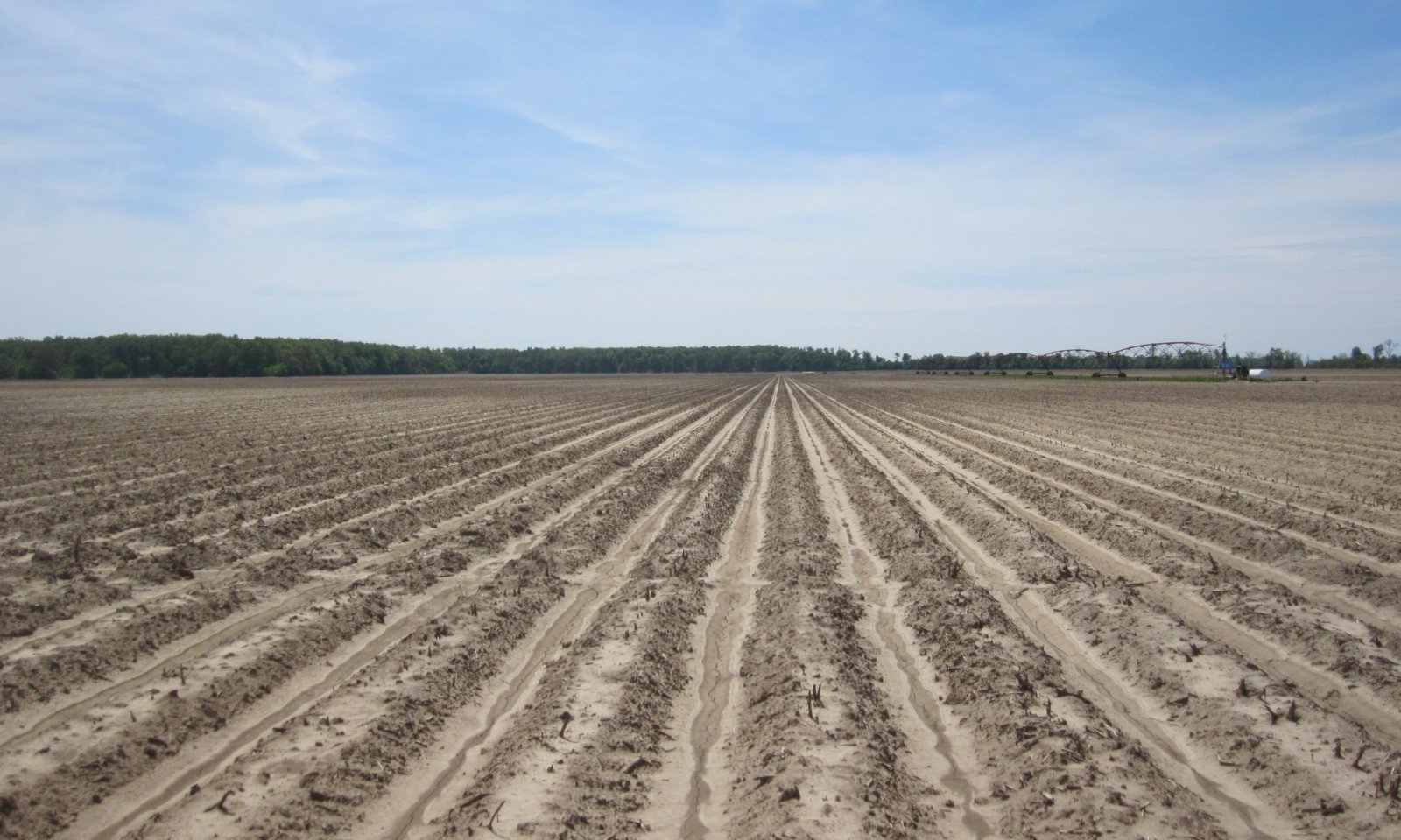
Overall, forest cover on this site is minor compared to other uses. Most areas have been cleared and are used for growing cotton, corn, soybeans, and small grain. This site is used extensively for row crop production and some areas have been land leveled up to 3 feet to meet irrigation needs. A secondary use on this site is pasturage.
Following this narrative, a “provisional” state and transition model is provided that includes the “perceived” reference state and several alternative (or altered) vegetation states that have been observed and/or projected for this ecological site. This model is based on limited inventories, literature, expert knowledge, and interpretations. Plant communities may differ from one location to the next depending on the severity of local land use activities and rates of deposition. Depending on objectives, the reference plant community may not necessarily be the management goal.
The environmental and biological characteristics of this site are complex and dynamic. As such, the following diagram suggests pathways that the vegetation on this site might take, given that the modal concepts of climate and soils are met within an area of interest. Specific locations with unique soils and disturbance histories may have alternate pathways that are not represented in the model. This information is intended to show the possibilities within a given set of circumstances and represents the initial steps toward developing a defensible description and model. The model and associated information are subject to change as knowledge increases and new information is garnered. This is an iterative process. Most importantly, local and/or state professional guidance should always be sought before pursuing a treatment scenario.State and transition model
Custom diagramStandard diagram
Figure 10. STM

Figure 11. STM legend
More interactive model formats are also available. View Interactive Models
More interactive model formats are also available. View Interactive Models
Click on state and transition labels to scroll to the respective textEcosystem states
States 1, 5 and 2 (additional transitions)
States 3 and 7 (additional transitions)
T1A - Manipulate composition and manage for production (Community 2.1); Heavy timber cutting/high-grading (Community 2.2) T1B - Vegetation/stump removal (mechanical/chemical); preparation for cultivation T1C - Vegetation/stump removal (mechanical/chemical); seedbed preparation; establishment of desired forage; manage for grazing T2A - Re-establish missing species; control exotics (mechanical/chemical); timber stand improvement; natural stand dynamics T2B - Vegetation/stump removal (mechanical/chemical); preparation for cultivation T2C - Vegetation/stump removal (mechanical/chemical); seedbed preparation; establishment of desired forage; manage for grazing T3A - Precision land leveling T3B - Establish desired forage species; manage for grazing. T3C - Natural succession (Community 6.1) or site prep (plow pan breakup, fertilizing, etc.); planting species appropriate for site (Community 6.2) T3D - Establish select native species suitable for site; prepare for planting (herbicide and/or mechanical) T5A - Vegetation/stump removal (mechanical/chemical); preparation for cultivation T5B - Natural succession (Community 6.1) or site prep (plow pan breakup, fertilizing, etc.); planting species appropriate for site (Community 6.2) T5C - Establish select native species suitable for site; prepare for planting (herbicide and/or mechanical) T6A - Vegetation/stump removal (mechanical/chemical); preparation for cultivation T6B - Vegetation/stump removal (mechanical/chemical); seedbed preparation; establishment of desired forage; manage for grazing T7A - Vegetation/stump removal (mechanical/chemical); preparation for cultivation T7B - Vegetation/stump removal (mechanical/chemical); seedbed preparation; establishment of desired forage; manage for grazing T7C - Natural succession (Community 6.1) or site prep; planting species appropriate for site (Afforestation – Community 6.2). State 1 submodel, plant communities
State 2 submodel, plant communities
2.1A - Cessation of management followed by heavy cutting/high-grading 2.2A - Silvicultural treatments: removal of undesirable species; re-establish species favored in management; timber stand improvement; establish advance regeneration State 3 submodel, plant communities
3.1A - Soil disturbance (tillage); reduction of soil health. 3.1B - Conventional tillage, seeding, and fertility management for crops. 3.2A - No-till, cover crops, reduced till–soil health improvements. 3.2B - Conventional tillage, seeding, and fertility management for crops. 3.3A - Reduced till, no-till, and cover crops with soil health improvements as a goal. State 4 submodel, plant communities
State 5 submodel, plant communities
5.1A - Seeding and/or management for desired species composition. 5.1B - Species management without overseeding. 5.2A - Seeding, fertilizing, management/removal of undesirable species. 5.2B - Species management without overseeding 5.3A - Seeding, fertilizing, management/removal of undesirable species. 5.3B - Seeding and/or management for desired species composition. 5.3C - Lack of disturbance; no (infrequent) mowing, herbivory, or brush management; natural succession of woody species. 5.4A - Brush management/removal of unwanted species. State 6 submodel, plant communities
6.1A - Remove undesirable competitors; final soil preparation; establish site-appropriate species (favored in management). State 7 submodel, plant communities
State 1
Reference: Moist Bottomland ForestRemoval of the pre-settlement natural communities of this site occurred long before thorough studies and investigations were conducted. Accordingly, reference conditions for this site have yet to be confirmed. Once assigned, that vegetation community will not represent the pre-settlement forest association, but it should identify an assemblage of naturally occurring species that reflects and contributes to the regional biodiversity and local forest ecology. The reference state will be based on decades of forest inventories and expert knowledge and opinion.
The return or transition pathway from the altered states back to the reference state is intended to represent the suite of hardwood species favored in management on this site.Community 1.1
Mixed Bottomland HardwoodsA specific community or forest type that is representative of reference conditions has not been determined. The position of this site being intermediate to the drier, loamy natural levee ridges (see site F131AY306MS) and the wetter, natural levee toeslopes (see site F131AY308MS) creates a setting that likely include forest components adapted to both extremes. Putnam and Bull’s (1932) willow oak – cherrybark oak – cow oak type includes species that are associates of both sites. Broadfoot (1976) listed several species (mutually in Putnam and Bull’s description) that are both favored in management and that frequently occur on the soils of this site, including Nuttall oak, cherrybark oak, water oak, willow oak, and sweetgum. Broadfoot also listed the following associates to favor in management that occasionally occur on these soils: green ash, eastern cottonwood, American sycamore, swamp chestnut oak, and pecan (corroborated by Steve Meadows, USFS Principal Silviculturist, personal communication to Rachel Stout Evans, contributing author). As an example of the productivity of this site, the following are site index ranges (tree height in feet at 50 years except cottonwood which is 30 years) of the preceding species from Broadfoot (1976): Nuttall oak – 85 to 105; cherrybark oak – 90 to 110; water oak – 85 to 105; willow oak – 90 to 110; sweetgum – 90 to 110; green ash – 70 to 90; eastern cottonwood – 90 to 110; American sycamore 95 to 115; swamp chestnut oak – 70 to 90; pecan – 80 to 100.
Typical of forests in moist environments of the Mississippi River Alluvium many additional species are associates of this site. Additional canopy and subcanopy taxa include American elm, sugarberry, red maple, red mulberry, common persimmon, cedar elm (Ulmus crassifolia), and boxelder (Acer negundo). Understory components of older stands without prior management likely include shade tolerant canopy and subcanopy trees such as elm, ash, sugarberry, red maple, and red mulberry along with shrubs of possumhaw (Ilex decidua), roughleaf dogwood (Cornus drummondii), and hawthorn (Crataegus spp.). Undergrowth consists of several vines including greenbrier (Smilax spp.), eastern poison ivy (Toxicodendron radians), peppervine (Nekemias arborea), American buckwheat vine or redvine (Brunnichia ovata), trumpet creeper (Campsis radicans), Carolina coralbead (Cocculus carolinus), Virginia creeper (Parthenocissus quinquefolia), and grape (Vitis spp.). Herbaceous taxa may include bedstraw (Galium spp.), violet (Viola spp.), bluestar (Amsonia spp.), and jewelweed (Impatiens capensis) (Eyre, 1980; NatureServe, 2020).
The arrangement of tree species listed in the Dominant Plant Species table below follows the same order of importance (i.e., decreasing dominance) as indicated in the sweetgum – water oaks forest type in Putnam (1951). Putnam's list is interpreted to be more representative of natural variability than ranking the species by commercial value.Dominant plant species
-
sweetgum (Liquidambar styraciflua), tree
-
water oak (Quercus nigra), tree
-
Nuttall oak (Quercus texana), tree
-
willow oak (Quercus phellos), tree
-
American elm (Ulmus americana), tree
-
sugarberry (Celtis laevigata), tree
-
green ash (Fraxinus pennsylvanica), tree
-
pecan (Carya illinoinensis), tree
-
cedar elm (Ulmus crassifolia), tree
-
eastern cottonwood (Populus deltoides), tree
-
possumhaw (Ilex decidua), shrub
-
roughleaf dogwood (Cornus drummondii), shrub
-
hawthorn (Crataegus), shrub
-
greenbrier (Smilax), shrub
-
eastern poison ivy (Toxicodendron radicans), shrub
-
peppervine (Nekemias arborea), shrub
-
American buckwheat vine (Brunnichia ovata), shrub
-
trumpet creeper (Campsis radicans), shrub
-
Carolina coralbead (Cocculus carolinus), shrub
-
Virginia creeper (Parthenocissus quinquefolia), shrub
-
grape (Vitis), shrub
State 2
Commercial ForestlandThis state consists of two very different community phases and management approaches. Community Phase 2.1 represents forest management and production on this site. A distinguishing feature of this phase is the level of management intensity designed to maximize merchantable goals. Various silvicultural methods are available for selection, and these are generally grouped into even-aged (e.g., clearcutting, seed-tree, and shelterwood) and uneven-aged (e.g., single tree, diameter-limit, basal area, and group selection) approaches (Meadows and Stanturf, 1997). Depending on the method selected, different structural and compositional characteristics of the stand may result. Removal and control of community associates are typically a critical element of production goals. These actions may result in different community or “management phases” (and possibly alternate states) depending on the methods used and desired results. Finding the appropriate approach for a given stand and environment necessitates close consultation with trained, experienced, and knowledgeable forestry professionals. If there is a desire to proceed with this state, it is strongly urged and advised that professional guidance be obtained and a well-designed silvicultural plan developed in advance of any work conducted.
Community Phase 2.2 represents conditions of many stands that have incurred indiscriminate timber harvests (e.g., heavy cutting, diameter-limit harvests of select species) and opportunistic regrowth following such harvests (i.e., no management at any period). Some stands may continue to support a few desirable species and quality stems, but in many instances, affected stands will be comprised of mostly shade tolerant species or trees of desirable species that fail to meet their maximum potential.
Although this site is well suited for forest production, seasonal wetness imposes moderate to severe limitations for some forest operations. Heavy equipment usage on wet soils can cause compaction, which may reduce site productivity. If possible, equipment operations are best conducted during drier periods of the year, which minimizes soil damage, erosion, and helps to maintain productivity.
An important caveat of this state is its representation of forest conditions that have retained full site production potential. Currently, transitional pathways to this state originate from another forested state (State 1), only. Former landuses (alternate states) that result in soil compaction (increased bulk densities), lower soil organic matter content, altered fertility, and smaller available rooting volume can reduce forest site production by 10 to 20 percent for some species (Groninger et al., 1999). These are conservative percentage reductions. The model from the Baker and Broadfoot (1979) method of site evaluation have produced site index values of over 20 percent lower than trees measured on non-impacted, forest soils. These impacts, however, can be ameliorated through various “afforestation” techniques such as plow pan breakup (subsoil or deep plowing), fertilization, and fallowing fields before stand establishment (Emile Gardiner, USFS Research Forester, personal communication with Rachel Stout Evans, contributing author). State 6 (Forest Recovery) is representative of forest establishment and growth on locations where soil compaction and reduction of nutrients have occurred. Once a previously affected location has recovered its site potential, transition to this state may be possible. That potential transition is still under review and is currently not shown or addressed in the state and transition model.Community 2.1
Forest ManagementPrescribing a silvicultural system for a given stand depends on species composition; long term production and postproduction goals; and the presence and abundance of advance regeneration (i.e., the presence of seedlings and saplings of the desired species). The canopy trees listed in State 1 as “favored in management” are all production options on this site ranging from single species plantations to complex multi-species stands. (Species favored in management are listed below for convenience.)
Establishing and maintaining oaks on bottomland sites may be preferred given the multiple values they provide (e.g., timber and wildlife). However, maintaining that component beyond a single rotation (or harvest) may be the most challenging. Creating conditions that promote oak persistence in future stands require a sufficient advance regeneration component. Ensuring that this future crop is established will require close adherence to a well-designed silvicultural plan, which requires programmatic intermediate operations (e.g., improvement cuttings, thinnings, and other partial cuttings). An even-aged silvicultural system that utilizes the clearcutting regeneration method along with brush management to reduce subsequent competition is typically the advocated approach when harvesting bottomland oak stands (Johnson and Shropshire, 1983; Clatterbuck and Meadows, 1993; Hodges, 1995; Meadows and Stanturf, 1997).
Except pecan, the remaining trees that are favored in management are light-seeded species. A variety of silvicultural systems may be implemented to promote production of these species including even-aged and group selection (uneven-aged) approaches (see Meadows and Stanturf, 1997).Dominant plant species
-
Nuttall oak (Quercus texana), tree
-
cherrybark oak (Quercus pagoda), tree
-
water oak (Quercus nigra), tree
-
willow oak (Quercus phellos), tree
-
sweetgum (Liquidambar styraciflua), tree
-
green ash (Fraxinus pennsylvanica), tree
-
eastern cottonwood (Populus deltoides), tree
-
American sycamore (Platanus occidentalis), tree
-
swamp chestnut oak (Quercus michauxii), tree
-
pecan (Carya illinoinensis), tree
Community 2.2
Non-managed/High-gradedThis forest community is directly influenced by former harvesting practices that include repeated single-tree selection or diameter-limit harvests with no additional management activities (e.g., brush management, competitor control, etc.). These practices typically target the highest quality trees of the most desirable species. The result is usually an expansion and in-filling of shade tolerant subcanopy trees. Over time, this practice will lead to a predominantly shade tolerant community that may be comprised of a variant of the sugarberry – American elm – green ash forest association, possibly with a plurality of sugarberry and elm. Additional shade tolerant components likely to occur consist of red maple, boxelder, red mulberry, roughleaf dogwood, and possumhaw.
Pathway 2.1A
Community 2.1 to 2.2Heavy cutting of the stand that removes the desired species (typically shade intolerant species) of sufficient diameters followed by no management of the residual stand. This pathway also includes repeated single-tree harvests (e.g., diameter-limit cuts) that removes the desired species followed by no management of the residual stand. The resulting stand is typically comprised of shade tolerant species with low commercial value.
Pathway 2.2A
Community 2.2 to 2.1Intensive management will be required to push a shade tolerant community into a more commercially desirable system. Actions will likely require a complete clearcut of the stand followed by repeated brush and competitor control (chemical and mechanical). If there is a lack of seed source, artificial regeneration will likely be required to reintroduce heavy-seeded species (oaks and pecan). Continual competitor control will be needed.
State 3
CroplandThis state is representative of the dominant landuse activity on this ecological site, agriculture production. The dominant crops grown on this site are cotton (Gossypium hirsutum), corn (Zea mays), soybeans (Glycine max), and potentially small grains such as wheat (Triticum aestivum). Minor crops, such as some specialty crops (e.g., fruits, vegetables, and tree nuts such as pecans), may be grown locally.
The soils of this site are well suited to agriculture production. Management concerns are centered on seasonal wetness, soil compaction from heavy equipment operations, and the development of a plow pan. Pringle et al. (2017) emphasized that a “fairly impermeable crust” tends to develop following a heavy rain or an irrigation event. Each of these factors could affect yields or impede optimum operation. Management measures to ameliorate some of these issues may include implementation of a drainage system or network in problematic areas; implementing a conservation tillage or management system; subsoiling to breakup plow pans (USDA-NRCS, 2006b). Major components that producers generally develop and plan are proper selection of crop cultivar, pest control, cropping system, tillage methods, nutrient management, and water management. Key practices of some cropping systems often include two or more crops grown in a multiyear rotation, which has been documented to disrupt pest cycles. Leaving crop residue on the surface can help to maintain tilth, fertility, and organic matter content – all critical elements of soil quality and health. For monoculture cropping systems, the implementation of well-designed pest and nutrient management systems are imperative (Pringle et al., 2017). (For assistance, interested parties are advised to visit their local NRCS Field Office.)
Three separate management phases comprise this state: Conservation Management (3.1), Transitional Conservation Management (3.2), and Conventional Management (3.3). The three phases consist of varying tillage methods and approaches to soil health management systems.Community 3.1
Conservation ManagementThis cropland phase utilizes long term, continuous conservation management systems that include reduced till and cover crops; no-till with cover crops; crop residue retention; and perennial cropping systems. The guiding principles of this system are minimizing soil disturbance and maximizing soil cover, biodiversity, and the presence of living roots. Implementing diverse crop rotations while maintaining these principles can lend to the development of an integrated pest management plan and contribute to overall system resilience.
Of caution, the above-ground crop growth or yields may not be the best tracking mechanism for assessing the efficacy or presence of this management phase. Indicators of these systems are generally determined via soil-site assessments with outcomes that may include enhanced soil aggregate stability, increased soil biological activity, higher organic matter content, and improved water holding capacity and infiltration rates while also alleviating soil compaction and reducing runoff and erosion (Chessman et al., 2019). Additional advantages to this system that have been noted by some producers are reductions in fuel and labor costs and less wear and tear on machinery and equipment.
There are challenges to this management system, especially in situations where tillage may be considered and/or needed to repair weather damage or other detrimental impacts. Implementation of conventional tillage even after long term conservation practices (e.g., no-till) can reset the affected area back to a conventional cropping system. However, those changes can be reversed and a return to a conservation management system is achievable.
Critical conservation practices associated with this phase include cover crops, no-till, and reduced till as the foundational practices. Additionally, this phase may include supporting and/or site-specific practices to address conservation needs for a given location.Community 3.2
Transitional Conservation Management
Figure 12. Undulating natural levee over older meander scroll Dundee sil, 0-3% slopes, Coahoma Co., MS.
This cropland phase utilizes a hybrid approach that combines conventional methods with conservation practices at specific periods and under specific situations. Practices under this phase may include a combination of conventional till, reduced till, strip till, and the inclusion of cover crops. For instance, perennial crop species could be in a continuous transitional phase where conventional tillage is implemented at the time of planting followed by reduced tillage during the rotation. Planted forage crops could also be included in this phase, especially when part of a crop rotation that utilizes reduced tillage for one crop followed by conventional tillage for a succeeding crop.
The development, implementation, and refinement of nutrient and pest management plans throughout component operations are imperative. Additionally, this phase may include supporting and site-specific practices to address conservation needs for a given location.Community 3.3
Conventional Management
Figure 13. Erosion on ridge and swale meander scroll, Sunflower Co., MS.
This management phase is representative of conventional cropland where tillage is implemented as an annual component of the production system. As crucial elements of the system, conservation practices such as nutrient and pest management are needed to address fertility requirements and pest concerns within the crop cycle. It is important to note that this phase may develop when tillage is implemented to address damage or for other purposes while under a conservation management system (Community Phase 3.1). There could also be associated, supporting, and site-specific practices that are needed to address specific conservation needs. Specific needs may include grade stabilization structures to control gully erosion, grassed waterways to trap sediment from sheet and rill erosion, or implementing reduced till.
Pathway 3.1A
Community 3.1 to 3.2Soil disturbance (tillage); reduction of soil health.
Pathway 3.1B
Community 3.1 to 3.3Conventional tillage, seeding, and fertility management for crops.
Pathway 3.2A
Community 3.2 to 3.1No-till, cover crops, reduced till–soil health improvements.
Pathway 3.2B
Community 3.2 to 3.3
Transitional Conservation Management
Conventional ManagementConventional tillage, seeding, and fertility management for crops.
Pathway 3.3A
Community 3.3 to 3.2
Conventional Management
Transitional Conservation ManagementReduced till, no-till, and cover crops with soil health improvements as a goal.
State 4
Land Formed CroplandThis gently sloping to undulating ecological site typically adjoins nearly level to level landscapes. It is bordered by soils of varying textures and drainage characteristics. Accordingly, inconsistencies in wetness, ease of operation, and production or yields may occur across a cropped location. An increasingly common practice on this site consists of land forming or leveling surface irregularities into a predetermined and engineered, uniform slope. This practice removes the drier and higher features of this site, which are then used to fill wetter and lower positions (e.g., depressions or swales) across the targeted area. Advantages of land leveling may include reduced hazards of erosion and runoff rates, improved surface drainage, and enhanced distribution and conservation of irrigation water. Disadvantages of the practice is a churning of various surface and subsurface materials (former soil horizons) that no longer occur in a predictable or regular pattern. Organic matter content in the surface layer is generally low, and the surface tends to crust and pack after heavy rains (USDA-NRCS, 2006b). One potential hazard that appears to be emerging in some areas is an effective management of surface water runoff. As both irrigated and stormwater runs off leveled fields at uniform rates, surface water tends to collect cumulatively and simultaneously, which places tremendous demands on local drainage networks. Without “in field” structures (natural or artificial) to stagger runoff, the downslope (or lower) ends of some fields tend to back flood thereby contributing to more flooding overall in local watersheds (personal observations).
Immediately following land leveling, the constituent elements of soil health are likely to be absent. In some areas, producers have initiated practices such as applying organic residues (e.g., poultry litter) or growing rice crops for one to two years to rapidly boost fertility and introduce organic matter (via rice biomass) in the surface layer. Over time, the full complement of the management phases of State 3 may be possible on land leveled fields. They are not repeated here.
Currently, this state serves as an endpoint in the state and transition model because the ability to predict vegetation response when transitioning to a different state is no longer possible without soil-site investigations for each area of interest. The former soils of this ecological site, including surface and subsurface horizons, will have been redistributed as particles among other former soils.Community 4.1
Land Leveled CroplandSome of the crop species and management practices indicated and discussed in State 3 (including all three management phases) may be suitable for establishing on land leveled areas that once supported the soils of this site. However, the type of crops suited for newly leveled areas may ultimately depend on the prevailing soil particle-size distribution and internal drainage characteristics. Former studies on precision leveled fields have noted variabilities and inconsistencies in soil particle-size distributions, bulk density, soil biological properties, and nutrients (Brye et al., 2003; Walker et al., 2003; Brye et al., 2006). Management concerns for this phase may consist of restricted permeability, low organic matter content, and crusting and packing (USDA-NRCS, 2006b). These impacts may be improved by implementing conservation tillage, cover crops, retaining crop residue, and nutrient and pest management strategies.
State 5
Pastureland/GrasslandThis state is representative of sites that have been converted to and maintained in pasture or grassland. In 1991, the soils of this site were placed in Pasture Suitability Group 11b for the State of Mississippi. The Dundee soils are generally considered well suited to most commonly grown forage species. However, there are some wetness limitations due to a seasonally high water table. Management concerns are mainly centered on soil compaction due to grazing, which may be improved or avoided by restricting grazing during wetter periods (USDA-NRCS, 2006b). Of caution, some annual winter plants naturally growing in wet locations (e.g., sedges and rushes) may be hazardous if consumed. Production is considered moderately high when adequately fertilized and properly managed.
Given that this ecological site adjoins lower, wetter sites, some forage operations may experience multiple wetness events in a single year, especially in pastures where wetter soils occur in complex or in close contact with those of this site. Flood-prone areas may limit the type of forage suited for this site. A system of artificial drainage or water control structures may be in place to facilitate continued forage production and grazing during wetter periods. Additionally, adjacent higher elevation or protected areas may be needed for the storage of harvested forage or holding of livestock when wet or flooded conditions occur.
Establishing an effective pasture management program can help minimize degradation of the site and assist in maintaining growth of desired forage. An effective pasture management program includes selecting well-adapted grass and/or legume species that will grow and establish rapidly; maintaining proper soil pH and fertility levels; using controlled grazing practices; mowing at proper timing and stage of maturity; allowing new seedings to become well established before use; and renovating pastures when needed (Rhodes et al., 2005; Green et al., 2006).
This state consists of four community phases that represent a range of forage management options and pasture/hayland condition scenarios. Options range from establishing a forage monoculture for haying to a broad mixture of forage species for production and grazing. It is strongly advised that consultation with local NRCS Service Centers be sought when assistance is needed in developing management recommendations or prescribed grazing practices.Community 5.1
Monoculture GrasslandThis phase is mainly characterized by planting forage species for hay production. Forage plantings generally consist of a single grass species. Native and non-native forage species can be seeded. Forage is usually harvested as hay or haylage, although grazing may occur periodically. These sites are highly productive for forage and can provide ecological benefits to control soil erosion. Allowing for adequate rest and regrowth of desired species is required to maintain productivity. Maintenance of monoculture stands also requires control of unwanted species, which will require pest and nutrient management.
Generally, the application of fertilizer and lime is needed to establish and maintain improved desirable pastures. Exceptions do occur for bahiagrass (Paspalum notatum) and common bermudagrass (Cynodon dactylon), which can be sustained under natural fertility and pH levels. Introduced grasses, such as hybrid bermudagrass, require a higher level of sustained fertility, pH above 6.0, and good surface drainage to persist. An additional measure to aid production may include prescribed grazing. Implementing limited and monitored grazing can promote deeper root penetration of grasses with the added benefit of greater nutrient and moisture uptake. This synergistic approach can lead to increased production of and may sustain desirable forages.
Conservation practices should include prescribed grazing, or forage harvest management, nutrient and pest management, and potentially other site-specific practices.Dominant plant species
-
Bermudagrass (Cynodon dactylon), grass
-
bahiagrass (Paspalum notatum), grass
-
dallisgrass (Paspalum dilatatum), grass
Community 5.2
Mixed Species SystemThis community is characterized by mixed species composition of grasses and legumes. Components of this forage system are either planted or they established naturally. Typically, perennial warm-season grasses are the foundation of the stand that are periodically overseeded with adapted cool-season forages. The latter creates an added benefit of extending the grazing season. This community phase can be highly productive for grazing and haying operations and can provide beneficial habitat for some wildlife species.
Maintenance of grass stands also requires a series of management practices such as prescribed grazing, brush management, pest management, and nutrient management to maintain production of the desired species. Prescribed grazing includes maintaining proper grazing or forage heights, timing, and stocking rates. Supporting or facilitating practices such as fences, water lines, and watering facilities could be part of the system that maintains this phase.Dominant plant species
-
Bermudagrass (Cynodon dactylon), grass
-
bahiagrass (Paspalum notatum), grass
-
dallisgrass (Paspalum dilatatum), grass
-
white clover (Trifolium repens), other herbaceous
-
red clover (Trifolium pratense), other herbaceous
-
crimson clover (Trifolium incarnatum), other herbaceous
Community 5.3
Mixed Species, Non-seededThis community is characterized by a mixture of native and naturalized non-native species. Forage is usually grazed and/or harvested as stored forage, hay or haylage. Common established species may include Bermudagrass, bahiagrass, Vasey grass (Paspalum urvillei), and carpetgrass (Axonopus sp.).
Stands are generally productive, and forage and grazing management can maintain the community. Healthy stands provide additional benefits by protecting soils from excessive runoff and erosion. However, a common peril associated with this phase is overgrazing, which lowers production and favors less palatable weedy species, especially in areas where livestock congregate. Proper stocking rates or grazing systems that allow for adequate rest and plant regrowth are required to maintain productivity. When forage species are afforded adequate recovery time between grazing intervals, they develop deeper root systems and greater leaf area. Conversely, when plants are not allowed to adequately recover, root development will be restricted leading to lower forage and biomass production. Additionally, maintenance of grass stands requires implementing pest management practices to control unwanted weedy and woody species.Community 5.4
Early Woody SuccessionThis community is characterized by a diverse composition of grasses and forbs with an increasing presence of woody species (both native and non-native) that are immature and of low stature. Woody species grow quickly on this site and can be difficult and expensive to control. One potentially problematic species may be honeylocust (Gleditsia triacanthos). Putnam (1951) reported honeylocust as being common on old pastures, and the species can be difficult to remove once established. Management to transition this phase to other forage communities of this state is still possible without excessive inputs and effort, particularly if stem diameters remain below 2 inches and are widely scattered (e.g., a density of less than 100 stems per acre). However, if diameters become greater than 3 inches and densities exceed 300 stems per acre, far more investment, effort, and inputs will be required. If brush management measures are not undertaken, the plant community will transition to the Ruderal/Opportunistic Regrowth (Community Phase 6.1) of State 6.
Of note, this community phase is often very beneficial habitat for some wildlife species, especially a specific guild of resident and Neotropical migratory bird species that depend on old field to young tree stand habitats.Dominant plant species
-
honeylocust (Gleditsia triacanthos), tree
Pathway 5.1A
Community 5.1 to 5.2Seeding and/or management for desired species composition.
Pathway 5.1B
Community 5.1 to 5.3Species management without overseeding.
Pathway 5.2A
Community 5.2 to 5.1Seeding, fertilizing, management/removal of undesirable species.
Pathway 5.2B
Community 5.2 to 5.3Species management without overseeding
Pathway 5.3A
Community 5.3 to 5.1Seeding, fertilizing, management/removal of undesirable species.
Pathway 5.3B
Community 5.3 to 5.2Seeding and/or management for desired species composition.
Pathway 5.3C
Community 5.3 to 5.4Lack of disturbance; no (infrequent) mowing, herbivory, or brush management; natural succession of woody species.
Pathway 5.4A
Community 5.4 to 5.3Brush management/removal of unwanted species.
State 6
Forest RecoveryThis state is representative of forest recovery in areas that were once under former intensive landuse such as long-term row crop cultivation. Characteristics that distinguish this state from other forest states on this site include a suite of soil-site properties that reportedly affect tree growth such as higher soil bulk density due to compaction, presence of a plow pan, lower organic matter content, and reduced fertility (Baker and Broadfoot, 1979; Groninger et al., 1999). Two community phases are provisionally recognized for this state. Community Phase 6.1 represents natural colonization of tree and shrub species without management. Community Phase 6.2 is representative of intentional forest establishment by artificial regeneration or planting.
For Community Phase 6.2, determining the objectives and goals of the future stand is imperative to increase the probability of successful establishment and production of the afforested area. These decisions will ultimately determine the species to be established, preparation requirements, planting density, and post-planting operations (e.g., competitor control, future improvement cuttings and thinnings, regeneration methods, and overall stand health). Since each area targeted for afforestation may have unique or different landuse histories, having a clear understanding of the soil-site conditions are essential. Some areas may necessitate a series of soil improvement actions prior to planting. These actions may include subsoiling or deep plowing to breakup plow pans and fertilizing the targeted area. An additional option is to allow the area to undergo fallowing for a predetermined period (Community Phase 6.1) to potentially increase soil organic matter content, enhance soil aggregate stability, increase soil biological activity, and improve water holding capacity and infiltration rates. Controlling competing vegetation (chemical and mechanical treatment) will most likely be critical. Post-planting operations and maintenance of the stand can enhance survival, future development, and achieve goals and objectives (see Gardiner et al., 2002).
Finding the appropriate approach for a given environment necessitates close consultation with trained, experienced, and knowledgeable forestry professionals. If there is a desire to proceed with this state, it is strongly urged and advised that professional guidance be obtained and a well-designed afforestation and silvicultural plan developed in advance of any work conducted. For an exceptional review and summarization of the afforestation literature, techniques, and practices within the Southern Mississippi River Alluvium, interested parties are directed to Gardiner et al. (2002).Community 6.1
Ruderal/Opportunistic RegrowthThis community phase is representative of former working lands (e.g., cropland and possibly high concentration areas of former pastureland) that have fallowed and subsequently undergone natural colonization by trees and shrubs. A profusion of growth will initiate within five to eight years of becoming idle – one that typically includes woody seedlings, grasses, forbs, and an increasing presence and covering of vines. Some areas may be far removed from established forest stands. Under this scenario, colonizing tree species may be mostly light-seeded species (e.g., ash, elm, maple). Heavy-seeded species like oaks and pecan may not have an opportunity to colonize available areas due to distance and lack of a dependable dispersing agent (e.g., wildlife and water). For those areas close to a viable seed source, oaks may be a component of the developing stand, although in the early stages of stand development oaks are likely to be a minor component (Meadows, 1993). Non-native invasive species will, most likely, be part of the developing stand and could form the plurality of an area given the proliferation of exotic plant species over the past century.
As the young stand matures and enters the stem exclusion stage (crown or canopy closure), composition of light-seeded tree species may include American elm, green ash, cedar elm, boxelder, American sycamore, red maple, sugarberry, and sweetgum. Oaks that may occur in the young stand include willow, water, and Nuttall but will likely be rare or uncommon components, if present at all. Non-native woody species that may occur include Japanese honeysuckle (Lonicera japonica), Chinese privet (Ligustrum sinense), Chinese tallow (Triadica sebifera), and Callery pear (Pyrus calleryana). Vines common in the young, developing stand may include greenbrier, eastern poison ivy, peppervine, American buckwheat vine, and trumpet creeper. As the stand matures decades into the future and the overstory stratifies (i.e., the understory reinitiation stage), shade tolerant species may dominate the stand and the community could transition to an elm – ash – sugarberry association or a variant of this type.Dominant plant species
-
American elm (Ulmus americana), tree
-
green ash (Fraxinus pennsylvanica), tree
-
cedar elm (Ulmus crassifolia), tree
-
boxelder (Acer negundo), tree
-
American sycamore (Platanus occidentalis), tree
-
red maple (Acer rubrum), tree
-
sugarberry (Celtis laevigata), tree
-
sweetgum (Liquidambar styraciflua), tree
Community 6.2
Afforestation
Figure 14. WRP planting on ridge and swale Dundee sil, 0-3% slopes, Bolivar Co., MS.
This community phase is representative of areas planted in tree species that are suited for and favored in management on this ecological site. Preparation of this phase may be initiated immediately following a former land use activity (e.g., State 3) or it may be started following a fallow period (Community Phase 6.1). If afforestation is initiated immediately following intensive land use without “site preparation,” potential productivity of the targeted area could be less than optimal if soil compaction, plow pan occurrence, degraded fertility, and depleted organic matter content have occurred.
The following are projected site index ranges of select tree species (tree height in feet with base age 30 years for cottonwood and 50 years for all others) whereby the soils of a given location had been under prolonged cultivation. Ranges of individual values are based on the presence of a plow pan (low value) to one where only prolonged cultivation is considered with no change in bulk density and organic matter content (high value): sweetgum – 74 to 86 feet; eastern cottonwood – 72 to 92 feet; cherrybark oak – 73 to 84 feet; water oak – 70 to 80 feet; green ash – 59 to 70 feet; Nuttall oak – 70 to 81 feet. (Site indices were derived via the models of Baker and Broadfoot, 1979, by Steve Meadows, USFS Principal Silviculturist, and shared with Rachel Stout Evans, contributing author.)
The tree species listed in the Dominant Plant Species table includes those listed above in addition to trees identified as suitable for planting on Dundee soils in Broadfoot (1976).Dominant plant species
-
sweetgum (Liquidambar styraciflua), tree
-
cherrybark oak (Quercus pagoda), tree
-
Nuttall oak (Quercus texana), tree
-
water oak (Quercus nigra), tree
-
green ash (Fraxinus pennsylvanica), tree
-
eastern cottonwood (Populus deltoides), tree
-
Shumard's oak (Quercus shumardii), tree
-
American sycamore (Platanus occidentalis), tree
Pathway 6.1A
Community 6.1 to 6.2Remove undesirable competitors; final soil preparation; establish site-appropriate species (favored in management).
State 7
Conservation (Herbaceous)This state is representative of the range of conservation actions that may be implemented and established on this ecological site. Apart from planting trees and managing for forest, one may elect to establish native herbaceous species and manage for predominantly a native grassland; a complex mixture of native grasses and forbs; or a pollinator planting whereby native forbs dominate the mix. In each of these options, it is strongly advised (and possibly a programmatic requirement) that the species comprising the planting or seed mix consist of spring, summer, and fall flowering species. Depending on goals and objectives, various conservation programs and practices may be available. For additional information and assistance, please contact or visit the local NRCS Field Office.
Community 7.1
Pollinator Planting/Native GrassesThis community phase represents the establishment of native forbs or wildflowers for pollinator habitat and/or native grasses. The seed mix for planting may be quite varied depending on objectives and goals. Ideally, the mix includes a wide range of species that flower at various times of the growing season (spring, summer, and fall). Plant species in some pollinator mixes may include but are not limited to beebalm (Monarda spp.), milkweeds (Asclepias spp.), beardtongue (Penstemon spp.), cardinalflower (Lobelia cardinalis), vervain (Verbena spp.), various legumes such as native lespedeza (Lespedeza spp.), Illinois bundleflower (Desmanthus illinoensis), partridge pea (Chamaecrista fasciculata), and a broad assortment of composites such as asters (Symphyotrichum spp.), tickseed (Coreopsis spp.), blazing star (Liatris spp.), coneflower (Rudbeckia spp.), sunflower (Helianthus spp.) among many others. If goals and objectives are to establish native grasses within a forb mix or in a grass-dominant stand, species suitable for planting may include switchgrass (Panicum virgatum), big bluestem (Andropogon gerardii), little bluestem (Schizachyrium scoparium) Indiangrass (Sorghastrum nutans), and eastern gamagrass (Tripsacum dactyloides).
Key to the establishment of this phase is initial preparation, seeding rate, planting period, follow-up treatment, and maintenance of the planting. The selection of species to establish on any given area may ultimately depend on size and conditions of the location where the planting will occur, landowner/manager goals and objectives, and the advice and knowledge of the conservation practitioner.Transition T1A
State 1 to 2Stand composition is heavily altered and managed to favor select species for production (Community 2.1). This transitional pathway also includes heavy timber cutting and/or high-grading leading to Community 2.2.
Transition T1B
State 1 to 3Actions include mechanical removal of vegetation and stumps; herbicide treatment of residual plants; and preparation for cultivation.
Transition T1C
State 1 to 5Actions include mechanical removal of vegetation and stumps; herbicide treatment of residual plants; seedbed preparation; and establishment of desired forage.
Transition T2A
State 2 to 1This transition represents a return to perceived reference conditions and involves the re-establishment of missing species; the control/removal of exotic species (herbicide and mechanical); stand improvement practices that favors a return of more shade intolerant components.
Transition T2B
State 2 to 3Actions include mechanical removal of vegetation and stumps; herbicide treatment of residual plants; and preparation for cultivation.
Transition T2C
State 2 to 5Mechanical removal of vegetation and stumps; herbicide treatment of residual plants; seedbed preparation; and establishment of desired forage.
Transition T3A
State 3 to 4Precision land leveling
Transition T3B
State 3 to 5Establish desired forage species and manage for grazing.
Transition T3C
State 3 to 6Natural succession (Community 6.1) or site prep (plow pan breakup, fertilizing, etc.); planting species appropriate for site (Community 6.2)
Transition T3D
State 3 to 7Establish select native species suitable for site; prepare site for planting (herbicide and/or mechanical)
Transition T5A
State 5 to 3Cropland establishment: vegetation removal (mechanical/chemical) and preparation for cultivation
Transition T5B
State 5 to 6Natural succession (Community 6.1) or site prep (plow pan breakup, fertilizing, etc.); planting species appropriate for site (Community 6.2)
Transition T5C
State 5 to 7Establish select native species suitable for site; prepare for planting (herbicide and/or mechanical)
Transition T6A
State 6 to 3Cropland establishment: vegetation removal (mechanical/chemical) and preparation for cultivation
Transition T6B
State 6 to 5Actions include mechanical removal of vegetation and stumps; herbicide treatment of residual plants; establish desired forage species and manage for grazing.
Transition T7A
State 7 to 3Cropland establishment: vegetation removal (mechanical/chemical) and preparation for cultivation
Transition T7B
State 7 to 5Removal of vegetation; herbicide treatment of residual plants; establish desired forage species and manage for grazing
Transition T7C
State 7 to 6Natural succession (Community 6.1) or site prep; planting species appropriate for site (Afforestation – Community 6.2).
Additional community tables
Table 6. Community 1.1 plant community composition
Group Common name Symbol Scientific name Annual production () Foliar cover (%) Table 7. Community 2.1 plant community composition
Group Common name Symbol Scientific name Annual production () Foliar cover (%) Table 8. Community 2.2 plant community composition
Group Common name Symbol Scientific name Annual production () Foliar cover (%) Table 9. Community 3.1 plant community composition
Group Common name Symbol Scientific name Annual production () Foliar cover (%) Table 10. Community 3.2 plant community composition
Group Common name Symbol Scientific name Annual production () Foliar cover (%) Table 11. Community 3.3 plant community composition
Group Common name Symbol Scientific name Annual production () Foliar cover (%) Table 12. Community 4.1 plant community composition
Group Common name Symbol Scientific name Annual production () Foliar cover (%) Table 13. Community 5.1 plant community composition
Group Common name Symbol Scientific name Annual production () Foliar cover (%) Table 14. Community 5.2 plant community composition
Group Common name Symbol Scientific name Annual production () Foliar cover (%) Table 15. Community 5.3 plant community composition
Group Common name Symbol Scientific name Annual production () Foliar cover (%) Table 16. Community 5.4 plant community composition
Group Common name Symbol Scientific name Annual production () Foliar cover (%) Table 17. Community 6.1 plant community composition
Group Common name Symbol Scientific name Annual production () Foliar cover (%) Table 18. Community 6.2 plant community composition
Group Common name Symbol Scientific name Annual production () Foliar cover (%) Table 19. Community 7.1 plant community composition
Group Common name Symbol Scientific name Annual production () Foliar cover (%) Interpretations
Supporting information
Inventory data references
The information provided on the states and community phases in this provisional description report were generated from literature reviews, conversations with technical specialists, and limited personal observations and experience on this soil-site environment. Intensive vegetation inventories were not conducted during the development of this provisional report. Those tasks will occur during future phases of ecological site development.
Other references
Aslan, A. and W.J. Autin. 1999. Evolution of the Holocene Mississippi River floodplain, Ferriday, Louisiana: Insights on the origin of fine-grained floodplains. Journal of Sedimentary Research 69: 800-815.
Autin, W.J., S.F. Burns, B.J. Miller, R.T. Saucier, and J.I. Snead. 1991. Quaternary geology of the Lower Mississippi Valley. p. 547-582. In R.B. Morrison (Editor). Quaternary Nonglacial Geology: Conterminous U.S. Geological Society of America. The Geology of North America, Volume K-2. Boulder, CO.
Baker, J.B. and W.M. Broadfoot. 1979. A practical field method of site evaluation for commercially important southern hardwoods. General Technical Report SO-26. Southern Forest Experiment Station, New Orleans, LA. 51 p.
Berkowitz, J.F., D.R. Johnson, and J.J. Price. 2020. Forested wetland hydrology in a large Mississippi River tributary system. Wetlands 40: 1133-1148.
Blum, M.D., M.J. Guccione, D.A. Wysocki, P.C. Robnett, and M. Rutledge. 2000. Late Pleistocene evolution of the Lower Mississippi Valley, southern Missouri to Arkansas. Geological Society of America Bulletin 112: 221-235.
Broadfoot, W.M. 1976. Hardwood suitability for and properties of important Midsouth soils. USDA Forest Service Research Paper SO-127. Southern Forest Experiment Station, New Orleans, LA. 84 p.
Brye, K.R., N.A. Slaton, M.C. Savin, R.J. Norman, and D.M. Miller. 2003. Short-term effects of land leveling on soil physical properties and microbial biomass. Soil Science Society of America Journal 67: 1405-1417.
Brye, K.R., N.A. Slaton, and R.J. Norman. 2006. Soil physical and biological properties as affected by land leveling in a clayey Aquert. Soil Science Society of America Journal 70: 631-642.
Chapman, S.S., G.E. Griffith, J.M. Omernik, J.A. Comstock, M.C. Beiser, and D. Johnson. 2004. Ecoregions of Mississippi (color poster with map, descriptive text, summary tables, and photographs): Reston, Virginia, U.S. Geological Survey (map scale 1:1,000,000).
Clatterbuck, W.K. and J.S. Meadows. 1993. Regenerating oaks in the bottomlands. p: 184-195. In: D.L. Loftis and C.E. McGee (Editors). Oak Regeneration: Serious Problems, Practical Recommendations. Symposium Proceedings, 8-10 September 1992, Knoxville, TN. General Technical Report SE-84. USDA Forest Service, Southeastern Forest Experiment Station, Asheville, NC.
Chessman, D., B.N. Moebius-Clune, B.R. Smith, and B. Fisher. 2019. The basics of addressing resource concerns with conservation practices within integrated soil health management systems on cropland. Soil Health Technical Note No. 450-04. U.S. Department of Agriculture, Natural Resources Conservation Service. Available: https://directives.sc.egov.usda.gov/OpenNonWebContent.aspx?content=44340.wba (Accessed: 9 September 2020).
Cleland, D.T., J.A. Freeouf, J.E. Keys, G.J. Nowacki, C.A. Carpenter, and W.H. McNab. 2007. Ecological Subregions: Sections and Subsections for the conterminous United States. General Technical Report WO-76D, Map on CD-ROM (A.M. Sloan, cartographer). U.S. Department of Agriculture, Forest Service, Washington, DC. presentation scale 1:3,500,000; colored.
Elliott, D.O. 1932. The Improvement of the Lower Mississippi River for Flood Control and Navigation. Volume 1. U.S. Waterways Experiment Station, Vicksburg, MS.
Eyre, F.H. 1980. Forest cover types of the United States and Canada. Society of American Foresters, Washington, DC. 148 p.
Gardiner, E.S. personal communication. Research Forester, USDA Forest Service, Southern Research Station, Stoneville, MS.
Gardiner, E.S. and J.M. Oliver. 2005. Restoration of bottomland hardwood forests in Lower Mississippi Alluvial Valley, U.S.A. p. 235-251. In: J.A. Stanturf and P. Madsen (Editors). Restoration of Boreal and Temperate Forests. Boca Raton, FL: CRC Press.
Gardiner, E.S., D.R. Russell, M. Oliver, and L.C. Dorris, Jr. 2002. Bottomland hardwood afforestation: state of the art. p. 75-86. In: M.M. Holland, M.L. Warren, and J.A. Stanturf (Editors). Proceedings of a conference on sustainability of wetlands and water resources: how well can riverine wetlands continue to support society into the 21st century? General Technical Report SRS-50. USDA Forest Service, Southern Research Station, Asheville, NC.
Green, Jonathan D., W.W. Witt, and J.R. Martin. 2006. Weed management in grass pastures, hayfields, and other farmstead sites. University of Kentucky Cooperative Extension Service, Publication AGR-172.
Groninger, J.W., M.W. Aust, M. Miwa, and J.A. Stanturf. 1999. Tree species-soil relationships on marginal soybean lands in the Mississippi Delta. p. 205-209. In: J.D. Haywood (Editor). Proceedings of the Tenth Biennial Southern Silvicultural Research Conference, Shreveport, LA. General Technical Report SRS-30. USDA Forest Service, Southern Research Station, Asheville, NC. 632 p.
Hodges, J.D. 1995. The southern bottomland hardwood region and brown loam bluffs subregion. p. 227-269. In: J.W. Barrett (Editor). Regional Silviculture of the United States. Third Edition. John Wiley & Sons, Inc., New York, NY.
Hodges, J.D. 1997. Development and ecology of bottomland hardwood sites. Forest Ecology and Management 90: 117-125.
Hudson, J.C. 1979. The Yazoo-Mississippi Delta as Plantation Country. Tall Timbers Fire Ecology Proceedings, Volume 16. p. 66-88. Available: https://talltimbers.org/wp-content/uploads/2018/09/66-Hudson1979_op.pdf (Accessed: 12 December 2019).
Johnson, R.L. and F.W. Shropshire. 1983. Bottomland Hardwoods. p. 175-179. In: R.M. Burns (Editor). Silvicultural Systems for the Major Forest Types of the United States. Agricultural Handbook 445. USDA Forest Service, Washington, DC.
Kirchner, W.N., B.A. Kleiss, E.J. Clairain, Jr., W.B. Parker, and C.J. Newling. 1992. Delineation of Wetlands of the Yazoo River Basin in Northwestern Mississippi. Miscellaneous Paper EL-92-2, U.S. Army Engineer Waterways Experiment Station, Vicksburg, MS.
Klimas, C., J. Pagan, T. Foti., and B.E. Tirpak. 2011. Potential Natural Vegetation of the Mississippi Alluvial Valley: Yazoo Basin, Mississippi. U.S. Fish and Wildlife Service, Lower Mississippi Valley Joint Venture. Vicksburg, MS.
Meadows, J.S. personal communication. Principal Silviculturist (Retired), USDA Forest Service, Southern Research Station, Stoneville, MS.
Meadows, J.S. 1993. Stand development and silviculture in bottomland hardwoods. p. 12-16. In: W.P. Smith and D.N. Pashley (Editors). Proceedings of a workshop to resolve conflicts in the conservation of migratory landbirds of bottomland hardwood forests. 9-10 August 1993, Tallulah, LA. General Technical Report SO-114. USDA Forest Service, Southern Forest Experiment Station, New Orleans, LA.
Meadows, J.S. and J.A. Stanturf. 1997. Silvicultural systems for southern bottomland hardwoods. Forest Ecology and Management 90: 127-140.
[MMNS] Mississippi Museum of Natural Science. 2015. Mississippi State Wildlife Action Plan. Mississippi Department of Wildlife, Fisheries, and Parks, Mississippi Museum of Natural Science, Jackson, Mississippi.
Moore, N.R. 1972. Improvement of the Lower Mississippi River and Tributaries 1931-1972. Mississippi River Commission, Vicksburg, MS.
NatureServe. 2020. NatureServe Explorer: An online encyclopedia of life [web application]. Version 7.1. NatureServe, Arlington, Virginia. Available: http://explorer.natureserve.org (Accessed: 21 July 2020).
[NCDC] National Climatic Data Center. 2018. Climate of Mississippi. Available https://www.ncdc.noaa.gov/climatenormals/clim60/states/Clim_MS_01.pdf (Accessed: 22 May 2018).
Oliver, C.D., E.C. Burkhardt, and D.A. Skojac. 2005. The increasing scarcity of red oaks in Mississippi River floodplain forests: influence of the residual overstory. Forest Ecology and Management 210: 393-414.
Pringle, H.C., III, L. Falconer, D.K. Fisher, and L.J. Krutz. 2017. Initiation of furrow irrigation in corn on a Dundee/Forestdale silty clay loam soil with and without deep tillage. Applied Engineering in Agriculture 33(2): 205-216.
Putnam, J.A. 1951. Management of bottomland hardwoods. U.S. Department of Agriculture, Forest Service, Southern Forest Experiment Station, Occasional Paper 116.
Putnam, J.A. and H. Bull. 1932. The Trees of the Bottomlands of the Mississippi River Delta Region, U.S. Department of Agriculture, Forest Service, Southern Forest Experiment Station, Occasional Paper 27.
Rhodes, G.N., Jr., G.K. Breeden, G. Bates, and S. McElroy. 2005. Hay crop and pasture weed management. University of Tennessee Agricultural Extension Service, Publication PB 1521-10M-6/05 (Rev). Available: https://trace.tennessee.edu/utk_agexfora/ (Accessed: 9 January 2024).
Rittenhour, T.M., M.D. Blum, and R.J. Goble. 2007. Fluvial evolution of the Lower Mississippi River Valley during the last 100 k.y. glacial cycle: Response to glaciation and sea-level change. Geological Society of America Bulletin 119: 586-608.
Saucier, R.T. 1994. Geomorphology and Quaternary geologic history of the Lower Mississippi Valley. Volumes I (report) and II (map folio). U.S. Army Engineer Waterways Experiment Station, Vicksburg, MS.
Shen, Z., T.E. Tornqvist, W.J. Autin, Z.R.P. Mateo, K.M. Straub, and B. Mauz. 2012. Rapid and widespread response of the Lower Mississippi River to eustatic forcing during the last glacial-interglacial cycle. Geological Society of America Bulletin 124: 690-704.
Smith, R.D. and C. Klimas. 2002. A regional guidebook for applying the hydrogeomorphic approach to assessing wetland functions of selected regional wetland subclasses, Yazoo Basin, Lower Mississippi River Alluvial Valley. ERDC/EL TR-02-4, U.S. Army Engineer Research and Development Center, Vicksburg, MS.
Taylor, J.R., M.A. Cardamone, and W.J. Mitsch. 1990. Bottomland hardwood forests: their functions and values. p. 13-86. In: J.G. Gosselink, L.C. Lee, and T.A, Muir (Editors). Ecological Processes and Cumulative Impacts: Illustrated by Bottomland Hardwood Wetland Ecosystems. First edition, CRC Press. Boca Raton, FL. 728 p.
[USACE] United States Army Corps of Engineers. 2017. The Mississippi Drainage Basin. U.S. Army Corps of Engineers, New Orleans District Website. Available: https://www.mvn.usace.army.mil/Missions/Mississippi-River-Flood-Control/Mississippi-River-Tributaries/Mississippi-Drainage-Basin/ (Accessed: 2017).
[USDA-NRCS] United States Department of Agriculture, Natural Resources Conservation Service. 2006a. Land Resource Regions and Major Land Resource Areas of the United States, the Caribbean, and the Pacific Basin. U.S. Department of Agriculture Handbook 296.
[USDA-NRCS] United States Department of Agriculture, Natural Resources Conservation Service. 2006b. Soil Survey of Leflore County, Mississippi. 281 p. Available: https://archive.org/details/usda-soil-survey-of-leflore-county-mississippi (Accessed: 13 August 2018).
[USDA-NRCS] United States Department of Agriculture, Natural Resources Conservation Service. 2022. Land resource regions and major land resource areas of the United States, the Caribbean, and the Pacific Basin. U.S. Department of Agriculture, Agriculture Handbook 296.
[USDA-SCS] United States Department of Agriculture, Soil Conservation Service. 1958. Soil Survey of Quitman County, Mississippi. Series 1947, No. 9. Available: https://archive.org/details/usda-index-to-map-sheets-for-detailed-soil-maps-soil-survey-of-quitman-county-mississippi (Accessed: 22 March 2017).
[USDA-SCS] United States Department of Agriculture, Soil Conservation Service. 1961. Soil Survey of Washington County, Mississippi. Series 1958, No. 3. Available: https://archive.org/details/usda-general-soil-map-soil-survey-of-washington-county-mississippi (Accessed: 11 January 2018).
Walker, T.W., W.L. Kingery, J.E. Street, M.S. Cox, J.L. Oldham, P.D. Gerard, and F.X. Han. 2003. Rice yield and soil chemical properties as affected by precision land leveling in alluvial soils. Agronomy Journal 95: 1483-1488.
Wiken, E., F.J. Nava, and G. Griffith. 2011. North American Terrestrial Ecoregions – Level III. Commission for Environmental Cooperation, Montreal, Canada.Contributors
Barry Hart
Rachel Stout EvansApproval
Charles Stemmans, 6/10/2025
Acknowledgments
We are sincerely grateful to the MLRA 131A Technical Team for their assistance and input in the development of this report. Special recognition is owed to Tom Foti (Ecologist, Arkansas Natural Heritage Commission, Retired) and Henry Langston (Wetland Ecologist, Arkansas Department of Transportation, Retired) for their time, personal travel expenses, and willingness to share their vast knowledge of the region. Their assistance with field reconnaissance, identifying sites and locations for investigating, and verifying ecological factors across multiple Mississippi River basins has led to a deeper understanding of the ecological sites and their associated states and community phases in the Southern Mississippi River Alluvium.
Rangeland health reference sheet
Interpreting Indicators of Rangeland Health is a qualitative assessment protocol used to determine ecosystem condition based on benchmark characteristics described in the Reference Sheet. A suite of 17 (or more) indicators are typically considered in an assessment. The ecological site(s) representative of an assessment location must be known prior to applying the protocol and must be verified based on soils and climate. Current plant community cannot be used to identify the ecological site.
Author(s)/participant(s) Contact for lead author Date 08/28/2026 Approved by Approval date Composition (Indicators 10 and 12) based on Annual Production Indicators
-
Number and extent of rills:
-
Presence of water flow patterns:
-
Number and height of erosional pedestals or terracettes:
-
Bare ground from Ecological Site Description or other studies (rock, litter, lichen, moss, plant canopy are not bare ground):
-
Number of gullies and erosion associated with gullies:
-
Extent of wind scoured, blowouts and/or depositional areas:
-
Amount of litter movement (describe size and distance expected to travel):
-
Soil surface (top few mm) resistance to erosion (stability values are averages - most sites will show a range of values):
-
Soil surface structure and SOM content (include type of structure and A-horizon color and thickness):
-
Effect of community phase composition (relative proportion of different functional groups) and spatial distribution on infiltration and runoff:
-
Presence and thickness of compaction layer (usually none; describe soil profile features which may be mistaken for compaction on this site):
-
Functional/Structural Groups (list in order of descending dominance by above-ground annual-production or live foliar cover using symbols: >>, >, = to indicate much greater than, greater than, and equal to):
Dominant:
Sub-dominant:
Other:
Additional:
-
Amount of plant mortality and decadence (include which functional groups are expected to show mortality or decadence):
-
Average percent litter cover (%) and depth ( in):
-
Expected annual annual-production (this is TOTAL above-ground annual-production, not just forage annual-production):
-
Potential invasive (including noxious) species (native and non-native). List species which BOTH characterize degraded states and have the potential to become a dominant or co-dominant species on the ecological site if their future establishment and growth is not actively controlled by management interventions. Species that become dominant for only one to several years (e.g., short-term response to drought or wildfire) are not invasive plants. Note that unlike other indicators, we are describing what is NOT expected in the reference state for the ecological site:
-
Perennial plant reproductive capability:
Print Options
Sections
Font
AAAAOther
PrintThe Ecosystem Dynamics Interpretive Tool is an information system framework developed by the USDA-ARS Jornada Experimental Range, USDA Natural Resources Conservation Service, and New Mexico State University.
Accessibility statement


