
Natural Resources
Conservation Service
Ecological site F109XY025MO
Interbedded Sedimentary Exposed Backslope Woodland
Last updated: 7/02/2024
Accessed: 09/15/2026
-
Search


Major Land Resource Area or ecological site by name and/or ID.
PreviousSectionsNextGeneral information
Provisional. A provisional ecological site description has undergone quality control and quality assurance review. It contains a working state and transition model and enough information to identify the ecological site.
Click to explore map
Figure 1. Mapped extent
Areas shown in blue indicate the maximum mapped extent of this ecological site. Other ecological sites likely occur within the highlighted areas. It is also possible for this ecological site to occur outside of highlighted areas if detailed soil survey has not been completed or recently updated.
MLRA notes
Major Land Resource Area (MLRA): 109X–Iowa and Missouri Heavy Till Plain
The Iowa and Missouri Heavy Till Plain is an area of rolling hills interspersed with interfluve divides and alluvial valleys. Elevation ranges from about 660 feet (200 meters) along the lower reaches of rivers, to about 980 feet (300 meters) on stable interfluve summits in southern Iowa. Relief is about 80 to 160 feet (25 to 50 meters) between major streams and adjacent interfluve summits. Most of the till plain drains south to the Missouri River via the Grand and Chariton River systems, but the northeastern portion drains southeast to the Mississippi River. Loess caps the pre-Illinoisan aged till on interfluves, whereas the till is exposed on side slopes. Mississippian aged limestone and Pennsylvanian aged sandstone and shale crop out on lower slopes in some areas.
Classification relationships
Terrestrial Natural Community Type in Missouri (Nelson, 2010):
The reference state for this ecological site is most similar to a Dry Limestone/Dolomite Woodland.
Missouri Department of Conservation Forest and Woodland Communities (Missouri Department of Conservation, 2006):
The reference state for this ecological site is most similar to a Mixed Oak Woodland.
National Vegetation Classification System Vegetation Association (NatureServe, 2010):
The reference state for this ecological site is most similar to a Quercus stellata - Quercus marilandica - Quercus velutina - Carya texana / Schizachyrium scoparium Woodland (CEGL002149).
Geographic relationship to the Missouri Ecological Classification System (Nigh & Schroeder, 2002):
This ecological site occurs in many Land Type Associations, primarily within the following Subsections:
Chariton River Hills
Grand River HillsEcological site concept
NOTE: This is a “provisional” Ecological Site Description (ESD) that is under development. It contains basic ecological information that can be used for conservation planning, application and land management. As additional information is collected, analyzed and reviewed, this ESD will be refined and published as “Approved”.
Interbedded Sedimentary Exposed Backslope Woodlands are within the green areas on the map. They occupy the southerly and westerly aspects of steep, dissected slopes, and are mapped in complex with the Interbedded Sedimentary Protected Backslope Forest ecological site. Sites are scattered throughout the MLRA, on Pennsylvanian aged sediments that are typically interbedded shale, sandstone, siltstone and limestone. Soils are moderately deep over interbedded sedimentary bedrock, and typically have sedimentary fragments in clayey subsoils. The reference plant community is woodland with an overstory dominated by white oak and black oak, and a ground flora of native grasses and forbs.Associated sites
R109XY002MO Loess Upland Prairie
Loess Upland Prairies are upslope in prairie areas, on summits and shoulders.
F109XY003MO Loess Upland Woodland
Loess Upland Woodlands are upslope from the shale sites, on upper backslopes and shoulders.
F109XY004MO Loamy Upland Drainageway Woodland
Loamy Upland Drainageway Woodlands, and other floodplain sites, are downslope.
F109XY007MO Till Upland Woodland
Till Upland Woodlands are upslope from the shale sites, on upper backslopes and shoulders.
F109XY011MO Interbedded Sedimentary Upland Woodland
Interbedded Sedimentary Upland Woodlands are upslope, on upper backslopes and shoulders.
F109XY013MO Interbedded Sedimentary Protected Backslope Forest
Interbedded Sedimentary Protected Backslope Forests are mapped in complex with this ecological site, on steep backslopes with southern to western aspects.
Similar sites
F109XY022MO Till Exposed Backslope Woodland
Till Exposed Backslope Woodlands have similar overstory compositions but are somewhat more productive.
Table 1. Dominant plant species
Tree (1) Quercus alba
(2) Quercus velutinaShrub (1) Rhus aromatica
Herbaceous (1) Schizachyrium scoparium
(2) Helianthus hirsutusPhysiographic features
This site is on upland backslopes with slopes of 14 to 50 percent. It is on exposed aspects (south, southwest, and west), which receive significantly more solar radiation than the protected aspects. The site receives runoff from upslope summit and shoulder sites, and generates runoff to adjacent, downslope ecological sites. This site does not flood.
The following figure (adapted from Oelmann,1984) shows a typical landscape position of this ecological site, and landscape relationships among the major ecological sites in the uplands and adjacent floodplains. Assuming that north is towards the top of the diagram, the site is within the area labeled “3”, on southerly and westerly aspects. This site is typically downslope from Loess or Till Upland ecological sites. Upland Drainageway or Floodplain ecological sites are directly downslope.
Figure 2. Landscape relationships for this ecological site
Table 2. Representative physiographic features
Landforms (1) Hill
Flooding frequency None Ponding frequency None Elevation 500 – 1400 ft Slope 14 – 50 % Water table depth 24 – 72 in Aspect W, SE, S, SW Climatic features
The Iowa and Missouri Heavy Till Plain MLRA has a continental type of climate marked by strong seasonality. In winter, dry-cold air masses, unchallenged by any topographic barriers, periodically swing south from the northern plains and Canada. If they invade reasonably humid air, snowfall and rainfall result. In summer, moist, warm air masses, equally unchallenged by topographic barriers, swing north from the Gulf of Mexico and can produce abundant amounts of rain, either by fronts or by convectional processes. In some summers, high pressure stagnates over the region, creating extended droughty periods. Spring and fall are transitional seasons when abrupt changes in temperature and precipitation may occur due to successive, fast-moving fronts separating contrasting air masses.
This MLRA experiences small regional differences in climates that grade inconspicuously into each other. The basic gradient for most climatic characteristics is along a line from north to south. Both mean annual temperature and precipitation exhibit fairly minor gradients along this line.
Mean January minimum temperature follows the north-to-south gradient. However, mean July maximum temperature shows hardly any geographic variation in the region. Mean July maximum temperatures have a range of only two to three degrees across the region.
Mean annual precipitation varies along the same gradient as temperature – lower annual precipitation in the north, higher in the south. Seasonality in precipitation is very pronounced due to strong continental influences. June precipitation, for example, averages four to five times greater than January precipitation.
During years when precipitation is normal, moisture is stored in the soil profile during the winter and early spring, when evaporation and transpiration are low. During the summer months the loss of water by evaporation and transpiration is high, and if rainfall fails to occur at frequent intervals, drought will result. Drought directly influences ecological communities by limiting water supplies, especially at times of high temperatures and high evaporation rates. Drought indirectly affects ecological communities by increasing plant and animal susceptibility to the probability and severity of fire. Frequent fires encourage the development of grass/forb dominated communities and understories.
Superimposed upon the basic MLRA climatic patterns are local topographic influences that create topoclimatic, or microclimatic variations. For example, air drainage at nighttime may produce temperatures several degrees lower in valley bottoms than on side slopes. At critical times during the year, this phenomenon may produce later spring or earlier fall freezes in valley bottoms. Slope orientation is an important topographic influence on climate. Summits and south-and-west-facing slopes are regularly warmer and drier, supporting more grass dominated communities than adjacent north- and-east-facing slopes that are cooler and moister that support more woody dominated communities. Finally, the climate within a canopied forest ecological site is measurably different from the climate of the more open grassland or savanna ecological sites.
Source: University of Missouri Climate Center - http://climate.missouri.edu/climate.php;
Land Resource Regions and Major Land Resource Areas of the United States, the Caribbean, and the Pacific Basin, United States Department of Agriculture Handbook 296 - http://soils.usda.gov/survey/geography/mlra/Table 3 Representative climatic features
Frost-free period (characteristic range) 140-160 days Freeze-free period (characteristic range) 170-190 days Precipitation total (characteristic range) 40-40 in Frost-free period (actual range) 130-160 days Freeze-free period (actual range) 160-190 days Precipitation total (actual range) 40-40 in Frost-free period (average) 150 days Freeze-free period (average) 170 days Precipitation total (average) 40 in Characteristic rangeActual rangeBarLineFigure 3. Monthly precipitation range
Characteristic rangeActual rangeBarLineFigure 4. Monthly minimum temperature range
Characteristic rangeActual rangeBarLineFigure 5. Monthly maximum temperature range
BarLineFigure 6. Monthly average minimum and maximum temperature
Figure 7. Annual precipitation pattern
Figure 8 Annual average temperature pattern
Climate stations used
-
(1) LONG BRANCH RSVR [USC00235050], Macon, MO
-
(2) ALBIA 3 NNE [USC00130112], Albia, IA
-
(3) CHARITON 1 E [USC00131394], Chariton, IA
-
(4) KEARNEY 3E [USC00234382], Kearney, MO
-
(5) KEOSAUQUA [USC00134389], Keosauqua, IA
-
(6) AMITY 4 NE [USC00230143], Maysville, MO
-
(7) GALLATIN 1W [USC00233102], Gallatin, MO
">Influencing water features
This ecological site is not influenced by wetland or riparian water features.
Soil features
These soils are underlain with interbedded sedimentary bedrock at 20 to 40 inches (51 to 102 centimeters) deep. Some areas are underlain by soft shale at shallower depths. The soils were formed under woodland vegetation, and have thin, light-colored surface horizons. Parent material is slope alluvium and residuum weathered from interbedded shale, sandstone, siltstone and limestone, overlying sedimentary bedrock. They have silty clay loam or silt loam surface layers. Subsoils are silty clay loam to silty clay, with low to moderate amounts of sedimentary fragments. Some soils are slightly affected by seasonal wetness. Soil series associated with this site include Gosport, Locksprings, Mandeville, Munterville, Norris, Reger, and Vanmeter.
The accompanying picture of a roadcut in the Vanmeter series illustrates the variable depth to sedimentary bedrock typical of the soils in this ecological site. Photo courtesy of Kim Worth, NRCS.
Figure 9. Vanmeter series
Table 4. Representative soil features
Parent material (1) Residuum – limestone, sandstone, and shale
Surface texture (1) Silt loam
(2) Loam
(3) Silty clay loam
Family particle size (1) Clayey
Drainage class Moderately well drained to well drained Permeability class Very slow to slow Soil depth 10 – 40 in Surface fragment cover <=3" 0 – 10 % Surface fragment cover >3" 0 – 5 % Available water capacity
(0-40in)3 – 5 in Calcium carbonate equivalent
(0-40in)0 – 5 % Electrical conductivity
(0-40in)0 – 2 mmhos/cm Sodium adsorption ratio
(0-40in)Not specified Soil reaction (1:1 water)
(0-40in)4.5 – 8.2 Subsurface fragment volume <=3"
(Depth not specified)0 – 20 % Subsurface fragment volume >3"
(Depth not specified)0 – 30 % Ecological dynamics
Information contained in this section was developed using historical data, professional experience, field reviews, and scientific studies. The information presented is representative of very complex vegetation communities. Key indicator plants, animals and ecological processes are described to help inform land management decisions. Plant communities will differ across the MLRA because of the naturally occurring variability in weather, soils, and aspect. The Reference Plant Community is not necessarily the management goal. The species lists are representative and are not botanical descriptions of all species occurring, or potentially occurring, on this site. They are not intended to cover every situation or the full range of conditions, species, and responses for the site.
The reference plant community is woodland dominated by an overstory of white oak and black oak and occasional hickories, bur oak and post oak. This woodland type has a moderate canopy closure (50 to 80 percent), with an open understory and a dense, diverse herbaceous ground flora. Woodlands are distinguished from forest, by their relatively open understory, and the presence of sun-loving ground flora species.
Fire played an important role in the maintenance of these systems. Because these sites normally occur next to the prairie edge, it is likely that these ecological sites burned at least once every 3 to 5 years. These periodic fires kept woodlands open, removed the litter, and stimulated the growth and flowering of the grasses and forbs. During fire free intervals, woody understory species increased and the herbaceous understory diminished. The return of fire would open the woodlands up again and stimulate the abundant ground flora.
Today, this community has either been cleared and converted to pasture, or has grown dense in the absence of fire. Most occurrences today exhibit canopy closure of 80 to 100 percent. In addition, the sub-canopy and understory layers are better developed. Black oak and hickory now share dominance with white oak and there are considerably more saplings in the understory. Under these denser, more shaded conditions, the original sun-loving ground flora has diminished in diversity and cover. While some woodland species persist in the ground flora, many have been replaced by more shade-tolerant species.
In the long term absence of fire, woody species, especially hickory, hophornbeam and gooseberry encroach into these woodlands. Once established, these woody plants can quickly fill the existing understory increasing shade levels, greatly diminishing ground flora. Opening the canopy, removing the younger understory and applying prescribed fire have proven to be effective restoration means.
Uncontrolled domestic grazing has also impacted these communities, further diminishing the diversity of native plants and introducing species that are tolerant of grazing, such as buckbrush, gooseberry, and Virginia creeper. Grazed sites also have a more open understory. In addition, soil compaction and soil erosion related to grazing can be a problem and lower site productivity.
This ecological site, if managed properly, can be a source for timber products. Most areas on this ecological site have been repeatedly logged and high graded. Even-age management, using clearcut, or shelterwood and seed tree harvest systems without fire will perpetuate the overly dense, shaded conditions of current stands. Partial selective cutting and prescribed fire can, however, restore the more open structure and diversity of ground flora species. Managed areas show an exceptional resiliency and production. Characteristic plants in the ground flora can be used to gauge the restoration potential of a stand along with remnant open-grown old-age trees, and tree height growth. This type of management can provide timber products, wildlife habitat, and potential native forage.
A state-and-transition model follows. Detailed descriptions of each state, transition, plant community, and pathway follow the model. This model is based on available experimental research, field observations, professional consensus, and interpretations. It is likely to change as knowledge increases.State and transition model
Custom diagramStandard diagram
Figure 10. State and transition diagram for this ecological site
More interactive model formats are also available. View Interactive Models
More interactive model formats are also available. View Interactive Models
Click on state and transition labels to scroll to the respective textEcosystem states
States 1 and 5 (additional transitions)
State 2 submodel, plant communities
State 3 submodel, plant communities
State 4 submodel, plant communities
State 5 submodel, plant communities
State 1
ReferenceThe reference state for this ecological site was old growth oak woodland dominated by black oak, and white oak. Maximum tree age was likely 150 to 300 years. Periodic disturbances from fire, wind or ice maintained the woodland structure and diverse ground flora species. Long disturbance-free periods allowed an increase in both the density of trees and the abundance of shade tolerant species. Two community phases are recognized in the reference state, with shifts between phases based on disturbance frequency.
This reference state is uncommon today. Some sites have been converted to grassland (State 4). Others have been subject to repeated, high-graded timber harvest coupled with domestic livestock grazing (State 5). Fire suppression has resulted in increased canopy density, which has affected the abundance and diversity of ground flora. Many reference sites have been managed for timber harvest, resulting in either even-age (State 2) or uneven-age (State 3) forests.Dominant plant species
-
white oak (Quercus alba), tree
-
black oak (Quercus velutina), tree
-
red hickory (Carya ovalis), tree
-
fragrant sumac (Rhus aromatica), shrub
-
little bluestem (Schizachyrium), other herbaceous
-
hairy sunflower (Helianthus hirsutus), other herbaceous
Community 1.1
White Oak-Black Oak/Aromatic Sumac/Little Bluestem-Hairy Sunflower
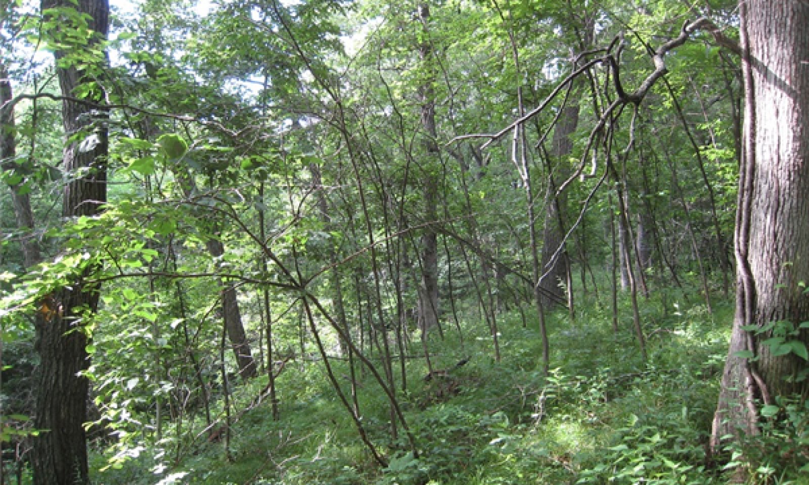
Figure 11. Dark Hollow Conservation Area near Green City, Missouri
This phase has an overstory that is dominated by white oak and black oak with hickory and and post oak also present. This woodland community has a two-tiered structure with an open understory and a dense, diverse herbaceous ground flora.
Periodic disturbances including fire, ice and wind create canopy gaps, allowing white oak and black oak to successfully reproduce and remain in the canopy and sunlight to reach the woodland floor to maintain native grasses and forbs.Forest overstory.The Forest Overstory Species list is based on reconnaissance-level plots, as well as commonly occurring species listed in Nelson (2010). Species identified from plot data include cover percentages and canopy heights. Species not found in plots, but listed in Nelson, do not include cover and canopy data.
Forest understory. The Forest Understory list is based on reconnaissance-level plots, as well as commonly occurring species listed in Nelson (2010). Species identified from plot data include cover percentages and canopy heights. Species not found in plots, but listed in Nelson, do not include cover and canopy data. Note that plot data for canopy heights are by height class, not actual species heights.
Dominant plant species
-
white oak (Quercus alba), tree
-
black oak (Quercus velutina), tree
-
fragrant sumac (Rhus aromatica), shrub
-
little bluestem (Schizachyrium), other herbaceous
-
hairy sunflower (Helianthus hirsutus), other herbaceous
Community 1.2
White Oak-Black Oak/Aromatic Sumac-Hickory/Little Bluestem-Hairy SunflowerThis phase is similar to community phase 1.1 but oak and hickory understory densities are increasing due to longer periods of fire suppression. Displacement of some grasses and forbs may be occurring due to shading and competition from the increased densities of oak and hickory saplings in the understory.
Dominant plant species
-
white oak (Quercus alba), tree
-
black oak (Quercus velutina), tree
-
red hickory (Carya ovalis), tree
-
fragrant sumac (Rhus aromatica), shrub
-
little bluestem (Schizachyrium), other herbaceous
-
hairy sunflower (Helianthus hirsutus), other herbaceous
Pathway 1.1A
Community 1.1 to 1.2No disturbance (10+ years)
Pathway 1.2A
Community 1.2 to 1.1Disturbance (fire, wind, ice) <10 years
State 2
Even-Age Managed WoodlandThis state starts with a sequence of early seral white oak woodlands, which mature over time. These woodlands tend to be rather dense, with an under developed understory and ground flora. Thinning can increase overall tree vigor and improve understory diversity. Continual timber management, depending on the practices used, will either maintain this state, or convert the site to uneven-age (State 3) woodlands.
Dominant plant species
-
black oak (Quercus velutina), tree
-
white oak (Quercus alba), tree
-
pin oak (Quercus palustris), tree
-
fragrant sumac (Rhus aromatica), shrub
-
hairy woodland brome (Bromus pubescens), other herbaceous
Community 2.1
Black Oak-White Oak-Chinkapin Oak/Aromatic Sumac/Woodland BromeDominant plant species
-
black oak (Quercus velutina), tree
-
white oak (Quercus alba), tree
-
pin oak (Quercus palustris), tree
-
fragrant sumac (Rhus aromatica), shrub
-
hairy woodland brome (Bromus pubescens), other herbaceous
State 3
Uneven-Age Managed WoodlandUneven-Age Managed woodlands resemble the reference state. The biggest difference is tree age, most being only 50 to 90 years old. Composition is also likely altered from the reference state depending on tree selection during harvest. In addition, without a regular 15 to 20 year harvest re-entry into these stands, they will slowly increase in more shade tolerant species such as sugar maple and white oak will become less dominant.
Dominant plant species
-
black oak (Quercus velutina), tree
-
red hickory (Carya ovalis), tree
-
hophornbeam (Ostrya), shrub
-
Dahurian wild rye (Elymus dahuricus), other herbaceous
Community 3.1
Black Oak-Hickory/Hophornbeam/WildryeDominant plant species
-
black oak (Quercus velutina), tree
-
red hickory (Carya ovalis), tree
-
hophornbeam (Ostrya), shrub
-
wildrye (Elymus), other herbaceous
State 4
GrasslandState 4: Grassland
Type conversion of woodlands to planted, non-native pasture species such as tall fescue has been common in this MLRA. Steep slopes, abundant surface fragments, low organic matter contents and soil acidity make non-native pastures challenging to maintain in a healthy, productive state on this ecological site. If grazing and active pasture management is discontinued, the site will eventually transition to State 2 (Even-Age).Dominant plant species
-
tall fescue (Schedonorus arundinaceus), other herbaceous
-
red clover (Trifolium pratense), other herbaceous
-
broomsedge bluestem (Andropogon virginicus), other herbaceous
-
oak (Quercus), other herbaceous
Community 4.1
Tall Fescue-Red CloverThis phase is well-managed grassland, composed of non-native cool season grasses and legumes. Grazing and haying is occurring. The effects of long-term liming on soil pH, and calcium and magnesium content, is most evident in this phase. Studies show that these soils have higher pH and higher base status in soil horizons as much as two feet below the surface, relative to poorly managed grassland (phase 4.2) and to woodland communities (where liming is not practiced).
Dominant plant species
-
tall fescue (Schedonorus arundinaceus), other herbaceous
-
red clover (Trifolium pratense), other herbaceous
Community 4.2
Tall Fescue-Broomsedge/Oak SproutsThis phase is the result of over use, poor grassland and grazing management and lack of adequate nutrient application. Forage production and quality are generally lower than phase 4.1.
Dominant plant species
-
tall fescue (Schedonorus arundinaceus), other herbaceous
-
broomsedge bluestem (Andropogon virginicus), other herbaceous
-
oak (Quercus), other herbaceous
Pathway 4.1A
Community 4.1 to 4.2Overgrazing; no fertilization
Pathway 4.2A
Community 4.2 to 4.1Brush management; grassland seeding; grassland management
State 5
High-Graded/Grazed WoodlandEcological sites subjected to repeated, high-graded timber harvests and uncontrolled domestic grazing transition to this State. This state exhibits an over-abundance of hickory and other less desirable tree species, and weedy understory species such as buckbrush, gooseberry, poison ivy and Virginia creeper. The vegetation offers little nutritional value for cattle, and excessive stocking damages tree boles, degrades understory species composition and results in soil compaction and accelerated erosion and runoff. Exclusion of livestock from sites in this state coupled with uneven-age management techniques will cause a transition to State 3 (Uneven-Age).
Dominant plant species
-
black oak (Quercus velutina), tree
-
red hickory (Carya ovalis), tree
-
hophornbeam (Ostrya), shrub
-
coralberry (Symphoricarpos orbiculatus), shrub
-
sedge (Abildgaardia), other herbaceous
Community 5.1
Black Oak-Hickory/Hophornbeam/Buckbrush/Sedge
Figure 12. A previously grazed and logged site on Mineral Hills Conservation Area
Dominant plant species
-
black oak (Quercus velutina), tree
-
red hickory (Carya ovalis), tree
-
hophornbeam (Ostrya), shrub
-
coralberry (Symphoricarpos orbiculatus), shrub
-
sedge (Abildgaardia), other herbaceous
Transition T1A
State 1 to 2Even-aged management
Transition T1B
State 1 to 3Fire suppresson; uneven-age management
Transition T1C
State 1 to 4Clearing and pasture planting
Transition T1D
State 1 to 5Poorly planned harvest and uncontrolled grazing
Restoration pathway R1B
State 2 to 1Uneven-age management; extended rotations
Transition T2A
State 2 to 3Uneven-age management
Restoration pathway R1A
State 3 to 1Prescribed fire and extended rotations
Restoration pathway T3A
State 3 to 2Even-age management
Restoration pathway T4A
State 4 to 2Tree planting; long-term succession; no grazing
Restoration pathway T4B
State 5 to 3Uneven-age management; no grazing; forest stand improvement
Restoration pathway T5A
State 5 to 4Tree planting; long-term succession; no grazing
Additional community tables
Table 5. Community 1.1 plant community composition
Group Common name Symbol Scientific name Annual production () Foliar cover (%) Table 6. Community 1.1 forest overstory composition
Common name Symbol Scientific name Nativity Height ft Canopy cover (%) Diameter in Basal area (square ft/acre) Treenorthern red oak QURU Quercus rubra Native 35-80 10-75 – 0 chinquapin oak QUMU Quercus muehlenbergii Native 60-80 25-50 – 0 black oak QUVE Quercus velutina Native 60-80 10-25 – 0 slippery elm ULRU Ulmus rubra Native 35-55 10-25 – 0 white oak QUAL Quercus alba Native 35-80 10-25 – 0 pignut hickory CAGL8 Carya glabra Native 35-55 10-25 – 0 hophornbeam OSVI Ostrya virginiana Native 35-55 1-2 – 0 shagbark hickory CAOV2 Carya ovata Native – – – 0 post oak QUST Quercus stellata Native – – – 0 Table 7. Community 1.1 forest understory composition
Common name Symbol Scientific name Nativity Height (ft) Canopy cover (%) Grass/grass-like (Graminoids)rock muhly MUSO Muhlenbergia sobolifera Native 0.3–2 1–2 hairgrass AIRA Aira Native 0.3–2 1–2 rosette grass DICHA2 Dichanthelium Native 0.3–2 0.1–1 eastern bottlebrush grass ELHY Elymus hystrix Native – – Virginia wildrye ELVI3 Elymus virginicus Native – – little bluestem SCSC Schizachyrium scoparium Native – – big bluestem ANGE Andropogon gerardii Native – – hairy woodland brome BRPU6 Bromus pubescens Native – – Pennsylvania sedge CAPE6 Carex pensylvanica Native – – parasol sedge CAUM4 Carex umbellata Native – – Forb/Herbpointedleaf ticktrefoil DEGL5 Desmodium glutinosum Native 0.3–2 10–25 hairy sunflower HEHI2 Helianthus hirsutus Native 0.3–2 2–25 elmleaf goldenrod SOUL2 Solidago ulmifolia Native 0.3–2 2–25 American hogpeanut AMBR2 Amphicarpaea bracteata Native 0.3–2 5–10 clustered blacksnakeroot SAOD Sanicula odorata Native 0.3–2 5–10 white snakeroot AGAL5 Ageratina altissima Native 0.3–2 1–5 soft agrimony AGPU Agrimonia pubescens Native 0.3–2 1–2 largeflower bellwort UVGR Uvularia grandiflora Native 0.3–2 1–2 American lopseed PHLE5 Phryma leptostachya Native 0.3–2 1–2 jumpseed POVI2 Polygonum virginianum Native 0.3–2 0.1–1 beaked agrimony AGRO3 Agrimonia rostellata Native 0.3–2 0.1–1 manyray aster SYAN2 Symphyotrichum anomalum Native 0.3–2 0.1–1 widowsfrill SIST Silene stellata Native 0.3–2 0.1–1 aster SYMPH4 Symphyotrichum Native 0.3–2 0.1–1 shining bedstraw GACO3 Galium concinnum Native 0.3–2 0.1–1 white avens GECA7 Geum canadense Native 0.3–2 0.1–1 queendevil HIGR3 Hieracium gronovii Native 0.3–2 0.1–1 pinweed LECHE Lechea Native 0.3–2 0.1–1 broadleaf enchanter's nightshade CILU Circaea lutetiana Native 0.3–2 0.1–1 largebract ticktrefoil DECU Desmodium cuspidatum Native 0.3–2 0.1–1 flowering spurge EUCO10 Euphorbia corollata Native 0.3–2 0.1–1 Virginia threeseed mercury ACVI Acalypha virginica Native 0.3–2 0.1–1 narrowleaf mountainmint PYTE Pycnanthemum tenuifolium Native 0.3–2 0.1–1 littleleaf buttercup RAAB Ranunculus abortivus Native 0.3–2 0.1–1 stalked wild petunia RUPE4 Ruellia pedunculata Native 0.3–2 0.1–1 fourleaf milkweed ASQU Asclepias quadrifolia Native 0.3–2 0.1–1 nakedflower ticktrefoil DENU4 Desmodium nudiflorum Native – – eastern purple coneflower ECPU Echinacea purpurea Native – – slender lespedeza LEVI7 Lespedeza virginica Native – – eastern beebalm MOBR2 Monarda bradburiana Native – – Canadian blacksnakeroot SACA15 Sanicula canadensis Native – – smooth blue aster SYLAC Symphyotrichum laeve var. concinnum Native – – bluejacket TROH Tradescantia ohiensis Native – – Culver's root VEVI4 Veronicastrum virginicum Native – – Fern/fern allynorthern maidenhair ADPE Adiantum pedatum Native 0.3–2 0.1–1 Shrub/Subshrubblackberry RUBUS Rubus Native 0.3–5 2–10 eastern poison ivy TORA2 Toxicodendron radicans Native 0.3–2 0.1–2 fragrant sumac RHAR4 Rhus aromatica Native 2–5 1–2 gray dogwood CORA6 Cornus racemosa Native 0.3–2 0.1–1 Missouri gooseberry RIMI Ribes missouriense Native 0.3–5 0.1–1 American hazelnut COAM3 Corylus americana Native – – New Jersey tea CEAM Ceanothus americanus Native – – Treehophornbeam OSVI Ostrya virginiana Native 2–25 1–50 common serviceberry AMAR3 Amelanchier arborea Native 2–25 2–25 black maple ACNI5 Acer nigrum Native 6–25 10–25 white ash FRAM2 Fraxinus americana Native 2–5 0.1–10 sugar maple ACSA3 Acer saccharum Native 2–5 2–5 eastern redbud CECA4 Cercis canadensis Native 2–25 1–5 common hackberry CEOC Celtis occidentalis Native 0.3–2 1–2 red mulberry MORU2 Morus rubra Native 0.3–2 0.1–1 American basswood TIAM Tilia americana Native 0.3–2 0.1–1 winged elm ULAL Ulmus alata Native 0.3–2 0.1–1 slippery elm ULRU Ulmus rubra Native 0.3–2 0.1–1 bitternut hickory CACO15 Carya cordiformis Native 2–5 0.1–1 black cherry PRSE2 Prunus serotina Native 0.3–2 0.1–1 Vine/LianaVirginia creeper PAQU2 Parthenocissus quinquefolia Native 0.3–2 0.1–1 frost grape VIVU Vitis vulpina Native 0.3–2 0.1–1 Table 8. Community 1.2 plant community composition
Group Common name Symbol Scientific name Annual production () Foliar cover (%) Table 9. Community 2.1 plant community composition
Group Common name Symbol Scientific name Annual production () Foliar cover (%) Table 10. Community 2.1 forest overstory composition
Common name Symbol Scientific name Nativity Height ft Canopy cover (%) Diameter in Basal area (square ft/acre) Treepost oak QUST Quercus stellata Native – – – 0 blackjack oak QUMA3 Quercus marilandica Native – – – 0 black oak QUVE Quercus velutina Native – – – 0 black hickory CATE9 Carya texana Native – – – 0 Table 11. Community 2.1 forest understory composition
Common name Symbol Scientific name Nativity Height (ft) Canopy cover (%) Grass/grass-like (Graminoids)little bluestem SCSC Schizachyrium scoparium Native – – Table 12. Community 3.1 plant community composition
Group Common name Symbol Scientific name Annual production () Foliar cover (%) Table 13. Community 4.1 plant community composition
Group Common name Symbol Scientific name Annual production () Foliar cover (%) Table 14. Community 4.2 plant community composition
Group Common name Symbol Scientific name Annual production () Foliar cover (%) Table 15. Community 5.1 plant community composition
Group Common name Symbol Scientific name Annual production () Foliar cover (%) Interpretations
Animal community
Wildlife (MDC, 2006)
Wild turkey, white-tailed deer, and eastern gray squirrel depend on hard and soft mast food sources and are typical upland game species of this type.
Oaks provide hard mast; scattered shrubs provide soft mast; native legumes provide high-quality wildlife food;
Sedges and native cool-season grasses provide green browse; patchy native warm-season grasses provide cover and nesting habitat; and a diversity of forbs provides a diversity and abundance of insects.
Post-burn areas can provide temporary bare-ground – herbaceous cover habitat important for turkey poults and quail chicks.
Bird species associated with mature communities include Indigo Bunting, Red-headed Woodpecker, Eastern Bluebird, Northern Bobwhite, Eastern Wood-Pewee, Broad-winged Hawk, Great-Crested Flycatcher, Summer Tanager, and Red-eyed Vireo.
Reptile and amphibian species associated with the Loess Upland Woodland include tiger salamander, small-mouthed salamander, ornate box turtle, northern fence lizard, five-lined skink, broad-headed skink, flat-headed snake, and rough earth snake.Other information
Forestry
Management: Field measured site index values for oak range from 51 for post oak, 62 for northern red oak and 54 for white oak. Timber management opportunities are fair. Create group openings of at least 2 acres. Large clearcuts should be minimized if possible to reduce impacts on wildlife and aesthetics. Uneven-aged management using single tree selection or small group selection cuttings of ½ to 1 acre are other options that can be used if clear cutting is not desired or warranted. These sites respond well to prescribed fire as a management tool.
Limitations: Clay in upper portion of soil profile; seasonal wetness. Clayey soils have reduced traction and compact easily when wet. Unsurfaced roads and skid trails may be impassable during rainy periods. Restrict activities to dry periods or surfaced areas. Seedling mortality may be high during the summer because of lack of adequate soil moisture, especially on south facing slopes. The use of equipment is restricted in spring and other wet periods. The surface layer is firm when dry and sticky when wet and becomes cloddy if tilled. Erosion is a hazard when slopes exceed 15 percent. On steep slopes greater than 35 percent, traction problems increase and equipment use is not recommended.Supporting information
Inventory data references
Potential Reference Sites: Interbedded Sedimentary Exposed Backslope Woodland Plot DAHOCA05 – Mandeville soil Located in Dark Hollow CA, Sullivan County, MO Latitude: 40.325896 Longitude: -92.923299 Plot DAHOCA06 – Gosport soil Located in Dark Hollow CA, Sullivan County, MO Latitude: 40.32682 Longitude: - 92.933903 Plot POOSCA02 – Locksprings soil Located in Poosey CA, Livingston County, MO Latitude: 39.954128 Longitude: - 93.702634 Plot CROWSP03 – Reger soil Located in Crowder State Park, Grundy County, MO Latitude: 40.091002 Longitude: -93.665985 Plot THHISP07 – Reger soil Located in Thousand Hills State Park, Adair County, MO Latitude: 40.183225 Longitude: - 92.651841
Other references
Anderson, R.C. 1990. The historic role of fire in North American grasslands. Pp. 8-18 in S.L. Collins and L.L. Wallace (eds.). Fire in North American tallgrass prairies. University of Oklahoma Press, Norman.
Frost, C., 1996. Pre-settlement Fire Frequency Regimes of the United States: A First Approximation. Pages 70-81, Proceedings of the 20nd Tall Timbers Fire Ecology Conference: Fire in Ecosystem Management: Shifting the Paradigm from Suppression to Prescription. Tall Timbers Research Station, Tallahassee, FL.
Missouri Department of Conservation. 2006. Missouri Forest and Woodland Community Profiles. Missouri Department of Conservation, Jefferson City, Missouri.
Natural Resources Conservation Service. 2002. Woodland Suitability Groups. Missouri FOTG, Section II, Soil Interpretations and Reports. 30 pgs.
Natural Resources Conservation Service. Site Index Reports. Accessed May 2014. https://esi.sc.egov.usda.gov/ESI_Forestland/pgFSWelcome.aspx
NatureServe. 2010. Vegetation Associations of Missouri (revised). NatureServe, St. Paul, Minnesota.
Nelson, Paul W. 2010. The Terrestrial Natural Communities of Missouri. Missouri Department of Conservation, Jefferson City, Missouri.
Nigh, Timothy A. and Walter A. Schroeder. 2002. Atlas of Missouri Ecoregions. Missouri Department of Conservation, Jefferson City, Missouri.
Oelmann, Douglas B. 1984. Soil Survey of Monroe County, Iowa. U.S. Dept. of Agric. Soil Conservation Service.
United States Department of Agriculture – Natural Resource Conservation Service (USDA-NRCS). 2006. Land Resource Regions and Major Land Resource Areas of the United States, the Caribbean, and the Pacific Basin. U.S. Department of Agriculture Handbook 296. 682 pgs.Contributors
Doug Wallace
Fred YoungApproval
Suzanne Mayne-Kinney, 7/02/2024
Acknowledgments
Missouri Department of Conservation and Missouri Department of Natural Resources personnel provided significant and helpful field and technical support in the development of this ecological site. This site was originally approved on 07/28/2015 for publication.
Rangeland health reference sheet
Interpreting Indicators of Rangeland Health is a qualitative assessment protocol used to determine ecosystem condition based on benchmark characteristics described in the Reference Sheet. A suite of 17 (or more) indicators are typically considered in an assessment. The ecological site(s) representative of an assessment location must be known prior to applying the protocol and must be verified based on soils and climate. Current plant community cannot be used to identify the ecological site.
Author(s)/participant(s) Contact for lead author Date 09/15/2026 Approved by Approval date Composition (Indicators 10 and 12) based on Annual Production Indicators
-
Number and extent of rills:
-
Presence of water flow patterns:
-
Number and height of erosional pedestals or terracettes:
-
Bare ground from Ecological Site Description or other studies (rock, litter, lichen, moss, plant canopy are not bare ground):
-
Number of gullies and erosion associated with gullies:
-
Extent of wind scoured, blowouts and/or depositional areas:
-
Amount of litter movement (describe size and distance expected to travel):
-
Soil surface (top few mm) resistance to erosion (stability values are averages - most sites will show a range of values):
-
Soil surface structure and SOM content (include type of structure and A-horizon color and thickness):
-
Effect of community phase composition (relative proportion of different functional groups) and spatial distribution on infiltration and runoff:
-
Presence and thickness of compaction layer (usually none; describe soil profile features which may be mistaken for compaction on this site):
-
Functional/Structural Groups (list in order of descending dominance by above-ground annual-production or live foliar cover using symbols: >>, >, = to indicate much greater than, greater than, and equal to):
Dominant:
Sub-dominant:
Other:
Additional:
-
Amount of plant mortality and decadence (include which functional groups are expected to show mortality or decadence):
-
Average percent litter cover (%) and depth ( in):
-
Expected annual annual-production (this is TOTAL above-ground annual-production, not just forage annual-production):
-
Potential invasive (including noxious) species (native and non-native). List species which BOTH characterize degraded states and have the potential to become a dominant or co-dominant species on the ecological site if their future establishment and growth is not actively controlled by management interventions. Species that become dominant for only one to several years (e.g., short-term response to drought or wildfire) are not invasive plants. Note that unlike other indicators, we are describing what is NOT expected in the reference state for the ecological site:
-
Perennial plant reproductive capability:
Print Options
Sections
Font
AAAAOther
PrintThe Ecosystem Dynamics Interpretive Tool is an information system framework developed by the USDA-ARS Jornada Experimental Range, USDA Natural Resources Conservation Service, and New Mexico State University.
Accessibility statement


