
Natural Resources
Conservation Service
-
Search


Major Land Resource Area or ecological site by name and/or ID.
PreviousSectionsNextGeneral information
Provisional. A provisional ecological site description has undergone quality control and quality assurance review. It contains a working state and transition model and enough information to identify the ecological site.
Click to explore map
Figure 1. Mapped extent
Areas shown in blue indicate the maximum mapped extent of this ecological site. Other ecological sites likely occur within the highlighted areas. It is also possible for this ecological site to occur outside of highlighted areas if detailed soil survey has not been completed or recently updated.
MLRA notes
Major Land Resource Area (MLRA): 102B–Till Plains
The Till Plains (102B) is located within the Western Lake Section of the Central Lowland Province of the Interior Plains. It is entirely in South Dakota, encompassing 2,215 square miles (Figure 1). The elevation ranges from 1,140 to 1,880 feet. The MLRA is characterized by glaciated, nearly level to hilly plains populated by stagnation and end moraines, glacial outwash terraces, and floodplains as the major landforms. The dominant parent materials are silty drift, glacial till, glacial outwash, and alluvium. (USDA-NRCS 2006)
The dominant soil order in this MLRA is Mollisols. The soils in the area dominantly have a mesic temperature regime, a udic ustic moisture regime and mixed or smectitic mineralogy. They generally are very deep, well drained to poorly drained, and clayey or loamy. This area is in the western area of the tall grass prairie and supports big bluestem (Andropogon gerardi), little bluestem (Schizachyrium scoparium), Indiangrass (Sorghastrum nutans), porcupine grass (Hesperostipa spartea), and green needlegrass (Nassella viridula) as the dominant native species. Cattails (Typha), prairie cordgrass (Spartina pectinate), bulrush (Cyperaceae) and reed canarygrass (Phalaris arundinacea) are commonly found on the poorly drained soils. (USDA-NRCS, 2006).Classification relationships
Major Land Resource Area (MLRA): Till Plains (102B) (USDA-NRCS, 2006)
USFS Subregions: North Central Glaciated Plains Section (251B); Outer Coteau des Prairies (251Bb); Yankton Hills and Valleys (251Bf); Northwest Iowa Plains (251Bd); (Cleland et al., 2007).
US EPA Level IV Ecoregion: Prairie Coteau (46k); James River Lowland (46n); Loess Prairies (47a); Big Sioux Basin (46m) - (USEPA, 2013)Ecological site concept
The Loamy ecological site occurs on upland areas. Soils are well drained and have less than 40 percent clay in the surface and or subsoil. The surface and subsoil textures typically are loam, silt loam, silty clay loam, clay loam, sandy clay loam, and very fine sandy loam. Some soils are underlain with sand or gravel at about two to three feet in depth. In some areas the surface layer may consist of stony to extremely stony. Slopes can range from zero to 25 percent.
Vegetation in the Reference State includes Big bluestem, and needlegrasses. Forbs include goldenrods, cudweed sagewort, heath aster, western yarrow, and Cuman ragweed. Non-native grasses and woodies such as Kentucky bluegrass, smooth brome, quackgrass, and Eastern Redcedar may invade the site due to changes in disturbance regime.Associated sites
R102BY012SD Thin Upland
These sites occur on uplands. Soils are well drained and will effervesce with acid at or near the surface. The central concept soil series are Ethan and Betts, but other series are included.
R102BY020SD Loamy Overflow
These sites occur in upland swales. Soils are moderately well drained which have water flow into and over or through the site. The central concept soil series are Trent and Viborg but other series are included.
Similar sites
R102BY020SD Loamy Overflow
The Loamy Overflow site occurs in upland swales. Soils are moderately well drained which have water flow into and over or through the site. A Loamy Overflow site has more big bluestem and higher production than a Loamy site.
R102BY011SD Clayey
The Clayey site is in a similar landscape position, but the soils have greater than 40 percent clay in the surface or subsoil. A Clayey site has more green needlegrass and less big bluestem than a Loamy site.
Table 1. Dominant plant species
Tree Not specified
Shrub Not specified
Herbaceous (1) Andropogon gerardii
(2) Sorghastrum nutansPhysiographic features
This site occurs on nearly level to moderately sloping uplands.

Figure 2. Site Distribution Map for the Loamy site in MLRA 102B.
Table 2. Representative physiographic features
Landforms (1) Till plain
(2) Moraine
(3) Outwash terrace
Flooding duration Brief (2 to 7 days) Flooding frequency None to rare Ponding frequency None Elevation 1100 – 1900 ft Slope 1 – 25 % Water table depth 48 – 80 in Aspect Aspect is not a significant factor Climatic features
Major Land Resource Area 102B is considered to have a continental climate with cold winters and relatively hot summers, low to moderate humidity, light rainfall, and much sunshine. Extremes in temperature may also abound. The climate is the result of the location of this MLRA near the geographic center of North America. There are few natural barriers on the Northern Great Plains and air masses move freely across the plains and account for rapid changes in temperature.
Annual precipitation typically ranges from 24 to 26 inches per year. The average annual temperature is about 46°F. January is the coldest month with average temperatures ranging from about 14°F (Wentworth 2 WNW, South Dakota, to about 18°F (Canton 4 WNW, SD). July is the warmest month with temperatures averaging from about 72°F (Wentworth 2 WNW, SD), to about 73°F (Canton 4 WNW, SD). The range of normal average monthly temperatures between the coldest and warmest months is about 57°F. This large annual range attests to the continental nature of the climate of this area. Hourly winds are estimated to average about 11 miles per hour (mph) annually, ranging from about 13 mph during the spring to about 10 mph during the summer. Daytime winds are generally stronger than nighttime and occasional strong storms may bring brief periods of high winds with gusts to more than 50 mph.
Growth of cool-season plants begins in early to mid-March, slowing or ceasing in late June. Warm-season plants begin growth about mid-May and continue to early or mid-September. Green-up of cool-season plants may occur in September and October when adequate soil moisture is present.Table 3 Representative climatic features
Frost-free period (characteristic range) 120-130 days Freeze-free period (characteristic range) 140-140 days Precipitation total (characteristic range) 30 in Frost-free period (actual range) 120-130 days Freeze-free period (actual range) 140-140 days Precipitation total (actual range) 30-30 in Frost-free period (average) 130 days Freeze-free period (average) 140 days Precipitation total (average) 30 in Characteristic rangeActual rangeBarLineFigure 3. Monthly precipitation range
Characteristic rangeActual rangeBarLineFigure 4. Monthly minimum temperature range
Characteristic rangeActual rangeBarLineFigure 5. Monthly maximum temperature range
BarLineFigure 6. Monthly average minimum and maximum temperature
Figure 7. Annual precipitation pattern
Figure 8 Annual average temperature pattern
Climate stations used
-
(1) CENTERVILLE 6 SE [USC00391579], Beresford, SD
-
(2) CANTON [USC00391392], Canton, SD
-
(3) MONTROSE 8N [USC00395738], Montrose, SD
-
(4) MADISON 2SE [USC00395090], Madison, SD
-
(5) WENTWORTH 2.5 WNW [USC00399042], Wentworth, SD
">Influencing water features
No riparian areas or wetland features are directly associated with this site.
Soil features
The common features of soils in this site are fine sandy loam to clay loam textured subsurface soils, with slopes ranging from one to 25 percent. Some soils are underlain with sand or gravel at about two to three feet in depth. The soils in this site are well-drained and typically formed in till, drift, and loess. The loam to silty clay loam surface layer is typically six to 20 inches thick. The soils have a slow to moderately slow infiltration rate. This site typically should show slight to no evidence of rills, wind scoured areas, or pedestalled plants. If present, water flow paths are broken, irregular in appearance, or discontinuous. The soil surface is stable and intact. Subsurface soil layers are nonrestrictive to water movement and root penetration. These soils are mainly susceptible to water erosion. The hazard of water erosion increases on slopes greater than about nine percent. The loss of 50 percent or more of the surface layer of the soils on this site can result in a shift in species composition and production.
The central concept soil series for this site are Egan and Wentworth, but other series are included.
Access Web Soil Survey (http://websoilsurvey.nrcs.usda.gov/app/HomePage.htm) for specific local soils information.Table 4. Representative soil features
Surface texture (1) Loam
(2) Silt loam
(3) Silty clay loam
Family particle size (1) Loamy
Drainage class Moderately well drained to well drained Permeability class Slow to moderately slow Soil depth 40 – 80 in Surface fragment cover <=3" 0 – 5 % Surface fragment cover >3" 0 – 10 % Available water capacity
(0-40in)6 – 8 in Calcium carbonate equivalent
(0-40in)0 – 30 % Electrical conductivity
(0-40in)0 – 4 mmhos/cm Sodium adsorption ratio
(0-40in)0 – 2 Soil reaction (1:1 water)
(0-40in)5.6 – 8.4 Subsurface fragment volume <=3"
(Depth not specified)0 – 30 % Subsurface fragment volume >3"
(Depth not specified)0 – 4 % Ecological dynamics
State and Community Phases
The information in this Ecological Site Description, including the state-and-transition model (STM), was developed based on historical data, current field data, professional experience, and a review of the scientific literature. As a result, all possible scenarios or plant species may not be included. Key indicator plant species, disturbances, and ecological processes are described to inform land management decisions.
The site which is located in the Till Plains Region developed under Northern Great Plains climatic conditions and included natural influence of large herding herbivores and occasional fire. Changes occur in the plant communities due to weather fluctuations and management actions. Under adverse impacts, a relatively rapid decline in vegetative vigor and composition can occur. Under favorable conditions, the site has the potential to resemble the Reference State. Interpretations for this site are based primarily on the 1.1 Big Bluestem-Green Needlegrass Plant Community Phase. This community phase and the Reference State have been determined by study of rangeland relic areas, areas protected from excessive disturbance, and areas under long-term rotational grazing regimes. Trends in plant community dynamics ranging from heavily grazed to lightly grazed areas, seasonal use pastures, and historical accounts also have been considered. Plant community phases, states, transitional pathways, and thresholds have been determined through similar studies and experience.
This ecological site (ES) has been grazed by domestic livestock since they have been introduced into the area. The introduction of domestic livestock and the use of fencing and reliable water sources have changed the ecological dynamics of this site. Heavy, continuous grazing without adequate recovery periods following each grazing occurrence causes departure from the 3.1 Big Bluestem-Green Needlegrass Plant Community Phase. Little bluestem, western wheatgrass (Pascopyrum smithii), sideoats grama (Bouteloua curtipendula), and blue grama (Bouteloua gracilis) will increase. Eventually, blue grama, quackgrass (Elymus repens), and Kentucky bluegrass (Poa pratensis) may develop into a sod. Indiangrass, big bluestem, porcupinegrass, green needlegrass, sideoats grama, and little bluestem decrease in frequency and production. Extended periods of non-use and/or lack of fire will result in excessive litter and a plant community dominated by cool-season grasses such as Kentucky bluegrass, smooth bromegrass (Bromus inermis), green needlegrass, and cheatgrass (Bromus tectorum). Extended periods of no surface fire could result in the invasion of conifers through which eastern redcedar (Juniperus virginiana) and Rocky Mountain juniper (Juniperus scopulorum) will increase and could eventually dominate the site.
Following the state-and-transition diagram are narratives for each of the described states and community phases. These may not represent every possibility, but they are the most prevalent and repeatable states and community phases. The plant composition tables shown below have been developed from the best available knowledge at the time of this revision. As more data are collected, some of these community phases and states may be revised or removed, and new ones may be added. The main purpose for including the descriptions here is to capture the current knowledge and experience at the time of this revision.
The following is a diagram that illustrates the common plant community phases that can occur on the site and the transition and community pathways between them. The ecological processes will be discussed in more detail in the plant community descriptions following the diagram.State and transition model
Custom diagramStandard diagram
Figure 9. State-and-Transition Model for the Loamy site in MLRA 102B.

Figure 10. Legend for the Loamy site in MLRA 102B.

Figure 11. Matrix for the Loamy site in MLRA 102B.
More interactive model formats are also available. View Interactive Models
More interactive model formats are also available. View Interactive Models
Click on state and transition labels to scroll to the respective textEcosystem states
States 1, 5 and 6 (additional transitions)
States 2 and 6 (additional transitions)
State 2 submodel, plant communities
State 3 submodel, plant communities
State 4 submodel, plant communities
State 6 submodel, plant communities
State 1
Reference StateThe Reference State represents the natural range of variability that dominated the dynamics of this ecological site (ES). This state was dominated by warm-season grasses, with cool-season grasses being subdominant. Prior to European settlement in North America, the primary disturbance mechanisms for this site in the Reference condition included periods of below and above average precipitation, periodic fire, and herbivory by insects and large ungulates.
The timing of fires and herbivory coupled with weather events dictated the dynamics that occurred within the natural range of variability. In some locations, this site likely received relatively heavy grazing pressure. Tall warm-season grasses would have declined and cool-season bunchgrasses and short to mid-statured warm-season grasses would have increased. Today, a similar state, the Native/Invaded State (State 3) can be found on areas that are properly managed with grazing and/or prescribed burning, and sometimes on areas receiving occasional short periods of rest.Community 1.1
Big Bluestem-Green Needlegrass
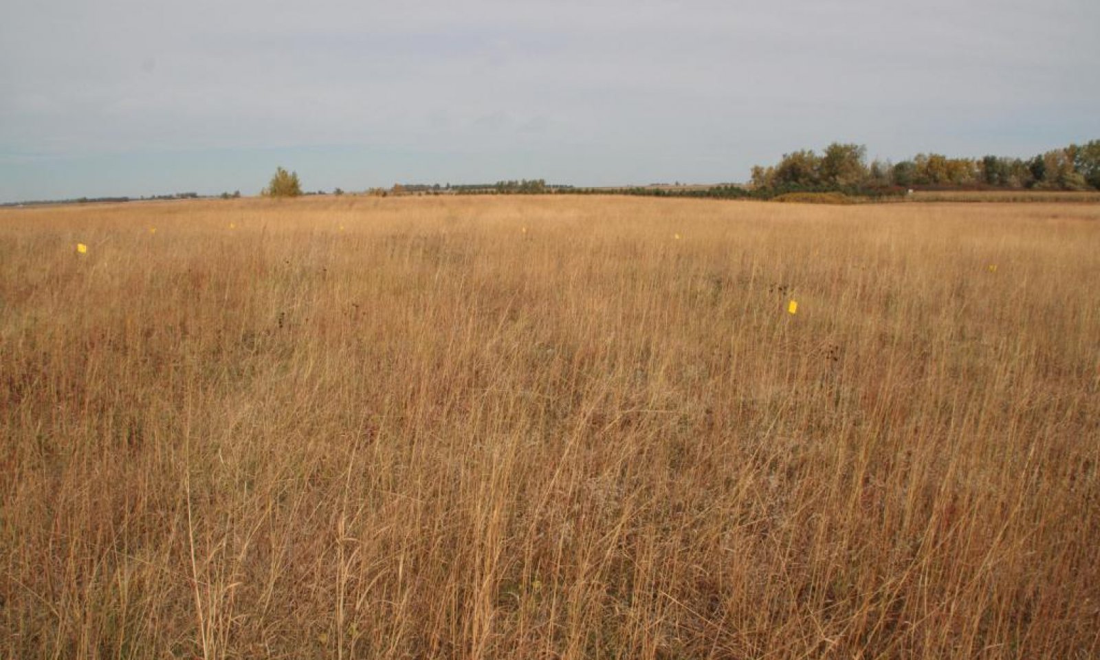
Figure 12. Vegetation typical of the Reference Community on the Loamy site in MLRA 102B.
Interpretations are based primarily on the 1.1 Big Bluestem-Green Needlegrass Plant Community Phase (this is also considered to be Reference). This plant community evolved with grazing by large herbivores, frequent surface fires, and periodic flooding events, and is suited for grazing by domestic livestock. It can be found on areas that are grazed that receive adequate periods of rest during the growing season. The potential vegetation was about 80 percent grasses or grass-like plants, 15 percent forbs, and five percent shrubs. The community was dominated by warm-season grasses, with cool-season grasses being subdominant. The major grasses included big bluestem, green needlegrass, Indiangrass, porcupinegrass, and little bluestem. Other grass or grass-like species included switchgrass (Panicum virgatum), sideoats grama, slender wheatgrass (Elymus trachycaulus), prairie dropseed (Sporobolus heterolepis), and sedges (Cyperaceae). This plant community was resilient and well adapted to the Northern Great Plains climatic conditions. The diversity in plant species allowed for high tolerance to drought. This was a sustainable plant community in regards to site and soil stability, watershed function, and biologic integrity.
Figure 13. Annual production by plant type (representative values) or group (midpoint values)
Table 5. Annual production by plant type
Plant type Low
(lb/acre)Representative value
(lb/acre)High
(lb/acre)Grass/Grasslike 2465 3145 3695 Forb 165 370 665 Shrub/Vine 70 185 340 Total 2700 3700 4700 Figure 14. Plant community growth curve (percent production by month). SD0214 , Till Plains, warm-season dominant, cool-season subdominant.. Warm-season dominant, cool-season subdominant..
Jan Feb Mar Apr May Jun Jul Aug Sep Oct Nov Dec J F M A M J J A S O N D 0 0 3 7 17 25 25 15 7 1 0 0 Community 1.2
Green Needlegrass-Little Bluestem-Big Bluestem-Blue GramaThis plant community evolved under heavy, continuous grazing or from over utilization during extended drought periods. The potential plant community was made up of approximately 85 percent grasses and grass-like species, 10 percent forbs, and five percent shrubs. Dominant grasses included green needlegrass, little bluestem, big bluestem, and sideoats grama. Grasses of secondary importance included blue grama, western wheatgrass, porcupinegrass, Indiangrass, switchgrass, tall dropseed (Sporobolus compositus), prairie dropseed, slender wheatgrass, and sedge (Carex). Forbs commonly found in this plant community included Canada goldenrod (Solidago canadensis), cudweed sagewort (Artemisia ludoviciana), heath aster (Symphyotrichum), scurfpea (Psoralidium), stiff goldenrod (Solidago rigida), Cuman ragweed (Ambrosia psilostachya), and western yarrow (Achillea millefolium). This plant community had similar plant composition to the 3.2 Green Needlegrass-Little Bluestem-Kentucky Bluegrass Plant Community Phase. The main difference is that this plant community phase did not have the presence of non-native invasive species such as Kentucky bluegrass and smooth bromegrass.
When compared to the 1.1 Big Bluestem-Green Needlegrass Plant Community Phase, green needlegrass and little bluestem increased. Production of tall warm-season grasses was reduced. This plant community was moderately resistant to change. The herbaceous species present were well adapted to grazing; however, species composition could be altered through long-term overgrazing. If the herbaceous component was intact, it tended to be resilient if the disturbance was not long-term. Most of the components of the ecological processes would have been functioning at optimum levels. However, the vigor and reproductive capability of the tall warm-season grasses would have been reduced due to grazing pressure or a combination of stressors. A reduction of this dominant functional group allowed for an increase in shorter-statured (and shallower rooted) species.Figure 15. Plant community growth curve (percent production by month). SD0213 , Till Plains, cool-season/warm-season codominant.. Cool-season, warm-season codominant..
Jan Feb Mar Apr May Jun Jul Aug Sep Oct Nov Dec J F M A M J J A S O N D 0 0 3 10 20 28 21 10 5 3 0 0 Community 1.3
Big Bluestem-Indiangrass-Sideoats GramaThis plant community was a result of fire occurring at relatively frequent intervals. This phase could have also resulted from a combination of grazing events immediately following early season fire (i.e., large ungulates attracted to highly nutritious vegetative growth following a fire). These events would have caused a reduction in cool-season grasses and an increase in warm-season grasses. The warm-season grasses were more tolerant of shorter return intervals of fire and would have increased in vigor and production leading to a temporary shift to this phase. Needlegrasses would have decreased most significantly amongst the cool-season grasses. The potential vegetation was about 80 percent grasses or grass-like plants, 15 percent forbs, and five percent shrubs. The community was dominated by warm-season grasses. The major grasses included big bluestem, Indiangrass, sideoats grama, switchgrass, little bluestem, and prairie dropseed. Other grass or grass-like species included green needlegrass, porcupinegrass, western wheatgrass, blue grama, slender wheatgrass, tall dropseed, and sedge. This plant community was not resistant to change and would have readily shifted back to the 1.1 Big Bluestem-Green Needlegrass Plant Community Phase with a return of more normal fire return intervals.
Figure 16. Plant community growth curve (percent production by month). SD0215 , Till Plains, warm-season dominant.. Warm-season dominant..
Jan Feb Mar Apr May Jun Jul Aug Sep Oct Nov Dec J F M A M J J A S O N D 0 0 2 5 15 25 30 15 7 1 0 0 Pathway 1.1A
Community 1.1 to 1.2Heavy, continuous grazing which includes herbivory at moderate to heavy levels at the same time of year each year without adequate recovery periods, periods of below normal precipitation, and no surface fire for extended periods of time (typically for 10 years or more) will shift this community to the 1.2 Green Needlegrass-Little Bluestem-Big Bluestem-Blue Grama Plant Community Phase.
Pathway 1.1B
Community 1.1 to 1.3Prescribed burning occurring at relatively frequent intervals (3 to 5 years) and a return to normal disturbance regime levels, along with occasional grazing events immediately following early season fire caused a reduction in cool-season grasses and an increase in warm-season grasses. The warm-season grasses were more tolerant of shorter return intervals of fire and would increase in vigor and production leading to a temporary shift to the 1.3 Big Bluestem-Indiangrass-Sideoats Grama Plant Community Phase.
Pathway 1.2A
Community 1.2 to 1.1Any combination of prescribed grazing (alternating season of use and providing adequate recovery periods), periodic light to moderate grazing, prescribed burning occurring at relatively frequent intervals (every 3 to 5 years), a return to normal disturbance regime levels and frequencies, and brush management will shift this plant community to the 1.1 Big Bluestem-Green Needlegrass Plant Community Phase.
Pathway 1.3A
Community 1.3 to 1.1Any combination of prescribed grazing (alternating season of use and providing adequate recovery periods), periodic light to moderate grazing, prescribed burning occurring at relatively frequent intervals (every 3 to 5 years), a return to normal disturbance regime levels and frequencies, and brush management will shift this plant community to the 1.1 Big Bluestem-Green Needlegrass Plant Community Phase.
State 2
Degraded StateThis state is the result of heavy, continuous grazing, and the absence of periodic fire due to fire suppression. This state is dominated by little bluestem, slender wheatgrass, and blue grama. The blue grama can form a sod-like layer that effectively blocks introduction of other plants into the system. Taller warm-season species will decline, and a corresponding increase in short statured grass will occur. Once the threshold is crossed, a change in grazing management alone cannot restore the degraded state.
Community 2.1
Community Phase 2.1 Little Bluestem-Slender Wheatgrass-Blue GramaThis plant community evolved under heavy, continuous season grazing or from over utilization during extended drought periods. The potential plant community was made up of approximately 85 percent grasses and grass-like species, 10 percent forbs, and five percent shrubs. Dominant grasses typically included little bluestem, slender wheatgrass, blue grama, and sideoats grama. Grasses of secondary importance included big bluestem, switchgrass, green needlegrass, western wheatgrass, tall dropseed, and sedge. Forbs commonly found in this plant community included cudweed sagewort, green sagewort (Artemisia campestris), and western yarrow.
When compared to the 1.1 Big Bluestem-Green Needlegrass Plant Community Phase, tall warm-season grasses were reduced, and the more grazing tolerant species such as blue grama, little bluestem, and sideoats grama were dominant on this plant community. With the exception of slender wheatgrass, cool-season grasses decreased significantly. This vegetation state was very resistant to change, especially if the disturbance continued and the short-statured species such as blue grama increased. The herbaceous species present were well adapted to grazing. This plant community was less productive than other phases.Figure 17. Plant community growth curve (percent production by month). SD0214 , Till Plains, warm-season dominant, cool-season subdominant.. Warm-season dominant, cool-season subdominant..
Jan Feb Mar Apr May Jun Jul Aug Sep Oct Nov Dec J F M A M J J A S O N D 0 0 3 7 17 25 25 15 7 1 0 0 State 3
Native/Invaded StateThis state represents the more common range of variability that exists with higher levels of grazing management but in the absence of periodic fire due to fire suppression. This state is dominated by cool- and warm-season grasses. It can be found on areas that are properly managed with grazing and/or prescribed burning, and sometimes on areas receiving occasional short periods of rest. Taller warm-season species can decline and a corresponding increase in short statured grass will occur.
Community 3.1
Big Bluestem-Green NeedlegrassThis plant community phase is similar to the 1.1 Big Bluestem-Green Needlegrass Plant Community Phase, but it also contains minor amounts of non-native invasive grass species such as Kentucky bluegrass and smooth bromegrass (up to about 10 percent by air-dry weight). The potential vegetation is about 80 percent grasses or grass-like plants, 15 percent forbs, and five percent shrubs. This community is dominated by warm-season grasses, with cool-season grasses being subdominant. The major grasses include big bluestem, green needlegrass, Indiangrass, porcupinegrass, and little bluestem. Other grass or grass-like species include switchgrass, sideoats grama, slender wheatgrass, prairie dropseed, tall dropseed, and sedges. This plant community is resilient and well adapted to the Northern Great Plains climatic conditions. The diversity in plant species allows for high drought tolerance. This is a sustainable plant community in regards to site and soil stability, watershed function, and biologic integrity.
Figure 18. Plant community growth curve (percent production by month). SD0214 , Till Plains, warm-season dominant, cool-season subdominant.. Warm-season dominant, cool-season subdominant..
Jan Feb Mar Apr May Jun Jul Aug Sep Oct Nov Dec J F M A M J J A S O N D 0 0 3 7 17 25 25 15 7 1 0 0 Community 3.2
Green Needlegrass-Little Bluestem-Kentucky BluegrassThis plant community is a result of heavy, continuous grazing or from over utilization during extended drought periods. The potential plant community is made up of approximately 85 percent grasses and grass-like species, 10 percent forbs, and five percent shrubs. Dominant grasses include green needlegrass, little bluestem, Kentucky bluegrass, big bluestem, and sideoats grama. Grasses of secondary importance include blue grama, western wheatgrass, porcupinegrass, Indiangrass, switchgrass, tall dropseed, prairie dropseed, slender wheatgrass, and sedge. Forbs commonly found in this plant community include Canada goldenrod, cudweed sagewort, heath aster, scurfpea, stiff goldenrod, Cuman ragweed, and western yarrow.
When compared to the 1.1 Big Bluestem-Green Needlegrass Plant Community Phase, green needlegrass and little bluestem have increased. Production of tall warm-season grasses is reduced. This plant community is moderately resistant to change. The herbaceous species present are well adapted to grazing; however, species composition can be altered through long-term overgrazing. If the herbaceous component is intact, it tends to be resilient if the disturbance is not long-term. Most of the components of the ecological processes are functioning at optimum levels. However, the vigor and reproductive capability of the tall warm-season grasses are reduced due to grazing pressure or a combination of stressors. A reduction of this dominant functional group allows for an increase in shorter-statured (and shallower rooted) species. The introduction of non-native invasive species such as Kentucky bluegrass and smooth bromegrass results in alterations to the soil profile. Organic matter levels tend to decrease and begin to be concentrated more in the surface layers and the structure will begin to be modified. These changes favor the shallow-rooted species and hasten their eventual dominance if steps are not taken to reduce these species.Figure 19. Annual production by plant type (representative values) or group (midpoint values)
Table 6. Annual production by plant type
Plant type Low
(lb/acre)Representative value
(lb/acre)High
(lb/acre)Grass/Grasslike 2040 2685 3290 Forb 135 225 345 Shrub/Vine 25 90 165 Total 2200 3000 3800 Figure 20. Plant community growth curve (percent production by month). SD0213 , Till Plains, cool-season/warm-season codominant.. Cool-season, warm-season codominant..
Jan Feb Mar Apr May Jun Jul Aug Sep Oct Nov Dec J F M A M J J A S O N D 0 0 3 10 20 28 21 10 5 3 0 0 Pathway 3.1A
Community 3.1 to 3.2Heavy, continuous grazing which includes herbivory at moderate to heavy levels at the same time of year each year without adequate recovery periods, periods of below normal precipitation, and no surface fire for extended periods of time (typically for 10 years or more) will shift this community to the 3.2 Green Needlegrass-Little Bluestem-Kentucky Bluegrass Plant Community Phase.
Pathway 3.2A
Community 3.2 to 3.1Any combination of prescribed grazing (alternating season of use and providing adequate recovery periods), periodic light to moderate grazing, prescribed burning occurring at relatively frequent intervals (every 3 to 5 years), a return to normal disturbance regime levels and frequencies, and brush management will shift this plant community to the 3.1 Big Bluestem-Green Needlegrass Plant Community Phase.
Conservation practices
Prescribed Grazing State 4
Invaded StateThis state is a result of encroachment mainly by invasive introduced cool-season grasses. The ecological processes are not functioning, especially the biotic processes and the hydrologic functions. The introduced cool-season grasses cause reduced infiltration and increased runoff. Preliminary studies would tend to indicate this threshold may exist when Kentucky bluegrass exceeds 30 percent of the plant community and native grasses represent less than 40 percent of the plant community composition. The opportunity for high intensity spring burns is severely reduced by early green up and increased moisture and humidity at the soil surface and grazing pressure cannot cause a reduction in sodgrass dominance. Production is limited to the sod forming species. Infiltration continues to decrease and runoff increases and energy capture into the system is restricted to early season low producing species. Nutrient cycling is limited by root depth of the dominant species.
Community 4.1
Smooth Bromegrass-Kentucky BluegrassThis plant community is a result of extended periods of non-use and no fire or occasionally light levels of grazing over several years. It is characterized by dominance of smooth bromegrass and to a lesser extent Kentucky bluegrass. The dominance is at times so complete that other species are difficult to find on the site. A thick duff layer also accumulates at or above the soil surface and eventually a thatch-mat layer may develop at the surface.
Nutrient cycling is greatly reduced and native plants have great difficulty becoming established. When dominated by smooth bromegrass, infiltration is moderately reduced and runoff is moderate. Production can be equal to or higher than the interpretive plant community. However, when dominated by Kentucky bluegrass, infiltration is greatly reduced and runoff is high. Production in this case will likely be significantly less. In either case, the period that palatability is high is relatively short, as these cool-season species mature rapidly. Energy capture is also reduced.
The dominance of these introduced species has been shown to alter the biotic component of the soil, as well as, organic matter levels and eventually the soil structure. These alterations perpetuate the dominance of Kentucky bluegrass and smooth bromegrass and tend to make establishment of native species extremely difficult.Figure 21. Annual production by plant type (representative values) or group (midpoint values)
Table 7. Annual production by plant type
Plant type Low
(lb/acre)Representative value
(lb/acre)High
(lb/acre)Grass/Grasslike 2420 2958 3500 Forb 150 340 610 Shrub/Vine 30 102 190 Total 2600 3400 4300 Figure 22. Plant community growth curve (percent production by month). SD0211 , Till Plains, cool-season dominant.. Cool-season dominant..
Jan Feb Mar Apr May Jun Jul Aug Sep Oct Nov Dec J F M A M J J A S O N D 0 0 4 12 25 36 10 5 4 4 0 0 Community 4.2
Kentucky Bluegrass-QuackgrassThis plant community phase is a result of heavy, continuous seasonal grazing or heavy, continuous season-long grazing. It is characterized by a dominance of Kentucky bluegrass and Quackgrass. The dominance is at times so complete that other species are difficult to find on the site. A relatively thick duff layer can sometimes accumulate at or above the soil surface and a thatch-mat layer often develops at the surface. Nutrient cycling is greatly reduced, and native plants have great difficulty becoming established. Infiltration is greatly reduced and runoff is high. Production will be significantly reduced when compared to the interpretive plant community. The period that palatability is high is relatively short as Kentucky bluegrass matures rapidly. Energy capture is also reduced. Biological activity in the soil is likely reduced significantly in this phase
Figure 23. Annual production by plant type (representative values) or group (midpoint values)
Table 8. Annual production by plant type
Plant type Low
(lb/acre)Representative value
(lb/acre)High
(lb/acre)Grass/Grasslike 1595 2100 2450 Forb 105 240 420 Shrub/Vine 0 60 130 Total 1700 2400 3000 Figure 24. Plant community growth curve (percent production by month). SD0211 , Till Plains, cool-season dominant.. Cool-season dominant..
Jan Feb Mar Apr May Jun Jul Aug Sep Oct Nov Dec J F M A M J J A S O N D 0 0 4 12 25 36 10 5 4 4 0 0 Community 4.3
Annual Pioneer-Perennial PioneerThis plant community developed under continuous, heavy grazing or other excessive disturbances. The potential plant community is made up of approximately 40 to 80 percent grasses and grass-like species, 20 to 60 percent forbs, and 0 to five percent shrubs. The species present in this phase are highly variable but often include non-native invasive and early seral species. Plant diversity is low (plant richness may be high, but areas are often dominated by a few species). The ecological processes are difficult to restore because of the loss of plant diversity and overall soil disturbance. Soil erosion is potentially very high because of the bare ground and shallow rooted herbaceous plant community. Water runoff will increase and infiltration will decrease due to animal related soil compaction and loss of root mass due to low plant diversity and vigor. This plant community will require significant economic inputs and time to move towards another plant community. This movement is highly variable in its succession. This is due to the loss of diversity (including the loss of the seed bank), within the existing plant community, and the plant communities on adjacent sites. This community can be renovated to improve the production capability; however, if management changes are not made the vegetation could revert back to early seral species.
Pathway 4.1A
Community 4.1 to 4.2Heavy, continuous grazing which includes herbivory at moderate to heavy levels at the same time of year each year without adequate recovery periods, or during periods of below normal precipitation when grazing frequency and intensity increases on these sites due to limited forage availability on adjacent upland sites will shift this community to the 4.2 Kentucky Bluegrass-Quackgrass Plant Community Phase.
Pathway 4.2A
Community 4.2 to 4.1Prescribed grazing (alternating season of use and providing adequate recovery periods) or periodic light to moderate grazing possibly including periodic rest will convert this plant community to the 4.1 Smooth Bromegrass-Kentucky Bluegrass Plant Community Phase.
Conservation practices
Prescribed Grazing Pathway 4.3A
Community 4.3 to 4.2This community pathway occurs with the passage of time as successional processes take place and perennial plants gradually begin to establish on the site again. This pathway will lead to the 4.2 Kentucky Bluegrass-Quackgrass Plant Community Phase.
Conservation practices
Integrated Pest Management (IPM) State 5
Conifer/Invaded StateThis state is dominated (canopy exceeds 20 percent of total surface area) by areas where trees have become established or have encroached onto the site due to the absence of periodic fire. This state is dominated by eastern redcedar and/or Rocky Mountain juniper with cool-season grasses being subdominant. The plant community can develop into a closed canopy that impedes the reproductive capability of the major native perennial grass species. A single eastern redcedar tree with a 7 foot crown diameter eliminates the equivalent of 3 pounds of forage. Further, the forage potential of a pasture with 250 mature eastern redcedar trees per acre (or one tree every thirteen feet) is reduce by 50 percent. It is suggested that stocking rates should be reduced by 10 percent for every 50 trees per acre. The increase in tree canopy which is a result of a disruption of the natural and human related fire regimes that occurred prior to European settlement in North America, which kept trees from encroaching much of the grasslands.
Community 5.1
Eastern Redcedar-Rocky Mountain Juniper/Green Needlegrass-Sideoats GramaThis plant community evolved due to the invasion of conifers, such as eastern redcedar and Rocky Mountain juniper. This phase was a result of the absence of periodic fire. These events may cause a reduction in warm-season grasses and an increase in cool-season grasses and allow for the encroachment of conifers. The potential plant community is made up of approximately 50 percent grasses and grass-like species, 10 percent forbs, 10 percent shrubs, and 30 percent trees. Dominant grasses and grass-likes include big bluestem, green needlegrass, little bluestem, blue grama, Indiangrass, and sideoats grama. As the canopy increases, warm-season grasses tend to decrease as the cool-season grasses increase. Forbs will be diverse.
Trees species will include eastern redcedar and Rocky Mountain juniper. When compared to the 1.1 Big Bluestem-Green Needlegrass Plant Community, coniferous trees have increased significantly and the herbaceous component has decreased. This plant community is susceptible to the encroachment of eastern redcedar and Rocky Mountain juniper.Community 5.2
Eastern Redcedar-Rocky Mountain Juniper/Kentucky BluegrassThis plant community phase is a result of heavy, continuous seasonal grazing or heavy, continuous season-long grazing or non-use and/or no surface fire for extended periods of time (typically for 10 or more years). When compared to the 5.1 Eastern Redcedar-Rocky Mountain Juniper/Green Needlegrass-Sideoats Grama Plant Community, the amount of non-native invasive cool-season grasses such as Kentucky bluegrass and smooth bromegrass have increased significantly.
It is characterized by a dominance of Kentucky bluegrass, smooth bromegrass, and blue grama. The dominance of Kentucky bluegrass is at times so complete that other species are difficult to find on the site. A relatively thick duff layer can sometimes accumulate at or above the soil surfaceand a thatch-mat layer often develops at the surface. Production is limited to the sod forming species. The period that palatability is high is relatively short, as Kentucky bluegrass matures rapidly. Infiltration continues to decrease, runoff increases, and energy captured into the system is restricted to early season low producing species. Nutrient cycling is limited by root depth of the dominate species. Biological activity in the soil is likely reduced significantly in this phase.Community 5.3
Eastern Redcedar-Rocky Mountain JuniperThis plant community phase is a result of no surface fire for extended periods of time (typically for 10 or more years). Coniferous trees have increased significantly, and the herbaceous component has decreased. With the dominance of the coniferous trees such as eastern redcedar and Rocky Mountain juniper, the canopy covers the area and grass species are unable to survive. Grass production for livestock is severely limited. Prescribed burning before the juniper species reach maturity and are still susceptible to fire (< 5 foot in height), or mechanical brush management can be used to maintain or recover 5.3 Eastern Redcedar-Rocky Mountain Juniper Plant Community Phase.
Pathway 5.1A
Community 5.1 to 5.2Non-use and/or no surface fire for extended periods of time (typically for 10 or more years) causing litter levels to become high enough to reduce native grass vigor, diversity, and density, heavy continuous grazing, or invasion of non-native plant species will shift this plant community to the 5.2 Eastern Red Cedar-Rocky Mountain Juniper/Kentucky Bluegrass Plant Community Phase.
Pathway 5.2A
Community 5.2 to 5.3No surface fire for extended periods of time (typically for 10 or more years) causing litter levels to become high enough to reduce native grass vigor, diversity, and density, will shift this plant community to the 5.3 Eastern Red Cedar-Rocky Mountain Juniper Plant Community Phase.
State 6
Crop Production StateThis state is characterized by the production of annual crops using a variety of tillage and cropping systems along with management practices. Cropping on this site is enabled during years with drier than normal precipitation or with artificial drainage (surface or subsurface).
Community 6.1
Annual CropsThis plant community developed with the use of a variety of tillage systems and cropping systems for the production of annual crops including corn, soybeans, wheat, and a variety of other crops.
Transition T1A
State 1 to 2Heavy, continuous grazing (stocking levels well above carrying capacity for extended portions of the growing season, and often at the same time of year each year) would have converted this plant community to the 2.1 Little Bluestem/Wheatgrass/Grama Plant Community Phase and the Degraded State.
Transition T1B
State 1 to 3Non-use and/or no surface fire for extended periods of time (typically for 10 or more years) causing litter levels to become high enough to reduce native grass vigor, diversity, and density, heavy, continuous grazing, or the invasion of non-native plant species will lead this state over a threshold to the Native/Invaded State (State 3).
Transition T5
State 1 to 4Encroachment of non-native invasive and noxious species, abandonment of cropping, or seeding of introduced or native forage species may lead this plant community phase over a threshold to the Invaded State (State 4) and more specifically to the 4.3 Annual/Pioneer, Non-native Perennial Plant Community Phase. In the case of a seeding, refer to the corresponding Forage Suitability Group (FSG) description for adapted species and expected production (production estimates in the FSG description may be unrealistically high due to the degraded condition of the site at this phase).
Transition T1C
State 1 to 5No surface fire for extended periods of time (typically for 10 or more years) causing litter levels to become high enough to reduce native grass vigor, diversity, and density, and invasion of conifer will likely lead this state over a threshold leading to the 5.1 Eastern Redcedar-Rocky Mountain Juniper/Green Needlegrass-Sideoats Grama Plant Community Phase within the Conifer/Invaded State (State 5).
Transition T1D
State 1 to 6Tillage will cause a shift over a threshold leading to the 6.1 Annual Crops Plant Community Phase within the Crop Production State (State 6).
Transition T2A
State 2 to 6Tillage will cause a shift over a threshold leading to the 6.1 Annual Crops Plant Community Phase within the Crop Production State (State 6).
Transition T3A, T3B
State 3 to 4Non-use and/or no surface fire for extended periods of time (typically for 10 or more years) causing litter levels to become high enough to reduce native grass vigor, diversity, and density, will lead this state over a threshold leading to the 4.1 Smooth Bromegrass-Kentucky Bluegrass Community Phase within the Invaded State (State 4). Heavy, continuous grazing (stocking levels well above carrying capacity for extended portions of the growing season and often at the same time of year each year), will lead this state over a threshold leading to the 4.2 Kentucky Bluegrass-Quackgrass Community Phase within the Invaded State (State 4). Grazing repeatedly in the early growing season can expedite this shift by causing mechanical disturbance due to trampling.
Transition T3C
State 3 to 6Tillage will cause a shift over a threshold leading to the 6.1 Annual Crops Plant Community Phase within the Crop Production State (State 6).
Restoration pathway T4A
State 4 to 3Any combination of prescribed grazing (alternating season of use and providing adequate recovery periods), periodic light to moderate grazing, prescribed burning occurring at relatively frequent intervals (every 3 to 5 years), a return to normal disturbance regime levels and frequencies, and brush management will shift this plant community to the Native/Invaded State (State 3).
Conservation practices
Prescribed Grazing Transition T4C
State 4 to 5No surface fire for extended periods of time (typically for 10 or more years) causing litter levels to become high enough to reduce native grass vigor, diversity, and density, and invasion of conifer will likely lead this state over a threshold leading to the 5.2 Eastern Redcedar-Rocky Mountain Juniper/Kentucky Bluegrass Plant Community Phase within the Conifer/Invaded State (State 5).
Transition T4B
State 4 to 6Tillage will cause a shift over a threshold leading to the 6.1 Annual Crops Community Phase within the Crop Production State (State 6).
Restoration pathway T5A
State 5 to 1Brush management which would include the mechanical removal of the conifers, coupled with prescribed burning occurring at relatively frequent intervals (every 3 to 5 years) and a return to normal disturbance regime levels may lead this 5.1 Eastern Redcedar-Rocky Mountain Juniper/Green Needlebrass-Sideoats Grama Plant Community Phase within the Conifer/Invaded State (State 5) over a threshold to the Reference State (State 1).
Restoration pathway T5B, T5D
State 5 to 3Brush management which would include the mechanical removal of the conifers, coupled with prescribed burning occurring at relatively frequent intervals (every 3 to 5 years) and a return to normal disturbance regime levels may lead this 5.2 Eastern Redcedar-Rocky Mountain Juniper/Kentucky Bluegrass Plant Community Phase within the Conifer/Invaded State (State 5) over a threshold to the Native/Invaded State (State 3). Brush management which would include the mechanical removal of the conifers, coupled with prescribed burning occurring at relatively frequent intervals (every 3 to 5 years) and a return to normal disturbance regime levels may lead this 5.3 Eastern Recedar-Rocky Mountain Juniper Plant Community Phase within the Conifer/Invaded State (State 5) over a threshold to the Native/Invaded State (State 3).
Restoration pathway T5C
State 5 to 4Brush management which would include the mechanical removal of the conifers may lead this 5.2 Eastern Redcedar-Rocky Mountain Juniper/Kentucky Bluegrass Plant Community Phase within the Conifer/Invaded State (State 5) over a threshold to the Invaded State (State 4).
Transition T5E
State 5 to 6Brush management which would include the mechanical removal of the conifers, coupled with tillage will cause a shift over a threshold leading to the 6.1 Annual Crops Plant Community Phase within the Crop Production State (State 6).
Restoration pathway T6A
State 6 to 3Seeding may lead this Crop Production State (State 6) over a threshold to the Native/Invaded State (State 3).
Restoration pathway T6B, T6C
State 6 to 4Seeding may lead this Crop Production State (State 6) over a threshold to the Invaded State (State 4). Cropping followed by abandonment may lead this plant community phase over a threshold to the Invaded State (State 4) and more specifically to the 4.3 Annual Pioneer-Perennial Pioneer Plant Community Phase.
Additional community tables
Table 9. Community 1.1 plant community composition
Group Common name Symbol Scientific name Annual production () Foliar cover (%) Grass/Grasslike1 Tall Warm-season Grasses 740–1665 big bluestem ANGE Andropogon gerardii 370–1295 – Indiangrass SONU2 Sorghastrum nutans 185–925 – switchgrass PAVI2 Panicum virgatum 74–370 – composite dropseed SPCOC2 Sporobolus compositus var. compositus 0–111 – 2 Cool-season Bunchgrasses 370–740 porcupinegrass HESP11 Hesperostipa spartea 185–740 – green needlegrass NAVI4 Nassella viridula 185–740 – Canada wildrye ELCA4 Elymus canadensis 0–111 – 3 Mid Warm-season Grasses 370–740 little bluestem SCSC Schizachyrium scoparium 185–555 – prairie dropseed SPHE Sporobolus heterolepis 74–370 – sideoats grama BOCU Bouteloua curtipendula 74–370 – 4 Wheatgrass 185–370 slender wheatgrass ELTR7 Elymus trachycaulus 74–370 – western wheatgrass PASM Pascopyrum smithii 0–185 – 5 Other Native Grasses 111–259 Graminoid (grass or grass-like) 2GRAM Graminoid (grass or grass-like) 37–185 – blue grama BOGR2 Bouteloua gracilis 37–185 – prairie Junegrass KOMA Koeleria macrantha 37–74 – Scribner's rosette grass DIOLS Dichanthelium oligosanthes var. scribnerianum 0–37 – fall rosette grass DIWI5 Dichanthelium wilcoxianum 0–37 – 6 Grass-likes 37–185 sedge CAREX Carex 37–185 – Grass-like (not a true grass) 2GL Grass-like (not a true grass) 0–111 – Forb7 Forbs 185–555 Forb, native 2FN Forb, native 37–185 – blazing star LIATR Liatris 37–111 – scurfpea PSORA2 Psoralidium 37–111 – white heath aster SYER Symphyotrichum ericoides 37–74 – aromatic aster SYOB Symphyotrichum oblongifolium 0–74 – stiff goldenrod OLRI Oligoneuron rigidum 37–74 – western marbleseed ONBEO Onosmodium bejariense var. occidentale 37–74 – upright prairie coneflower RACO3 Ratibida columnifera 37–74 – compassplant SILA3 Silphium laciniatum 0–74 – Canada goldenrod SOCA6 Solidago canadensis 37–74 – western yarrow ACMIO Achillea millefolium var. occidentalis 37–74 – Cuman ragweed AMPS Ambrosia psilostachya 37–74 – field sagewort ARCA12 Artemisia campestris 37–74 – white sagebrush ARLU Artemisia ludoviciana 37–74 – false boneset BREU Brickellia eupatorioides 37–74 – wavyleaf thistle CIUN Cirsium undulatum 0–74 – purple prairie clover DAPU5 Dalea purpurea 37–74 – blacksamson echinacea ECAN2 Echinacea angustifolia 37–74 – stiff sunflower HEPA19 Helianthus pauciflorus 37–74 – American vetch VIAM Vicia americana 37–74 – Missouri goldenrod SOMI2 Solidago missouriensis 0–37 – rush skeletonplant LYJU Lygodesmia juncea 0–37 – Nuttall's sensitive-briar MINU6 Mimosa nuttallii 0–37 – hoary verbena VEST Verbena stricta 0–37 – cutleaf anemone PUPAM Pulsatilla patens ssp. multifida 0–37 – Shrub/Vine8 Shrubs 74–296 leadplant AMCA6 Amorpha canescens 37–148 – rose ROSA5 Rosa 37–111 – snowberry SYMPH Symphoricarpos 37–111 – smooth sumac RHGL Rhus glabra 0–74 – Shrub (>.5m) 2SHRUB Shrub (>.5m) 0–74 – prairie sagewort ARFR4 Artemisia frigida 0–37 – Table 10. Community 1.2 plant community composition
Group Common name Symbol Scientific name Annual production () Foliar cover (%) Table 11. Community 1.3 plant community composition
Group Common name Symbol Scientific name Annual production () Foliar cover (%) Table 12. Community 2.1 plant community composition
Group Common name Symbol Scientific name Annual production () Foliar cover (%) Table 13. Community 3.1 plant community composition
Group Common name Symbol Scientific name Annual production () Foliar cover (%) Table 14. Community 3.2 plant community composition
Group Common name Symbol Scientific name Annual production () Foliar cover (%) Grass/Grasslike1 Tall Warm-season Grasses 150–450 big bluestem ANGE Andropogon gerardii 60–450 – switchgrass PAVI2 Panicum virgatum 0–150 – Indiangrass SONU2 Sorghastrum nutans 0–150 – composite dropseed SPCOC2 Sporobolus compositus var. compositus 0–150 – 2 Cool-season Bunchgrasses 300–900 green needlegrass NAVI4 Nassella viridula 150–750 – porcupinegrass HESP11 Hesperostipa spartea 60–300 – Canada wildrye ELCA4 Elymus canadensis 0–30 – 3 Mid Warm-season Grasses 450–750 little bluestem SCSC Schizachyrium scoparium 300–750 – sideoats grama BOCU Bouteloua curtipendula 60–450 – prairie dropseed SPHE Sporobolus heterolepis 0–150 – 4 Wheatgrass 150–450 western wheatgrass PASM Pascopyrum smithii 60–300 – slender wheatgrass ELTR7 Elymus trachycaulus 30–240 – 5 Other Native Grasses 150–300 blue grama BOGR2 Bouteloua gracilis 60–240 – Graminoid (grass or grass-like) 2GRAM Graminoid (grass or grass-like) 30–150 – prairie Junegrass KOMA Koeleria macrantha 30–60 – Scribner's rosette grass DIOLS Dichanthelium oligosanthes var. scribnerianum 0–30 – fall rosette grass DIWI5 Dichanthelium wilcoxianum 0–30 – 6 Grass-likes 30–150 sedge CAREX Carex 30–150 – Grass-like (not a true grass) 2GL Grass-like (not a true grass) 0–90 – 7 Non-Native Grasses 150–450 Kentucky bluegrass POPR Poa pratensis 150–450 – smooth brome BRIN2 Bromus inermis 0–240 – quackgrass ELRE4 Elymus repens 0–150 – Forb8 Forbs 150–300 Canada goldenrod SOCA6 Solidago canadensis 30–90 – white heath aster SYER Symphyotrichum ericoides 30–90 – white sagebrush ARLU Artemisia ludoviciana 30–90 – Forb, introduced 2FI Forb, introduced 30–90 – western yarrow ACMIO Achillea millefolium var. occidentalis 30–90 – Cuman ragweed AMPS Ambrosia psilostachya 30–90 – stiff goldenrod OLRI Oligoneuron rigidum 30–90 – scurfpea PSORA2 Psoralidium 30–90 – field sagewort ARCA12 Artemisia campestris 30–60 – Forb, native 2FN Forb, native 0–60 – hoary verbena VEST Verbena stricta 0–60 – American vetch VIAM Vicia americana 0–30 – aromatic aster SYOB Symphyotrichum oblongifolium 0–30 – Missouri goldenrod SOMI2 Solidago missouriensis 0–30 – upright prairie coneflower RACO3 Ratibida columnifera 0–30 – western marbleseed ONBEO Onosmodium bejariense var. occidentale 0–30 – false boneset BREU Brickellia eupatorioides 0–30 – wavyleaf thistle CIUN Cirsium undulatum 0–30 – purple prairie clover DAPU5 Dalea purpurea 0–30 – blacksamson echinacea ECAN2 Echinacea angustifolia 0–30 – stiff sunflower HEPA19 Helianthus pauciflorus 0–30 – blazing star LIATR Liatris 0–30 – rush skeletonplant LYJU Lygodesmia juncea 0–30 – Shrub/Vine9 Shrubs 30–150 smooth sumac RHGL Rhus glabra 0–120 – rose ROSA5 Rosa 30–60 – snowberry SYMPH Symphoricarpos 0–60 – prairie sagewort ARFR4 Artemisia frigida 0–60 – Shrub (>.5m) 2SHRUB Shrub (>.5m) 0–30 – leadplant AMCA6 Amorpha canescens 0–30 – Table 15. Community 4.1 plant community composition
Group Common name Symbol Scientific name Annual production () Foliar cover (%) Grass/Grasslike1 Tall Warm-season Grasses 0–170 composite dropseed SPCOC2 Sporobolus compositus var. compositus 0–170 – big bluestem ANGE Andropogon gerardii 0–102 – 2 Cool-season Bunchgrasses 0–340 green needlegrass NAVI4 Nassella viridula 0–340 – Canada wildrye ELCA4 Elymus canadensis 0–68 – porcupinegrass HESP11 Hesperostipa spartea 0–68 – 3 Mid Warm-season Grasses 0–170 sideoats grama BOCU Bouteloua curtipendula 0–170 – little bluestem SCSC Schizachyrium scoparium 0–170 – 4 Wheatgrass 0–170 slender wheatgrass ELTR7 Elymus trachycaulus 0–170 – western wheatgrass PASM Pascopyrum smithii 0–170 – 5 Other Native Grasses 0–170 Graminoid (grass or grass-like) 2GRAM Graminoid (grass or grass-like) 0–170 – blue grama BOGR2 Bouteloua gracilis 0–136 – Scribner's rosette grass DIOLS Dichanthelium oligosanthes var. scribnerianum 0–34 – fall rosette grass DIWI5 Dichanthelium wilcoxianum 0–34 – prairie Junegrass KOMA Koeleria macrantha 0–34 – 6 Grass-likes 0–170 sedge CAREX Carex 0–170 – Grass-like (not a true grass) 2GL Grass-like (not a true grass) 0–68 – 7 Non-Native Grasses 1020–2550 smooth brome BRIN2 Bromus inermis 680–2380 – Kentucky bluegrass POPR Poa pratensis 340–1700 – quackgrass ELRE4 Elymus repens 0–340 – Forb8 Forbs 170–510 Forb, introduced 2FI Forb, introduced 34–340 – white sagebrush ARLU Artemisia ludoviciana 34–238 – Canada goldenrod SOCA6 Solidago canadensis 34–238 – white heath aster SYER Symphyotrichum ericoides 34–170 – Cuman ragweed AMPS Ambrosia psilostachya 34–170 – field sagewort ARCA12 Artemisia campestris 34–136 – stiff goldenrod OLRI Oligoneuron rigidum 34–136 – scurfpea PSORA2 Psoralidium 34–136 – western yarrow ACMIO Achillea millefolium var. occidentalis 34–136 – hoary verbena VEST Verbena stricta 0–102 – rush skeletonplant LYJU Lygodesmia juncea 0–34 – Forb, native 2FN Forb, native 0–34 – Shrub/Vine9 Shrubs 34–170 smooth sumac RHGL Rhus glabra 0–170 – snowberry SYMPH Symphoricarpos 34–102 – Shrub (>.5m) 2SHRUB Shrub (>.5m) 0–68 – prairie sagewort ARFR4 Artemisia frigida 0–34 – rose ROSA5 Rosa 0–34 – Table 16. Community 4.2 plant community composition
Group Common name Symbol Scientific name Annual production () Foliar cover (%) Grass/Grasslike1 Tall Warm-season Grasses 0–120 composite dropseed SPCOC2 Sporobolus compositus var. compositus 0–120 – big bluestem ANGE Andropogon gerardii 0–72 – switchgrass PAVI2 Panicum virgatum 0–72 – 2 Cool-season Bunchgrasses 0–120 green needlegrass NAVI4 Nassella viridula 0–120 – 3 Mid Warm-season Grasses 0–120 sideoats grama BOCU Bouteloua curtipendula 0–72 – little bluestem SCSC Schizachyrium scoparium 0–72 – 4 Wheatgrass 0–120 western wheatgrass PASM Pascopyrum smithii 0–120 – slender wheatgrass ELTR7 Elymus trachycaulus 0–24 – 5 Other Native Grasses 24–240 blue grama BOGR2 Bouteloua gracilis 24–240 – Graminoid (grass or grass-like) 2GRAM Graminoid (grass or grass-like) 0–72 – Scribner's rosette grass DIOLS Dichanthelium oligosanthes var. scribnerianum 0–24 – fall rosette grass DIWI5 Dichanthelium wilcoxianum 0–24 – prairie Junegrass KOMA Koeleria macrantha 0–24 – 6 Grass-likes 24–120 sedge CAREX Carex 24–120 – Grass-like (not a true grass) 2GL Grass-like (not a true grass) 0–24 – 7 Non-Native Grasses 480–1800 Kentucky bluegrass POPR Poa pratensis 240–1440 – quackgrass ELRE4 Elymus repens 120–960 – smooth brome BRIN2 Bromus inermis 120–720 – Forb8 Forbs 120–360 Forb, introduced 2FI Forb, introduced 24–240 – Canada goldenrod SOCA6 Solidago canadensis 24–144 – white sagebrush ARLU Artemisia ludoviciana 0–120 – stiff goldenrod OLRI Oligoneuron rigidum 24–120 – western yarrow ACMIO Achillea millefolium var. occidentalis 24–120 – Cuman ragweed AMPS Ambrosia psilostachya 24–120 – field sagewort ARCA12 Artemisia campestris 24–96 – white heath aster SYER Symphyotrichum ericoides 0–96 – hoary verbena VEST Verbena stricta 0–72 – scurfpea PSORA2 Psoralidium 0–72 – Forb, native 2FN Forb, native 0–24 – Shrub/Vine9 Shrubs 0–120 smooth sumac RHGL Rhus glabra 0–120 – prairie sagewort ARFR4 Artemisia frigida 0–72 – snowberry SYMPH Symphoricarpos 0–48 – Shrub (>.5m) 2SHRUB Shrub (>.5m) 0–24 – Table 17. Community 4.3 plant community composition
Group Common name Symbol Scientific name Annual production () Foliar cover (%) Table 18. Community 5.1 plant community composition
Group Common name Symbol Scientific name Annual production () Foliar cover (%) Table 19. Community 5.2 plant community composition
Group Common name Symbol Scientific name Annual production () Foliar cover (%) Table 20. Community 5.3 plant community composition
Group Common name Symbol Scientific name Annual production () Foliar cover (%) Table 21. Community 6.1 plant community composition
Group Common name Symbol Scientific name Annual production () Foliar cover (%) Interpretations
Animal community
The following table lists annual, suggested initial stocking rates with average growing conditions. These are conservative estimates that should be used only as guidelines in the initial stages of conservation planning. Often, the current plant composition does not entirely match any particular plant community (as described in this ES description). Because of this, a resource inventory is necessary to document plant composition and production. More accurate carrying capacity estimates should eventually be calculated using the following stocking rate information along with animal preference data and actual stocking records, particularly when grazers other than cattle are involved. With consultation of the land manager, more intensive grazing management may result in improved harvest efficiencies and increased carrying capacity. Stocking rates are calculated using Animal-Unit-Month (AUM), which is the amount of air-dry forage required to feed a cow, with or without calf, for one month.
Bluestem/Needlegrass (1.1 & 3.1)
Average Annual Production (lbs./acre, air-dry): 3,700
Stocking Rate* (AUM/acre): 1.01
Needlegrass/Little Bluestem/Kentucky Bluegrass (3.2)
Average Annual Production (lbs./acre, air-dry): 3,000
Stocking Rate* (AUM/acre): 0.82
Smooth Bromegrass/Kentucky Bluegrass (4.1)
Average Annual Production (lbs./acre, air-dry): 3,400
Stocking Rate* (AUM/acre): 0.93
Kentucky Bluegrass/Quackgrass (4.2)
Average Annual Production (lbs./acre, air-dry): 2,400
Stocking Rate* (AUM/acre): 0.66
Annual/Pioneer, Non-Native Perennial (4.3)
Average Annual Production (lbs./acre, air-dry): 1,000
Stocking Rate* (AUM/acre): 0.27
*Based on 912 lbs./acre (air-dry weight) per Animal Unit Month (AUM), and on 25 percent harvest efficiency (refer to United States Department of Agriculture (USDA) Natural Resources Conservation Service (NRCS), National Range and Pasture Handbook).
Grazing by domestic livestock is one of the major income-producing industries in the area. Rangeland, in this area, may provide yearlong forage. During the dormant period, the forage for livestock will likely be lacking protein to meet livestock requirements and added protein will allow ruminants to better utilize the energy stored in grazed plant materials. A forage quality test (either directly or through fecal sampling) should be used to determine the level of supplementation needed.Hydrological functions
Water is the principal factor limiting forage production on this site. This site is dominated by soils in hydrologic group B, with some soils in hydrologic group C. Infiltration and runoff potential for this site varies from moderate to high depending on soil hydrologic group, slope, and ground cover. In many cases, areas with greater than 75 percent ground cover have the greatest potential for high infiltration and lower runoff. An example of an exception would be where shortgrasses form a strong sod and dominate the site. Dominance by blue grama, bluegrass, or smooth bromegrass will result in reduced infiltration and increased runoff. Areas where ground cover is less than 50 percent have the greatest potential to have reduced infiltration and higher runoff (refer to Section 4, NRCS National Engineering Handbook for runoff quantities and hydrologic curves).
Recreational uses
This site provides hunting, hiking, photography, bird watching and other opportunities. The wide variety of plants that bloom from spring until fall have an aesthetic value that appeals to visitors.
Wood products
No appreciable wood products are typically present on this site.
Other products
Seed harvest of native plant species can provide additional income on this site.
Other information
Ecological Site Correlation Issues and Questions:
• SD027 Clay County, SD did not use the (Wa) Wakonda-Worthing-Chancellor complex (national symbol h749) as used in the adjoining SD127 Union County, SD.
• SD027 Clay County, SD did not use the (Wc) Wentworth-Worthing silty clay loams (national symbol h74d) as used in the adjoining SD127 Union County, SD.
• SD127 Union County, SD did not use the (Wc) Wakonda-Wentworth-Whitewood complex, 0 to 2 percent slopes (national symbol gypx) as used in the adjoining SD027 Clay County, SD.
• SD127 Union County, SD did not use the (DkA) Davison-Tetonka-Egan complex, 0 to 3 percent slopes (national symbol gysb) as used in the adjoining SD027 Clay County, SD.
• SD127 Union County, SD did not use the (EfB) Egan-Ethan-Tetonka complex, 0 to 6 percent slopes (national symbol gymq) as used in the adjoining SD027 Clay County, SD.
• SD099 Minnehaha County, SD did not use the (MnB) Moody-Nora complex, 2 to 6 percent slopes (national symbol 2ts6p) (R102CY010SD ESD) as used in the adjoining SD079 Lake County. SD079 Lake County, SD (MnB) Moody-Nora complex, 2 to 6 percent slopes (national symbol 2ts6p) (R102CY010SD ESD) will need to be split correlated to match SD099 Minnehaha County, SD ESD.
• SD099 Minnehaha County, SD did not use the (MtA) Moody-Trent complex, 0 to 2 percent slopes (national symbol 2vwc5) (R102CY010SD ESD) as used in the adjoining SD079 Lake County. SD079 Lake County, SD (MnB) Moody-Trent complex, 0 to 2 percent slopes (national symbol 2vwc5) (R102CY010SD ESD) will need to be split correlated to match SD099 Minnehaha County, SD ESD.
• SD101 Moody County, SD did not use the (HeB) Henkin loam, 3 to 9 percent slopes (national symbol fzdk) (R102BY010SD ESD) as used in the adjoining SD079 Lake County. In the adjoining SD101 Moody County, SD (FaB) Flandreau loam, 2 to 6 percent slopes (national symbol g19h) (R102BY010SD ESD) was used, but only exists in the MLRA102C overlap table and will need to be split correlated to match SD079 Lake County, SD ESD
• Reference and alternative states within the state and transition model are may not be fully documented and may require additional field sampling for refinement.Supporting information
Inventory data references
Information presented here has been derived from NRCS clipping data and other inventory data. Field observations from range-trained personnel were also used. Those involved in developing this site include: Stan Boltz, Range Management Specialist, NRCS; and Bruce Kunze, Soil Scientist, NRCS. Data Source Sample Period State County None
Other references
Cleland, D.T., J.A. Freeouf, J.E. Keys, G.J. Nowacki, C. Carpenter, and W.H. McNab. 2007. Ecological Subregions: sections and subsections of the coterminous United States. USDA Forest Service, General Technical Report WO-76. Washington, DC.
Gilbert, M.C., Whited, P.M., Clairain Jr, E.J., & Smith, R.D. 2006. A Regional Guidebook for Applying the Hydrogeomorphic Approach to Assessing Wetland Functions of Prairie Potholes. Washington, DC.
Samson, F.B., & Knopf, F.L. 1996. Prairie Conservation Preserving North America's Most Endangered Ecosystem. Washington, DC: Island Press.
Soil Survey Staff, Natural Resources Conservation Service, United States Department of Agriculture. Official Soil Series Descriptions. Available online. Accessed March 2018.
United States Department of Agriculture Natural Resource Conservation Service (USDA-NRCS). 2003. National Range and Pasture Handbook, Revision 1. Grazing Lands Technology Institute. 214.
United States Department of Agriculture – Natural Resource Conservation Service (USDA-NRCS). 2006. Land Resource Regions and Major Land Resource Areas of the United States, the Caribbean, and the Pacific Basin. U.S. Department of Agriculture Handbook 296.
USDA, NRCS. 2018. The PLANTS Database (http://plants.usda.gov, accessed 27 March 2018). National Plant Data Team.
U.S. Environmental Protection Agency [EPA]. 2013. Level III and Level IV Ecoregions of the Continental United States. Corvallis, OR, U.S. EPA, National Health and Environmental Effects Research Laboratory, map scale 1:3,000,000. Available at http://www.epa.gov/eco-research/level-iii-and-iv-ecoregions- continental-united-states. (Accessed 1 March 2018).
High Plains Regional Climate Center, University of Nebraska, Lincoln, NE. http://www.hprcc.unl.edu/
USDA, NRCS. National Water and Climate Center, Portland, OR. http://wcc.nrcs.usda.gov
USDA, NRCS. National Soil Information System, Information Technology Center, Fort Collins, CO. http://nasis.nrcs.usda.govContributors
Megan Baxter
Stan BoltzApproval
Suzanne Mayne-Kinney, 2/01/2024
Acknowledgments
Contact for Lead Authors: Natural Resources Conservation Service (USDA-NRCS), Redfield Soil Survey Office, Redfield, SD & Stanton Soil Survey Office, Stanton, NE; Lance Howe (Lance.Howe@usda.gov), Soil Survey Office Leader, USDA-NRCS, Redfield, SD; Steve Winter (Steven.Winter@usda.gov), Soil Scientist, USDA-NRCS, Redfield, SD; and Greg Clark (Greg.Clark@usda.gov), Soil Survey Office Leader, USDA-NRCS, Stanton, NE. Additional Information Acknowledgment: Jason Hermann (Jason.Hermann@usda.gov), Area Rangeland Management Specialist, USDA-NRCS, Redfield, SD. This Provisional Ecological Site concept has passed both Quality Control and Quality Assurance processes. It was officially approved for publication by David Kraft as of 11/12/2020. Non-discrimination Statement In accordance with Federal civil rights law and U.S. Department of Agriculture (USDA) civil rights regulations and policies, the USDA, its Agencies, offices, and employees, and institutions participating in or administering USDA programs are prohibited from discriminating based on race, color, national origin, religion, sex, gender identity (including gender expression), sexual orientation, disability, age, marital status, family/parental status, income derived from a public assistance program, political beliefs, or reprisal or retaliation for prior civil rights activity, in any program or activity conducted or funded by USDA (not all bases apply to all programs). Remedies and complaint filing deadlines vary by program or incident. Persons with disabilities who require alternative means of communication for program information (e.g., Braille, large print, audiotape, American Sign Language, etc.) should contact the responsible Agency or USDA's TARGET Center at (202) 720-2600 (voice and TTY) or contact USDA through the Federal Relay Service at (800) 877-8339. Additionally, program information may be made available in languages other than English. To file a program discrimination complaint, complete the USDA Program Discrimination Complaint Form, AD-3027, available online and at any USDA office, or write a letter addressed to USDA and provide in the letter all of the information requested in the form. To request a copy of the complaint form, call (866) 632- 9992. Submit your completed form or letter to USDA by: (1) mail: U.S. Department of Agriculture, Office of the Assistant Secretary for Civil Rights, 1400 Independence Avenue, SW, Washington, D.C. 20250-9410; (2) fax: (202) 690-7442; or (3) email: program.intake@usda.gov.
Rangeland health reference sheet
Interpreting Indicators of Rangeland Health is a qualitative assessment protocol used to determine ecosystem condition based on benchmark characteristics described in the Reference Sheet. A suite of 17 (or more) indicators are typically considered in an assessment. The ecological site(s) representative of an assessment location must be known prior to applying the protocol and must be verified based on soils and climate. Current plant community cannot be used to identify the ecological site.
Author(s)/participant(s) David Schmidt, Tim Nordquist, Stan Boltz Contact for lead author Date 12/07/2004 Approved by Approval date Composition (Indicators 10 and 12) based on Annual Production Indicators
-
Number and extent of rills:
Rills should not be present. -
Presence of water flow patterns:
Barely observable. -
Number and height of erosional pedestals or terracettes:
Essentially, non-existent. -
Bare ground from Ecological Site Description or other studies (rock, litter, lichen, moss, plant canopy are not bare ground):
Bare ground less than 5% and less than 2 inches in diameter. -
Number of gullies and erosion associated with gullies:
Active gullies should not be present. -
Extent of wind scoured, blowouts and/or depositional areas:
None. -
Amount of litter movement (describe size and distance expected to travel):
Little to no plant litter movement. Plant litter remains in place and is not moved by erosional forces. -
Soil surface (top few mm) resistance to erosion (stability values are averages - most sites will show a range of values):
Stability class usually 6. Typically high root content, organic matter, and granular structure. Soil surface is very resistant to erosion. -
Soil surface structure and SOM content (include type of structure and A-horizon color and thickness):
Use soil series description for depth and color of A-horizon. -
Effect of community phase composition (relative proportion of different functional groups) and spatial distribution on infiltration and runoff:
Healthy, deep rooted native grasses enhance infiltration and reduce runoff. -
Presence and thickness of compaction layer (usually none; describe soil profile features which may be mistaken for compaction on this site):
No compaction layer should be evident. -
Functional/Structural Groups (list in order of descending dominance by above-ground annual-production or live foliar cover using symbols: >>, >, = to indicate much greater than, greater than, and equal to):
Dominant:
Tall warm-season rhizomatous grasses >>Sub-dominant:
Mid and tall cool-season bunchgrasses = mid warm-season grasses >Other:
Forbs > shrubs > short grass-like species > short cool-season grasses > short warm-season grassesAdditional:
Due to differing root structure and distribution, Kentucky bluegrass and smooth bromegrass do not fit into reference plant community F/S groups. -
Amount of plant mortality and decadence (include which functional groups are expected to show mortality or decadence):
Very little to no evidence of decadence or mortality. -
Average percent litter cover (%) and depth ( in):
70-80%, roughly 0.5 inch thick or less. Litter cover is in contact with soil surface. -
Expected annual annual-production (this is TOTAL above-ground annual-production, not just forage annual-production):
Production ranges from 2,700-4,700 lbs./acre (air-dry weight). Reference value production is 3,700 lbs./acre (air-dry weight). -
Potential invasive (including noxious) species (native and non-native). List species which BOTH characterize degraded states and have the potential to become a dominant or co-dominant species on the ecological site if their future establishment and growth is not actively controlled by management interventions. Species that become dominant for only one to several years (e.g., short-term response to drought or wildfire) are not invasive plants. Note that unlike other indicators, we are describing what is NOT expected in the reference state for the ecological site:
Refer to State and Local Noxious Weed List, also Kentucky bluegrass, smooth bromegrass -
Perennial plant reproductive capability:
All species are capable of reproducing.
Print Options
Sections
Font
AAAAOther
PrintThe Ecosystem Dynamics Interpretive Tool is an information system framework developed by the USDA-ARS Jornada Experimental Range, USDA Natural Resources Conservation Service, and New Mexico State University.
Accessibility statement


