
Natural Resources
Conservation Service
-
Search


Major Land Resource Area or ecological site by name and/or ID.
PreviousSectionsNextGeneral information
Provisional. A provisional ecological site description has undergone quality control and quality assurance review. It contains a working state and transition model and enough information to identify the ecological site.
Click to explore map
Figure 1. Mapped extent
Areas shown in blue indicate the maximum mapped extent of this ecological site. Other ecological sites likely occur within the highlighted areas. It is also possible for this ecological site to occur outside of highlighted areas if detailed soil survey has not been completed or recently updated.
MLRA notes
Major Land Resource Area (MLRA): 087A–Texas Claypan Area, Southern Part
This MLRA is entirely in south-central Texas. It is approximately 10,212 square miles (27,295 square kilometers). The towns of Bastrop, Bryan, Centerville, College Station, Ennis, Fairfield, Franklin, Giddings, Gonzales, Groesbeck, La Grange, Madisonville, and Rockdale are in this MLRA. Interstate 45 crosses the northern part of the area, and Interstate 10 crosses the southern part. A number of State Parks are located throughout this area. The parks are commonly associated with reservoirs.
The term “claypan” refers to the heavier clay subsoils underlying the sandy and loamy soils. The vegetation is adapted to fairly droughty conditions due to restricted rooting depth and water transmission. The boundary to the west with the Blackland Prairies is gradual as vegetation transitions from tree to herbaceous species and the amount of precipitation decreases. The boundary to the east with the Southern Coastal Plain is distinct and marked by the tall pine species.
The average annual precipitation in this area is 27 to 45 inches (685 to 1,145 millimeters). Most of the rainfall occurs in spring and fall. The average precipitation during the freeze-free period is about 30 inches (760 millimeters). The average annual temperature is 64 to 70 degrees F (18 to 21 degrees C). The freeze-free period averages about 285 days and ranges from 260 to 310 days.
The dominant soil orders are Alfisols, Vertisols, Mollisols, and Entisols. The soils in the area are very deep to moderately deep and are somewhat excessively drained to somewhat poorly drained. They have a thermic soil temperature regime, an ustic soil moisture regime, and smectitic, siliceous, or mixed mineralogy.
Most of the farmland in this MLRA is used for pasture and livestock grazing. Most of the pastured areas were formerly cultivated. Although significant areas of rangeland have been overgrazed, conservation efforts are improving the rangeland condition. The cropland in the MLRA is used primarily for corn. Other important crops are cotton, peanuts, hay, and truck crops. Urban land is expanding in several areas.Classification relationships
USDA-Natural Resources Conservation Service, 2006.
-Major Land Resource Area (MLRA) 87AEcological site concept
The site is characterized by structureless sands greater than 80 inches in depth. Due to the nature of sandy soils, they are vegetatively unproductive compared to other sites within the other area due to lower water holding capacity. Slopes range from 1 to 8 percent, and the elevation ranges from 260 to 620 feet.
Associated sites
R087AY007TX Deep Sand
Deep Sand, gently sloping to sloping ridges
R087AY009TX Wet Sandy Draw
Wet Sandy Draw, concave drainages
R087AY004TX Deep Redland
Deep Redland, gently sloping upland ridges
R087AY006TX Sandy
Sandy, gently sloping to strongly sloping ridges and stream terraces
Similar sites
R087AY006TX Sandy
Gently sloping to moderately sloping ridges and stream terraces, Drainage class is moderately well drained to well drained, Permeable class is moderate to rapid, Soil depth is 45 - 80 inches, Family particle size is loamy, Slope ranges between 1-8 percent
R087AY007TX Deep Sand
Landforms consist primarily of broad ridges and stream terraces, Drainage class is well drained to somewhat excessively drained, Permeable class is rapid to very rapid, Soil depth is 72 - 80 inches, Family particle size is sandy, Slope ranges from 1-10 percent
Table 1. Dominant plant species
Tree (1) Quercus incana
(2) Quercus marilandicaShrub (1) Ilex vomitoria
(2) Vaccinium arboreumHerbaceous (1) Schizachyrium scoparium
(2) Sorghastrum elliottiiPhysiographic features
This ecological site occurs on stream terraces and broad ridges of interfluves of broad ridges on inland dissected coastal plains.
Table 2. Representative physiographic features
Landforms (1) Plains > Stream terrace
(2) Plains > Ridge
Runoff class Negligible to very low Flooding frequency None Ponding frequency None Elevation 260 – 620 ft Aspect Aspect is not a significant factor Climatic features
The climate for MLRA 87A is humid subtropical and is characterized by hot summers, especially in July and August, and relatively mild winters. The summer months have little variation in day-to-day weather except for occasional thunderstorms that dissipate the afternoon heat. The moderate temperatures in spring and fall are characterized by long periods of mild days and cool nights. The average annual precipitation in this area is 41 inches. Most of the rainfall occurs in spring and fall. The freeze-free period averages about 276 days and the frost-free period 241 days.
Table 3 Representative climatic features
Frost-free period (average) 240 days Freeze-free period (average) 280 days Precipitation total (average) 40 in BarLineFigure 2. Monthly precipitation range
BarLineFigure 3. Monthly average minimum and maximum temperature
Figure 4. Annual precipitation pattern
Figure 5 Annual average temperature pattern
Climate stations used
-
(1) CROCKETT [USC00412114], Crockett, TX
-
(2) FAIRFIELD 3W [USC00413047], Fairfield, TX
-
(3) GONZALES 1N [USC00413622], Gonzales, TX
-
(4) COLLEGE STN [USW00003904], College Station, TX
-
(5) BARDWELL DAM [USC00410518], Ennis, TX
-
(6) ELGIN [USC00412820], Elgin, TX
-
(7) FRANKLIN [USC00413321], Franklin, TX
-
(8) SOMERVILLE DAM [USC00418446], Somerville, TX
-
(9) BELLVILLE 6NNE [USC00410655], Bellville, TX
-
(10) LA GRANGE [USC00414903], La Grange, TX
-
(11) MADISONVILLE [USC00415477], Madisonville, TX
-
(12) SMITHVILLE [USC00418415], Smithville, TX
">Influencing water features
This ecological site is influenced by the lower water holding capacity of the very deep sandy soils. Based on the landform position, this site is not influenced by streams or wetlands.
Wetland description
Wetlands are not associated with this site.
Soil features
The soils for this ecological site consist of very deep, somewhat excessively drained, rapidly permeable soils that formed in residuum weathered from Eocene age sandstone of the Claiborne Group. They are loose and structureless to a depth of 80 inches or more. These soils have high permeability and rapid infiltration. The available water- holding capacity and soil fertility are low, making this one of the lowest producing sites in the MLRA. Water erosion on this site is generally not a problem but the site is susceptible to wind erosion. Arenosa is the only soil series correlated to this ecological site. The taxonomic classification is a thermic, uncoated Ustic Quartzipsamment.
Table 4. Representative soil features
Parent material (1) Residuum – sandstone and shale
Surface texture (1) Fine sand
Family particle size (1) Sandy
Drainage class Somewhat excessively drained Permeability class Rapid Soil depth 80 in Surface fragment cover <=3" Not specified Surface fragment cover >3" Not specified Available water capacity
(0-40in)2 in Calcium carbonate equivalent
(0-40in)Not specified Electrical conductivity
(0-40in)0 – 2 mmhos/cm Sodium adsorption ratio
(0-40in)Not specified Soil reaction (1:1 water)
(0-40in)4.5 – 6.5 Subsurface fragment volume <=3"
(Depth not specified)Not specified Subsurface fragment volume >3"
(Depth not specified)Not specified Ecological dynamics
The Very Deep Sand ecological site evolved with and maintained by grazing and herding effects of native large ungulates, periodic fires, and extreme climatic fluctuations. Continuous grazing by domestic livestock and the suppression of fire removes little bluestem (Schizachyrium scoparium), slender Indiangrass (Sorghastrum elliottii), switchgrass (Panicum virgatum), and desirable forbs. Less productive perennial and annual grasses and forbs replace these plants.
After years of continuous grazing, communities in this ecological site require periods of prolonged rest for recovery of the perennial herbaceous plant components. Prolonged rest with no fire or brush management lead a community dominated by woody species such as winged elm (Ulmus alata), yaupon (Ilex vomitoria), post oak (Quercus stellata), blackjack oak (Quercus marilandica), and bluejack oak (Quercus incana).State and transition model
More interactive model formats are also available. View Interactive Models
Click on state and transition labels to scroll to the respective textEcosystem states
T1A - Abandonment, no fire, and grazing management T1B - Brush management, plowed, pasture planting R2A - Prescribed grazing, fire, and/or brush management T2A - Abandonment, no fire, and "inadequate" grazing management T2B - Brush management, plowed, pasture planting R3A - Extensive brush management or herbicide applications T3A - Brush management, plowed, pasture planting R4A - Range planting, prescribed grazing, prescribed burning T4A - Heavy continuous grazing, no brush management, abandonment T4B - Heavy continuous grazing, brush management State 1 submodel, plant communities
State 2 submodel, plant communities
State 3 submodel, plant communities
State 4 submodel, plant communities
State 1
ReferenceOne community phase exists in the Reference State, the 1.1 Tallgrass/Oak Savannah Community Phase. The State is dominated by warm-season perennial grasses and the overstory canopy cover is less than 30 percent.
Community 1.1
Tallgrass/Oak Savannah
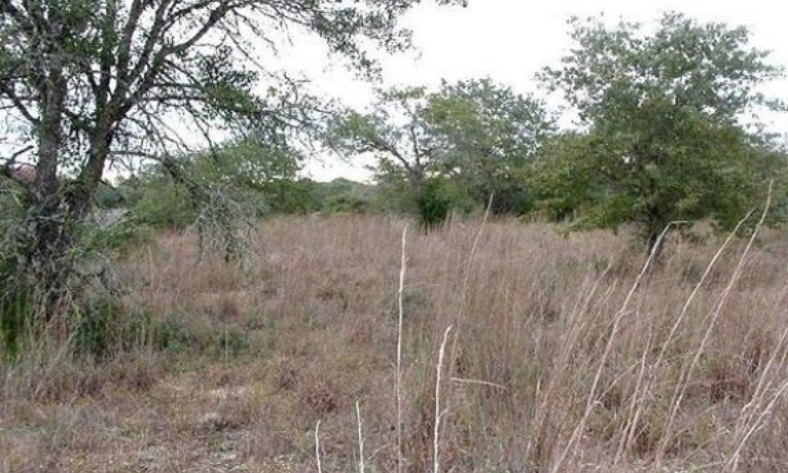
The Reference Plant Community is an open savannah of bluejack, post, and blackjack oak trees that shade up to 30 percent of the ground. Yaupon shrubs are associated with the trees. The herbaceous component is tall and mid-grasses and is dominated by little bluestem, Indiangrass (Sorghastrum nutans), slender Indiangrass, and brownseed paspalum (Paspalum plicatulum). Tall and mid-grasses make up to 50 to 75 percent of the total annual production. A thin stand of purple lovegrass (Eragrostis spectabilis), red lovegrass (Eragrostis secundiflora), woolly sheath threeawn (Aristida lanosa), Hall's panicum (Panicum hallii), and thin paspalum (Paspalum setaceum) occupy the interspaces.
Grazing prescriptions that allow for adequate rest periods along with prescribed fire every five to seven years are important in the maintenance of the reference plant community and the savannah landscape structure. Continuous overgrazing or over rest and the absence of fire tend to allow a vegetative shift towards woody species. Without corrective measures, this shift will continue to the Shrubland State.Figure 6. Annual production by plant type (representative values) or group (midpoint values)
Table 5. Annual production by plant type
Plant type Low
(lb/acre)Representative value
(lb/acre)High
(lb/acre)Grass/Grasslike 1700 1875 2050 Tree 350 400 450 Shrub/Vine 100 125 150 Forb 100 125 150 Total 2250 2525 2800 State 2
Shrubland DominatedOne community exists in the Shrubland Dominated State, the 2.1 Oak Scrub/Shrubland Community. The herbaceous production is not as great compared to the Reference State, and overstory canopy has increased to 30 and 50 percent.
Community 2.1
Oak Scrub/ShrublandThis plant community phase is a transitional community between the Reference and Encroached States. It develops in the absence of fire, mechanical, or chemical treatments for brush control. It is the result of abandonment or yearly continuous grazing. Trees and shrubs encroach or replace the grassland component of the Reference State. In addition to the naturally occurring bluejack, blackjack, and post oak - yaupon increases in density and canopy coverage (30 to 50 percent). Remnants of little bluestem and Indiangrass may still occur but to a lesser extent than is present in the reference state/current potential state. .The herbaceous component of the community becomes dominated by less desirable herbaceous grasses and forbs. Woollysheath threeawn (Aristida lanosa), sand dropseed (Sporobolus cryptandrus), arrowfeather threeawn (Aristida purpurascens), Scribner's dichanthelium (Dicanthelium oliganthes), thin paspalum (Paspalum setaceum), wild buckwheat (Eriogonum spp.), and Texas croton (Croton texensis) commonly occur.
Figure 7. Annual production by plant type (representative values) or group (midpoint values)
Table 6. Annual production by plant type
Plant type Low
(lb/acre)Representative value
(lb/acre)High
(lb/acre)Grass/Grasslike 1025 1150 1250 Tree 675 750 850 Shrub/Vine 450 475 500 Forb 100 125 150 Total 2250 2500 2750 State 3
EncroachedOne community phase exists in the Encroached State, the 3.1 Oak/Yaupon Woodland Community. The ecological site is characterized by a decrease in herbaceous species and an increase in woody species. The overstory canopy cover is greater than 50 percent with significant shrub understory.
Community 3.1
Oak/Yaupon Woodland
This plant community is a closed overstory (50 to 80 percent canopy cover) woodland dominated by bluejack, blackjack, and post oak. Yaupon is the dominant understory shrub. Woody vines also occur and include greenbriar (Smilax spp.), grape (Vitis spp.), and poison ivy (Toxicodendron radicans). Herbaceous understory is almost nonexistent but shade tolerant species including longleaf woodoats (Chasmanthium sessiliflorum) and cedar sedge (Carex planostachys) may occur in small amounts.
Figure 8. Annual production by plant type (representative values) or group (midpoint values)
Table 7. Annual production by plant type
Plant type Low
(lb/acre)Representative value
(lb/acre)High
(lb/acre)Tree 1475 1625 1775 Grass/Grasslike 450 500 550 Shrub/Vine 225 250 275 Forb 100 125 150 Total 2250 2500 2750 State 4
PasturelandThe Pastureland State contains the 4.1 Pastureland Community. This state is characterized by cultivation and seeding of the land.
Community 4.1
Pastureland
This site is often planted to native or introduced grasses and legumes for livestock grazing or hay production. Typical species planted include improved Bermudagrass varieties, bahiagrass, switchgrass, dallisgrass, eastern gamagrass, annual ryegrass (Lolium multiflorum), and white clover. Many of the introduced species (bahiagrass, Bermudagrass, and dallisgrass) are invasive. The primary means of propagation for these species is by seed distribution via wind, water, and animal vectors. Once established, they are extremely difficult to remove and will hinder the reestablishment of native species. The establishment and maintenance of these species requires cultivation, fertilization, weed control, and prescribed grazing management.
Transition T1A
State 1 to 2The Reference State will transition to the Shrubland Dominated State with continued heavy grazing pressure, no brush management, or abandonment occurs. The transition is evident when woody species canopy cover exceeds 30 percent and grasses shift composition to more shade-tolerant species.
Transition T1B
State 1 to 4The transition to the Pastureland State occurs when the site is plowed for planting pasture. The driver for the transition is the land manager's decision to farm the site.
Restoration pathway R2A
State 2 to 1Restoration back to the Reference State requires brush management, prescribed grazing or prescribed fire. The woody canopy cover needs to be less than 50 percent and adequate herbaceous fine fuel to carry fire. When the threshold is exceeded, mechanical or chemical brush control becomes necessary to move this transitional community back towards Reference state. Prescribed grazing may require destocking and/or deferment, depending on the condition of the herbaceous understory and seed bank. While these treatment methods may remove the woody species, re-establishment of the herbaceous component is very difficult due to the low water holding capacity and low fertility of the soils.
Transition T2A
State 2 to 3The Shrubland Dominated State will transition to the Encroached State when continued heavy grazing pressure, no brush management, or abandonment continues. The transition is evident when woody species canopy cover exceeds 50 percent and grasses shift composition to more shade-tolerant species.
Transition T2B
State 2 to 4The transition to the Pastureland State occurs when the site is cultivated and planted to pasture. The driver for the transition is the land manager's decision to cultivate the site.
Restoration pathway R3A
State 3 to 1Restoration back to the Reference State requires substantial energy inputs. Brush management/"prescribed fire" and prescribed grazing will be needed to shift the community back. Mechanical or chemical controls can be used to remove the woody overstory species back below 30 percent. Chemical brush control on a large scale is not a viable treatment option due to resistance of yaupon to broadcast herbicide applications. Individual plant treatment with herbicides on a small acreages may be a viable treatment option. Prescribed grazing may require destocking and deferment to manage the understory grasses back to those found in the reference community. Prescribed fire may be a viable option if enough fine fuel still exists in the understory to help carry the fire across the landscape. Increased frequency of burns may be required to initiate a burning schedule. The low water holding capacity and low fertility of these soils make re-establishment of herbaceous species difficult.
Transition T3A
State 3 to 4The transition to the Pastureland State occurs when the site is cultivated and planted for pasture. The driver for the transition is the land manager's decision to cultivate the site.
Restoration pathway R4A
State 4 to 1The restoration to Reference State can occur when the land manager ceases agronomic practices. Range planting of native species found in the reference community will be required to bring back a similar community as the Reference State plant composition. Proper grazing and brush management will be required to ensure success.
Restoration pathway T4A
State 4 to 2The Converted Land State will transition to the Shrub Dominated State when continued heavy grazing pressure, no brush management, or abandonment continues. The transition is evident when woody species canopy cover exceeds 50 percent and grasses shift composition to more shade-tolerant species.
Transition T4B
State 4 to 3The Converted Land State will transition to the Encroached State with continued heavy grazing pressure, and brush management is needed to control invasive woody and shrub species.
Additional community tables
Table 8. Community 1.1 plant community composition
Group Common name Symbol Scientific name Annual production () Foliar cover (%) Grass/Grasslike1 Tallgrass 850–1025 little bluestem SCSC Schizachyrium scoparium 850–1025 – 2 Tall/Midgrasses 450–525 longleaf woodoats CHSE2 Chasmanthium sessiliflorum 450–525 – brownseed paspalum PAPL3 Paspalum plicatulum 450–525 – switchgrass PAVI2 Panicum virgatum 450–525 – slender Indiangrass SOEL3 Sorghastrum elliottii 450–525 – Indiangrass SONU2 Sorghastrum nutans 450–525 – purpletop tridens TRFL2 Tridens flavus 450–525 – 3 Midgrasses 250–300 woollysheath threeawn ARLA6 Aristida lanosa 250–300 – red lovegrass ERSE Eragrostis secundiflora 250–300 – purple lovegrass ERSP Eragrostis spectabilis 250–300 – sand lovegrass ERTR3 Eragrostis trichodes 250–300 – sand dropseed SPCR Sporobolus cryptandrus 250–300 – 4 Midgrasses 150–200 splitbeard bluestem ANTE2 Andropogon ternarius 150–200 – sedge CAREX Carex 150–200 – composite dropseed SPCOC2 Sporobolus compositus var. compositus 150–200 – Forb5 Forbs 75–100 partridge pea CHFA2 Chamaecrista fasciculata 75–100 – Atlantic pigeonwings CLMA4 Clitoria mariana 75–100 – Virginia dayflower COVI3 Commelina virginica 75–100 – ticktrefoil DESMO Desmodium 75–100 – lespedeza LESPE Lespedeza 75–100 – snoutbean RHYNC2 Rhynchosia 75–100 – fuzzybean STROP Strophostyles 75–100 – prairie spiderwort TROC Tradescantia occidentalis 75–100 – 6 Forbs 25–50 Texas bullnettle CNTE Cnidoscolus texanus 25–50 – hogwort CRCA6 Croton capitatus 25–50 – yankeeweed EUCO7 Eupatorium compositifolium 25–50 – plains snakecotton FRFL Froelichia floridana 25–50 – Shrub/Vine7 Shrubs/Vines 100–150 American beautyberry CAAM2 Callicarpa americana 100–150 – parsley hawthorn CRMA5 Crataegus marshallii 100–150 – yaupon ILVO Ilex vomitoria 100–150 – southern dewberry RUTR Rubus trivialis 100–150 – cat greenbrier SMGL Smilax glauca 100–150 – muscadine VIRO3 Vitis rotundifolia 100–150 – Arkansas yucca YUAR2 Yucca arkansana 100–150 – Texas pricklypear OPENL Opuntia engelmannii var. lindheimeri 100–150 – peppervine NEAR5 Nekemias arborea 100–150 – summer grape VIAE Vitis aestivalis 100–150 – muscadine VIRO3 Vitis rotundifolia 100–150 – plains yucca YUCA Yucca campestris 100–150 – Tree8 Trees 350–450 eastern redcedar JUVI Juniperus virginiana 350–450 – bluejack oak QUIN Quercus incana 350–450 – blackjack oak QUMA3 Quercus marilandica 350–450 – post oak QUST Quercus stellata 350–450 – Table 9. Community 2.1 plant community composition
Group Common name Symbol Scientific name Annual production () Foliar cover (%) Table 10. Community 3.1 plant community composition
Group Common name Symbol Scientific name Annual production () Foliar cover (%) Table 11. Community 4.1 plant community composition
Group Common name Symbol Scientific name Annual production () Foliar cover (%) Interpretations
Animal community
The historic savannah provided habitat to bison, deer, turkey, migratory birds and large predators such as wolves, coyotes, mountain lions, and black bear. White-tailed deer, turkey, coyotes, bobcats, and resident and migratory birds find suitable habitat in these savannahs today. Domestic livestock and exotic ungulates are the dominant grazers and browsers of this ecological site. As the savannah transitions through the various vegetative states towards woodlands, the quality of the habitat may improve for some species and decline for others. Management must be applied to maintain a vegetative state in optimum habitat quality for the desired species.
Hydrological functions
Peak rainfall periods occur in May and June from frontal passage thunderstorms and in September and October from tropical systems as well as frontal passages. Precipitation totals may be high (three to five inches per event) and events may be intense producing high volumes of precipitation over a short period of time. Extended periods of little to no rainfall during the growing season are common. Because of the gently to moderately sloping topography with rapid intake rate of the surface sands and very rapid permeability of the soils, there is usually little to no runoff from this site. Water from these somewhat excessively drained soils provides groundwater recharge. In some places, seeps and springs occur at the base of the site. They provide a continuing flow of high quality water for downstream use and sub-irrigation for vegetation on adjacent sites.
Recreational uses
Hunting, camping, bird watching, and equestrian are common activities.
Wood products
Oaks are used for firewood. Yaupon is used for landscaping.
Other products
Fruit from dewberry and grapes are available for harvest.
Supporting information
Inventory data references
Site descriptions were developed as part a Provisional Ecological Site project using historic soil survey manuscripts, available site descriptions, and low intensity field traverse sampling. Current work for this site is focusing on the verification stage. To accomplish this field verification across the geographical extent of the soils to which it is correlated. Where possible, existing data from partners and NRCS was evaluated. In addition low and medium intensity inventory was completed and analyzed. A final field review, peer review, quality control, and quality assurance review of the will be needed in order to finalize the document and bring it to the characterized stage.
Other references
1. Archer, S. 1994. Woody plant encroachment into southwestern grasslands and savannas: rates, patterns and proximate causes. In: Ecological implications of livestock herbivory in the West, pp. 13-68. Edited by M. Vavra, W. Laycock, R. Pieper. Society for Range Management Publication, Denver, CO.
2. Archer, S. and F.E. Smeins. 1991. Ecosystem-level Processes. Chapter 5 in: Grazing Management: An Ecological Perspective. Edited by R.K. Heitschmidt and J.W. Stuth. Timber Press, Portland, OR.
3. Bestelmeyer, B.T., J.R. Brown, K.M. Havstad, R. Alexander, G. Chavez, and J.E. Herrick. 2003. Development and use of state-and-transition models for rangelands. J. Range Manage. 56(2): 114-126.
4. Brown, J.R. and S. Archer. 1999. Shrub invasion of grassland: recruitment is continuous and not regulated by herbaceous biomass or density. Ecology 80(7): 2385-2396.
5. Foster, J.H. 1917. Pre-settlement fire frequency regions of the United States: a first approximation. Tall Timbers Fire Ecology Conference Proceedings No. 20.
6. Gould, F.W. 1975. The Grasses of Texas. Texas A&M University Press, College Station, TX. 653p.
7. Hamilton, W. and D. Ueckert. 2005. Rangeland Woody Plant Control: Past, Present, and Future. Chapter 1 in: Brush Management: Past, Present, and Future. pp. 3-16. Texas A&M University Press.
8. Scifres, C.J. and W.T. Hamilton. 1993. Prescribed Burning for Brush Management: The South Texas Example. Texas A&M University Press, College Station, TX. 245 p.
9. Smeins, F., S. Fuhlendorf, and C. Taylor, Jr. 1997. Environmental and Land Use Changes: A Long Term Perspective. Chapter 1 in: Juniper Symposium 1997, pp. 1-21. Texas Agricultural Experiment Station.
10. Stringham, T.K., W.C. Krueger, and P.L. Shaver. 2001. State and transition modeling: and ecological process approach. J. Range Manage. 56(2):106-113.
11. Texas Agriculture Experiment Station. 2007. Benny Simpson’s Texas Native Trees (http://aggie-horticulture.tamu.edu/ornamentals/natives/).
12. Texas A&M Research and Extension Center. 2000. Native Plants of South Texas (http://uvalde.tamu.edu/herbarium/index.html).
13. Thurow, T.L. 1991. Hydrology and Erosion. Chapter 6 in: Grazing Management: An Ecological Perspective. Edited by R.K. Heitschmidt and J.W. Stuth. Timber Press, Portland, OR.
14. USDA/NRCS Soil Survey Manuals counties within MLRA 87A.
15. USDA, NRCS. 1997. National Range and Pasture Handbook.
16. USDA, NRCS. 2007. The PLANTS Database (http://plants.usda.gov). National Plant Data Center, Baton Rouge, LA 70874-4490 USA.
17. USDA-Natural Resources Conservation Service, 2006. - Major Land Resource Area (MLRA)87A.
18. Vines, R.A. 1984. Trees of Central Texas. University of Texas Press, Austin, TX.
19. Vines, R.A. 1977. Trees of Eastern Texas. University of Texas Press, Austin, TX. 538 p.
20. Wright, H.A. and A.W. Bailey. 1982. Fire Ecology: United States and Southern Canada. John Wiley & Sons, Inc.Contributors
Mike Stellbaur
Tyson Hart
Antonio ArgullinApproval
Dean Stacy, 5/16/2025
Rangeland health reference sheet
Interpreting Indicators of Rangeland Health is a qualitative assessment protocol used to determine ecosystem condition based on benchmark characteristics described in the Reference Sheet. A suite of 17 (or more) indicators are typically considered in an assessment. The ecological site(s) representative of an assessment location must be known prior to applying the protocol and must be verified based on soils and climate. Current plant community cannot be used to identify the ecological site.
Author(s)/participant(s) Mike Stellbauer, David Polk, and Bill Deauman Contact for lead author Mike Stellbauer, Zone RMS, NRCS, Bryan, Texas Date 05/17/2005 Approved by Approval date Composition (Indicators 10 and 12) based on Annual Production Indicators
-
Number and extent of rills:
None. -
Presence of water flow patterns:
Water flow patterns are uncommon for this site. -
Number and height of erosional pedestals or terracettes:
Pedestals or terracettes are uncommon for this site when occupied by the reference community. -
Bare ground from Ecological Site Description or other studies (rock, litter, lichen, moss, plant canopy are not bare ground):
Expect no more than 40 percent bare ground randomly distributed in small patches. -
Number of gullies and erosion associated with gullies:
No gullies should be present. -
Extent of wind scoured, blowouts and/or depositional areas:
Blowouts or dunes could occur but should be uncommon under reference community. -
Amount of litter movement (describe size and distance expected to travel):
This site has very highly permeable soils with very high infiltration rates. Only small-sized litter will move short distances with intense storms. -
Soil surface (top few mm) resistance to erosion (stability values are averages - most sites will show a range of values):
Soil surface is resistant to erosion. -
Soil surface structure and SOM content (include type of structure and A-horizon color and thickness):
Soil surface structure is greater than 80 inches thick with colors from pale brown fine sand to pale brown fine sand and generally single grain structures. SOM is less than one percent. -
Effect of community phase composition (relative proportion of different functional groups) and spatial distribution on infiltration and runoff:
The savannah of trees, shrubs, vines, grasses, and forbs, along with adequate litter and little bare ground, provides for maximum infiltration and little runoff under normal rainfall events. -
Presence and thickness of compaction layer (usually none; describe soil profile features which may be mistaken for compaction on this site):
None. -
Functional/Structural Groups (list in order of descending dominance by above-ground annual-production or live foliar cover using symbols: >>, >, = to indicate much greater than, greater than, and equal to):
Dominant:
Warm-season tallgrasses >>Sub-dominant:
Warm-season midgrasses >Other:
Trees > Shrubs/Vines > ForbsAdditional:
-
Amount of plant mortality and decadence (include which functional groups are expected to show mortality or decadence):
There should be little mortality or decadence for any functional groups. -
Average percent litter cover (%) and depth ( in):
Litter is primarily herbaceous. -
Expected annual annual-production (this is TOTAL above-ground annual-production, not just forage annual-production):
2,250 pounds per acre for below average moisture years to 2,800 pounds per acre for above average moisture years. -
Potential invasive (including noxious) species (native and non-native). List species which BOTH characterize degraded states and have the potential to become a dominant or co-dominant species on the ecological site if their future establishment and growth is not actively controlled by management interventions. Species that become dominant for only one to several years (e.g., short-term response to drought or wildfire) are not invasive plants. Note that unlike other indicators, we are describing what is NOT expected in the reference state for the ecological site:
Potential invasive species include post oak, bluejack oak, blackjack oak, yaupon, and elm. -
Perennial plant reproductive capability:
All perennial plants should be capable of reproducing, except for periods of prolonged drought conditions, heavy natural herbivory and intense wildfires.
Print Options
Sections
Font
AAAAOther
PrintThe Ecosystem Dynamics Interpretive Tool is an information system framework developed by the USDA-ARS Jornada Experimental Range, USDA Natural Resources Conservation Service, and New Mexico State University.
Accessibility statement


