
Natural Resources
Conservation Service
-
Search


Major Land Resource Area or ecological site by name and/or ID.
PreviousSectionsNextGeneral information
Provisional. A provisional ecological site description has undergone quality control and quality assurance review. It contains a working state and transition model and enough information to identify the ecological site.
Click to explore map
Figure 1. Mapped extent
Areas shown in blue indicate the maximum mapped extent of this ecological site. Other ecological sites likely occur within the highlighted areas. It is also possible for this ecological site to occur outside of highlighted areas if detailed soil survey has not been completed or recently updated.
MLRA notes
Major Land Resource Area (MLRA): 086B–Texas Blackland Prairie, Southern Part
MLRA 86B, the Southern Part of the Texas Blackland Prairie is located in east-central Texas. It makes up about 2,925 square miles (7,585 square kilometers). The towns of Brenham, Caldwell, La Grange, Schulenberg, Hallettsville, and Navasota are in the eastern part while Lincoln, Benchley, and Normangee are in the western part. The area supports tall and mid-grass prairies, but improved pasture, croplands, and urban development account for the majority of the acreage.
Classification relationships
USDA-Natural Resources Conservation Service, 2006.
-Major Land Resource Area (MLRA) 86BEcological site concept
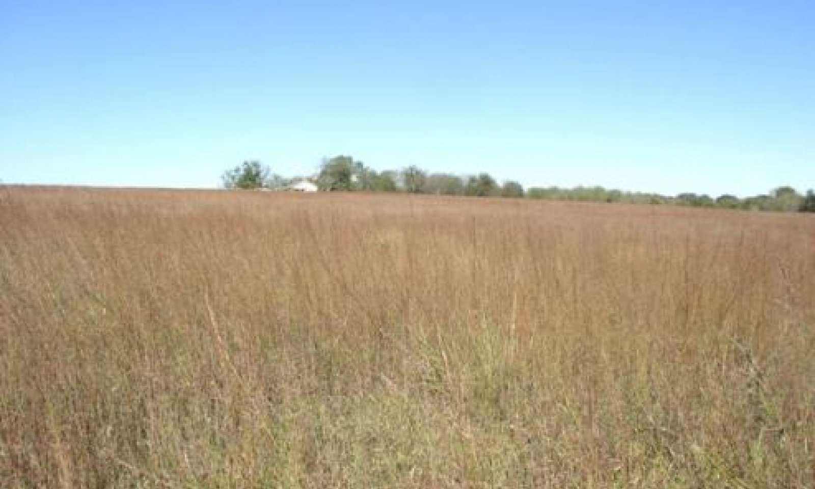
The Blackland ecological site is distinguished by its deep productive soils that are richly black in color, and characterized by their shrink-swell nature. The sites are widely distributed across the region.
Associated sites
R086BY001TX Chalky Ridge
The Chalky Ridge site is often upslope from the Blackland. It differs from the site by having shallow soils and low soil fertility.
R086BY002TX Claypan Prairie
The Claypan Prairie site is often adjacent to the Blackland. It differs from the site by having a sandy loam surface soil layer over clay subsoils.
R086BY006TX Loamy Bottomland
The Blackland Site occurs at higher elevation in the drainage and provides runoff to the Loamy Bottomland Site.
R086BY007TX Clayey Bottomland
The Blackland Site occurs at higher elevation in the drainage and provides runoff to the Clayey Bottomland Site.
Similar sites
R086BY004TX Eroded Blackland
The Eroded Blackland site is similar to the Blackland site by having similar soil types and topography. It differs by having extensive erosion indicated by a partial or lost A horizon, actives rills and/or gullies, and lower production.
Table 1. Dominant plant species
Tree (1) Celtis laevigata var. reticulata
(2) Ulmus crassifoliaShrub (1) Symphoricarpos orbiculatus
Herbaceous (1) Schizachyrium scoparium
(2) Andropogon gerardiiPhysiographic features
This site includes nearly level, moderately sloping, gently rolling, and hilly topography. Slopes range from 0 to 8 percent, but are typically 1 to 5 percent.
Table 2. Representative physiographic features
Landforms (1) Plains > Terrace
(2) Plains > Ridge
Runoff class High to very high Flooding frequency None Ponding frequency None Elevation 200 – 500 ft Slope 1 – 5 % Aspect Aspect is not a significant factor Table 3. Representative physiographic features (actual ranges)
Runoff class Not specified Flooding frequency Not specified Ponding frequency Not specified Elevation 0 ft Slope 0 – 8 % Climatic features
The climate for MLRA 86B is humid subtropical and is characterized by hot summers, especially in July and August, and relatively mild winters. Tropical maritime air controls the climate during spring, summer and fall. In winter and early spring, frequent surges of Polar Canadian air cause sudden drops in temperatures and add considerable variety to the daily weather. When these cold air masses stagnate and are overrun by moist air from the south, several days of cold, cloudy, and rainy weather follow. Generally, these occasional cold spells are of short duration with rapid clearing following cold frontal passages. The summer months have little variation in day-to-day weather except for occasional thunderstorms that dissipate the afternoon heat. The moderate temperatures in spring and fall are characterized by long periods of sunny skies, mild days, and cool nights. Rainfall during the spring and summer months generally falls during thunderstorms, and fairly large amounts of rain may fall in a short time. High intensity rains of short duration are likely to produce rapid runoff almost anytime during the year. The amount of rain that falls varies considerably from month-to-month and from year-to-year.
Table 4 Representative climatic features
Frost-free period (average) 250 days Freeze-free period (average) 280 days Precipitation total (average) 40 in BarLineFigure 2. Monthly precipitation range
BarLineFigure 3. Monthly average minimum and maximum temperature
Figure 4. Annual precipitation pattern
Figure 5 Annual average temperature pattern
Climate stations used
-
(1) LEXINGTON [USC00415193], Lexington, TX
-
(2) BRENHAM [USC00411048], Brenham, TX
-
(3) FLATONIA 4SE [USC00413183], Moulton, TX
-
(4) WASHINGTON SP [USC00419491], Navasota, TX
-
(5) HALLETTSVILLE 2 N [USC00413873], Hallettsville, TX
">Influencing water features
The plant community of this site is not influenced by a stream.
Wetland description
Wetlands are not associated with this site.
Soil features
These soils are deep, dark colored to olive, slightly acid to calcareous clays. The soils have high shrink-swell properties often forming microdepressions and microknolls. When they are dry and cracked, they take in water rapidly. When they are wet and the cracks have closed, however, the water intake is slow. The soils hold large amounts of water and have high natural fertility. They seal over when cover is inadequate and erosion is then a hazard. The soils are sticky and plastic when wet. When moist, they are crumbly. Good soil structure is generally very evident under grass cover. In this condition, they favor air and water movement and root growth.
Soils correlated to this site include: Bleiblerville, Branyon, Denhawken, Denvaca, Dimebox, Elmendorf, Elmenwood, Frelsburg, Greenvine, Heiden, Houston Black, Leson, and Luling.Table 5. Representative soil features
Parent material (1) Residuum – shale
Surface texture (1) Clay
Family particle size (1) Clayey
Drainage class Moderately well drained to well drained Soil depth 80 in Surface fragment cover <=3" Not specified Surface fragment cover >3" Not specified Available water capacity
(0-40in)6 – 10 in Calcium carbonate equivalent
(0-40in)0 – 40 % Electrical conductivity
(0-40in)0 – 4 mmhos/cm Sodium adsorption ratio
(0-40in)0 – 2 Soil reaction (1:1 water)
(0-40in)5.6 – 8.4 Subsurface fragment volume <=3"
(Depth not specified)0 – 3 % Subsurface fragment volume >3"
(Depth not specified)0 – 1 % Ecological dynamics
This tallgrass prairie site evolved and was maintained by the grazing and herding effects of native large ungulates, by rodents and rabbits, by insects and disease, and the occurrence of periodic fire. Extreme climatic fluctuations over time may also have been important in the maintenance of the historic plant community. Continuous overgrazing by confined domestic livestock and the suppression of fire degrades the plant community. Continuous grazing will remove big bluestem (Andropogon gerardii), Indiangrass (Sorghastrum nutans), little bluestem (Schizachyrium scoparium), switchgrass (Panicum virgatum), and preferred forbs such as Engelmann's daisy (Engelmannia peristenia), Maximilian sunflower (Helianthus maximilliani), Illinois bundleflower (Desmanthus illinoensis), and compass plant (Silphium spp.). These plants will be replaced by less productive perennial and annual grasses and forbs including silver bluestem (Bothriochloa saccharoides), Texas wintergrass (Nassella leucotricha), windmillgrass (Chloris spp.), white tridens (Tridens albescens), annual broomweed (Amphiachyris dracunculoides), and snow on the prairie (Euphorbia bicolor). With continued continuous grazing and the absence of periodic fire, a community dominated by woody species including mesquite (Prosopis glandulosa), cedar elm (Ulmus crassifolia), netleaf hackberry (Celtis laevigata), and eastern red cedar (Juniperus virginiana) will replace the grassland.
State and transition model
More interactive model formats are also available. View Interactive Models
Click on state and transition labels to scroll to the respective textEcosystem states
T1A - No fire, no brush management, improper grazing management, drought T1B - Brush management, crop cultivation, pasture planting, nutrient management, pest management R2A - Fire, brush management, proper grazing, range planting T2A - Brush management, crop cultivation, pasture planting, nutrient management, pest management R3A - Fire, brush management, proper grazing, range planting T3A - No fire, no brush management, heavy continuous grazing, no pest management State 1 submodel, plant communities
1.1A - No fire, no brush management, improper grazing management, drought 1.2A - Fire, brush management, proper grazing State 2 submodel, plant communities
2.1A - No fire, no brush management, improper grazing management, drought State 3 submodel, plant communities
State 1
Prairie/SavannahTwo communities exist in the Prairie/Savannah State: the 1.1 Tallgrass Prairie Community and the 1.2 Mesquite/Midgrass Savannah Community. Community 1.1 is characterized by tallgrasses dominating the understory, with woody cover less than 10 percent. Community 1.2 is characterized by a decrease in tallgrasses and an increase in midgrasses and forbs. Woody cover increases to 20 to 40 percent.
Community 1.1
Tallgrass Prairie
The characteristic plant community of this site is the reference plant community. This site is a true prairie with few large live oak (Quercus virginiana), elm, and hackberry trees along the draws and in occasional motts. Little bluestem dominates the plant community, making up 40 to 50 percent of the total annual yield. Indiangrass and big bluestem make up another 30 percent. Numerous other grasses occur in the potential plant community but less frequently and in smaller amounts. Texas wintergrass and Virginia wildrye (Elymus virginiana) are perennial cool season plants that occur on the site. A variety of forbs, including Illinois bundleflower, Maximilian sunflower, Engelmann’s daisy, and black sampson (Echinacea angustifolia) occur in this community. Grazing prescriptions that permit acceptable grazing periods and allow adequate rest periods along with prescribed fire every three to five years are important in the maintenance of the reference plant community and the prairie landscape structure. Continuous overgrazing, or over-rest and the absence of fire, tend to favor a vegetative shift towards woody species such as mesquite, elm, hackberry, cedar, and locust (Gleditsia triacanthos). Without corrective measures, this shift will continue to a mesquite-shrub dominated community.
Figure 6. Annual production by plant type (representative values) or group (midpoint values)
Table 6. Annual production by plant type
Plant type Low
(lb/acre)Representative value
(lb/acre)High
(lb/acre)Grass/Grasslike 3825 5100 6375 Forb 450 600 750 Tree 180 240 300 Shrub/Vine 45 60 75 Total 4500 6000 7500 Table 7. Ground cover
Tree foliar cover 0-10% Shrub/vine/liana foliar cover 0-10% Grass/grasslike foliar cover 30-60% Forb foliar cover 10-10% Non-vascular plants 0% Biological crusts 0% Litter 10-20% Surface fragments >0.25" and <=3" 0% Surface fragments >3" 0% Bedrock 0% Water 0% Bare ground 10-20% Table 8. Soil surface cover
Tree basal cover 0-10% Shrub/vine/liana basal cover 0-10% Grass/grasslike basal cover 10-30% Forb basal cover 0-0% Non-vascular plants 0% Biological crusts 0% Litter 30-40% Surface fragments >0.25" and <=3" 0% Surface fragments >3" 0% Bedrock 0% Water 0% Bare ground 10-20% Table 9. Canopy structure (% cover)
Height Above Ground (ft) Tree Shrub/Vine Grass/
GrasslikeForb <0.5 – – – 0-5% >0.5 <= 1 – – 5-10% 0-5% >1 <= 2 – – 10-20% 0-5% >2 <= 4.5 – 0-10% 20-40% 5-10% >4.5 <= 13 – – 0-5% 0-5% >13 <= 40 0-10% – – – >40 <= 80 – – – – >80 <= 120 – – – – >120 – – – – Community 1.2
Mesquite/Midgrass Savannah
The Mesquite/Midgrass Savannah Community develops in the absence of fire or mechanical or chemical brush management treatments. It is usually the result of abandonment following cropping or yearly continuous grazing. Mesquite is the dominant woody plant on the site but eastern red cedar, prickly ash (Zanthoxylum clava-herculis), cedar elm, bumelia (Sideroxylon lanuginosum), coralberry (Symphoricarpos orbiculatus), and netleaf hackberry may also occur. Remnants of little bluestem and Indiangrass may still occur, but the herbaceous component of the community becomes dominated by lesser producing grasses and forbs. Silver bluestem, windmillgrass, white tridens, fall witchgrass (Digitaria cognata), threeawn (Aristida sp.), Texas wintergrass, prickly pear (Opuntia sp.), tasajillo (Opuntia leptocaulis), western ragweed (Ambrosia psilostachya), croton (Croton sp.), annual broomweed, and snow on the prairie are common occupants. If the woody canopy has not exceeded 40 percent, prescribed burning on a three to five year interval in conjunction with prescribed grazing is a viable option for returning this community to a tallgrass prairie that may resemble the reference plant community. If the woody canopy has exceeded 40 percent, chemical or mechanical brush control must be applied to move the transitional community back towards the reference plant community.
Figure 7. Annual production by plant type (representative values) or group (midpoint values)
Table 10. Annual production by plant type
Plant type Low
(lb/acre)Representative value
(lb/acre)High
(lb/acre)Grass/Grasslike 1200 1800 2400 Shrub/Vine 450 675 900 Forb 300 450 600 Tree 150 225 300 Total 2100 3150 4200 Table 11. Ground cover
Tree foliar cover 10-40% Shrub/vine/liana foliar cover 10-20% Grass/grasslike foliar cover 30-40% Forb foliar cover 20-30% Non-vascular plants 0% Biological crusts 0% Litter 10-20% Surface fragments >0.25" and <=3" 0% Surface fragments >3" 0% Bedrock 0% Water 0% Bare ground 20-40% Table 12. Soil surface cover
Tree basal cover 0% Shrub/vine/liana basal cover 10-20% Grass/grasslike basal cover 10-20% Forb basal cover 10-10% Non-vascular plants 0% Biological crusts 0% Litter 10-20% Surface fragments >0.25" and <=3" 0% Surface fragments >3" 0% Bedrock 0% Water 0% Bare ground 20-40% Table 13. Canopy structure (% cover)
Height Above Ground (ft) Tree Shrub/Vine Grass/
GrasslikeForb <0.5 – – 5-10% – >0.5 <= 1 – – 5-10% – >1 <= 2 – – 20-40% 5-15% >2 <= 4.5 – – 5-15% 5-15% >4.5 <= 13 – 10-20% – – >13 <= 40 20-40% – – – >40 <= 80 – – – – >80 <= 120 – – – – >120 – – – – Pathway 1.1A
Community 1.1 to 1.2
Tallgrass Prairie
Mesquite/Midgrass SavannahThe Tallgrass Prairie Community will shift to the Mesquite/Midgrass Savannah Community when there is continued growing-season stress on reference grass species. These stresses include improper grazing management that creates insufficient critical growing-season deferment, excess intensity of defoliation, repeated, long-term growing-season defoliation, long-term drought, and/or other repeated critical growing-season stress. Increaser species (midgrasses and woody species) are generally endemic species released by disturbance. Woody species canopy exceeding 20 percent and a species shift from tallgrass to midgrass composition indicate a transition. The driver for the shift is heavy grazing, no fire, no brush management, and/or abandonment.
Pathway 1.2A
Community 1.2 to 1.1
Mesquite/Midgrass Savannah
Tallgrass PrairieThe Mesquite/Midgrass Savannah Plant Community will return to the Tallgrass Prairie Plant Community under grazing management that provides sufficient critical growing season deferment in combination with proper grazing intensity as long as the seedbank or seed source is still present. Favorable moisture conditions will facilitate or accelerate this transition. The understory component may return to dominance by tallgrasses in the absence of fire or brush control. However, reduction of the woody component to reference conditions of 10 percent or less canopy cover will require inputs of fire or brush control.
State 2
ShrublandTwo communities exist in the Shrubland State: the 2.1 Mesquite/Midgrass Shrubland Community and the 2.2 Mesquite/Texas Wintergrass Woodland Community. Community 2.1 is characterized by an increase in shade-tolerant grass and an overstory canopy of greater than 40 percent. Community 2.2 is characterized by a cool-season grasses, especially Texas wintergrass, and a greater than 40 percent canopy cover.
Community 2.1
Mesquite/Midgrass ShrublandThis is a transitional community between the prairie, pastureland, or cropland states and the mesquite-woodland state. It develops in the absence of fire or mechanical or chemical brush management treatments. It is usually the result of abandonment following cropping or yearly continuous grazing. Mesquite is the dominant woody plant on the site but eastern red cedar, prickly ash, cedar elm, bumelia, coralberry, and netleaf hackberry may also occur. Remnants of little bluestem and Indiangrass may still occur, but the herbaceous component of the community becomes dominated by lesser producing grasses and forbs. Silver bluestem, windmillgrass, white tridens, fall witchgrass, threeawn, Texas wintergrass, prickly pear, tasajillo, western ragweed, croton, annual broomweed, and snow on the prairie are common occupants. Since the woody canopy has exceeded 40 percent, chemical or mechanical brush control must be applied to move the transitional community back towards the reference plant community.
Figure 8. Annual production by plant type (representative values) or group (midpoint values)
Table 14. Annual production by plant type
Plant type Low
(lb/acre)Representative value
(lb/acre)High
(lb/acre)Grass/Grasslike 900 1300 1800 Shrub/Vine 400 600 800 Tree 375 560 750 Forb 200 325 450 Total 1875 2785 3800 Community 2.2
Mesquite/Texas Wintergrass Woodland
This plant community is dominated by mesquite but may include some live oak, eastern red cedar, hackberry, cedar elm, bumelia, and prickly ash. Canopy cover exceeds 40 percent. Understory shrubs and vines include coralberry, greenbriar (Smilax spp.), grape (Vitis spp.), prickly pear, and tasajillo. Texas wintergrass, silver bluestem, cedar sedge (Carex planostachys), threeawn, annual broomweed, and snow on the prairie are the most common herbaceous components. Herbaceous species composition and production are directly related to woody canopy cover. If the site is not abandoned cropland, chemical brush control combined with prescribed grazing and prescribed burning is a viable treatment option for moving this community back towards the reference plant community. Mechanical brush control and seeding is usually the most viable treatment option when the objective is to return this state to a community that resembles the reference plant community.
Figure 9. Annual production by plant type (representative values) or group (midpoint values)
Table 15. Annual production by plant type
Plant type Low
(lb/acre)Representative value
(lb/acre)High
(lb/acre)Grass/Grasslike 650 925 1300 Tree 600 900 1200 Shrub/Vine 350 525 700 Forb 100 200 300 Total 1700 2550 3500 Table 16. Ground cover
Tree foliar cover 40-60% Shrub/vine/liana foliar cover 20-40% Grass/grasslike foliar cover 10-20% Forb foliar cover 20-30% Non-vascular plants 0% Biological crusts 0% Litter 10-10% Surface fragments >0.25" and <=3" 0% Surface fragments >3" 0% Bedrock 0% Water 0% Bare ground 20-40% Table 17. Soil surface cover
Tree basal cover 20-40% Shrub/vine/liana basal cover 20-30% Grass/grasslike basal cover 10-10% Forb basal cover 10-10% Non-vascular plants 0% Biological crusts 0% Litter 10-10% Surface fragments >0.25" and <=3" 0% Surface fragments >3" 0% Bedrock 0% Water 0% Bare ground 20-40% Table 18. Canopy structure (% cover)
Height Above Ground (ft) Tree Shrub/Vine Grass/
GrasslikeForb <0.5 – – 5-10% 5-10% >0.5 <= 1 – – – – >1 <= 2 – – 5-10% 10-20% >2 <= 4.5 – – 5-10% – >4.5 <= 13 – 15-25% – – >13 <= 40 40-60% – – – >40 <= 80 – – – – >80 <= 120 – – – – >120 – – – – Pathway 2.1A
Community 2.1 to 2.2The Mesquite/Midgrass Shrubland Community will transition to the Mesquite/Texas Wintergrass Woodland Community with continued heavy grazing, no fire, no brush management and/or abandonment. Indicators of the transition include an increased species composition of cool-season grasses and trees becoming more mature.
State 3
Converted LandThe Converted Land State contains one community, the 3.1 Converted Land Community. The state is characterized by the land manager farming crops or planted grasses.
Community 3.1
Converted Land
Conversion of the tallgrass prairie to cropland (primarily cotton, corn, and grain sorghum) began in the middle 1800's and continued into the early 1900's. Much of the prairie is in cropland today and includes additional crops of small grains (for grain and livestock grazing), soybeans, and rice. While restoration of this site to a semblance of the tallgrass prairie is possible with seeding, prescribed grazing, and prescribed burning - complete restoration of the reference plant community in a reasonable time is unlikely. If cropping is abandoned, this site is usually planted to introduced grasses and forbs and managed as pastureland.
Following crop production or brush control, this site is often planted to native or introduced grasses and legumes for livestock grazing or hay production. Typical species planted include improved Bermudagrass (Cynodon spp.) varieties, dallisgrass (Paspalum dilatam), switchgrass, kleingrass (Panicum coloratum), old-world bluestem (Bothriochloa spp.) varieties, and various legume species. Many of the introduced species (Bermudagrass, dallisgrass, old-world bluestem) are invasive - moving by wind, water, and animals. Once established, they are extremely difficult to remove and will hinder the re-establishment of native species. The establishment and maintenance of these species requires cultivation, fertilization, weed control, and prescribed grazing management. Without the yearly application of these cultural practices, this vegetative state will move towards the Shrubland State.Figure 10. Annual production by plant type (representative values) or group (midpoint values)
Table 19. Annual production by plant type
Plant type Low
(lb/acre)Representative value
(lb/acre)High
(lb/acre)Grass/Grasslike 3000 6500 10000 Total 3000 6500 10000 Transition T1A
State 1 to 2The Prairie/Savannah State will transition to the Shrubland State when continued heavy grazing pressure, no fire, no brush management, and/or field abandonment continues. The transition is evident when woody species canopy cover exceeds 40 percent and grasses shift composition to more shade-tolerant species.
Transition T1B
State 1 to 3The transition to the Converted State occurs when the site is plowed for planting crops or pasture. The driver for the transition is the land manager's decision to farm the site.
Restoration pathway R2A
State 2 to 1Restoration of the Shrubland State to the Prairie/Savannah State requires substantial energy input. Mechanical or herbicidal brush control treatments can be used to remove woody species. A long-term prescribed fire program may sufficiently reduce brush density particularly if the woody component is dominated by species that are not re-sprouters. However, fire may not be sufficient to remove mature trees. Brush control in combination with prescribed fire, proper grazing management, and favorable growing conditions may be the most economical means of creating and maintaining the desired plant community. If remnant populations of tallgrasses, midgrasses, and desirable forbs are not present at sufficient levels, range planting will be necessary to restore the reference plant community.
Transition T2A
State 2 to 3The transition to the Converted State occurs when the site is plowed for planting crops or pasture. The driver for the transition is the land manager's decision to farm the site.
Restoration pathway R3A
State 3 to 1The restoration to State 1 can occur when the land manager ceases agronomic practices. Range planting of native species found in the reference community will be required to bring back a similar community as the State 1 plant composition. The extent of previous soil disturbances will determine how much seedbed preparation will be needed, as well as the ability to be restored. Proper grazing and brush management will be required to ensure success.
Transition T3A
State 3 to 2The Converted Land State will transition to the Shrubland State by heavy continuous grazing, no fire, no brush management and/or abandonment. Woody species that encroach will eventually grow into the overstory and begin to shade out grasses.
Additional community tables
Table 20. Community 1.1 plant community composition
Group Common name Symbol Scientific name Annual production () Foliar cover (%) Grass/Grasslike1 Tallgrass 1500–3000 little bluestem SCSC Schizachyrium scoparium 1500–3000 – 2 Tallgrasses 750–1500 big bluestem ANGE Andropogon gerardii 750–1500 – Indiangrass SONU2 Sorghastrum nutans 750–1500 – 3 Mid/Shortgrasses 300–600 sideoats grama BOCU Bouteloua curtipendula 300–600 – buffalograss BODA2 Bouteloua dactyloides 300–600 – silver beardgrass BOLAT Bothriochloa laguroides ssp. torreyana 300–600 – sedge CAREX Carex 300–600 – cylinder jointtail grass COCY Coelorachis cylindrica 300–600 – fall witchgrass DICO6 Digitaria cognata 300–600 – Virginia wildrye ELVI3 Elymus virginicus 300–600 – Texas cupgrass ERSE5 Eriochloa sericea 300–600 – Texas wintergrass NALE3 Nassella leucotricha 300–600 – Florida paspalum PAFL4 Paspalum floridanum 300–600 – Hall's panicgrass PAHA Panicum hallii 300–600 – vine mesquite PAOB Panicum obtusum 300–600 – switchgrass PAVI2 Panicum virgatum 300–600 – marsh bristlegrass SEPA10 Setaria parviflora 300–600 – composite dropseed SPCOC2 Sporobolus compositus var. compositus 300–600 – white tridens TRAL2 Tridens albescens 300–600 – eastern gamagrass TRDA3 Tripsacum dactyloides 300–600 – longspike tridens TRST2 Tridens strictus 300–600 – Forb4 Forbs 300–600 Cuman ragweed AMPS Ambrosia psilostachya 300–600 – groovestem Indian plantain ARPL4 Arnoglossum plantagineum 300–600 – bluebell bellflower CARO2 Campanula rotundifolia 300–600 – compact prairie clover DACOC Dalea compacta var. compacta 300–600 – Illinois bundleflower DEIL Desmanthus illinoensis 300–600 – blacksamson echinacea ECAN2 Echinacea angustifolia 300–600 – Engelmann's daisy ENPE4 Engelmannia peristenia 300–600 – button eryngo ERYU Eryngium yuccifolium 300–600 – Maximilian sunflower HEMA2 Helianthus maximiliani 300–600 – coastal indigo INMI Indigofera miniata 300–600 – pinkscale blazing star LIEL Liatris elegans 300–600 – Nuttall's sensitive-briar MINU6 Mimosa nuttallii 300–600 – whitest evening primrose OEAL Oenothera albicaulis 300–600 – Nuttall's prairie parsley PONU4 Polytaenia nuttallii 300–600 – prairie snoutbean RHLA5 Rhynchosia latifolia 300–600 – fuzzybean STROP Strophostyles 300–600 – Shrub/Vine5 Vines 30–60 coralberry SYOR Symphoricarpos orbiculatus 30–60 – Tree6 Trees 150–300 netleaf hackberry CELAR Celtis laevigata var. reticulata 150–300 – gum bully SILAL3 Sideroxylon lanuginosum ssp. lanuginosum 150–300 – cedar elm ULCR Ulmus crassifolia 150–300 – Table 21. Community 1.2 plant community composition
Group Common name Symbol Scientific name Annual production () Foliar cover (%) Table 22. Community 2.1 plant community composition
Group Common name Symbol Scientific name Annual production () Foliar cover (%) Table 23. Community 2.2 plant community composition
Group Common name Symbol Scientific name Annual production () Foliar cover (%) Table 24. Community 3.1 plant community composition
Group Common name Symbol Scientific name Annual production () Foliar cover (%) Grass/Grasslike1 Small Grains 6000–8000 common oat AVSA Avena sativa 6000–8000 – Italian ryegrass LOPEM2 Lolium perenne ssp. multiflorum 6000–8000 – common wheat TRAE Triticum aestivum 6000–8000 – 2 Pastureland Species 3000–10000 Bermudagrass CYDA Cynodon dactylon 3000–10000 – kleingrass PACO2 Panicum coloratum 3000–10000 – bahiagrass PANO2 Paspalum notatum 3000–10000 – Interpretations
Animal community
As a historic tall grass prairie, this site was occupied by bison, antelope, deer, prairie chickens, quail, turkey, and dove. This site was also used by many species of grassland songbirds, migratory waterfowl, coyotes, and wolves. This site now provides forage for livestock and is still used by quail, dove, migratory waterfowl, migratory and resident grassland birds, and coyotes. Deer use the site when mesquite and associated woody species occur in sufficient densities and proper structure to provide adequate cover.
Hydrological functions
Peak rainfall periods occur in May and June from frontal passage thunderstorms and in September and October from tropical systems, as well as frontal passage thunderstorms. Rainfall amounts may be high (three to five inches per event) and events may be intense. The site is subject to erosion where adequate herbaceous cover is not maintained and on heavy use areas such as roads and livestock trails. Extended periods (60 days) of little to no rainfall during the growing season are common.
Recreational uses
The site is used for hunting, fishing, and photography.
Wood products
Mesquite may be harvested for firewood, charcoal, and specialty uses including furniture, gun stocks, and veneer.
Other products
Hay, seed from native grasses, forbs, and legumes
Supporting information
Inventory data references
These site descriptions were developed as part a Provisional Ecological Site project using historic soil survey manuscripts, available site descriptions, and low intensity field traverse sampling. Future work to validate the information is needed. This will include field activities to collect low, medium, and high-intensity sampling, soil correlations, and analysis of that data. A final field review, peer review, quality control, and quality assurance review of the will be needed to produce the final document.
Other references
Diggs, G.M., B.L. Lipscomb, and R.J. O'Kennon. 1999. Illustrated Flora of North Central Texas Botanical Research Institute of Texas and Austin College, Fort Worth, TX.
Hatch, S.L, K.N. Gandhi, and L.E. Brown. 1990. Checklist of the vascular plants of Texas. Texas Agricultural Experiment Station, College Station, TX.Contributors
Mark Moseley
Tyson HartApproval
Bryan Christensen, 9/21/2023
Rangeland health reference sheet
Interpreting Indicators of Rangeland Health is a qualitative assessment protocol used to determine ecosystem condition based on benchmark characteristics described in the Reference Sheet. A suite of 17 (or more) indicators are typically considered in an assessment. The ecological site(s) representative of an assessment location must be known prior to applying the protocol and must be verified based on soils and climate. Current plant community cannot be used to identify the ecological site.
Author(s)/participant(s) Mike Stellbauer Contact for lead author Mike Stellbauer, Zone RMS, NRCS, Bryan, Texas Date 05/23/2005 Approved by Approval date Composition (Indicators 10 and 12) based on Annual Production Indicators
-
Number and extent of rills:
A few rills of small extent may naturally occur on this site. -
Presence of water flow patterns:
Some water flow patterns are normal for this site due to landscape position and slope but should be vegetated and stable. -
Number and height of erosional pedestals or terracettes:
Pedestals or terracettes are uncommon for this site when occupied by the reference community. -
Bare ground from Ecological Site Description or other studies (rock, litter, lichen, moss, plant canopy are not bare ground):
Expect no more than 20 percent bare ground distributed in small patches. -
Number of gullies and erosion associated with gullies:
No gullies should be present. Drainageways should be stable and covered with vegetation. -
Extent of wind scoured, blowouts and/or depositional areas:
None. -
Amount of litter movement (describe size and distance expected to travel):
This site has slowly permeable soils On sloping sites, small to medium-size litter will move short distances with intense storms. -
Soil surface (top few mm) resistance to erosion (stability values are averages - most sites will show a range of values):
Soil surface is resistant to erosion. Stability class range is expected to be 5 to 6. -
Soil surface structure and SOM content (include type of structure and A-horizon color and thickness):
Soil surface structure is greater than 60 inches. Colors range from black to very dark brown and moderate fine to medium subangular block structure. SOM is one to three percent. -
Effect of community phase composition (relative proportion of different functional groups) and spatial distribution on infiltration and runoff:
This prairie site is dominated by tallgrasses and forbs, with adequate litter and little bare ground, which provides for maximum infiltration and little runoff under normal rainfall events. -
Presence and thickness of compaction layer (usually none; describe soil profile features which may be mistaken for compaction on this site):
No evidence of compaction. -
Functional/Structural Groups (list in order of descending dominance by above-ground annual-production or live foliar cover using symbols: >>, >, = to indicate much greater than, greater than, and equal to):
Dominant:
Warm-season tallgrasses >>Sub-dominant:
Warm-season midgrasses > Cool-season midgrasses > Forbs >Other:
Trees > Shrubs/VinesAdditional:
-
Amount of plant mortality and decadence (include which functional groups are expected to show mortality or decadence):
There should be little mortality or decadence for any functional group for the reference community. -
Average percent litter cover (%) and depth ( in):
-
Expected annual annual-production (this is TOTAL above-ground annual-production, not just forage annual-production):
4,500 pounds per acre during below average moisture years to 7,500 pounds per acre during above average moisture years. -
Potential invasive (including noxious) species (native and non-native). List species which BOTH characterize degraded states and have the potential to become a dominant or co-dominant species on the ecological site if their future establishment and growth is not actively controlled by management interventions. Species that become dominant for only one to several years (e.g., short-term response to drought or wildfire) are not invasive plants. Note that unlike other indicators, we are describing what is NOT expected in the reference state for the ecological site:
Potential invasive species include yellow bluestems, common Bermudagrass, mesquite, elm, huisache, eastern red cedar, and osage orange. -
Perennial plant reproductive capability:
All perennial plants should be capable of reproducing, except during drought conditions, heavy natural herbivory, and intense wildfires.
Print Options
Sections
Font
AAAAOther
PrintThe Ecosystem Dynamics Interpretive Tool is an information system framework developed by the USDA-ARS Jornada Experimental Range, USDA Natural Resources Conservation Service, and New Mexico State University.
Accessibility statement


