
Natural Resources
Conservation Service
-
Search


Major Land Resource Area or ecological site by name and/or ID.
PreviousSectionsNextGeneral information
Provisional. A provisional ecological site description has undergone quality control and quality assurance review. It contains a working state and transition model and enough information to identify the ecological site.
Click to explore map
Figure 1. Mapped extent
Areas shown in blue indicate the maximum mapped extent of this ecological site. Other ecological sites likely occur within the highlighted areas. It is also possible for this ecological site to occur outside of highlighted areas if detailed soil survey has not been completed or recently updated.
MLRA notes
Major Land Resource Area (MLRA): 086B–Texas Blackland Prairie, Southern Part
MLRA 86B, the Southern Part of the Texas Blackland Prairie is located in east-central Texas. It makes up about 2,925 square miles (7,585 square kilometers). The towns of Brenham, Caldwell, La Grange, Schulenberg, Hallettsville, and Navasota are in the eastern part while Lincoln, Benchley, and Normangee are in the western part. The area supports tall and mid-grass prairies, but improved pasture, croplands, and urban development account for the majority of the acreage.
Classification relationships
USDA-Natural Resources Conservation Service, 2006.
-Major Land Resource Area (MLRA) 86BEcological site concept
The Chalky Ridge sites are characterized by their shallow soils on ridges with high concentrations of chalk, or calcium carbonates.
Associated sites
R086BY003TX Clay Loam
The Clay Loam site is often downslope from the Chalky Ridge site. It differs from the site by having deeper soils, higher soil fertility, low to moderate runoff, and lower erosion rates.
R086BY005TX Blackland
The Blackland site is often downslope from the Chalky Ridge site. It differs from the site by having deeper soils, higher soil fertility, and higher soil clay content.
Similar sites
R086AY001TX Northern Chalky Ridge
Similar but different MLRA
R086AY002TX Southern Chalky Ridge
Similar but different MLRA
Table 1. Dominant plant species
Tree (1) Quercus virginiana
(2) Celtis laevigata var. laevigataShrub (1) Symphoricarpos orbiculatus
(2) Smilax rotundifoliaHerbaceous (1) Schizachyrium scoparium
(2) Andropogon gerardiiPhysiographic features
This site occurs as gently sloping to rolling upland ridges. Slope gradients range from 1 to 20 percent but are usually less than 8 percent.
Table 2. Representative physiographic features
Landforms (1) Plains > Ridge
Runoff class Low to high Flooding frequency None Ponding frequency None Elevation 200 – 600 ft Slope 1 – 8 % Water table depth 72 in Aspect Aspect is not a significant factor Table 3. Representative physiographic features (actual ranges)
Runoff class Not specified Flooding frequency Not specified Ponding frequency Not specified Elevation 0 ft Slope 1 – 20 % Water table depth 0 in Climatic features
The climate for MLRA 86B is humid subtropical and is characterized by hot summers, especially in July and August, and relatively mild winters. Tropical maritime air controls the climate during spring, summer and fall. In winter and early spring, frequent surges of Polar Canadian air cause sudden drops in temperatures and add considerable variety to the daily weather. When these cold air masses stagnate and are overrun by moist air from the south, several days of cold, cloudy, and rainy weather follow. Generally, these occasional cold spells are of short duration with rapid clearing following cold frontal passages. The summer months have little variation in day-to-day weather except for occasional thunderstorms that dissipate the afternoon heat. The moderate temperatures in spring and fall are characterized by long periods of sunny skies, mild days, and cool nights. Rainfall during the spring and summer months generally falls during thunderstorms, and fairly large amounts of rain may fall in a short time. High intensity rains of short duration are likely to produce rapid runoff almost anytime during the year. The amount of rain that falls varies considerably from month-to-month and from year-to-year.
Table 4 Representative climatic features
Frost-free period (average) 250 days Freeze-free period (average) 280 days Precipitation total (average) 40 in BarLineFigure 2. Monthly precipitation range
BarLineFigure 3. Monthly average minimum and maximum temperature
Figure 4. Annual precipitation pattern
Figure 5 Annual average temperature pattern
Climate stations used
-
(1) HALLETTSVILLE 2 N [USC00413873], Hallettsville, TX
-
(2) LEXINGTON [USC00415193], Lexington, TX
-
(3) BRENHAM [USC00411048], Brenham, TX
-
(4) FLATONIA 4SE [USC00413183], Moulton, TX
-
(5) WASHINGTON SP [USC00419491], Navasota, TX
">Influencing water features
A stream does not influence the plant community of this site.
Wetland description
Wetlands are not associated with this site.
Soil features
The soils are dark brown to brownish-gray calcareous clay loams. The surface soil, usually low in organic matter, is underlain by strongly cemented, calcareous sandstone at depths of 11 to 15 inches. The shallow soils severely limit moisture and fertility holding capacity. Roots readily penetrate the parent material, but moisture and minerals are generally not sufficient to support dense stands of high producing grasses. Surface compaction is common. Runoff is high and erosion is a problem when the soil is bare. Soils correlated to this site include: Renish and Shiner.
Table 5. Representative soil features
Parent material (1) Residuum – calcareous sandstone
Surface texture (1) Clay loam
Family particle size (1) Loamy
Drainage class Well drained Permeability class Very slow Soil depth 11 – 15 in Surface fragment cover <=3" Not specified Surface fragment cover >3" 0 – 10 % Available water capacity
(0-40in)1.8 – 2.4 in Calcium carbonate equivalent
(0-40in)10 – 35 % Electrical conductivity
(0-40in)0 – 2 mmhos/cm Sodium adsorption ratio
(0-40in)Not specified Soil reaction (1:1 water)
(0-40in)7.4 – 8.4 Subsurface fragment volume <=3"
(Depth not specified)6 – 7 % Subsurface fragment volume >3"
(Depth not specified)3 – 20 % Ecological dynamics
This is a prairie site that was protected from extensive cultivation because of its shallow topsoil and the hard sandstone that lies beneath. Large live oak (Quercus virginiana) trees are scattered sparingly on this site in the western portion of the MLRA while hackberry (Celtis laevigata) and bumelia (Sideroxylon lanuginosum) are the most common woody species on the eastern fringe. Woody canopy is less than 10 percent in the reference plant community. Little bluestem (Schizachyrium scoparium), Indiangrass (Sorghastrum nutans), big bluestem (Andropogon gerardii), sideoats grama (Bouteloua curtipendula), and meadow dropseed (Sporobolus compositus) are the dominant grass species on this site. Gayfeather (Liatris sp.), black sampson (Echinacea angustifolia), cobea penstemon (Penstemon cobaea), Engelmann’s daisy (Engelmannia peristenia), Illionois bundleflower (Desmanthus illinoensis), and western indigo (Indigofera miniata) are important forbs in the herbaceous community.
State and transition model
More interactive model formats are also available. View Interactive Models
Click on state and transition labels to scroll to the respective textEcosystem states
T1A - No fire, no brush management, improper grazing management, drought R2A - Fire, brush management, proper grazing, range planting State 1 submodel, plant communities
1.1A - No fire, no brush management, improper grazing management, drought 1.2A - Fire, brush management, proper grazing State 2 submodel, plant communities
2.1A - No fire, no brush management, improper grazing management, drought State 1
Prairie/SavannahTwo communities exist in the Prairie/Savannah State: the 1.1 Tallgrass Prairie Community and the 1.2 Live Oak/Red Cedar Savannah Community. Community 1.1 is characterized by tallgrasses dominating the understory, with woody cover less than 10 percent. Community 1.2 is characterized by a decrease in tallgrasses and an increase in midgrasses and forbs. Woody cover increases to 10 to 25 percent.
Community 1.1
Tallgrass Prairie
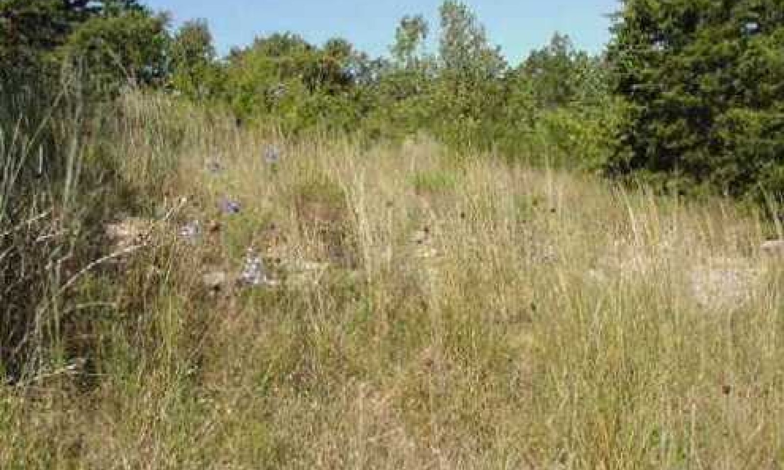
The reference plant community of this site is a prairie or very open savannah sparsely covered with single live oak, hackberry, or bumelia trees, or scattered woody mottes that provide 10 percent or less canopy. The scattered trees, tall native grasses, colorful wildflowers, and rolling topography make this an attractive site. The herbaceous plant community is dominated by little bluestem which generally produces 50 to 75 percent of the total annual production. Indiangrass, big bluestem, sideoats grama, and meadow dropseed are important components of the warm season grass population. Virginia wildrye (Elymus virginicus), Canada wildrye (Elymus canadensis), and Texas wintergrass (Nassella leucotricha) are components of the cool season grass population. Important forbs include gayfeather, Maximillian sunflower (Helianthus maximilliani), Engelmann’s daisy, cobea penstemon, black samson, blue sage (Salvia azurea), compass plant (Silphium sp.), bundleflower, and western indigo.
Grazing prescriptions that permit acceptable grazing periods and allow adequate rest periods along with prescribed fire every three to five years are important in the maintenance of the reference plant community and the prairie landscape structure. Continuous over grazing, or over rest, and the absence of fire tend to favor a transition towards a community dominated by hackberry, prickly pear (Opuntia sp.), eastern red cedar (Juniperus virginiana), cedar elm (Ulmus crassifolia), threeawn (Aristida sp.), Texas wintergrass, and annual broomweed (Amphiachyris amoena). Without corrective grazing management and burning, the transition will continue to a woodland state dominated by cedar, bumelia, elm, and hackberry.Figure 6. Annual production by plant type (representative values) or group (midpoint values)
Table 6. Annual production by plant type
Plant type Low
(lb/acre)Representative value
(lb/acre)High
(lb/acre)Grass/Grasslike 1875 2775 3750 Forb 250 375 500 Tree 100 150 200 Shrub/Vine 50 75 100 Total 2275 3375 4550 Table 7. Ground cover
Tree foliar cover 0-10% Shrub/vine/liana foliar cover 0-10% Grass/grasslike foliar cover 30-60% Forb foliar cover 10-10% Non-vascular plants 0% Biological crusts 0% Litter 10-20% Surface fragments >0.25" and <=3" 0-20% Surface fragments >3" 0-10% Bedrock 0% Water 0% Bare ground 10-20% Table 8. Soil surface cover
Tree basal cover 0-10% Shrub/vine/liana basal cover 0-10% Grass/grasslike basal cover 10-30% Forb basal cover 0-0% Non-vascular plants 0% Biological crusts 0% Litter 10-20% Surface fragments >0.25" and <=3" 0-20% Surface fragments >3" 0-10% Bedrock 0% Water 0% Bare ground 10-20% Table 9. Canopy structure (% cover)
Height Above Ground (ft) Tree Shrub/Vine Grass/
GrasslikeForb <0.5 – – – 0-5% >0.5 <= 1 – – 5-10% 0-5% >1 <= 2 – – 10-20% 0-5% >2 <= 4.5 – 0-10% 20-40% 5-10% >4.5 <= 13 – – 0-5% 0-5% >13 <= 40 0-10% – – – >40 <= 80 – – – – >80 <= 120 – – – – >120 – – – – Community 1.2
Live Oak/Red Cedar SavannahThis plant community is a transitional community between the Prairie and the Shrubland State. It develops in the absence of fire and proper grazing management, or the absence of chemical or biological brush management. It is usually the result of abandonment following yearly continuous grazing. In addition to the naturally occurring trees, eastern red cedar and bois d’arc (Maclura pomifera) increase in density and canopy coverage (10 to 25 percent canopy). In some cases, eastern red cedar may dominate the component of the community. Species whose seed is wind blown (elm) or animal dispersed (cedar, bumelia, bois d’arc) are the first to invade and dominate the site. Remnants of little bluestem, Indiangrass, and sideoats grama may still occur, but the herbaceous component of the community becomes dominated by lesser producing grasses and forbs. Silver bluestem (Bothriochloa laguroides), fall witchgrass (Digitaria cognata), threeawn, western ragweed (Ambrosia psilostachya), annual broomweed (Amphiachyris dracunculoides), and snow on the prairie (Euphorbia bicolor) commonly occur. Since the woody shrub canopy has not exceeded 40 percent, prescribed burning on a five to seven year interval in conjunction with prescribed grazing is a viable option for returning this community to a tallgrass prairie that may resemble the reference plant community.
Figure 7. Annual production by plant type (representative values) or group (midpoint values)
Table 10. Annual production by plant type
Plant type Low
(lb/acre)Representative value
(lb/acre)High
(lb/acre)Grass/Grasslike 1200 1900 2600 Forb 500 900 1200 Shrub/Vine 200 300 400 Tree 100 150 200 Total 2000 3250 4400 Pathway 1.1A
Community 1.1 to 1.2The Tallgrass Prairie Plant Community will shift to the Live Oak/Red Cedar Savannah Plant Community when there is continued growing-season stress on reference grass species. These stresses include improper grazing management that creates insufficient critical growing-season deferment, excess intensity of defoliation, repeated, long-term growing-season defoliation, long-term drought, and/or other repeated critical growing-season stress. Increaser species (midgrasses and woody species) are generally endemic species released by disturbance. Woody species canopy exceeding 10 percent and a species shift from tallgrass to midgrass composition indicate a transition. The driver for the shift is heavy grazing, no fire, no brush management, and/or abandonment.
Pathway 1.2A
Community 1.2 to 1.1The 1.2 Plant Community will return to the Tallgrass Prairie Plant Community under grazing management that provides sufficient critical growing season deferment in combination with proper grazing intensity as long as the seedbank or seed source is still present. Favorable moisture conditions will facilitate or accelerate this transition. The understory component may return to dominance by tallgrasses in the absence of fire or brush control. However, reduction of the woody component to reference conditions of 10 percent or less canopy cover will require inputs of fire or brush control.
State 2
ShrublandTwo communities exist in the Shrubland State: the 2.1 Live Oak/Red Cedar Shrubland Community and the 2.2 Live Oak/Red Cedar Woodland Community. Community 2.1 is characterized by a shift in grass composition to silver bluestem and threeawns. The overstory canopy increases to 25 to 40 percent. Community 2.2 is characterized by a shortgrasses and low forbs with greater than 40 percent overstory canopy cover.
Community 2.1
Live Oak/Red Cedar Shrubland
The Live Oak/Red Cedar Shrubland develops in the absence of fire and proper grazing management, or the absence of chemical or biological brush management. It is usually the result of abandonment following yearly continuous grazing. In addition to the naturally occurring trees, eastern red cedar and bois d’arc (Maclura pomifera) increase in density and canopy coverage (25 to 40 percent). In some cases, eastern red cedar may dominate the component of the community. Species whose seed is wind blown (elm) or animal dispersed (cedar, bumelia, bois d’arc) are the first to invade and dominate the site. Remnants of little bluestem, Indiangrass, and sideoats grama may still occur, but the herbaceous component of the community becomes dominated by lesser producing grasses and forbs. Silver bluestem, fall witchgrass, threeawn, Western ragweed, annual broomweed, and snow on the prairie commonly occur. Since the woody shrub canopy still has not exceeded 40 percent, prescribed burning on a five to seven year interval in conjunction with prescribed grazing is a viable option for returning this community to a tallgrass prairie that may resemble the reference plant community. The presence of sandstone close to the soil surface precludes most methods of mechanical control other than hand cutting.
Figure 8. Annual production by plant type (representative values) or group (midpoint values)
Table 11. Annual production by plant type
Plant type Low
(lb/acre)Representative value
(lb/acre)High
(lb/acre)Forb 950 1425 1900 Grass/Grasslike 700 1050 1400 Shrub/Vine 300 450 600 Tree 100 150 200 Total 2050 3075 4100 Table 12. Ground cover
Tree foliar cover 10-40% Shrub/vine/liana foliar cover 10-20% Grass/grasslike foliar cover 30-40% Forb foliar cover 20-30% Non-vascular plants 0% Biological crusts 0% Litter 10-20% Surface fragments >0.25" and <=3" 0-20% Surface fragments >3" 0-10% Bedrock 0% Water 0% Bare ground 20-40% Table 13. Soil surface cover
Tree basal cover 20-20% Shrub/vine/liana basal cover 10-20% Grass/grasslike basal cover 10-20% Forb basal cover 10-10% Non-vascular plants 0% Biological crusts 0% Litter 10-20% Surface fragments >0.25" and <=3" 0-20% Surface fragments >3" 0-10% Bedrock 0% Water 0% Bare ground 20-40% Table 14. Canopy structure (% cover)
Height Above Ground (ft) Tree Shrub/Vine Grass/
GrasslikeForb <0.5 – – 5-10% – >0.5 <= 1 – – 5-10% – >1 <= 2 – – 20-40% 5-15% >2 <= 4.5 – – 5-15% 5-15% >4.5 <= 13 – 10-20% – – >13 <= 40 20-40% – – – >40 <= 80 – – – – >80 <= 120 – – – – >120 – – – – Community 2.2
Live Oak/Red Cedar Woodland
This plant community is dominated by woody species including eastern red cedar, bumelia, hackberry, cedar elm, and live oak. Canopy cover exceeds 40 percent. Understory shrubs and vines include coralberry (Symphoricarpos orbiculatus), greenbriar (Smilax sp.), grape (Vitis sp.), prickly pear, and tasajillo (Opuntia leptocaulis). Herbaceous composition and production varies with woody canopy cover but Texas wintergrass, cedar sedge (Carex planostachys), silver bluestem, threeawn, annual broomweed, and snow on the prairie are common occupants of the site. Treatment options to move this community back towards the reference community are limited. If the woody canopy has exceeded 40 percent, chemical brush control must be applied. The presence of sandstone close to the soil surface precludes most methods of mechanical treatments other than handcutting or tree dozing. Commercial aerial herbicide application is usually impractical due to the limited extent of the site, while the presence of large trees hinders the effectiveness of ground applied herbicides. Prescribed burning is usually not a viable alternative due to the lack of fine fuel.
Figure 9. Annual production by plant type (representative values) or group (midpoint values)
Table 15. Annual production by plant type
Plant type Low
(lb/acre)Representative value
(lb/acre)High
(lb/acre)Tree 750 1125 1500 Forb 650 975 1300 Grass/Grasslike 400 600 800 Shrub/Vine 300 450 600 Total 2100 3150 4200 Table 16. Ground cover
Tree foliar cover 40-60% Shrub/vine/liana foliar cover 20-40% Grass/grasslike foliar cover 10-20% Forb foliar cover 20-30% Non-vascular plants 0% Biological crusts 0% Litter 10-10% Surface fragments >0.25" and <=3" 0-20% Surface fragments >3" 0-10% Bedrock 0% Water 0% Bare ground 20-40% Table 17. Soil surface cover
Tree basal cover 20-40% Shrub/vine/liana basal cover 20-30% Grass/grasslike basal cover 10-10% Forb basal cover 10-10% Non-vascular plants 0% Biological crusts 0% Litter 10-10% Surface fragments >0.25" and <=3" 0-20% Surface fragments >3" 0-10% Bedrock 0% Water 0% Bare ground 20-40% Table 18. Canopy structure (% cover)
Height Above Ground (ft) Tree Shrub/Vine Grass/
GrasslikeForb <0.5 – – 5-10% 5-10% >0.5 <= 1 – – – – >1 <= 2 – – 5-10% 10-20% >2 <= 4.5 – – 5-10% – >4.5 <= 13 – 15-25% – – >13 <= 40 40-60% – – – >40 <= 80 – – – – >80 <= 120 – – – – >120 – – – – Pathway 2.1A
Community 2.1 to 2.2
Live Oak/Red Cedar Shrubland
Live Oak/Red Cedar WoodlandThe Shrubland Community will transition to the Woodland Community with continued heavy grazing, no fire, no brush management and/or abandonment. Indicators of the transition include an increased species composition of shortgrasses and trees becoming more mature.
Transition T1A
State 1 to 2The Prairie/Savannah State will transition to the Shrubland State when continued heavy grazing pressure, no fire, no brush management, and/or field abandonment continues. The transition is evident when woody species canopy cover exceeds 25 percent and grasses shift composition to silver bluestem, threeawns, and shortgrasses.
Restoration pathway R2A
State 2 to 1Restoration of the Shrubland State to the Prairie/Savannah State requires substantial energy input. Mechanical or herbicidal brush control treatments can be used to remove woody species. A long-term prescribed fire program may sufficiently reduce brush density particularly if the woody component is dominated by species that are not re-sprouters. However, fire may not be sufficient to remove mature trees. Brush control in combination with prescribed fire, proper grazing management, and favorable growing conditions may be the most economical means of creating and maintaining the desired plant community. If remnant populations of tallgrasses, midgrasses, and desirable forbs are not present at sufficient levels, range planting will be necessary to restore a plant community similar to the reference community.
Additional community tables
Table 19. Community 1.1 plant community composition
Group Common name Symbol Scientific name Annual production () Foliar cover (%) Grass/Grasslike1 Tallgrass 1200–2400 little bluestem SCSC Schizachyrium scoparium 1200–2400 – 2 Tallgrasses 325–650 big bluestem ANGE Andropogon gerardii 325–650 – Indiangrass SONU2 Sorghastrum nutans 325–650 – 3 Midgrasses 225–450 sideoats grama BOCU Bouteloua curtipendula 225–450 – silver beardgrass BOLAT Bothriochloa laguroides ssp. torreyana 225–450 – composite dropseed SPCOC2 Sporobolus compositus var. compositus 225–450 – 4 Mid/Shortgrasses 100–200 purple threeawn ARPU9 Aristida purpurea 100–200 – Wright's threeawn ARPUW Aristida purpurea var. wrightii 100–200 – Canada wildrye ELCA4 Elymus canadensis 100–200 – Virginia wildrye ELVI3 Elymus virginicus 100–200 – Texas wintergrass NALE3 Nassella leucotricha 100–200 – Florida paspalum PAFL4 Paspalum floridanum 100–200 – slim tridens TRMU Tridens muticus 100–200 – Forb5 Forbs 250–450 purple dalea DALA4 Dalea lasiathera 250–450 – pointedleaf ticktrefoil DEGL5 Desmodium glutinosum 250–450 – Illinois bundleflower DEIL Desmanthus illinoensis 250–450 – blacksamson echinacea ECANA Echinacea angustifolia var. angustifolia 250–450 – Engelmann's daisy ENPE4 Engelmannia peristenia 250–450 – Maximilian sunflower HEMA2 Helianthus maximiliani 250–450 – coastal indigo INMI Indigofera miniata 250–450 – dotted blazing star LIPUP Liatris punctata var. punctata 250–450 – Nuttall's sensitive-briar MINU6 Mimosa nuttallii 250–450 – yellow puff NELU2 Neptunia lutea 250–450 – whitest evening primrose OEAL Oenothera albicaulis 250–450 – cobaea beardtongue PECO4 Penstemon cobaea 250–450 – Texas snoutbean RHSE4 Rhynchosia senna 250–450 – fringeleaf wild petunia RUHU Ruellia humilis 250–450 – azure blue sage SAAZ Salvia azurea 250–450 – compassplant SILA3 Silphium laciniatum 250–450 – amberique-bean STHE9 Strophostyles helvola 250–450 – 6 Forbs 25–50 Cuman ragweed AMPS Ambrosia psilostachya 25–50 – downy Indian paintbrush CAPU11 Castilleja purpurea 25–50 – California larkspur DECA Delphinium californicum 25–50 – snow on the prairie EUBI2 Euphorbia bicolor 25–50 – plains beeblossom GABR2 Gaura brachycarpa 25–50 – Texas lupine LUTE Lupinus texensis 25–50 – Drummond's skullcap SCDR2 Scutellaria drummondii 25–50 – Shrub/Vine7 Vines 50–100 roundleaf greenbrier SMRO Smilax rotundifolia 50–100 – coralberry SYOR Symphoricarpos orbiculatus 50–100 – muscadine VIRO3 Vitis rotundifolia 50–100 – Tree8 Trees 150–300 sugarberry CELA Celtis laevigata 150–300 – live oak QUVI Quercus virginiana 150–300 – gum bully SILAA4 Sideroxylon lanuginosum ssp. albicans 150–300 – cedar elm ULCR Ulmus crassifolia 150–300 – Table 20. Community 1.2 plant community composition
Group Common name Symbol Scientific name Annual production () Foliar cover (%) Table 21. Community 2.1 plant community composition
Group Common name Symbol Scientific name Annual production () Foliar cover (%) Table 22. Community 2.2 plant community composition
Group Common name Symbol Scientific name Annual production () Foliar cover (%) Interpretations
Animal community
Historical accounts of early Texas explorers indicate that the tallgrass prairie sites were used by bison, deer, antelope, prairie chicken, wolf, mountain lion, and black bear. Wild horses and wild cattle occupied these prairie sites into the middle 1800's. While most prairie sites were converted to cropland, the shallow rocky nature of this site precluded that. Habitat values and potential plant communities for this site have been influenced by past grazing management or lack of. Deer, bobcat, coyote, quail, turkey, dove, and a host of other mammals, birds, and reptiles use this site when woody cover is sufficient. Being of limited extent, the habitat values of this site are influenced by the quality of the habitat of the surrounding ecological sites. Manipulation of the plant community and habitat types by methods other than fire and grazing management are somewhat limited by the shallow rocky soil.
Hydrological functions
Because of the fractured sandstone horizon and the potential herbaceous plant community, this site may provide ground water recharge or contribute to surface runoff. Peak rainfall periods occur in May and June from frontal passage thunderstorms and in September and October from tropical systems, as well as frontal passages. Rainfall amounts may be high (three to five inches per event) and events may be intense. The site is subject to erosion where adequate herbaceous cover is not maintained and on heavy use areas such as roads and livestock trails. Extended periods (60 days) of little to no rainfall during the growing season are common and can limit herbaceous production and ground cover. The hydrology of this site may be manipulated through management to yield higher runoff volumes or greater infiltration to ground water. Management for less herbaceous cover will favor higher surface runoff while dense herbaceous cover will favor ground water recharge. Potential pollution from sediment and pesticides should always be considered when managing for higher volumes of surface runoff.
Recreational uses
Recreational uses of this site may include hunting, bird watching, photography, horseback riding, cycling, hiking, and camping.
Supporting information
Inventory data references
These site descriptions were developed as part a Provisional Ecological Site project using historic soil survey manuscripts, available site descriptions, and low intensity field traverse sampling. Future work to validate the information is needed. This will include field activities to collect low, medium, and high-intensity sampling, soil correlations, and analysis of that data. A final field review, peer review, quality control, and quality assurance review of the will be needed to produce the final document.
Other references
Diggs, G.M., B.L. Lipscomb, and R.J. O'Kennon. 1999. Illustrated Flora of North Central Texas Botanical Research Institute of Texas and Austin College, Fort Worth, TX.
Hatch, S.L, K.N. Gandhi, and L.E. Brown. 1990. Checklist of the vascular plants of Texas. Texas Agricultural Experiment Station, College Station, TX.Contributors
Mark Moseley
Tyson HartApproval
Bryan Christensen, 9/21/2023
Rangeland health reference sheet
Interpreting Indicators of Rangeland Health is a qualitative assessment protocol used to determine ecosystem condition based on benchmark characteristics described in the Reference Sheet. A suite of 17 (or more) indicators are typically considered in an assessment. The ecological site(s) representative of an assessment location must be known prior to applying the protocol and must be verified based on soils and climate. Current plant community cannot be used to identify the ecological site.
Author(s)/participant(s) Mike Stellbauer Contact for lead author Mike Stellbauer, Zone RMS, NRCS, Bryan, Texas Date 05/23/2005 Approved by Approval date Composition (Indicators 10 and 12) based on Annual Production Indicators
-
Number and extent of rills:
A few short rills may be present due to landscape position, slope, and production potential of the site. -
Presence of water flow patterns:
Some water flow patterns are normal for this site due to landscape position and slope. -
Number and height of erosional pedestals or terracettes:
A few slightly elevated pedestals or terracettes may occur due to slope, landscape position, and natural lack of cover on this site. -
Bare ground from Ecological Site Description or other studies (rock, litter, lichen, moss, plant canopy are not bare ground):
No more than 30 percent bare ground randomly distributed. -
Number of gullies and erosion associated with gullies:
None -
Extent of wind scoured, blowouts and/or depositional areas:
None -
Amount of litter movement (describe size and distance expected to travel):
Small to medium-size litter movement for short distances should be expected for this site during intense rainfall events. -
Soil surface (top few mm) resistance to erosion (stability values are averages - most sites will show a range of values):
Soil surface is resistant to erosion. Stability class range is 4 to 6. -
Soil surface structure and SOM content (include type of structure and A-horizon color and thickness):
Soil surface is 7 to 15 inches thick with colors of very dark brown to very dark grayish brown with moderate fine to very fine subangular blocky structure. SOM is 1 to 3 percent. -
Effect of community phase composition (relative proportion of different functional groups) and spatial distribution on infiltration and runoff:
The predominance of tallgrasses, midgrasses, perennial forbs, and adequate litter provide for maximum infiltration and reduced runoff under normal rainfall events. -
Presence and thickness of compaction layer (usually none; describe soil profile features which may be mistaken for compaction on this site):
None. -
Functional/Structural Groups (list in order of descending dominance by above-ground annual-production or live foliar cover using symbols: >>, >, = to indicate much greater than, greater than, and equal to):
Dominant:
Warm-season tallgrasses >>Sub-dominant:
Warm-season midgrasses > Forbs >Other:
Trees > ShrubsAdditional:
-
Amount of plant mortality and decadence (include which functional groups are expected to show mortality or decadence):
There should be little mortality or decadence in any functional groups. -
Average percent litter cover (%) and depth ( in):
-
Expected annual annual-production (this is TOTAL above-ground annual-production, not just forage annual-production):
2,275 pounds per acre for below average moisture years to 4,550 pounds per acre for above average moisture years. -
Potential invasive (including noxious) species (native and non-native). List species which BOTH characterize degraded states and have the potential to become a dominant or co-dominant species on the ecological site if their future establishment and growth is not actively controlled by management interventions. Species that become dominant for only one to several years (e.g., short-term response to drought or wildfire) are not invasive plants. Note that unlike other indicators, we are describing what is NOT expected in the reference state for the ecological site:
Potential invasive species include hackberry, elm, yellow bluestem, common Bermudagrass, eastern red cedar, pricklypear and osage orange. -
Perennial plant reproductive capability:
Perennial plants are capable of adequate reproduction, except during periods of prolonged drought conditions, heavy natural herbivory, and intense wildfires.
Print Options
Sections
Font
AAAAOther
PrintThe Ecosystem Dynamics Interpretive Tool is an information system framework developed by the USDA-ARS Jornada Experimental Range, USDA Natural Resources Conservation Service, and New Mexico State University.
Accessibility statement


