
Natural Resources
Conservation Service
Ecological site R084AY095OK
Subirrigated Bottomland
Last updated: 9/21/2023
Accessed: 08/29/2026
-
Search


Major Land Resource Area or ecological site by name and/or ID.
PreviousSectionsNextGeneral information
Provisional. A provisional ecological site description has undergone quality control and quality assurance review. It contains a working state and transition model and enough information to identify the ecological site.
Click to explore map
Figure 1. Mapped extent
Areas shown in blue indicate the maximum mapped extent of this ecological site. Other ecological sites likely occur within the highlighted areas. It is also possible for this ecological site to occur outside of highlighted areas if detailed soil survey has not been completed or recently updated.
MLRA notes
Major Land Resource Area (MLRA): 084A–North Cross Timbers
MLRA 84A “North Cross Timbers” is characterized by rolling to hilly uplands dominated by Oak trees with bedrock outcrops and narrow stream valleys. It is believed that the Cross Timbers ecosystem is one the least disturbed forest types remaining in the Eastern US. Major rivers in this MLRA include the Verdigris River in Kansas and the Arkansas, Cimarron, and South Canadian Rivers in Oklahoma. The western parts of this MLRA are underlain by sandstone and shale of Permian age, while the eastern parts are underlain by sandstone and shale of Pennsylvanian age. There are also occurrences of Pleistocene age stream terraces along the rivers.
Classification relationships
This ecological site is correlated to soil components at the Major Land Resource Area (MLRA) level which is further described in USDA Ag Handbook 296.
Level IV EPA Ecoregions 27o “Crosstimbers Transition”, 29a “Northern Crosstimbers”, and 29h “Northwestern Crosstimbers”.Ecological site concept
The Subirrigated Bottomland ecological site consists of coarse-loamy floodplain soils that are occasionally to frequently flooded. These soils contain a high water table, typically within 40 inches of the surface for most of the year. The vegetation of the reference state is a bottomland savannah with a mixture of trees, shrubs, and grasses. In the reference state, the woody species are limited by periodic fires or alternative brush management. When fire is removed from the ecosystem and no alternative brush control is implemented, woody species may take over the site. This process will transition the site to an alternative ecological state. There are also many of these sites that have been farmed for a short period and planted back to introduced perennial vegetation.
There is a high amount of variability within this ecological site due to the effects of subsurface water on the vegetative dynamics. Certain plants will be more prolific during wetter periods while others will increase in abundance as the site periodically dries out.
This ecological site is of small extent throughout MLRA 84A. It occurs primarily on small floodplains and backwater areas off of small creeks and tributaries. Most commonly the soil associated with this ecological site is mapped as a minor component of a soil Mapunit. Therefore, these sites are often small inclusions within a management unit (pasture/field). While these sites are small in scale, they may still warrant special management considerations due to the unique vegetation and potential use by domestic animals and wildlife species.Associated sites
R084AY050OK Loamy Bottomland
Similar landscapes within MLRA 84A. Sandy Loam soils. Does not have high water table.
Similar sites
R084AY050OK Loamy Bottomland
Similar landscapes within MLRA 84A. Sandy Loam soils. Does not have high water table.
Table 1. Dominant plant species
Tree (1) Salix Nigra
(2) Carya illinoinensisShrub (1) Cephalanthus occidentalis
(2) Amorpha fruticosaHerbaceous (1) Panicum virgatum
(2) Spartina pectinataPhysiographic features
Subirrigated sites are on nearly level, broad flood plains of the Northern Cross Timbers. Slopes range from 0 to 2 percent.

Figure 2. 084AY095
Table 2. Representative physiographic features
Landforms (1) Alluvial plain > Flood plain
Runoff class Medium to high Flooding duration Brief (2 to 7 days) Flooding frequency Occasional to frequent Elevation 800 – 1200 ft Slope 0 – 2 % Water table depth 6 – 42 in Aspect Aspect is not a significant factor Climatic features
Climate is moist sub-humid with annual precipitation ranging from 30 to 45 inches. There will be noticeable differences in precipitation and temperatures from north to south and east to west. The most intense rainfall occurs in late spring and early summer while warm season vegetation is growing rapidly. Frost free and freeze free days increase from north to south. Precipitation increases from west to east.
Table 3 Representative climatic features
Frost-free period (characteristic range) 170-190 days Freeze-free period (characteristic range) 200-210 days Precipitation total (characteristic range) 40-40 in Frost-free period (actual range) 170-190 days Freeze-free period (actual range) 200-210 days Precipitation total (actual range) 40-40 in Frost-free period (average) 180 days Freeze-free period (average) 210 days Precipitation total (average) 40 in Characteristic rangeActual rangeBarLineFigure 3. Monthly precipitation range
Characteristic rangeActual rangeBarLineFigure 4. Monthly minimum temperature range
Characteristic rangeActual rangeBarLineFigure 5. Monthly maximum temperature range
BarLineFigure 6. Monthly average minimum and maximum temperature
Figure 7. Annual precipitation pattern
Figure 8 Annual average temperature pattern
Climate stations used
-
(1) SEMINOLE [USC00348042], Seminole, OK
-
(2) CHANDLER [USC00341684], Chandler, OK
-
(3) BLANCHARD 2 SSW [USC00340830], Blanchard, OK
-
(4) BRISTOW [USC00341144], Bristow, OK
">Influencing water features
The usual high water table enables growth of lush vegetation and is typically not affected by frequent dry periods during the growing season like other sites in this area. Wetl soil characteristics can be easily distinguished on this site and some obligate wetland plants can be found, but typically the site is dominated by facultative plants. These sites act as a filter for overland flow and can easily become saturated during heavy periods of rainfall especially during the spring. Evaporation is minimized by tall and dense plant growth that shades the soil surface. The site contributes to the stability of the overall riparian system that occurs along major streams and rivers. While the subirrigated soils normally are subject to endosaturation (water moving vertically upward or horizontally into the profiles), flood events may produce periods episaturation (surface water becoming perched above a layer of low permeability) and lead to a temporary increase in hydrophitic vegetation.These sites are characterized by their high water tables with water at or near the surface during winter and spring.
Wetland description
Site specific analysis should be conducted by trained experts in determining the presence of wetlands.

Figure 9.
Soil features
Representative soils for this site include:
Tribbey fine sandy loam
The Tribbey series consists of very deep, somewhat poorly drained, moderately rapid permeable soils that formed in loamy and sandy alluvium of Recent age. These nearly level to very gently sloping soils are on narrow flood plains in the Cross Timbers (MLRA-84A).
Note: There may be inclusions of other soils that because of mapping scale are not divided out. These may include some areas of the Pulaski series (Loamy Bottomland 084AY050OK) and the Port or Ashport series (Loamy Bottomland 080AY050OK).
Soils are mapped for each county within the MLRA. Mapunits are representations of the major soil series component(s) and named accordingly. Each Mapunit is spatially represented on a digital soils map as polygons of different shapes and sizes. Within these Mapunits, there are often minor soil series components included. These minor components are soils that occur within a Mapunit polygon but are of small extent (15% or less of the Mapunit area). However, it is difficult to separate these minor soils spatially due to the scale of soil mapping.
Ecological sites are correlated at the component level of the soil survey. Therefore, a single Mapunit may contain multiple Ecological Sites just as it may contain multiple soil components. This is important to understand when investigating soils and Ecological Sites. A soil survey Mapunit may be correlated to a single Ecological Site based on the major component; however, there may be inclusional areas of additional Ecological Sites which are correlated to the minor components of that particular soil Mapunit.Table 4. Representative soil features
Parent material (1) Alluvium – sandstone and shale
Surface texture (1) Fine sandy loam
(2) Loam
(3) Loamy fine sand
Drainage class Somewhat poorly drained Permeability class Moderately rapid Soil depth 60 – 0 in Surface fragment cover <=3" 0 – 1 % Surface fragment cover >3" 0 – 1 % Available water capacity
(0-40in)4.8 – 12 in Calcium carbonate equivalent
(0-40in)0 – 1 % Electrical conductivity
(0-40in)0 – 1 mmhos/cm Sodium adsorption ratio
(0-40in)0 – 1 Soil reaction (1:1 water)
(0-40in)5.5 – 7.5 Subsurface fragment volume <=3"
(Depth not specified)0 – 1 % Subsurface fragment volume >3"
(0-1in)Not specified Table 5. Representative soil features (actual values)
Drainage class Not specified Permeability class Not specified Soil depth 0 in Surface fragment cover <=3" 0 % Surface fragment cover >3" 0 % Available water capacity
(0-40in)0 in Calcium carbonate equivalent
(0-40in)0 % Electrical conductivity
(0-40in)0 mmhos/cm Sodium adsorption ratio
(0-40in)0 Soil reaction (1:1 water)
(0-40in)5.5 – 8.4 Subsurface fragment volume <=3"
(Depth not specified)0 % Subsurface fragment volume >3"
(0-1in)0 % Ecological dynamics
Like many sites in the Great Plains this ecological site is maintained by the interaction between fire and grazing. These fires restrict growth of woody species and limited woody canopy.
Unlike some of the similar sites in the adjoining MLRA’s this site is typically smaller in nature and may not occur directly adjacent to water bodies that it is formed by. The size of this site when compared to the surrounding landscape is typically small in nature and as such can have a tendency to become overgrazed due to the abundance of palatable forage plants for domestic livestock. Cattle naturally are attracted to this site because of the palatable forage but also because of the amount of time that may be spent loafing in these sites because of available water in areas along with the shade it can provide.
Fire and grazing stimulates regrowth of the dominant plants as well as suppress shrub and tree species from becoming the prevailing plants on the site where they can become established. The dominant deep rooted tallgrasses such as switchgrass and gamagrass can thrive with periodic fire. Cordgrass also occurs in the wettest areas and can easily regrow after fire aided by its dense root system. Woody species such as button bush, cottonwood, pecan, and persimmon can be controlled with fires and allow a resetting of the plant community dynamics. The use of fire on these sites may be more mosaic in look as compared to the associated sites due to surface water.
Typically these sites would have a water table within the upper 40 inches during at least 9 months out of the year and in many cases year around. The subsurface water would have provided the plants that frequent the site any needed water during the growing season for all but the warmest and driest months of the year. Natural hydrology of these sites has been lost in many cases due to a variety of human induced causes, including farming, dredging and filling in some cases. Many of the upland sites associated with this ecological site have been altered by the removal of the historic tree population which has been replaced by an even stand of young trees which shades out many of the herbaceous plants that would have slowed overland flow of water and increased infiltration.
Plants that are associated with this site are able to grow in wet and sometimes saturated soils and typically are highly productive due to available plant water during most of the year. Plant diversity is typically extremely high and many plants are found on this site that are unlikely to be found on other ecological sites within this major land resource area (MLRA). The plant community is a mix of grasses, forbs, legumes, shrubs and trees and provide excellent wildlife habitat where they occur. There are many different functional groups of plants present on the site also which is likely due to the variability of available water due to fluctuations in the water table throughout the season. The soils can be highly variable in their range of characteristics and as such the plant communities can fluctuate widely within a mapped soil.
A State and Transition Model for the Subirrigated Bottomland Ecological Site (084AY095) is depicted below. Thorough descriptions of each state, transition, plant community, and pathway follow the model. Experts base this model on available experimental research, field observations, professional consensus, and interpretations. It is likely to change as knowledge increases.
Plant communities will differ across the MLRA because of the naturally occurring variability in weather, soils, and aspect. The Reference Plant Community is not necessarily the management goal; other vegetative states may be desired plant communities as long as the Range Health assessments are in the moderate and above category. The biological processes on this site are complex. Therefore, representative values are presented in a land management context. The species lists are representative and are not botanical descriptions of all species occurring, or potentially occurring, on this site. They are not intended to cover every situation or the full range of conditions, species, and responses for the site.
Both percent species composition by weight and percent canopy cover are described as are other metrics. Most observers find it easier to visualize or estimate percent canopy for woody species (trees and shrubs). Canopy cover can drive the transitions between communities and states because of the influence of shade and interception of rainfall. Species composition by dry weight is used for describing the herbaceous community and the community as a whole. Woody species are included in species composition for the site. Calculating similarity index requires use of species composition by dry weight.
The following diagram suggests some pathways that the vegetation on this site might take. There may be other states not shown on the diagram. This information is intended to show what might happen in a given set of circumstances. It does not mean that this would happen the same way in every instance. Local professional guidance should always be sought before pursuing a treatment scenario.State and transition model
More interactive model formats are also available. View Interactive Models
Click on state and transition labels to scroll to the respective textEcosystem states
T1A - No fire, No brush management T1B - Tillage, Seeding R2A - Selective thinning, Prescribed burning, Prescribed grazing State 1 submodel, plant communities
State 2 submodel, plant communities
State 3 submodel, plant communities
State 1
SavannahThis is the reference state for this ecological site. It represents the historical variability of plant communities for the site.
Characteristics and indicators. Tallgrasses dominate the plant communities within this state. Other vegetative components include numerous forbs, midgrasses, and bottomland hardwood tree species. Woody canoy averages 30-50 percent.This canopy may vary substantially as areas adjacent to creeks and streams are more protected from fire. This often leads to a feathered effect of low canopy further from the the water course and higher canopy adjacent to it.
Resilience management. The plant communities within this state evolved under disturbance from periodic fire and grazing. Woody species vigor and reproduction is restricted by periodic fires. As grazing pressure increases, more palatable tallgrass species and forbs will decline in vigor and may be replaced by less desirable midgrass species.
Dominant plant species
-
pecan (Carya illinoinensis), tree
-
willow (Salix), shrub
-
common buttonbush (Cephalanthus occidentalis), shrub
-
switchgrass (Panicum virgatum), grass
Community 1.1
Tallgrass Savannah (R)
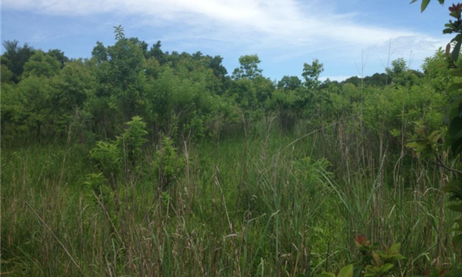
Figure 10. Tribbey Soils. Reference community. Lincoln County, OK
This plant community is the reference plant community for the site. It contains a mixture of tallgrasses, perennial forbs, shrubs, and trees. The representative grasses are Switchgrass (Panicum virgatum), Eastern Gamagrass (Tripsacum dactyloides), and Prairie Cordgrass (Spartina pectinata). Forbs include Bonesets (Eupatorium spp.), Verbenas (Verbena spp.), Western Ironweed (Vernonia baldwinii), Goldenrods (Solidago spp.), and many others. Shrub species present may include Buttonbush (Cephalanthus occidentalis), Indigo bush (Amorpha fruticosa), Grape (Vitis spp.), and Poison Ivy (Toxicodendron radicans). The trees occurring in this community are primarily, Black Willow (Salix nigra), Pecan (Carya illinoinensis), Eastern Cottonwood (Populus deltoids), and occasionally Common Persimmon (Diospyros virginiana).
This plant community provides good habitat for many species of wildlife and domestic grazing animals. There is abundant herbaceous litter between plants and very little bare ground. Water from rainfall events may percolate rapidly, depending upon the depth of the water table. There is very little soil loss within this plant community and soil biota should be able to flourish.
The following species cover, structure, and production tables have been developed using collected data and professional knowledge. As with anything in nature, there is a large amount of variability from year to year even within a relatively stable plant community. This is true for both vegetative production as well as foliar cover produced by a plant species. The following figures are to be viewed only as a representation of the estimated potential for a given species. As more data is collected and measurement methods are refined some values may be updated through future revisions.Figure 11. Annual production by plant type (representative values) or group (midpoint values)
Table 6. Annual production by plant type
Plant type Low
(lb/acre)Representative value
(lb/acre)High
(lb/acre)Grass/Grasslike 4550 5525 6500 Forb 1050 1275 1500 Shrub/Vine 700 850 1000 Tree 700 850 1000 Total 7000 8500 10000 Table 7. Ground cover
Tree foliar cover 10-20% Shrub/vine/liana foliar cover 10-20% Grass/grasslike foliar cover 60-80% Forb foliar cover 10-20% Non-vascular plants 0-10% Biological crusts 0% Litter 50-80% Surface fragments >0.25" and <=3" 0% Surface fragments >3" 0% Bedrock 0% Water 0% Bare ground 0-10% Table 8. Soil surface cover
Tree basal cover 0% Shrub/vine/liana basal cover 0% Grass/grasslike basal cover 0% Forb basal cover 0% Non-vascular plants 0% Biological crusts 0% Litter 50% Surface fragments >0.25" and <=3" 0% Surface fragments >3" 0% Bedrock 0% Water 0% Bare ground 0-10% Table 9. Canopy structure (% cover)
Height Above Ground (ft) Tree Shrub/Vine Grass/
GrasslikeForb <0.5 0-1% 0-1% 70-90% 10-30% >0.5 <= 1 0-1% 0-10% 70-90% 5-25% >1 <= 2 0-1% 0-15% 70-90% 5-25% >2 <= 4.5 0-1% 0-15% 70-90% 0-20% >4.5 <= 13 0-5% 0-20% 60-80% 0-5% >13 <= 40 10-30% – – – >40 <= 80 0-5% – – – >80 <= 120 – – – – >120 – – – – Figure 12. Plant community growth curve (percent production by month). OK0020 , Native Grass with Savannah Overstory.
Jan Feb Mar Apr May Jun Jul Aug Sep Oct Nov Dec J F M A M J J A S O N D 3 4 7 25 30 15 4 2 1 3 4 2 Community 1.2
Midgrass/Tallgrass Savannah
Figure 13. Tribbey soils. Community 1.2 under heavy grazing pressure. Remnant switchgrass.
This plant community has developed as the result of long term abusive grazing and the exclusion of fire and/or other brush management. This abusive grazing has involved stocking rates that exceed the carrying capacity for the reference community without adequate rest provided for recovery of the palatable grasses. Therefore, the dominant tallgrasses from the reference community (1.1) have declined and have been replaced by less palatable species. These less palatable species including Bulrush (Schoenoplectus spp.), Broomsedge Bluestem (Andropogon virginicus), and Paspalums (Paspalums spp.), have received less pressure from grazing animals and have been able to thrive. The more palatable legumes and forbs have also decreased and allowing for the increase of Ragweeds (Ambrosia spp.) and Sumpweed (Iva annua). Woody species such as Pecan and Common Persimmon have increased in the absence of fire. This plant community will most often still contain the fine fuel loads required to implement prescribed burning, however, proper planning and evaluation will be necessary to implement this practice. On some sites large, rank Switchgrass plants have been avoided by grazers and will persist in this plant community.
Pathway 1.1A
Community 1.1 to 1.2
Tallgrass Savannah (R)
Midgrass/Tallgrass SavannahIf the reference plant community (1.1) is subjected to abusive grazing for long periods of time, it may begin to shift to a Midgrass/Tallgrass Savannah plant community (1.2). With heavy grazing pressure on preferred tallgrass species, they will decrease in vigor and eventually be replaced by less palatable midgrasses. This shift can be avoided by following proper stocking rates and allowing periodic rests between grazing events. This shift may also be the result of a long term drought resulting in a lowered water table, as the tallgrass species tend to be less drought tolerant than some midgrasses. While the soils of this site are not considered excessively droughty and typically will maintain an elevated water table, long dry periods can begin to have an impact on the plant community. These impacts are compounded with improper grazing management (inadequate rest). Without the impacts of fire, this plant community will also be subjected to an increase in tree and shrub cover. The readily available subsurface water coupled with the fertile bottomland soils creates a suitable environment for woody species encroachment.
Pathway 1.2A
Community 1.2 to 1.1
Midgrass/Tallgrass Savannah
Tallgrass Savannah (R)With the implementation of a prescribed grazing system that involves light stocking rates and periodic growing season rest (deferment), this plant community may shift back to the reference plant community (1.1). Additionally, prescribed fire or another form of brush management will be required to control the increasing woody canopy of Pecan and Persimmon saplings.
State 2
WoodlandThis ecological state is the result of long term exclusion of fire from the ecosystem.
Characteristics and indicators. Woody species that were historically controlled by periodic fire have been allowed to reproduce and have encroached in the savannah ecosystem of the reference state (1).
Resilience management. The ecological function of the site has been altered and is now dominated by woody species. While sites in this state may be grazed by cattle, the production of palatable herbaceous species is diminished. Thus, the production value of grazing is greatly reduced. Some species of wildlife will find use of the site in this state; however, other species will not persist as the site becomes dominated by woody plants.
Dominant plant species
-
willow (Salix), shrub
-
tamarisk (Tamarix), shrub
-
common buttonbush (Cephalanthus occidentalis), shrub
-
bulrush (Schoenoplectus), other herbaceous
Community 2.1
Woody Invasion
Figure 14. Tribbey soils. Woody invasion

Figure 15. Tribbey soils. Eastern Redcedar and Salt Cedar invasion
This plant community is dominated by woody species including Pecan, Persimmon, Black Willow, and Green Ash. Invasives such as Eastern Redcedar and Salt Cedar are common and may take over some sites. The woody canopy may average around 50 – 60%. Some herbaceous species still occupy canopy interspaces. The herbaceous community may include remnants of Switchgrass, Purpletop, Dropseeds, Broomsedge Bluestem, and a variety of Sedge species depending on current and prior grazing management. Shrub species including Poison Ivy, Greenbriar, and Buckbrush are also common.
Community 2.2
Closed Canopy
Figure 16. Tribbey soils, closed canopy beyond road right-of-way

Figure 17. 2.2 to 2.1 community shifting. Fire has thinned understory.
This plant community is the result of long term fire exclusion from the ecosystem. In the absence of fire, woody species have encroached and now completely dominate the site. The fertile, coarse bottomland soils and close proximity to groundwater are favorable for woody plant growth. Major woody invaders include Common Persimmon, Pecan, Green Ash (Fraxinus pennsylvanica), and Eastern Redcedar (Juniperus virginiana). American Elm (Ulmus Americana) and Hackberry (Celtis laevigata) may also invade this site. Some understory woody species include Saw Greenbriar (Smilax bona-nox), Eastern Poison Ivy (Toxicodendron radicans), and Virginia Creeper (Parthenocissus quinquefolia). Some of these woody species occur in small amounts within the reference state (1), however, most have been limited by periodic fires. Once the species are fully mature they are very difficult to control with fire alone (except for wildfires). The closed canopy created by these woody species creates a mesophytic microclimate in the understory that favors woody species and a few shade tolerant herbaceous species. This plant community may provide some benefits to wildlife species that use it for browse and cover, but the value of the site for cattle grazing has severely deteriorated. There is potential for use of this plant community by goats due to the amount of understory woody species.
Pathway 2.1A
Community 2.1 to 2.2
Woody Invasion
Closed CanopyWithout periodic fire, this plant community will be susceptible to further woody encroachment and may shift to a closed canopy woodland plant community.
Pathway 2.2A
Community 2.2 to 2.1
Closed Canopy
Woody InvasionThrough some selective thinning of woody species and re-introduction of fire through prescribed burning, the closed canopy plant community may be shifted to a more open community (2.1).
State 3
ConvertedThis ecological state is the result of reseeding herbaceous plant species or abandonment following a period of cultivation. The plant communities within this state are highly variable in both species composition and production. The species composition, ecological function, and soil health may never be restored to reference conditions. Therefore, careful consideration should be taken when evaluating a bottomland site that may have been broken out for cultivation in the past.
Dominant plant species
-
Bermudagrass (Cynodon dactylon), grass
Community 3.1
Cropland/Tame Pasture
Figure 18. Tribbey Soils planted to Bermudagrass and Fescue

Figure 19. Tribbey Soils "Go Back" with invading Johnsongrass
Some areas of this ecological site were broken out for farming purposes in the past. However, due to flooding and high water tables, most areas are no longer in crop production. These areas were either abandoned and allowed to “go back” to some kind of vegetative cover or planted to an introduced pasture species.
The “go back” plant community is the result of abandonment or range seeding after cultivation. The pioneer species of a “go back” plant community might include Purpletop (Tridens flavus), Broomsedge Bluestem (Andropogon virginicus), Giant Ragweed (Ambrosia trifida), and often times Johnsongrass (Sorghum halepense). There is often a large amount of variability within both species composition and production within this community. Some sites may be seeded to a diverse mixture of native grasses, forbs, and legumes, while other sites were seeded with very few species or simply abandoned. It is important to remember that without periodic fire or other brush management, the site may be invaded by woody species, regardless of the establishment methods of herbaceous plants.
When this site is taken out of crop production, it is often planted to an introduced perennial grass. The most common species are Bermudagrass (Cynodon dactylon) and Tall Fescue (Schedonorus arundinaceus). Many of these sites are used for grazing, cut for hay, or both. The productivity of these perennial grasses is greatly dependent upon nutrient inputs (fertilizer). Nutrient management is key to the establishment and management of these introduced species. Additionally, the addition of nutrients may help to expedite the buildup of soil microorganisms and potentially soil organic matter. For more information about suitable pasture species, planting specifications, and yield data, refer to ag extension publications, web soil survey, and forage suitability group descriptions (if available).
Transition T1A
State 1 to 2In the absence of fire, many woody species are allowed to encroach across the landscape. Once these woodies are abundant enough, they begin to drive the ecological functions of the site.
Constraints to recovery.Shading negatively affects the herbaceous plants and hydrologic changes may lower the water table, limiting available water for these species. As the woody species begin to dominate the site, it will transition to a woodland ecological state (2).
Key drivers
-
Fire
-
Fire frequency
Key ecosystem services affected
-
Nutrient cycling
-
Primary production
-
Food and fiber: livestock forage
-
Wildlife forage
-
Wildlife habitat
Transition T1B
State 1 to 3Many of these sites have been plowed for farming purposes over the last century, although typically for short durations. Once the site is cultivated, it transitions to an alternative state (3).
Constraints to recovery.The soils structure, organic matter, and biota have been altered and will no longer function the same as the soils in the reference state. A majority of the sites that were once cultivated have been abandoned or reseeded to non-native perennial grasses.
Key drivers
-
Mechanical soil disturbance
-
Seeding
Key ecosystem services affected
-
Erosion control
-
Nutrient cycling
-
Wildlife habitat
-
Plant biodiversity
Restoration pathway R2A
State 2 to 1Through an integrated program of Brush Management (selective thinning), Grazing Management (deferment), and Prescribed Fire, the Woodland State may be restored to the Reference Savannah State (1). Selective thinning will be required to remove undesirable woody species while leaving the large bottomland trees that occur in the Reference State. Prescribed grazing will be required in order to allow the tallgrasses, forbs, and legumes recover and re-establish once the canopy is thinned. This will also be required in order to establish proper fuel loads in order to successfully implement a prescribed fire program. Prescribed fire will be necessary in order to clean up remaining understory species and can be used as a management tool to prevent future woody encroachment.
Conservation practices
Brush Management Prescribed Burning Prescribed Grazing Additional community tables
Table 10. Community 1.1 plant community composition
Group Common name Symbol Scientific name Annual production () Foliar cover (%) Grass/Grasslike1 Tallgrasses 3000–4300 big bluestem ANGE Andropogon gerardii 550–900 0 switchgrass PAVI2 Panicum virgatum 550–900 0 Indiangrass SONU2 Sorghastrum nutans 400–650 0 eastern gamagrass TRDA3 Tripsacum dactyloides 400–650 0 prairie cordgrass SPPE Spartina pectinata 250–450 0 Florida paspalum PAFL4 Paspalum floridanum 250–450 0 purpletop tridens TRFL2 Tridens flavus 100–225 0 Grass, native 2GN Grass, native 100–225 0 2 Cool Season Grasses 400–700 deertongue DICL Dichanthelium clandestinum 40–140 0 Heller's rosette grass DIOL Dichanthelium oligosanthes 40–140 0 Canada wildrye ELCA4 Elymus canadensis 80–140 0 Virginia wildrye ELVI3 Elymus virginicus 0–100 0 Indian woodoats CHLA5 Chasmanthium latifolium 60–100 0 Grass, native 2GN Grass, native 40–70 0 3 Other Perennial Grasses 600–950 little bluestem SCSC Schizachyrium scoparium 150–250 0 bushy bluestem ANGL2 Andropogon glomeratus 70–120 0 beaked panicgrass PAAN Panicum anceps 70–120 0 longspike tridens TRST2 Tridens strictus 60–100 0 Grass, native 2GN Grass, native 60–100 0 thin paspalum PASE5 Paspalum setaceum 30–60 0 broomsedge bluestem ANVI2 Andropogon virginicus 25–50 0 fall witchgrass DICO6 Digitaria cognata 25–50 0 marsh bristlegrass SEPA10 Setaria parviflora 25–50 0 dropseed SPORO Sporobolus 25–50 0 foxtail barley HOJU Hordeum jubatum 0–30 0 nimblewill MUSC Muhlenbergia schreberi 0–30 0 4 Grasslike 400–700 sedge CAREX Carex 150–300 0 flatsedge CYPER Cyperus 0–150 0 bulrush SCHOE6 Schoenoplectus 0–100 0 bulrush SCIRP Scirpus 0–100 0 rush JUNCU Juncus 40–70 0 Forb5 Forbs 1050–1500 Forb, perennial 2FP Forb, perennial 50–125 0 sunflower HELIA3 Helianthus 50–125 0 common boneset EUPE3 Eupatorium perfoliatum 25–100 0 lateflowering thoroughwort EUSE2 Eupatorium serotinum 25–100 0 goldenrod SOLID Solidago 30–90 0 vervain VERBE Verbena 25–75 0 ticktrefoil DESMO Desmodium 15–60 0 Forb, annual 2FA Forb, annual 0–50 0 tickseed COREO2 Coreopsis 0–40 0 Carolina elephantsfoot ELCA3 Elephantopus carolinianus 0–35 0 false boneset BREU Brickellia eupatorioides 0–35 0 harvestlice AGPA6 Agrimonia parviflora 0–35 0 Cuman ragweed AMPS Ambrosia psilostachya 20–35 0 Indianhemp APCA Apocynum cannabinum 0–35 0 white sagebrush ARLU Artemisia ludoviciana 20–35 0 milkweed ASCLE Asclepias 20–35 0 aster SYMPH4 Symphyotrichum 20–35 0 stinging nettle URDI Urtica dioica 0–35 0 Baldwin's ironweed VEBA Vernonia baldwinii 0–35 0 annual marsh elder IVAN2 Iva annua 0–35 0 azure blue sage SAAZ Salvia azurea 20–35 0 Texas star SACA3 Sabatia campestris 0–35 0 prairie gentian EUSTO Eustoma 0–35 0 turkey tangle fogfruit PHNO2 Phyla nodiflora 0–35 0 groundcherry PHYSA Physalis 0–35 0 knotweed POLYG4 Polygonum 20–35 0 crownbeard VERBE2 Verbesina 0–35 0 scurfpea PSORA2 Psoralidium 0–30 0 blackeyed Susan RUHI2 Rudbeckia hirta 0–30 0 American licorice GLLE3 Glycyrrhiza lepidota 0–30 0 Nuttall's sensitive-briar MINU6 Mimosa nuttallii 0–30 0 prairie acacia ACAN Acacia angustissima 0–30 0 wild indigo BAPTI Baptisia 0–30 0 prairie fleabane ERST3 Erigeron strigosus 0–30 0 Queen Anne's lace DACA6 Daucus carota 0–30 0 prairie clover DALEA Dalea 0–30 0 Illinois bundleflower DEIL Desmanthus illinoensis 10–30 0 copperleaf ACALY Acalypha 0–25 0 milkvetch ASTRA Astragalus 0–15 0 Shrub/Vine6 Shrub/Vine 700–1000 common buttonbush CEOC2 Cephalanthus occidentalis 300–500 0 false indigo bush AMFR Amorpha fruticosa 100–200 0 Carolina coralbead COCA Cocculus carolinus 0–50 0 Oklahoma blackberry RUOK Rubus oklahomus 0–50 0 saw greenbrier SMBO2 Smilax bona-nox 20–50 0 coralberry SYOR Symphoricarpos orbiculatus 20–50 0 eastern poison ivy TORA2 Toxicodendron radicans 20–50 0 grape VITIS Vitis 20–50 0 Shrub, other 2S Shrub, other 0–20 – Tree7 Trees 700–1000 pecan CAIL2 Carya illinoinensis 200–300 10–30 black willow SANI Salix nigra 150–250 0 American sycamore PLOC Platanus occidentalis 100–200 0 eastern cottonwood PODE3 Populus deltoides 100–200 0 common persimmon DIVI5 Diospyros virginiana 0–20 0 green ash FRPE Fraxinus pennsylvanica 0–20 0 Tree, deciduous, broadleaf 2TDB Tree, deciduous, broadleaf 0–20 – sugarberry CELA Celtis laevigata 0–10 0 common hackberry CEOC Celtis occidentalis 0–10 0 American elm ULAM Ulmus americana 0–10 0 Table 11. Community 1.2 plant community composition
Group Common name Symbol Scientific name Annual production () Foliar cover (%) Table 12. Community 2.1 plant community composition
Group Common name Symbol Scientific name Annual production () Foliar cover (%) Table 13. Community 2.2 plant community composition
Group Common name Symbol Scientific name Annual production () Foliar cover (%) Table 14. Community 3.1 plant community composition
Group Common name Symbol Scientific name Annual production () Foliar cover (%) Interpretations
Animal community
This site is suited for the production of domestic livestock and provides habitat for native wildlife and certain species of exotic wildlife. Cow-calf operations are the primary livestock enterprise although stocker cattle are also grazed. Sustainable stocking rates have declined drastically over the past 100 years because of deterioration of the reference state. Initial starting stocking rates should be determined with the landowner or decision maker based on the merits of the existing plants for the desired animals.
Many species will utilize the Subirrigated Bottomland site for at least a portion of their habitat needs but rely on a more extensive landscape to meet all their needs. Some animals may only utilize one plant community of the Subirrigated Bottomland site to fulfill their habitat needs.
Smaller mammals include many kinds of rodents, jackrabbit, cottontail rabbit, raccoon, skunks, opossum, and armadillo. Mammalian predators include coyote, fox, and bobcat. Many species of snakes and lizards are native to the site.
Many species of birds are found on this site including game birds, songbirds, and birds of prey. Major game birds that are economically important are Rio Grande turkey, bobwhite quail, and mourning dove. Turkey prefers plant communities with substantial amounts of shrubs and trees interspersed with grassland. Quail prefer plant communities with a combination of low shrubs, bunch grass, bare ground, and low successional forbs. The different species of songbirds vary in their habitat preferences. In general, habitat that provides a diversity of grasses, forbs, shrubs, vines and trees, and a complex of grassland, savannah, shrubland, and woodland will support a variety and abundance of songbirds. Birds of prey are important to keep the numbers of rodents, rabbits, and snakes in balance. The different plant communities of the site will sustain different species of raptors.Hydrological functions
State 1
In the Savannah state, the mixture of grasses and forbs, along with the relatively flat landscape, allow for rapid infiltrating of rainfall and drainage from overland flow. However, due to the landscape position, somewhat poorly drained soils, and proximity to water courses, some of these sites are subjected to periodic flood events. While these areas do not pond water for extended periods of time, the surface water coupled with the high water table can promote the growth of hydrophitic vegetation.
State 2
Once the site has transitioned to a Woodland State, the overall hydrology of the site will be altered. While the site will still receive runoff from overland flow, much of the rainfall is intercepted in tree canopies and does not make it into the herbaceous understory. Additionally, the shading created by the overstory of woody species can create a more mesophytic microclimate and offset the reduction in rainfall passage to the understory. This allows certain shade tolerant species to thrive within this state.
State 3
Under cultivation, the hydrology, soil health, and soil structure have been altered. The degree of infiltration varies from site to site and can still be relatively high due to the coarse textured soils. With the re-establishment of perennial grasses to the site, the hydrology may be somewhat restored to that of the grassland state. This may take a significant amount of time depending on the prior cultivation practices and species of grass used in re-establishment.Recreational uses
These sites are often used for recreational hunting, bird watching, and many other outdoor activities.
Wood products
Some tree species associated with this ecological site are preferred for use as firewood, smoking wood, and other non-commercial uses.
Other products
NA
Other information
NA
Supporting information
Inventory data references
The concepts, plant community data, and interpretations for this site description were initiated in the early 2000s by Oklahoma ECS staff. The initial work was based on information contained within Oklahoma Range site Descriptions developed on the 1960s along with additional field inventories and professional knowledge. The information was then reviewed, revised, and field verified as part of a FY2014 ESD development project by the Stillwater Soil Survey office in collaboratioin with Oklahoma NRCS Ecological Sciences staff.
References
-
Bestelmeyer, B., J.R. Brown, K.M. Havstad, B. Alexander, G. Chavez, and J.E. Herrick. 2003. Development and Use of State and Transition Models for Rangelands. Jornal of Range Management 56:114–126.
-
Frost, C.C. 1998. Presettlement Fire Frequency Regimes of the United States: A First Approximation. Plant Conservation Program. North Carolina Department of Agriculture and Consumer Services, Raleigh, NC.
Other references
Fuhlendorf, S. D., Engle, D. M., Kerby, J. A. Y., & Hamilton, R. (2009). Pyric herbivory: rewilding landscapes through the recoupling of fire and grazing. Conservation Biology, 23(3), 588-598.
Harlan, J. R. (1957). Grasslands of Oklahoma.
National Soil Information System (NASIS). Accessed 2013
Shantz, H. L. (1923). The natural vegetation of the Great Plains region. Annals of the Association of American Geographers, 13(2), 81-107.
Shiflet, T. N. (1994). Rangeland cover types of the United States (Vol. 152). Denver, CO, USA: Society for Range Management.
Soil Survey Staff, Natural Resources Conservation Service, United States Department of Agriculture. Web Soil Survey. Available online at http://websoilsurvey.nrcs.usda.gov/. Accessed [5/5/2014].
USDA NRCS Plants Database. Online.
USDA-SCS Oklahoma Range Site Descriptions(1960s)
USDA-SCS. Soil Survey of Lincoln County, Oklahoma. 1970
USDA-SCS. Soil Survey of Payne County, Oklahoma. 1987
USDA-SCS. Soil Survey of Cleveland County, Oklahoma. 1987
Contributors/Reviewers
Brandon Reavis(QC) - Range Management Specialist, OK
Harry Fritzler - Range Management Specialist, OK
Denise Turner - Range Management Specialist, OK
Mark Moseley(QA) - Ecological Site Specialist - Soil Survey Region 9Contributors
Colin Walden, Soil Survey Region 9, Stillwater, OK
Brandon Reavis, State RMS, Stillwater, OKApproval
Bryan Christensen, 9/21/2023
Acknowledgments
Site Development and Testing Plan: Future work, as described in a Project Plan, to validate the information in this Provisional Ecological Site Description is needed. This will include field activities to collect low, medium and high intensity sampling, soil correlations, and analysis of that data. Annual field reviews should be done by soil scientists and vegetation specialists. A final field review, peer review, quality control, and quality assurance reviews of the ESD will be needed to produce the final document. Annual reviews of the Project Plan are to be conducted by the Ecological Site Technical Team.
Rangeland health reference sheet
Interpreting Indicators of Rangeland Health is a qualitative assessment protocol used to determine ecosystem condition based on benchmark characteristics described in the Reference Sheet. A suite of 17 (or more) indicators are typically considered in an assessment. The ecological site(s) representative of an assessment location must be known prior to applying the protocol and must be verified based on soils and climate. Current plant community cannot be used to identify the ecological site.
Author(s)/participant(s) Jack Eckroat, Steve Glasgow, Harry Fritzler Contact for lead author 100 USDA Suite 206 Stillwater, OK 74074 Date 04/01/2005 Approved by Approval date Composition (Indicators 10 and 12) based on Annual Production Indicators
-
Number and extent of rills:
There are few, if any, rills (only following flood events) and there is no active headcutting and sides are covered with vegetation. -
Presence of water flow patterns:
There is some evidence of soil deposition (only after a flood event). Water generally flows evenly over the entire landscape. -
Number and height of erosional pedestals or terracettes:
There should not be any evidence of erosional pedestals or terracettes on this site. -
Bare ground from Ecological Site Description or other studies (rock, litter, lichen, moss, plant canopy are not bare ground):
There is <5% bare ground on this site. Bare areas are small and not connected. -
Number of gullies and erosion associated with gullies:
None. Drainages are represented as natural, stable, vegetated channels -
Extent of wind scoured, blowouts and/or depositional areas:
None. -
Amount of litter movement (describe size and distance expected to travel):
Uniform distribution of litter. Litter rarely moves >12 inches only following high intensity storms or flood events. -
Soil surface (top few mm) resistance to erosion (stability values are averages - most sites will show a range of values):
Surface soil is stabilized (Stability Score 5-6). Stability scores based on a minimum of 6 samples tested. -
Soil surface structure and SOM content (include type of structure and A-horizon color and thickness):
Soil surface horizon intact. A--0 to 10 inches; red (2.5YR 4/6) fine sandy loam, red (2.5YR 5/6) dry; weak fine granular structure; slightly hard, very friable; faint stratification; slightly alkaline; clear smooth boundary. (4 to 14 inches thick) Refer to description for specific component sampled. -
Effect of community phase composition (relative proportion of different functional groups) and spatial distribution on infiltration and runoff:
Infiltration is moderately rapid and uniform. Runoff is very low. Reference plant community composition and distribution is intact. (Tallgrass dominated) -
Presence and thickness of compaction layer (usually none; describe soil profile features which may be mistaken for compaction on this site):
There is no compaction layer. -
Functional/Structural Groups (list in order of descending dominance by above-ground annual-production or live foliar cover using symbols: >>, >, = to indicate much greater than, greater than, and equal to):
Dominant:
TallgrassesSub-dominant:
Midgrasses Cool-Season Perennial Grasses = Forbs =Trees = ShrubsOther:
Shortgrasses, AnnualsAdditional:
-
Amount of plant mortality and decadence (include which functional groups are expected to show mortality or decadence):
There may be some plant mortality and decadence on the perennial grasses, especially in the absence of fire and herbivory, but usually <5% depending on recent precipitation patterns. -
Average percent litter cover (%) and depth ( in):
Litter should cover 50-75% of the area between plants with accumulations of <1 inch deep. Depending on time since fire. -
Expected annual annual-production (this is TOTAL above-ground annual-production, not just forage annual-production):
Normal production is 7000 – 10,000 pounds per year. -
Potential invasive (including noxious) species (native and non-native). List species which BOTH characterize degraded states and have the potential to become a dominant or co-dominant species on the ecological site if their future establishment and growth is not actively controlled by management interventions. Species that become dominant for only one to several years (e.g., short-term response to drought or wildfire) are not invasive plants. Note that unlike other indicators, we are describing what is NOT expected in the reference state for the ecological site:
Invasives might include: eastern redcedar, locust, sericea lespedeza, annuals and non-natives. -
Perennial plant reproductive capability:
All plants capable of reproducing at least every year. Both seedheads and vegetative rhizomes/tillers should be evaluated.
Print Options
Sections
Font
AAAAOther
PrintThe Ecosystem Dynamics Interpretive Tool is an information system framework developed by the USDA-ARS Jornada Experimental Range, USDA Natural Resources Conservation Service, and New Mexico State University.
Accessibility statement


