Natural Resources
Conservation Service
-
Search


Major Land Resource Area or ecological site by name and/or ID.
PreviousSectionsNextGeneral information
Provisional. A provisional ecological site description has undergone quality control and quality assurance review. It contains a working state and transition model and enough information to identify the ecological site.
Click to explore map
Figure 1. Mapped extent
Areas shown in blue indicate the maximum mapped extent of this ecological site. Other ecological sites likely occur within the highlighted areas. It is also possible for this ecological site to occur outside of highlighted areas if detailed soil survey has not been completed or recently updated.
MLRA notes
Major Land Resource Area (MLRA): 084A–North Cross Timbers
084A-North Cross Timbers
MLRA 84A “North Cross Timbers” is characterized by rolling to hilly uplands dominated by Oak trees with bedrock outcrops and narrow stream valleys. It is believed that the Cross Timbers ecosystem is one the least disturbed forest types remaining in the Eastern US. Major rivers in this MLRA include the Verdigris River in Kansas and the Arkansas, Cimarron, and South Canadian Rivers in Oklahoma. The western parts of this MLRA are underlain by sandstone and shale of Permian age, while the eastern parts are underlain by sandstone and shale of Pennsylvanian age. There are also occurrences of Pleistocene age stream terraces along the rivers.Classification relationships
This ecological site is correlated to soil components at the Major Land Resource Area (MLRA) level which is further described in USDA Ag Handbook 296.
Level IV EPA Ecoregions 27o “Crosstimbers Transition”, 29a “Northern Crosstimbers”, and 29h “Northwestern Crosstimbers”.Ecological site concept
The Savannah Breaks ecological site is characterized by steep slopes and large rock outcrops and boulders. The primary vegetation type is an oak savannah. These sites provide little grazing value, however, they may be ideal wildlife habitat for certain species. Having evolved under periodic fire, the vegetation of the site may shift in structure and composition with fire removal.
Associated sites
R084AY088OK Shallow Savannah
Fine sandy loam savannah sites. <20inches to bedrock. <20% slope.
Similar sites
R084AY088OK Shallow Savannah
Fine sandy loam savannah sites. <20 inches to bedrock. <20% slope.
Table 1. Dominant plant species
Tree (1) Quercus marilandica
(2) Quercus stellataShrub (1) Symphoricarpos orbiculatus
(2) Smilax bona-noxHerbaceous (1) Schizachyrium scoparium
(2) Elymus canadensisPhysiographic features
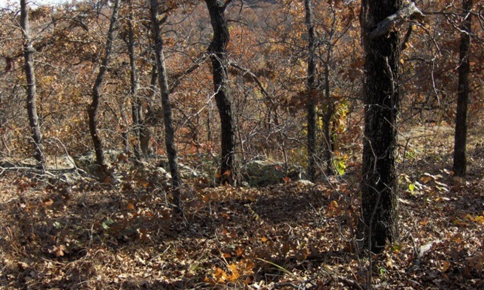
This site occurs where gentle savannah slopes to a point where slope increases drastically or "breaks" to 20 percent or greater. Hence the name Savannah Breaks. This site is steep, rocky rangeland.

Figure 2. Savannah Breaks
Table 2. Representative physiographic features
Landforms (1) Hills > Hill
(2) Hills > Escarpment
Runoff class Very high Elevation 700 – 1300 ft Slope 20 – 45 % Aspect Aspect is not a significant factor Climatic features
Climate is moist sub-humid with annual precipitation ranging from 30 to 45 inches. There will be noticeable differences in precipitation and temperatures from north to south and east to west. The most intense rainfall occurs in late spring and early summer while warm season vegetation is growing rapidly. Frost free and freeze free days increase from north to south. Precipitation increases from west to east.
Table 3 Representative climatic features
Frost-free period (characteristic range) 170-180 days Freeze-free period (characteristic range) 200-210 days Precipitation total (characteristic range) 40-40 in Frost-free period (actual range) 170-190 days Freeze-free period (actual range) 200-210 days Precipitation total (actual range) 30-40 in Frost-free period (average) 170 days Freeze-free period (average) 200 days Precipitation total (average) 40 in Characteristic rangeActual rangeBarLineFigure 3. Monthly precipitation range
Characteristic rangeActual rangeBarLineFigure 4. Monthly minimum temperature range
Characteristic rangeActual rangeBarLineFigure 5. Monthly maximum temperature range
BarLineFigure 6. Monthly average minimum and maximum temperature
Figure 7. Annual precipitation pattern
Figure 8 Annual average temperature pattern
Climate stations used
-
(1) BARTLESVILLE F P FLD [USW00003959], Bartlesville, OK
-
(2) SEDAN [USC00147305], Sedan, KS
-
(3) BLANCHARD 2 SSW [USC00340830], Blanchard, OK
-
(4) CHANDLER [USC00341684], Chandler, OK
-
(5) MANNFORD 6 NW [USC00345522], Cleveland, OK
-
(6) ANADARKO 3 E [USC00340224], Anadarko, OK
">Influencing water features
These upland site may shed some water via runoff during heavy rain events. The presence of good ground cover and deep rooted grasses can help facilitate infiltration and reduce sediment loss.
Wetland description
NA

Figure 9.
Soil features
Soils are mapped for each county within the MLRA. Mapunits are representations of the major soil series component(s) and named accordingly. Each Mapunit is spatially represented on a digital soils map as polygons of different shapes and sizes. Within these Mapunits, there are often minor soil series components included. These minor components are soils that occur within a Mapunit polygon but are of small extent (15% or less of the Mapunit area). However, it is difficult to separate these minor soils spatially due to the scale of soil mapping.
Ecological sites are correlated at the component level of the soil survey. Therefore, a single Mapunit may contain multiple Ecological Sites just as it may contain multiple soil components. This is important to understand when investigating soils and Ecological Sites. A soil survey Mapunit may be correlated to a single Ecological Site based on the major component; however, there may be inclusional areas of additional Ecological Sites which are correlated to the minor components of that particular soil Mapunit.
Representative soil components for this site include:
Darnell (20-45% Slope)
Niotaze (25-45% Slope)
These are shallow to moderately deep sandy loam soils formed over sandstone and shale. Typically, large boulders are present.Table 4. Representative soil features
Parent material (1) Residuum – sandstone and shale
Surface texture (1) Very stony fine sandy loam
(2) Silty clay loam
Drainage class Somewhat poorly drained to well drained Permeability class Slow to moderately rapid Soil depth 10 – 40 in Surface fragment cover <=3" 7 – 15 % Surface fragment cover >3" 5 – 40 % Available water capacity
(0-40in)1.6 – 4 in Calcium carbonate equivalent
(0-40in)0 – 1 % Electrical conductivity
(0-40in)0 – 1 mmhos/cm Sodium adsorption ratio
(0-40in)Not specified Soil reaction (1:1 water)
(0-40in)5.1 – 7.3 Subsurface fragment volume <=3"
(Depth not specified)7 – 10 % Subsurface fragment volume >3"
(Depth not specified)5 – 35 % Ecological dynamics
The reference plant community of the Savannah Breaks ecological site is a mixedgrass savannah and is a disturbance driven community. Tall grasses persist in pockets of deeper soil and coupled with midgrass species make up the majority of warm season grasses. The cool season grasses and grasslikes are a minor component. Numerous perennial forbs are present.
The ecological states of this site are dynamic and vary in relation to fire and rainfall. While adjacent sites are heavily influenced by large herbivore grazing impacts, the slopes and surface rock present on these sites inhibit most grazers. However, wildlife grazing/browsing impacts are sometimes present. Although these sites are not of great importance to a grazing operation, they can offer abundant wildlife habitat as well as other important ecosystem services.
The historical average fire return intervals for the region have been estimated between 2 to 5 years. This fire return keeps the fire-intolerant species restricted to areas protected from fire (i.e. rock outcrops, etc.). Therefore, the plant community is dominated by fire-tolerant species such as Post Oak, Blackjack Oak, and many herbaceous species endemic to the tallgrass prairie ecosystem.
The species in the reference community allowed for good water infiltration although some runoff is to be expected due to slopes and surface rock. As the woody canopy increases and the site transitions to the woody invasion state, the hydrology of the site is altered. The increased canopy intercepts most of the precipitation and leads to evaporative losses. Therefore, the remaining understory species have less available water for growth. However, with increased canopy and shading, understory species may have less evapotranspiration losses due to the altered microclimate.
One of the major species involved in the woody invasion is Eastern Redcedar. While it is quite possible that these trees were present in small extents within the reference state, they were restricted to rock outcrops and other fire protected areas. With the exclusion of fire, these trees can grow rapidly and outcompete other species for resources. Aside from crowding out herbaceous species, these trees may act as “ladder fuels” because of their growth form. When fire is once again introduced onto the landscape either by wildfire or prescribed fire, these trees can “ladder” the fire from surface level into the tree canopies causing a dangerous crown fire.State and transition model
More interactive model formats are also available. View Interactive Models
Click on state and transition labels to scroll to the respective textEcosystem states
T1A - No fire R2A - Selective thinning, Prescribed fire State 1 submodel, plant communities
State 1
Savannah
In reference condition, this site is a fire-driven climax of Oak savannah with a tall grass understory. Average woody canopy cover is below 60 percent. Surface rock from cobbles to boulders may be up to 25 percent. The composition by functional group production consists of 40 percent tall grasses, 25 percent mid grasses, and 10 percent forbs and legumes. Total average herbaceous production can range from 500 to 1,800 pounds per acre. Some juniper may occur depending upon the last fire or in areas protected from fire due to rock outcrops. Species composition can vary somewhat depending on the present soil resources and depth to bedrock.
Due to the slope and amount of surface rock, these sites are rarely grazed by domestic livestock. In some areas, the sites themselves are uses as natural barriers between pastures eliminating the need of traditional fences. There is some potential use by goats if they are adapted to utilizing such landscapes. However, numerous wildlife species may utilize these sites for bedding, foraging, and escape cover.
Characteristics and indicators. Post Oak & Blackjack Oak with understory of native tallgrass species. <60% woody canopy 2-5 year fire return
Resilience management. In the absence of fire, mid-story woody species including elm, hackberry, and eastern redcedar, and greenbriar will begin to encroach into the sites and shade out understory species. This creates a risk of transition to the Woody Invasion State.
Dominant plant species
-
blackjack oak (Quercus marilandica), tree
-
saw greenbrier (Smilax bona-nox), shrub
-
little bluestem (Schizachyrium scoparium), grass
Community 1.1
Post Oak/ Black Jack OakFigure 10. Annual production by plant type (representative values) or group (midpoint values)
State 2
Woodland
The description for this plant community is derived from analysis of limited field data and professional consensus of range trained individuals.
This state is the result of the removal of fire from the ecosystem. Without fire, some fire-intolerant woody species have been able to grow and reproduce unchecked. This has resulted in an increase in canopy coverage and hindered the growth of the herbaceous understory of the reference state.
The understory woody browse, forbs, and legumes cannot persist as the woody mid-story takes over. Thus much of the wild life habitat value declines as the site transitions to this state.
Much of the hydrologic cycle has changed as the functional plants are the woody overstory. Some rainfall is trapped in the foliage of the overstory and evaporates but some also reaches the soil via stem flow. Without the herbaceous understory, the sight may be prone to increased runoff from overland flow.
Characteristics and indicators. Oak/Hickory Woodland with Hackberry, Elm, and Juniper encroachment. Shade tolerant herbaceous plants. >60% woody canopy >5 year fire return
Resilience management. Tools that restore the energy flow back to these plants and restore the hydrologic cycle include an integrated approach using brush management and fire. It is possible to restore this plant community to something similar to the reference plant community but may be very difficult depending on remnant seedstocks and time since fire.
Dominant plant species
-
blackjack oak (Quercus marilandica), tree
-
elm (Ulmus), tree
-
hackberry (Celtis), tree
-
black hickory (Carya texana), tree
-
poverty oatgrass (Danthonia spicata), grass
Transition T1A
State 1 to 2
Savannah
WoodlandIn the absence of fire, mid-story woody species including elm, hackberry, and eastern redcedar, and greenbriar will begin to encroach into the sites and shade out understory species.
Constraints to recovery.This lack of fire or other brush management creates a risk of transition to the Woodland State.
Restoration pathway R2A
State 2 to 1
Woodland
SavannahTools that restore the energy flow back to these plants and restore the hydrologic cycle include an integrated approach using brush management and fire. It is possible to restore this plant community to something similar to the reference plant community but may be very difficult depending on remnant seedstocks and time since fire.
Additional community tables
Table 5. Community 1.1 plant community composition
Group Common name Symbol Scientific name Annual production () Foliar cover (%) Tree1 – post oak QUST Quercus stellata – – blackjack oak QUMA3 Quercus marilandica – – Interpretations
Animal community
This breaks site may be used by deer for cover and browsing. Small mammals and predators also frequent the site. Due to boulder cover and slope, cattle rarely visit these areas and should not be included in a forage inventory.
Hydrological functions
These upland site may shed some water via runoff during heavy rain events. The presence of good ground cover and deep rooted grasses can help facilitate infiltration and reduce sediment loss. Reduction in ground cover may lead to increased sediment loss.
Recreational uses
NA
Wood products
NA
Other products
NA
Other information
NA
Supporting information
Inventory data references
Any clipping data and other observations on file in the Oklahoma NRCS State Office: 100 USDA, Suite 206 Stillwater, Oklahoma 74074 Old SCS Range Site Descriptions and county Soil Survey Manuscripts were utilized in the development of this provisional ESD.
References
-
Archer, S. 1994. Woody plant encroachment into southwestern grasslands and savannas: rates, patterns and proximate causes.. Pages 13–68 in , , and , editors. Ecological implications of livestock herbivory in the West. Society for Range Management Publication, Denver, CO.
Other references
Bestelmeyer, B.T., J.R. Brown, K.M. Havsted, R. Alexander, G. Chavez, and J.E. Hedrick. 2003. Development and use of state-and-transition models for rangelands. Journal of Range Management. 56(2): 114-126.
Frost, C. C. 1998. Presettlement fire frequency regimes of the Unites States: a First Approximation. Tall Timbers Fire Ecology Conference Proceedings. No. 20. Tall Timbers Research Station. Tallahassee, FL.
USDA-NRCS (Formerly Soil Conservation Service) Range Site Descriptions (1960s)
USDA-NRCS (Formerly Soil Conservation Service) Ag Handbook 296 (2006)Contributors
Colin Walden, Soil Survey Region 9, Stillwater OK
Approval
Bryan Christensen, 9/21/2023
Acknowledgments
Site Development and Testing Plan Future work, as described in a Project Plan, to validate the information in this Provisional Ecological Site Description is needed. This will include field activities to collect low, medium and high intensity sampling, soil correlations, and analysis of that data. Annual field reviews should be done by soil scientists and vegetation specialists. A final field review, peer review, quality control, and quality assurance reviews of the ESD will be needed to produce the final document. Annual reviews of the Project Plan are to be conducted by the Ecological Site Technical Team.
Rangeland health reference sheet
Interpreting Indicators of Rangeland Health is a qualitative assessment protocol used to determine ecosystem condition based on benchmark characteristics described in the Reference Sheet. A suite of 17 (or more) indicators are typically considered in an assessment. The ecological site(s) representative of an assessment location must be known prior to applying the protocol and must be verified based on soils and climate. Current plant community cannot be used to identify the ecological site.
Author(s)/participant(s) Colin Walden Contact for lead author 405-742-1223 Date 08/12/2015 Approved by Approval date Composition (Indicators 10 and 12) based on Annual Production Indicators
-
Number and extent of rills:
Few present due to steep slope but only after heavy rains. No scouring -
Presence of water flow patterns:
Some present due to steep slope but no scouring -
Number and height of erosional pedestals or terracettes:
None -
Bare ground from Ecological Site Description or other studies (rock, litter, lichen, moss, plant canopy are not bare ground):
Less than 20%. This does not include rock cover. -
Number of gullies and erosion associated with gullies:
None -
Extent of wind scoured, blowouts and/or depositional areas:
None -
Amount of litter movement (describe size and distance expected to travel):
Herbaceous litter may move down slope during extremely heavy rainfall but not moving offsite. -
Soil surface (top few mm) resistance to erosion (stability values are averages - most sites will show a range of values):
Surface soil is stabilized (Stability Score 5-6). Stability scores based on a minimum of 6 samples tested. -
Soil surface structure and SOM content (include type of structure and A-horizon color and thickness):
0 to 5 in; brown (10YR 5/3) fine sandy loam (Darnell) or 0 to 3 in; grayish brown (10YR 5/2) very cobbly fine sandy loam (Niotaze) Refer to description for specific component sampled. -
Effect of community phase composition (relative proportion of different functional groups) and spatial distribution on infiltration and runoff:
Woody canopy 15-40%. Tallgrasses and forbs. Very Few Cedars. Runoff is expected on steep slopes in heavy rains. However, adequate ground cover should capture moisture and limit soil erosion. -
Presence and thickness of compaction layer (usually none; describe soil profile features which may be mistaken for compaction on this site):
None -
Functional/Structural Groups (list in order of descending dominance by above-ground annual-production or live foliar cover using symbols: >>, >, = to indicate much greater than, greater than, and equal to):
Dominant:
Tallgrasses = OaksSub-dominant:
Midgrasses Cool Seasons = ForbsOther:
AnnualsAdditional:
-
Amount of plant mortality and decadence (include which functional groups are expected to show mortality or decadence):
Some decadence in cool season grasses during extremely hot/dry periods -
Average percent litter cover (%) and depth ( in):
Depending on time since fire -
Expected annual annual-production (this is TOTAL above-ground annual-production, not just forage annual-production):
Herbaceous production estimated between 500 - 1,800 lbs/acre. Total production including woody species could exceed 8,000 lb/acre. -
Potential invasive (including noxious) species (native and non-native). List species which BOTH characterize degraded states and have the potential to become a dominant or co-dominant species on the ecological site if their future establishment and growth is not actively controlled by management interventions. Species that become dominant for only one to several years (e.g., short-term response to drought or wildfire) are not invasive plants. Note that unlike other indicators, we are describing what is NOT expected in the reference state for the ecological site:
Sericea Lespedeza, Eastern Redcedar, Perilla Mint -
Perennial plant reproductive capability:
All plant should be capable of reproducing every year.
Print Options
Sections
Font
AAAAOther
PrintThe Ecosystem Dynamics Interpretive Tool is an information system framework developed by the USDA-ARS Jornada Experimental Range, USDA Natural Resources Conservation Service, and New Mexico State University.
Accessibility statement