
Natural Resources
Conservation Service
Ecological site R084AY075OK
Sandy Loam Savannah
Last updated: 9/21/2023
Accessed: 08/31/2026
-
Search


Major Land Resource Area or ecological site by name and/or ID.
PreviousSectionsNextGeneral information
Provisional. A provisional ecological site description has undergone quality control and quality assurance review. It contains a working state and transition model and enough information to identify the ecological site.
Click to explore map
Figure 1. Mapped extent
Areas shown in blue indicate the maximum mapped extent of this ecological site. Other ecological sites likely occur within the highlighted areas. It is also possible for this ecological site to occur outside of highlighted areas if detailed soil survey has not been completed or recently updated.
MLRA notes
Major Land Resource Area (MLRA): 084A–North Cross Timbers
MLRA 84A “North Cross Timbers” is characterized by rolling to hilly uplands with oak trees, bedrock outcrops, and narrow stream valleys. It is believed that the Cross Timbers ecosystem is one the least disturbed forest types remaining in the Eastern US. Major rivers in this MLRA include the Verdigris River in Kansas and the Arkansas, Cimarron, and South Canadian Rivers in Oklahoma. The western parts of this MLRA are underlain by sandstone and shale of Permian age, while the eastern parts are underlain by sandstone and shale of Pennsylvanian age. There are also occurrences of Pleistocene age stream terraces along the rivers.
Classification relationships
This ecological site is correlated to soil components at the Major Land Resource Area (MLRA) level which is further described in USDA Ag Handbook 296.
Level IV EPA Ecoregions 27o “Crosstimbers Transition”, 29a “Northern Crosstimbers”, and 29h “Northwestern Crosstimbers”.Ecological site concept
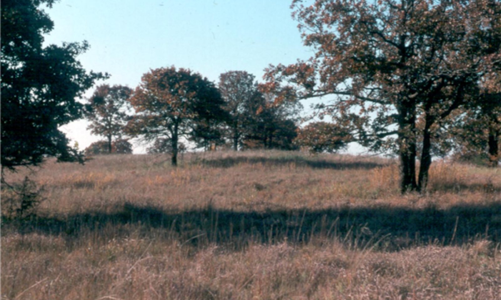
These sites occur over sandstone and shale parent material on gently sloping to moderately steep ridge crests and side slopes. The reference vegetation is tallgrass prairie species with an overstory of Post Oak and Blackjack Oak averaging 30 percent canopy, creating a savannah mosaic ecotype. This plant community is disturbance driven and requires periodic fire to maintain the savannah community. When fire is removed from the system, the site is at risk of encroachment of woody species and buildup of leaf litter, altering the plant community and driving it towards a woodland system with little understory production.
Associated sites
R084AY018OK Deep Sand Savannah
Savannah site over deep sand. Lower landscape positions.
R084AY088OK Shallow Savannah
Many times intermingled with Sandy Savannah. Shallow soils, less productive.
Similar sites
R084AY018OK Deep Sand Savannah
Savannah site over deep sand. Lower landscape positions.
R084AY088OK Shallow Savannah
Many times intermingled with Sandy Savannah. Shallow soils, less productive.
Table 1. Dominant plant species
Tree (1) Quercus stellata
(2) Quercus marilandicaShrub Not specified
Herbaceous (1) Andropogon gerardii
(2) Schizachyrium scopariumPhysiographic features
This site occurs on very gently sloping to moderately steep ridge crest and side slopes in the Cross Timbers. Slopes range from1 to 25 percent but are typically 5 to 15 percent.

Figure 2. Sandy Savannah Block Diagram
Table 2. Representative physiographic features
Landforms (1) Hills > Hill
(2) Hills > Cuesta
Runoff class Medium to high Elevation 500 – 1500 ft Slope 5 – 15 % Aspect Aspect is not a significant factor Table 3. Representative physiographic features (actual ranges)
Runoff class Low to very high Elevation 0 ft Slope 1 – 25 % Climatic features
Climate is moist sub-humid with annual precipitation ranging from 30 to 45 inches. There will be noticeable differences in precipitation and temperatures from north to south and east to west. The most intense rainfall occurs in late spring and early summer while warm season vegetation is growing rapidly. Frost free and freeze free days increase from north to south. Precipitation increases from west to east.
Table 4 Representative climatic features
Frost-free period (characteristic range) 170-190 days Freeze-free period (characteristic range) 200-210 days Precipitation total (characteristic range) 40-40 in Frost-free period (actual range) 170-200 days Freeze-free period (actual range) 190-230 days Precipitation total (actual range) 30-50 in Frost-free period (average) 180 days Freeze-free period (average) 210 days Precipitation total (average) 40 in Characteristic rangeActual rangeBarLineFigure 3. Monthly precipitation range
Characteristic rangeActual rangeBarLineFigure 4. Monthly minimum temperature range
Characteristic rangeActual rangeBarLineFigure 5. Monthly maximum temperature range
BarLineFigure 6. Monthly average minimum and maximum temperature
Figure 7. Annual precipitation pattern
Figure 8 Annual average temperature pattern
Climate stations used
-
(1) SEDAN [USC00147305], Sedan, KS
-
(2) BARTLESVILLE F P FLD [USW00003959], Bartlesville, OK
-
(3) PAWHUSKA [USC00346935], Pawhuska, OK
-
(4) BARNSDALL [USC00340535], Barnsdall, OK
-
(5) MANNFORD 6 NW [USC00345522], Cleveland, OK
-
(6) BRISTOW [USC00341144], Bristow, OK
-
(7) CHANDLER [USC00341684], Chandler, OK
-
(8) NORMAN 3SSE [USC00346386], Norman, OK
-
(9) ADA [USC00340017], Ada, OK
-
(10) SEMINOLE [USC00348042], Seminole, OK
-
(11) CHICKASHA EXP STATION [USC00341750], Chickasha, OK
-
(12) ANADARKO 3 E [USC00340224], Anadarko, OK
-
(13) LINDSAY 2 W [USC00345216], Lindsay, OK
-
(14) DUNCAN [USC00342660], Duncan, OK
-
(15) STILLWATER 5 WNW [USW00053927], Stillwater, OK
">Influencing water features
These upland site is not associated with any wetland or riparian system.
Wetland description
NA

Figure 9.
Soil features
Representative soils: Bartlesville,Littleaxe, Newalla, Niotaze, Stephenville, and Konowa.
These are deep to moderately deep, permeable, medium textured soils formed over sandstone and shale. These particular soils are very susceptible to severe water and wind erosion unless good cover is maintained.
Soils are mapped for each county within the MLRA. Mapunits are representations of the major soil series component(s) and named accordingly. Each Mapunit is spatially represented on a digital soils map as polygons of different shapes and sizes. Within these Mapunits, there are often minor soil series components included. These minor components are soils that occur within a Mapunit polygon but are of small extent (15% or less of the Mapunit area). However, it is difficult to separate these minor soils spatially due to the scale of soil mapping.
Ecological sites are correlated at the component level of the soil survey. Therefore, a single Mapunit may contain multiple Ecological Sites just as it may contain multiple soil components. This is important to understand when investigating soils and Ecological Sites. A soil survey Mapunit may be correlated to a single Ecological Site based on the major component; however, there may be inclusional areas of additional Ecological Sites which are correlated to the minor components of that particular soil Mapunit.Table 5. Representative soil features
Parent material (1) Residuum – sandstone and shale
Surface texture (1) Fine sandy loam
(2) Loamy fine sand
Drainage class Somewhat poorly drained to excessively drained Permeability class Very slow to moderately rapid Depth to restrictive layer 24 – 0 in Soil depth 24 – 0 in Surface fragment cover <=3" 0 – 10 % Surface fragment cover >3" 0 – 10 % Available water capacity
(0-40in)2 – 6.1 in Electrical conductivity
(0-40in)0 – 2 mmhos/cm Sodium adsorption ratio
(0-40in)0 – 8 Soil reaction (1:1 water)
(0-40in)5.5 – 7.5 Subsurface fragment volume <=3"
(Depth not specified)0 – 60 % Subsurface fragment volume >3"
(Depth not specified)0 – 21 % Table 6. Representative soil features (actual values)
Drainage class Not specified Permeability class Not specified Depth to restrictive layer 0 in Soil depth 0 in Surface fragment cover <=3" 0 % Surface fragment cover >3" 0 % Available water capacity
(0-40in)0 in Electrical conductivity
(0-40in)0 mmhos/cm Sodium adsorption ratio
(0-40in)0 Soil reaction (1:1 water)
(0-40in)4.5 – 8.4 Subsurface fragment volume <=3"
(Depth not specified)0 % Subsurface fragment volume >3"
(Depth not specified)0 % Ecological dynamics
The reference state is an oak savannah interspersed with tallgrasses, forbs and shrubs. The vegetation is predominately tallgrasses and midgrasses, consisting of big bluestem, little bluestem, Indiangrass and switchgrass. Secondary grasses include purpletop, sand lovegrass, purple lovegrass, sand dropseed Canada wildrye and Virginia wildrye. Overstory trees of post oak, blackjack oak and various species of hickory formed a canopy of approximately 15 to 20 percent. However, it is important to note that woody canopy has always varied from 70+ to
State and transition model
More interactive model formats are also available. View Interactive Models
Click on state and transition labels to scroll to the respective textEcosystem states
T1A - No brush management, No fire T1B - Chemical brush management, Prescribed burning T1C - Land clearing, Tillage, Seeding R2A - Selective thinning, Prescribed burning, Prescribed grazing T2A - Chemical brush management, Prescribed burning, Prescribed grazing T2B - Land clearing, Tillage, Seeding R3A - Prescribed burning 4 year+ return, Prescribed grazing T3A - No fire, No brush management T3B - Tillage, Seeding R4A - Range planting, Prescribed burning 4+ year interval T4A - Soil erosion State 1 submodel, plant communities
State 2 submodel, plant communities
State 3 submodel, plant communities
State 4 submodel, plant communities
State 1
SavannahThis is the Reference state for this ecological site. It represents the historical variability of plant communities on this site under the natural disturbance regime.
Characteristics and indicators. This ecological state consists of native grasses and forbs with an overstory of oak trees. The average canopy coverage of tree species ranges from 15-30%.
Resilience management. This state requires periodic fire every 2-5 years to maintain the relationship between woody and herbaceous species.
Dominant plant species
-
post oak (Quercus stellata), tree
-
blackjack oak (Quercus marilandica), tree
-
black hickory (Carya texana), tree
-
winged sumac (Rhus copallinum), shrub
-
coralberry (Symphoricarpos orbiculatus), shrub
-
big bluestem (Andropogon gerardii), grass
-
little bluestem (Schizachyrium scoparium), grass
-
Indiangrass (Sorghastrum nutans), grass
-
goldenrod (Solidago), other herbaceous
-
sunflower (Helianthus), other herbaceous
Community 1.1
Tallgrass Savannah(Reference Community)
The general aspect of the vegetation is an oak savannah. The major plants are tallgrasses and midgrasses with a scattered overstory of trees. Big bluestem, little bluestem, Indiangrass and switchgrass are the dominant grasses and comprise 50 to 60 percent of the vegetation by weight. Secondary grasses include purpletop, sand lovegrass, purple lovegrass, sand dropseed Canada wildrye and Virginia wildrye. Post oak, blackjack oak and hickory are the major trees. Common species of shrubs are smooth sumac, skunkbush, and leadplant. Combined woody species form an overstory of about 20 to 40 percent. The site supports a large number of forbs and legumes. Major legumes include Illinois bundleflower, sessile tickclover, Illinois tickclover, catclaw sensitivebrier, Virginia tephrosia, slender lespedeza, Stuves’ lespedeza and roundhead lespedeza. More abundant forbs are Maximilian sunflower, hairy sunflower, pale echinacea, fringeleaf ruellia, heathaster and several species of goldenrod. Over the years this plant community has been maintained by periodic fires and moderate grazing.
Resilience management. This community relies on periodic fire every 2-5 years in order to maintain the structure and composition of species. Abusive grazing practices can both alter herbaceous species composition and reduce fuel loads needed for effective use of fire. Without fire, woody species can dominate the site reducing hydrological function and energy flow on the site.
Dominant plant species
-
post oak (Quercus stellata), tree
-
blackjack oak (Quercus marilandica), tree
-
black hickory (Carya texana), tree
-
coralberry (Symphoricarpos orbiculatus), shrub
-
smooth sumac (Rhus glabra), shrub
-
big bluestem (Andropogon gerardii), grass
-
little bluestem (Schizachyrium scoparium), grass
-
goldenrod (Solidago), other herbaceous
-
sunflower (Helianthus), other herbaceous
Figure 10. Annual production by plant type (representative values) or group (midpoint values)
Table 7. Annual production by plant type
Plant type Low
(lb/acre)Representative value
(lb/acre)High
(lb/acre)Grass/Grasslike 2089 2972 3854 Tree 811 903 1046 Forb 200 400 550 Shrub/Vine 100 125 150 Total 3200 4400 5600 Figure 11. Plant community growth curve (percent production by month). OK0003 , Warm season tallgrasses, forbs, and a few woody species.
Jan Feb Mar Apr May Jun Jul Aug Sep Oct Nov Dec J F M A M J J A S O N D 0 2 6 9 21 24 14 6 11 4 2 1 Community 1.2
Midgrass Savannah
Within this community phase, the more palatable tallgrasses and forbs have decreased. They have been replaced by species such as tall dropseed, silver bluestem, and sideoats grama. The less palatable annual forbs, such as broomweed and western ragweed have increased also. Total herbaceous production may remain the same as the reference community, however, the composition has been altered significantly. In this community, midgrass species are roughly equal to tallgrass species in composition by weight.
Resilience management. The communities of the reference state are quite resilient. However, without periodic fire, this community may be at risk of transitioning to a woody state. Abusive grazing practices may also contribute to this risk by reducing fuel loads need to produce an effective fire.
Figure 12. Plant community growth curve (percent production by month). OK0003 , Warm season tallgrasses, forbs, and a few woody species.
Jan Feb Mar Apr May Jun Jul Aug Sep Oct Nov Dec J F M A M J J A S O N D 0 2 6 9 21 24 14 6 11 4 2 1 Pathway 1.1A
Community 1.1 to 1.2
Tallgrass Savannah(Reference Community)
Midgrass SavannahAbusive grazing practices which exceed carrying capacity without adequate rest/recovery will result in a quick reduction of tall grass species and palatable forbs. Without some type of rest for these plants, constant defoliation will reduce the vigor creating an opportunity for less palatable plants to out-compete them for resources.
Context dependence.While drought can exacerbate this pathway, it is often grazing that is the main driver.
Pathway 1.2A
Community 1.2 to 1.1
Midgrass Savannah
Tallgrass Savannah(Reference Community)Through a properly implemented prescribed grazing system that includes a balanced stocking rate and some degree of growing season rest, this community phase may be reverted to the reference plant community. The length of deferment and time required for this restoration is dependent upon length of abusive grazing, precipitation and management system used.
State 2
WoodlandThis vegetative state is composed of an overstory of trees and shrubs that will slowly eliminate most herbaceous vegetation from the plant community if left unchecked.
Characteristics and indicators. The major species are post oak and black jack oak. Woody species that were historically suppressed by fire have increased. These include hackberry, elms and greenbriar.
Resilience management. There is a high potential for encroachment by eastern redcedar in this ecological state if proper management is not applied.
Dominant plant species
-
post oak (Quercus stellata), tree
-
blackjack oak (Quercus marilandica), tree
-
American elm (Ulmus americana), tree
-
black hickory (Carya texana), tree
-
eastern poison ivy (Toxicodendron radicans), shrub
-
Virginia creeper (Parthenocissus quinquefolia), shrub
-
coralberry (Symphoricarpos orbiculatus), shrub
-
saw greenbrier (Smilax bona-nox), shrub
-
sedge (Carex), grass
-
poverty oatgrass (Danthonia spicata), grass
-
purpletop tridens (Tridens flavus), grass
-
wildrye (Elymus), grass
-
goldenrod (Solidago), other herbaceous
-
crownbeard (Verbesina), other herbaceous
Community 2.1
Tree/Shrub Dominant
This plant community is a moderately closed oak savannah with an understory of mid and tallgrasses. The absence of fire has allowed woody species to increase in abundance. The overstory tree canopy ranges from 40 to 60 percent. The competition from the increased canopy has led to a decrease in herbaceous understory plants. Little bluestem is the dominant grass in the understory. Other grasses include big bluestem, Indiangrass, switchgrass, purpletop, purple lovegrass, Scribners’ panicum, Virginia wildrye and Canada wildrye. More abundant legumes are slender lespedeza. Illinois tickclover, catclaw sensitivebrier, trailing wildbean and showy partridgepea. Hairy sunflower, heathaster, western ragweed, fleabane and goldenrods are the more common forbs. Woody species that were historically suppressed by fire have increased, including hackberry and elm species. Low growing woody species such as buckbrush, flameleaf sumac, blackberry and greenbriar have increased and are common on the site.
Figure 13. Plant community growth curve (percent production by month). OK0006 , MLRA 84A, Oak/Cedar. Mature oak overstory .
Jan Feb Mar Apr May Jun Jul Aug Sep Oct Nov Dec J F M A M J J A S O N D 2 3 5 10 18 25 10 5 8 5 4 5 Community 2.2
Closed Canopy Woodland
This plant community is characterized by oak trees and other trees forming an overstory canopy of 65 to 85 percent. Understory vegetation is sparse and composed primarily of shade tolerant grasses, forbs and low growing woody species. Grasses and grasslike plants include Scribners panicum, Virginia wildrye, sedges, arrowfeather threeawn, fringeleaf paspalum, little bluestem, broomsedge bluestem and purpletop. Major forbs include goldenrods, pussytoes, heathaster, blue aster, sageworts, tickclovers, lespedezas and showy partridgepea. Woody plants in the understory include blackberry, buckbrush, eastern redcedar, redbud and seedlings and immature plants of blackjack, post oak, elm and hackberry.
Figure 14. Plant community growth curve (percent production by month). OK0006 , MLRA 84A, Oak/Cedar. Mature oak overstory .
Jan Feb Mar Apr May Jun Jul Aug Sep Oct Nov Dec J F M A M J J A S O N D 2 3 5 10 18 25 10 5 8 5 4 5 Pathway 2.1A
Community 2.1 to 2.2
Tree/Shrub Dominant
Closed Canopy WoodlandIn the absence of fire or brush managment, the trees and shrubs in this plant community will continue to out-compete the herbaceous vegetation for sunlight and resources. With time, it will become a closed canopy woodland community.
Pathway 2.2A
Community 2.2 to 2.1
Closed Canopy Woodland
Tree/Shrub DominantThrough a program of brush management and prescribed fire, the closed canopy plant community can be reverted to the tree/shrub dominant community. This pathway can be accomplished by opening the canopy and allowing more sunlight to reach the soil surface. Special consideration should be taken if eastern redcedar is present in high amounts in the understory as they will be very competitive once the canopy is opened.
State 3
GrasslandIn this state, the shallow savannah has been transitioned to an open grassland dominated by tallgrasses and forbs.
Characteristics and indicators. This state has very low canopy of trees due to chemical and/or mechanical brush management.
Resilience management. Without proper management, this state may return to a savannah state within a short time. It is important to note that maintaining this state will require significant inputs and the transition may take many years. A large number of acres of Sandy Loam Savannah sites have had an attempt at clearing woody species through chemical herbicide use. Mid-century use of 2,4,5-T and other similar chemicals led to large areas of timber kill. However, many of these areas resprouted into thicker and denser "scrub oak" mottes. More recently, tebuthiuron pellets have been used in attempts to open up more grazable acres for cattle production. Some have had success, however, many times the canopy release leads to secondary invasions by eastern redcedar, sericea lespedeza, and broomsedge bluestem. Careful planning and consideration should be used before attempting chemical application in the cross timbers.
Dominant plant species
-
little bluestem (Schizachyrium scoparium), grass
-
big bluestem (Andropogon gerardii), grass
-
broomsedge bluestem (Andropogon virginicus), grass
Community 3.1
Tallgrass Dominant
This community is dominated by tallgrass species such as little bluestem, big bluestem, switchgrass, and indiangrass. Some perenial forbs may persist, depending on the herbicide used on the oak trees. Grazing management plays a key role in the maintenance of this plant community. If tebuthiuron pellets are used to control woody species, it is important to remember that there is a period of years following treatment that it is inadvisable to burn. Therefore special caution should be taken when stocking pastures to ensure that the tallgrass community remains dominant. Other invaders such as sericia lespedeza and eastern redcedar also thrive once released from the oak canopy.
Figure 15. Plant community growth curve (percent production by month). OK0009 , Native Warm-Season Grasses. The growing season for warm season(C4) grasses in this region runs from last frost to first frost with peak production from mid April through mid July. The curve listed below is intended to be a representative of normal growing conditions. The monthly production pecentages can vary from year to year deopending upon temperature and rainfall variatioins..
Jan Feb Mar Apr May Jun Jul Aug Sep Oct Nov Dec J F M A M J J A S O N D 0 0 3 9 25 28 15 5 10 5 0 0 Community 3.2
Midgrass Dominant
This community is dominated by less palatable midgrass species. Abusive grazing has resulted in the decline of palatable tallgrasses and forbs. Little bluestem will persist, along with dropseed species, silver bluestem, native lovegrasses, sideoats grama, and broomsedge bluestem(in eastern portions of MLRA). Annual forbs increase in abundance. Total site production may be similar to community 3.1 but composition has changed significantly.
Figure 16. Plant community growth curve (percent production by month). OK0009 , Native Warm-Season Grasses. The growing season for warm season(C4) grasses in this region runs from last frost to first frost with peak production from mid April through mid July. The curve listed below is intended to be a representative of normal growing conditions. The monthly production pecentages can vary from year to year deopending upon temperature and rainfall variatioins..
Jan Feb Mar Apr May Jun Jul Aug Sep Oct Nov Dec J F M A M J J A S O N D 0 0 3 9 25 28 15 5 10 5 0 0 Pathway 3.1A
Community 3.1 to 3.2
Tallgrass Dominant
Midgrass DominantAbusive grazing practices exceeding carrying capacity without adequate rest/recovery can push this tallgrass dominated plant community towards a community that is dominated by less palatable midgrass species.
Pathway 3.2A
Community 3.2 to 3.1
Midgrass Dominant
Tallgrass DominantThrough a properly implemented prescribed grazing system that includes some degree of growing season rest, this community phase may be reverted to the reference plant community. The length of deferment and time required for this restoration is dependent upon precipitation and management system used.
State 4
ConvertedThis state is the result of a change in land use. Native vegetation has been tilled and crops or introduced perennial vegetation has been planted.
Resilience management. This state is not likely to return to reference conditions due to the alteration of soil structure, chemistry and hydrology. However, if abandoned, the site may become invaded by woody species and transition to something similar to the woodland state.
Dominant plant species
-
Bermudagrass (Cynodon dactylon), grass
Community 4.1
Cropland/Tame PastureWith brush management, tillage, seeding and/or sprigging, this site can support a variety of native and non-native plant communities. Good grazing management and, occasionally, reseeding may be needed to re-establish and maintain desired plant communities. Once tillage has occured, physical and biological soil properties have been significantly altered. The return of this state to the reference state may not be achievable. However, range seeding, prescribed fire and proper grazing management can restore a plant community similar the the reference state.
State 5
ErodedThis state is the result of water erosion over bare soil.
Characteristics and indicators. Most of the "A" horizon of the soil profile has been displaced. The remaining subsoil is very low in fertility. Some native grasses and forbs will persist in this state, however, production is greatly reduced.
Resilience management. Site specific evaluations are required on eroded soils in order to determine what restoration options are feasible.
Dominant plant species
-
silver beardgrass (Bothriochloa laguroides), grass
-
threeawn (Aristida), grass
Transition T1A
State 1 to 2In the absence of fire or brush management, this savannah state will transition to a woodland state of tree/shrub dominance.
Constraints to recovery.Overall woody infestation level and time since fire will determine level of restoration needed.
Key drivers
-
Fire frequency
Key ecosystem services affected
-
Nutrient cycling
-
Food and fiber: livestock forage
Transition T1B
State 1 to 3Through intensive chemical brush management, the savannah state may be transitioned to a grassland state dominated by tallgrasses or midgrasses with very few trees and shrubs. It is important to note that maintaining this state will require significant inputs.
Context dependence.A large number of acres of Sandy Loam Savannah sites have had an attempt at clearing woody species through chemical herbicide use. Mid-century use of 2,4,5-T and other similar chemicals led to large areas of timber kill. However, many of these areas resprouted into thicker and denser "scrub oak" mottes. More recently, tebuthiuron pellets have been used in attempts to open up more grazable acres for cattle production. Some have had success, however, many times the canopy release leads to secondary invasions by eastern redcedar, sericea lespedeza, and broomsedge bluestem. Careful planning and consideration should be used before attempting chemical application in the cross timbers.
Conservation practices
Brush Management Key drivers
-
Timber management
Key ecosystem services affected
-
Aesthetic values
-
Nutrient cycling
-
Food and fiber: livestock forage
-
Food and fiber: wood products
-
Wildlife forage
-
Wildlife habitat
-
Plant biodiversity
Transition T1C
State 1 to 4Through land clearing tillage and seeding the sandy savannah site may be converted to cropland or tame pasture
Context dependence.Once tillage has occurred, physical and biological soil properties have been significantly altered. The return of this state to the reference state may not be achievable.
Conservation practices
Land Clearing Key drivers
-
Mechanical soil disturbance
-
Seeding
Key ecosystem services affected
-
Erosion control
-
Pollination
-
Aesthetic values
-
Nutrient cycling
-
Recreation
-
Food and fiber: livestock forage
-
Wildlife habitat
-
Animal biodiversity
Restoration pathway R2A
State 2 to 1Implementing a brush management plan that includes mechanical thinning and the use of prescribed fire can restore the woodland state to an open canopy savannah state. Fire alone can help restore the site, however, this may take many years to accomplish.
Context dependence.Overall woody encroachment level and time since fire have an impact on restoration efforts.
Conservation practices
Brush Management Prescribed Burning Prescribed Grazing Transition T2A
State 2 to 3Through intensive chemical brush management, the woodland state may be transitioned to a grassland state dominated by tallgrasses or midgrasses with very few trees and shrubs. It is important to note that maintaining this state will require significant inputs. A large number of acres of Sandy Loam Savannah sites have had an attempt at clearing woody species through chemical herbicide use. Mid-century use of 2,4,5-T and other similar chemicals led to large areas of timber kill. However, many of these areas resprouted into thicker and denser "scrub oak" mottes. More recently, tebuthiuron pellets have been used in attempts to open up more grazable acres for cattle production. Some have had success, however, many times the canopy release leads to secondary invasions by eastern redcedar, sericea lespedeza, and broomsedge bluestem. Careful planning and consideration should be used before attempting chemical application in the cross timbers.
Transition T2B
State 2 to 4Through land clearing tillage and seeding the sandy savannah site may be converted to cropland or tame pasture land use.
Constraints to recovery.Once tillage has occurred, physical and biological soil properties have been significantly altered. The return of this state to the reference state may not be achievable.
Conservation practices
Land Clearing Key drivers
-
Avalanche frequency or severity
-
Seeding
Key ecosystem services affected
-
Erosion control
-
Pollination
-
Aesthetic values
-
Nutrient cycling
-
Water regulation
-
Wildlife habitat
-
Plant biodiversity
Restoration pathway R3A
State 3 to 1This state may be restored to the savannah state with the exclusion of chemical brush management.
Context dependence.A prescribed fire program must be implemented to control resprouting woody species and maintain an open savannah canopy. Otherwise, the site could transition to the woody dominated state. This restoration may take many years.
Conservation practices
Prescribed Burning Prescribed Grazing Transition T3A
State 3 to 2In the absence of fire or brush management, this grassland state will transition to a woodland state of tree/shrub dominance.
Key drivers
-
Fire
-
Fire frequency
Key ecosystem services affected
-
Nutrient cycling
-
Plant biodiversity
Transition T3B
State 3 to 4Through tillage and seeding the grassland state may be converted to cropland or tame pasture land use.
Constraints to recovery.Once tillage has occurred, physical and biological soil properties have been significantly altered. The return of this state to the reference state may not be achievable.
Key drivers
-
Mechanical soil disturbance
-
Seeding
Key ecosystem services affected
-
Erosion control
-
Aesthetic values
-
Nutrient cycling
-
Food and fiber: livestock forage
-
Wildlife habitat
-
Plant biodiversity
Restoration pathway R4A
State 4 to 1The potential for this converted state to revert to another state varies greatly from site to site. It is dependent upon multiple factors including length of time in production, soil integrity, planned restoration methods, and precipitation patterns. The return of soil properties to reference condition may not be achievable, post cultivation. Introduced pasture species are also very difficult to eradicate once established. Consult with local conservationists to develop a site specific restoration plan.
Transition T4A
State 4 to 5If this ecological site is subjected to soil disturbances such as land clearing, ripping, or plowing that leave large amounts of exposed soil, the site may become very susceptible to water erosion. Once the "A" horizon has been displace through erosion, this site has transitioned to an Eroded Sate.
Key drivers
-
Mechanical soil disturbance
Key ecosystem services affected
-
Erosion control
Additional community tables
Table 8. Community 1.1 plant community composition
Group Common name Symbol Scientific name Annual production () Foliar cover (%) Grass/Grasslike1 Tallgrasses 746–1375 big bluestem ANGE Andropogon gerardii 543–1000 – switchgrass PAVI2 Panicum virgatum 102–188 – Indiangrass SONU2 Sorghastrum nutans 102–188 – 2 Little Bluestem 678–1250 little bluestem SCSC Schizachyrium scoparium 679–1250 – 3 Mid/Shortgrasses 305–563 dropseed SPORO Sporobolus 102–188 – purpletop tridens TRFL2 Tridens flavus 68–125 – beaked panicgrass PAAN Panicum anceps 68–125 – sand lovegrass ERTR3 Eragrostis trichodes 68–125 – purple lovegrass ERSP Eragrostis spectabilis 34–63 – cylinder jointtail grass COCY Coelorachis cylindrica 34–63 – broomsedge bluestem ANVI2 Andropogon virginicus 34–63 – sideoats grama BOCU Bouteloua curtipendula 34–63 – arrowfeather threeawn ARPUP4 Aristida purpurascens var. purpurascens 20–38 – marsh muhly MURA Muhlenbergia racemosa 20–38 – splitbeard bluestem ANTE2 Andropogon ternarius 20–38 – green sprangletop LEDU Leptochloa dubia 14–25 – hairawn muhly MUCA2 Muhlenbergia capillaris 14–25 – bearded skeletongrass GYAM Gymnopogon ambiguus 14–25 – blue grama BOGR2 Bouteloua gracilis 14–25 – hairy grama BOHI2 Bouteloua hirsuta 14–25 – churchmouse threeawn ARDI4 Aristida dichotoma 7–13 – gummy lovegrass ERCU Eragrostis curtipedicellata 7–13 – nimblewill MUSC Muhlenbergia schreberi 7–13 – puffsheath dropseed SPNE2 Sporobolus neglectus 7–13 – 4 Cool-Season Grassses 360–666 Virginia wildrye ELVI3 Elymus virginicus 102–188 – Canada wildrye ELCA4 Elymus canadensis 68–125 – fall rosette grass DIWI5 Dichanthelium wilcoxianum 34–63 – Texas bluegrass POAR Poa arachnifera 34–63 – sedge CAREX Carex 34–63 – slimleaf panicgrass DILI2 Dichanthelium linearifolium 34–63 – Scribner's rosette grass DIOLS Dichanthelium oligosanthes var. scribnerianum 34–63 – roundseed panicgrass DISPS3 Dichanthelium sphaerocarpon var. sphaerocarpon 20–38 – Forb5 Forbs 125–344 Maximilian sunflower HEMA2 Helianthus maximiliani 50–138 – compassplant SILA3 Silphium laciniatum 50–138 – ashy sunflower HEMO2 Helianthus mollis 25–69 – stiff sunflower HEPA19 Helianthus pauciflorus 25–69 – muck sunflower HESI2 Helianthus simulans 25–69 – cobaea beardtongue PECO4 Penstemon cobaea 25–69 – prairie fleabane ERST3 Erigeron strigosus 25–69 – pitcher sage SAAZG Salvia azurea var. grandiflora 25–69 – bluejacket TROH Tradescantia ohiensis 25–69 – Baldwin's ironweed VEBA Vernonia baldwinii 20–55 – button eryngo ERYU Eryngium yuccifolium 20–55 – pale purple coneflower ECPA Echinacea pallida 20–55 – flowering spurge EUCO10 Euphorbia corollata 20–55 – Appalachian mountainmint PYFL Pycnanthemum flexuosum 20–55 – rough coneflower RUGR Rudbeckia grandiflora 15–41 – fringeleaf wild petunia RUHU Ruellia humilis 15–41 – Missouri goldenrod SOMI2 Solidago missouriensis 15–41 – devil's bite LISC2 Liatris scariosa 15–41 – tall thoroughwort EUAL3 Eupatorium altissimum 15–41 – butterfly milkweed ASTU Asclepias tuberosa 15–41 – Cuman ragweed AMPS Ambrosia psilostachya 15–41 – pussytoes ANTEN Antennaria 10–28 – common yarrow ACMI2 Achillea millefolium 10–28 – soft agrimony AGPU Agrimonia pubescens 10–28 – whorled milkweed ASVE Asclepias verticillata 10–28 – Deane's milkvetch ASDE Astragalus deanei 10–28 – licorice bedstraw GACI2 Galium circaezans 10–28 – cudweed GNAPH Gnaphalium 10–28 – Nuttall's prairie parsley PONU4 Polytaenia nuttallii 10–28 – hairy hawkweed HILO2 Hieracium longipilum 10–28 – showy goldenrod SOSP2 Solidago speciosa 10–28 – browneyed Susan RUTR2 Rudbeckia triloba 10–28 – blackeyed Susan RUHI2 Rudbeckia hirta 5–14 – 6 Legumes 75–206 partridge pea CHFA2 Chamaecrista fasciculata 25–69 – white prairie clover DACA7 Dalea candida 25–69 – purple prairie clover DAPUP Dalea purpurea var. purpurea 25–69 – Illinois bundleflower DEIL Desmanthus illinoensis 25–69 – sessileleaf ticktrefoil DESE Desmodium sessilifolium 25–69 – roundhead lespedeza LECA8 Lespedeza capitata 25–69 – tall lespedeza LEST5 Lespedeza stuevei 25–69 – slender lespedeza LEVI7 Lespedeza virginica 25–69 – Virginia tephrosia TEVI Tephrosia virginiana 25–69 – violet lespedeza LEVI6 Lespedeza violacea 20–55 – blue wild indigo BAAUM Baptisia australis var. minor 15–41 – Atlantic pigeonwings CLMA4 Clitoria mariana 10–28 – Shrub/Vine7 Shrubs 100–150 leadplant AMCA6 Amorpha canescens 33–50 – Jersey tea CEHE Ceanothus herbaceus 33–50 – dwarf chinquapin oak QUPR Quercus prinoides 33–50 – winged sumac RHCO Rhus copallinum 33–50 – smooth sumac RHGL Rhus glabra 33–50 – skunkbush sumac RHTR Rhus trilobata 33–50 – Carolina rose ROCA4 Rosa carolina 33–50 – blackberry RUBUS Rubus 33–50 – saw greenbrier SMBO2 Smilax bona-nox 33–50 – coralberry SYOR Symphoricarpos orbiculatus 33–50 – western poison ivy TORY Toxicodendron rydbergii 33–50 – grape VITIS Vitis 33–50 – Tree8 Trees 600–800 post oak QUST Quercus stellata 462–615 – blackjack oak QUMA3 Quercus marilandica 185–246 – black hickory CATE9 Carya texana 92–123 – bitternut hickory CACO15 Carya cordiformis 46–61 – shagbark hickory CAOV2 Carya ovata 46–61 – eastern redbud CECA4 Cercis canadensis 28–37 – common hackberry CEOC Celtis occidentalis 28–37 – American elm ULAM Ulmus americana 28–37 – Oklahoma plum PRGR Prunus gracilis 28–37 – white ash FRAM2 Fraxinus americana 28–37 – eastern redcedar JUVI Juniperus virginiana 18–25 – common persimmon DIVI5 Diospyros virginiana 18–25 – Table 9. Community 1.1 forest overstory composition
Common name Symbol Scientific name Nativity Height ft Canopy cover (%) Diameter in Basal area (square ft/acre) Treepost oak QUST Quercus stellata Native – 10-25 – 0 blackjack oak QUMA3 Quercus marilandica Native – 10-25 – 0 black hickory CATE9 Carya texana Native – 1-10 – 0 Table 10. Community 1.2 plant community composition
Group Common name Symbol Scientific name Annual production () Foliar cover (%) Table 11. Community 2.1 plant community composition
Group Common name Symbol Scientific name Annual production () Foliar cover (%) Table 12. Community 2.2 plant community composition
Group Common name Symbol Scientific name Annual production () Foliar cover (%) Table 13. Community 3.1 plant community composition
Group Common name Symbol Scientific name Annual production () Foliar cover (%) Table 14. Community 3.2 plant community composition
Group Common name Symbol Scientific name Annual production () Foliar cover (%) Table 15. Community 4.1 plant community composition
Group Common name Symbol Scientific name Annual production () Foliar cover (%) Interpretations
Animal community
This plants on this site have value for grazing cattle. They also provide cover and food for many species of wildlife including whitetail deer and bobwhite quail. Coyote, red fox, squirrel, cottontail rabbit, opossum and raccoon are common. Numerous song birds and woodpeckers may be found on the site.
Hydrological functions
These upland sites may shed some water via runoff during heavy rain events. The presence of good ground cover and deep rooted grasses can help facilitate infiltration and reduce sediment loss. As ground cover decreases, sediment loss may increase.
Many of these soils maintain a shallow water table during the dormant season when water remains perched over the sandstone or shale bedrock. This water may discharge downslope at areas of exposed bedrock.
In the woody state, trees and shrubs may intercept a majority of the rainfall. There may be some enter the soil through stemflow, however, much of the moisture is intercepted in the canopy and lost via evaporation. This can alter the overall cycling of water and other nutrients.Recreational uses
Hunting, Camping, Hiking, Bird watching, Photography, Horseback Riding.
Wood products
There is not much "marketable" timber on these sites. Some areas are sources for firewood.
Other products
NA
Other information
NA
Supporting information
Inventory data references
Clipping data and other observations on file in the Oklahoma NRCS State Office: Suite 206 100 USDA Stillwater, Oklahoma 74074 The original information presented here was derived from field observations of Dr. Jack Eckroat, in the summer of 2007, correlated to office files and old Rangesite Technical Descriptions (1961 USDA/SCS). Species compositions are as complete as possible. Production will vary by species from within years, from year to year, and from site to site. Range-417 collections and NRI data were used to validate production and species estimates.
Type locality
Location 1: Osage County, OK General legal description Osage County, Oklahoma; 14 miles northeast of Pawhuska; about 2,300 feet south and 650 feet east of the NW corner of Sec. 23, T. 27 N, R. 10 E References
-
Bestelmeyer, B., J.R. Brown, K.M. Havstad, B. Alexander, G. Chavez, and J.E. Herrick. 2003. Development and Use of State and Transition Models for Rangelands. Jornal of Range Management 56:114–126.
-
Frost, C.C. 1998. Presettlement Fire Frequency Regimes of the United States: A First Approximation. Plant Conservation Program. North Carolina Department of Agriculture and Consumer Services, Raleigh, NC.
Other references
Bestelmeyer, B. T., Brown, J. R., Havstad, K. M., Alexander, R., Chavez, G., & Herrick, J. E. (2003). Development and use of state-and-transition models for rangelands. Journal of Range Management, 114-126.
Frost, Cecil C. 1998. Presettlement fire frequency regimes of the United States: a first approximation. Proceedings: Twentieth Annual Tall Timbers Fire Ecology Conference. Tallahassee, FL: Tall Timbers Research Station. pp. 70-81.
Fuhlendorf, S. D., Engle, D. M., Kerby, J. A. Y., & Hamilton, R. (2009). Pyric herbivory: rewilding landscapes through the recoupling of fire and grazing. Conservation Biology, 23(3), 588-598.
Harlan, J. R. (1957). Grasslands of Oklahoma.
National Soil Information System (NASIS). Accessed 2013
Shantz, H. L. (1923). The natural vegetation of the Great Plains region. Annals of the Association of American Geographers, 13(2), 81-107.
Shiflet, T. N. (1994). Rangeland cover types of the United States (Vol. 152). Denver, CO, USA: Society for Range Management.
Soil Survey Staff, Natural Resources Conservation Service, United States Department of Agriculture. Web Soil Survey. Available online at http://websoilsurvey.nrcs.usda.gov/. Accessed [5/5/2014].
USDA NRCS Plants Database. Online.
USDA-SCS Oklahoma Range Site Descriptions(1960s)Contributors
Edits by Colin Walden, Soil Survey Region 9, Stillwater, OK
Dr. Jack Eckroat, Grazing Lands Specialist, NRCS, OklahomaApproval
Bryan Christensen, 9/21/2023
Acknowledgments
Site Development and Testing Plan: Future work, as described in a Project Plan, to validate the information in this Provisional Ecological Site Description is needed. This will include field activities to collect low, medium and high intensity sampling, soil correlations, and analysis of that data. Annual field reviews should be done by soil scientists and vegetation specialists. A final field review, peer review, quality control, and quality assurance reviews of the ESD will be needed to produce the final document. Annual reviews of the Project Plan are to be conducted by the Ecological Site Technical Team.
Rangeland health reference sheet
Interpreting Indicators of Rangeland Health is a qualitative assessment protocol used to determine ecosystem condition based on benchmark characteristics described in the Reference Sheet. A suite of 17 (or more) indicators are typically considered in an assessment. The ecological site(s) representative of an assessment location must be known prior to applying the protocol and must be verified based on soils and climate. Current plant community cannot be used to identify the ecological site.
Author(s)/participant(s) Colin Walden, Brandon Reavis Contact for lead author 100 USDA Suite 206 Stillwater, Oklahoma 740740 Date 05/28/2020 Approved by Approval date Composition (Indicators 10 and 12) based on Foliar Cover Indicators
-
Number and extent of rills:
No rills present due to adequate ground cover. -
Presence of water flow patterns:
Very few water flow patterns. Only in understory following intense storms. -
Number and height of erosional pedestals or terracettes:
No pedestals or terracettes present on site. -
Bare ground from Ecological Site Description or other studies (rock, litter, lichen, moss, plant canopy are not bare ground):
There is some variability, but it should average less than 10% bare ground on this site. Bare areas are small and not connected. -
Number of gullies and erosion associated with gullies:
No gully erosion on site. -
Extent of wind scoured, blowouts and/or depositional areas:
No wind erosion on site. -
Amount of litter movement (describe size and distance expected to travel):
Uniform distribution of litter. Litter rarely moves >6 inches on flatter slopes and may be as much as doubled on steeper slopes, then only during high intensity storms. -
Soil surface (top few mm) resistance to erosion (stability values are averages - most sites will show a range of values):
Average of stability scores 5 or better. -
Soil surface structure and SOM content (include type of structure and A-horizon color and thickness):
Ap horizon: 0 to 16 inches; light brown loamy fine sand, single grained structure. Bt horizon: 16 to 36 inches; reddish brown sandy loam, reddish brown medium prismatic structure. Refer to description for specific component sampled. -
Effect of community phase composition (relative proportion of different functional groups) and spatial distribution on infiltration and runoff:
Infiltration and runoff are not affected by any changes in plant community composition and distribution. (Tallgrass/ Tree dominant). -
Presence and thickness of compaction layer (usually none; describe soil profile features which may be mistaken for compaction on this site):
There is no compaction layer. -
Functional/Structural Groups (list in order of descending dominance by above-ground annual-production or live foliar cover using symbols: >>, >, = to indicate much greater than, greater than, and equal to):
Dominant:
Foliar cover : Tree = TallgrassesSub-dominant:
Little BluestemOther:
Mid/Short = Forb+Legume , ShrubAdditional:
Tree species should be predominately oak and hickory -
Amount of plant mortality and decadence (include which functional groups are expected to show mortality or decadence):
There may be some plant mortality and decadence on the perennial grasses, especially in the absence of fire and herbivory, but usually <5%. -
Average percent litter cover (%) and depth ( in):
Litter should cover 50-75% of the area between plants with accumulations of no more than 1 inch deep. -
Expected annual annual-production (this is TOTAL above-ground annual-production, not just forage annual-production):
Normal production is 2500 – 5000 pounds per year. -
Potential invasive (including noxious) species (native and non-native). List species which BOTH characterize degraded states and have the potential to become a dominant or co-dominant species on the ecological site if their future establishment and growth is not actively controlled by management interventions. Species that become dominant for only one to several years (e.g., short-term response to drought or wildfire) are not invasive plants. Note that unlike other indicators, we are describing what is NOT expected in the reference state for the ecological site:
Invasives include: eastern redcedar, elm, hackberry, greenbriar, privet, sericea lespedeza and non-natives (introduced species). -
Perennial plant reproductive capability:
All plants capable of reproducing every year. Seed stalks, stalk length and seedheads are numerous.
Print Options
Sections
Font
AAAAOther
PrintThe Ecosystem Dynamics Interpretive Tool is an information system framework developed by the USDA-ARS Jornada Experimental Range, USDA Natural Resources Conservation Service, and New Mexico State University.
Accessibility statement


