
Natural Resources
Conservation Service
Ecological site R081BY324TX
Clay Flat
23-31 PZ
Last updated: 9/19/2023
Accessed: 08/29/2026
-
Search


Major Land Resource Area or ecological site by name and/or ID.
PreviousSectionsNextGeneral information
Provisional. A provisional ecological site description has undergone quality control and quality assurance review. It contains a working state and transition model and enough information to identify the ecological site.
Click to explore map
Figure 1. Mapped extent
Areas shown in blue indicate the maximum mapped extent of this ecological site. Other ecological sites likely occur within the highlighted areas. It is also possible for this ecological site to occur outside of highlighted areas if detailed soil survey has not been completed or recently updated.
MLRA notes
Major Land Resource Area (MLRA): 081B–Edwards Plateau, Central Part
This area is entirely in south-central Texas. It makes up about 11,125 square miles (28,825 square kilometers). The towns of Fredericksburg, Junction, Menard, Rocksprings, and Sonora are in this MLRA. Interstate 10 crosses the middle part of the area. A few State parks and State historic sites are in this MLRA.
Classification relationships
USDA-Natural Resources Conservation Service, 2006.
-Major Land Resource Area (MLRA) 81BEcological site concept
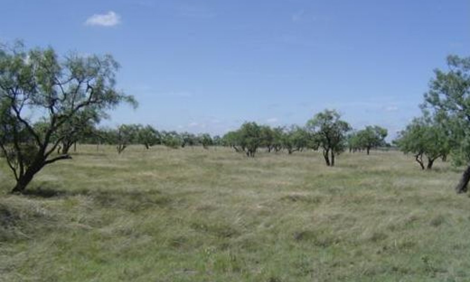
The Clay Flat is characterized by heavy clay soils on nearly level slopes. Sites are productive, but can be droughty due to their high clay content and available moisture to plants. The depression areas can be occasionally ponded with excess precipitation for up to a month.
Associated sites
R081BY354TX Very Shallow 23-31 PZ
The Very Shallow site may be encountered adjacent to this site.
R081BY326TX Clay Loam 23-31 PZ
The Clay Loam site may be encountered on the adjacent slopes.
Similar sites
R081BY326TX Clay Loam 23-31 PZ
The Clay Loam has deep soils but has less clay content.
Table 1. Dominant plant species
Tree Not specified
Shrub Not specified
Herbaceous (1) Pleuraphis mutica
(2) Bouteloua curtipendulaPhysiographic features
The Clay Flat consists of nearly level soils. The Clay Flat occurs on broad flats below limestone hills. The elevation ranges from 1,100 feet to 2,800 feet above sea level. Slope ranges from 0 to 3 percent. The site is used mostly for rangeland while irrigated vegetables, cotton, corn, and grain sorghum are also planted.
Table 2. Representative physiographic features
Landforms (1) Plateau > Ridge
(2) Plateau > Plain
(3) Plateau > Depression
Runoff class Negligible to high Flooding frequency None Ponding duration Long (7 to 30 days) Ponding frequency None to occasional Elevation 1100 – 2800 ft Slope 0 – 3 % Ponding depth 0 – 24 in Water table depth 40 – 80 in Aspect Aspect is not a significant factor Table 3. Representative physiographic features (actual ranges)
Runoff class Negligible to very high Flooding frequency Not specified Ponding duration Not specified Ponding frequency Not specified Elevation 0 ft Slope 0 % Ponding depth 0 – 72 in Water table depth 0 – 80 in Climatic features
The climate in the MLRA 81B is subtropical subhumid on the eastern portion and subtropical steppe on the western portion of the MLRA. Winters are dry, and the summers are hot and humid. The precipitation increases from west to east and the temperatures increase from north to south. The area usually receives 65 to 70 percent sunshine each year. The majority of the rainfall occurs during the warm months of April to October. Most precipitation comes from thunderstorms that vary in the amount of water received and the areas covered. Spring is characterized by fluctuating patterns, but mild temperatures prevail. July and August are relatively dry and hot with little weather variability day-to-day. As summer progresses through fall, an increase of precipitation usually occurs in the eastern portions while a decrease of precipitation occurs to the west. Winter temperatures are mild, but polar Canadian air masses bring rapid drops in temperature. These cold spells last 2 or 3 days. Prevailing winds are southerly with March and April the windiest months.
Table 4 Representative climatic features
Frost-free period (characteristic range) 210-240 days Freeze-free period (characteristic range) 240-280 days Precipitation total (characteristic range) 30-30 in Frost-free period (actual range) 210-240 days Freeze-free period (actual range) 240-280 days Precipitation total (actual range) 20-30 in Frost-free period (average) 230 days Freeze-free period (average) 260 days Precipitation total (average) 30 in Characteristic rangeActual rangeBarLineFigure 2. Monthly precipitation range
Characteristic rangeActual rangeBarLineFigure 3. Monthly minimum temperature range
Characteristic rangeActual rangeBarLineFigure 4. Monthly maximum temperature range
BarLineFigure 5. Monthly average minimum and maximum temperature
Figure 6. Annual precipitation pattern
Figure 7 Annual average temperature pattern
Climate stations used
-
(1) BRADY [USC00411017], Brady, TX
-
(2) EDEN [USC00412741], Eden, TX
-
(3) FREDERICKSBURG [USC00413329], Fredericksburg, TX
-
(4) FT MCKAVETT [USC00413257], Fort Mc Kavett, TX
-
(5) HUNT 10 W [USC00414375], Hunt, TX
-
(6) JUNCTION 4SSW [USC00414670], Junction, TX
-
(7) JUNCTION KIMBLE CO AP [USW00013973], Junction, TX
-
(8) MENARD [USC00415822], Menard, TX
-
(9) ROCKSPRINGS 1S [USC00417706], Rocksprings, TX
-
(10) SAN SABA [USC00417992], San Saba, TX
">Influencing water features
Due to the high clay content and low slope, sites can be ponded. This only occurs occasionally, 1 in 10 years, but can be ponded for 1 month.
Wetland description
Wetland determinations need to be made onsite.
Soil features
The Clay Flat consists of soils that are very deep, well drained, very slowly permeable soils formed in calcareous clayey alluvium derived from limestone. The bedrock, when present, is greater than 60 inches below the surface and it is about 20 inches thick. Internal drainage is well drained and permeability is very slow. The available water capacity is moderate. The following soil series are associated: Irion and Tobosa.
Table 5. Representative soil features
Parent material (1) Alluvium – limestone
Surface texture (1) Clay
(2) Silty clay
Family particle size (1) Fine
Drainage class Well drained Permeability class Very slow Depth to restrictive layer 60 – 80 in Soil depth 60 – 80 in Surface fragment cover <=3" 0 – 4 % Surface fragment cover >3" 0 – 1 % Available water capacity
(0-40in)4.1 – 7.1 in Calcium carbonate equivalent
(0-40in)0 – 20 % Electrical conductivity
(0-40in)0 – 2 mmhos/cm Sodium adsorption ratio
(0-40in)0 – 15 Soil reaction (1:1 water)
(0-40in)7.4 – 8.4 Subsurface fragment volume <=3"
(4-40in)0 – 4 % Subsurface fragment volume >3"
(4-40in)0 – 1 % Table 6. Representative soil features (actual values)
Drainage class Not specified Permeability class Not specified Depth to restrictive layer 40 – 80 in Soil depth 40 – 80 in Surface fragment cover <=3" 0 % Surface fragment cover >3" 0 % Available water capacity
(0-40in)0 in Calcium carbonate equivalent
(0-40in)0 % Electrical conductivity
(0-40in)0 mmhos/cm Sodium adsorption ratio
(0-40in)0 Soil reaction (1:1 water)
(0-40in)0 Subsurface fragment volume <=3"
(4-40in)0 % Subsurface fragment volume >3"
(4-40in)0 % Ecological dynamics
The Clay Flat was a fire-induced midgrass prairie with a few scattered shrubs. The reference community evolved under frequent fire and periodic heavy grazing by bison, pronghorn antelope, and deer. The subtropical semiarid climate, with hot summers and convective summer precipitation, is conducive to deep-rooted woody plants and herbs. European settlement during the 1800’s brought animal husbandry, windmills, and fencing to the area. Before their arrival, however, frequent wildfires suppressed woody and forb species at very low levels. Historians postulate that fires, set either by Native Americans or lightning, occurred as often as 7 to 12-year intervals on the middle part of the Edwards Plateau. The frequent and intense fires likely were more influential in shaping the open Midgrass Prairie Community (1.1) than intermittent grazing by bison and pronghorns and periodic droughts.
Tobosa (Phleuraphis mutica), sideoats grama (Bouteloua curtipendula), feathery bluestems (Bothriochloa spp.) and vine mesquite (Panicum obtusum) dominated the Midgrass Prairie Community (1.1) making up approximately 70 percent of the total herbage production. The frequent fires favored grasses, especially tobosa, over woody plants and forbs, but there was a wide variety of forbs and legumes present. Although the site is quite droughty, the shrink-swell characteristics of the soil produce a gilgai microrelief with microflats and microdepressions adding diversity to the plant community. Deep cracks form when the soils are dry limit the plant community to those species that can tolerate frequent root pruning.
The Midgrass Prairie Community (1.1) was relatively stable and resilient until European Settlement. The settlement in the 1800’s brought an elimination of the bison herd and a large increase of domestic livestock. The development of the windmill and barbed wire fencing in the 1880’s brought about heavy continuous grazing throughout the Edwards Plateau. As heavy grazing continued, there was a reduction of more palatable plants and an increase in tobosa, less palatable forbs, and shortgrasses. When retrogression was cattle induced, sideoats grama, feathery bluestems, vine mesquite and other palatable species decreased. Total herbage production declined as well. There was a concomitant decline in vegetative ground cover, mulch, and soil organic matter. The shift in composition of the plant cover and the decline in soil properties favored woody plant encroachment. This, along with the reduction in intensity and frequency of fires, allowed invasion of species from adjacent sites or the increase of more grazing resistant endemic species.
Under the above scenario, the reference community will transition into a Tobosa/Mixed-grass Savannah Community (1.2). In this plant community, tobosa, buffalograss (Bouteloua dactyloides), and curlymesquite (Hilaria belangeri) increase and become dominant. Grasses, primarily tobosa, dominate primary production and the encroaching woody species also contributed to the total annual production. When the Tobosa/Mixed-grass Savannah Community (1.2) is continually grazed heavily and fire is excluded, ecological succession proceeds toward woody plant dominants and replacement of the more preferred species. Primary increasing woody species are mesquite and pricklypear. Tobosa, buffalograss, and curly mesquite continue to increase and palatable forbs and midgrasses decrease. As grass cover declines, litter and soil organic matter decline while bare ground, erosion, and other desertification processes increase. The microclimate in the grassland areas becomes more arid. When the woody plant component reaches approximately 15 percent canopy, grazing management strategies, such as grazing deferment, generally will not restore the grassland community. A combination of proper grazing and prescribed burning could be successful. Without these management practices, the woody plants will continue to increase in density and size as ecological succession forces drive the plant community toward a woody plant dominance in the absence of fire and competition from herbaceous plants. The next community in the succession is a Tobosa/Shortgrass Mesquite/Mixed-Brush Community (2.1).
In the Mesquite/Mixed-grass Shortgrass Community (2.1), mesquite and understory brush continue to increase in size and density regardless of grazing management. Initially, the grass component is a mixture of tobosa, shortgrasses, and low-quality forbs. With continued heavy livestock grazing, tobosa, buffalograss, and curlymesquite are replaced by less palatable species such as three-awns (Aristida spp.), low gramas (Bouteloua spp.), and snakeweed (Gutierrezia spp.). Cool-season grasses such as Texas wintergrass (Nassella leucotricha) and annuals also increase. Once woody plant cover exceeds 40 to 50 percent, forage production is very limited, and generally composed of unpalatable and weakened shrubs, grasses and forbs. In this state, the site is poor range for livestock and low quality deer habitat providing only cover and low quality browse forbs. Desertification, including erosion, continues in the interspaces until maximum ground cover by woody species is approached. The microclimate becomes drier as interception losses increase with canopy cover. Once canopy cover reaches potential, however, the hydrologic processes, energy flow, and nutrient cycling stabilize under the woodland environment.
Major expense and energy are required to restore Mesquite/Mixed-brush Shortgrass Community (2.2) to a midgrass prairie community. Generally, mechanical or herbicidal treatments are used to remove brush. Areas can be dozed or plants treated individually (IPT) with chemicals. Many times, this is followed by range planting to provide native seed back in the soil. Restoration of this site is very difficult to accomplish because of different soil characteristics. The brushy species, namely mesquite, can be very hard to control with herbicides. Mechanical control such as grubbing or root plowing can destroy the perennial grass cover and more often than not, annuals or broom snakeweed can prevail for two or three years, even with reseeding. Eventually, the plants most adapted to the site will return and again become dominant. The restoration process may take several years of repeated treatments. Soil erosion during the restoration process may preclude a complete return to the reference community.
The Clay Flat site is used mainly for range, but some areas are cultivated. Potential for cultivated crops are high with irrigation. Without irrigation, crop agriculture is not sustainable in the semiarid climate. Although some grain and winter cereal crops are planted today, most of the fields in the site are used as rangeland. Some areas originally planted to crops have been abandoned and let “Go Back” to native range. These generally re-establish naturally with species from adjacent acreage, especially brush species. If the woody invaders are not controlled with brush management, woody species will eventually dominate through secondary succession.State and transition model
More interactive model formats are also available. View Interactive Models
Click on state and transition labels to scroll to the respective textEcosystem states
T1A - Absence of disturbance and natural regeneration over time, coupled with excessive grazing pressure T1B - Extensive soil disturbance followed by seeding R2A - Reintroduction of historic disturbance return intervals T2A - Extensive soil disturbance followed by seeding State 1 submodel, plant communities
State 2 submodel, plant communities
State 3 submodel, plant communities
State 1
GrasslandDominant plant species
-
tobosagrass (Pleuraphis mutica), grass
-
sideoats grama (Bouteloua curtipendula), grass
Community 1.1
Midgrass Prairie
Figure 8. 1. Midgrass Prairie Community
The reference community for this site is a fire-dependent midgrass prairie. Woody species make up less than five percent of the total herbage production. Tobosa, being tolerant of repeated fires, contributes as much as 30 percent composition in the western portion of the area but decreases in dominance from west to east. Sideoats grama, feathery bluestems, vine mesquite (Panicum obtusum), Arizona cottontop (Digitaria californica), Texas cupgrass (Eriochloa sericea), and plain bristlegrass (Setaria leucopila) make up 30 to 45 percent. Buffalograss and curlymesquite are common shortgrasses. Texas wintergrass (Nassella leucotricha), wildryes (Elymus spp), and Western wheatgrass (Pascopyrum smithii) are important parts of the cool-season component. Forbs included Engelmann’s daisy (Engelmannia peristenia), ruellia (Ruellia spp.), sida (Sida spp.), half-shrub sundrop (Calylophus serrulatus), and bundleflower (Desmanthus spp.). Shrubs are scarce but include fire-resistant species like sumac (Rhus spp.), greenbriar (Smilax spp.), pricklypear (Opuntia spp.), and bumelia (Sideroxylon lanuginosum). Oaks (Quercus spp.) and mesquite (Prosopis spp.) are also present but are usually scattered multi-stemmed shrubs created by repeated wildfires.
The Midgrass Prairie Community (1.1) produced as much as 3,500 pounds in good moisture years and 600 pounds or less in dry years. Annual production declines from east to west due to precipitation differences. Grasses contribute up to 95 percent of the total annual production. The midgrasses aid in the infiltration of rainfall into the moderately permeable soil and reduced runoff. Litter and organic matter buildup was limited by the dry climate. The Midgrass Prairie Community (1.1) furnishes quality habitat for herbivores.Figure 9. Annual production by plant type (representative values) or group (midpoint values)
Table 7. Annual production by plant type
Plant type Low
(lb/acre)Representative value
(lb/acre)High
(lb/acre)Grass/Grasslike 540 2250 3150 Shrub/Vine 30 125 175 Forb 30 125 175 Tree 0 0 0 Total 600 2500 3500 Figure 10. Plant community growth curve (percent production by month). TX3622 , Mid and Shortgrass Savannah, 10% canopy. Mid and shortgrasses dominate the site with less than 20 percent forbs, shrubs, and woody plants..
Jan Feb Mar Apr May Jun Jul Aug Sep Oct Nov Dec J F M A M J J A S O N D 2 3 5 13 23 15 4 5 15 7 5 3 Community 1.2
Tobosa/Mixed-grass Savannah
Figure 11. 2. Tobosa/Mixed-grass Savannah Community
The Tobosa/Mixed-grass Savannah Community (1.2) is a tobosa dominated mixed-grass community being encroached by woody species that have been held at low densities by repeated fires and competition from a vigorous grass component. Brushy species, including pricklypear and mesquite, increase in density because heavy abusive grazing by livestock reduces grass cover, causes reduction of soil cover, and reduces fine fuel necessary to care fires. Due to selective grazing and differential response of plants to defoliation, heavy grazing also causes changes in composition of the reference community. The more palatable midgrasses and forbs are replaced by less palatable, or more grazing resistant, species.
The encroaching woody species are generally less than five feet tall and subject to control by prescribed burning and proper grazing management. The woody canopy varies between 10 and 25 percent depending on length and severity of overgrazing, time since burned, and availability of invading species. Typically, mesquite and/or pricklypear are early and persistent increasers. Condalia (Condalia spp.), algerita (Mahonia trifoliolata), and acacia (Acacia spp.) are also common. The prairie becomes a grassland shrub savannah being encroached by suppressed woody species. The preferred midgrasses are being replaced by the more grazing resistant tobosa, although sideoats grama, vine mesquite, Texas cupgrass, and feathery bluestems persist in this phase. Most of the perennial forbs found in the reference plant community remain, although in lesser amounts.
Annual primary production is reduced slightly in relation to the reference community, ranging from 500 to 3,000 pounds per acre depending on precipitation amounts and the soil series. Grasses remain the dominant producers of forage. Heavy abusive grazing reduced plant cover, litter and mulch and increased bare ground exposing the soil to some erosion. There could be some mulch and litter movement during rainstorms, but due to gentle slopes little soil movement takes place in this vegetation phase.Figure 12. Annual production by plant type (representative values) or group (midpoint values)
Table 8. Annual production by plant type
Plant type Low
(lb/acre)Representative value
(lb/acre)High
(lb/acre)Grass/Grasslike 400 1440 2400 Shrub/Vine 75 270 450 Forb 25 90 150 Tree 0 0 0 Total 500 1800 3000 Figure 13. Plant community growth curve (percent production by month). TX3633 , Tobosa/Mixed-grass Savannah Community. Warm-season rangeland with peaks in production in May and in September that coincide with peaks in precipitation..
Jan Feb Mar Apr May Jun Jul Aug Sep Oct Nov Dec J F M A M J J A S O N D 3 3 5 13 20 17 4 4 15 7 5 4 Pathway 1.1A
Community 1.1 to 1.2
Midgrass Prairie
Tobosa/Mixed-grass SavannahThe reference community can be maintained with prescribed grazing and prescribed burning. Stocking rates must consider the kind of livestock and balance their numbers with current annual forage production while considering competition from other herbivores. With heavy abusive grazing, a decrease in intensity and frequency of fires and no brush management, this plant community transitions very quickly to the Tobosa/Mixed-grass Savannah Community (1.2).
Pathway 1.2A
Community 1.2 to 1.1
Tobosa/Mixed-grass Savannah
Midgrass PrairieWith the use of prescribed grazing and prescribed burning conservation practices, the Tobosa/Mixed-grass Savannah Community can revert back to the Midgrass Prairie Community.
Conservation practices
Prescribed Burning Prescribed Grazing Community 2.1
Mesquite/Mixed-Brush Shortgrass
Figure 14. 2.1 Mesquite/Mixed-Brush Shortgrass Community
The Mesquite/Mixed-brush Shortgrass Community (2.1) is a 30 percent or greater woody plant canopy dominated by mesquite with mixed-brush and pricklypear understory. It is the result of selective overgrazing, absence of fire, and the differential response of plants to defoliation. The diversity of the grassland component declines while woody plants and unpalatable forbs increase. Primary production has decreased due to decline in soil structure and organic matter and is primarily from the woody component. All woody species, except the more palatable ones, have increased in size and density. The typical woody cover is scattered oak trees or mottes, with mesquite and pricklypear common understory species. Algerita, acacia, condalia, and snakeweed (Gutierrezia spp.) are also common in places.
Remnants of reference community may occupy interspaces between trees and shrubs, but more often they are unpalatable invader species. Tobosa remains dominant, but as regression progresses under continued overgrazing, tobosa gives way to buffalograss (Bouteloua dactyloides), curlymesquite (Hilaria belangeri), and other less palatable shortgrasses and forbs. Mexican sagewort (Artemesia ludoviciana), Texas nightshade (Solanum spp.), queen’s delight (Stillingia sylvatica), prairie coneflower (Ratibida columnifera), Texas grama (Bouteloua rigidiseta var. rigidiseta), and red grama (Bouteloua trifida) are common. Cool-season grasses such as Texas wintergrass can be found under and around woody plants. In wet cycles, grasses such as bromes (Bromus spp.), and other annual species such as broomweed (Amphiachyris spp.) are abundant. Because of grazing pressure and competition for nutrients and water from the woody plants, the grassland component shows lack of plant vigor and productivity.
As the grassland component declines, more soil is exposed to crusting and wind erosion. During the middle and end of this plant community phase, considerable soil becomes exposed further. Water erosion is not a serious problem because of the shallow slopes on the site but wind erosion can be rather high. High interception losses by the increasing woody canopy combined with evaporation losses can reduce the effectiveness of rainfall. Litter, soil organic matter and structure decline in the interspaces reducing water infiltration but hydrologic conditions improve under the woody plant cover.
Annual primary production is approximately 500 to 3,000 pounds per acre, which is dominated by the mesquite, pricklypear, and other mixed-brush components. As this plant community nears maturity, the herbaceous component contributes less than 30 percent of the annual total production. Browsing animals such as goats and deer find fair food value in this plant community if browse resources have not been grazed excessively. Forage quantity and quality for cattle is low. Livestock stocking decisions should consider the species composition and quantity of available forage and set-stocking rates accordingly.
Unless brush management and good grazing management are applied, the continued transition toward dense shrubland will continue. The trend cannot be reversed with good grazing management practices alone. Renovation type brush control practices are required to reverse the trend toward dense shrubland. Alternatives for restoration include: brush management, range planting to return vegetation back to reference species, proper grazing management, and prescribed burning to maintain the desired community.Figure 15. Annual production by plant type (representative values) or group (midpoint values)
Table 9. Annual production by plant type
Plant type Low
(lb/acre)Representative value
(lb/acre)High
(lb/acre)Tree 375 875 1050 Grass/Grasslike 125 625 750 Shrub/Vine 125 625 750 Forb 50 250 300 Total 675 2375 2850 Figure 16. Plant community growth curve (percent production by month). TX3632 , Mesquite/Mixed-Brush Shortgrass Community. Warm season rangeland with peaks in production from herbaceous layer in May and in September..
Jan Feb Mar Apr May Jun Jul Aug Sep Oct Nov Dec J F M A M J J A S O N D 3 3 5 13 20 17 4 4 15 7 5 4 Community 3.1
Converted Land
Figure 17. 3.1 Cropland Community

Figure 18. 3.1 Pastureland Community
Early settlers, having a farming background, cultivated small fields on the Clay Flat and adjacent Clay Loam and Bottomland sites for vegetable crops, grain, forage sorghum and winter cereals for livestock forage. Many acres of the were converted to cropland. The potential for cropland is high. Many areas of the Clay Flat site are associated with other arable soils and could be converted to cropland. Cropping small acreages is practiced for summer annual forage crops or winter small grain grazing especially if irrigation water is available. Many fields, however, have been abandoned and let ‘go back’ to native range or planted to native or introduced grasses for pasture.
Cropland areas are often seeded to native or introduced species such as Kleingrass (Panicum coloratum). Herbage production on those seeded to adapted introduced grasses or native grasses can reach peak production within a few years if a full stand is established. In this case, herbage production will equal the reference community. Adapted introduced species plantings such as Kleingrass may surpass reference community production depending upon the degree of cultivation induced soil deterioration. The practice of including adapted legumes or other forbs to the grass mixture will enhance vegetative productivity and usefulness on the land, especially for wildlife.
Invasion of the seeded fields by brush, particularly mesquite and pricklypear, is common in this site. Drought and reduced soil cover due to cropping and heavy abusive grazing along with a nearby seed source trigger the brush invasion. The shrubs that appear in seeded or abandoned fields are established by seeds brought in by animals, water, or wind. The invading brush must be controlled with grazing management, prescribed burning, or other appropriate brush management methods, or the woody invaders will dominate.Figure 19. Annual production by plant type (representative values) or group (midpoint values)
Table 10. Annual production by plant type
Plant type Low
(lb/acre)Representative value
(lb/acre)High
(lb/acre)Grass/Grasslike 1500 3000 4000 Total 1500 3000 4000 Figure 20. Plant community growth curve (percent production by month). TX3600 , Cool Season Crops. Cool season species are planted in the fall for winter and spring growth. Species include wheat and oats..
Jan Feb Mar Apr May Jun Jul Aug Sep Oct Nov Dec J F M A M J J A S O N D 5 5 10 10 5 0 0 0 20 25 15 5 Figure 21. Plant community growth curve (percent production by month). TX3601 , Warm Season Crops. Warm season species are planted in early spring. Their peak growth is in late May with a lesser peak in September. Forage and Grain sorghum that are planted during the warm season months..
Jan Feb Mar Apr May Jun Jul Aug Sep Oct Nov Dec J F M A M J J A S O N D 0 0 8 20 25 20 10 10 5 2 0 0 Figure 22. Plant community growth curve (percent production by month). TX3602 , Warm Season Perennial Pasture. Depends on planted species, but most production will be in April, May and June with a lesser peak in September and October..
Jan Feb Mar Apr May Jun Jul Aug Sep Oct Nov Dec J F M A M J J A S O N D 1 2 2 18 23 17 6 4 16 6 3 2 Community 3.2
Go Back LandThe Go Back Land Community (3.2) is used to describe cropland fields that have been abandoned and are undergoing secondary succession. The Go Back Land Community results from abandoning cropped land and leaving it idle without seeding or brush management. Many cropland areas have been abandoned and are invaded by brush from the adjacent rangeland. The initial composition of abandoned fields is composed of annual, biennial, and weak perennial grasses and forbs. The species depends on the seed source from adjacent areas.
The rate of succession depends on grazing management and drought frequency, but reestablishment of reference community species takes many years. Without grazing management and brush management practices, brush species such as pricklypear, mesquite, and juniper will dominate the site before a grass community can establish. Biomass production will be limited in the early seral stage and increase as the plant community develops. Brush management and grazing management are necessary to allow the field to go back to the reference community.Figure 23. Annual production by plant type (representative values) or group (midpoint values)
Table 11. Annual production by plant type
Plant type Low
(lb/acre)Representative value
(lb/acre)High
(lb/acre)Grass/Grasslike 550 990 1320 Forb 300 540 720 Shrub/Vine 100 180 240 Tree 50 90 120 Total 1000 1800 2400 Figure 24. Plant community growth curve (percent production by month). TX3632 , Mesquite/Mixed-Brush Shortgrass Community. Warm season rangeland with peaks in production from herbaceous layer in May and in September..
Jan Feb Mar Apr May Jun Jul Aug Sep Oct Nov Dec J F M A M J J A S O N D 3 3 5 13 20 17 4 4 15 7 5 4 Pathway 3.1A
Community 3.1 to 3.2With abusive grazing pressure, no fires, no brush management, no pasture/cropland management, abandonment, and idled land conditions, the Converted Land Community would shift to the Abandoned Land Community.
Pathway 3.2A
Community 3.2 to 3.1Prescribed grazing, range/pasture/cropland management, pasture planting, range planting, and crop cultivation are several of the conservation practices necessary to revert back to the Converted Land Community.
Conservation practices
Prescribed Burning Range Planting Prescribed Grazing Transition T1A
State 1 to 2The changes in species composition are small initially. Unless proper grazing and prescribed burning are initiated at this stage, the invading species continue to increase in size and density. When the canopy of the woody plants becomes dense enough (25 percent) and tall enough (greater than five feet) to suppress grass growth and resist fire damage, a threshold in ecological succession is crossed. This threshold can also occur when the fine fuel load provided by grasses is too low to effectively control the brush with prescribed burning. Once this threshold is passed, the Tobosa/Mixed-grass Community (1.2) transitions into the Mesquite/Mixed-brush Shortgrass Community (2.1) a plant community state in which normal range management practices, such as proper grazing and prescribed burning, cannot reverse the trend to woody plant dominance.
Transition T1B
State 1 to 3The Grassland State can shift to the Converted Land State through the implementation of various practices such as brush management, pasture planting, range planting, and crop cultivation.
Restoration pathway R2A
State 2 to 1The Shrubland State can be reverted back to the Grassland State through the application of various conservation practices including prescribed grazing, brush management, IPT, range planting, and prescribed burning.
Conservation practices
Brush Management Prescribed Burning Range Planting Prescribed Grazing Transition T2A
State 2 to 3With the use of brush management, pasture planting, range planting, and crop cultivation, the Shrubland State shifts to the Converted Land State.
Additional community tables
Table 12. Community 1.1 plant community composition
Group Common name Symbol Scientific name Annual production () Foliar cover (%) Grass/Grasslike1 midgrass 180–1050 tobosagrass PLMU3 Pleuraphis mutica 180–1050 – 2 midgrasses 240–1400 cane bluestem BOBA3 Bothriochloa barbinodis 240–1400 – sideoats grama BOCU Bouteloua curtipendula 240–1400 – silver beardgrass BOLAT Bothriochloa laguroides ssp. torreyana 240–1400 – plains lovegrass ERIN Eragrostis intermedia 240–1400 – Texas cupgrass ERSE5 Eriochloa sericea 240–1400 – vine mesquite PAOB Panicum obtusum 240–1400 – plains bristlegrass SEVU2 Setaria vulpiseta 240–1400 – composite dropseed SPCOC2 Sporobolus compositus var. compositus 240–1400 – Drummond's dropseed SPCOD3 Sporobolus compositus var. drummondii 240–1400 – 3 shortgrasses 180–350 threeawn ARIST Aristida 180–350 – buffalograss BODA2 Bouteloua dactyloides 180–350 – hairy grama BOHI2 Bouteloua hirsuta 180–350 – curly-mesquite HIBE Hilaria belangeri 180–350 – slim tridens TRMU Tridens muticus 180–350 – slim tridens TRMUE Tridens muticus var. elongatus 180–350 – 4 shortgrasses 30–175 Texas grama BORI Bouteloua rigidiseta 30–175 – red grama BOTR2 Bouteloua trifida 30–175 – fall witchgrass DICO6 Digitaria cognata 30–175 – hairy woollygrass ERPI5 Erioneuron pilosum 30–175 – 5 cool-season grasses 30–175 Canada wildrye ELCA4 Elymus canadensis 30–175 – Texas wintergrass NALE3 Nassella leucotricha 30–175 – western wheatgrass PASM Pascopyrum smithii 30–175 – Forb6 forbs 30–175 pelotazo ABIN Abutilon incanum 30–175 – Cuman ragweed AMPS Ambrosia psilostachya 30–175 – white sagebrush ARLUM2 Artemisia ludoviciana ssp. mexicana 30–175 – yellow sundrops CASE12 Calylophus serrulatus 30–175 – leather flower CLEMA Clematis 30–175 – croton CROTO Croton 30–175 – prairie clover DALEA Dalea 30–175 – bundleflower DESMA Desmanthus 30–175 – Engelmann's daisy ENPE4 Engelmannia peristenia 30–175 – Gregg's tube tongue JUPI5 Justicia pilosella 30–175 – rush skeletonplant LYJU Lygodesmia juncea 30–175 – narrowleaf Indian breadroot PELI10 Pediomelum linearifolium 30–175 – beardtongue PENST Penstemon 30–175 – smartweed leaf-flower PHPO3 Phyllanthus polygonoides 30–175 – groundcherry PHYSA Physalis 30–175 – wild petunia RUELL Ruellia 30–175 – awnless bushsunflower SICA7 Simsia calva 30–175 – fanpetals SIDA Sida 30–175 – Texas nightshade SOTR2 Solanum triquetrum 30–175 – globemallow SPHAE Sphaeralcea 30–175 – fuzzybean STROP Strophostyles 30–175 – queen's-delight STSY Stillingia sylvatica 30–175 – Shrub/Vine7 shrubs/vines 30–175 acacia ACACI Acacia 30–175 – snakewood CONDA Condalia 30–175 – algerita MATR3 Mahonia trifoliolata 30–175 – pricklypear OPUNT Opuntia 30–175 – sumac RHUS Rhus 30–175 – Tree8 trees 0 mesquite PROSO Prosopis 0 – oak QUERC Quercus 0 – Table 13. Community 1.2 plant community composition
Group Common name Symbol Scientific name Annual production () Foliar cover (%) Table 14. Community 2.1 plant community composition
Group Common name Symbol Scientific name Annual production () Foliar cover (%) Table 15. Community 3.1 plant community composition
Group Common name Symbol Scientific name Annual production () Foliar cover (%) Grass/Grasslike1 Small Grain 1500–3500 2 Forage Sorghum 3000–4000 3 Pastureland Community 2300–4400 Table 16. Community 3.2 plant community composition
Group Common name Symbol Scientific name Annual production () Foliar cover (%) Interpretations
Animal community
Many types of grassland prairie wildlife use the Clay Flat Ecological Site. Insects, reptiles, birds, and mammals frequent the site, either as their base habitat or from the adjacent sites. Small mammals include many kinds of rodents, rabbits, raccoon, skunk, opossum, and armadillo. Predators include coyote, red fox, gray fox, and bobcat. Many types of birds including game birds, songbirds, and birds of prey are indigenous. Most are still plentiful. Bison and pronghorn antelope, however, are no longer present. White-tailed deer and many species of exotic deer utilize the Clay Flat site in its various states. Deer, turkey, and quail particularly favor the habitat provided by the Tobosa/Midgrass Savannah Plant Community.
The site is suitable for production of livestock, including cattle, sheep, and goats. The reference community is very suited to primary grass eaters such as bison and cattle. As retrogression occurs and woody plants invade, it becomes better habitat for sheep, goats, deer, and other wildlife because of the browse and cool-season grasses. Cattle, sheep, and goats should be stocked in proportion to the available grass, forb, and browse forage, keeping deer competition for forbs and browse in mind. If the animal numbers are not kept in balance with herbage and browse production through grazing management and good wildlife population management, the late Mesquite/Mixed-Brush Shortgrass phase will have little to offer as habitat except cover.Hydrological functions
The Clay Flat Ecological Site is a well-drained, deep upland with generally flat slopes. It may receive water from surrounding soils and the site may be covered with by water during seasons of high rainfall. Soil moisture holding capacity is high and percolation is moderate. Runoff is slow due to gentle to nearly level depression slopes. The soil crusts readily when exposed leading to high evaporation and possibly wind erosion. It also cracks to great depth when dry, allowing rapid water up-taken when rain occurs on dry soil. The deep soils, with moderate to good water holding capacity, are conducive to high herbage production during above average moisture years.
Under reference conditions, the grassland vegetation intercepts and utilizes much of the incoming rainfall. Litter and soil movement is slight. Standing plant cover, duff, and organic matter decrease as the Midgrass Prairie (1.1) transitions to the Tobosa/Midgrass Savannah Community (1.2). These processes continue in the interstitial spaces in the Tobosa/Shortgrass Mesquite/Mixed-brush Community (2.1). Once the shrubland matures, the hydrologic and ecological processes, nutrient cycling, and energy flow stabilize within the woody plant canopy. Evaporation and interception losses are higher, however, resulting in less moisture reaching the soil. Essentially no water passes through the soil to underground water.Recreational uses
The Clay Flat site is well suited for many outdoor recreational uses including recreational hunting, hiking, camping, equestrian, and bird watching. This site along with adjacent upland sites provides diverse scenic beauty and many opportunities for recreation.
Wood products
Mesquite is sometimes used for posts and charcoal.
Other products
Jams and jellies are made from many fruit-bearing species. Seeds are harvested from many plants for commercial sale. Grasses and forbs may be harvested by the dried-plant industry for sale in dried flower arrangements. Honeybees are utilized to harvest honey from the many flowering plants.
Supporting information
Inventory data references
Information presented here has been derived from the revised Clay Flat Range Site, literature, limited NRCS clipping data (417s), field observations, and personal contacts with range-trained personnel. Photos by J. L. Schuster.
Other references
Archer, S. 1994. Woody plant encroachment into southwestern grasslands and savannas: Rates, patterns, and proximate causes. Ecological implications of livestock herbivory in the West, 13-68.
Archer, S. and F. E. Smeins. 1991. Ecosystem-level processes. Grazing Management: An Ecological Perspective. Edited by R.K. Heischmidt and J.W. Stuth. Timber Press, Portland, OR.
Bestelmeyer, B. T., J. R. Brown, K. M. Havstad, R. Alexander, G. Chavez, and J. E. Herrick. 2003. Development and use of state-and-transition models for rangelands. Journal of Range Management, 56(2):114-126.
Bracht, V. 1931. Texas in 1848. German-Texan Heritage Society, Department of Modern Languages, Southwest Texas State University, San Marcos, TX.
Bray, W. L. 1904. The timber of the Edwards Plateau of Texas: Its relations to climate, water supply, and soil. No. 49. US Department of Agriculture, Bureau of Forestry.
Briske, D. D., S. D. Fuhlendorf, and F. E. Smeins. 2005. State-and-transition models, thresholds, and rangeland health: A synthesis of ecological concepts and perspectives. Rangeland Ecology and Management, 58(1):1-10.
Brothers, A., M. E. Ray Jr., and C. McTee. 1998. Producing quality whitetails, revised edition. Texas Wildlife Association, San Antonio, TX.
Brown, J. K. and J. K. Smith. 2000. Wildland fire in ecosystems, effects of fire on flora. Gen. Tech. Rep. RMRS-GTR-42-vol. 2. Ogden, UT: US Department of Agriculture, Forest Service, Rocky Mountain Research Station, 257:42.
Davis, W. B. 1974. The Mammals of Texas. Texas Parks and Wildlife Department, 41.
Foster, J. H. 1917. The spread of timbered areas in central Texas. Journal of Forestry 15(4):442-445.
Frost, C. C. 1998. Presettlement fire frequency regimes of the United States: A first approximation. Fire in ecosystem management: Shifting the paradigm from suppression to prescription. Tall Timbers Fire Ecology Conference Proceedings, 20:70-81.
Gould, F. W. 1975. The grasses of Texas. The Texas Agricultural Experiment Station, Texas A&M University Press, College Station, TX.
Hatch, S. L. and J. Pluhar. 1993. Texas Range Plants. Texas A&M University Press, College Station, TX.
Hamilton, W. and D. Ueckert. 2005. Rangeland woody plant control--past, present, and future. Texas A&M University Press. College Station, TX.
Hart, C. R., A. McGinty, and B. B. Carpenter. 1998. Toxic plants handbook: Integrated management strategies for West Texas. Texas Agricultural Extension Service, The Texas A&M University, College Station, TX.
Heitschmidt, R. K. and J. W. Stuth. 1991. Grazing management: An ecological perspective. Timberline Press, Portland, OR.
Loughmiller, C. and L. Loughmiller. 1984. Texas wildflowers. University of Texas Press, Austin, TX.
Milchunas, D. G. 2006. Responses of plant communities to grazing in the southwestern United States. Gen. Tech. Rep RMRS-GTR-169. Fort Collins, CO: US Department of Agriculture, Forest Service, Rocky Mountain Research Station, 126:169.
Niehaus, T. F. 1998. A field guide to Southwestern and Texas wildflowers (Vol. 31). Houghton Mifflin Harcourt, Boston, MA.
Ramsey, C. W. 1970. Texotics. Texas Parks and Wildlife Department, Austin, TX.
Roemer, F. translated by O. Mueller. 1995. Roemer’s Texas, 1845 to 1847. Texas Wildlife Association, San Antonio, TX.
Scifres, C. J. and W. T. Hamilton. 1993. Prescribed burning for brushland management: The South Texas example. Texas A&M Press, College Station, TX.
Smeins, F. E., S. Fuhlendorf, and C. Taylor, Jr. 1997. Environmental and land use changes: A long term perspective. Juniper Symposium, 1-21.
Taylor, C. A. and F. E. Smeins. 1994. A history of land use of the Edwards Plateau and its effect on the native vegetation. Juniper Symposium, 94:2.
Thurow, T. L. 1991. Hydrology and erosion. Grazing Management: An Ecological Perspective. Edited by R.K. Heitschmidt and J.W. Stuth. Timber Press, Portland, OR.
Tull, D. and G. O. Miller. 1991. A field guide to wildflowers, trees and shrubs of Texas. Texas Monthly Publishing, Houston, TX.
USDA-NRCS. 1997. National range and pasture handbook. Washington, DC: United States Department of Agriculture. Natural Resources Conservation Service, Grazing Lands Technology Institute.
Weniger, D. 1997. The explorers’ Texas: The animals they found. Eakin Press, Austin, TX.
Weniger, D. 1984. The explorers’ Texas: The lands and waters. Eakin Press, Austin, TX.
Vines, R. A. 1984. Trees of Central Texas. University of Texas Press, Austin, TX.
Vines, R. A. 1960. Trees, shrubs and vines of the Southwest. University of Texas Press, Austin, TX.Contributors
Dr. Joseph Schuster, Range & Wildlife Habitat Consultants, LLC, Bryan, TX
Mark Moseley, RMS, NRCS, Boerne, TX
Edits by Travis Waiser, MLRA Leader, NRCS, Kerrville, TXApproval
Bryan Christensen, 9/19/2023
Acknowledgments
Technical Review: Charles Anderson, RMS, NRCS, San Angelo, TX Justin Clary, RMS, NRCS, Temple, TX Carroll Green, RMS, NRCS, Eldorado, TX Mark Moseley, RMS, NRCS, Boerne, TX Homer Sanchez, RMS, NRCS, Temple, TX QC/QA completed by: Bryan Christensen, SRESS, NRCS, Temple, TX Erin Hourihan, ESDQS, NRCS, Temple, TX
Rangeland health reference sheet
Interpreting Indicators of Rangeland Health is a qualitative assessment protocol used to determine ecosystem condition based on benchmark characteristics described in the Reference Sheet. A suite of 17 (or more) indicators are typically considered in an assessment. The ecological site(s) representative of an assessment location must be known prior to applying the protocol and must be verified based on soils and climate. Current plant community cannot be used to identify the ecological site.
Author(s)/participant(s) Joe Franklin, Zone RMS, NRCS, San Angelo, TX Contact for lead author 325-944-0147 Date 12/01/2005 Approved by Approval date Composition (Indicators 10 and 12) based on Annual Production Indicators
-
Number and extent of rills:
None. -
Presence of water flow patterns:
None to slight. Site may receive runoff from adjacent sites. -
Number and height of erosional pedestals or terracettes:
None to slight. Minimal pedestals due to erosion. Cracking and shrinking and swelling of soil profile may give gilgae relief which should not be confused with water erosion patterns and pedestaling. -
Bare ground from Ecological Site Description or other studies (rock, litter, lichen, moss, plant canopy are not bare ground):
Small and non-connected areas with 0 to 5 percent bare ground. -
Number of gullies and erosion associated with gullies:
None. Flat concave terrain and climax vegetative cover precluded gullying. -
Extent of wind scoured, blowouts and/or depositional areas:
None to slight. Wind hazard is slight for Tobosa soils being exposed. -
Amount of litter movement (describe size and distance expected to travel):
Minimal movement of litter for short distances. -
Soil surface (top few mm) resistance to erosion (stability values are averages - most sites will show a range of values):
Erosion stability values estimated at 5 to 6. Water erosion hazard of bare soil is slight. -
Soil surface structure and SOM content (include type of structure and A-horizon color and thickness):
Surface layer of Tobosa soil is dark grayish brown clay. Structure is moderate fine granular to very fine subangular blocky. Fine roots common. -
Effect of community phase composition (relative proportion of different functional groups) and spatial distribution on infiltration and runoff:
Midgrasses with good distribution and cover provided excellent infiltration and slowed runoff. Under normal rainfall, runoff is essentially nil but when rainfall exceeds sites ability to hold water, the runoff is free of erosive action. -
Presence and thickness of compaction layer (usually none; describe soil profile features which may be mistaken for compaction on this site):
None. -
Functional/Structural Groups (list in order of descending dominance by above-ground annual-production or live foliar cover using symbols: >>, >, = to indicate much greater than, greater than, and equal to):
Dominant:
Warm-season midgrassesSub-dominant:
Warm-season shortgrasses Cool-season grasses ForbsOther:
Shrubs/Vines TreesAdditional:
-
Amount of plant mortality and decadence (include which functional groups are expected to show mortality or decadence):
Minimal. Grasses will almost always show mortality and decadence, especially in drought conditions. -
Average percent litter cover (%) and depth ( in):
Interspaces between plant canopies essentially covered with various sizes of litter and mulch. -
Expected annual annual-production (this is TOTAL above-ground annual-production, not just forage annual-production):
600 pounds per acre in years with below average moisture, 2,500 pounds per acre in average moisture years, and 3,500 pounds per acre in above average moisture years. Site may receive extra moisture from adjacent sites and be highly productive in wetter years. -
Potential invasive (including noxious) species (native and non-native). List species which BOTH characterize degraded states and have the potential to become a dominant or co-dominant species on the ecological site if their future establishment and growth is not actively controlled by management interventions. Species that become dominant for only one to several years (e.g., short-term response to drought or wildfire) are not invasive plants. Note that unlike other indicators, we are describing what is NOT expected in the reference state for the ecological site:
Mesquite, pricklypear, broom snakeweed, agarito, acacia and condalia. -
Perennial plant reproductive capability:
Good. All species should be capable of reproducing except during periods of prolonged drought, heavy natural herbivory or intense fire. Recovery from these disturbances will take 2 to 5 years.
Print Options
Sections
Font
AAAAOther
PrintThe Ecosystem Dynamics Interpretive Tool is an information system framework developed by the USDA-ARS Jornada Experimental Range, USDA Natural Resources Conservation Service, and New Mexico State University.
Accessibility statement


