Natural Resources
Conservation Service
Ecological site R080BY148TX
Deep Redland
26-33" PZ
Last updated: 9/19/2023
Accessed: 06/29/2026
-
Search


Major Land Resource Area or ecological site by name and/or ID.
PreviousSectionsNextGeneral information
Provisional. A provisional ecological site description has undergone quality control and quality assurance review. It contains a working state and transition model and enough information to identify the ecological site.
Click to explore map
Figure 1. Mapped extent
Areas shown in blue indicate the maximum mapped extent of this ecological site. Other ecological sites likely occur within the highlighted areas. It is also possible for this ecological site to occur outside of highlighted areas if detailed soil survey has not been completed or recently updated.
MLRA notes
Major Land Resource Area (MLRA): 080B–Texas North-Central Prairies
MLRA 80B consists of gently rolling, dissected plains with very steep hillsides and sideslopes and narrow flood plains associated with small streams. Loamy and clayey soils range from very shallow to deep and developed in sandstones, shales, and limestones of Pennsylvanian age.
Classification relationships
This ecological site is correlated to soil components at the Major Land Resource Area (MLRA) level which is further described in USDA Ag Handbook 296.
Ecological site concept
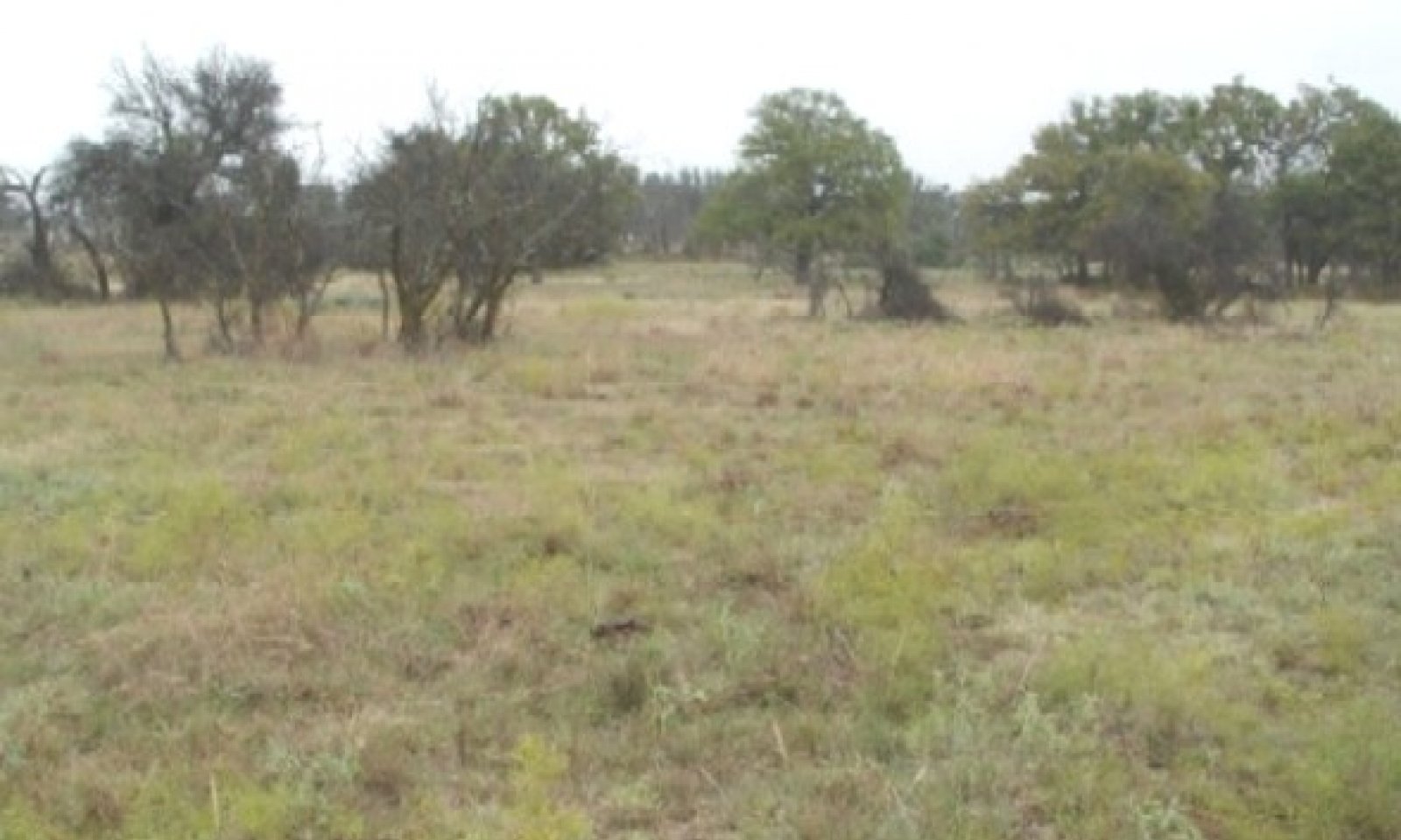
These sites occur over moderately deep non-calcareous loam and clay loam soils on uplands. The reference vegetation includes native perennial tallgrasses with abundant forbs and scattered oaks. Without fire or other brush management, woody species may increase and dominate the site. In reference condition, woody canopy coverage is less than thirty percent.
Associated sites
R080BY155TX Redland 26-33" PZ
Shallower soils than Deep Redland site.
Similar sites
R080BY146TX Clay Loam 26-33" PZ
Similar landforms and surface texture but higher in carbonates.
Table 1. Dominant plant species
Tree (1) Quercus stellata
(2) Quercus marilandicaShrub Not specified
Herbaceous (1) Andropogon gerardii
(2) Schizachyrium scopariumPhysiographic features
This site occurs on linear to convex interfluves and crests of ridges and dip slopes in the Texas North-Central Prairies. This site is characteristically a water distributing site. Slopes are typically less than 3 percent.
Table 2. Representative physiographic features
Landforms (1) Hills > Ridge
(2) Hills > Dip slope
Runoff class High Elevation 750 – 2400 ft Slope 0 – 3 % Aspect Aspect is not a significant factor Climatic features
The climate is subtropical subhumid and is characterized by hot humid summers and relatively mild winters. Tropical maritime air controls the climate during spring, summer and fall. In winter and early spring, frequent surges of polar Canadian air cause sudden drops in temperatures and add considerable variety to the daily weather. The average first frost generally occurs about November 5 and the last freeze of the season usually occurs about March 19. The average frost free period ranges from 215 days in the northern counties, to 240 days in the south.
The average relative humidity in mid-afternoon is about 60 percent in the summer months. Humidity is higher at night, and the average at dawn is about 80 percent. The sun shines 75 percent of the time possible during the summer and 50 percent in winter. The prevailing wind direction is from the southwest and highest windspeeds occur during the spring months.
Approximately 75% of annual rainfall occurs between April 1 and October 31. Rainfall during the months of April through September typically occurs during thunderstorms which tend to be intense and brief, resulting in large amounts of rain in a short time. The wettest months of the year are May, June, September, and October. The driest months during the growing season are July and August. The winter months of November, December, January, and February are the driest months overall.
Average annual precipitation for the entire MLRA is approximately 28 inches. There is a noticeable difference in the average annual precipitation in the northern counties in comparison to the southern and western counties of this Major Land Resource Area. Jack, Clay, Young, and Palo Pinto Counties all have an average annual precipitation of more than 31 inches. Stephens, Eastland, McCulloch, and San Saba Counties all have an average annual precipitation of less than 28 inches.
Winters tend to be mild, with occasional periods of very cold temperatures which can be accompanied by strong northerly winds and freezing precipitation. Snow is infrequent and significant accumulations are rare. These periods of very cold weather are generally short-lived. Summers tend to be hot and dry. Drought conditions are common during most summers. Air temperatures of more than 95oF are common from mid-June through September. In the northern counties nearest to the Red River, temperatures are generally slightly cooler during winter months and slightly warmer during summer months than in the other counties in the North Central Prairie.Table 3 Representative climatic features
Frost-free period (characteristic range) 180-200 days Freeze-free period (characteristic range) 210-230 days Precipitation total (characteristic range) 30-30 in Frost-free period (actual range) 180-200 days Freeze-free period (actual range) 210-230 days Precipitation total (actual range) 30-30 in Frost-free period (average) 190 days Freeze-free period (average) 220 days Precipitation total (average) 30 in Characteristic rangeActual rangeBarLineFigure 2. Monthly precipitation range
Characteristic rangeActual rangeBarLineFigure 3. Monthly minimum temperature range
Characteristic rangeActual rangeBarLineFigure 4. Monthly maximum temperature range
BarLineFigure 5. Monthly average minimum and maximum temperature
Figure 6. Annual precipitation pattern
Figure 7 Annual average temperature pattern
Climate stations used
-
(1) SAN SABA 7NW [USC00417994], Richland Springs, TX
-
(2) BROWNWOOD 2ENE [USC00411138], Early, TX
-
(3) EASTLAND [USC00412715], Eastland, TX
-
(4) MINERAL WELLS AP [USW00093985], Millsap, TX
-
(5) BRECKENRIDGE [USC00411042], Breckenridge, TX
-
(6) GRAHAM [USC00413668], Graham, TX
-
(7) JACKSBORO [USC00414517], Jacksboro, TX
">Influencing water features
This being an upland site, it is not influenced by water from a wetland or stream.<br />
<br />
The site sheds water to adjacent areas downslope. However, the presence of deep rooted tallgrasses help to facilitate water infiltration into the soil.Wetland description
NA
Soil features
Representative soil components for this ecological site include: Lindy
The site is characterized by moderately deep to very deep, non-calcareous loamy, well drained soils.Table 4. Representative soil features
Parent material (1) Residuum – limestone
Surface texture (1) Stony loam
(2) Clay loam
(3) Silt loam
Drainage class Well drained Permeability class Slow Soil depth 20 – 40 in Surface fragment cover <=3" 0 – 2 % Surface fragment cover >3" 0 – 2 % Available water capacity
(0-40in)4 – 5 in Calcium carbonate equivalent
(Depth not specified)0 – 5 % Electrical conductivity
(0-40in)0 – 2 mmhos/cm Sodium adsorption ratio
(0-40in)Not specified Soil reaction (1:1 water)
(0-40in)6.1 – 7.8 Subsurface fragment volume <=3"
(Depth not specified)0 – 10 % Subsurface fragment volume >3"
(Depth not specified)0 – 2 % Ecological dynamics
The plant communities that can occur on this site range from a Tallgrass/Midgrass dominant, live oak (Quercus fusiformis) and post oak (Quercus stellata) Savannah to a Midgrass Savannah, to an Ashe juniper (Juniperus ashei) and Mesquite (Prosopis glandulosa var. glandulosa) dominated mixed grass and/or shortgrass range, to a thick canopy Ashe juniper/mesquite/shrub short and annual grasses and forb complex community. This wide diversity of plant communities occurring on this site is in direct response to type of grazing management, the inherent selection of this site by all kinds of grazing animals due to its fertility in relation to other neighboring sites, reaction to fire regimes, extermination of the prairie dogs, and the impacts of droughts on the different hydrology’s associated with each of the steady states.
The reference plant community is a Tall/Midgrass Savannah Community of live oak and post oak that have a woody canopy of approximately ten percent. The major tallgrass species are big bluestem (Andropogon gerardii), little bluestem (Schizachyrium scoprium ssp. scoparium), Indiangrass (Sorghastrum nutans), and switchgrass (Panicum virgatum). These grasses dominate the site with a number of midgrasses such as sideoats grama (Bouteloua curtipendula var. curtipendula), tall dropseed (Sporobolus compositus var. compositus), cane bluestem (Bothriochloa barbinoidis var. barbinoidis), silver bluestem (Bothriochloa laguroides ssp. torreyana), vine-mesquite (Panicum obtusum), and cool-season grasses such as Canada wildrye (Elymus canadensis var. canadensis), Texas bluegrass (Poa arachnifera), and Texas wintergrass (Nassella leucotricha). There are numerous perennial forbs that share the landscape. Such forbs include Maximilian sunflower (Helianthus maximiliani), bush sunflower (Simsia calva), Englemann’s daisy (Engelmannia peristenia), dotted gayfeather (Liatris punctata var. punctata), blacksamson (Liatris punctata var. punctata), bundleflowers (Desmanthus sp.), heath aster (Chaetopappa ericoides), western ragweed (Ambrosia psilostachya), and legumes such as prairie clover (Dalea sp.), trailing wildbean (Strophostyles helvula), least snoutbean (Rhynchosia minima), tickclover (Desmodium sp.), and scurfpea (Pediomelum sp.). Besides the live oak and post oak, there are numerous other woody plants such as Texas oak (Quercus buckleyi), bigelow oak (Quercus sinuata var. breviloba), blackjack oak (Quercus marilandica), elm (Ulmus sp.), hackberry (Celtis laevigata), redbud (Cercus canadensis var. texensis) , bumelia (Sideroxylon lanuginosum), sumacs (Rhus sp.), elbowbush (Froestiera pubescens), agarito (Mahonia trifiolata), greenbriar (Smilax sp.), vine ephedra (Ephedra antisyphilitica), and bush honeysuckle (Lonicera albiflora).
In the reference plant community, tall and midgrasses dominated the shortgrasses due to their ability to capture sunlight and shade them. The tall and midgrasses also had deeper root systems that allowed them to capture the deep moisture while the shortgrasses had shorter root systems and could capture only the more shallow moisture. Many of the deep-rooted grasses also have more root hairs that allow them to be more efficient at extracting moisture from very dry soil. Due to these differences, the tall and midgrasses maintained their dominance over the shortgrasses as they could produce much more food and maintain a high state of health and vigor even in times of drought.
When European settlers arrived, the area was inhabited by bison, white-tailed deer, turkey, quail, dove, many song birds, rabbits, squirrel, prairie dogs, lizards and snakes. Fire was a major factor in maintaining the site in the reference state. Lightning fires, and fires set by Native Americans would burn for days with out stopping. Hundreds of thousands of acres would burn as there was nothing but wide spread rivers or a change in weather to stop them. This repeated burning kept the range in a savannah state, with only the large tall trees being spared a top kill. The re-sprouting shrubs, the fresh lush green growth of the grass and forbs made this range a sea of lush growth that attracted the grazing and browsing animals and provided them highly nutritious forage.
There were no fences. The bison were free to roam and migrate from south to north in the summer and north to south as the winter season was nearing. This area provided the winter grazing for the bison herds that had ventured north for the summer. They came by the thousands and grazed the range as they moved around. Antelope were on the range, and grazed and roamed at their desire, seeking the best nutrition they could find in the forbs and grasses. Prairie dogs lived in groups on the site. They kept the woody shrubs cut down as a means of protection from hawks, eagles, coyotes, bobcats, and cougars. Recent research has shown that they would not let a mesquite stand overnight that was planted in or around their town.
European settlers started settling this area in the early 1800’s with a major thrust just before and after the civil war. The first settlers moved about from ranch to ranch as no one owned land. After the grass was grazed to a point of “being gone”, they would move to another place where the grass was good and start another ranch. When the grass “came back” on the ranch they had left, a new rancher would move in and take over that ranch.
In 1880, barbed wire was introduced into this area. The land had also come under private ownership. The fencing stopped the open range, where livestock had wondered to be guided only by the line riders. Now the forces of contained livestock grazing started to have its toll on the plant communities. The wildfires that once systematically burned over the land were either put out or burned with less intensity due to reduced fine fuel due to the heavier and continuous grazing.
Depending on how the rancher managed, the plant communities started to change. If the rancher allowed fire to continue to control the Ashe juniper and mesquite seedlings, they could manage their rangeland to be classified as Tall/Midgrass Savannah Community. If fire was not allowed to maintain the invading brush species, the Ashe juniper and mesquite would encroach over the range as the many other shrubs natural to the site expanded in canopy. If it was burned prior to achieving approximately 6 feet in height, fire could be used to reclaim the land. If the brush was allowed to exceed 6 feet, then fire could no longer control the brush species and the range entered a new steady state that would require more than fire to reclaim it. The manager would have to use machinery or herbicides to manage the brush to a desired canopy.
Also, the manager would have to apply a well thought out prescribed grazing plan to maintain the vigor and health of the grasses and forbs that they desired on the range. As the stocking rates exceeded the carrying capacity of the land and the natural graze-rest cycles were broken by continuous grazing, the palatable and highly selected tallgrasses were grazed to the point that they could no longer produce sufficient food in their leaves to maintain their health and vigor. Records of stocking rates show that on much of the land, there was a cow to 2 acres. When the tallgrasses were grazed to the point that they had little leaf area left, they stopped supplying the root system with food, as all available food produced was going to grow more leaf area to enhance the food manufacturing process. If the overgrazing continued, the root system of the overgrazed plants continued to be used up and shrink, as respiration continued in the root system that required energy. In time, with continued close grazing, the tallgrasses would become not a deep rooted, healthy plant, but a very shallow rooted, small leaf area, weak plant that was set up for doom during the next drought. This process was intensified due to the natural droughts that occur in the area. These tallgrass plants were not now in a dominant position to the midgrasses, but in a position of being dominated by the midgrasses on the site. This then lead to the demise of the tallgrasses and an increase of mid and shortgrasses on the site. These midgrasses were sideoats grama, cane bluestem, silver bluestem and vine-mesquite. At the same time this was occurring with the grasses, the palatable forbs were being overgrazed and killed out of the plant community.
If the new steady state of cedar and mesquite and mixed grasses was overgrazed and no brush was controlled, the site would evolve to a canopy of 30 to 50 percent, with mainly buffalograss, Texas wintergrass and other short grasses in the understory. If this management was allowed to continue, the site would change to a dense canopy of juniper and mesquite, shortgrasses and invading forbs and annual cool-season grasses.
Since the soils of this site are very productive and fertile, much of this site has been plowed and put into cropland. In many instances, this land has either been reseeded to native grasses, introduced grasses or just turned out to let come back what could. Many times this turned out land, also known as Abandoned or Go Back land, was planted to native or introduced grasses when it was found that it was not very productive growing the annual grasses and forbs.
After the land was planted to native or introduced grasses and forbs, management of the land to control the invasion of Ashe juniper and mesquite from neighboring lands was a must if the manager desired to keep the open land. This could be accomplished with prescribed burning or other means of brush management. Also, to maintain the stand of native or introduced grasses planted, a prescribed grazing plan must be designed and applied that meets the needs of the plants, the animals and the managers objectives.State and transition model
More interactive model formats are also available. View Interactive Models
Click on state and transition labels to scroll to the respective textEcosystem states
State 1 submodel, plant communities
State 2 submodel, plant communities
State 3 submodel, plant communities
State 4 submodel, plant communities
State 1
Oak Savannah State - ReferenceThe Reference Plant Community for the Deep Redland Ecological Site is a tall and midgrass savannah community. The dominant tallgrasses are big and little bluestem, Indiangrass, and switchgrass. Midgrasses include sideoats grama, tall dropseed, cane and silver bluestem, and vine-mesquite. Cool-season grasses include Texas wintergrass, Canada wildrye, and Texas bluegrass. The site has numerous forbs associated with it. Annual production ranges from 3000 to 6000 pounds per acre.
The Midgrass Savannah Community occurs when the continuous overgrazing pressure caused the tallgrasses to be selected out of the plant community, giving rise to the increase of the midgrasses. This can still be managed back to community 1.1 by applying sound grazing management practices through a prescribed grazing plan. Tree canopy approaches 20%. Annual production ranges from 2500 to 4500 pounds per acre.
The Midgrass/Shrub Savannah Community occurs as the manager controlled the natural fires, removed the prairie dog from the site, and mismanaged the grazing. Ashe juniper and mesquite invaded the site and the tallgrasses were reduced and replaced by the expansion of the midgrasses. Canopy of trees now approaches 30%. Annual production ranges from 1500 to 4500 pounds per acre.Dominant plant species
-
post oak (Quercus stellata), tree
-
big bluestem (Andropogon gerardii), grass
Community 1.1
Tallgrass/Midgrass Savannah Community
Figure 8. 1.1 Tall/Midgrass Savannah Community
This community represents the Reference Plant Community for the Deep Redland Ecological Site. The site is a tall and midgrass savannah community. The dominant tallgrasses are big and little bluestem, Indiangrass, and switchgrass. Midgrasses include sideoats grama, tall dropseed, cane and silver bluestem, and vine-mesquite. Cool-season grasses include Texas wintergrass, Canada wildrye, and Texas bluegrass. The site has numerous forbs associated with it. They are largely composed of Maximilian sunflower, bushsunflower, Engelmanndaisy, dotted gayfeather, blacksamson, Louisiana sagewort, halfshrub sundrop, bundleflowers, native legumes, heath aster, western ragweed and others.
Natural fires and prairie dogs maintained the area as an open grassland with live oak and post oak and shrubs scattered throughout. The shrubs were re-sprouting types that could respond to the fire. Elbowbush, hackberry, vine ephedra, agarito, greenbriar, bush honeysuckle and bumelia were scattered throughout the site. Texas oak, bigelow oak, blackjack oak, hackberry, redbud and elm also occurs on the site.
Fire being natural to the site kept the woody plants in check and prevented their spread on the site. As discussed in the Ecological Dynamics of the site, fires and prairie dog towns kept the mesquite, pricklypear and tasajillo under control and prevented their spread throughout the site until the area was settled. Human settlement brought many changes as well. Overgrazing by fenced livestock, fire prevention, and eradication of the prairie dogs all had a profound impact on the plant community and rapidly changed it to a brush-land steady state of invaded mesquite and Ashe juniper with the live oak, post oak, other shrubs, forbs, and mixed grasses native to the site.
Within the reference oak savannah state, the plant community changed in response to over grazing, drought and fire. If the area was continuously heavily grazed and fire was controlled, the community would change into the Midgrass Savannah Community (1.2). If it was overgrazed and the fire controlled, it would develop into a Midgrass/Shrub Savannah with the invasion of Ashe juniper and mesquite (1.3). In both cases these plant communities could be managed back to plant community (1.1) through the use and management of the natural forces of grazing management and prescribed burning.Figure 9. Annual production by plant type (representative values) or group (midpoint values)
Table 5. Annual production by plant type
Plant type Low
(lb/acre)Representative value
(lb/acre)High
(lb/acre)Grass/Grasslike 2550 3825 5100 Shrub/Vine 210 315 420 Forb 150 225 300 Tree 90 135 180 Total 3000 4500 6000 Figure 10. Plant community growth curve (percent production by month). TX3014 , Tall and mid-grass Savannah, 10 % canopy. Tall and mid grass savannah with some forbs and woody species..
Jan Feb Mar Apr May Jun Jul Aug Sep Oct Nov Dec J F M A M J J A S O N D 2 2 2 10 20 24 10 5 10 10 3 2 Community 1.2
Midgrass Savannah Community
Figure 11. 1.2 Midgrass Savannah Community
As the ranchers fenced and concentrated the grazing, they many times overstocked the range and did not allow for any rest of the plants. Fire still burned the area either naturally or as a prescription. The continuous overgrazing pressure caused the tallgrasses to be selected out of the plant community, giving rise to the increase of the midgrasses. This can still be managed back to community 1.1 by applying sound grazing management practices through a prescribed grazing plan. Tree canopy approaches 20%. Annual production ranges from 2500 to 4500 pounds per acre.
Figure 12. Annual production by plant type (representative values) or group (midpoint values)
Table 6. Annual production by plant type
Plant type Low
(lb/acre)Representative value
(lb/acre)High
(lb/acre)Grass/Grasslike 1750 2625 3150 Shrub/Vine 250 375 450 Tree 250 375 450 Forb 250 375 450 Total 2500 3750 4500 Figure 13. Plant community growth curve (percent production by month). TX3020 , Midgrass Savannah, 10% canopy. Midgrass savannah with 10 percent canopy cover. Continuous overgrazing led to the decline of tall grasses and the rise of the midgrass species..
Jan Feb Mar Apr May Jun Jul Aug Sep Oct Nov Dec J F M A M J J A S O N D 2 2 2 10 20 24 10 5 10 10 3 2 Community 1.3
Midgrass/Shrub Savannah CommunityAs the manager suppressed fires, removed the prairie dog from the site, and mismanaged the grazing, Ashe juniper and mesquite invaded the site and the tallgrasses were reduced and replaced by the expansion of the midgrasses. Canopy of trees now approaches 30%. The plant community could still be managed back to the community 1.2 through the use of natural forces impacting the site. Prescribed Burning could still be used successfully because the Ashe juniper and the mesquite were less than 6 feet tall. A Prescribed Grazing Plan could be developed and applied that would allow the plant community to move back to a Tallgrass/ Midgrass plant community. Annual production ranges from 1500 to 4500 pounds per acre.
Figure 14. Annual production by plant type (representative values) or group (midpoint values)
Table 7. Annual production by plant type
Plant type Low
(lb/acre)Representative value
(lb/acre)High
(lb/acre)Grass/Grasslike 750 1750 2250 Tree 300 700 900 Forb 225 525 675 Shrub/Vine 225 525 675 Total 1500 3500 4500 Figure 15. Plant community growth curve (percent production by month). TX3021 , Midgrass savannah with 30% canopy of mesquite. Midgrass savannah with 30 percent canopy of mesquite that are over 6 feet tall..
Jan Feb Mar Apr May Jun Jul Aug Sep Oct Nov Dec J F M A M J J A S O N D 2 2 5 15 20 20 5 5 14 7 3 2 Pathway 1.1A
Community 1.1 to 1.2
Tallgrass/Midgrass Savannah Community
Midgrass Savannah CommunityWith heavy continuous grazing and prescribed burning, the Tall/Midgrass Savannah Community can be shifted to the Midgrass Savannah Community.
Pathway 1.2A
Community 1.2 to 1.1
Midgrass Savannah Community
Tallgrass/Midgrass Savannah CommunityWith Prescribed Grazing and Prescribed Burning conservation practices, the Midgrass Savannah Community can be reverted back to the Tall/Midgrass Savannah Community.
Conservation practices
Prescribed Burning Prescribed Grazing Pathway 1.2B
Community 1.2 to 1.3With heavy continuous grazing and Prescribed Burning, the Midgrass Savannah Community shifts to the Midgrass/Shrub Savannah Community.
Conservation practices
Prescribed Burning Pathway 1.3A
Community 1.3 to 1.2With Prescribed Grazing and Prescribed Burning, the Midgrass/Shrub Savannah Community will revert back to the Midgrass Savannah Community.
Conservation practices
Prescribed Burning Prescribed Grazing State 2
Juniper/Mesquite Woodland StateIf the manager does not control the spread of Ashe juniper and mesquite, they will grow beyond the size that fire will control. Cedar and mesquite now encompass greater than 30 percent canopy with trees over six feet tall. When this occurs, a new steady state has been entered. It will take some form of energy such as mechanical or herbicides to reduce the canopy of the Ashe juniper and mesquite if so desired. This plant community is the Juniper/Mesquite/Mixed-grass Community. Annual production ranges from 1500 to 3500 pounds per acre.
This new community is now Juniper/Mesquite/Cool-season Community (2.2). The midgrasses will start to die out due to the selective overgrazing and the increase in shade. The shorter and shade tolerant grasses such as Texas wintergrass, buffalograss, and forbs will dominate the understory along with the shade tolerant shrubs. Prescribed burning will help to reduce the canopy, but will not normally remove the Ashe juniper and mesquite from the site. Annual production ranges from 1250 to 3000 pounds per acre.
As denser canopy of Ashe juniper, mesquite, persimmon and lotebush developed, this new plant community is now the Juniper/Mesquite/40% Canopy Community (2.3). Forbs such as annual broomweed, western ragweed, prairie coneflower, horehound, eryngo and snow-on-the- mountain increase or invade the site. Annual grasses such as little barley, rescue grass, and Japanese brome increase rapidly on the site, as the mid and short grasses are almost gone, leaving much bare ground that is open to cool-season annual grass germination. Annual production ranges from 500 to 2500 pounds per acre.Dominant plant species
-
Ashe's juniper (Juniperus ashei), tree
-
honey mesquite (Prosopis glandulosa), shrub
-
Texas wintergrass (Nassella leucotricha), grass
Community 2.1
Juniper/Mesquite/Mixed-grass CommunityIf the manager does not control the spread of Ashe juniper and mesquite, they will grow beyond the size that fire will control. Cedar and mesquite now encompass greater than 30 percent canopy with trees over six feet tall. When this occurs, a new steady state has been entered. It will take some form of energy such as mechanical or herbicides to reduce the canopy of the Ashe juniper and mesquite if so desired. The understory of grasses and forbs and shrubs have changed in response to the grazing management and reduction of fire by moving more to a midgrass plant community that has less production from the forb and shrub components. Annual production ranges from 1500 to 3500 pounds per acre.
Figure 16. Annual production by plant type (representative values) or group (midpoint values)
Table 8. Annual production by plant type
Plant type Low
(lb/acre)Representative value
(lb/acre)High
(lb/acre)Grass/Grasslike 750 1500 1750 Tree 375 750 875 Shrub/Vine 225 450 525 Forb 150 300 350 Total 1500 3000 3500 Figure 17. Plant community growth curve (percent production by month). TX3022 , Cedar/Mesquite/Mixed grasses. "Cedar, Mesquite, and mixed grasses along with 30 percent canopy greater than 6 feet tall.".
Jan Feb Mar Apr May Jun Jul Aug Sep Oct Nov Dec J F M A M J J A S O N D 2 2 5 15 20 20 5 5 14 7 3 2 Community 2.2
Juniper/Mesquite/Cool-Season Community
Figure 18. 2.2 Juniper/Mesquite/Cool-Season Community
If the Juniper/Mesquite/Mixed-grass Community (2.1) is continued to be managed with no fire and continuous overgrazing, it will continue to gain in canopy of Ashe juniper and mesquite. This new community is now Juniper/Mesquite/Cool-season grasses Community (2.2). The midgrasses will start to die out due to the selective overgrazing and the increase in shade. The shorter and more shade tolerant grasses such as Texas wintergrass, buffalograss, sedges, and forbs will dominate the understory along with the shade tolerant shrubs. Prescribed burning will help to reduce the canopy, but will not normally remove the Ashe juniper and mesquite from the site. If the manager desires to remove these invading woody species, they will have to use mechanical or herbicide methods followed up with prescribed burning or maintenance with mechanical control or herbicides. Annual production ranges from 1250 to 3000 pounds per acre.
Figure 19. Annual production by plant type (representative values) or group (midpoint values)
Table 9. Annual production by plant type
Plant type Low
(lb/acre)Representative value
(lb/acre)High
(lb/acre)Grass/Grasslike 500 1000 1200 Tree 375 750 900 Forb 187 375 450 Shrub/Vine 188 375 450 Total 1250 2500 3000 Figure 20. Plant community growth curve (percent production by month). TX3023 , Cedar/Mesquite/shortgrasses with 30% canopy >6 ft. Continuous invasion of cedar and mesquite. Little midgrasses remaining. Increase of cool season grasses and shortgrasses..
Jan Feb Mar Apr May Jun Jul Aug Sep Oct Nov Dec J F M A M J J A S O N D 4 6 10 15 20 20 5 2 5 5 5 3 Community 2.3
Juniper/Mesquite 40% + canopy Community
Figure 21. 2.3 Juniper/Mesquite 40% + canopy Community
If the Juniper/Mesquite/Cool-season Community (2.2) is continued to be managed with no fire and overgrazing, it will continue to change to a denser canopy of Ashe juniper, mesquite, persimmon and lotebush. This new plant community is now a Juniper/Mesquite/40% Canopy Community (2.3). Forbs such as annual broomweed, western ragweed, prairie coneflower, horehound, eryngo and snow-on-the- mountain increase or invade the site. Annual grasses such as little barley, rescue grass, and Japanese brome increase rapidly on the site, as the mid and shortgrasses are almost gone, leaving much bare ground that is open to cool season annual grass germination. Management at this point requires brush management, seeding, prescribed grazing and periodic fire. Prescribed burning would be difficult except for a summer burn. Even then it would have to be repeated often to get much control of the brush species. Many times this land is cleared of brush and managed as cropland. Annual production ranges from 500 to 2500 pounds per acre.
Figure 22. Annual production by plant type (representative values) or group (midpoint values)
Table 10. Annual production by plant type
Plant type Low
(lb/acre)Representative value
(lb/acre)High
(lb/acre)Tree 200 800 1000 Forb 100 400 500 Grass/Grasslike 100 400 500 Shrub/Vine 100 400 500 Total 500 2000 2500 Figure 23. Plant community growth curve (percent production by month). TX3024 , Cedar/Mesquite with 40% canopy. "Cedar/Mesquite with 40% + canopy >6 feet tall w/short grasses, and invading forbs and grasses.".
Jan Feb Mar Apr May Jun Jul Aug Sep Oct Nov Dec J F M A M J J A S O N D 5 5 10 15 20 5 3 2 10 10 10 5 Pathway 2.1A
Community 2.1 to 2.2With heavy continuous grazing, no fires and no brush management practices, the Juniper/Mesquite/Mixed-grass Community will shift to the Juniper/Mesquite/Cool-season Community.
Pathway 2.2A
Community 2.2 to 2.1With the implementation of various conservation practices such as Prescribed Grazing, Prescribed Burning, Brush Management, the Juniper/Mesquite/Cool-season Community will shift back to the Juniper/Mesquite/Mixed-grass Community.
Conservation practices
Brush Management Prescribed Burning Prescribed Grazing Range Planting Pathway 2.2B
Community 2.2 to 2.3
Juniper/Mesquite/Cool-Season Community
Juniper/Mesquite 40% + canopy CommunityWith heavy continuous grazing, no fires, and no brush management, the Juniper/Mesquite/Cool-season Community will shift to the Juniper/Mesquite/40% Canopy Community.
Pathway 2.3A
Community 2.3 to 2.2
Juniper/Mesquite 40% + canopy Community
Juniper/Mesquite/Cool-Season CommunityWith Prescribed Grazing, Prescribed Burning, and Brush Management, the Juniper/Mesquite/40 % Canopy will shift back to the Juniper/Mesquite/Cool-season Community.
Conservation practices
Brush Management Prescribed Burning Range Planting Prescribed Grazing State 3
Converted Land StateDue to the natural fertility and excellent water holding capacity of these soils, much of this Ecological site is managed as cropland.
There are other plant communities in the cultivated state where range planting of native plants can be used to manage toward the Converted Land Community. Each of these steady states has lost the seed source of the native plants that inhabited the site as they were destroyed by farming. The Abandoned or Go Back Land will have some of the native plants back, but will need to be seeded in most instances to establish plants such as big bluestem, Indiangrass, switchgrass, little bluestem and sideoats gama.Dominant plant species
-
Bermudagrass (Cynodon dactylon), grass
Community 3.1
Converted Land CommunityDue to the natural fertility and excellent water holding capacity of these soils, much of this Ecological site is managed as cropland.
There are other plant communities in the cultivated state where range planting of native plants can be used to manage toward the Converted Land Community. Each of these steady states has lost the seed source of the native plants that inhabited the site as they were destroyed by farming. The Abandoned or Go Back Land will have some of the native plants back, but will need to be seeded in most instances to establish plants such as big bluestem, Indiangrass, switchgrass, little bluestem and sideoats gama. Forbs such as maximilian sunflower, Englemann’s daisy, and Illinois bundleflower should be included in the seeding mix. Other forbs should be included if seed are available. If seed are available, desirable shrubs should be planted depending on the objectives of the manager.
A Prescribed Grazing plan must be developed and applied that meets the needs of the plants, the animals, and the objectives of the manager. Prescribed Burning or some form of Brush Management must be applied on a regular basis to maintain the site in the state that meets the objectives of the manager. If these things are not done, the seeding will become a failure and Ashe juniper, mesquite and associated shrubs will take over the site. Once more, the time and money expended has been lost.
Seeding the site to introduced grasses creates a steady plant community that most likely will not return to the reference state. It is created when the manager decides to plant introduced grasses such as KR bluestem (Bothriochloa ischaemum), Kleingrass (Panicum coloratum), or Old World bluestem (Bothriochloa spp.) in the place of or with native plants. This can occur when planting cultivated communities such as or when seeding any of the communities of the Juniper/Mesquite Woodland State (2). These grasses must be managed with a Prescribed Grazing Plan that meets the plants' needs, animals’ requirements and the manager’s needs. Prescribed Burning or Brush Management must be applied or the site will be overcome with Ashe juniper, mesquite, persimmon, or lotebush. When managing these areas for wildlife habitat, the manager may desire to leave selected brush for cover or browse. Some managers plant a monoculture of introduced plants and then manage them with agronomic practices such as fertilizing and weed control.Figure 24. Annual production by plant type (representative values) or group (midpoint values)
Table 11. Annual production by plant type
Plant type Low
(lb/acre)Representative value
(lb/acre)High
(lb/acre)Grass/Grasslike 2000 3200 4400 Forb 500 800 1100 Shrub/Vine 0 0 0 Tree 0 0 0 Total 2500 4000 5500 Figure 25. Plant community growth curve (percent production by month). TX3003 , Native Seeding. Native Seeding of grasses and forbs..
Jan Feb Mar Apr May Jun Jul Aug Sep Oct Nov Dec J F M A M J J A S O N D 2 2 5 15 20 20 5 5 14 7 3 2 Figure 26. Plant community growth curve (percent production by month). TX3249 , Introduced Seeding. Introduced seed mixtures used instead of native grass seed mixtures. This method will least likely reach the Historic Climax Community..
Jan Feb Mar Apr May Jun Jul Aug Sep Oct Nov Dec J F M A M J J A S O N D 2 2 5 15 20 20 5 5 14 7 3 2 Community 3.2
Abandoned Land Community
Figure 27. 3.2 Abandoned Land Community
Managers many times make the decision to not farm this land any longer and turn it out to grow what ever it will. Normally, annual grasses and forbs come on the land at first. Later, mid-grasses such as silver bluestem and cane bluestem and buffalograss move in on the sight. The bluestem seed blow into the area from neighboring pastures and the buffalograss is usually brought in by seed and or stolons in mud on the cows’ feet. In time, little bluestem will come in as well as the perennial forbs such as western ragweed. Many annual forbs come in such as annual broomweed. Shrubs start to invade the site as livestock, coyotes, rabbits, and etc. scatter the seed. Mesquite, Ashe juniper, lotebush, persimmon, prickly pear, and elm move onto the site quite rapidly.
Figure 28. Annual production by plant type (representative values) or group (midpoint values)
Table 12. Annual production by plant type
Plant type Low
(lb/acre)Representative value
(lb/acre)High
(lb/acre)Grass/Grasslike 125 750 1250 Forb 100 600 1000 Shrub/Vine 13 75 125 Tree 12 75 125 Total 250 1500 2500 Figure 29. Plant community growth curve (percent production by month). TX3018 , Secondary Succession - Annuals/forbs.
Jan Feb Mar Apr May Jun Jul Aug Sep Oct Nov Dec J F M A M J J A S O N D 5 5 10 15 20 5 3 2 10 10 10 5 Pathway 3.1A
Community 3.1 to 3.2When the land is left idled and/or abandonment along with no brush management, the Converted Land Community will shift to the Abandoned Land Community (3.2).
Pathway 3.2A
Community 3.2 to 3.1With the implementation of Range Planting, Pasture Planting, Crop Cultivation, Pest Management, Nutrient Management, Prescribed Grazing, Prescribed Burning, Brush Management, the Abandoned Land Community reverts back to the Converted Land Community.
Conservation practices
Brush Management Conservation Crop Rotation Prescribed Burning Prescribed Grazing Range Planting Nutrient Management Integrated Pest Management (IPM) State 4
Woodland StateThe Mesquite/Juniper/Introduced Grasses Community is created when the Ashe juniper, mesquite and persimmon are not managed prior to the time they reach 6 feet in height as well as introduced grass encroachment; a new steady state has been established. Fire will not control these plants, so if the manager desires to manage the woody species, they must use mechanical means or herbicides combined with prescribed burning.
Community 4.1
Juniper/Mesquite/Introduced Grasses CommunityIf the Ashe juniper, mesquite and persimmon are not managed prior to the time they reach 6 feet in height, a new steady state has been established. Fire will not now control these plants, so if the manager desires to manage the woody species, they must use mechanical means or herbicides combined with prescribed burning. If the introduced grasses are not managed properly, they will become weak and unhealthy and be replaced with short grasses such as buffalograss and/or annual grasses and forbs. A prescribed grazing plan should be developed and applied that meets the needs of the plants, the needs of the animals, and the needs of the manager.
Figure 30. Annual production by plant type (representative values) or group (midpoint values)
Table 13. Annual production by plant type
Plant type Low
(lb/acre)Representative value
(lb/acre)High
(lb/acre)Grass/Grasslike 975 1950 2600 Forb 225 450 600 Shrub/Vine 150 300 400 Tree 150 300 400 Total 1500 3000 4000 Figure 31. Plant community growth curve (percent production by month). TX3019 , Mesquite and Introduced Grasses. Mesquite overtaking pastures being planted with introduced species..
Jan Feb Mar Apr May Jun Jul Aug Sep Oct Nov Dec J F M A M J J A S O N D 5 5 5 10 15 15 10 5 10 10 5 5 Transition T1A
State 1 to 2With heavy continuous grazing, no fires, and prairie dog removal, the Oak Savannah State will transition into the Juniper/Mesquite Woodland State.
Transition T1B
State 1 to 3With Plow, Crop Cultivation, Range Planting, Pasture Planting, Idle, and Abandonment, the Oak Savannah State transitions into the Converted Land State.
Restoration pathway R2A
State 2 to 1With Prescribed Grazing, Prescribed Burning, Brush Management and Range Planting, the Juniper/Mesquite Woodland State will be restored back into the Oak Savannah State.
Conservation practices
Brush Management Prescribed Burning Prescribed Grazing Range Planting Transition T2A
State 2 to 3With Prescribed Grazing, Brush Management, Pasture Planting, Crop Cultivation, the Juniper/Mesquite Woodland State will transition into the Converted Land State.
Transition T3A
State 3 to 4With heavy continuous grazing, no fires and no brush management, the Converted Land State will transition into the Woodland State.
Restoration pathway R4A
State 4 to 3With Prescribed Grazing, Brush Management, and Prescribed Grazing, the Woodland State can be restored to the Converted Land State.
Conservation practices
Brush Management Prescribed Burning Prescribed Grazing Additional community tables
Table 14. Community 1.1 plant community composition
Group Common name Symbol Scientific name Annual production () Foliar cover (%) Grass/Grasslike1 Tallgrasses 900–1800 big bluestem ANGE Andropogon gerardii 0–500 – switchgrass PAVI2 Panicum virgatum 0–500 – little bluestem SCSC Schizachyrium scoparium 0–500 – Indiangrass SONU2 Sorghastrum nutans 0–500 – 2 Midgrasses 870–1740 cane bluestem BOBA3 Bothriochloa barbinodis 0–435 – sideoats grama BOCU Bouteloua curtipendula 0–435 – silver beardgrass BOLAT Bothriochloa laguroides ssp. torreyana 0–435 – vine mesquite PAOB Panicum obtusum 0–435 – composite dropseed SPCOC2 Sporobolus compositus var. compositus 0–435 – 3 Cool-season Grasses 450–900 Canada wildrye ELCA4 Elymus canadensis 0–300 – Texas wintergrass NALE3 Nassella leucotricha 0–300 – Texas bluegrass POAR Poa arachnifera 0–300 – 4 Shortgrasses 300–600 purple threeawn ARPUP6 Aristida purpurea var. purpurea 0–150 – Wright's threeawn ARPUW Aristida purpurea var. wrightii 0–150 – buffalograss BODA2 Bouteloua dactyloides 0–150 – hairy grama BOHI2 Bouteloua hirsuta 0–150 – fall witchgrass DICO6 Digitaria cognata 0–150 – Scribner's rosette grass DIOLS Dichanthelium oligosanthes var. scribnerianum 0–150 – plains lovegrass ERIN Eragrostis intermedia 0–150 – Texas cupgrass ERSE5 Eriochloa sericea 0–150 – curly-mesquite HIBE Hilaria belangeri 0–150 – white tridens TRAL2 Tridens albescens 0–150 – 5 Grass/Grasslike 30–60 sedge CAREX Carex 0–60 – purpletop tridens TRFL2 Tridens flavus 0–60 – Forb6 Forbs 150–300 Texas Indian mallow ABFR3 Abutilon fruticosum 0–75 – Cuman ragweed AMPS Ambrosia psilostachya 0–75 – white sagebrush ARLU Artemisia ludoviciana 0–75 – aster ASTER Aster 0–75 – Berlandier's sundrops CABEB2 Calylophus berlandieri ssp. berlandieri 0–75 – prairie clover DALEA Dalea 0–75 – bundleflower DESMA Desmanthus 0–75 – ticktrefoil DESMO Desmodium 0–75 – blacksamson echinacea ECANA Echinacea angustifolia var. angustifolia 0–75 – Engelmann's daisy ENGEL Engelmannia 0–75 – beeblossom GAURA Gaura 0–75 – Maximilian sunflower HEMA2 Helianthus maximiliani 0–75 – coastal indigo INMI Indigofera miniata 0–75 – dotted blazing star LIPU Liatris punctata 0–75 – Indian breadroot PEDIO2 Pediomelum 0–75 – smartweed leaf-flower PHPO3 Phyllanthus polygonoides 0–75 – least snoutbean RHMI4 Rhynchosia minima 0–75 – wild petunia RUELL Ruellia 0–75 – pitcher sage SAAZG Salvia azurea var. grandiflora 0–75 – awnless bushsunflower SICA7 Simsia calva 0–75 – amberique-bean STHE9 Strophostyles helvola 0–75 – Shrub/Vine7 Shrubs 210–420 eastern redbud CECA4 Cercis canadensis 0–105 – Texas redbud CECAT Cercis canadensis var. texensis 0–105 – clapweed EPAN Ephedra antisyphilitica 0–105 – stretchberry FOPU2 Forestiera pubescens 0–105 – western white honeysuckle LOAL Lonicera albiflora 0–105 – algerita MATR3 Mahonia trifoliolata 0–105 – Texas red oak QUBU2 Quercus buckleyi 0–105 – bastard oak QUSIB Quercus sinuata var. breviloba 0–105 – sumac RHUS Rhus 0–105 – gum bully SILAO Sideroxylon lanuginosum ssp. oblongifolium 0–105 – greenbrier SMILA2 Smilax 0–105 – Tree8 Trees 90–180 hackberry CELTI Celtis 0–45 – Texas live oak QUFU Quercus fusiformis 0–45 – blackjack oak QUMA3 Quercus marilandica 0–45 – post oak QUST Quercus stellata 0–45 – elm ULMUS Ulmus 0–45 – Table 15. Community 1.2 plant community composition
Group Common name Symbol Scientific name Annual production () Foliar cover (%) Table 16. Community 1.3 plant community composition
Group Common name Symbol Scientific name Annual production () Foliar cover (%) Table 17. Community 2.1 plant community composition
Group Common name Symbol Scientific name Annual production () Foliar cover (%) Table 18. Community 2.2 plant community composition
Group Common name Symbol Scientific name Annual production () Foliar cover (%) Table 19. Community 2.3 plant community composition
Group Common name Symbol Scientific name Annual production () Foliar cover (%) Table 20. Community 3.1 plant community composition
Group Common name Symbol Scientific name Annual production () Foliar cover (%) Table 21. Community 3.2 plant community composition
Group Common name Symbol Scientific name Annual production () Foliar cover (%) Table 22. Community 4.1 plant community composition
Group Common name Symbol Scientific name Annual production () Foliar cover (%) Interpretations
Animal community
Bison and prairie dog were inhabitants of this site when the area was settled by European man. They have been removed from the site as explained in the Ecological Dynamics portion of this site description.
This site is used for the production of domestic livestock and to provide habitat for native wildlife. Cow-calf and stocker operations are the primary livestock enterprises. Sheep and goat operations have been used in the past, but currently are very few. Sustainable stocking rates have declined over the years due to a change in the plant community. As the tall and midgrasses have been removed by continuous overgrazing and the invasion of Ashe juniper, mesquite, and lotebush, the production of plants desired by cattle have been drastically reduced in some situations.
As the plant community changes, the stocking rate for one animal species may decrease while the amount of desired forage for other animals may increase. For instance, as grass production decreases, and the forbs and shrub/vine production increases, the production for food and cover for quail and white-tailed deer are increasing. Therefore, the early stages of (2.1) Juniper/Mesquite with Midgrasses, 30 % Canopy steady state may be outstanding for quail and deer. In the manager’s scheme, he or she may desire to maintain all or part of their land in this steady state to meet their overall wildlife and domestic livestock plan.
Smaller mammals on the site include rodents, jackrabbit, cottontail rabbit, raccoon skunks, opossum, and armadillo. Mammalian predators include coyote, red fox, gray fox, and bobcat. Species of snakes and lizards are native to the site.
Many species of birds are found on this site including game birds, song birds and birds of prey. Major game birds that are economically important are Rio Grande turkey, bobwhite quail, and mourning dove. Turkey prefers plant communities with substantial amounts of shrubs and trees interspersed with grassland. Quail prefer plant communities with a combination of low shrubs, bunch grass, bare ground and low successional forbs. The different song birds vary in their habitat preferences. In general, habitat that provides a large variety of grasses, forbs, shrubs, vines and trees and a complex of grassland, savannah, shrubland, and woodland will support a good variety and abundance of songbirds. Birds of prey are important to keep the numbers of rodents, rabbits and snakes in balance. The different plant communities of the site will sustain different species of raptors.
Feral hogs are present on this site in many instances. They can cause much damage to the site as they up root the desirable plants. They can be controlled by trapping and hunting.Hydrological functions
The landform is a plain that ranges in elevation from 751 to 2251 feet above sea level. The hydrologic group is C and the runoff class is high. The drainage class is well drained. Permeability class is very slow. The soil is underlain by fractured limestone at approximately 28 to 40 inches. There is no water table within 6 feet of the surface. Site does not pond water and the area does not flood.
The Tallgrass/Midgrass Savannah, 10% Canopy had a very favorable influence on the infiltration and deep percolation of rainfall. As the site is overgrazed there is a reduction in the tallgrasses and midgrasses. As this change occurs, organic matter in the soil is reduced. This has a negative impact on infiltration and water holding capacity of the soil. More runoff is generated from rainfall, and erosion becomes more evident. When the soil is dry, it cracks. This allows rapid infiltration at first, but as the cracks close, infiltration is greatly reduced. Light showers tend to be ineffective on this site.
As the site is invaded by Ashe juniper and mesquite, the water cycle is further altered. Interception of rainfall by tree canopies is increased which reduces the amount of rainfall reaching the surface. Stem flow is increased due to the funneling effect of the canopy, which increases soil moisture at the base of the tree. Increased transpiration, especially when evergreen species such as live oak and juniper dominate, provides less chance for deep percolation into aquifers. As woody species increase, grass cover decreases, which causes some of the same effects as overgrazing. Brush management combined with good grazing management can help restore the natural hydrology of the site.Recreational uses
This site has the appeal of the wide open spaces. The abundant tall and midgrasses with the scattered live oak and post oak and shrubs provides excellent fall color variations. This site produces excellent wildlife foods, there fore is a choice for bird watching, viewing deer, turkey, and quail, as well as hunting.
Wood products
Honey mesquite, oaks, and ashe juniper can be used for firewood and the specialty wood industry.
Other products
None.
Other information
None.
Supporting information
Inventory data references
1. 417 data collected on the site with emphasis form 1979 until 1985.
References
-
. 2021 (Date accessed). USDA PLANTS Database. http://plants.usda.gov.
-
Bailey, V. 1905. Biological Survey of Texas. North American Fauna 25:1–222.
Other references
417 data collected on the site with emphasis form 1979 until 1985.
2. Data was collected by Joe Norris prior to 1972 when the range site description was originally prepared.
3. The Deep Redland range site description prepared 3/20/79 for Albany, Breckenridge, and Throckmorton.
4. WETS table information.
5. Soils data
6. Beef, Brush and Bobwhites, Quail Management in Cattle Country, Fred S. Guthery, Caesar Kleberg Wildlife Research Institute, Texas A&I University, Kingsville, Texas78363, 1986.
7. Research report on impacts of prairie dogs on the range ecosystem, Dr. Steve Archer, Texas A&M University, College Station, Texas.
8. NATIONAL SCIENTIFIC PLANT SYMBOLS, Plant list for Texas.
9. CHECKLIST OF THE VASCULAR PLANTS OF TEXAS, Stephan L. Hatch, Kancheepuram N. Gandhi, and Larry E. Brown, Texas Agricultural Experiment Station, MP-1655, July 1990.
10. THE GRASSES OF TEXAS, Frank W. Gould, The Texas Agricultural Experiment Station, Texas A&M University Press, College Station, TX. 1975.
11. TEXAS RANGE PLANTS, Stephan L. Hatch and Jennifer Pluhar, Texas A&M University Press, College Station, TX, Third printing 1999.
12. WILD FLOWER OF THE UNITED STATES-TEXAS, Harold William Rickett, The New York Botanical Garden, McGraw-Hill Book Company, New York.
13. TREES SHRUBS AND VINES OF THE SOUTHWEST, Robert A Vines, University of Texas Press, Austin, TX. 1960.
14. SPRING FLORA OF THE DALLAS-FORT WORTH AREA TEXAS, Lloyd H. Shinners,Copyright 1958,Lloyd H. Shinners, SMU Box 473, Dallas 22, Texas, USA.
15. INTERWOVEN – A PIONEER CHRONICLE, Sallie Reynolds Matthews, Texas A&M Press, College Station, TexasContributors
Joe B Norris
Rhett JohnsonApproval
Bryan Christensen, 9/19/2023
Acknowledgments
Site Development and Testing Plan: Future work, as described in a Project Plan, to validate the information in this Provisional Ecological Site Description is needed. This will include field activities to collect low, medium and high intensity sampling, soil correlations, and analysis of that data. Annual field reviews should be done by soil scientists and vegetation specialists. A final field review, peer review, quality control, and quality assurance reviews of the ESD will be needed to produce the final document. Annual reviews of the Project Plan are to be conducted by the Ecological Site Technical Team.
Rangeland health reference sheet
Interpreting Indicators of Rangeland Health is a qualitative assessment protocol used to determine ecosystem condition based on benchmark characteristics described in the Reference Sheet. A suite of 17 (or more) indicators are typically considered in an assessment. The ecological site(s) representative of an assessment location must be known prior to applying the protocol and must be verified based on soils and climate. Current plant community cannot be used to identify the ecological site.
Author(s)/participant(s) Colin Walden, Soil Survey Region 9 Contact for lead author colin.walden@ok.usda.gov Date 02/14/2018 Approved by Approval date Composition (Indicators 10 and 12) based on Annual Production Indicators
-
Number and extent of rills:
Minimal evidence of current or past rill formation. -
Presence of water flow patterns:
Few water flow patterns on steep areas. Short and stable, not incising. -
Number and height of erosional pedestals or terracettes:
No pedestals or terracettes present. -
Bare ground from Ecological Site Description or other studies (rock, litter, lichen, moss, plant canopy are not bare ground):
Bare ground less than 10 percent. Bare areas small and not connected. -
Number of gullies and erosion associated with gullies:
No gullies present. -
Extent of wind scoured, blowouts and/or depositional areas:
No wind scoured areas. -
Amount of litter movement (describe size and distance expected to travel):
Litter movement less than 3 feet. Vegetative cover should restrict litter movement over long distances. Only herbaceous litter less than .25 inches expected to move. -
Soil surface (top few mm) resistance to erosion (stability values are averages - most sites will show a range of values):
Soil stability scores of 5 or greater expected. -
Soil surface structure and SOM content (include type of structure and A-horizon color and thickness):
Lindy series: Ap--0 to 4 inches; dark brown (7.5YR 4/3) loam, dark brown (7.5YR 3/3) moist; weak medium granular structure, thin platy in surface inch; very hard, friable See official description for specific soil component. -
Effect of community phase composition (relative proportion of different functional groups) and spatial distribution on infiltration and runoff:
Presence of native tallgrasses and midgrasses allow for good infiltration across landscape. -
Presence and thickness of compaction layer (usually none; describe soil profile features which may be mistaken for compaction on this site):
No compaction under reference conditions. Beware texture change of Bt horizon not product of compaction. -
Functional/Structural Groups (list in order of descending dominance by above-ground annual-production or live foliar cover using symbols: >>, >, = to indicate much greater than, greater than, and equal to):
Dominant:
Tallgrasses (group 1) Midgrasses (2)Sub-dominant:
Cool season & shortgrasses (3&4)Other:
All other groups.Additional:
-
Amount of plant mortality and decadence (include which functional groups are expected to show mortality or decadence):
Possible mortality only during prolonged drought. Less than 5%. -
Average percent litter cover (%) and depth ( in):
Litter expected to be at 75% cover at average .25 inch depth. -
Expected annual annual-production (this is TOTAL above-ground annual-production, not just forage annual-production):
Annual production 4,500 lb/ac. Ranging from 3,000 to 6,000 lbs. -
Potential invasive (including noxious) species (native and non-native). List species which BOTH characterize degraded states and have the potential to become a dominant or co-dominant species on the ecological site if their future establishment and growth is not actively controlled by management interventions. Species that become dominant for only one to several years (e.g., short-term response to drought or wildfire) are not invasive plants. Note that unlike other indicators, we are describing what is NOT expected in the reference state for the ecological site:
Mesquite and Juniper(ashe juniper/eastern redcedar) most common invaders. -
Perennial plant reproductive capability:
Plants should be capable of reproducing every year with exception of prolonged growing season drought.
Print Options
Sections
Font
AAAAOther
PrintThe Ecosystem Dynamics Interpretive Tool is an information system framework developed by the USDA-ARS Jornada Experimental Range, USDA Natural Resources Conservation Service, and New Mexico State University.
Accessibility statement