Natural Resources
Conservation Service
-
Search


Major Land Resource Area or ecological site by name and/or ID.
PreviousSectionsNextGeneral information
Provisional. A provisional ecological site description has undergone quality control and quality assurance review. It contains a working state and transition model and enough information to identify the ecological site.
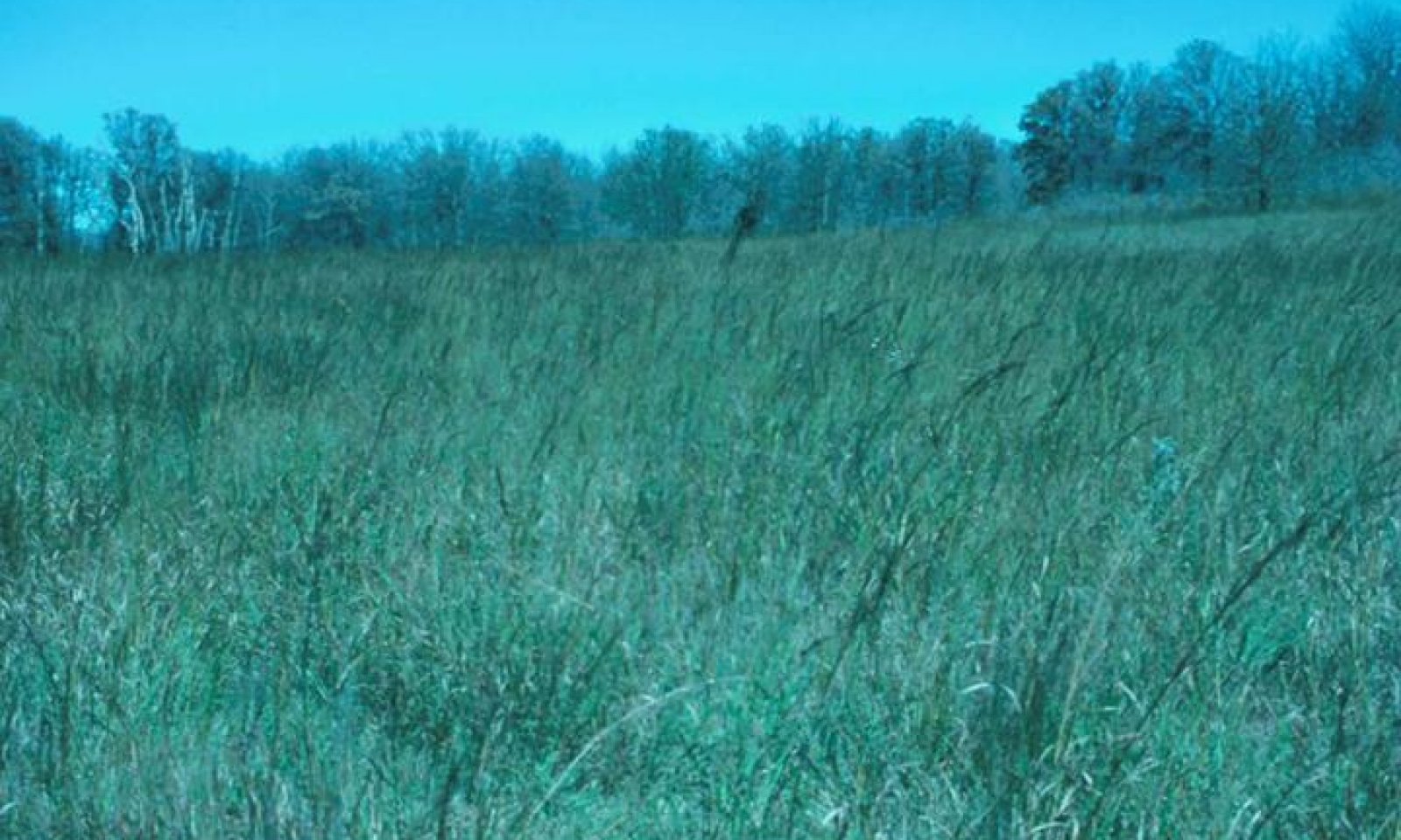
Click to explore map
Figure 1. Mapped extent
Areas shown in blue indicate the maximum mapped extent of this ecological site. Other ecological sites likely occur within the highlighted areas. It is also possible for this ecological site to occur outside of highlighted areas if detailed soil survey has not been completed or recently updated.
MLRA notes
Major Land Resource Area (MLRA): 080A–Central Rolling Red Prairies
MLRA 80A is characterized by dark red Permian sandstones or shales that are exposed on gently sloping plains. The dominant soil order in this MLRA is Mollisols. The soils in the area dominantly have a thermic soil temperature regime, an ustic soil moisture regime, and mixed, siliceous, or smectitic mineralogy. They generally are shallow to very deep, are well drained, and generally are loamy or clayey. These plains are dissected by rivers that flow from northwest to southeast. Major rivers of this MLRA include the Chickaskia and Bluff rivers in KS, the Salt Fork, Cimarron, North and South Canadian, Washita, Cache, Red River in OK, and branches of the Wichita River in TX.
Classification relationships
This ecological site is correlated to soil components at the Major Land Resource Area (MLRA) level which is further described in USDA Ag Handbook 296.
Ecological site concept
These sites occur on shallow loamy soils over sandstone. The loamy soils are well suited for herbaceous plant growth, however, shallow depth to bedrock can limit the water holding capacity. Also, the position of these sites on upland ridges and hills can result in shedding of water to lower adjacent sites. The reference state consists of tallgrass and midgrass species with forbs and very few woody species. Shortgrasses will persist on the areas with the more shallow soils. Historically, a combination of frequent fires and the shallow soils have limited woody plant encroachment on these sites. However, in the absence of fire, these sites are susceptible invasion by Eastern Redcedar.
Associated sites
R080AY080OK Shallow Clay Upland
Shallow clay soils over shale.
Similar sites
R080AY080OK Shallow Clay Upland
Shallow clay soils over shale.
Table 1. Dominant plant species
Tree Not specified
Shrub Not specified
Herbaceous (1) Schizachyrium scoparium
(2) Andropogon gerardiiPhysiographic features
This ecological site consists of gently sloping to moderately steep soils on hills. Slopes range from 5 to 25 percent. Surface rock is typically less than 10 percent.
Table 2. Representative physiographic features
Landforms (1) Upland > Hill
Runoff class High to very high Elevation 500 – 1500 ft Slope 2 – 25 % Aspect Aspect is not a significant factor Climatic features
The climate is characterized by moist, cool, springs; hot, often dry summers; mild autumns; and mild to cold winters. Variation in timing and amounts of precipition from year to year is quite common. Drought cycles range from three to five years duration with occasionally longer periods occurring at unpredictable intervals. Above normal rainfall cycles are usually just as random, but shorter in duration.
Table 3 Representative climatic features
Frost-free period (characteristic range) 170-190 days Freeze-free period (characteristic range) 190-200 days Precipitation total (characteristic range) 30-40 in Frost-free period (actual range) 160-190 days Freeze-free period (actual range) 190-210 days Precipitation total (actual range) 30-40 in Frost-free period (average) 180 days Freeze-free period (average) 200 days Precipitation total (average) 40 in Characteristic rangeActual rangeBarLineFigure 2. Monthly precipitation range
Characteristic rangeActual rangeBarLineFigure 3. Monthly minimum temperature range
Characteristic rangeActual rangeBarLineFigure 4. Monthly maximum temperature range
BarLineFigure 5. Monthly average minimum and maximum temperature
Climate stations used
-
(1) WATONGA [USC00349364], Watonga, OK
-
(2) PAULS VALLEY 4 WSW [USC00346926], Pauls Valley, OK
-
(3) ANTHONY [USW00013980], Anthony, KS
-
(4) STILLWATER 5 WNW [USW00053927], Stillwater, OK
-
(5) OKEENE [USC00346629], Okeene, OK
-
(6) WALTERS [USC00349278], Walters, OK
-
(7) KINGFISHER [USC00344861], Kingfisher, OK
-
(8) JEFFERSON [USC00344573], Medford, OK
-
(9) CHEROKEE 4W [USC00341724], Cherokee, OK
">Influencing water features
These sites occur in upland positions that are not subject to flooding or wetland influences.
Wetland description
N/A

Figure 6.
Soil features
Soils are mapped for each county within the MLRA. Mapunits are representations of the major soil series component(s) and named accordingly. Each Mapunit is spatially represented on a digital soils map as polygons of different shapes and sizes. Within these Mapunits, there are often minor soil series components included. These minor components are soils that occur within a Mapunit polygon but are of small extent (15% or less of the Mapunit area). However, it is difficult to separate these minor soils spatially due to the scale of soil mapping.
Ecological sites are correlated at the component level of the soil survey. Therefore, a single Mapunit may contain multiple Ecological Sites just as it may contain multiple soil components. This is important to understand when investigating soils and Ecological Sites. A soil survey Mapunit may be correlated to a single Ecological Site based on the major component; however, there may be inclusional areas of additional Ecological Sites which are correlated to the minor components of that particular soil Mapunit.
Representative soil components for this site include:
Ironmound & Lucien
The Lucien series consists of shallow, well drained soils on the summits and shoulders of low hills that formed in material weathered from sandstone, interbedded with clay, siltstone, or sandy shale of Permian age.
The Ironmound series consists of shallow, well drained soils that formed in material weathered from sandstone, or sandstone interbedded with siltstone or shale, of Permian age.
Surface textures range from silt loam to fine sandy loam.
Figure 7.
Table 4. Representative soil features
Parent material (1) Residuum – sandstone and shale
Surface texture (1) Loam
(2) Silt loam
(3) Fine sandy loam
Drainage class Well drained Permeability class Moderate to moderately rapid Soil depth 10 – 20 in Surface fragment cover <=3" 0 – 10 % Surface fragment cover >3" 0 – 5 % Available water capacity
(0-40in)1 – 4 in Electrical conductivity
(0-40in)Not specified Sodium adsorption ratio
(0-40in)Not specified Soil reaction (1:1 water)
(0-40in)6 – 7 Subsurface fragment volume <=3"
(Depth not specified)0 – 10 % Subsurface fragment volume >3"
(Depth not specified)0 – 6 % Ecological dynamics
Like many sites across the Great Plains, this Shallow Upland site evolved under periodic disturbances by fire, drought, and grazing(Frost 1998,Fuhlendorf 2009). The soils are well suited for herbaceous plant growth but are limited by their depth to sandstone bedrock. The shallow soils and run-off upland position make the shallow site susceptible to influence by drought. However, the reference state of this site is very resilient to natural disturbances. Alternative states include a woody encroached state and a converted state.
The reference state is dominated by native warm season tallgrasses and midgrasses. These grass species are tightly intermixed and well distributed over the site. Forbs are abundant. A limited variety of shrubs occur in sparse amounts. This plant community evolved under periodic grazing by large herbivores and a fire frequency of once every two to four years(Frost 1998). Shallow Prairie sites are well suited to grazing by domestic livestock. Soils typically are shallow, ranging from seven to twenty inches in depth over sandstone. In areas where underlying bedrocks are fragmented, roots of perennial grasses have deep penetration and vegetative production is significantly enhanced.
In addition to the reference community, other plant communities can exist on this site and are usually the result of management practices, or lack thereof. After the absence of fire for five or more years, shrub species will usually begin to increase. There are various transitional stages on this site, and transitional stage may result in a stable community for many years. While grazing may not, by itself, lead to an increase in shrubs or shrub canopy cover, it can reduce fuel loads necessary to carry a fire and thus restrict woody plant dominance.
Historically, the focus of conservation efforts has been on proper stocking rates and restoration of the woody encroached sites across the Great Plains. However, new research suggests that a more effective strategy involves addressing woody plants in the seed dispersal stage prior to the change in ecological states. Preserving intact prairie for both agricultural production and ecosystem services must become a priority for land managers and conservationist alike.
State and Transition Diagram:
The following diagram suggests some pathways that the vegetation on this site might take. There may be other states not shown on the diagram. This information is intended to show what might happen in a given set of circumstances. It does not mean that this would happen the same way in every instance. Local professional guidance should always be sought before pursuing a treatment scenario.State and transition model
More interactive model formats are also available. View Interactive Models
Click on state and transition labels to scroll to the respective textLand use 1 submodel, ecosystem states
State 1 submodel, plant communities
Land use 2 submodel, ecosystem states
Land use 1
RangelandThis land use is native rangeland. Dominant use is grazing by ruminant livestock.
State 1.1
ReferenceThe reference state is dominated by native warm season tallgrasses and midgrasses. These grass species are tightly intermixed and well distributed over the site. Forbs are abundant. A limited variety of shrubs occur in sparse amounts. This plant community evolved under periodic grazing by large herbivores and a fire frequency of once every two to four years(Frost). Shallow Upland sites are well suited to grazing by domestic livestock. Soils typically are shallow, ranging from seven to twenty inches in depth over sandstone. In areas where underlying bedrocks are fragmented, roots of perennial grasses have deep penetration and vegetative production is significantly enhanced.
Characteristics and indicators. This state is dominated by native, herbaceous species. The soils are shallow, but intact and show minimal sign of disturbance.
Resilience management. With a fire return interval of less than 4 years and managed grazing that is balanced with the carrying capacity, this state may be maintained as a grassland reference state.
Dominant plant species
-
little bluestem (Schizachyrium scoparium), grass
-
big bluestem (Andropogon gerardii), grass
State 1.2
Woody InvasionIn this state, eastern redcedar, mesquite and various shrubs or some other invasive species, has invaded the plant community. Extreme energy input must be introduced to the site to clear the tree and shrub species to return the plant community to state 1. This site still has remnant midgrasses and shortgrasses, but now with a substantial amount of shrubs and trees. Usually, this plant community is the result of long term overgrazing and no fire which encourages an increase of woodies. Midgrasses are little bluestem, composite dropseed, sand dropseed, sideoats grama, purple lovegrass and purpletop tridens. Shortgrasses include blue grama, buffalograss and hairy grama. Remnants of tallgrasses occur throughout the site. Major shrubs are sumac, dogwood, blackberry and buckbrush. Other woody plants include skunkbush sumac, plum, elm, mesquite and easter redcedar.
In general, the more abundant perennial forbs have a low grazing preference by livestock. These perennial forbs include goldenrods, mountainmint, Cuman ragweed, green antelopehorn and Baldwin’s ironweed. Annual ragweeds and prairie broomweed are abundant when the site is closely grazed.
Prescribed brush control using herbicides and mechanical removal will help drive the community towards plant community towards the grass dominant state. Prescribed burning will provide satisfactory brush control in most cases, however, in some circumstances, due to the mixture of woody species present and their relative susceptibility to different brush control methods, a combination of methods may be required for complete and acceptable brush control. An example of this situation might be the combination of eastern redcedar and sumac. Fire is relatively effective on young redcedar, but not effective on sumac species. This situation will require a prescribed combination of controls. Prescribed grazing, affording periods of deferred grazing during the summer growing season, will be needed to restore overall productivity of the site.Dominant plant species
-
eastern redcedar (Juniperus virginiana), tree
-
sumac (Rhus), shrub
-
silver beardgrass (Bothriochloa laguroides), grass
State 1.3
ErodedOnce the soil is disturbed and vegetation is removed, these site are prone to soil erosion. Water erosion can leave a devastating impact on these sites due to the shallow soils. It is difficult to predict the vegetation response on these eroded sites. Site specific evaluations are need to access remaining soil resources.
Resilience management. With time, eroded sites may revegetate or be reseeded with native species. While the plant communities can resemble the reference state, the soil physical, chemical, and biological properties may take many years to recover.
Dominant plant species
-
threeawn (Aristida), grass
Transition T1A
State 1.1 to 1.2In the absence of fire or other brush management strategies, woody species may begin to encroach on the site. If left unchecked, some woody species will begin to dominate the ecological functions of the site such as nutrient cycling and hydrologic cycle.
Transition T1B
State 1.1 to 1.3Through soil disturbance with heavy equipment or prior cultivation attempts, the site becomes suscetible to water erosion. The result of this erosion is displacement of the A horizon and transition to the Eroded State.
Restoration pathway R2A
State 1.2 to 1.1Through the implementation of a prescribed burning program or alternative forms of brush management, the site may be restored to the reference state. Careful grazing management is often required to ensure proper fuel loads and allow for the recovery of herbaceous species.
Land use 2
Introduced PasturelandWhile not common, this site is sometimes planted to introduced grasses such as bermudagrass. Primary use is livestock and/or hay production. Often, this land use is managed as a monoculture with little biotic diversity. However, in some cases, forb/legume/grass mixtures are maintained with may increase soil and ecosystem health.
State 2.1
MonocultureThis community consists of a planted monoculture of an introduced pasture grass used predominately for grazing and/or hay production. Adapted species include bermudagrass, old world bluestems, and weeping lovegrass (only on well drained sites). These species require a higher level of management inputs than native rangeland species. Soil tests should be performed prior to planting and or subsequent fertilizer applications. Without persistent nutrient management and proper grazing, some undesired "weedy" species may invade the site. While biodiversity can be beneficial to both plants, animals, and soil, it may be undesirable under certain management systems such as certified hay production. Proper grazing should be planned to allow for adequate residual heights in order to ensure the vigor of the grass. These heights vary by species and grazing system. They can be found in the OK NRCS Prescribed Grazing practice specification. Average yields are listed below as representative for the MLRA. These yields can vary greatly depending on precipitation amount and timing. As with any pasture management program, site specific evaluation and monitoring is essential.
Yields are represented AUMs or Animal Unit Months. This represents the amount of dry matter required by one Animal Unit Equivalent for one month. For more on AUEs and AUMs consult local extension service fact sheets and publications. Keep in mind these yields are estimated under a high level of management which includes annual additions of nitrogen and other nutrients as required.
It is important to note that while these introduced species can provide good grazing potential, often wildlife habitat is limited. These species are also known to expand offsite and become invasive in adjacent native ecosystems.Dominant plant species
-
Bermudagrass (Cynodon dactylon), grass
State 2.2
Grass/Legume MixThis community represents a planted mixture of introduced grasses and forbs/legumes. Bermudagrass and introduced clover is the most common pasture mix. Incorporation of a legume into the system can help offset inputs associated with nitrogen additions. Special strategies should be used to ensure the health and vigor of both the cool season legumes and warm season grasses. Yields for these pasture mixes are not available as the mixtures and ratios vary from site to site so yields for a monoculture community should be used as a baseline estimate.
Dominant plant species
-
Bermudagrass (Cynodon dactylon), grass
-
clover (Trifolium), other herbaceous
Conversion C1
Land use 1 to 2With the cultivation and planting of perennial introduced forage grasses, this land use is converted to Introduced Pastureland.
Conversion C2
Land use 2 to 1This land use conversion is achieved through reseeding native grasses and forbs or allowing native species to repopulate the site by reducing management of introduced species. While the site may be converted back to a rangeland land use, some soil properties and ecological function may not return to pre-disturbance levels.
Additional community tables
Table 5. Community 2.1 plant community composition
Group Common name Symbol Scientific name Annual production () Foliar cover (%) Grass/Grasslike1 800–1800 big bluestem ANGE Andropogon gerardii 720–1170 – Indiangrass SONU2 Sorghastrum nutans 200–325 – switchgrass PAVI2 Panicum virgatum 160–260 – 2 600–1200 little bluestem SCSC Schizachyrium scoparium 680–1100 – composite dropseed SPCO16 Sporobolus compositus 100–500 – beaked panicgrass PAAN Panicum anceps 40–65 – Florida paspalum PAFL4 Paspalum floridanum 40–65 – 3 200–500 sideoats grama BOCU Bouteloua curtipendula 160–260 – blue grama BOGR2 Bouteloua gracilis 80–130 – sand dropseed SPCR Sporobolus cryptandrus 40–65 – white tridens TRAL2 Tridens albescens 40–65 – purpletop tridens TRFL2 Tridens flavus 40–65 – hairy grama BOHI2 Bouteloua hirsuta 40–65 – silver beardgrass BOLA2 Bothriochloa laguroides 40–65 – purple lovegrass ERSP Eragrostis spectabilis 40–65 – plains muhly MUCU3 Muhlenbergia cuspidata 40–65 – thin paspalum PASE5 Paspalum setaceum 40–65 – 4 80–120 sedge CAREX Carex 40–65 – Scribner's rosette grass DIOLS Dichanthelium oligosanthes var. scribnerianum 40–65 – Canada wildrye ELCA4 Elymus canadensis 40–65 – Virginia wildrye ELVI3 Elymus virginicus 40–65 – prairie Junegrass KOMA Koeleria macrantha 15–25 – Forb5 150–250 Maximilian sunflower HEMA2 Helianthus maximiliani 150–260 – compassplant SILA3 Silphium laciniatum 150–260 – wholeleaf rosinweed SIIN2 Silphium integrifolium 112–195 – Cuman ragweed AMPS Ambrosia psilostachya 75–130 – yellow sundrops CASE12 Calylophus serrulatus 75–130 – pale purple coneflower ECPA Echinacea pallida 75–130 – eastern daisy fleabane ERAN Erigeron annuus 75–130 – yellow sundrops CASE12 Calylophus serrulatus 75–130 – Missouri goldenrod SOMI2 Solidago missouriensis 75–130 – Cuman ragweed AMPS Ambrosia psilostachya 75–130 – pale purple coneflower ECPA Echinacea pallida 75–130 – white heath aster SYER Symphyotrichum ericoides 75–130 – stiff sunflower HEPA19 Helianthus pauciflorus 52–91 – Canada goldenrod SOCA6 Solidago canadensis 45–78 – tall blazing star LIAS Liatris aspera 37–65 – dotted blazing star LIPU Liatris punctata 37–65 – cobaea beardtongue PECO4 Penstemon cobaea 37–65 – narrowleaf mountainmint PYTE Pycnanthemum tenuifolium 37–65 – upright prairie coneflower RACO3 Ratibida columnifera 37–65 – fringeleaf wild petunia RUHU Ruellia humilis 37–65 – azure blue sage SAAZ Salvia azurea 37–65 – ashy sunflower HEMO2 Helianthus mollis 37–65 – prairie spiderwort TROC Tradescantia occidentalis 37–65 – Indian paintbrush CASTI2 Castilleja 37–65 – flowering spurge EUCO10 Euphorbia corollata 37–65 – hairy sunflower HEHI2 Helianthus hirsutus 37–65 – groovestem Indian plantain ARPL4 Arnoglossum plantagineum 37–65 – butterfly milkweed ASTU Asclepias tuberosa 37–65 – button eryngo ERYU Eryngium yuccifolium 37–65 – flowering spurge EUCO10 Euphorbia corollata 37–65 – Indian paintbrush CASTI2 Castilleja 37–65 – groovestem Indian plantain ARPL4 Arnoglossum plantagineum 37–65 – butterfly milkweed ASTU Asclepias tuberosa 37–65 – 6 150–250 fourvalve mimosa MIQU2 Mimosa quadrivalvis 100–200 – Illinois bundleflower DEIL Desmanthus illinoensis 75–130 – roundhead lespedeza LECA8 Lespedeza capitata 75–130 – Virginia tephrosia TEVI Tephrosia virginiana 50–90 – trailing lespedeza LEPR Lespedeza procumbens 35–65 – slender lespedeza LEVI7 Lespedeza virginica 35–65 – purple dalea DALA4 Dalea lasiathera 35–65 – blue wild indigo BAAU Baptisia australis 35–65 – white prairie clover DACA7 Dalea candida 35–65 – purple dalea DALA4 Dalea lasiathera 35–65 – slimflower scurfpea PSTE5 Psoralidium tenuiflorum 35–65 – silverleaf Indian breadroot PEAR6 Pediomelum argophyllum 20–40 – large Indian breadroot PEES Pediomelum esculentum 20–40 – groundplum milkvetch ASCR2 Astragalus crassicarpus 20–40 – Shrub/Vine7 50–100 leadplant AMCA6 Amorpha canescens 50–100 – Jersey tea CEHE Ceanothus herbaceus 50–100 – roughleaf dogwood CODR Cornus drummondii 25–50 – winged sumac RHCO Rhus copallinum 25–50 – skunkbush sumac RHTR Rhus trilobata 25–50 – eastern poison ivy TORA2 Toxicodendron radicans 25–50 – Table 6. Community 2.2 plant community composition
Group Common name Symbol Scientific name Annual production () Foliar cover (%) Grass/Grasslike1 710–1400 big bluestem ANGE Andropogon gerardii 568–1120 – switchgrass PAVI2 Panicum virgatum 106–210 – Indiangrass SORGH Sorghastrum 106–210 – 2 533–1050 little bluestem SCSC Schizachyrium scoparium 532–1050 – 3 320–630 composite dropseed SPCO16 Sporobolus compositus 142–280 – sideoats grama BOCU Bouteloua curtipendula 106–210 – blue panicum PAAN4 Panicum antidotale 71–140 – purpletop tridens TRFL2 Tridens flavus 71–140 – thin paspalum PASE5 Paspalum setaceum 49–98 – marsh bristlegrass SEPA10 Setaria parviflora 49–98 – purple lovegrass ERSP Eragrostis spectabilis 49–98 – sand dropseed SPCR Sporobolus cryptandrus 35–70 – silver bluestem BOSA Bothriochloa saccharoides 35–70 – 4 213–420 fall witchgrass DICO6 Digitaria cognata 71–140 – hairy grama BOHI2 Bouteloua hirsuta 71–140 – tumblegrass SCPA Schedonnardus paniculatus 49–98 – windmill grass CHLOR Chloris 49–98 – prairie threeawn AROL Aristida oligantha 35–50 – 5 36–70 winter bentgrass AGHY Agrostis hyemalis 35–70 – Scribner's rosette grass DIOLS Dichanthelium oligosanthes var. scribnerianum 35–70 – Canada wildrye ELCA4 Elymus canadensis 35–70 – Forb6 150–400 Missouri goldenrod SOMI2 Solidago missouriensis 75–200 – white heath aster SYER Symphyotrichum ericoides 75–200 – slimflower scurfpea PSTE5 Psoralidium tenuiflorum 75–200 – Cuman ragweed AMPS Ambrosia psilostachya 75–200 – white sagebrush ARLU Artemisia ludoviciana 75–200 – eastern daisy fleabane ERAN Erigeron annuus 75–200 – Maximilian sunflower HEMA2 Helianthus maximiliani 75–200 – lespedeza LESPE Lespedeza 75–200 – groovestem Indian plantain ARPL4 Arnoglossum plantagineum 52–140 – prairie clover DALEA Dalea 45–120 – prairie broomweed AMDR Amphiachyris dracunculoides 45–120 – pale purple coneflower ECPA Echinacea pallida 37–100 – upright prairie coneflower RACO3 Ratibida columnifera 37–100 – blue wild indigo BAAU Baptisia australis 37–100 – dotted blazing star LIPU Liatris punctata 37–100 – Shrub/Vine7 150–300 blackberry RUBUS Rubus 150–300 – buckbrush CECU Ceanothus cuneatus 150–300 – roughleaf dogwood CODR Cornus drummondii 150–300 – winged sumac RHCO Rhus copallinum 150–300 – skunkbush sumac RHTR Rhus trilobata 75–150 – Jersey tea CEHE Ceanothus herbaceus 75–150 – leadplant AMCA6 Amorpha canescens 75–150 – Table 7. Community 2.3 plant community composition
Group Common name Symbol Scientific name Annual production () Foliar cover (%) Grass/Grasslike1 Midgrass/Shortgrass 536–1120 composite dropseed SPCO16 Sporobolus compositus 201–420 – sideoats grama BOCU Bouteloua curtipendula 134–280 – thin paspalum PASE5 Paspalum setaceum 100–210 – western wheatgrass PASM Pascopyrum smithii 67–140 – sand dropseed SPCR Sporobolus cryptandrus 67–140 – purpletop tridens TRFL2 Tridens flavus 67–140 – purple lovegrass ERSP Eragrostis spectabilis 67–140 – silver bluestem BOSA Bothriochloa saccharoides 33–70 – white tridens TRAL2 Tridens albescens 33–70 – 2 Tallgrasses 168–350 big bluestem ANGE Andropogon gerardii 100–210 – little bluestem SCHIZ4 Schizachyrium 67–140 – Indiangrass SORGH Sorghastrum 33–70 – switchgrass PAVI2 Panicum virgatum 33–70 – 3 Midgrasses/Shortgrasses 436–910 blue grama BOGR2 Bouteloua gracilis 201–420 – hairy grama BOHI2 Bouteloua hirsuta 134–280 – windmill grass CHLOR Chloris 67–140 – fall witchgrass DICO6 Digitaria cognata 67–140 – Scribner's rosette grass DIOLS Dichanthelium oligosanthes var. scribnerianum 67–140 – tumblegrass SCPA Schedonnardus paniculatus 67–140 – 4 67–140 prairie threeawn AROL Aristida oligantha 67–140 – cheatgrass BRTE Bromus tectorum 67–140 – little barley HOPU Hordeum pusillum 67–140 – Forb5 150–400 Cuman ragweed AMPS Ambrosia psilostachya 134–340 – prairie broomweed AMDR Amphiachyris dracunculoides 67–170 – Missouri goldenrod SOMI2 Solidago missouriensis 67–170 – white heath aster SYER Symphyotrichum ericoides 67–170 – Baldwin's ironweed VEBA Vernonia baldwinii 33–85 – white sagebrush ARLU Artemisia ludoviciana 33–85 – annual ragweed AMAR2 Ambrosia artemisiifolia 33–85 – green antelopehorn ASVI2 Asclepias viridis 33–85 – snow on the mountain EUMA8 Euphorbia marginata 33–85 – slimflower scurfpea PSTE5 Psoralidium tenuiflorum 33–85 – upright prairie coneflower RACO3 Ratibida columnifera 33–85 – blue wild indigo BAAU Baptisia australis 20–51 – Texas goldentop EUGY Euthamia gymnospermoides 20–51 – groundplum milkvetch ASCR2 Astragalus crassicarpus 20–51 – hoary verbena VEST Verbena stricta 20–51 – yarrow ACHIL Achillea 13–34 – Shrub/Vine6 201–390 buckbrush CECU Ceanothus cuneatus 134–260 – roughleaf dogwood CODR Cornus drummondii 134–260 – smooth sumac RHGL Rhus glabra 134–260 – pricklypear OPUNT Opuntia 67–130 – American plum PRAM Prunus americana 67–130 – Interpretations
Animal community
Domestic livestock and white-tail deer are the dominant grazers and browsers of the site. Various songbirds and small mammals may also find use of these areas. As the site changes towards the woody dominated community, the quality of the habitat may improve for some species and decline for others. Management must be applied to maintain a vegetative state in optimum habitat quality for the desired animal species.
Hydrological functions
These sites occur on uplands and shed water to adjacent sites lower on the landscape. The presence of deep rooted tallgrasses can help facilitate percolation of water into the soil profile. Minimizing bare ground is very important in reducing soil erosion by water movement.
Recreational uses
Camping, fishing, hunting, hiking, bird watching, horseback riding and many other outdoor recreational practices.
Wood products
There are no significant wood produts from this site.
Other products
N/A
Other information
N/A
Supporting information
Inventory data references
Information presented has been derived from NRCS clipping data, research from Oklahoma State University, field observations and measurements by trained range personnel. Most of the clipping data was gathered by a team consisting of a range conservationist and a soil scientist and was site/soil specific. Yields were taken at the end of the growing season and, as near as possible, were obtained from areas that were un-grazed that year. Clipping data repository is in the NRCS State Office in Stillwater, OK.
References
-
Frost, C.C. 1998. Presettlement Fire Frequency Regimes of the United States: A First Approximation. Plant Conservation Program. North Carolina Department of Agriculture and Consumer Services, Raleigh, NC.
-
Fuhlendorf, S.D., D.M. Engle, J. Kerby, and R. Hamilton. 2009. Pyric Herbivory: Rewilding Landscapes through the Recoupling of Fire and Grazing. Conservation Biology 23:588–598.
Other references
Bestelmeyer, B. T., Brown, J. R., Havstad, K. M., Alexander, R., Chavez, G., & Herrick, J. E. (2003). Development and use of state-and-transition models for rangelands. Journal of Range Management, 114-126.
Harlan, J. R. (1957). Grasslands of Oklahoma.
National Soil Information System (NASIS). Accessed 2013
Shantz, H. L. (1923). The natural vegetation of the Great Plains region. Annals of the Association of American Geographers, 13(2), 81-107.
Shiflet, T. N. (1994). Rangeland cover types of the United States (Vol. 152). Denver, CO, USA: Society for Range Management.
USDA-NRCS (Formerly Soil Conservation Service) Range Site Descriptions (1960s)
USDA-NRCS (Formerly Soil Conservation Service) Ag Handbook 296 (2006)Contributors
Dr. Jack Eckroat, Grazing Lands Specialist, NRCS, Oklahoma
Harland Dietz, Range Conservationist, NRCS, Oklahoma, (Retired)
Edits by Colin Walden, Soil Survey Office, Stillwater, OKApproval
Bryan Christensen, 9/19/2023
Acknowledgments
Site Development and Testing Plan Future work, as described in a Project Plan, to validate the information in this Provisional Ecological Site Description is needed. This will include field activities to collect low, medium and high intensity sampling, soil correlations, and analysis of that data. Annual field reviews should be done by soil scientists and vegetation specialists. A final field review, peer review, quality control, and quality assurance reviews of the ESD will be needed to produce the final document. Annual reviews of the Project Plan are to be conducted by the Ecological Site Technical Team.
Rangeland health reference sheet
Interpreting Indicators of Rangeland Health is a qualitative assessment protocol used to determine ecosystem condition based on benchmark characteristics described in the Reference Sheet. A suite of 17 (or more) indicators are typically considered in an assessment. The ecological site(s) representative of an assessment location must be known prior to applying the protocol and must be verified based on soils and climate. Current plant community cannot be used to identify the ecological site.
Author(s)/participant(s) Mark Moseley, Jack Eckroat Contact for lead author 100 USDA Suite 206, Stillwater, OK 74074 (405)742-1235 Date 05/24/2004 Approved by Approval date Composition (Indicators 10 and 12) based on Annual Production Indicators
-
Number and extent of rills:
Very few. -
Presence of water flow patterns:
Few, usually only after high intensity rains. -
Number and height of erosional pedestals or terracettes:
Some, but rarely more than 1 inch depth. -
Bare ground from Ecological Site Description or other studies (rock, litter, lichen, moss, plant canopy are not bare ground):
Variable, but should average less than 15%. -
Number of gullies and erosion associated with gullies:
Very few. Stabilized sides and base. -
Extent of wind scoured, blowouts and/or depositional areas:
None -
Amount of litter movement (describe size and distance expected to travel):
Less than 12 inches, and usually only after high intensity rainfall. -
Soil surface (top few mm) resistance to erosion (stability values are averages - most sites will show a range of values):
Stability score 5 – 6. -
Soil surface structure and SOM content (include type of structure and A-horizon color and thickness):
Dark reddish brown 0 – 6 inches. Subangular blocky structure, very hard. Refer to specific description for component sampled. -
Effect of community phase composition (relative proportion of different functional groups) and spatial distribution on infiltration and runoff:
Mid and shortgrass community. Tallgrasses random, occurring in drains and scattered along slopes. Slow permeability and moderate cover can results in high runoff. -
Presence and thickness of compaction layer (usually none; describe soil profile features which may be mistaken for compaction on this site):
None, fine textured, hard soils can be mistaken for compaction. -
Functional/Structural Groups (list in order of descending dominance by above-ground annual-production or live foliar cover using symbols: >>, >, = to indicate much greater than, greater than, and equal to):
Dominant:
Midgrass (little bluestem)Sub-dominant:
shortgrassesOther:
tall grasses warm-season perennial forbs shrubs cool season grasses and grasslikes.Additional:
Midgrass (little bluestem) shortgrasses tall grasses warm-season perennial forbs shrubs cool season grasses and grasslikes. -
Amount of plant mortality and decadence (include which functional groups are expected to show mortality or decadence):
There can be some plant loss due to droughty nature of the site, especially after severe drought, but should be less than 10%. -
Average percent litter cover (%) and depth ( in):
Litter cover should average 40 - 60% at a depth not more than ½ inch. Basal cover around 22%. -
Expected annual annual-production (this is TOTAL above-ground annual-production, not just forage annual-production):
Reference production is 2,500-4,250#/acre, annually. -
Potential invasive (including noxious) species (native and non-native). List species which BOTH characterize degraded states and have the potential to become a dominant or co-dominant species on the ecological site if their future establishment and growth is not actively controlled by management interventions. Species that become dominant for only one to several years (e.g., short-term response to drought or wildfire) are not invasive plants. Note that unlike other indicators, we are describing what is NOT expected in the reference state for the ecological site:
Eastern redcedar with a lack of regular burning. Mesquite in the south. -
Perennial plant reproductive capability:
All plants capable of reproducing at least every 2 – 3 years.
Print Options
Sections
Font
AAAAOther
PrintThe Ecosystem Dynamics Interpretive Tool is an information system framework developed by the USDA-ARS Jornada Experimental Range, USDA Natural Resources Conservation Service, and New Mexico State University.
Accessibility statement