
Natural Resources
Conservation Service
Ecological site R080AY050OK
Loamy Bottomland
Last updated: 9/19/2023
Accessed: 10/16/2026
-
Search


Major Land Resource Area or ecological site by name and/or ID.
PreviousSectionsNextGeneral information
Provisional. A provisional ecological site description has undergone quality control and quality assurance review. It contains a working state and transition model and enough information to identify the ecological site.
Click to explore map
Figure 1. Mapped extent
Areas shown in blue indicate the maximum mapped extent of this ecological site. Other ecological sites likely occur within the highlighted areas. It is also possible for this ecological site to occur outside of highlighted areas if detailed soil survey has not been completed or recently updated.
MLRA notes
Major Land Resource Area (MLRA): 080A–Central Rolling Red Prairies
MLRA 80A is characterized by dark red Permian rocks that are exposed on gently sloping plains. These plains are dissected by rivers that flow from northwest to southeast. Major rivers of this MLRA include the Chickaskia and Bluff rivers in KS, the Salt Fork, Cimarron,North and South Canadian,Washita, Cache, Red River in OK, and branches of the Wichita River in TX. Soils are generally well drained, loamy or clayey deposits overlying Permian sandstones or shales.
Classification relationships
This ecological site is correlated to soil components at the Major Land Resource Area (MLRA) level which is further described in USDA Ag Handbook 296.
Ecological site concept
This site occurs on deep, loamy soils on floodplains. The sites are periodically flooded and also receive run-on water from adjacent uplands. The reference plant community is dominated by tallgrasses mixed with midgrasses and forbs. Shrubs may be present and small amounts and there may be a mixture of bottomland hardwood trees scattered across the landscape. In the absence of fire, various woody species including elm, hackberry, and eastern redcedar may dominate the landscape.
Associated sites
R080AY056OK Loamy Upland
Loamy soils on uplands.
R080AY001OK Alkali Bottomland
Localized sodic areas on floodplains
R080AY045OK Clay Bottomland
Clay soils. Similar landscape positions.
Similar sites
R080AY045OK Clay Bottomland
Clay soils. Similar landscape positions.
R080AY068OK Sandy Bottomland
Sandy soils. Similar landscape positions.
Table 1. Dominant plant species
Tree (1) Carya illinoinensis
Shrub Not specified
Herbaceous (1) Tripsacum dactyloides
Physiographic features
These sites are deep, productive, alluvial, loamy bottomlands subject to frequent or occasional overflow from streams and runoff from hillsides. This site ranges from gently sloping and level bottomlands with slopes from 0% to 2%.

Figure 2. R080AY050OK
Table 2. Representative physiographic features
Landforms (1) Alluvial plain > Flood plain
Runoff class Negligible to medium Flooding duration Very brief (4 to 48 hours) to brief (2 to 7 days) Flooding frequency Rare to frequent Elevation 152 – 457 m Slope 0 – 2 % Water table depth 152 – 0 cm Aspect Aspect is not a significant factor Climatic features
The climate is characterized by moist, cool, springs; hot, often dry summers; mild autumns; and mild to cold winters. Variation in timing and amounts of precipition from year to year is quite common. Drought cycles range from three to five years duration with occasionally longer periods occurring at unpredictable intervals. Above normal rainfall cycles are usually just as random, but shorter in duration.
Table 3 Representative climatic features
Frost-free period (characteristic range) 170-190 days Freeze-free period (characteristic range) 190-210 days Precipitation total (characteristic range) 840-990 mm Frost-free period (actual range) 160-190 days Freeze-free period (actual range) 190-220 days Precipitation total (actual range) 790-1,090 mm Frost-free period (average) 180 days Freeze-free period (average) 210 days Precipitation total (average) 940 mm Characteristic rangeActual rangeBarLineFigure 3. Monthly precipitation range
Characteristic rangeActual rangeBarLineFigure 4. Monthly minimum temperature range
Characteristic rangeActual rangeBarLineFigure 5. Monthly maximum temperature range
BarLineFigure 6. Monthly average minimum and maximum temperature
Figure 7. Annual precipitation pattern
Figure 8 Annual average temperature pattern
Climate stations used
-
(1) PAWHUSKA [USC00346935], Pawhuska, OK
-
(2) PERRY [USC00347012], Perry, OK
-
(3) PONCA CITY MUNI AP [USW00013969], Ponca City, OK
-
(4) OKEENE [USC00346629], Okeene, OK
-
(5) GEARY [USC00343497], Calumet, OK
-
(6) CARNEGIE 5 NE [USC00341504], Carnegie, OK
-
(7) CHICKASHA EXP STATION [USC00341750], Chickasha, OK
-
(8) NORMAN 3SSE [USC00346386], Norman, OK
-
(9) PAULS VALLEY 4 WSW [USC00346926], Pauls Valley, OK
-
(10) CUSHING [USC00342318], Cushing, OK
-
(11) MEEKER 5 W [USC00345779], Meeker, OK
-
(12) RALSTON [USC00347390], Ralston, OK
-
(13) JEFFERSON [USC00344573], Medford, OK
-
(14) ANTHONY [USW00013980], Anthony, KS
">Influencing water features
These sites occur on floodplains and drainageways on deep, alluvial soils. These areas receive run-on water from adjacent upland sites. Run off is usually slow due to the low slopes of the floodplain. The presence of deep rooted tallgrasses can help facilitate percolation of water into the soil profile.
Wetland description
NA

Figure 9.
Soil features
Soils are mapped for each county within the MLRA. Mapunits are representations of the major soil series component(s) and named accordingly. Each Mapunit is spatially represented on a digital soils map as polygons of different shapes and sizes. Within these Mapunits, there are often minor soil series components included. These minor components are soils that occur within a Mapunit polygon but are of small extent (15% or less of the Mapunit area). However, it is difficult to separate these minor soils spatially due to the scale of soil mapping.
Ecological sites are correlated at the component level of the soil survey. Therefore, a single Mapunit may contain multiple Ecological Sites just as it may contain multiple soil components. This is important to understand when investigating soils and Ecological Sites. A soil survey Mapunit may be correlated to a single Ecological Site based on the major component; however, there may be inclusional areas of additional Ecological Sites which are correlated to the minor components of that particular soil Mapunit.
Representative soil components for this site include:
Port, Dale, and Yahola
These are deep, dark, loamy alluvial soils on the level floodplains of larger streams. Surface soils are loams and silt over deep, sometimes stratified alluvial deposits of loams, sandy loams, or clay loams. The soils are neutral to calcareous and are both friable and permeable. They are fertile and have a good infiltration rate as well as a high moisture storage capacity. They are occasionally overflowed and sometimes receive excess water from adjacent slopes. Soils in this site are very productive.Table 4. Representative soil features
Parent material (1) Alluvium – sandstone and shale
Surface texture (1) Loam
(2) Sandy loam
(3) Silt loam
Drainage class Moderately well drained to well drained Permeability class Moderate to moderately rapid Soil depth 152 – 0 cm Surface fragment cover <=3" 0 – 1 % Surface fragment cover >3" 0 – 1 % Available water capacity
(0-101.6cm)22.86 – 30.48 cm Calcium carbonate equivalent
(0-101.6cm)0 – 1 % Electrical conductivity
(0-101.6cm)0 – 1 mmhos/cm Sodium adsorption ratio
(0-101.6cm)0 – 1 Soil reaction (1:1 water)
(0-101.6cm)6.5 – 7.5 Subsurface fragment volume <=3"
(Depth not specified)0 – 4 % Ecological dynamics
The information contained in the State and Transition Diagram (STD) and the Ecological Site Description was developed using archaeological and historical data, professional experience, and scientific studies. The information presented is representative of a very complex set of plant communities. Not all scenarios or plants are included. Key indicator plants, animals and ecological processes are described to inform land management decisions.
The reference plant community is tallgrass dominated with midgrasses and forbs. This site occurs on broad bottoms adjacent to streams and rivers and along narrower upland drainageways. Loamy Bottomland soils have deep, fertile, loamy surfaces that often receive extra moisture from overflow or run-in from adjacent slopes. Plant community dominance in the plains usually oft-times depends on fire and grazing histories of the site. Historically, a major portion of this site was subjected to occasional fire and large animal herbivory (i.e. bison, elk, deer). The resultant plant community was usually dominated by deep rooted, warm season, perennial, tallgrasses. All the major grasses, and most of the dominant forbs, are rhizomatous. The rhizomes of grasses saturate the upper four to five inches of soil and are usually tightly intertwined and intermixed with numerous deep rooted perennial warm season forbs. Because of this site’s deep soils and high rainfall averages, the plant community is very productive. For centuries, the reference plants of this community have withstood sporadic rainfall; flooding and sedimentation; long rainy periods and extended drouths. Some narrow areas, located adjacent to streams and rivers, along with a few larger areas such as oxbows, were historically protected from fire. These protected areas developed savannah or woodland type plant communities dominated by an overstory of large hardwood trees and a understory of predominately cool season grasses and other shade tolerant plants.
In addition to the reference state, several other plant communities can exist on Loamy Bottomland sites. These communities usually reflect historical management practices. There are various recognizable stages of degradation on this site. Each stage may result in a plant community that may, or may not, remain stable for many years. Loamy Bottomland is a favored grazing area by most large herbivores, so long term overgrazing is common unless prescribed grazing regimes are implemented. Long term overgrazing by cattle results in a gradual decrease of the tallgrasses and preferred forbs. As these preferred species decline, they are replaced by midgrasses and less palatable forbs. For various reasons, as degradation continues on the site, woody species such as eastern redcedar begin to invade the plant community.
Fire was a major influence in the development of this site. With the suppression of fire, over time, shrubs and trees usually invade the grassland portions of Loamy Bottomlands and may eventually become the dominant species on site. Shrub invasion can occur, regardless of the grazing regime, in the absence of fire.
State and Transition Diagram:
A State and Transition Diagram for the Loamy Bottomland (R080AY050OK) site is depicted below. Thorough descriptions of each state, transition, and pathway follow the model. Experts base this model on available experimental research, field observations, professional consensus, and interpretations. It is likely to change as knowledge increases.
Plant communities will differ across the MLRA because of the natural variability in weather, soils, and aspect. The Reference Plant Community is not necessarily the management goal; other vegetative states may be desired plant communities as long as the Range Health assessments are in the moderate and above category.
The biological processes on this site are complex. Therefore, representative values are presented in a land management context. The species lists are representative and are not botanical descriptions of all species occurring, or potentially occurring, on this site. They are not intended to cover every situation or the full range of conditions, species, and responses for the site.
Composition by dry weight and percent canopy cover are provided to describing the functional groups. Most observers find it easier to visualize or estimate percent canopy for woody species (trees and shrubs).
The following diagram suggests some pathways that the vegetation on this site might take. There may be other states not shown on the diagram. This information is intended to show what might happen in a given set of circumstances. It does not mean that this would happen the same way in every instance. Local professional guidance should always be sought before pursuing a treatment scenario.State and transition model
Custom diagramStandard diagram
Figure 10. R080AY050OK

Figure 11. R080AY050OK
More interactive model formats are also available. View Interactive Models
More interactive model formats are also available. View Interactive Models
Click on state and transition labels to scroll to the respective textEcosystem states
State 1 submodel, plant communities
State 1
GrasslandThis is the reference or diagnostic community for the site. The description is based on early range site descriptions, clipping data, professional consensus of experienced range specialists, and analysis of field work
Dominant plant species
-
pecan (Carya illinoinensis), tree
-
eastern gamagrass (Tripsacum dactyloides), grass
Community 1.1
Tallgrass
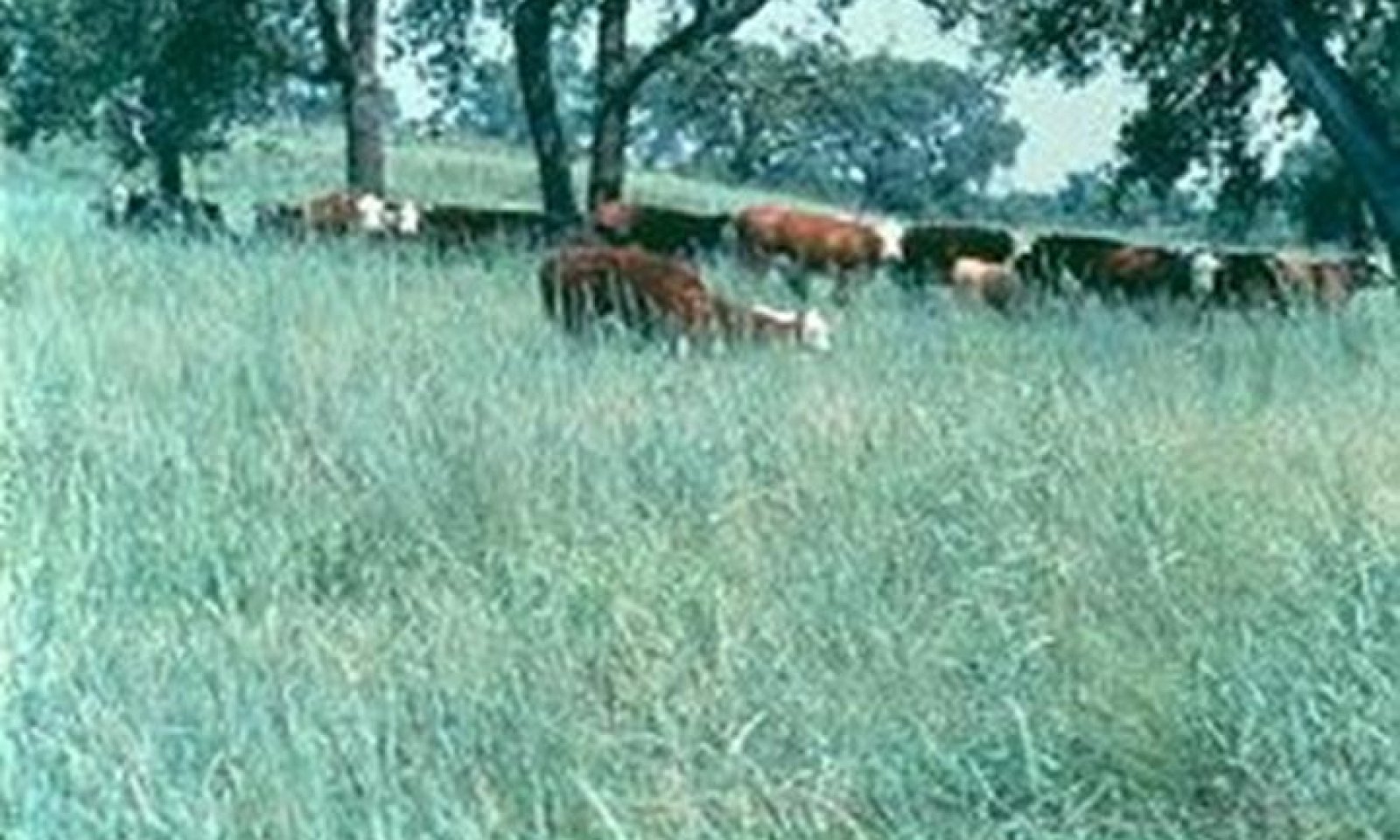
Figure 12. Loamy Bottomland #1, HPC

Figure 13. Loamy Bottomland, Talgrass Dominant
The reference community is dominated by a composite of tall, warm season grasses. Big bluestem, eastern gamagrass, Indiangrass, prairie cordgrass and switchgrass comprise approximately 80 percent of the vegetation. Secondary grasses occur in minor amounts. These secondary grasses include tall dropseed, Florida paspalum, beaked panicum, little bluestem and knotroot bristlegrass. Cool season grasses and grasslike plants such as Canada wildrye, Virginia wildrye and sedges may contribute up to five percent of the total vegetation on site. Most of the major grasses grow during the months April through June. In a typical year, approximately 75 to 80 percent of the annual herbage production is completed by the first of July. Both eastern gamagrass and prairie cordgrass have been observed emerging through several inches of sediment deposited on the site by flood waters.
Numerous forbs prevail on this site. The more abundant forbs are wholeleaf rosinweed, Maximilian sunflower, sawtooth sunflower and Illinois bundleflower. Other common forbs are cupleaf rosinweed, stiffleaf sunflower, ashy sunflower, Canada goldenrod, heathaster, smooth oxeye, prairie acacia and roundhead lespedeza. Under moderate levels of grazing, the major HPC grasses on this site will remain very durable and plant composition proportions can be maintained almost indefinitely. Most of the palatable forbs will decrease with light to moderate continuous grazing, however, it is possible to maintain these palatable forbs under periodic deferment by using prescribed grazing.
Overgrazing by livestock will eventually have major impacts on vegetation composition. A decrease in vigor of the more palatable grasses will encourage a gradual increase in secondary plants such as tall dropseed, purpletop, silver bluestem and sideoats grama. Many of the forbs are very palatable and readily selected by livestock. Forbs that increase with overgrazing include heathaster, tall goldenrod, Missouri goldenrod, western ragweed and Louisiana sagewort. Woody plants such as buckbrush, blackberry, roughleaf dogwood, smooth sumac, persimmon, hawthorn, elm, oak and ash also increase under Long term overgrazing, especially if there is also absence of fire. Often, the total elimination of fire on this site, regardless of grazing intensity implemented, can result in the transformation of a herbaceous dominated plant community to a community almost closed by tree canopy. Major tree species that encroach on the site are oak, ash, elm, hackberry, pecan, sycamore and cottonwood.Figure 14. Annual production by plant type (representative values) or group (midpoint values)
Table 5. Annual production by plant type
Plant type Low
(kg/hectare)Representative value
(kg/hectare)High
(kg/hectare)Grass/Grasslike 8182 10088 13899 Forb 560 897 1569 Shrub/Vine 112 112 112 Tree 112 112 112 Total 8966 11209 15692 Figure 15. Plant community growth curve (percent production by month). OK0001 , Native, Warm Season Grasses. Typically, the summer growing season for warm season grasses begins April 5 to 15 and ends October 15 to 25. Nearly three-fourths of the season production will occur before the first of July. This varies from year to year depending upon temperatures and precipitation..
Jan Feb Mar Apr May Jun Jul Aug Sep Oct Nov Dec J F M A M J J A S O N D 0 1 5 10 20 30 10 5 10 6 2 1 Community 1.2
Midgrass/Tallgrass
This plant community is dominated by a mixture of midgrasses and tallgrasses with the midgrasses more prevelant than the tallgrasses. There has been a decrease in the more palatable grasses such as eastern gamagrass, big bluestem and Indiangrass. These grasses have been replaced by an increase in secondary grasses including purpletop, knotroot bristlegrass, and tall dropseed. Western wheatgrass is more abundant in northern counties. Shortgrasses such as buffalograss and fall witchgrass are found in some areas. These changes have resulted in a reduction in herbage production on the site.
The dominant perennial forbs are heathaster, Canada goldenrod, Baldwin ironweed and tall eupatorium. Heavy stands of annuals often occur after periods of close grazing. These annuals include seacoast sumpweed, common sunflower, giant ragweed, annual ragweed and marestail.
Continuous overgrazing has reduced the fuel load and lessened the occurrence and subsequent benefits of prescribed burning. Shrubs, including buckbrush, blackberry, sumac and roughleaf dogwood are common. Tree species such as elm, hackberry, Osage orange and eastern redcedar are often scattered across the site.
Prescribed burning coupled with prescribed grazing, involving deferment during all or a part of the growing season, will increase the desirable grasses. This site can be restored to near reference conditions in eight to twelve years.
Figure 16. Annual production by plant type (representative values) or group (midpoint values)
Table 6. Annual production by plant type
Plant type Low
(kg/hectare)Representative value
(kg/hectare)High
(kg/hectare)Grass/Grasslike 4483 6165 7622 Forb 336 560 897 Shrub/Vine 504 673 673 Tree 280 336 336 Total 5603 7734 9528 Figure 17. Plant community growth curve (percent production by month). OK0001 , Native, Warm Season Grasses. Typically, the summer growing season for warm season grasses begins April 5 to 15 and ends October 15 to 25. Nearly three-fourths of the season production will occur before the first of July. This varies from year to year depending upon temperatures and precipitation..
Jan Feb Mar Apr May Jun Jul Aug Sep Oct Nov Dec J F M A M J J A S O N D 0 1 5 10 20 30 10 5 10 6 2 1 Pathway 1.1A
Community 1.1 to 1.2If the site is subjected to abusive grazing for multiple growing seasons and the more palatable tallgrass species are not allowed adequate recovery, the plant community will begin to transition to a Midgrass dominated plant community(1.2). This community shift may also occur as a result of long term drought as the Midgrass and Shortgrass species are better adapted to dry climates. This pathway is not a one-way street and it is important to remember that this community shift occurred often, historically, and represents the variability within this Reference Sate.
Pathway 1.2A
Community 1.2 to 1.1With adequate rest from grazing pressure and favorable growing conditions, this plant community may be able to return to the reference plant community (1.1).
State 2
WoodyThe description for this plant community is derived from analysis of limited field data and professional consensus of range trained individuals.
This plant community is a result of the absence of fire. Fire was an important element in suppressing woody plants during the ecological evolution of this site. So, when fire was suppressed for many years, the vegetative composition naturally and gradually shifted towards woody plant dominance. Areas protected from both fire and grazing for 20 to 30 years, or longer, have transitioned from open grassland to closed canopy woodland. Some areas, due to their juxtaposition to streams, were historically protected from reoccurring fires.
Species composition of woody plants will vary from area to area. But generally, tree species will be bur oak, hackberry, elm, ash, sycamore or pecan. Eastern redcedar is becoming more prominent in this plant community. Shrubs and vines common to the site are buckbrush, sumac, blackberry, poison ivy, grape and greenbrier. Combined trees and shrubs may form an overstory canopy of 70 to 80 percent. The understory is dominated by shade tolerant plants such as Virginia wildrye, Canada wildrye, sedges, Scribner’s panicum, Indian woodoats, sweet woodreed and various muhlys.
Herbage production suitable for livestock use is limited. The site provides shelter for both livestock, deer and numerous small mammals. Many species of birds frequent this site.Dominant plant species
-
pecan (Carya illinoinensis), tree
-
elm (Ulmus), tree
-
hackberry (Celtis), tree
-
eastern redcedar (Juniperus virginiana), tree
-
coralberry (Symphoricarpos orbiculatus), shrub
-
wildrye (Elymus), grass
State 3
ConvertedMany loamy bottomland sites have been cultivated over the past century in order to produce crops. Due to the level, deep loam soils, these sites are well suited for Ag production. Within this state, most woody species have been cleared in order to facilitate the access of farm machinery.
Dominant plant species
-
wheat (Triticum), grass
-
soybean (Glycine max), other herbaceous
Transition T1A
State 1 to 2Without fire in the ecosystem, woody species may grow and reproduce unchecked. These species may be endemic (pecan, hackberry, etc.) or species introduced to the site by animals (eastern redcedar) or plantings (black locust/honey locust). These woody species have the ability to grow deep roots and locate resources within the soil that herbaceous species may not have access to. This gives them a competitive edge for resources and allows them to expand across the landscape. As this woody encroachment occurs, the site may transition to state 2 where the woody species begin to dominate the ecological functions of the plant community.
Transition T1B
State 1 to 3Many of these sites have been plowed for farming purposes over the last century. Once the site is cultivated, it transitions to an alternative state (3). The soils structure, organic matter, and biota have been altered and will no longer function the same as the soils in the reference state.
Restoration pathway R2A
State 2 to 1A carefully planned program will restore the Woody state to a close resemblance to a grassland state. Because the woody community may be difficult to burn (but susceptible to wildfires), some brush management intervention will be needed. Brush management either mechanical, chemical or an integration of both, will allow sunlight energy and soil moisture to be used by tall grasses rather than invasive brush. Careful grazing management will be required for this plant community to be restored to the grassland state (1).
Transition T2A
State 2 to 3Many of these sites have been plowed for farming purposes over the last century. Once the site is cultivated, it transitions to an alternative state (3). The soils structure, organic matter, and biota have been altered and will no longer function the same as the soils in the reference or woody state.
Restoration pathway R3A
State 3 to 1Through carefully planned implementation of range seeding, prescribed grazing and rest, the cultivated state can be returned to a plant community similar to those in the reference state.
Context dependence.As a result of cultivation and soil erosion, soil properties are altered and ecological processes are changed. While permanent native vegetation can be re-established to a species mix similar to the reference state, often the site may never be restored ecologically to reference condition. This is especially true of sites that have experience a significant loss of the soil surface horizon. However, many sites have been restored to something very close the reference state and this should always be the target if full ecological restoration is the goal.
Additional community tables
Table 7. Community 1.1 plant community composition
Group Common name Symbol Scientific name Annual production () Foliar cover (%) Grass/Grasslike1 7263–12554 big bluestem ANGE Andropogon gerardii 2242–3923 – Indiangrass SORGH Sorghastrum 1121–2242 – eastern gamagrass TRDA3 Tripsacum dactyloides 1121–1681 – prairie cordgrass SPPE Spartina pectinata 560–1121 – switchgrass PAVI2 Panicum virgatum 560–1121 – 2 363–628 Florida paspalum PAFL4 Paspalum floridanum 56–112 – little bluestem SCSC Schizachyrium scoparium 56–112 – marsh bristlegrass SEPA10 Setaria parviflora 56–112 – 3 363–628 Indian woodoats CHLA5 Chasmanthium latifolium 11–56 – Mexican muhly MUME2 Muhlenbergia mexicana 11–56 – vine mesquite PAOB Panicum obtusum 11–56 – thin paspalum PASE5 Paspalum setaceum 11–45 – rice cutgrass LEOR Leersia oryzoides 0–34 – whitegrass LEVI2 Leersia virginica 11–22 – longleaf woodoats CHSE2 Chasmanthium sessiliflorum 0–22 – sweet woodreed CIAR2 Cinna arundinacea 0–22 – 4 91–157 composite dropseed SPCO16 Sporobolus compositus 11–78 – purpletop tridens TRFL2 Tridens flavus 11–56 – fall witchgrass DICO6 Digitaria cognata 11–56 – purple lovegrass ERSP Eragrostis spectabilis 11–56 – bushy bluestem ANGL2 Andropogon glomeratus 11–22 – broomsedge bluestem ANVI2 Andropogon virginicus 11–22 – silver bluestem BOSA Bothriochloa saccharoides 11–22 – 5 454–785 Canada wildrye ELCA4 Elymus canadensis 112–280 – Virginia wildrye ELVI3 Elymus virginicus 112–224 – western wheatgrass PASM Pascopyrum smithii 56–112 – Texas bluegrass POAR Poa arachnifera 56–112 – sedge CAREX Carex 56–112 – common spikerush ELPA3 Eleocharis palustris 22–67 – Kentucky bluegrass POPR Poa pratensis 22–67 – Scribner's rosette grass DIOLS Dichanthelium oligosanthes var. scribnerianum 22–67 – porcupinegrass HESP11 Hesperostipa spartea 22–56 – Texas wintergrass NALE3 Nassella leucotricha 22–56 – deertongue DICL Dichanthelium clandestinum 22–45 – winter bentgrass AGHY Agrostis hyemalis 22–45 – Forb6 494–1412 wholeleaf rosinweed SIIN2 Silphium integrifolium 224–336 – sawtooth sunflower HEGR4 Helianthus grosseserratus 112–336 – Maximilian sunflower HEMA2 Helianthus maximiliani 112–336 – compassplant SILA3 Silphium laciniatum 112–224 – cup plant SIPE2 Silphium perfoliatum 56–168 – ashy sunflower HEMO2 Helianthus mollis 22–56 – stiff sunflower HEPA19 Helianthus pauciflorus 22–56 – Jerusalem artichoke HETU Helianthus tuberosus 22–56 – whitest evening primrose OEAL Oenothera albicaulis 11–56 – cobaea beardtongue PECO4 Penstemon cobaea 11–56 – azure blue sage SAAZ Salvia azurea 11–56 – fringeleaf wild petunia RUHU Ruellia humilis 11–34 – prairie blazing star LIPY Liatris pycnostachya 11–34 – devil's bite LISC2 Liatris scariosa 11–34 – prairie spiderwort TROC Tradescantia occidentalis 11–34 – Culver's root VEVI4 Veronicastrum virginicum 11–34 – 7 494–1412 Canada goldenrod SOCA6 Solidago canadensis 11–67 – white heath aster SYER Symphyotrichum ericoides 11–67 – Missouri goldenrod SOMI2 Solidago missouriensis 11–56 – tall thoroughwort EUAL3 Eupatorium altissimum 11–56 – Appalachian mountainmint PYFL Pycnanthemum flexuosum 11–56 – white crownbeard VEVI3 Verbesina virginica 11–56 – wingstem VEAL Verbesina alternifolia 11–56 – groovestem Indian plantain ARPL4 Arnoglossum plantagineum 11–56 – false boneset BREU Brickellia eupatorioides 11–56 – Philadelphia fleabane ERPH Erigeron philadelphicus 11–56 – largeflower tickseed COGR5 Coreopsis grandiflora 11–34 – Indian paintbrush CASTI2 Castilleja 11–34 – tall thistle CIAL2 Cirsium altissimum 11–34 – swamp milkweed ASIN Asclepias incarnata 11–34 – prairie milkweed ASSU3 Asclepias sullivantii 11–34 – common milkweed ASSY Asclepias syriaca 11–34 – butterfly milkweed ASTU Asclepias tuberosa 11–34 – whorled milkweed ASVE Asclepias verticillata 11–34 – green antelopehorn ASVI2 Asclepias viridis 11–34 – Virginia threeseed mercury ACVI Acalypha virginica 11–34 – Cuman ragweed AMPS Ambrosia psilostachya 11–34 – Arkansas ironweed VEAR3 Vernonia arkansana 11–34 – Baldwin's ironweed VEBA Vernonia baldwinii 11–34 – golden zizia ZIAU Zizia aurea 11–34 – pinnate prairie coneflower RAPI Ratibida pinnata 11–34 – rough coneflower RUGR Rudbeckia grandiflora 11–34 – browneyed Susan RUTR2 Rudbeckia triloba 11–34 – stiff goldenrod OLRI Oligoneuron rigidum 11–34 – downy phlox PHPI Phlox pilosa 11–34 – shorthair goldenrod SOCAG Solidago canadensis var. gilvocanescens 11–34 – skyblue aster SYOO Symphyotrichum oolentangiense 11–34 – white arrowleaf aster SYUR Symphyotrichum urophyllum 11–34 – Canada germander TECA3 Teucrium canadense 11–34 – Nuttall's prairie parsley PONU4 Polytaenia nuttallii 11–22 – stiff marsh bedstraw GATI Galium tinctorium 11–22 – cardinalflower LOCA2 Lobelia cardinalis 11–22 – great ragweed AMTR Ambrosia trifida 11–22 – white doll's daisy BOAS Boltonia asteroides 11–22 – spotted water hemlock CIMA2 Cicuta maculata 11–22 – wavyleaf thistle CIUN Cirsium undulatum 11–22 – poison hemlock COMA2 Conium maculatum 11–22 – Queen Anne's lace DACA6 Daucus carota 11–22 – field horsetail EQAR Equisetum arvense 11–22 – prairie fleabane ERST3 Erigeron strigosus 11–22 – 8 141–404 Illinois bundleflower DEIL Desmanthus illinoensis 22–168 – American licorice GLLE3 Glycyrrhiza lepidota 22–112 – littleleaf sensitive-briar MIMI22 Mimosa microphylla 22–112 – prairie acacia ACAN Acacia angustissima 22–112 – Canadian milkvetch ASCA11 Astragalus canadensis 22–56 – white wild indigo BAAL Baptisia alba 22–56 – longbract wild indigo BABR2 Baptisia bracteata 22–56 – white prairie clover DACA7 Dalea candida 22–56 – purple dalea DALA4 Dalea lasiathera 22–56 – slimflower scurfpea PSTE5 Psoralidium tenuiflorum 22–56 – roundhead lespedeza LECA8 Lespedeza capitata 22–56 – sessileleaf ticktrefoil DESE Desmodium sessilifolium 22–56 – Shrub/Vine9 0–112 leadplant AMCA6 Amorpha canescens 22–112 – winged sumac RHCO Rhus copallinum 22–112 – smooth sumac RHGL Rhus glabra 22–112 – climbing rose ROSE2 Rosa setigera 22–112 – western poison ivy TORY Toxicodendron rydbergii 22–112 – rusty blackhaw VIRU Viburnum rufidulum 22–56 – grape VITIS Vitis 22–56 – blackberry RUBUS Rubus 22–56 – elderberry SAMBU Sambucus 22–56 – saw greenbrier SMBO2 Smilax bona-nox 22–56 – Ohio buckeye AEGL Aesculus glabra 22–56 – false indigo AMORP Amorpha 22–56 – pawpaw ASTR Asimina triloba 22–56 – buckbrush CECU Ceanothus cuneatus 22–56 – common buttonbush CEOC2 Cephalanthus occidentalis 22–56 – Carolina coralbead COCA Cocculus carolinus 22–56 – limber honeysuckle LODI2 Lonicera dioica 22–56 – yellow honeysuckle LOFL Lonicera flava 22–56 – Virginia creeper PAQU2 Parthenocissus quinquefolia 22–56 – American plum PRAM Prunus americana 22–56 – Tree10 0–112 river birch BENI Betula nigra 56–112 – pecan CAIL2 Carya illinoinensis 56–112 – hybrid hickory CARYA Carya 56–112 – common hackberry CEOC Celtis occidentalis 56–112 – hawthorn CRATA Crataegus 56–112 – white ash FRAM2 Fraxinus americana 56–112 – black walnut JUNI Juglans nigra 56–112 – Osage-orange MAPO Maclura pomifera 56–112 – American sycamore PLOC Platanus occidentalis 56–112 – eastern cottonwood PODE3 Populus deltoides 56–112 – bur oak QUMA2 Quercus macrocarpa 56–112 – post oak QUST Quercus stellata 56–112 – black oak QUVE Quercus velutina 56–112 – black willow SANI Salix nigra 56–112 – gum bully SILAL3 Sideroxylon lanuginosum ssp. lanuginosum 56–112 – American elm ULAM Ulmus americana 56–112 – cedar elm ULCR Ulmus crassifolia 56–112 – slippery elm ULRU Ulmus rubra 56–112 – Table 8. Community 1.2 plant community composition
Group Common name Symbol Scientific name Annual production () Foliar cover (%) Grass/Grasslike1 1800–2959 big bluestem ANGE Andropogon gerardii 673–1345 – switchgrass PAVI2 Panicum virgatum 224–560 – Indiangrass SORGH Sorghastrum 224–560 – prairie cordgrass SPPE Spartina pectinata 56–112 – eastern gamagrass TRDA3 Tripsacum dactyloides 22–56 – 2 1838–2690 composite dropseed SPCO16 Sporobolus compositus 336–1009 – purpletop tridens TRFL2 Tridens flavus 224–560 – blue panicum PAAN4 Panicum antidotale 224–560 – little bluestem SCSC Schizachyrium scoparium 224–448 – marsh bristlegrass SEPA10 Setaria parviflora 112–448 – Florida paspalum PAFL4 Paspalum floridanum 112–336 – broomsedge bluestem ANVI2 Andropogon virginicus 112–336 – silver bluestem BOSA Bothriochloa saccharoides 112–336 – purple lovegrass ERSP Eragrostis spectabilis 112–336 – vine mesquite PAOB Panicum obtusum 28–112 – longspike tridens TRST2 Tridens strictus 28–112 – 3 245–404 windmill grass CHLOR Chloris 28–224 – fall witchgrass DICO6 Digitaria cognata 28–224 – 4 573–942 western wheatgrass PASM Pascopyrum smithii 112–560 – Texas bluegrass POAR Poa arachnifera 56–224 – sedge CAREX Carex 112–224 – Canada wildrye ELCA4 Elymus canadensis 112–224 – Virginia wildrye ELVI3 Elymus virginicus 56–224 – Scribner's rosette grass DIOLS Dichanthelium oligosanthes var. scribnerianum 56–112 – winter bentgrass AGHY Agrostis hyemalis 56–112 – 5 164–269 cheatgrass BRTE Bromus tectorum 22–112 – Forb6 409–673 tall thoroughwort EUAL3 Eupatorium altissimum 28–112 – Canada goldenrod SOCA6 Solidago canadensis 28–112 – Missouri goldenrod SOMI2 Solidago missouriensis 28–112 – false gaura STLI2 Stenosiphon linifolius 28–112 – white heath aster SYER Symphyotrichum ericoides 28–112 – wingstem VEAL Verbesina alternifolia 28–112 – Arkansas ironweed VEAR3 Vernonia arkansana 28–112 – Baldwin's ironweed VEBAB Vernonia baldwinii ssp. baldwinii 28–112 – Cuman ragweed AMPS Ambrosia psilostachya 56–112 – white sagebrush ARLU Artemisia ludoviciana 56–112 – groovestem Indian plantain ARPL4 Arnoglossum plantagineum 56–112 – green antelopehorn ASVI2 Asclepias viridis 56–112 – white crownbeard VEVI3 Verbesina virginica 28–112 – blue wild indigo BAAU Baptisia australis 22–56 – hoary verbena VEST Verbena stricta 28–56 – 7 82–135 annual ragweed AMAR2 Ambrosia artemisiifolia 56–112 – great ragweed AMTRT2 Ambrosia trifida var. trifida 56–112 – field horsetail EQAR Equisetum arvense 56–112 – Shrub/Vine8 504–673 buckbrush CECU Ceanothus cuneatus 56–448 – roughleaf dogwood CODR Cornus drummondii 56–336 – winged sumac RHCO Rhus copallinum 56–336 – smooth sumac RHGL Rhus glabra 56–336 – blackberry RUBUS Rubus 56–336 – common buttonbush CEOC2 Cephalanthus occidentalis 560–112 – Tree9 279–336 common hackberry CEOC Celtis occidentalis 28–112 – white ash FRAM2 Fraxinus americana 28–112 – eastern redcedar JUVI Juniperus virginiana 28–112 – Osage-orange MAPO Maclura pomifera 28–112 – American sycamore PLOC Platanus occidentalis 28–112 – bur oak QUMA2 Quercus macrocarpa 28–112 – elm ULMUS Ulmus 28–112 – gum bully SILAL3 Sideroxylon lanuginosum ssp. lanuginosum 28–56 – Interpretations
Animal community
Numerous animal and bird species utilize this site as habitat. Small mammals, song birds, predators, along with traditional game species such as turkey, bobwhite quail, whitetail deer, mule deer, and others frequent this site. The combination of grasses, forbs, trees and woody shrubs that occur in the presumed historic plant community provide suitable habitat for all the above species, at least at some time during the year. Surface water, in the form of ponds, springs, and flowing streams provide water for species that require daily watering. Many different species move in and out of the site. Predators such as coyotes and bobcats may utilize the site for hunting prey and hiding during the day.
Hydrological functions
These sites occur on floodplains and drainageways on deep, alluvial soils. These areas receive run-on water from adjacent upland sites. Run off is usually slow due to the low slopes of the floodplain. The presence of deep rooted tallgrasses can help facilitate percolation of water into the soil profile.
Recreational uses
Hunting, Fishing, Camping, Hiking, Bird Watching, Photography, Horseback Riding, etc..
Wood products
There are limited wood products taken from this site. Trees can be used for most wood products indigenous to the species. Several species of trees are found on this site, but there is seldom any harvesting of wood products other than firewood for cooking, heat and fence posts.
Other products
Fruits, blackberries, other berries and pecans are harvested from this site.
Other information
NA
Supporting information
Inventory data references
The OK 551 Data Records are forms used in Oklahoma that preceded the 417 form. Data below is arranged in columns of: Data Source Form Number: Number of Records: Sample Period: State: County: 551 5 1957 OK Osage 551 1 1958 OK Osage 551 4 1959 OK Osage 551 12 1960 OK Washington 551 1 1960 OK Osage 551 9 1961 OK Washington 551 1 1961 OK Osage 551 1 1962 OK Washington 551 5 1962 OK Osage 551 1 1962 OK Bryan 551 1 1963 OK Jefferson 551 3 1963 OK Washington 551 1 1963 OK Osage 551 2 1964 OK Washington 551 2 1964 OK Osage 551 3 1965 OK Osage 551 1 1965 OK Washington 551 1 1966 OK Washington 551 2 1966 OK Osage 417 1 1968 OK Osage 417 1 1971 OK Noble 417 1 1972 OK Grant
Type locality
Location 1: Lincoln County, OK General legal description Lincoln County, Oklahoma; about 1 mile east of Harrah; about 4,000 feet south and 900 feet east of northwest corner of sec. 30, T. 12 N., R. 2 E References
-
Scholtz, R. and . 2018. Grassland fragmentation and its influence on woody plant cover in the southern Great Plains, USA. Landscape Ecology 33:1785–1797.
Other references
This “Approved” site was included in an update project during 2013. The State&Transition model was re-formatted and the ESD was edited to fit the new ESIS format. The concepts and vegetative data contained therein was not altered. The entire ESD will be reviewed, updated, and subjected to the QC/QA processes as part of a future project. CW
USDA-NRCS (Formerly Soil Conservation Service) Range Site Descriptions (1960s)
USDA-NRCS (Formerly Soil Conservation Service) Ag Handbook 296 (2006)Contributors
Edits by Colin Walden, Range Specialist, Stillwater, OK
Dr. Jack Eckroat, Grazing Lands Specialist, NRCS, Oklahoma
Harland Dietz, Range Conservationist, NRCS, Oklahoma, (Retired)Approval
Bryan Christensen, 9/19/2023
Acknowledgments
Site Development and Testing Plan Future work, as described in a Project Plan, to validate the information in this Provisional Ecological Site Description is needed. This will include field activities to collect low, medium and high intensity sampling, soil correlations, and analysis of that data. Annual field reviews should be done by soil scientists and vegetation specialists. A final field review, peer review, quality control, and quality assurance reviews of the ESD will be needed to produce the final document. Annual reviews of the Project Plan are to be conducted by the Ecological Site Technical Team.
Rangeland health reference sheet
Interpreting Indicators of Rangeland Health is a qualitative assessment protocol used to determine ecosystem condition based on benchmark characteristics described in the Reference Sheet. A suite of 17 (or more) indicators are typically considered in an assessment. The ecological site(s) representative of an assessment location must be known prior to applying the protocol and must be verified based on soils and climate. Current plant community cannot be used to identify the ecological site.
Author(s)/participant(s) Mark Moseley, Kay Anderson, Jack Eckroat, Harry Fritzler, Steve Glasgow Contact for lead author 100 USDA Suite 206 Stillwater, OK 74074 Date 04/01/2005 Approved by Approval date Composition (Indicators 10 and 12) based on Annual Production Indicators
-
Number and extent of rills:
This site usually has flatter slopes. There are few, if any, rills (only in lowest area where flooding occurs) and there is no active headcutting and sides are covered with vegetation -
Presence of water flow patterns:
There is some evidence of soil deposition or erosion (particularly after a flood event). Water generally flows evenly over the entire landscape. -
Number and height of erosional pedestals or terracettes:
There should not be any evidence of erosional pedestals or terracettes on this site. -
Bare ground from Ecological Site Description or other studies (rock, litter, lichen, moss, plant canopy are not bare ground):
There is 0-5% bare ground on this site. Bare areas are small and not connected. -
Number of gullies and erosion associated with gullies:
Usually none. Most drainages are represented as natural stable channels; vegetation is common with no signs of erosion. Some nick points can occur where trees are uprooted from floods. -
Extent of wind scoured, blowouts and/or depositional areas:
None -
Amount of litter movement (describe size and distance expected to travel):
Uniform distribution of litter. Litter rarely moves >12 inches on flatter slopes and may be as much as doubled on steeper slopes, then only during high intensity storms. -
Soil surface (top few mm) resistance to erosion (stability values are averages - most sites will show a range of values):
Surface soil is stabilized (Stability Score 5 – 6). Stability scores based on a minimum of 6 samples tested. -
Soil surface structure and SOM content (include type of structure and A-horizon color and thickness):
Ap horizon: 0 to 7 inches; dark grayish brown silt loam, weak fine granular structure. A horizon: 7 to 21 inches; dark grayish brown silt loam, moderate fine and medium granular structure. Refer to specific description for component sampled. -
Effect of community phase composition (relative proportion of different functional groups) and spatial distribution on infiltration and runoff:
Infiltration and runoff are not affected by any changes in plant community composition and distribution. (Tallgrass dominated). Any changes in infiltration and runoff can be attributed to other factors (e.g. compaction) -
Presence and thickness of compaction layer (usually none; describe soil profile features which may be mistaken for compaction on this site):
There is usually no compaction layer. -
Functional/Structural Groups (list in order of descending dominance by above-ground annual-production or live foliar cover using symbols: >>, >, = to indicate much greater than, greater than, and equal to):
Dominant:
Tallgrasses MidgrassesSub-dominant:
Forbs Cool-Season Perennial GrassesOther:
Shortgrasses, Shrubs, TreesAdditional:
-
Amount of plant mortality and decadence (include which functional groups are expected to show mortality or decadence):
There is some plant mortality and decadence on the perennial grasses, especially in the absence of fire and herbivory, but usually <5%. -
Average percent litter cover (%) and depth ( in):
Litter should cover 50 - 75% of the area between plants with accumulations of .5 - 1 inches deep. -
Expected annual annual-production (this is TOTAL above-ground annual-production, not just forage annual-production):
Reference production is 8,000-14,000 pounds per year. -
Potential invasive (including noxious) species (native and non-native). List species which BOTH characterize degraded states and have the potential to become a dominant or co-dominant species on the ecological site if their future establishment and growth is not actively controlled by management interventions. Species that become dominant for only one to several years (e.g., short-term response to drought or wildfire) are not invasive plants. Note that unlike other indicators, we are describing what is NOT expected in the reference state for the ecological site:
No invasive species. Invasives might include: eastern redcedar, locust, salt cedar, Russian olive, annuals and non-natives. Also mesquite in the south. -
Perennial plant reproductive capability:
All plants capable of reproducing at least every year. Seed stalks, stalk length, and seedheads are numerous and what would be expected. Overall health of plants is what would be expected.
Print Options
Sections
Font
AAAAOther
PrintThe Ecosystem Dynamics Interpretive Tool is an information system framework developed by the USDA-ARS Jornada Experimental Range, USDA Natural Resources Conservation Service, and New Mexico State University.
Accessibility statement


