
Natural Resources
Conservation Service
Ecological site R078BY084TX
Rough Breaks
19-26" PZ
Last updated: 9/15/2023
Accessed: 08/19/2026
-
Search


Major Land Resource Area or ecological site by name and/or ID.
PreviousSectionsNextGeneral information
Provisional. A provisional ecological site description has undergone quality control and quality assurance review. It contains a working state and transition model and enough information to identify the ecological site.
Click to explore map
Figure 1. Mapped extent
Areas shown in blue indicate the maximum mapped extent of this ecological site. Other ecological sites likely occur within the highlighted areas. It is also possible for this ecological site to occur outside of highlighted areas if detailed soil survey has not been completed or recently updated.
MLRA notes
Major Land Resource Area (MLRA): 078B–Central Rolling Red Plains, Western Part
MLRA 78B is characterized by strongly dissected, rolling plains with prominent ridges and valleys and rolling to steep irregular topography. Loamy soils are generally well drained, range from shallow to deep, and developed in sediments of Triassic and Permian age.
LRU notes
NA
Classification relationships
This ecological site is correlated to soil components at the Major Land Resource Area (MLRA) level which is further described in USDA Ag Handbook 296.
Ecological site concept
These sites occur on shallow soils on steep slopes and escarpments. The reference vegetation is mid and shortgrasses with forbs and scattered woody species. These site are often protected from most fires and don't experience heavy grazing due to slope. However, in some instances these ecological drivers still play an important roll.
Associated sites
R078BY075TX Gravelly 20-24" PZ
The Gravelly site is located near the base of the Rough Breaks site. Occurs as small hills and rolling slopes.
R078BY076TX Gyp 19-26" PZ
Generally Gyp sites occurs as small pockets within very shallow sites near the top edge of the Rough Breaks site.
R078BY090TX Shallow Clay 19-26" PZ
May be found on the upland area or near the base of the Rough Breaks site.
R078BY091TX Very Shallow 19-26" PZ
Located along the upper edge of the Rough Breaks rim. Narrow shallow bands of soils.
Table 1. Dominant plant species
Tree (1) Juniperus pinchotii
Shrub (1) Dalea formosa
Herbaceous (1) Schizachyrium scoparium
Physiographic features
This site occurs on rough broken terrain including the escarpments and scarp slopes along the caprock separating the high plains from the rolling plains, and in rough river breaks in the rolling plains. Slopes are steep and soil development is limited. Runoff is rapid due to slope and infiltration minimal. Accessibility to livestock is generally limited and grazing pressure is usually light. Vegetative production is low to moderate due to limited moisture regime. South and west exposures usually have less vegetative production than do the north and east facing exposures.
Table 2. Representative physiographic features
Landforms (1) Breaks > Escarpment
(2) Breaks > Scarp
(3) Breaks > Scarp slope
Runoff class Very high Flooding frequency None Ponding frequency None Elevation 1000 – 3000 ft Slope 8 – 60 % Water table depth 60 – 80 in Aspect Aspect is not a significant factor Climatic features
The climate of the western rolling plains is dry, sub-humid with hot summers and mild winters. Temperatures often reach 100 degrees F for several consecutive days during summer. Cold spells with temperatures less than 20 degrees F only last short periods of time. The soil is not frozen below the 3-inch depth for more than 2 to 3 days. Humidity is low during the winter and early spring months. Sometimes relative humidity is high enough to make summer days seem uncomfortable. Most of the precipitation comes in the form of rain and that in the spring and early summer principally. May is the wettest month followed by June. July and August are dryer and much hotter. Rainfall often comes as intense showers of relatively short duration. Rainfall rate per hour is often high and runoff is significant. Infiltration is diminished due to lack of opportunity time. The growing season begins in April and ends with the first killing frost in November. There is little snowfall with the average being about 10 inches. Rainfall averages about 22 inches.
There is a 70% chance that yearly precipitation will fall between 16 and 24 inches. About 55% of the time, the yearly rainfall is below the mean. Dry spells during the growing season are common and long-term droughts occur in cycles of about 20 years. Native vegetation is principally warm season.Table 3 Representative climatic features
Frost-free period (characteristic range) 190-190 days Freeze-free period (characteristic range) 200-220 days Precipitation total (characteristic range) 20-20 in Frost-free period (actual range) 180-200 days Freeze-free period (actual range) 200-220 days Precipitation total (actual range) 20-30 in Frost-free period (average) 190 days Freeze-free period (average) 210 days Precipitation total (average) 20 in Characteristic rangeActual rangeBarLineFigure 2. Monthly precipitation range
Characteristic rangeActual rangeBarLineFigure 3. Monthly minimum temperature range
Characteristic rangeActual rangeBarLineFigure 4. Monthly maximum temperature range
BarLineFigure 5. Monthly average minimum and maximum temperature
Figure 6. Annual precipitation pattern
Figure 7 Annual average temperature pattern
Climate stations used
-
(1) WELLINGTON [USC00419565], Wellington, TX
-
(2) PADUCAH [USC00416740], Paducah, TX
-
(3) JAYTON [USC00414570], Jayton, TX
-
(4) SNYDER [USC00418433], Snyder, TX
-
(5) ROBERT LEE [USC00417669], Robert Lee, TX
">Influencing water features
Rapid runoff from steep slopes can cause considerable erosion, especially where plant cover is sparse. Runoff is picked up by streams and drainages and has influence downstream.
Wetland description
NA
Soil features
The soils of this site are shallow, steeply sloping and often rocky or gravelly. Textures range from clay loams to sandy loams. Slopes range from 8 to 60 %. Fertility is generally low and water holding capacity limited. Infiltration is limited and runoff rapid. Soil development is limited due to slope and moisture regime. The site occurs along the break between the high and rolling plains and along escarpments formed by major drainages. It also is found on the slopes of erosional remnants, steep side slopes and knolls.
Major Soil Taxonomic Units correlated to this site include: Rough broken land, Burson – Quinlan complex, Burson soils.Table 4. Representative soil features
Parent material (1) Residuum – sandstone and siltstone
Surface texture (1) Clay loam
(2) Sandy loam
Family particle size (1) Loamy
Drainage class Well drained Permeability class Slow to moderately rapid Depth to restrictive layer 4 – 20 in Soil depth 3 – 20 in Surface fragment cover <=3" 0 – 1 % Surface fragment cover >3" 0 – 2 % Available water capacity
(0-40in)1.6 – 6.3 in Calcium carbonate equivalent
(0-40in)0 – 10 % Electrical conductivity
(0-40in)0 – 2 mmhos/cm Sodium adsorption ratio
(0-40in)0 – 1 Soil reaction (1:1 water)
(0-40in)7.4 – 8.4 Subsurface fragment volume <=3"
(Depth not specified)0 – 5 % Subsurface fragment volume >3"
(Depth not specified)0 – 4 % Ecological dynamics
The plant community for this site is quite variable depending on aspect and location. The reference plant community includes woody shrubs, small trees, perennial and annual forbs and tall, mid and shortgrass species. Diversity is actually quite high compared to many other sites. Production is low because of slope and moisture regime. Density is generally low and bare ground fairly high. The site is important from an aesthetic point of view and also from a wildlife habitat standpoint. Many species of plants found on the site do not usually occur elsewhere. The rough terrain has a limiting effect on grazing accessibility. The draws and canyons associated with the site offer protection from the wind and cold for wildlife and livestock. Runoff from the site contributes to the flow of many streams which originate in the area. The different exposures of the site vary in both productive capacity and species composition. More mesic exposures (north and east) generally produce more woody shrubs and more tall grass species than do the dryer (south and west) exposures. In general, the site is not heavily grazed or browsed although certain species of browse can show considerable use in areas of greater deer populations.
Redberry juniper (Juniperus pinchotti) has most certainly increased on a majority of the rough breaks sites in the rolling plains since settlement times. This has not been the result of overgrazing for the most part. Lack of fire no doubt has played a part in shrub increase as periodic fire can suppress juniper although very little redberry juniper is actually killed by fires. The ecology of woody shrubs in this former grassland region is not fully understood. Long term droughts followed by wet conditions lasting several days may be a climatic episode needed for maximum germination and survival of seedling of juniper as well as some other woody species. Finding a plant community that would typify the natural community at time of settlement is very difficult. Other woody plants that have shown increase include Mohr’s oak (Quercus mohriana), in some locations, and mesquite (Prosopis glandulosa).
The more common grasses found on the Rough Breaks ecological site include: little bluestem (Schizachyrium scoparium), sideoats grama (Bouteloua curtipendula), big bluestem (Andropogon gerardii), Indiangrass (Sorghastrum nutans) Canada wildrye (Elymus canadensis), hairy grama (Bouteloua hirsuta), blue grama (Bouteloua gracilis) black grama (Bouteloua eriopoda), slim tridens (Tridens muticus), sand dropseed (Sporobolus cryptandrus) and wright threeawn (Aristida wrightii).
Major forbs include: halfshrub sundrop (Calylophus serrulatus), longleaf buckwheat (Eriogonum longifolium), plains blackfoot (Melampodium leucanthum), dotted gayfeather (Liatris punctata), primroses (Oenothera spp.), baby white aster (Leucelene ericoides), ratany (Krameria lanceolata), plains actinea (Tetraneurus scaposa), broom nailwort (Paronychia jamesii), and Mexican sagewort (Artemisia ludoviciana).
The more frequently found woody shrubs include: feather dalea (Dalea formosa), skunkbush sumac (Rhus trilobata), elbowbush (Forestiera pubescens), Mohr’s oak, plains greasebush (Forsellesia planitierum), littleleaf sumac (Rhus microphylla), catclaw mimosa (Mimosa nuttallii), hoptree (Ptelea trifoliata), mimosa (Mimosa biuncifera), prickly pear (Opuntia polycantha), broom snakeweed (Gutierrezia sarothrae), and occasionally winterfat (Ceratoides lanata) and mountain mahogany (Cercocarpus montanus). Some mesquite is found on the dryer slopes. Trees include: hackberry (Celtis reticulata), redberry juniper and occasional one-seeded juniper (Juniperus monosperma).
Early day settlers depended on this site as a source of wood for fence posts and for firewood. Often times, dugouts were constructed using the side of a steep slope. The value of protection from the elements was much on the minds of early day pioneers and they tended to settle where some rough terrain protected their homes.
Plant Communities and Transitional Pathways (diagram):
The following diagram suggests some pathways that the vegetation on this site might take. There may be other states not shown on the diagram. This information is intended to show what might happen in a given set of circumstances; it does not mean that this would happen the same way in every instance. Local professional guidance should always be sought before pursuing a treatment scenario.State and transition model
More interactive model formats are also available. View Interactive Models
Click on state and transition labels to scroll to the respective textEcosystem states
T1A - Absence of disturbance and natural regeneration over time, may be coupled with excessive grazing pressure T1B - Absence of disturbance and natural regeneration over time, may be coupled with excessive grazing pressure T1C - Absence of disturbance and natural regeneration over time, may be coupled with excessive grazing pressure R2A - Adequate rest from defoliation and removal of woody canopy, followed by reintroduction of historic disturbance regimes R3A - Adequate rest from defoliation and removal of woody canopy, followed by reintroduction of historic disturbance regimes R3A - Adequate rest from defoliation and removal of woody canopy, followed by reintroduction of historic disturbance regimes State 1 submodel, plant communities
State 2 submodel, plant communities
State 3 submodel, plant communities
State 4 submodel, plant communities
State 1
Grassland/Shrubland StateThe Mixed-grasses/Shrubs Community is a mixture of woody shrubs, small trees, forbs and grasses which typifies this site. The major grasses are sideoats grama and little bluestem. Woody plants include juniper, skunkbush sumac, elbowbush, and scattered mesquite. A good variety of perennial forbs is present. Grasses and forbs make up more of the total production than do the woody shrubs on this particular site.
Dominant plant species
-
featherplume (Dalea formosa), shrub
-
little bluestem (Schizachyrium scoparium), grass
Community 1.1
Mixed-grasses/Shrubs Community
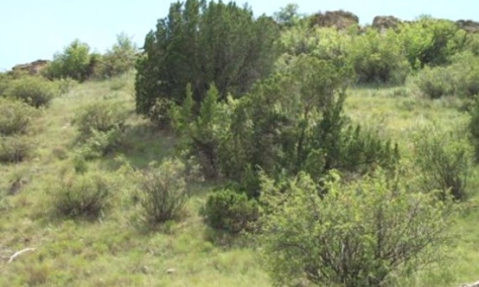
Figure 8. 1.1 Mixed-grasses/Shrubs Community
The interpretive or "reference" plant community for this site is a mixture of woody shrubs, small trees, forbs and grasses which typifies this site. The major grasses are sideoats grama and little bluestem. Woody plants include juniper, skunkbush sumac, elbowbush, and scattered mesquite. A good variety of perennial forbs is present. Grasses and forbs make up more of the total production than do the woody shrubs on this particular site.
Figure 9. Annual production by plant type (representative values) or group (midpoint values)
Table 5. Annual production by plant type
Plant type Low
(lb/acre)Representative value
(lb/acre)High
(lb/acre)Grass/Grasslike 400 550 650 Tree 150 150 175 Shrub/Vine 60 100 150 Forb 80 100 120 Microbiotic Crusts 20 25 25 Total 710 925 1120 Figure 10. Plant community growth curve (percent production by month). TX2019 , Tall/Midgrass prairie with trees, shrubs and forbs. Tall and midgrasses with trees, small shrubs and forbs in near historic climax..
Jan Feb Mar Apr May Jun Jul Aug Sep Oct Nov Dec J F M A M J J A S O N D 1 3 5 10 25 25 10 5 8 5 2 1 State 2
Oak/Juniper StateThe Oak/Juniper State is a shrub dominant with oaks and junipers dominating the site. There are some mid and tallgrasses present. The calcareous soils influence the species composition.
Dominant plant species
-
oak (Quercus), tree
-
juniper (Juniperus), tree
-
sideoats grama (Bouteloua curtipendula), grass
Community 2.1
Oak/Juniper Community
Figure 11. 2.1 Oak/Juniper Community
The Oak/Juniper Community is composed of primarily Mohr’s oak and redberry juniper along with a few remnants of tall and midgrasses present. There is a decreased grass/forb production from the Grassland/Shrubland State. The highly calcareous soils, aspect, and lack of fire generated the greatest affect on the plant community.
Figure 12. Annual production by plant type (representative values) or group (midpoint values)
Table 6. Annual production by plant type
Plant type Low
(lb/acre)Representative value
(lb/acre)High
(lb/acre)Shrub/Vine 400 500 600 Grass/Grasslike 200 350 400 Forb 75 90 100 Tree 50 70 90 Microbiotic Crusts 20 20 20 Total 745 1030 1210 Figure 13. Plant community growth curve (percent production by month). TX2023 , Oak / Juniper Community. Oaks and junipers with few perennial grasses..
Jan Feb Mar Apr May Jun Jul Aug Sep Oct Nov Dec J F M A M J J A S O N D 1 3 6 16 30 16 8 5 8 4 2 1 State 3
Juniper/Mesquite StateThe Juniper/Mesquite State has seen a dramatic increase of redberry juniper and mesquite dominating the Rough Breaks ecological site. There are still a few grass species remaining in the plant community. A few mesquite trees are present. Redberry juniper has increased over the past thirty years by at least twenty percent.
Community 3.1
Juniper/Mesquite Community
Figure 14. 3.1 Juniper/Mesquite Community
The Juniper/Mesquite Community is composed of primarily redberry juniper and mesquite which dominates the community along with a few clumps of mid and tallgrass species. There are still a few mesquite trees present. The redbed soils with gypsum strata have some influence on species composition. Redberry juniper has increased over the past thirty years by at least twenty percent.
Figure 15. Annual production by plant type (representative values) or group (midpoint values)
Table 7. Annual production by plant type
Plant type Low
(lb/acre)Representative value
(lb/acre)High
(lb/acre)Grass/Grasslike 300 400 500 Tree 200 300 375 Forb 75 100 120 Shrub/Vine 50 75 85 Microbiotic Crusts 5 20 20 Total 630 895 1100 Figure 16. Plant community growth curve (percent production by month). TX2046 , Mesquite/Juniper Woodland Community. Mesquite and Juniper dominated Woodland community..
Jan Feb Mar Apr May Jun Jul Aug Sep Oct Nov Dec J F M A M J J A S O N D 5 5 5 10 20 10 5 5 10 10 10 5 State 4
Mesquite/Juniper/Shortgrass StateThe Mesquite/Juniper/Shortgrasses Community is a mixed community of shrubs and grasses. This community is found primarily on a southwest facing slope. Shortgrasses and mesquite seem to be more acclimated to the hotter slopes.
Community 4.1
Mesquite/Juniper/Shortgrasses Community
Figure 17. 4.1 Mesquite/Juniper/Shortgrasses Community
This Mesquite/Juniper/Shortgrass Community is a mixed community of shrubs and variety of grasses. This community is on a southwest facing slope. Shortgrasses and mesquite seem to be more acclimated to the hotter slopes. There is a less total vegetative production than on north or east facing slopes.
Figure 18. Annual production by plant type (representative values) or group (midpoint values)
Table 8. Annual production by plant type
Plant type Low
(lb/acre)Representative value
(lb/acre)High
(lb/acre)Grass/Grasslike 250 350 400 Tree 200 250 300 Forb 75 90 100 Shrub/Vine 40 50 60 Microbiotic Crusts 10 10 10 Total 575 750 870 Figure 19. Plant community growth curve (percent production by month). TX2041 , Woody Shrubs and Shortgrasses. Mesquite, Juniper, and shortgrasses..
Jan Feb Mar Apr May Jun Jul Aug Sep Oct Nov Dec J F M A M J J A S O N D 0 2 5 15 25 22 10 6 8 5 1 1 Transition T1A
State 1 to 2Due to heavy continuous grazing, no fires, and no brush management, the Grassland/Shrubland State will transition into the Oak/Juniper State.
Transition T1B
State 1 to 3Due to heavy continuous grazing, no fires, and no brush management, the Grassland/Shrubland State will transition into the Juniper/Mesquite State.
Transition T1C
State 1 to 4Due to heavy continuous grazing, no fires, and no brush management, the Grassland/Shrubland State will transition into the Mesquite/Juniper/Shortgrass State. This is usually found on the south-southwest aspect.
Restoration pathway R2A
State 2 to 1With the implementation of conservation practices such as Prescribed Grazing, Prescribed Burning, and Brush Management, the Oak/Juniper State can be restored back to the Grassland/Shrubland State.
Conservation practices
Brush Management Prescribed Burning Prescribed Grazing Restoration pathway R3A
State 3 to 1With the implementation of conservation practices such as Prescribed Grazing, Prescribed Burning, and Brush Management, the Juniper/Mesquite State can be restored back to the Grassland/Shrubland State.
Conservation practices
Brush Management Prescribed Burning Prescribed Grazing Restoration pathway R3A
State 4 to 1With the implementation of conservation practices such as Prescribed Grazing, Prescribed Burning, and Brush Management, the Mesquite/Juniper/Shortgrass State can be restored back to the Grassland/Shrubland State.
Conservation practices
Brush Management Prescribed Burning Prescribed Grazing Additional community tables
Table 9. Community 1.1 plant community composition
Group Common name Symbol Scientific name Annual production () Foliar cover (%) Grass/Grasslike1 Tall/Midgrasses 350 little bluestem SCSC Schizachyrium scoparium 200 – sideoats grama BOCU Bouteloua curtipendula 150 – 2 Mid/Shortgrasses 105 Wright's threeawn ARPUW Aristida purpurea var. wrightii 15 – blue grama BOGR2 Bouteloua gracilis 15 – slim tridens TRMU Tridens muticus 15 – hairy grama BOHI2 Bouteloua hirsuta 10 – silver beardgrass BOLAT Bothriochloa laguroides ssp. torreyana 10 – fall witchgrass DICO6 Digitaria cognata 10 – large-spike bristlegrass SEMA5 Setaria macrostachya 10 – sand dropseed SPCR Sporobolus cryptandrus 10 – black grama BOER4 Bouteloua eriopoda 10 – 3 Tallgrasses 55 sand bluestem ANHA Andropogon hallii 25 – Indiangrass SONU2 Sorghastrum nutans 20 – switchgrass PAVI2 Panicum virgatum 10 – 4 Cool-season Grasses 40 Canada wildrye ELCA4 Elymus canadensis 20 – New Mexico feathergrass HENE5 Hesperostipa neomexicana 20 – Forb5 Forbs 100 stemmy four-nerve daisy TESC2 Tetraneuris scaposa 10 – white sagebrush ARLUM2 Artemisia ludoviciana ssp. mexicana 10 – yellow sundrops CASE12 Calylophus serrulatus 10 – trailing krameria KRLA Krameria lanceolata 10 – dotted blazing star LIPU Liatris punctata 5 – plains blackfoot MELE2 Melampodium leucanthum 5 – littleleaf sensitive-briar MIMI22 Mimosa microphylla 5 – evening primrose OENOT Oenothera 5 – rose heath CHER2 Chaetopappa ericoides 5 – shortray fleabane ERLO Erigeron lonchophyllus 5 – hoary false goldenaster HECA8 Heterotheca canescens 5 – Rocky Mountain zinnia ZIGR Zinnia grandiflora 5 – slimflower scurfpea PSTE5 Psoralidium tenuiflorum 5 – Drummond's skullcap SCDR2 Scutellaria drummondii 5 – Forb, annual 2FA Forb, annual 5 – Chalk Hill hymenopappus HYTE2 Hymenopappus tenuifolius 0–1 – purple locoweed OXLA3 Oxytropis lambertii 0–1 – James' nailwort PAJA Paronychia jamesii 0–1 – Shrub/Vine6 Shrubs/Vines 100 fragrant sumac RHAR4 Rhus aromatica 25 – mesquite PROSO Prosopis 15 – broom snakeweed GUSA2 Gutierrezia sarothrae 10 – catclaw mimosa MIACB Mimosa aculeaticarpa var. biuncifera 10 – alderleaf mountain mahogany CEMO2 Cercocarpus montanus 10 – featherplume DAFO Dalea formosa 10 – plains pricklypear OPPO Opuntia polyacantha 5 – Mohr oak QUMO Quercus mohriana 5 – littleleaf sumac RHMI3 Rhus microphylla 5 – soapweed yucca YUGL Yucca glauca 5 – common hoptree PTTR Ptelea trifoliata 0–1 – stretchberry FOPU2 Forestiera pubescens 0–1 – fourwing saltbush ATCA2 Atriplex canescens 0–1 – Tree7 Trees 120–150 Pinchot's juniper JUPI Juniperus pinchotii 120 – oneseed juniper JUMO Juniperus monosperma 20 – hackberry CELTI Celtis 10 – Table 10. Community 2.1 plant community composition
Group Common name Symbol Scientific name Annual production () Foliar cover (%) Table 11. Community 3.1 plant community composition
Group Common name Symbol Scientific name Annual production () Foliar cover (%) Table 12. Community 4.1 plant community composition
Group Common name Symbol Scientific name Annual production () Foliar cover (%) Interpretations
Animal community
Animals that use the site for habitat are Whitetail deer and Mule deer, Aoudad sheep, coyotes, raccoon, small mammals, songbirds, bobcats, raptors, lizards, various species of snakes. The site offers cover and protection from the elements, bedding areas for deer and sheep and much needed shade during summer heat. Mud swallows sometimes use the sheer cliff walls to build their nests. In certain locations there are small caves in steep walls that are attractive to bats.
Hydrological functions
Contributes fast runoff to surrounding streams and drainages.
Recreational uses
Hunting, Camping, Hiking, Birdwatching, Photography, and Horseback Riding.
Wood products
At times, juniper has been used for posts.
Other products
None.
Other information
Early native Americans frequented these sites utilizing the woody plants for tools and for shelter.
Supporting information
Inventory data references
NRCS FOTG – Section II of the FOTG Range Site Descriptions and numerous historical accounts of vegetative conditions at the time of early settlement in the area were used in the development of this site description. Vegetative inventories were made at several site locations for support documentation. Inventory Data References (documents): NRCS FOTG – Section II - Range Site Descriptions NRCS Clipping Data summaries over a 20 year period
Other references
J.R. Bell , USDA-NRCS Rangeland Management Specialist (retired)
Natural Resources Conservation Service - Range Site Descriptions
USDA-Natural Resources Conservation Service - Soil Surveys & Website soil database
Rathjen, Frederick W., The Texas Panhandle Frontier, Rev. 1998, Univ. of Texas Press
Hatch, Brown and Ghandi, Vascular Plants of Texas (An Ecological Checklist)
Texas A&M Exp. Station, College Station, Texas
Texas Tech University – Range,Wildlife & Fisheries Dept.Contributors
J.R. Bell
PES Edits by Tyson Morley, MLRA Soil Scientist, Altus, OklahomaApproval
Bryan Christensen, 9/15/2023
Acknowledgments
Site Development and Testing Plan: Future work, as described in a Project Plan, to validate the information in this Provisional Ecological Site Description is needed. This will include field activities to collect low, medium and high intensity sampling, soil correlations, and analysis of that data. Annual field reviews should be done by soil scientists and vegetation specialists. A final field review, peer review, quality control, and quality assurance reviews of the ESD will be needed to produce the final document. Annual reviews of the Project Plan are to be conducted by the Ecological Site Technical Team.
Rangeland health reference sheet
Interpreting Indicators of Rangeland Health is a qualitative assessment protocol used to determine ecosystem condition based on benchmark characteristics described in the Reference Sheet. A suite of 17 (or more) indicators are typically considered in an assessment. The ecological site(s) representative of an assessment location must be known prior to applying the protocol and must be verified based on soils and climate. Current plant community cannot be used to identify the ecological site.
Author(s)/participant(s) Stan Bradbury, Zone RMS, NRCS, Lubbock, Texas Contact for lead author 806-791-0581 Date 09/04/2007 Approved by Approval date Composition (Indicators 10 and 12) based on Annual Production Indicators
-
Number and extent of rills:
Due to the percent slopes, rills will be common. -
Presence of water flow patterns:
Due to the percent slopes, water flow patterns will be common. -
Number and height of erosional pedestals or terracettes:
Due to the percent slopes, pedestals/terracettes will be common. -
Bare ground from Ecological Site Description or other studies (rock, litter, lichen, moss, plant canopy are not bare ground):
25-35% mineral soil. -
Number of gullies and erosion associated with gullies:
Due to the percent slopes, gullies will be common. -
Extent of wind scoured, blowouts and/or depositional areas:
Slight to moderate. -
Amount of litter movement (describe size and distance expected to travel):
Slight to moderate. -
Soil surface (top few mm) resistance to erosion (stability values are averages - most sites will show a range of values):
Not very resistant to surface erosion. -
Soil surface structure and SOM content (include type of structure and A-horizon color and thickness):
Very gravelly loam; friable; low SOM. -
Effect of community phase composition (relative proportion of different functional groups) and spatial distribution on infiltration and runoff:
Lack of vegetative cover and slope increases the erosion potential. This site is a moderately permeable soil, rapid runoff, and available water holding capacity is low. -
Presence and thickness of compaction layer (usually none; describe soil profile features which may be mistaken for compaction on this site):
None. -
Functional/Structural Groups (list in order of descending dominance by above-ground annual-production or live foliar cover using symbols: >>, >, = to indicate much greater than, greater than, and equal to):
Dominant:
Warm-season midgrasses >Sub-dominant:
Warm-season tallgrasses > Shrubs/Vines >Other:
Warm-season shortgrasses > Cool-season grasses > Forbs > TreesAdditional:
-
Amount of plant mortality and decadence (include which functional groups are expected to show mortality or decadence):
Plant mortality and decadence is minimal. -
Average percent litter cover (%) and depth ( in):
Litter is dominantly herbaceous. -
Expected annual annual-production (this is TOTAL above-ground annual-production, not just forage annual-production):
750 to 1,200 pounds per acre. -
Potential invasive (including noxious) species (native and non-native). List species which BOTH characterize degraded states and have the potential to become a dominant or co-dominant species on the ecological site if their future establishment and growth is not actively controlled by management interventions. Species that become dominant for only one to several years (e.g., short-term response to drought or wildfire) are not invasive plants. Note that unlike other indicators, we are describing what is NOT expected in the reference state for the ecological site:
Juniper can be invasive. -
Perennial plant reproductive capability:
All plant species should be capable of reproduction except during periods of prolonged drought conditions, heavy natural herbivory, or intense wildfires.
Print Options
Sections
Font
AAAAOther
PrintThe Ecosystem Dynamics Interpretive Tool is an information system framework developed by the USDA-ARS Jornada Experimental Range, USDA Natural Resources Conservation Service, and New Mexico State University.
Accessibility statement


