
Natural Resources
Conservation Service
Ecological site R077EY057TX
Limy Upland
16-24" PZ
Last updated: 9/12/2023
Accessed: 09/14/2026
-
Search


Major Land Resource Area or ecological site by name and/or ID.
PreviousSectionsNextGeneral information
Provisional. A provisional ecological site description has undergone quality control and quality assurance review. It contains a working state and transition model and enough information to identify the ecological site.
Click to explore map
Figure 1. Mapped extent
Areas shown in blue indicate the maximum mapped extent of this ecological site. Other ecological sites likely occur within the highlighted areas. It is also possible for this ecological site to occur outside of highlighted areas if detailed soil survey has not been completed or recently updated.
MLRA notes
Major Land Resource Area (MLRA): 077E–Southern High Plains, Breaks
MLRA 77E occurs along very gently sloping breaks and steep escarpments associated with dissecting river systems and erosional margins of the Southern High Plains. Soil temperature regime is thermic and soil moisture regime is ustic bordering on aridic. Loamy and sandy soils are generally well drained, range from shallow to deep, and developed in highly calcareous upper Ogallala Formation sediments.
Classification relationships
This ecological site is correlated to soil components at the Major Land Resource Area (MLRA) level which is further described in USDA Ag Handbook 296.
Ecological site concept
This site occurs on deep highly calcareous coarse-loamy and fine-loamy soils. Reference vegetation consists of a mixture of mid and shortgrasses with forbs and few woody plants. The absence of fire or alternative brush management may lead to an increase in woody plant cover and altered ecological function. Continued abusive grazing practices may cause a decrease in palatable species and a shift to a shortgrass dominated plant community.
Associated sites
R077EY051TX Clay Loam 16-24" PZ
Nearly level to gently sloping plains, divides, side slopes and upland terraces with very deep clay loam soils. Short grasses and midgrasses with scattered forbs and few shrubs.
R077EY052TX Draw 16-24" PZ
Nearly level to very gently sloping very deep loamy soils on lower draw landscapes. Tall and midgrass species with forbs and few woody plants
R077EY055TX Hardland Slopes 16-24" PZ
Nearly level to moderately steep fine-loamy calcareous soils on similar positions. Dominantly shortgrass community with some midgrasses, forbs, and few woody species.
R077EY053TX Gravelly 16-24" PZ
Gently sloping to steep hillslopes, very deep gravelly loams and gravelly sandy loam soils on lower positions. Up to 35% of the soil surface covered with gravels. Intermixed midgrasses and shortgrasses and forbs with occasional tallgrasses.
R077EY056OK Loamy Upland 16-24" PZ
Nearly level to sloping very deep fine-loamy and fine-silty soils on stream terraces, remnant stream terraces, paleoterraces, and aggraded hillslopes. Mid and tallgrass with forbs and very few woody species
R077EY061TX Mixedland Slopes 16-24" PZ
Very gently to moderately steeply sloping, very deep coarse-loamy soils on lower hillslopes. Tallgrasses and midgrasses dominate with forbs, and few shrub species.
R077EY062TX Breaks 16-24" PZ
Strongly sloping to very steep, shallow, loamy soils often intermixed with rock outcrops on higher positions. A mixture of grasses, forbs, shrubs, and a few trees with bare ground. Many rocks and cobbles on the surface.
R077EY068TX Very Shallow 16-24" PZ
Nearly level to steep, shallow and very shallow soils over caliche on higher limestone on ridges, hills, structural benches, and along escarpments. A mixture of native tall, mid and shortgrasses with forbs and scattered shrubs.
R077AY013TX Very Shallow 16-22" PZ
Nearly level to moderately sloping soils with shallow soils formed over petrocalcic horizons on higher positions. Dominated by short and midgrasses with forbs. Limited production potential due to shallow soil depth over restrictive petrocalcic.
Similar sites
R077EY055TX Hardland Slopes 16-24" PZ
Hardland slopes are not as calcareous throughout the soil profile. Hardland slopes are dominantly blue grama whereas Limy Upland supports more sideoats grama and other midgrasses.
R077AY006TX Limy Upland 16-22" PZ
A similar site in MLRA 77A with soils formed in a slightly cooler mesic soil temperature regime.
Table 1. Dominant plant species
Tree Not specified
Shrub Not specified
Herbaceous (1) Bouteloua gracilis
(2) Bouteloua curtipendulaPhysiographic features
This site occurs as convex ridgetops, hillsides, and side slopes above drainages. Slopes vary from 1 to 20% and may be short or relatively long. The position on the landscape is upper Ogallala formation on the erosional surfaces below the escarpment of the High Plains. The site is extensive in MLRA 77E.
Table 2. Representative physiographic features
Landforms (1) Plains > Hillslope
(2) Plains > Valley side
(3) Plains > Ridge
Runoff class Low to high Flooding frequency None Ponding frequency None Elevation 2000 – 4500 ft Slope 1 – 20 % Aspect Aspect is not a significant factor Table 3. Representative physiographic features (actual ranges)
Runoff class Low to high Flooding frequency None Ponding frequency None Elevation 2000 – 4500 ft Slope 1 – 20 % Climatic features
Climate is a cold semi-arid steppe (Koppen-Geiger classification BSk). Summers are hot and winters are cold. Temperature extremes are common. Humidity is generally low, evaporation is high, and short-term droughts are common. Average annual wind speed is 12 mph with highest winds in early spring. The prevailing wind direction is south. Summertime brings strong high pressure systems that build into heat domes with highs in the upper 90 to mid-100 degree F range. Evaporation in summer is high and open pan evaporation exceeds 6 feet per year. Early autumn temperatures are mild, with Canadian and Pacific cold fronts bringing cold air in mid-autumn throughout winter. Arctic air can settle in and dominate for several weeks during winter with very cold air in place for 2 to 3 weeks at a time.
Most of the precipitation comes in the form of rain from May through September. Rainfall events often occur as intense showers of relatively short duration. Snowfall average is about 17 inches but is also variable from 8 to 36 inches annually. Long term droughts are likely to occur every 15 to 20 years and may last 4 to 5 years. Mean precipitation is around 21 inches but varies significantly from year to year. Rainfall amounts over the last 100 years have varied from as little as 9 inches to as much as 37 inches. The probability is about 70% that precipitation will fall between 14 to 24 inches. Growing season averages 190 days. Average first frost is around October 22, and the last freeze of the season occurs around April 15.Table 4 Representative climatic features
Frost-free period (characteristic range) 150-160 days Freeze-free period (characteristic range) 180-190 days Precipitation total (characteristic range) 20-20 in Frost-free period (actual range) 140-180 days Freeze-free period (actual range) 180-200 days Precipitation total (actual range) 20-30 in Frost-free period (average) 160 days Freeze-free period (average) 190 days Precipitation total (average) 20 in Characteristic rangeActual rangeBarLineFigure 2. Monthly precipitation range
Characteristic rangeActual rangeBarLineFigure 3. Monthly minimum temperature range
Characteristic rangeActual rangeBarLineFigure 4. Monthly maximum temperature range
BarLineFigure 5. Monthly average minimum and maximum temperature
Figure 6. Annual precipitation pattern
Figure 7 Annual average temperature pattern
Climate stations used
-
(1) BEAVER [USC00340593], Beaver, OK
-
(2) BOYS RANCH [USC00411000], Vega, TX
-
(3) GATE [USC00343489], Gate, OK
-
(4) CANADIAN [USC00411412], Canadian, TX
-
(5) FOLLETT [USC00413225], Follett, TX
-
(6) SANFORD DAM [USC00418040], Fritch, TX
-
(7) GUYMON MUNI AP [USW00003030], Guymon, OK
-
(8) MEADE [USC00145171], Meade, KS
-
(9) CLARENDON [USW00023072], Clarendon, TX
-
(10) CHANNING 2 [USC00411649], Channing, TX
-
(11) COLDWATER [USC00141704], Coldwater, KS
-
(12) REYDON 2SSE [USC00347579], Reydon, OK
-
(13) MIAMI [USC00415875], Miami, TX
-
(14) LIPSCOMB [USC00415247], Booker, TX
">Influencing water features
Well drained soils with low to high runoff. No influencing water features.
Wetland description
Soils in this ecological site are not part of wetland ecosystems.
Soil features
Soils are mapped for each county within the MLRA. Mapunits are representations of the major soil series component(s) and named accordingly. Each Mapunit is spatially represented on a digital soils map as polygons of different shapes and sizes. Within these Mapunits, there are often minor soil series components included. These minor components are soils that occur within a Mapunit polygon but are of small extent (15% or less of the Mapunit area). However, it is difficult to separate these minor soils spatially due to the scale of soil mapping.
Ecological sites are correlated at the component level of the soil survey. Therefore, a single Mapunit may contain multiple Ecological Sites just as it may contain multiple soil components. This is important to understand when investigating soils and Ecological Sites. A soil survey Mapunit may be correlated to a single Ecological Site based on the major component; however, there may be inclusions of areas of additional Ecological Sites which are correlated to the minor components of that particular soil Mapunit.
These are deep to very deep well drained soils that are calcareous to the surface. Slopes range from 1 to 20%. Free lime in the profile influences vegetative community makeup. Calcium carbonate equivalent ranges from 15 to 60 %. Surface textures are loam, clay loam, and fine sandy loam. Inherent fertility is moderate to moderately low and permeability is moderate. Plant roots easily penetrate the soil.
Representative soil components for this site include: Alowood, Case, Catesby, Mansic, Slapout, and Veal.Table 5. Representative soil features
Parent material (1) Colluvium – arenaceous limestone
Surface texture (1) Loam
(2) Clay loam
(3) Fine sandy loam
Family particle size (1) Coarse-loamy
(2) Fine-loamy
Drainage class Well drained Permeability class Moderate Soil depth 60 – 80 in Surface fragment cover <=3" 0 – 6 % Surface fragment cover >3" 0 – 2 % Available water capacity
(0-40in)4.3 – 7.8 in Calcium carbonate equivalent
(0-40in)15 – 60 % Electrical conductivity
(0-40in)0 – 2 mmhos/cm Soil reaction (1:1 water)
(0-40in)7.2 – 9 Subsurface fragment volume <=3"
(0-40in)0 – 40 % Subsurface fragment volume >3"
(0-40in)0 – 10 % Ecological dynamics
The information contained in the State and Transition Diagram (STD) and the Ecological Site Description was developed using archeological and historical data, professional experience, and scientific studies. The information presented is representative of a very complex set of plant communities. Not all scenarios or plants are included. Key indicator plants, animals and ecological processes are described to inform land management decisions.
The reference plant community consists of mid and shortgrasses with a good variety of perennial forbs and few woody shrubs. The calcareous soils influence the species composition of the site. The main grass species are sideoats grama (Bouteloua curtipendula), blue grama (Bouteloua gracilis), little bluestem (Schizachyrium scoparium), vine mesquite (Panicum obtusum), western wheatgrass (Pascopyrum smithii), and perennial three-awn (Aristida purpurea). The more free lime in the soil the more little bluestem and sideoats grama will be present on the site. In small depressional areas, sand bluestem (Andropogon hallii) and Indiangrass (Sorghastrum nutans) may be found in small quantities. Major forbs are dotted gayfeather (Liatris punctata), slimleaf scurfpea (Psoralidium tenuiflorum), engelmanndaisy (Engelmannia peristenia), chocolate daisy (Berlandiera lyrata), baby white aster (Chaetopappa ericoides.), catclaw sensitivebriar (Mimosa nuttallii), rushpea (Hoffmannseggia spp.), and plains actinea (Tetraneuris scaposa). The major woody shrub is plains yucca (Yucca glauca) and there are often small amounts of catclaw mimosa (Mimosa aculeaticarpa var. biuncifera), plains pricky pear (Opuntia polyacantha), broom snakeweed (Gutierrezia sarothrae), and cholla (Cylindropuntia imbricata) present. Yucca acts as a strong increaser on this site and if the site is constantly rested in spring when the yucca blooms and makes seed, the increase is hastened. With grazing pressure over time, the midgrasses give way to shortgrass species such as blue grama and the productive capacity is reduced as well as the diversity. Long term abusive grazing will see deterioration of the perennial grass community with species such as broom snakeweed and cactus increasing dramatically. Yucca can become the dominant plant on this site with no fire or brush management. Some ungrazed sites have a large yucca population. Prescribed grazing and occasional prescribed fire can sustain a productive community that is near reference condition.
Natural fire played a major role in the ecology of this site as with most plains sites. The major effect of periodic fire was to suppress woody shrubs and promote a grassland community. With the absence of fire it is much easier for woody shrubs to proliferate and become dominant. Natural fires probably occurred every 10 to 15 years and perhaps more often throughout the plains region. This was often enough to hold most woody species in check and encourage grass dominance. Fire also promoted diversity of forb growth for a couple of years following the burn, which drew the attention of wildlife species such as pronghorn and mule deer. The main obstacle to the use of fire in the present day is the liability situation and the unpredictability of precipitation. As precipitation falls below a mean of 18 inches, measuring the positive effects of fire becomes more difficult. Fire can be a valuable tool for managing vegetation when used by trained experts in the proper manner.
Large herbivores, mainly bison, roamed the prairie, grazed heavily, but moved on quickly allowing for long recovery periods. Healthy, productive grassland ecosystems were maintained under this type of natural grazing regime. The grazing of domestic livestock, mainly cattle, began in the 1870’s. Early day ranchers saw a land of endless grass and overestimated the ability of the land to support large numbers of stock. As the land was fenced in the 1880’s, stock began to be more confined leading to continuous grazing pressure on much of the range. Since that time, continuous grazing has been common and stocking rates have been for the most part excessive.
Productivity and diversity of the plant community has generally suffered. Many plains sites are resistant to damage by grazing but will yield to constant pressure. When given good management this site, as well as other sites, respond favorably and some measure of recovery can be expected fairly rapidly. In extreme cases, where abuse has been long term, or where woody shrub invasion has gone unchecked, good management comes too late to allow recovery to the more productive communities of the past. Significant energy input such as brush control, weed control, prescribed burning and sometimes reseeding may be necessary to change the plant community in the desired direction.
Hydrologically speaking, the site produces a considerable amount of runoff which finds its way to the numerous small and medium sized drainages. If plant cover is a healthy grassland community, the runoff is slowed and the water quality of runoff is acceptable. Poor cover with significant bare soil promotes runoff and siltation. This becomes a vicious cycle with infiltration being limited by poor cover and poor moisture relationships limiting the growth of healthy plants. Deep rooted perennial grasses and forbs aid in keeping an efficient water cycle.
This is not a particularly diverse site as far as habitat for wildlife is concerned. However, grassland birds, pronghorn and mule deer inhabit the site. Woody cover is not sufficient to provide cover for whitetail deer and turkey. Scaled quail are found often on the site as they need no more brush than a few yucca and cholla to provide their cover needs. In reference condition, this site could support the native plains wildlife, while other sites with more woody vegetation supported different species. In planning with producers to meet wildlife habitat needs, the potential of each ecological site needs to be realized and included on the overall plan.
State and Transition Diagram:
A State and Transition Diagram for the Limy Upland (R077EY057TX) site is depicted below. Thorough descriptions of each state, transition, and pathway follow the model. Experts base this model on available experimental research, field observations, professional consensus, and interpretations. It is likely to change as knowledge increases.
Plant communities will differ across the MLRA because of the natural variability in weather, soils, and aspect. The Reference Plant Community is not necessarily the management goal; other vegetative states may be desired plant communities as long as the Range Health assessments are in the moderate and above category.
The biological processes on this site are complex. Therefore, representative values are presented in a land management context. The species lists are representative and are not botanical descriptions of all species occurring, or potentially occurring, on this site. They are not intended to cover every situation or the full range of conditions, species, and responses for the site.
Composition by dry weight and percent canopy cover are provided to describing the functional groups. Most observers find it easier to visualize or estimate percent canopy for woody species (trees and shrubs).
The following diagram suggests some pathways that the vegetation on this site might take. There may be other states not shown on the diagram. This information is intended to show what might happen in a given set of circumstances. It does not mean that this would happen the same way in every instance. Local professional guidance should always be sought before pursuing a treatment scenario.State and transition model
More interactive model formats are also available. View Interactive Models
Click on state and transition labels to scroll to the respective textT1A - Excessive grazing pressure over time R2A - Introduction of historic disturbance return intervals and release from excessive grazing pressure T2A - Absence of disturbance and natural regeneration over time, may be coupled with excessive grazing pressure T2B - Absence of disturbance and natural regeneration over time, may be coupled with excessive grazing pressure R3A - Removal of woody canopy R4A - Removal of woody canopy State 1 submodel, plant communities
State 2 submodel, plant communities
State 3 submodel, plant communities
State 4 submodel, plant communities
State 1
Midgrass StateThis is the reference or diagnostic community for the site. The description is based on early range site descriptions, clipping data, professional consensus of experienced range specialists, and analysis of field work.
Dominant plant species
-
sideoats grama (Bouteloua curtipendula), grass
-
blue grama (Bouteloua gracilis), grass
-
little bluestem (Schizachyrium scoparium), grass
Community 1.1
Midgrass/Shortgrass Community
Figure 8. 1.1 Midgrass/Shortgrass Community
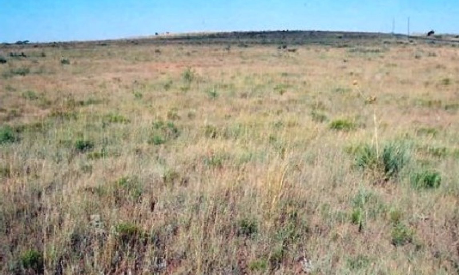
The reference plant community for this site is mid and shortgrasses with 5 to 8 % perennial forbs and scattered woody shrubs. Grasses include sideoats grama and blue grama with smaller amounts of vine mesquite. Shrubs include broom snakeweed and yucca.
Figure 9. Annual production by plant type (representative values) or group (midpoint values)
Table 6. Annual production by plant type
Plant type Low
(lb/acre)Representative value
(lb/acre)High
(lb/acre)Grass/Grasslike 1090 1495 1920 Forb 70 125 200 Shrub/Vine 30 65 60 Microbiotic Crusts 10 15 20 Tree 1 1 1 Total 1201 1701 2201 Figure 10. Plant community growth curve (percent production by month). TX1511 , Warm season dominant mid and shortgrasses. Mid and shortgrasses with some perennial forbs and scattered woody shrubs..
Jan Feb Mar Apr May Jun Jul Aug Sep Oct Nov Dec J F M A M J J A S O N D 0 3 4 10 17 27 12 10 8 5 3 1 State 2
Shortgrass StateDominant plant species
-
yucca (Yucca), shrub
-
blue grama (Bouteloua gracilis), grass
-
threeawn (Aristida), grass
Community 2.1
Shortgrass with Scattered Shrubs Community
Figure 11. 2.1 Shortgrass with Scattered Shrubs Community
This community is shortgrasses with increasing woody shrubs and halfshrubs. This community has blue grama and perennial threeawn along with some increase in yucca and snakeweed. Production is lower than that of Reference community and plant diversity is less.
Figure 12. Annual production by plant type (representative values) or group (midpoint values)
Table 7. Annual production by plant type
Plant type Low
(lb/acre)Representative value
(lb/acre)High
(lb/acre)Grass/Grasslike 1000 1300 1500 Forb 50 70 100 Shrub/Vine 30 70 100 Microbiotic Crusts 10 15 15 Tree 0 1 1 Total 1090 1456 1716 Figure 13. Plant community growth curve (percent production by month). TX1507 , Shortgrass Dominant with some shrubs. Community is shortgrasses with increasing woody shrubs and halfshrubs. Production is lower than climax community..
Jan Feb Mar Apr May Jun Jul Aug Sep Oct Nov Dec J F M A M J J A S O N D 0 3 4 10 17 27 12 10 8 5 3 1 State 3
Shrubland StateWoody shrubs are dominating the shortgrass community. Yucca has increased to the point of dominance. Perennial three-awn is in about equal amounts with blue grama.
Dominant plant species
-
broom snakeweed (Gutierrezia sarothrae), shrub
-
yucca (Yucca), shrub
-
threeawn (Aristida), grass
Community 3.1
Shrub Dominant/Shortgrass Community
Figure 14. 3.1 Shrub Dominant/Shortgrass Community
Woody shrubs are dominating the shortgrass community. Yucca has increased to the point of dominance. Perennial three-awn is in about equal amounts with blue grama. Threshold has been crossed to where management inputs such as brush management, prescribed grazing, pest management and prescribed burning are needed to revert back to the shortgrass community.
Figure 15. Annual production by plant type (representative values) or group (midpoint values)
Table 8. Annual production by plant type
Plant type Low
(lb/acre)Representative value
(lb/acre)High
(lb/acre)Grass/Grasslike 500 700 800 Shrub/Vine 275 350 400 Forb 50 80 120 Microbiotic Crusts 5 10 10 Tree 0 1 1 Total 830 1141 1331 Figure 16. Plant community growth curve (percent production by month). TX1510 , Shortgrass/halfshrubs. Shortgrasses with halfshrubs and shrubs increasing on site..
Jan Feb Mar Apr May Jun Jul Aug Sep Oct Nov Dec J F M A M J J A S O N D 1 3 6 14 24 22 5 4 5 12 3 1 State 4
Degraded Shortgrass StateThis community is low vigor shortgrasses in open turf with increasing broom snakeweed. Some increase in bare ground and annuals is apparent. Broom snakeweed has become very competitive in this community. Some increase in prickly pear and cholla.
Community 4.1
Shortgrass/Halfshrubs Community
Figure 17. 4.1 Shortgrass/Halfshrubs Community
This community is low vigor shortgrasses with increasing broom snakeweed. Some increase in bare ground and annuals is apparent.
Low vigor blue grama with some open turf is present in this community. Snakeweed has become very competitive. Some increase in prickly pear and cholla. This is very close to threshold and in fact may have already crossed. The snakeweed may not cycle out without control.Figure 18. Annual production by plant type (representative values) or group (midpoint values)
Table 9. Annual production by plant type
Plant type Low
(lb/acre)Representative value
(lb/acre)High
(lb/acre)Grass/Grasslike 450 550 700 Shrub/Vine 300 400 500 Forb 70 100 120 Microbiotic Crusts 5 10 15 Tree 0 1 1 Total 825 1061 1336 Figure 19. Plant community growth curve (percent production by month). TX1509 , Shortgrass/halfshrub. Low vigor blue grama with broom snakeweed..
Jan Feb Mar Apr May Jun Jul Aug Sep Oct Nov Dec J F M A M J J A S O N D 1 3 6 14 24 22 5 4 5 12 3 1 Transition T1A
State 1 to 2Due to heavy continuous grazing pressure, no fires, and brush invasion of broom snakeweed and yucca, the Midgrass State will transition into the Shortgrass State.
Restoration pathway R2A
State 2 to 1With Prescribed Grazing, Prescribed Burning, and Individual Plant Treatment (Brush Management, the Shortgrass State can be restored back to the Midgrass State.
Conservation practices
Brush Management Prescribed Burning Prescribed Grazing Transition T2A
State 2 to 3With heavy continuous grazing pressure, no brush management, and brush invasion of woody shrubs and halfshrubs, the Shortgrass State will transition to the Shrubland State.
Transition T2B
State 2 to 4With heavy continuous grazing pressure, no brush management, and brush invasion of woody shrubs and half shrubs, the Shortgrass State will transition into the Degraded Shortgrass State.
Restoration pathway R3A
State 3 to 2With the implementation of various conservation practices such as Brush Management, Prescribed Grazing, Pest Management, and Prescribed Burning (over a ten year period), the Shrubland State can be restored back to the Shortgrass State.
Conservation practices
Brush Management Prescribed Burning Integrated Pest Management (IPM) Prescribed Grazing Restoration pathway R4A
State 4 to 2With Brush Management, Prescribed Grazing, Pest Management, and Prescribed Burning conservation practices implemented over a ten year period, the Degraded Shortgrass State can be restored back to a Shortgrass State.
Conservation practices
Brush Management Prescribed Burning Prescribed Grazing Integrated Pest Management (IPM) Additional community tables
Table 10. Community 1.1 plant community composition
Group Common name Symbol Scientific name Annual production () Foliar cover (%) Grass/Grasslike1 Tallgrasses 30–50 sand bluestem ANHA Andropogon hallii 0–50 – Indiangrass SONU2 Sorghastrum nutans 0–50 – 2 Midgrasses 350–610 sideoats grama BOCU Bouteloua curtipendula 300–500 – little bluestem SCSC Schizachyrium scoparium 50–110 – 3 Midgrasses 500–900 blue grama BOGR2 Bouteloua gracilis 450–830 – vine mesquite PAOB Panicum obtusum 50–90 – 4 Shortgrasses 30–60 buffalograss BODA2 Bouteloua dactyloides 30–60 – sand dropseed SPCR Sporobolus cryptandrus 25–50 – purple threeawn ARPU9 Aristida purpurea 30–50 – hairy grama BOHI2 Bouteloua hirsuta 15–25 – silver beardgrass BOLAT Bothriochloa laguroides ssp. torreyana 15–25 – tumble windmill grass CHVE2 Chloris verticillata 5–15 – gummy lovegrass ERCU Eragrostis curtipedicellata 5–15 – sand muhly MUAR2 Muhlenbergia arenicola 0–10 – 5 Cool-season grasses 60–110 western wheatgrass PASM Pascopyrum smithii 25–50 – Canada wildrye ELCA4 Elymus canadensis 20–35 – eastern bottlebrush grass ELHY Elymus hystrix 15–30 – Forb6 Forbs 35–165 Cuman ragweed AMPS Ambrosia psilostachya 0–40 – white sagebrush ARLUM2 Artemisia ludoviciana ssp. mexicana 0–40 – lyreleaf greeneyes BELY Berlandiera lyrata 0–40 – yellow sundrops CASE12 Calylophus serrulatus 0–40 – prairie clover DALEA Dalea 0–40 – Engelmann's daisy ENGEL Engelmannia 0–40 – tall woolly buckwheat ERELE Eriogonum elatum var. elatum 0–40 – scarlet beeblossom GACO5 Gaura coccinea 0–40 – curlycup gumweed GRSQ Grindelia squarrosa 0–40 – stiffleaf false goldenaster HEST3 Heterotheca stenophylla 0–40 – rushpea HOFFM Hoffmannseggia 0–40 – dotted blazing star LIPU Liatris punctata 0–40 – Florida mimosa MIQUF Mimosa quadrivalvis var. floridana 0–40 – Fendler's penstemon PEFE Penstemon fendleri 0–40 – little combseed PEPU Pectocarya pusilla 0–40 – slimflower scurfpea PSTE5 Psoralidium tenuiflorum 0–40 – scarlet globemallow SPCO Sphaeralcea coccinea 0–40 – stemmy four-nerve daisy TESC2 Tetraneuris scaposa 0–40 – stiff greenthread THFI Thelesperma filifolium 0–40 – Rocky Mountain zinnia ZIGR Zinnia grandiflora 0–40 – Shrub/Vine7 Shrubs 30–65 soapweed yucca YUGL Yucca glauca 25–35 – soapweed yucca YUGL Yucca glauca 25–35 – broom snakeweed GUSA2 Gutierrezia sarothrae 10–20 – broom snakeweed GUSA2 Gutierrezia sarothrae 10–20 – plains pricklypear OPPO Opuntia polyacantha 5–15 – plains pricklypear OPPO Opuntia polyacantha 5–15 – fragrant mimosa MIBO2 Mimosa borealis 0–10 – fragrant mimosa MIBO2 Mimosa borealis 0–10 – tree cholla CYIMI Cylindropuntia imbricata var. imbricata 0–5 – tree cholla CYIMI Cylindropuntia imbricata var. imbricata 0–5 – Tree8 Trees 0–1 netleaf hackberry CELAR Celtis laevigata var. reticulata 0–1 – Table 11. Community 2.1 plant community composition
Group Common name Symbol Scientific name Annual production () Foliar cover (%) Table 12. Community 3.1 plant community composition
Group Common name Symbol Scientific name Annual production () Foliar cover (%) Table 13. Community 4.1 plant community composition
Group Common name Symbol Scientific name Annual production () Foliar cover (%) Interpretations
Animal community
Native animals that occupy this site include bob-white quail, white-tailed deer, turkey, lesser prairie chicken and various small mammals and grassland birds. The site provides cover and nesting habitat for turkey, prairie chicken and quail. Deer frequent the site for screening cover and bedding sites. Many white-tailed deer fawns are observed in the tallgrass cover in the spring. Turkeys use this site frequently for nesting especially if it is in close proximity to creeks and/or bottomlands.
Hydrological functions
This upland site contributes runoff to small and medium sized drainages. With good vegetative cover, infiltration is enhanced, runoff reduced and siltation minimized. Poor cover and lower ecological condition will contribute to an ineffective water cycle.
Recreational uses
Hunting, camping, hiking, horseback riding, and photography are some recreational uses for this site.
Wood products
None.
Other products
None.
Other information
None.
Supporting information
Inventory data references
The information in this document is based on long term observations of well managed ranges, several years of clipping data, NRCS FOTG Range Site Descriptions ( both past and present ) and numerous historical accounts of vegetative conditions at the time of settlement of the area. Vegetative inventories were made at several locations as this site description was being prepared. Inventory Data References: NRCS 417 data for eight years was reviewed and clipping data summaries over a 20 year period were reviewed.
Other references
USDA Soil Survey Reports; Soil Series Official Descriptions ; Hatch, Gandhi and Brown, Checklist of the Vascular Plants of Texas: Gould’s Grasses of Texas; Stubbendieck, Hatch and Butterfield, North American Range Plants
Technical Review:
Mark Moseley, Oklahoma State Range Conservation NRCS
Homer Sanchez, State Rangeland Management Specialist
Tony Garcia, Zone Rangeland Management Specialist
Clint Rollins, Rangeland Management Specialist
Dr. Jack Eckroat, Grazing Lands Specialist Oklahoma NRCS
Justin Clary, Rangeland Management SpecialistContributors
J.R. Bell, RMS, NRCS, Amarillo, Texas
Steven McGowen, MLRA Office Leader, NRCS, Woodward, OKApproval
Bryan Christensen, 9/12/2023
Acknowledgments
Site Development and Testing Plan Future work, as described in a Project Plan, to validate the information in this Provisional Ecological Site Description is needed. This will include field activities to collect low, medium and high intensity sampling, soil correlations, and analysis of that data. Annual field reviews should be done by soil scientists and vegetation specialists. A final field review, peer review, quality control, and quality assurance reviews of the ESD will be needed to produce the final document. Annual reviews of the Project Plan are to be conducted by the Ecological Site Technical Team.
Rangeland health reference sheet
Interpreting Indicators of Rangeland Health is a qualitative assessment protocol used to determine ecosystem condition based on benchmark characteristics described in the Reference Sheet. A suite of 17 (or more) indicators are typically considered in an assessment. The ecological site(s) representative of an assessment location must be known prior to applying the protocol and must be verified based on soils and climate. Current plant community cannot be used to identify the ecological site.
Author(s)/participant(s) Stan Bradbury, Zone RMS, NRCS, Lubbock, Texas Contact for lead author 806-791-0581 Date 09/04/2007 Approved by Approval date Composition (Indicators 10 and 12) based on Annual Production Indicators
-
Number and extent of rills:
None to slight. -
Presence of water flow patterns:
None to slight. -
Number and height of erosional pedestals or terracettes:
None to slight. -
Bare ground from Ecological Site Description or other studies (rock, litter, lichen, moss, plant canopy are not bare ground):
20-25%. -
Number of gullies and erosion associated with gullies:
None to slight. -
Extent of wind scoured, blowouts and/or depositional areas:
None to slight. -
Amount of litter movement (describe size and distance expected to travel):
None to slight. -
Soil surface (top few mm) resistance to erosion (stability values are averages - most sites will show a range of values):
Very resistant to surface erosion. -
Soil surface structure and SOM content (include type of structure and A-horizon color and thickness):
Loamy, friable surface, medium SOM. -
Effect of community phase composition (relative proportion of different functional groups) and spatial distribution on infiltration and runoff:
Basal cover and density with small interspaces will make rainfall impact minimal. This site is a moderately permeable soil, runoff is slow to medium, and available water holding capacity is medium. -
Presence and thickness of compaction layer (usually none; describe soil profile features which may be mistaken for compaction on this site):
None. -
Functional/Structural Groups (list in order of descending dominance by above-ground annual-production or live foliar cover using symbols: >>, >, = to indicate much greater than, greater than, and equal to):
Dominant:
Warm-season shortgrasses >Sub-dominant:
Warm-season midgrasses > Cool-season midgrasses >Other:
Warm-season tallgrasses > Forbs > Shrubs/Vines > TreesAdditional:
-
Amount of plant mortality and decadence (include which functional groups are expected to show mortality or decadence):
Grasses due to their growth habit will exhibit some mortality and decadence though minimal. -
Average percent litter cover (%) and depth ( in):
Litter is dominantly herbaceous. -
Expected annual annual-production (this is TOTAL above-ground annual-production, not just forage annual-production):
1,200 to 2,200 pounds per acre. -
Potential invasive (including noxious) species (native and non-native). List species which BOTH characterize degraded states and have the potential to become a dominant or co-dominant species on the ecological site if their future establishment and growth is not actively controlled by management interventions. Species that become dominant for only one to several years (e.g., short-term response to drought or wildfire) are not invasive plants. Note that unlike other indicators, we are describing what is NOT expected in the reference state for the ecological site:
Yucca, cholla, and pricklypear can be invasive. -
Perennial plant reproductive capability:
All plant species should be capable of reproduction except during periods of prolonged drought conditions, heavy natural herbivory, or intense wildfires.
Print Options
Sections
Font
AAAAOther
PrintThe Ecosystem Dynamics Interpretive Tool is an information system framework developed by the USDA-ARS Jornada Experimental Range, USDA Natural Resources Conservation Service, and New Mexico State University.
Accessibility statement


