
Natural Resources
Conservation Service
Ecological site R077CY036TX
Sandy Loam
16-21" PZ
Last updated: 9/11/2023
Accessed: 09/09/2026
-
Search


Major Land Resource Area or ecological site by name and/or ID.
PreviousSectionsNextGeneral information
Provisional. A provisional ecological site description has undergone quality control and quality assurance review. It contains a working state and transition model and enough information to identify the ecological site.
Click to explore map
Figure 1. Mapped extent
Areas shown in blue indicate the maximum mapped extent of this ecological site. Other ecological sites likely occur within the highlighted areas. It is also possible for this ecological site to occur outside of highlighted areas if detailed soil survey has not been completed or recently updated.
MLRA notes
Major Land Resource Area (MLRA): 077C–Southern High Plains, Southern Part
MLRA 77C is characterized by nearly level plains with numerous playa depressions, moderately sloping breaks along drainageways, and a steep escarpment along the eastern margin. From southwest to northeast, soils grade from coarse-textured to fine-textured. Soils are generally deep and occur in a thermic soil temperature regime and ustic soil moisture regime bordering on aridic. Current land use is dominantly cropland.
Classification relationships
This ecological site is correlated to soil components at the Major Land Resource Area (MLRA) level which is further described in USDA Ag Handbook 296.
Ecological site concept
This site occurs on gently sloping sandy loam soils on uplands. The reference vegetation consists of midgrasses with some shortgrasses and forbs and few woody plants. Abusive grazing practices can lead to a decrease in palatable species and a shift in the plant community. Without fire or other brush management, woody species may increase across the site.
Associated sites
R077CY027TX Playa 16-21" PZ
The Playa site occurs on fine textured soils of closed depressions or playa basins. Water is ponded for various lengths of time. These sites are on lower landscape positions and water is ponded for various lengths of time. Vegetation is variable and may fluctuate because of the duration and depth of ponding.
R077CY028TX Limy Upland 16-21" PZ
The Limy Upland is on plains, interdunes, playa steps, and playa slopes. This site is associated with Sandy Loam sites that are on similar or slightly lower landscape positions. Midgrasses and shortgrasses dominate these sites.
R077CY037TX Very Shallow 16-21" PZ
The shallow site is on uplands and has calcareous, very gravelly soils or soils that are shallow to an indurated petrocalcic horizon. These sites are on landscape positions similar to the Sandy Loam site. The reference plant community consists of midgrasses, shortgrasses and forbs. Overall production is limited due to the shallow depth of the soils.
Similar sites
R077CY035TX Sandy 16-21" PZ
This site occurs on very deep, loamy fine sand soils on gently rolling uplands. The reference vegetation includes tall and midgrasses with forbs and few shrubs. This site is less productive than the Sandy Loam site in MLRA 77C.
R077DY047TX Sandy Loam 12-17" PZ
This site occurs on very deep, loamy fine sand soils on gently rolling uplands. The reference vegetation includes tall and midgrasses with forbs and few shrubs. Mean annual precipitation is lower (15 to 17 inches). This site is less productive than the Sandy Loam site in MLRA 77C.
R077BY021TX Sandy Loam 12-17" PZ
This site occurs on very deep, loamy fine sand soils on gently rolling uplands. The reference vegetation includes tall and midgrasses with forbs and few shrubs.
Table 1. Dominant plant species
Tree Not specified
Shrub (1) Yucca
(2) Prosopis glandulosa var. torreyanaHerbaceous (1) Bouteloua curtipendula
(2) Schizachyrium scopariumPhysiographic features
This upland site is moderately deep to very deep, moderately well to well drained and composed of nearly level to gently sloping plains, concave plains in broad, shallow basins and swales, and adjacent to natural drains. Elevations generally range from 2,500 to 4,700 feet. Surface textures are fine sandy loams with slopes ranging from 0 to 5 percent and runoff is negligible to medium.
Table 2. Representative physiographic features
Landforms (1) Plateau > Plain
(2) Plateau > Playa slope
(3) Plateau > Playa floor
Runoff class Negligible to low Flooding frequency None Ponding duration Very brief (4 to 48 hours) to brief (2 to 7 days) Ponding frequency Occasional to rare Elevation 2600 – 5100 ft Slope 0 – 5 % Ponding depth 2 – 12 in Water table depth 5 – 24 in Aspect W, NW, N, NE, E, SE, S, SW Climatic features
Climate is semi-arid dry steppe. Summers are hot with winters being generally mild with numerous cold fronts that drop temperatures into the single digits for 24 to 48 hours. Temperature extremes are the rule rather than the exception. Humidity is generally low and evaporation high. Wind speeds are highest in the spring and are generally southwesterly. Canadian and Pacific cold fronts come through the region in fall, winter and spring with predictability and temperature changes can be rapid. Most of the precipitation comes in the form of rain and during the period from May through October. Snowfall averages around 15 inches but may be as little as 8 inches or as much as 36 inches. Rainfall in the growing season often comes as intense showers of relatively short duration. Long-term droughts occur on the average of once every 20 years and may last as long as five to six years (during these drought years, moisture during the growing season is from 50 to 60 percent of the mean). Based on long-term records, approximately 60 percent of the years are below the mean rainfall and approximately 40 percent are above the mean. May, June and July are the main growth months for perennial warm-season grasses. Forbs make their growth somewhat earlier.
Table 3 Representative climatic features
Frost-free period (characteristic range) 160-190 days Freeze-free period (characteristic range) 190-210 days Precipitation total (characteristic range) 20-20 in Frost-free period (actual range) 150-200 days Freeze-free period (actual range) 180-210 days Precipitation total (actual range) 20-20 in Frost-free period (average) 170 days Freeze-free period (average) 200 days Precipitation total (average) 20 in Characteristic rangeActual rangeBarLineFigure 2. Monthly precipitation range
Characteristic rangeActual rangeBarLineFigure 3. Monthly minimum temperature range
Characteristic rangeActual rangeBarLineFigure 4. Monthly maximum temperature range
BarLineFigure 5. Monthly average minimum and maximum temperature
Figure 6. Annual precipitation pattern
Figure 7 Annual average temperature pattern
Climate stations used
-
(1) BIG SPRING [USW00023041], Big Spring, TX
-
(2) PORTALES [USC00297008], Portales, NM
-
(3) DENVER CITY [USC00412408], Denver City, TX
-
(4) CROSBYTON [USC00412121], Crosbyton, TX
-
(5) CLOVIS 13 N [USC00291963], Clovis, NM
-
(6) RAGLAND 3 SSW [USC00297226], McAlister, NM
-
(7) MULESHOE #1 [USC00416135], Muleshoe, TX
-
(8) LEVELLAND [USC00415183], Levelland, TX
-
(9) PLAINS [USC00417074], Plains, TX
-
(10) LAMESA 1 SSE [USC00415013], Lamesa, TX
">Influencing water features
Water features are generally not an influencing factor on these sites. Some areas may receive runoff from heavy rainfall events and concentrate in low areas for a short period of time.
Wetland description
N/A
Soil features
The Sandy Loam site is made up of moderately deep to very deep, nearly level to gently sloping, noncalcareous fine sandy loams on uplands and in shallow playas or depressions and swales. This site was formed from loamy eolian sediments or wind-altered lacustrine sediments. Slopes range from 0 to 5 percent and elevation ranges from 2,600 to 5,100 feet. These soils are moderately well or well drained and permeability is moderate. Some sites are moderately deep to a restrictive petrocalcic horizon between 20 and 40 inches and have moderate permeability above a very slowly permeable layer. Due to the sandy loam soil texture, wind and water erosion is moderate without vegetative cover.
Major Soil Taxonomic Units correlated to this site include: Amarillo fine sandy loam, Arvana fine sandy loam, Seagraves fine sandy loam, and Tokio fine sandy loam, Zita fine sandy loam.Table 4. Representative soil features
Parent material (1) Eolian deposits – metamorphic and sedimentary rock
Surface texture (1) Fine sandy loam
Family particle size (1) Fine-loamy
Drainage class Moderately well drained to well drained Permeability class Moderate Depth to restrictive layer 20 – 80 in Soil depth 20 – 80 in Surface fragment cover <=3" 0 – 3 % Surface fragment cover >3" Not specified Available water capacity
(0-40in)4.6 – 6.9 in Calcium carbonate equivalent
(0-40in)0 – 50 % Electrical conductivity
(0-40in)0 – 2 mmhos/cm Sodium adsorption ratio
(0-40in)0 – 2 Soil reaction (1:1 water)
(0-40in)6.6 – 8.8 Subsurface fragment volume <=3"
(0-40in)0 – 8 % Subsurface fragment volume >3"
(0-40in)Not specified Ecological dynamics
The soils, topographic location, climate, periodic droughts and fire influenced the stabilization of the reference plant community on this site as was the case on most all High Plains ecological sites. This plant community as found by European settlers in the early 1800’s developed under the prevailing climate over time along with the soils in their topographic location. Grazing and/or browsing by local and nomadic wildlife influenced the plant community as well. The resulting plant community is a Midgrass/Shortgrass Community (1.1). The sandy loam site is quite possibly the most productive site in the Texas Panhandle. Midgrasses tend to dominate over most of the site with sideoats grama (Bouteloua curtipendula) being the overall dominant species. Lesser amounts of vine-mesquite (Panicum obtusum), Arizona cottontop (Digitaria californica), plains bristlegrass (Setaria leucopila), hooded windmillgrass (Chloris cucullata), sand dropseed (Sporobolus cryptandrus), tumble windmillgrass (Chloris verticillata), silver bluestem (Bothriochloa laguroides), hairy grama (Bouteloua hirsuta), fall witchgrass (Digitaria cognata), gummy lovegrass (Eragrostis curtipedicellata), black grama (Bouteloua eriopoda), and sand muhly (Muhlenbergia arenicola) are present. Little bluestem (Schizachyrium scoparium)is present with lesser amounts of Indiangrass (Sorghastrum nutans) and sand bluestem (Andropogon hallii). In areas where tighter soils occur, the shortgrasses are blue grama (Bouteloua gracilis) and buffalograss (Bouteloua dactyloides). Some cool-season grasses occurr in small amounts such as western wheatgrass (Pascopyrum smithii), Canada wildrye (Elymus canadensis) and needle & thread (Hesperostipa comata). Typically associated forbs include dotted gayfeather (Liatris punctata), prairie clover (Dalea purpurea), catclaw sensitivebriar (Mimosa microphylla), golden dalea (Dalea aurea), gaura (Gaura spp.), rushpea (Hoffmanseggia glauca), Engelmann’s daisy (Engelmannia peristenia), lyreleaf greeneyes (Berlandiera lyrata), sagewort (Artemisia ludoviciana), scarlet globemallow (Sphaeralcea coccinea), Fendler’s penstemon (Penstemon fendleri), wild alfalfa (Psoralidium tenuiflorum) and numerous annual forbs. Woody species include sand sagebrush (Artemesia filifolia), yucca (Yucca glauca), and catclaw mimosa (Mimosa aculeaticarpa var. biuncifera). Nutrient cycling, the water cycle, watershed protection and biological functions were functioning at their peak.
Fire plays an important role in the function of most plains sites, especially the tallgrass communities. Tallgrasses such as sand bluestem and little bluestem were dependent upon fire to stimulate them and remove old growth that would accumulate on the soil surface. Fire also keeps shrubs from getting too thick. Fire helps to keep a balance between the grasses, forbs, and shrubs. Wildlife habitat is improved by opening up canopies and stimulating forb growth. The deep-rooted species that grow on the site are not easily damaged by fire. Yucca and associated shrubs will usually resprout, but are suppressed for a time allowing grasses to dominate. If periodic fire does not occur, then the yucca and woody plants will slowly increase and with grazing pressure can begin to dominate the site. Since fire is not always available to be applied, practices such as brush management may necessary from time to time to help keep the community in balance.
Periodic grazing and trampling by migrating herds of bison and resident herds of pronghorn antelope probably occurred during drought periods. However, long rest periods followed once the large herds of bison and antelope moved out of the area, allowing the resilient grassland to re-establish itself and maintain its climax community structure.
The major forces influencing the transition from the reference community are continued overgrazing by livestock and a decrease in the frequency and intensity of fire. As livestock and wildlife numbers increase and grazing use exceeds a plants ability to sustain defoliation, the more palatable and generally more productive species decline in stature, productivity and density.
Under good management this is one of the most productive sites in the Texas Panhandle and will give good animal performance. Little bluestem and sideoats grama are fairly resistant to grazing pressure but will decline if continuous heavy grazing persists. The tallgrasses are fairly sensitive to overgrazing and will begin to decrease more quickly if continuous abusive grazing occurs for long periods. If excessive grazing pressure continues, ecological retrogression occurs. The tendency of this site, as excessive grazing pressure occurs, is to become a shortgrass dominant site, allowing sideoats grama and little bluestem to give way to blue grama. There will be an increase in perennial and annual forbs, and perennial three-awn will increase. Yucca and sand sagebrush tend to increase. Invasion of mesquite, broom snakeweed and pricklypear may occur on some sites. The decrease in density and stature of the midgrasses and tallgrasses and an increase in shortgrasses and the density of the yucca and woody vegetation bring about a new plant community, the Shortgrass Community (2.1).
In the Shortgrass Community (2.1), the transition back to the reference community requires proper grazing management, brush management, and pest management. Prescribed burning could be used if the conditions allow. The production of vegetation has shifted from mostly herbaceous vegetation to more yucca and woody, although the herbaceous vegetation biomass is still the largest amount. Nutrient cycling, the water cycle, watershed protection and biological functions have changed little.
If long-term abusive grazing continues, a threshold will be crossed to a Degraded Shortgrass Community (3.1). In this degraded state, typical vegetation will be low vigor blue grama with bare areas opening up with annuals filling the voids. Perennial three-awn will increase when the more desirable grasses are weakened and/or removed. Yucca and sand sagebrush will increase dramatically. On sites where mesquite, pricklypear and broom snakeweed have invaded, these woody invaders can increase to the point of dominating the woody canopy. The loss of herbaceous cover and increased bare ground encourages accelerated erosion. Nutrient cycling, the water cycle, watershed protection and biological functions have been severely reduced. The plant community is so degraded that it cannot reverse retrogression without extensive energy and management inputs. Restoration will require prescribed grazing with rest periods during the growing season, re-seeding bare areas with adapted native grass species, and chemical and/or mechanical brush management and some form of pest management. With the reduced amounts of grass fuel, prescribed burning is usually not an option in this phase.
Recovery can occur fairly rapidly if the competitive plants are controlled and proper grazing management is applied. Full recovery and maintenance of the reference community requires continued proper grazing management as well as occasional brush and pest management.
NOTE: Rangeland Health Reference Worksheets have been posted for this site on the Texas NRCS website (www.tx.nrcs.usda.gov) in Section II of the eFOTG under (F) Ecological Site Descriptions.
STATE AND TRANSITIONAL PATHWAYS
Narrative:
The following diagram suggests some pathways that the vegetation on this site might take. There may be other states not shown on the diagram. This information is intended to show what might happen in a given set of circumstances; it does not mean that this would happen the same way in every instance. Local professional guidance should always be sought before pursuing a treatment scenario.
Changes in the structure and composition of the plant community may be due to management and/or natural occurrences. At some point thresholds are crossed as indicated by the State and Transition Diagram. This suggests that once changes have progressed to a certain point, the plant community has been altered to the extent that a return to the former state is not possible unless some form of energy is applied. These changes take place on all ecological sites. Some sites support communities that are more resistant to change than others. Also, some sites are more resilient and can heal or restore themselves more easily. Usually, changes in management practices alone, such as grazing techniques, will not be sufficient to restore former plant communities. An example of energy input might be the implementation of chemical brush management to decrease the amount of woody/cacti shrubs and increase the amount of grasses and forbs. This shift in community balance could not be brought about with grazing alone. The amount of energy required to bring about a change in plant community balance may vary a great deal depending on the present state and the desired result.State and transition model
More interactive model formats are also available. View Interactive Models
Click on state and transition labels to scroll to the respective textEcosystem states
T1A - Absence of disturbance and natural regeneration over time, may be coupled with excessive grazing pressure T2A - Absence of disturbance and natural regeneration over time, may be coupled with excessive grazing pressure R3A - Adequate rest from defoliation and removal of woody canopy, followed by range land seeding State 1 submodel, plant communities
State 2 submodel, plant communities
State 3 submodel, plant communities
State 1
Midgrass StateThe Midgrass/Shortgrass Community has a good mixture of midgrasses, shortgrasses and lesser amounts of tallgrasses. Grasses make up approximately 90 percent of the plant community. Midgrasses tend to dominate over most of the site with sideoats grama being the overall dominant species. Little bluestem is the dominant tallgrass and blue grama is the dominant shortgrass. The cool-season grasses include western wheatgrass and Canada wildrye and lesser amounts of needle & thread. Perennial forbs make up 3 – 5 percent of the community and shrubs such as sand sagebrush, yucca and catclaw acacia compose of remaining 3 – 5 percent of the overall annual production for the plant community.
Dominant plant species
-
sideoats grama (Bouteloua curtipendula), grass
Community 1.1
Midgrass/Shortgrass Dominant Community
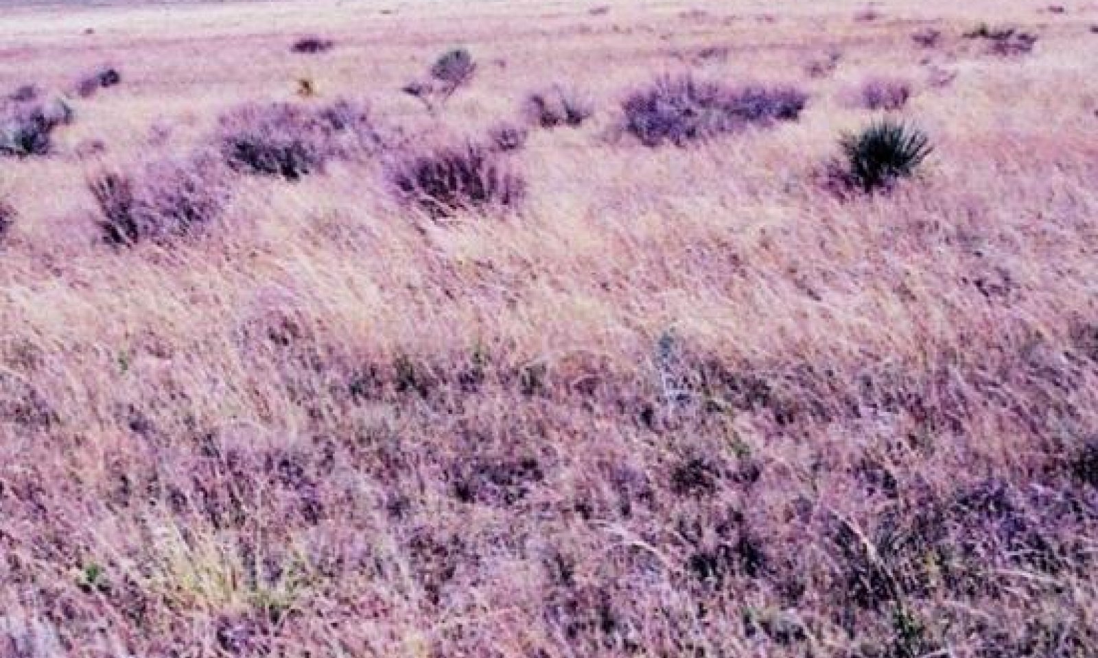
Figure 8. 1.1 Midgrass/Shortgrass Community
The interpretive or "reference" plant community for this site is a good mixture of midgrasses, shortgrasses and lesser amounts of tallgrasses. Grasses make up approximately 90 percent of the plant community. Midgrasses tend to dominate over most of the site with sideoats grama being the overall dominant species. Little bluestem is the dominant tallgrass and blue grama is the dominant shortgrass. The cool-season grasses include western wheatgrass and Canada wildrye and lesser amounts of needle & thread. Perennial forbs make up 3 – 5 percent of the community and shrubs such as sand sagebrush, yucca and catclaw acacia compose of 3 – 5 percent of the overall plant community. The sites ecological processes are in balance with the environment. Most energy and nutrient cycling is contained in the narrow grass/soil interface and evapo-transpiration is minimal. Maintenance of this community requires continued proper grazing management as well as occasional brush and pest management.
Figure 9. Annual production by plant type (representative values) or group (midpoint values)
Table 5. Annual production by plant type
Plant type Low
(lb/acre)Representative value
(lb/acre)High
(lb/acre)Grass/Grasslike 1350 1575 1800 Forb 75 90 100 Shrub/Vine 75 85 100 Tree 0 0 0 Microbiotic Crusts 0 0 0 Total 1500 1750 2000 Figure 10. Plant community growth curve (percent production by month). TX1031 , Midgrass/Shortgrass Dominant Community. Growth is predominately mid and shortgrasses with few forbs and shrubs from April through October with peak growth from May to July..
Jan Feb Mar Apr May Jun Jul Aug Sep Oct Nov Dec J F M A M J J A S O N D 0 2 6 9 22 25 12 6 11 4 2 1 State 2
Shortgrass StateShortgrasses dominate with some midgrasses present. There is an increase in annual forbs and grasses. There are also increasing amounts of yucca, mesquite and broom snakeweed. Percent bare ground is increasing and production is decreasing.
Dominant plant species
-
yucca (Yucca), shrub
-
broom snakeweed (Gutierrezia sarothrae), shrub
-
buffalograss (Bouteloua dactyloides), grass
Community 2.1
Shortgrass Community
Figure 11. 2.1 Shortgrass Community
As retrogression occurs, the tendency of this site is to become a Shortgrass Community (2.1) site. The sideoats grama and little bluestem will give way to blue grama. There will be an increase in perennial and annual forbs, with increasing amounts of yucca and sand sagebrush. Some sites may see an invasion of broom snakeweed, pricklypear and mesquite. The production of vegetation has shifted from mostly herbaceous vegetation to more yucca and woody species, although the herbaceous vegetation biomass is still the largest amount. Nutrient cycling, the water cycle, watershed protection and biological functions have changed little. The transition back to the reference community is reversible with proper grazing management, brush and pest management.
Figure 12. Annual production by plant type (representative values) or group (midpoint values)
Table 6. Annual production by plant type
Plant type Low
(lb/acre)Representative value
(lb/acre)High
(lb/acre)Grass/Grasslike 1010 1085 1205 Shrub/Vine 360 415 475 Forb 130 200 245 Microbiotic Crusts 0 0 0 Tree 0 0 0 Total 1500 1700 1925 Figure 13. Plant community growth curve (percent production by month). TX1009 , Shortgrass Dominant. Shortgrass dominant species include blue grama and buffalograss..
Jan Feb Mar Apr May Jun Jul Aug Sep Oct Nov Dec J F M A M J J A S O N D 0 2 3 5 30 30 8 4 8 6 3 1 State 3
Degraded Shortgrass StateThe Degraded Shortgrass State for a Sandy Loam site has low vigor shortgrasses and increased amounts of perennial three-awn. Mesquite, yucca, sand sagebrush and broom snakeweed along with other woody species make up greater than 40 percent canopy. The bare areas have filled with annuals and the annual production potential is low.
Dominant plant species
-
honey mesquite (Prosopis glandulosa), shrub
-
yucca (Yucca), shrub
-
threeawn (Aristida), grass
Community 3.1
Degraded Shortgrass Community
Figure 14. 3.1 Degraded Shortgrass Community
In this phase of retrogression a threshold has been crossed to a Degraded Shortgrass Community (3.1). In this degraded state, typical vegetation will be low vigor blue grama; bare areas will open up with annuals filling the voids. Perennial three-awn will invade this site when the more desirable grasses are weakened and/or removed. Yucca, sand sagebrush mesquite, pricklypear and broom snakeweed will increase dramatically. The loss of herbaceous cover and increased bare ground encourages accelerated erosion. Nutrient cycling, the water cycle, watershed protection and biological functions have been severely reduced. The plant community is so degraded that it cannot reverse retrogression without extensive energy and management inputs. Restoration requires prescribed grazing with rest periods during the growing season, re-seeding bare areas with adapted native grass species, and chemical and/or mechanical brush management and some form of pest management. With the reduced amounts of grass fuel, prescribed burning is usually not an option in this phase.
Figure 15. Annual production by plant type (representative values) or group (midpoint values)
Table 7. Annual production by plant type
Plant type Low
(lb/acre)Representative value
(lb/acre)High
(lb/acre)Grass/Grasslike 330 505 660 Shrub/Vine 330 385 440 Forb 55 85 100 Microbiotic Crusts 0 0 0 Tree 0 0 0 Total 715 975 1200 Figure 16. Plant community growth curve (percent production by month). TX1027 , Degraded shortgrasses with annual forbs/grasses. Growth is predominately shortgrasses with forbs and shrubs from April through October with peak growth from May to July..
Jan Feb Mar Apr May Jun Jul Aug Sep Oct Nov Dec J F M A M J J A S O N D 0 2 5 15 30 25 5 3 6 6 2 1 Transition T1A
State 1 to 2With heavy continuous grazing pressure, no fires, and no brush management practices implemented, the Midgrass/Shortgrass Community will shift to the Shortgrass Community.
Transition T2A
State 2 to 3With heavy continuous grazing, no fires, no pest management, and no brush management, the Shortgrass Community will transition to the Degraded Shortgrass Community.
Restoration pathway R3A
State 3 to 2Restoration will require prescribed grazing with rest periods during the growing season, re-seeding bare areas with adapted native grass species, and chemical and/or mechanical brush management and some form of pest management. With the reduced amounts of grass fuel, prescribed burning is usually not an option in this phase.
Conservation practices
Brush Management Prescribed Grazing Range Planting Integrated Pest Management (IPM) Additional community tables
Table 8. Community 1.1 plant community composition
Group Common name Symbol Scientific name Annual production () Foliar cover (%) Grass/Grasslike1 Tall/Mid/Shortgrasses 750–1000 sideoats grama BOCU Bouteloua curtipendula 300–400 – blue grama BOGR2 Bouteloua gracilis 300–400 – little bluestem SCSC Schizachyrium scoparium 150–200 – 2 Tallgrasses 75–100 sand bluestem ANHA Andropogon hallii 50–100 – Indiangrass SONU2 Sorghastrum nutans 50–100 – 3 Cool-season grasses 75–100 Canada wildrye ELCA4 Elymus canadensis 50–100 – needle and thread HECOC8 Hesperostipa comata ssp. comata 50–100 – western wheatgrass PASM Pascopyrum smithii 50–100 – 4 Midgrasses 225–300 vine mesquite PAOB Panicum obtusum 100–250 – large-spike bristlegrass SEMA5 Setaria macrostachya 100–250 – Arizona cottontop DICA8 Digitaria californica 100–200 – 5 Shortgrasses 150–200 buffalograss BODA2 Bouteloua dactyloides 100–150 – hooded windmill grass CHCU2 Chloris cucullata 100–150 – sand dropseed SPCR Sporobolus cryptandrus 100–150 – 6 Mid/Shortgrasses 75–100 black grama BOER4 Bouteloua eriopoda 20–50 – hairy grama BOHI2 Bouteloua hirsuta 20–50 – silver beardgrass BOLAT Bothriochloa laguroides ssp. torreyana 20–50 – tumble windmill grass CHVE2 Chloris verticillata 20–50 – fall witchgrass DICO6 Digitaria cognata 20–50 – gummy lovegrass ERCU Eragrostis curtipedicellata 20–50 – ear muhly MUAR Muhlenbergia arenacea 20–50 – Forb7 Forbs 75–100 Forb, annual 2FA Forb, annual 0–50 – white sagebrush ARLU Artemisia ludoviciana 20–50 – lyreleaf greeneyes BELY Berlandiera lyrata 20–50 – golden prairie clover DAAU Dalea aurea 20–50 – purple prairie clover DAPU5 Dalea purpurea 20–50 – Engelmann's daisy ENPE4 Engelmannia peristenia 20–50 – beeblossom GAURA Gaura 20–50 – Indian rushpea HOGL2 Hoffmannseggia glauca 20–50 – dotted blazing star LIPU Liatris punctata 20–50 – Nuttall's sensitive-briar MINU6 Mimosa nuttallii 20–50 – Fendler's penstemon PEFE Penstemon fendleri 20–50 – elephant grass PEPU2 Pennisetum purpureum 20–50 – slimflower scurfpea PSTE5 Psoralidium tenuiflorum 20–50 – scarlet globemallow SPCOE Sphaeralcea coccinea ssp. elata 20–50 – Shrub/Vine8 Shrubs/Vines 75–100 sand sagebrush ARFI2 Artemisia filifolia 50–100 – catclaw mimosa MIACB Mimosa aculeaticarpa var. biuncifera 50–100 – yucca YUCCA Yucca 50–100 – Table 9. Community 2.1 plant community composition
Group Common name Symbol Scientific name Annual production () Foliar cover (%) Table 10. Community 3.1 plant community composition
Group Common name Symbol Scientific name Annual production () Foliar cover (%) Interpretations
Animal community
Native animals that occupy this site include scaled quail, pronghorn, lesser prairie chicken, and various small mammals and grassland birds. The site lacks woody cover for deer and turkey. Predators such as coyotes and bobcats may utilize the site for hunting prey and to hide during the day. If the site is a Shortgrass Dominant Community (2), then diversity is increased and the wildlife habitat may become more desirable.
Hydrological functions
This site captures nearly most of the water that falls on it, provided the vegetation is in good condition. The sandy loam soil infiltrates water fairly rapidly. There is not significant runoff if cover is good. With poor cover, runoff is significant and small gullies can develop.
Recreational uses
Hunting, Camping, Hiking, Bird watching, Photography, Horseback Riding.
Wood products
None.
Other products
None.
Other information
None.
Supporting information
Inventory data references
NRCS FOTG – Section II of the FOTG Range Site Descriptions and numerous historical accounts of vegetative conditions at the time of early settlement in the area were used in the development of this site description. Vegetative inventories were made at several site locations for support documentation. Inventory Data References (documents): NRCS FOTG – Section II - Range Site Descriptions NRCS Clipping Data summaries over a 20 year period
Other references
1. Archer S. 1994. Woody plant encroachment into southwestern grasslands and savannas: rates, patterns and proximate causes. In Ecological implications of livestock herbivory in the West, Ed M Vavra, W Laycock, R Pieper, pp13-68, Denver, CO: society for Range Management
2. Gould F. 1978. Common Texas Grasses: an illustrated guide. College Station, TX: Texas A & M Press.
3. Hatch, Brown and Ghandi, Vascular Plants of Texas (An Ecological Checklist)
4. Heischmidt RK, Stuth, Eds. 1991 Grazing Management: an ecological perspective. Portland OR: Timberline Press
5. North Rolling Plains RC&D, NRCS, and GLCI. 2006 edition. Common Rangeland Plants of the Texas Panhandle.
6. Scifres CJ, Hamilton WT. 1993. Prescribed burning for Brushland management: the South Texas example. College Station, TX: Texas A & M Press.
7. Natural Resources Conservation Service - Range Site Descriptions
8. USDA-Natural Resources Conservation Service - Soil Surveys & Website soil database
The following individuals assisted with the development of this site description:
Clint Rollins – Rangeland Management Specialist- NRCS; Amarillo, Texas
Justin Clary – Rangeland Management Specialist – NRCS; Temple, Texas
Stan Bradbury – Rangeland Management Specialist - NRCS; Lubbock, Texas
Kelly Attebury – Soil Scientist- NRCS; Lubbock, Texas
Charles Coffman – Biologist - NRCS; Lubbock, TexasContributors
Brent Conlin, Area Conservationist, Amarillo
Duckworth-Cole, Inc., Bryan, Texas
T. Craig ByrdApproval
Bryan Christensen, 9/11/2023
Acknowledgments
Site Development and Testing Plan Future work, as described in a Project Plan, to validate the information in this Provisional Ecological Site Description is needed. This will include field activities to collect low, medium and high intensity sampling, soil correlations, and analysis of that data. Annual field reviews should be done by soil scientists and vegetation specialists. A final field review, peer review, quality control, and quality assurance reviews of the ESD will be needed to produce the final document. Annual reviews of the Project Plan are to be conducted by the Ecological Site Technical Team.
Rangeland health reference sheet
Interpreting Indicators of Rangeland Health is a qualitative assessment protocol used to determine ecosystem condition based on benchmark characteristics described in the Reference Sheet. A suite of 17 (or more) indicators are typically considered in an assessment. The ecological site(s) representative of an assessment location must be known prior to applying the protocol and must be verified based on soils and climate. Current plant community cannot be used to identify the ecological site.
Author(s)/participant(s) Stan Bradbury, Zone RMS, NRCS, Lubbock, Texas Contact for lead author 806-791-0581 Date 09/04/2007 Approved by Approval date Composition (Indicators 10 and 12) based on Annual Production Indicators
-
Number and extent of rills:
None to slight. -
Presence of water flow patterns:
None to slight. -
Number and height of erosional pedestals or terracettes:
None to slight. -
Bare ground from Ecological Site Description or other studies (rock, litter, lichen, moss, plant canopy are not bare ground):
20-25%. -
Number of gullies and erosion associated with gullies:
None to slight. -
Extent of wind scoured, blowouts and/or depositional areas:
None to slight. -
Amount of litter movement (describe size and distance expected to travel):
None to slight. -
Soil surface (top few mm) resistance to erosion (stability values are averages - most sites will show a range of values):
Moderate resistance to surface erosion. -
Soil surface structure and SOM content (include type of structure and A-horizon color and thickness):
Fine sandy loam, friable surface and medium SOM. -
Effect of community phase composition (relative proportion of different functional groups) and spatial distribution on infiltration and runoff:
Basal cover and density with moderate interspaces should make rainfall impact minimal. This site has moderate permeability, runoff is slow and available water holding capacity is high. -
Presence and thickness of compaction layer (usually none; describe soil profile features which may be mistaken for compaction on this site):
None. -
Functional/Structural Groups (list in order of descending dominance by above-ground annual-production or live foliar cover using symbols: >>, >, = to indicate much greater than, greater than, and equal to):
Dominant:
Warm-season midgrasses = Warm-season shortgrasses >Sub-dominant:
Warm-season tallgrasses > Cool-season grasses >Other:
Shrubs/Vines > ForbsAdditional:
-
Amount of plant mortality and decadence (include which functional groups are expected to show mortality or decadence):
Grasses due to their growth habit will exhibit some mortality and decadence, though minimal. -
Average percent litter cover (%) and depth ( in):
Litter is dominantly herbaceous. -
Expected annual annual-production (this is TOTAL above-ground annual-production, not just forage annual-production):
1,400 to 1,800 pounds per acre. -
Potential invasive (including noxious) species (native and non-native). List species which BOTH characterize degraded states and have the potential to become a dominant or co-dominant species on the ecological site if their future establishment and growth is not actively controlled by management interventions. Species that become dominant for only one to several years (e.g., short-term response to drought or wildfire) are not invasive plants. Note that unlike other indicators, we are describing what is NOT expected in the reference state for the ecological site:
Sand Sagebrush and Yucca can become invasive. -
Perennial plant reproductive capability:
All plant species should be capable of reproduction except during prolonged drought conditions, heavy natural herbivory or intense wildfires.
Print Options
Sections
Font
AAAAOther
PrintThe Ecosystem Dynamics Interpretive Tool is an information system framework developed by the USDA-ARS Jornada Experimental Range, USDA Natural Resources Conservation Service, and New Mexico State University.
Accessibility statement


