
Natural Resources
Conservation Service
Ecological site R075XY049NE
Closed Upland Depression
Last updated: 4/17/2025
Accessed: 08/31/2026
-
Search


Major Land Resource Area or ecological site by name and/or ID.
PreviousSectionsNextGeneral information
Provisional. A provisional ecological site description has undergone quality control and quality assurance review. It contains a working state and transition model and enough information to identify the ecological site.
Click to explore map
Figure 1. Mapped extent
Areas shown in blue indicate the maximum mapped extent of this ecological site. Other ecological sites likely occur within the highlighted areas. It is also possible for this ecological site to occur outside of highlighted areas if detailed soil survey has not been completed or recently updated.
MLRA notes
Major Land Resource Area (MLRA): 075X–Central Loess Plains
Named “The Central Loess Plains,” MLRA 75 is located primarily in south-central Nebraska, with about 10 percent lying in north-central Kansas. This approximately 5.3 million acre landscape covers all or parts of 21 counties: Gosper, Phelps, Kearney, Adams, Clay, Fillmore, York, Hall, Hamilton, Seward, Butler, Polk, Saline, Gage, Harlan, Franklin, Thayer, Nuckolls, and Webster in Nebraska, with a significant presence in Republic and Washington counties in Kansas. The northern border is defined by the Platte River. This MLRA is home to the unique ecological system called “The Rainwater Basin,” which is comprised of a 24,000 acre network of wetlands and uplands that occupy portions of 13 of the northern counties and in internationally known for its significance to millions of migratory birds.
The landscape primarily consists of gently rolling plains, with a number of narrow, shallow stream valleys. The river valleys are broader, and most feature a number of terraces. The elevation in MLRA 75 ranges from nearly 2,600 feet to less than 1,100 feet above sea level. The local relief averages from 10 to 25 feet but may stretch to a maximum of 165 feet in some areas. The average annual precipitation ranges from 23 to 36 inches, and the number of freeze-free days range from 150 to 200.
Loess overlays the surface of almost all of the uplands in this MLRA. Alluvial clay, silt, sand, and gravel are deposited in the stream and river valleys and can be extensive in the major drainages. Terraces are common in the valleys along the river systems. The predominant soil orders in this geographic area are mesic, ustic Mollisols, commonly represented by the Geary, Hastings, Holder, Holdrege, Kenesaw, and Uly soil series. The matrix vegetation type is mixed-grass prairie, with big and little bluestem, switchgrass, Indiangrass, and sideoats and blue grama to make up the bulk of the warm-season species, while western wheatgrass is the dominant cool-season grass.
Seventy two percent of the land in this MLRA has been broken out of native prairie and farmed; the land is primarily planted to corn, wheat, and grain sorghum, while only eighteen percent of the grasslands remain intact. Livestock grazing, primarily by cattle, is the main industry on these remnants. Irrigation of croplands uses over 90 percent of the total annual water withdrawal in this area.
Wildlife flourishes in this combination of crop and grassland environment, with both mule and white-tailed deer being the most abundant wild ungulates. A variety of smaller species, including coyote, raccoon, opossum, porcupines, muskrat, beaver, squirrel, and mink thrive in the region, as well as several upland bird species. Grassland bird populations are somewhat limited by the lack of contiguous native prairie and fragmented habitat created by the farmland. The rivers, streams, and lakes harbor excellent fisheries, and an estimated tens of millions of migrating and local waterfowl use the wetland complexes. These complexes provide ideal habitat for many different wading and shore bird species as well.
This landscape serves as a backdrop for a disturbance-driven ecosystem, evolving under the influences of herbivory, fire, and variable climate. Historically, these processes created a heterogeneous mosaic of plant communities and structure heights across the region. Any given site in this landscape experienced fire every 6 to 8 years. The fires were caused by lightning strikes and also were set by native Americans, who used fire for warfare, signaling, and to refresh the native grasses. These people understood the value of fire as a tool, and that the highly palatable growth following a fire provided both excellent forage for their horses and attracted grazing game animals such as bison and elk.
Fragmentation of the native grasslands by conversion to cropland, transportation corridors, and other developments have effectively disrupted the natural fire regime of this ecosystem. This has allowed encroachment by native and introduced shrubs and trees into the remnants of the native prairie throughout the MLRA. Aggressive fire suppression policies have exacerbated this process to the point that shrub and tree encroachment is a major ecological issue in the majority of both native and reseeded grasslands.
Even as post-European settlement's alteration of the fire regime allows the expansion of the woody component of the native prairie, introduction of eastern redcedar (ERC) as a windbreak species further facilitates invasion by this species. While eastern red cedar is native to Nebraska, the historic population in MLRA 75 was limited to isolated pockets in rugged river drainages which were subsequently insulated from fire. Widespread plantings of windbreaks with eastern redcedar as a primary component have provided a seed source for the aggressive woody plant. The ensuing encroachment into the native grasslands degrades the native wildlife habit and causes significant forage loss for domestic livestock.
Since it is not a root sprouter, eastern red cedar is very susceptible to fire when under six feet tall. Management with prescribed fire is exceedingly effective if applied before this stage. Larger redcedars can also be controlled with fire, but successful application requires the use of specifically designed ignition and holding techniques.Classification relationships
NRCS FOTG Section 1 - Nebraska Vegetation Zone 3.
Major Land Resource Area (MLRA): Major Land Resource Area (MLRA) 75 (USDA-Natural Resources Conservation Service, 2006)Ecological site concept
The features associated with the Closed Upland Depression ecological site are playa wetlands, which are embedded in an upland setting with no natural outlet. Each playa has an isolated watershed, not connected to any natural drainage. The closed watershed funnels water to the playa at the lowest point in the watershed. These wetlands generally exhibit temporary, seasonal, or semi-permanent water regimes, causing, in an average year, ponded water for weeks or months annually. However, these wetlands can occasionally remain ponded or dry for greater durations that may extend more than a year.
These sites shift between a variety of vegetation communities with distinctly different species. The species composition is driven largely by depth and length of inundation as well as the amount and level of disturbance. The deepest portions of playas that remain ponded for extended periods of time are often dominated by native and non-native bulrush and cattail species. Around the deep areas are the portions that are often saturated or pond water for shorter periods and are dominated by moist soil species that oscillate between annual and perennial communities. The areas that are occasionally saturated but seldom pond water are considered the wet meadow zone. The wetland-upland interface around the outer rim is often dominated by grass species. However, not all of these zones are found in every playa wetland and the boundaries of the different zones may shift from year to year depending on annual hydroperiod and disturbance.Associated sites
R075XY057NE Clayey Plains
This site is adjacent to the Closed Upland Depression site but occupies a run-off position on the landscape.
R075XY058NE Loamy Plains
This site may be adjacent to the Closed Upland Depression site but occupies a run-off position on the landscape.
R075XY059NE Limy Loess Slopes
This site may be adjacent to the Closed Upland Depression site but occupies a run-off position on the landscape.
Similar sites
R075XY083NE Saline Depression
This site is located in a similar landscape position as the Closed Upland Depression site, but has higher soil salinity.
Table 1. Dominant plant species
Tree Not specified
Shrub Not specified
Herbaceous (1) Pascopyrum
(2) CarexPhysiographic features
These sites occur in playas and depressions of the uplands, and occasionally on a depression on a fan. They receive runoff from areas higher on the landscape and are ponded for brief to long periods from run-in water. They are not subject to flooding. However, anthropogenic features, such as reuse pits, concentration pits, ditches, and drains, may alter the functionality of Closed Upland Depressions by preventing water from reaching the sites, concentrating water on sites in unnaturally deep areas, or diverting water away from the sites.
Wind deflation can help maintain natural hydrology within the wetland by removing excessive culturally accelerated sediment from the site. This occurs when water drowns persistent vegetation followed by extended drought. This cycle causes the wetland vegetation to die and leaves the soil surface bare. Winds then scour the soil, removing the sediment from the wetland and depositing it in the upland.
Figure 2. Block Diagram for Closed Upland Depression
Table 2. Representative physiographic features
Landforms (1) Playa
(2) Depression
(3) Flat
Runoff class Negligible Flooding frequency None Ponding duration Brief (2 to 7 days) to long (7 to 30 days) Ponding frequency Occasional to frequent Elevation 1130 – 2770 ft Slope 0 – 1 % Ponding depth 3 – 6 in Water table depth 80 in Aspect Aspect is not a significant factor Climatic features
Like most Great Plains landscapes, the climate in this MLRA is under the sway of the continental effect. This creates a regime of extremes, with summer highs often in the triple digits, and winter lows plunging well below zero. Blizzards can occur anytime between early fall and late spring, often dropping the temperature more than 50 degrees in just a few hours. These events can pile up several feet of snow, often driven by winds in excess of 50 miles an hour. The resulting huge snow drifts can cause serious hardship for livestock, wildlife, and humans. Winters can be open, with bare ground for most of the season, or closed, with up to several feet of snow persisting until March. Most winters have a number of warm days, interspersed with dropping temperatures, usually associated with approaching cold fronts. Spring brings violent thunderstorms, hail, high winds, and frequent tornadoes. Daily winds range from an average of 14 miles per hour during the spring to 11 miles per hour during the late summer. Occasional strong storms may bring brief periods of high winds with gusts to more than 80 miles per hour.
Growth of native cool-season plants begin in early April and continues to about mid-June. Native warm-season plants begin growth in early June and continue to early August. Green up of cool-season plants may occur in September and October.Table 3 Representative climatic features
Frost-free period (average) 160 days Freeze-free period (average) 180 days Precipitation total (average) 30 in BarLineFigure 3. Monthly precipitation range
BarLineFigure 4. Monthly average minimum and maximum temperature
Figure 5. Annual precipitation pattern
Figure 6 Annual average temperature pattern
Climate stations used
-
(1) GENEVA [USC00253175], Geneva, NE
-
(2) HASTINGS 4N [USC00253660], Hastings, NE
-
(3) MINDEN [USC00255565], Minden, NE
-
(4) RED CLOUD [USC00257070], Red Cloud, NE
-
(5) YORK [USC00259510], York, NE
-
(6) CLAY CTR [USC00251684], Saronville, NE
-
(7) FAIRMONT [USC00252840], Fairmont, NE
-
(8) OSCEOLA [USC00256375], Osceola, NE
-
(9) SUPERIOR 4E [USC00258320], Hardy, NE
-
(10) SURPRISE [USC00258328], Surprise, NE
-
(11) BELLEVILLE [USC00140682], Belleville, KS
-
(12) AURORA [USC00250445], Aurora, NE
-
(13) FRIEND 3E [USC00253065], Friend, NE
-
(14) RAGAN [USC00257002], Alma, NE
">Influencing water features
These sites are temporarily, seasonally, or semi-permanently ponded, filling as a result of runoff from snowmelt or precipitation events. These wetlands are independent of ground water influence. A site’s hydroperiod depends on the size of the drainage area; infiltration rate; type and amount of vegetative cover of surrounding soils; the frequency, intensity, and total accumulation of rainfall; and the depth of the depression. Due to variable climatic conditions, the hydroperiod of a site can change annually.
Wetland description
Wetland Description<br />
(Cowardin System)<br />
System Subsystem Class <br />
Palustrine N/A Emergent WetlandSoil features
The features common to all soils in this site include a closed upland depression landform, frequent ponding, low saturated hydraulic conductivity, and slopes of 0 to 1 percent. The soils in this site are all formed in loess. The surface layer is almost always silt loam or silty clay loam and ranges from 2 to 17 inches thick. The texture of the subsurface is silty clay. Runoff as evidenced by patterns of rill, gully, or other water flow is negligible due to the low slope gradient. Pedestalling of plants does not typically occur on this site, however mucking by excessive hoof traffic can create an effect which appears exaggerated, but similar to pedestalling.
Major soils series correlated to this ecological site include Scott, and Fillmore. More information can be found in the various soil survey reports. Contact the local USDA Service Center for internet links to soil survey data that includes more details specific to your location.
Figure 7. Fillmore Series Soil Profile
Table 4. Representative soil features
Parent material (1) Loess
Surface texture (1) Silty clay loam
(2) Silt loam
Drainage class Poorly drained to somewhat poorly drained Permeability class Very slow to slow Soil depth 80 in Surface fragment cover <=3" Not specified Surface fragment cover >3" Not specified Available water capacity
(0-40in)5.5 – 9.2 in Calcium carbonate equivalent
(0-40in)0 – 2 % Electrical conductivity
(0-40in)0 – 2 mmhos/cm Sodium adsorption ratio
(0-40in)Not specified Soil reaction (1:1 water)
(0-40in)5.1 – 8.4 Subsurface fragment volume <=3"
(Depth not specified)Not specified Subsurface fragment volume >3"
(Depth not specified)Not specified Ecological dynamics
Closed Upland Depression sites occur as depressions in an upland position and are subject to ponding. The vegetation communities evolved under a disturbance regime that included periods of sporadic but often intensive grazing by large transient herbivores, and occasional wildfires. They are often referred to as buffalo wallows.
Hydroperiods are the driving force that controls the type and extent of vegetation communities within the sites. Because hydroperiod can vary year to year, the boundaries between communities can fluctuate as hydroperiod fluctuates. Vegetation also shifts as a result of different grazing and disturbance regimes. In general, disturbance promotes annual communities, while lack of disturbance promotes perennial communities.
Additionally, not all playas contain all possible communities; they may contain as few as one vegetation community. Similarly, wetland-upland interfaces are transient due to variable hydroperiods. During periods of above average precipitation, the wetland will move into the upland, while in periods of below average precipitation, the wetland will constrict.
Growth of native cool-season plants begins about April 1 and continues to about June 15. Native warm-season plants begin growth about May 15 and continue to about August 15. Green up of cool-season plants may occur in September and October if adequate moisture is available.
Land managers have begun to introduce the natural processes of grazing and fire when and where possible to create open areas that allow seed bearing annual plants to establish. These plants provide a critical food source for the millions of migratory birds that pass through the area annually. To facilitate reclamation of the more invaded sites, many managers have also begun using the more intensive practices of shredding, light disking, and applying herbicides.
Due to the small patch distribution of these sites and the degree of disturbance in the landscape, locating examples and reliable descriptions of examples of the pre-European reference plant community is difficult. The reference community description was determined by study of the best remaining relic examples, areas protected from excessive disturbance, research literature, expert opinions, and historical accounts.
Currently, five states are used to describe the Closed Upland Depression site, including the Reference State, Grassy Invaded State, Cattail/Bulrush Invaded State, Cropped Wetland State, and the Drained Wetland State. These states are based on anthropogenic alteration, hydroperiod, and disturbance regime and intensity.
The following diagram illustrates the states and the plant communities within the states that can occur on the site. The transitions between the states and between the communities are represented by the arrows. The processes that cause the fluctuation between the states and communities are discussed in more detail in the plant community descriptions following the diagram.State and transition model
More interactive model formats are also available. View Interactive Models
Click on state and transition labels to scroll to the respective textEcosystem states
States 1, 5 and 2 (additional transitions)
State 1 submodel, plant communities
State 2 submodel, plant communities
State 3 submodel, plant communities
State 1
Reference StateThe Reference State is dynamic and transitions between three vegetation communities. At any given time, a single wetland in the Reference State could have all three communities present or be dominated by a single community. The three communities that make up the Reference State are Reference Community, Moist Soil Perennial Community, and Moist Soil Annual Community. The spatial border between the three communities is directly linked to the duration and depth of ponding. This is driven seasonally, and by local rainfall events. Implementation of management practices like grazing, herbicide application, disking, shredding, haying, etc. can also influence community presence. Some of these areas may pond water long enough to drown out vegetation, leaving bare soil during dry cycles or sparse annual vegetation.
Implementation of management actions (e.g., prescribed fire, disking, haying, grazing, herbicide application) or the lack of disturbance can result in community phase changes within the reference state. In the absence of historical intensive grazing by bison and elk herds, and the disruption of the fire regime, land managers have intentionally engaged in practices to create and maintain a more disturbed phase within the reference state to achieve wildlife management goals.
The Reference State can transition to four other states as a result of human alteration (e.g., ditching or excavating concentration pits), very severe disturbance (e.g., plowing), and/or naturally occurring ecological processes. These other states include the Grassy Invaded State, Cattail/Bulrush Invaded State, Cropped Wetland State, and Drained Wetland State.Dominant plant species
-
western wheatgrass (Pascopyrum smithii), grass
-
foxtail barley (Hordeum jubatum), grass
-
switchgrass (Panicum virgatum), grass
-
rush (Juncus), other herbaceous
-
sedge (Carex), other herbaceous
-
golden tickseed (Coreopsis tinctoria var. tinctoria), other herbaceous
-
knotweed (Polygonum), other herbaceous
Community 1.1
Reference Community
Figure 8. Reference Community
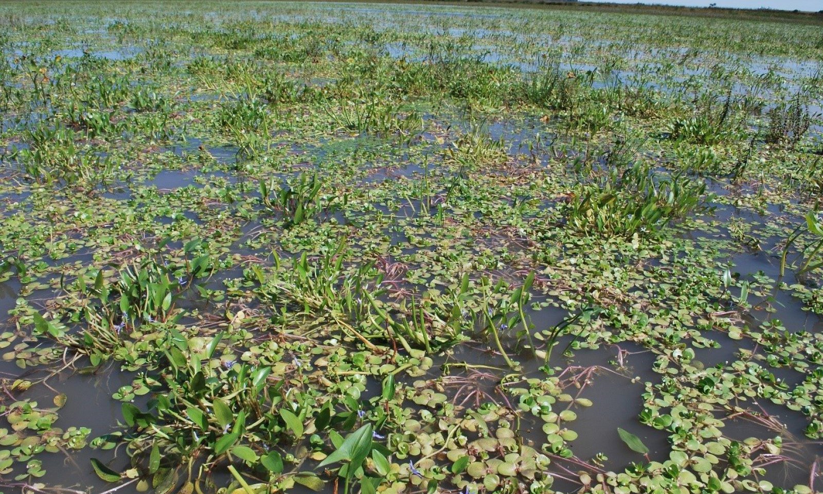
The Reference Community is also known as a saturated soil community. This community serves as the reference community in sites that have been inundated for extended periods of time. This zone is often characterized as a hemi-marsh. This community is often designated as a saturated soil perennial community. Dominant species in the hemi-marsh zone include arrowhead, bur-reed, native cattail, softstem bulrush, and water plantain.
As long as the site continues to be ponded and has moderate disturbance through grazing with adequate recovery periods, this community will persist. If the community has excessive sedimentation and lack of disturbance, it is susceptible to invasion by river bulrush, cattails, and if the hydroperiod decreases, reed canarygrass.
Under average climatic conditions, this community can be correlated to the Massie soil component of Closed Upland Depressions. The Massie soil is the major component of Massie map units and therefore this should be the dominant community of these delineations. It can be found as a minor inclusion in Scott map units and rarely in Fillmore map units. Excessive irrigation runoff can also promote the Saturated Soil Perennial Community regardless of soil type.Dominant plant species
-
arrowhead (Sagittaria), other herbaceous
-
broadleaf cattail (Typha latifolia), other herbaceous
-
northern water plantain (Alisma triviale), other herbaceous
-
broadfruit bur-reed (Sparganium eurycarpum), other herbaceous
-
softstem bulrush (Schoenoplectus tabernaemontani), other herbaceous
Figure 9. Plant community growth curve (percent production by month). NE0013 , CUD MLRA75 State 1. Moist-Soil and Saturated-Soil annuals and perennials.
Jan Feb Mar Apr May Jun Jul Aug Sep Oct Nov Dec J F M A M J J A S O N D 5 10 60 10 10 5 Community 1.2
Moist Soil Perennial Community
Figure 10. Moist Soil Perennial Community
The Moist Soil Perennial Community is the reference community for wetlands with saturated soil for extended periods or shallow ponding (i.e.,
Dominant plant species
-
western wheatgrass (Pascopyrum smithii), grass
-
switchgrass (Panicum virgatum), grass
-
foxtail barley (Hordeum jubatum), grass
-
spikerush (Eleocharis), other herbaceous
-
sedge (Carex), other herbaceous
-
rush (Juncus), other herbaceous
-
knotweed (Polygonum), other herbaceous
Community 1.3
Moist Soil Annual Community
Figure 11. Moist Soil Annual Community
The Moist Soil Annual Community is the result of an intensive disturbance regime coupled with saturated soil for extended periods or shallow ponding intermittently. Common species include annual smartweeds, barnyardgrass, bidens, cocklebur, fall panicum, pigweeds, plains coreopsis, ragweeds, and sumpweed.
A heterogeneous mix of annual forbs and grasses provide ideal foraging habitat for migrating waterfowl during spring migration due to species diversity and high seed production of many of these species. Because of its habitat quality for migrating waterfowl, wildlife managers often focus efforts on creating and maintaining the Annual Moist Soil Community.
To promote and maintain this community, a variety of management treatments can be implemented. These treatments can include grazing, disking, and chemical application. If grazing is implemented, it needs to be conducted with a sufficient number of animals to remove aboveground biomass and create bare ground to promote germination of annual species. Animals should be removed from the site by July 15 to maximize time for plant growth and seed germination. If the site is rested for multiple years or has light to moderate annual disturbance, it will transition to a perennial community. If there is excessive sedimentation with an increase in ponding frequency bulrush and cattails can invade the site; if the site has excessive sedimentation and a normal hydroperiod, reed canarygrass can colonize the site.
Under average climatic conditions, this community can be correlated to the Fillmore soil component of Closed Upland Depressions. The Fillmore soil is the major component of Fillmore map units and therefore this should be the dominant community of these delineations. It can be found as a minor inclusion in Scott map units and rarely in Massie map units.Dominant plant species
-
fall panicgrass (Panicum dichotomiflorum), grass
-
barnyardgrass (Echinochloa crus-galli), grass
-
golden tickseed (Coreopsis tinctoria var. tinctoria), other herbaceous
-
beggarticks (Bidens), other herbaceous
-
knotweed (Polygonum), other herbaceous
-
ragweed (Ambrosia), other herbaceous
-
Canada cocklebur (Xanthium strumarium var. canadense), other herbaceous
-
annual marsh elder (Iva annua), other herbaceous
Pathway 1.1A
Community 1.1 to 1.2
Reference Community
Moist Soil Perennial CommunityAs saturated conditions subside with little additional disturbance, this community will transition to the Moist Soil Perennial Community. Annual haying and/or light grazing can also cause this transition.
Pathway 1.1B
Community 1.1 to 1.3
Reference Community
Moist Soil Annual CommunityThis community will shift to the Moist Soil Annual Community if the hydroperiod shortens and disturbance increases. Disturbance often involves the implementation of one or a combination of management treatments. Common management treatments include grazing, fire, shredding, disking, and spraying.
Pathway 1.2A
Community 1.2 to 1.1
Moist Soil Perennial Community
Reference CommunityWhen ponding duration and depth (i.e., >12 inches) increases, this community can transition to the Saturated Soil Perennial Community. This generally occurs on sites that do not have a large sediment load and that routinely receive moderate disturbance.
Pathway 1.2B
Community 1.2 to 1.3
Moist Soil Perennial Community
Moist Soil Annual CommunityIncreased disturbance, such as disking, chemical application, and/or grazing, will shift this community to the Moist Soil Annual Community. For grazing to transition the community, it must be at a rate and intensity high enough to remove sufficient biomass and generate bare ground for germination of the annual species.
Pathway 1.3A
Community 1.3 to 1.1
Moist Soil Annual Community
Reference CommunityWhen ponding duration and depth (>12 inches) increases and disturbance decreases, this community can transition to the Saturated Soil Perennial Community. This generally occurs on sites that do not have a large sediment load and routinely have light to moderate disturbance.
Pathway 1.3B
Community 1.3 to 1.2
Moist Soil Annual Community
Moist Soil Perennial CommunityIf this community remains undisturbed for several years, light to moderately grazed annually, and/or hayed annually, it will likely transition to the Moist Soil Perennial Community.
State 2
Grassy Invaded State
Figure 12. Grassy Invaded State - Reed Canarygrass Community
The Grassy Invaded State is dominated by reed canarygrass and generally occurs in areas that have little or no disturbance. Sites in the Grassy Invaded State may have been seeded to reed canarygrass or naturally colonized.
Annual haying and/or moderate grazing throughout the growing season with sufficient rest can promote dominant stands of reed canarygrass. Excessive sedimentation and/or areas in the wetland that have been land leveled with fill material can also promote the Grassy Invaded State. It has been hypothesized that the nutrient loads associated with sediment promotes vigorous growth of reed canarygrass. Saturated conditions and ponding generally less than 12 inches for prolonged periods also encourage Grassy Invaded State growth. Under average climatic conditions, this community can be correlated to the Fillmore and Scott soil components of Closed Upland Depressions.
The Fillmore soil is the major component of Fillmore map units and the Scott soil is the major component of Scott map units. Therefore, this may be the dominant community of these delineations. It can rarely be found as a minor inclusion in Massie map units. This community does occur in Massie map units when the associated watershed is significantly modified resulting in a more seasonal or temporary water regime.
The state consists of the Reed Canarygrass Community.Dominant plant species
-
reed canarygrass (Phalaris arundinacea), grass
Community 2.1
Reed Canarygrass CommunityThis plant community is dominated by reed canarygrass and occurs when the site has little or no disturbance.
Figure 13. Plant community growth curve (percent production by month). NE0014 , CUD MLRA 75-State 2. Reed canarygrass dominant with occasional moist-soil plants in the plant community.
Jan Feb Mar Apr May Jun Jul Aug Sep Oct Nov Dec J F M A M J J A S O N D 10 25 40 10 5 5 5 State 3
Cattail/Bulrush Invaded State
Figure 14. Cattail/Bulrush Invaded State
The Cattail/Bulrush Invaded State contains hybrid cattails and/or river bulrush. It generally occurs in wetlands that have little or no disturbance and ponding is deep, for long periods, and/or frequent. Hydrology of these sites generally promotes ponded conditions as a result of a highly functional watershed or supplemental water from irrigation runoff. Because of how wet these sites are, they are not routinely disturbed with grazing, disking, or haying. Sites that promote the Cattail/Bulrush Invaded State can have high sediment loads that provide excessive nitrogen and phosphorus. Under average climatic conditions in wetlands with intact watersheds, this community can be correlated to the Massie and Scott soil components of Closed Upland Depressions.
The Massie soil is the major component of Massie map units and the Scott soil is the major component of Scott map units. Therefore, this may be the dominant community of these delineations. It can rarely be found as a minor inclusion in Fillmore map units. Excessive irrigation runoff that results in a more semi-permanent water regime can allow this community to persist on Fillmore map units.
This state consists of the Cattail/River Bulrush Community.Dominant plant species
-
cattail (Typha), other herbaceous
-
river bulrush (Bolboschoenus fluviatilis), other herbaceous
Community 3.1
Cattail/River Bulrush CommunityThis plant community is dominated by hybrid cattails or river bulrush or both plants. It occurs when ponding is deep and/or frequent in combination with low levels of disturbance.
Dominant plant species
-
river bulrush (Bolboschoenus fluviatilis), other herbaceous
-
cattail (Typha), other herbaceous
Figure 15. Plant community growth curve (percent production by month). NE0015 , CUD MLRA 75-State 3. Bulrush/Cattail dominate with moist-soil plants in the plant community.
Jan Feb Mar Apr May Jun Jul Aug Sep Oct Nov Dec J F M A M J J A S O N D 5 25 25 20 15 5 5 State 4
Cropped Wetland StateThis state is actively cultivated and generally contains hydrologic modifications, such as concentration pits, excavation of surface drains or road ditches, and/or placement of fill material. Despite active cultivation and, generally, the presence of wetland modifications, these sites continue to pond water and grow hydrophytes.
State 5
Drained Wetland StateThis state is actively cultivated and generally contains significant hydrologic modifications, such as concertation pits, excavation of surface drains or road ditches, and/or placement of fill material. Hydrologic modifications are so significant that hydrophytes rarely grow and ponding rarely occurs except, potentially, in a concentration pit. These sites are also generally cultivated.
Transition T1A
State 1 to 2This transition occurs when the duration and intensity of disturbance is significantly reduced and where the hydrology promotes saturated conditions. Sites that have had a significant deposition of culturally accelerated sediment above the native soil profile can also transition to the Grassy Invaded State. This transition can also occur when sites are seeded to reed canarygrass.
Transition T1B
State 1 to 3This transition occurs when disturbance is decreased to little or none and/or culturally accelerated sedimentation occurs. On areas that would normally be Moist Soil Annual or Moist Soil Perennial under average climatic conditions, ponding duration and frequency is increased through watershed restoration activities or as a result of excessive irrigation runoff. On areas that would normally be Saturated Soil Perennial, no change in hydroperiod is required.
Transition T1C
State 1 to 4This transition occurs when the site is plowed or disked and planted to a commodity crop. The transition almost always requires wetland or watershed modifications. Some examples include excavation of concentration pits, construction of surface drains, placement of fill material within the hydric soil, and/or excessive sedimentation above the natural soil profile. Despite active cultivation and, generally, the presence of wetland modifications, the Cropped Wetland State continues to occasionally pond water and grow hydrophytes.
Transition T1D
State 1 to 5The Drained Wetland State will result when significant wetland modifications are constructed to facilitate production agricultural practices. These sites rarely pond water outside of concentration pits.
Restoration pathway R2A
State 2 to 1This transition occurs when the site receives a variety of disturbance treatments. A transition out of this state often requires a combination of spraying and disking treatments. The first spraying treatment kills a majority of the adult plants. A follow-up disking treatment kills the remaining adult plants and prepares the seedbank for germination of reed canarygrass seeds. A follow-up chemical treatment kills the sprouting seedlings. Maximum label rates of glyphosate approved for use over water have demonstrated good success. Both aerial and ground rig treatments have been successful for application. If sites are too wet to be successfully disked, heavy grazing in combination with chemical applications can be substituted. Restoration of hydrology may also be required to promote desired vegetation communities. If there is a large sediment load, heavy equipment can be used to excavate the material out of the wetland. Sediment surveys should be completed to determine the amount and location of the deposition.
Transition T2A
State 2 to 3
Grassy Invaded State
Cattail/Bulrush Invaded StateThe transition from the Grassy Invaded Site to the Bulrush/Cattail Invaded State often results from an increase in hydroperiod. Ponding depth, duration, and/or frequency increase as a result of the extended hydroperiod. Cattail/Bulrush sites often also have an accumulation of sediment and are not routinely disturbed.
Transition T2B
State 2 to 4This transition occurs when the site is plowed or disked and planted to a commodity crop. Usually, hydrologic modifications (e.g., concertation pits, excavation of surface drains or road ditches, and/or placement of fill material) are constructed to negatively impact hydroperiod and facilitate cultivation of crops. Despite active cultivation and, generally, the presence of wetland modifications, the Cropped Wetland State continues to occasionally pond water and grow hydrophytes.
Transition T2C
State 2 to 5The Grassy Invaded State will transition to the Drained Wetland State if significantly modified to facilitate production agriculture practices. Common wetland modifications include excavation of concentration pits or surface drains, placement of fill material in the wetland or excessive sedimentation into the wetland. The Drained Wetland State sites rarely pond water outside of concentration pits.
Restoration pathway R3A
State 3 to 1This transition occurs when the site receives a variety of disturbance treatments implemented over multiple years. If the site would naturally be Moist Soil Annual or Perennial, ponding duration and frequency is reduced. The transition from gravity to pivot irrigation or alternations in the watershed (i.e., excavation of road ditches) that reduce runoff to the wetland can promote this transition. If there is a large sediment load, heavy equipment can be used to excavate the material out of the wetland. Sediment surveys should be completed to determine the amount and location of the deposition. Once in the Reference State, the Saturated Soil Perennial Community usually dominates if no change in hydroperiod occurred. If a change in hydroperiod occurred, the site usually transitions to Moist Soil Annual Community due to increased disturbance.
Restoration pathway R3B
State 3 to 2
Cattail/Bulrush Invaded State
Grassy Invaded StateThe transition from the Bulrush/Cattail Invaded State to the Grassy Invaded State often results from a decrease in hydroperiod. Sites that are not routinely disturbed and have an accumulation of sediment will often transition to the Grassy Invaded State.
Transition T3A
State 3 to 4This transition occurs when the site is plowed or disked and planted to a commodity crop. Generally, hydrologic modifications (e.g., concertation pits, excavation of surface drains or road ditches, and/or placement of fill material) are constructed to negatively impact hydroperiod and facilitate cultivation of crops. Despite active cultivation and, generally, the presence of wetland modifications, the Cropped Wetland State site continues to pond water and grow hydrophytes such as barnyardgrass and smartweeds.
Transition T3B
State 3 to 5State 3 will transition to State 5 if significantly altered by hydrologic modifications to facilitate production agricultural practices. The Drained Wetland State sites rarely pond water outside of concentration pits.
Restoration pathway R4A
State 4 to 1This transition occurs as a result of the site no longer being cultivated. If hydrologic modifications are on site, wetland restoration is usually required. Wetland restoration actions often include filling concentration pits, plugging surface drains, and/or removing culturally accelerated sediment. After the site is no longer cultivated and restored, annual disturbance through grazing or other treatments can be implemented to maintain the Reference State. The Moist Soil Annual Community is the most likely community after cultivation and restoration due to the extreme disturbance caused by these activities.
Restoration pathway R4B
State 4 to 2The transition of wetlands in the Cropped Wetland State to the Grassy Invaded State often occurs on those sites that are no longer cropped but are not routinely disturbed. If hydrologic modifications are on site, wetland restoration is usually required. This transition takes several years to occur post restoration because the extreme disturbance due to cultivation and restoration generally promotes the Moist Soil Annual Community initially.
Restoration pathway R4C
State 4 to 3The transition of wetlands in the Cropped Wetland State to the Bulrush/Cattail Invaded State often occurs on those sites that are no longer cropped but are not routinely disturbed. For this transition to occur, the hydroperiod must be significantly increased and result in ponded water on the site. Hydroperiod can be increased by wetland restoration, an increase in natural precipitation for an extended period, or a change in surrounding land that increases runoff to the site (e.g., converting neighboring fields from dryland to gravity irrigation, or diverting a ditch into the wetland). Establishment of this state generally takes several years to occur post restoration because the extreme disturbance due to cultivation and restoration generally promotes the Moist Soil Annual Community initially.
Transition T4A
State 4 to 5Transition from the Cropped Wetland Site to the Drained Wetland State is often the result of either constructing new wetland hydrologic modifications or maintenance of existing wetland drainage features. As a result of these features, sites have reduced wetland function and rarely pond water or grow hydrophytes.
Restoration pathway R5A
State 5 to 1This transition occurs as a result of wetland restoration and change in landuse. Wetland restoration actions often include filling concentration pits, plugging surface drains, and/or removing culturally accelerated sediment. After restoration, disturbance regime and ponding frequency and duration will drive the vegetation state that occurs on the site. The Moist Soil Annual Community is the most likely community immediately after restoration due to the extreme disturbance caused by restoration.
Restoration pathway R5B
State 5 to 2This transition occurs as a result of wetland restoration and change in landuse. Wetland restoration actions often include filling concentration pits, plugging surface drains, and/or removing culturally accelerated sediment. After restoration, disturbance regime and ponding frequency and duration will drive the vegetation state that occurs on the site. The Moist Soil Annual Community is the most likely community immediately after restoration due to the extreme disturbance caused by restoration.
Restoration pathway R5C
State 5 to 3This transition occurs as a result of wetland restoration and change in landuse. Wetland restoration actions often include filling concentration pits, plugging surface drains, and/or removing culturally accelerated sediment. After restoration, disturbance regime and ponding frequency and duration will drive the vegetation state that occurs on the site. The Moist Soil Annual Community is the most likely community immediately after restoration due to the extreme disturbance caused by restoration.
Restoration pathway R5D
State 5 to 4Transition from the Drained Wetland State to the Cropped Wetland State is often the result of wetland modifications failing, but the site remaining cropped. This has occurred when concentration pits have silted in resulting in lost storage capacity, or when tile drains have collapsed. With the reduced function of these modifications, wetland features will often pond water and grow hydrophytes.
Additional community tables
Table 5. Community 1.1 plant community composition
Group Common name Symbol Scientific name Annual production () Foliar cover (%) Table 6. Community 1.2 plant community composition
Group Common name Symbol Scientific name Annual production () Foliar cover (%) Table 7. Community 1.3 plant community composition
Group Common name Symbol Scientific name Annual production () Foliar cover (%) Table 8. Community 2.1 plant community composition
Group Common name Symbol Scientific name Annual production () Foliar cover (%) Table 9. Community 3.1 plant community composition
Group Common name Symbol Scientific name Annual production () Foliar cover (%) Interpretations
Animal community
LIVESTOCK – GRAZING INTERPRETATIONS:
Closed Upland Depressions are a small-patch community in the matrix of the landscape, and grazing is usually in conjunction with adjacent upland sites. The Closed Upland Depression sites can provide good forage, although generally not to the extent that native tallgrass prairies can. The protein levels in Reference State plants can sustain body condition at all growth stages. When sites are dry, they can provide hay.
Grazing can also be used as a management tool for the vegetation. Historically, elk and bison tended to concentrate near water sources during drier periods and the associated lush vegetative communities. This could lead to overgrazing, and a reduction of the perennial species. More recently, land managers have begun to use livestock as tools to create annual forb and grass communities that produce an abundance of seeds, which provide an important forage source for the migratory birds passing through the area. This type of management tries to mimic the historical boom and bust grazing regime of the bison and elk herds, creating a heterogeneous mosaic of vegetative communities throughout the region.
WILDLIFE HABITAT INTERPRETATIONS:
Historically these sites were often utilized for extended periods by herds of large grazers such as elk and bison. This was primarily driven by high forage production and ample water supply. It is no less true today that these sites can support significant numbers of livestock. The variation in grazing timing, intensity, and duration can have significant impact on the plant communities and species composition. Other species of wildlife also utilize these sites during periods of inundation. Mammals such as raccoons, coyotes, and badgers take advantage of the abundant small mammal prey, as do raptors such as short-eared owls and northern harriers. These areas also provide excellent habitat for ground nesting grassland birds when in the Reference State.
These depressions remain critically important to migratory birds. The aquatic vegetation and associated invertebrates such as non-biting midges, fairy shrimp, tadpole shrimp, and clam shrimp provide a high energy source for several groups of migratory birds such as shorebirds, ducks, and geese during their stops in the spring and fall. These sites also provide important breeding habitat for many species of amphibians during periods of inundation in the spring.
These sites are of critical importance to many species of waterbirds, especially when the sites’ inundated periods coincide with spring and fall migrations. Shorebirds take advantage of the abundant invertebrates like fairy shrimp, whose eggs can remain viable in the soil for up to 15 years until a rainfall event. Ducks, geese, and cranes will use these sites as roosting areas as well as feeding areas, taking advantage of a high energy food source supplied by seeds from wetland plants such as annual smartweed. Waterfowl will often winter on these sites until the water freezes. Ring-necked pheasants may use these sites for nesting, brood-rearing, and roosting if adequate cover and forbs are present.
Several small mammal species will thrive under these conditions. Due to the abundance of these small mammals, these sites are often favorite hunting areas for predators including coyotes, short-eared owls, red-tailed hawks, and northern harriers. Whitetail deer will use these depressions for water, when present, and as a food source, mainly utilizing the wide diversity of forbs.Hydrological functions
This ecological site is found on nearly level uplands and is characterized by slight depressions that pond water from direct precipitation and runoff, but not groundwater. The amount of water and length of inundation will depend on the drainage area, the frequency of rainfall, and the depth of the depression.
Historically, the soil had an A and E horizon that overlaid a thick clay pan that significantly slowed permeability once the soils were saturated. When the soil dries out, deep cracks can form through the soil profile. At the first flush of rain, water will flow down the cracks to the deep soil and eventually help recharge the groundwater. As the clay swells with additional moisture, the cracks shrink until the clay pan seals, at which point water starts to pond and groundwater recharge becomes negligible. Researchers determined that the initial flush of water down the cracks in playa soils before the clay pan seals is an important source of groundwater recharge.
Most of these upland depressions have been farmed because of the productivity of the adjacent soils. Farming can significantly increase sedimentation into the wetlands, which can alter their hydrology. A significant number of hydrologic modifications such as concentration pits, road ditches, drains, tiles, and fill material have been used in an attempt to drain and/or fill the sites to increase production of commodity crops. These practices can be detrimental to the proper functioning of the sites, altering the hydrology to the extent that the beneficial plant community structure and diversity are greatly diminished.
These sites are found in areas susceptible to drought and, as a result, offer an unpredictable yet highly important source of water for wildlife, especially waterfowl.Recreational uses
Because of the additional water that is sometime present, these sites are popular for hunting, bird watching, plant collecting, etc.
The site exhibits some visual contrast and present a panoramic view of the wide-open spaces cherished by many in the Great Plains states.Wood products
This site is not an important wood producing site.
Other products
No other products are produced in quantity.
Other information
Revision Notes: “This PROVISIONAL ecological site concept has been through the quality control and quality assurance process to ensure that the site meets the NESH standards for a provisional ecological site that provides basic compiled information in one location. This site should not be considered an Approved ESD until further data entry and editing is completed.
Supporting information
Inventory data references
Information presented here has been derived from field observations by trained and experienced range personnel.
Other references
High Plains Regional Climate Center, University of Nebraska. (http://hpcc.unl.edu, accessed 12/05/16)
Johnsgaard, P.A. 2001. “The Nature of Nebraska.” University of Nebraska Press.
LaGrange, T.G. 2015. Final Report submitted to EPA for the project entitled: Nebraska’s Wetland Condition Assessment: An Intensification Study in Support of the 2011 National Survey (CD# 97714601), and the related project entitled: Nebraska's Supplemental Clean Water Act §106 Funds, as Related to Participation in National Wetland Condition Assessment (I – 97726201). Nebraska Game and Parks Commission, Lincoln.
Muhs, Daniel R., E. Bettis III, J. Aleinikoff, J. McGeehin, J. Beann, G. Skipp, B. Marshall, H. Roberts, W. Johnson, and R. Benton. "Origin and paleoclimatic significance of late Quaternary loess in Nebraska: Evidence from stratigraphy, chronology, sedimentology, and geochemistry". 2008. USGS Staff -- Published Research. Paper 162. http://digitalcommons.unl.edu/usgsstaffpub/162 Accessed 12/05/16.
Personal communications with professional ecologists and wildlife experts.
Rainwater Basin Joint Venture Public Lands Workgroup. 2016. “Best management practices for Rainwater Basin wetlands”. Rainwater Basin Joint Venture Report, Grand Island, Nebraska.
Rolfsmeier, S.B. and G. Steinauer. 2010. "Terrestrial Ecological Systems and Natural Communities of Nebraska", (version IV) Nebraska Natural Heritage Program.
U.S. Dept. of Agriculture. NRCS National Ecological Site Handbook. January, 2014.
U.S. Dept. of Agriculture. NRCS National Engineering Handbook, Section 4. August, 2011.
U.S. Dept. of Agriculture, NRCS. National Soil Information System, Information Technology Center, Fort Collins, CO. http://nasis.nrcs.usda.gov Accessed 12/05/16. USDA, NRCS. 2002. The PLANTS Database, Version 3.5 http://plants.usda.gov Accessed 12/05/16. National Plant Data Center, Baton Rouge, LA.
U.S. Dept. of Agriculture, NRCS. Soil Surveys from Gosper, Phelps, Kearney, Adams, Hamilton, Polk, York, Butler, Seward, Saline, Fillmore, Clay, Franklin, Webster, Nuckolls, Thayer and Jefferson counties in Nebraska, and Republic and Washington counties in Kansas.
U.S. Dept. of Agriculture, NRCS. National Water and Climate Center, Portland, OR. http://wcc.nrcs.usda.gov Accessed 12/05/16. USDA, NRCS.1997. National Range and Pasture Handbook.Contributors
Doug Whisenhunt
Andy Bishop
Eleanor Nugent
Nadine BishopApproval
Suzanne Mayne-Kinney, 4/17/2025
Acknowledgments
My appreciation for the hard work and diligence of the members of the MLRA 75 soils team, local practitioners' team, and technical team.
Rangeland health reference sheet
Interpreting Indicators of Rangeland Health is a qualitative assessment protocol used to determine ecosystem condition based on benchmark characteristics described in the Reference Sheet. A suite of 17 (or more) indicators are typically considered in an assessment. The ecological site(s) representative of an assessment location must be known prior to applying the protocol and must be verified based on soils and climate. Current plant community cannot be used to identify the ecological site.
Author(s)/participant(s) Jeff Nichols, Nadine Bishop Contact for lead author jeffrey.nichols@usda.gov Date 11/30/2024 Approved by Approval date Composition (Indicators 10 and 12) based on Annual Production Indicators
-
Number and extent of rills:
Rills are not expected on this site. -
Presence of water flow patterns:
None. Water flow patterns are not expected on this site. -
Number and height of erosional pedestals or terracettes:
None. Pedestals and terracettes are not expected to occur on this site. -
Bare ground from Ecological Site Description or other studies (rock, litter, lichen, moss, plant canopy are not bare ground):
Bare ground is typically less than 10 percent. Bare ground patches should be small, less than 2 inches (5 cm) in diameter and scattered across the site. After prolonged ponding, bare ground may approach 35 percent with patch sizes of 12 to 18inches (30 to 45 cm). Bare ground is exposed mineral soil that is not by vegetation (basal and/or foliar canopy), litter, standing dead vegetation, gravel/rock, and visible biological crust (e.g., lichen, mosses, algae). -
Number of gullies and erosion associated with gullies:
None. Gullies are not expected on this site. -
Extent of wind scoured, blowouts and/or depositional areas:
None. Wind scoured and/or depositional areas are not expected on this site. -
Amount of litter movement (describe size and distance expected to travel):
Litter should fall in place. Slight amount of movement of fine litter (less than 6 inches or 15 cm) from water is possible, but not normal. Litter movement from wind is not expected. -
Soil surface (top few mm) resistance to erosion (stability values are averages - most sites will show a range of values):
Soil stability ratings should typically be 5 to 6, normally 6. There is typically a high root content and organic matter in the soil surface. -
Soil surface structure and SOM content (include type of structure and A-horizon color and thickness):
A-horizon should be a minimum of 7 inches (18 cm) thick. Soil colors range from very dark gray(10YR 3/1) to dark gray (10YR 4/1) to gray (10YR 5/1) when dry and black ((10YR 2/1) to very dark gray (10YR 3/1) when moist. Soil structure is moderate medium granular in the upper A-horizon to weak coarse platy structure in lower A-horizon. A surface layer of partially decayed leaves and stems may be present. Soil is slightly hard and slightly to moderately acid. Redoximorphic features will be present. An E-horizon, which is pale due to significant leaching of mineral and/or organic content, will exist between the A- and B-horizons. See Official Soils Descriptions for additional details. The major soil series correlated to this site include Massie, Scott, and Fillmore. -
Effect of community phase composition (relative proportion of different functional groups) and spatial distribution on infiltration and runoff:
Relative composition will vary with the level and duration of inundation on the site. The Reference Community or Saturated Soil Community (1.1) will be dominated by forbs. The Moist Soil Perennial Community (1.2) will be co-dominated by grasses and grass-likes. The Moist Soil Annual Community (1.3) will be dominated by forbs and annual grasses. -
Presence and thickness of compaction layer (usually none; describe soil profile features which may be mistaken for compaction on this site):
None. No compaction layers are expected to occur on this site. When dry, upper horizons can be hard and appear to be compacted, but no platy structure will be present. Heavy traffic (livestock or vehicular) when these soils are wet can produce a compaction layer. -
Functional/Structural Groups (list in order of descending dominance by above-ground annual-production or live foliar cover using symbols: >>, >, = to indicate much greater than, greater than, and equal to):
Dominant:
Phase 1.1: 1. Forbs (perennial and annual): Arrowhead, burreed, native cattail, softstem bulrush, waterplantain, and other forbs that vary from location to location. Phase 1.2: 1. Grass-likes: Spikerushes, sedges, rushes. Phase 1.3: 1. smartweeds, bidens, cocklebur, pigweed, plains coreopsis, ragweed, sumpweed.Sub-dominant:
Phase 1.2: 1. Native, perennial, warm-season grasses: Switchgrass; 2. Native, perennial, cool-season grasses: Western wheatgrass, foxtail barley Phase 1.3: 1. Annual grasses:Barnyardgrass, fall panicumOther:
Minor - Phase 1.1: 2. Grass-likes: Spikerushes, sedges, rushes Minor - Phase 1.2 1. Forbs (Perennial and Annual): Perennial smartweed, and other forbs that vary from location to location.Additional:
The primary driver which determines the plant community phase is the depth and duration of inundation on the site. The Reference Community or Saturated Soil Community (1.1) is dominated by forbs. The Moist Soil Perennial Community (1.2) is dominated by perennial grass-likes and grasses. The Moist Soil Annual Community (1.3) is dominated by annual Forbs and grasses. -
Amount of plant mortality and decadence (include which functional groups are expected to show mortality or decadence):
A few (less than 3 percent) dead centers may occur in bunchgrasses. -
Average percent litter cover (%) and depth ( in):
Plant litter cover is evenly distributed throughout the site. Plant litter cover ranges from 80-100 percent at a depth of 0.5 to 1 inch (1.3 to 2.5 cm). Reed canarygrass litter may produce excessive amounts of litter in terms of litter depth. -
Expected annual annual-production (this is TOTAL above-ground annual-production, not just forage annual-production):
Annual production varies significantly with the plant community with production ranging from 9100 to 12,350pounds per acres for perennial dominant plant communities and 3,900 pounds per acre for moist soil annual communities. -
Potential invasive (including noxious) species (native and non-native). List species which BOTH characterize degraded states and have the potential to become a dominant or co-dominant species on the ecological site if their future establishment and growth is not actively controlled by management interventions. Species that become dominant for only one to several years (e.g., short-term response to drought or wildfire) are not invasive plants. Note that unlike other indicators, we are describing what is NOT expected in the reference state for the ecological site:
No non-native invasive species are present. Reed canarygrass, narrowleaf cattail, river bulrush, Kentucky bluegrass, smooth brome are known invasives that have the potential to be dominant or co-dominant on the site. Consult the state noxious weed and state watch lists for potential invasive species on each ecological site. NOTE: Invasive plants (for the purposes of the IIRH protocol) are plant species that are typically not found on the ecological site or should only be in trace or minor categories under the natural disturbance regime and have the potential to become a dominant or codominant species on the site if their establishment and growth are not actively controlled by natural disturbances or management interventions. Species listed characterize degraded states AND have the potential to become a dominant or co-dominant species. -
Perennial plant reproductive capability:
All perennial species exhibit high vigor relative to climatic conditions. Perennial grasses should have vigorous rhizomes or tillers; vegetative and reproductive structures are not stunted. All perennial species should be capable of reproducing annually.
Print Options
Sections
Font
AAAAOther
PrintThe Ecosystem Dynamics Interpretive Tool is an information system framework developed by the USDA-ARS Jornada Experimental Range, USDA Natural Resources Conservation Service, and New Mexico State University.
Accessibility statement


