
Natural Resources
Conservation Service
-
Search


Major Land Resource Area or ecological site by name and/or ID.
PreviousSectionsNextGeneral information
Provisional. A provisional ecological site description has undergone quality control and quality assurance review. It contains a working state and transition model and enough information to identify the ecological site.
MLRA notes
Major Land Resource Area (MLRA): 070A–High Plateaus of the Southwestern Great Plains
This site is only applicable to the Canadian Plateaus LRU of MLRA 70A (LRU 70A.1).
LRU notes
This site is only applicable to the Canadian Plateaus LRU of MLRA 70A (LRU 70A.1). Please refer to the following key:
Land Resource Unit (LRU) Key for MLRA 70A
– High Plateaus of the Southwestern Great Plains
1a. The site exists on a landform of volcanic origin, such as a basalt plateau, or is part of an escarpment system that rises directly to a volcanic structure. These escarpments are included if they have volcanic alluvium or colluvium (i.e. basalt, rhyolite, tuff, cinders) overlying non-volcanic residuum or bedrock (i.e. sandstone, shale). → VOLCANIC PLATEAUS LRU (VP)
User tip: Other alluvial or colluvial landform features extending below the escarpments are not included unless they have a predominance of volcanic fragments at the surface. Also, note that playas atop volcanic plateaus are included within the VP-LRU.
1b. All other sites. → 2
2a. The site exists in the annulus or floor of a playa. → CANADIAN PLATEAUS LRU (CP)
User tip: Small islands of playas occur within large areas of HP-LRU. These sites may be far from the nearest CP landform but will still key-out to the CP-LRU. The playa rim components, however, may key out to either LRU, so it is important to properly identify their soil properties.
2b All other sites. → 3
3a. The site is part of an escarpment landscape complex (defined below) or is within a canyon, valley, or small basin confined by such escarpments. At the upper boundary of the LRU, the soil surface meets at least 4 of the following 5 criteria:
I. Shallow or very shallow soils are present in at least 50% of the landform area;
II. Soils are underlain by sandstone bedrock of the Cretaceous Dakota Formation or older;
III. Presence or historical evidence of a conifer stand (≥ 2% canopy cover);
IV. The ground surface has a slope of at least 10%;
V. The landforms drain towards steep-walled escarpments or canyons below the Dakota sandstone (older Jurassic and Triassic Formations underlie this sandstone mesa cap).
→ MESOZOIC CANYONS AND BREAKS LRU (MCB)
User tip: The MCB sites also occur on any colluvial or alluvial bottomlands confined within escarpments or canyons. Some valleys transition from CP to MCB, or back to CP, and the turning point can be difficult to determine. Generally, the landforms are part of the MCB when confined between Dakota sandstone breaks or escarpments on both sides. Much of the acreage in the MCB is aproned by colluvial debris fans—composed of sandy materials with large sandstone fragments visible on the soil surface, including large stones or boulders. The soils in the bottoms of these confined valleys will also be in the MCB. When the valley opens, or there is only a single escarpment opening to the plains, the landforms below the steeper, rockier escarpments will be members of the CP-LRU.
3b. Fewer than 4 of the above criteria are met. → 4
4a. The soil is on a plateau summit position (tread) and is within 50 cm to contact with either plateau bedrock (non-soil bedrock of cemented sandstone, limestone, or shale) or strath terrace cobbles, but not a petrocalcic contact (caprock or caliche of cemented calcium carbonate). → CANADIAN PLATEAUS LRU (CP)
4b. No plateau bedrock or strath terrace cobbles within 50 cm. → 5
5a. Fragments (>2 mm) are visible within the soil profile and/or on the surface. If fragments cannot be found in the profile, it is acceptable to look nearby on ant mounds or around burrows. If site is in a drainageway, one can look for fragments on landforms immediately upslope.→ 6
5b. Fragments are entirely absent. → 7
6a. Fragments are mostly petronodes or High Plains gravels. → HIGH PLAINS LRU (HP)
6b. Fragments are mostly plateau bedrock fragments. → CANADIAN PLATEAUS LRU
7a. All horizons in the upper 100 cm of soil have textures of sandy clay loam or sandier.
→ CANADIAN PLATEAUS LRU (CP)
7b. At least one horizon in the upper 100 cm of soil has a texture that is less sandy than sandy clay loam. → HIGH PLAINS LRU (HP)Classification relationships
NRCS and BLM: Playas Canadian Plateaus LRU Major Land Resource Area 70A, High Plateaus of the Southwestern Great Plains Land Resource Region G, Western Great Plains Range and Irrigated Region (United States Department of Agriculture, Natural Resources Conservation Service, 2006).
USFS: Playas Sandy Smooth High Plains Subsection Southern High Plains Section Great Plains-Palouse Dry Steppe Province (Cleland, et al., 2007).
EPA: Playas <26l Upper Canadian Plateau<26 Southwestern Tablelands (Griffith, et al., 2006).Ecological site concept
The Playas ecological site occurs closed depression on plateaus in the Canadian Plateaus (CP) LRU of MLRA 70A. The CP occupies the western portion of MLRA 70A and extends from Las Vegas, NM at the southern end to beyond Raton, NM at its northern end. Elevation for the CP LRU ranges from 5,000 to 7,500 feet.
This site covers two distinct but inseparable landform positions: the playa floor and the playa annulus. As hydrology changes—both in the short-term and long-term—the spatial extent and relative percentage of each of these components changes. Excavation of playa floors to establish stock tanks also changes extent and percentage. Thus, at least two soil components and related plant communities can be found in a given playa, and relative percentages of these components is described in the Ecological Dynamics section below.
Soil depth for the Playas is over 79 inches (200 centimeters) to root-restrictive layers. Slope gradient ranges from 0 to 10 percent, but is usually less than 2 percent. Aspect has little effect on site dynamics. However, prevailing winds from the west favor lee-side deposits of eolian materials radiating to the east from the playa. Playa floor soils are somewhat poorly- to very poorly-drained. Annulus soils are somewhat poorly- to moderately well-drained. Drainage classes can be drastically altered by the common practice of stock tank excavation on playa floors.
The playas of the CP were originally divided into two ecological sites: Playas and Saline Playas. This division was based on the observation that significant accumulations of salts (primarily gypsum) are limited to playas lower on the landscape. However, since salts are dynamic, and respond to alterations in hydrology, and because saline conditions are strongly correlated to contemporary irrigation activities, saline conditions seem best characterized as an ecological state rather than a distinct ecological site. For more information on the relationships between hydrology, salinity, and plant communities; see Soil Hydrology and Ecological Dynamics below.Associated sites
GX070A01X003 Loamy Uplands
This site occurs in soils that do not have a diagnostic clay bulge below the topsoil such as those of the Clayey Uplands site. Typically, these soils have less developed profiles which is testament to their transitional landform position.
GX070A01X002 Clayey Uplands
This site occurs in soils that have more clay in subsurface horizons than those of the Loamy Uplands site. Typically, these soils are on more stable landforms that have resisted erosion, or else they have subsurface horizons derived from shale residuum.
GX070A01X014 Lithic Limestone
This site occurs where soils are ≤ 50 cm to lithic contact with limestone bedrock, and often supports oneseed juniper savannahs.
GX070A01X008 Ephemeral Drainageways
This site occurs on the channels and floodplains of ephemeral streams. Adjacent Playas sites may receive water from this site via surface and subsurface flow.
GX070A01X013 Lithic Sandstone
This site occurs where soils are ≤ 50 cm to lithic contact with sandstone bedrock, and often supports oneseed juniper savannahs.
Table 1. Dominant plant species
Tree Not specified
Shrub Not specified
Herbaceous Not specified
Legacy ID
R070AA017NM
Physiographic features
The Canadian Plateaus LRU exists on a plateau unit of the Great Plains Province landscape. The landforms that occur on this landscape include both erosional and depositional surfaces of plateaus and consist of alluvial fans, ridges, benches, playas, breaks, terraces, and floodplains. The Canadian River Valley, primarily to the east, is the base level towards which the entire LRU is eroding and draining. As plateaus grade towards the Canadian River, the elevation drops from above 7,500 feet to below 5,000 feet over a distance of 30 to 40 miles. Because of this erosional gradient, the exposed strata are generally older as you move from west to east across this LRU. In the west, the younger rocks, such as the late Cretaceous shales and limestones, remain intact, a testament to their distance from the Canadian River Valley. To the east, the early Cretaceous Dakota sandstone provides a caprock that serves as the plateau rim.
The Playas ecological site occurs as depressions on plateau surfaces across the Canadian Plateaus LRU. This site is not extensive in terms of acreage, but it can be found scattered across all portions of the CP where the plateau is not dissected.
As noted in the Soils section above, the Playas ecological site is composed of two distinct landform positions on the playa bottoms: the playa floor and the annulus. Since topography is subtle, the geomorphic distinction between these positions is often difficult to discern, but a shift in vegetation typically marks the boundary.
Associated sites that occur on landforms and landform positions adjacent to the Playas site are the Sandy, Loamy Uplands, Clayey Uplands, Lithic Limestone, and Lithic Sandstone. Playa dunes, or “lunettes” are found on the leeward side of the playa rim and upland positions and can be either Loamy Uplands or Clayey Uplands ecological sites depending on the surface textures of the playa bottoms. On the windward side of the playa rim, wind scouring on plateau bedrock often leads to shallower soils with ecosites such as the Lithic Sandstone.
For more detail on how the Playas site contrasts with and relates to other sites in the Canadian Plateaus, see the Ecological Site Key and Associated Sites section.
Geology:
The geology of the CP consists primarily of Cretaceous rocks: shale, limestone, and sandstone of the Dakota, Graneros, Greenhorn, Pierre, and Niobrara Formations. Being widely distributed across this LRU, the Playas site occurs on each of these formations. The alternation of wet and dry periods, a trademark of the southwest climate, is an important mechanism for the formation of a playa. The weathering of bedrock during moist periods, followed by wind scouring when dry, is one hypothesized mechanism for their formation. Regardless, once they begin to form, the depressions are self-perpetuating in that the wind scouring accelerates once they begin to collect water. The larger, deeper playas are shallow to exposed bedrock near the windward sides of their rims–a testament to the magnitude of wind erosion that must have taken place over long periods of time.
Currently, this ecological site extends beyond the range or Cretaceous plateau bedrocks, applying to playas on High Plains strata such as the Ogallala Formation. Much of the rationale behind this unique decision has to do with acreage and ecological complexity. While they are essential components of this landscape, playas account for minimal acreage. As demonstrated in the Ecological Dynamics section, their plant communities exhibit great variability in response to a number of factors. Since the plant communities of playas on Cretaceous Plateau and High Plains strata are quite similar, one concept has been applied to playas on both geologic entities.
If, during ESD development on the High Plains LRU of 70A, it is determined that the playas on the Ogallala require a unique site, this CP site will be updated accordingly.
Figure 1. Landscape setting of the Playas ecological site in relation to adjacent sites with related landforms. This is an example of a smaller playa without a well-distinguished playa rim.
Table 2. Representative physiographic features
Landforms (1) Plateaus or tablelands > Playa
Flooding frequency None Ponding duration Long (7 to 30 days) to very long (more than 30 days) Ponding frequency Occasional to frequent Elevation 5000 – 7500 ft Slope 0 – 10 % Water table depth 0 – 80 in Aspect Aspect is not a significant factor Climatic features
The Canadian Plateaus are currently described as having an aridic-ustic and mesic soil climate regime. The estimated average annual soil temperature ranges from 49 to 58 F, supported by soil temperature measurements taken from May 2014 to July 2015. Rainfall occurs mostly during the summer months and ranges from 15 to 18 inches annually. An annual average range of 130 to 170 cumulative frost free days is common, with 150 days or fewer occurring above 7,000 feet.
Table 3 Representative climatic features
Frost-free period (characteristic range) 130-170 days Freeze-free period (characteristic range) Precipitation total (characteristic range) 20-20 in Frost-free period (average) 150 days Freeze-free period (average) Precipitation total (average) 20 in BarLineFigure 2. Monthly precipitation range
BarLineFigure 3. Monthly average minimum and maximum temperature
Climate stations used
-
(1) CIMARRON 4 SW [USC00291813], Cimarron, NM
-
(2) MAXWELL 3 NW [USC00295490], Maxwell, NM
-
(3) DES MOINES [USC00292453], Des Moines, NM
-
(4) SPRINGER [USC00298501], Springer, NM
-
(5) LAS VEGAS WWTP [USC00294862], Las Vegas, NM
-
(6) ROY [USC00297638], Roy, NM
-
(7) VALMORA [USC00299330], Valmora, NM
-
(8) LAS VEGAS MUNI AP [USW00023054], Las Vegas, NM
">Influencing water features
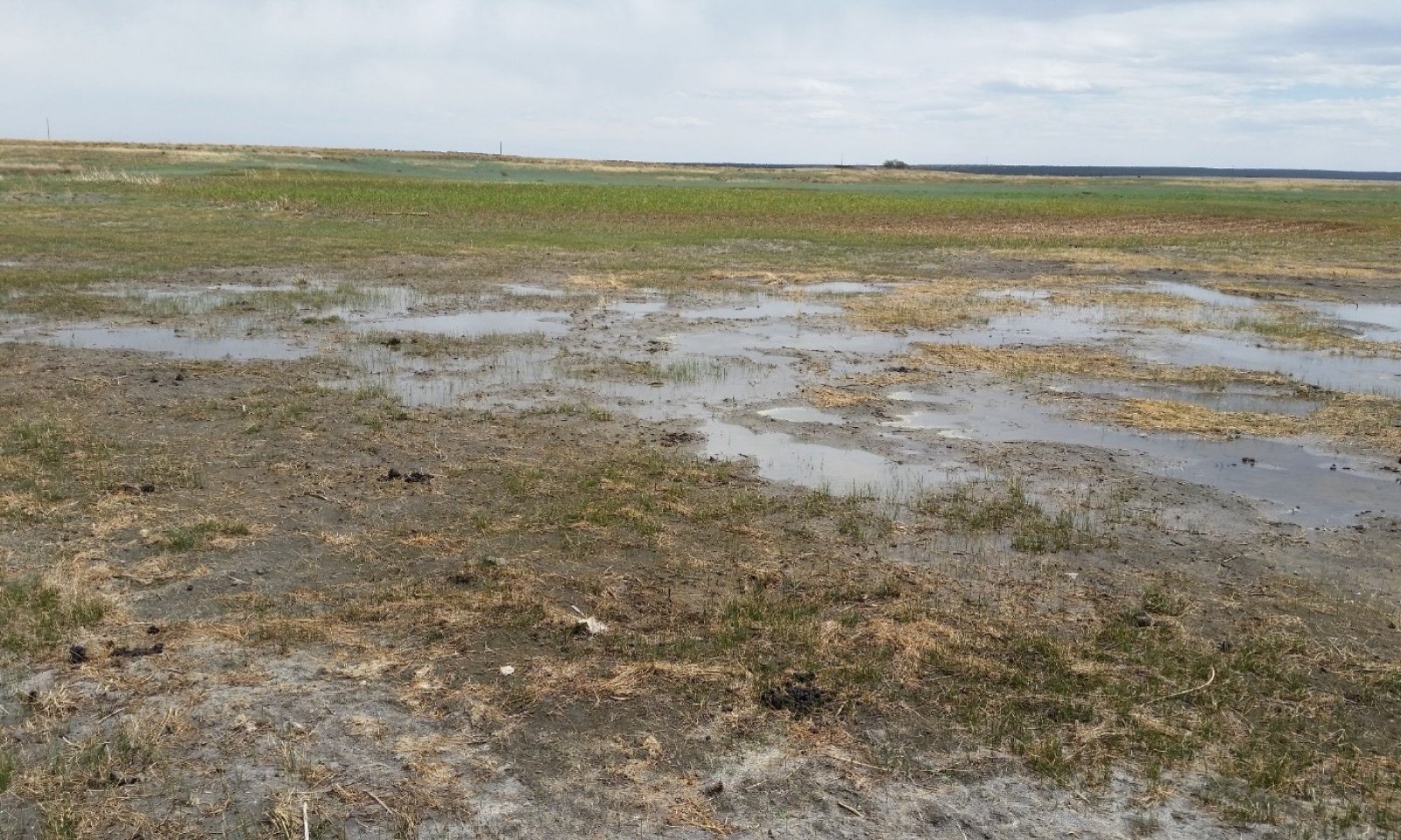
A playa is an internally drained area that receives run-on water from surrounding uplands by means of overland flow and throughflow. On wetter years the playa floor will experience ponding of surface water or at least a saturated soil profile to near the surface. On drier years, there may be no water table present within playa floor profiles. <br />
<br />
Among playas, hydrology is variable, depending on position on the plateau surface. Playas which occupy higher positions on a plateau tend to be elevated well above the mean water table. Thus, these playas receive most of their moisture from run-on, and net water movement through the soils on their floors is downwards. Such playas are referred to as “recharge” playas. Lower on the landscape, it is not uncommon to observe playas which occur below the annual high water table, and are hydrologically connected via throughflow to playas higher on the landscape. Thus, these “discharge” playas are subirrigated during wet periods. While discharge playas also receive run-on moisture from above, their net water movement is in an upward direction. Between recharge and discharge playas often exist “flow-through” playas, where groundwater moves laterally during wet periods. <br />
<br />
In recharge playas, a large portion of the moisture received during wet periods is able to move into the groundwater system and is transported away from the playa. This process allows accumulated salts to be flushed from their soils. In contrast, discharge playas only experience flushing of salts during precipitation (or irrigation) events when the water table is well below the playa floor. When the water table is at or near the surface, evapotranspiration leads to an accumulation of salts at the surface. For this reason, the soils of discharge playas can contain significant accumulations of salts—particularly gypsum. This phenomenon is most often observed where irrigation water has been diverted to playas higher in the landscape—thereby elevating the water tables connected to discharge playas and further preventing percolation. In terms of salinity dynamics, flow-through playas are intermediate.<br />
<br />
Although soils on the playa annulus are only ponded in exceptionally wet years, they receive run-on moisture from upland soils higher in the catena, as well as subirrigation when capillary action draws groundwater into their profiles (Note that when the clay content of the annulus soil surface is lower than the clay content of its subsurface horizons, capillary action cannot draw water above this textural break). The soils also have a high water-holding capacity, allowing them to store large amounts of water. <br />
<br />
The Playas ecological site is associated with wetlands systems; hydric soils are common. Wetland species, though intermittent with alternating wet and dry years, inhabit these sites. During wet years, the water table can be very near to above the surface, and water can even be ponded over the playa floor for long periods.
Figure 4. Diagram showing the relative positions of three playa types on a plateau surface. Arrows depict the net direction of water movement. Note that slope has been exaggerated and landscape scale compressed.
Soil features
Every ecological site and associated soil component has static soil properties that help define the physical, chemical, and biological characteristics that make the site unique. The following soil profile information is a description of those unique soil properties for the Playas ecological site.
The Playas ecological site is tied to the components of numerous map units in the Canadian Plateaus LRU of 70A. These components are not correlated to any current series from MLRA 70A. These soils typically form in alluvium and eolian materials from mixed sources.
Playa floor soils: Surface textures commonly found in this site are clay, clay loam, silty clay loam, and silty clay—the heavier textures being more common. Subsurface texture is either clay or silty clay. The central concept for this position is alluvial deposits with poor drainage. During wetter years or following irrigation events, there will be some ponded water retained in most playas for some duration. It is common for these soils to be hydric, especially in the medium to larger playas, and a functioning wetland often occurs in this position. The higher clay contents in the profile affect the infiltration rates of water and may cause a significant amount of shrink-swell action due to alternating wetting and drying periods. The soils also have a high water-holding capacity, allowing them to store large amounts of water. The dynamics between recharge, flow-through, and discharge playas (described in Soil Hydrology above) demonstrate that an individual playa is not a closed system. While salt accumulations (particularly gypsum) are inherently dynamic, they are most common and pronounced in discharge playas and least so in recharge playas. For more information on salinity dynamics and their effects on plant communities, see Ecological Dynamics below.
Annulus soils: Surface textures commonly found in this site are clay, clay loam, silty clay loam, and silty clay. Subsurface texture is clay loam, clay, or silty clay. The central concept for this position is a mix of eolian and alluvial materials that occur far enough above the seasonal high water table to be either somewhat poorly- or moderately well-drained. Although these soils are only ponded in exceptionally wet years (or in response to irrigation), they receive run-on moisture from upland soils higher in the catena, as well as subirrigation when capillary action draws groundwater into their profiles. The soils also have a high water-holding capacity, allowing them to store large amounts of water. In discharge playas, annulus soils are generally lower in salinity than those on playa floors.
In normal years these soils are driest during the winter. They may be dry in some or all parts for over 90 cumulative days, but are moist in some or all parts for either 180 cumulative days or 90 consecutive days during the growing season. The effect of run-on water to this site is significant and increases the available water in both amounts and duration, especially in the lowest parts of this landform. Often, there is a hydric soil found in playa bottoms due to the duration of water ponding. The soil moisture regime is ustic bordering on aridic, but aquic conditions are common where water tables are frequently near the surface. The mean annual soil temperature is 49 to 55 degrees F; this range falls in the mesic soil temperature regime.
The soils of Playas sites are characterized by subsurface horizons with at least 30 percent clay in the fine-earth fraction, and few to no rock fragments. They can be distinguished from other sites that occur on plateau summits based on the depression-type landform and drainage class.
TYPICAL PEDON: Typical pedon of a playa floor soil in a depression with a 2 percent slope to the south; San Miguel County at the Las Vegas Wildlife Refuge, just north of Clodfelters Lake, UTM: 13S 486749 3935538, Elevation: 6,549 feet.
Fine, kaolinitic, nonacid, Mesic Ustic Torriorthents
A-0 to 6 inches; dark gray (7.5YR 4/1) silty clay loam, very dark gray (7.5Y 3/1) moist; moderate fine granular structure; sticky and plastic; many fine and very fine roots; few fine interstitial pores; very slight effervescence with dilute HCl; moderately alkaline
Bkg-6 to 13 inches; brown (7.5YR 4/2) silty clay, dark brown (7.5Y 3/2) moist; 2 percent redox concentrations (7.5YR 4/6 moist), fine, prominent, as pore linings; moderate medium angular blocky structure; sticky and plastic; many fine and very fine roots; few fine interstitial pores; few fine disseminated carbonates; strong effervescence with dilute HCl, moderately alkaline
Ck-13 to 80 inches; dark grayish brown (10YR 4/2) clay, very dark brown (10YR 2/2) moist; weak coarse prismatic structure that parts to medium subangular blocky; very hard, very firm, sticky and very plastic; few fine and very fine roots; few fine interstitial pores; few fine disseminated carbonates; strong effervescence with dilute HCl, moderately alkaline.
The A horizon has hue of 7.5YR to 2.5Y, value of 2 to 4 when dry, 2 or 3 when moist, and chroma of 1 to 3. The C horizon has hue of 7.5YR to 2.5Y, value of 3 to 5 when dry, and chroma of 1 to 3. Clay contents in the fine earth fraction in the A horizons range from 15 to 45 percent, and in the B and C horizons from 30 to 60 percent.
Parent Material Kind: mixed
Parent Material Origin: alluvial and eolian
Surface Texture Group: very fine sandy loam, sandy clay loam, silty clay loam, and silty clay
Subsurface Texture Group: sandy clay loam, silty clay loam, clay loam, silty clay, and clayTable 4. Representative soil features
Parent material (1) Alluvium – sandstone and shale
(2) Eolian deposits – sandstone and shale
Surface texture (1) Very fine sandy loam
(2) Sandy clay loam
(3) Silty clay
Family particle size (1) Clayey
Drainage class Somewhat poorly drained to poorly drained Permeability class Very slow Soil depth 80 – 200 in Surface fragment cover <=3" 0 – 1 % Available water capacity
(0-60in)9 – 11 in Calcium carbonate equivalent
(0-60in)0 – 10 % Electrical conductivity
(0-60in)0 – 1 mmhos/cm Sodium adsorption ratio
(0-60in)0 – 2 Soil reaction (1:1 water)
(0-60in)6.6 – 8.6 Subsurface fragment volume <=3"
(Depth not specified)0 – 3 % Ecological dynamics
While plant community dynamics are complex in any ecological site, their complexity is multiplied in playa ecosystems. Since playa systems are composed of two inextricably-linked components, the floor and annulus, each plant community phase described herein contains two distinct plant communities. Moreover, since hydrology is markedly altered when playas are excavated to establish stock tanks, the relative percentages of these two components differ between the excavated and non-excavated states. Within a given state, plant communities on both positions respond to grazing pressure and annual weather patterns—the latter being quite pronounced since this site receives significant run-on moisture. Furthermore, the quality, quantity, and timing of run-on moisture entering playas is determined by management/disturbance regimes on adjacent uplands. This is a very similar scenario to sites that occur along streams and rivers, as these are equally sensitive to weather patterns and changes in hydrology, and contain multiple components which change positions over time.
As described in the Soil Hydrology section above, playa hydrology is strongly influenced by landscape position. For this reason, the Saline State (4.0) only occurs in playas that experience hydrologic discharge—usually as a consequence of lower landscape position coupled with the addition of irrigation water up-slope from the playa. Thus, the ecological dynamics of a given playa can be profoundly influenced by off-site management. For example, irrigation water is diverted to one playa and this, in turn, influences the hydrology of another playa lower on the landscape.
Correlation to Current Ecological Sites:
There are no legacy ecological sites that are correlated to the Playas ecological site.State and transition model
Custom diagramStandard diagram
Figure 5. STM diagram for the Playas ecological site
More interactive model formats are also available. View Interactive Models
More interactive model formats are also available. View Interactive Models
Click on state and transition labels to scroll to the respective textState 3 submodel, plant communities
State 4 submodel, plant communities
State 1
Reference StateThis state represents the most ecologically stable conditions in terms of hydrologic function and resistance to erosion. Moreover, this state has the highest potential for productivity and plant diversity.
It is possible that more than one state occurs in playas that have neither been plowed nor excavated. However, if so, such playas are rare enough in the Canadian Plateaus that such state-level distinctions have yet to be differentiated.Community 1.1
Recently-ponded, not excavated (diagnostic plant community)
Figure 6. Community 1.1 on a playa floor in San Miguel County, May 2018. While the plant community is recovering from winter dormancy and a prolonged ponding event, it harbors a relatively diverse plant community (note stand of cattails in the background).

Figure 7. Community 1.1 on a playa annulus, May 2018. While the plant community is recovering from a late-winter fire and only cool-season species are visible, grass cover is already high.
This community is dominated by grasses and grass-like plants, but typically contains scattered forbs of a few species. Cool-season plants, such as western wheatgrass and arctic rush, are dominant in the playa floor. In addition to arctic rush, other hydrophytic species such Kentucky bluegrass and cattails are often present in the floor—the latter occupying the very wettest positions. The annulus contains a relatively balanced mix of cool- and warm-season species. Total foliar cover is generally greater than 90 percent on either position.
Dominant plant species
-
western wheatgrass (Pascopyrum smithii), grass
-
arctic rush (Juncus arcticus), grass
Community 1.2
Not recently-ponded, not excavated
Figure 8. Community 1.2 in Mora County, September 2017. This photo was taken in the playa bottom, where hydrophytic species have all but disappeared. While western wheatgrass is clearly dominant, buffalograss is well-represented on this position.

Figure 9. Community 1.2 in Mora County, September 2017. Here, only a small fraction of the playa bottom has been saturated in recent years. While the acreage supporting hydrophytic vegetation is miniscule, it acts as a seedbank refuge for species.
This community is dominated by grasses, but typically contains scattered forbs of a few species, as well as a shrub component on the annulus. Western wheatgrass is generally dominant in the playa floor, and buffalograss is often well-represented there. Hydrophytic vegetation is either lacking altogether or else confined to the very center of the playa floor. The annulus contains a mix of cool- and warm-season species—including a significant abundance of shrubs.
Dominant plant species
-
broom snakeweed (Gutierrezia sarothrae), shrub
-
prairie sagewort (Artemisia frigida), shrub
-
western wheatgrass (Pascopyrum smithii), grass
-
arctic rush (Juncus arcticus), grass
-
buffalograss (Bouteloua dactyloides), grass
Community 1.3
Recently-ponded, not excavated, continuously-grazed
Figure 10. Community 1.3 in a playa bottom, August 2017. The dominant plant here is arctic rush. Western wheatgrass and spikerush are also well-represented. Bare patches and light soil surface indicate recent disturbance.
The community of the playa floor is dominated by cool-season grasses and grasslike plants; western wheatgrass, arctic rush, and spikerush are the most common. The community on the annulus contains relatively balanced a mix of cool- and warm-season grasses, with some forbs and shrubs, as well; buffalograss and/or western wheatgrass are most dominant here. Both communities contain scattered forbs.
Dominant plant species
-
spikerush (Eleocharis), grass
-
western wheatgrass (Pascopyrum smithii), grass
-
arctic rush (Juncus arcticus), grass
-
buffalograss (Bouteloua dactyloides), grass
Community 1.4
Not recently-ponded, not excavated, continuously-grazed
Figure 11. Community 1.4 in a playa floor in San Miguel County, May 2017. The dominance of forbs here suggests a history of continuous grazing.

Figure 12. Community 1.4 in a playa annulus in San Miguel County, May 2017. A relatively high percentage of bare ground and the abundance of early-seral forbs suggest a history of continuous grazing.
The community of the playa floor is either dominated by grasses, or else exhibits grasses and forbs in codominance. The annulus contains a relatively balanced mix of grasses and forbs. Of the grasses, western wheatgrass is generally dominant on both landform positions. Early-seral species are quite well-represented throughout.
Dominant plant species
-
broom snakeweed (Gutierrezia sarothrae), shrub
-
prairie sagewort (Artemisia frigida), shrub
-
western wheatgrass (Pascopyrum smithii), grass
-
buffalograss (Bouteloua dactyloides), grass
Pathway P1.1B
Community 1.1 to 1.2
Recently-ponded, not excavated (diagnostic plant community)
Not recently-ponded, not excavatedThis pathway represents a dry period—typically spanning multiple years—during which ponding does not occur in the playa floor. Consequently, hydrophytic species “disappear”, although many persist in the seedbank, or as dormant rhizomes. Buffalograss increases in the playa floor, and upland forbs often appear on this position. In response to reduced subirrigation, the annulus experiences both diminished relative cover of cool-season species and a decrease in total plant production. It should be noted that this phase shift is not always complete. During many dry years, soils typically remain moist, if not saturated in the very center of the playa floor—thus supporting the growth of hydrophytic plants in a small area. This contributes little to overall production, but is important for biodiversity.
Key drivers
-
Precipitation (decadal scale)
Pathway P1.1A
Community 1.1 to 1.3
Recently-ponded, not excavated (diagnostic plant community)
Recently-ponded, not excavated, continuously-grazedThis pathway represents a period of heavy grazing, typically season-long, which suppresses herbaceous species that are more palatable and/or less resilient under grazing pressure. While continuous grazing alone is not generally enough to extirpate major species such as western wheatgrass and Arctic rush, total cover and production of these species does diminish. Concurrently, spike rush and/or buffalograss either appear or increase in abundance within the playa floor, and a relative increase in warm-season plants occurs on the annulus.
Key drivers
-
Livestock grazing or browsing
Pathway P1.2B
Community 1.2 to 1.1
Not recently-ponded, not excavated
Recently-ponded, not excavated (diagnostic plant community)This pathway represents at least one ponding event in the playa floor—which can result either from precipitation events or from the addition of irrigation water. Often, ponding in multiple consecutive wet years is needed for Community 1.1 to re-establish. This change in hydrology translates to an increase in the range and abundance of hydrophytic vegetation within the playa floor—or to the re-emergence of such plants from seeds and/or rhizomes. Concurrently, the annulus exhibits an increase in the relative abundance of cool-season species and in total production. It should be noted that the plant community’s response does not occur overnight. Often, the result of prolonged ponding is the death of plants intolerant of submerged conditions within the playa floor. Thus, a relatively barren playa floor is not necessarily evidence of drought or overgrazing.
Key drivers
-
Precipitation (annual scale)
Pathway P1.2A
Community 1.2 to 1.4
Not recently-ponded, not excavated
Not recently-ponded, not excavated, continuously-grazedThis pathway represents a period of heavy grazing, typically season-long, which suppresses herbaceous species that are more palatable and/or less resilient under grazing pressure. Total plant cover diminishes, as does the production of western wheatgrass.
Key drivers
-
Livestock grazing or browsing
Pathway P1.3A
Community 1.3 to 1.1
Recently-ponded, not excavated, continuously-grazed
Recently-ponded, not excavated (diagnostic plant community)This pathway represents prescribed grazing or rest from grazing. In either case, herbaceous plants that are palatable and/or sensitive to grazing increase in vigor and abundance at the expense of less palatable and less sensitive species. Thus, a decrease in spikerush in the playa floor and a decrease in buffalograss on both positions occurs.
Key drivers
-
Livestock grazing or browsing
Pathway P1.3B
Community 1.3 to 1.4
Recently-ponded, not excavated, continuously-grazed
Not recently-ponded, not excavated, continuously-grazedThis pathway represents a dry period—typically spanning multiple years—during which ponding does not occur in the playa floor. Consequently, hydrophytic species “disappear”, although many persist in the seedbank, or as dormant rhizomes. Buffalograss increases in the playa floor, and upland forbs often appear on this position. In response to reduced subirrigation, the annulus experiences both a diminishment in the relative cover of cool-season species and a decrease in total plant production. It should be noted that this phase shift is not always complete. During many dry years, soils are at least saturated in the very center of the playa floor—thus supporting the growth of hydrophytic plants in a small area. This contributes little to overall production, but is important for biodiversity.
Key drivers
-
Precipitation (decadal scale)
Pathway P1.4A
Community 1.4 to 1.2
Not recently-ponded, not excavated, continuously-grazed
Not recently-ponded, not excavatedThis pathway represents prescribed grazing or rest from grazing. In either case, herbaceous plants that are palatable and/or sensitive to grazing increase in vigor and abundance at the expense of less palatable and less sensitive species. Thus, an increase in western wheatgrass, and decreases in early-seral forbs and buffalograss on both positions occurs.
Key drivers
-
Livestock grazing or browsing
Pathway P1.4B
Community 1.4 to 1.3
Not recently-ponded, not excavated, continuously-grazed
Recently-ponded, not excavated, continuously-grazedThis pathway represents at least one ponding event in the playa floor—which can result either from precipitation events or from the addition of irrigation water. Often, ponding in multiple consecutive wet years is needed for a shift to Community 1.3. This change in hydrology translates to an increase in the range and abundance of hydrophytic vegetation within the playa floor—or to the re-emergence of such plants from seeds and/or rhizomes. Concurrently, the annulus exhibits an increase in the relative abundance of cool-season species and in total production. It should be noted that the plant community’s response does not occur overnight. Often, the immediate result of prolonged ponding is the death of land plants in the playa floor. Thus, a relatively barren playa floor is not necessarily evidence of drought or overgrazing.
Key drivers
-
Precipitation (decadal scale)
State 2
Excavated StateThis state occurs where a portion of the playa floor has been excavated in order to establish a stock tank. The hydrology of both of the floor and the annulus has been significantly altered.
Community 2.1
Excavated, recently-ponded
Figure 13. Community 2.1 in San Miguel County, June 2015. Person approaching outer edge of annulus. Playa floor is a deeper shade of green. A stock tank appears on the far end of the playa floor.

Figure 14. Community 2.1 in San Miguel County, November 2017. The playa annulus, which dominates the frame, exhibits very high production of western wheatgrass. Cattle had been absent in this pasture for 5 years.
This community phase occurs in excavated playas that have received both recent ponding and rest from continuous grazing. The playa floor community is dominated by cool-season grasses, and contains some wetland plants—often congregated near the stock tank. The annulus contains a mix of grasses, forbs, and shrubs, with warm- and cool-season species being well-represented. Early-seral forbs and grasses are generally present on both landform positions.
Dominant plant species
-
western wheatgrass (Pascopyrum smithii), grass
-
spikerush (Eleocharis), grass
-
arctic rush (Juncus arcticus), grass
-
buffalograss (Bouteloua dactyloides), grass
Community 2.2
Excavated, not recently-ponded
Figure 15. Community 2.2 on a playa floor in Harding County at the end of a dry spring, May 2018. The dominance of western wheatgrass here reflects rest from continuous grazing, as well as a lack of major ponding events in recent years.

Figure 16. Community 2.2 on a playa annulus at the end of a dry spring, May 2018. Western wheatgrass is increasing with prescribed grazing, while buffalograss reflects a history of continuous grazing and a lack of spring moisture.
The playa floor contains a mix of cool- and warm-season grasses, with either western wheatgrass or buffalograss being dominant. The annulus contains a mix of cool- and warm-season species—including a significant abundance of shrubs. Early-seral forbs and grasses are generally quite abundant on both landform positions.
Dominant plant species
-
broom snakeweed (Gutierrezia sarothrae), shrub
-
prairie sagewort (Artemisia frigida), shrub
-
western wheatgrass (Pascopyrum smithii), grass
-
buffalograss (Bouteloua dactyloides), grass
Community 2.3
Excavated, continuously-grazed, recently-ponded
Figure 17. Community 2.3 in San Miguel County, June 2015. This image is from a playa floor that has been both excavated and bisected by a road. Recent ponding has led to relatively high production.
The playa floor community contains a mix of cool-season grasses and various forbs—including some wetland plants. The latter are most concentrated near the stock tank. The annulus contains a mix of grasses, forbs, and shrubs, with warm- and cool-season species being well-represented. Buffalograss is often a major player on the annulus, and is frequently present on the playa floor. Early-seral forbs and grasses are generally quite abundant on both landform positions.
Dominant plant species
-
western wheatgrass (Pascopyrum smithii), grass
-
buffalograss (Bouteloua dactyloides), grass
-
spikerush (Eleocharis), grass
Community 2.4
Excavated, continuously-grazed, not recently-pondedThe playa floor contains a mix of cool- and warm-season grasses, with western wheatgrass and buffalograss generally being codominant. The annulus contains a mix of cool- and warm-season species—including a significant abundance of shrubs. Sleepygrass is a common species on both positions. Early seral forbs and grasses are generally quite abundant on both landform positions. Recent erosion on the annulus and deposition to the playa floor are both quite evident.
Dominant plant species
-
broom snakeweed (Gutierrezia sarothrae), shrub
-
prairie sagewort (Artemisia frigida), shrub
-
buffalograss (Bouteloua dactyloides), grass
-
western wheatgrass (Pascopyrum smithii), grass
-
sleepygrass (Achnatherum robustum), grass
Pathway P2.1B
Community 2.1 to 2.2
Excavated, recently-ponded
Excavated, not recently-pondedThis pathway represents a dry period—typically spanning multiple years— during which ponding may occur in the middle of the tank, but does not saturate topsoil in the playa floor.
Key drivers
-
Precipitation (decadal scale)
Pathway P2.1A
Community 2.1 to 2.3
Excavated, recently-ponded
Excavated, continuously-grazed, recently-pondedThis pathway represents a period of heavy grazing, typically season-long, which suppresses herbaceous species that are more palatable and/or less resilient under grazing pressure.
Key drivers
-
Livestock grazing or browsing
Pathway P2.2B
Community 2.2 to 2.1
Excavated, not recently-ponded
Excavated, recently-pondedThis pathway represents at least one major ponding event in the playa floor. Often, multiple consecutive wet years are needed for Community 2.1 to re-establish, and all but complete filling or breaching of the stock tank may not suffice
Key drivers
-
Precipitation (decadal scale)
Pathway P2.4A
Community 2.2 to 2.4This pathway represents prescribed grazing or rest from grazing. In either case, herbaceous plants that are palatable and/or sensitive to grazing increase in vigor and abundance, and early-seral forbs are at a competitive disadvantage.
Key drivers
-
Livestock grazing or browsing
Pathway P2.3A
Community 2.3 to 2.1
Excavated, continuously-grazed, recently-ponded
Excavated, recently-pondedThis pathway represents prescribed grazing or rest from grazing. In either case, herbaceous plants that are palatable and/or sensitive to grazing increase in vigor and abundance.
Key drivers
-
Livestock grazing or browsing
Pathway P2.3B
Community 2.3 to 2.4This pathway represents a dry period—typically spanning multiple years—during which ponding may occur in the middle of the tank, but does not saturate topsoil in the playa floor.
Key drivers
-
Precipitation (decadal scale)
Pathway P2.2A
Community 2.4 to 2.2This pathway represents a period of heavy grazing, typically season-long, which suppresses herbaceous species that are more palatable and/or less resilient under grazing pressure.
Key drivers
-
Livestock grazing or browsing
Pathway P2.4B
Community 2.4 to 2.3This pathway represents at least one major ponding event in the playa floor. Often, multiple consecutive wet years are needed for Community 2.1 to re-establish, and all but complete filling or breaching of the stock tank may not suffice.
Key drivers
-
Precipitation (decadal scale)
State 3
Post-Cropped StateThis state occurs where a playa has been plowed. Given enough data, this state could probably be divided into multiple phases.
Community 3.1
Various plants, plowed
Figure 18. Community 3.1 in San Miguel County, May 2015. Western wheatgrass and field bindweed are codominant here.
Various cool-and warm-season plants occupy this community phase. Species present depend largely on the span since plowing. However, since plowing of most playas was abandoned decades ago, and since ecological succession proceeds with relative speed in these run-on sites, the plant communities in most plowed playas are relatively stable. Western wheatgrass and field bindweed are the most common species on playa floor. Annuli contain a mix of cool-and warm-season plants, with early-seral species being quite well-represented.
Dominant plant species
-
western wheatgrass (Pascopyrum smithii), grass
-
buffalograss (Bouteloua dactyloides), grass
State 4
Saline StateThis state occurs where a given playa has been the site of net groundwater discharge for a number of years. As a result, soils exhibit significant concentrations of salts—particularly gypsum. The term “saline” is used relatively here, as these soils are typically very slightly to slightly saline (EC values of 2-8 dS/M). However, gypsum contents and salt crusts at the soil surface both influence the plant community, with the latter inhibiting germination. As noted in Soil Hydrology and Water Features, such conditions are much more likely in playas that occupy lower positions on a landscape.
This state could theoretically be divided into at least two phases: one in which recent ponding is evidenced by a sparse, forb-dominated community on the playa floor; and another where a lack of recent ponding is evidenced by a more robust, grass-dominated community on the playa floor. However, since all field observations occurred in playas affected by current irrigation, community phase 4.1 is the only one that has been documented.Community 4.1
Saline soils, salt-tolerant vegetation
Figure 19. Community 4.1 on an annulus in Colfax County, November 2017. Standing water on the playa floor is visible in the background. The dominant plant here is inland saltgrass.

Figure 20. Community 4.1 on a playa annulus in San Miguel County, May 2018. Dominant plants are inland saltgrass and alkali sacaton.
The playa floor is sparsely vegetated and forb-dominated. Salt-tolerant members of the Chenopodiaceae plant family are most dominant here. Average annual production ranges from 0 to 600 pounds per acre, depending mostly on the amount of time since inundation. The annulus is well-vegetated and dominated by grasses—particularly inland saltgrass and alkali sacaton. Fourwing saltbush is also common. Average annual production ranges from 1,000 to 2,000 pounds per acre.
Transition T1A
State 1 to 2Trigger event: A portion of the playa floor is excavated in order to establish a stock tank. A primary threshold is generally crossed during excavation, as a sizeable tank will markedly alter hydrology—both of the floor and the annulus. Slow variables: The area surrounding the stock tank receives frequent and heavy trampling, and palatable species experience intense grazing pressure. This leads to a reduction in palatable species and soil health parameters. Secondary thresholds are reached when certain palatable species are extirpated, and when significant amounts of topsoil are transported from the annulus to the playa floor.
Key drivers
-
Livestock grazing or browsing
-
Seed dispersal by livestock
-
Mechanical soil disturbance
Transition T1B
State 1 to 3Trigger event(s): Plowing kills perennial plants. Slow variables: Once crop planting ceases, pioneer species (mostly annual forbs) establish and their abundance gradually increases. Given frequent additions of run-on water, perennial grasses re-establish more rapidly than they would in an upland site. Threshold: After repeated cycles of plowing and/or applications of herbicides, certain species within the native seedbank are exhausted.
Key drivers
-
Mechanical soil disturbance
Transition T1C
State 1 to 4Landscape hydrology is altered such that the playa becomes a site of net groundwater discharge rather than recharge or flow-through. This is most often the result of the addition of irrigation water to landforms above the playa in question, but could theoretically occur in response to changes in weather patterns. Slow variables: In periods between ponding events, capillary action draws groundwater to the surface of the playa. Evapotranspiration leaves behind the salts (particularly gypsum) that were dissolved in the groundwater. Since the water table is elevated, ponding no longer flushes these salts from soils. Thus, over a number of years under the new hydrologic regime, significant amounts of salts accumulate in the playa soils.
Key drivers
-
Precipitation (decadal scale)
-
Addition of irrigation water
Restoration pathway R2A
State 2 to 1Slow variables: In the absence of excavation activities, the tank gradually fills-in. Alternatively, this can be accomplished in a short span by pushing the berm into the tank with heavy equipment. Threshold: The tank fills to the point that hydrological response to rain events returns to that of state 1.
Transition T2A
State 2 to 3Trigger event(s): Plowing kills perennial plants. Slow variables: Once crop planting ceases, pioneer species (mostly annual forbs) establish and their abundance gradually increases. Given frequent additions of run-on water, perennial grasses re-establish more rapidly than they would in an upland site. Threshold: After repeated cycles of plowing and/or applications of herbicides, certain species within the native seedbank are exhausted.
Key drivers
-
Mechanical soil disturbance
Transition T2B
State 2 to 4Landscape hydrology is altered such that the playa becomes a site of net groundwater discharge rather than recharge or flow-through. This is most often the result of the addition of irrigation water to landforms above the playa in question, but could theoretically occur in response to changes in weather patterns. Slow variables: In periods between ponding events, capillary action draws groundwater to the surface of the playa. Evapotranspiration leaves behind the salts (particularly gypsum) that were dissolved in the groundwater. Since the water table is elevated, ponding no longer flushes these salts from soils. Thus, over a number of years under the new hydrologic regime, significant amounts of salts accumulate in the playa soils.
Key drivers
-
Precipitation (decadal scale)
-
Addition of irrigation water
Restoration pathway R3A
State 3 to 1This restoration pathway will culminate in the establishment of a State 1 plant community. It will involve the re-introduction of extirpated species. If a stock tank is present, it must be filled in order to restore hydrology.
Restoration pathway R3B
State 3 to 2This restoration pathway will culminate in the establishment of a State 2 plant community. It will involve the re-introduction of extirpated species, and may require the excavation of a stock tank.
Transition T3A
State 3 to 4Landscape hydrology is altered such that the playa becomes a site of net groundwater discharge rather than recharge or flow-through. This is most often the result of the addition of irrigation water to landforms above the playa in question, but could theoretically occur in response to changes in weather patterns. Slow variables: In periods between ponding events, capillary action draws groundwater to the surface of the playa. Evapotranspiration leaves behind the salts (particularly gypsum) that were dissolved in the groundwater. Since the water table is elevated, ponding no longer flushes these salts from soils. Thus, over a number of years under the new hydrologic regime, significant amounts of salts accumulate in the playa soils.
Key drivers
-
Precipitation (decadal scale)
-
Addition of irrigation water
Restoration pathway R4A
State 4 to 1Each restoration pathway from State 4 will necessarily involve a change in landscape hydrology which effectively lowers the water table below the playa in question. In most cases, this will involve a reduction or cessation of irrigation activities up-slope from the playa. The result is that water effectively percolates through the soils of the playa floor. Highly soluble salts such as sodium chloride and sodium bicarbonate are removed rapidly—perhaps in a matter of years. Gypsum, having only moderate solubility and often times being quite concentrated in State 4, will require decades to be markedly reduced, and perhaps centuries to be removed entirely. Which of the three restoration pathways the plant community takes will depend on a number of factors. R4A will occur if a stock tank is either absent or removed from the playa floor, and if native, hydrophytic plants can be re-introduced to the playa floor. Re-introduction of plants may require the initial removal of salts (a slow process), followed by seeding activities.
Restoration pathway R4B
State 4 to 2Each restoration pathway from State 4 will necessarily involve a change in landscape hydrology which effectively lowers the water table below the playa in question. In most cases, this will involve a reduction or cessation of irrigation activities up-slope from the playa. The result is that water effectively percolates through the soils of the playa floor. Highly soluble salts such as sodium chloride and sodium bicarbonate are removed rapidly—perhaps in a matter of years. Gypsum, having only moderate solubility and often times being quite concentrated in State 4, will require decades to be markedly reduced, and perhaps centuries to be removed entirely. Which of the three restoration pathways the plant community takes will depend on a number of factors. R4B will occur if a stock tank remains in the playa floor. Again, re-introduction of plants may require the initial removal of salts (a slow process), followed by seeding activities.
Restoration pathway R4C
State 4 to 3Each restoration pathway from State 4 will necessarily involve a change in landscape hydrology which effectively lowers the water table below the playa in question. In most cases, this will involve a reduction or cessation of irrigation activities up-slope from the playa. The result is that water effectively percolates through the soils of the playa floor. Highly soluble salts such as sodium chloride and sodium bicarbonate are removed rapidly—perhaps in a matter of years. Gypsum, having only moderate solubility and often times being quite concentrated in State 4, will require decades to be markedly reduced, and perhaps centuries to be removed entirely. Which of the three restoration pathways the plant community takes will depend on a number of factors. R4C will occur if the extirpated plant community is not effectively re-introduced. Regardless of whether or not cultivation occurred prior to the accumulation of salts, early-seral forbs will dominate the playa floor if native grasses are not effectively re-introduced.
Additional community tables
Table 5. Community 1.1 plant community composition
Group Common name Symbol Scientific name Annual production () Foliar cover (%) Table 6. Community 1.2 plant community composition
Group Common name Symbol Scientific name Annual production () Foliar cover (%) Table 7. Community 1.3 plant community composition
Group Common name Symbol Scientific name Annual production () Foliar cover (%) Table 8. Community 1.4 plant community composition
Group Common name Symbol Scientific name Annual production () Foliar cover (%) Table 9. Community 2.1 plant community composition
Group Common name Symbol Scientific name Annual production () Foliar cover (%) Table 10. Community 2.2 plant community composition
Group Common name Symbol Scientific name Annual production () Foliar cover (%) Table 11. Community 2.3 plant community composition
Group Common name Symbol Scientific name Annual production () Foliar cover (%) Table 12. Community 2.4 plant community composition
Group Common name Symbol Scientific name Annual production () Foliar cover (%) Table 13. Community 3.1 plant community composition
Group Common name Symbol Scientific name Annual production () Foliar cover (%) Table 14. Community 4.1 plant community composition
Group Common name Symbol Scientific name Annual production () Foliar cover (%) Interpretations
Animal community
Habitat for Wildlife:
(From Clayey Upland-RO70AY002NM)* This site provides habitats which support a resident animal community that includes pronghorn antelope, coyote, black-tailed jackrabbit, black-tailed prairie dog, thirteen-lined ground squirrel, marsh hawk, horned lark, meadowlark, scaled quail, bullsnake, Great Plains skunk, and prairie rattlesnake.
*Note that this list comes from an upland site, which is merely the closest fit among existing sites.Hydrological functions
A playa is an internally drained area that receives run-on water from surrounding uplands by means of overland flow and throughflow. On wetter years the playa floor will experience ponding of surface water or at least a saturated soil profile to near the surface. On drier years, there may be no water table present within playa floor profiles.
Among playas, hydrology is variable, depending on position on the plateau surface. Playas which occupy higher positions on a plateau tend to be elevated well above the mean water table. Thus, these playas receive most of their moisture from run-on, and net water movement through the soils on their floors is downwards. Such playas are referred to as “recharge” playas. Lower on the landscape, we often find playas which occur below the annual high water table, and are hydrologically connected via throughflow to playas higher on the landscape. Thus, these “discharge” playas are subirrigated during wet periods. While discharge playas also receive run-on moisture from above, their net water movement is in an upward direction. Between recharge and discharge playas, we often find “flow-through” playas—where groundwater moves laterally during wet periods.
In recharge playas, a large portion of the moisture received during wet periods is able to move into the groundwater system and is transported away from the playa. This process allows accumulated salts to be flushed from their soils. In contrast, discharge playas only experience flushing of salts during precipitation (or irrigation) events when the water table is well below the playa floor. When the water table is at or near the surface, evapotranspiration leads to an accumulation of salts at the surface. For this reason, the soils of discharge playas can contain significant accumulations of salts—particularly gypsum. This phenomenon is most often observed where irrigation water has been diverted to playas higher in the landscape—thereby elevating the water tables connected to discharge playas and further preventing percolation. In terms of salinity dynamics, flow-through playas are intermediate.
Although soils on the playa annulus are only ponded in exceptionally wet years, they receive run-on moisture from upland soils higher in the catena, as well as subirrigation when capillary action draws groundwater into their profiles (Note that when the clay content of the annulus soil surface is lower than the clay content of its subsurface horizons, capillary action cannot draw water above this textural break). The soils also have a high water-holding capacity, allowing them to store large amounts of water.
The Playas ecological site is associated with wetlands systems; hydric soils are common. Wetland species, though intermittent with alternating wet and dry years, inhabit these sites. During wet years, the water table can be very near to above the surface, and water can even be ponded over the playa floor for long periods.Recreational uses
The Playas site is unfit for most recreational uses due to ponding and high shrink-swell activity of the soils.
Wood products
Trees do not grow on this site.
Other information
Future Work:
The Playas sites of the Canadian Plateaus LRU may possibly have more than one ESD tied to the concept. Where sandstone appears to be the underlying bedrock, or there is a source for blowing in sands, a very fine sandy loam surface often develops in the playa which, on drier years, may favor plants that prefer a coarser textured surface. Where the playas develop in plateau rocks of limestone and shale, finer textures are found at the surface.
Also, the overall size of the playa may play a factor in its function. The larger playas tend to fill with water more frequently and for longer durations. When they dry out, they are typically devoid of vegetation which make them more susceptible to wind scouring. This has an impact on the accumulation of surface salts as well as fine sands.
ESD Workgroup:
Logan Peterson, NRCS, Soil Survey Project Leader, Soil Scientist
Aaron Miller, NRCS, MLRA 70 Project Leader, Soil Scientist
Robert (Scott) Woodall, NRCS, Region 8 Ecological Site Specialist, Range EcologistSupporting information
Other references
Cleland, D.T., Freeouf, J.A., Keys, J.E., Jr.; Nowacki, G.J., Carpenter, C, and McNab, W.H. 2007. Ecological Subregions: Sections and Subsections of the Conterminous United States.[1:3,500,000], Sloan, A.M., cartog. Gen. Tech. Report WO-76. Washington, DC: U.S. Department of Agriculture, Forest Service.
Gebow, B. S., 2001. Search, Compile, and Analyze Fire Literature and Research Associated with Chihuahuan Desert Uplands, Tucson: The University of Arizona.
Griffith, G.E.; Omernik, J.M., McGraw, M.M., Jacobi, G.Z., Canavan, C.M., Schrader, T.S., Mercer, D., Hill, R., and Moran, B.C., 2006. Ecoregions of New Mexico (color poster with map, descriptive text, summary tables, and photographs): Reston, Virginia, U.S. Geological Survey (map scale 1:1,400,000).
Kuchler, A.W. 1964. Potential Natural Vegetation of the Conterminous United States. American Geographical Society, Special Publication No. 36.
Smith, L.M, Haukos, D.A., Mcmurry, S. T., Lagrange, T., and Willis, D., 2011. Ecosystem services provided by playas in the High Plains: potential influences of USDA conservation programs. Ecological Applications, 21(3) Supplement, pp. 82-92, by the Ecological Society of America
United States Department of Agriculture, Natural Resources Conservation Service. 2006. Land Resource Regions and Major Land Resource Areas of the United States, the Caribbean, and the Pacific Basin. U.S. Department of Agriculture Handbook 296.Contributors
Aaron Miller
Logan PetersonApproval
Curtis Talbot, 10/01/2021
Rangeland health reference sheet
Interpreting Indicators of Rangeland Health is a qualitative assessment protocol used to determine ecosystem condition based on benchmark characteristics described in the Reference Sheet. A suite of 17 (or more) indicators are typically considered in an assessment. The ecological site(s) representative of an assessment location must be known prior to applying the protocol and must be verified based on soils and climate. Current plant community cannot be used to identify the ecological site.
Author(s)/participant(s) Contact for lead author Date 09/19/2026 Approved by Approval date Composition (Indicators 10 and 12) based on Annual Production Indicators
-
Number and extent of rills:
-
Presence of water flow patterns:
-
Number and height of erosional pedestals or terracettes:
-
Bare ground from Ecological Site Description or other studies (rock, litter, lichen, moss, plant canopy are not bare ground):
-
Number of gullies and erosion associated with gullies:
-
Extent of wind scoured, blowouts and/or depositional areas:
-
Amount of litter movement (describe size and distance expected to travel):
-
Soil surface (top few mm) resistance to erosion (stability values are averages - most sites will show a range of values):
-
Soil surface structure and SOM content (include type of structure and A-horizon color and thickness):
-
Effect of community phase composition (relative proportion of different functional groups) and spatial distribution on infiltration and runoff:
-
Presence and thickness of compaction layer (usually none; describe soil profile features which may be mistaken for compaction on this site):
-
Functional/Structural Groups (list in order of descending dominance by above-ground annual-production or live foliar cover using symbols: >>, >, = to indicate much greater than, greater than, and equal to):
Dominant:
Sub-dominant:
Other:
Additional:
-
Amount of plant mortality and decadence (include which functional groups are expected to show mortality or decadence):
-
Average percent litter cover (%) and depth ( in):
-
Expected annual annual-production (this is TOTAL above-ground annual-production, not just forage annual-production):
-
Potential invasive (including noxious) species (native and non-native). List species which BOTH characterize degraded states and have the potential to become a dominant or co-dominant species on the ecological site if their future establishment and growth is not actively controlled by management interventions. Species that become dominant for only one to several years (e.g., short-term response to drought or wildfire) are not invasive plants. Note that unlike other indicators, we are describing what is NOT expected in the reference state for the ecological site:
-
Perennial plant reproductive capability:
Print Options
Sections
Font
AAAAOther
PrintThe Ecosystem Dynamics Interpretive Tool is an information system framework developed by the USDA-ARS Jornada Experimental Range, USDA Natural Resources Conservation Service, and New Mexico State University.
Accessibility statement


