
Natural Resources
Conservation Service
Ecological site GX070A01X014
Lithic Limestone
Last updated: 10/01/2021
Accessed: 09/14/2026
-
Search


Major Land Resource Area or ecological site by name and/or ID.
General information
Provisional. A provisional ecological site description has undergone quality control and quality assurance review. It contains a working state and transition model and enough information to identify the ecological site.
MLRA notes
Major Land Resource Area (MLRA): 070A–High Plateaus of the Southwestern Great Plains
This site is only applicable to the Canadian Plateaus LRU of MLRA 70A (LRU 70A.1).
LRU notes
This site is only applicable to the Canadian Plateaus LRU of MLRA 70A (LRU 70A.1). Please refer to the following key:
Land Resource Unit (LRU) Key for MLRA 70A
– High Plateaus of the Southwestern Great Plains
1a. The site exists on a landform of volcanic origin, such as a basalt plateau, or is part of an escarpment system that rises directly to a volcanic structure. These escarpments are included if they have volcanic alluvium or colluvium (i.e. basalt, rhyolite, tuff, cinders) overlying non-volcanic residuum or bedrock (i.e. sandstone, shale). → VOLCANIC PLATEAUS LRU (VP)
User tip: Other alluvial or colluvial landform features extending below the escarpments are not included unless they have a predominance of volcanic fragments at the surface. Also, note that playas atop volcanic plateaus are included within the VP-LRU.
1b. All other sites. → 2
2a. The site exists in the annulus or floor of a playa. → CANADIAN PLATEAUS LRU (CP)
User tip: Small islands of playas occur within large areas of HP-LRU. These sites may be far from the nearest CP landform but will still key-out to the CP-LRU. The playa rim components, however, may key out to either LRU, so it is important to properly identify their soil properties.
2b All other sites. → 3
3a. The site is part of an escarpment landscape complex (defined below) or is within a canyon, valley, or small basin confined by such escarpments. At the upper boundary of the LRU, the soil surface meets at least 4 of the following 5 criteria:
I. Shallow or very shallow soils are present in at least 50% of the landform area;
II. Soils are underlain by sandstone bedrock of the Cretaceous Dakota Formation or older;
III. Presence or historical evidence of a conifer stand (≥ 2% canopy cover);
IV. The ground surface has a slope of at least 10%;
V. The landforms drain towards steep-walled escarpments or canyons below the Dakota sandstone (older Jurassic and Triassic Formations underlie this sandstone mesa cap).
→ MESOZOIC CANYONS AND BREAKS LRU (MCB)
User tip: The MCB sites also occur on any colluvial or alluvial bottomlands confined within escarpments or canyons. Some valleys transition from CP to MCB, or back to CP, and the turning point can be difficult to determine. Generally, the landforms are part of the MCB when confined between Dakota sandstone breaks or escarpments on both sides. Much of the acreage in the MCB is aproned by colluvial debris fans—composed of sandy materials with large sandstone fragments visible on the soil surface, including large stones or boulders. The soils in the bottoms of these confined valleys will also be in the MCB. When the valley opens, or there is only a single escarpment opening to the plains, the landforms below the steeper, rockier escarpments will be members of the CP-LRU.
3b. Fewer than 4 of the above criteria are met. → 4
4a. The soil is on a plateau summit position (tread) and is within 50 cm to contact with either plateau bedrock (non-soil bedrock of cemented sandstone, limestone, or shale) or strath terrace cobbles, but not a petrocalcic contact (caprock or caliche of cemented calcium carbonate). → CANADIAN PLATEAUS LRU (CP)
4b. No plateau bedrock or strath terrace cobbles within 50 cm. → 5
5a. Fragments (>2 mm) are visible within the soil profile and/or on the surface. If fragments cannot be found in the profile, it is acceptable to look nearby on ant mounds or around burrows. If site is in a drainageway, one can look for fragments on landforms immediately upslope.→ 6
5b. Fragments are entirely absent. → 7
6a. Fragments are mostly petronodes or High Plains gravels. → HIGH PLAINS LRU (HP)
6b. Fragments are mostly plateau bedrock fragments. → CANADIAN PLATEAUS LRU
7a. All horizons in the upper 100 cm of soil have textures of sandy clay loam or sandier.
→ CANADIAN PLATEAUS LRU (CP)
7b. At least one horizon in the upper 100 cm of soil has a texture that is less sandy than sandy clay loam. → HIGH PLAINS LRU (HP)Classification relationships
NRCS and BLM: Lithic Limestone Canadian Plateaus LRU Major Land Resource Area 70A, High Plateaus of the Southwestern Great Plains Land Resource Region G, Western Great Plains Range and Irrigated Region (United States Department of Agriculture, Natural Resources Conservation Service, 2006).
USFS: Lithic Limestone Sandy Smooth High Plains Subsection Southern High Plains Section Great Plains-Palouse Dry Steppe Province (Cleland, et al., 2007).
EPA: Lithic Limestone <26l Upper Canadian Plateau<26 Southwestern Tablelands (Griffith, et al., 2006).Ecological site concept
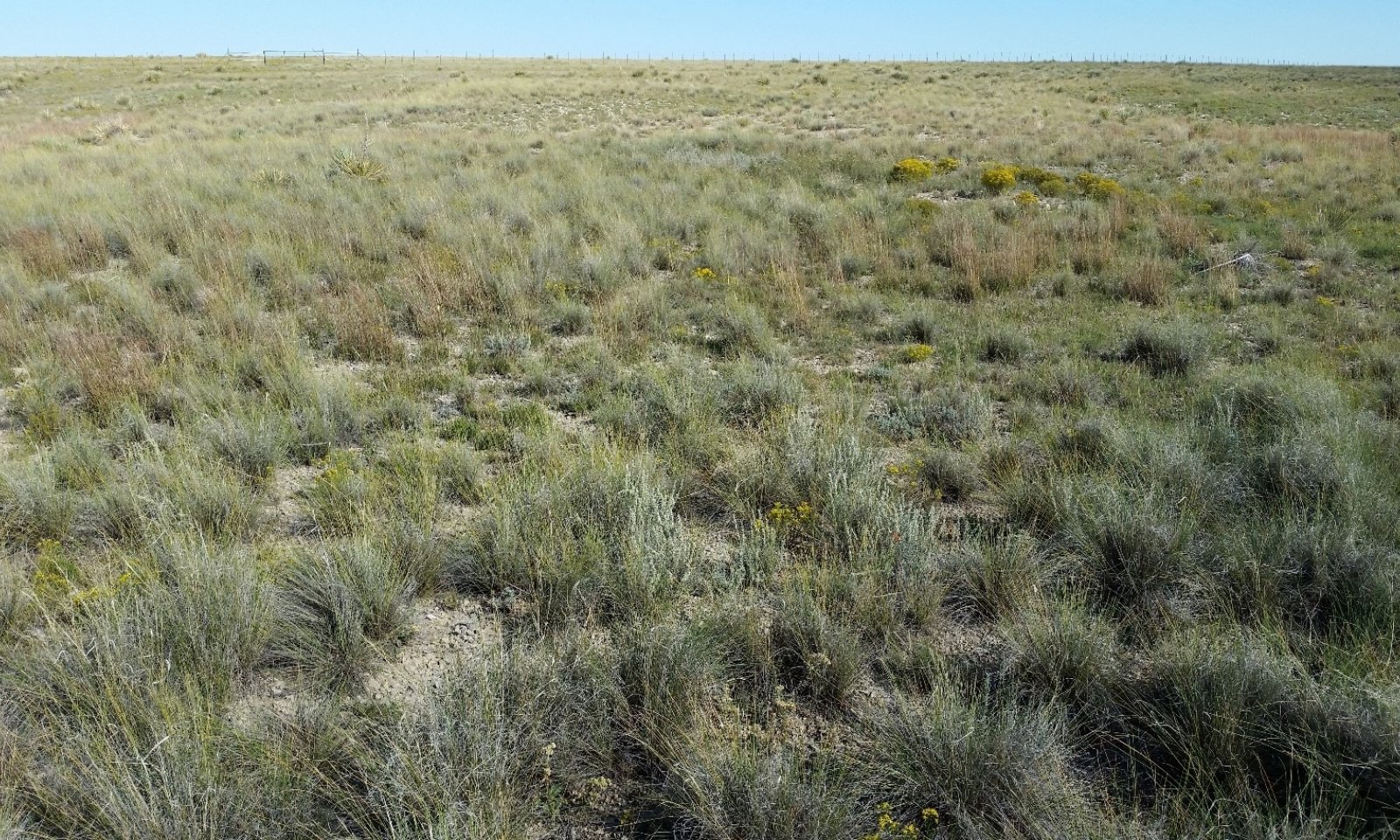
The Lithic Limestone ecological site occurs on plateau summits in the Canadian Plateaus LRU. This LRU occupies the western portion of MLRA 70A and extends from Las Vegas, NM at the southern end to beyond Raton, NM at its northern end. Elevation for the Canadian Plateaus LRU ranges from 5,000 to 7,500 feet.
The site concept for Lithic Limestone is soils that are up to 20 inches (50 centimeters) deep to lithic contact with limestone bedrock which occur on plateau summits with slopes of less than 10 percent. The soils of this site are distinguished from the soils of the Lithic Sandstone ecological site in that they are underlain by, and formed from materials weathered from limestone rather than sandstone bedrock. While the Limy Escarpments ecological site also contains soils with shallow limestone bedrock, it occurs on escarpments with slopes greater than 10 percent.
Landscape: Plateaus
Landforms: Plateau Summits
Slope: 0 to 10 percent, but mostly under 5 percent
Aspect: Aspect does not exert much influence on this ecological site.Associated sites
GX070A01X017 Playas
This site occurs in playas. Adjacent Lithic Limestone sites contribute water to this site via run-on and through-flow.
GX070A01X002 Clayey Uplands
This site occurs in soils that have high amounts of clay in subsurface horizons. Typically, these soils are on more stable landforms that have resisted erosion, or else they have subsurface horizons derived from shale residuum.
GX070A01X005 Limy
This site occurs where soils surfaces have strong or violent effervescence and ≥ 5% calcareous rock fragments. The Limy site frequently occurs on deep soils adjacent to Lithic Limestone. Limy also exists on alluvial landforms below the Lithic Limestone site.
GX070A01X007 Limy Escarpments
This site occurs on escarpments that contain visible rock outcrop, and that have both of the following properties at the soil surface: 1) strong or violent effervescence (HCl, 1N); 2) ≥ 5% calcareous surface fragments. Adjacent Lithic Limestone sites contribute water to this site via run-on and through-flow.
GX070A01X008 Ephemeral Drainageways
This site occurs on the channels and floodplains of ephemeral streams where salts have not accumulated. Adjacent Lithic Limestone sites contribute water to this site via run-on and through-flow.
GX070A01X021 Sandy
This site occurs in soils that are > 50 cm to a root restrictive layer and have surface textures of sandy loam or coarser with subsurface horizon textures of sandy clay loam or sandier. Such sites typically occur on sand sheets and dunes adjacent to playas or leeward from stream channels.
GX070A01X003 Loamy Uplands
This site occurs in soils that are deeper than 50 cm.
GX070A01X004 Shallow Loamy
This site occurs where soils have a paralithic contact to softer bedrock within 50 cm.
GX070A01X013 Lithic Sandstone
This site occurs where soils are ≤ 50 cm to lithic contact with sandstone bedrock, and often supports oneseed juniper savannahs.
Similar sites
R070AY003NM Shallow Upland
The Penrose components of the Lithic Limestone are currently correlated to the Shallow Upland (R070AY003NM) site. Penrose series is an MLRA 69 concept. As noted above, the plant community described in this ESD seems to have been developed using data from hotter, drier areas than the CP, such as MLRAs 70B and 70C.
R070AY001NM Loamy Upland
The Escabosa component of this site is correlated to the Loamy Upland (R070AY001NM) site. This may fit deeper subsets of the Escabosa components, but is a poor fit for soils less than 75 cm deep. Also note that the Loamy Upland site doesn’t reflect a site with limestone parent material. Refer to the Future Work section below for more information on this issue.
Table 1. Dominant plant species
Tree Not specified
Shrub Not specified
Herbaceous Not specified
Legacy ID
R070AA014NM


