
Natural Resources
Conservation Service
-
Search


Major Land Resource Area or ecological site by name and/or ID.
PreviousSectionsNextGeneral information
Approved. An approved ecological site description has undergone quality control and quality assurance review. It contains a working state and transition model, enough information to identify the ecological site, and full documentation for all ecosystem states contained in the state and transition model.
Click to explore map
Figure 1. Mapped extent
Areas shown in blue indicate the maximum mapped extent of this ecological site. Other ecological sites likely occur within the highlighted areas. It is also possible for this ecological site to occur outside of highlighted areas if detailed soil survey has not been completed or recently updated.
MLRA notes
Major Land Resource Area (MLRA): 066X–Dakota-Nebraska Eroded Tableland
The Dakota-Nebraska Eroded Tableland (MLRA 66) occurs in north-central Nebraska (56 percent) and south-central South Dakota (44 percent). MLRA 66 is approximately 3.6 million acres and covers all or parts of 12 counties between the two states. The northern border of the MRLA bisects Tripp County, South Dakota, just south of the town of Winner. Valentine is in the northeastern corner of Cherry County, Nebraska and is located on the MLRA’s southwestern border. From there, the MLRA stretches southeast to the northwestern corner of Antelope County, Nebraska and the town of O’Neil, Nebraska in Holt County its southeastern border.
The MLRA occupies a smooth fluvial plain primarily consisting of broad intervalley areas with terraces, river breaks, and local badlands along the well-defined major drainages. The slopes range from nearly level tablelands to steep ridges and drainages. The elevation ranges from 1,970 to 2,950 feet. The Keya Paha, Elkhorn, and the Niobrara Rivers flow through the MLRA. The Niobrara is a designated National Scenic River.
Layers of shaly chalk and limestone marine sediments overlaying the Cretaceous Niobrara Formation make up the bulk of the MLRA, though the western and southwestern portions exhibit surface eolian deposits. The floors of the major drainages are underlain by deposits of alluvial sand and gravel. The dominant soil orders in this MLRA are mesic, ustic or aridic Mollisols and Entisols. Loamy and sandy are the primary soil textures in this landscape.
Twenty-seven percent of the land in this MLRA has been broken out of native prairie and farmed, while sixty-six percent of the grasslands remain intact. The remaining acres are divided between forest, urban development, and other uses. Livestock grazing, primarily by cattle, is a major industry. Corn, winter wheat, and grain sorghum are the primary commodity crops but a significant number of acres are planted to forage sorghum and alfalfa for harvest as hay. With limited irrigation available, and annual precipitation averaging from 18 inches in the west to 25 inches in the east, crop production is marginal across most of the MLRA.
The historical matrix vegetation type is mixed-grass prairie. Big bluestem, sand bluestem, prairie sandreed, little bluestem, sideoats grama, and blue grama make up the bulk of the warm-season species. Western wheatgrass, green needlegrass, and needle and thread are the dominant cool-season grasses. Large- and small-patch vegetative communities are found primarily along the riparian zones, on lowland sites, and in closed depressions. Woodlands make up about 3 percent of MLRA 66 and consist primarily of green ash, bur oak, and hackberry. Ponderosa pines can be found on steeper sites in the western portion of the landscape.
Wildlife flourishes in this combination of crop and grassland environments. In a landscape historically occupied by bison herds, white-tailed and mule deer are now the most abundant wild ungulates. Pronghorns also number among the remaining native grazers. A variety of smaller species, including coyote, raccoon, opossum, porcupines, muskrat, beaver, squirrel, prairie dogs, and mink, thrive in the region. Grassland birds, including several upland game birds, are common across the MLRA.
This landscape serves as a backdrop for a disturbance-driven ecosystem, evolving under the influences of herbivory, fire, and variable climate. Historically, these processes created a heterogeneous mosaic of plant communities and structure heights across the region. Any given site in this landscape burned every six to ten years, with most of the MLRA experiencing a six to eight year fire regime. The fires were caused by lightning strikes and were also set by Native Americans, who used fire for warfare, signaling, and to refresh the native grasses. Indigenous inhabitants understood the value of fire as a tool, and that the highly palatable growth following a fire provided excellent forage for their horses and attracted grazing game animals such as bison and elk.
Land use patterns by post-European settlers have greatly altered the historical fire regime, allowing the expansion of woody species. Fragmentation of the native grasslands by conversion to cropland, transportation corridors, and other developments has contributed to disruption of the natural fire regime of this ecosystem. The most common encroaching woody species is eastern redcedar. While eastern redcedar is native to the landscape, the historic population in MLRA 66 was limited to isolated pockets in rugged river drainageways that were protected from wildfire. Widespread plantings of windbreaks with eastern redcedar as a primary component provide a seed source for the aggressive woody plant which further facilitates woody encroachment. Encroachment of native and introduced shrubs and trees into the native grasslands degrades wildlife habit and causes significant forage loss for domestic livestock. Aggressive fire suppression policies have exacerbated this process to the point that shrub and tree encroachment is a major ecological threat to grasslands throughout most of the MLRA.Classification relationships
►EPA◄
Level IV Ecoregions of the Conterminous United States
43—Northwestern Great Plains:
43i—Keya Paha Tablelands.
►USDA◄
Land Resource Regions and Major Land Resource Areas (USDA-NRCS, 2006)
Land Resource Region: G—Western Great Plains Range and Irrigated Region:
Major Land Resource Area (MLRA): 66 Dakota-Nebraska Eroded Tableland.Ecological site concept
The Wet Land ecological site is a run-on site found primarily on wet swales, and in river and stream valleys on slopes of 0 to 2 percent. The site is saturated or ponded for a long duration on or near the surface during the growing season. The soils are poorly to very poorly drained, and the water table is within 20 inches of the surface.
Vegetation in the Reference Plant Community (1.1) is dominated by a mixture of warm-season tallgrasses and grass-likes. Dominant grasses and grass-likes include prairie cordgrass, northern reedgrass, and various sedges. Forbs are common and diverse. The site is susceptible to invasion of non-native, cool-season grasses.Associated sites
R066XY046NE Subirrigated
The Subirrigated ecological site is often located adjacent to the Wet Land ecological site but on a slightly higher landscape position.
Similar sites
R066XY046NE Subirrigated
The Subirrigated ecological site has a deeper water table, usually 20 to 36 inches, while the water table on Wetland ecological sites ranges from the surface to 20 inches.
Table 1. Dominant plant species
Tree Not specified
Shrub Not specified
Herbaceous (1) Spartina pectinata
(2) CalamagrostisPhysiographic features
The Wet Land ecological site is a run-on site and is typically located on floodplains of river valley. It may also occur on stream terraces and on nearly level wet swales of interdunes on uplands.

Figure 2. Block diagram for the Wetland site.
Table 2. Representative physiographic features
Landforms (1) Flood plain
(2) Stream terrace
(3) Swale
Runoff class Negligible to very high Flooding duration Very brief (4 to 48 hours) to brief (2 to 7 days) Flooding frequency None to frequent Ponding duration Long (7 to 30 days) Ponding frequency None to frequent Elevation 1900 – 3000 ft Slope 0 – 2 % Ponding depth 0 – 6 in Water table depth 0 – 20 in Aspect Aspect is not a significant factor Climatic features
MLRA 66 is considered to have a continental climate with cold winters and hot summers, low humidity, light rainfall, and much sunshine. Extremes in temperature may also abound. The climate is the result of this MLRA’s location near the geographic center of North America. There are few natural barriers on the northern Great Plains and the winds move freely across the plains and account for rapid changes in temperature.
Annual precipitation ranges from 18 to 25 inches per year. The normal average annual temperature is about 48°F. January is the coldest month with average temperatures ranging from about 19°F (Bonesteel, SD) to about 23°F (Ainsworth, NE). July is the warmest month with temperatures averaging from about 73°F (Harrington, SD) to about 75°F (Gregory, SD). The range of normal average monthly temperatures between the coldest and warmest months is about 54°F. This large annual range attests to the continental nature of the climate this area. Hourly winds average about ten miles per hour annually, ranging from about 11 miles per hour during the spring to about nine miles per hour during the summer. Daytime winds are generally stronger than nighttime and occasional strong storms may bring brief periods of high winds with gusts to more than 50 miles per hour.
Growth of native cool-season plants begins mid to late March and continues to late June. Native warm-season plants begin growth in early May and continue to late August. Green-up of cool-season plants may occur in September and October when adequate soil moisture is present.Table 3 Representative climatic features
Frost-free period (characteristic range) 110-130 days Freeze-free period (characteristic range) 130-150 days Precipitation total (characteristic range) 20-30 in Frost-free period (actual range) 100-130 days Freeze-free period (actual range) 120-150 days Precipitation total (actual range) 20-30 in Frost-free period (average) 120 days Freeze-free period (average) 140 days Precipitation total (average) 20 in Characteristic rangeActual rangeBarLineFigure 3. Monthly precipitation range
Characteristic rangeActual rangeBarLineFigure 4. Monthly minimum temperature range
Characteristic rangeActual rangeBarLineFigure 5. Monthly maximum temperature range
BarLineFigure 6. Monthly average minimum and maximum temperature
Figure 7. Annual precipitation pattern
Figure 8 Annual average temperature pattern
Climate stations used
-
(1) MARTIN 5 E [USC00395285], Martin, SD
-
(2) HARRINGTON [USC00393574], Tuthill, SD
-
(3) KILGORE 1NE [USC00254432], Kilgore, NE
-
(4) VALENTINE MILLER FLD [USW00024032], Valentine, NE
-
(5) SPRINGVIEW [USC00258090], Springview, NE
-
(6) AINSWORTH [USC00250050], Ainsworth, NE
-
(7) NEWPORT [USC00255925], Newport, NE
-
(8) ATKINSON 3SW [USC00250420], Atkinson, NE
-
(9) O NEILL [USC00256290], Oneill, NE
-
(10) BUTTE [USC00251365], Butte, NE
">Influencing water features
The hydrology of this site is directly affected by the water table which ranges from the surface to a depth of 20 inches.
Wetland description
According to the Cowardin system, The Wet Land ecological site can be either Lacustrine or Palustrine. The Lacustrine phase is littoral, permanently, semi-permanently, or seasonally flooded with an unconsolidated shoreline. The Palustrine phase is a Persistent Emergent Wetland, and permanently, semi-permanently, or seasonally flooded, or saturated. These wetland types include fens, and abandoned ox-bows.
Soil features
The soils associated with the Wet Land ecological site are very deep, somewhat poorly to very poorly drained on slopes that range from 0 to 2 percent. A number of soils have surfaces of mucky peat and slightly decomposed plant material. The majority of the soils are formed in loamy or sandy alluvium but some soils are formed from silty or clayey alluvium or from eolian deposits.
Runoff as evidenced by patterns of rill, gully, or other water flow is negligible due to the low slope gradient and high intake rate of these soils. Pedestalling of plants does not typically occur on this site.
The primary soil series correlated to the Wet Land site are Barney, Norway, Blackloup, and Loup. Other series correlated to the site include Almeria, Fedora, Herdcamp, Kezan, and Tryon. More information can be found in the various soil survey reports. Contact the local USDA Service Center for soil survey reports that include more detail specific to your location or visit Web Soil Survey (https://websoilsurvey.sc.egov.usda.gov).
Figure 9. Loup series profile
Table 4. Representative soil features
Parent material (1) Alluvium
(2) Eolian deposits
Surface texture (1) Loam
(2) Loamy fine sand
(3) Fine sandy loam
(4) Silt loam
(5) Silty clay loam
Family particle size (1) Loamy
(2) Sandy
Drainage class Somewhat poorly drained to very poorly drained Permeability class Moderately slow to rapid Soil depth 80 in Surface fragment cover <=3" 0 – 6 % Surface fragment cover >3" Not specified Available water capacity
(Depth not specified)2 – 7.9 in Calcium carbonate equivalent
(Depth not specified)0 – 20 % Electrical conductivity
(Depth not specified)0 – 4 mmhos/cm Sodium adsorption ratio
(Depth not specified)0 – 3 Soil reaction (1:1 water)
(Depth not specified)5.6 – 9.6 Subsurface fragment volume <=3"
(Depth not specified)0 – 9 % Subsurface fragment volume >3"
(Depth not specified)Not specified Ecological dynamics
Typically, the Wet Land ecological site is extremely stable. Species composition and production are typically constant under most management scenarios. Changes may occur in the plant communities due to short-term weather variations and impacts of native and exotic plant and animal species but the primary cause of change is ditching to drain the wetland. This practice usually results in a shift to another ecological site, usually the Subirrigated ecological site.
The State and Transition Model (STM) is depicted below and includes a Reference State (1) and a Mechanically Altered State (2). Each state represents the crossing of a major ecological threshold due to the alteration of the functional dynamic properties of the ecosystem. The primary properties observed to determine this change are soil stability, vegetative communities, and the hydrologic cycle. Each state may have one or more plant communities that fluctuate in species composition and abundance within the normal parameters of the state. Within each state, communities may degrade or recover in response to natural and man caused disturbances such as variation in the degree and timing of herbivory, presence or absence of fire, and climatic and local fluctuations in the precipitation regime. The processes that cause the movement between the states and communities are discussed in more detail in the state and community descriptions following the diagram.
Interpretations are primarily based on the Reference Community. It has been determined by study of rangeland relic areas, areas protected from excessive disturbance, and areas under long-term rotational grazing regimes. Trends in plant community dynamics ranging from heavily grazed to lightly grazed areas, seasonal use pastures, and historical accounts have been used as well. Plant communities, states, transitional pathways, and thresholds have been determined through similar studies and experience.State and transition model
Custom diagramStandard diagram
Figure 10. State and Transition Model Diagram. MLRA 66, Wet Land Ecological Site.
More interactive model formats are also available. View Interactive Models
More interactive model formats are also available. View Interactive Models
Click on state and transition labels to scroll to the respective textEcosystem states
T1A - Mechanical alteration to lower the water table on the site. State 1 submodel, plant communities
State 2 submodel, plant communities
State 1
Reference StateThe Reference State (1) describes the range of vegetative communities that occur on the Wet Land ecological site where the range of natural variability under historic conditions and disturbance regimes is mostly intact. The Reference State developed under the combined influences of climatic conditions, periodic fire activity, grazing by large herbivores, and impacts from small mammals and insects. High perennial grass cover and production allows for increased soil moisture retention, vegetative production and overall soil quality.
The Reference State includes one plant community phase which is the Reference Community (1.1). The Reference Community serves as a description of the native plant community that naturally occurs on the site when the natural disturbance regimes are intact or closely mimicked by management practices.Dominant plant species
-
prairie cordgrass (Spartina pectinata), grass
-
northern reedgrass (Calamagrostis stricta ssp. inexpansa), grass
-
bluejoint (Calamagrostis canadensis), grass
-
slimstem reedgrass (Calamagrostis stricta), grass
-
plains bluegrass (Poa arida), grass
-
sedge (Carex), other herbaceous
-
rush (Juncus), other herbaceous
-
spikerush (Eleocharis), other herbaceous
Community 1.1
Reference Community
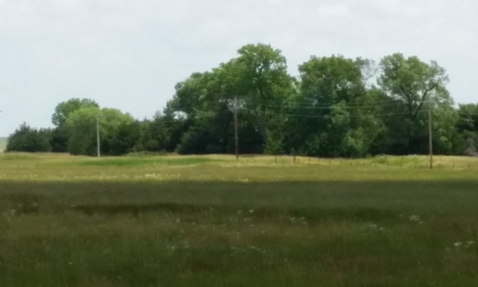
Figure 11. MLRA 66, Wet Land Ecological Site, Reference Community (1.1), Brown County, Nebraska.
The Reference Community or Prairie Cordgrass-Reedgrass (Spartina pectinata-Calamagrostis) Community (1.1) is a representation of the native plant community phase that occupies a site that has been minimally altered by management. Interpretations are primarily based on the Reference Community. This plant community is very resistant to any change that does not affect the associated water table. With a seasonably high water table that ranges from above the ground surface in wet years to within twenty inches the surface in dry years, traditional hayland management usually leaves these areas idle.
The dominant warm-season tallgrass is prairie cordgrass. Reedgrasses are also common in this community. A wide variety of grass-like plants are present and may comprise up to 30 percent of the plant community. Forbs include Pennsylvania and swamp smartweed, wild strawberry, and cinquefoil. Dominant shrubs are false indigo and willow. The potential vegetation is 50 to 60 percent grasses, 25 to 35 percent grass-like plants, 5 to 15 percent forbs, and 0 to 5 percent shrubs.
Wildlife species are the primary users of the Wet Land ecological site. Ditching has been a traditional management tool. Ditching facilitates livestock production by providing grazingland or hayland. Draining a wetland effectively changes the hydrology of the site and results in land that closely resembles a Subirrigated ecological site. Once ditched, wetland restoration requires significant inputs.Dominant plant species
-
prairie cordgrass (Spartina pectinata), grass
-
northern reedgrass (Calamagrostis stricta ssp. inexpansa), grass
-
bluejoint (Calamagrostis canadensis), grass
-
slimstem reedgrass (Calamagrostis stricta), grass
-
plains bluegrass (Poa arida), grass
-
sedge (Carex), other herbaceous
-
rush (Juncus), other herbaceous
-
spikerush (Eleocharis), other herbaceous
Figure 12. Annual production by plant type (representative values) or group (midpoint values)
Table 5. Annual production by plant type
Plant type Low
(lb/acre)Representative value
(lb/acre)High
(lb/acre)Grass/Grasslike 3625 4027 4300 Forb 225 360 675 Shrub/Vine 0 113 225 Total 3850 4500 5200 Figure 13. Plant community growth curve (percent production by month). NE6543 , NE/SD Sandhills, Native Grass, Wet. Warm-season dominant, cool-season subdominant, mid & tall grasses.
Jan Feb Mar Apr May Jun Jul Aug Sep Oct Nov Dec J F M A M J J A S O N D 0 0 0 5 20 35 25 10 5 0 0 0 State 2
Mechanically Drained StateThe Mechanically Drained State (2) occurs when drainage activities, primarily ditching, are conducted to lower the water level on the Wet Land ecological site to make haying or livestock grazing feasible. These actions convert the drained area into a site resembling a Subirrigated ecological site. While the resulting vegetation is similar to that found on Subirrigated ecological sites, the soil properties and hydrologic function are different from the Subirrigated ecological site.
Dominant plant species
-
big bluestem (Andropogon gerardii), grass
-
Indiangrass (Sorghastrum nutans), grass
-
northern reedgrass (Calamagrostis stricta ssp. inexpansa), grass
-
prairie cordgrass (Spartina pectinata), grass
Community 2.1
Converted Tallgrass CommunityThe Converted Tallgrass or Big Bluestem-Indiangrass-Switchgrass (Andropogon gerardii-Sorghastrum nutans-Panicum virgatum) Community (2.1) results when the Wet Land site is drained to lower the water table. This drainage activity results in a warm-season, tallgrass community that is similar to the Reference Community of Subirrigated ecological sites.
The plant community is 80 to 90 percent grasses and grass-likes, 5 to 10 percent forbs and 0 to 5 percent shrubs. The major grasses include big bluestem, Indiangrass, switchgrass, prairie cordgrass, northern reedgrass, bluejoint, and slimstem reedgrass.Dominant plant species
-
big bluestem (Andropogon gerardii), grass
-
Indiangrass (Sorghastrum nutans), grass
-
switchgrass (Panicum virgatum), grass
-
prairie cordgrass (Spartina pectinata), grass
-
northern reedgrass (Calamagrostis stricta ssp. inexpansa), grass
-
bluejoint (Calamagrostis canadensis), grass
-
slimstem reedgrass (Calamagrostis stricta), grass
Transition T1A
State 1 to 2The Reference State (1) transitions to the Mechanically Drained State (20 when the hydrology of the site is altered, usually by ditching the site. This mechanical draining lowers the water table level making haying and grazing feasible. Significant inputs are required to restore and maintain the high water table.
Additional community tables
Table 6. Community 1.1 plant community composition
Group Common name Symbol Scientific name Annual production () Foliar cover (%) Grass/Grasslike1 Warm-Season Tallgrass 1575–2475 prairie cordgrass SPPE Spartina pectinata 1125–2250 – marsh muhly MURA Muhlenbergia racemosa 0–225 – Grass, perennial 2GP Grass, perennial 0–90 – 2 Cool-Season Grasses 225–900 bluejoint CACA4 Calamagrostis canadensis 0–900 – northern reedgrass CASTI3 Calamagrostis stricta ssp. inexpansa 225–900 – slimstem reedgrass CASTS5 Calamagrostis stricta ssp. stricta 0–675 – plains bluegrass POAR3 Poa arida 225–450 – slender wheatgrass ELTRT Elymus trachycaulus ssp. trachycaulus 0–450 – foxtail barley HOJU Hordeum jubatum 0–225 – Grass, perennial 2GP Grass, perennial 0–90 – 3 Grass-Likes 1125–1575 sedge CAREX Carex 675–1350 – rush JUNCU Juncus 0–450 – bulrush SCHOE6 Schoenoplectus 0–225 – spikerush ELEOC Eleocharis 0–225 – Grass-like, perennial 2GLP Grass-like, perennial 0–225 – Forb4 Forbs 225–675 willowleaf aster SYPR5 Symphyotrichum praealtum 0–225 – swamp smartweed POHY2 Polygonum hydropiperoides 0–225 – Pennsylvania smartweed POPE2 Polygonum pensylvanicum 0–225 – white panicle aster SYLA6 Symphyotrichum lanceolatum 0–225 – cinquefoil POTEN Potentilla 0–90 – Virginia strawberry FRVI Fragaria virginiana 0–90 – American licorice GLLE3 Glycyrrhiza lepidota 0–90 – wild mint MEAR4 Mentha arvensis 0–90 – Forb, annual 2FA Forb, annual 0–90 – Forb, perennial 2FP Forb, perennial 0–90 – Shrub/Vine5 Shrubs 0–225 false indigo bush AMFR Amorpha fruticosa 0–135 – Missouri River willow SAER Salix eriocephala 0–135 – narrowleaf willow SAEX Salix exigua 0–135 – meadow willow SAPE5 Salix petiolaris 0–135 – Shrub (>.5m) 2SHRUB Shrub (>.5m) 0–90 – Table 7. Community 2.1 plant community composition
Group Common name Symbol Scientific name Annual production () Foliar cover (%) Interpretations
Animal community
Grazing by domestic livestock is one of the major income-producing industries in the area. Rangeland in this area may provide year-long forage for cattle, sheep, or horses. During the dormant period, the protein levels of the forage may be lower than the minimum needed to meet livestock (primarily cattle and sheep)requirements. The following table lists suggested stocking rates for cattle under continuous season-long grazing under normal growing conditions. These are conservative estimates that should be used only as guidelines in the initial stages of the conservation planning process. Often, the current plant composition does not entirely match any particular plant community (as described in this ecological site description). Because of this, a field visit is recommended, in all cases, to document plant composition and production. More precise carrying capacity estimates should eventually be calculated using this information along with animal preference data, particularly when grazers other than cattle are involved. With consultation of the land manager, more intensive grazing management may result in improved harvest efficiencies and increased carrying capacity.
The Wet Land site is typically only grazed during dry periods when the water table drops to the lower range of the depth for this site. Since the water table is still relatively high production during these drier periods can be near the representative value for the site.
Production and Carrying Capacity*
Community 1.1, Reference Community: 4,500 lbs/acre, 1.23 AUM/acre
*Based upon the following conditions: continuous season-long grazing by cattle under average growing conditions, 25 percent harvest efficiency. Air dry forage requirements based on 3 percent of animal body weight, or 912 lbs/AU/month.
WILDLIFE INTERPRETATIONS:
Major Land Resource Area (MLRA) 66 lies primarily within the Mixed-grass prairie ecosystem. Though European settlers have converted about a quarter of this landscape to farmland, the majority of the prairie is still intact. This area still consists of diverse grassland habitats interspersed with varying densities of depressional wetlands and limited woody riparian corridors. These habitats historically provided critical life cycle components for the grassland birds, prairie dogs, and herds of roaming bison, elk, and pronghorn. Bobcats, wolves, and mountain lions occupied the apex predator niche. Diverse populations of small mammals and insects still provide a bountiful prey base for raptors and omnivores such as coyotes, foxes, raccoons, and opossums. In addition, a wide variety of reptiles and amphibians thrive in this landscape.
The Mixed-Grass Prairie was a disturbance-driven ecosystem with fire, herbivory, and climate functioning as the primary disturbances. Following European settlement, elimination of fire, overgrazing, and some habitat fragmentation significantly altered the appearance and functionality of the entire ecosystem. Bison and prairie dogs were historically keystone species, but free-roaming bison herds have been extirpated in this region. The loss of bison and fire as ecological drivers greatly influenced the character of the remaining native grasslands and the habitats that they provide. Fragmentation has reduced habitat quality for numerous area-sensitive species, as highlighted by the decline of the greater prairie chicken.
Historically, an ecological mosaic of the sites provided habitat for species requiring unfragmented grasslands. Most of these important habitat features and components are intact, providing upland nesting habitat for grassland birds and game birds; nesting and escape cover for waterfowl; forbs and insects for brood-rearing habitat; and a forage source for small and large herbivores.
Disruption of the natural fire regime and lack of appropriate grazing management are the greatest threats to the ecosystem dynamics today. Tree and shrub encroachment from lack of fire creates habitat that favors generalist species such as American robin and mourning dove, and provides perches for raptors, increasing the predation mortality on native bird populations. Introduced species such as smooth bromegrass, Kentucky bluegrass, nodding plumeless thistle (musk thistle), and Canada thistle further degrade the biological integrity of many areas of the prairie.
The Wet Land ecological site usually occupies small areas on the landscape. These small areas provide excellent habitat for waterfowl and shorebirds and are important during the migration season for a wide variety of avian species as well as for a smaller number of species during the breeding season.Hydrological functions
Excessive water is the principal factor limiting forage production on the Wetland site. Soils on this site are in Hydrologic Soil Group D due to high water tables. Although soils are permeable, high water tables limit infiltration. Surrounding upland areas tend to have very permeable soils that cause surface inflow peaks to these sites to be muted. Outflows typically occur as a result of intense storms or seepage inflows during very wet years. Many areas are frequently to continuously flooded.
For the interpretive plant community, rills and gullies are not typically present. Water flow patterns should be barely distinguishable if at all present. Pedestals are not typically present. Litter falls in place, and signs of movement are not common. Litter often accumulates to create muck peat like conditions. Chemical and physical crusts are rare. Cryptogamic crusts are present but are not expected to significantly affect hydrologic considerations. Overall, this site has the appearance of being stable and productive.Recreational uses
This site provides hunting opportunities for upland game and waterfowl species. The wide variety of plants which bloom from spring until fall have an aesthetic value that appeals to visitors.
Wood products
No appreciable wood products are present on the site.
Other products
None noted.
Other information
Field Offices (Counties)
Nebraska:
Ainsworth, (Brown, Keya Paha, and Rock)
Bloomfield, (Knox,)
Spencer (Boyd)
Neligh (Antelope)
O'Neill, (Holt)
Valentine, (Cherry)
South Dakota:
Burke, (Gregory)
Martin, (Bennett and Shannon)
Winner, (Tripp)
White River, (Mellette and Todd)Supporting information
Inventory data references
Information presented here has been derived from NRCS clipping data and other inventory data. Field observations from range- trained personnel also were used. Those involved in developing this site include Wayne Bachman, Soil Scientist, NRCS; Stan Boltz, Range Management Specialist, NRCS; Anna Ferguson, Soil Conservationist, NRCS; Roger Hammer, Soil Scientist, NRCS; Dana Larsen, Range Management Specialist, NRCS; Dave Schmidt, Rangeland Management Specialist, NRCS; Kim Stine, Rangeland Management Specialist, NRCS.
Other references
High Plains Regional Climate Center, University of Nebraska.(http://www.hprcc.unl.edu/)
U.S. Department of Agriculture, Natural Resources Conservation Service. 2003. National Range and Pasture Handbook. (https://www.nrcs.usda.gov/national-range-and-pasture-handbook)
U.S. Department of Agriculture, Natural Resources Conservation Service. National Water and Climate Center. (http://www.wcc.nrcs.usda.gov/climate).
U.S. Department of Agriculture, Natural Resources Conservation Service. 2021b. National Soil Information System. (https://www.nrcs.usda.gov/resources/education-and-teaching-materials/national-soil-information-system-nasis).
U.S. Department of Agriculture, Natural Resources Conservation Service. 2021c. National soil survey handbook, title 430-VI. (http://soils.usda.gov/technical/handbook/).
Soil Survey Staff. 2021. Web soil survey. U.S. Department of Agriculture, Natural Resources Conservation Service. (https://websoilsurvey.sc.egov.usda.gov/)
USDA, NRCS. 2001. The PLANTS Database, Version 3.1 (http://plants.usda.gov). National Plant Data Center, Baton Rouge, LA USA.
USDA, NRCS, various published Soil SurveysContributors
Dana Larsen
Doug Whisenhunt
Nadine BishopApproval
Suzanne Mayne-Kinney, 11/18/2024
Acknowledgments
Many thanks to the members of the soils, local practitioners and technical teams, as well as the editor. This Ecological Site was approved for publication in March of 2021. Non-discrimination statement In accordance with Federal civil rights law and U.S. Department of Agriculture (USDA) civil rights regulations and policies, the USDA, its Agencies, offices, and employees, and institutions participating in or administering USDA programs are prohibited from discriminating based on race, color, national origin, religion, sex, gender identity (including gender expression), sexual orientation, disability, age, marital status, family/parental status, income derived from a public assistance program, political beliefs, or reprisal or retaliation for prior civil rights activity, in any program or activity conducted or funded by USDA (not all bases apply to all programs). Remedies and complaint filing deadlines vary by program or incident. Persons with disabilities who require alternative means of communication for program information (e.g., Braille, large print, audiotape, American Sign Language, etc.) should contact the responsible Agency or USDA's TARGET Center at (202) 720-2600 (voice and TTY) or contact USDA through the Federal Relay Service at (800) 877-8339. Additionally, program information may be made available in languages other than English. To file a program discrimination complaint, complete the USDA Program Discrimination Complaint Form, AD-3027, found online at How to File a Program Discrimination Complaint and at any USDA office or write a letter addressed to USDA and provide in the letter all of the information requested in the form. To request a copy of the complaint form, call (866) 632-9992. Submit your completed form or letter to USDA by: (1) mail: U.S. Department of Agriculture, Office of the Assistant Secretary for Civil Rights, 1400 Independence Avenue, SW, Washington, D.C. 20250-9410; (2) fax: (202) 690-7442; or (3) email: program.intake@usda.gov.
Rangeland health reference sheet
Interpreting Indicators of Rangeland Health is a qualitative assessment protocol used to determine ecosystem condition based on benchmark characteristics described in the Reference Sheet. A suite of 17 (or more) indicators are typically considered in an assessment. The ecological site(s) representative of an assessment location must be known prior to applying the protocol and must be verified based on soils and climate. Current plant community cannot be used to identify the ecological site.
Author(s)/participant(s) Original Author: Stan Boltz Version V participants: Emily Helms, Nadine Bishop, Jeff Nichols Contact for lead author jeffrey.nichols@usda.gov Date 11/18/2024 Approved by Approval date Composition (Indicators 10 and 12) based on Annual Production Indicators
-
Number and extent of rills:
None. Rills are not expected on this site. -
Presence of water flow patterns:
None. Water flow patterns are not expected on this site. -
Number and height of erosional pedestals or terracettes:
None. Pedestals and terracettes are not expected on this site. -
Bare ground from Ecological Site Description or other studies (rock, litter, lichen, moss, plant canopy are not bare ground):
Bare ground is typically less than 5 percent. Bare ground is exposed mineral soil that is not covered by vegetation (basal and/or foliar canopy), standing dead vegetation, gravel/rock, and visible biological crust (e.g., lichen, mosses, algae). -
Number of gullies and erosion associated with gullies:
None. Gullies are not expected on this site. -
Extent of wind scoured, blowouts and/or depositional areas:
None. Wind-scoured areas and depositional areas are not expected on this site. -
Amount of litter movement (describe size and distance expected to travel):
Litter should fall in place. Slight amount of movement of fine litter (less than 12 inches) from water is possible, but not normal. Litter movement from wind is not expected. -
Soil surface (top few mm) resistance to erosion (stability values are averages - most sites will show a range of values):
Soil stability ratings should typically be 5 to 6, normally 6. Surface organic matter adheres to the soil surface. Soil surface fragments will typically retain structure indefinitely when dipped in distilled water. -
Soil surface structure and SOM content (include type of structure and A-horizon color and thickness):
The A-horizon should be 4 to 10 inches (10-25 cm) thick. Soil colors range from gray to dark gray (values of 3 to 6) when dry and very dark gray to black (values of 2 to 4) when moist. Structure varies significantly with soil series and ranges from weak fine granular, strong medium granular, weak coarse prismatic, to weak thin platy. The primary soil series correlated to the Wet Land ecological site are Barney, Norway, Blackloup, and Loup. Other soil series correlated to the site are Almeria, Fedora, Herdcamp, Kezan, and Tryon. -
Effect of community phase composition (relative proportion of different functional groups) and spatial distribution on infiltration and runoff:
The functional/structural groups provide a combination of rooting depths and structure which positively influences infiltration. A combination of shallow and deep rooted species with fine and coarse roots positively influences infiltration. Invasion of introduced cool-season grasses may have an adverse impact on infiltration and runoff. Woody encroachment may also negatively influence infiltration. The expected composition of the plant community is approximately 50 to 60 percent perennial grasses, 25 to 35 percent grass-likes, 5 to 15 percent forbs, and 0 to 5 percent shrubs. The perennial grass component is made up of C4, tall rhizomatous grasses (35-50%) and C3 grasses (5 to 20%). -
Presence and thickness of compaction layer (usually none; describe soil profile features which may be mistaken for compaction on this site):
None. A compaction layer should not be present, -
Functional/Structural Groups (list in order of descending dominance by above-ground annual-production or live foliar cover using symbols: >>, >, = to indicate much greater than, greater than, and equal to):
Dominant:
Phase 1.1 1. Native, perennial, C4 tallgrass, 1575-2475 #/ac, 35-50% (1 species minimum): prairie cordgrass, marsh muhly. 2. Grass-likes, 1125-1575, 25-35% (1 species minimum): sedge, rush, bulrush, spikerush.Sub-dominant:
Phase 1.1 1. Native, perennial, C3 grass, 225-900 #ac, 5-20% (2 species minimum): bluejoint, northern reedgrass, slimstem reedgrass, plains bluegrass, slender wheatgrass, foxtail barley. 2. Native forbs, 225-675 #/ac, 5-15% (4 species minimum): willowleaf aster, swamp smartweed, Pennsylvania smartweed, American licorice, white panicle aster, and other forbs that vary from location to location.Other:
Minor - Phase 1.1 1. Shrubs, 0-225 #/ac, 0-5%: false indigo bush, Missouri River willow, narrowleaf willow, meadow willow, and other shrubs.Additional:
The Reference Community (1.1) consists of five F/S groups. These groups are in order of relative abundance native, perennial, warm-season tallgrass; grass-likes; native, perennial, cool-season grass; forbs, and shrubs. -
Amount of plant mortality and decadence (include which functional groups are expected to show mortality or decadence):
Bunch grasses have strong, healthy centers with few (less than 3 percent) dead centers. Shrubs may show some dead branches (less than 5 percent) as plants age. -
Average percent litter cover (%) and depth ( in):
Plant litter cover is evenly distributed throughout the site and is expected to be 80 to 90 percent and at a depth of 0.50 to 1.5 inch (1.3-4 cm). -
Expected annual annual-production (this is TOTAL above-ground annual-production, not just forage annual-production):
The representative value (RV) for annual production is 4,500 pounds per acre on an air dry weight basis. Low and High production years should yield 3,850 to 5,200 pounds per acre respectively. -
Potential invasive (including noxious) species (native and non-native). List species which BOTH characterize degraded states and have the potential to become a dominant or co-dominant species on the ecological site if their future establishment and growth is not actively controlled by management interventions. Species that become dominant for only one to several years (e.g., short-term response to drought or wildfire) are not invasive plants. Note that unlike other indicators, we are describing what is NOT expected in the reference state for the ecological site:
No non-native invasive species are present. Canada thistle, reed canarygrass, creeping foxtail, common watercress, leafy spurge, quackgrass, redtop, and purple loosestrife are known invasives that have the potential to become dominant or co-dominant on this site. Consult the state noxious weed and state watch lists for potential invasive species. Note: species that become dominant for only one to several years (e.g., short-term response to drought or wildfire) are not invasive plants. -
Perennial plant reproductive capability:
All perennial species exhibit high vigor relative to recent weather conditions. Perennial grasses should have vigorous rhizomes or tillers; vegetative and reproductive structures are not stunted. All perennial species should be capable of reproducing annually.
Print Options
Sections
Font
AAAAOther
PrintThe Ecosystem Dynamics Interpretive Tool is an information system framework developed by the USDA-ARS Jornada Experimental Range, USDA Natural Resources Conservation Service, and New Mexico State University.
Accessibility statement


