
Natural Resources
Conservation Service
-
Search


Major Land Resource Area or ecological site by name and/or ID.
PreviousSectionsNextGeneral information
Provisional. A provisional ecological site description has undergone quality control and quality assurance review. It contains a working state and transition model and enough information to identify the ecological site.
MLRA notes
Major Land Resource Area (MLRA): 063A–Northern Rolling Pierre Shale Plains
MLRA 63A is approximately 10,160 square miles in size, the majority of which is in South Dakota and a very small portion in North Dakota. The MLRA extends west of the northern half of the South Dakota reach of the Missouri River. All five of the major rivers draining western South Dakota cross this area. From north to south, these are the Grand, Moreau, Cheyenne, Bad, and White Rivers.
Elevation range from 1,300 to 1,640 feet on the bottom land along the Missouri River to 1,640 to 2,950 feet on the shale plain uplands. Cretaceous Pierre Shale underlies almost all of this area. This is a marine sediment having layers of volcanic ash that has been altered to smectitic clays. These clays shrink as they dry and swell as they get wet. Tertiary and Quaternary river deposits, remnants of erosion from the Black Hills uplift, cap isolated highlands in this area. Deposits of alluvial sand and gravel occur on the valley floors adjacent to the major streams in the area.
The average annual precipitation in this area is 15 to 20 inches.
The vegetation in this area is a transition from eastern tall grass prairie to a western mixed grass prairie, (USDA-NRCS, Ag Handbook 296).Classification relationships
Land Resource Region (LRR): G - Western Great Plains Range and Irrigated Region, Major Land Resource Area (MLRA): 63A Northern Rolling Pierre Shale Plains, (USDA Ag Handbook 296).
Level IV Ecoregions of the Conterminous United States, 2013: 43c – River Breaks and 43f – Subhumid Pierre Shale Plains.Ecological site concept
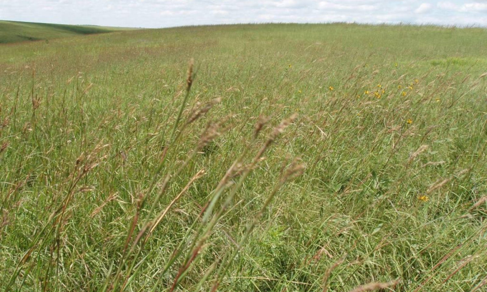
The Limy Clay Ecological Site occurs throughout the MLRA. It is located on upland landscapes, is a run off site and does not receive additional water from runoff or overflow. Slopes range from 2 to 30 percent. The soils are moderately deep, but rooting depths exceed 20 inches. The surface layer, or “A” horizon, is less than 6 inches in depth with a silty clay or clayey texture. Carbonates are present at or near the soil surface and throughout the soil profile. Weathered shale chips are also found throughout the soil profile. The vegetation in reference consists of a mix of warm- and cool-season grasses. Big bluestem, needlegrasses, western wheatgrass, little bluestem and prairie sandreed are dominant. Forbs are common and diverse but never dominant, shrubs, can be present but are minor or trace components. Western snowberry commonly occurs on this site.
Associated sites
R063AY017SD Shallow Clay
Shallow Clay
R063AY012SD Thin Upland
Thin Upland
R063AY021SD Clayey Overflow
Clayey Overflow [more big bluestem; higher production]
R063AY010SD Loamy
Loamy. [less green needlegrass; more needleandthread] Loam surface texture.
Similar sites
R063AY010SD Loamy
Loamy [less green needlegrass; more needleandthread]
R063AY021SD Clayey Overflow
Clayey Overflow [more big bluestem; higher production]
Table 1. Dominant plant species
Tree Not specified
Shrub Not specified
Herbaceous (1) Andropogon gerardii
(2) Pascopyrum smithiiPhysiographic features
This site occurs on mild to moderately steep sloping uplands. Parent materials are calcareous shale.
Table 2. Representative physiographic features
Landforms (1) Fan
(2) Hill
(3) Plain
Runoff class High Flooding frequency None Ponding frequency None Elevation 1650 – 2650 ft Slope 9 – 25 % Ponding depth 0 in Water table depth 80 – 0 in Aspect Aspect is not a significant factor Climatic features
MLRA 63A is considered to have a continental climate – cold winters and hot summers, low humidity, light rainfall, and abundant sunshine. Extreme temperature fluctuations are also common. The climate is the result of this MLRA’s location near the geographic center of North America. There are few natural barriers on the Northern Great Plains and air masses move freely across the plains and account for rapid changes in temperature.
Annual precipitation ranges from 16 to 20 inches per year. The average annual temperature is about 47°F. January is the coldest month with average temperatures ranging from about 11°F (Pollock, South Dakota (SD)), to about 22°F (Cedar Butte, SD). July is the warmest month with temperatures averaging from about 72°F (Pollock, SD), to about 76° F (Cedar Butte, SD). The range of normal average monthly temperatures between the coldest and warmest months is about 58°F. This large annual range attests to the continental nature of this area's climate. Hourly winds are estimated to average about 11 miles per hour annually, ranging from about 13 miles per hour during the spring to about 10 miles per hour during the summer. Daytime winds are generally stronger than nighttime and occasional strong storms may bring brief periods of high winds with gusts to more than 50 miles per hour.
Growth of cool-season plants begins in early to mid-March, slowing or ceasing in late June. Warm-season plants begin growth about mid-May and continue to early or mid-September. Green up of cool-season plants may occur in September and October when adequate soil moisture is present.Table 3 Representative climatic features
Frost-free period (characteristic range) 110-120 days Freeze-free period (characteristic range) 130-130 days Precipitation total (characteristic range) 20-20 in Frost-free period (actual range) 100-120 days Freeze-free period (actual range) 130-130 days Precipitation total (actual range) 20-20 in Frost-free period (average) 110 days Freeze-free period (average) 130 days Precipitation total (average) 20 in Characteristic rangeActual rangeBarLineFigure 1. Monthly precipitation range
Characteristic rangeActual rangeBarLineFigure 2. Monthly minimum temperature range
Characteristic rangeActual rangeBarLineFigure 3. Monthly maximum temperature range
BarLineFigure 4. Monthly average minimum and maximum temperature
Figure 5. Annual precipitation pattern
Figure 6 Annual average temperature pattern
Climate stations used
-
(1) POLLOCK [USC00396712], Pollock, SD
-
(2) KENNEBEC [USC00394516], Kennebec, SD
-
(3) CEDAR BUTTE 1NE [USC00391539], White River, SD
-
(4) COTTONWOOD 2 E [USC00391972], Kadoka, SD
">Influencing water features
No riparian areas or wetland features are directly associated with this site.
Wetland description
Not Applicable.
Soil features
The Lakoma soil correlated to this site has a silty clay to clay surface texture on slopes of 2 to 30 percent. This soil is moderately deep, well drained, and have moderately rapid permeability. This soil is calcareous and formed from weathered Pierre shale. Subsurface soil texture is para-channery clay and contains up to 50 percent shale fragments. The soil profile typically has a granular surface and subangular blocky subsurface structure, with many weathered shale fragments throughout. A calcic horizon typically occurs between 12 to 28 inches (30 to 71 cm) but strong effervescence occurs at or near the soil surface.
This site should show slight to no evidence of rills. There may be some slight erosion due to wind and some pedestalling of plants does occur. Water flow paths are broken, irregular in appearance, or discontinuous with numerous debris dams or vegetative barriers. Soil blowing is a severe hazard.
These soils are mainly susceptible to water and wind erosion. The hazard of water erosion increases on slopes greater than about five percent. Loss of 50 percent or more of the surface layer of the soils on this site can result in a shift in species composition and/or production.Table 4. Representative soil features
Parent material (1) Residuum – clayey shale
Surface texture (1) Silty clay
(2) Clay
Family particle size (1) Clayey
Drainage class Well drained Permeability class Very slow to moderately rapid Depth to restrictive layer 20 – 80 in Soil depth 20 – 80 in Surface fragment cover <=3" Not specified Surface fragment cover >3" Not specified Available water capacity
(0-60in)3 – 5 in Calcium carbonate equivalent
(0-40in)10 – 30 % Soil reaction (1:1 water)
(0-40in)7.4 – 8.4 Subsurface fragment volume <=3"
(0-40in)0 – 12 % Subsurface fragment volume >3"
(0-40in)Not specified Ecological dynamics
This site developed under Northern Great Plains climatic conditions, light to severe grazing by bison and other large herbivores, sporadic natural or man-caused wildfire (often of light intensities), and other biotic and abiotic factors that typically influence soil/site development. Changes will occur in the plant communities due to short-term weather variations, impacts of native and/or exotic plant and animal species, and management actions. While the following plant community descriptions describe more typical transitions between communities that will occur, severe disturbances, such as periods of well below average precipitation, can cause significant shifts in plant communities and/or species composition.
As this site deteriorates, species such as sedges, forbs, and blue grama will increase. Perennial grasses such as big bluestem, porcupine grass, prairie sandreed, and little bluestem will decrease in frequency and production. In extreme cases, bare ground and possibly dunes (shale chips) may form due to lack of ground cover. Soil erosion can greatly influence the existing plant communities. Depositional areas tend to be dominated by prairie sandreed and bluestem, while the areas from which soil is transported tend to be characterized by sedge, rush, and bare ground. However, the amount of deposition and transport can alter the plant communities. The historic and recent grazing impacts will also influence the plant composition. Big bluestem, western wheatgrass and prairie sandreed are important plants to this site. The rhizomes of these plants help hold and bind the soil. As these species decrease, the hazard for wind erosion increases. Areas can become bare dune like areas.
Interpretations are primarily based on the Bluestem-Needlegrass-Wheatgrass Plant Community. It has been determined by study of rangeland relic areas, areas protected from excessive disturbance, and areas under long-term rotational grazing regimes. Trends in plant community dynamics ranging from heavily grazed to lightly grazed areas, seasonal use pastures, and historical accounts also have been used. Plant communities, states, transitional pathways, and thresholds have been determined through similar studies and experience.
The following is a diagram that illustrates the common plant communities that can occur on the site and the transition pathways between communities. The ecological processes will be discussed in more detail in the plant community descriptions following the diagram.
State and transition model
Custom diagramStandard diagram
Figure 7. Limy Clay - R063AY030SD

Figure 8. Limy Clay - R063AY030SD
More interactive model formats are also available. View Interactive Models
More interactive model formats are also available. View Interactive Models
Click on state and transition labels to scroll to the respective textEcosystem states
State 2 submodel, plant communities
State 3 submodel, plant communities
State 4 submodel, plant communities
State 1
Reference StateThis State represents what is believed to show the natural range of variability that dominated the dynamics of the ecological site prior to European settlement. This site, in reference, is dominated by a mix of warm- and cool-season grasses. Grazing or lack of grazing is the primary drivers between plant community phases. Depending on the season of use, continuous seasonal grazing can push this plant community to warm-season dominated or a cool-season dominated grassland. Non-use and no fire will result in heavy litter accumulations and the invasion of non-native cool-season grasses.
Dominant plant species
-
leadplant (Amorpha canescens), shrub
-
rose (Rosa), shrub
-
western snowberry (Symphoricarpos occidentalis), shrub
-
big bluestem (Andropogon gerardii), grass
-
porcupinegrass (Hesperostipa spartea), grass
-
sideoats grama (Bouteloua curtipendula), grass
-
western wheatgrass (Pascopyrum smithii), grass
-
sun sedge (Carex inops ssp. heliophila), grass
-
composite dropseed (Sporobolus compositus), grass
-
prairie sandreed (Calamovilfa longifolia), grass
-
green needlegrass (Nassella viridula), grass
-
slender wheatgrass (Elymus trachycaulus), grass
-
little bluestem (Schizachyrium scoparium), grass
-
needle and thread (Hesperostipa comata), grass
-
white sagebrush (Artemisia ludoviciana), other herbaceous
-
goldenrod (Solidago), other herbaceous
-
scurfpea (Psoralidium), other herbaceous
-
white heath aster (Symphyotrichum ericoides), other herbaceous
Community 1.1
Bluestem-Needlegrass-Wheatgrass Plant Community
Interpretations are based primarily on the Bluestem-Needlegrass-Wheatgrass Plant Community which is considered to be the reference Plant Community. This plant community can be found on areas that are properly managed with grazing and/or prescribed burning, and sometimes on areas receiving occasional short periods of rest. The potential vegetation is about 85 percent grasses or grass-like plants, 10 percent forbs, and 5 percent woody plants. The community is dominated by cool- and warm-season grasses. Patches of snowberry often occurs across the site.
The major grasses include big bluestem, porcupine grass, sideoats grama, and western wheatgrass. Other grasses include tall dropseed, prairie sandreed, green needlegrass, slender wheatgrass, little bluestem, and needleandthread. This plant community is extremely resilient and well adapted to the Northern Great Plains climatic conditions. The diversity in plant species allows for high drought tolerance. This is a sustainable plant community in regards to site/soil stability, watershed function, and biologic integrity.
Figure 9. Annual production by plant type (representative values) or group (midpoint values)
Table 5. Annual production by plant type
Plant type Low
(lb/acre)Representative value
(lb/acre)High
(lb/acre)Grass/Grasslike 1950 2379 2760 Forb 25 117 235 Shrub/Vine 25 104 205 Total 2000 2600 3200 Figure 10. Plant community growth curve (percent production by month). SD6304 , Pierre Shale Plains, warm-season dominant, cool-season subdominant. Warm-season dominant, cool-season subdominant.
Jan Feb Mar Apr May Jun Jul Aug Sep Oct Nov Dec J F M A M J J A S O N D 0 0 3 7 17 25 25 15 7 1 0 0 Community 1.2
Bluestem-Tall Dropseed Plant CommunityThis plant community developed with early spring grazing at high stock densities or through winter grazing. Big bluestem and other warm-season species can increase to almost complete dominance on this plant community. Production is high and the vigor of big bluestem is very high. Plant diversity is lower as the big bluestem occupies a large extent of the site.
Figure 11. Annual production by plant type (representative values) or group (midpoint values)
Table 6. Annual production by plant type
Plant type Low
(lb/acre)Representative value
(lb/acre)High
(lb/acre)Grass/Grasslike 2120 2760 3360 Forb 25 135 275 Shrub/Vine 55 105 165 Total 2200 3000 3800 Community 1.3
Needlegrass-Wheatgrass-Tall Dropseed-Bluegrass Plant CommunityThis plant community developed under continuous season-long grazing or from over utilization during extended drought periods. This plant community can also develop with extended periods of nonuse and no fire. The potential plant community is made up of approximately 90 to 95 percent grasses and grass-like species, 1 to 5 percent forbs, and 1 to 5 percent shrubs. Dominant grasses include porcupine grass, western wheatgrass, needleandthread, and tall dropseed. Grass or grass-like species of secondary importance include big bluestem, green needlegrass, little bluestem, slender wheatgrass, and sun sedge. Forbs commonly found in this plant community include cudweed sagewort, goldenrod, scurfpea, and heath aster. Shrubs present include leadplant, rose, and western snowberry.
When compared to the Bluestem-Needlegrass-Wheatgrass Plant Community, needleandthread, western wheatgrass, and sun sedge have increased. Big bluestem, prairie sandreed, and sideoats grama have decreased and production has been reduced. When this plant community is reached as a result on nonuse and no fire, Kentucky bluegrass will also increase significantly. This plant community is moderately resistant to change. The herbaceous species present are well adapted to grazing; however, species composition can be altered through long-term overgrazing. If the herbaceous component is intact, it tends to be resilient if the disturbance is not long-term. This plant community is at risk of transitioning to the Native/Invaded State (2.0) if Kentucky bluegrass is allowed to increase.
Figure 12. Annual production by plant type (representative values) or group (midpoint values)
Table 7. Annual production by plant type
Plant type Low
(lb/acre)Representative value
(lb/acre)High
(lb/acre)Grass/Grasslike 1370 1880 2380 Forb 15 60 110 Shrub/Vine 15 60 110 Total 1400 2000 2600 Figure 13. Plant community growth curve (percent production by month). SD6303 , Pierre Shale Plains, cool/warm-season codominant.. Cool-season, warm-season codominant..
Jan Feb Mar Apr May Jun Jul Aug Sep Oct Nov Dec J F M A M J J A S O N D 0 0 3 10 20 28 21 10 5 3 0 0 Pathway 1.1A
Community 1.1 to 1.2Heavy continuous seasonal grazing specifically during the spring growing season and/or winter grazing that extends into the early spring will convert the plant community to a warm-season dominated community (1.2). This plant community is common in winter pastures.
Pathway 1.1B
Community 1.1 to 1.3Continuous season-long grazing or nonuse and no fire will convert the plant community to the Needlegrass-Wheatgrass-Tall Dropseed-Bluegrass Plant Community (1.3).
Pathway 1.2A
Community 1.2 to 1.1Rotational grazing, providing proper stock density, change in season of use and adequate rest will quickly move this plant community to the Bluestem-Needlegrass-Wheatgrass Plant Community (1.1).
Pathway 1,3A
Community 1.3 to 1.1Prescribed grazing including proper stocking levels, changing season of use, and adequate recovery periods, will convert this plant community to the Bluestem-Needlegrass-Wheatgrass Plant Community (1.1).
State 2
Native/Invaded StateThis State has a significant amount of Kentucky bluegrass or smooth brome in the plant community but they have not become the dominate species. Preliminary studies would tend to indicate that when Kentucky bluegrass exceeds 30 percent of the plant community and native grasses represent less than 40 percent of the plant community composition the ecological process will be dominated by Kentucky bluegrass. Plant communities dominated by Kentucky bluegrass have significantly less cover and diversity of native grasses and forb species. (Toledo, D. et al., 2014). This State is at risk of transitioning to a bluegrass dominated State, however at this point in time, a bluegrass dominated State does not appear to occur on this Ecological Site in MLRA 63A.
Dominant plant species
-
leadplant (Amorpha canescens), shrub
-
rose (Rosa), shrub
-
western snowberry (Symphoricarpos occidentalis), shrub
-
Kentucky bluegrass (Poa pratensis), grass
-
smooth brome (Bromus inermis), grass
-
big bluestem (Andropogon gerardii), grass
-
porcupinegrass (Hesperostipa spartea), grass
-
sideoats grama (Bouteloua curtipendula), grass
-
western wheatgrass (Pascopyrum smithii), grass
-
sun sedge (Carex inops ssp. heliophila), grass
-
composite dropseed (Sporobolus compositus), grass
-
prairie sandreed (Calamovilfa longifolia), grass
-
green needlegrass (Nassella viridula), grass
-
slender wheatgrass (Elymus trachycaulus), grass
-
little bluestem (Schizachyrium scoparium), grass
-
needle and thread (Hesperostipa comata), grass
-
white sagebrush (Artemisia ludoviciana), other herbaceous
-
goldenrod (Solidago), other herbaceous
-
scurfpea (Psoralidium), other herbaceous
-
white heath aster (Symphyotrichum ericoides), other herbaceous
Community 2.1
Bluegrass-Needlegrass-Tall Dropseed Plant CommunityThis plant community develops either from long-term continuous season-long grazing or from extended periods of exclusion by large herbivores, fire suppression, and lack of other vegetation disturbance. When this plant community results from nonuse and no fire for extended periods, plant litter accumulates in large amounts when this community first develops. Litter buildup reduces mature plant vigor and density, and seedling recruitment declines. Eventually litter levels become high enough that plant density decreases. Typically, rhizomatous grasses form small colonies because of a lack of tiller stimulation.
Figure 14. Annual production by plant type (representative values) or group (midpoint values)
Table 8. Annual production by plant type
Plant type Low
(lb/acre)Representative value
(lb/acre)High
(lb/acre)Grass/Grasslike 930 1356 1770 Forb 70 113 165 Shrub/Vine 0 31 65 Total 1000 1500 2000 Figure 15. Plant community growth curve (percent production by month). SD6301 , Pierre Shale Plains, cool-season dominant.. Cool-season dominant on uplands..
Jan Feb Mar Apr May Jun Jul Aug Sep Oct Nov Dec J F M A M J J A S O N D 0 0 4 12 25 36 10 5 4 4 0 0 State 3
Eroded StateIn extreme cases, heavy continuous grazing, heavy disturbance, or frequent and sever defoliation can cause this site to erode down to shale chips. At this point a significant amount of the most of the top soil is lost and the plant communities can look very much like those on a Shallow Porous Clay Ecological Site.
Dominant plant species
-
sun sedge (Carex inops ssp. heliophila), grass
-
little bluestem (Schizachyrium scoparium), grass
-
prairie sandreed (Calamovilfa longifolia), grass
Community 3.1
Sedge-Little Bluestem-Prairie Sandreed, Bare GroundThis plant community evolved under heavy continuous seasonal grazing, frequent and sever defoliation or from over utilization during extended drought periods. The potential plant community is made up of approximately 80 percent grasses and grass-like species, 10 percent forbs, and 10 percent shrubs. This plant community is characterized by considerable amounts of bare ground, and the erosion potential is high. The dominant grass or grass-likes species include sun sedge, little bluestem and small clumps of prairie sandreed. Restoration may be difficult if not impossible, depending on the amount of top soil loss.
State 4
Go-Back, Introduced or Invaded StateThis State occurs through cultivation and or seeding to perennial pasture forage grasses/legumes. This State includes two separate vegetation states that are highly variable in nature. They are derived through three distinct management scenarios, and are not related successionally. Infiltration, runoff and soil erosion varies depending on the vegetation present on the site.
Dominant plant species
-
broom snakeweed (Gutierrezia sarothrae), shrub
-
sweetclover (Melilotus), shrub
-
deathcamas (Zigadenus), shrub
-
prickly lettuce (Lactuca serriola), shrub
-
Canadian horseweed (Conyza canadensis), shrub
-
forage kochia (Bassia prostrata), shrub
-
foxtail (Alopecurus), shrub
-
sunflower (Helianthus), shrub
-
crested wheatgrass (Agropyron cristatum), grass
-
intermediate wheatgrass (Thinopyrum intermedium), grass
-
alfalfa (Medicago), grass
-
threeawn (Aristida), grass
-
Kentucky bluegrass (Poa pratensis), grass
-
smooth brome (Bromus inermis), grass
-
field brome (Bromus arvensis), grass
-
buffalograss (Bouteloua dactyloides), grass
-
western wheatgrass (Pascopyrum smithii), grass
Community 4.1
Go-back, Introduced or InvadedThe Go-back Land state can be reached whenever severe mechanical disturbance occurs (e.g., tilled and abandoned land, either past or present). During the early successional stages, the species that mainly dominate are annual grasses and forbs, later being replaced by both native and introduced perennials. The vegetation on this site varies greatly, sometimes being dominated by threeawn, bluegrass, smooth bromegrass, annual brome, crested wheatgrass, buffalograss, broom snakeweed, sweetclover, and non-native thistles. Other plants that commonly occur on the site include western wheatgrass, deathcamas, prickly lettuce, marestail, kochia, foxtail, and sunflowers. Bare ground is prevalent due to the loss of organic matter and lower overall soil health.
The Introduced state is normally those areas seeded to crested wheatgrass, pubescent wheatgrass, intermediate wheatgrass, alfalfa, or other introduced species. Refer to the associated Forage Suitability Group description for adapted species.
Transition 1A
State 1 to 2Invasion of non-native cool season grasses, heavy continuous season-long grazing or non-use and no fire for extended periods will convert this plant community to the Native/Invaded State (2.0).
Transition 1B
State 1 to 3Heavy continuous grazing, heavy disturbance or frequent and sever defoliation resulting in erosion and significant soil loss.
Transition 5A
State 1 to 4This State (4.0), is the result of the cultivation and abandonment or seeding of perennial forage species.
Restoration pathway 2A
State 2 to 1Prescribed burning followed by long-term prescribed grazing may shift this plant community back to the Reference State. This transition may not be rapid or meet management goals.
Transition 5A
State 2 to 4This State is the result of the cultivation and abandonment or seeding of perennial forage species.
Transition 5A
State 3 to 4This State is the result of the cultivation and abandonment or seeding of perennial forage species.
Additional community tables
Table 9. Community 1.1 plant community composition
Group Common name Symbol Scientific name Annual production () Foliar cover (%) Grass/Grasslike1 TALL WARM-SEASON GRASSES 520–1040 big bluestem ANGE Andropogon gerardii 390–910 – composite dropseed SPCOC2 Sporobolus compositus var. compositus 130–390 – prairie sandreed CALO Calamovilfa longifolia 52–260 – switchgrass PAVI2 Panicum virgatum 0–130 – 2 NEEDLEGRASS 260–650 porcupinegrass HESP11 Hesperostipa spartea 260–520 – green needlegrass NAVI4 Nassella viridula 130–260 – needle and thread HECOC8 Hesperostipa comata ssp. comata 0–208 – 3 MID WARM-SEASON GRASSES 130–520 sideoats grama BOCU Bouteloua curtipendula 52–390 – little bluestem SCSC Schizachyrium scoparium 26–208 – prairie dropseed SPHE Sporobolus heterolepis 0–130 – 4 WHEATGRASSES 130–390 western wheatgrass PASM Pascopyrum smithii 130–390 – slender wheatgrass ELTR7 Elymus trachycaulus 0–260 – 5 OTHER NATIVE GRASSES 52–130 Grass, perennial 2GP Grass, perennial 26–130 – blue grama BOGR2 Bouteloua gracilis 26–130 – prairie Junegrass KOMA Koeleria macrantha 26–78 – 6 GRASS-LIKES 26–130 sun sedge CAINH2 Carex inops ssp. heliophila 26–130 – Dudley's rush JUDU2 Juncus dudleyi 0–52 – Grass-like (not a true grass) 2GL Grass-like (not a true grass) 0–52 – Forb8 FORBS 26–208 longbract spiderwort TRBR Tradescantia bracteata 26–78 – Forb, native 2FN Forb, native 26–78 – white sagebrush ARLU Artemisia ludoviciana 26–52 – false boneset BREU Brickellia eupatorioides 0–52 – purple prairie clover DAPU5 Dalea purpurea 26–52 – blacksamson echinacea ECAN2 Echinacea angustifolia 0–52 – hairy false goldenaster HEVI4 Heterotheca villosa 0–52 – dotted blazing star LIPU Liatris punctata 26–52 – scurfpea PSORA2 Psoralidium 26–52 – upright prairie coneflower RACO3 Ratibida columnifera 0–52 – goldenrod SOLID Solidago 26–52 – white heath aster SYER Symphyotrichum ericoides 26–52 – American vetch VIAM Vicia americana 26–52 – large Indian breadroot PEES Pediomelum esculentum 0–26 – scarlet beeblossom GACO5 Gaura coccinea 0–26 – milkvetch ASTRA Astragalus 0–26 – western yarrow ACMIO Achillea millefolium var. occidentalis 0–26 – Shrub/Vine9 SHRUBS 26–182 leadplant AMCA6 Amorpha canescens 26–130 – western snowberry SYOC Symphoricarpos occidentalis 26–78 – Shrub (>.5m) 2SHRUB Shrub (>.5m) 0–78 – skunkbush sumac RHTR Rhus trilobata 0–52 – rose ROSA5 Rosa 26–52 – Table 10. Community 1.2 plant community composition
Group Common name Symbol Scientific name Annual production () Foliar cover (%) Grass/Grasslike1 TALL WARM-SEASON GRASSES 1050–1950 big bluestem ANGE Andropogon gerardii 900–1800 – composite dropseed SPCOC2 Sporobolus compositus var. compositus 60–300 – switchgrass PAVI2 Panicum virgatum 0–240 – prairie sandreed CALO Calamovilfa longifolia 30–150 – 2 NEEDLEGRASS 150–300 porcupinegrass HESP11 Hesperostipa spartea 60–300 – green needlegrass NAVI4 Nassella viridula 30–240 – needle and thread HECOC8 Hesperostipa comata ssp. comata 0–150 – 3 MID WARM-SEASON GRASSES 60–300 sideoats grama BOCU Bouteloua curtipendula 30–240 – little bluestem SCSC Schizachyrium scoparium 30–210 – prairie dropseed SPHE Sporobolus heterolepis 0–120 – 4 WHEATGRASSES 60–300 slender wheatgrass ELTR7 Elymus trachycaulus 0–300 – western wheatgrass PASM Pascopyrum smithii 60–300 – 5 OTHER NATIVE GRASSES 60–150 Grass, perennial 2GP Grass, perennial 30–90 – blue grama BOGR2 Bouteloua gracilis 0–90 – prairie Junegrass KOMA Koeleria macrantha 30–60 – 6 GRASS-LIKES 30–150 sun sedge CAINH2 Carex inops ssp. heliophila 30–120 – Dudley's rush JUDU2 Juncus dudleyi 0–60 – Grass-like (not a true grass) 2GL Grass-like (not a true grass) 0–60 – 7 NON-NATIVE GRASSES 0–60 cheatgrass BRTE Bromus tectorum 0–60 – bluegrass POA Poa 0–60 – Forb8 FORBS 30–240 Forb, native 2FN Forb, native 30–90 – white sagebrush ARLU Artemisia ludoviciana 30–60 – false boneset BREU Brickellia eupatorioides 0–60 – purple prairie clover DAPU5 Dalea purpurea 30–60 – blacksamson echinacea ECAN2 Echinacea angustifolia 0–60 – dotted blazing star LIPU Liatris punctata 30–60 – scurfpea PSORA2 Psoralidium 30–60 – upright prairie coneflower RACO3 Ratibida columnifera 0–60 – goldenrod SOLID Solidago 30–60 – white heath aster SYER Symphyotrichum ericoides 30–60 – longbract spiderwort TRBR Tradescantia bracteata 30–60 – American vetch VIAM Vicia americana 30–60 – Forb, introduced 2FI Forb, introduced 0–60 – Indian breadroot PEDIO2 Pediomelum 0–30 – scarlet beeblossom GACO5 Gaura coccinea 0–30 – hairy false goldenaster HEVI4 Heterotheca villosa 0–30 – milkvetch ASTRA Astragalus 0–30 – western yarrow ACMIO Achillea millefolium var. occidentalis 0–30 – Shrub/Vine9 SHRUBS 60–150 leadplant AMCA6 Amorpha canescens 30–120 – rose ROSA5 Rosa 30–60 – western snowberry SYOC Symphoricarpos occidentalis 0–60 – skunkbush sumac RHTR Rhus trilobata 0–30 – Table 11. Community 1.3 plant community composition
Group Common name Symbol Scientific name Annual production () Foliar cover (%) Grass/Grasslike1 TALL WARM-SEASON GRASSES 100–300 big bluestem ANGE Andropogon gerardii 20–200 – composite dropseed SPCOC2 Sporobolus compositus var. compositus 20–200 – prairie sandreed CALO Calamovilfa longifolia 0–40 – switchgrass PAVI2 Panicum virgatum 0–20 – 2 NEEDLEGRASS 300–600 porcupinegrass HESP11 Hesperostipa spartea 200–500 – needle and thread HECOC8 Hesperostipa comata ssp. comata 100–300 – green needlegrass NAVI4 Nassella viridula 40–200 – 3 MID WARM-SEASON GRASSES 40–200 little bluestem SCSC Schizachyrium scoparium 20–200 – sideoats grama BOCU Bouteloua curtipendula 20–100 – prairie dropseed SPHE Sporobolus heterolepis 0–60 – 4 WHEATGRASSES 200–600 western wheatgrass PASM Pascopyrum smithii 200–500 – slender wheatgrass ELTR7 Elymus trachycaulus 0–200 – 5 OTHER NATIVE GRASSES 100–200 blue grama BOGR2 Bouteloua gracilis 20–160 – Grass, perennial 2GP Grass, perennial 20–100 – prairie Junegrass KOMA Koeleria macrantha 20–60 – 6 GRASS-LIKES 100–300 sun sedge CAINH2 Carex inops ssp. heliophila 40–200 – Dudley's rush JUDU2 Juncus dudleyi 0–100 – Grass-like (not a true grass) 2GL Grass-like (not a true grass) 0–100 – 7 NON-NATIVE GRASSES 20–160 bluegrass POA Poa 20–160 – cheatgrass BRTE Bromus tectorum 0–60 – Forb8 FORBS 20–100 goldenrod SOLID Solidago 20–60 – white sagebrush ARLU Artemisia ludoviciana 20–60 – Forb, introduced 2FI Forb, introduced 0–40 – Forb, native 2FN Forb, native 0–40 – slimflower scurfpea PSTE5 Psoralidium tenuiflorum 20–40 – white heath aster SYER Symphyotrichum ericoides 20–40 – longbract spiderwort TRBR Tradescantia bracteata 0–20 – American vetch VIAM Vicia americana 0–20 – upright prairie coneflower RACO3 Ratibida columnifera 0–20 – western yarrow ACMIO Achillea millefolium var. occidentalis 0–20 – milkvetch ASTRA Astragalus 0–20 – false boneset BREU Brickellia eupatorioides 0–20 – purple prairie clover DAPU5 Dalea purpurea 0–20 – blacksamson echinacea ECAN2 Echinacea angustifolia 0–20 – dotted blazing star LIPU Liatris punctata 0–20 – Shrub/Vine9 SHRUBS 20–100 leadplant AMCA6 Amorpha canescens 0–40 – rose ROSA5 Rosa 0–40 – western snowberry SYOC Symphoricarpos occidentalis 0–40 – skunkbush sumac RHTR Rhus trilobata 0–20 – Shrub (>.5m) 2SHRUB Shrub (>.5m) 0–20 – Table 12. Community 2.1 plant community composition
Group Common name Symbol Scientific name Annual production () Foliar cover (%) Table 13. Community 3.1 plant community composition
Group Common name Symbol Scientific name Annual production () Foliar cover (%) Table 14. Community 4.1 plant community composition
Group Common name Symbol Scientific name Annual production () Foliar cover (%) Interpretations
Animal community
Animal Community – Grazing Interpretations
The following table lists annual, suggested initial stocking rates with average growing conditions. These are conservative estimates that should be used only as guidelines in the initial stages of conservation planning. Often, the current plant composition does not entirely match any particular plant community (as described in this ecological site description). Because of this, a resource inventory is necessary to document plant composition and production. More accurate carrying capacity estimates should eventually be calculated using the following stocking rate information along with animal preference data and actual stocking records, particularly when grazers other than cattle are involved. With consultation of the land manager, more intensive grazing management may result in improved harvest efficiencies and increased carrying capacity.
Bluestem-Needlegrass-Wheatgrass Plant Community (1.1)
Ave annual Production (lbs/acre, air-dry): 2600
Stocking rate (AUM/acre): 0.71
Bluestem-Tall Dropseed Plant Community (1.2)
Ave Annual Preproduction (lbs/acre, air-dry): 3000
Stocking rate (AUM/acre): 0.82
Needlegrass-Wheatgrass-Tall Dropseed-Bluegrass Plant Community (1.3)
Ave Annual Production (lbs/acre, air-dry): 2000
Stocking rate (AUM/acre): 0.55
Bluegrass-Needlegrass-Tall Dropseed Plant Community (2.1)
Ave Annual Production (lbs/acre, air-dry): 1500
Stocking rate (AUM/acre): 0.41
*Based on 912 lbs./acre (air-dry weight) per Animal Unit Month (AUM), and on 25 percent harvest efficiency (refer to USDA NRCS, National Range and Pasture Handbook).
Grazing by domestic livestock is one of the major income-producing industries in the area. Rangeland in this area may provide yearlong forage. During the dormant period, the forage for livestock will likely be lacking protein to meet livestock requirements, and added protein will allow ruminants to better utilize the energy stored in grazed plant materials. A forage quality test (either directly or through fecal sampling) should be used to determine the level of supplementation needed.
Hydrological functions
Water is the principal factor limiting forage production on this site. This site is dominated by soils in hydrologic group B. Infiltration and runoff potential for this site varies from moderate to high depending on soil hydrologic group, slope and ground cover. In many cases, areas with greater than 75 percent ground cover have the greatest potential for high infiltration and lower runoff. An example of an exception would be where shortgrasses form a strong sod and dominate the site. Areas where ground cover is less than 50 percent have the greatest potential to have reduced infiltration and higher runoff (refer to Section 4, NRCS National Engineering Handbook for runoff quantities and hydrologic curves).
Recreational uses
This site provides hunting, hiking, photography, bird watching, and other opportunities. The wide varieties of plants that bloom from spring until fall have an esthetic value that appeals to visitors.
Wood products
No appreciable wood products are typically present on this site.
Other products
Seed harvest of native plant species can provide additional income on this site.
Other information
Revision Notes: “Previously Approved Provisional
This Provisional ecological site concept has passed Quality Control (QC) and Quality Assurance (QA) to ensure that the site meets the 2014 NESH standards for a Provisional ecological site. This is an updated “Previously Approved” ESD which represents a first generation tier of documentation that prior to the release of the 2014 National Ecological Site Handbook (NESH), met all requirement as an Approved ESD as laid out in the 2003 National Range and Pasture Handbook (NRPH). The document fully describe the reference state and community phase in the state and transition model. All other alternative states are at least described in narrative form. The “Previously Approved” ESD has been field tested for a minimum of five years and is a proven functional document for conservation planning. The “Previously Approved” ESD does not contain all tabular and narrative entries as required in the current Approved level of documentation but it is expected that the “Previously Approved” ESD will continue refinement towards an Approved status.
Site Development and Testing Plan:
Future work, as described in a Project Plan, to validate the information in this Provisional Ecological Site Description is needed. This will include field activities to collect low, medium and high intensity sampling, soil correlations, and analysis of that data. Annual field reviews should be done by soil scientists and vegetation specialists. A final field review, peer review, quality control, and quality assurance reviews of the ESD will be needed to produce the final document.
Supporting information
Inventory data references
Information presented here has been derived from NRCS clipping data and other inventory data. Field observations from range-trained personnel were also used. Those involved in developing this site include: Stan Boltz, Range Management Specialist (RMS), NRCS; Kent Cooley, Soil Scientist, NRCS; Rick Peterson, RMS, NRCS; and L. Michael Stirling, RMS, NRCS. No SCS-RANGE-417 clipping data forms have been recorded on this site.
Other references
High Plains Regional Climate Center, University of Nebraska. (http://www.hprcc.unl.edu/)
Teledo, D., Sanderson, M., Spaeth, K., Hendrickson, J., Printz, J. 2014. Extent of Kentucky Bluegrass and Its Effect on Native Plant Species Diversity and Ecosystem Services in the Northern Great Plains of the United States. Invasive Plant Science and Management. 7(4):543-522. Weed Science Society of America.
USDA, NRCS. Land Resource Regions and Major Land Resource Areas of the United States, the Caribbean, and the Pacific Basin. U.S. Department of Agriculture Handbook 296, 2006
USDA, NRCS. National Ecological Site Handbook, 1st Ed. January, 2014
USDA, NRCS. National Water and Climate Center. (http://www.wcc.nrcs.usda.gov/)
USDA, NRCS. National Range and Pasture Handbook, September 1997
USDA, NRCS. National Soil Information System, Information Technology Center. (http://nasis.nrcs.usda.gov)
USDA, NRCS. 2001. The PLANTS Database, Version 3.1 (http://plants.usda.gov). National Plant Data Center.
USDA, NRCS, Various Published Soil SurveysContributors
Betty Bisch
Stan Boltz
Ezra Hoffman, Ecological Site Specialist, NRCSApproval
Suzanne Mayne-Kinney, 6/26/2024
Acknowledgments
Rick L. Peterson ESD Update 7/26/16
Rangeland health reference sheet
Interpreting Indicators of Rangeland Health is a qualitative assessment protocol used to determine ecosystem condition based on benchmark characteristics described in the Reference Sheet. A suite of 17 (or more) indicators are typically considered in an assessment. The ecological site(s) representative of an assessment location must be known prior to applying the protocol and must be verified based on soils and climate. Current plant community cannot be used to identify the ecological site.
Author(s)/participant(s) Stan Boltz Contact for lead author stanley.boltz@sd.usda.gov, 605-352-1236 Date 05/08/2010 Approved by Approval date Composition (Indicators 10 and 12) based on Annual Production Indicators
-
Number and extent of rills:
None typical on more vegetated areas – some rills on exposed shale. -
Presence of water flow patterns:
None, or barely visible and discontinuous. -
Number and height of erosional pedestals or terracettes:
Pedestals are sometimes present, but not common. Vegetated areas adjacent to bare shale areas are sometimes elevated above shale. -
Bare ground from Ecological Site Description or other studies (rock, litter, lichen, moss, plant canopy are not bare ground):
5 to 20 percent is typical on well vegetated area – higher amounts may be found on exposed shale. -
Number of gullies and erosion associated with gullies:
None should be present. -
Extent of wind scoured, blowouts and/or depositional areas:
None. -
Amount of litter movement (describe size and distance expected to travel):
Litter should fall in place. Slight amount of movement of smallest size class litter is possible, but not normal. -
Soil surface (top few mm) resistance to erosion (stability values are averages - most sites will show a range of values):
Soil aggregate stability ratings should typically be 5 to 6, normally 6. Surface organic matter adheres to the soil surface. Soil surface fragments will typically retain structure indefinitely when dipped in distilled water. -
Soil surface structure and SOM content (include type of structure and A-horizon color and thickness):
A-horizon should be 2 to 6 inches thick with mollic (dark) colors when moist. Structure typically is medium to fine granular at least in the upper A-horizon. -
Effect of community phase composition (relative proportion of different functional groups) and spatial distribution on infiltration and runoff:
Combination of shallow and deep rooted species (mid & tall rhizomatous and tufted perennial cool-season grasses) with fine and coarse roots positively influences infiltration. -
Presence and thickness of compaction layer (usually none; describe soil profile features which may be mistaken for compaction on this site):
None. -
Functional/Structural Groups (list in order of descending dominance by above-ground annual-production or live foliar cover using symbols: >>, >, = to indicate much greater than, greater than, and equal to):
Dominant:
Tall warm-season rhizomatous grasses > Mid/tall cool-season bunchgrasses >Sub-dominant:
Mid warm-season grasses > Mid cool-season rhizomatous grasses >Other:
Forbs > Shrubs > Grass-likes = Short warm-season grassesAdditional:
-
Amount of plant mortality and decadence (include which functional groups are expected to show mortality or decadence):
Very little evidence of decadence or mortality. Bunch grasses have strong, healthy centers and shrubs are vigorous. -
Average percent litter cover (%) and depth ( in):
-
Expected annual annual-production (this is TOTAL above-ground annual-production, not just forage annual-production):
Production ranges from 2,000-3,200 lbs./acre (air-dry weight). Reference value production is 2,600 lbs./acre (air-dry weight). -
Potential invasive (including noxious) species (native and non-native). List species which BOTH characterize degraded states and have the potential to become a dominant or co-dominant species on the ecological site if their future establishment and growth is not actively controlled by management interventions. Species that become dominant for only one to several years (e.g., short-term response to drought or wildfire) are not invasive plants. Note that unlike other indicators, we are describing what is NOT expected in the reference state for the ecological site:
State and local noxious weeds, Kentucky bluegrass, annual bromes -
Perennial plant reproductive capability:
All species exhibit high vigor relative to climatic conditions. Do not rate based solely on seed production. Perennial grasses should have vigorous rhizomes or tillers.
Print Options
Sections
Font
AAAAOther
PrintThe Ecosystem Dynamics Interpretive Tool is an information system framework developed by the USDA-ARS Jornada Experimental Range, USDA Natural Resources Conservation Service, and New Mexico State University.
Accessibility statement


