
Natural Resources
Conservation Service
Ecological site R062XC024SD
Shallow Loamy - South
Last updated: 7/31/2024
Accessed: 08/28/2026
-
Search


Major Land Resource Area or ecological site by name and/or ID.
PreviousSectionsNextGeneral information
Provisional. A provisional ecological site description has undergone quality control and quality assurance review. It contains a working state and transition model and enough information to identify the ecological site.
Click to explore map
Figure 1. Mapped extent
Areas shown in blue indicate the maximum mapped extent of this ecological site. Other ecological sites likely occur within the highlighted areas. It is also possible for this ecological site to occur outside of highlighted areas if detailed soil survey has not been completed or recently updated.
MLRA notes
Major Land Resource Area (MLRA): 062X–Black Hills
The Black Hills (MLRA 62) is a unique, low lying mountain range situated in the midst of a mixed short and mid-grass prairie. It is a true Island in the Plains, as it has geophysical and biological attributes that are unlike the surrounding area. The Black Hills have strong floristic ties to four of the North American biomes: Cordilleran (Rocky Mountain) Forest, Northern Coniferous Forest, Eastern Deciduous Forest, and Grasslands.
MLRA 62 is approximately 3,040 square miles in size; 74 percent is located in South Dakota, and 26 percent is in Wyoming. The towns of Lead, Deadwood, Hill City, and Custer, South Dakota, are in this area. U.S. Highways 16 and 385 cross the MLRA. The Black Hills National Forest, Custer State Park, Mt. Rushmore National Monument, Jewel Cave National Monument, and Wind Cave National Park are located in this MLRA.
This area forms the core of the Black Hills and the Bear Lodge Mountains where the elevation ranges between 3,600 to 6,565 feet, however, Black Elk Peak (Harney Peak) rises to 7,242 feet. Slopes range from moderately sloping on some of the high plateaus to very steeply sloping along drainageways and on peaks and ridges. Narrow valleys generally are gently sloping to strongly sloping.
The Black Hills uplift is the product of the Laramide mountain-building episodes that produced most of the ranges in the Rocky Mountains. Uplift began near the end of the Cretaceous period, 65 million years ago and ended by 35 million years ago (Froiland 1999). The core of the Black Hills is a plutonic mass of granite with steeply dipping metamorphic rocks, primarily slate and schist, which directly surrounds the granite core. A plateau of Mississippian limestone surrounds the igneous and metamorphic rock core. The Madison limestone is broken around the outer edges of the uplifted area. The Permian Minnekahta limestone forms the outermost boundary of the area. Many other tilted sandstone, shale, and limestone units are exposed like a bathtub ring inside the steeply dipping Madison limestone.
The dominant soil orders in this MLRA are Alfisols (forest soils) and Mollisols (grassland soils). The soils in the area have a frigid or cryic soil temperature regime, a udic or ustic soil moisture regime, and mixed, micaceous, or smectitic mineralogy. They are shallow to very deep, generally well drained, and loamy in texture.
The Black Hills MLRA supports open to dense forest vegetation. Ponderosa pine is the dominant species across the Black Hills. White spruce grows at the higher elevations and along the major drainageways. Bur oak is found intermixed with pine in the northern and eastern fringes of the Black Hills, and Rocky Mountain juniper is most common in the southern portion of the Black Hills. Aspen is of minor extent throughout the Black Hills area. Roughleaf ricegrass, slender wheatgrass, bearded wheatgrass, poverty oatgrass, Richardson’s needlegrass, and mountain ricegrass are the most common native grasses under open forest stands. The most common native shrubs are common snowberry, bearberry, common juniper, Oregon grape, and Saskatoon serviceberry.
MLRA 62 land ownership is approximately 47 percent private and 53 percent federal. Rangeland and forestland are split almost equally between private and federal ownership (47 percent each). Minor areas of land are privately owned cropland and urban development. The forestland in this area is used mainly for timber production, recreation, and grazing.
The major resource concerns are soil erosion and surface compaction caused by logging, mining, wildfires, grazing, and urban expansion. The quality of ground and surface water is another concern, especially in the northern part of the Black Hills. The primary cause is contamination from mine waste and septic systems in areas of rural development and urban expansion (USDA-NRCS, 2006: Ag Handbook 296).LRU notes
For development of ecological sites, MLRA 62 is divided into three Land Resource Units (LRU’s) or physiographic zones (A, B, C, and Y). Each LRU has a set of ecological sites that represents these zones.
The LRU is identified in the Ecological Site ID: R062XY000SD; “062X” identifies the MLRA, the next letter “Y” identifies the LRU. Note: The organization of Ecological Site ID’s will likely change in the future.
LRU-A includes the northern Black Hills and Bear Lodge Mountains (22-30” PZ); LRU-B includes the high elevation central core of the Black Hills (25-35” PZ); and LRU-C includes the southern portion of the Black Hills (17-21” PZ).
The Forest ecological sites are representative of sites in the Black Hills, Bear Lodge Mountains (MLRA-62), and the surrounding Dakota Hogback (MLRA-61). These sites are separated by elevation, soil temperature regimes, and slope.
The Low Mountain area includes all of the Black Hills, Bear Lodge Mountains, and Dakota Hogback below 6,200 feet in elevation (LRU’s A and C). The soils in this area have a frigid soil temperature regime.
The High Mountain area includes all of the Black Hills above 6,200 feet elevation (LRU-B). The soils in this area have a cryic soil temperature regime.Classification relationships
USDA
Land Resource Region G—Western Great Plains Range and Irrigated Region:
Major Land Resource Area (MLRA) 62—Black Hills
US Environmental Protection Agency (EPA)
Level IV Ecoregions of the Conterminous United States:
Black Hills Plateau—17b
Black Hills Core Highlands—17c
USDA Forest Service
Ecological Subregions: Sections and Subsections of Conterminous United States:
Black Hills Coniferous Forest Province—M334:
Black Hills Section—334A
Black Hills Limestone Plateau-Core Highlands Subsection—M334AbEcological site concept
This site is located on upland landscapes in the southern portion of the Black Hills (LRU-C). Soils on this site are shallow, between 10 and 20 inches in depth, with a loamy surface layer ranging from 2 to 6 inches in depth. Most soils on this site are calcareous to the surface. The soils are well to excessively drained with a restrictive bedrock layer of sandstone or limestone, which impedes water movement and rooting depth. Slope can range from 2 to 60 percent. The site does not receive additional water from runoff or overflow. Vegetation in reference consist primarily of warm season grass species with cool season species being sub-dominant. The dominant warm season grasses include little bluestem, big bluestem, and sideoats grama. Cool season grasses include western wheatgrass and needleandthread. Forbs are common and diverse but never dominant, shrubs such as western snowberry, skunkbush sumac, prairie rose and green sagewort are often present in the plant community. Ponderosa pine can be scattered throughout the site but will not exceed 2 percent canopy cover. This site is very susceptible to pine encroachment.
Associated sites
R062XC010SD Loamy - South
The loamy ecological site can be adjacent to shallow loamy and often at lower positions on the landscape.
R062XY029SD Stony Hills
Stony Hills ecological site can be adjacent to shallow loamy and often higher on the landscape.
Similar sites
R062XY029SD Stony Hills
Stony Hills more big bluestem and lead plant, higher potential for ponderosa pine, higher production.
Table 1. Dominant plant species
Tree Not specified
Shrub Not specified
Herbaceous (1) Schizachyrium scoparium
(2) Bouteloua curtipendulaPhysiographic features
MLRA 62 forms the core of the Black Hills which consists mainly of rounded domes and peaks. The shallow loamy site occurs mostly on gently sloping to very steep summits, shoulders, and backslopes. Slopes range from moderately sloping on some of the high plateaus to very steep along drainages and ridges.

Figure 2. Block Diagram of Black Hills
Table 2. Representative physiographic features
Landforms (1) Ridge
(2) Mountain slope
(3) Structural bench
Runoff class Low to very high Flooding frequency None Ponding frequency None Elevation 3800 – 5500 ft Slope 2 – 60 % Water table depth 80 – 0 in Aspect SE, S Climatic features
MLRA 62 is in a microclimate caused by the influence of increased elevation which leads to increased precipitation, moderate air temperature, and lower wind velocities as compared to the surrounding Great Plains. In general, the Black Hills climate is a continental type, cold in the winter and hot in the summer. Annual precipitation in MLRA 62 typically increases with elevation and decreases from west to east and north to south. The average annual precipitation range for LRU-C (South) is 17 to 21 inches. Most of the rainfall occurs as frontal storms early in the growing season, May and June. Some high-intensity, convective thunderstorms occur in July and August. Precipitation in the winter occurs mostly as snow. The annual average snowfall ranges from 23 inches at the lower elevations in the south to 54 inches at the higher elevations in the central part of MLRA 62. Average annual temperature ranges from 36 to 48 degrees F. January is the coldest month, with an average temperature of 22 °F in the central part and 25 °F in the southern part of MLRA 62. July is the warmest month, with an average daily temperature of 67 °F in the central part and 73 °F in the southern part of this MLRA. The frost free period ranges from 129 to 168 days. It is shortest at higher elevations and in the northwestern part of the MLRA. Hourly winds are estimated to average about 11 miles per hour (mph) annually. Growth of cool-season plants begins in April, slowing or ceasing growth by Mid-August. Warm-season plants begin growth in May, and continue to Mid-September. Regrowth of cool-season plants may occur in September and October depending on soil moisture availability.
Table 3 Representative climatic features
Frost-free period (characteristic range) 90-110 days Freeze-free period (characteristic range) 120-130 days Precipitation total (characteristic range) 20-20 in Frost-free period (actual range) 80-110 days Freeze-free period (actual range) 120-130 days Precipitation total (actual range) 20-20 in Frost-free period (average) 100 days Freeze-free period (average) 120 days Precipitation total (average) 20 in Characteristic rangeActual rangeBarLineFigure 3. Monthly precipitation range
Characteristic rangeActual rangeBarLineFigure 4. Monthly minimum temperature range
Characteristic rangeActual rangeBarLineFigure 5. Monthly maximum temperature range
BarLineFigure 6. Monthly average minimum and maximum temperature
Figure 7. Annual precipitation pattern
Figure 8 Annual average temperature pattern
Climate stations used
-
(1) CUSTER [USC00392087], Custer, SD
-
(2) HOT SPRINGS [USC00394007], Hot Springs, SD
-
(3) WIND CAVE [USC00399347], Buffalo Gap, SD
">Influencing water features
This site is not influenced by streams or wetlands
Soil features
The soils on this site are shallow and well to somewhat excessively drained. The surface layer ranges from 2 to 6 inches thick. Encroachment of ponderosa pine is common in many areas, thereby causing the mineral soil surface to be covered with 1 to 2 inches of pine needles and duff. Surface textures are variable and are listed below. Most soils on this site are calcareous to the surface. There are a few places where the soil parent material is derived from noncalcareous sources (primarily sandstone or schist), and the soils are noncalcareous. Slopes range from 2 to 60 percent.
This site typically show slight to no evidence of rills, wind scoured areas, or pedestalled plants. If present, water flow paths could include long, continuous, shallow gullies, or they could be broken, irregular in appearance or discontinuous. The soil surface is stable and intact. There is a restrictive layer of bedrock (typically sandstone or limestone) at about 10 to 20 inches in depth which impedes water movement and root penetration. These soils are mainly susceptible to water erosion. The hazard of water erosion increases on slopes greater than about 10 percent, and is more common on soils with few rock fragments. Loss of 50 percent or more of the surface layer of the soils on this site can result in a shift in species composition and/or production.
The commonly-occurring soils for this site include Corpening, and Rockerville. Corpening occurs in the North and South LRUs. Rockerville occurs throughout the MLRA.
Figure 9. Corpening - MLRA 62 - Shallow Loamy
Table 4. Representative soil features
Parent material (1) Residuum – limestone and sandstone
Surface texture (1) Channery loam
(2) Channery silt loam
(3) Loam
Family particle size (1) Loamy
Drainage class Well drained to somewhat excessively drained Permeability class Moderate to moderately rapid Soil depth 10 – 20 in Surface fragment cover <=3" 0 – 15 % Surface fragment cover >3" 0 – 7 % Available water capacity
(0-40in)1 – 3 in Calcium carbonate equivalent
(0-40in)0 – 30 % Electrical conductivity
(0-40in)0 – 4 mmhos/cm Sodium adsorption ratio
(0-40in)0 – 3 Soil reaction (1:1 water)
(0-40in)5.6 – 8.4 Subsurface fragment volume <=3"
(Depth not specified)0 – 75 % Subsurface fragment volume >3"
(Depth not specified)0 – 30 % Ecological dynamics
The vegetation of the shallow loamy ecological site is part of the Black Hills ecosystem vegetation consisting of a mixture of forests and grasslands resulting from the interaction of a varied topography, geology, climate and natural disturbance. Frequent fires, periodic droughts, and episodic mountain pine beetle infestations are also thought to have contributed to maintain this park-like forest structure of large prairie areas scattered throughout the Black Hills.
Ponderosa pine is a fire adapted species as it has evolved to coexist and flourish with fire; particularly frequent, low-intensity fires that consume mostly small seedlings, prune lower branches from large trees, and reduce woody fuels debris on the forest floor. The result is a mosaic of conditions ranging from open grassland areas to groups of young seedlings to clumps and groups of large older trees. When large crown fires did occur, they probably did not completely consume all trees within the landscape, but left large healthy trees as sources of seeds to eventually recolonize the burnt areas (Shepperd and Battaglia, 2002). Between 1388 and 1900, fire intervals in the Black Hills ranged from 16 to 20 years (Brown and Hull-Sieg, 1996). The last large-scale recorded fire in the Black Hills was in 2000 (due to arson) but the previous fire was in 1900.
With the advent of fire suppression over the past 120 years, forests density has increased and grassland areas decreased across the whole landscape. Historical records indicated the presence of large areas covered by tall grasses on the outer edges and slopes of the limestone plateau but did not mention ponderosa pine encroachment. McIntosh (1949) conducted botanical field work in the Black hills during the summers of 1924 to 1930 and noted that pines were invading the grassland. Gardner and Thompson (1972) also mentioned that pine encroachment was most evident on areas dominated by warm season grasses. Today, ponderosa pine encroachment is still quite evident on the shallow loamy ecological site where trees seem to germinate and survive well on the stony and gravelly soils in the absence of fire.
The historic native vegetation on this site consisted of mixed prairie grasses occurring on ridges and uplands. The vegetation was predominately warm season grasses mixed with some cool-season grasses portraying a mixed grass prairie characteristic. Little bluestem is the dominant species. Big bluestem and sideoats grama are in association with little bluestem. Subdominant cool season grasses include needle-and-thread and western wheatgrass with prairieJunegrass. Blue grama, hairy grama, and threadleaf sedge are present in the understory. Kentucky bluegrass can be present but does not dominate. Forbs make up a significant proportion in the mixture. Common forbs include cudweed sagewort, scurfpeas, coneflowers, gayfeather, asters along with hood phlox and pussytoes in the understory. Shrubs include fringed sagewort, broom snakeweed, green sagewort, prairie rose, and a few yucca plants scattered on the landscape. A few ponderosa pine and Rocky Mountain juniper trees are often dispersed across the landscape. Bare ground, rocks, and rock fragments are very noticeable across the landscape.
This site developed under Northern Great Plains historic conditions. This consisted of light grazing by ungulates and small mammals, sporadic to routine natural or man-caused fires (of light to moderate intensities) and drought. Changes will occur in the plant communities due to short-term weather variations, impacts of native and/or exotic plants and animals, and management actions. Heavy continuous grazing (stocking levels well above carrying capacity for extended portions of the growing season) without adequate recovery periods cause a departure from the Reference State. Big bluestem becomes reduced or absent from the plant community allowing less palatable, more grazing resistant plants to increase. With continued grazing pressure, non-native plant species such as Kentucky bluegrass, cheat grass, Japanese brome, and smooth brome may begin to invade the site. Continued grazing pressure with stocking rates well above the carrying capacity for the entire growing season could result in an increase in little bluestem (mostly on drier areas with slope). Short-statured grasses and grass-like plants may begin to dominate the site. Shrubs such as soapweed yucca, fringed sagewort, and western snowberry will also increase. If these conditions continue, fine fuels needed for fire will be reduced allowing conifer and shrub encroachment and maintain their dominance unless fire is returned to the site or conifers are removed mechanically.State and transition model
Custom diagramStandard diagram
Figure 10. Shallow Loamy 062XC024SD - LRU-C

Figure 11. Shallow Loamy 062XC024SD - LRU-C
More interactive model formats are also available. View Interactive Models
More interactive model formats are also available. View Interactive Models
Click on state and transition labels to scroll to the respective textEcosystem states
State 2 submodel, plant communities
State 3 submodel, plant communities
State 1
Reference StateThis state represents the natural range of variability that dominates the dynamics in this ecological site. This site is dominated by warm-season grasses, with cool-season grasses being subdominant. In pre-European times the primary disturbances included fire, insects and grazing by large ungulates and small mammals. Favorable growing conditions during the spring as well as the warm months of June and July along with routine or occasional fires, reduces tree cover and contributes to the ecological processes that maintain the reference plant community. Today a similar state can be found in areas where proper livestock use has occurred and where the encroachment of trees, especially ponderosa pine, has been limited.
Community 1.1
Little Bluestem-Western Wheatgrass-Sideoats Grama/Ponderosa Pine (< 2%)
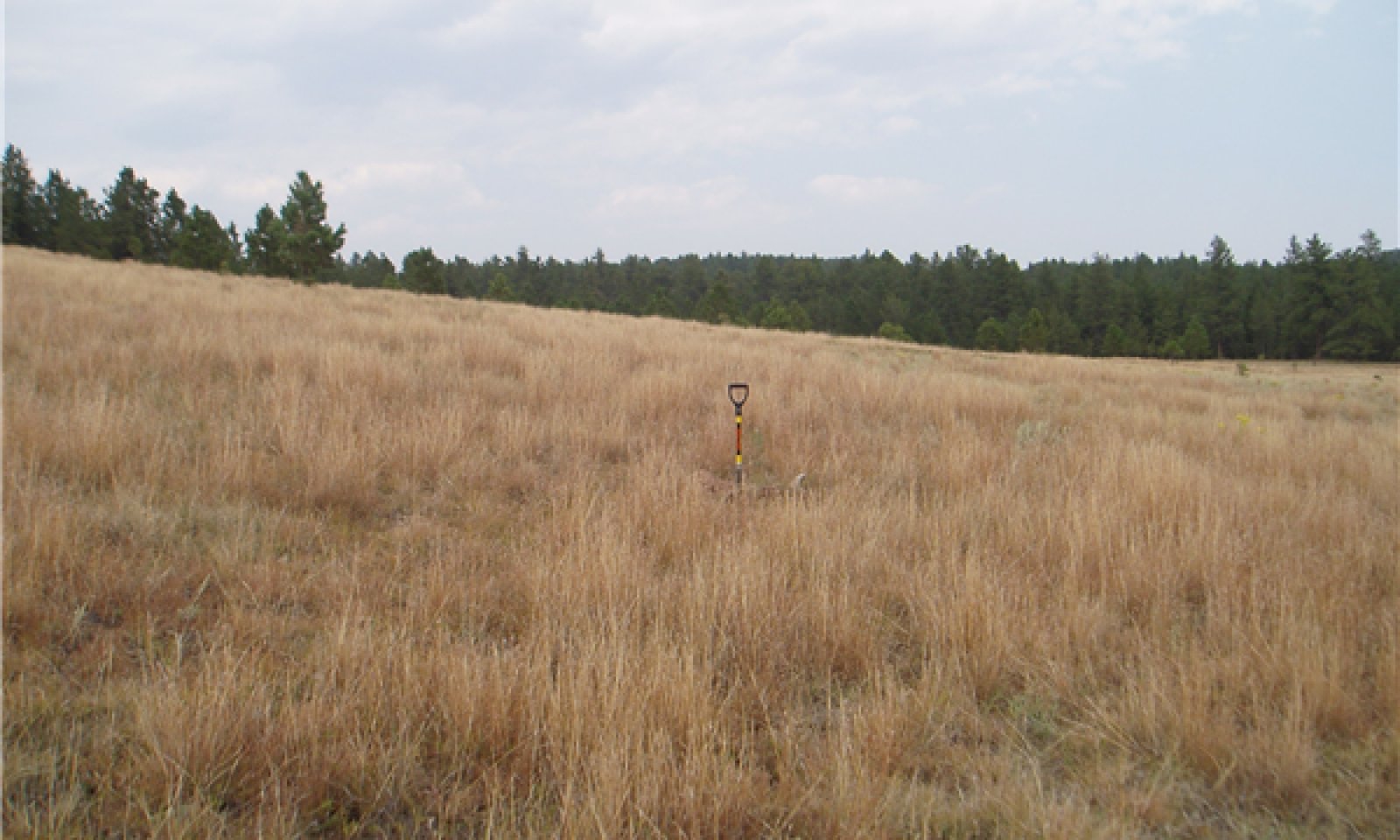
Figure 12. Little Bluestem-Sideoats Grama-Wheatgrass
Interpretations are based primarily on the Little bluestem-Western wheatgrass-Sideoats grama/Ponderosa pine plant community phase. This is also considered to be the reference or historic community. The potential vegetation is about 80 percent grass, 10 percent forbs, and 10 percent trees and shrubs. Average annual production for this plant community phase on a median year is 1,500 lbs/acre. The community is dominated by tall and mid-height warm season grasses with cool-season grasses being subdominant. The dominant grasses include little bluestem, big bluestem, and sideoats grama. Western wheatgrass and needleandthread may also comprise a significant amount of the plant community. Other grasses include prairie dropseed, tall dropseed, blue grama, and slender wheatgrass. This plant community is productive and resilient to disturbances such as drought and fire. This is a sustainable plant community in regards to soil/site stability, watershed function, and biological integrity.
Figure 13. Annual production by plant type (representative values) or group (midpoint values)
Table 5. Annual production by plant type
Plant type Low
(lb/acre)Representative value
(lb/acre)High
(lb/acre)Grass/Grasslike 1300 1512 1895 Forb 85 180 300 Shrub/Vine 15 99 185 Tree 0 9 20 Total 1400 1800 2400 Figure 14. Plant community growth curve (percent production by month). SD6204 , Black Hills, warm-season dominant, cool-season sub-dominant. Warm-season dominant, cool-season sub-dominant.
Jan Feb Mar Apr May Jun Jul Aug Sep Oct Nov Dec J F M A M J J A S O N D 0 0 3 7 17 25 25 15 7 1 0 0 Community 1.2
Little Bluestem-Wheatgrass-Needleandthread/Ponderosa Pine (< 2% Cover)
Figure 15. Little bluestem-Western wheatgrass-Needleand threa
This plant community is a result of heavy continuous grazing use by livestock or from over utilization during extended drought periods. The potential plant community is made up of approximately 70 percent grasses, 15 percent forbs, and 15 percent shrubs. Dominant grasses include little bluestem, western wheatgrass and needleandthread. These palatable grasses will decrease when subjected to heavy continuous season-long grazing. Short warm-season grasses such as blue grama and hairy grama present in the understory will increase because their short growth stature and lower growing points allow them to withstand grazing pressure better than the taller grasses. Shallow-rooted grass-likes such as threadleaf sedge also begin to increase under heavy grazing. Sideoats grama, and prairie dropseed contribute substantially to forage production but are considered decreasers when subjected to heavy continuous grazing. Invasive, non-native grasses such as Kentucky bluegrass, may contribute to biomass production but do not dominate this ecological site. Forbs contribute substantially to the biomass production in this plant community. Big bluestem has decreased dramatically and may be nearly absent from the site. The herbaceous species within this plant community are well-adapted to grazing. Improper grazing management leaves little opportunity for palatable midgrasses to recover. Blue grama, hairy grama, and threadleaf sedge now occupy more space than do the midgrasses. The increase in shallow rooted, short-statured grasses and grass-like plants could change the rooting structure of this plant community. The change in the rooting structure could reduce infiltration and increase runoff which could alter soil stability and lead to an increase in soil erosion.
Pathway 1.1A
Community 1.1 to 1.2
Little Bluestem-Western Wheatgrass-Sideoats Grama/Ponderosa Pine (< 2%)
Little Bluestem-Wheatgrass-Needleandthread/Ponderosa Pine (< 2% Cover)Continuous season long grazing or heavy continuous grazing with stocking rates well above the carrying capacity for the entire growing season or seasonal grazing during the middle of the growing season every year will cause a decrease in big bluestem and sideoats grama. Western wheatgrass and needlegrass will increase initially but will decrease in the plant community if grazing management is not changed.
Pathway 1.2A
Community 1.2 to 1.1
Little Bluestem-Wheatgrass-Needleandthread/Ponderosa Pine (< 2% Cover)
Little Bluestem-Western Wheatgrass-Sideoats Grama/Ponderosa Pine (< 2%)Long-term prescribed grazing that provided adequate recovery and change in season of use, along with normal precipitation regime and periodic fire can restore the tall warm season component of this plant community.
State 2
Shortgrass StateThis state is dominated by short-grass species and is the result of repeated season-long overgrazing. Desirable plants (i.e. the species most desirable to grazing animals), which were repeatedly grazed over long periods of time, weakened and declined in size and amounts. In the early phases of this plant community transition, some mid-grasses may remain in sufficient quantities to support the recovery to the Reference State if proper grazing management is done along with the occurrence of good growing conditions. If grazing pressures continue over long time or extended drought, recovery will become less likely due to increased runoff and reduced infiltration.
Community 2.1
Blue Grama-Threadleaf Sedge/Ponderosa Pine (< 2% Cover)
Figure 16. Bluegrama-Threadleaf sedge/Ponderosa Pine PCP 2.1
This plant community develops under heavy, continuous, season-long grazing, and may be accelerated by over-utilization during extended drought periods. This plant community is composed of approximately 65 percent grasses, 15 percent forbs, and 20 percent shrubs. Dominant grasses and grass-like plants include, blue and hairy grama, threadleaf sedge, little bluestem, sideoats grama, and western wheatgrass. Subdominant grasses include prairie Junegrass and sand dropseed. Cheatgrass, field brome, smooth brome, and Kentucky bluegrass may also invade the site. Forbs commonly found in this plant community include prairie coneflower, dotted gayfeather, and common mares-tail. Shrubs commonly found on this site include broom snakeweed, fringed sagewort, soapweed yucca, and prairie rose. When compared to the Reference State, short statured grasses have increased significantly and become more dominant on the site. Shrubs become more commonly found on the site as herbaceous species become reduced in vigor and cover. It is also common for Ponderosa pine to have increased in this plant community.
State 3
Conifer StateThis state is dominated by conifer and shrubs and most likely resulted from heavy continuous grazing and lack of frequent fire. Native warm-season grasses such as bluestems, grama grasses and associated cool-season grasses such as wheatgrasses and needlegrasses declined as overstory canopy cover increased, relinquishing space to shade tolerant grasses such as poverty oatgrass, bluegrasses, and rough-leaved ricegrass. Forbs such as cudweed sagewort and shrubs such as wood rose increased under intermediate canopy closure (< 25 percent). In the absence of fire, this plant community phase will be resistant to change. Ponderosa pine canopy will continue to increase over time, reducing the amount of precipitation that reaches the forest floor (according to Wrage (1994), ponderosa pine canopy can reduce precipitation reaching the forest floor by an average of 30 percent), and ultimately reducing the herbaceous layer. The resulting plant community is less productive for grazing animals than the other states. As ponderosa pine cover increases, herbaceous plant production decreases and bare ground increases. This results in lower water infiltration rates and increased runoff, with some soil erosion possible.
Community 3.1
Ponderosa Pine (> 35% Cover)/Little Bluestem-Kentucky Bluegrass/Fringed Sagewort
Figure 17. Ponderosa Pine/Little Bluestem PCP 3.1
This plant community is characterized by the dominance of shrubs and conifers, resulting from heavy continuous season-long grazing combined with delayed occurrence of fire. Conifers occupy approximately 35 percent and dominant shrubs occupy about 25 percent of the space within this plant community. Grasses and forbs occupy a little less than 40 percent of the area. Dominant grass and grass-like plants include little bluestem, Kentucky bluegrass, needleandthread, blue grama, and threadleaf sedge. Forbs present include cudweed sagewort, coneflower and dotted gayfeather. Prevalent shrubs include low stature shrubs such as prairie rose, fringed sagewort, and skunkbush. Most of these shrubs rarely exceed one foot in height. Ponderosa pine is the dominant tree species and Rocky Mountain juniper is sometimes present as a subordinate tree but does not dominate.
Transition T1A
State 1 to 2Continuous season-long grazing or heavy continuous grazing with stocking rates well above the carrying capacity for the entire growing season will lead toward the dominance of short grasses, State 2.
Transition T1B
State 1 to 3Heavy continuous season-long grazing with stocking rates well above the carrying capacity for the entire growing season combined with the absence of fire to control shrub and conifer seedling establishment, or no use, no fire and encroachment will lead toward a conifer dominated state, State 3.
Restoration pathway R2A
State 2 to 1Long-term prescribed grazing which provides growing season grazing deferment along with stocking rates not exceeding carrying capacities and periodic fire or prescribed burning will restore this plant community to the Reference State.
Transition T2A
State 2 to 3Continuous season-long grazing or heavy continuous grazing with stocking rates well above the carrying capacity for the entire growing season combined with the absence of fire to control shrub and conifer seedling establishment, or no use, no fire and encroachment will lead toward a conifer dominated state, State 3.
Restoration pathway R3A
State 3 to 1Long-term prescribed grazing and prescribed fire to kill shrubs and conifers along with mechanical brush management of large trees (if needed) is projected to lead back to the reference state. Seeding of warm-season tall grass species may be needed following the removal of trees. This restoration pathway may take an extended period of time and may not be achievable; favorable growing conditions will accelerate the recovery.
Transition T3A
State 3 to 2Depending on the existing herbaceous plant species in the understory, prescribed fire and or mechanical brush management to remove conifers and long-term prescribed grazing may transition the Conifer State to the Shortgrass State. Grazing deferments and favorable growing conditions will, in time, help reestablish the plant community however management goals may not be achieved.
Additional community tables
Table 6. Community 1.1 plant community composition
Group Common name Symbol Scientific name Annual production () Foliar cover (%) Grass/Grasslike1 Tall and Mid- Warm-Season Grasses 450–990 little bluestem SCSC Schizachyrium scoparium 180–630 – sideoats grama BOCU Bouteloua curtipendula 180–270 – prairie dropseed SPHE Sporobolus heterolepis 0–90 – composite dropseed SPCOC2 Sporobolus compositus var. compositus 18–90 – plains muhly MUCU3 Muhlenbergia cuspidata 0–90 – big bluestem ANGE Andropogon gerardii 36–90 – marsh muhly MURA Muhlenbergia racemosa 0–36 – 2 Cool-Season Bunchgrass 90–270 needle and thread HECOC8 Hesperostipa comata ssp. comata 90–180 – prairie Junegrass KOMA Koeleria macrantha 18–90 – Richardson's needlegrass ACRI8 Achnatherum richardsonii 0–90 – slender wheatgrass ELTR7 Elymus trachycaulus 36–90 – timber oatgrass DAIN Danthonia intermedia 0–90 – slender wheatgrass ELTRS Elymus trachycaulus ssp. subsecundus 36–90 – Columbia needlegrass ACNE9 Achnatherum nelsonii 0–90 – green needlegrass NAVI4 Nassella viridula 18–90 – mountain brome BRMA4 Bromus marginatus 0–90 – bluebunch wheatgrass PSSP6 Pseudoroegneria spicata 0–18 – 3 Cool-Season Rhizomatous Grass 36–180 western wheatgrass PASM Pascopyrum smithii 36–180 – thickspike wheatgrass ELLAL Elymus lanceolatus ssp. lanceolatus 0–90 – 4 Short Warm-Season Grasses 36–180 blue grama BOGR2 Bouteloua gracilis 18–180 – hairy grama BOHI2 Bouteloua hirsuta 18–90 – threeawn ARIST Aristida 0–90 – 5 Other Native Grasses 0–90 Grass, perennial 2GP Grass, perennial 0–90 – 6 Grass-Likes 36–180 needleleaf sedge CADU6 Carex duriuscula 18–90 – threadleaf sedge CAFI Carex filifolia 18–90 – Grass-like (not a true grass) 2GL Grass-like (not a true grass) 0–90 – Richardson's sedge CARI Carex richardsonii 0–36 – sedge CAREX Carex 18–36 – 7 Non-Native Cool-Season Grasses 0 Forb8 Forbs 90–270 goldenrod SOLID Solidago 18–90 – blacksamson echinacea ECAN2 Echinacea angustifolia 18–90 – scurfpea PSORA2 Psoralidium 18–90 – western yarrow ACMIO Achillea millefolium var. occidentalis 18–36 – white prairie aster SYFA Symphyotrichum falcatum 18–36 – wild bergamot MOFI Monarda fistulosa 0–36 – Forb, perennial 2FP Forb, perennial 0–36 – hairy false goldenaster HEVI4 Heterotheca villosa 0–36 – dotted blazing star LIPU Liatris punctata 18–36 – fleabane ERIGE2 Erigeron 0–36 – mariposa lily CALOC Calochortus 0–36 – beardtongue PENST Penstemon 0–36 – prairie clover DALEA Dalea 18–36 – upright prairie coneflower RACO3 Ratibida columnifera 18–36 – old man's whiskers GETR Geum triflorum 0–36 – American vetch VIAM Vicia americana 0–36 – blanketflower GAAR Gaillardia aristata 0–36 – Lewis flax LILE3 Linum lewisii 0–36 – bluebell bellflower CARO2 Campanula rotundifolia 0–36 – cinquefoil POTEN Potentilla 0–36 – white sagebrush ARLU Artemisia ludoviciana 18–36 – deathcamas ZIGAD Zigadenus 0–18 – downy paintedcup CASE5 Castilleja sessiliflora 0–18 – spiny phlox PHHO Phlox hoodii 0–18 – common starlily LEMO4 Leucocrinum montanum 0–18 – Shrub/Vine9 Shrubs 18–180 creeping juniper JUHO2 Juniperus horizontalis 18–90 – prairie sagewort ARFR4 Artemisia frigida 18–90 – field sagewort ARCA12 Artemisia campestris 18–36 – skunkbush sumac RHTR Rhus trilobata 0–36 – smooth sumac RHGL Rhus glabra 0–36 – soapweed yucca YUGL Yucca glauca 0–36 – Shrub (>.5m) 2SHRUB Shrub (>.5m) 0–36 – common juniper JUCO6 Juniperus communis 0–36 – plains pricklypear OPPO Opuntia polyacantha 0–18 – Tree10 Trees 0–18 ponderosa pine PIPO Pinus ponderosa 0–18 – Rocky Mountain juniper JUSC2 Juniperus scopulorum 0–18 – Table 7. Community 1.2 plant community composition
Group Common name Symbol Scientific name Annual production () Foliar cover (%) Table 8. Community 2.1 plant community composition
Group Common name Symbol Scientific name Annual production () Foliar cover (%) Table 9. Community 3.1 plant community composition
Group Common name Symbol Scientific name Annual production () Foliar cover (%) Interpretations
Recreational uses
In this area, there is wondrous scenery in any season and it almost has something for almost everyone for outdoor recreation activities. Despite that they may cause some ecological disturbances to the sites, visitors provide a good income to the small communities across the area. Opportunities for hiking, mountain biking, snowmobiling, and horse riding exist through a network of trails covering several hundreds of miles. The presence of two adjacent parks in the area (Custer State Park and Wind Cave National Park) brings in a large flow of resident and non-resident tourists which visit the area for its natural beauty and for the viewing of many wildlife species particularly buffalo, bighorn sheep, and mountain goats. Fishing and hunting attract a great number of sports men and women for trout fishing, turkey hunting, and big game hunting of elk, deer, and antelope. Wild cats such as mountain lion are hunted during the fall season. All of these recreation activities combined with the artistry business attracts a great number of visitors and brings in a substantial income to the small towns across the areas.
Wood products
No appreciable wood products are available in this site.
Other information
Revision Notes:
“This PROVISIONAL ecological site concept has been QC’d and QA’d to ensure that the site meets the NESH standards for a provisional ecological site that provides basic compiled information in one location. This site should not be considered an Approved ESD, as it is only the foundational site concepts and requires further data collection—specifically high-intensity data characterizations and full 232 soil descriptions—and further site investigations and final STM reviews before it can be used as an Approved ESD meeting NESH standards.”
Site Development and Testing Plan:
Future work, as described in a Project Plan, to validate the information in this Provisional Ecological Site Description is needed. This will include field activities to collect low, medium and high intensity sampling, soil correlations, and analysis of that data. Annual field reviews should be done by soil scientists and vegetation specialists. A final field review, peer review, quality control, and quality assurance reviews of the ESD will be needed to produce the final document.
Supporting information
Inventory data references
Information presented here has been derived from NRCS clipping data and other inventory data. Field observations from range-trained personnel were also used. Those involved in developing this site include: Lakhdar Benkobi, ESI/SRIC, NRCS; Stan Boltz, Range Management Specialist, NRCS; Dan Brady, Soil Scientist, NRCS; Mitch Faulkner, Range Management Specialist, NRCS; Roger Gates, Associate Professor/Rangeland Management Specialist, West River Ag Center; Rick Peterson, Ecological Site Specialist, NRCS; Matthew, Scott, Botanist - USFS Hell Canyon District Ranger; L. Michael Stirling, Range Management Specialist, NRCS; Jim Westerman, Soil Scientist, NRCS. All inventory information and data records are compiled within the Rapid City, SD USDA-NRCS Shared “S” network drive.
Other references
Brown, P. M. and C. Hull-Sieg. 1996. Fire History in Interior Ponderosa Pine Communities of the Black Hills, South Dakota, USA, Int. J. Wildland Fire 6(3): 97-105.
Gartner F. R. and W. W. Thompson. 1972. Fire in the Black Hills forest-grass ecotone, South Dakota Agricultural Experiment Station, Journal Series No 1115.
High Plains Regional Climate Center, University of Nebraska, 830728 Chase Hall, Lincoln, NE 68583-0728. (http://www.hprcc.unl.edu/)
McIntosh, A. C. 1949. A botanical survey of the Black Hills of South Dakota. Black Hills Engineer. 28 (4): 3-75.
Shepperd, W. D. and M. A. Battaglia. 2002. Ecology, silviculture, and management of Black Hills ponderosa pine. Gen. Tech. Rep. RMRS-GTR-97. Fort Collins, CO: US Department of Agriculture, Forest Service, Rocky Mountain Research Station. 112 p.
USDA, NRCS. National Water and Climate Center,
Toledo, D., Sanderson, M., Spaeth, K., Hendrickson, J., Printz, J. 2014. Extent of Kentucky Bluegrass and Its Effect on Native Plant Species Diversity and Ecosystem Services in the Northern Great Plains of the United States. Invasive Plant Science and Management. 7(4):543-522. Weed Science Society of America.
101 SW Main, Suite 1600, Portland, OR 97204-3224. (http://wcc.nrcs.usda.gov)
USDA, NRCS. National Range and Pasture Handbook, September 1997
USDA, NRCS. National Soil Information System, Information Technology Center, 2150 Centre Avenue, Building A, Fort Collins, CO 80526. (http://nasis.nrcs.usda.gov)
USDA, NRCS. 2001. The PLANTS Database, Version 3.1 (http://plants.usda.gov). National Plant Data Center, Baton Rouge, LA 70874-4490 USA.
USDA, NRCS. National Ecological Site Handbook, 1st Ed, January 2014
Wrage, K. J. 1994. The effects of ponderosa pine on soil moisture, precipitation, and understory vegetation in the Black Hills of South Dakota. 158 p. Thesis.Contributors
Westerman Jim
Benkobi Lakhadar
Faulkner Mitch
Peterson Rick L.Approval
Suzanne Mayne-Kinney, 7/31/2024
Acknowledgments
All ecological sites were then reviewed and approved at the Provisional Level by David Kraft, Regional ESS, Salina, KS.
Rangeland health reference sheet
Interpreting Indicators of Rangeland Health is a qualitative assessment protocol used to determine ecosystem condition based on benchmark characteristics described in the Reference Sheet. A suite of 17 (or more) indicators are typically considered in an assessment. The ecological site(s) representative of an assessment location must be known prior to applying the protocol and must be verified based on soils and climate. Current plant community cannot be used to identify the ecological site.
Author(s)/participant(s) Contact for lead author Date 08/28/2026 Approved by Approval date Composition (Indicators 10 and 12) based on Annual Production Indicators
-
Number and extent of rills:
-
Presence of water flow patterns:
-
Number and height of erosional pedestals or terracettes:
-
Bare ground from Ecological Site Description or other studies (rock, litter, lichen, moss, plant canopy are not bare ground):
-
Number of gullies and erosion associated with gullies:
-
Extent of wind scoured, blowouts and/or depositional areas:
-
Amount of litter movement (describe size and distance expected to travel):
-
Soil surface (top few mm) resistance to erosion (stability values are averages - most sites will show a range of values):
-
Soil surface structure and SOM content (include type of structure and A-horizon color and thickness):
-
Effect of community phase composition (relative proportion of different functional groups) and spatial distribution on infiltration and runoff:
-
Presence and thickness of compaction layer (usually none; describe soil profile features which may be mistaken for compaction on this site):
-
Functional/Structural Groups (list in order of descending dominance by above-ground annual-production or live foliar cover using symbols: >>, >, = to indicate much greater than, greater than, and equal to):
Dominant:
Sub-dominant:
Other:
Additional:
-
Amount of plant mortality and decadence (include which functional groups are expected to show mortality or decadence):
-
Average percent litter cover (%) and depth ( in):
-
Expected annual annual-production (this is TOTAL above-ground annual-production, not just forage annual-production):
-
Potential invasive (including noxious) species (native and non-native). List species which BOTH characterize degraded states and have the potential to become a dominant or co-dominant species on the ecological site if their future establishment and growth is not actively controlled by management interventions. Species that become dominant for only one to several years (e.g., short-term response to drought or wildfire) are not invasive plants. Note that unlike other indicators, we are describing what is NOT expected in the reference state for the ecological site:
-
Perennial plant reproductive capability:
Print Options
Sections
Font
AAAAOther
PrintThe Ecosystem Dynamics Interpretive Tool is an information system framework developed by the USDA-ARS Jornada Experimental Range, USDA Natural Resources Conservation Service, and New Mexico State University.
Accessibility statement


