Natural Resources
Conservation Service
Ecological site R062XA032SD
Channery Loam - North
Last updated: 8/19/2024
Accessed: 07/10/2026
-
Search


Major Land Resource Area or ecological site by name and/or ID.
PreviousSectionsNextGeneral information
Provisional. A provisional ecological site description has undergone quality control and quality assurance review. It contains a working state and transition model and enough information to identify the ecological site.
Click to explore map
Figure 1. Mapped extent
Areas shown in blue indicate the maximum mapped extent of this ecological site. Other ecological sites likely occur within the highlighted areas. It is also possible for this ecological site to occur outside of highlighted areas if detailed soil survey has not been completed or recently updated.
MLRA notes
Major Land Resource Area (MLRA): 062X–Black Hills
The Black Hills (MLRA 62) is a unique, low lying mountain range situated in the midst of a mixed short and mid-grass prairie. It is a true “Island in the Plains,” as it has geophysical and biological attributes that are unlike the surrounding area. The Black Hills have strong floristic ties to four of the North American biomes: Cordilleran (Rocky Mountain) Forest, Northern Coniferous Forest, Eastern Deciduous Forest, and Grasslands.
MLRA 62 is approximately 3,040 square miles in size; 74 percent is located in South Dakota, and 26 percent is in Wyoming. The towns of Lead, Deadwood, Hill City, and Custer, South Dakota, are in this area. U.S. Highways 16 and 385 cross the MLRA. The Black Hills National Forest, Custer State Park, Mt. Rushmore National Monument, Wind Cave National Park, and Jewel Cave National Monument are located in this MLRA.
This area forms the core of the Black Hills and the Bear Lodge Mountains where the elevation generally ranges between 3,600 to 6,565 feet, however, Black Elk Peak (formerly Harney Peak) rises to 7,242 feet. The slopes vary from moderately sloping on some of the high plateaus to very steeply sloping along drainageways and on peaks and ridges. Narrow valleys generally are gently sloping to strongly sloping.
The Black Hills uplift is the product of the Laramide mountain-building episodes that produced most of the ranges in the Rocky Mountains. Uplift began near the end of the Cretaceous period, 65 million years ago and ended by 35 million years ago (Froiland, 1990). The core of the Black Hills is a plutonic mass of granite with steeply dipping metamorphic rocks, primarily slate and schist, that directly surrounds the granite core. A plateau of Mississippian limestone surrounds the igneous and metamorphic rock core. The Madison limestone is broken around the outer edges of the uplifted area. The Permian Minnekahta limestone forms the outermost boundary of the area. Many other tilted sandstone, shale, and limestone units are exposed like a bathtub ring inside the steeply dipping Madison limestone.
The dominant soil orders in this MLRA are Alfisols (forest soils) and Mollisols (grassland soils). The soils in the area have a frigid or cryic soil temperature regime, a udic or ustic soil moisture regime, and mixed, micaceous, or smectitic mineralogy. They are shallow to very deep, generally are well drained, and are loamy in texture.
The Black Hills MLRA supports open to dense forest vegetation. Ponderosa pine is the dominant species across the Black Hills. White spruce grows at the higher elevations and along the major drainageways. Bur oak is found intermixed with pine in the northern and eastern fringes of the Black Hills, and Rocky Mountain Juniper is most common in the southern portion of the Black Hills. Aspen and paper birch are minor components found throughout the Black Hills. Prairie dropseed, roughleaf ricegrass, green needlegrass, poverty oatgrass, Richardson’s needlegrass, slender wheatgrass, and Canada wildrye are the most common native grasses under open forest stands. The most common native shrubs are bearberry, common juniper, grouse whortleberry, poison ivy, and Saskatoon serviceberry.
MLRA 62 land ownership is approximately 47 percent private and 53 percent federal. Rangeland and forestland are split almost equally between private and federal ownership (47 percent each). Minor areas of land are privately owned cropland and urban development. The forestland in this area is used mainly for timber production, recreation, and grazing.
The major resource concerns are soil erosion and surface compaction caused by logging, mining, wildfires, grazing, and urban expansion. The quality of both ground and surface water is another concern, especially in the northern part of the Black Hills. The primary cause for concern is contamination from mine waste and septic systems in areas of rural development and urban expansion (USDA-NRCS, 2006: Ag Handbook 296).LRU notes
For development of ecological sites, MLRA 62 is divided into three Land Resource Units (LRUs) or physiographic zones (A, B, C, and Y). Each LRU has a set of ecological sites that represents these zones.
The LRU is identified in the Ecological Site ID: R062XY000SD; “062X” identifies the MLRA, and the next letter “Y” identifies the LRU. Note: The organization of Ecological Site IDs will likely change in the future.
The North, LRU-A includes the northern Black Hills and Bear Lodge Mountains. It receives between 22 and 30 inches of annual precipitation and has a frigid soil temperature regime.
The High Central, LRU-B includes the high elevation (> 6,200 feet) central core of the Black Hills, which receives between 25 to 35 inches of annual precipitation and has a cryic soil temperature regime.
The South, LRU-C includes the southern portion of the Black Hills and receives between 17 to 21 inches of annual precipitation and has a frigid soil temperature regime.
One additional grouping of ecological sites that are common to the entire MLRA are designated with a “Y” in the ecological site ID.Classification relationships
USDA
Land Resource Region G—Western Great Plains Range and Irrigated Region:
Major Land Resource Area (MLRA) 62—Black Hills
US Environmental Protection Agency (EPA)
Level IV Ecoregions of the Conterminous United States:
Black Hills Plateau—17b
Black Hills Core Highlands—17c
USDA Forest Service
Ecological Subregions: Sections and Subsections of Conterminous United States:
Black Hills Coniferous Forest Province—M334:
Black Hills Section—334A
Black Hills Limestone Plateau-Core Highlands Subsection—M334AbEcological site concept
The Channery Loam - North ecological site can be found on upland landscapes in the northern portion of the Black Hills. It is not found in the Bear Lodge Mountains. This site was formally referred to as the Mountain Prairie Range Sites in the South Dakota, Black Hills Technical Guide.
This site does not receive additional moisture from runoff or overflow. The typical slopes range is 2 to 15 percent but can reach up to 40 percent. Soil are moderately deep (20 to 40 inches in depth) and formed in residuum from schist. The surface layer is a non-calcareous channery loam that range from 6 to 9 inches thick. Flat fragments of schist will make up 15 to 35 percent of the surface layer and > 35 percent in the subsurface layers. There is a restrictive layer of bedrock (schist) at 20 to 40 inches, which impedes water movement and root penetration.
The vegetation in the Reference State (1.0) consists of dominant warm-season grasses and subdominant cool-season grasses. Major warm-season grasses include little bluestem, big bluestem, and prairie dropseed. Western wheatgrass, slender wheatgrass, and needlegrasses are the major cool-season grasses. Forbs are diverse and shrubs are common, but never dominant.Associated sites
R062XA010SD Loamy - North
The Loamy-North ecological site is often located adjacent to the Channery Loam site. The Loamy-North sites have deep soils with little or no rock in the soil profile and will have higher vegetative production.
R062XA024SD Shallow Loamy - North
The Shallow Loamy-North ecological site can be located adjacent to the Channery Loam-North ecological site. The Shallow Loamy-North will have shallow soils (10-20” in depth), and lower vegetative production.
R062XY043SD Valley Loam
The Valley Loam ecological site can occur in swales and drainageways adjacent to or bisecting the Channery Loam-North ecological site. The Valley Loam sites will have deep soils with no rock in the soil profile, and with higher vegetative production.
F062XB052SD Highland Hills Pine Forest(0-15% Slope)
The Mod Steep to Steep Low Mountain Slopes forest ecological site will be found adjacent to the Channery Loam ecological site. The forest ecological site will have ponderosa pine as the dominant vegetation. Soil will have an “O” horizon of decomposing forest litter, a light-colored leached “E” horizon, and a “Bt” horizon of accumulated translocated clays.
Similar sites
R062XA024SD Shallow Loamy - North
The Shallow Loamy-North ecological site will have shallow soil depths and less rock in the soil profile; less big bluestem; and lower vegetative production than the Channery Loam-North ecological site.
R062XY012SD Thin Upland
The Thin Upland ecological site has deep soils with little, if an, rock in the soil profile. The Thin Upland site will have calcareous soils with carbonates locates at or near the soil surface. The plant community can look very similar but with more warm-season grasses and lower vegetative production than the Channery Loam ecological site.
Table 1. Dominant plant species
Tree Not specified
Shrub (1) Amorpha canescens
Herbaceous (1) Schizachyrium scoparium
(2) Andropogon gerardiiPhysiographic features
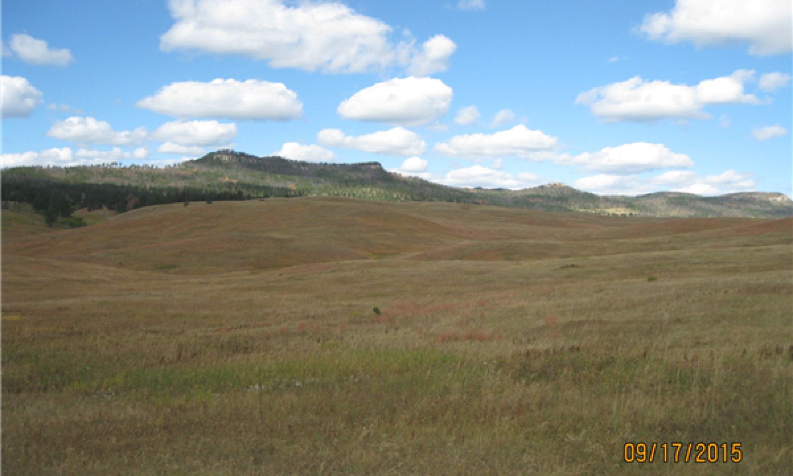
The Channery Loam - North ecological site occurs on gently sloping to steep open prairies in the Black Hills. It can occur on all aspects.
Table 2. Representative physiographic features
Landforms (1) Mountains > Mountain slope
(2) Mountains > Ridge
(3) Mountains > Plain
Runoff class Very low to high Flooding frequency None Ponding frequency None Elevation 3600 – 6200 ft Slope 2 – 40 % Aspect Aspect is not a significant factor Climatic features
MLRA 62 is in a microclimate caused by the influence of increased elevation which leads to increased precipitation, moderate air temperature, and lower wind velocities as compared to the surrounding Great Plains. In general, the Black Hills climate is a continental type, cold in the winter and hot in the summer.
Annual precipitation in MLRA 62 typically increases with elevation and decreases from west to east and from north to south. The average annual precipitation range for MLRA 62 is 17 to 35 inches. Most of the rainfall occurs as frontal storms early in the growing season, in May and June. Some high-intensity, convective thunderstorms occur in July and August. Precipitation in the winter occurs mostly as snow. Twenty to forty percent of the annual precipitation falls as snow. The annual average snowfall ranges from 23 inches at the lower elevations in the south, to 54 inches in the higher elevations of the central core of the Black Hills.
The average annual temperature ranges from 36°F to 48°F. January is the coldest month, with an average temperature of 22°F in the higher elevation of the central core, and 25°F in the southern part of MLRA 62. July is the warmest month, with an average daily temperature of 67°F in the central core, and 73°F in the southern part of this MLRA. The frost-free period ranges from 129 to 168 days. It is shortest at higher elevations and in the northwestern part of the MLRA. Hourly winds are estimated to average about 11 miles per hour (mph) annually.
Growth of cool-season plants begins in April, slowing or ceasing growth by mid-August. Warm-season plants begin growth in May and continue to mid-September. Regrowth of cool-season plants may occur in September and October, depending upon soil moisture availability.
The average annual precipitation range for LRU-A (Northern Black Hills and Bear Lodge Mountains) is 22 to 30 inches.Table 3 Representative climatic features
Frost-free period (characteristic range) 50-90 days Freeze-free period (characteristic range) 90-120 days Precipitation total (characteristic range) 20-30 in Frost-free period (actual range) 30-90 days Freeze-free period (actual range) 60-120 days Precipitation total (actual range) 20-30 in Frost-free period (average) 60 days Freeze-free period (average) 100 days Precipitation total (average) 20 in Characteristic rangeActual rangeBarLineFigure 2. Monthly precipitation range
Characteristic rangeActual rangeBarLineFigure 3. Monthly minimum temperature range
Characteristic rangeActual rangeBarLineFigure 4. Monthly maximum temperature range
BarLineFigure 5. Monthly average minimum and maximum temperature
Figure 6. Annual precipitation pattern
Figure 7 Annual average temperature pattern
Climate stations used
-
(1) LEAD [USC00394834], Lead, SD
-
(2) DEADWOOD 2NE [USC00392209], Whitewood, SD
-
(3) PACTOLA DAM [USC00396427], Rapid City, SD
-
(4) CUSTER [USC00392087], Custer, SD
-
(5) HILL CITY [USC00393868], Hill City, SD
-
(6) DEERFIELD 3 SE [USC00392231], Hill City, SD
">Influencing water features
No riparian areas or wetland features are directly associated with the Channery Loam – North ecological site.
Soil features
Soils common to the Channery Loam - North ecological site are moderately deep and well drained. The surface layer is typically is 6 to 9 inches thick. The soils are formed in residuum weathered from steeply dipping beds of metamorphic rocks (schist). Soil are non-calcareous throughout the profile. The surface textures are typically channery loam, with some areas being, very channery loam. Course rock fragments make up 15 to 35 percent of the surface layer and > 35 percent in the subsurface layer. The slopes range from 2 to 15 percent but can reach 40 percent.
There is a restrictive layer of bedrock (schist) at 20 to 40 inches, which impedes water movement and root penetration. Representative soils of this ecological site have a frigid temperature regime.
The major soil correlated to the Channery Loamy – North ecological site is, Heely.
This soil is mainly susceptible to water erosion. Because of the presence of surface rock fragments, the hazard of water erosion on this site is low until slopes exceed about 15 percent.
Loss of 50 percent or more of the surface layer of the soils on this site can result in a shift in species composition and/or production. Erosion on this site will tend to occur as rills around surface fragments and in areas of concentrated flow.
More information can be found in the various soil survey reports. Contact the local USDA Service Center for soil survey reports that include more detail specific to your area of interest, or use the internet to access USDA’s Web Soil Survey.
Figure 8. Heely Soil Profile (cm)
Table 4. Representative soil features
Parent material (1) Residuum – schist
Surface texture (1) Channery loam
Family particle size (1) Loamy
Drainage class Well drained Permeability class Moderate to moderately rapid Soil depth 20 – 40 in Surface fragment cover <=3" 2 – 15 % Surface fragment cover >3" 0 – 2 % Available water capacity
(0-40in)3 – 6 in Calcium carbonate equivalent
(0-40in)Not specified Electrical conductivity
(0-40in)0 – 2 mmhos/cm Sodium adsorption ratio
(0-40in)0 – 1 Soil reaction (1:1 water)
(0-40in)5.6 – 7.3 Subsurface fragment volume <=3"
(Depth not specified)35 – 75 % Subsurface fragment volume >3"
(Depth not specified)0 – 25 % Ecological dynamics
The Channery Loam - North ecological site evolved under Black Hills climatic conditions; light to severe grazing by bison, elk, insects, and small mammals; sporadic, natural or human-caused wildfire (often of light intensities); and other biotic and abiotic factors that typically influence soil and site development. Changes occur in the plant communities due to short-term weather variations, effects of native and exotic plant and animal species, and management actions. Severe disturbances, such as periods of well below-average precipitation, severe defoliation, excessive haying, or non-use and no fire can cause significant shifts in plant communities and species composition.
The natural fire regime maintained this site as a grassland and the plant communities were free of pine encroachment and invasion of non-native cool-season grasses. Fire, or the lack of fire, grazing, haying, drought, and the introduction of non-native cool-season grasses are major drivers that shape this site as well as adjacent ecological sites.
Continuous season-long stocking (e.g., the typical the full growing season, May through October) without change in season of use or adequate recovery periods following grazing events will cause departure from the Little Bluestem-Big Bluestem-Wheatgrass-Needlegrass Plant Community (1.1). Little bluestem, wheatgrass, and needlegrass will increase initially and then begin to decrease. Big bluestem and sideoats grama will decrease in frequency and production and shortgrasses and sedges will increase.
Extended periods of non-use and lack of fire will result in excessive litter and a plant community dominated by cool-season grasses such as western wheatgrass, and non-native cool-season grasses.
Heavy, continuous season-long stocking, heavy continuous stocking, or heavy disturbance can transition any plant community to a plant community dominated by clubmoss.
Long-term no fire does not appear to result in significant encroachment of conifer trees on this site as it will on adjacent ecological sites. Further investigation will be required to understand and quantify this observation.
Interpretations are primarily based on the Little Bluestem-Big Bluestem-Wheatgrass-Needlegrass Plant Community (1.1). It has been determined by study of rangeland relic areas, areas protected from excessive disturbance, and areas under long-term rotational grazing regimes. Trends in plant community dynamics ranging from heavily grazed to lightly grazed areas, seasonal use pastures, and historical accounts also have been used. Plant community phases, states, transitional pathways, and thresholds have been determined through similar studies and experience.
The following is a State-and-Transition diagram that illustrates the common plant communities that can occur on the site and the transition pathways between communities. The ecological processes will be discussed in more detail in the plant community descriptions following the diagram.State and transition model
Custom diagramStandard diagramMore interactive model formats are also available. View Interactive Models
Click on state and transition labels to scroll to the respective textT1A - • Invasion and expansion of non-native cool-season grasses • Continuous season-long stocking • Excessive haying • Non-use • No fire T1B - • Heavy, continuous season-long stocking • Heavy continuous stocking • Heavy disturbance • Reduced hydrologic function T2B - • Heavy, continuous season-long stocking • Heavy continuous stocking • Heavy disturbance • Reduced hydrologic function T2A - • Non-use • No fire • Continuous early-season stocking • Excessive haying T4A - • Prescribed burning • Prescribed grazing State 1 submodel, plant communities
1.1A - • Continuous season-long stocking • Heavy grazing in combination with drought • No fire • Drought 1.2A - • Prescribed grazing • Fire • Prescribed burning • Return to normal precipitation levels following drought State 2 submodel, plant communities
2.1A - • Continuous season-long stocking • Continuous early season stocking • Excessive haying • Extended periods of no use and no fire 2.2A - • Prescribed grazing • Prescribed burning State 3 submodel, plant communities
State 4 submodel, plant communities
State 1
Reference StateThe Reference State represents what is believed to show the natural range of variability that dominated the dynamics of the ecological site prior to European settlement. This site in the Reference State (1.0) is dominated by warm-season grasses, with cool-season grasses being subdominant.
In pre-European times, the primary disturbance mechanisms for this site in the reference condition included occasional fire and grazing by large ungulates. Timing of fires and grazing coupled with weather events dictated the dynamics that occurred within the natural range of variability. Taller cool- and warm-season grasses would have declined and a corresponding increase in short statured grass and grass-like species would have occurred.
Today, a similar state can be found on areas that are properly managed with grazing and/or prescribed burning, and sometimes on areas receiving occasional short periods of rest.
Characteristics and indicators. The Reference State (1.0) is dominated by mid- and tall-statured warm-season grasses and subdominant cool-season bunchgrasses and rhizomatous wheatgrass. The Reference State is very susceptible to invasion of non-native cool-season grasses and the expansion of clubmoss.
Resilience management. Management strategies to sustain the Reference State (1.0) include, setting proper stocking rates, monitoring utilization of key species, providing adequate time for plant recovery following grazing events or other disturbance events (e.g. fire, drought, hailstorms), and maintaining soil and site stability. The use of prescribed burning may be effective at limiting or minimizing the invasion and establishment of non-native cool-season grasses.
Community 1.1
Little Bluestem-Big Bluestem-Wheatgrass-Needlegrass
Figure 9. Channery Loam - PCP 1.1
Interpretations are based primarily on the Little Bluestem-Big Bluestem-Wheatgrass-Needlegrass Plant Community. This is also considered to be the Reference Plant Community (1.1).
The potential vegetation is about 85 percent grasses or grass-like plants, 10 percent forbs, 5 percent shrubs. The community is dominated by warm-season grasses, with cool-season grasses being subdominant. The major grasses include little bluestem, big bluestem, western wheatgrass, bearded wheatgrass, and needle and thread. Other grasses include porcupine grass, plains muhly, prairie dropseed, and a variety of other grass and grass-like species. Common forbs include, goldenrod, dotted gayfeather, western yarrow, and white sagebrush (cudweed sagewort). Prairie rose, leadplant, and fringed sagewort are common shrubs.
This plant community is resilient and well adapted to the Northern Great Plains climatic conditions. The diversity in plant species allows for high drought tolerance. This is a sustainable plant community in regard to site and soil stability, watershed function, and biologic integrity.
Resilience management. Management strategies to sustain this plant community include setting proper stocking rates, monitoring utilization of key species, providing adequate time for plant recovery following grazing events or other disturbance events, and maintaining soil and site stability.
Dominant plant species
-
prairie sagewort (Artemisia frigida), shrub
-
leadplant (Amorpha canescens), shrub
-
rose (Rosa), shrub
-
little bluestem (Schizachyrium scoparium), grass
-
big bluestem (Andropogon gerardii), grass
-
slender wheatgrass (Elymus trachycaulus), grass
-
western wheatgrass (Pascopyrum smithii), grass
-
needle and thread (Hesperostipa comata ssp. comata), grass
-
prairie dropseed (Sporobolus heterolepis), grass
-
white sagebrush (Artemisia ludoviciana), other herbaceous
-
dotted blazing star (Liatris punctata), other herbaceous
-
goldenrod (Solidago), other herbaceous
-
prairie clover (Dalea), other herbaceous
-
scurfpea (Psoralidium), other herbaceous
-
western yarrow (Achillea millefolium var. occidentalis), other herbaceous
Figure 10. Annual production by plant type (representative values) or group (midpoint values)
Table 5. Annual production by plant type
Plant type Low
(lb/acre)Representative value
(lb/acre)High
(lb/acre)Grass/Grasslike 1460 1755 2010 Forb 100 210 350 Shrub/Vine 40 125 215 Tree 0 10 25 Total 1600 2100 2600 Figure 11. Plant community growth curve (percent production by month). SD6204 , Black Hills, warm-season dominant, cool-season sub-dominant. Warm-season dominant, cool-season sub-dominant.
Jan Feb Mar Apr May Jun Jul Aug Sep Oct Nov Dec J F M A M J J A S O N D 0 0 3 7 17 25 25 15 7 1 0 0 Community 1.2
Little Bluestem-Wheatgrass-Blue GramaThis plant community developed under continuous season-long grazing (grazing at moderate to moderately heavy stocking levels for extended portions of the growing), or from over utilization during extended drought periods, and the lack of periodic fire.
The potential plant community is made up of approximately 85 percent grasses and grass-like species, 10 percent forbs, and 5 percent shrubs. Dominant grasses include little bluestem, western and bearded wheatgrass, blue grama and upland sedges. Grasses and grass-likes species of secondary importance include sideoats grama, needle and thread, porcupine grass, and prairie Junegrass. Forbs commonly found in this plant community include white sagebrush (cudweed sagewort), goldenrod, white prairie aster, and scurfpea. Shrubs will include leadplant, rose, and fringed sagewort.
When compared to the Reference Plant Community (1.1), little bluestem, blue grama, wheatgrass, and sedge have increased. Tall warm-season grasses have decreased, and vegetative production has also declined. Needlegrasses will persist in this phase. This plant community is moderately resistant to change. The herbaceous species present are well adapted to grazing; however, species composition can be altered through continued overgrazing. If the herbaceous component is intact, it tends to be resilient if the disturbance is not long-term.
Resilience management. Management strategies to sustain this plant community include setting proper stocking rates, monitoring utilization of key species, providing adequate time for plant recovery following grazing events or other disturbance events, and maintaining soil and site stability.
Dominant plant species
-
prairie sagewort (Artemisia frigida), shrub
-
rose (Rosa), shrub
-
leadplant (Amorpha canescens), shrub
-
little bluestem (Schizachyrium scoparium), grass
-
western wheatgrass (Pascopyrum smithii), grass
-
blue grama (Bouteloua gracilis), grass
-
threadleaf sedge (Carex filifolia), grass
-
white sagebrush (Artemisia ludoviciana), other herbaceous
-
goldenrod (Solidago), other herbaceous
-
scurfpea (Psoralidium), other herbaceous
-
western yarrow (Achillea millefolium var. occidentalis), other herbaceous
-
hairy false goldenaster (Heterotheca villosa), other herbaceous
Figure 12. Plant community growth curve (percent production by month). SD6204 , Black Hills, warm-season dominant, cool-season sub-dominant. Warm-season dominant, cool-season sub-dominant.
Jan Feb Mar Apr May Jun Jul Aug Sep Oct Nov Dec J F M A M J J A S O N D 0 0 3 7 17 25 25 15 7 1 0 0 Pathway 1.1A
Community 1.1 to 1.2•Continuous season-long stocking: repeated grazing at moderate to moderately heavy stocking levels, during the typical growing season (May through October), without change in season of use or adequate recovery periods following grazing events. •Extended periods of drought in combination with heavy stocking that is above available levels of plant vegetative production. •These mechanisms singly, or in combination, will shift the Little Bluestem-Big Bluestem-Wheatgrass-Needlegrass Plant Community (1.1) to the Little Bluestem-Wheatgrass-Blue Grama Plant Community (1.2).
Key drivers
-
Precipitation (decadal scale)
-
Fire
-
Livestock grazing or browsing
-
Fire frequency
Pathway 1.2A
Community 1.2 to 1.1•Prescribed grazing providing, proper stocking rates, alternating season of use, and adequate recovery periods following grazing events. •Periodic light to moderate grazing possibly including periodic rest (non-use) following drought or fire. •Possible prescribed burning. •These mechanisms singly, or in combination, will shift the Little Bluestem-Wheatgrass-Blue Grama Plant Community (1.2) to the Little Bluestem-Big Bluestem-Wheatgrass-Needlegrass Plant Community (1.1).
Conservation practices
Prescribed Burning Prescribed Grazing Key drivers
-
Precipitation (decadal scale)
-
Fire
-
Livestock grazing or browsing
-
Fire frequency
State 2
Native/Invaded StateThe Native/Invaded State is dominated by native cool- and warm-season grasses, and subdominant non-native cool-season grasses. The non-native cool-season grasses will make up to 15 percent of the total annual production. This state can be found on areas that would appear to be properly managed with grazing and possibly periodic prescribed burning. This state represents what is most typically found on this ecological site.
This state is the result of long-term continuous season-long stocking at light to moderate stocking levels, during the typical growing season (May through October); excessive haying; or extended periods of non-use, no fire, and the build-up litter. If the native cool-season grasses decline, a corresponding increase of non-native cool-season grasses can occur. The non-native cool-season grasses will include, Kentucky bluegrass, smooth brome, cheatgrass, and field brome.
Characteristics and indicators. Non-native cool-season grasses will make up to 15 percent of the total annual production in the Native/Invaded State (2.0).
Resilience management. Management strategies to sustain the Native/invaded State (2.0) include, setting proper stocking rates, monitoring utilization of key species, providing adequate time for plant recovery following grazing events or other disturbance events (e.g. fire, drought, hailstorms), and maintaining soil and site stability. The use of prescribed burning may be effective at limiting or minimizing the expansion of non-native cool-season grasses on the ecological site. Because of the adaptability and persistence of these non-native grass species, a recovery to the Reference State (1.0) is highly unlikely.
Community 2.1
Little bluestem-Wheatgrass-Needlegrass-Kentucky BluegrassPlant Community 2.1 will closely resemble the Reference Plant Community (1.1). The major difference is that non-native cool-season grasses have invaded and established on the site and make up to 15 percent (by weight) of the plant community. The potential vegetation is about 85 percent grass and grass-like plants, 10 percent forbs, 5 percent shrubs.
Warm-season grasses and cool-season grasses are codominant. The primary warm-season grasses include little bluestem, sideoats grama, and blue grama. The cool-season grasses include western wheatgrass, slender wheatgrass, bearded wheatgrass, needle and thread, and Kentucky bluegrass and/or other non-native cool-season grasses. Forbs are common and diverse. Shrubs include wild rose, leadplant, and fringed sagewort.
This plant community is productive and resilient to disturbances such as drought and fire. It is a sustainable plant community regarding soil and site stability, watershed function, and biological integrity. Management strategies must include techniques that minimize the increase of Kentucky bluegrass and other non-native cool-season grasses, or this plant community may become at-risk.
Resilience management. Management strategies to sustain this plant community include setting proper stocking rates, monitoring utilization of key species, providing adequate time for plant recovery following grazing events or other disturbance events, and maintaining soil and site stability. Prescribed burning may be beneficial in maintaining a relative low level of non-native cool-season grasses.
Dominant plant species
-
rose (Rosa), shrub
-
leadplant (Amorpha canescens), shrub
-
prairie sagewort (Artemisia frigida), shrub
-
little bluestem (Schizachyrium scoparium), grass
-
western wheatgrass (Pascopyrum smithii), grass
-
slender wheatgrass (Elymus trachycaulus), grass
-
needle and thread (Hesperostipa comata ssp. comata), grass
-
Kentucky bluegrass (Poa pratensis), grass
-
goldenrod (Solidago), other herbaceous
-
western yarrow (Achillea millefolium var. occidentalis), other herbaceous
-
white sagebrush (Artemisia ludoviciana), other herbaceous
-
scurfpea (Psoralidium), other herbaceous
-
prairie clover (Dalea), other herbaceous
Figure 13. Plant community growth curve (percent production by month). SD6203 , Black Hills, cool-season/warm-season co-dominant. Cool-season/warm-season co-dominant.
Jan Feb Mar Apr May Jun Jul Aug Sep Oct Nov Dec J F M A M J J A S O N D 0 0 3 10 20 28 21 10 5 3 0 0 Community 2.2
Wheatgrass-Kentucky Bluegrass-Little bluestem
Figure 14. Channery Loam - PCP 2.2
This plant community developed under continuous season-long grazing, or continuous early-season seasonal grazing with no change in season of use; excessive haying possibly in combination with grazing; or extended periods of non-use and no fire, allowing for excessive litter buildup.
This plant community phase is made up of approximately 85 percent grass and grass-like plants, 10 percent forbs, and 5 percent shrubs. The community is dominated by cool-season grasses, with much of the warm-season grass components replaced by Kentucky bluegrass and other non-native cool-season grasses. The dominant native cool-season grasses include western wheatgrass, slender and bearded wheatgrass. Kentucky bluegrass or other non-native cool-season grasses can make up 10 to 25 percent (by weight) of the plant community. The dominant warm-season grass is remnant stands of little bluestem. Production can be variable but will typically be less than plant community 2.1. The period when palatability is high, is relatively short, as Kentucky bluegrass matures early in the growing season.
This plant community may become at-risk of transitioning to the Invaded State (4.0).
Resilience management. Management strategies to sustain this plant community include setting proper stocking rates, monitoring utilization of key species, providing adequate time for plant recovery following grazing events or other disturbance events, and maintaining soil and site stability. Prescribed burning may be an option to reduce the amount of Kentucky bluegrass and other non-native cool-season grasses.
Dominant plant species
-
prairie sagewort (Artemisia frigida), shrub
-
rose (Rosa), shrub
-
field sagewort (Artemisia campestris), shrub
-
western wheatgrass (Pascopyrum smithii), grass
-
slender wheatgrass (Elymus trachycaulus), grass
-
Kentucky bluegrass (Poa pratensis), grass
-
little bluestem (Schizachyrium scoparium), grass
-
western yarrow (Achillea millefolium var. occidentalis), other herbaceous
-
white sagebrush (Artemisia ludoviciana), other herbaceous
-
scurfpea (Psoralidium), other herbaceous
Figure 15. Plant community growth curve (percent production by month). SD6102 , Black Hills Foot Slopes, cool-season dominant, warm-season sub-dominant. Cool-season dominant, warm-season sub-dominant.
Jan Feb Mar Apr May Jun Jul Aug Sep Oct Nov Dec J F M A M J J A S O N D 3 10 23 34 15 6 5 4 Pathway 2.1A
Community 2.1 to 2.2•Continuous season-long stocking including, repeated grazing at moderate to moderately heavy stocking levels, during the typical growing season (May through October), without change in season of use or adequate recovery periods following grazing events. •Continuous early-season stocking including, repeated moderate to moderately heavy stocking levels, during the spring, early cool-season growing season (April through early June), without change in season of use or adequate recovery periods following grazing events. •Excessive haying includes annual mechanical harvesting of rangeland plant communities without adequate time for plant recovery. Leaving inadequate post-harvest stubble height for retention of photosynthetic leaf area, nor providing adequate insulation cover from extreme heat or cold will result in a decline in plant health and vigor and increased plant mortality. Desirable grasses and forbs for forage and wildlife cover will decrease, and other less desirable plants will increase. •Extended periods of no use and no fire results in heavy litter buildup which favors non-native cool-season grasses such as Kentucky bluegrass, smooth brome, and other non-native species, and the reduction of native warm-season grasses. •These mechanisms, singly or in combination, will shift the Little Bluestem-Wheatgrass-Needlegrass-Kentucky Bluegrass Plant Community (2.1) to the Wheatgrass-Kentucky Bluegrass-Little Bluestem Plant Community (2.2).
Key drivers
-
Fire
-
Livestock grazing or browsing
-
Nonnative plant species presence and/or establishment
-
Fire frequency
Pathway 2.2A
Community 2.2 to 2.1•Long-term prescribed grazing including proper stocking rates, change in season of use, and adequate time for plant recovery following grazing events. •Prescribed burning to decrease the amount of non-native cool-season grasses. •These mechanisms, singly or in combination, may shift the Wheatgrass-Kentucky Bluegrass-Little Bluestem Plant Community (2.2) to the Little Bluestem-Wheatgrass-Needlegrass- Kentucky Bluegrass Plant Community (2.1).
Conservation practices
Prescribed Burning Prescribed Grazing Key drivers
-
Fire
-
Livestock grazing or browsing
-
Nonnative plant species presence and/or establishment
-
Fire frequency
State 3
Clubmoss StateClubmoss (lesser spikemoss) forms a dense sod-matt in this state. It will occupy areas of plant communities that are disturbed or degraded due to long-term repeated disturbances. Clubmoss cover is often 25 percent or greater. This sod-matt alters the normal hydrologic function of the site and creates a more arid microclimate, resulting in extreme competition for available moisture. The vigor and productivity of other native grasses are dramatically reduced.
Characteristics and indicators. Clubmoss expands in disturbed or degraded areas within a plant community. The foliar cover is often 25 percent or greater. It will alter the normal hydrologic function of this site, with increased runoff and less infiltration rates.
Resilience management. A restoration or transition pathway from the Clubmoss State (3.0) to another State is unlikely, except on small areas where channers are deeper in the profile. Most areas within this ecological site contain exposed schist channers, and the use of mechanical treatment to break up the clubmoss may not be practical or economical. Herbicides and/or intense short-term hoof action may be effective in reducing clubmoss in the plant community, but the results may be mixed, and not meet management objectives.
Community 3.1
Clubmoss/Blue Grama-Kentucky Bluegrass/Sedge
Figure 16. Channery Loam - PCP 3.1 - Clubmoss

Figure 17. Channery Loam - PCP 3.1 - Clubmoss root mat
This plant community is the results of heavy, continuous season-long stocking, heavy continuous stocking, heavy disturbance, and reduced hydrologic function.
This plant community is dominated by a dense sod of clubmoss, blue grama, and upland sedges. There will also be minor amounts of native cool-season grasses, forbs, and shrubs that persist in the plant community. Because infiltration is greatly reduced, tall, and mid-statured grasses will lack vigor and vegetative production. Cool-season grasses can include, Sandberg bluegrass, wheatgrass, needle and thread, prairie Junegrass, bottlebrush squirreltail, and Kentucky bluegrass. Common forbs will include goldenrod, scurfpea, and western yarrow. Shrubs will include green sagewort, and fringed sagewort.
Resilience management. The Clubmoss/Blue Grama-Kentucky Bluegrass/Sedge plant community is very resistant to change. The altered hydrology gives clubmoss, blue grama, and upland sedges a competitive advantage over other native species from expanding and establishing on the site. Initially runoff rates are low but then increase as clubmoss becomes saturated.
Dominant plant species
-
prairie sagewort (Artemisia frigida), shrub
-
field sagewort (Artemisia campestris), shrub
-
blue grama (Bouteloua gracilis), grass
-
threadleaf sedge (Carex filifolia), grass
-
Kentucky bluegrass (Poa pratensis), grass
-
prairie Junegrass (Koeleria macrantha), grass
-
Sandberg bluegrass (Poa secunda), grass
-
western wheatgrass (Pascopyrum smithii), grass
-
needle and thread (Hesperostipa comata ssp. comata), grass
-
lesser spikemoss (Selaginella densa), other herbaceous
-
western yarrow (Achillea millefolium var. occidentalis), other herbaceous
-
goldenrod (Solidago), other herbaceous
-
scurfpea (Psoralidium), other herbaceous
Figure 18. Plant community growth curve (percent production by month). SD6204 , Black Hills, warm-season dominant, cool-season sub-dominant. Warm-season dominant, cool-season sub-dominant.
Jan Feb Mar Apr May Jun Jul Aug Sep Oct Nov Dec J F M A M J J A S O N D 0 0 3 7 17 25 25 15 7 1 0 0 State 4
Invaded StateThe Invaded State (4.0) is the result long-term no use, and no fire, or continuous early-season stocking and/or excessive haying, which has allowed Kentucky bluegrass and other non-native cool-season grasses to dominate the site. No use and no fire will cause an excessive thatch layer to develop. Plant litter accumulation tends to favor the more shade-tolerant introduced grass species. Hydrological function can be reduced as the dense root mats created by Kentucky bluegrass reduces water infiltration. The nutrient cycle can also be impaired, resulting in a higher level of nitrogen which also favors the introduced species. Kentucky bluegrass is very resistant to overgrazing and will expand under heavy continuous grazing and out-compete other native species that are not as adapted to overgrazing.
Characteristics and indicators. Non-native cool-season grasses will make up 30 percent or more of the total annual production in the Invaded State (4.0).
Resilience management. Management strategies to sustain this plant community include setting proper stocking rates, monitoring utilization of key species, providing adequate time for plant recovery following grazing events or other disturbance events. If adequate native propagules remain in the plant community, long-term prescribed grazing, and prescribed burning, may reduce the amount of Kentucky bluegrass and other non-native cool-season grasses to facilitate a transition to the Native/Invaded State (2.0). Another potential option to facilitate a transition to the Native/Invaded State (2.0), if deemed both ecologically and/or economically feasible. This would include, mechanical and/or chemical herbaceous weed control to reduce the non-native cool-season grasses, followed by a seeding of a native grass and forb species, and the implementation of long-term prescribed grazing.
Community 4.1
Kentucky Bluegrass-Wheatgrass-Smooth Brome/Green Sagewort
Figure 19. Channery Loam - PCP 3.1
This plant community is dominated by Kentucky bluegrass and/or other non-native cool-season grasses. These species will make up 30 percent or more of the total annual production. This plant community developed under long-term no use and no fire, or with continuous early-season stocking, and/or excessive haying.
This plant community is made up of approximately 85 percent grasses and grass-like species, 10 percent forbs, and 5 percent shrubs. Dominant grasses include Kentucky bluegrass and smooth brome. Western wheatgrass, slender or bearded wheatgrass, and a minor amount of needlegrass and little bluestem. Forbs commonly found will include western yarrow, scurfpeas, and goldenrod. Shrubs include green sagewort and fringed sagewort.Dominant plant species
-
field sagewort (Artemisia campestris), shrub
-
prairie sagewort (Artemisia frigida), shrub
-
Kentucky bluegrass (Poa pratensis), grass
-
smooth brome (Bromus inermis), grass
-
western wheatgrass (Pascopyrum smithii), grass
-
slender wheatgrass (Elymus trachycaulus), grass
-
western yarrow (Achillea millefolium var. occidentalis), other herbaceous
-
scurfpea (Psoralidium), other herbaceous
-
goldenrod (Solidago), other herbaceous
Figure 20. Plant community growth curve (percent production by month). SD6201 , Black Hills, cool-season dominant. Cool-season dominant.
Jan Feb Mar Apr May Jun Jul Aug Sep Oct Nov Dec J F M A M J J A S O N D 0 0 4 12 25 36 10 5 4 4 0 0 Transition T1A
State 1 to 2•Invasion of non-native cool-season grasses. •Continuous season-long stocking: long-term grazing at moderate to moderately heavy stocking levels, during the typical growing season (May through October), without change in season of use or adequate recovery periods following grazing events. •Excessive haying includes annual mechanical harvesting of rangeland plant communities without adequate time for plant recovery. Leaving inadequate post-harvest stubble height for retention of photosynthetic leaf area, nor providing adequate insulation cover from extreme heat or cold will result in a decline in plant health and vigor and increased plant mortality. Desirable grasses and forbs for forage and wildlife cover will decrease, and other less desirable grasses and forbs species will increase. •Extended periods of no use and no fire results in heavy litter buildup which favors non-native cool-season grasses such as Kentucky bluegrass, smooth brome, and other non-native species, and the reduction of native warm-season grasses.
Constraints to recovery.Disturbance regime results in the transition from plant communities dominated by native tall and mid- warm-season and cool-season grass to plant communities with up to 15 percent non-native cool-season grasses. Because of the adaptability and persistence of these non-native grass species, a recovery to the Reference State (1.0) is highly unlikely.
Key drivers
-
Livestock grazing or browsing
-
Nonnative plant species presence and/or establishment
-
Fire frequency
Transition T1B
State 1 to 3•Heavy, continuous season-long stocking: long-term grazing at moderately heavy to heavy stocking levels, during the typical growing season (May through October), without change in season of use or adequate recovery periods following grazing events. •Heavy, continuous stocking: repeated year-long grazing at moderately heavy to heavy stocking levels, without change in season of use or adequate recovery periods following grazing events. •Heavy disturbance: Soil and site stability is compromised from one, or a combination of excessive grazing or defoliation, heavy livestock or vehicle traffic, wildfire, or drought. •Shift in hydrologic function with reduced infiltration and increased runoff.
Constraints to recovery.Disturbance regime results in the transition from plant communities dominated by native tall and mid- warm-season and cool-season grass to plant communities dominated by short warm-season grasses, sedges, and clubmoss. Because of the persistence of these species and a shift in the functional structural groups, a recovery to the Reference State (1.0) is highly unlikely.
Key drivers
-
Livestock grazing or browsing
-
Mechanical soil disturbance
-
Nonnative plant species presence and/or establishment
Transition T2B
State 2 to 3•Heavy, continuous season-long stocking: long-term grazing at moderately heavy to heavy stocking levels, during the typical growing season (May through October), without change in season of use or adequate recovery periods following grazing events. •Heavy, continuous stocking: repeated year-long grazing at moderately heavy to heavy stocking levels, without change in season of use or adequate recovery periods following grazing events. •Heavy disturbance: Soil and site stability is compromised from one, or a combination of excessive grazing or defoliation, heavy livestock or vehicle traffic, wildfire, or drought. •Shift in hydrologic function with reduced infiltration and increased runoff.
Constraints to recovery.Disturbance regime results in the transition from plant communities dominated by native tall and mid- warm-season and cool-season grass to plant communities dominated by short warm-season grasses, sedges, and clubmoss. Because of the persistence of these species and a shift in the, a recovery to the Native/Invaded State (2.0) is highly unlikely.
Key drivers
-
Livestock grazing or browsing
-
Nonnative plant species presence and/or establishment
Transition T2A
State 2 to 4•Long-term no use resulting in heavy litter buildup which favors non-native cool-season grasses such as Kentucky bluegrass, smooth brome, and other non-native species, and the reduction of native warm-season grasses. •Long-term no fire resulting in heavy litter buildup which favors non-native cool-season grasses such as Kentucky bluegrass, smooth brome, and other non-native species, and the reduction of native warm-season grasses. •Continuous early-season stocking including, repeated moderate to moderately heavy stocking levels, during the spring, early cool-season growing season (April through early June), without change in season of use or adequate recovery periods following grazing events. •Excessive haying includes annual mechanical harvesting of rangeland plant communities without adequate time for plant recovery. Leaving inadequate post-harvest stubble height for retention of photosynthetic leaf area, nor providing adequate insulation cover from extreme heat or cold will result in a decline in plant health and vigor and increased plant mortality. Desirable grasses and forbs for forage and wildlife cover will decrease, and other less desirable plants will increase.
Constraints to recovery.Disturbance regime results in the transition from plant communities dominated by native tall and mid-statured warm- and cool-season grass, and non-native cool-season grasses that make up 15 percent or less of the plant community, to plant communities dominated by non-native cool-season grasses with native grasses being sub-dominant. Because of the persistence of non-native cool-season grasses, a recovery to the Native/Invaded State (2.0) is uncertain and may not be feasible.
Context dependence.Transition T2A is most likely going to occur from Plant Community 2.2. Preliminary studies indicate this threshold may exist when Kentucky bluegrass exceeds 30 percent of the plant community, and native grasses represent less than 40 percent of the plant community composition. Plant communities dominated by Kentucky bluegrass have significantly less cover and diversity of native grasses and forb species. (Toledo, D. et al., 2014).
Key drivers
-
Fire
-
Livestock grazing or browsing
-
Mechanical soil disturbance
-
Nonnative plant species presence and/or establishment
-
Fire frequency
Transition T4A
State 4 to 2•Early season prescribed burning followed by •Long-term prescribed grazing including proper stocking rates, change in season of use, and adequate time for plant recovery following grazing events. •These mechanisms, in combination, may shift the Invaded State (4.0) to the Native/Invaded State (2.0). •Chemical and/or mechanical herbaceous weed control treatment, followed by seeding of native grass and forb species, and long-term prescribed grazing may be an option in some areas where channers are deeper in the soil profile. This could accelerate the reestablishment of structural functional groups similar to those in State 2.0, however, the resulting plant community may not achieve management objectives.
Constraints to recovery.Plant communities dominated by non-native cool-season grasses can be very resilient, and difficult to restore to a native dominated plant community. Preliminary studies would indicate this threshold occurs when Kentucky bluegrass exceeds 30 percent of the plant community, and native grasses represent less than 40 percent of the plant community (Toledo, D. et al., 2014). Because of the persistence of these species, a transition to the Native/Invaded State (2.0) may not be ecologically or economically feasible.
Conservation practices
Prescribed Burning Prescribed Grazing Key drivers
-
Fire
-
Livestock grazing or browsing
-
Nonnative plant species presence and/or establishment
-
Fire frequency
Additional community tables
Table 6. Community 1.1 plant community composition
Group Common name Symbol Scientific name Annual production () Foliar cover (%) Grass/Grasslike1 Tall and Mid- Warm-Season Rhizomatous Grasses 315–735 little bluestem SCSC Schizachyrium scoparium 210–420 – big bluestem ANGE Andropogon gerardii 105–210 – sideoats grama BOCU Bouteloua curtipendula 21–105 – 2 Cool-Season Bunchgrass 105–420 slender wheatgrass ELTRS Elymus trachycaulus ssp. subsecundus 42–210 – slender wheatgrass ELTR7 Elymus trachycaulus 42–210 – green needlegrass NAVI4 Nassella viridula 21–105 – needle and thread HECOC8 Hesperostipa comata ssp. comata 21–105 – prairie Junegrass KOMA Koeleria macrantha 21–105 – Sandberg bluegrass POSE Poa secunda 0–105 – porcupinegrass HESP11 Hesperostipa spartea 0–42 – Columbia needlegrass ACNE9 Achnatherum nelsonii 0–42 – 3 Cool-Season Rhizomatous Grass 105–315 western wheatgrass PASM Pascopyrum smithii 105–315 – thickspike wheatgrass ELLAL Elymus lanceolatus ssp. lanceolatus 0–105 – 4 Tall and Mid- Warm-Season Bunchgrasses 42–210 prairie dropseed SPHE Sporobolus heterolepis 42–210 – composite dropseed SPCOC2 Sporobolus compositus var. compositus 0–105 – plains muhly MUCU3 Muhlenbergia cuspidata 0–42 – 5 Short Warm-Season Grasses 42–210 blue grama BOGR2 Bouteloua gracilis 42–210 – hairy grama BOHI2 Bouteloua hirsuta 0–105 – threeawn ARIST Aristida 0–21 – 6 Other Native Grasses 0–105 Grass, perennial 2GP Grass, perennial 0–105 – 7 Grass-Likes 42–105 needleleaf sedge CADU6 Carex duriuscula 21–105 – threadleaf sedge CAFI Carex filifolia 21–105 – Grass-like (not a true grass) 2GL Grass-like (not a true grass) 0–105 – 8 Non-Native Cool-Season Grasses 0 Forb9 Forbs 105–315 goldenrod SOLID Solidago 21–105 – scurfpea PSORA2 Psoralidium 21–105 – western yarrow ACMIO Achillea millefolium var. occidentalis 21–105 – wild bergamot MOFI Monarda fistulosa 0–63 – Forb, perennial 2FP Forb, perennial 0–42 – white prairie aster SYFA Symphyotrichum falcatum 0–42 – dotted blazing star LIPU Liatris punctata 21–42 – fleabane ERIGE2 Erigeron 0–42 – hairy false goldenaster HEVI4 Heterotheca villosa 21–42 – mariposa lily CALOC Calochortus 0–42 – beardtongue PENST Penstemon 0–42 – prairie clover DALEA Dalea 21–42 – old man's whiskers GETR Geum triflorum 0–42 – American vetch VIAM Vicia americana 0–42 – blanketflower GAAR Gaillardia aristata 0–42 – Lewis flax LILE3 Linum lewisii 0–42 – bluebell bellflower CARO2 Campanula rotundifolia 0–42 – cinquefoil POTEN Potentilla 0–42 – white sagebrush ARLU Artemisia ludoviciana 21–42 – deathcamas ZIGAD Zigadenus 0–21 – blacksamson echinacea ECAN2 Echinacea angustifolia 0–21 – spiny phlox PHHO Phlox hoodii 0–21 – common starlily LEMO4 Leucocrinum montanum 0–21 – 10 Mat-Forming Forb 0–21 lesser spikemoss SEDE2 Selaginella densa 0–21 – Shrub/Vine11 Shrubs 42–210 prairie sagewort ARFR4 Artemisia frigida 21–105 – rose ROSA5 Rosa 21–105 – shrubby cinquefoil DAFRF Dasiphora fruticosa ssp. floribunda 0–42 – skunkbush sumac RHTR Rhus trilobata 0–42 – western snowberry SYOC Symphoricarpos occidentalis 0–42 – Shrub (>.5m) 2SHRUB Shrub (>.5m) 0–42 – field sagewort ARCA12 Artemisia campestris 0–42 – leadplant AMCA6 Amorpha canescens 21–42 – Tree12 Trees 0–21 ponderosa pine PIPO Pinus ponderosa 0–21 – Table 7. Community 1.2 plant community composition
Group Common name Symbol Scientific name Annual production () Foliar cover (%) Table 8. Community 2.1 plant community composition
Group Common name Symbol Scientific name Annual production () Foliar cover (%) Table 9. Community 2.2 plant community composition
Group Common name Symbol Scientific name Annual production () Foliar cover (%) Table 10. Community 3.1 plant community composition
Group Common name Symbol Scientific name Annual production () Foliar cover (%) Table 11. Community 4.1 plant community composition
Group Common name Symbol Scientific name Annual production () Foliar cover (%) Interpretations
Animal community
Wildlife Interpretations
The Black Hills and Bear Lodge Mountains of South Dakota and Wyoming are truly a forested island in a grassland sea. To regional Native Americans they are “Paha Sapa,” or “hills that are black”, and from a distance, the ponderosa pine-covered slopes do appear like black hills (Larson, 1999).
The Black Hills and Bear Lodge Mountains are located in the drier areas of a northern mixed-grass prairie ecosystem in which sagebrush steppes to the west yield to grassland steppes to the east. Prior to European settlement, MLRA 62 consisted of diverse grassland, shrubland, and forest habitats interspersed with varying densities of depressional instream wetlands and woody riparian corridors. These habitats provided critical life cycle components for many users. Many species of grassland birds, small mammals, reptiles, amphibians, and herds of roaming bison, elk, and pronghorn were among the inhabitants adapted to this semi-arid region. Roaming herbivores, as well as several species of small mammals and insects, were the primary consumers linking the grassland resources to large predators, such as the gray wolf, mountain lion, grizzly bear, and to smaller carnivores, such as the coyote, bobcat, fox, and raptors.
Beaver inhabited surface waters associated with instream wetlands and woody riparian corridors along streams and drainages. Beaver occupation served as a mechanism to maintain water tables along flood plains and valley floors. During pre-European settlement times, the extent of the wet land sites was likely much more widespread and persistent during dry periods; however, excessive trapping and removal since that time has changed the hydrology and limited the extent of these sites while drying former mesic areas throughout the MLRA.
Grazing Interpretations
Production and accessibility of plant communities described in the Stony Hills ecological site can be highly variable. A complete resource inventory is necessary to document plant composition and production. Accurate estimates of carrying capacity should be calculated using vegetative clipping data, animal preference data, and actual stocking records.
Initial suggested stocking rates should be calculated using a base of 912 lb/acre (air-dry weight) per animal-unit-month (AUM). An AUM is defined as the equivalent amount of forage required by a 1,000-pound cow with or without calf, for one month. Use a 25 percent harvest efficiency of preferred and desirable forage species (refer to USDA-NRCS National Range and Pasture Handbook).
Grazing by domestic livestock is one of the major income-producing industries in the area. Rangeland in this area may provide yearlong forage for livestock. During the dormant period, the forage for livestock likely has insufficient protein to meet livestock requirements. Added protein allows ruminants to better utilize the energy stored in grazed plant materials. A forage quality test should be used to determine the level of supplementation needed.Hydrological functions
This site is dominated by soils in hydrologic groups B. Infiltration and runoff potential for this site varies from moderate to high depending on soil hydrologic group, slope and ground cover. Refer to the USDA-NRCS National Engineering Handbook, Part 630, for hydrologic soil groups, runoff quantities, and hydrologic curves.
Recreational uses
This site provides opportunities for hunting, hiking, photography, and bird watching. The wide variety of plants that bloom from spring until fall have an aesthetic value that appeals to visitors.
Wood products
No appreciable wood products are typically present on this site.
Other products
Harvesting the seeds of native plants on this site can provide additional income.
Other information
Revision Notes: Provisional
This provisional ecological site description (ESD) has passed quality control (QC) and quality assurance (QA) to ensure that it meets the 2014 National Ecological Site Handbook (NESH) standards for a provisional ecological site description. This site description should not be considered an Approved ESD, as it contains only the foundational site concepts and requires further data collection, site investigations, and final State-and-Transition Model (STM) reviews before it can be used as an Approved ESD meeting NESH standards.
Site Development and Testing Plan
Future work, as described in an official project plan, is necessary to validate the information in this provisional ecological site description. The plan will include field activities for low-, medium-, and high-intensity sampling, soil correlations, and analysis of the data. Annual field reviews should be done by soil scientists and vegetation specialists. Final field review, peer review, quality control, and quality assurance reviews are required to produce the final document.Supporting information
Inventory data references
Information presented here has been derived from NRCS clipping data and other inventory data. Field observations from range-trained personnel were also used. Those involved in developing this site include: Stan Boltz, range management specialist (RMS), NRCS; Dan Brady, soil scientist (SS), NRCS; Mitch Faulkner, RMS, NRCS; Rick Peterson, (RMS), NRCS; Mathew Scott, RMS, USFS; and Jim Westerman, (SS), NRCS. All inventory information and data records are compiled within the Rapid City, SD USDA-NRCS Shared “S” network drive.
Other references
Brown, P. M. and C. Hull-Sieg. 1996. Fire history in interior ponderosa pine communities of the Black Hills, South Dakota, USA, Int. J. Wildland Fire 6(3): 97-105.
Carter, J.M., D.G. Driscoll, and J.E. Williamson. 2002. The Black Hills Hydrology Study, U.S. Geological Survey Water-Resources Investigations, USGS Fact Sheet FS-046-02.
Cleland, D.T., J.A. Freeouf, J.E. Keys, G.J. Nowacki, C.A. Carpenter, and W.H McNab. 2007. Ecological subregions: Sections and subsections of the conterminous United States. USDA Forest Service, General Technical Report WO-76D. https://www.fs.fed.us/research/publications/misc/73326-wo-gtr-76d-cleland2007.pdf (accessed 31 January 2019).
Cowardin, L.M., V. Carter, F.C. Golet, and E.T. LaRoe. 1979. Classification of wetlands and deep-water habitats of the United States. U.S. Fish and Wildlife Service FWS/OBS-79/31.U.S.
Environmental Protection Agency. 2018. EPA level III and level IV ecoregions of the conterminous United States. https://www.epa.gov/eco-research/level-iii-and-iv-ecoregions- conterminous-united-states (accessed 26 April 2018).
Froiland S.G. and R.R. Weedon. 1990. Natural history of the Black Hills and Badlands. Center for Western Studies, Augustana College, Sioux Falls SD.
Gartner, F. R. and W. W. Thompson. 1972. Fire in the Black Hills forest-grass ecotone, South Dakota Agricultural Experiment Station, Journal Series No 1115.
Hall, J. S.; Marriott, J. H.; Perot, J. K. 2002. Ecological Conservation in the Black Hills. Minneapolis, MN: The Nature Conservancy.
High Plains Regional Climate Center, University of Nebraska. 2018. http://www.hprcc.unl.edu/ (accessed 6 April 2018).
Hoffman, George R. and, Robert R. Alexander. 1987. Forest vegetation of the Black Hills National Forest of South Dakota and Wyoming: a habitat type classification. Res. Pap. RM-276. USDA-USFS, Rocky Mountain Forest and Range Experiment Station.
Larson, Gary E. and James R. Johnson. 1999. Plants of the Black Hills and Bear Lodge Mountains. South Dakota State University, College of Agriculture and Biological Sciences and Agriculture Experiment Station, Bulletin 732, Brookings, SD.
McIntosh, A.C. 1949. A botanical survey of the Black Hills of South Dakota. Black Hills Engineer. 28 (4): 3-75.
Parrish, J. B., D. J. Herman, D. J. Reyher, and F. R. Gartner. 1996. A Century of change in the Black Hills and riparian ecosystems. Open Prairie: Bulletins 726, Agriculture Experiment Station, South Dakota State University. https://openprairie.sdstate.edu/agexperimentsta_bulletins/726
Shepperd, W. D. and M. A. Battaglia. 2002. Ecology, silviculture, and management of Black Hills ponderosa pine. Gen. Tech. Rep. RMRS-GTR-97. Fort Collins, CO: US Department of Agriculture, Forest Service, Rocky Mountain Research Station. 112 p.
Toledo, D., M. Sanderson, K. Spaeth, J. Hendrickson, and J. Printz. 2014. Extent of Kentucky bluegrass and its effect on native plant species diversity and ecosystem services in the Northern Great Plains of the United States. Invasive Plant Science and Management. 7(4):543–522. Weed Science Society of America.
U.S. Department of Agriculture, U.S. Forest Service. 2017. Black Hills Resilient Landscape Project, Draft Environmental Impact Statement.
U.S. Department of Agriculture, Natural Resources Conservation Service. 2019. Electronic field office technical guide. https://efotg.sc.egov.usda.gov (accessed 24 July 2019).
Soil Survey Staff. 2019. Official soil series descriptions. USDA Natural Resources Conservation Service. https://www.nrcs.usda.gov/wps/portal/nrcs/detail/soils/home/?cid=nrcs142p2_053587 (accessed 30 July 2019).
Soil Survey Staff. 2019. Web Soil Survey. USDA Natural Resources Conservation Service. https://websoilsurvey.sc.egov.usda.gov/App/WebSoilSurvey.aspx (accessed 30 July 2019).
U.S. Department of Agriculture, Natural Resources Conservation Service. 2006. Land resource regions and major land resource areas of the United States, the Caribbean, and the Pacific Basin. Agriculture Handbook 296. https://www.nrcs.usda.gov/Internet/FSE_DOCUMENTS/nrcs142p2_050898.pdf (accessed 27 January 2018).
U.S. Department of Agriculture, Natural Resources Conservation Service. 2014. National ecological site handbook, 1st ed. https://www.nrcs.usda.gov/wps/portal/nrcs/detail/soils/ref/?cid=nrcseprd1291232 (accessed 27 January 2018).
U.S. Department of Agriculture, Natural Resources Conservation Service. 2012. National engineering handbook, part 630. Hydrology chapters from e-Directives. https://directives.sc.egov.usda.gov/viewerFS.aspx?hid=21422 (accessed 17 January 2018).
U.S. Department of Agriculture, Natural Resources Conservation Service. 2018. Climate data. National Water and Climate Center. http://www.wcc.nrcs.usda.gov/ (accessed 2 December 2018).
U.S. Department of Agriculture, Natural Resources Conservation Service. 1997. National range and pasture handbook, rev. 1, 2003. https://www.nrcs.usda.gov/Internet/FSE_DOCUMENTS/stelprdb1043055.pdf (accessed 7 January 2018).
U.S. Department of Agriculture, Natural Resources Conservation Service. 2019. National Soil Information System, Information Technology Center. http://nasis.nrcs.usda.gov (accessed 30 July 2019).
U.S. Department of Agriculture, Natural Resources Conservation Service. 2019. PLANTS database. National Plant Data Team, Greensboro, NC. http://plants.usda.gov (accessed 30 July 2019).
U.S. Department of Agriculture, Natural Resources Conservation Service. 2007. National engineering handbook, part 654. Rosgen Stream Classification Technique – Supplemental Materials, Technical Supplement 3E. https://directives.sc.egov.usda.gov/OpenNonWebContent.aspx?content=17833.wba (accessed 4 March 2019).
Wrage, K.J. 1994. The effects of ponderosa pine on soil moisture, precipitation, and understory vegetation in the Black Hills of South Dakota. 158 p. Thesis.Contributors
Peterson Rick L
Westerman James
Stan C. BoltzApproval
Suzanne Mayne-Kinney, 8/19/2024
Acknowledgments
MLRA 62 sites were written to the Provisional Level by Rick L. Peterson, ESS, Rapid City, SSO in FY20. The ESDs were reviewed for quality control by Emily Helms, John Hartung, Mitch Faulkner, and Ryan Murray. All ecological sites were then reviewed and approved at the Provisional Level by David Kraft, Regional ESS, Salina, KS in September 2020. Nondiscrimination Statement In accordance with Federal civil rights law and U.S. Department of Agriculture (USDA) civil rights regulations and policies, the USDA, its Agencies, offices, and employees, and institutions participating in or administering USDA programs are prohibited from discriminating based on race, color, national origin, religion, sex, gender identity (including gender expression), sexual orientation, disability, age, marital status, family/parental status, income derived from a public assistance program, political beliefs, or reprisal or retaliation for prior civil rights activity, in any program or activity conducted or funded by USDA (not all bases apply to all programs). Remedies and complaint filing deadlines vary by program or incident. Persons with disabilities who require alternative means of communication for program information (e.g., Braille, large print, audiotape, American Sign Language, etc.) should contact the responsible Agency or USDA's TARGET Center at (202) 720-2600 (voice and TTY) or contact USDA through the Federal Relay Service at (800) 877-8339. Additionally, program information may be made available in languages other than English. To file a program discrimination complaint, complete the USDA Program Discrimination Complaint Form, AD-3027, available online at https://www.ascr.usda.gov/filing-program-discrimination-complaint-usda-customer and at any USDA office, or write a letter addressed to USDA and provide in the letter all of the information requested in the form. To request a copy of the complaint form, call (866) 632-9992. Submit your completed form or letter to USDA by: (1) mail: U.S. Department of Agriculture, Office of the Assistant Secretary for Civil Rights, 1400 Independence Avenue, SW, Washington, D.C. 20250-9410; (2) fax: (202) 690-7442; or (3) email: program.intake@usda.gov. USDA is an equal opportunity provider, employer, and lender.
Rangeland health reference sheet
Interpreting Indicators of Rangeland Health is a qualitative assessment protocol used to determine ecosystem condition based on benchmark characteristics described in the Reference Sheet. A suite of 17 (or more) indicators are typically considered in an assessment. The ecological site(s) representative of an assessment location must be known prior to applying the protocol and must be verified based on soils and climate. Current plant community cannot be used to identify the ecological site.
Author(s)/participant(s) Contact for lead author Date 07/10/2026 Approved by Approval date Composition (Indicators 10 and 12) based on Annual Production Indicators
-
Number and extent of rills:
-
Presence of water flow patterns:
-
Number and height of erosional pedestals or terracettes:
-
Bare ground from Ecological Site Description or other studies (rock, litter, lichen, moss, plant canopy are not bare ground):
-
Number of gullies and erosion associated with gullies:
-
Extent of wind scoured, blowouts and/or depositional areas:
-
Amount of litter movement (describe size and distance expected to travel):
-
Soil surface (top few mm) resistance to erosion (stability values are averages - most sites will show a range of values):
-
Soil surface structure and SOM content (include type of structure and A-horizon color and thickness):
-
Effect of community phase composition (relative proportion of different functional groups) and spatial distribution on infiltration and runoff:
-
Presence and thickness of compaction layer (usually none; describe soil profile features which may be mistaken for compaction on this site):
-
Functional/Structural Groups (list in order of descending dominance by above-ground annual-production or live foliar cover using symbols: >>, >, = to indicate much greater than, greater than, and equal to):
Dominant:
Sub-dominant:
Other:
Additional:
-
Amount of plant mortality and decadence (include which functional groups are expected to show mortality or decadence):
-
Average percent litter cover (%) and depth ( in):
-
Expected annual annual-production (this is TOTAL above-ground annual-production, not just forage annual-production):
-
Potential invasive (including noxious) species (native and non-native). List species which BOTH characterize degraded states and have the potential to become a dominant or co-dominant species on the ecological site if their future establishment and growth is not actively controlled by management interventions. Species that become dominant for only one to several years (e.g., short-term response to drought or wildfire) are not invasive plants. Note that unlike other indicators, we are describing what is NOT expected in the reference state for the ecological site:
-
Perennial plant reproductive capability:
Print Options
Sections
Font
AAAAOther
PrintThe Ecosystem Dynamics Interpretive Tool is an information system framework developed by the USDA-ARS Jornada Experimental Range, USDA Natural Resources Conservation Service, and New Mexico State University.
Accessibility statement

