
Natural Resources
Conservation Service
-
Search


Major Land Resource Area or ecological site by name and/or ID.
PreviousSectionsNextGeneral information
Provisional. A provisional ecological site description has undergone quality control and quality assurance review. It contains a working state and transition model and enough information to identify the ecological site.
Click to explore map
Figure 1. Mapped extent
Areas shown in blue indicate the maximum mapped extent of this ecological site. Other ecological sites likely occur within the highlighted areas. It is also possible for this ecological site to occur outside of highlighted areas if detailed soil survey has not been completed or recently updated.
MLRA notes
Major Land Resource Area (MLRA): 061X–Black Hills Foot Slopes
The Black Hills Foot Slopes (MLRA 61) is shared between Wyoming (WY) (58 percent) and South Dakota (SD) (42 percent). The MLRA is approximately 1,865 square miles. The towns of Spearfish, Sturgis, and Hot Springs, South Dakota, and Newcastle and Sundance, Wyoming, are all in this MLRA. Rapid City, South Dakota, is on the eastern edge of the MLRA. Wind Cave National Park, Devils Tower National Monument, and parts of Thunder Basin National Grassland and the Black Hills National Forest are also in MLRA 61. Devils Tower was the nation’s first National Monument, designated by President Theodore Roosevelt in 1906.
The Black Hills Foot Slopes consists of steeply dipping rocks circling the domed mountains of the Black Hills. As the mountains were uplifted, older sediments were tipped up and dipped away from the core of the mountains. The Lower Cretaceous Fall River and Lakota (Inyan Kara Group) sandstones, which are on the outside edge of the area, are referred to as the Dakota Hogback. The next geologic formation is the Triassic-aged red beds of the Spearfish shale. It forms a low valley. This “red valley” surrounds the Black Hills between the two ridges formed by the Inyan Kara (hogback) and Minnekahta Formations associated with the Black Hills (MLRA 62). The Lakota referred to the red valley as the “Big Racecourse or the Red Racetrack.” The red beds have gypsum and anhydrous layers. Ground water seepage can dissolve these layers, creating sinkholes on the surface.
The average elevation of MLRA 61 ranges from 2,950 to 3,940 feet with extremes to 5,580 feet. Slopes are generally hilly; however, the interior red beds are nearly level to moderately sloping. The exterior hogback is steep, erosion-resistant rock. The Belle Fourche River is the only river flowing through MLRA 61. It passes through Hulett, Wyoming.
The dominant soil orders in this MLRA are Alfisols, Entisols, and Mollisols. The soils in the area predominantly have frigid or mesic soil temperature regimes and aridic or ustic soil moisture regimes. The soils are shallow to very deep, generally well drained, and loamy.
Average annual precipitation is 16 to 22 inches. The majority of rainfall occurs early in the growing season. Some high-intensity thunderstorms occur in mid-late summer. This MLRA supports open grassland, open ponderosa forest, and savanna-like vegetation. The grassland is characterized by native grasses, such as big bluestem, little bluestem, western wheatgrass, needle and thread, prairie dropseed, and green needlegrass. Bur oak grows throughout the northern area and can develop into nearly pure stands.
The major resource concerns are water quality, wind erosion, water erosion, and urban expansion.
MLRA 61 is 54 percent privately owned rangeland and 19 percent forest land. Federal lands make up 7 percent of the rangeland and 5 percent of the forest land. The remaining 15 percent of the MLRA is privately owned cropland and urban development (USDA-NRCS, 2006: Ag Handbook 296).LRU notes
For development of ecological sites, MLRA 61 is divided into three precipitation zones (PZ).
The northern area (18–22” PZ) extends from just south of Rapid City, South Dakota, north to the Wyoming border.
The southern area (16–18” PZ) extends from Newcastle, Wyoming, south to Hot Springs, South Dakota, then north to just south of Rapid City.
The western area (16–20” PZ) is primarily located in Wyoming, extending from Newcastle in the south, to north of the Bear Lodge Mountains, then south through the gap between the Bear Lodge Mountains and the Black Hills.
One additional grouping of ecological sites represents sites that are common for the entire MLRA and do not have a precipitation zone designation.
The forest lands in MLRA 61 are represented by three forest ecological sites, which are currently correlated to MLRA 62 Black Hills.Classification relationships
USDA Land Resource Region G—Western Great Plains Range and Irrigated Region:
Major Land Resource Area (MLRA) 61—Black Hills Foot Slopes
US Environmental Protection Agency (EPA)
Level IV Ecoregions of the Conterminous United States:
Black Hills Foothills—17a
USDA Forest Service
Ecological Subregions: Sections and Subsections of Conterminous United States:
Black Hills Coniferous Forest Province—M334:
Black Hills Foothills Subsection—M334AaEcological site concept
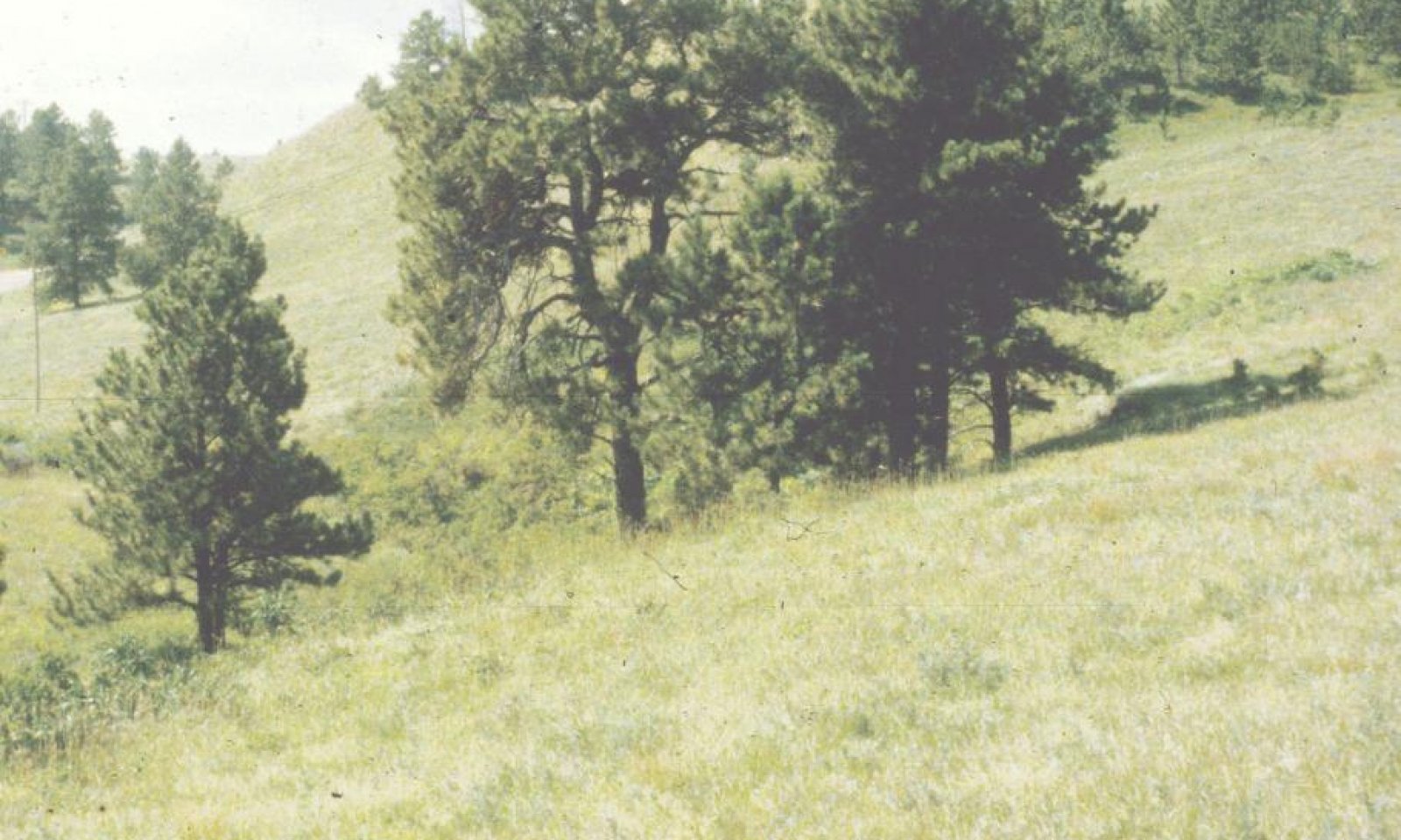
The Stony Hills ecological site occurs throughout MLRA 61. It is located on upland landscapes and does not receive additional moisture from runoff or overflow. The typical slopes range is from 0 to 40 percent. Soils are deep (greater than 20 inches in depth), with cobbly loam surface textures 7 to 8 inches deep. The surface of the soil may be covered by up to 20 percent cobbles and stones. Subsurface textures are loamy-skeletal.
The vegetation in the Reference State (1.0) is dominated by warm-season grasses with cool-season grasses being subdominant. The major grasses include big bluestem, little bluestem, green needlegrass, needle and thread, western wheatgrass, and sideoats grama. Forbs are common and diverse. Shrubs, such as leadplant and rose, are almost always present. Ponderosa pine is typically scattered across the site. The Stony Hills site is susceptible to invasion of non-native cool-season grasses.Associated sites
R061XS012SD Thin Upland-South (16-18" PZ)
The Thin Upland 16-18” PZ ecological site is found on similar landscapes adjacent to the Stony Hills ecological site.
R061XS024SD Shallow Loamy-South (16-18" PZ)
The Shallow Loamy 16-18” PZ ecological site is found on similar landscapes adjacent to the Stony Hills ecological site.
Similar sites
R061XS024SD Shallow Loamy-South (16-18" PZ)
The Shallow Loamy 16-18” PZ ecological site will have much less rock in the soil profile; less big bluestem; and lower vegetative production than the Stony Hills ecological site.
R061XS012SD Thin Upland-South (16-18" PZ)
The Thin Upland 16-18” PZ ecological site will have much less rock, and more carbonates in the soil profile; less big bluestem and ponderosa pine; lower vegetative production than the Stony Hills ecological site.
R061XS044SD Rocky Hills-South (16-18" PZ)
The Rocky Hills 16-18” PZ ecological site will have similar soils and landscape position; will have less tall and mid- warm-season grasses, and more cool-season bunchgrass; shrubs will include alderleaf mountain mahogany; and vegetative production will be much lower than the Stony Hills ecological site.
Table 1. Dominant plant species
Tree Not specified
Shrub Not specified
Herbaceous (1) Andropogon gerardii
(2) Schizachyrium scopariumPhysiographic features
The Stony Hills ecological site occurs on steeply sloping uplands.
Table 2. Representative physiographic features
Landforms (1) Mountain slope
Runoff class Medium to high Flooding frequency None Ponding frequency None Elevation 2900 – 5000 ft Slope 0 – 40 % Aspect Aspect is not a significant factor Climatic features
The climate in MLRA 61 is typical of the drier portions of the Northern Great Plains where sagebrush steppes to the west yield to grassland steppes to the east. Average annual precipitation ranges from 16 to 22 inches with most falling during the growing season. Temperatures show a wide range between summer and winter and between daily maximums and minimums. The wide range is due to the high elevation and dry air, which permit rapidly incoming and outgoing radiation. In winter, cold air outbreaks from Canada move rapidly from northwest to southeast and account for extreme minimum temperatures. Chinook winds may occur in the winter and bring rapid rises in temperature. Extreme storms may occur during the winter. They most severely affect ranch operations during late winter and spring.
The average annual temperature is about 47 °F. January and December are the coldest months with average temperatures ranging from about 23 °F (NNW of Edgemont, SD) to about 26 °F (Fort Meade, SD). July is the warmest month with average temperatures ranging from about 69 °F (Fort Meade, WY) to about 73 °F (Hot Springs, SD). The range of average monthly temperatures between the coldest and warmest months is about 47 °F. Wind speeds are estimated to average about 11 miles per hour annually, ranging from about 13 miles per hour during the spring to about 10 miles per hour during the summer. Winds are generally stronger during the day than at night. Occasionally, storms bring brief periods of high winds with gusts to more than 50 miles per hour.
Growth of cool-season plants begins in early to mid-March, slowing or ceasing in late June. Warm-season plants begin growth about mid-May and continue to early or mid-September. Cool-season plants may green-up in September and October if adequate soil moisture is present.Table 3 Representative climatic features
Frost-free period (characteristic range) 90-110 days Freeze-free period (characteristic range) 120-140 days Precipitation total (characteristic range) 20-20 in Frost-free period (actual range) 80-120 days Freeze-free period (actual range) 120-150 days Precipitation total (actual range) 20-20 in Frost-free period (average) 110 days Freeze-free period (average) 130 days Precipitation total (average) 20 in Characteristic rangeActual rangeBarLineFigure 2. Monthly precipitation range
Characteristic rangeActual rangeBarLineFigure 3. Monthly minimum temperature range
Characteristic rangeActual rangeBarLineFigure 4. Monthly maximum temperature range
BarLineFigure 5. Monthly average minimum and maximum temperature
Figure 6. Annual precipitation pattern
Figure 7 Annual average temperature pattern
Climate stations used
-
(1) BEAR RIDGE [USC00390554], Spearfish, SD
-
(2) SPEARFISH [USC00397882], Spearfish, SD
-
(3) FT MEADE [USC00393069], Fort Meade, SD
-
(4) RAPID CITY 4NW [USC00396947], Rapid City, SD
-
(5) EDGEMONT [USC00392557], Edgemont, SD
-
(6) EDGEMONT 23 NNW [USC00392565], Custer, SD
-
(7) HOT SPRINGS [USC00394007], Hot Springs, SD
-
(8) DEVILS TWR #2 [USC00482466], Devils Tower, WY
-
(9) HULETT [USC00484760], Hulett, WY
-
(10) NEWCASTLE [USC00486660], Newcastle, WY
-
(11) SUNDANCE [USC00488705], Sundance, WY
-
(12) UPTON 14ENE [USC00489208], Newcastle, WY
">Influencing water features
No riparian areas or wetland features are directly associated with the Stony Hills ecological site.
Wetland description
Not Applicable.
Soil features
The soils common to this ecological site are deep to very deep (greater than 20 inches) and well drained. In some areas, the surface may be covered by up to an inch of pine needles and duff. The soil surface layer is typically loamy in texture and 7 to 8 inches thick. The characteristics of the soil profile are dependent on the source of the parent material. Some soils on this site are derived from limestone and calcareous sandstone, and therefore have calcium carbonate in the profile (between depths of 12 and 20 inches). Other soils are derived from igneous and metamorphic rocks and will not have carbonates. A key characteristic of this site is the presence of cobble and stone sized rock fragments on the surface. The surface of the soil may be covered by up to 20 percent cobbles and stones. Slopes range from 0 to 40 percent. Subsurface soil layers are generally nonrestrictive to water movement and root penetration.
Major soils correlated to the Stony Hills ecological site include, Hilger and Mathias.
These soils are mainly susceptible to water erosion. Because of the presence of surface rock fragments, the hazard of water erosion on this site is low until slopes exceed about 20 percent. Loss of 50 percent or more of the surface layer of the soils on this site can result in a shift in species composition and production. Erosion on this site will tend to occur as rills around surface fragments and in areas of concentrated flow.
More information can be found in the various soil survey reports. Contact the local USDA Service Center for soil survey reports that include more detail specific to your area of interest, or use the internet to access USDA’s Web Soil Survey.Table 4. Representative soil features
Parent material (1) Alluvium
(2) Colluvium
(3) Residuum – limestone and sandstone
Surface texture (1) Cobbly very fine sandy loam
(2) Channery loam
Family particle size (1) Loamy
Drainage class Well drained Permeability class Moderate to moderately rapid Soil depth 40 – 60 in Surface fragment cover <=3" 1 – 8 % Surface fragment cover >3" 4 – 15 % Available water capacity
(0-40in)3 – 6 in Calcium carbonate equivalent
(0-40in)10 – 25 % Electrical conductivity
(0-40in)0 – 2 mmhos/cm Sodium adsorption ratio
(0-40in)0 – 2 Soil reaction (1:1 water)
(0-40in)6.6 – 8.4 Subsurface fragment volume <=3"
(Depth not specified)30 – 70 % Subsurface fragment volume >3"
(Depth not specified)5 – 35 % Ecological dynamics
The Stony Hills ecological site developed under Northern Great Plains climatic conditions; light to severe grazing by bison and other large herbivores; sporadic, natural or human-caused wildfire (often of light intensities); and other biotic and abiotic factors that typically influence soil and site development. Changes occur in the plant communities due to short-term weather variations, effects of native and exotic plant and animal species, and management actions. Although the following plant community descriptions are typical of the transitions between communities, severe disturbances, such as periods of well below average precipitation and the introduction of non-native cool-season grasses, can cause significant shifts in plant communities and species composition.
Continuous seasonal grazing (e.g., every spring or every summer at moderate to heavy stocking levels) without adequate recovery periods following grazing events causes departure from the Bluestem-Needlegrass-Wheatgrass Plant Community (1.1). Sedge and other short grasses will increase and eventually develop into a sod. Western wheatgrass will increase initially and then begin to decrease. Needle and thread, green needlegrass, big bluestem, sideoats grama, Indiangrass, and little bluestem will decrease in frequency and production. Excessive defoliation can cause annuals to increase and dominate the site. Extended periods of non-use and lack of fire will result in excessive litter and a plant community dominated by cool-season grasses such as green needlegrass, western wheatgrass, bluegrass, smooth brome, and cheatgrass.
Interpretations are primarily based on the Bluestem-Needlegrass-Wheatgrass Plant Community (1.1). It has been determined by study of rangeland relic areas, areas protected from excessive disturbance, and areas under long-term rotational grazing regimes. Trends in plant community dynamics ranging from heavily grazed to lightly grazed areas, seasonal use pastures, and historical accounts also have been used. Plant community phases, states, transitional pathways, and thresholds have been determined through similar studies and experience.
The following state-and-transition diagram illustrates the common plant communities on the site and the transition pathways between communities. The ecological processes are discussed in more detail in the plant community descriptions following the diagram.State and transition model
Custom diagramStandard diagramMore interactive model formats are also available. View Interactive Models
Click on state and transition labels to scroll to the respective textState 1 submodel, plant communities
State 2 submodel, plant communities
State 3 submodel, plant communities
State 4 submodel, plant communities
State 1
Reference StateThe Reference State represents what is believed to show the natural range of variability that dominated the dynamics of the Stony Hills ecological site prior to European settlement. This site in the Reference State (1.0) is dominated by warm-season grasses, with cool-season grasses being subdominant. In pre-European times, the primary disturbance mechanisms for this site in the reference condition included occasional fire and grazing by large ungulates. Timing of fires and grazing coupled with weather events dictated the dynamics that occurred within the natural range of variability. Taller cool- and warm-season grasses would have declined and a corresponding increase in short statured grass and grass-like species would have occurred. Today, a similar state can be found on areas that are properly managed with grazing and/or prescribed burning, and sometimes on areas receiving occasional short periods of rest. The Reference State (1.0) is very susceptible to invasion of non-native cool-season grasses and the encroachment of conifers from adjacent sites.
Community 1.1
Bluestem-Needlegrass-Wheatgrass
Interpretations are based primarily on the Bluestem-Needlegrass-Wheatgrass Plant Community Phase. This is also considered to be the Reference Plant Community (1.1). The potential vegetation is about 75 percent grasses or grass-like plants, 10 percent forbs, 10 percent shrubs, and 5 percent trees. The community is dominated by warm-season grasses, with cool-season grasses being subdominant. The major grasses include big bluestem, little bluestem, green needlegrass, needle and thread, western wheatgrass, and sideoats grama. Other grasses include porcupine grass, plains muhly, slender wheatgrass, prairie dropseed, Indiangrass, switchgrass, prairie sandreed, and a variety of other grass and grass-like species. This plant community is resilient and well adapted to the Northern Great Plains climatic conditions. The diversity in plant species allows for high drought tolerance. This is a sustainable plant community in regard to site and soil stability, watershed function, and biologic integrity.
Figure 8. Annual production by plant type (representative values) or group (midpoint values)
Table 5. Annual production by plant type
Plant type Low
(lb/acre)Representative value
(lb/acre)High
(lb/acre)Grass/Grasslike 1525 2132 2715 Shrub/Vine 125 195 275 Forb 125 195 275 Tree 25 78 135 Total 1800 2600 3400 Figure 9. Plant community growth curve (percent production by month). SD6104 , Black Hills Foot Slopes, warm-season dominant, cool-season sub-dominant. Warm-season dominant, cool-season sub-dominant.
Jan Feb Mar Apr May Jun Jul Aug Sep Oct Nov Dec J F M A M J J A S O N D 3 7 17 25 25 15 7 1 Community 1.2
Little Bluestem-Needle and Thread-Western WheatgrassThis plant community developed under continuous seasonal grazing (grazing at moderate to heavy stocking levels at the same time of year each year, without adequate recovery periods following each grazing occurrence), or from over utilization during extended drought periods. This community can also develop where this site occurs near water sources. The potential plant community is made up of approximately 75 percent grasses and grass-like species, 10 percent forbs, 10 percent shrubs, and 5 percent trees. Dominant grasses include little bluestem, needle and thread, and western wheatgrass. Grasses and grass-likes species of secondary importance include sideoats grama, porcupine grass, big bluestem, threadleaf sedge, blue grama, and a variety of other grasses. Forbs commonly found in this plant community include white sagebrush (cudweed sagewort), goldenrod, white prairie aster, and scurfpea.
When compared to the Bluestem-Needlegrass-Wheatgrass Plant Community (1.1), blue grama, sedge, and western wheatgrass have increased. Tall warm-season grasses have decreased, and production has also been reduced. Needle and thread will persist in this phase. This plant community is moderately resistant to change. This is due in part to the shallow rooted nature of the shortgrass species which decreases infiltration especially to the deeper rooted tall and mid-grass species. The herbaceous species present are well adapted to grazing; however, species composition can be altered through continued overgrazing. If the herbaceous component is intact, it tends to be resilient if the disturbance is not long-term.Figure 10. Annual production by plant type (representative values) or group (midpoint values)
Table 6. Annual production by plant type
Plant type Low
(lb/acre)Representative value
(lb/acre)High
(lb/acre)Grass/Grasslike 1370 1804 2235 Shrub/Vine 105 165 225 Forb 105 165 225 Tree 20 66 115 Total 1600 2200 2800 Figure 11. Plant community growth curve (percent production by month). SD6103 , Black Hills Foot Slopes, cool-season/warm-season co-dominant. Cool-season, warm-season co-dominant.
Jan Feb Mar Apr May Jun Jul Aug Sep Oct Nov Dec J F M A M J J A S O N D 3 10 20 28 21 10 5 3 Community 1.3
Needle and Thread-Western Wheatgrass/SedgeThis plant community developed under continuous season-long grazing (grazing at moderate to heavy stocking levels for the full growing season each year) or from over utilization during extended drought periods. This community can also develop where the site occurs near water sources. The potential plant community is made up of approximately 75 percent grasses and grass-like species, 10 percent forbs, 10 percent shrubs, and 5 percent trees. Dominant grass and grass-like species include needle and thread, western wheatgrass, threadleaf sedge, and blue grama. Grasses of secondary importance include little bluestem, hairy grama, sideoats grama, big bluestem, green needlegrass, Kentucky and/or Canada bluegrass, and a variety of other grasses. Forbs commonly found in this plant community include white sagebrush (cudweed sagewort), goldenrod, white prairie aster, scurfpea, and field sagewort (green sagewort).
When compared to the Bluestem-Needlegrass-Western Wheatgrass Plant Community (1.1), blue grama, sedge, and western wheatgrass have increased. Tall and mid-warm-season grasses have decreased, and production has also been reduced. This plant community is moderately resistant to change. This is due in part to the shallow rooted nature of the shortgrass species which decreases infiltration especially to the deeper rooted tall and mid-grass species. The herbaceous species present are well adapted to grazing; however, species composition can be altered through continued overgrazing. If the herbaceous component is intact, it tends to be resilient if the disturbance is not long-term. This plant community phase is reaching a critical point where continued overgrazing will likely shift this community over a threshold leading to a short grass and grass-like dominated state. The shorter, more grazing tolerant species tend to self-perpetuate as the shallow, dense rooting structure takes advantage of rainfall and reduces deeper infiltration to the taller species.Figure 12. Annual production by plant type (representative values) or group (midpoint values)
Table 7. Annual production by plant type
Plant type Low
(lb/acre)Representative value
(lb/acre)High
(lb/acre)Grass/Grasslike 1125 1394 1660 Shrub/Vine 80 128 175 Forb 80 128 175 Tree 15 50 90 Total 1300 1700 2100 Figure 13. Plant community growth curve (percent production by month). SD6102 , Black Hills Foot Slopes, cool-season dominant, warm-season sub-dominant. Cool-season dominant, warm-season sub-dominant.
Jan Feb Mar Apr May Jun Jul Aug Sep Oct Nov Dec J F M A M J J A S O N D 3 10 23 34 15 6 5 4 Pathway 1.1A
Community 1.1 to 1.2Continuous season-long grazing (stocking levels well above carrying capacity for extended portions of the growing season) or heavy grazing in combination with drought will push the Reference Plant Community (1.1) to the Little Bluestem-Needle and Thread-Western Wheatgrass Plant Community (1.2).
Pathway 1.2A
Community 1.2 to 1.1Prescribed grazing (proper stocking, alternating season of use, and providing adequate recovery periods); or periodic light to moderate grazing possibly including periodic rest; a return to normal precipitation patterns following drought will convert the Little Bluestem-Needle and Thread-Western Wheatgrass Plant Community (1.2) to the Bluestem-Needlegrass-Wheatgrass Plant Community (1.1).
Conservation practices
Prescribed Grazing Pathway 1.2B
Community 1.2 to 1.3Continuous season-long grazing (stocking levels well above carrying capacity for extended portions of the growing season) or heavy grazing in combination with drought will push the Little Bluestem-Needle and Thread-Western Wheatgrass Plant Community (1.2) to the Needle and Thread-Western Wheatgrass/Sedge Plant Community (1.3).
Pathway 1.3A
Community 1.3 to 1.2Prescribed grazing (proper stocking, alternating season of use, and providing adequate recovery periods) or periodic light to moderate grazing possibly including periodic rest, and a return to normal precipitation patterns following drought will convert the Needle and Thread-Western Wheatgrass/Sedge Plant Community (1.3) to the Little Bluestem- Needle and Thread-Western Wheatgrass Plant Community (1.2).
Conservation practices
Prescribed Grazing State 2
Conifer StateThis state consists of areas where tree canopy increases to a level that impedes the reproductive capability of the major native perennial grass species. The increase in tree canopy is a result of a disruption of the natural historic fire regime that kept the trees at an immature stage. This state is reached when mature tree canopy reaches approximately 25 percent or more. Tree canopy typically is dominated by ponderosa pine, but bur oak and Rocky Mountain juniper may also be present in varying amounts.
Community 2.1
Little Bluestem-Needlegrass/Ponderosa PineThis plant community develops where trees from adjacent sites encroach and begin to shade out the herbaceous component. Ponderosa pine is the most common species to occupy the site, but encroachment also occurs by eastern redcedar, Rocky Mountain juniper, and occasionally deciduous trees such as bur oak. These species expand on this site due to suppression of fire. The tree canopy is 25 percent or greater. The potential plant community is made up of approximately 45 percent grasses and grass-like species, 10 percent forbs, 10 percent shrubs, and 35 percent trees.
Dominant grass and grass-like species include little bluestem, needle and thread, green needlegrass, sideoats grama, western wheatgrass, and threadleaf sedge. As the canopy increases, warm-season grasses tend to decrease as the cool-season grasses initially increase. Forbs commonly found in this community include white sagebrush (cudweed sagewort), goldenrod, and field sagewort (green sagewort). Non-native species such as cheatgrass and bluegrass will tend to invade.
Compared to the Bluestem-Needlegrass-Western Wheatgrass Plant Community (1.1), trees encroach and increase significantly. The grass component decreases dramatically with increased shading and the buildup of duff. Annual herbaceous production also decreases significantly. While the tree canopy provides excellent protection from the weather for both livestock and wildlife, it is not capable of supporting large numbers of wildlife and livestock due to decreased production.Figure 14. Plant community growth curve (percent production by month). SD6111 , Black Hills Foot Slopes, heavy conifer canopy. Mature ponderosa pine/juniper overstory.
Jan Feb Mar Apr May Jun Jul Aug Sep Oct Nov Dec J F M A M J J A S O N D 1 3 7 11 24 27 12 5 4 3 2 1 Community 2.2
Ponderosa PineThis plant community is a result of continued suppression of fire, and a lack of brush management. The tree canopy eventually becomes closed and most of the herbaceous understory is lost. Tree canopy approaches 45 percent or higher and competition slows the growth rate of the trees. A few cool-season species may survive, as well as, shrubs and possibly vines. This plant community may only be altered through harvest, or possibly a wildfire that has enough energy to cause the removal of trees. This plant community phase will also be accompanied by a relatively thick layer of acidic duff from the needles of the trees which will further reduce the establishment of herbaceous species.
Figure 15. Plant community growth curve (percent production by month). SD6111 , Black Hills Foot Slopes, heavy conifer canopy. Mature ponderosa pine/juniper overstory.
Jan Feb Mar Apr May Jun Jul Aug Sep Oct Nov Dec J F M A M J J A S O N D 1 3 7 11 24 27 12 5 4 3 2 1 Pathway 2.1A
Community 2.1 to 2.2No fire or brush management for extended periods of time will allow tree canopy to continue to increase and shift the Little Bluestem-Needlegrass/Ponderosa Pine Plant Community (2.1) to the Ponderosa Pine Plant Community (2.2).
Pathway 2.2A
Community 2.2 to 2.1Fire; prescribed burning; mechanical brush management, or possibly timber harvest, will be required to shift the Ponderosa Pine Plant Community (2.2) to the Little Bluestem-Needlegrass/Ponderosa Pine (2.1). Reproductive propagules of the herbaceous species will need to be present to result in this shift.
Conservation practices
Brush Management Prescribed Burning State 3
Shortgrass Sod StateThis state is a result of overgrazing (individual plants of selected species being repeatedly grazed due to continuous grazing systems which allow for long paddock occupation periods). This type of grazing causes reduced vigor of the selected species (i.e., typically the most desired by grazing ungulates). As the photosynthetic area of these species is repeatedly removed, carbohydrate production needed for root respiration is inadequate and the root systems of these species begin to falter. The shorter, more grazing tolerant species are given the advantage and will dominate the site. In the early stages of this state, mid- and tall grass remnants may be present in sufficient quantities to allow for recovery to the Reference State (1.0). Over time, this recovery will become less likely due to higher runoff and reduced infiltration.
Community 3.1
Sedge/Blue Grama/Fringed SagewortThis plant community evolved under, long-term continuous season-long grazing (grazing at moderate to heavy stocking levels for the full growing season each year); long-term continuous seasonal grazing (grazing at moderate to heavy stocking levels at the same time of year each year, without adequate recovery periods following each grazing occurrence); or from over utilization during extended drought periods.
The potential plant community is made up of approximately 65 percent grasses and grass-like species, 15 percent forbs, 15 percent shrubs, and 5 percent trees. Dominant grass and grass-like species include threadleaf sedge, blue grama, and sun sedge. Grasses of secondary importance include western wheatgrass, needle and thread, little bluestem, sideoats grama, hairy grama, and prairie Junegrass. Cheatgrass may also invade and become quite prevalent. Forbs commonly found in this plant community include white sagebrush (cudweed sagewort), goldenrod, spiny phlox, and field sagewort (green sagewort). When compared to the Bluestem-Needlegrass-Wheatgrass Plant Community (1.1), short statured species are dominant on this plant community. Tall and mid-grasses have decreased significantly. This vegetation state is very resistant to change due to the increase in the root mat near the surface of the soil which further reduces infiltration. The herbaceous species present are well adapted to grazing.
This plant community is less productive than other plant community phases. The thick sod prevents other species from getting established. Lack of litter and reduced plant vigor causes higher soil temperatures, poor water infiltration rates, and high evapotranspiration which give the short statured species a competitive advantage. Soil erosion will be minimal due to the sod forming habit of dominant species in this community.Figure 16. Annual production by plant type (representative values) or group (midpoint values)
Table 8. Annual production by plant type
Plant type Low
(lb/acre)Representative value
(lb/acre)High
(lb/acre)Grass/Grasslike 680 924 1165 Shrub/Vine 55 120 185 Forb 55 120 185 Tree 10 36 65 Total 800 1200 1600 Figure 17. Plant community growth curve (percent production by month). SD6104 , Black Hills Foot Slopes, warm-season dominant, cool-season sub-dominant. Warm-season dominant, cool-season sub-dominant.
Jan Feb Mar Apr May Jun Jul Aug Sep Oct Nov Dec J F M A M J J A S O N D 3 7 17 25 25 15 7 1 State 4
Native/Invaded StateThe Native/Invaded State is dominated by native cool- and warm-season grasses, and subdominant non-native cool-season grasses. It can be found on areas that would appear to be properly managed with grazing and possibly prescribed burning. Extended periods of non-use and no fire, or long-term light grazing can result in the invasion and establishment of non-native cool-season grasses onto this site. If the native cool-season grasses decline, a corresponding increase of non-native cool-season grasses can occur. The non-native cool-season grasses will include, smooth brome, Kentucky bluegrass, cheatgrass, and field brome.
Community 4.1
Wheatgrass-Bluestem-Needlegrass-Non-Native Cool-Season Grasses (<15%)This plant community develops when non-native cool-season grasses, such as Kentucky bluegrass or smooth brome invade and become established on the site. This may occur due to the sites close proximity to seed sources, expansion from road ditches, improved pastures, other invaded sites, or from contaminated hay. Repeated seasonal grazing (typically during the summer), or long-term light grazing, or extended periods of non-use and no fire, will allow these non-native cool-season grasses to increase in the plant community. Plant litter accumulates in large amounts when this community first develops. Litter buildup reduces mature native plant vigor and density, and seedling recruitment declines. Eventually litter levels become high enough that plant density decreases. Typically, rhizomatous grasses form small colonies because of a lack of tiller stimulation.
The potential vegetation is about 80 percent grasses or grass-like plants, 10 percent forbs, and 10 percent shrubs and trees. The community is dominated by cool-season grasses. The major grasses include western wheatgrass, needle and thread, green needlegrass, Kentucky bluegrass, and smooth brome. Other grass and grass-like species include little bluestem, blue grama, sideoats grama, and needleleaf sedge. This is a sustainable plant community in regard to soil and site stability, watershed function, and biologic integrity. However, the presence of smooth bromegrass, Kentucky bluegrass, and other invasive species will begin to alter the soil biotic community and potentially lead to further invasion of non-native species.Figure 18. Plant community growth curve (percent production by month). SD6102 , Black Hills Foot Slopes, cool-season dominant, warm-season sub-dominant. Cool-season dominant, warm-season sub-dominant.
Jan Feb Mar Apr May Jun Jul Aug Sep Oct Nov Dec J F M A M J J A S O N D 3 10 23 34 15 6 5 4 Transition T1A
State 1 to 2Encroachment or an increase in canopy cover of native coniferous tree species, and no fire will transition the Reference State (1.0) to the Conifer State (2.0). This threshold will be crossed when tree canopy reaches approximately 25 percent or more of mature trees.
Transition T1B
State 1 to 3Continuous season-long grazing (stocking levels above carrying capacity for extended portions of the growing season); continuous seasonal grazing (spring or fall); or heavy grazing in combination with drought will transition the Reference State (1.0) to the Shortgrass Sod State (3.0). This transition will most likely occur from the Needle and Thread-Western Wheatgrass/Sedge Plant Community (1.3).
Transition T1C
State 1 to 4Continuous seasonal grazing (summer); long-term light grazing; or no use and no fire; and the invasion of non-native cool-season grasses will transition the Reference State (1.0) to the Native/Invaded State (4.0).
Restoration pathway R2A
State 2 to 1Prescribed burning or mechanical brush management in conjunction with long-term prescribed grazing may lead this plant community across a threshold back to the Reference State (1.0). This would have to take place before the trees reach maturity and are still susceptible to fire, and reproductive propagules of the perennial grasses are still present. After trees reach maturity, a stand removing fire or tree removal would be needed to move this plant community over the threshold back to the Reference State (1.0). Herbaceous weed control may also be needed for treatment of weedy species.
Conservation practices
Brush Management Prescribed Burning Prescribed Grazing Herbaceous Weed Control Transition T2A
State 2 to 4Invasion of non-native cool-season grasses; fire; mechanical brush management; or prescribed burning to remove conifers will transition the Conifer State (2.0) to the Native/Invaded State (4.0). Once conifers are removed, prescribed grazing will be required to facilitate herbaceous recovery and maintenance.
Conservation practices
Brush Management Prescribed Burning Prescribed Grazing Herbaceous Weed Control Restoration pathway R3A
State 3 to 1Long-term prescribed grazing including proper stocking rates, change in season of use, adequate time for recovery; or periodic light to moderate stocking levels possibly including periodic rest; and a return to normal precipitation patterns following drought, may transition the Shortgrass Sod State (3.0) to the Reference State (1.0). This will likely take a long period of time, possibly up to 10 years or more, and recovery may not be attainable. Under certain circumstances, the harsh conditions created by the shortgrass sod can lead to the elimination of invasive grass species such as Kentucky bluegrass.
Conservation practices
Prescribed Grazing Transition T3A
State 3 to 4Invasion of non-native cool-season grasses; long-term prescribed grazing including proper stocking rates, change in season of use, adequate time for recovery; or periodic light to moderate stocking levels possibly including periodic rest; and a return to normal precipitation patterns following drought, may transition the Shortgrass Sod State (3.0) to the Native/Invaded State (4.0). This transition may not be fast or meet management objectives.
Conservation practices
Prescribed Grazing Transition T4A
State 4 to 2Encroachment or an increase in canopy cover of native coniferous tree species, and no fire will lead the Native/Invaded State (4.0) over a threshold to the Conifer State (2.0). This threshold will be crossed when tree canopy reaches approximately 25 percent or more of mature trees.
Transition T4B
State 4 to 3Continuous season-long grazing (stocking levels above carrying capacity for extended portions of the growing season); continuous seasonal grazing (spring or fall); or heavy grazing in combination with drought will result in a transition from the Native Invaded State (4.0) to the Shortgrass Sod State (3.0).
Additional community tables
Table 9. Community 1.1 plant community composition
Group Common name Symbol Scientific name Annual production () Foliar cover (%) Grass/Grasslike1 Tall Warm-Season Grasses 390–780 big bluestem ANGE Andropogon gerardii 260–650 – switchgrass PAVI2 Panicum virgatum 26–182 – Indiangrass SONU2 Sorghastrum nutans 0–130 – prairie sandreed CALO Calamovilfa longifolia 26–130 – composite dropseed SPCOC2 Sporobolus compositus var. compositus 26–104 – 2 Mid- Warm-Season Grasses 390–780 little bluestem SCSC Schizachyrium scoparium 130–650 – sideoats grama BOCU Bouteloua curtipendula 130–390 – prairie dropseed SPHE Sporobolus heterolepis 26–260 – plains muhly MUCU3 Muhlenbergia cuspidata 26–130 – 3 Cool-Season Bunchgrass 130–390 green needlegrass NAVI4 Nassella viridula 52–260 – needle and thread HECOC8 Hesperostipa comata ssp. comata 52–260 – slender wheatgrass ELTR7 Elymus trachycaulus 26–260 – green needlegrass NAVI4 Nassella viridula 0–150 – porcupinegrass HESP11 Hesperostipa spartea 0–130 – bluebunch wheatgrass PSSP6 Pseudoroegneria spicata 0–52 – 4 Rhizomatous Wheatgrass 130–390 western wheatgrass PASM Pascopyrum smithii 52–390 – thickspike wheatgrass ELLAL Elymus lanceolatus ssp. lanceolatus 0–260 – 5 Other Native Grasses 26–130 prairie Junegrass KOMA Koeleria macrantha 26–130 – Grass, perennial 2GP Grass, perennial 0–104 – blue grama BOGR2 Bouteloua gracilis 0–52 – Sandberg bluegrass POSE Poa secunda 0–26 – squirreltail ELEL5 Elymus elymoides 0–26 – Cusick's bluegrass POCU3 Poa cusickii 0–26 – 6 Grass-likes 130–260 threadleaf sedge CAFI Carex filifolia 52–208 – sun sedge CAINH2 Carex inops ssp. heliophila 26–130 – Grass-like (not a true grass) 2GL Grass-like (not a true grass) 0–78 – 7 Non-Native Cool-Season Grases 0 Forb8 Forbs 130–260 Forb, native 2FN Forb, native 26–130 – stiff goldenrod OLRI Oligoneuron rigidum 26–52 – stiff sunflower HEPA19 Helianthus pauciflorus 0–52 – silverleaf Indian breadroot PEAR6 Pediomelum argophyllum 26–52 – upright prairie coneflower RACO3 Ratibida columnifera 26–52 – blacksamson echinacea ECAN2 Echinacea angustifolia 26–52 – nineanther prairie clover DAEN Dalea enneandra 0–52 – white sagebrush ARLU Artemisia ludoviciana 26–52 – dotted blazing star LIPU Liatris punctata 26–52 – hairy false goldenaster HEVI4 Heterotheca villosa 26–52 – Indian breadroot PEDIO2 Pediomelum 26–52 – Missouri goldenrod SOMI2 Solidago missouriensis 26–52 – beardtongue PENST Penstemon 0–26 – downy Indian paintbrush CAPU11 Castilleja purpurea 0–26 – field sagewort ARCA12 Artemisia campestris 0–26 – groundplum milkvetch ASCR2 Astragalus crassicarpus 0–26 – pussytoes ANTEN Antennaria 0–26 – scarlet beeblossom GACO5 Gaura coccinea 0–26 – slimflower scurfpea PSTE5 Psoralidium tenuiflorum 0–26 – spiny phlox PHHO Phlox hoodii 0–26 – white prairie aster SYFA Symphyotrichum falcatum 0–26 – Shrub/Vine9 Shrubs 130–260 leadplant AMCA6 Amorpha canescens 52–208 – rose ROSA5 Rosa 26–78 – Shrub (>.5m) 2SHRUB Shrub (>.5m) 0–78 – skunkbush sumac RHTR Rhus trilobata 0–52 – western snowberry SYOC Symphoricarpos occidentalis 0–52 – prairie sagewort ARFR4 Artemisia frigida 0–26 – Tree10 Trees 26–130 ponderosa pine PIPO Pinus ponderosa 26–130 – Rocky Mountain juniper JUSC2 Juniperus scopulorum 0–78 – bur oak QUMA2 Quercus macrocarpa 0–52 – Tree 2TREE Tree 0–52 – Table 10. Community 1.2 plant community composition
Group Common name Symbol Scientific name Annual production () Foliar cover (%) Grass/Grasslike1 Tall Warm-Season Grasses 44–220 big bluestem ANGE Andropogon gerardii 22–176 – switchgrass PAVI2 Panicum virgatum 0–66 – composite dropseed SPCOC2 Sporobolus compositus var. compositus 0–66 – Indiangrass SONU2 Sorghastrum nutans 0–44 – prairie sandreed CALO Calamovilfa longifolia 0–22 – 2 Mid- Warm-Season Grasses 220–440 little bluestem SCSC Schizachyrium scoparium 110–440 – sideoats grama BOCU Bouteloua curtipendula 44–220 – prairie dropseed SPHE Sporobolus heterolepis 0–110 – plains muhly MUCU3 Muhlenbergia cuspidata 0–66 – 3 Cool-Season Bunchgrass 220–550 needle and thread HECOC8 Hesperostipa comata ssp. comata 110–440 – green needlegrass NAVI4 Nassella viridula 22–176 – green needlegrass NAVI4 Nassella viridula 0–125 – slender wheatgrass ELTR7 Elymus trachycaulus 0–110 – porcupinegrass HESP11 Hesperostipa spartea 0–66 – bluebunch wheatgrass PSSP6 Pseudoroegneria spicata 0–22 – 4 Rhizomatous Wheatgrass 220–440 western wheatgrass PASM Pascopyrum smithii 220–440 – thickspike wheatgrass ELLAL Elymus lanceolatus ssp. lanceolatus 0–220 – 5 Other Native Grasses 110–220 blue grama BOGR2 Bouteloua gracilis 44–176 – Grass, perennial 2GP Grass, perennial 0–88 – prairie Junegrass KOMA Koeleria macrantha 22–66 – Sandberg bluegrass POSE Poa secunda 0–44 – squirreltail ELEL5 Elymus elymoides 0–44 – 6 Grass-likes 220–330 threadleaf sedge CAFI Carex filifolia 110–264 – sun sedge CAINH2 Carex inops ssp. heliophila 22–154 – Grass-like (not a true grass) 2GL Grass-like (not a true grass) 0–88 – 7 Non-Native Cool-Season Grasses 0 Forb8 Forbs 110–220 Forb, native 2FN Forb, native 22–88 – silverleaf Indian breadroot PEAR6 Pediomelum argophyllum 22–66 – white sagebrush ARLU Artemisia ludoviciana 22–66 – field sagewort ARCA12 Artemisia campestris 0–44 – hairy false goldenaster HEVI4 Heterotheca villosa 22–44 – Missouri goldenrod SOMI2 Solidago missouriensis 22–44 – slimflower scurfpea PSTE5 Psoralidium tenuiflorum 0–44 – upright prairie coneflower RACO3 Ratibida columnifera 0–44 – blacksamson echinacea ECAN2 Echinacea angustifolia 0–44 – stiff goldenrod OLRI Oligoneuron rigidum 22–44 – white prairie aster SYFA Symphyotrichum falcatum 22–44 – stiff sunflower HEPA19 Helianthus pauciflorus 0–22 – pussytoes ANTEN Antennaria 0–22 – spiny phlox PHHO Phlox hoodii 0–22 – beardtongue PENST Penstemon 0–22 – Indian breadroot PEDIO2 Pediomelum 0–22 – groundplum milkvetch ASCR2 Astragalus crassicarpus 0–22 – dotted blazing star LIPU Liatris punctata 0–22 – nineanther prairie clover DAEN Dalea enneandra 0–22 – Shrub/Vine9 Shrubs 110–220 Shrub (>.5m) 2SHRUB Shrub (>.5m) 0–88 – western snowberry SYOC Symphoricarpos occidentalis 0–66 – prairie sagewort ARFR4 Artemisia frigida 22–66 – leadplant AMCA6 Amorpha canescens 0–66 – rose ROSA5 Rosa 22–66 – skunkbush sumac RHTR Rhus trilobata 0–44 – Tree10 Trees 22–110 ponderosa pine PIPO Pinus ponderosa 22–110 – Rocky Mountain juniper JUSC2 Juniperus scopulorum 0–66 – bur oak QUMA2 Quercus macrocarpa 0–44 – Tree 2TREE Tree 0–44 – Table 11. Community 1.3 plant community composition
Group Common name Symbol Scientific name Annual production () Foliar cover (%) Grass/Grasslike1 Tall Warm-Season Grasses 0–85 big bluestem ANGE Andropogon gerardii 0–68 – composite dropseed SPCOC2 Sporobolus compositus var. compositus 0–51 – prairie sandreed CALO Calamovilfa longifolia 0–17 – 2 Mid- Warm-Season Grasses 34–170 little bluestem SCSC Schizachyrium scoparium 17–170 – sideoats grama BOCU Bouteloua curtipendula 17–136 – plains muhly MUCU3 Muhlenbergia cuspidata 0–34 – 3 Cool-Season Bunch Grass 170–425 needle and thread HECOC8 Hesperostipa comata ssp. comata 170–425 – slender wheatgrass ELTR7 Elymus trachycaulus 0–85 – green needlegrass NAVI4 Nassella viridula 0–68 – 4 Rhizomatous Wheatgrass 170–340 western wheatgrass PASM Pascopyrum smithii 170–340 – thickspike wheatgrass ELLAL Elymus lanceolatus ssp. lanceolatus 0–170 – 5 Other Native Grasses 85–255 blue grama BOGR2 Bouteloua gracilis 34–204 – Grass, perennial 2GP Grass, perennial 0–68 – prairie Junegrass KOMA Koeleria macrantha 17–51 – Sandberg bluegrass POSE Poa secunda 0–34 – squirreltail ELEL5 Elymus elymoides 0–34 – 6 Grass-likes 170–340 threadleaf sedge CAFI Carex filifolia 85–255 – sun sedge CAINH2 Carex inops ssp. heliophila 17–136 – Grass-like (not a true grass) 2GL Grass-like (not a true grass) 0–68 – 7 Non-Native Cool-Season Grasses 0 Forb8 Forbs 85–170 white sagebrush ARLU Artemisia ludoviciana 17–68 – field sagewort ARCA12 Artemisia campestris 17–51 – Missouri goldenrod SOMI2 Solidago missouriensis 17–51 – Forb, native 2FN Forb, native 0–51 – silverleaf Indian breadroot PEAR6 Pediomelum argophyllum 17–34 – slimflower scurfpea PSTE5 Psoralidium tenuiflorum 0–34 – stiff goldenrod OLRI Oligoneuron rigidum 17–34 – white prairie aster SYFA Symphyotrichum falcatum 17–34 – spiny phlox PHHO Phlox hoodii 0–17 – upright prairie coneflower RACO3 Ratibida columnifera 0–17 – blacksamson echinacea ECAN2 Echinacea angustifolia 0–17 – pussytoes ANTEN Antennaria 0–17 – hairy false goldenaster HEVI4 Heterotheca villosa 0–17 – dotted blazing star LIPU Liatris punctata 0–17 – Shrub/Vine9 Shrubs 85–170 prairie sagewort ARFR4 Artemisia frigida 17–102 – Shrub (>.5m) 2SHRUB Shrub (>.5m) 0–68 – western snowberry SYOC Symphoricarpos occidentalis 0–51 – rose ROSA5 Rosa 0–34 – skunkbush sumac RHTR Rhus trilobata 0–34 – Tree10 Trees 17–85 ponderosa pine PIPO Pinus ponderosa 17–85 – Rocky Mountain juniper JUSC2 Juniperus scopulorum 0–51 – bur oak QUMA2 Quercus macrocarpa 0–34 – Tree 2TREE Tree 0–34 – Table 12. Community 2.1 plant community composition
Group Common name Symbol Scientific name Annual production () Foliar cover (%) Table 13. Community 2.2 plant community composition
Group Common name Symbol Scientific name Annual production () Foliar cover (%) Table 14. Community 3.1 plant community composition
Group Common name Symbol Scientific name Annual production () Foliar cover (%) Grass/Grasslike1 Tall Warm-Season Grasses 0–12 composite dropseed SPCOC2 Sporobolus compositus var. compositus 0–12 – 2 Mid- Warm-Season Grasses 0–60 sideoats grama BOCU Bouteloua curtipendula 0–60 – little bluestem SCSC Schizachyrium scoparium 0–36 – 3 Cool-Season Bunchgrass 0–120 needle and thread HECOC8 Hesperostipa comata ssp. comata 0–120 – slender wheatgrass ELTR7 Elymus trachycaulus 0–60 – 4 Rhizomatous Wheatgrass 0–120 western wheatgrass PASM Pascopyrum smithii 0–120 – thickspike wheatgrass ELLAL Elymus lanceolatus ssp. lanceolatus 0–60 – 5 Other Native Grasses 120–240 blue grama BOGR2 Bouteloua gracilis 60–216 – Sandberg bluegrass POSE Poa secunda 0–36 – Grass, perennial 2GP Grass, perennial 0–36 – squirreltail ELEL5 Elymus elymoides 0–24 – prairie Junegrass KOMA Koeleria macrantha 12–24 – 6 Grass-Likes 180–360 threadleaf sedge CAFI Carex filifolia 120–300 – sun sedge CAINH2 Carex inops ssp. heliophila 24–120 – Grass-like (not a true grass) 2GL Grass-like (not a true grass) 0–48 – 7 Non-Native Cool-Season Grasses 24–120 cheatgrass BRTE Bromus tectorum 24–96 – field brome BRAR5 Bromus arvensis 0–96 – Kentucky bluegrass POPR Poa pratensis 0–84 – smooth brome BRIN2 Bromus inermis 0–60 – Forb8 Forbs 60–180 Forb, introduced 2FI Forb, introduced 12–72 – white sagebrush ARLU Artemisia ludoviciana 12–60 – field sagewort ARCA12 Artemisia campestris 12–60 – Missouri goldenrod SOMI2 Solidago missouriensis 12–36 – silverleaf Indian breadroot PEAR6 Pediomelum argophyllum 0–24 – stiff goldenrod OLRI Oligoneuron rigidum 0–24 – Forb, native 2FN Forb, native 0–24 – white prairie aster SYFA Symphyotrichum falcatum 0–12 – slimflower scurfpea PSTE5 Psoralidium tenuiflorum 0–12 – spiny phlox PHHO Phlox hoodii 0–12 – pussytoes ANTEN Antennaria 0–12 – Shrub/Vine9 Shrubs 60–180 prairie sagewort ARFR4 Artemisia frigida 24–144 – Shrub (>.5m) 2SHRUB Shrub (>.5m) 0–36 – skunkbush sumac RHTR Rhus trilobata 0–24 – western snowberry SYOC Symphoricarpos occidentalis 0–24 – rose ROSA5 Rosa 0–12 – Tree10 Trees 12–60 ponderosa pine PIPO Pinus ponderosa 12–60 – Rocky Mountain juniper JUSC2 Juniperus scopulorum 0–36 – bur oak QUMA2 Quercus macrocarpa 0–24 – Tree 2TREE Tree 0–24 – Table 15. Community 4.1 plant community composition
Group Common name Symbol Scientific name Annual production () Foliar cover (%) Interpretations
Animal community
MLRA 61 lies within the drier portion of the northern mixed-grass prairie ecosystem where sagebrush steppes to the west yield to grassland steppes to the east. Prior to European settlement, this area consisted of diverse grass- and shrubland habitats interspersed with varying densities of depressional instream wetlands and woody riparian corridors. These habitats provided critical life cycle components for many users. Many species of grassland birds, small mammals, reptiles, amphibians, and herds of roaming bison, elk, and pronghorn were among the inhabitants adapted to this semi-arid region. Roaming herbivores, as well as several small mammal and insect species, were the primary consumers linking the grassland resources to predators such as the gray wolf, mountain lion, and grizzly bear, and smaller carnivores such as the coyote, bobcat, fox, and raptors. The prairie dog was once abundant; however, the species remains a keystone species within its range. The black-footed ferret, burrowing owl, ferruginous hawk, mountain plover, and swift fox were associated with prairie dog complexes.
Historically, the northern mixed-grass prairie was a disturbance-driven ecosystem with fire, herbivory, and climate functioning as the primary disturbance factors either singly or in combination. Following European settlement, livestock grazing, cropland conversion, elimination of fire, energy development, and other anthropogenic factors influenced species composition and abundance. Introduced and invasive species further impacted plant and animal communities. The bison was a historical keystone species but had been extirpated in this area as a free-ranging herbivore. The loss of the bison and reduction of prairie dog populations and fire as ecological drivers greatly influenced the character of the remaining native plant communities and altered wildlife habitats. Human development has reduced habitat quality for area-sensitive species.
Within MLRA 61, the Stony Hills ecological site provides upland grassland cover with an associated forb component. It was typically part of an expansive grassland landscape that included combinations of Clayey, Loamy, Overflow, Subirrigated, and Terrace ecological sites.
This site provided habitat for species requiring unfragmented grassland. Important habitat features, and components found commonly or exclusively on this site may include sharp-tailed grouse leks; upland nesting habitat for grassland birds, forbs and insects for brood habitat; and a forage source for small and large herbivores. Many grassland and shrub steppe nesting bird populations are declining. Extirpated species include free-ranging American bison, grizzly bear, gray wolf, black-footed ferret, mountain plover, Rocky Mountain locust, and swift fox.
The majority of the Stony Hills ecological site has remained relatively intact and provides increasingly important habitat for grassland and shrub steppe nesting birds, small rodents, coyote, and a variety of reptiles, amphibians, and insects. Invasive species such as Kentucky bluegrass, smooth brome, and annual brome grasses have impacted the biological integrity of the site for some grassland birds. Changes in historic fire regime and domestic grazing have impacted the forb/shrub/grass percentages.
Grazing Interpretations:
The following list suggests annual, initial stocking rates for average growing conditions. These estimates are conservative and should be used only as guidelines in the initial stages of conservation planning. Commonly, the current plant composition does not entirely match any particular plant community (as described in this ecological site description). Therefore, a resource inventory is necessary to document plant composition and production. More accurate estimates of carrying capacity should eventually be calculated using the following stocking rate information along with animal preference data and actual stocking records, particularly when grazers other than cattle are involved. In consultation with the land manager, a more intensive grazing management program that results in improved harvest efficiencies and increased carrying capacity may be developed.
The following suggested initial stocking rates are based on 912 lb/acre (air-dry weight) per animal-unit-month (AUM) with a 25 percent harvest efficiency of preferred and desirable forage species (refer to USDA-NRCS, National Range and Pasture Handbook). An AUM is defined as the equivalent amount of forage required by a 1,000-pound cow, with or without calf, for one month.
Plant Community: Bluestem-Needlegrass-Wheatgrass (1.1)
Average Production (lb/acre, air-dry): 2,600
Stocking Rate (AUM/acre): 0.71
Plant Community: Little Bluestem-Needle and Thread-Western Wheatgrass (1.2)
Average Production (lb/acre, air-dry): 2,200
Stocking Rate (AUM/acre): 0.60
Plant Community: Needle and Thread-Western Wheatgrass/Sedge (1.3)
Average Production (lb/acre, air-dry): 1,700*
Stocking Rate (AUM/acre): 0.47*
Plant Community: Little Bluestem-Needlegrass/Ponderosa Pine (2.1)
Average Production (lb/acre, air-dry): 500*
Stocking Rate (AUM/acre): 0.14*
Plant Community: Sedge/Blue Grama/Fringed Sagewort (3.1)
Average Production (lb/acre, air-dry): 1,200*
Stocking Rate (AUM/acre): 0.33*
Plant Community: All other plant communities identified in this document have variable annual production values and require onsite sampling to determine initial stocking rates.
* Total annual production and stocking rates are highly variable and require onsite sampling.
Total onsite annual production may contain vegetation deemed undesirable or untargeted by the grazing animal. Therefore, AUM values may need to be reduced to reflect only preferred or desirable forage species.
Grazing by domestic livestock is one of the major income-producing industries in the area. Rangeland in this area may provide yearlong forage for livestock. During the dormant period, the forage for livestock likely has insufficient protein to meet livestock requirements. Added protein allows ruminants to better utilize the energy stored in grazed plant materials. A forage quality test (either directly or through fecal sampling) should be used to determine the level of supplementation needed.Hydrological functions
Water is the principal factor limiting forage production on this site. This site is dominated by soils in hydrologic groups B. Infiltration and runoff potential for this site varies from moderate to high depending on soil hydrologic group, slope, and ground cover. In many cases, areas with greater than 75 percent ground cover have the greatest potential for high infiltration and lower runoff. An example of an exception would be where shortgrasses form a strong sod and dominate the site. Dominance by blue grama, buffalograss, bluegrass, or smooth brome will result in reduced infiltration and increased runoff. Areas where ground cover is less than 50 percent have the greatest potential to have reduced infiltration and higher runoff. Refer to the USDA-NRCS National Engineering Handbook, Part 630, for hydrologic soil groups, runoff quantities, and hydrologic curves.
Recreational uses
This site provides hunting, hiking, photography, bird watching, and other opportunities. The wide variety of plants that bloom from spring until fall have aesthetic value that appeals to visitors.
Wood products
No appreciable wood products are typically present on this site. Some timber could potentially be harvested from the Conifer State (2.0).
Other products
Harvesting the seeds of native plants can provide additional income on this site.
Other information
Revision Notes: “Previously Approved” Provisional
This provisional ecological site description (ESD) has passed quality control (QC) and quality assurance (QA) to ensure the it meets the 2014 NESH standards for a “Provisional” ecological site description.
This ecological site description (ESD) is an updated “Previously Approved” ESD that represented a first-generation tier of documentation that met all requirements as an “Approved” ESD as laid out in the 1997 National Range and Pasture Handbook (NRPH). The requirements for approved status changed with the release of the 2014 National Ecological Site Handbook (NESH). The previously approved document fully described the reference state and community phase in the state-and-transition model. All other alternative states were at least described in narrative form. The “Previously Approved” ESD has been field-tested for a minimum of five years and is a proven functional document for conservation planning. The “Previously Approved” ESD may not contain all tabular and narrative entries as required in the current “Approved” level of documentation, but it is expected this ESD will continue refinement toward the current “Approved” status.
Site Development and Testing Plan
Future work, as described in an official project plan, is necessary to validate the information in this provisional ecological site description. The plan will include field activities for low-, medium-, and high-intensity sampling, soil correlations, and analysis of the data. Annual field reviews should be done by soil scientists and vegetation specialists. Final field review, peer review, quality control, and quality assurance reviews are required to produce the final document.Supporting information
Inventory data references
Information presented here has been derived from NRCS clipping data and other inventory data. Field observations from range-trained personnel were also used. Those involved in developing this site include: Stan Boltz, Range Management Specialist, NRCS; Cynthia Englebert, Range Management Specialist, Forest Service; George Gamblin, Range Management Specialist, NRCS; Ryan Murray, Range Management Specialist, NRCS; Cheryl Nielsen, Range Management Specialist, NRCS; L. Michael Stirling, Range Management Specialist, NRCS; Jim Westerman, Soil Scientist, NRCS.
Other references
Cleland, D.T., J.A. Freeouf, J.E. Keys, G.J. Nowacki, C.A. Carpenter, and W.H McNab. 2007. Ecological subregions: Sections and subsections of the conterminous United States. USDA Forest Service, General Technical Report WO-76D. https://www.fs.fed.us/research/publications/misc/73326-wo-gtr-76d-cleland2007.pdf (accessed 31 January 2019).
Cowardin, L.M., V. Carter, F.C. Golet, and E.T. LaRoe. 1979. Classification of wetlands and deep-water habitats of the United States. U.S. Fish and Wildlife Service FWS/OBS-79/31.
U.S. Environmental Protection Agency. 2018.
EPA level III and level IV ecoregions of the conterminous United States. https://www.epa.gov/eco-research/level-iii-and-iv-ecoregions- conterminous-united-states (accessed 26 April 2018).
High Plains Regional Climate Center, University of Nebraska. 2018. http://www.hprcc.unl.edu/ (accessed 6 April 2018).
Larson, Gary E. and James R. Johnson. 1999. Plants of the Black Hills and Bear Lodge Mountains. South Dakota State University, College of Agriculture and Biological Sciences and Agriculture Experiment Station, Bulletin 732, Brookings, SD.
Toledo, D., M. Sanderson, K. Spaeth, J. Hendrickson, and J. Printz. 2014. Extent of Kentucky bluegrass and its effect on native plant species diversity and ecosystem services in the Northern Great Plains of the United States. Invasive Plant Science and Management. 7(4):543–522. Weed Science Society of America.
U.S. Department of Agriculture, Natural Resources Conservation Service. 2018. Electronic field office technical guide. https://efotg.sc.egov.usda.gov (accessed 24 September 2018).
Soil Survey Staff. 2018. Official soil series descriptions. USDA Natural Resources Conservation Service. https://www.nrcs.usda.gov/wps/portal/nrcs/detail/soils/home/?cid=nrcs142p2_053587 (accessed 20 December 2018).
Soil Survey Staff. 2018. Web Soil Survey. USDA Natural Resources Conservation Service. https://websoilsurvey.sc.egov.usda.gov/App/WebSoilSurvey.aspx (accessed 20 December 2018).
U.S. Department of Agriculture, Natural Resources Conservation Service. 2006. Land resource regions and major land resource areas of the United States, the Caribbean, and the Pacific Basin. Agriculture Handbook 296. https://www.nrcs.usda.gov/Internet/FSE_DOCUMENTS/nrcs142p2_050898.pdf (accessed 17 January 2018).
U.S. Department of Agriculture, Natural Resources Conservation Service. 2014. National ecological site handbook, 1st ed. https://www.nrcs.usda.gov/wps/portal/nrcs/detail/soils/ref/?cid=nrcseprd1291232 (accessed 27 January 2018).
U.S. Department of Agriculture, Natural Resources Conservation Service. 2012. National engineering handbook, part 630. Hydrology chapters from e-Directives. https://directives.sc.egov.usda.gov/viewerFS.aspx?hid=21422 (accessed 17 January 2018).
U.S. Department of Agriculture, Natural Resources Conservation Service. 2018. Climate data. National Water and Climate Center. http://www.wcc.nrcs.usda.gov/ (accessed 2 December 2018).
U.S. Department of Agriculture, Natural Resources Conservation Service. 1997. National range and pasture handbook, rev. 1, 2003. https://www.nrcs.usda.gov/Internet/FSE_DOCUMENTS/stelprdb1043055.pdf (accessed 7 January 2018).
U.S. Department of Agriculture, Natural Resources Conservation Service. 2018. National Soil Information System, Information Technology Center. http://nasis.nrcs.usda.gov (accessed 25 May 2018.
U.S. Department of Agriculture, Natural Resources Conservation Service. 2018. PLANTS database. National Plant Data Team, Greensboro, NC. http://plants.usda.gov (accessed 27 December 2018).
U.S. Department of Agriculture, Natural Resources Conservation Service. 2007. National engineering handbook, part 654. Rosgen Stream Classification Technique – Supplemental Materials, Technical Supplement 3E. https://directives.sc.egov.usda.gov/OpenNonWebContent.aspx?content=17833.wba (accessed 4 March 2019).
Vore Buffalo Jump Foundation. 2019. Vore Buffalo Jump. https://www.vorebuffalojump.org/content/ (accessed 20 June 2019).Contributors
Stan C. Boltz
Rick L. PetersonApproval
Suzanne Mayne-Kinney, 7/17/2024
Acknowledgments
All ecological sites were written to the Provisional Level by Rick L. Peterson, ESS, Rapid City, SSO in FY20. The ESDs were reviewed for quality control by Emily Helms, John Hartung, Mitch Faulkner, and Ryan Murray. All ecological sites were then reviewed and approved at the Provisional Level by David Kraft, Regional ESS, Salina, KS in September 2020. Non-Discrimination Statement: In accordance with Federal civil rights law and U.S. Department of Agriculture (USDA) civil rights regulations and policies, the USDA, its Agencies, offices, and employees, and institutions participating in or administering USDA programs are prohibited from discriminating based on race, color, national origin, religion, sex, gender identity (including gender expression), sexual orientation, disability, age, marital status, family/parental status, income derived from a public assistance program, political beliefs, or reprisal or retaliation for prior civil rights activity, in any program or activity conducted or funded by USDA (not all bases apply to all programs). Remedies and complaint filing deadlines vary by program or incident. Persons with disabilities who require alternative means of communication for program information (e.g., Braille, large print, audiotape, American Sign Language, etc.) should contact the responsible Agency or USDA's TARGET Center at (202) 720-2600 (voice and TTY) or contact USDA through the Federal Relay Service at (800) 877-8339. Additionally, program information may be made available in languages other than English. To file a program discrimination complaint, complete the USDA Program Discrimination Complaint Form, AD-3027, available online at https://www.ascr.usda.gov/filing-program-discrimination-complaint-usda-customer and at any USDA office, or write a letter addressed to USDA and provide in the letter all of the information requested in the form. To request a copy of the complaint form, call (866) 632-9992. Submit your completed form or letter to USDA by: (1) mail: U.S. Department of Agriculture, Office of the Assistant Secretary for Civil Rights, 1400 Independence Avenue, SW, Washington, D.C. 20250-9410; (2) fax: (202) 690-7442; or (3) email: program.intake@usda.gov. USDA is an equal opportunity provider, employer, and lender.
Rangeland health reference sheet
Interpreting Indicators of Rangeland Health is a qualitative assessment protocol used to determine ecosystem condition based on benchmark characteristics described in the Reference Sheet. A suite of 17 (or more) indicators are typically considered in an assessment. The ecological site(s) representative of an assessment location must be known prior to applying the protocol and must be verified based on soils and climate. Current plant community cannot be used to identify the ecological site.
Author(s)/participant(s) Stan Boltz Contact for lead author Stan Boltz, stanley.boltz@sd.usda.gov, 605-352-1236 Date 09/30/2009 Approved by Approval date Composition (Indicators 10 and 12) based on Annual Production Indicators
-
Number and extent of rills:
Slight to none, typically on steeper slopes and discontinuous. -
Presence of water flow patterns:
None, or barely visible and discontinuous with numerous debris dams when present. -
Number and height of erosional pedestals or terracettes:
Few pedastalled plants typically on steeper slopes. Terracettes not present. -
Bare ground from Ecological Site Description or other studies (rock, litter, lichen, moss, plant canopy are not bare ground):
Bare ground is roughly 5 to 20 percent, and patches are less than 2 inches in diameter. -
Number of gullies and erosion associated with gullies:
Active gullies should not be present. -
Extent of wind scoured, blowouts and/or depositional areas:
None. -
Amount of litter movement (describe size and distance expected to travel):
Small size litter classes will generally move short distances, some medium size class litter will move very short distances. Litter debris dams are occasionally present. -
Soil surface (top few mm) resistance to erosion (stability values are averages - most sites will show a range of values):
Soil aggregate stability ratings typically 5 to 6, normally 6. Surface organic matter adheres to the soil surface. -
Soil surface structure and SOM content (include type of structure and A-horizon color and thickness):
Soil surface structure is typically granular, and mollic (higher organic matter) colors of surface horizon about 2 to 4 inches deep. If conditions are other than this, refer to map unit component descriptions for component on which the site occurs. -
Effect of community phase composition (relative proportion of different functional groups) and spatial distribution on infiltration and runoff:
Combination of shallow and deep rooted species (mid & tall rhizomatous and tufted perennial cool- and warm-season grasses) with fine and coarse roots positively influences infiltration. -
Presence and thickness of compaction layer (usually none; describe soil profile features which may be mistaken for compaction on this site):
None. -
Functional/Structural Groups (list in order of descending dominance by above-ground annual-production or live foliar cover using symbols: >>, >, = to indicate much greater than, greater than, and equal to):
Dominant:
Tall, warm-season grasses = mid, warm-season grasses >>Sub-dominant:
Mid and tall cool-season bunchgrasses = wheatgrasses (mid, cool-season rhizomatous) >Other:
Grass-like species = forbs = shrubs > treesAdditional:
Other grasses occur in other functional groups in minor amounts. -
Amount of plant mortality and decadence (include which functional groups are expected to show mortality or decadence):
Very little evidence of decadence or mortality. Bunch grasses have strong, healthy centers and shrubs are vigorous. -
Average percent litter cover (%) and depth ( in):
55 to 65 percent plant litter cover, roughly 0.25 to 0.5 inch depth. Litter cover is in contact with soil surface. -
Expected annual annual-production (this is TOTAL above-ground annual-production, not just forage annual-production):
Ranges from 1,800 to 3,400 pounds/acre. Reference value is 2,600 pounds/acre (air-dry weight basis). -
Potential invasive (including noxious) species (native and non-native). List species which BOTH characterize degraded states and have the potential to become a dominant or co-dominant species on the ecological site if their future establishment and growth is not actively controlled by management interventions. Species that become dominant for only one to several years (e.g., short-term response to drought or wildfire) are not invasive plants. Note that unlike other indicators, we are describing what is NOT expected in the reference state for the ecological site:
Refer to State and Local Noxious Weed List. -
Perennial plant reproductive capability:
All species exhibit high vigor relative to climatic conditions. Do not rate based solely on seed production. Perennial grasses typically have vigorous rhizomes or tillers.
Print Options
Sections
Font
AAAAOther
PrintThe Ecosystem Dynamics Interpretive Tool is an information system framework developed by the USDA-ARS Jornada Experimental Range, USDA Natural Resources Conservation Service, and New Mexico State University.
Accessibility statement


