
Natural Resources
Conservation Service
-
Search


Major Land Resource Area or ecological site by name and/or ID.
PreviousSectionsNextGeneral information
Provisional. A provisional ecological site description has undergone quality control and quality assurance review. It contains a working state and transition model and enough information to identify the ecological site.
Click to explore map
Figure 1. Mapped extent
Areas shown in blue indicate the maximum mapped extent of this ecological site. Other ecological sites likely occur within the highlighted areas. It is also possible for this ecological site to occur outside of highlighted areas if detailed soil survey has not been completed or recently updated.
MLRA notes
Major Land Resource Area (MLRA): 060A–Pierre Shale Plains
The Pierre Shale Plains (MLRA 60A) consists of approximately 10,150 square miles, the majority of which is located in South Dakota (70 percent) and small portions are in Montana (2 percent), Nebraska (8 percent), and Wyoming (20 percent). It encircles the Black Hills (MLRA 62) and the Dakota Hogback (MLRA 61). MLRA 60A includes portions of the Oglala, Buffalo Gap, and Thunder Basin National Grasslands. It also includes small sections of the Pine Ridge Indian Reservation, Badlands National Park, and Black Hills National Forest. The Cheyenne and Belle Fourche Rivers flow through the MLRA.
MLRA 60A is in the unglaciated section of the Missouri Plateau, of the Great Plains Province of the Interior Plains. It is an area of old plateaus and terraces that have been deeply eroded. Cretaceous Pierre Shale underlies almost all of this MLRA. This is a marine sediment with layers of volcanic ash that has been altered to smectitic clay. These clays shrink as they dry and swell as they receive moisture. Soils are shallow to very deep and generally are well drained and clayey.
Elevations generally range from 2,620 to 3,610 feet throughout the MLRA, but can range up to 4,260 feet. The average annual precipitation for the western side of the MLRA is 13 to 16 inches, whereas the eastern side receives 16 to 18 inches. A suite of ecological sites have been written specifically for these two precipitation zones. The Locator Map shows the break between the two precipitation zones.
This area supports a mixed natural prairie vegetation consisting of both cool- and warm-season grasses and forbs. Wyoming big sagebrush occurs primarily in the drier western portion of the MLRA; however, small remnant stands can be found in the eastern portion. Dominant land uses of the area are primarily ranching and, to a lesser extent, farming. Major resource concerns to this MLRA are wind erosion and surface water quality.Classification relationships
USDA - Land Resource Region G – Western Great Plains Range and Irrigated Region, Major Land Resource Area (MLRA) 60A – Pierre Shale Plains.
EPA - Level IV Ecoregions of the Continental United States: 43e – Sagebrush Steppe, 43g Semiarid Pierre Shale Plains, and 43k – Dense Clay Prairie.Ecological site concept
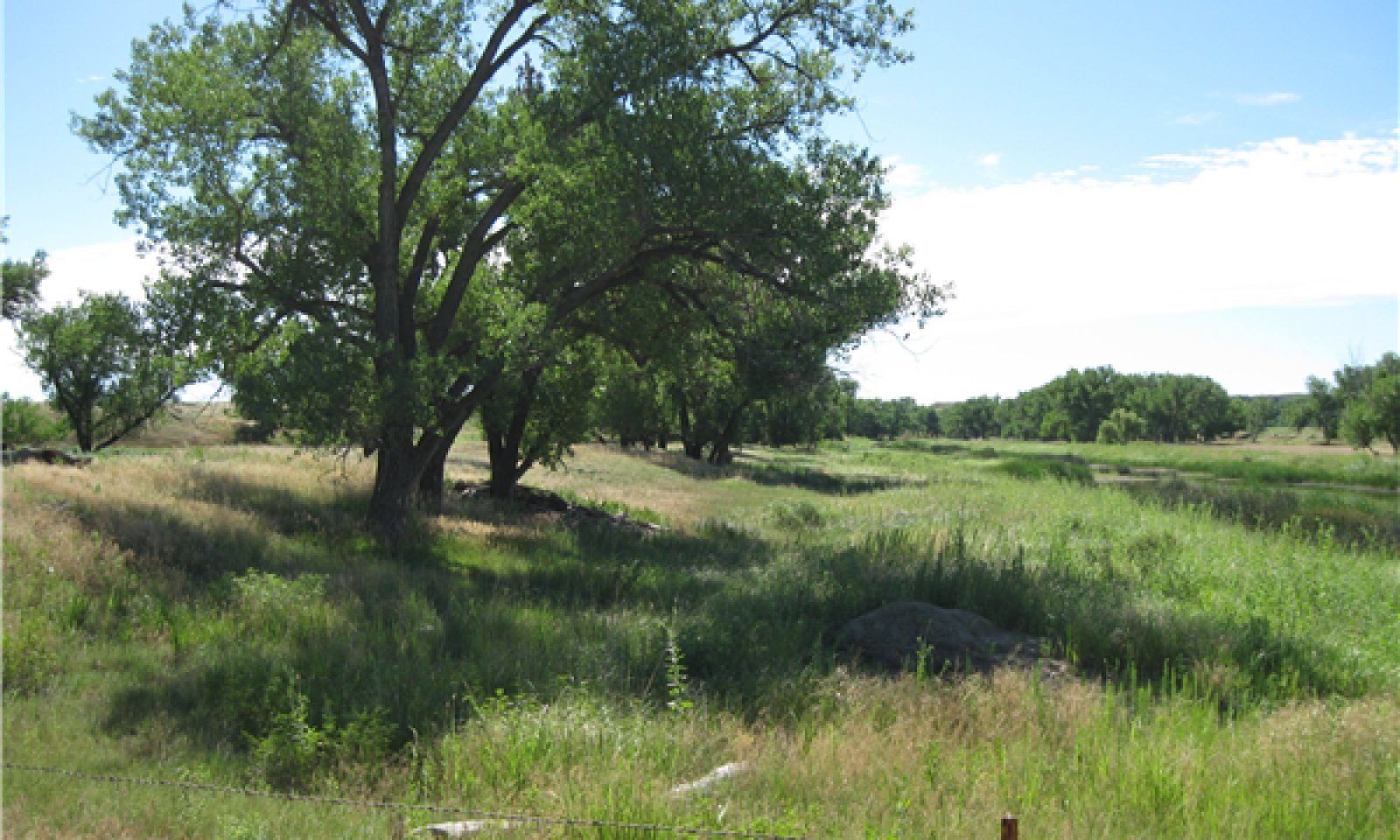
The Loamy Overflow ecological site occurs throughout the MLRA. It is located on Stream Orders 2 or greater. This site is a run-in site and receives additional moisture through runoff from adjacent sites and overflow during occasional flooding. Typical slopes range from 0 to 5 percent. The soil surface layer is 5 to 20 inches in depth with a texture range of clay loam to very fine sandy loam. When degraded, this site is susceptible to down cutting. The natural vegetation will gradually shift from almost exclusively herbaceous species in the upper reaches of a drainageway, to a mix of species including grasses, forbs, shrubs, and trees in the lower reaches.
Vegetation in the Reference State (1.0) consists primarily of warm- and cool-season tall- and mid-grasses. Big bluestem and switchgrass are the dominant warm-season grasses, while western wheatgrass and needlegrasses are the dominant cool-season grasses. Forbs are common and very diverse. Patches of western snowberry, American plum, chokecherry, and willow are almost always present.
In the western portion of the MLRA, Wyoming big sagebrush will likely be present. Tree species can exist throughout the site but are more likely to occur in the lower reaches. Major tree species include plains cottonwood, green ash, boxelder and willow. When disturbed, this site is very susceptible to invasion of non-native cool-season grasses, Canada thistle, hound’s tongue, and other weedy forbs. Russian olive and saltcedar are invasive tree species that can dominate this site if not actively treated.Associated sites
R060AY003SD Subirrigated
The Subirrigated site can be found adjacent to or, in some cases, intermixed with the Loamy Overflow site.
R060AY010SD Loamy 13-16" P.Z.
The Loamy 13-16 PZ site will be located on upland landscape positions above the overflow site.
R060AY022SD Loamy Terrace
The Loamy Terrace site will be located on a stream or river terrace above the overflow site, but typically below the adjacent upland sites.
R060AY041SD Loamy 16-18" P.Z.
The Loamy 16-18 PZ site will be located on upland landscape positions above the overflow site.
Similar sites
R060AY010SD Loamy 13-16" P.Z.
On the upper reaches of the Loamy Overflow, the adjacent Loamy 13-16 PZ will have more rhizomatous wheatgrass, more needlegrass, more big sagebrush, and lower forage production.
R060AY003SD Subirrigated
The Subirrigated site will have more big bluestem and prairie cordgrass and less green needlegrass.
R060AY041SD Loamy 16-18" P.Z.
On the upper reaches of the Loamy Overflow site, the adjacent Loamy 16-18 PZ will have less big bluestem, more western wheatgrass, more needlegrass less shrubs, and lower forage production.
R060AY022SD Loamy Terrace
The Loamy Terrace site will have little, if any, tree regeneration, more sagebrush, more rhizomatous wheatgrass, more needlegrass, and lower forage production.
Table 1. Dominant plant species
Tree Not specified
Shrub Not specified
Herbaceous (1) Andropogon gerardii
(2) Pascopyrum smithiiPhysiographic features
This site occurs on nearly level to gently sloping uplands and river valleys.
Table 2. Representative physiographic features
Landforms (1) Alluvial fan
(2) Flood plain
(3) Stream terrace
Flooding duration Very brief (4 to 48 hours) to brief (2 to 7 days) Flooding frequency Rare to frequent Ponding frequency None Elevation 2500 – 4300 ft Slope 0 – 5 % Water table depth 42 – 80 in Aspect Aspect is not a significant factor Climatic features
The climate in this MLRA is typical of the drier portions of the Northern Great Plains, where sagebrush steppes to the west yield to grassland steppes to the east. Annual precipitation for the entire MLRA ranges from 13 to 18 inches per year, with most occurring during the growing season. Temperatures show a wide range between summer and winter and between daily maximums and minimums, due to the high elevation and dry air, which permits rapid incoming and outgoing radiation. Cold air masses from Canada in winter move rapidly from northwest to southeast and account for extreme minimum temperatures. Chinook winds may occur in winter and bring rapid rises in temperature. Extreme storms may occur during the winter, but the more severe occur during late fall, late winter, and spring.
The normal average annual temperature is about 46°F. January is the coldest month with average temperatures ranging from about 19°F (Moorcroft CAA, WY) to about 22°F (Belle Fourche, SD). July is the warmest month with temperatures averaging from about 70°F (Moorcroft CAA, WY) to about 72°F (Belle Fourche, SD). The range of normal average monthly temperatures between the coldest and warmest months is about 51°F. Hourly winds are estimated to average about 11 miles per hour annually, ranging from about 13 miles per hour during the spring to about 10 miles per hour during the summer. Daytime winds generally are stronger than nighttime, and occasional strong storms may bring brief periods of high winds with gusts to more than 50 miles per hour.
Growth of cool-season plants begins in early to mid-March, slowing or ceasing in late June. Warm-season plants begin growth about mid-May and can continue to early or mid-September. Green-up of cool-season plants may occur in September and October when adequate soil moisture is present.Table 3 Representative climatic features
Frost-free period (characteristic range) 100-110 days Freeze-free period (characteristic range) 120-130 days Precipitation total (characteristic range) 20-20 in Frost-free period (actual range) 80-110 days Freeze-free period (actual range) 110-130 days Precipitation total (actual range) 10-20 in Frost-free period (average) 100 days Freeze-free period (average) 120 days Precipitation total (average) 20 in Characteristic rangeActual rangeBarLineFigure 2. Monthly precipitation range
Characteristic rangeActual rangeBarLineFigure 3. Monthly minimum temperature range
Characteristic rangeActual rangeBarLineFigure 4. Monthly maximum temperature range
BarLineFigure 5. Monthly average minimum and maximum temperature
Figure 6. Annual precipitation pattern
Figure 7 Annual average temperature pattern
Climate stations used
-
(1) ARDMORE 1 NW [USC00390236], Edgemont, SD
-
(2) BELLE FOURCHE [USC00390559], Belle Fourche, SD
-
(3) WASTA [USC00398911], Owanka, SD
-
(4) MOORCROFT 3S [USW00024088], Moorcroft, WY
-
(5) UPTON [USC00489205], Upton, WY
-
(6) REDBIRD [USC00487555], Lance Creek, WY
">Influencing water features
Stream Type: B6, C6<br />
(Rosgen System)Wetland description
Not Applicable.
Soil features
The soils in this site are moderately well to well drained and formed in alluvium. The clay loam to fine sandy loam surface layer is 5 to 20 inches thick. The soils have a moderately slow to moderately rapid infiltration rate. This site should show no evidence of rills, wind-scoured areas, or pedestalled plants. Water flow paths are broken, irregular in appearance, or discontinuous with numerous debris dams or vegetative barriers. The soil surface is stable and intact.
These soils are mainly susceptible to water erosion. The hazard of water erosion increases where vegetative cover is not adequate. A drastic loss of the soil surface layer on this site can result in a shift in species composition and/or production.
Major soils correlated this site include: Barnum, Clarkelen, Colombo, Craft, Draknab, Glenberg, Goshen, Haverdad, Haverson, Lomiller, Onita, Rockypoint, St.Onge, and Winetti.
More information can be found in the various soil survey reports. Contact the local USDA Service Center for soil survey reports that include more detail specific to your location.Table 4. Representative soil features
Surface texture (1) Silty clay loam
(2) Loam
(3) Fine sandy loam
Family particle size (1) Loamy
Drainage class Moderately well drained to well drained Permeability class Moderately slow to rapid Soil depth 80 in Surface fragment cover <=3" Not specified Surface fragment cover >3" Not specified Available water capacity
(0-40in)4 – 7 in Calcium carbonate equivalent
(0-40in)0 – 25 % Electrical conductivity
(0-40in)0 – 8 mmhos/cm Sodium adsorption ratio
(0-40in)0 – 10 Soil reaction (1:1 water)
(0-40in)6.6 – 9 Subsurface fragment volume <=3"
(Depth not specified)0 – 10 % Subsurface fragment volume >3"
(Depth not specified)0 – 5 % Ecological dynamics
This site developed under Northern Great Plains climatic conditions, natural influences of large herbivores, occasional fire, and other biotic and abiotic factors that typically influence soil/site development. Changes will occur in the plant communities due to short-term weather variations, impacts of native and/or exotic plant and animal species, and management actions. While the following plant community descriptions specify more typical transitions between communities that will occur, severe disturbances, such as periods of well-below average precipitation, can cause significant shifts in plant communities and/or species composition.
Continuous grazing without adequate recovery periods following each grazing occurrence over several years causes this site to depart from the Reference Plant Community (1.1). Species such as western wheatgrass and blue grama will initially increase. Big bluestem, green needlegrass, and switchgrass will decrease in frequency and production. Heavy continuous grazing causes Kentucky bluegrass to increase and eventually develops into a sod condition. Extended periods of non-use and no fire will result in a plant community with high litter levels, which favors an increase in Kentucky bluegrass and annual bromes. In time, shrubs such as western snowberry and chokecherry will also increase. In relatively recent time, non-native tree species, principally Russian olive and saltcedar, have become very invasive in this site. Over time, and without treatment, these species can produce a closed canopy and out-compete native shrubs and trees.
The plant community upon which interpretations are primarily based is the Reference Plant Community. The Reference Plant Community has been determined by studying rangeland relic areas, areas protected from excessive disturbance, and areas under long-term rotational grazing regimes. Trends in plant community dynamics ranging from heavily grazed to lightly grazed areas, seasonal use pastures, and historical accounts also have been used. Plant communities, states, transitional pathways, and thresholds have been determined through similar studies and experience.
The following is a diagram that illustrates the common plant communities that can occur on the site and the transition pathways between communities. The ecological processes are discussed in more detail in the plant community descriptions following the diagram.
State and transition model
Custom diagramStandard diagram
Figure 8. Loamy Overflow - R060AY020SD.

Figure 9. Loamy Overflow - R060AY020SD
More interactive model formats are also available. View Interactive Models
More interactive model formats are also available. View Interactive Models
Click on state and transition labels to scroll to the respective textEcosystem states
State 1 submodel, plant communities
State 3 submodel, plant communities
State 5 submodel, plant communities
State 1
Reference StateThis State represents what is believed to exist prior to European settlement. The Reference State may exist but is unlikely to function within the natural rage of variability due to the spread of Kentucky bluegrass and smooth brome onto this site. In the Reference State, this site is dominated by warm-and cool- season grasses, and various shrub and tree species that are scattered across the site. Grazing or the lack of grazing, flooding or lack of flooding, fire, excessive haying, and invasion of non-native cool-season grasses are the major drivers of this State. Flooding and no fire on this site can cause a transition to a Woody Overstory State (4.0).
Community 1.1
Big Bluestem-Rhizomatous Wheatgrass/Scattered Shrubs/Scattered Trees
Figure 10. Loamy Overflow - R060AY020SD - PCP 1.1
The plant community upon which interpretations are primarily based is the Big Bluestem-Rhizomatous Wheatgrass/Scattered Shrubs/Scattered Trees Plant Community (1.1). This is also considered to be the Reference Plant Community. This plant community can be found on areas that are properly managed with prescribed grazing that allows for adequate recovery periods following each grazing event.
The potential vegetation is about 70 to 85 percent grasses and grass-like plants, 5 to 15 percent forbs, 5 to 10 percent shrubs, and 0 to 3 percent trees. Major grasses include big bluestem, wheatgrasses, green needlegrass, and switchgrass. Prairie sandreed may be prevalent on the more sandy textured sites. Other grasses occurring on this community include blue grama, Canada wildrye, needle and thread, and prairie Junegrass. Major forbs and shrubs include American licorice, goldenrod, purple prairie clover, silver sagebrush, western snowberry, and leadplant. Big sagebrush will be common in the western portion of the MLRA. Scattered green ash, plains cottonwood, and American elm may occur.
This plant community is well adapted to the Northern Great Plains climatic conditions. Individual species can vary greatly in production depending on growing conditions (timing and amount of precipitation, and temperature). Community dynamics, nutrient cycle, water cycle, and energy flow are functioning properly. Plant litter is properly distributed with very little movement off-site and natural plant mortality is very low. The diversity in plant species allows for high drought tolerance. Run-off from adjacent sites and moderate or high available water capacity provides a favorable soil-water-plant relationship.
Figure 11. Annual production by plant type (representative values) or group (midpoint values)
Table 5. Annual production by plant type
Plant type Low
(lb/acre)Representative value
(lb/acre)High
(lb/acre)Grass/Grasslike 1730 2268 2765 Forb 135 280 450 Shrub/Vine 135 210 300 Tree 0 42 85 Total 2000 2800 3600 Figure 12. Plant community growth curve (percent production by month). SD6008 , Pierre Shale Plains, lowland cool season/warm season co-dominant. Cool season, warm season co-dominant, lowland..
Jan Feb Mar Apr May Jun Jul Aug Sep Oct Nov Dec J F M A M J J A S O N D 0 0 4 11 19 23 20 12 6 5 0 0 State 2
Native/Invaded StateThis State has a significant amount of Kentucky bluegrass or smooth brome in the plant community but they have not become the dominate species. In this State, Kentucky bluegrass makes up less than 30 percent of the plant community composition (by weight). This State is at risk of transitioning to a bluegrass dominated Invaded State (3.0).
Community 2.1
Rhizomatous Wheatgrass-Kentucky Bluegrass-Remnant Big Bluestem/Scattered TreesThis plant community results from continuous season-long grazing without adequate recovery periods between each grazing event during the growing season, or excessive haying, and invasion of non- native cool-season grasses. Western wheatgrass is the dominant species, Kentucky bluegrass is subdominant. Big bluestem, little bluestem, green needlegrass, and switchgrass are greatly reduced. Forb species include western yarrow, asters, prairie coneflower, cudweed sagewort, and western ragweed. Leadplant is greatly reduced while other shrub species would tend to be heavily browsed. Scattered American elm, boxelder, cottonwood, and green ash are common on this site. Seedling and saplings can also be heavily browsed. This plant community is relatively stable and less productive than the Reference Plant Community (1.1). Reduction of litter and short plant heights result in higher soil temperatures, poor water infiltration rates, and increased runoff. This plant community can occur throughout the site, on spot grazed areas, and around water sources where season-long grazing patterns occur. Soil erosion will be minimal due to the sod forming habit of Kentucky bluegrass.
Figure 13. Annual production by plant type (representative values) or group (midpoint values)
Table 6. Annual production by plant type
Plant type Low
(lb/acre)Representative value
(lb/acre)High
(lb/acre)Grass/Grasslike 850 1296 1735 Forb 75 160 250 Shrub/Vine 75 120 165 Tree 0 24 50 Total 1000 1600 2200 Figure 14. Plant community growth curve (percent production by month). SD6007 , Pierre Shale Plains, cool season dominant, warm season subdominant. Cool season dominant, warm season subdominant, lowland..
Jan Feb Mar Apr May Jun Jul Aug Sep Oct Nov Dec J F M A M J J A S O N D 0 0 5 13 20 25 18 11 5 3 0 0 Community 2.2
Rhizomatous Wheatgrass-Bluegrass/Mixed Shrub/Scattered TreesThis plant community develops after an extended period of non-use and exclusion of fire. This plant community will also develop with moderate or heavy continuous seasonal grazing. In either case, shrubs increase and can sometimes dominate the plant community. Cool-season grasses make up the majority of the understory with the balance made up of short- warm-season grasses, and miscellaneous forbs. Western wheatgrass and Kentucky bluegrass are the dominant grasses. Grasses of secondary importance include blue grama, prairie Junegrass, Sandberg bluegrass, green needlegrass, and needle and thread. Forbs commonly found in this plant community include cudweed sagewort, goldenrod, hairy goldenaster, and scurfpea. Woody plants such as silver sagebrush, and snowberry increase with canopy cover up to 20 percent. Wyoming big sagebrush will occur in the west. Scattered native trees will likely be present as will Russian olive and saltcedar.
This plant community is resistant to change. Grazing in combination with brush management will reduce shrub cover if that is the management goal. Soil erosion is low. Runoff is similar to the Reference Plant Community (1.1). Once the advanced stage of this plant community is reached, time and external resources will be needed to see recovery in the diversity of the site.Figure 15. Annual production by plant type (representative values) or group (midpoint values)
Table 7. Annual production by plant type
Plant type Low
(lb/acre)Representative value
(lb/acre)High
(lb/acre)Grass/Grasslike 880 1507 2130 Shrub/Vine 215 440 650 Forb 105 220 350 Tree 0 33 70 Total 1200 2200 3200 Figure 16. Plant community growth curve (percent production by month). SD6008 , Pierre Shale Plains, lowland cool season/warm season co-dominant. Cool season, warm season co-dominant, lowland..
Jan Feb Mar Apr May Jun Jul Aug Sep Oct Nov Dec J F M A M J J A S O N D 0 0 4 11 19 23 20 12 6 5 0 0 Pathway 2.1A
Community 2.1 to 2.2Nonuse and no fire will move this plant community to the Rhizomatous Wheatgrass-Bluegrass/Snowberry/Scattered Trees/Excessive Litter Plant Community (2.2).
Pathway 2.2A
Community 2.2 to 2.1Prescribed grazing that includes proper stocking, change in season of use, and adequate time for recovery, will move this plant community back to Plant Community Phase (PCP) 2.1. Brush management (reduction, not removal of shrubs) or prescribed burning followed by prescribed grazing will also move this plant community toward PCP 1.2. Either would require long-term management with prescribed grazing and/or prescribed burning under controlled conditions.
State 3
Invaded StateThis state is the result of invasion and dominance of introduced species. This state is characterized by the dominance of Kentucky bluegrass and smooth brome, and an increasing thatch layer that effectively blocks introduction of other plants into the system. Plant litter accumulation tends to favor the more shade tolerant, introduced grass species. The nutrient cycle is also impaired, and the result is typically a higher level of nitrogen which also favors the introduced species. Increasing plant litter decreases the amount of sunlight reaching plant crowns thereby shifting competitive advantage to shade tolerant, introduced grass species. Studies indicate that soil biological activity is altered, and this shift apparently exploits the soil microclimate and encourages growth of the introduced grass species. Once the threshold is crossed, a change in grazing management alone cannot cause a reduction in the invasive grass dominance. Preliminary studies would tend to indicate this threshold may exist when Kentucky bluegrass exceeds 30 percent of the plant community and native grasses represent less than 40 percent of the plant community composition. Plant communities dominated by Kentucky bluegrass have significantly less cover and diversity of native grasses and forb species (Toledo, D. et al., 2014).
Community 3.1
Kentucky Bluegrass/Weedy Annual and Perennial ForbsThis plant community developed with heavy continuous season-long grazing, and/or excessive haying. Kentucky bluegrass dominates the community and can develop into a “sod-bound” appearance. Low vigor western wheatgrass can be found scattered throughout the community. Green needlegrass has been greatly reduced. Big bluestem may persist in minor amounts, greatly reduced in vigor and not readily seen. Western yarrow, scurfpea, ragweed, and goldenrod have increased. Non-native grasses and forbs such as annual bromes, curlycup gumweed, thistle, and cocklebur will invade this plant community. Western snowberry, American plum, and chokecherry may persist in the plant community if not removed during haying activities. Russian olive and saltcedar may be present but in minor amounts.
This plant community is resistant to change due to grazing tolerance of Kentucky bluegrass. A significant amount of production and diversity has been lost when compared to the Reference Plant Community (1.1). The dominance of non-native cool-season grasses and the loss of other desirable species has negatively impacted energy flow and nutrient cycling. Water infiltration is reduced significantly and soil loss may be accelerated where concentrated flows occur.
Figure 17. Annual production by plant type (representative values) or group (midpoint values)
Table 8. Annual production by plant type
Plant type Low
(lb/acre)Representative value
(lb/acre)High
(lb/acre)Grass/Grasslike 360 760 1155 Forb 95 150 205 Shrub/Vine 45 75 105 Tree 0 15 35 Total 500 1000 1500 Figure 18. Plant community growth curve (percent production by month). SD6006 , Pierre Shale Plains, lowland cool season dominant. Cool season dominant, lowland..
Jan Feb Mar Apr May Jun Jul Aug Sep Oct Nov Dec J F M A M J J A S O N D 0 0 6 15 20 26 17 9 4 3 0 0 State 4
Woody Overstory StateThis State is the result of the establishment of a tree overstory and shrub mid-story canopy. This State is more common on the lower reaches of the site. The dynamics of this State are largely due to flooding and successional changes, starting with cottonwood and shrub establishment, and eventually the development of a green ash and boxelder plant community. The successional process can restart following another flooding event. Water control structures which limit flooding, livestock grazing, heavy wildlife browse, fire, and the introduction of non-native, cool-season grasses can alter the dynamics of this site resulting in old remnant stands of trees with little, if any regeneration.
Down cutting of the drainageway or stream channel will eventually leave the overflow site on a higher and drier landscape position. In this case the site will be described as the Loamy Terrace Ecological Site (R060AY022SD).
Community 4.1
Cottonwood/Prunus-Snowberry/Forbs/GrassesThis plant community typically occurs after a flooding event. Flooding reduces herbaceous competition through scouring of the soil surface, which provides a site for regeneration and establishment of cottonwood and shrubs. Prescribed grazing, which prevents targeted grazing of cottonwood seedlings, is necessary for this plant community to establish. Trees will range from seedlings to saplings, and the herbaceous understory will still be productive as a result of the filtered canopy of the deciduous trees. Understory shrubs, primarily plum and/or chokecherry, and snowberry will likely establish. However, other species, including silver buffaloberry, silver sagebrush, big sagebrush, and currants can occur and make up a significance percentage of the shrub layer.
Community 4.2
Mature Cottonwood-Immature Green Ash-Boxelder/Prunus-Snowberry/Forbs/Grass UnderstoryMature cottonwood trees and woody shrubs provide a suitable microclimate for establishment of other deciduous trees. Green ash and boxelder are typically the first trees to establish, but other species such as hackberry and possibly bur oak will established as well. The herbaceous plant community will remain relatively productive, but will be reduced somewhat from the Reference Plant Community (1.1). This is due mainly to the competition from the woody shrub understory.
Community 4.3
Green Ash-Boxelder/Prunus-Snowberry/Forbs/Grass UnderstoryThis plant community develops over time, with prescribed grazing and no flooding. Mature cottonwood trees will likely remain in lesser numbers, but the dominant trees will normally be green ash and boxelder. At times there will be a mix of all three species; however, some areas will be dominated by one or two of these species. Woody shrubs will remain in the understory, but typically in lesser amounts than in the previous two plant communities. While somewhat reduced, the herbaceous understory will remain relatively productive. The trees will mostly be in the mature stage, but regeneration will normally be evident (i.e., seedlings and saplings should be present).
Pathway 4.1A
Community 4.1 to 4.2No flooding and long-term prescribed grazing that manages the herbaceous understory, but is not detrimental to woody regeneration, will allow this plant community to develop into the Mature Cottonwood-Immature Green Ash-Boxelder/ Prunus-Snowberry/ Forbs/ Grass Understory Plant Community (4.2). Existing saplings must be large enough to avoid damage by livestock and wildlife for this pathway to occur.
Pathway 4.2A
Community 4.2 to 4.1Flooding, which opens up the herbaceous understory and allows for woody regeneration, followed by long-term prescribed grazing that manages for woody regeneration and establishment will shift this plant community back to the Cottonwood/ Prunus-Snowberry / Forbs/ Grasses Plant Community (4.1).
Pathway 4.2B
Community 4.2 to 4.3No flooding, long-term prescribed grazing that manages the herbaceous understory, but is not detrimental to woody regeneration, and time will transition this plant community to the Green Ash-Boxelder/ Prunus-Snowberry/ Forbs/ Grass Understory Plant Community (4.3).
Pathway 4.3A
Community 4.3 to 4.1Flooding, which opens up the herbaceous understory and allows for woody regeneration, followed by long-term prescribed grazing that manages for woody regeneration and establishment will shift this plant community back to the Cottonwood/ Prunus-Snowberry/ Forbs/ Grasses Plant Community (4.1).
State 5
Woody Invaded StateThis State developed as a result of the invasion of Russian olive and/or saltcedar in combination with continuous season-long grazing, or continuous seasonal grazing, or fire. With time, the cottonwood, boxelder and ash trees that survive become mature, and little or no regeneration occurs. This is due mainly to grazing of seedlings and saplings. Wildlife browse can also contribute to the loss of native tree and shrub regeneration. Grazing that limits regeneration also results in a reduction of the desirable native herbaceous species, often resulting in a dominance of species such as bluegrass and/or smooth brome, and forbs such as western ragweed, Canada thistle, burdock, and hound’s tongue.
Community 5.1
Scattered Mature Native Trees-Russian Olive-Saltcedar/Shrubs/Forbs/Bluegrass
Figure 19. Loamy Overflow - R060Y020SD - PCP 5.1
This plant community developed due to the lack of woody regeneration, natural occurrences of flooding events, and continuous season-long grazing without adequate recovery periods. Older mature trees remain, including cottonwood, boxelder, and green ash. The trees are scattered, and the site may have a “park-like” appearance with few trees and reduced understory. If grazed during the winter, the increased durations of livestock loitering can result in manure accumulations and soil compaction which will reduce the vigor of the native understory plant community. Kentucky bluegrass and smooth brome continue to persist as dominant grass species at reduced production rates. The presence of non-desirable forb species such as Canada thistle, burdock, and hound’s tongue can be prolific and difficult to control. Russian olive and/or saltcedar will increase over time and will eventually dominate the site.
Transition T1A
State 1 to 2Continuous season-long grazing and/or excessive haying and the invasion of non-native cool-season grasses will convert this plant community to the Native/Invaded State (2.0).
Transition T1B
State 1 to 4T1B Flooding, followed by long-term prescribed grazing, and no fire can transition this plant community to the Woody Overstory State (4.0). This State is more likely to occur on the mid to lower reaches of a drainage.
Transition T2A
State 2 to 3Continuous season-long grazing and/or excessive haying in addition to the spread of non-native cool-season grasses will result in a transition to the Invaded State (3.0). The spread of non-native invasive trees species is also a possibility.
Transition T2B
State 2 to 4Flooding and no fire followed, by long-term prescribed grazing, including proper stocking, change in season of use, and adequate time for recovery will likely transition this site to the Woody Overstory State (4.0). Timed grazing is very important and must be followed for many years in order for saplings to attain a height where livestock will not damage and/or kill the trees. Wildlife browse can also be a concern if the management objective are to improve the overstory canopy. The Woody Overstory State is more likely to occur on the mid to lower reaches of a drainage.
Restoration pathway R3A
State 3 to 2Long term prescribed grazing and/or prescribed burning may transition the plant community toward the Native/Invaded State (2.0). This is assuming an adequate seed/vegetative source is available. This transition my take an extended period of time and in the end not meet management objectives.
Transition T3A
State 3 to 5Invasion of non-native tree species, continuous season-long grazing, continuous seasonal grazing and time will transition the Invaded State (3.0) to the Woody Invaded State (5.0).
Transition T4B
State 4 to 2Fire, invasion of non-native, cool-season grasses, continuous season-long grazing, or continuous seasonal grazing resulting in little woody regeneration, and time will transition this state to the Native/Invaded State (2.0).
Transition T4A
State 4 to 5Invasion of non-native tree species in combination with continuous season-long grazing, continuous seasonal grazing, heavy wildlife browse, or fire can cause any of the plant communities in the Woody Overstory State (4.0) to transition to the Woody Invaded State (5.0).
Transition T5A
State 5 to 3Fire, brush management to remove Russian olive and salt cedar, continuous season-long grazing, or continuous seasonal grazing will transition this plant community to the Invaded State (3.0).
Additional community tables
Table 9. Community 1.1 plant community composition
Group Common name Symbol Scientific name Annual production () Foliar cover (%) Grass/Grasslike1 Tall Warm-Season Grasses 700–1260 big bluestem ANGE Andropogon gerardii 560–1120 – switchgrass PAVI2 Panicum virgatum 140–560 – 2 Wheatgrasses 560–840 western wheatgrass PASM Pascopyrum smithii 560–840 – thickspike wheatgrass ELLAL Elymus lanceolatus ssp. lanceolatus 140–280 – slender wheatgrass ELTRT Elymus trachycaulus ssp. trachycaulus 140–280 – 3 Needlegrasses 140–280 green needlegrass NAVI4 Nassella viridula 140–280 – needle and thread HECOC8 Hesperostipa comata ssp. comata 56–140 – 4 Native Grasses/Grass-Likes 140–420 Canada wildrye ELCA4 Elymus canadensis 56–224 – sedge CAREX Carex 56–224 – blue grama BOGR2 Bouteloua gracilis 28–140 – Grass, perennial 2GP Grass, perennial 0–140 – sideoats grama BOCU Bouteloua curtipendula 0–140 – buffalograss BODA2 Bouteloua dactyloides 0–84 – prairie sandreed CALO Calamovilfa longifolia 0–84 – dropseed SPORO Sporobolus 0–84 – little bluestem SCSC Schizachyrium scoparium 0–56 – spikerush ELEOC Eleocharis 0–56 – foxtail barley HOJU Hordeum jubatum 0–56 – prairie Junegrass KOMA Koeleria macrantha 28–56 – Sandberg bluegrass POSE Poa secunda 0–28 – saltgrass DISP Distichlis spicata 0–28 – Forb6 Forbs 140–420 goldenrod SOLID Solidago 28–140 – American licorice GLLE3 Glycyrrhiza lepidota 28–112 – Maximilian sunflower HEMA2 Helianthus maximiliani 28–84 – Forb, perennial 2FP Forb, perennial 0–84 – common yarrow ACMI2 Achillea millefolium 28–56 – white heath aster SYER Symphyotrichum ericoides 28–56 – American vetch VIAM Vicia americana 0–56 – blazing star LIATR Liatris 0–56 – mint MENTH Mentha 0–56 – Canadian anemone ANCA8 Anemone canadensis 0–56 – white sagebrush ARLU Artemisia ludoviciana 28–56 – purple prairie clover DAPU5 Dalea purpurea 28–56 – milkvetch ASTRA Astragalus 0–28 – false boneset BREU Brickellia eupatorioides 0–28 – thistle CIRSI Cirsium 0–28 – scurfpea PSORA2 Psoralidium 0–28 – upright prairie coneflower RACO3 Ratibida columnifera 0–28 – blue-eyed grass SISYR Sisyrinchium 0–28 – Cuman ragweed AMPS Ambrosia psilostachya 0–28 – Shrub/Vine7 Shrubs 140–280 Subshrub (<.5m) 2SUBS Subshrub (<.5m) 0–140 – silver sagebrush ARCA13 Artemisia cana 0–140 – big sagebrush ARTR2 Artemisia tridentata 0–140 – American plum PRAM Prunus americana 0–140 – chokecherry PRVI Prunus virginiana 0–140 – silver buffaloberry SHAR Shepherdia argentea 0–140 – snowberry SYMPH Symphoricarpos 28–140 – leadplant AMCA6 Amorpha canescens 28–112 – currant RIBES Ribes 0–84 – rose ROSA5 Rosa 28–84 – willow SALIX Salix 0–84 – prairie sagewort ARFR4 Artemisia frigida 0–56 – Tree8 Trees 0–84 Tree 2TREE Tree 0–84 – boxelder ACNE2 Acer negundo 0–84 – common hackberry CEOC Celtis occidentalis 0–84 – green ash FRPE Fraxinus pennsylvanica 0–84 – plains cottonwood PODEM Populus deltoides ssp. monilifera 0–84 – American elm ULAM Ulmus americana 0–84 – Table 10. Community 2.1 plant community composition
Group Common name Symbol Scientific name Annual production () Foliar cover (%) Grass/Grasslike1 Tall Warm-Season Grasses 80–240 big bluestem ANGE Andropogon gerardii 80–240 – switchgrass PAVI2 Panicum virgatum 16–80 – 2 Wheatgrasses 400–560 western wheatgrass PASM Pascopyrum smithii 320–560 – thickspike wheatgrass ELLAL Elymus lanceolatus ssp. lanceolatus 32–80 – slender wheatgrass ELTRT Elymus trachycaulus ssp. trachycaulus 32–80 – 3 Needlegrasses 16–80 green needlegrass NAVI4 Nassella viridula 16–80 – needle and thread HECOC8 Hesperostipa comata ssp. comata 0–48 – 4 Native Grasses/Grass-Likes 80–160 Grass, perennial 2GP Grass, perennial 0–80 – sedge CAREX Carex 16–80 – Canada wildrye ELCA4 Elymus canadensis 16–80 – foxtail barley HOJU Hordeum jubatum 16–80 – dropseed SPORO Sporobolus 16–80 – saltgrass DISP Distichlis spicata 16–48 – blue grama BOGR2 Bouteloua gracilis 16–48 – prairie sandreed CALO Calamovilfa longifolia 16–48 – sideoats grama BOCU Bouteloua curtipendula 0–32 – buffalograss BODA2 Bouteloua dactyloides 0–32 – prairie Junegrass KOMA Koeleria macrantha 0–32 – Sandberg bluegrass POSE Poa secunda 0–32 – little bluestem SCSC Schizachyrium scoparium 0–16 – 5 Non-Native Grasses 240–400 Kentucky bluegrass POPR Poa pratensis 240–400 – cheatgrass BRTE Bromus tectorum 16–160 – smooth brome BRIN2 Bromus inermis 0–80 – Forb6 Forbs 80–240 cocklebur XANTH2 Xanthium 0–80 – goldenrod SOLID Solidago 16–80 – white heath aster SYER Symphyotrichum ericoides 32–80 – Forb, annual 2FA Forb, annual 16–80 – Cuman ragweed AMPS Ambrosia psilostachya 32–80 – white sagebrush ARLU Artemisia ludoviciana 32–80 – thistle CIRSI Cirsium 0–80 – mint MENTH Mentha 0–80 – American licorice GLLE3 Glycyrrhiza lepidota 0–64 – common yarrow ACMI2 Achillea millefolium 32–64 – upright prairie coneflower RACO3 Ratibida columnifera 16–48 – Forb, perennial 2FP Forb, perennial 0–48 – purple prairie clover DAPU5 Dalea purpurea 16–32 – milkvetch ASTRA Astragalus 0–32 – scurfpea PSORA2 Psoralidium 16–32 – blazing star LIATR Liatris 0–32 – curlycup gumweed GRSQ Grindelia squarrosa 0–16 – Maximilian sunflower HEMA2 Helianthus maximiliani 0–16 – blue-eyed grass SISYR Sisyrinchium 0–16 – false boneset BREU Brickellia eupatorioides 0–16 – Canadian anemone ANCA8 Anemone canadensis 0–16 – American vetch VIAM Vicia americana 0–16 – Shrub/Vine7 Shrubs 80–160 Subshrub (<.5m) 2SUBS Subshrub (<.5m) 0–80 – silver sagebrush ARCA13 Artemisia cana 0–80 – big sagebrush ARTR2 Artemisia tridentata 0–80 – American plum PRAM Prunus americana 0–80 – chokecherry PRVI Prunus virginiana 0–80 – silver buffaloberry SHAR Shepherdia argentea 0–80 – snowberry SYMPH Symphoricarpos 16–80 – currant RIBES Ribes 0–48 – rose ROSA5 Rosa 16–48 – leadplant AMCA6 Amorpha canescens 16–48 – prairie sagewort ARFR4 Artemisia frigida 0–32 – willow SALIX Salix 0–32 – Tree8 Trees 0–48 Tree 2TREE Tree 0–48 – boxelder ACNE2 Acer negundo 0–48 – common hackberry CEOC Celtis occidentalis 0–48 – green ash FRPE Fraxinus pennsylvanica 0–48 – plains cottonwood PODEM Populus deltoides ssp. monilifera 0–48 – American elm ULAM Ulmus americana 0–48 – Table 11. Community 2.2 plant community composition
Group Common name Symbol Scientific name Annual production () Foliar cover (%) Grass/Grasslike1 Tall Warm-Season Grasses 44–220 big bluestem ANGE Andropogon gerardii 22–176 – switchgrass PAVI2 Panicum virgatum 22–110 – 2 Wheatgrasses 220–440 western wheatgrass PASM Pascopyrum smithii 220–440 – thickspike wheatgrass ELLAL Elymus lanceolatus ssp. lanceolatus 0–110 – slender wheatgrass ELTRT Elymus trachycaulus ssp. trachycaulus 0–66 – 3 Needlegrasses 22–110 green needlegrass NAVI4 Nassella viridula 22–110 – needle and thread HECOC8 Hesperostipa comata ssp. comata 0–66 – 4 Native Grasses/Grass-Likes 110–330 dropseed SPORO Sporobolus 44–176 – foxtail barley HOJU Hordeum jubatum 0–110 – Canada wildrye ELCA4 Elymus canadensis 22–110 – Grass, perennial 2GP Grass, perennial 0–110 – blue grama BOGR2 Bouteloua gracilis 22–110 – prairie sandreed CALO Calamovilfa longifolia 22–110 – sedge CAREX Carex 44–110 – sideoats grama BOCU Bouteloua curtipendula 0–44 – buffalograss BODA2 Bouteloua dactyloides 0–44 – prairie Junegrass KOMA Koeleria macrantha 0–44 – Sandberg bluegrass POSE Poa secunda 0–44 – little bluestem SCSC Schizachyrium scoparium 0–44 – spikerush ELEOC Eleocharis 0–22 – saltgrass DISP Distichlis spicata 0–22 – 5 Non-Native Grasses 330–440 smooth brome BRIN2 Bromus inermis 0–220 – cheatgrass BRTE Bromus tectorum 22–220 – Kentucky bluegrass POPR Poa pratensis 0–220 – Forb6 Forbs 110–330 Forb, annual 2FA Forb, annual 44–220 – goldenrod SOLID Solidago 44–176 – mint MENTH Mentha 0–110 – scurfpea PSORA2 Psoralidium 22–110 – Forb, perennial 2FP Forb, perennial 44–110 – common yarrow ACMI2 Achillea millefolium 44–110 – Cuman ragweed AMPS Ambrosia psilostachya 44–110 – white sagebrush ARLU Artemisia ludoviciana 22–110 – American licorice GLLE3 Glycyrrhiza lepidota 22–110 – thistle CIRSI Cirsium 0–66 – upright prairie coneflower RACO3 Ratibida columnifera 0–66 – white heath aster SYER Symphyotrichum ericoides 22–66 – American vetch VIAM Vicia americana 0–44 – cocklebur XANTH2 Xanthium 0–44 – false boneset BREU Brickellia eupatorioides 0–44 – blazing star LIATR Liatris 0–44 – purple prairie clover DAPU5 Dalea purpurea 0–22 – Canadian anemone ANCA8 Anemone canadensis 0–22 – blue-eyed grass SISYR Sisyrinchium 0–22 – curlycup gumweed GRSQ Grindelia squarrosa 0–22 – Maximilian sunflower HEMA2 Helianthus maximiliani 0–22 – Shrub/Vine7 Shrubs 220–660 snowberry SYMPH Symphoricarpos 44–330 – silver sagebrush ARCA13 Artemisia cana 44–330 – big sagebrush ARTR2 Artemisia tridentata 44–330 – American plum PRAM Prunus americana 22–110 – chokecherry PRVI Prunus virginiana 22–110 – prairie sagewort ARFR4 Artemisia frigida 0–110 – Subshrub (<.5m) 2SUBS Subshrub (<.5m) 22–110 – willow SALIX Salix 22–110 – silver buffaloberry SHAR Shepherdia argentea 0–110 – currant RIBES Ribes 0–66 – rose ROSA5 Rosa 22–66 – leadplant AMCA6 Amorpha canescens 0–44 – Tree8 Trees 0–66 Tree 2TREE Tree 0–66 – boxelder ACNE2 Acer negundo 0–66 – common hackberry CEOC Celtis occidentalis 0–66 – green ash FRPE Fraxinus pennsylvanica 0–66 – plains cottonwood PODEM Populus deltoides ssp. monilifera 0–66 – American elm ULAM Ulmus americana 0–66 – Table 12. Community 3.1 plant community composition
Group Common name Symbol Scientific name Annual production () Foliar cover (%) Grass/Grasslike1 Tall Warm-Season Grasses 0–50 big bluestem ANGE Andropogon gerardii 0–50 – switchgrass PAVI2 Panicum virgatum 0–20 – 2 Wheatgrasses 50–100 western wheatgrass PASM Pascopyrum smithii 50–100 – 3 Needlegrasses 0–50 green needlegrass NAVI4 Nassella viridula 0–50 – needle and thread HECOC8 Hesperostipa comata ssp. comata 0–30 – 4 Native Grasses/Grass-Likes 50–150 Grass, perennial 2GP Grass, perennial 0–100 – dropseed SPORO Sporobolus 20–100 – sedge CAREX Carex 10–50 – saltgrass DISP Distichlis spicata 10–50 – foxtail barley HOJU Hordeum jubatum 20–50 – prairie sandreed CALO Calamovilfa longifolia 10–30 – prairie Junegrass KOMA Koeleria macrantha 0–20 – Sandberg bluegrass POSE Poa secunda 0–20 – 5 Non-Native Grasses 350–500 Kentucky bluegrass POPR Poa pratensis 350–500 – smooth brome BRIN2 Bromus inermis 0–100 – cheatgrass BRTE Bromus tectorum 20–100 – Forb6 Forbs 100–200 Cuman ragweed AMPS Ambrosia psilostachya 50–150 – thistle CIRSI Cirsium 0–100 – curlycup gumweed GRSQ Grindelia squarrosa 0–100 – cocklebur XANTH2 Xanthium 0–80 – common yarrow ACMI2 Achillea millefolium 20–50 – goldenrod SOLID Solidago 20–50 – white heath aster SYER Symphyotrichum ericoides 20–50 – mint MENTH Mentha 0–50 – scurfpea PSORA2 Psoralidium 20–50 – white sagebrush ARLU Artemisia ludoviciana 20–50 – Forb, annual 2FA Forb, annual 20–50 – Forb, perennial 2FP Forb, perennial 10–30 – upright prairie coneflower RACO3 Ratibida columnifera 10–30 – blazing star LIATR Liatris 0–10 – Shrub/Vine7 Shrubs 50–100 silver sagebrush ARCA13 Artemisia cana 0–50 – snowberry SYMPH Symphoricarpos 10–50 – rose ROSA5 Rosa 10–30 – Subshrub (<.5m) 2SUBS Subshrub (<.5m) 0–20 – prairie sagewort ARFR4 Artemisia frigida 0–20 – big sagebrush ARTR2 Artemisia tridentata 0–10 – chokecherry PRVI Prunus virginiana 0–10 – willow SALIX Salix 0–10 – silver buffaloberry SHAR Shepherdia argentea 0–10 – Tree8 Trees 0–30 Tree 2TREE Tree 0–30 – boxelder ACNE2 Acer negundo 0–30 – common hackberry CEOC Celtis occidentalis 0–30 – green ash FRPE Fraxinus pennsylvanica 0–30 – plains cottonwood PODEM Populus deltoides ssp. monilifera 0–30 – American elm ULAM Ulmus americana 0–30 – Table 13. Community 4.1 plant community composition
Group Common name Symbol Scientific name Annual production () Foliar cover (%) Table 14. Community 4.2 plant community composition
Group Common name Symbol Scientific name Annual production () Foliar cover (%) Table 15. Community 4.3 plant community composition
Group Common name Symbol Scientific name Annual production () Foliar cover (%) Table 16. Community 5.1 plant community composition
Group Common name Symbol Scientific name Annual production () Foliar cover (%) Interpretations
Animal community
The following table lists annual suggested initial stocking rates with average growing conditions. These are conservative estimates that should be used only as guidelines in the initial stages of conservation planning. Often, the current plant composition does not entirely match any particular plant community (as described in this Ecological Site Description). Therefore, a resource inventory is necessary to document plant composition and production. More accurate carrying capacity estimates should eventually be calculated using the following stocking rate information along with animal preference data and actual stocking records, particularly when grazers other than cattle are involved. With consultation of the land manager, more intensive grazing management may result in improved harvest efficiencies and increased carrying capacity.
Plant Community = Big Bluestem-Rhizomatous Wheatgrass/Scattered Shrubs/Scattered Trees (1.1)
Average Annual Production (lbs./ac, air-dry) = 2800
Stocking Rate (AUM/ac) = 0.77
Plant Community = Rhizomatous Wheatgrass-Kentucky Bluegrass-Remnant Big Bluestem/Scattered Trees (2.1)
Average Annual Production (lbs./ac, air-dry) = 1600
Stocking Rate (AUM/ac) = 0.44
Plant Community = Rhizomatous Wheatgrass-Bluegrass/Mixed Shrubs/Scattered Trees (2.2)
Average Annual Production (lbs./ac, air-dry) = 2200
Stocking Rate (AUM/ac) = 0.60*
Plant Community = Kentucky Bluegrass/Weedy Annuals and Perennial Forbs (3.1)
Average Annual Production (lbs./ac, air-dry) = 1000
Stocking Rate (AUM/ac) = 0.27*
Based on 912 lbs./acre (air-dry weight) per Animal Unit Month (AUM), and on 25 percent harvest efficiency of preferred and desirable forage species (refer to USDA NRCS, National Range and Pasture Handbook).
* Highly variable production, stocking rates needs to be determined based from on-site production data.
Total annual production on-site may contain vegetation deemed undesirable or untargeted by the grazing animal. Therefore, AUM values may have been reduced to reflect only preferred or desirable forage species.
Grazing by domestic livestock is one of the major income-producing industries in the area. Rangeland in this area may provide yearlong forage. During the dormant period, the forage for livestock will likely be lacking protein to meet livestock requirements, and added protein will allow ruminants to better utilize the energy stored in grazed plant materials. A forage quality test (either directly or through fecal sampling) should be used to determine the level of supplementation needed.
Hydrological functions
Water is the principal factor limiting herbage production on this site. The site is dominated by soils in hydrologic groups B and C. Infiltration and runoff potential for this site varies from moderate to high depending on soil hydrologic group, slope, and ground cover. In many cases, areas with greater than 75 percent ground cover have the greatest potential for high infiltration and lower runoff. An exception would be where shortgrasses form a dense sod and dominate the site. Normally areas where ground cover is less than 50 percent have the greatest potential to have reduced infiltration and higher runoff (refer to Section 4, NRCS National Engineering Handbook for runoff quantities and hydrologic curves).
Recreational uses
This site provides hunting opportunities for upland game species. The wide variety of plants which bloom from spring until fall have an aesthetic value that appeals to visitors.
Other products
Seed harvest of native plant species can provide additional income on this site.
Other information
Revision Notes: “Previously Approved” Provisional
This Provisional ecological site concept has passed Quality Control (QC) and Quality Assurance (QA) to ensure that the site meets the 2014 NESH standards for a Provisional ecological site. This is an updated “Previously Approved” ESD which represents a first-generation tier of documentation that, prior to the release of the 2014 National Ecological Site Handbook (NESH), met all requirements as an “Approved” ESD as laid out in the 1997, rev.1, 2003 National Range and Pasture Handbook (NRPH). The document fully described the Reference State and Community Phase in the State-and-Transition model. All other alternative states are at least described in narrative form. The “Previously Approved” ESD has been field-tested for a minimum of five years and is a proven functional document for conservation planning. The “Previously Approved” ESD does not contain all tabular and narrative entries as required in the current “Approved” level of documentation but it is expected that the “Previously Approved” ESD will continue refinement towards an “Approved” status.
Site Development and Testing Plan:
Future work, as described in a Project Plan, is needed to validate the information in this Provisional Ecological Site Description. This will include field activities to collect low-, medium-, and high-intensity sampling, soil correlations, and analysis of that data. Annual field reviews should be done by soil scientists and vegetation specialists. The final field review, peer review, quality control, and quality assurance reviews of the ESD will be needed to produce the final document.
Non-discrimination Statement
In accordance with Federal civil rights law and U.S. Department of Agriculture (USDA) civil rights regulations and policies, the USDA, its Agencies, offices, and employees, and institutions participating in or administering USDA programs are prohibited from discriminating based on race, color, national origin, religion, sex, gender identity (including gender expression), sexual orientation, disability, age, marital status, family/parental status, income derived from a public assistance program, political beliefs, or reprisal or retaliation for prior civil rights activity, in any program or activity conducted or funded by USDA (not all bases apply to all programs). Remedies and complaint filing deadlines vary by program or incident.
Persons with disabilities who require alternative means of communication for program information (e.g., Braille, large print, audiotape, American Sign Language, etc.) should contact the responsible Agency or USDA's TARGET Center at (202) 720-2600 (voice and TTY) or contact USDA through the Federal Relay Service at (800) 877-8339. Additionally, program information may be made available in languages other than English.
To file a program discrimination complaint, complete the USDA Program Discrimination Complaint Form, AD-3027, available online and at any USDA office, or write a letter addressed to USDA and provide in the letter all of the information requested in the form. To request a copy of the complaint form, call (866) 632- 9992. Submit your completed form or letter to USDA by: (1) mail: U.S. Department of Agriculture, Office of the Assistant Secretary for Civil Rights, 1400 Independence Avenue, SW, Washington, D.C. 20250-9410; (2) fax: (202) 690-7442; or (3) email: program.intake@usda.gov.
Supporting information
Inventory data references
Information presented here has been derived from NRCS clipping data and other inventory data. Field observations from range-trained personnel were also used. Those involved in developing this site description include: Stan Boltz, Range Management Specialist, NRCS; Darrel DuVall, Range Management Specialist, NRCS; Jill Epley, Range Management Specialist, NRCS; Cheryl Nielsen, Range Management Specialist, NRCS; Rick Peterson, Range Management Specialist, NRCS; and Mike Stirling, Range Management Specialist, NRCS.
Other references
EPA – Level III and Level IV Ecoregions of the Continental United States, (https://www.epa.gov/eco-research/level-iii-and-iv-ecoregions-continental-united-states). Available online. Accessed 01/03/17
High Plains Regional Climate Center, University of Nebraska, (http://www.hprcc.unl.edu/). Available online. Accessed 02/27/17.
Teledo, D., Sanderson, M., Spaeth, K., Hendrickson, J., Printz, J. 2014. Extent of Kentucky Bluegrass and Its Effect on Native Plant Species Diversity and Ecosystem Services in the Northern Great Plains of the United States. Invasive Plant Science and Management. 7(4):543-522. Weed Science Society of America.
USDA, NRCS. Soil Survey Staff. Official Soil Series Descriptions. Available online. Accessed 07/17/17.
USDA, NRCS. Soil Survey Staff. Web Soil Survey. Available online. Accessed 07/17/17.
USDA, NRCS. 2006. Land Resource Regions and Major Land Resource Areas of the United States, the Caribbean, and the Pacific Basin. Ag Handbook 296.
USDA, NRCS. 2014. National Ecological Site Handbook, 1st Ed.
USDA, NRCS. National Water and Climate Center. (http://www.wcc.nrcs.usda.gov/). Available online. Accessed 02/27/17.
USDA, NRCS. 1997, rev. 1, 2003. National Range and Pasture Handbook.
USDA, NRCS. National Soil Information System, Information Technology Center. (http://nasis.nrcs.usda.gov).
USDA, NRCS. 2017. The PLANTS Database (http://plants.usda.gov, 2017). Available online. Accessed 7/14/17.
USDA, NRCS. Various Published Soil Surveys.Contributors
Stan C. Boltz
Rick L. PetersonApproval
Suzanne Mayne-Kinney, 6/25/2024
Acknowledgments
ESD updated by Rick L. Peterson on 7/24/17. MLRA 60A Provisional Level Quality Control (QC) Process 9/28/17 Ecological Site from MLRA 60A were Previously Approved ESDs and meet the requirements as stated in the 2003 National Range and Pasture Handbook. The Sites were updated to the Provisional Level by Rick L. Peterson, ESS, Rapid City, SSO in FY17. The sites were reviewed by George Gamblin, RMS, Wheatland, WY and Mitch Faulkner, RMS, Belle Fourche, SD. Mitch Faulkner acted as the Provisional QC. The Sites were then reviewed and approved at the Provisional Level by David Kraft, Regional ESS, Salina, KS. Worked closely with Kent Cooley, Area SS, with MLRA key development and soils narratives
Rangeland health reference sheet
Interpreting Indicators of Rangeland Health is a qualitative assessment protocol used to determine ecosystem condition based on benchmark characteristics described in the Reference Sheet. A suite of 17 (or more) indicators are typically considered in an assessment. The ecological site(s) representative of an assessment location must be known prior to applying the protocol and must be verified based on soils and climate. Current plant community cannot be used to identify the ecological site.
Author(s)/participant(s) Stan Boltz, Ryan Beer, Mitch Iverson, Thad Berrett, Cheryl Nielsen Contact for lead author stanley.boltz@sd.usda.gov, 605-352-1236 Date 06/04/2008 Approved by Approval date Composition (Indicators 10 and 12) based on Annual Production Indicators
-
Number and extent of rills:
None. -
Presence of water flow patterns:
Typically none or barely visible. Evidence of water flow may be present after high overland flow events or flooding from adjacent streams, but vegetation normally remains intact. -
Number and height of erosional pedestals or terracettes:
None. -
Bare ground from Ecological Site Description or other studies (rock, litter, lichen, moss, plant canopy are not bare ground):
0 to 5 percent is typical. -
Number of gullies and erosion associated with gullies:
None typical, however limited headcutting may form after high runoff or flooding events. Existing gullies should be stabilized with good vegetative cover. -
Extent of wind scoured, blowouts and/or depositional areas:
None typical, but limited deposition may occur after major runoff or flooding events. -
Amount of litter movement (describe size and distance expected to travel):
Litter of small and medium size classes will move after average to high rainfall events. Litter does not travel far, typically being trapped in small bunches by the extensive vegetative cover. Litter movement may be fairly extensive after major runoff or flooding events. -
Soil surface (top few mm) resistance to erosion (stability values are averages - most sites will show a range of values):
Soil aggregate stability ratings should typically be 5 to 6, normally 6. Surface organic matter adheres to the soil surface. Soil surface fragments will typically retain structure indefinitely when dipped in distilled water. -
Soil surface structure and SOM content (include type of structure and A-horizon color and thickness):
A-horizon should be 5 to 20 inches thick with mollic (dark) colors when moist. Structure typically is medium to fine granular in the upper A-horizon. -
Effect of community phase composition (relative proportion of different functional groups) and spatial distribution on infiltration and runoff:
Combination of shallow and deep rooted species (mid & tall rhizomatous and tufted perennial cool- and warm-season grasses) with fine and coarse roots positively influences infiltration. -
Presence and thickness of compaction layer (usually none; describe soil profile features which may be mistaken for compaction on this site):
None – when dry, B horizons can be hard and appear to be compacted, but no platy structure will be present. -
Functional/Structural Groups (list in order of descending dominance by above-ground annual-production or live foliar cover using symbols: >>, >, = to indicate much greater than, greater than, and equal to):
Dominant:
Tall warm-season rhizomatous >Sub-dominant:
Mid cool-season rhizomatous >> mid/tall cool-season bunchgrasses > forbs >Other:
Shrubs = short cool-season grasses/grass-likesAdditional:
-
Amount of plant mortality and decadence (include which functional groups are expected to show mortality or decadence):
Very little evidence of decadence or mortality. Bunch grasses have strong, healthy centers and shrubs are vigorous. -
Average percent litter cover (%) and depth ( in):
-
Expected annual annual-production (this is TOTAL above-ground annual-production, not just forage annual-production):
Production ranges from 2,000-3,600 lbs./acre (air-dry weight). Reference value production is 2,800 lbs./acre (air-dry weight). -
Potential invasive (including noxious) species (native and non-native). List species which BOTH characterize degraded states and have the potential to become a dominant or co-dominant species on the ecological site if their future establishment and growth is not actively controlled by management interventions. Species that become dominant for only one to several years (e.g., short-term response to drought or wildfire) are not invasive plants. Note that unlike other indicators, we are describing what is NOT expected in the reference state for the ecological site:
State and local noxious weeds, Kentucky bluegrass, snowberry -
Perennial plant reproductive capability:
All species exhibit high vigor relative to climatic conditions. Do not rate based solely on seed production. Perennial grasses should have vigorous rhizomes or tillers.
Print Options
Sections
Font
AAAAOther
PrintThe Ecosystem Dynamics Interpretive Tool is an information system framework developed by the USDA-ARS Jornada Experimental Range, USDA Natural Resources Conservation Service, and New Mexico State University.
Accessibility statement


