
Natural Resources
Conservation Service
-
Search


Major Land Resource Area or ecological site by name and/or ID.
PreviousSectionsNextGeneral information
Provisional. A provisional ecological site description has undergone quality control and quality assurance review. It contains a working state and transition model and enough information to identify the ecological site.
Click to explore map
Figure 1. Mapped extent
Areas shown in blue indicate the maximum mapped extent of this ecological site. Other ecological sites likely occur within the highlighted areas. It is also possible for this ecological site to occur outside of highlighted areas if detailed soil survey has not been completed or recently updated.
MLRA notes
Major Land Resource Area (MLRA): 058C–Northern Rolling High Plains, Northeastern Part
MLRA 58C covers 2,320 square miles and encompasses approximately 1.8 million acres. MLRA 58C spans two states, with 96 percent located in North Dakota and the remaining 4 percent is in Montana. The MLRA 58C landscape is characterized by steeply sloping dissected badlands along the Little Missouri River and its tributaries. Primary land uses are of rangeland for grazing and wildlife habitat. Microclimates inherent in badlands landscapes influence both variety and abundance of vegetation in MLRA 58C. South- and west- facing exposures are dry, hot, and sparsely vegetated. More humid and cooler north- and east-facing exposures are favorable for abundant forage and woody vegetation.
MLRA 58C is known as the Little Missouri Badlands, which formed when the Little Missouri River was diverted along a shorter, steeper course by Pleistocene glaciers. Due to the resulting increased gradient after its eastward diversion by the glaciers, the Little Missouri River began rapidly downcutting into the soft, calcareous sedimentary shale, siltstone, and sandstone of the Fort Union and Hell Creek geological formations. This rapid downcutting eroded and carved the badlands of the MLRA. This cycle of erosion and deposition continues today.
Most of the soils in MLRA 58C developed from residuum weathered in place. As a result of constant erosion and deposition, the majority of soils in MLRA 58C are Entisols and Inceptisols. Mollisols formed on the high, stable drainageway divides and plateaus above the steeper, dissected hillslopes and fans that define the Little Missouri Badlands. Elevation ranges from 1,835 feet (560 meters) to 3,400 feet (1,036 meters). The Little Missouri River flows through the entire length of MLRA 58C and empties into Lake Sakakawea that was formed by the Garrison Dam on the Missouri River.Classification relationships
Level IV Ecoregions of Conterminous United States: 43b-Little Missouri Badlands.
Ecological site concept
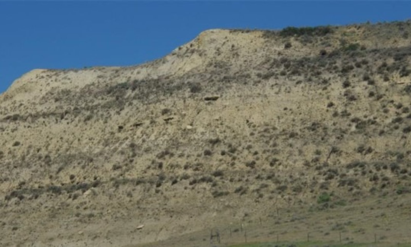
The Badland ecological site is characterized by exposed soft, sedimentary siltstone and shale bedrock that is actively eroding. These sites have greater than 80 percent bare ground. Slopes are typically steeper than 50 percent but range from strongly sloping to very steep (9 to 150 percent). The Badland ecological site is constantly undergoing geological erosion; surface runoff is very rapid. This site is located on steep- sided buttes, escarpments, knobs, and ridges; it is characterized by sparse vegetation, deeply entrenched drainageways, and depositional fans below these landforms. Associated ecological sites are Badland Fan and Limy Residual ecological sites which occur lower and Shallow Loamy and Very Shallow sites which occur higher (on more stable positions).
To see a full copy of the ecological site description with all tables and the full version 5 rangeland health worksheet, please use the following hyperlink:
https://efotg.sc.egov.usda.gov/references/public/ND/58C_Badland_Narrative_FINAL.pdf
Figure 2 Caption: Badland ecological site in relationship to other ecological sites. The Badlands soil mapping unit consists of Badland ecological sites on the south and west aspects while other sites (such as Shallow Loamy, Limy Residual, etc.) can be found on the east and north aspects. The east and north aspects can be dominated by Rocky Mountain juniper.Associated sites
R058CY086ND Shallow Loamy
This site is typically on the summit above the very steep, sparsely vegetated badland escarpment. This site may also occur on upper back slopes immediately below the summit on north- and east-facing aspects opposite the badland escarpment which generally faces south or west. Shallow Loamy ecological sites are well-vegetated, complex slopes. Soils are medium- textured, well drained soils with soft mudstone or siltstone bedrock at a depth of 10 to 20 inches. The soft sedimentary bedrock affects root growth. The soil above the soft bedrock will form a ribbon 1 to 2 inches long. The Shallow Loamy site has more production than the Badland site.
R058CY079ND Limy Residual
This site is on nearby, relatively stable alluvial fans below the Badland and Badland Fan ecological sites. Soils on the Limy Residual site are very deep, medium- textured soils that are calcareous within a depth of 8 inches. The result of constant, progressive erosion of the steep badland escarpments is that they gradually recede away from the slope alluvium that has been deposited at the base of the escarpments. As the alluvial fans get farther away from the actively eroding badlands escarpments, they become more stable. Deposition on them is less frequent and soil development progresses. Soils on these relatively stable alluvial fans have a thin surface horizon, but these soils generally do not have a mollic epipedon. The soils on Limy Residual sites will form a ribbon <2 inches long. The Limy Residual site has more soil development and better production than the Badland and Badland Fan ecological sites.
R058CY083ND Very Shallow
This site occurs on two distinctly different landform positions in association with the Badland ecological site. Very Shallow sites are either on steep, convex shoulders and upper back slopes adjacent to and in conjunction with Shallow Loamy sites or on porcelanite (scoria) covered summits of very steep badland escarpments. On steep, convex shoulders and upper back slopes, Very Shallow sites are typically adjacent to and associated with Shallow Loamy sites immediately below the summit on north- and east- facing aspects opposite the badland escarpment (which typically faces south or west). Soils on Very Shallow sites are medium-textured, well drained soils with either soft, sedimentary bedrock that affects root penetration within 10 inches of the soil surface or with greater than 90% porcelanite (scoria) fragments within 20 inches of the soil surface. The Very Shallow site is sparsely vegetated, but it has more production than the Badland site.
R058CY070ND Badland Fan
This site is below the Badland ecological site on alluvial fans at the base of badland escarpments. These are medium-textured, well drained soils that developed in stratified layers of slope alluvium. Carbonates are present at or near the soil surface. Soils on Badland Fan sites will form a ribbon <2 inches long. As a result of constant deposition of sediments from the adjacent steep, sparsely- vegetated badland escarpment, the Badland Fan site has more bare ground and less production than the Limy Residual site that is lower on the landscape.

Figure 1. Badland ecological site in relationship to other ecological sites. See Ecological Site concept narrative for more details.

Figure 2. Badland ecological site in relationship to Badland Fan ecological site. Badland Fan ecological sites are typically located downslope of Badland ecological sites.
Table 3. Dominant plant species
Tree Not specified
Shrub Not specified
Herbaceous Not specified
Physiographic features
The Badland ecological site consists of bare, eroding exposures of soft siltstone and shale bedrock on steep- sided buttes, escarpments, knobs, ridges, and in deeply entrenched, steep-sided-drainageways. The exposed bedrock makes up about 80 percent of any given area and supports little or no vegetation. Runoff is rapid and geologic erosion is active. Slope ranges from 9 to 150 percent.
Table 4. Representative physiographic features
Landforms (1) Escarpment
(2) Butte
(3) Ridge
Runoff class High to very high Flooding frequency None Ponding frequency None Elevation 1835 – 3400 ft Slope 9 – 100 % Water table depth 72 – 80 in Aspect W, S, SW Climatic features
MLRA 58C is considered to have a continental climate with cold winters and hot summers, low humidity, light rainfall, and much sunshine. Extremes in temperature are common and characteristic of the MLRA. The continental climate is the result of the location of this MLRA in the geographic center of North America. There are few natural barriers on the northern Great Plains, so air masses move unobstructed across the plains and account for rapid changes in temperature.
Annual precipitation ranges from 14 to 17 inches per year. The normal average annual temperature is about 41° F. January is the coldest month with an average temperature of about 17° F. July is the warmest month with an average temperature of about 70° F. The range of normal average monthly temperatures between the coldest and warmest months is 53° F. This large temperature range attests to the continental nature of the MLRA 58C climate. Wind speeds average about 11 miles per hour, ranging from about 13 miles per hour during the spring to about 10 miles per hour during the summer. Daytime wind speeds are generally stronger than nighttime wind speeds, and occasional strong storms may bring brief periods of high winds with gusts to more than 50 miles per hour.
Growth of native cool-season plants begins in late March and continues to early to mid-July. Native warm- season plants begin growth in mid-May and continue to the end of August. Greening up of cool-season plants can occur in September and October when adequate soil moisture is present.Table 5 Representative climatic features
Frost-free period (characteristic range) 90-100 days Freeze-free period (characteristic range) 120-120 days Precipitation total (characteristic range) 20-20 in Frost-free period (actual range) 80-100 days Freeze-free period (actual range) 120-120 days Precipitation total (actual range) 10-20 in Frost-free period (average) 100 days Freeze-free period (average) 120 days Precipitation total (average) 20 in Characteristic rangeActual rangeBarLineFigure 2. Monthly precipitation range
Characteristic rangeActual rangeBarLineFigure 3. Monthly minimum temperature range
Characteristic rangeActual rangeBarLineFigure 4. Monthly maximum temperature range
BarLineFigure 5. Monthly average minimum and maximum temperature
Figure 6. Annual precipitation pattern
Figure 7 Annual average temperature pattern
Climate stations used
-
(1) WATFORD CITY 14S [USC00329246], Grassy Butte, ND
-
(2) TROTTERS 3 SSE [USC00328812], Beach, ND
-
(3) CARLYLE 13 NW [USC00241518], Wibaux, MT
-
(4) AMIDON [USC00320209], Amidon, ND
-
(5) MEDORA 7 E [USW00094080], Fairfield, ND
">Influencing water features
No significant water features influence this site; it is on a runoff (erosive) landscape position. The depth to a seasonal water table is typically more than 80 inches throughout the year.
Soil features
The Northern Rolling High Plains, Northeastern Part (MLRA 58C) is also known as the Little Missouri Badlands; many map units in MLRA 58C have the miscellaneous land type ‘Badland’ either as a named component or as an inclusion. Since 'Badland' is considered a miscellaneous land type, there is not a named soil series correlated to the Badland ecological site. However, there are numerous map units that have the Badland ecological site as a component. Many of these Badlands complex map units are of large extent in MLRA 58C. This site is on the hot, dry south and west exposures of strongly sloping to very steep badlands landforms; slopes range from 9 to 150 percent slopes. When east and north facing slopes exceed 70 percent, this site is basically unvegetated.
Actual soil material on the surface of the Badlands component varies between ½ inch to 3 inches of calcareous silty or loamy material over soft, calcareous sedimentary siltstone, mudstone or shale bedrock that was laid down during the Tertiary and late Cretaceous periods. Constant, active geological erosion and deposition make it difficult for soil to develop and vegetation to establish on the Badland ecological site.
Very steep slopes, carbonates at the surface, and sparse or no vegetation make these sites highly susceptible to water and wind erosion. Badland ecological sites may be sparsely vegetated with big sagebrush and rubber rabbitbrush, but if the thin soil surface layer is lost due to erosion, the result is reduced plant numbers or complete loss of vegetation on the site.
Access Web Soil Survey (https://websoilsurvey.sc.egov.usda.gov/App/WebSoilSurvey.aspx) for specific local soils information.Table 6. Representative soil features
Parent material (1) Residuum – shale and siltstone
(2) Residuum – mudstone
(3) Residuum – sandstone
Surface texture (1) Loam
(2) Silt loam
(3) Clay loam
(4) Silty clay loam
Drainage class Well drained to excessively drained Permeability class Very slow to moderately slow Depth to restrictive layer 0 – 3 in Surface fragment cover <=3" 0 – 12 % Surface fragment cover >3" 0 – 1 % Available water capacity
(0-40in)0.15 – 2 in Calcium carbonate equivalent
(0-40in)10 – 35 % Electrical conductivity
(0-40in)2 – 4 mmhos/cm Sodium adsorption ratio
(0-40in)0 – 5 Soil reaction (1:1 water)
(0-40in)7.4 – 8.4 Subsurface fragment volume <=3"
(Depth not specified)Not specified Subsurface fragment volume >3"
(Depth not specified)Not specified Ecological dynamics
This ecological site description is based on nonequilibrium ecology and resilience theory and utilizes a State- and-Transition Model (STM) diagram to organize and communicate information about ecosystem change as a basis for management. The ecological dynamics characterized by the STM diagram reflect how changes in ecological drivers, feedback mechanisms, and controlling variables can maintain or induce changes in plant community composition (phases and/or states). The application of various management actions, combined with weather variables, impact the ecological processes which influence the competitive interactions, thereby maintaining or altering plant community structure.
Due to steepness of slope, precipitation events, fires, hydrology, drought, bedrock/parent material (e.g., mudstone or siltstone), soil conditions/development, and other factors, this ecological site is subject to rotational slides, also known as slumping (see Figure 4 below). Significant precipitation events saturating the soil profile is a major contributing factor. If east and north facing slopes exceed 70 percent, this site is basically unvegetated.
As the slide occurs, the sliding mass may stay intact and result in relatively small changes in site conditions. However, it may also break up into portions of different sizes and settle out in different orientations. Often, much of the vegetation present before the slide continues growing after being relocated by the slide. The result is a mosaic of various sized segments that can markedly differ in soil characteristics, aspect, areal extent, existing vegetation, and other factors. Over time, different ecological sites may develop. As such, care should be given to identify any rotational slides, as well as whether the slide has resulted in a change in states, community phases, or perhaps ecological site(s).
Three vegetative states have been identified for the site (Reference, Native/Invaded, and Rotational Slide/Mosaic). Within each state, one community phase has been identified. The community phases are named based on the more dominant and visually conspicuous characteristics and species; they have been determined by study of historical documents, relict areas, scientific studies, and ecological aspects of plant species and plant communities. Transitional pathways and thresholds have been determined through similar methods.
State 1: Reference State represents the natural range of variability that dominated the dynamics of this ecological site prior to European influence. Dynamics of the state were largely determined by variations in climate and weather (e.g., drought, heavy precipitation events). One community phase has been identified for the state.
Currently the primary disturbances are rotational slides (aka slumping) and the widespread introduction of exotic species. The presence of exotic species on the site precludes it from being placed in the Reference State. It must then be placed in State 2: Native/Invaded State (T1A). A rotational slide results in State 3: Rotational Slide/Mosaic State via T1B.
State 2: Native/Invaded State. Colonization of the site by exotic species results in a transition from State 1: Reference State to State 2: Native/Invaded State (T1A). This transition is probably inevitable; it often results from colonization by exotic cool-season grasses, such as smooth brome, and/or crested wheatgrass. Other exotics such as sweet clover, Canada thistle, and leafy spurge are also known to colonize the site. One community phase has been identified for the state.
State 3: Rotational Slide/Mosaic State. This state results from a rotational slide (T1B), also known as slumping. These rotational landslides are caused by the downward and outward movement of a mass on top of a concave upward failure surface. The sliding mass may stay intact, thus resulting in relatively small changes in site conditions or break up into portions of different sizes and settle out in different orientations. Often, much of the vegetation present before the slide continues growing after being relocated by the slide. The result can be a mosaic of various sized segments that can markedly differ in soil characteristics, aspect, areal extent, existing vegetation, and other factors.
The following state and transition model diagram illustrates the common states, community phases, and transitions that can occur on the site based on current knowledge and experience. Changes may be made as more data are collected.State and transition model
Custom diagramStandard diagram
Figure 8. Badland ESD – Bare east facing slope – greater than 70 percent slope

Figure 9. Rotational landslides are caused by the downward and outward movement of a mass on top of a concave upward failure surface (Abbott 2004).

Figure 10. Badland State and Transition model with key
More interactive model formats are also available. View Interactive Models
More interactive model formats are also available. View Interactive Models
Click on state and transition labels to scroll to the respective textT1A - Colonization by exotic cool-season grasses T1B - Rotational slide T2A - Rotational slide State 1 submodel, plant communities
State 2 submodel, plant communities
State 3 submodel, plant communities
State 1
Reference StateThis state represents the natural range of variability that dominated the dynamics of this ecological site prior to European influence. The primary disturbance mechanism for this site in the reference condition is rotational slides (aka slumping). Due to steepness of slope, precipitation events, fires, hydrology, bedrock/parent material (e.g., lignite veins), soil conditions/development, and other factors, this ecological site is subject to rotational slides. These rotational slides appear to be more frequent on the north and east facing slopes with fire followed by major precipitation events being a major contributing factor. Wildfires may serve as triggers for future slides due to changes in vegetation, soil conditions, hydrology, and other factors. As a result, care should be given to identify any rotational slides, as well as whether the slide has resulted in a change in states and community phases or perhaps ecological site(s). These factors largely dictate the dynamics that occur within the natural range of variability which likely cause the community to shift both spatially and temporally between two community phases.
Due to the variations in soils, aspect, and other factors, bare ground is extensive with vegetation typically sparse and widely scattered. However, it may include a wide variety of plants.
Characteristics and indicators. No invasive exotic plants present. Presence of non-invasive species (e.g., sweet clover), however, does not signify a transition to State 2: Native/Invasive State.
Resilience management. If intact, the reference state should probably be managed with current disturbance regimes which has permitted the site to remain in reference condition, as well as maintaining the quality and integrity of associated ecological sites. Maintenance of the reference condition is contingent upon a monitoring protocol to guide management.
Community 1.1
Bare Ground/Scattered Grasses, Shrubs, and Forbs
Figure 11. Community Phase 1.1: Bare Ground/Scattered Grasses, Shrubs, and Forbs - sparse, widely scattered vegetation and extensive bare ground.
This community phase is historically the most dominant both temporally and spatially. It may be characterized by extensive areas of bare ground with sparse and widely scattered vegetation. Although sparse and widely scattered, the vegetation species richness can be quite high.
Graminoids may include threadleaf sedge, needle and thread, saltgrass, prairie sandreed, sideoats grama, and little bluestem. Common forb and shrub species include white penstemon, tufted evening primrose, scarlet globemallow, scarlet beeblossom, foothill bladderpod, buttecandle, broom snakeweed, western pricklypear, skunkbush sumac, prairie sagewort, big sagebrush, silver sagebrush, and soapweed yucca. Where more mesic conditions exist, trees such as Rocky Mountain juniper and common juniper may also be present.State 2
Native/Invaded StateThis state is similar to State 1: Reference State but has now been colonized by the exotic cool-season grasses (commonly smooth brome, and/or crested wheatgrass) which are now present in small amounts. Other exotic species (e.g., leafy spurge, Canada thistle, sweetclover) may also be present.
Characteristics and indicators. The presence of trace amounts of exotic cool-season grasses indicates a transition from State 1 to State 2. Canada thistle and leafy spurge are also known to invade the site. The presence of exotic biennial or perennial leguminous forbs (e.g., sweet clover, black medic) may not, on their own, indicate a transition from State 1 to State 2 but may facilitate that transition.
Resilience management. Due to steepness of slope and sparse vegetation, prescribed grazing and prescribed burning are generally not viable options. Management of adjacent ecological sites is an important factor in slowing or limiting the invasion of exotic plants.
Community 2.1
Bare Ground/ Scattered Vegetation/Exotics
Figure 12. Foreground - Community Phase 2.1: Bare Ground/Grasses/Shrubs/Forbs – sparse, widely scattered vegetation with high amount of bare ground and scattered exotic species.
This Community Phase is similar to Community Phase 1.1 but has been colonized by exotic cool-season grasses, often smooth brome and/or crested wheatgrass. However, these exotics are present in smaller amounts with the community still dominated by native grasses. Exotic forbs, such as Canada thistle and leafy spurge, are also known to invade the site.
State 3
Rotational Slide/Mosaic StateThis state results from a rotational slide (aka slump). The sliding mass may stay intact, thus resulting in relatively small changes in site conditions. However, it may also break up into portions of different sizes and settle out in different orientations. Often, much of the vegetation present before the slide continues growing after being relocated by the slide. The result is a mosaic of various sized segments that can markedly differ in soil characteristics, aspect, areal extent, existing vegetation, and other factors. Over time, different ecological sites may develop. As such, care should be given to identify any rotational slides, as well as whether the slide has resulted in a change in states, community phases, or perhaps ecological site(s).
Characteristics and indicators. The presence of a rotational slide characterizes this Rotational Slide/Mosaic State.
Resilience management. Due to steepness of slope and sparse vegetation, prescribed grazing and prescribed burning are generally not viable options. Management of adjacent ecological sites is an important factor in slowing or limiting the invasion of exotic plants.
Community 3.1
Bare Ground/Scattered Vegetation
Figure 13. Community Phase 3.1: Badland ecological site with rotational slide.
This community phase can be characterized by extensive areas of bare ground with scattered vegetation consisting of native and/or exotic plants. If the sliding mass remains intact, relatively small changes in site conditions and vegetation may result. As such, the community phase may resemble that of Community Phases 1.1 or 2.1. However, if the slide mass breaks up, the resulting masses and supporting vegetation can be quite variable. As such, care should be given to identify any/all rotational slides, as well as whether the slide has resulted in a change in states or perhaps ecological site(s).
Transition T1A
State 1 to 2This is the transition from the State 1: Reference State to the State 2: Native/Invaded State due to the introduction and establishment of exotic cool-season grasses (typically smooth brome, and/or crested wheatgrass). This transition is probably inevitable. The threshold between states is crossed when smooth brome, crested wheatgrass, or other exotic species become established on the site.
Constraints to recovery.Current knowledge and technology will not facilitate a successful restoration to Reference State.
Transition T1B
State 1 to 3This is the transition from the State 1: Reference State to the State 3: Rotational State/Mosaic State results from a rotational slide (aka slump). The sliding mass may remain intake resulting in relatively small changes in site conditions or break up into portions of different sizes and settle out in different orientations resulting in a mosaic of various segments that can markedly differ in soil characteristics, aspect, vegetation, and other factors.
Constraints to recovery.Current knowledge and technology will not facilitate a successful restoration to State 1: Reference State.
Transition T2A
State 2 to 3This is the transition from the State 2: Native/Invaded State to the State 3: Rotational State/Mosaic State results from a rotational slide (aka slump). The sliding mass may remain intact resulting in relatively small changes in site conditions or break up into portions of different sizes and settle out in different orientations resulting in a mosaic of various segments that can markedly differ in soil characteristics, aspect, vegetation, and other factors.
Constraints to recovery.Current knowledge and technology will not facilitate a successful restoration to State 2: Native/Invaded State.
Additional community tables
Table 7. Community 1.1 plant community composition
Group Common name Symbol Scientific name Annual production () Foliar cover (%) Table 8. Community 2.1 plant community composition
Group Common name Symbol Scientific name Annual production () Foliar cover (%) Table 9. Community 3.1 plant community composition
Group Common name Symbol Scientific name Annual production () Foliar cover (%) Interpretations
Animal community
Wildlife Interpretations
Landscape:
The MLRA 58C landscape is characterized by moderately dissected rolling plains with areas of local Badlands, buttes, and isolated hills. MLRA 58C is considered to have a continental climate with cold winters and hot summers, low humidity, light rainfall, and much sunshine. Extremes in temperature are common and characteristic of the MLRA. This area supports natural mixed-grass prairie vegetation with prairie rose, leadplant, and patches of western snowberry interspersed throughout the area. Green ash, chokecherry, and buffaloberry occur in draws and narrow valleys, creating woody riparian corridors. Complex/intermingled ecological sites create diverse grass- and shrubland habitats interspersed with varying densities linear, slope, depressional, and in-stream wetlands associated with headwater streams and tributaries to the Missouri River. These habitats provide critical life-cycle components for many wildlife species.
Historic Communities/Conditions within MLRA 58C:
The northern mixed-grass prairie was a disturbance-driven ecosystem with fire, herbivory, and climate functioning as the primary ecological drivers (either singly or often in combination). Many species of grassland birds, small mammals, insects, reptiles, amphibians, and large herds of Audubon bighorn sheep, roaming bison, elk, and pronghorn were historically among the inhabitants adapted to this semi-arid region. Bighorn sheep have been re-introduced. Roaming herbivores, as well as several small mammal and insect species, were the primary consumers linking the grassland resources to large predators (such as the wolf, mountain lion, and grizzly bear) and smaller carnivores (such as the coyote, bobcat, red fox, and raptors). The black-tailed prairie dog was once abundant and provided ecological services by manipulating the plant and soil community providing habitat for the black-footed ferret, burrowing owl, ferruginous hawk, mountain plover, swift fox, small mammals, and amphibians and reptiles. Extirpated species include free-ranging American bison, Canada lynx, common raven, grizzly bear, gray wolf, black-footed ferret, mountain plover, and peregrine falcon (breeding). Extinct from the region is the Rocky Mountain locust.
Present Communities/Conditions within MLRA 58C:
Following European influence, domestic livestock grazing, elimination of fire, energy development, and other anthropogenic factors influenced plant community composition and abundance. Transportation corridors, energy development, and Rocky Mountain juniper and ponderosa pine encroachment are the main factors contributing to habitat fragmentation, reducing habitat quality for area-sensitive species. These influences fragmented the landscape, reduced or eliminated ecological drivers (fire), and introduced exotic plant species including smooth brome, crested wheatgrass, Kentucky bluegrass, and leafy spurge further impacting plant and animal communities. The loss of the bison, reduction of black-tailed prairie dogs, and fire, as primary ecological drivers, greatly influenced the character of the remaining native plant communities and the associated wildlife moving towards a less diverse and more homogeneous landscape, lacking diverse species composition and stature.
Extensive fragmentation by annual cropping has not occurred within the MLRA. Limited fragmentation from annual cropping or tame hay production has occurred within the Little Missouri River flood plain and the higher, flat plateaus. Fragmentation east and west of MLRA 58C has funneled many species into this area in search of expansive grasslands.
Some wildlife species in this area are: mule deer, white-tailed deer, elk, bighorn sheep, pronghorn, mountain lion, coyote, red fox, bobcat, prairie rattlesnake, American badger, raccoon, North American porcupine, beaver, striped skunk, American mink, white-tailed jackrabbit, black-tailed prairie dog, Eastern and Merriam’s wild turkey, golden eagle, ferruginous hawks, sharp-tailed grouse, greater sage-grouse, black-billed magpie, and numerous species of grassland-nesting birds and pollinating insects. The highest diversity of bats in North Dakota also occurs in this MLRA, where eleven species have been documented.
Presence of wildlife species is often determined by ecological site characteristics including grass and forb species, hydrology, aspect, and other associated ecological sites. Home ranges for most species are larger than one ecological site or are dependent on more than one ecological site for annual life requisites. Ecological sites offer different habitat elements as the annual life requisites change. Habitat improvement and creation must be conducted within the mobility limits of a known population for the species.
Insects play an important role providing ecological services for plant community development. Insects that are scavengers or aid in decomposition provide the food chain baseline sustaining the carnivorous insects feeding upon them. Many insects provide the ecological services necessary for pollination, keeping plant communities healthy and productive. Insects provide a protein food source for numerous species including grassland nesting birds and their young.
Species unique to the MLRA:
Mountain Lions: Mountain lions were relatively common in the Badlands but disappeared from the state by the early 20th Century. Sightings resumed in the 1950’s and have subsequently increased since that time. The species has recently taken up permanent residency within the region. Mountain lions occur in of the Little Missouri Badlands and woody habitat in MLRA 58C. Rugged terrain and forest provide excellent stalking cover to hunt large mammals and other prey. Mountain lions make use of caves for escape and loafing cover.
Bighorn sheep: Bighorn sheep make use of the rugged terrain, rocky outcrops, and high plateaus of MLRA 58C along the Little Missouri River. North Dakota bighorn sheep populations are almost exclusively within MLRA 58C. Bighorn sheep were once extirpated from North Dakota but were successfully reintroduced in the mid-twentieth century. They now occur in several distinct populations within MLRA 58C. Rocky Mountain juniper encroachment degrades the limited habitat for bighorn sheep. Managers should consider bighorn sheep association with domestic sheep, since transfer of pneumonia and other diseases is known to occur.
Golden eagle: The badlands within MLRA 58C are key areas for Golden eagle nesting. Adjacent grasslands, shrublands, and black-tailed prairie dog towns are used for hunting.
Bats: MLRA 58C provides life requisites for several bat species, in part due to presence of riparian forest, wooded draws, caves, and rocky outcrops. Hibernacula of six bat species have been found in MRLA 58C; however, additional work is needed to further understand utilization of hibernacula by bats during the winter months in North Dakota.
Short-horned lizard and sagebrush lizard: This MLRA provides preferred habitat for these two species. The short-horned lizard prefers semi-arid, shortgrass prairie in rough terrain, and is uncommon to locally abundant in MLRA 58C. The rare sagebrush lizard prefers sagebrush and rocky areas provided by this MLRA and adjacent MLRA 58D.
Greater sage-grouse and Brewer’s sparrow: The extreme southwest extension of MLRA 58C have ecological sites capable of producing sufficient big sage canopy cover to provide greater sage-grouse life requisites. MLRA 58C and 58D are the only MLRAs in North Dakota that support Wyoming big sage brush (big sage) production. Research data indicates greater sage-grouse prefer big sagebrush canopy cover for nesting at ≥8% with an average height of around 16 inches. The species prefers winter cover canopy that averages 15% with an average height of around 8 inches. Soil site potential, management, climate, and other factors all play a role in the amount, if any, of big sagebrush on an ecological site. Changes in big sage canopy cover occur slowly (30-50 years) unless the site is impacted by fire or cultivation. Big sage recovery after a burn can take 30 to 100 years. Greater sage- grouse and Brewer’s sparrow habitat and populations are reduced or eliminated when big sagebrush canopy is reduced to less than 8% for greater sage-grouse and 10% cover for Brewer’s sparrow. As conifer encroachment increases, greater sage-grouse lekking activity decreases. Once conifer encroachment exceeds 4% canopy cover, no leks remain.
Species of Concern within the MLRA:
Following is a list of species considered “species of conservation priority” in the North Dakota State Wildlife Action Plan (2015); “species of greatest conservation need” in the Montana State Wildlife Action Plan (2015); and species listed as “threatened, endangered, or petitioned” under the Endangered Species Act within MLRA 58C at the time this section was developed:
Invertebrates: Dakota skipper, monarch butterfly, regal fritillary, yellow-banded bumble bee, and western bumble bee.
Birds: American kestrel, Baird’s sparrow, bald eagle, black-billed cuckoo, bobolink, Brewer’s sparrow, burrowing owl, chestnut-collared longspur, common poorwill, eastern screech-owl ferruginous hawk, golden eagle, grasshopper sparrow, greater sage-grouse, lark bunting, loggerhead shrike, long-billed curlew, marbled godwit, McCown’s longspur, mountain plover, northern harrier, northern pintail, peregrine falcon (migration), prairie falcon, red knot (migration), red-headed woodpecker, sharp-tailed grouse, short-eared owl, Sprague’s pipit, Swainson’s hawk, upland sandpiper, western meadowlark, Wilson’s phalarope, whooping crane (migration), and willet.
Mammals: Big brown bat, black-footed ferret, black-tailed prairie dog, dwarf shrew, gray wolf, hispid pocket mouse, little brown bat, long-eared bat, long-legged bat, meadow jumping mouse, Merriam’s shrew, northern long-eared bat, porcupine, sagebrush vole, swift fox, Townsend’s big- eared bat, and western small-footed bat.
Amphibians and Reptiles: Common snapping turtle, Great Plains toad, greater short-horned lizard, milk snake, northern leopard frog, plains hognose snake, plains spadefoot, sagebrush lizard, smooth softshell, smooth green snake, and spiny softshell.
Fish and Mussels: Blue sucker, burbot, Flathead chub, northern redbelly dace, sickle-fin chub, pearl dace, shortnose gar, sturgeon chub, and sauger.
Grassland Management for Wildlife in the MLRA
Management activities within the community phase pathways impact wildlife. Community phase, transitional, and restoration pathways are keys to long-term management within each State and between States. Significant inputs must occur to cross the threshold between States (e.g., State 3.0 to 2.0) requiring substantial economic inputs and management (mechanical, reseeding, prescribed fire, woody vegetation removal, grazing intensity, etc.). Timing, intensity, and frequency of these inputs can have dramatic positive or negative effects on local wildlife species. Ranchers and other land managers must always consider the long-term beneficial effects of management on the habitat in comparison to potential short-term negative effects to individuals.
Ecological sites occur as intermingled complexes on the landscape with gradual or sometimes abrupt transitions. Rarely do ecological sites exist in large enough acreage to manage independently. Ecological sites, supporting a dominance of herbaceous vegetation (Loamy/Limy Residual), can be located adjacent to ecological sites that support medium to tall shrubs (Loamy Overflow). Conversely, ecological sites that are dominated by short to mid statured grasses (Claypan) can be adjacent to sites with bare soil only supporting minor amounts of short grasses and forbs (Thin Claypan).
Management of these complex ecological sites can provide a heterogeneous or a homogenous landscape. Grassland bird use declines as the plant community transitions to a homogenous state. Managers need to recognize ecological sites and the complexes they occur in to properly manage the landscape. A management regime for one ecological site may negatively impact an adjacent site (e.g., alteration of a grazing regime within a Flat Bottom Wooded Draw ecological site to encourage understory growth may encourage exotic, cool-season grasses to increase or dominate an adjacent ecological site).
Life requisites and habitat deficiencies are determined for targeted species. Deficiencies need to be addressed along community phase, transitional, and restoration pathways as presented in specific state and transition models. Ecological sites should be managed and restored within the capabilities of the site to provide sustainable habitat. Managers also need to consider habitat provided by adjacent/intermingled ecological sites for species with home ranges or life requisites that cannot be provided by one ecological site.
With populations of many grassland-nesting birds in decline, it is important to maintain these ecological sites in a 1.0 Reference State or the 2.0 Native/Invaded. Plant communities, optimal for a guild of grassland species, serve as a population source where the birth rate exceeds mortality. Species may use marginal plant communities; however, these sites may function as a population sink where mortality exceeds the birth rate.
Understanding preferred vegetative stature and sensitivity to woody encroachment is necessary to manage for the specific grassland species. Various grass heights may be used for breeding, nesting, foraging, or winter habitat. While most species use varying heights, many have a preferred vegetative stature height. Please reference the provisional ESD on the North Dakota eFOTG (linked below) for a chart that provides preferred vegetative stature heights and sensitivity to woody vegetation encroachment.
https://efotg.sc.egov.usda.gov/references/public/ND/58C_Badland_Narrative_FINAL.pdf
Badland Wildlife Habitat Interpretation:
Badland ecological sites consist of bare, eroding exposures of soft siltstone and shale bedrock on steep-sided buttes, escarpments, knobs, ridges, and in deeply entrenched, steep-sided- drainageways. The exposed bedrock makes up about 80 percent of any given area and supports little or no vegetation. Associated ecological sites include Badland Fan, Limy Residual, Very Shallow, and Shallow Loamy.
Badland ecological sites are steep with limited grasses, forbs, or shrubs. Bare ground and exposed bedrock dominate the site providing limited food and cover for wildlife. Steep slopes limit ground dwelling mammals and grazing herbivores. Badland ecological sites provide excellent habitat for bighorn sheep using these sites for escape, loafing, and lambing areas. Steep slopes provide excellent visibility to detect predators while the associated ecological sites provide foraging opportunities. These associated sites commonly support grassland nesting birds and forage, escape, and thermal cover for small herbivores. The short statured vegetation of these associated sites is preferred by short-grass nesting birds.
Grazing Interpretations
Due to site conditions, (e.g., steep slopes, limited forage production, etc.), grazing on this site is limited. Therefore, grazing management efforts should be concentrated on adjacent sites and should be applied that enhances the competitive advantage of native grass and forb species. This may include: (1) grazing when exotic cool-season grasses are actively growing and native cool-season grasses are dormant; (2) applying proper deferment periods allowing native grasses to recover and maintain or improve vigor; (3) adjusting overall grazing intensity to reduce excessive plant litter (above that needed for rangeland health indicator #14 – see Rangeland Health Reference Worksheet); (4) incorporating early heavy spring utilization which focuses grazing pressure on exotic cool-season grasses and reduces plant litter, provided that livestock are moved when grazing selection shifts from exotic cool-season grasses to native grasses.
Grazing levels are noted within the plant community narratives and pathways in reference to grazing management on adjacent sites. “Degree of utilization” is defined as the proportion of the current years forage production that is consumed and/or destroyed by grazing animals (may refer to a single plant species or a portion or all the vegetation). “Grazing utilization” is classified as slight, moderate, full, close, and severe (see the following table for description of each grazing use category). The following utilization levels are also described in the Ranchers Guide to Grassland Management IV. Utilization levels are determined by using the landscape appearance method as outlined in the Interagency Technical Reference “Utilization Studies and Residual Measurements” 1734-3.
Utilization Level:
Slight (Light) 0-20% Appears practically undisturbed when viewed obliquely. Only choice areas and forage utilized.
Moderate 20-40% Almost all of accessible range shows grazing. Little or no use of poor forage. Little evidence of trailing to grazing.
Full 40-60% All fully accessible areas are grazed. The major sites have key forage species properly utilized (about half taken, half left). Points of concentration with overuse limited to 5 to 10 percent of accessible area.
Close (Heavy) 60-80% All accessible range plainly shows use and major sections closely cropped. Livestock forced to use less desirable forage, considering seasonal preference.
Severe > 80% Key forage species completely used. Low-value forages are dominant.Hydrological functions
Water is the principal factor limiting herbage production on this site. The site is dominated by soils in hydrologic group D. Infiltration is moderately slow or slow; runoff potential is high or very high depending on slope percent, surface texture, and ground cover. Due to slope and most areas having less than 20% ground cover, most precipitation is lost via runoff.
Recreational uses
The largest acreage of public land available for recreation in the MLRA is owned and managed by the United States Forest Service (USFS) within the Little Missouri National Grasslands in North Dakota (525,211 acres). These areas are available for hunting, fishing, hiking, camping, horse and bike riding, nature viewing, etc. In addition, the Bureau of Land Management (BLM) manages 30,895 acres in North Dakota and Montana with the same recreational opportunities as the USFS lands. North Dakota and Montana Department of Trust Lands (80,220 acres) provide hunting, bird watching, hiking, and other outdoor recreation opportunities. North Dakota Wildlife Management Areas (3,447 acres) of land managed by the states for wildlife habitat in MLRA 58C.
MLRA 58C is home to the North and South Units of Theodore Roosevelt National Park. The Park encompasses approximately 70,000 acres and welcomes approximately 900,000 visitors annually. 29,920 acres of the park is designated Wilderness Area. The south unit of the park has a 48-mile scenic drive while the north unit has a 28-mile scenic drive. The Badland and associated ecological sites provide the main scenery attraction.
Bird watching: Public and private grasslands within MLRA 58C provide essential habitat for prairie-dependent bird species (such as Sprague's pipits, western meadowlark, and Baird's sparrow) along with some of the larger, showy members of the upland prairie including marbled godwits, upland sandpipers, and willets. The abundance of publicly owned lands (such as Theodore Roosevelt National Park, USFS, North Dakota Department of Trust Lands, BLM, etc.) provide excellent birding opportunities. MLRA 58C is in the Central Flyway.
Hunting/Fishing: MLRA 58C is a fall destination for upland game bird hunters, especially sharp-tailed grouse. This MLRA also provides excellent white-tailed deer, mule deer, pronghorn, elk, coyote, and mountain lion hunting opportunities along with the only bighorn sheep hunting units in the North Dakota. The North Dakota Game and Fish Department manages three man-made fishing lakes within the MLRA. Available species include rainbow and brown trout, bluegill, and largemouth and smallmouth bass.
Camping: Many camping opportunities exist in the MLRA. Modern and primitive camping is available at the Theodore Roosevelt National Park, Sully’s Creek State Park, Little Missouri State Park, Buffalo Gap Campground, BLM land, and the Dakota Prairie National Grasslands. The Sully’s Creek and Little Missouri State Parks are designated horse parks.
Hiking/Biking: Over 150 miles of the May-Daah-Hey Trail provide some of the best single-track trails in the world for biking, hiking, or horseback riding. The International Mountain Biking Association (IMBA) has designated the hiking, biking, and horseback riding trail as EPIC - meaning it’s one of the top mountain biking trails in the United States. The trail has nine fenced campgrounds, each accessible by gravel surfaced roads; they include camping spurs, potable water, hitching rails, picnic tables, fire rings, and accessible toilets. They are spaced about every 20 miles along the trail. The North and South Units of the Theodore Roosevelt National Park provide 38.9 and 49.6 miles, respectively, of hiking trails for walkers, bikers, or horseback riders. The Little Missouri State Park has 45 miles of trails that run through the North Dakota Badlands.
Canoeing: Traversing 274 miles through MLRA 58C, the Little Missouri River provides early spring canoeing and kayaking. The Little Missouri River is the only designated State Scenic River in the MLRA. The river passes through Sully Creek State Park, the Little Missouri National Grassland, and Theodore Roosevelt National Park.Wood products
No appreciable wood products are present on the site.
Other products
None
Other information
Site Development and Testing Plan.
This ESD is the best available knowledge. The site concept and species composition table have been used in the field and tested for more than five years. It is expected that as additional information becomes available revisions may be required.Supporting information
Inventory data references
Information presented here has been derived from NRCS and other federal/state agency clipping and inventory data. Also, field knowledge of range-trained personnel was used. All descriptions were peer reviewed and/or field-tested by various private, state, and federal agency specialists.
Other references
Abbott, P.L., 2004, Natural disasters, New York, McGraw-Hill Companies, Inc., 460 p.
Bakker, K.K. 2003. The effect of woody vegetation on grassland nesting birds: an annotated bibliography. The Proceedings of the South Dakota Academy of Science 82:119-141.
Barker, W.T. and W. C. Whitman. 1988. Vegetation of the Northern Great Plains. Rangelands 10: 266-272h
Barnhart, Paul. 2017. Documentation of overwintering bat species presence and hibernacula use in the badlands of North Dakota, Northwestern Naturalist 98(1), 48-56, (1 March 2017). https://doi.org/10.1898/NWN15-34.1.
Bjustad, A. J. 1965. Vegetation measurements in relation to range condition classification on the principal range sites of southwestern North Dakota. Ph.D. Thesis. North Dakota State University.
Bluemle. J.P. 2016. North Dakota’s geologic legacy. North Dakota State University Press. 382 pages.
Brand, M. D. and H. Goetz. 1986. Vegetation of exclosures in southwestern North Dakota. Journal of Range Management 39:434-437.
Briske, D.D. (editor). 2017. Rangeland systems – processes, management, and challenges. Springer Series on Environmental Management. 661 pages.
DeKeyser, S., G. Clambey, K. Krabbenhoft and J. Ostendorf. 2009. Are changes in species composition on central North Dakota rangelands due to non-use management? Rangelands 31:16-19.
Dodd, J.L. 1970. Distribution and community site relations of bluebunch wheatgrass in North Dakota. Ph.D. Thesis. North Dakota State University.
Dyke, S. R., S. K. Johnson, and P.T. Isakson. 2015. North Dakota state wildlife action plan – North Dakota Game and Fish Department.
Ehrenfeld, J.G. 2002. Effects of exotic plant invasions on soil nutrient cycling processes. Ecosystems 6:503- 523.
Endangered and threatened wildlife and plants; designation of critical habitat for the Dakota skipper and Poweshiek skipperling; Vol. 79 No. Final Rule October 1, 2015, 50 CFR Part 17.
Ereth, C., J. Hendrickson, D. Kirby, E. DeKeyser, K. Sedevic, and M. West. Controlling Kentucky bluegrass with herbicide and burning is influenced by invasion level. Invasive Plant Science and Management 10:80-89.
Flesland, J.R. 1964. Composition and structure of the salt-desert shrub type in the badlands of western North Dakota. M.S. Thesis. North Dakota State University.
Gilgert, W.; and S. Zack. 2010. Integrating multiple ecosystem services introduction ecological site descriptions. Rangelands 32:49-54.
Gillam, Erin. Distribution and habitat use of the bats of North Dakota, Final Report, T2-5-R Bat Survey Final Report 2012_0.pdf (nd.gov).
Grant, T.A. and R.K. Murphy. 2005. Changes on woodland cover on prairie refuges in North Dakota, USA. Natural Areas Journal 25:359-368.
Hanson, H.C and W. Whitman. 1938. Characteristics of major grassland types in western North Dakota. Ecological Monographs 8:57-114.
Heitschmidt, R. K., K. D. Klement, and M. R. Haferkamp. 2005. Interactive effects of drought and grazing on Northern Great Plains rangelands. Rangeland Ecology and Management 58:11-19.
Hendrickson, J.R., P. S. Johnson, M. A. Liebig, K. K. Sedivec, and G. A. Halvorson. 2016. Use of ecological sites in managing wildlife and livestock: an example with prairie dogs. Rangelands 38:23-28.
Higgins, K.F. 1984. Lightning fires in North Dakota grasslands and in pine-savanna lands of South Dakota and Montana. Journal of Range Management 37:100-103.
Higgins, K.F. 1986. Interpretation and compendium of historical fire accounts in the northern great plains. United States Department of Interior, Fish and Wildlife Service. Resource Publication 161. 39 pages.
Higgins, K. F., A. D. Kruse, and J. L. Piehl. 1987. Effects of fire in the northern Great Plains. South Dakota State University Extension Circular Paper 429.
High Plains Regional Climate Center, University of Nebraska. http://hprcc.unl.edu, Accessed on May 1, 2017.
Hirsch, K.L. 1985. Habitat type classification of grasslands and shrublands of southwestern North Dakota. Ph.D. Thesis. North Dakota State University.
Johnson, S. 2015. Reptiles and amphibians of North Dakota. North Dakota Game and Fish Department. 64 pages.
Jordan, N. R., D.L. Larson, and S.C. Huerd. 2008. Soil modification by invasive plants: effects on native and invasive species of mixed-grass prairies. Biological Invasions 10:177-190.
Mader, E., M. Shepherd, M. Vaughan, and S.H. Black. 2011. Attracting native pollinators: protecting North America's bees and butterflies. Accessed at https://xerces.org, May 1, 2017.
Montana’s State Wildlife Action Plan. 2015. Montana Fish, Wildlife and Parks. Viewed at https://xerces.org/ on May 1, 2017.
North Dakota Division of Tourism, Accessed on February 25, 2019. Available at https://www.ndtourism.com/sports-recreation
North Dakota Parks and Recreation Department, Accessed on February 25, 2019. Available at http://www.parkrec.nd.gov/recreationareas/recreationareas.html
Palit, R., G. and E.S. DeKeyser. 2022. Impacts and drivers of smooth brome (Bromus inermis Leyes.) invasion in native ecosystems. Plants: 10,3390. http://http://http://http://https://www.mdpi.com/2223-7747/11/10/1340
Palit, R., G. Gramig, and E.S. DeKeyser. 2021. Kentucky bluegrass invasion in the Northern Great Plains and prospective management approaches to mitigate its spread. Plants: 10,817. https://doi.org/10.3390/plants10040817
Printz, J.L. and J.R. Hendrickson. 2015. Impacts of Kentucky bluegrass invasion (Poa pratensis) on ecological processes in the Northern Great Plains. Rangelands 37:226-232.
Redmann, R.E. 1975. Production ecology of grassland plant communities in western North Dakota. Ecological Monographs 45:83-106.
Reeves, J.L., J.D. Derner, M.A. Sanderson, J.R. Hendrickson, S.L. Kronberg, M.K. Petersen, and L.T. Vermeire. 2014. Seasonal weather influences on yearling beef steer production in C3-dominated Northern Great Plains rangeland. Agriculture, Ecosystems and Environment 183:110-117.
Robinson, A.C. 2014. Management plan and conservation strategies for greater sage grouse in North Dakota. North Dakota Game and Fish Department.
Royer, R. A., 2003. Butterflies of North Dakota: an atlas and guide. Minot State University.
Sanford, R.C. 1970. Skunk bush in the North Dakota badlands: ecology, phytosociology, browse production, and utilization. Ph.D. Thesis. North Dakota State University.
Seabloom, R. 2020. Mammals of North Dakota. North Dakota State University Press.
Sedivec, K.K., and J.L. Printz. 2014. Ranchers guide to grassland management IV. North Dakota State University Extension Service publication R1707.
South Dakota Dept. of Game, Fish and Parks. 2014. South Dakota wildlife action plan. Wildlife Division Report 2014-03.
Spaeth, K.E., Hayek, M.A., Toledo, D., and Hendrickson, J. 2019. Cool season grass impacts on native mixed grass prairie species in the Northern Great Plains. America’s Grassland Conference: Working Across Boundaries. The Fifth Biennial Conference on the Conservation of America’s Grasslands. Bismarck, ND. 20- 22 August.
Steffens, Tim, G. Grisson, M. Barnes, F. Provenza, and R. Roath. Adaptive grazing management for recovery. Know why you’re moving from paddock to paddock. Rangelands 35(5):28–34
Tidwell, D., D.T. Fogarty, and J.R. Weir. 2021. Woody encroachment in grasslands, a guide for understanding risk and vulnerability. Oklahoma State University, Oklahoma Cooperative Extension Service Publication E- 1054. 32 pages.
Toledo, D., M. Sanderson, K. Spaeth, J. Hendrickson, and J. Printz. 2014. Extent of Kentucky bluegrass and its effect on native plant species diversity and ecosystem services in the Northern Great Plains of the United State. Invasive Plant Science and Management 7:543-552.
United States Department of Agriculture, Natural Resources Conservation Service. 2006. Land Resource Regions and Major Land Resource Areas of the United States, the Caribbean, and the Pacific Basin. U.S. Department of Agriculture Handbook 296.
USDA, NRCS. National Water and Climate Center. (http://www.wcc.nrcs.usda.gov)
USDA, NRCS. National range and pasture handbook, September 1997.
USDA, NRCS. National Soil Information System, Information Technology Center. Accessed on May 1, 2017 at http://nasis.nrcs.usda.gov.
USDA, NRCS. 2001. The PLANTS Database, Version 3.1. http://plants.usda.gov. Accessed May 2, 2017.
USDA, NRCS. 2021. Species diversification of crested wheatgrass dominated grasslands: a review of methods. Plant Materials Technical Note No. MT-126 November 2021.
USDA, NRCS, Various published soil surveys.
USDI BLM. Utilization studies and residual measurements. Interagency Technical Reference 1734-3. 1999.
Vinton, M.A. and E.M. Goergen. 2006. Plant-soil feedbacks contribute to the persistence of Bromus inermis in tallgrass prairie. Ecosystems 9:967-976.
Whitman, W., H. Hanson, and R. Peterson. 1943. Relation of drought and grazing to North Dakota rangelands. North Dakota Agricultural Experimentation Bulletin 320.
Zaczkowski, N. K. 1972. Vascular flora of Billings, Bowman, Golden Valley, and Slope counties, North Dakota. Ph.D. Thesis, North Dakota State University.
Zimmerman, G. M. 1981. Effects of fire upon selected plant communities in the little Missouri badlands. M.S. Thesis, North Dakota State University.Contributors
ND NRCS: David Dewald, Alan Gulsvig, Mark Hayek, Jeanne Heilig, John Kempenich, Chuck Lura, Jeff Printz, and Steve Sieler.
Approval
Suzanne Mayne-Kinney, 4/21/2025
Acknowledgments
NRCS would like to acknowledge the United State Forest Service (USFS) and National Park Service (NPS) for access to USFS and NPS properties and technical assistance in ESD development. USFS: Jack Dahl, Nickole Dahl, Chad Prosser, Jack Butler; NPS: Chad Sexton.
Rangeland health reference sheet
Interpreting Indicators of Rangeland Health is a qualitative assessment protocol used to determine ecosystem condition based on benchmark characteristics described in the Reference Sheet. A suite of 17 (or more) indicators are typically considered in an assessment. The ecological site(s) representative of an assessment location must be known prior to applying the protocol and must be verified based on soils and climate. Current plant community cannot be used to identify the ecological site.
Author(s)/participant(s) Contact for lead author Date 09/18/2026 Approved by Approval date Composition (Indicators 10 and 12) based on Annual Production Indicators
-
Number and extent of rills:
-
Presence of water flow patterns:
-
Number and height of erosional pedestals or terracettes:
-
Bare ground from Ecological Site Description or other studies (rock, litter, lichen, moss, plant canopy are not bare ground):
-
Number of gullies and erosion associated with gullies:
-
Extent of wind scoured, blowouts and/or depositional areas:
-
Amount of litter movement (describe size and distance expected to travel):
-
Soil surface (top few mm) resistance to erosion (stability values are averages - most sites will show a range of values):
-
Soil surface structure and SOM content (include type of structure and A-horizon color and thickness):
-
Effect of community phase composition (relative proportion of different functional groups) and spatial distribution on infiltration and runoff:
-
Presence and thickness of compaction layer (usually none; describe soil profile features which may be mistaken for compaction on this site):
-
Functional/Structural Groups (list in order of descending dominance by above-ground annual-production or live foliar cover using symbols: >>, >, = to indicate much greater than, greater than, and equal to):
Dominant:
Sub-dominant:
Other:
Additional:
-
Amount of plant mortality and decadence (include which functional groups are expected to show mortality or decadence):
-
Average percent litter cover (%) and depth ( in):
-
Expected annual annual-production (this is TOTAL above-ground annual-production, not just forage annual-production):
-
Potential invasive (including noxious) species (native and non-native). List species which BOTH characterize degraded states and have the potential to become a dominant or co-dominant species on the ecological site if their future establishment and growth is not actively controlled by management interventions. Species that become dominant for only one to several years (e.g., short-term response to drought or wildfire) are not invasive plants. Note that unlike other indicators, we are describing what is NOT expected in the reference state for the ecological site:
-
Perennial plant reproductive capability:
Print Options
Sections
Font
AAAAOther
PrintThe Ecosystem Dynamics Interpretive Tool is an information system framework developed by the USDA-ARS Jornada Experimental Range, USDA Natural Resources Conservation Service, and New Mexico State University.
Accessibility statement


