
Natural Resources
Conservation Service
Ecological site R058AC057MT
Shallow (Sw)
RRU 58A-C 11-14" p.z.
Last updated: 4/30/2024
Accessed: 09/20/2026
-
Search


Major Land Resource Area or ecological site by name and/or ID.
PreviousSectionsNextGeneral information
Provisional. A provisional ecological site description has undergone quality control and quality assurance review. It contains a working state and transition model and enough information to identify the ecological site.
Click to explore map
Figure 1. Mapped extent
Areas shown in blue indicate the maximum mapped extent of this ecological site. Other ecological sites likely occur within the highlighted areas. It is also possible for this ecological site to occur outside of highlighted areas if detailed soil survey has not been completed or recently updated.
Associated sites
R058AC040MT Silty (Si) RRU 58A-C 11-14" p.z.
R058AC042MT Sandy (Sy) RRU 58A-C 11-14" p.z.
R058AC058MT Very Shallow (VSw) RRU 58A-C 11-14" p.z.
Similar sites
R058AC040MT Silty (Si) RRU 58A-C 11-14" p.z.
The Silty site varies by being over 20 inches deep, and by having significantly more ground cover and production.
R058AC058MT Very Shallow (VSw) RRU 58A-C 11-14" p.z.
The Very Shallow site is less than 10 inches deep, or has a water holding capacity of 2 inches or less.
R058AC042MT Sandy (Sy) RRU 58A-C 11-14" p.z.
The Sandy site varies by being over 20 inches deep, and by having significantly more ground cover and production.
R058AC059MT Shallow Clay (SwC) RRU 58A-C 11-14" p.z.
The Shallow Clay site varies by texture.
Table 1. Dominant plant species
Tree Not specified
Shrub Not specified
Herbaceous (1) Pseudoroegneria spicata
(2) Nassella viridulaPhysiographic features
The soils in this ecological site can occur on shoulders and side slopes of hills, ridgetops, and escarpments. Slope aspect can be significant, and can occur on all aspects.
Table 2. Representative physiographic features
Landforms (1) Ridge
(2) Hill
(3) Escarpment
Flooding frequency None to rare Elevation 2250 – 4500 ft Slope 0 – 60 % Water table depth 60 – 0 in Aspect N, E, S Climatic features
Major Land Resource Area (MLRA) 58AC in Montana is considered to have a continental climate characterized by cold winters, hot summers, low humidity, light rainfall, and much sunshine. Extremes in temperature are typical. The climate is the result of this MLRA’s location in the geographic center of North America. There are few natural barriers on the northern Great Plains and the winds move freely across the plains and account for rapid changes in temperature. Seasonal precipitation is often limiting for plant growth. Annual fluctuations in species composition and total production are typical depending on the amount and timing of rainfall.
Temperatures can be very extreme in this part of Montana. Summer daytime temperatures are typically quite warm, generally averaging in the mid to upper 80º’s F for July and August. Summertime temperatures will typically reach in the 100º’s F at some point during the summer, and can reach 90º F any month between May and September. Conversely, winter temperatures can be cold, averaging in the mid teens to mid 20º’s F for December and January. There will typically be several days of below zero temperatures each winter. It is not uncommon for temperatures to reach 30–40º F below zero, or even colder, most any winter.
Spring can be windy throughout this MLRA, with winds averaging over 10 mph about 15 percent of the time. Speeds of 50 mph or stronger can occasionally occur as a weather system crosses this part of Montana.
The majority of the rangeland in MLRA 58AC is within the 11 to 14 inch Mean Annual Precipitation (MAP) range. During an average year, 70 to 75 percent of the annual precipitation falls between April and September, which are the primary growing season months.
Snowfall is not heavy in the area, averaging 28 total inches in the Yellowstone Valley. Heavy snowfall occurs infrequently, usually late in the winter or early spring. Snow cover is typically 1 to 3 inches.
The frost-free (32º F.) season averages about 105 to 145 days each year in the uplands, to nearly 170 days along the Yellowstone River Valley.
For local climate station information, refer to http://www.wcc.nrcs.usda.gov/cgibin/state.pl?state=mt.Table 3 Representative climatic features
Frost-free period (average) 140 days Freeze-free period (average) 160 days Precipitation total (average) 10 in ">Influencing water features
Soil features
These soils are 10 to 20 inches deep to hard rock or soft beds of weathered siltstone or sandstone. Few roots penetrate deeper than 20 inches. Surface textures are mainly silt loam, loam, sandy loam, fine sandy loam, loamy fine sand, and very fine sandy loam. Available Water Holding Capacity to 20 inches is 2 to 4 inches.
Table 4. Representative soil features
Surface texture (1) Silt loam
(2) Loam
(3) Sandy loam
Surface fragment cover <=3" 5 – 10 % Available water capacity
(0-40in)2 – 4 in Ecological dynamics
The following are descriptions of several plant communities that may occupy this site.
State and transition model
Custom diagramStandard diagram
More interactive model formats are also available. View Interactive Models
More interactive model formats are also available. View Interactive Models
Click on state and transition labels to scroll to the respective textEcosystem states
State 1 submodel, plant communities
State 2 submodel, plant communities
State 3 submodel, plant communities
State 4 submodel, plant communities
State 5 submodel, plant communities
State 1
Tall and Medium Grasses/ Forbs/ Shrubs (HCPC)Community 1.1
Tall and Medium Grasses/ Forbs/ Shrubs (HCPC)
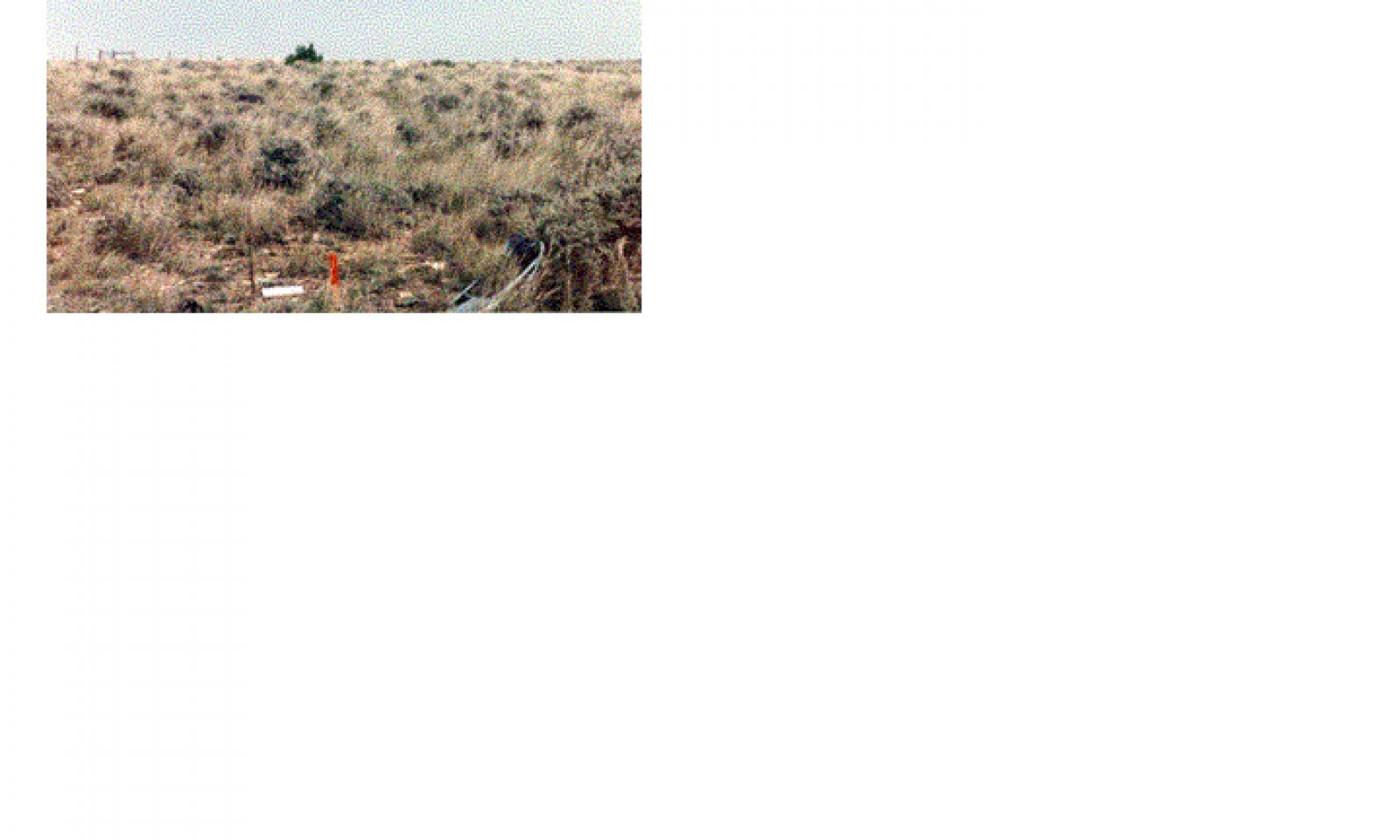
Figure 2. 58AC Shallow 11-14" MAP Plant Community 1
The physical aspect of this site in the Historical Climax (HCPC) is that of mixed grass/ shrub land dominated by cool-season bunchgrasses and a mixture of shrubs. Approximately 70–80% of the annual production is from grasses and sedges, 5–10% from forbs, and 10–20% is from shrubs and half-shrubs. Canopy cover of shrubs is typically 5 to 15%. Ponderosa pine may occur on this site, as well as Rocky Mountain juniper.
Dominant species include bluebunch wheatgrass, green needlegrass, plains muhly, western or thickspike wheatgrass, and needleandthread. Short grasses and sedges such as Sandberg bluegrass, prairie junegrass, and threadleaf sedge are also present. There are abundant forbs (purple and white prairie clover, prairie coneflower, dotted gayfeather) which occur in smaller percentages. Shrubs such as Wyoming big sagebrush and skunkbush sumac are common. Rocky Mountain and creeping juniper may also occur.
This plant community is well adapted to the Northern Great Plains climatic conditions. The diversity in plant species and presence of tall, deep-rooted perennial grasses allows for drought tolerance. Plants on this site have strong, healthy root systems that allow production to increase significantly with favorable moisture conditions. Abundant plant litter is available for soil building and moisture retention. Plant litter is properly distributed with very little movement off-site and natural plant mortality is very low. This plant community provides for soil stability and a functioning hydrologic cycle.
Figure 3. Annual production by plant type (representative values) or group (midpoint values)
Table 5. Annual production by plant type
Plant type Low
(lb/acre)Representative value
(lb/acre)High
(lb/acre)Grass/Grasslike 710 800 890 Shrub/Vine 140 160 180 Forb 70 80 90 Total 920 1040 1160 Table 6. Ground cover
Tree foliar cover 0% Shrub/vine/liana foliar cover 0-10% Grass/grasslike foliar cover 40-60% Forb foliar cover 10-10% Non-vascular plants 0% Biological crusts 0% Litter 0% Surface fragments >0.25" and <=3" 0% Surface fragments >3" 0% Bedrock 0% Water 0% Bare ground 0% Table 7. Soil surface cover
Tree basal cover 0% Shrub/vine/liana basal cover 0-10% Grass/grasslike basal cover 10-10% Forb basal cover 0-0% Non-vascular plants 0% Biological crusts 0-0% Litter 40-60% Surface fragments >0.25" and <=3" 10-10% Surface fragments >3" 0% Bedrock 0% Water 0% Bare ground 20-30% Table 8. Canopy structure (% cover)
Height Above Ground (ft) Tree Shrub/Vine Grass/
GrasslikeForb <0.5 – – – – >0.5 <= 1 – 1-7% – 5-10% >1 <= 2 – – 40-60% – >2 <= 4.5 – – – – >4.5 <= 13 – – – – >13 <= 40 – – – – >40 <= 80 – – – – >80 <= 120 – – – – >120 – – – – State 2
Medium and Short Grasses and Sedges/ Half-shrubsCommunity 2.1
Medium and Short Grasses and Sedges/ Half-shrubs
Figure 4. 58AC Shallow 11-14" MAP Plant Community 2
This community occurs from shifts in climate or other disturbances. Dominant species include needleandthread, western or thickspike wheatgrass, threadleaf sedge, and prairie junegrass. Bluebunch wheatgrass, green needlegrass, and plains muhly will still be present but in smaller amounts. Palatable and nutritious forbs will be replaced by less desirable and more aggressive species, such as hairy goldenaster, silverleaf scurfpea, and scarlet globemallow.
Grass biomass production and litter become reduced in Community 2 as the taller grasses become less prevalent, increasing evaporation and reducing moisture retention. Additional open space in the community can result in undesirable invader species. This plant community provides for moderate soil stability.State 3
Short and Medium Grasses and Sedges/ Half-shrubs and ShrubsCommunity 3.1
Short and Medium Grasses and Sedges/ Half-shrubs and ShrubsThis is a disturbance induced community, with dominants including Sandberg bluegrass, prairie junegrass, threadleaf sedge, perennial forbs, fringed sagewort, and Wyoming big sagebrush. Remnant amounts of western or thickspike wheatgrass and needleandthread may be present. Tall grasses and palatable forbs will be mostly absent. The amount of Wyoming big sagebrush in this community can also be the result of lack of fire in Community 4, as periodic fire tends to reduce the amount of big sagebrush that is present. There will be some shifting of sagebrush between communities 3 and 4, depending on the occurrence and frequency of fire.
State 4
Short and Medium Grasses and Sedges/ Half-shrubsCommunity 4.1
Short and Medium Grasses and Sedges/ Half-shrubsThis is a disturbance induced community, with dominants including Sandberg bluegrass, prairie junegrass, threadleaf sedge, and other short grasses. It is similar to Community 3, but having less of a shrub component. Remnant amounts of western or thickspike wheatgrass and needleandthread may be present. Tall grasses and palatable forbs will be mostly absent.
Plant Communities 3 and 4 are much less productive than Plant Communities 1 or 2, and have lost many of the attributes of a healthy rangeland. The loss of deep perennial root systems reduces total available moisture for plant growth. Reduction of plant litter will result in higher surface soil temperatures and increased evaporation losses. Annual species are often aggressive and competitive with seedlings of perennial plants. This community can respond positively to improved grazing management but it will take additional inputs to move it towards a community similar in production and composition to that of Plant Community 1 or 2.State 5
Half-shrubs/ Annual Grasses and Forbs/ Short GrassesCommunity 5.1
Half-shrubs/ Annual Grasses and Forbs/ Short GrassesThis community is the result of continual adverse disturbances. Dominant species include fringed sagewort and broom snakeweed, and annuals and biennials such as cheatgrass, Japanese brome, six-weeks fescue, and thistles. Red threeawn and non-native, weedy forbs are also likely to invade. Blue grama, Sandberg bluegrass, and prairie junegrass may be present in lesser amounts. Wyoming big sagebrush may be a major component depending on the fire history of the site. Plant community 5 has extremely reduced production of native plants (< 400 lbs. /acre). The lack of litter and short plant heights result in higher soil temperatures, poor water infiltration rates, and increased evaporation, which gives short sod grasses and sedges and annual invaders a competitive advantage over the tall and medium grasses. This community has lost many of the attributes of a healthy rangeland, including good infiltration, minimal erosion and runoff, nutrient cycling and energy flow. Significant economic inputs and time would be required to move this plant community toward a higher successional stage and a more productive plant community.
*Seeding and mechanical treatment are typically not recommended on shallow soils, such as those associated with this ecological site. However, in this Rangeland Resource Unit this ecological site is often a minor component of larger map units containing deeper soils. In these situations, treating the shallow site is often only incidental to treating the larger area of deeper soils. Also, to avoid the shallow component of these areas often becomes impractical. In some locations, shallow soils have been cultivated as part of a field composed of mainly deeper soils. Reseeding is generally feasible and practical in these situations.
Additional community tables
Table 9. Community 1.1 plant community composition
Group Common name Symbol Scientific name Annual production () Foliar cover (%) Grass/Grasslike1 Native grasses 644–812 bluebunch wheatgrass PSSP6 Pseudoroegneria spicata 368–696 – Indian ricegrass ACHY Achnatherum hymenoides 1–116 – tufted wheatgrass ELMA7 Elymus macrourus 46–116 – needle and thread HECOC8 Hesperostipa comata ssp. comata 46–116 – green needlegrass NAVI4 Nassella viridula 46–116 – western wheatgrass PASM Pascopyrum smithii 46–116 – plains muhly MUCU3 Muhlenbergia cuspidata 1–58 – 2 Native grasses and sedges 1–116 Grass, perennial 2GP Grass, perennial 1–58 – blue grama BOGR2 Bouteloua gracilis 1–58 – threadleaf sedge CAFI Carex filifolia 1–58 – plains reedgrass CAMO Calamagrostis montanensis 1–58 – prairie Junegrass KOMA Koeleria macrantha 1–58 – Sandberg bluegrass POSE Poa secunda 1–58 – sand dropseed SPCR Sporobolus cryptandrus 1–58 – 3 Native grasses 1–3 Fendler's threeawn ARPUF Aristida purpurea var. fendleriana 1–3 – Forb4 Native forbs 46–116 Forb, perennial 2FP Forb, perennial 46–58 – common yarrow ACMI2 Achillea millefolium 46–58 – pussytoes ANTEN Antennaria 46–58 – tufted milkvetch ASSP6 Astragalus spatulatus 46–58 – milkvetch ASTRA Astragalus 46–58 – miner's candle CRVI4 Cryptantha virgata 46–58 – white prairie clover DACA7 Dalea candida 46–58 – purple prairie clover DAPU5 Dalea purpurea 46–58 – buckwheat ERIOG Eriogonum 46–58 – hairy false goldenaster HEVI4 Heterotheca villosa 46–58 – dotted blazing star LIPU Liatris punctata 46–58 – desertparsley LOMAT Lomatium 46–58 – evening primrose OENOT Oenothera 46–58 – beardtongue PENST Penstemon 46–58 – spiny phlox PHHO Phlox hoodii 46–58 – scurfpea PSORA2 Psoralidium 46–58 – upright prairie coneflower RACO3 Ratibida columnifera 46–58 – scarlet globemallow SPCO Sphaeralcea coccinea 46–58 – prairie thermopsis THRH Thermopsis rhombifolia 46–58 – American vetch VIAM Vicia americana 46–58 – 5 Native forbs (toxic properties) 1–3 twogrooved milkvetch ASBI2 Astragalus bisulcatus 1–3 – larkspur DELPH Delphinium 1–3 – white locoweed OXSE Oxytropis sericea 1–3 – deathcamas ZIGAD Zigadenus 1–3 – Shrub/Vine6 Native shrubs and half-shrubs 92–232 Shrub, broadleaf 2SB Shrub, broadleaf 1–58 – prairie sagewort ARFR4 Artemisia frigida 1–58 – Wyoming big sagebrush ARTRW8 Artemisia tridentata ssp. wyomingensis 1–58 – yellow rabbitbrush CHVI8 Chrysothamnus viscidiflorus 1–58 – rubber rabbitbrush ERNAN5 Ericameria nauseosa ssp. nauseosa var. nauseosa 1–58 – creeping juniper JUHO2 Juniperus horizontalis 1–58 – Rocky Mountain juniper JUSC2 Juniperus scopulorum 1–58 – winterfat KRLA2 Krascheninnikovia lanata 1–58 – skunkbush sumac RHTR Rhus trilobata 1–58 – prairie rose ROAR3 Rosa arkansana 1–58 – soapweed yucca YUGL Yucca glauca 1–58 – 7 Native shrubs and half-shrubs 1–3 broom snakeweed GUSA2 Gutierrezia sarothrae 1–3 – plains pricklypear OPPO Opuntia polyacantha 1–3 – Table 10. Community 2.1 plant community composition
Group Common name Symbol Scientific name Annual production () Foliar cover (%) Table 11. Community 3.1 plant community composition
Group Common name Symbol Scientific name Annual production () Foliar cover (%) Table 12. Community 4.1 plant community composition
Group Common name Symbol Scientific name Annual production () Foliar cover (%) Table 13. Community 5.1 plant community composition
Group Common name Symbol Scientific name Annual production () Foliar cover (%) Interpretations
Animal community
Livestock Grazing Interpretations:
Managed livestock grazing is suitable on this site as it has the potential to produce a moderate amount of high quality forage. Forage production is somewhat limited by steep slopes and shallow soils, and the potential for runoff, which reduces the effectiveness of the precipitation received for plant growth. The steeper slopes may also limit livestock travel and result in poor grazing distribution, especially in areas away from water. Management objectives should include maintenance or improvement of the plant community. Shorter grazing periods and adequate re-growth after grazing are recommended for plant maintenance and recovery. Heavy stocking and season long use of this site can be detrimental and will alter the plant community composition and production over time.
Whenever Plant Community 2 (medium and short grasses) occurs, grazing management strategies need to be implemented to avoid further deterioration. This community is still stable, productive, and healthy provided it receives proper management. This community will respond fairly quickly to improved grazing management, including increased growing season rest of key forage plants. Grazing management alone can usually move this community back towards the potential community.
Plant Communities 3 and 4 have substantially reduced forage production, and a high percentage of aggressive, non-palatable species. Once these plant communities become established, it will be much more difficult to restore the site to a community that resembles the potential with grazing management alone. Additional growing season rest is often necessary for re-establishment of the desired species and to restore the stability and health of the site.
Plant Community 5 has extremely limited forage production (< 150 lbs./acre), and a high percentage of non-preferred species for cattle and sheep. Seeding may be necessary to restore desirable native perennial species.
Wildlife Interpretations:
The Shallow ecological site, with its complex topography and vegetative structure, along with the tendency to occur in a mosaic with other ecological sites, often provides for a variety of habitat niches and cover types in an otherwise fairly uniform landscape. Historically, mule deer, pronghorn and sage grouse were probably the most conspicuous wildlife species as they still are. The general area provides thermal and escape cover for big game animals as well as a variety of other wildlife species. Shrub availability on steep, south slopes often provides important winter range for mule deer and elk. Abundant prey and perch sites (on rock outcrops and scattered trees) attract a variety of raptors. Sites having steeper, rocky topography provide habitat for interesting songbird species such as rock wrens, canyon wrens and spotted towhees. Scattered junipers and pines host field sparrows and chipping sparrows. The interface of sandy and shale geologic substrates often results in seeps forming on side-hills and toe slopes. These are an important water source for wildlife as well as a source of biodiversity.
Plant Community 1: Tall and Medium Grasses/ Forbs/ Shrubs (HCPC):
The diversity of forbs, half-shrubs and shrubs provides feeding substrate for a variety of pollinating insects, which are prey for many birds, reptiles and small mammals. Springs and seeps are habitat for amphibians such as tiger salamanders. The short-horned lizard is a representative reptile. The diversity of plant species and life forms, in combination with topographic variation, provides high quality bird habitat. Lark sparrows, green-tailed towhees, mountain bluebirds and golden eagles are examples of birds using this community. Sharp-tailed grouse and sage grouse may use this community for lek sites on ridge tops and fairly level topography. The diversity of forbs and shrubs favors browsers and selective feeders such as mule deer and pronghorn. Large animal nutrition levels are relatively high yearlong because of plant species and life form diversity. Winter range value is often high for big game species when topographic diversity provides south exposures and browse plants such as skunkbush sumac and winterfat are available. Small mammal diversity may be fairly high. Example species include the kangaroo rat, deer mouse, olive-backed pocket mouse and desert cottontail.
Plant Community 2: Medium and Short Grasses and Sedges/ Half-shrubs:
Insect diversity may decline with a partial loss of forb variety. The reduction of taller grasses and some desirable shrubs degrades habitat value for many birds, small mammals and big game. Potential increases in half-shrubs and shrubs may maintain big game winter range feeding value, although thermal cover is reduced. Small mammal diversity declines with the loss of vegetative diversity and litter cover.
Plant Community 3: Short Grasses & Sedges/ Half-shrubs and Shrubs:
Insects may be abundant at the height of population cycles but species diversity is reduced significantly. Springs and seeps are very degraded which results in poor amphibian habitat. Sparse vegetation and increased bare ground may provide suitable habitat for a few species (i.e. horned larks) but the lack of complex vegetative structure and residual cover makes this community poor habitat in general for most ground-nesting birds and relatively poor big game habitat. Pronghorn and mule deer may forage in this type thoughout the year. However, nutritional levels for big game are greatly reduced and are available for a much shorter period as compared to the HCPC.
Plant Community 4: Short and Medium Grasses and Sedges/ Half-shrubs:
The habitat values of this community are similar to Community No. 3, above, except that the lack of big sagebrush makes big game habitat even less valuable.
Plant Community 5: Half-shrubs/ Annual Grasses and Forbs/ Short Grasses:
General wildlife habitat value is very poor in this community. Insect diversity and abundance is considerably reduced which decreases feeding opportunity for amphibians, birds and some small mammals. The lack of complex vegetative structural diversity, a shortened period of active plant growth and loss of ground cover make the habitat inhospitable for many birds and most small mammals. Big sagebrush, if present, and fringed sagewort provide some valuable big game winter forage. Thermal cover values are very limited with the loss of skunkbush sumac and other shrubs as well as herbaceous cover. Small mammal diversity is very low. The seed-eating deer mouse may be fairly well represented.Hydrological functions
The runoff potential for this site is low to moderate, depending on slope and ground cover/health. Runoff curve numbers generally range from 78 to 90. The soils associated with this ecological site are generally in Hydrologic Soil Group C. The infiltration rates for these soils will normally be moderate to moderately rapid.
Other information
The following is an example of how to calculate the recommended stocking rate. This example does not use production estimates from this specific ecological site. You will need to adjust the annual production values and run the calculations using total annual production values from the ecological sites encountered on each individual ranch/pasture. Before making specific recommendations, an on-site evaluation must be made.
Example of total annual production amounts by type of year:
Favorable years = 2200 lbs/acre
Normal years = 1480 lbs/acre
Unfavorable years = 1200 lbs/acre
It is recommended that on slopes of 30% or less, stocking rate should be derived from the total annual production pounds minus 500 pounds for residual dry matter and 25% harvest efficiency. On slopes over 30%, stocking rate is derived from total annual production pounds minus 800 pounds for residual dry matter and 25% harvest efficiency. Refer to the NRCS National Range and Pasture Handbook for a list of Animal Unit Equivalents.
Sample Calculations using Favorable Year production amounts:
< 30% slopes: AUM/AC = [(2200-500)(0.25)]/915 lbs/month for one AU = 0.46 AUM/AC
AC/AUM = (1.0 AU)/(0.46AUM/AC) = 2.2 AC/AUM
> 30% slopes: AUM/AC = [(2200-800)(0.25)]/915 lbs/month for one AU = 0.38 AUM/AC
AC/AUM = (1.0 AU)/(0.38 AUM/AC) = 2.6 AC/AUM
NOTE: 915 lbs/month for one Animal Unit is used as the baseline for maintenance requirements. This equates to 30 lbs/day of air-dry forage (1200 lb cow at 2.5% of body weight).
Supporting information
Inventory data references
Supporting Data for Site Development: NRCS Production & Composition Record for Native Grazing Lands (Range-417): 7 BLM Soil & Vegetation Inventory Method (SVIM) Data: 3 NRCS Range Condition Record (ECS-2): 10 NRCS Range/Soil Correlation Observations & Soil 232 notes: 32 Ecological Site Reference: NRCS 417 No.: Wheatland County 509, Golden Valley County 517 Field Offices where this site occurs within the state: Big Sandy Big Timber Billings Chinook Columbus Crow Agency Fort Belknap Hardin Harlowton Joliet Lewistown Malta Roundup Stanford White Sulphur Springs Winnett
Other references
Site Documentation:
Authors:
Original: NRCS, 1983
Revised: Matthew J. Ricketts, Robert E. Leiland, Rhonda Sue Noggles, Peter O. Husby, 2003
Contributors
MJR, REL, RSN, POH
RSNApproval
Kirt Walstad, 4/30/2024
Rangeland health reference sheet
Interpreting Indicators of Rangeland Health is a qualitative assessment protocol used to determine ecosystem condition based on benchmark characteristics described in the Reference Sheet. A suite of 17 (or more) indicators are typically considered in an assessment. The ecological site(s) representative of an assessment location must be known prior to applying the protocol and must be verified based on soils and climate. Current plant community cannot be used to identify the ecological site.
Author(s)/participant(s) Matt Ricketts, Loretta Metz Contact for lead author Date 04/29/2005 Approved by Approval date Composition (Indicators 10 and 12) based on Annual Production Indicators
-
Number and extent of rills:
Rills should not be evident in the reference state. Exceptions include steep slopes (>40%) following heavy thunderstorms. Rills may then be present, but will generally be less than 8 feet in length. -
Presence of water flow patterns:
Water flow patterns are generally not evident on lesser slopes, but can be apparent on steeper slopes in the reference state. When they are present, they are short (< 2 feet long) and discontinuous. -
Number and height of erosional pedestals or terracettes:
Both may be evident in the reference state, especially on steeper slopes (>40%). If present, they do not exceed 1.0 inches in height. -
Bare ground from Ecological Site Description or other studies (rock, litter, lichen, moss, plant canopy are not bare ground):
Bare ground is less than 25% in the reference state. In HCPC, bare ground should not exceed 18%. -
Number of gullies and erosion associated with gullies:
Gully erosion is not evident in the reference state. -
Extent of wind scoured, blowouts and/or depositional areas:
These are not evident in the reference state. -
Amount of litter movement (describe size and distance expected to travel):
Litter movement varies by size and depth of litter. In the reference state, litter should be coarse perennial grass leaves, anywhere from 1.5 inches up to 8 inches in length, plus small shrub leaves. Litter will not move more than a couple of inches from where it originated. -
Soil surface (top few mm) resistance to erosion (stability values are averages - most sites will show a range of values):
Stability values of 2-4 in plant interspaces. Stability values of 4-5 under plant canopies and at plant bases. Soil texture plays an important role in the overall stability values. -
Soil surface structure and SOM content (include type of structure and A-horizon color and thickness):
Surface soil texture varies. Moderate or strong granular surface structure of 1 to 3 inches thickness. Organic matter varies with soil texture. Coarse soils have approx. 1-3% soil organic matter. Loams and heavier textures can have up to 5% soil organic matter. -
Effect of community phase composition (relative proportion of different functional groups) and spatial distribution on infiltration and runoff:
Deep-rooted native perennial midgrasses optimize infiltration and runoff. Perennial plants (grasses, forbs and shrubs) should be spaced approximately 1 to 1.5 feet apart in the reference state. -
Presence and thickness of compaction layer (usually none; describe soil profile features which may be mistaken for compaction on this site):
No compaction layer present in reference state. -
Functional/Structural Groups (list in order of descending dominance by above-ground annual-production or live foliar cover using symbols: >>, >, = to indicate much greater than, greater than, and equal to):
Dominant:
cool season, mid-grasses >> cool season, short-grasses > shrubs > or = perennial forbs > warm season, short-grasses >> trees.Sub-dominant:
Other:
Additional:
-
Amount of plant mortality and decadence (include which functional groups are expected to show mortality or decadence):
Plant mortality of deep-rooted perennial bunchgrases is very low; mortality of shrubs/trees is very low. Decadence during periods of prolonged drought will be evident on all plant species. -
Average percent litter cover (%) and depth ( in):
-
Expected annual annual-production (this is TOTAL above-ground annual-production, not just forage annual-production):
920 – 1160 #/acre. -
Potential invasive (including noxious) species (native and non-native). List species which BOTH characterize degraded states and have the potential to become a dominant or co-dominant species on the ecological site if their future establishment and growth is not actively controlled by management interventions. Species that become dominant for only one to several years (e.g., short-term response to drought or wildfire) are not invasive plants. Note that unlike other indicators, we are describing what is NOT expected in the reference state for the ecological site:
plains pricklypear, broom snakeweed, cheatgrass, Japanese brome, red threeawn, curlycup gumweed, Wyoming big sagebrush, fringed sagewort, blue grama, Rocky Mountain juniper, creeping juniper. -
Perennial plant reproductive capability:
This is not impaired in the reference state.
Print Options
Sections
Font
AAAAOther
PrintThe Ecosystem Dynamics Interpretive Tool is an information system framework developed by the USDA-ARS Jornada Experimental Range, USDA Natural Resources Conservation Service, and New Mexico State University.
Accessibility statement


