Natural Resources
Conservation Service
Ecological site R047XA504UT
High Mountain Clay
(slender wheatgrass)
Last updated: 2/05/2025
Accessed: 07/10/2026
-
Search


Major Land Resource Area or ecological site by name and/or ID.
PreviousSectionsNextGeneral information
Provisional. A provisional ecological site description has undergone quality control and quality assurance review. It contains a working state and transition model and enough information to identify the ecological site.
Click to explore map
Figure 1. Mapped extent
Areas shown in blue indicate the maximum mapped extent of this ecological site. Other ecological sites likely occur within the highlighted areas. It is also possible for this ecological site to occur outside of highlighted areas if detailed soil survey has not been completed or recently updated.
MLRA notes
Major Land Resource Area (MLRA): 047X–Wasatch and Uinta Mountains
MLRA 47 occurs in Utah (86 percent), Wyoming (8 percent), Colorado (4 percent), and Idaho (2 percent). It encompasses approximately 23,825 square miles (61,740 square kilometers). The northern half of this area is in the Middle Rocky Mountains Province of the Rocky Mountain System. Parts of the western edge of this MLRA are in the Great Basin Section of the Basin and Range Province of the Intermontane Plateaus. The MLRA includes the Wasatch Mountains, which trend north and south. The steeply sloping, precipitous Wasatch Mountains have narrow crests and deep valleys. Active faulting and erosion are a dominant force in controlling the geomorphology of the area.
The mountains in this area are primarily fault blocks that have been tilted up. Alluvial fans at the base of the mountains are recharge zones for the basin fill aquifers. An ancient shoreline of historic Bonneville Lake is evident on the footslopes along the western edge of the area. Rocks exposed in the mountains are mostly Mesozoic and Paleozoic sediments.
The average precipitation is from 12 to 16 inches in the valleys and can range up to 73 inches in the mountains. Peak precipitation occurs in the winter months. The average annual temperature is 30 to 50 degrees Fahrenheit (-1 to 15 C). The freeze-free period averages 140 days and ranges from 60 to 220 days, generally decreasing in length with elevation.
The dominant soil orders in this MLRA are Entisols, Inceptisols, and Mollisols. The lower elevations are dominated by a frigid temperature regime, while the higher elevations experience cryic temperature regimes. The soil moisture regime is typically xeric. The minerology is generally mixed and the soils are very shallow to very deep, generally well drained, and loamy or loamy-skeletal.Classification relationships
Modal Soil: Herd CB-L, 3-15% — fine, montmorillonitic Mollic Cryoboralfs
Ecological site concept
The soils of this site are deep, well-drained clay loams. Clay content tends to increase with increasing depth. They formed on mountain slopes and ridges in colluvium and slope alluvium derived from sandstone, conglomerate and/or quartzite parent materials. Cobbles and gravels may be present on the soil surface and account for no more than 20 percent of the soil volume. Permeability of water is moderately slow to slow and roots penetrate the soil readily. These soils are non-calcareous and neutral to slightly acidic. Available water capacity is 5.3 to 7.9 inches in the upper 40 inches of soil. The soil moisture regime is xeric udic and the soil temperature regime is frigid or cryic.
Associated sites
R047XA516UT High Mountain Loam (mountain big sagebrush)
R047XA517UT High Mountain Loam (silver sagebrush)
R047XA528UT High Mountain Stony Clay (slender wheatgrass)
Similar sites
R047XA402UT Mountain Clay (slender wheatgrass)
R047XA528UT High Mountain Stony Clay (slender wheatgrass)
The soils of this site have greater than 35% rock fragments by volume. It also typically occurs at high elevations than the high mountain clay site, up to 9,000 feet.
R047XA454UT Mountain Stony Clay (slender wheatgrass)
The soil for this site has greater than 35% rock fragments by volume. It also recieves less annual precipitation than the high mountain clay site.
Table 1. Dominant plant species
Tree Not specified
Shrub Not specified
Herbaceous (1) Elymus trachycaulus
(2) Bromus carinatusPhysiographic features
This site occurs on mountain slopes and ridges at elevations between 7,000 and 8,000 feet. It can be found on gentle to moderately steep slopes and on all aspects. Flooding and ponding do not occur on this site.
Table 2. Representative physiographic features
Landforms (1) Mountain slope
(2) Ridge
Flooding frequency None Ponding frequency None Elevation 7000 – 8000 ft Slope 3 – 30 % Aspect Aspect is not a significant factor Climatic features
The climate of this site is characterized by cold, snowy winters and cool, dry summers. The average precipitation ranges from 25 to 30 inches. Most of the effective moisture available for plant growth comes from snowmelt and spring moisture.
Table 3 Representative climatic features
Frost-free period (characteristic range) 30-50 days Freeze-free period (characteristic range) 70-100 days Precipitation total (characteristic range) Frost-free period (average) Freeze-free period (average) Precipitation total (average) 30 in ">Influencing water features
Due to its landscape position, this site is not influenced by streams or wetlands.
Wetland description
N/A
Soil features
The soils of this site are deep, well-drained clay loams. Clay content tends to increase with increasing depth. They formed on mountain slopes and ridges in colluvium and slope alluvium derived from sandstone, conglomerate and quartzite parent materials. Cobbles and gravels may be present on the soil surface and account for no more than 20 percent of the soil volume. Permeability of water is moderately slow to slow and roots penetrate the soil readily. These soils are non-calcareous and neutral to slightly acidic. Available water capacity is 5.3 to 7.9 inches in the upper 40 inches of soil. The soil moisture regime is xeric and the soil temperature regime is frigid or cryic.
Soil Survey Area Soil Components (Map Units in parentheses)
Cache Valley Area (UT603) Goring (GOE2);
Morgan Area (UT609) Herd (HrC, HtC);Table 4. Representative soil features
Parent material (1) Colluvium – conglomerate
(2) Slope alluvium – sandstone
(3) Quartzite
Surface texture (1) Cobbly clay loam
(2) Clay loam
Family particle size (1) Clayey
Drainage class Well drained Permeability class Moderately slow to slow Soil depth 40 – 60 in Surface fragment cover <=3" 0 – 13 % Surface fragment cover >3" 0 – 18 % Available water capacity
(0-40in)5.3 – 7.9 in Calcium carbonate equivalent
(0-40in)Not specified Electrical conductivity
(0-40in)0 – 2 mmhos/cm Sodium adsorption ratio
(0-40in)Not specified Soil reaction (1:1 water)
(0-40in)5.6 – 7.3 Subsurface fragment volume <=3"
(Depth not specified)3 – 12 % Subsurface fragment volume >3"
(Depth not specified)0 – 8 % Ecological dynamics
It is impossible to determine in any quantitative detail the Historic Climax Plant Community (HCPC) for this ecological site because of the lack of direct historical documentation preceding all human influence. In some areas, the earliest reports of dominant plants include the cadastral survey conducted by the General Land Office, which began in the late 19th century for this area (Galatowitsch 1990). However, up to the 1870s the Shoshone Indians, prevalent in northern Utah and neighboring states, grazed horses and set fires to alter the vegetation for their needs (Parson 1996). In the 1860s, Europeans brought cattle and horses to the area, grazing large numbers of them on unfenced parcels year-long (Parson 1996). Itinerant and local sheep flocks followed, largely replacing cattle as the browse component increased.
Below is a State and Transition Model diagram to illustrate the “phases” (common plant communities), and “states” (aggregations of those plant communities) that can occur on the site. Differences between phases and states depend primarily upon observations of a range of disturbance histories in areas where this ESD is represented. These situations include grazing gradients to water sources, fence-line contrasts, patches with differing dates of fire, herbicide treatment, tillage, etc. Reference State 1 illustrates the common plant communities that probably existed just prior to European settlement.
The major successional pathways within states, (“community pathways”) are indicated by arrows between phases. “Transitions” are indicated by arrows between states. The drivers of these changes are indicated in codes decipherable by referring to the legend at the bottom of the page and by reading the detailed narratives that follow the diagram. The transition between Reference State 1 and State 2 is considered irreversible because of the naturalization of exotic species of both flora and fauna, possible extinction of native species, and climate change. There may have also been accelerated soil erosion.
When available, monitoring data (of various types) were employed to validate more subjective inferences made in this diagram. See the complete files in the office of the State Range Conservationist for more details.
The plant communities shown in this State and Transition Model may not represent every possibility, but are probably the most prevalent and recurring plant communities. As more monitoring data are collected, some phases or states may be revised, removed, or new ones may be added. None of these plant communities should necessarily be thought of as “Desired Plant Communities.” According to the USDA NRCS National Range and Pasture Handbook (USDA-NRCS 2003), Desired Plant Communities (DPC’s) will be determined by the decision-makers and will meet minimum quality criteria established by the NRCS. The main purpose for including descriptions of a plant community is to capture the current knowledge at the time of this revision.State and transition model
Custom diagramStandard diagram
Figure 2. State and Transition Model
More interactive model formats are also available. View Interactive Models
More interactive model formats are also available. View Interactive Models
Click on state and transition labels to scroll to the respective textT1a - introduction of exotic species T2a - Mechanical disturbance of woody species and continued heavy livestock grazing during the growing-season State 1 submodel, plant communities
State 2 submodel, plant communities
State 3 submodel, plant communities
State 1
Reference StateThe Reference State is a description of this ecological site just prior to Euro-American settlement but long after the arrival of Native Americans. The description of the Reference State was determined by NRCS Soil Survey Type Site Location information and familiarity with rangeland relict areas where they exist. The least modified plant community would have been co-dominated by a mixture of grass and forb species (1.1), with slender wheatgrass (Elymus trachycaulus) and mule-ears (Wyethia amplexicaulis) as the primary species. A more complete list of species by lifeform for the Reference State is available in accompanying tables in the “Plant Community Composition by Weight and Percentage” section of this ESD document.
Community 1.1
Co-dominant grass-forb mixture/ scattered snowberry and other low shrubsThis plant community would have been characterized by a co-dominance of grass and forb species. Grasses would have included slender wheatgrass, mountain brome (Bromus marginatus), basin wildrye (Leymus cinereus), sheep fescue (Festuca ovina), Columbia needlegrass (Achnatherum nelsonii), and Letterman's needlegrass (Achnatherum lettermanii). Forb species would have included mule-ears, silvery lupine (Lupinus argenteus), showy goldeneye (Heliomeris multiflora), and western mountain aster (Symphyotrichum spathulatum) among others. Mountain snowberry (Symphoricarpos oreophilus) and low sagebrush (Artemisia arbuscula) would also have been scattered throughout the site.
Figure 3. Annual production by plant type (representative values) or group (midpoint values)
Table 5. Annual production by plant type
Plant type Low
(lb/acre)Representative value
(lb/acre)High
(lb/acre)Grass/Grasslike 230 350 450 Forb 230 350 450 Shrub/Vine 173 263 338 Total 633 963 1238 Table 6. Ground cover
Tree foliar cover 0% Shrub/vine/liana foliar cover 0-10% Grass/grasslike foliar cover 40-40% Forb foliar cover 10-10% Non-vascular plants 0% Biological crusts 0% Litter 0% Surface fragments >0.25" and <=3" 0% Surface fragments >3" 0% Bedrock 0% Water 0% Bare ground 0% Table 7. Canopy structure (% cover)
Height Above Ground (ft) Tree Shrub/Vine Grass/
GrasslikeForb <0.5 – – – – >0.5 <= 1 – – – 9-11% >1 <= 2 – – 39-41% – >2 <= 4.5 – 4-6% – – >4.5 <= 13 – – – – >13 <= 40 – – – – >40 <= 80 – – – – >80 <= 120 – – – – >120 – – – – State 2
Shrub Steppe StateState 2 is a description of the ecological site shortly following Euro-American settlement, which has been influenced by the introduction of several non-native plants and animals, possible extinctions of native species, and a different climate. Historic heavy continuous season-long grazing by livestock and the prevention of wildfire also had a major impact on these sites creating a shrub steppe which should now be considered the present potential. Unpalatable species such as mule-ears and native woody species such as mountain snowberry, silver sagebrush (Artemisia cana), and low sagebrush increased while the palatable herbaceous species diminished.
Community 2.1
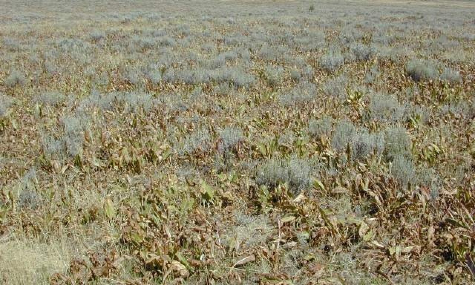
Snowberry and sagebrush increased/ palatable grasses and forbs depleted
Figure 4. R047XA454UT High Mountain Clay (Slender wheatgrass) Community 2.1, 15% grasses, 30% forbs, 15% shrubs, 15% bare ground, 5% rock and 15% litter. Dominant forb is Mules ears; dominant shrub is Low sagebrush; dominant grass is Sandberg’s bluegrass.
State 2 is a description of the ecological site shortly following Euro-American settlement, which has been influenced by the introduction of several non-native plants and animals, possible extinctions of native species, and a different climate. Historic heavy continuous season long grazing by livestock and the prevention of wildfire also had a major impact on these sites creating a shrub steppe which should now be considered the present potential. Unpalatable species such as mule-ears and native woody species such as mountain snowberry, silver sagebrush (Artemisia cana), and low sagebrush increased while the palatable herbaceous species diminished.
State 3
Perennial Forb and Annual Grass StateWith continued impacts from heavy livestock grazing and mechanical, herbicidal, or fire removal of native shrubs, the native grass component will markedly decrease or be absent, shrubs will also be reduced to absence, but perennial forbs and annual grasses such as mule-ears, tarweed , (Madia glomerata) and cheatgrass (Bromus tectorum) will increase.
Community 3.1
Mule-ears/ tarweed/ annual grassesThis plant community is characterized by a suite of very grazing-tolerant herbaceous species such as mule-ears, tarweed, and cheatgrass.
Transition T1a
State 1 to 2The simultaneous introduction of exotic species, both plants and animals, possible extinctions of native flora and fauna, climate change, the advent of heavy continuous season long livestock grazing, and fire prevention has caused State 1 to transition to State 2. Reversal of such historic changes (i.e. a return pathway) back to State 1 is not practical.
Transition T2a
State 2 to 3Mechanical disturbance of woody species and continued heavy livestock grazing during the growing-season of grasses will cause a transition from State 2 to a perennial forb and annual grass-dominated state (State 3). The churning clay soils naturally favor herbs over woody species, thus shrubs are a temporary occupier of such sites. However both the mechanical and herbivory of interzonal grazing can trigger the shrubs which are moderately palatable, especially to sheep. Mule-ears is however, unpalatable to all animals and its massive root structure allows it to prevail under all treatments except deep plowing and herbicides. Reducing livestock grazing has little effect on reducing its competitive hold. The only potential restoration pathway requires massive tillage with subsequent herbicide and re-seeding efforts to convert these sites to perennial grasslands.
Additional community tables
Table 8. Community 1.1 plant community composition
Group Common name Symbol Scientific name Annual production () Foliar cover (%) Shrub/Vine0 Dominant Shrubs 144–270 mountain snowberry SYOR2 Symphoricarpos oreophilus 90–180 – little sagebrush ARAR8 Artemisia arbuscula 54–90 – 3 Sub-Dominant Shrubs 144–270 Shrub (>.5m) 2SHRUB Shrub (>.5m) 54–90 – Saskatoon serviceberry AMAL2 Amelanchier alnifolia 18–36 – silver sagebrush ARCA13 Artemisia cana 18–36 – yellow rabbitbrush CHVIV4 Chrysothamnus viscidiflorus ssp. viscidiflorus var. viscidiflorus 18–36 – slender buckwheat ERMI4 Eriogonum microthecum 18–36 – antelope bitterbrush PUTR2 Purshia tridentata 18–36 – Grass/Grasslike0 Dominant Grasses 720–990 slender wheatgrass ELTR7 Elymus trachycaulus 540–630 – basin wildrye LECI4 Leymus cinereus 90–180 – California brome BRCA5 Bromus carinatus 90–180 – 1 Sub-Dominant Grasses 792–1260 Grass, annual 2GA Grass, annual 180–270 – Grass, perennial 2GP Grass, perennial 180–270 – Letterman's needlegrass ACLE9 Achnatherum lettermanii 54–90 – Columbia needlegrass ACNE9 Achnatherum nelsonii 54–90 – Geyer's sedge CAGE2 Carex geyeri 54–90 – blue wildrye ELGL Elymus glaucus 54–90 – sheep fescue FEOV Festuca ovina 54–90 – prairie Junegrass KOMA Koeleria macrantha 54–90 – western wheatgrass PASM Pascopyrum smithii 54–90 – muttongrass POFE Poa fendleriana 54–90 – Forb0 Dominant Forbs 108–180 tailcup lupine LUCAC3 Lupinus caudatus ssp. caudatus 54–90 – mule-ears WYAM Wyethia amplexicaulis 54–90 – 2 Sub-Dominant Forbs 432–1116 Forb, annual 2FA Forb, annual 90–180 – Forb, perennial 2FP Forb, perennial 90–180 – common yarrow ACMI2 Achillea millefolium 18–54 – silverleaf milkvetch ASAR4 Astragalus argophyllus 18–54 – shortstem buckwheat ERBR5 Eriogonum brevicaule 18–54 – sticky purple geranium GEVI2 Geranium viscosissimum 18–54 – showy goldeneye HEMU3 Heliomeris multiflora 18–54 – Nevada pea LALA3 Lathyrus lanszwertii 18–54 – western stoneseed LIRU4 Lithospermum ruderale 18–54 – Gray's biscuitroot LOGR Lomatium grayi 18–54 – tall fringed bluebells MECI3 Mertensia ciliata 18–54 – western sweetroot OSOC Osmorhiza occidentalis 18–54 – Fendler's meadow-rue THFE Thalictrum fendleri 18–54 – tobacco root VAED Valeriana edulis 18–54 – mountain deathcamas ZIEL2 Zigadenus elegans 18–54 – Table 9. Community 2.1 plant community composition
Group Common name Symbol Scientific name Annual production () Foliar cover (%) Table 10. Community 3.1 plant community composition
Group Common name Symbol Scientific name Annual production () Foliar cover (%) Interpretations
Animal community
This site is dominanted by grasses but has enough forbs and shrubs to supply a fairly good balance of nutritious feed. It is well adapted for summer and fall use for horses, cattle and sheep. Many of the plants remain green until frost, maintaining animal gains throughout the grazing period. When this site deteriorates, mules ear dock may dominate the site and valuable forage may be lost.
Animal species occaisoinally found on this site are; songbirds, golden eagles, small rodents, snowshoe hares, small rodents, weasels, ferrets, coyotes, cougars, mule deer, elk, and black bear.Hydrological functions
Recreational uses
This site has aesthetic value and provides open space. It is a component of a larger landscape that is good for elk and deer hunting. It has high potential for hiking, biking, horseback riding, skiing, snowshoeing and snowmobiling.
Wood products
None
Supporting information
Inventory data references
Information presented here has been derived from NRCS clipping data and other inventory data. Field observations from range trained personnel were also used.
Other references
Galatowitsch, S.M. 1990. Using the original land survey notes to reconstruct pre-settlement landscapes in the American West. Great Basin Naturalist: 50(2): 181-191. Keywords: [Western U.S., conservation, history, human impact]
Parson, R. E. 1996. A History of Rich County. Utah State Historical Society, County Commission, Rich County, Utah. Keywords: [Rich County, Utah, Historic land use, European settlements]
USDA-NRCS. 2003. National Range and Pasture Handbook. in USDA, editor, USDA-Natural Resources Conservation Service-Grazing Lands Technology Institute. Keywords: [Western US, Federal guidelines, Range pasture management]
Western Regional Climate Center, Western U.S. Climate Historical Summaries. Available at: http://www.wrcc.dri.edu/summary/Climsmut.html. Accessed 20 May 2009.
Web Soil Survey, Official Soil Series Descriptions. Available at: http://soils.usda.gov/technical/classification/osd/index.html. Accessed 20 February 2009.Contributors
Dr. R. Douglas Ramsey, USU
Dr. Neil E. West, USU
John Lowry, USU
Lisa Langs Stoner, USU
Kate Peterson, USU
Samuel Rivera, USU
Dr. Leila Shultz, USUApproval
Kendra Moseley, 2/05/2025
Rangeland health reference sheet
Interpreting Indicators of Rangeland Health is a qualitative assessment protocol used to determine ecosystem condition based on benchmark characteristics described in the Reference Sheet. A suite of 17 (or more) indicators are typically considered in an assessment. The ecological site(s) representative of an assessment location must be known prior to applying the protocol and must be verified based on soils and climate. Current plant community cannot be used to identify the ecological site.
Author(s)/participant(s) V. Keith Wadman (NRCS Retired). Contact for lead author shane.green@ut.usda.gov Date 11/09/2012 Approved by Approval date Composition (Indicators 10 and 12) based on Annual Production Indicators
-
Number and extent of rills:
None to rare. Some very minor rill development may occur on steeper slopes (>10%) or on areas located below exposed bedrock or other water shedding areas where increased runoff may occur. Any rills present should be <1 inch deep, fairly short (<6 feet long) and somewhat widely spaced (8-10 feet). Minor rill development may be observed following major thunderstorm or spring runoff events, but they should heal during the next growing season. Vertical cracking and slickensides (due to clay soil textures) are natural components of the soils on this site and should not be mistaken for rills. -
Presence of water flow patterns:
Slight. Some very minor evidence of water flow patterns may be found around perennial plant bases. They show little evidence of current erosion. They are expected to be somewhat short (3-6 feet), stable, sinuous and not connected. There may also be very minor evidence of deposition. Evidence of water flow may increase somewhat with slope and following large storm events. -
Number and height of erosional pedestals or terracettes:
None to rare. Perennial vegetation shows very little evidence of erosional pedestalling (2 to 3% of individual plants). Plant roots are covered and litter remains in place around plant crowns. Terracettes should be absent or, if present, stable. A slight increase in both pedestal and terracette development may occur with increasing slope. Gilgai micro-relief may be evident and is natural on this site. -
Bare ground from Ecological Site Description or other studies (rock, litter, lichen, moss, plant canopy are not bare ground):
20-25% bare ground. Soil surface is typically covered by up to 30% coarse fragments. Bare ground spaces should not be greater than 1 to 2 feet in diameter and should not be connected. -
Number of gullies and erosion associated with gullies:
None to Very Few. A few gullies may be present in landscape settings where they transport runoff from areas of greater water flow such as exposed bedrock. These gullies will be limited to slopes exceeding 20% slope and adjacent to sites where this runoff accumulation occurs. Any gullies present should show little sign of accelerated erosion and should be stabilized with perennial vegetation. -
Extent of wind scoured, blowouts and/or depositional areas:
None. No evidence of wind generated soil movement is expected. No blowouts or depositional materials are present. -
Amount of litter movement (describe size and distance expected to travel):
Most litter resides in place with some redistribution caused by water movement. Minor litter removal may occur in flow channels with deposition occurring within 1 to 2 feet at points of obstruction. The majority of litter accumulates at the base of plants. Some grass leaves and small twigs (grass stems) may accumulate in soil depressions adjacent to plants. Woody stems are not likely to move. However, some litter movement is expected (up to 6 feet) with increases in slopes > 10% and/or increased runoff resulting from heavy thunderstorms. -
Soil surface (top few mm) resistance to erosion (stability values are averages - most sites will show a range of values):
This site should have a soil stability rating of 5 or 6 under the plant canopies, and a rating of 4 to 5 in the interspaces. The average rating should be a 5. Soil surface texture is typically a silty clay. -
Soil surface structure and SOM content (include type of structure and A-horizon color and thickness):
(Herd) Soil surface 0-3 inches. Texture is a cobbly clay loam; color is yellowish brown (10YR 2/2); structure is moderate fine granular. Mollic epipedon ranges from 10 to 20 inches. Use the specific information for the soil you are assessing found in the published soil survey to supplement this description. -
Effect of community phase composition (relative proportion of different functional groups) and spatial distribution on infiltration and runoff:
The clay content within the soil profile may limit infiltration during all but the most gentle storms and snowmelt periods. Perennial vegetation provides sufficient cover and spatial arrangement to intercept most raindrops and reduce raindrop splash erosion. Litter on soil surface and cryptogamic crusting, where present, protect soil surface from splash erosion and encourages a higher rate of infiltration. Good plant spatial distribution will slow runoff, allowing additional time for infiltration. Bare spaces are expected to be small and irregular in shape and are usually not connected. Vegetative structure is usually adequate to capture snow and ensure that snowmelt occurs in a controlled manner, allowing time for good infiltration, reducing runoff and erosion. When perennial grasses and shrubs decrease due to natural events, including drought, insect damage, etc., which may reduce ground cover, runoff is expected to increase and infiltration be reduced. -
Presence and thickness of compaction layer (usually none; describe soil profile features which may be mistaken for compaction on this site):
None. Some soils may have natural textural variability within their profiles, including changes in clay content, these should not be mistaken for a compaction pan. -
Functional/Structural Groups (list in order of descending dominance by above-ground annual-production or live foliar cover using symbols: >>, >, = to indicate much greater than, greater than, and equal to):
Dominant:
Rhizomatous grasses (slender wheatgrass) > Sprouting shrubs (silver sagebrush, mountain snowberry), > Perennial bunchgrasses (mountain brome, basin wildrye)Sub-dominant:
Perennial Forbs (northern mulesears)Other:
Perennial and annual forbs can be expected to vary widely in their expression in the plant community based upon departures from average growing conditions.Additional:
Natural disturbance regimes include fire, drought, and insects. Assumed fire cycle of 40 to 60+ years. Functional/structural groups may appropriately contain non-native species if their ecological function is the same as the native species in the reference state. Following a disturbance such as fire, drought, rodents or insects that remove woody vegetation, forbs and perennial grasses (herbaceous species) may dominate the community for a period of time. If a disturbance has not occurred for an extended period of time, woody species may continue to increase. These conditions would reflect a functional community phase within the reference state. -
Amount of plant mortality and decadence (include which functional groups are expected to show mortality or decadence):
All age classes of perennial grasses should be present under average to above average growing conditions with age class expression likely subdued during periods of extended drought. Slight decadence in the principle shrubs could occur near the end of the fire cycle or during periods of extended drought, or insect infestations. In general, a mix of age classes should be expected with some dead and decadent plants present. -
Average percent litter cover (%) and depth ( in):
Litter cover will be heavier under plants. Most litter will be herbaceous and depths of 1 to 2.5 inches would be considered normal. Perennial vegetation should be well distributed on the site. -
Expected annual annual-production (this is TOTAL above-ground annual-production, not just forage annual-production):
Annual production in air-dry herbage should be approximately 1700 - 1800#/acre on an average year, but could range from 1100 to 2300#/acre during periods of prolonged drought or above average precipitation. -
Potential invasive (including noxious) species (native and non-native). List species which BOTH characterize degraded states and have the potential to become a dominant or co-dominant species on the ecological site if their future establishment and growth is not actively controlled by management interventions. Species that become dominant for only one to several years (e.g., short-term response to drought or wildfire) are not invasive plants. Note that unlike other indicators, we are describing what is NOT expected in the reference state for the ecological site:
Cheatgrass and/or medusahead, Canada thistle, morningglory, Russian thistle, alyssum, dock & mustard species, leafy spurge. Mulesears commonly become dominant. -
Perennial plant reproductive capability:
All perennial plants should have the ability to reproduce in all years, except in extreme drought years. Green rabbitbrush sprouts vigorously following fire. There are no restrictions on either seed or vegetative reproduction. Some seedling recruitment of major species should be present during average and above average growing years.
Print Options
Sections
Font
AAAAOther
PrintThe Ecosystem Dynamics Interpretive Tool is an information system framework developed by the USDA-ARS Jornada Experimental Range, USDA Natural Resources Conservation Service, and New Mexico State University.
Accessibility statement