
Natural Resources
Conservation Service
Ecological site R047XA416UT
Mountain Loamy Bottom
(basin big sagebrush)
Last updated: 2/05/2025
Accessed: 10/03/2026
-
Search


Major Land Resource Area or ecological site by name and/or ID.
PreviousSectionsNextGeneral information
Provisional. A provisional ecological site description has undergone quality control and quality assurance review. It contains a working state and transition model and enough information to identify the ecological site.
MLRA notes
Major Land Resource Area (MLRA): 047X–Wasatch and Uinta Mountains
MLRA 47 occurs in Utah (86 percent), Wyoming (8 percent), Colorado (4 percent), and Idaho (2 percent). It encompasses approximately 23,825 square miles (61,740 square kilometers). The northern half of this area is in the Middle Rocky Mountains Province of the Rocky Mountain System. The southern half is in the High Plateaus of the Utah Section of the Colorado Plateaus Province of the Intermontane Plateaus. Parts of the western edge of this MLRA are in the Great Basin Section of the Basin and Range Province of the Intermontane Plateaus. The MLRA includes the Wasatch Mountains, which trend north and south, and the Uinta Mountains, which trend east and west. The steeply sloping, precipitous Wasatch Mountains have narrow crests and deep valleys. Active faulting and erosion are a dominant force in controlling the geomorphology of the area. The Uinta Mountains have a broad, gently arching, elongated shape. Structurally, they consist of a broadly folded anticline that has an erosion-resistant quartzite core. The Wasatch and Uinta Mountains have an elevation of 4,900 to about 13,500 feet (1,495 to 4,115 meters).
The mountains in this area are primarily fault blocks that have been tilted up. Alluvial fans at the base of the mountains are recharge zones for the basin fill aquifers. An ancient shoreline of historic Bonneville Lake is evident on the footslopes along the western edge of the area. Rocks exposed in the mountains are mostly Mesozoic and Paleozoic sediments, but Precambrian rocks are exposed in the Uinta Mountains. The Uinta Mountains are one of the few ranges in the United States that are oriented west to east. The southern Wasatch Mountains consist of Tertiary volcanic rocks occurring as extrusive lava and intrusive crystalline rocks.
The average precipitation is from 8 to 16 inches (203 to 406 mm) in the valleys and can range up to 73 inches (1854 mm) in the mountains. In the northern and western portions of the MLRA, peak precipitation occurs in the winter months. The southern and eastern portions have a greater incidence of high-intensity summer thunderstorms; hence, a significant amount of precipitation occurs during the summer months. The average annual temperature is 30 to 50 degrees Fahrenheit (-1 to 15 C). The freeze-free period averages 140 days and ranges from 60 to 220 days, generally decreasing in length with elevation.
The dominant soil orders in this MLRA are Aridisols, Entisols, Inceptisols, and Mollisols. The lower elevations are dominated by a frigid temperature regime, while the higher elevations experience cryic temperature regimes. Mesic temperature regimes come in on the lower elevations and south facing slopes in the southern portion of this MLRA. The soil moisture regime is typically xeric in the northern part of the MLRA, but grades to ustic in the extreme eastern and southern parts. The minerology is generally mixed and the soils are very shallow to very deep, generally well drained, and loamy or loamy-skeletal.LRU notes
Major Land Resource Unit 47A is located in the northern half of the Middle Rocky Mountains Province of the Rocky Mountain System. This MLRA includes the Wasatch Mountains which tend to run north and south. These steeply sloping, precipitous mountains have narrow crests and deep valleys. They are primarily fault blocks that have been tilted up. The alluvial fans located at the base of these mountains are important recharge zones for valley aquifers.
Ecological site concept
The characteristic soils for this site formed in alluvium derived from limestone, sandstone, shale and quartzite. They are deep to very deep and hold between 4.4 and 7.3 inches of water in the upper 40 inches of soil. Surface textures are loams, and rock fragments may be present on the soil surface. Rock fragments may also be present throughout the soil profile, but usually constitute less than 35 percent of the total soil volume. These soils can be somewhat poorly to moderately well-drained and have moderately slow to moderately rapid permeability. The soil moisture regime is xeric and the soil temperature regime is frigid.
Associated sites
R047XA002UT Semi-moist Streambank (narrowleaf cottonwood)
Sites often occur adjacent to each other.
Similar sites
R047XA016UT Loamy Bottom (basin wildrye)
Table 1. Dominant plant species
Tree Not specified
Shrub (1) Artemisia tridentata ssp. tridentata
Herbaceous (1) Leymus cinereus
Physiographic features
This site occurs on stream terraces, flood plains and alluvial fans at elevations between 5,100 and 8,300 feet. It may have a high water table that fluctuates between 18 and 42 inches below the surface throughout the year. However, this site does not require a high water table and in many locations the water table is greater than 60 inches below the soil surface throughout the year. Flooding may happen occaisionally but flood duration is usually brief. Slopes typically range from 0 to 8 percent and runoff is low to medium on this site.
Table 2. Representative physiographic features
Landforms (1) Stream terrace
(2) Flood plain
(3) Alluvial fan
Flooding duration Brief (2 to 7 days) to long (7 to 30 days) Flooding frequency None to occasional Elevation 5100 – 8300 ft Slope 0 – 8 % Water table depth 18 – 0 in Climatic features
The climate of this site is characterized by cold, snowy winters and warm, dry summers. Annual precipitation is typically between 16 and 24 inches with 60 to 70 percent coming during the plant dormant period (October to March). This cool-season moisture is the most dependable supply of water for plant growth. Higher evapotranspiration rates and less-intense, less-frequent storms during the summer months reduce the amount of moisture available to plants through July and August.
Table 3 Representative climatic features
Frost-free period (average) 110 days Freeze-free period (average) 140 days Precipitation total (average) 20 in BarLineFigure 1. Monthly precipitation range
BarLineFigure 2. Monthly average minimum and maximum temperature
">Influencing water features
This site is found in low-lying areas and is often adjacent to streams.
Wetland description
Further review is required.
Soil features
The characteristic soils for this site formed in alluvium derived from limestone, sandstone, shale and quartzite. They are deep to very deep and hold between 4.4 and 7.3 inches of water in the upper 40 inches of soil. Surface textures are loams, and rock fragments may be present on the soil surface. Rock fragments may also be present throughout the soil profile, but usually constitute less than 35 percent of the total soil volume. These soils can be somewhat poorly to moderately well-drained and have moderately slow to moderately rapid permeability. The soil moisture regime is xeric and the soil temperature regime is frigid.
Table 4. Representative soil features
Surface texture (1) Loam
(2) Gravelly fine sandy loam
(3) Cobbly loam
Family particle size (1) Loamy
Drainage class Somewhat poorly drained to moderately well drained Permeability class Moderately slow to moderately rapid Soil depth 60 – 0 in Surface fragment cover <=3" 0 – 23 % Surface fragment cover >3" 0 – 8 % Available water capacity
(0-40in)4.4 – 7.3 in Calcium carbonate equivalent
(0-40in)0 – 15 % Electrical conductivity
(0-40in)0 – 2 mmhos/cm Sodium adsorption ratio
(0-40in)0 – 5 Soil reaction (1:1 water)
(0-40in)6.6 – 7.8 Subsurface fragment volume <=3"
(Depth not specified)0 – 26 % Subsurface fragment volume >3"
(Depth not specified)0 – 10 % Ecological dynamics
This site was historically dominated by basin big sagebrush and a diverse perennial understory, including basin wildrye, western wheatgrass, and slender wheatgrass. The high production of herbaceous material on this site has produced a fertile soil high in organic matter, thus reinforcing high plant production. The historic fire return interval is presumed to be about 50 to 100 years (Fryer and Luensmann 2012). Native grasses would have dominated for several years following fire, with sprouting shrubs increasing in the community. Sagebrush will most commonly re-establish and in the community within 10 years after the fire and increase steadily for 10 to 20 years until it dominates the overstory. In addition to fire, drought, snow mold or aroga moths may cause sagebrush to decrease in the community.
Today this site often burns less frequently due to fire suppression efforts and/or reduced fine fuel loads. In addition, improper livestock grazing can cause native grasses and forbs to lose vigor or disappear from the community completely. This occurs when livestock are allowed to graze native grasses below the height of their growing points (apical meristems) during the active growing season. Since basin wildrye has relatively high growing points, it can be easily removed from the community by improper grazing.
When the ecological processes are altered due to improper grazing, prolonged drought, altered fire regime, invasive species dominance, or other disturbances, alternative states can occur that differ from the historic reference state in both plant community structure and ecological function. Cheatgrass and annual forbs can establish on this site, and juniper can also be seen to increase on the site with lack of fire. As the plant community shifts from perennial grass dominance to annual and/or woody dominance, it is likely that the soil fertility of the site will become altered and the overall production potential of the site reduced due to a change in the organic matter inputs from the plant community.State and transition model
Custom diagramStandard diagram
Figure 3. State-and-Transition Model
More interactive model formats are also available. View Interactive Models
More interactive model formats are also available. View Interactive Models
Click on state and transition labels to scroll to the respective textT1a - Establishment and persistence of non-native species T2a - Improper grazing, prolonged drought T2b - seeding non-native perennial grass species. T3a - seeding non-native perennial grass species. State 1 submodel, plant communities
1.1a - big sagebrush is removed by fire, aroga moth, snow mold, or other natural disturbance 1.2a - over time as basin big sagebrush slowly regains co-dominance with perennial grasses State 2 submodel, plant communities
2.1a - big sagebrush is removed by fire, aroga moth, snow mold, or other natural disturbances 2.1b - excessive grazing during the growing period 2.2a - Time 2.3a - reducing grazing during the growing season State 3 submodel, plant communities
3.1a - Livestock trampling, mechanical treatment, or other disturbances 3.2b - Time with no disturbance to the sagebrush cover (increasing cover) State 4 submodel, plant communities
4.1a - natural re-establishment of native species following a rangeland seeding 4.2b - removal of native species in favor of introduced perennial grass species State 1
Reference StateThe Reference State contains plant communities presumed to occur prior to the introduction of non-native plants, livestock grazing, and other modern disturbances. The ecological processes represented in the Reference State are presumed to represent the conditions affecting soil-formation, and ultimately site potential. Basin big sagebrush and native perennial grasses drive many of the ecological processes in this state. The relative dominance of sagebrush to perennial grasses depends on time since fire, aroga moth, extended drought, and possibly other factors that are yet to be documented.
Community 1.1
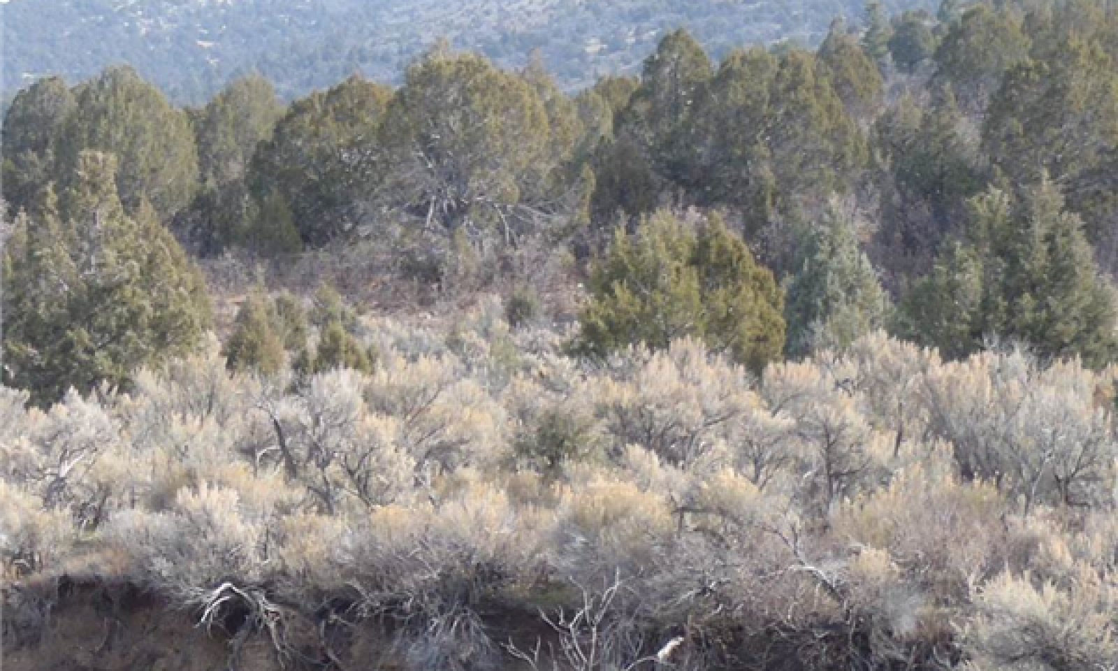
Basin big sagebrush / perennial grassThe Reference Plant Community Phase is dominated by basin big sagebrush and basin wildrye, with rubber rabbitbrush and western or slender wheatgrass also common in the plant community. This plant community is presumed to be the plant community that historically occupied this site for the majority of time prior to European settlement, thus contributing to soil development and overall potential of the site as it is today. Production by air-dry weight is 25 to 60 percent perennial native grasses, 5 to 15 percent forbs, and 40 to 65 percent shrubs.
Figure 4. Annual production by plant type (representative values) or group (midpoint values)
Table 5. Annual production by plant type
Plant type Low
(lb/acre)Representative value
(lb/acre)High
(lb/acre)Shrub/Vine 700 850 1000 Grass/Grasslike 600 750 900 Forb 100 200 300 Total 1400 1800 2200 Community 1.2
Perennial grass / sprouting shrubThis phase occurs when the reference plant community loses most or all of the sagebrush due to fire, snow mold, aroga moth, or any other natural process. Sprouting shrubs, such as rabbitbrush may be present in this phase immediately following sagebrush removal. However, perennial grass species dominate and drive most of the ecological processes in this phase. Forbs may increase in the plant community following fire. Production by air-dry weight is 60 to 85 percent perennial native grasses, 5 to 25 percent forbs, and 5 to 35 percent shrubs.
Figure 5. Annual production by plant type (representative values) or group (midpoint values)
Table 6. Annual production by plant type
Plant type Low
(lb/acre)Representative value
(lb/acre)High
(lb/acre)Grass/Grasslike 1000 1200 1400 Forb 100 300 500 Shrub/Vine 100 300 500 Total 1200 1800 2400 Pathway 1.1a
Community 1.1 to 1.2This pathway occurs when big sagebrush is removed by fire, aroga moth, snow mold, or other natural disturbance. Perennial grasses gain dominate the structure and processes of the site.
Pathway 1.2a
Community 1.2 to 1.1This pathway occurs over time as basin big sagebrush slowly regains co-dominance with perennial grasses. Sprouting shrubs may still be present in the overstory, but they do not dominate.
State 2
Invaded StateThe Invaded State is similar to the Reference State in ecological structure and process, however, the introduction of invasive species and altered disturbance regimes reduce the overall resilience of this state. As a result, an at-risk plant community with reduced perennial grass dominance and sagebrush super-dominance is included in this state.
Community 2.1
Basin big sagebrush / perennial grass
Figure 6. Phase 2.1
This plant community phase is very similar to the Reference Plant Community Phase. It is dominated by basin big sagebrush and basin wildrye, with rubber rabbitbrush and western or slender wheatgrass also common in the plant community. However, this phase also allow for non-native species to be present. As a result, the overall resilience of this phase following disturbance is reduced, with a greater likelihood of further alteration and degradation than the reference plant community. Production by air-dry weight is 25 to 60 percent perennial native grasses, 5 to 15 percent forbs, and 40 to 65 percent shrubs.
Figure 7. Annual production by plant type (representative values) or group (midpoint values)
Table 7. Annual production by plant type
Plant type Low
(lb/acre)Representative value
(lb/acre)High
(lb/acre)Shrub/Vine 700 850 1000 Grass/Grasslike 600 750 900 Forb 100 200 300 Total 1400 1800 2200 Community 2.2
Perennial grass / sprouting shrub
Figure 8. Phase 2.2
This phase occurs when the reference plant community loses most or all of the sagebrush due to fire, snow mold, aroga moth, or any other natural process. Sprouting shrubs, such as rabbitbrush may be present in this phase immediately following sagebrush removal. However, perennial grass species dominate and drive most of the ecological processes in this phase. Forbs may increase in the plant community following fire. Production by air-dry weight is 60 to 85 percent perennial native grasses, 5 to 25 percent forbs, and 5 to 35 percent shrubs.
Figure 9. Annual production by plant type (representative values) or group (midpoint values)
Table 8. Annual production by plant type
Plant type Low
(lb/acre)Representative value
(lb/acre)High
(lb/acre)Grass/Grasslike 1000 1200 1400 Forb 100 300 500 Shrub/Vine 100 300 500 Total 1200 1800 2400 Community 2.3
At-risk: Basin big sagebrush / reduced perennial grass
Figure 10. Phase 2.3
This plant community phase is at-risk of losing the perennial grass component in the understory. Either a repeated removal of grass biomass, or the lack of removal of woody biomass (or some combination of the two), is causing the perennial grass species to lose vigor. Once perennial grasses can no longer perpetuate themselves in the community, this phase will transition to State 3. Production by air-dry weight is 10 to 20 percent perennial grasses, 5 to 15 percent forbs and annual grasses, and 65 to 75 percent shrubs.
Figure 11. Annual production by plant type (representative values) or group (midpoint values)
Table 9. Annual production by plant type
Plant type Low
(lb/acre)Representative value
(lb/acre)High
(lb/acre)Shrub/Vine 800 1000 1200 Grass/Grasslike 200 300 400 Forb 100 200 300 Total 1100 1500 1900 Pathway 2.1a
Community 2.1 to 2.2
Basin big sagebrush / perennial grass
Perennial grass / sprouting shrubThis pathway occurs when big sagebrush is removed by fire, aroga moth, snow mold, or other natural disturbances. Perennial grasses dominate the structure and processes of the site.
Pathway 2.1b
Community 2.1 to 2.3
Basin big sagebrush / perennial grass
At-risk: Basin big sagebrush / reduced perennial grassThis pathway occurs when perennial grasses are reduced in the understory due to excessive grazing during the growing period. Perennial grasses are losing their ability to propagate themselves, and non-native species may co-dominate the understory.
Pathway 2.2a
Community 2.2 to 2.1
Perennial grass / sprouting shrub
Basin big sagebrush / perennial grassThis pathway occurs over time as basin big sagebrush slowly regains co-dominance with perennial grasses. Sprouting shrubs may still be present in the overstory, but they do not dominate.
Pathway 2.3a
Community 2.3 to 2.2
At-risk: Basin big sagebrush / reduced perennial grass
Perennial grass / sprouting shrubThis pathway occurs when perennial grasses are allowed to recover in the community and regain co-dominance with shrubs. This may be best achieved by reducing grazing during the growing season of perennial grasses, and may also require targeted browsing or shrub thinning to reduce shrub dominance.
State 3
Depleted Understory StateThe depleted understory state is dominated by sagebrush, and is characterized by a lack of perennial grasses in the community. The understory may be sparse, or dominated by annual grasses and forbs. Native perennial grasses are unable to regain dominance in the community without significant human inputs.
Community 3.1
Basin big sagebrush / limited understoryPerennial grasses have been lost from the understory. Basin big sagebrush continues to increase beyond the natural fire return interval, in part due to lack of fine fuels to carry a fire. Production by air-dry weight is 5 to 15 percent forbs and annual grasses, and 85 to 95 percent shrubs.
Figure 12. Annual production by plant type (representative values) or group (midpoint values)
Table 10. Annual production by plant type
Plant type Low
(lb/acre)Representative value
(lb/acre)High
(lb/acre)Shrub/Vine 800 1000 1200 Forb 100 200 300 Grass/Grasslike 5 100 200 Total 905 1300 1700 Community 3.2
Basin big sagebrush / annual understoryPerennial grasses have been lost from the understory. Annuals (particularly cheatgrass) and weak perennials dominate the understory. Production by air-dry weight is 15 to 25 percent forbs and annual grasses, and 75 to 85 percent shrubs.
Figure 13. Annual production by plant type (representative values) or group (midpoint values)
Table 11. Annual production by plant type
Plant type Low
(lb/acre)Representative value
(lb/acre)High
(lb/acre)Shrub/Vine 800 1000 1200 Grass/Grasslike 100 300 500 Forb 100 200 300 Total 1000 1500 2000 Pathway 3.1a
Community 3.1 to 3.2Livestock trampling, mechanical treatment, or other disturbances reduces sagebrush cover and makes germination sites available for invasive annual species, particularly cheatgrass and annual forbs.
Pathway 3.2b
Community 3.2 to 3.1This pathway occurs when basin big sagebrush is not reduced by any means, and therefore increases in the community while anuuals decrease.
State 4
Seeded RangeThe Seeded Range State is the result of vegetation removal, and successful establishment of non-native perennial grasses, such as smooth brome or crested wheatgrass. Intermediate wheatgrass can also be established on this site. This site can be seeded with a high probability of success due to the general soil fertility and relatively high rainfall. It is also common to see native species establish in the community shortly after seeding. Over time, it is expected that seeded range may transition to a native-dominated state (State 2), but this is yet to be sufficiently documented.
Community 4.1
Introduced Grasses
Figure 14. Phase 4.1
This phase represents a rangeland seeding. Crested wheatgrass, smooth brome, and intermediate wheatgrass have been documented in rangeland seedings on this site.
Figure 15. Annual production by plant type (representative values) or group (midpoint values)
Table 12. Annual production by plant type
Plant type Low
(lb/acre)Representative value
(lb/acre)High
(lb/acre)Grass/Grasslike 1000 1200 1400 Forb 0 200 400 Shrub/Vine 0 200 400 Total 1000 1600 2200 Community 4.2
Introduced Grasses with Natives
Figure 16. Phase 4.2
This phase represents a rangeland seeding with native species re-establishing in the community. The soil fertility and annual precipitation of this site make natural re-establishment more likely on this site than similar settings in drier parts of the MLRA. Production is 45 to 65 percent perennial introduced grasses, 2 to 10 percent perennial native grasses, 5 to 20 percent forbs, and 20 to 40 percent shrubs.
Figure 17. Annual production by plant type (representative values) or group (midpoint values)
Table 13. Annual production by plant type
Plant type Low
(lb/acre)Representative value
(lb/acre)High
(lb/acre)Shrub/Vine 800 1000 1200 Grass/Grasslike 800 1000 1200 Forb 100 200 300 Total 1700 2200 2700 Pathway 4.1a
Community 4.1 to 4.2
Introduced Grasses
Introduced Grasses with NativesThis pathway is the result of natural re-establishment of native species following a rangeland seeding. This may occur rapidly, within years following a seeding, or more slowly over decades--depending on the conditions at the time of the seeding and in subsequent years.
Pathway 4.2b
Community 4.2 to 4.1
Introduced Grasses with Natives
Introduced GrassesThis pathway represents the removal of native species in favor of introduced perennial grass species.
Transition T1a
State 1 to 2Establishment and persistence of non-native species results in a transition from the reference state to the invaded state.
Transition T2a
State 2 to 3This transition occurs when perennial grasses are reduced by improper grazing to the point that they can no longer self-propagate. Few remnant plants may still persist under shrubs, but reestablishment and dominance by perennial grasses will not occur following a fire, or with the removal of livestock grazing.
Transition T2b
State 2 to 4This transition occurs when existing vegetation is removed and replaced by seeding non-native perennial grass species.
Transition T3a
State 3 to 4This transition occurs when existing vegetation is removed and replaced by seeding non-native perennial grass species.
Additional community tables
Table 14. Community 1.1 plant community composition
Group Common name Symbol Scientific name Annual production () Foliar cover (%) Shrub/Vine0 Dominant Shrubs 500–900 Utah serviceberry AMUT Amelanchier utahensis 0–150 0–7 needle and thread HECO26 Hesperostipa comata 0–100 0–5 Sandberg bluegrass POSE Poa secunda 0–100 0–5 mountain snowberry SYOR2 Symphoricarpos oreophilus 0–100 0–5 Indian ricegrass ACHY Achnatherum hymenoides 0–100 0–5 Rocky Mountain juniper JUSC2 Juniperus scopulorum 0–50 0–3 Gambel oak QUGA Quercus gambelii 0–50 0–2 skunkbush sumac RHTR Rhus trilobata 0–50 0–2 wax currant RICE Ribes cereum 0–50 0–2 Columbia needlegrass ACNE9 Achnatherum nelsonii 0–50 0–2 mountain brome BRMA4 Bromus marginatus 0–50 0–2 squirreltail ELEL5 Elymus elymoides 0–50 0–2 Woods' rose ROWO Rosa woodsii 0–30 0–1 chokecherry PRVI Prunus virginiana 0–30 0–1 broom snakeweed GUSA2 Gutierrezia sarothrae 0–30 0–1 1 Sub-dominant Shrubs 100–300 Grass/Grasslike0 Dominant Grasses 400–800 Indian paintbrush CASTI2 Castilleja 10–60 1–3 white sagebrush ARLU Artemisia ludoviciana 10–50 1–2 creeping barberry MARE11 Mahonia repens 0–50 0–2 beardtongue PENST Penstemon 0–30 0–1 longleaf phlox PHLO2 Phlox longifolia 0–30 0–1 gooseberryleaf globemallow SPGR2 Sphaeralcea grossulariifolia 0–30 0–1 silverleaf milkvetch ASAR4 Astragalus argophyllus 0–30 0–1 common yarrow ACMI2 Achillea millefolium 0–30 0–1 pale agoseris AGGL Agoseris glauca 0–30 0–1 gilia GILIA Gilia 0–30 0–1 povertyweed IVAX Iva axillaris 0–30 0–1 Nevada pea LALA3 Lathyrus lanszwertii 0–30 0–1 desertparsley LOMAT Lomatium 0–30 0–1 1 Sub-dominant grasses 100–300 Forb2 Forbs 100–300 Table 15. Community 1.2 plant community composition
Group Common name Symbol Scientific name Annual production () Foliar cover (%) Shrub/Vine0 Sub-dominant grasses 50–400 needle and thread HECO26 Hesperostipa comata 0–200 0–10 Indian ricegrass ACHY Achnatherum hymenoides 0–200 0–10 Utah serviceberry AMUT Amelanchier utahensis 0–150 0–7 basin big sagebrush ARTRT Artemisia tridentata ssp. tridentata 0–150 0–7 Sandberg bluegrass POSE Poa secunda 0–100 0–5 mountain snowberry SYOR2 Symphoricarpos oreophilus 0–100 0–5 Columbia needlegrass ACNE9 Achnatherum nelsonii 0–100 0–5 broom snakeweed GUSA2 Gutierrezia sarothrae 0–70 0–4 Gambel oak QUGA Quercus gambelii 0–50 0–2 skunkbush sumac RHTR Rhus trilobata 0–50 0–2 wax currant RICE Ribes cereum 0–50 0–2 mountain brome BRMA4 Bromus marginatus 0–50 0–2 squirreltail ELEL5 Elymus elymoides 0–50 0–2 Woods' rose ROWO Rosa woodsii 0–30 0–1 chokecherry PRVI Prunus virginiana 0–30 0–1 1 Sub-dominant Shrubs 0–300 Grass/Grasslike0 Dominant Grasses 700–1100 gooseberryleaf globemallow SPGR2 Sphaeralcea grossulariifolia 0–100 0–5 white sagebrush ARLU Artemisia ludoviciana 10–100 1–5 Indian paintbrush CASTI2 Castilleja 10–100 1–5 povertyweed IVAX Iva axillaris 0–100 0–5 common yarrow ACMI2 Achillea millefolium 0–75 0–4 beardtongue PENST Penstemon 0–75 0–4 longleaf phlox PHLO2 Phlox longifolia 0–50 0–2 creeping barberry MARE11 Mahonia repens 0–50 0–2 pale agoseris AGGL Agoseris glauca 0–30 0–1 silverleaf milkvetch ASAR4 Astragalus argophyllus 0–30 0–1 Nevada pea LALA3 Lathyrus lanszwertii 0–30 0–1 desertparsley LOMAT Lomatium 0–30 0–1 gilia GILIA Gilia 0–30 0–1 1 Sub-dominant grasses 150–500 Forb2 Forbs 100–500 Table 16. Community 2.1 plant community composition
Group Common name Symbol Scientific name Annual production () Foliar cover (%) Shrub/Vine0 Dominant Shrubs 500–900 Utah serviceberry AMUT Amelanchier utahensis 0–150 0–7 mountain snowberry SYOR2 Symphoricarpos oreophilus 0–100 0–5 Indian ricegrass ACHY Achnatherum hymenoides 0–100 0–5 smooth brome BRIN2 Bromus inermis 0–100 0–5 cheatgrass BRTE Bromus tectorum 5–100 1–5 needle and thread HECO26 Hesperostipa comata 0–100 0–5 Sandberg bluegrass POSE Poa secunda 0–100 0–5 Rocky Mountain juniper JUSC2 Juniperus scopulorum 0–50 0–3 Gambel oak QUGA Quercus gambelii 0–50 0–2 skunkbush sumac RHTR Rhus trilobata 0–50 0–2 wax currant RICE Ribes cereum 0–50 0–2 intermediate wheatgrass THIN6 Thinopyrum intermedium 0–50 0–2 bulbous bluegrass POBU Poa bulbosa 0–50 0–2 Kentucky bluegrass POPR Poa pratensis 0–50 0–2 squirreltail ELEL5 Elymus elymoides 0–50 0–2 mountain brome BRMA4 Bromus marginatus 0–50 0–2 Columbia needlegrass ACNE9 Achnatherum nelsonii 0–50 0–2 crested wheatgrass AGCR Agropyron cristatum 0–50 0–2 Woods' rose ROWO Rosa woodsii 0–30 0–1 broom snakeweed GUSA2 Gutierrezia sarothrae 0–30 0–1 chokecherry PRVI Prunus virginiana 0–30 0–1 1 Sub-dominant Shrubs 100–300 Grass/Grasslike0 Dominant Grasses 400–800 Indian paintbrush CASTI2 Castilleja 10–60 1–3 nodding plumeless thistle CANU4 Carduus nutans 0–50 0–2 white sagebrush ARLU Artemisia ludoviciana 10–50 1–2 Canada thistle CIAR4 Cirsium arvense 0–50 0–2 common mullein VETH Verbascum thapsus 0–50 0–2 creeping barberry MARE11 Mahonia repens 0–50 0–2 field bindweed COAR4 Convolvulus arvensis 0–30 0–1 gypsyflower CYOF Cynoglossum officinale 0–30 0–1 gilia GILIA Gilia 0–30 0–1 povertyweed IVAX Iva axillaris 0–30 0–1 Nevada pea LALA3 Lathyrus lanszwertii 0–30 0–1 silverleaf milkvetch ASAR4 Astragalus argophyllus 0–30 0–1 whitetop CADR Cardaria draba 0–30 0–1 common yarrow ACMI2 Achillea millefolium 0–30 0–1 pale agoseris AGGL Agoseris glauca 0–30 0–1 desertparsley LOMAT Lomatium 0–30 0–1 curveseed butterwort CETE5 Ceratocephala testiculata 0–30 0–1 beardtongue PENST Penstemon 0–30 0–1 longleaf phlox PHLO2 Phlox longifolia 0–30 0–1 gooseberryleaf globemallow SPGR2 Sphaeralcea grossulariifolia 0–30 0–1 prickly lettuce LASE Lactuca serriola 0–20 0–1 sweetclover MEOF Melilotus officinalis 0–20 0–1 alfalfa MESA Medicago sativa 0–20 0–1 common dandelion TAOF Taraxacum officinale 0–10 0–1 1 Sub-dominant Grasses 100–300 Forb2 Forbs 100–300 Table 17. Community 2.2 plant community composition
Group Common name Symbol Scientific name Annual production () Foliar cover (%) Shrub/Vine0 Sub-dominant grasses 50–400 needle and thread HECO26 Hesperostipa comata 0–200 0–10 Indian ricegrass ACHY Achnatherum hymenoides 0–200 0–10 Utah serviceberry AMUT Amelanchier utahensis 0–150 0–7 basin big sagebrush ARTRT Artemisia tridentata ssp. tridentata 0–150 0–7 Sandberg bluegrass POSE Poa secunda 0–100 0–5 mountain snowberry SYOR2 Symphoricarpos oreophilus 0–100 0–5 Columbia needlegrass ACNE9 Achnatherum nelsonii 0–100 0–5 cheatgrass BRTE Bromus tectorum 0–100 0–5 smooth brome BRIN2 Bromus inermis 0–100 0–5 broom snakeweed GUSA2 Gutierrezia sarothrae 0–70 0–4 Gambel oak QUGA Quercus gambelii 0–50 0–2 skunkbush sumac RHTR Rhus trilobata 0–50 0–2 wax currant RICE Ribes cereum 0–50 0–2 intermediate wheatgrass THIN6 Thinopyrum intermedium 0–50 0–2 mountain brome BRMA4 Bromus marginatus 0–50 0–2 squirreltail ELEL5 Elymus elymoides 0–50 0–2 bulbous bluegrass POBU Poa bulbosa 0–50 0–2 Kentucky bluegrass POPR Poa pratensis 0–50 0–2 crested wheatgrass AGCR Agropyron cristatum 0–50 0–2 Woods' rose ROWO Rosa woodsii 0–30 0–1 chokecherry PRVI Prunus virginiana 0–30 0–1 1 Sub-dominant Shrubs 0–300 Grass/Grasslike0 Dominant Grasses 700–1100 gooseberryleaf globemallow SPGR2 Sphaeralcea grossulariifolia 0–100 0–5 white sagebrush ARLU Artemisia ludoviciana 10–100 1–5 povertyweed IVAX Iva axillaris 0–100 0–5 Indian paintbrush CASTI2 Castilleja 10–100 1–5 common yarrow ACMI2 Achillea millefolium 0–75 0–4 beardtongue PENST Penstemon 0–75 0–4 longleaf phlox PHLO2 Phlox longifolia 0–50 0–2 nodding plumeless thistle CANU4 Carduus nutans 0–50 0–2 Canada thistle CIAR4 Cirsium arvense 0–50 0–2 creeping barberry MARE11 Mahonia repens 0–50 0–2 sweetclover MEOF Melilotus officinalis 0–30 0–1 alfalfa MESA Medicago sativa 0–30 0–1 curveseed butterwort CETE5 Ceratocephala testiculata 0–30 0–1 Nevada pea LALA3 Lathyrus lanszwertii 0–30 0–1 prickly lettuce LASE Lactuca serriola 0–30 0–1 desertparsley LOMAT Lomatium 0–30 0–1 field bindweed COAR4 Convolvulus arvensis 0–30 0–1 gypsyflower CYOF Cynoglossum officinale 0–30 0–1 gilia GILIA Gilia 0–30 0–1 pale agoseris AGGL Agoseris glauca 0–30 0–1 silverleaf milkvetch ASAR4 Astragalus argophyllus 0–30 0–1 whitetop CADR Cardaria draba 0–30 0–1 common dandelion TAOF Taraxacum officinale 0–10 0–1 1 Sub-dominant grasses 150–500 Forb2 Forbs 100–500 Table 18. Community 2.3 plant community composition
Group Common name Symbol Scientific name Annual production () Foliar cover (%) Shrub/Vine0 Dominant Shrubs 600–1200 Utah serviceberry AMUT Amelanchier utahensis 0–150 0–7 slender wheatgrass ELTR7 Elymus trachycaulus 50–150 2–6 western wheatgrass PASM Pascopyrum smithii 50–150 2–6 Sandberg bluegrass POSE Poa secunda 0–100 0–5 mountain snowberry SYOR2 Symphoricarpos oreophilus 0–100 0–5 cheatgrass BRTE Bromus tectorum 5–100 1–5 smooth brome BRIN2 Bromus inermis 0–100 0–5 Rocky Mountain juniper JUSC2 Juniperus scopulorum 0–50 0–3 intermediate wheatgrass THIN6 Thinopyrum intermedium 0–50 0–2 Gambel oak QUGA Quercus gambelii 0–50 0–2 skunkbush sumac RHTR Rhus trilobata 0–50 0–2 wax currant RICE Ribes cereum 0–50 0–2 basin wildrye LECI4 Leymus cinereus 0–50 0–2 crested wheatgrass AGCR Agropyron cristatum 0–50 0–2 squirreltail ELEL5 Elymus elymoides 0–30 0–1 needle and thread HECO26 Hesperostipa comata 0–30 0–1 broom snakeweed GUSA2 Gutierrezia sarothrae 0–30 0–1 Woods' rose ROWO Rosa woodsii 0–30 0–1 chokecherry PRVI Prunus virginiana 0–30 0–1 mountain brome BRMA4 Bromus marginatus 0–20 0–1 Indian ricegrass ACHY Achnatherum hymenoides 0–20 0–1 Columbia needlegrass ACNE9 Achnatherum nelsonii 0–20 0–1 1 Sub-dominant Shrubs 100–300 Indian paintbrush CASTI2 Castilleja 10–60 1–3 nodding plumeless thistle CANU4 Carduus nutans 0–50 0–2 white sagebrush ARLU Artemisia ludoviciana 10–50 1–2 Canada thistle CIAR4 Cirsium arvense 0–50 0–2 creeping barberry MARE11 Mahonia repens 0–50 0–2 common mullein VETH Verbascum thapsus 0–50 0–2 field bindweed COAR4 Convolvulus arvensis 0–30 0–1 gypsyflower CYOF Cynoglossum officinale 0–30 0–1 gilia GILIA Gilia 0–30 0–1 povertyweed IVAX Iva axillaris 0–30 0–1 Nevada pea LALA3 Lathyrus lanszwertii 0–30 0–1 silverleaf milkvetch ASAR4 Astragalus argophyllus 0–30 0–1 whitetop CADR Cardaria draba 0–30 0–1 common yarrow ACMI2 Achillea millefolium 0–30 0–1 pale agoseris AGGL Agoseris glauca 0–30 0–1 desertparsley LOMAT Lomatium 0–30 0–1 curveseed butterwort CETE5 Ceratocephala testiculata 0–30 0–1 beardtongue PENST Penstemon 0–30 0–1 longleaf phlox PHLO2 Phlox longifolia 0–30 0–1 gooseberryleaf globemallow SPGR2 Sphaeralcea grossulariifolia 0–30 0–1 prickly lettuce LASE Lactuca serriola 0–20 0–1 sweetclover MEOF Melilotus officinalis 0–20 0–1 alfalfa MESA Medicago sativa 0–20 0–1 common dandelion TAOF Taraxacum officinale 0–10 0–1 Grass/Grasslike1 Grasses 200–400 Forb2 Forbs 100–300 Table 19. Community 3.1 plant community composition
Group Common name Symbol Scientific name Annual production () Foliar cover (%) Shrub/Vine0 Dominant Shrubs 600–1200 Utah serviceberry AMUT Amelanchier utahensis 0–150 0–7 mountain snowberry SYOR2 Symphoricarpos oreophilus 0–100 0–5 cheatgrass BRTE Bromus tectorum 5–100 1–5 Rocky Mountain juniper JUSC2 Juniperus scopulorum 0–50 0–3 Gambel oak QUGA Quercus gambelii 0–50 0–2 skunkbush sumac RHTR Rhus trilobata 0–50 0–2 wax currant RICE Ribes cereum 0–50 0–2 bulbous bluegrass POBU Poa bulbosa 0–50 0–2 Kentucky bluegrass POPR Poa pratensis 0–30 0–1 Sandberg bluegrass POSE Poa secunda 0–30 0–1 Woods' rose ROWO Rosa woodsii 0–30 0–1 broom snakeweed GUSA2 Gutierrezia sarothrae 0–30 0–1 chokecherry PRVI Prunus virginiana 0–30 0–1 slender wheatgrass ELTR7 Elymus trachycaulus 0–15 0–1 western wheatgrass PASM Pascopyrum smithii 0–15 0–1 needle and thread HECO26 Hesperostipa comata 0–5 0–1 basin wildrye LECI4 Leymus cinereus 0–5 0–1 intermediate wheatgrass THIN6 Thinopyrum intermedium 0–5 0–1 squirreltail ELEL5 Elymus elymoides 0–5 0–1 Indian ricegrass ACHY Achnatherum hymenoides 0–5 0–1 Columbia needlegrass ACNE9 Achnatherum nelsonii 0–5 0–1 crested wheatgrass AGCR Agropyron cristatum 0–5 0–1 smooth brome BRIN2 Bromus inermis 0–5 0–1 1 Sub-dominant Shrubs 100–300 Indian paintbrush CASTI2 Castilleja 10–60 1–3 nodding plumeless thistle CANU4 Carduus nutans 0–50 0–2 white sagebrush ARLU Artemisia ludoviciana 10–50 1–2 Canada thistle CIAR4 Cirsium arvense 0–50 0–2 creeping barberry MARE11 Mahonia repens 0–50 0–2 common mullein VETH Verbascum thapsus 0–50 0–2 field bindweed COAR4 Convolvulus arvensis 0–30 0–1 gypsyflower CYOF Cynoglossum officinale 0–30 0–1 gilia GILIA Gilia 0–30 0–1 povertyweed IVAX Iva axillaris 0–30 0–1 Nevada pea LALA3 Lathyrus lanszwertii 0–30 0–1 silverleaf milkvetch ASAR4 Astragalus argophyllus 0–30 0–1 whitetop CADR Cardaria draba 0–30 0–1 common yarrow ACMI2 Achillea millefolium 0–30 0–1 pale agoseris AGGL Agoseris glauca 0–30 0–1 desertparsley LOMAT Lomatium 0–30 0–1 curveseed butterwort CETE5 Ceratocephala testiculata 0–30 0–1 beardtongue PENST Penstemon 0–30 0–1 longleaf phlox PHLO2 Phlox longifolia 0–30 0–1 gooseberryleaf globemallow SPGR2 Sphaeralcea grossulariifolia 0–30 0–1 prickly lettuce LASE Lactuca serriola 0–20 0–1 sweetclover MEOF Melilotus officinalis 0–20 0–1 alfalfa MESA Medicago sativa 0–20 0–1 common dandelion TAOF Taraxacum officinale 0–10 0–1 Grass/Grasslike1 Grasses 5–200 Forb2 Forbs 100–300 Table 20. Community 3.2 plant community composition
Group Common name Symbol Scientific name Annual production () Foliar cover (%) Shrub/Vine0 Dominant Shrubs 600–1200 cheatgrass BRTE Bromus tectorum 100–400 5–20 Utah serviceberry AMUT Amelanchier utahensis 0–150 0–7 mountain snowberry SYOR2 Symphoricarpos oreophilus 0–100 0–5 bulbous bluegrass POBU Poa bulbosa 0–100 0–5 Rocky Mountain juniper JUSC2 Juniperus scopulorum 0–50 0–3 Gambel oak QUGA Quercus gambelii 0–50 0–2 skunkbush sumac RHTR Rhus trilobata 0–50 0–2 wax currant RICE Ribes cereum 0–50 0–2 Sandberg bluegrass POSE Poa secunda 0–50 0–2 Kentucky bluegrass POPR Poa pratensis 0–30 0–1 Woods' rose ROWO Rosa woodsii 0–30 0–1 broom snakeweed GUSA2 Gutierrezia sarothrae 0–30 0–1 chokecherry PRVI Prunus virginiana 0–30 0–1 slender wheatgrass ELTR7 Elymus trachycaulus 0–15 0–1 western wheatgrass PASM Pascopyrum smithii 0–15 0–1 needle and thread HECO26 Hesperostipa comata 0–5 0–1 basin wildrye LECI4 Leymus cinereus 0–5 0–1 intermediate wheatgrass THIN6 Thinopyrum intermedium 0–5 0–1 squirreltail ELEL5 Elymus elymoides 0–5 0–1 Indian ricegrass ACHY Achnatherum hymenoides 0–5 0–1 Columbia needlegrass ACNE9 Achnatherum nelsonii 0–5 0–1 crested wheatgrass AGCR Agropyron cristatum 0–5 0–1 smooth brome BRIN2 Bromus inermis 0–5 0–1 1 Sub-dominant Shrubs 100–300 Indian paintbrush CASTI2 Castilleja 10–60 1–3 nodding plumeless thistle CANU4 Carduus nutans 0–50 0–2 white sagebrush ARLU Artemisia ludoviciana 10–50 1–2 Canada thistle CIAR4 Cirsium arvense 0–50 0–2 creeping barberry MARE11 Mahonia repens 0–50 0–2 common mullein VETH Verbascum thapsus 0–50 0–2 field bindweed COAR4 Convolvulus arvensis 0–30 0–1 gypsyflower CYOF Cynoglossum officinale 0–30 0–1 gilia GILIA Gilia 0–30 0–1 povertyweed IVAX Iva axillaris 0–30 0–1 Nevada pea LALA3 Lathyrus lanszwertii 0–30 0–1 silverleaf milkvetch ASAR4 Astragalus argophyllus 0–30 0–1 whitetop CADR Cardaria draba 0–30 0–1 common yarrow ACMI2 Achillea millefolium 0–30 0–1 pale agoseris AGGL Agoseris glauca 0–30 0–1 desertparsley LOMAT Lomatium 0–30 0–1 curveseed butterwort CETE5 Ceratocephala testiculata 0–30 0–1 beardtongue PENST Penstemon 0–30 0–1 longleaf phlox PHLO2 Phlox longifolia 0–30 0–1 gooseberryleaf globemallow SPGR2 Sphaeralcea grossulariifolia 0–30 0–1 prickly lettuce LASE Lactuca serriola 0–20 0–1 sweetclover MEOF Melilotus officinalis 0–20 0–1 alfalfa MESA Medicago sativa 0–20 0–1 common dandelion TAOF Taraxacum officinale 0–10 0–1 Grass/Grasslike1 Grasses 100–500 Forb2 Forbs 100–300 Table 21. Community 4.1 plant community composition
Group Common name Symbol Scientific name Annual production () Foliar cover (%) Grass/Grasslike0 Grasses 1000–1400 Shrub/Vine1 Shrubs 0–400 Utah serviceberry AMUT Amelanchier utahensis 0–150 0–7 mountain snowberry SYOR2 Symphoricarpos oreophilus 0–100 0–5 Rocky Mountain juniper JUSC2 Juniperus scopulorum 0–50 0–3 Gambel oak QUGA Quercus gambelii 0–50 0–2 skunkbush sumac RHTR Rhus trilobata 0–50 0–2 wax currant RICE Ribes cereum 0–50 0–2 Woods' rose ROWO Rosa woodsii 0–30 0–1 chokecherry PRVI Prunus virginiana 0–30 0–1 broom snakeweed GUSA2 Gutierrezia sarothrae 0–30 0–1 Forb2 Forbs 0–400 Indian paintbrush CASTI2 Castilleja 10–60 1–3 nodding plumeless thistle CANU4 Carduus nutans 0–50 0–2 white sagebrush ARLU Artemisia ludoviciana 10–50 1–2 Canada thistle CIAR4 Cirsium arvense 0–50 0–2 common mullein VETH Verbascum thapsus 0–50 0–2 creeping barberry MARE11 Mahonia repens 0–50 0–2 field bindweed COAR4 Convolvulus arvensis 0–30 0–1 gypsyflower CYOF Cynoglossum officinale 0–30 0–1 gilia GILIA Gilia 0–30 0–1 povertyweed IVAX Iva axillaris 0–30 0–1 Nevada pea LALA3 Lathyrus lanszwertii 0–30 0–1 silverleaf milkvetch ASAR4 Astragalus argophyllus 0–30 0–1 whitetop CADR Cardaria draba 0–30 0–1 common yarrow ACMI2 Achillea millefolium 0–30 0–1 pale agoseris AGGL Agoseris glauca 0–30 0–1 desertparsley LOMAT Lomatium 0–30 0–1 curveseed butterwort CETE5 Ceratocephala testiculata 0–30 0–1 beardtongue PENST Penstemon 0–30 0–1 longleaf phlox PHLO2 Phlox longifolia 0–30 0–1 gooseberryleaf globemallow SPGR2 Sphaeralcea grossulariifolia 0–30 0–1 prickly lettuce LASE Lactuca serriola 0–20 0–1 sweetclover MEOF Melilotus officinalis 0–20 0–1 alfalfa MESA Medicago sativa 0–20 0–1 common dandelion TAOF Taraxacum officinale 0–10 0–1 Table 22. Community 4.2 plant community composition
Group Common name Symbol Scientific name Annual production () Foliar cover (%) Shrub/Vine0 Dominant Shrubs 600–1200 Utah serviceberry AMUT Amelanchier utahensis 0–150 0–7 mountain snowberry SYOR2 Symphoricarpos oreophilus 0–100 0–5 cheatgrass BRTE Bromus tectorum 5–100 1–5 Rocky Mountain juniper JUSC2 Juniperus scopulorum 0–50 0–3 Gambel oak QUGA Quercus gambelii 0–50 0–2 skunkbush sumac RHTR Rhus trilobata 0–50 0–2 wax currant RICE Ribes cereum 0–50 0–2 bulbous bluegrass POBU Poa bulbosa 0–50 0–2 Kentucky bluegrass POPR Poa pratensis 0–30 0–1 Sandberg bluegrass POSE Poa secunda 0–30 0–1 Woods' rose ROWO Rosa woodsii 0–30 0–1 broom snakeweed GUSA2 Gutierrezia sarothrae 0–30 0–1 chokecherry PRVI Prunus virginiana 0–30 0–1 slender wheatgrass ELTR7 Elymus trachycaulus 0–15 0–1 western wheatgrass PASM Pascopyrum smithii 0–15 0–1 needle and thread HECO26 Hesperostipa comata 0–5 0–1 basin wildrye LECI4 Leymus cinereus 0–5 0–1 intermediate wheatgrass THIN6 Thinopyrum intermedium 0–5 0–1 squirreltail ELEL5 Elymus elymoides 0–5 0–1 Indian ricegrass ACHY Achnatherum hymenoides 0–5 0–1 Columbia needlegrass ACNE9 Achnatherum nelsonii 0–5 0–1 crested wheatgrass AGCR Agropyron cristatum 0–5 0–1 smooth brome BRIN2 Bromus inermis 0–5 0–1 1 Sub-dominant Shrubs 100–300 Indian paintbrush CASTI2 Castilleja 10–60 1–3 nodding plumeless thistle CANU4 Carduus nutans 0–50 0–2 white sagebrush ARLU Artemisia ludoviciana 10–50 1–2 Canada thistle CIAR4 Cirsium arvense 0–50 0–2 creeping barberry MARE11 Mahonia repens 0–50 0–2 common mullein VETH Verbascum thapsus 0–50 0–2 field bindweed COAR4 Convolvulus arvensis 0–30 0–1 gypsyflower CYOF Cynoglossum officinale 0–30 0–1 gilia GILIA Gilia 0–30 0–1 povertyweed IVAX Iva axillaris 0–30 0–1 Nevada pea LALA3 Lathyrus lanszwertii 0–30 0–1 silverleaf milkvetch ASAR4 Astragalus argophyllus 0–30 0–1 whitetop CADR Cardaria draba 0–30 0–1 common yarrow ACMI2 Achillea millefolium 0–30 0–1 pale agoseris AGGL Agoseris glauca 0–30 0–1 desertparsley LOMAT Lomatium 0–30 0–1 curveseed butterwort CETE5 Ceratocephala testiculata 0–30 0–1 beardtongue PENST Penstemon 0–30 0–1 longleaf phlox PHLO2 Phlox longifolia 0–30 0–1 gooseberryleaf globemallow SPGR2 Sphaeralcea grossulariifolia 0–30 0–1 prickly lettuce LASE Lactuca serriola 0–20 0–1 sweetclover MEOF Melilotus officinalis 0–20 0–1 alfalfa MESA Medicago sativa 0–20 0–1 common dandelion TAOF Taraxacum officinale 0–10 0–1 Grass/Grasslike1 Grasses 5–200 Forb2 Forbs 100–300 Interpretations
Supporting information
Inventory data references
Information presented here has been derived from NRCS clipping data and other inventory data. Field observations from range trained personnel were also used.
Other references
Fryer, J. L., & Luensmann, P. S. 2012. Fire regimes of the conterminous United States. Fire Effects Information System (FEIS). US Department of Agriculture, Forest Service, Rocky Mountain Research Station, Fire Sciences Laboratory, Missoula, Montana, USA.
Contributors
Jamin Johanson
Approval
Kendra Moseley, 2/05/2025
Rangeland health reference sheet
Interpreting Indicators of Rangeland Health is a qualitative assessment protocol used to determine ecosystem condition based on benchmark characteristics described in the Reference Sheet. A suite of 17 (or more) indicators are typically considered in an assessment. The ecological site(s) representative of an assessment location must be known prior to applying the protocol and must be verified based on soils and climate. Current plant community cannot be used to identify the ecological site.
Author(s)/participant(s) Contact for lead author Date 10/03/2026 Approved by Approval date Composition (Indicators 10 and 12) based on Annual Production Indicators
-
Number and extent of rills:
-
Presence of water flow patterns:
-
Number and height of erosional pedestals or terracettes:
-
Bare ground from Ecological Site Description or other studies (rock, litter, lichen, moss, plant canopy are not bare ground):
-
Number of gullies and erosion associated with gullies:
-
Extent of wind scoured, blowouts and/or depositional areas:
-
Amount of litter movement (describe size and distance expected to travel):
-
Soil surface (top few mm) resistance to erosion (stability values are averages - most sites will show a range of values):
-
Soil surface structure and SOM content (include type of structure and A-horizon color and thickness):
-
Effect of community phase composition (relative proportion of different functional groups) and spatial distribution on infiltration and runoff:
-
Presence and thickness of compaction layer (usually none; describe soil profile features which may be mistaken for compaction on this site):
-
Functional/Structural Groups (list in order of descending dominance by above-ground annual-production or live foliar cover using symbols: >>, >, = to indicate much greater than, greater than, and equal to):
Dominant:
Sub-dominant:
Other:
Additional:
-
Amount of plant mortality and decadence (include which functional groups are expected to show mortality or decadence):
-
Average percent litter cover (%) and depth ( in):
-
Expected annual annual-production (this is TOTAL above-ground annual-production, not just forage annual-production):
-
Potential invasive (including noxious) species (native and non-native). List species which BOTH characterize degraded states and have the potential to become a dominant or co-dominant species on the ecological site if their future establishment and growth is not actively controlled by management interventions. Species that become dominant for only one to several years (e.g., short-term response to drought or wildfire) are not invasive plants. Note that unlike other indicators, we are describing what is NOT expected in the reference state for the ecological site:
-
Perennial plant reproductive capability:
Print Options
Sections
Font
AAAAOther
PrintThe Ecosystem Dynamics Interpretive Tool is an information system framework developed by the USDA-ARS Jornada Experimental Range, USDA Natural Resources Conservation Service, and New Mexico State University.
Accessibility statement


