
Natural Resources
Conservation Service
Ecological site EX046X01B032
Loamy
15-19" PZ Frigid
Rocky Mountain Front Foothills
Last updated: 5/08/2025
Accessed: 08/28/2026
-
Search


Major Land Resource Area or ecological site by name and/or ID.
PreviousSectionsNextGeneral information
Provisional. A provisional ecological site description has undergone quality control and quality assurance review. It contains a working state and transition model and enough information to identify the ecological site.
MLRA notes
Major Land Resource Area (MLRA): 046X–Northern and Central Rocky Mountain Foothills
The Rocky Mountain Foothills Major Land Resource Area (MLRA) 46 is approximately 11.6 million acres. MLRA 46’s extent has changed over recent years and is now primarily located in Montana and Wyoming, with limited acres in Utah and Colorado. It spans from the Canadian border south to the Uinta Mountains of Northwest Colorado. MLRA 46 is a transitional MLRA between the plains and mountains of primarily non-forested rangeland. In Montana, three land resource units (LRUs) exist based on differences in geology, landscape, soils, water resources, and plant communities. Elevations for this MLRA in Montana vary from a low of 3,200 feet to a high of 6,500 feet (975 to 1,981m). However, the elevations on the fringes of this MLRA may fall outside that range in minimal, isolated areas where the boundaries between neighboring MLRAs are not easily defined. Annual precipitation ranges from eight (8) inches (254mm) to, in very isolated areas, 42 inches (1,083mm). In general, precipitation rarely exceeds 24 inches (610mm). Frost-free days are variable, ranging from 50 days near the Crazy and Beartooth Mountains to 130 days in the foothills south of the Bear’s Paw Mountains of Central Montana. The geology of MLRA 46 is generally Cretaceous and Jurassic marine sediments.
MLRA 46’s plant communities are dominated by cool-season bunchgrasses with mixed shrubs. This MLRA is rarely forested; however, ponderosa and limber pine do occupy areas. Portions of this MRLA may have a subdominance of warm-season bunchgrasses such as little bluestem (Schizachyrium scoparium) and plains muhly (Muhlenbergia cuspidata), but the general concept of the MRLA does not have a large component of warm-season species. Big sagebrush (Artemisia tridentata), silver sagebrush (Artemisia cana), common snowberry (Symphoricarpos albus), and shrubby cinquefoil (Dasiphora fruticosa) tend to be the dominant shrub components.
Conversion from rangeland to cropland has been the largest land use change in this relatively intact grassland system. Small grain production is the most common crop produced in this area. Forage crops such as hay barley, perennial grass pastures, and alfalfa hay are also common. Irrigation from the area's extensive water resources facilitates highly productive farming practices.
MLRA 46 has experienced high conversion from rangeland to urban development, where larger expanses of land have been separated into smaller ranchette subdivisions. Often, these ranchettes experience extremely high grazing pressure from companion animals.LRU notes
The Rocky Mountain Front Foothills LRU is the northernmost LRU of MLRA 46. Within MLRA 46, this LRU is also known as LRU 01. The Rocky Mountains Front Foothills LRU shares boundaries with MRLA 43B (Central Rocky Mountains) and the western extent of MLRA 52 (Brown, Glaciated Plains). Portions of the Rocky Mountain Front Foothills may also border limited portions of MLRA 58, the Sedimentary Plains. The boundaries between these MLRAs are extremely broad and can be very hard to distinguish.
Major watersheds of this LRU include the Missouri River, Sun River, Teton River, Marias River, and Milk River. These river systems all originate in MLRA 43B. All of these river systems have been significantly modified for the purpose of irrigation of pastures and crops.
The Rocky Mountain Front Foothills LRU’s geology is generally sedimentary in nature. Primary geological units include Two Medicine Limestone and Sandstone, Colorado Shale, Glacial Drift, Terrace Deposits, and the Saint Mary River Formation (mudstone). Landforms include outwash terraces, escarpments, fan remnants, valleys, hillslopes, and drainage ways. Elevations in this landscape range from 3,221 feet (982m) to 6,954 feet (2,120m).
Well-drained soils are dominant in this LRU. The majority of the areas range from nearly level to 15 percent slope, with some areas having steeper slopes near the 43B boundary. Soils are slightly to moderately alkaline. Soil mean clay percentages are mostly above 23 percent, with very deep soils accounting for roughly 70 percent of the LRU and moderately deep to deep soils accounting for roughly 30 percent of the LRU.
The climate of this LRU is highly variable, but the average of 16.9 inches (429mm) follows the typical MLRA concept. The major difference between this LRU and the others in MLRA 46 is the Chinook wind. These winds create massive temperature swings in the winter, which can melt snow cover and trigger bud growth on shrubs. These changes may dry the soil, affecting plant production and species composition. The Rocky Mountain Front Foothills receive 10 inches (247mm) to 42 inches (1,083mm) annually. However, the extent of the area that receives 42 inches is minimal. The average air temperature ranges from 36 degrees Fahrenheit (2.39°C) to 46 degrees Fahrenheit (8.02°C). The Soil Temperature Regime is Frigid, with an Ustic Soil Moisture Regime. The average number of frost-free days ranges from 70 to 117.
The vegetation potential for the Rocky Mountain Front Foothills LRU can be variable; however, it is dominated by cool-season bunchgrass rangeland. The rangeland of this LRU follows the following general concept of the MLRA: The drier sites are dominated by bluebunch wheatgrass (Pseudoroegneria spicata), and as the precipitation increases and temperatures decrease, rough fescue (Festuca campestris) will increase. In areas that receive the highest precipitation, Columbia needlegrass (Achnatherum nelsonii) and Richardson’s needlegrass (Achnatherum richardsonii) will exist. Shrub cover is limited in this area and is generally silver sagebrush and shrubby cinquefoil with areas of chokecherry (Prunus virginiana) and buffaloberry (Sherpherdia spp.). The glacial drift areas will often have wetland-associated vegetation in potholes as well as large areas of quaking aspen (Populus tremuloides) with mixed meadows. Limited forested areas are composed primarily of ponderosa pine (Pinus ponderosa), limber pine (Pinus flexilis), Douglas fir (Pseudotsuga menziesii), or Rocky Mountain juniper (Juniperus scopulorum), with a mixed understory.Classification relationships
EPA Ecoregion Level III: Canadian Rockies
Level IV: Northern Front
Southern Carbonate Front
EPA Ecoregion Level III: Northwestern Glaciated Plains
Level IV: Rocky Mountain Front Foothill Potholes
Sweetgrass Uplands
Foothills Grasslands
Glaciated Northern Grasslands
EPA Ecoregion Level III: Northwestern Great Plains
Level IV: Limy Foothill Grassland
Judith Basin GrasslandEcological site concept
This ecological site is an upland site that does not receive additional moisture from offsite. It is in LRU 01, Climate Subset B, which receives 15 to 19 inches of precipitation and has 50 to 90 Frost-Free Days. The soil texture ranges from sandy clay loam to silt loam with a clay percentage of less than 32 percent in the top four inches of soil. The soil is not saline or saline-sodic affected are moderately deep to very deep. This site is not skeletal, meaning it has less than 35 percent rock fragments in the 10 to 20 inch zone and is not strongly or violently effervescent within 10 inches of the soil surface. This site exists on gentle sloping hills, alluvial fans, terraces, and fan remnants with slopes less than 15 percent.
Associated sites
EX046X01B040 Loamy Steep 15-19" PZ Frigid Rocky Mountain Front Foothills
The Loamy Steep ecological site is a neighboring site that is located on steeper hillslopes. It differs mainly by being on slopes greater than 15 percent and having lower production.
EX046X01B001 Clayey 15-19" PZ Frigid Rocky Mountain Front Foothills
The Clayey ecological site occupies the same landscape positions. The primary difference is soil texture but may express a similar plant community.
EX046X01B110 Sandy 15-19" PZ Frigid Rocky Mountain Front Foothills
The Sandy ecological site occupies the same landscape positions. The primary difference is soil texture, which is often associated with glacial outwash. The core plants associated with the sites are similar.
EX046X01B136 Shallow Loamy 15-19" PZ Frigid Rocky Mountain Front Foothills
The Shallow Loamy ecological site differs by being 20 inches or less to a restrictive layer or bedrock and having significantly lower production and ground cover. The shallow site is typically located higher on the landform, near the shoulder and summit.
Similar sites
EX046X01B036 Droughty 15-19" PZ Frigid Rocky Mountain Front Foothills
The Droughty ecological site may express similar plant community and shares a state and transition model. It differs by having greater than 35 percent rock fragments in the 10 to 20 inch zone and will have a slightly lower overall biomass production.
EX046X01B110 Sandy 15-19" PZ Frigid Rocky Mountain Front Foothills
The Sandy ecological site occupies the same landscape positions; the primary difference is soil texture; however, the core plants associated with the sites are similar.
EX046X01B136 Shallow Loamy 15-19" PZ Frigid Rocky Mountain Front Foothills
The Shallow Loamy ecological site differs by being 20 inches or less to a restrictive layer or bedrock and having significantly lower production and ground cover.
EX046X01B040 Loamy Steep 15-19" PZ Frigid Rocky Mountain Front Foothills
The Loamy Steep ecological site is a neighboring site that is located on steeper hillslopes. It differs mainly by being on slopes greater than 15 percent and having lower production.
Table 1. Dominant plant species
Tree Not specified
Shrub (1) Symphoricarpos albus
(2) Artemisia canaHerbaceous (1) Festuca campestris
(2) Pseudoroegneria spicataLegacy ID
R046XN032MT
Physiographic features
The Loamy ecological site exists on nearly level to gently sloping hills, plains, stream terraces, fan remnants, and alluvial fans. Slopes range is two (2) to 15 percent, but usually less than eight (8) percent. Aspect effects are not significant, but slight variations may be noticed in site production between the north and south aspects.
Table 2. Representative physiographic features
Hillslope profile (1) Footslope
Landforms (1) Foothills > Alluvial fan
(2) Foothills > Hill
(3) Foothills > Stream terrace
(4) Foothills > Plain
(5) Foothills > Fan remnant
Runoff class Negligible to low Elevation 3450 – 5200 ft Slope 1 – 15 % Aspect Aspect is not a significant factor Table 3. Representative physiographic features (actual ranges)
Runoff class Medium to low Elevation 3200 – 6000 ft Slope 1 – 15 % Climatic features
The climate of the Rocky Mountain Front LRU is in Climatic Subset B. The central concepts of Climatic Subset B are 15 to 19 inches of Relative Effective Annual Precipitation (REAP) and 50 to 90 Frost-Free Days (FFD). REAP is the amount of moisture available at a given site and is adjusted for precipitation, slope, aspect, and soil properties. Frost-free days are based on the average dates of the first and last killing frosts. These calculated averages are based on climate station data within this LRU.
The soil temperature regime for the Loamy ecological site is frigid and the soil moisture regime is ustic.
The Rocky Mountain Front LRU is located on the southern edge of a large Chinook system that primarily affects the Canadian provinces of Alberta and British Columbia. Chinook winds are a major winter climate driver for this ecological site as well as others in this LRU. These warm, dry winds blow over the Rocky Mountains to the much drier lee side of the mountains. These strong winds can remove the entire winter's snow cover in a matter of hours. Many people in the Pacific Northwest call these winds "snow eaters". Chinook winds not only melt the snow, but the snow often sublimates (changes from solid to gas). The rapid removal of winter snow can often result in a drying of the soil and cause significant water and wind erosion if the soil is not protected. In some cases, these warm winds may trick plants into breaking dormancy early, only to be damaged by freezing weather once the winds subside.Table 4 Representative climatic features
Frost-free period (characteristic range) 60-90 days Freeze-free period (characteristic range) 110-130 days Precipitation total (characteristic range) 20-20 in Frost-free period (actual range) 40-90 days Freeze-free period (actual range) 100-130 days Precipitation total (actual range) 10-20 in Frost-free period (average) 70 days Freeze-free period (average) 120 days Precipitation total (average) 20 in Characteristic rangeActual rangeBarLineFigure 1. Monthly precipitation range
Characteristic rangeActual rangeBarLineFigure 2. Monthly minimum temperature range
Characteristic rangeActual rangeBarLineFigure 3. Monthly maximum temperature range
BarLineFigure 4. Monthly average minimum and maximum temperature
Figure 5. Annual precipitation pattern
Figure 6 Annual average temperature pattern
Climate stations used
-
(1) FAIRFIELD [USC00242857], Fairfield, MT
-
(2) BABB 6 NE [USC00240392], Babb, MT
-
(3) GIBSON DAM [USC00243489], Augusta, MT
-
(4) ROGERS PASS 9 NNE [USC00247159], Wolf Creek, MT
-
(5) CASCADE 5 S [USC00241552], Cascade, MT
">Influencing water features
This site is not associated with any water features.
Wetland description
This site is not associated with wetland characteristics.
Soil features
The Loamy ecological site's soils are moderately deep to very deep, with no root-restrictive layer in the top 20 inches. The clay content of the four-inch surface mineral is less than 32 percent. Surface textures are variable, primarily consisting of loam, silt loam, very fine sandy loam, and silty clay loam. If present, an argillic horizon will have less than 35 percent clay. Common soil series of this ecological site are Judith, Raynesford, Rothiemay, and Bearpaw. The parent material consists primarily of alluvium and slope alluvium.

Figure 7.
Table 5. Representative soil features
Parent material (1) Alluvium – igneous, metamorphic and sedimentary rock
(2) Slope alluvium – igneous, metamorphic and sedimentary rock
Surface texture (1) Loam
(2) Silt loam
(3) Very fine sandy loam
(4) Silty clay loam
Family particle size (1) Fine-loamy
Drainage class Moderately well drained to well drained Permeability class Slow to moderately rapid Soil depth 20 – 60 in Surface fragment cover <=3" 0 – 5 % Surface fragment cover >3" 0 – 5 % Available water capacity
(0-40in)5.5 – 7.1 in Soil reaction (1:1 water)
(0-10in)6.6 – 7.8 Subsurface fragment volume <=3"
(10-20in)0 – 20 % Subsurface fragment volume >3"
(10-20in)0 – 10 % Table 6. Representative soil features (actual values)
Drainage class Moderately well drained to somewhat excessively drained Permeability class Moderately slow to moderately rapid Soil depth 20 – 100 in Surface fragment cover <=3" 0 – 10 % Surface fragment cover >3" 0 – 5 % Available water capacity
(0-40in)4.2 – 7.7 in Soil reaction (1:1 water)
(0-10in)6.1 – 7.8 Subsurface fragment volume <=3"
(10-20in)0 – 25 % Subsurface fragment volume >3"
(10-20in)0 – 15 % Ecological dynamics
As the Loamy ecological site occurs across a relatively large landscape, slight variations within the plant community occur due to elevation, frost-free days, and relative effective annual precipitation. The Reference plant community is heavily dominated by rough fescue (Festuca campestris), bluebunch wheatgrass (Pseudoroegneria spicata), and green needlegrass (Nassella viridula). Subdominant species may include Idaho fescue (Festuca idahoensis), western wheatgrass (Pascopyrum smithii), rabbitbrushes (Ericameria and Chrysothamnus spp.), and common snowberry (Symphoricarpos albus). This potential is suggested by investigations showing a predominance of perennial grasses on near-pristine range sites (Ross et al., 1973). In the reference plant community, shrubs are a relatively minor vegetative component.
A shift to the dominance of shrubs may occur in response to improper grazing management or an extended drought. Improper grazing management is typically defined as allowing multiple grazing events that take more than half of the current year's growth without allowing rest and recovery. Within this site, shrub encroachment by a variety of species, including broom snakeweed (Gutierrezia sarothrae), prairie sagewort (Artemisia frigida), rubber rabbitbrush (Ericameria nauseosa), yellow rabbitbrush (Chrysothamnus viscidiflorus), and plains prickly pear (Opuntia polyacantha), occurs as the mid-stature bunchgrasses decrease. Shrub dominance and grass loss can be associated with soil erosion and, ultimately, thinning of the native soil surface. Subsequent loss of soil could lead to a Degraded state.
Historical records indicate that prior to the introduction of livestock (cattle and sheep) during the late 1800s, elk and bison grazed this ecological site. Due to the nomadic nature and herd structure of bison, areas that were grazed received periodic, high-intensity, short-duration grazing pressure.
Natural fire, as well as prescribed fire utilized by indigenous peoples, were major ecological drivers of not only this ecological site but the entire MLRA. Indigenous peoples have utilized fire on this ecological site for thousands of years prior to European settlement as a means to move wildlife populations for harvest (Roos Christopher I. et al., 2018). Fire restricted tree and shrub growth to small patches and promote a herbaceous plant community (Gruell, 1983). The natural fire return interval was highly variable, but it was likely shorter than 30 years. With the historically recent suppression of fire, shrubs and coniferous trees have increased significantly.
Due to the relatively neutral to slightly alkaline pH of the soils on this site, the potential for farmland conversion is high. Hay and small grain production have constituted the largest replacement of native vegetation on this site, with cool-season annual crops (wheat, barley, and oats), perennially introduced grass species, and legumes (e.g., alfalfa) being best adapted. This ecological site has also been converted to pastureland, usually with perennial grasses and legumes for grazing. Cropland, pastureland, and hayland are intensively managed with annual cultivation, annual harvesting, and/or frequent use of herbicides, pesticides, and commercial fertilizers to increase production. Where irrigation water is available, this site is highly productive.
Lesser spikemoss (Selaginella densa), in general, is a minor component of the Reference state of the Loamy ecological site. The conditions that created the large cover classes of lesser spikemoss on this site point to a history of continuous (yearlong) or moderate spring grazing use (Sturm, 1954). The site could also be an old crop field that has reverted to rangeland. In this case, lesser spikemoss helps reduce erosion and increase site stability. While lesser spikemoss provides soil stability on the sites where it exists, a study from Canada in a similar climate, on similar soils, indicates that the correlation between reduced plant-available water and spikemoss cover is negligible (Colberg and Romo, 2003).
Some of the major invasive species that can occur on this site includes spotted knapweed (Centaurea stoebe), leafy spurge (Euphorbia esula), sulphur cinquefoil (Potentilla recta), cheatgrass (Bromus tectorum), field brome (Bromus arvensis), yellow toadflax (Linaria vulgaris), yellow salsify (Tragopogon dubius), dandelion (Taraxacum spp.), and Kentucky bluegrass (Poa pratensis). Invasive weeds are beginning to have a high impact on this ecological site, often as a result of human impacts such as mismanaged grazing, recreation, and urban development. It is common for this ecological site to have one or more invasive species present, especially combinations of Kentucky bluegrass, dandelion, cheatgrass, and yellow salsify.
A state-and-transition model (STM) for this Loamy ecological site is depicted below. Thorough descriptions of each state, transition, plant community, and pathway follow the model. This model is based on available experimental research, field data, field observations, and interpretations by experts. It is likely to change as knowledge increases.
The plant communities within the same ecological site will differ across the MLRA due to the naturally occurring variability in weather, soils, and aspects. The biological processes on this site are complex; therefore, representative values are presented in a land management context. The species lists are representative and are not full botanical descriptions of all species occurring, or potentially occurring, on this site. They are intended to cover the core species and their known range of conditions and responses.
Both percent species composition by weight and percent canopy cover are referenced in this document. Canopy cover drives the transitions between communities and states because of the influence of shade, the interception of rainfall, and the competition for available water. Species composition by dry weight remains an important descriptor of the herbaceous community and of the community as a whole. Woody species are included in the species composition for the site. Calculating the similarity index requires species composition by dry weight.State and transition model
More interactive model formats are also available. View Interactive Models
Click on state and transition labels to scroll to the respective textEcosystem states
States 1, 5 and 6 (additional transitions)
States 2, 5 and 6 (additional transitions)
T1A - The trigger for this transition is improper grazing management and/or long-term drought, leading to a decrease in rough fescue composition, increased bare ground and a reduction in total plant canopy cover. T1B - The drivers for this transition are improper grazing management, intense or repeated fires, and/or heavy human disturbance. Rapid transition to the Degraded state is generally realized where livestock are confined to small pastures for long periods of time, such as feeding areas, horse pastures, and bull lots. T1C - The trigger for this transition is the presence of aggressive invasive species, with invasive species composition by dry weight approaching 10 percent. T1D - Long-term stress conditions for native species (e.g., overgrazing, drought, and fire) accelerate this transition. If populations of invasive species reach critical levels, the site transitions to the Naturalized Herbaceous Invaded State. These naturalized plants are present in quantities greater than a trace amount by dry weight (approximately 10 pounds per acre) or greater than 2 percent canopy cover. T1E - Rangeland is converted to production cropland for annual cropping, hay, or pasture. R2A - Grazing practices that promote rough fescue are primarily light to moderate grazing during the critical season (late June through July) or fall and dormant season of moderate use. Use of low intensity prescribed fire, range reseeding to bolster midstatured bunchgrasses, and addition of soil amendments such as biochar may be necessary. T2A - In this state, improper grazing management is defined as grazing events that exceed moderate grazing (40 to 50 percent grazing use), a grazing season that exceeds half of the growing season, and/or grazing events that consume plant regrowth in the same growing season. T2B - The trigger is the presence of seeds and/or other viable material such as rhizomes or stolons of invasive species. T2C - This transition is being driven by 10 pounds per acre or more than 2 percent canopy cover of herbaceous naturalized plants. The trigger is the presence of seeds and/or other viable material of invasive species. T2D - Rangeland is converted to production cropland for annual cropping, hay, or pasture. R3A - The drivers for the restoration pathway are the removal of increaser species, restoration of native bunchgrass species, persistent management of invasives and shrubs, and proper grazing management. This transition may not be successful due to excessive loss of soil resources and viable midstatured bunchgrass. R3B - Grazing management strategies that follow light grazing and allow for long periods of rest will allow for limited recovery of remaining bunchgrasses. However, grazing management alone may not directly result in restoration. Restoration methods such as reseeding may be necessary. T3A - The trigger is the presence of seeds or viable material of invasive species. This state has sufficient bare ground that the transition could occur simply due to the presence or introduction of invasive seeds or viable material. T3B - This transition is being driven by 10 pounds per acre or more than two percent canopy cover of herbaceous naturalized plants. The trigger is the presence of seeds and/or other viable material of invasive species. T3C - Rangeland is converted to production cropland for annual cropping, hay, or pasture. R4A - The drivers for the restoration pathway are the removal of invasive species, restoration of native bunchgrass species, persistent management of invasive species, and proper grazing management. Without continued control, invasive species are likely to return (probably rapidly) due to the presence of seeds and/or other viable material in the soil and management practices that increase soil disturbance. R4B - Persistent pest management is necessary to remove viable invasive species. R4C - The driver for the reclamation pathway is weed management without reseeding. T4D - An Integrated Pest Management (IPM) Plan will be necessary to maintain and improve this state and any other state within this ecological site. T4B - Rangeland is converted to production cropland for annual cropping, hay, or pasture. R5A - Removal of non-native herbaceous plants via mechanical or herbicidal methods with grazing management. R5B - The drivers for the restoration pathway are the removal of invasive species, persistent management of invasive species, and proper grazing management. T5A - Rangeland is converted to production cropland for annual cropping, hay, or pasture. R6A - The Converted Cropland state is restored to the Reference state via planting a mix of species similar to those listed in the Reference state. State 1 submodel, plant communities
1.1A - The driver for community shift 1.1A is improper grazing management or prolonged drought. 1.1B - Conservative grazing management styles such as deferred or rest rotations utilizing moderate grazing (less than 50 percent grazing use) combined with time and favorable growing conditions such as cool, wet springs. State 2 submodel, plant communities
2.1A - This shift is triggered by the continued loss of bunchgrass vigor, especially the remaining Idaho fescue and needlegrasses 2.1B - Grazing management that tends to be light to moderate or follows short season grazing with amble rest post grazing event. State 3 submodel, plant communities
State 4 submodel, plant communities
State 5 submodel, plant communities
State 6 submodel, plant communities
P6.1 - The Annual Crop community is planted to the Forage Crop community for use as hay. P6.3 - The site is planted to permanent herbaceous cover for grazing P6.2 - The site receives mechanical and chemical treatments to be planted to annual crops. P6.4 - The Pasture community is planted to annual crops. State 1
Reference
The Reference state of this ecological site consists of two potential plant communities: the Rough Fescue community and the Mixed Bunchgrass community. These are described below but are generally characterized by a tall to midstatured cool-season grass community with limited shrub production. Community 1.1 is dominated by rough fescue and is considered the reference, while Community 1.2 has a codominance of bunchgrasses and shortgrasses. These communities may meld into each other due to the varying conditions and may often exist together in a relatively small area.
Dominant plant species
-
common snowberry (Symphoricarpos albus), shrub
-
silver sagebrush (Artemisia cana), shrub
-
shrubby cinquefoil (Dasiphora fruticosa), shrub
-
rough fescue (Festuca campestris), grass
-
bluebunch wheatgrass (Pseudoroegneria spicata), grass
-
green needlegrass (Nassella viridula), grass
-
Idaho fescue (Festuca idahoensis), grass
-
purple prairie clover (Dalea purpurea), other herbaceous
-
upright prairie coneflower (Ratibida columnifera), other herbaceous
-
common yarrow (Achillea millefolium), other herbaceous
-
old man's whiskers (Geum triflorum), other herbaceous
Community 1.1
Rough Fescue
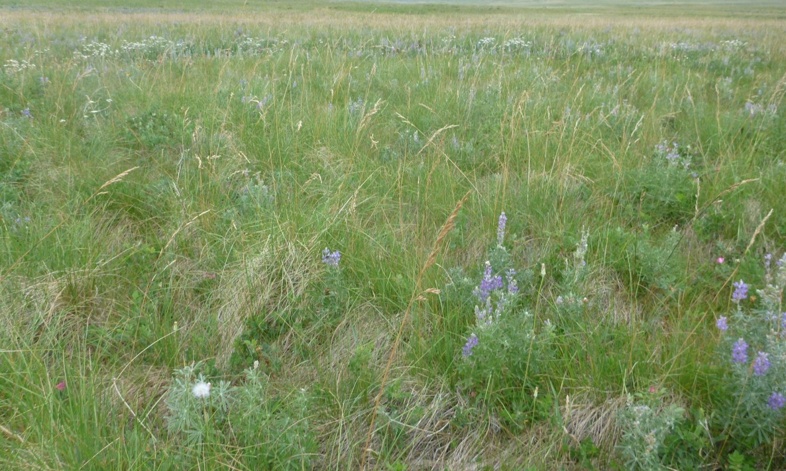
The Rough Fescue community is considered the Reference plant community for this ecological site. This community contains a high diversity of grasses depending on how much precipitation the site receives on average, with the majority of the grass component being cool-season grasses. Rough fescue (Festuca campestris), bluebunch wheatgrass (Pseudoroegneria spicata), and green needlegrass (Nassella viridula) are dominant. Idaho fescue (Festuca idahoensis), Sandberg bluegrass (Poa secunda), and needle and thread (Hesperostipa comata) are subdominant grass species in the community. Warm-season grasses may be present, but they are often localized to small patches in the community.
The forb community is diverse and may contain a combination of up to two dozen species. Forbs will account for 10 to 15 percent of the total above-ground biomass on the Loamy ecological site. Species synonymous with the Reference state include purple prairie clover (Dalea purpurea), prairie thermopsis (Thermopsis rhombifolia), dotted blazing star (Liatris punctata), and American vetch (Vicia americana). As precipitation increases within the Climate Subset, species such as deathcamas (Zigadenus spp.), western stoneseed (Lithospermum ruderale), old man's whiskers (Geum triflorum), and northern bedstraw (Galium boreale) may also increase.
As discussed in the Ecological Dynamics section, the natural fire regime restricted shrubs to relatively small portions of this community. Shrubs will account for less than five percent of the overall site production. Frequent shrub species include silver sagebrush (Artemisia cana), big sagebrush, shrubby cinquefoil (Dasiphora fruticosa), common snowberry (Symphoricarpos albus), white sagebrush (Artemisia ludoviciana), and winterfat (Krascheninnikovia lanata). In areas of coarse soil texture, spineless horsebrush (Tetradymia canescens) may occupy a small niche.
This state exists in areas with conservative grazing management or in areas with highly managed, intense grazing. For this community, conservative grazing management is a complex issue as rough fescue and bluebunch wheatgrass lack resistance to grazing during the critical growing season (spring). This reduces plant vigor and production if grazed in the critical growing season for more than one year out of three (Wilson et al., 1966). Rough fescue-dominated communities are also susceptible to heavy grazing during the summer months. Rough fescue communities are best suited to late-summer or dormant-season grazing (Willms et al., 1985).
Resilience management. The Rough Fescue Community is moderately resilient and will return to dynamic equilibrium following a relatively short period of stress (such as short-term drought, heavy grazing, and/or wildfire), provided there is a return of favorable or normal growing conditions and properly managed grazing. In this plant community, proper grazing management is typically short-term, with light to moderate grazing events during the growing season or moderate grazing in the dormant season.
Dominant plant species
-
common snowberry (Symphoricarpos albus), shrub
-
silver sagebrush (Artemisia cana), shrub
-
Woods' rose (Rosa woodsii), shrub
-
big sagebrush (Artemisia tridentata), shrub
-
rough fescue (Festuca campestris), grass
-
bluebunch wheatgrass (Pseudoroegneria spicata), grass
-
green needlegrass (Nassella viridula), grass
-
Idaho fescue (Festuca idahoensis), grass
-
lupine (Lupinus), other herbaceous
-
American vetch (Vicia americana), other herbaceous
-
dotted blazing star (Liatris punctata), other herbaceous
-
purple prairie clover (Dalea purpurea), other herbaceous
-
common yarrow (Achillea millefolium), other herbaceous
Figure 8. Annual production by plant type (representative values) or group (midpoint values)
Table 7. Annual production by plant type
Plant type Low
(lb/acre)Representative value
(lb/acre)High
(lb/acre)Grass/Grasslike 1350 1650 1980 Forb 200 400 500 Shrub/Vine 100 140 200 Total 1650 2190 2680 Table 8. Ground cover
Tree foliar cover 0% Shrub/vine/liana foliar cover 0-10% Grass/grasslike foliar cover 80-90% Forb foliar cover 0-10% Non-vascular plants 0-0% Biological crusts 0-0% Litter 40-70% Surface fragments >0.25" and <=3" 0-0% Surface fragments >3" 0-0% Bedrock 0% Water 0% Bare ground 0-10% Table 9. Soil surface cover
Tree basal cover 0% Shrub/vine/liana basal cover 0-0% Grass/grasslike basal cover 20-20% Forb basal cover 0-10% Non-vascular plants 0-0% Biological crusts 0-0% Litter 0% Surface fragments >0.25" and <=3" 0-10% Surface fragments >3" 0-10% Bedrock 0% Water 0% Bare ground 60-80% Table 10. Canopy structure (% cover)
Height Above Ground (ft) Tree Shrub/Vine Grass/
GrasslikeForb <0.5 – – 0-10% 1-5% >0.5 <= 1 – – 30-45% 1-5% >1 <= 2 – 1-10% 15-25% – >2 <= 4.5 – – – – >4.5 <= 13 – – – – >13 <= 40 – – – – >40 <= 80 – – – – >80 <= 120 – – – – >120 – – – – Figure 9. Plant community growth curve (percent production by month). MT46X01 , LRU 01 (North LRU). Growth Curve for MLRA 46 LRU 01 with site dominated by cool season bunchgrasses.
Jan Feb Mar Apr May Jun Jul Aug Sep Oct Nov Dec J F M A M J J A S O N D 0 0 5 15 25 30 15 5 5 0 0 0 Community 1.2
Mixed Bunchgrass

Figure 10. Rough fescue site left undisturbed by grazing and/or fire. Large clumps of rough fescue dying. Excessive litter cover is suppressing seedling recruitment. Reference plants are present but struggling.
Rough fescue, bluebunch wheatgrass, green needlegrass, and Idaho fescue share dominance in the Mixed Bunchgrass community. The growing points for rough fescue and bluebunch wheatgrass are several inches above the ground, making them very susceptible to continued close grazing, while needle and thread growing points tend to be near the plant base (Smoliak et al., 2006). Idaho fescue and needle and thread increase in composition when more palatable or less grazing-tolerant plants decrease due to improper grazing management or extended drought conditions. Other grass species, which are more tolerant to grazing and are likely to increase compared to the Rough Fescue community, include Sandberg bluegrass (Poa secunda), purple threeawn (Aristida purpurea), prairie Junegrass, western wheatgrass (Pascopyrum smithii), thickspike wheatgrass (Elymus lanceolatus), and blue grama (Bouteloua gracilis). Some increaser forb species include western yarrow (Achillea millefolium), western stoneseed (Lithospermum ruderale), spiny phlox (Phlox hoodii), scarlet globemallow (Sphaeralcea coccinea), hairy false goldenaster (Heterotheca villosa), and pussytoes (Antennaria spp.). Prairie sagewort (Artemisia frigida) also increases under prolonged drought or heavy grazing and can respond to summer precipitation.
Heavy, continuous grazing will reduce plant cover, litter, and mulch. The timing of grazing is important on this site because of the moisture limitations beyond June, especially on the drier sites. Bare ground will increase, exposing the soil to erosion. Litter and mulch will be reduced as plant cover declines. As long as rough fescue is still a dominant species in total biomass production, the site can return to the Rough Fescue community using proper grazing management and favorable growing conditions.
Idaho fescue, needle and thread, and western wheatgrass may continue to increase until they make up the majority of the species composition. It may be difficult for the site to recover to the Rough Fescue community once the rough fescue has been reduced to less than 15 percent dry weight. The risk of soil erosion increases when canopy cover decreases. As soil conditions degrade, there will be a loss of organic matter, less litter, and reduced soil fertility. Degraded soil conditions can increase the difficulty of reestablishing bluebunch wheatgrass and returning to the Rough Fescue community.
The Mixed Bunchgrass community is the at-risk plant community for this ecological site. When overgrazing continues, increaser species such as Sandberg bluegrass and needle and thread, along with increaser native forb species, will become more dominant, and this triggers the change to the Altered State or the Degraded state. Until the Mixed Bunchgrass community crosses the threshold into the Idaho Fescue community or the Invaded community, this community can be managed toward the Rough Fescue community using prescribed grazing and strategic weed control. It may take several years to achieve this recovery, depending on growing conditions, the vigor of remnant rough fescue plants, and the aggressiveness of the weed treatments.
Resilience management. The Mixed Bunchgrass community is is moderately resilient and will return to dynamic equilibrium following a relatively short period of stress (such as short-term drought, heavy grazing, and/or wildfire), provided there is a return of favorable or normal growing conditions and properly managed grazing. In this plant community, proper grazing management is typically short-term, with light to moderate grazing events during the growing season or moderate grazing in the dormant season.
Dominant plant species
-
common snowberry (Symphoricarpos albus), shrub
-
shrubby cinquefoil (Dasiphora fruticosa), shrub
-
rough fescue (Festuca campestris), grass
-
bluebunch wheatgrass (Pseudoroegneria spicata), grass
-
Idaho fescue (Festuca idahoensis), grass
-
lupine (Lupinus), other herbaceous
-
western stoneseed (Lithospermum ruderale), other herbaceous
Pathway 1.1A
Community 1.1 to 1.2
Rough Fescue
Mixed BunchgrassMidstatured bunchgrasses lose vigor with improper grazing or extended drought. When vigor declines in response to disturbances such as these, bunchgrass basal areas will decrease in size, while species with higher grazing tolerance (primarily Idaho fescue on this site) will increase in vigor and production as they access the resources previously used by decreaser bunchgrasses. The reduction in mid-statured bunchgrass composition to less than 40 percent and an increase in forb and shrub canopy cover to 15 percent indicate that the plant community has shifted to the Mixed Bunchgrass community. The Reference state has evolved under a disturbance regime that has included frequent grazing by bison and regular burning by indigenous peoples. A lack of disturbance can result in a loss of health and vigor for the dominant rough fescue. This reduced vigor is noticeable in the dead or dying plant bases that typically start in the centers of plants. In the long term, the reduced basal area of rough fescue allows for infestation by increasers and nonnative herbaceous plants. The driver for community shift 1.1A is improper grazing management or prolonged drought. Improper grazing on this ecological site is defined as grazing utilization that exceeds moderate use (50 percent grazing use), particularly during the active growing season on rough fescue-dominated sites and/or multiple grazing events of a plant without rest in the same growing season. Associated with grazing intensity is the timing of grazing. The critical grazing period for this site is late spring to early summer, or approximately boot stage on grass. Rough fescue is particularly sensitive to summer grazing, which may drive the transition to the Mixed Bunchgrass community. This shift is triggered by the loss of vigor of rough fescue and bluebunch wheatgrass. Bare ground increases in associated with prolonged drought coupled with improper grazing.
Context dependence.Drought and warmer-than-normal temperatures are known to advance plant phenology by as much as one month (Blaisdell, 1958). During drought years, plants may be especially sensitive or reach a critical stage of development earlier than expected. The Rough Fescue community may slowly transition to the Mixed Bunchgrass community regardless of management.
Pathway 1.1B
Community 1.2 to 1.1
Mixed Bunchgrass
Rough FescueThe Mixed Bunchgrass community will return to the Rough Fescue community with proper grazing management and appropriate grazing intensity. Favorable moisture conditions will facilitate or accelerate this transition. It may take several years of favorable conditions for the community to transition back to a decreaser bunchgrass-dominated state. The increased vigor of midstatured bunchgrasses, which now account for more than 40 percent of the species composition, is the driving force behind this community shift. The trigger for this shift is the change in grazing management, which favors decreaser bunchgrasses. These triggers are generally conservative grazing management styles such as deferred or rest rotations utilizing moderate grazing (less than 50 percent grazing use) combined with favorable growing conditions such as cool, wet springs. Late-season or dormant-season grazing tends to promote rough fescue's growth patterns, which may increase the success of a grazing regime. These systems tend to promote increases in soil organic matter, which in turn promotes microfauna and increases infiltration rates. Inversely, long periods of rest at a time when this state is considered stable may not result in an increase in rough fescue, bluebunch wheatgrass, and other decreaser bunchgrasses. Long periods of rest or underutilization may actually drive the system to a lower level of stability by creating large amounts of standing biomass, dead plant caudex centers, and gaps in the plant canopy (Noy-Meir, 1973).
Context dependence.Soil and precipitation variability across this ecological site will create conditions that sites may express less rough fescue than others. Drier sites and those with increased calcium carbonates in the soil profile will express less rough fescue. Those sites may never reach the Rough Fescue community regardless of management or favorable growing conditions.
State 2
Altered
This state is distinguished by having less than 10 percent midstatured bunchgrasses by weight. It is represented by two communities that differ in the percent composition of Idaho fescue and overall production. Some native plants tend to increase in quantity under prolonged drought and/or heavy grazing practices. A few of these species may include Idaho fescue, Sandberg bluegrass, Cusick's bluegrass (Poa cusickii), scarlet globemallow, hairy false goldenaster, and prairie sagewort. Poisonous plants such as lupine (Lupinus spp.) and deathcamas (Zigadenus spp.) may also increase under these conditions.
This state is a result of extended heavy grazing, which is often combined with extended drought. Heavy grazing is defined as grazing that exceeds 50 percent utilization in a grazing season and/or multiple grazing events during critical spring growth with inadequate time between grazing events.Community 2.1
Idaho FescueThis plant community is a result of repeated heavy grazing disturbances that are often paired with environmental stressors such as drought or fire. The community is dominated by increaser species such as Idaho fescue, thickspike wheatgrass, western wheatgrass, oatgrass (Danthonia sp.), prairie Junegrass, and needle and thread. As the decreaser bunchgrasses reduce, these increaser grasses will fill the basal gaps, and native forbs will tend to increase as well. A slight increase in shrubs may also be seen.
Midstatured bunchgrasses comprise up to 10 percent of species composition by dry weight. The remaining midstatured bunchgrass plants tend to be scattered and low in vigor. Remnant populations of rough fescue and bluebunch wheatgrass exist under taller shrubs or within creeping juniper (Juniperus horizontalis) patches, protected from grazing animals. Increaser and invader species will be more common. Hairy false goldenaster, deathcamas, goldenrod (Solidago spp.), stonecrop, lupine, and yarrow (Achillea millefolium) are examples of increaser forbs. It is not uncommon for a minor component of invader species such as dandelion and yellow salsify to be present. This creates more competition for the midstatured bunchgrasses, making it difficult for them to quickly respond to a change in grazing management alone. Therefore, an input of energy is required for the community to return to the Reference state. Wind and water erosion may be eroding soil from the plant interspaces. Soil fertility is reduced, and soil surface erosion resistance has declined compared to the Reference state.
Long-term grazing mismanagement with continuous growing-season pressure will reduce the total productivity of the site and lead to an increase in bare ground. Suppression of fire can also promote shrub growth, increasing plant interspaces. Once plant cover is reduced, the site is more susceptible to erosion and degradation of soil properties. Soil erosion, or reduced soil fertility, will result in reduced plant production. This soil erosion, or loss of soil fertility, indicates the transition to the Altered state because it creates a threshold requiring energy input to return to the Reference state. Extended drought conditions may exacerbate the transition to the Idaho Fescue community.
This community crossed a threshold from the Reference state due to the erosion of soil, altered vegetative composition, loss of soil fertility, or degradation of soil conditions. This results in a critical shift in the ecology of the site. The effects of soil erosion can alter the hydrology, soil chemistry, soil microorganisms, and soil structure to the point where intensive restoration is required to restore the site to another state or community. Changing grazing management alone may not create sufficient improvement to restore the site if decreaser species are greatly reduced. A study suggests that with decreased grazing pressure, a needle and thread plant community did not change species composition, but the content of the soil carbon increased (Dormaar et al., 1997). It will require a considerable amount of energy to move the site back to the Reference state. This state has lost soil or vegetation attributes to the point that recovery to the Reference state will require reclamation efforts, i.e., soil rebuilding, intensive mechanical treatments, and/or reseeding.
The transition to this state could result from overgrazing and fire suppression, especially repeated early-season grazing coupled with an extensive drought. If heavy grazing continues, plant cover, litter, and mulch will continue to decrease, while bare ground will increase, exposing the soil to accelerated erosion. Litter and mulch will move off-site as plant cover declines. The Idaho Fescue community will then shift to a Rhizomatous community. Continued overgrazing will drive the community to a Degraded state. The introduction or expansion of invasive species will further drive the plant community into the Invaded state.Community 2.2
Rhizomatous Grass
With continued mismanagement of grazing, especially coupled with prolonged drought, Idaho fescue will decrease in vigor. The bunchgrasses will decline in production as plants die or become smaller, and species with higher grazing tolerance (such as western wheatgrass and Sandberg bluegrass) will increase in vigor and production as they respond to resources previously used by the bunchgrasses. These less desirable, shorter-rooted species will become dominant, with bunchgrasses only sparsely existing on the site. Midstatured grasses such as bluebunch wheatgrass, rough fescue, Columbia needlegrass, and green needlegrass will exist within shrub canopies where they are protected from grazing animals. However, few of these plants will exist outside of the shrub canopy.
This plant community is at risk of complete invasion by Kentucky bluegrass, dandelion, cheatgrass, and yellow salsify.Pathway 2.1A
Community 2.1 to 2.2The driver for community shift 2.1A is continuing to overgraze. On this site, overgrazing is defined as grazing utilization of more than 60 percent and/or season-long grazing where livestock can graze regrowth. This shift is triggered by the continued loss of bunchgrass vigor, especially in the remaining Idaho fescue and needlegrasses. The rhizomatous and shortgrasses will become more competitive and dominant over the bunchgrasses. Shrub species like broom snakeweed and rabbitbrush will increase.
Context dependence.Repeated negative grazing events are required to transition from the Idaho Fescue community to the Rhizomatous Grass community. This may occur in small patches near traditional water sites or small pastures.
Pathway 2.1B
Community 2.2 to 2.1If grazing management is implemented, Idaho fescue may regain its vigor and move toward the Idaho Fescue community. This will give grasses an advantage over invading shrubs before too much competition takes place. Since the transition from community 2.1 to community 2.2 was likely caused by repeated heavy utilization, a conservative grazing plan where utilization is reduced to at or below moderate utilization with rest or deferment is incorporated. Forage production increased by an average of 35 percent on western ranges when converting from heavy utilization to moderate utilization that is less than 50 percent (Lacey and Van Poolen, 1979). Shrub removal and favorable growing conditions can accelerate this process. A low-intensity fire or mechanical treatment could reduce shrub competition and allow for increased vigor and the reestablishment of grass species (Wambolt and Payne, 1986).
Context dependence.Sites that Idaho fescue has been removed completely may not recover to this community regardless of management. Seeding practices will be required. Favorable precipitation patterns will also be necessary.
State 3
DegradedDegraded state lacks midstatured bunchgrasses. Sandberg bluegrass and prairie Junegrass are the dominant grasses, increaser shrubs nearly replace larger shrub species. Larger shrub species that remain are heavily hedged. This state is likely terminal and restoration will likely be impossible, unsuccessful, or require major energy inputs.
Community 3.1
ShortgrassThis state is characterized by soil surface degradation and little plant soil surface cover. Soil loss continues, and subsequent loss of soil organic matter creates conditions where native perennial grasses are reduced. Grass and forb cover may be sparse, with obvious rill erosion between plant bases. Extensive, lesser spikemoss patches may also exist.
Needle and thread and Sandberg bluegrass exist in small patches. This could occur due to overgrazing, a long-term lack of fire, or the introduction of invasive species.
In the most severe stages of degradation, there is a significant amount of bare ground, and large gaps occur between plants. Soils have the potential to erode to the point where irreversible damage occurs. This is a critical shift in the ecology of the site. Soil erosion combined with a lack of organic matter deposition due to sparse vegetation creates negative changes to the hydrology, soil chemistry, soil microorganisms, and soil structure to the point where intensive restoration is required to restore the site to another state.
The forb component shifts to being dominated by spiny phlox, and the shrub canopy cover is typically greater than 15 percent. Broom snakeweed, rabbitbrushes, prairie sagewort, and plain prickly pear cactus are dominant shrubs.
This state has lost soil or vegetation attributes to the point that recovery to the Reference state will require extensive reclamation efforts, i.e., soil rebuilding, intensive mechanical treatments, and reseeding. Grazing management practices such as rest rotations will not return this community to the Reference state without reclamation efforts.
This plant community is likely a terminal state and will not return to the Reference state due to significant barriers to restoration from degraded soil conditions and the loss of higher successional native plant species.State 4
Invaded
The Invaded state is identified as being in the exponential growth phase of invader abundance, where control is a priority. The dominance (or relative dominance) of noxious and other hard-to-control invasive species reduces species diversity, forage production, wildlife habitat, and site protection. Even with proper grazing management or favorable growing conditions, a level of 10 percent by weight of invasive species composition by dry weight indicates that a significant energy input, such as herbicide or mechanical removal, will be required to create a shift to the grassland state. Prescriptive grazing that specifically focuses on the grazing of invasive plants can be used to manage invasive species. In some instances, carefully targeted grazing (sometimes in combination with other treatments) can reduce or maintain the species composition of invasive species.
This state differs from the Naturalized Herbaceous Invaded state in the severity of the ecological impact of the species. The species in the Invaded State are often considered noxious or to be those that, once present, are difficult to control and almost impossible to eradicate, such as cheatgrass (Bromus tectorum) or North Africa grass (Ventenata dubia).Community 4.1
Invaded
Communities in this state may be structurally indistinguishable from those in the reference state except that invasive or noxious species have reached 10 percent of species composition by dry weight. Although there is no research for this threshold, it is estimated to be the point in the invasion process following the lag phase (Masters and Sheley, 2001). For aggressive invasive species (such as spotted knapweed), the threshold could be as low much lower. Early in the invasion process, there is a lag phase where the invasive plant populations remain small and localized for long periods before expanding exponentially (Hobbs and Humphries, 1995).
Production in the invaded community may vary greatly based on the severity of the invasion and potential subsequent effects on species composition. A site dominated by Kentucky bluegrass or spotted knapweed, where soil fertility and chemistry remain near reference, may have production near that of the reference community. A site with degraded soils and a cheatgrass infestation may produce only 10 to 20 percent of the Reference state.
Once invasive species dominate the site, either in species composition by weight or in their impact on the community, the threshold has been crossed to the Invaded state. As invasive species such as spotted knapweed, cheatgrass, and leafy spurge become established, it becomes very difficult to eradicate them. Therefore, considerable effort should be placed into preventing plant communities from crossing the threshold into the Invaded state through early detection and proper management. Preventing new invasions is by far the most cost-effective control strategy and typically places an emphasis on education. Control measures used on the noxious plant species impacting this ecological site include chemical, biological, and cultural (burning, mowing, and cutting) control methods. The best success has been found with an integrated pest management (IPM) strategy that incorporates one or several of these options along with education and prevention efforts. (DiTomaso, 2000).State 5
Naturalize Herbaceous Invaded
Figure 11. Rough fescue rangeland with yellow sweet clover in background.
This state is one that has been invaded by plants that are not generally considered to have the same extreme impact on this ecological site as those in the Invaded state, though they can pose a negative impact on this ecological site, particularly on the hydrologic functions. This list of species is often introduced by encroachment from neighboring cultivated pastures such as Kentucky bluegrass (Poa pratensis), Timothy (Phleum pratense), smooth brome (Bromus inermis), and crested wheatgrass (Agropyron cristatum). It is not uncommon for introduced forbs to invade via wind-blown seeds such as dandelion (Taraxacum spp.), sweetclover (Melilotus officinalis), and yellow salsify (Tragopogon dubius).
This state may resemble the Reference state in structure or could be completely invaded. These naturalized plants have a dry weight of more than 10 pounds per acre or a canopy cover of more than two percent.Community 5.1
Naturalized InvadedA common occurrence in this LRU is the invasion of herbaceous plants that are weeds, though they are considered, by many, to be more of a nuisance than an actual threat to rangeland conditions. Kentucky bluegrass, smooth brome, crested wheatgrass, Timothy, sweetclover, dandelions, and yellow salsify are common naturalized invasive species.
Common naturalized nonnative grasses often encroach into rangeland that isn't in the Reference state. They have taken root in an open area of bare ground or in between plants via rhizomes. Often, these grasses are palatable to all classes of livestock and many native mammals, so they are not actively controlled by many land managers. Common naturalized grasses are typically shallow-rooted, causing site stability issues in the long term. Naturalized grass such as crested wheatgrass dominated sites express reduced soil nitrogen and carbon (Christian and Wilson, 1999).
As with naturalized grasses, invasive weedy forbs pose the same threat to native rangelands. The prolific seed producers will occupy the tiniest bit of bare ground and produce thousands of seeds. In the case of the dandelion and yellow salsify, the plants are generally small in stature, but the large taproot and spreading leaves outcompete many native species for the limited resources available. Sweetclover can occupy thousands of acres of land, and as a biennial, it takes advantage of early season soil moisture and sunlight and grows to a large stature, effectively outcompeting native plants for space and sunlight.
While not species of immediate concern, these species pose a real danger to the overall health of the rangeland and do have major impacts on rangeland health, specifically by occupying space typically reserved for native plants (Vaness and Wilson, 2007). In the long term, this will mean fewer native plants on the landscape, causing issues with hydrology and site stability, which will affect the grazeability of a site and its suitability as a wildlife habitat.
These species can be controlled with simple methods. Naturalized grasses are susceptible to fire and repeated prescribed fire treatments have proven to be an effective control. Targeted grazing alone will not control for naturalized grasses. Naturalized forbs in this state can be controlled with broadleaf herbicides. It is important to note that these plants are often interspersed with native forbs, so this method would need to be reserved for a large invasion or applied with a wand sprayer for spot applications. Tall forbs such as sweetclover can be easily controlled via mowing or haying, particularly when done before seed production. Livestock will actively graze this tall forb, although the hay produced from sweetclover can be toxic.State 6
Converted CroplandThe Loamy ecological site has been, extensively, converted to Annual Crop or Pasture with dominant species being introduced for grain or forage production. The conversion of native rangeland required intensive tillage for this state to exist.
Community 6.1
Annual CropThe Annual Crop community is common on this ecological site as the soil pH, water holding capacity, and inherent soil organic matter tend to be favorable to annual cropping. Barley, oats, and wheat are the most common. If irrigation is available, this community is extremely productive. Besides small grains, the site is capable of producing a wide variety of crops, including corn silage, seed potatoes, pumpkins, sunflowers, and other specialty crops.
Long-term annual cropping can destroy soil aggregation, deplete organic matter, and alter pH, so a conservative crop management system will need to be applied to prevent degradation of the site.
The Rocky Mountain Front LRU is particularly susceptible to wind erosion due to the frequent Chinook winds that occur in winter when soil surface cover is lowest. Common cropping methods such as no-till, reduced-till, and cover cropping significantly reduce the potential for wind erosion.Community 6.2
Forage CropThe Forage Crop community is mechanically harvested and baled for feed for livestock. Nutrients are removed from the site, and long-term inputs are required to maintain productivity. This often requires a maintenance cycle of annual cropping for one to three years before the site is planted back to hay. In this LRU, the primary species is alfalfa with one or more species of introduced grasses such as pubescent or intermediate wheatgrass (Thinopyrum intermedium), smooth brome (Bromus inermis), meadow brome (Bromus biebersteinii), orchardgrass (Dactylis glomerata), or Timothy (Phleum pratense). The Loamy ecological site is capable of producing high amounts of quality hay, especially with the addition of irrigation.
Community 6.3
PastureThe Pasture Community is very common within the Converted Cropland State. It consists primarily of long-term herbaceous crop planted for grazing animals. Management styles are extremely variable. Vegetation is considered permanent though stands may see brief periods of tillage/cropping as stands age or as management goals change. The Pasture Community differs from the Forage Crop Community by being managed for grazing animals. Their excrement remains on the site for nutrient cycling while the Forage Crop Community nutrients are removed from the site.
Pathway P6.1
Community 6.1 to 6.2The Annual Crop community is planted to the Forage Crop community. Permanent herbaceous forage is harvested, mechanically, and removed from the field to be fed to livestock.
Context dependence.The site needs to have soil conditions conducive to farming practices prior to conversion to the permanent cover for grazing. Typically if the site has been used for the Annual Crop community, there are no major limitations for this transition.
Pathway P6.3
Community 6.1 to 6.3The Annual Crop community is planted to permanent herbaceous cover for the intended purpose of grazing livestock. Introduced grasses and forbs dominate the site.
Context dependence.The site needs to have soil conditions conducive to farming practices prior to conversion to the permanent cover for grazing. Typically if the site has been used for the Annual Crop community, there are no major limitations for this transition.
Pathway P6.2
Community 6.2 to 6.1The Forage Crop community is removed and planted to the Annual Crop community. Different methods may be used for the removal of the Forage Crop community; however, mechanical tillage is often required to reduce competition for the species that may be planted in the Annual Crop community. In the Rocky Mountain Foothills LRU, the most common species include barley, wheat, and oats but may include a variety of other annual crops.
Context dependence.The Forage Crop community conversion to the Annual Crop community typically has few site restrictions that prevent the transition. Favorable seasonal precipitation aids in the success of conversion.
Pathway P6.4
Community 6.3 to 6.1The Pasture community is converted to the Crop community as a result of extensive tillage and seeding of a crop. Often this is a small grain such as barley, wheat, or oats.
Context dependence.The Pasture community conversion to the Annual Crop community typically has few site restrictions that prevent the transition. Favorable seasonal precipitation aids in the success of conversion.
Transition T1A
State 1 to 2
Reference
AlteredThe Reference state transitions to the Altered state if mid-statured bunchgrasses decrease to less than 10 percent by dry weight or if bare ground cover increases beyond 10 percent. The driver for this transition is the loss of taller bunchgrasses, which creates open areas in the plant canopy with bare soil. Soil erosion results in decreased soil fertility, driving transitions to the Altered state. There are several other key factors signaling the approach of transition T1A, such as an increase in physical soil crusting, a decrease in the cover of biological crusts, a decrease in soil surface aggregate stability, and evidence of erosion, including water flow patterns, pedestals, and litter movement.
Constraints to recovery.The lack of deep-rooted bunchgrasses will prevent recovery to the Reference state without inputs such as seeding and mulching. Favorable growing conditions are necessary to facilitate restoration to the Reference state.
Context dependence.The transition to the Altered state is primarily driven by negative grazing events, however, prolonged drought may expedite this transition. If present, intense fire may also create conditions where the midstatured bunchgrasses are removed. Intense fire is often paired with hot, dry summer conditions which damage the caudex of these bunchgrasses.
Transition T1B
State 1 to 3The Reference state transitions to the Degraded state when rough fescue and bluebunch wheatgrass are completely removed from the plant community. Idaho fescue is subdominant (or often absent) to needle and thread and short-statured bunchgrasses such as Sandberg bluegrass and Cusick's bluegrass. The trigger for this transition is the loss of most mid-statured bunchgrasses, which creates open spaces with bare soil. Soil erosion as a result of increased bare ground and shallow roots decreases soil fertility, driving transitions to the Degraded state. There are several other key factors signaling the approach of Transition T1B: an increase in soil physical crusting, a decrease in biological crusts, a decrease in soil surface aggregate stability, and/or evidence of erosion, including rills, water flow patterns, pedestals, and litter movement. The drivers for this transition are improper grazing management, intense or repeated fires, and/or heavy human disturbance. Rapid transition to the Degraded state is generally realized where livestock are confined to small pastures for long periods of time, such as feeding areas, horse pastures, and bull lots. Degradation may be so extreme that traditional restoration methods may not be successful and require extensive mechanical and financial inputs.
Constraints to recovery.The lack of deep-rooted bunchgrasses will prevent recovery to the Reference state without inputs such as seeding and mulching.
Context dependence.The transition to the Degraded state is primarily driven by negative grazing events, however prolonged drought may expedite this transition. If present, intense fire may also create conditions where the midstatured bunchgrasses are removed. Intense fire is often paired with hot, dry summer conditions which damage the caudex of these bunchgrasses.
Transition T1C
State 1 to 4
Reference
InvadedHealthy plant communities are the most resistant to invasion. However, sometimes, regardless of grazing management, without some form of active weed management (chemical, mechanical, or biological control), the Reference state can transition to the Invaded state in the presence of aggressive invasive species such as spotted knapweed, leafy spurge, and cheatgrass. The Rocky Mountain Front Foothills LRU tends to resist invasion, though recent dry climate cycles, repeated heavy grazing, or intense human activities can open the interspaces of the Reference state and allow for encroachment. Long-term stress conditions for native species (e.g., overgrazing, drought, and fire) accelerate this transition. If populations of invasive species reach critical levels, the site transitions to an Invaded state. The trigger for this transition is the presence of aggressive invasive species, with the composition of invasive species by dry weight approaching 10 percent.
Constraints to recovery.The removal of invasive species requires significant inputs of time, weed management, and capital. Many invasive species such as cheatgrass, spotted knapweed, and leafy spurge are challenging to control and may always be present on a site, once established. The level of invasion needs to be minimal or the species must be easy to control to return to the Reference state
Context dependence.Invasive species vary in aggressiveness and ease of control. Some species such as yellow salsify may have minimal impact on an ecological site while an aggressive species such as cheatgrass may begin to affect the site at a very low composition. Drought, fire return interval, and grazing patterns may influence the speed at which a site will be invaded.
Transition T1D
State 1 to 5
Reference
Naturalize Herbaceous InvadedHealthy plant communities are most resistant to invasion, but sometimes the Reference state can transition to the Naturalized Herbaceous Invaded state in the presence of herbaceous invasive species. Non-native plants take advantage of small gaps in the plant community and prolific seed producers. The list of species includes, but is not limited to, Kentucky bluegrass, Timothy, smooth brome, dandelion, yellow salsify, and yellow sweet clover. Rough fescue communities tend to resist invasion, though dry climate cycles, heavy grazing, or intense human activities can open the interspaces of the Reference state and allow for encroachment. Long-term stress conditions for native species (e.g., overgrazing, drought, and fire) accelerate this transition. If populations of invasive species reach critical levels, the site transitions to the Naturalized Herbaceous Invaded state. These naturalized plants are present in quantities greater than a trace amount by dry weight or greater than two percent canopy cover.
Constraints to recovery.Naturalized grasses are increasingly hard to control and may always be present in a low amount once established.
Context dependence.This site often exists land that has been planted to hay or pasture. Small gaps between native plants offer an opportunity for these competitive species to establish.
Transition T1E
State 1 to 6Mechanical tillage converts rangeland to production cropland with intent of producing small grains (primarily wheat, barley, oats, and oilseed) or forage crops such as pasture or hay for livestock.
Context dependence.Some sites may not have been converted to production cropland due to rock fragments, slope, or other site conditions such as soil pH.
Restoration pathway R2A
State 2 to 1
Altered
ReferenceThe Altered state has lost soil or vegetation attributes to the point that recovery to the Reference state requires reclamation efforts such as soil rebuilding, intensive mechanical treatments, cultural treatments, and revegetation. Examples of mechanical treatment may be brush control, while cultural treatments may include prescribed grazing, targeted brush browsing, or prescribed burning. Grazing practices that promote rough fescue are primarily light to moderate grazing during the critical season (late June through July) or dormant season of moderate use. Heavy utilization may not have immediate negative impacts, though grazing should match the species composition of the site prior to exceeding moderate utilization (Dormaar and Willms, 1998). Low-intensity prescribed fires can be used to reduce competitive increaser plants such as Idaho fescue, needle and thread, and Sandberg bluegrass. A low-intensity fire will also reduce shrubby cinquefoil populations, if present. In areas with the potential for annual grass infestations, fire should be carefully planned or avoided. The drivers for this restoration pathway are reclamation efforts along with grazing management.
Context dependence.If midstatured bunchgrasses exist, a grazing management using light-intensity grazing along with time for recovery combined with favorable growing conditions may facilitate the restoration back to the Reference state.
Transition T2A
State 2 to 3As improper grazing continues, the vigor of bunchgrasses will decrease. The shorter grasses and shrubs will increase towards the Degraded state. In this state, improper grazing management is defined as grazing events that exceed moderate grazing (40 to 50 percent grazing use), a grazing season that exceeds half of the growing season, and/or grazing events that consume plant regrowth in the same growing season. Highly managed grazing events that exceed moderate grazing levels for short timeframes are generally not included in this definition due to the increased rest periods between these grazing events. Additionally, prolonged drought will provide a competitive advantage to shrubs, allowing them to become co-dominant with grasses. Shrub canopies may increase, though they will express low growth forms as a result of browsing by livestock. Mat-forming forbs and lesser spikemoss will also increase. Key transition factors include an increase in native shrub canopy cover, a decrease in bunchgrass production, a decrease in total plant canopy cover and production, an increase in mean bare patch size, an increase in soil crusting, a decrease in cryptobiotic crust cover, a decrease in soil aggregate stability, and/or evidence of erosion, such as water flow patterns and litter movement.
Constraints to recovery.Removal of all midstatured grasses will require reseeding and soil rebuilding efforts to restore to the Altered state
Context dependence.Exceptionally dry conditions may expedite the transition from the Altered state. The loss of soil organic matter may increase the odds of invasion by annual grasses.
Transition T2B
State 2 to 4
Altered
InvadedInvasive species can occupy the Altered state and drive it to the Invaded state. The Altered state is at risk if invasive seeds and/or other viable material are present. More than 10 percent of the dry weight of invasive species is the driving force behind this transition. The trigger is the presence of seeds and/or other viable material from invasive species.
Constraints to recovery.The addition of aggressive non-native plants could completely prevent restoration to the Altered state. Significant capital and time will be necessary.
Context dependence.The condition of the Invaded state must resemble that of the Altered state to be restored to the Altered state. The kind and amount of invasive species may also affect the ability of the site to be restored.
Transition T2C
State 2 to 5
Altered
Naturalize Herbaceous InvadedInvasive species can occupy the Altered state and drive it to the Naturalized Herbaceous Invaded state. The Altered state is at risk of invasion due to increased bare ground and basal gaps, which allow for ease of establishment. This transition is being driven by a trace (10 pounds of per acre) or more than two percent canopy cover of herbaceous naturalized plants. The trigger is the presence of seeds and/or other viable material from invasive species.
Constraints to recovery.Naturalized grasses are increasingly hard to control and may always be present in a low amount once established.
Context dependence.This site often exists land that has been planted to hay or pasture. Small gaps between native plants offer an opportunity for these competitive species to establish.
Transition T2D
State 2 to 6Mechanical tillage converts rangeland to production cropland with intent of producing small grains (primarily wheat, barley, oats, and oilseed) or forage crops such as pasture or hay for livestock.
Constraints to recovery.Removal of native vegetation and tilling of the soil will require reseeding of the site. In some cases, the Converted Cropland state is left unmanaged and pioneer species may slowly begin to revegetate the site.
Context dependence.Sites converted to the Converted Cropland state are often gentle sloping with minimal rock fragments within the soil. Newly converted sites are frequently located nearby other converted lands.
Restoration pathway R3A
State 3 to 1The Degraded state has lost soil or vegetation attributes to the point that recovery to the Reference state will require reclamation efforts such as soil rebuilding, intensive mechanical treatments, and/or revegetation. Studies suggest that mulch with a high carbon-to-nitrogen ratio, such as wood chips or bark in low-moisture scenarios, can be beneficial for the slow mobilization of plant-available nitrogen (Whitford et al., 1989). Biochar may also be added to the system to improve soil organic carbon (SOC), which should improve cation exchange capacity (CEC), microbial activity, and hydrologic conductivity (Stavi, 2012). The drivers for the restoration pathway are the removal of increaser species, restoration of native bunchgrass species, persistent management of invasives and shrubs, and proper grazing management. Without continued control, invasive and shrub species are likely to return (probably rapidly) due to the presence of seeds and/or other viable material such as rhizomes or stolons in the soil and management-related increased soil disturbance.
Context dependence.The Degraded state lacks the midstatured bunchgrass of the Reference state and may be affected by soil loss. Restoration methods will vary based on soil conditions but will require significant inputs to add soil organic matter as well as seeding the site. This site may have lost so much soil that it will never return to the Reference state.
Restoration pathway R3B
State 3 to 2Since the deep-rooted bunchgrass plant community has been removed, restoration to the Altered State is unlikely unless a seed source is available. If a sufficient amount of bunchgrass remains on the site, chemical application and/or biological control, in conjunction with proper grazing management, can reduce the number of shrubs and invasive species and restore the site to the Rhizomatous Grass community. Grazing management strategies that follow light grazing and allow for long periods of rest will allow for limited recovery of remaining bunchgrasses. However, grazing management alone may not directly result in restoration. Restoration methods, such as reseeding, will be necessary. Low-intensity fire can be utilized to reduce shrub competition and allow the reestablishment of grass species. Caution must be used when considering fire as a management tool on sites with fire-tolerant shrubs such as rubber rabbitbrush, as these shrubs will sprout after a burn. Some shrubs, like broom snakeweed and prairie sagewort, may or may not re-sprout depending on conditions (Tirmenstein, 1999).
Context dependence.The Degraded state lacks the midstatured bunchgrass of the Altered state and may be affected by soil loss. Restoration to the Altered state may require soil rebuilding practices as well as seeding of native species.
Transition T3A
State 3 to 4The Degraded state is particularly susceptible to invasion by weeds, which drives it to the Invaded state. The Degraded state is at risk of this transition occurring if invasive seeds or viable material are present. The driver for this transition is the presence of critical population levels of invasive species. The trigger is the presence of seeds or viable material from invasive species. This state has sufficient bare ground that the transition could occur simply due to the presence or introduction of invasive seeds or viable material. This is particularly true of aggressive invasive species such as spotted knapweed and cheatgrass. This transition could be assisted by overgrazing (failure to adjust stocking rate to declining forage production), a long-term lack of fire, high-intensity fire, or an extensive drought.
Constraints to recovery.The Degraded state has shallow-rooted plants which affect its ability to utilize precipitation and often has reduced litter cover which also affects soil moisture. Reduced soil nutrients from erosion may affect the site's ability to recruit native plants.
Context dependence.Favorable moisture is necessary to facilitate restoration. The Degraded state has reduced soil organic matter as well as shallow-rooted plants which affects the site's infiltration rates and ability to store moisture. The reestablishment of native species is greatly reduced by these soil conditions.
Transition T3B
State 3 to 5The Degraded state is particularly susceptible to invasion by weeds, which drives it to the Naturalized Herbaceous Invaded state. The Degraded state is at risk of invasion due to increased bare ground and basal gaps, which allow for ease of establishment. This transition is being driven by 10 pounds per acre or more than two percent of the canopy cover of herbaceous naturalized plants. The trigger is the presence of seeds and/or other viable material from invasive species.
Constraints to recovery.Naturalized grasses are increasingly hard to control and may always be present in a low amount once established.
Context dependence.This site often exists near land that has been planted to hay or pasture. Small gaps between native plants offer an opportunity for these competitive species to establish.
Transition T3C
State 3 to 6Mechanical tillage converts rangeland to production cropland with intent of producing small grains (primarily wheat, barley, oats, and oilseed) or forage crops such as pasture or hay for livestock.
Constraints to recovery.Removal of native vegetation and tilling of the soil will require reseeding of the site. In some cases, the Converted Cropland state is left unmanaged and pioneer species may slowly begin to revegetate the site.
Context dependence.Sites converted to the Converted Cropland state are often gentle sloping with minimal rock fragments within the soil. Newly converted sites are frequently located nearby other converted lands.
Restoration pathway R4A
State 4 to 1
Invaded
ReferenceRestoring the Invaded state to the Reference state requires a significant energy input. The drivers for the restoration pathway are the removal of invasive species, restoration of native bunchgrass species, persistent management of invasive species, and proper grazing management. Without continued control, invasive species are likely to return (probably rapidly) due to the presence of seeds and/or other viable material in the soil and management practices that increase soil disturbance. Sites that have transitioned from the Degraded state to the Invaded state may be severely lacking in soil and vegetative properties that will allow for restoration to the Reference state. Hydrologic function damage may be irreversible, especially with accelerated gully erosion.
Context dependence.The Invaded state must have a plant community similar to one of those in the Reference state. Without midstatured bunchgrasses present, significant inputs such as reseeding will be necessary to facilitate this restoration.
Restoration pathway R4B
State 4 to 2
Invaded
AlteredIf invasive species are removed before remnant populations of bunchgrass have been drastically reduced, the Invaded state can return to the Altered state. The driver for the reclamation pathway is weed management with possible reseeding. Continued Integrated Pest Management (IPM) will be required as many of the invasive species that can occupy the Invaded State have extended dormant seed life. The trigger is invasive species control.
Context dependence.The Invaded state must have a plant community similar to one of those in the Altered state. Without those species present, significant inputs such as reseeding will be necessary to facilitate this restoration.
Restoration pathway R4C
State 4 to 3If invasive species are removed, the site could return to the Degraded state. Without sufficient remnant populations of preferred plants, the Invaded state is not likely to return to any of the other states. The driver for the reclamation pathway is weed management without reseeding. The trigger is invasive species control. Invading species cause a significant increase in soil loss due to a lack of ground cover (Lacey et al., 1989).
Context dependence.The Invaded state must have a plant community similar to one of those in the Degraded state. Without those species present, significant inputs such as reseeding will be necessary to facilitate this restoration.
Transition T4D
State 4 to 5
Invaded
Naturalize Herbaceous InvadedIf noxious and aggressive invasive species are removed, the site could return to the Naturalized Herbaceous Invaded state. Without sufficient remnant populations of preferred plants, the Invaded state is not likely to return to any of the other states. The driver for the reclamation pathway is weed management without reseeding. The trigger is invasive species control. Invading species cause a significant increase in soil loss due to a lack of ground cover (Lacey et al., 1989). An Integrated Pest Management (IPM) Plan will be necessary to maintain and improve this state and any other state within this ecological site.
Context dependence.The Invaded state must have a plant community similar to one of those in the Naturalized Herbaceous Invasive state. Without those species present, significant inputs such as reseeding will be necessary to facilitate this restoration. Continued pest management such as herbicide application or targeted grazing will be necessary to maintain or remove invasive weeds.
Transition T4B
State 4 to 6Mechanical tillage converts rangeland to production cropland with intent of producing small grains (primarily wheat, barley, oats, and oilseed) or forage crops such as pasture or hay for livestock.
Restoration pathway R5A
State 5 to 1
Naturalize Herbaceous Invaded
ReferenceThe conditional return to the Reference state requires that the plant population must resemble that of the Reference communities with only the addition of these trace amounts of naturalized plants. If the plant community closely resembles that of the Altered state or Degraded state, then other restoration pathways will be necessary to return to the Reference state. Restoration of the Naturalized Herbaceous Invaded state to the Reference state requires substantial energy input. The drivers for the restoration pathway are the removal of invasive species, restoration of native bunchgrass species, persistent management of invasive species, and proper grazing management. Without continued control, invasive species are likely to return (probably rapidly) due to the presence of seeds and/or other viable material in the soil and management practices that increase soil disturbance. The forb species present in this state tend to be susceptible to readily available conventional herbicide treatments. Application methods must be controlled so as not to affect the native forbs that are common in this state. Mowing herbaceous forbs such as sweet clover or sainfoin is a successful method of control. Caution should be taken to ensure this occurs before seed is set to reduce the risk of Naturalized grasses in this state can be hard to eradicate especially once established (Vaness and Wilson, 2007). They are often palatable to livestock and reproduce by rhizome. Repeated spring fires, specifically in the month of May, have proven to be an effective control method in conjunction with rest from grazing animals (Abrams and Hulbert, 1987).
Restoration pathway R5B
State 5 to 2
Naturalize Herbaceous Invaded
AlteredThe conditional return to the Altered state is that the plant population must resemble that of the Altered state with only the addition of these trace amounts of naturalized plants. If the plant community closely resembles that of the other states within this ecological site, then other restoration pathways will be necessary to return to the Altered State. If restoration of this site to the Reference state is desired, additional restoration methods will be necessary, such as the implementation of grazing management as well as the possibility of requiring reseeding of native plants. Restoration of the Naturalized Herbaceous Invaded state to the Altered state requires substantial energy input. The drivers for the restoration pathway are the removal of invasive species, persistent management of invasive species, and proper grazing management. Without continued control, invasive species are likely to return (probably rapidly) due to the presence of seeds and/or other viable material in the soil and management practices that increase soil disturbance. The forb species present in this state tend to be susceptible to readily available conventional herbicide treatments. Application methods must be controlled so as not to affect the native forbs that are common in this state. Mowing herbaceous forbs such as sweet clover or sainfoin is a successful method of control. Caution should be taken to ensure this occurs before seed is set to reduce the risk of dispersing seed. Naturalized grasses in this state can be hard to eradicate especially once established (Vaness and Wilson, 2007). They are often palatable to livestock and reproduce by rhizome. Repeated spring fires, specifically in the month of May, have proven to be an effective control method in conjunction with rest from grazing animals (Abrams and Hulbert, 1987).
Transition T5A
State 5 to 6Mechanical tillage converts rangeland to production cropland with intent of producing small grains (primarily wheat, barley, oats, and oilseed) or forage crops such as pasture or hay for livestock.
Constraints to recovery.Recovery to this state will require reseeding of native species with some naturalized herbaceous species present.
Context dependence.Restoration to the Naturalized Herbaceous Invaded state is uncommon. Typically the Converted Cropland state will remain in production until the site is restored to native vegetation.
Restoration pathway R6A
State 6 to 1Restoration returns the Converted Cropland state to Reference state. Significant input may be necessary to remove competitive introduced species such as extensive tillage, nonselective herbicide application or a combination of the two. After competitive vegetation is removed or terminated, seeding of the site may occur. A successful restoration can be hard to distinguish from a truly native rangeland system though hydrologic and biotic functions of the system may not be fully restored due to soil modifications from tillage.
Context dependence.The Converted Cropland state will require seedbed preparation and seeding to recover the site to the Reference state. Time and favorable precipitation are required for success.
Additional community tables
Table 11. Community 1.1 plant community composition
Group Common name Symbol Scientific name Annual production () Foliar cover (%) Grass/Grasslike1 Tall-Midstatured Bunchgrasses 1100–1350 rough fescue FECA4 Festuca campestris 850–1260 20–45 bluebunch wheatgrass PSSP6 Pseudoroegneria spicata 100–175 7–10 green needlegrass NAVI4 Nassella viridula 80–125 5–7 Columbia needlegrass ACNE9 Achnatherum nelsonii 20–60 0–2 needlegrass ACHNA Achnatherum 0–40 0–2 slender wheatgrass ELTR7 Elymus trachycaulus 0–40 0–2 2 Cool Season Increaser Bunchgrasses/Sedges 170–390 Idaho fescue FEID Festuca idahoensis 20–160 1–5 needle and thread HECO26 Hesperostipa comata 20–160 1–5 prairie Junegrass KOMA Koeleria macrantha 20–60 1–5 threadleaf sedge CAFI Carex filifolia 0–60 1–2 Sandberg bluegrass POSE Poa secunda 20–60 0–1 onespike danthonia DAUN Danthonia unispicata 0–40 0–1 3 Cool Season Rhizomatous Grasses/Sedges 60–100 western wheatgrass PASM Pascopyrum smithii 0–60 0–2 thickspike wheatgrass ELLA3 Elymus lanceolatus 0–60 0–2 plains reedgrass CAMO Calamagrostis montanensis 0–15 0–1 4 Warm Season Decreaser Bunchgrasses 20–100 plains muhly MUCU3 Muhlenbergia cuspidata 20–100 0–3 5 Warm Season Increaser Grasses 0–40 purple threeawn ARPU9 Aristida purpurea 0–40 0–1 blue grama BOGR2 Bouteloua gracilis 0–10 0–1 Forb6 Forbs 200–500 lupine LUPIN Lupinus 0–150 0–3 sticky purple geranium GEVI2 Geranium viscosissimum 0–100 0–2 arrowleaf balsamroot BASA3 Balsamorhiza sagittata 0–80 0–2 scurfpea PSORA2 Psoralidium 0–80 0–1 goldenrod SOLID Solidago 0–80 0–1 desertparsley LOMAT Lomatium 0–80 0–1 purple prairie clover DAPU5 Dalea purpurea 20–60 0–2 common yarrow ACMI2 Achillea millefolium 5–60 0–2 upright prairie coneflower RACO3 Ratibida columnifera 10–60 0–1 western stoneseed LIRU4 Lithospermum ruderale 0–60 0–1 blanketflower GAAR Gaillardia aristata 10–40 0–2 milkvetch ASTRA Astragalus 0–40 0–1 Bonneville shootingstar DOCO Dodecatheon conjugens 5–40 0–1 pale agoseris AGGL Agoseris glauca 0–40 0–1 old man's whiskers GETR Geum triflorum 5–40 0–1 white sagebrush ARLU Artemisia ludoviciana 10–30 0–2 yellow fritillary FRPU2 Fritillaria pudica 0–30 0–1 deathcamas ZIGAD Zigadenus 0–20 0–1 little larkspur DEBI Delphinium bicolor 0–20 0–1 onion ALLIU Allium 0–20 0–1 littleleaf pussytoes ANMI3 Antennaria microphylla 0–10 0–1 rosy pussytoes ANRO2 Antennaria rosea 0–10 0–1 Shrub/Vine7 Shrubs 100–200 common snowberry SYAL Symphoricarpos albus 10–100 1–5 big sagebrush ARTR2 Artemisia tridentata 0–40 1–5 silver sagebrush ARCA13 Artemisia cana 0–40 0–2 shrubby cinquefoil DAFR6 Dasiphora fruticosa 0–20 0–1 Woods' rose ROWO Rosa woodsii 0–15 1–5 rubber rabbitbrush ERNA10 Ericameria nauseosa 0–10 0–1 creeping juniper JUHO2 Juniperus horizontalis 0–5 0–1 Table 12. Community 1.2 plant community composition
Group Common name Symbol Scientific name Annual production () Foliar cover (%) Table 13. Community 2.1 plant community composition
Group Common name Symbol Scientific name Annual production () Foliar cover (%) Table 14. Community 2.2 plant community composition
Group Common name Symbol Scientific name Annual production () Foliar cover (%) Table 15. Community 3.1 plant community composition
Group Common name Symbol Scientific name Annual production () Foliar cover (%) Table 16. Community 4.1 plant community composition
Group Common name Symbol Scientific name Annual production () Foliar cover (%) Table 17. Community 5.1 plant community composition
Group Common name Symbol Scientific name Annual production () Foliar cover (%) Table 18. Community 6.1 plant community composition
Group Common name Symbol Scientific name Annual production () Foliar cover (%) Table 19. Community 6.2 plant community composition
Group Common name Symbol Scientific name Annual production () Foliar cover (%) Table 20. Community 6.3 plant community composition
Group Common name Symbol Scientific name Annual production () Foliar cover (%) Interpretations
Animal community
Habitat fragmentation on this site has contributed to the decline of some "area-sensitive" wildlife species, particularly ground-nesting birds like the grasshopper sparrow.
This site is home to a diverse native wildlife complex. Historically, there were huge herds of migratory bison, elk, and pronghorn, as well as large numbers of sharp-tailed grouse. These were probably the dominant game species for local tribes. In addition, a wide variety of ground-nesting songbirds, waterfowl, and shorebirds utilize these upland sites for nesting.
Grazing patterns, topographic diversity, extensive acreages, and interspersion with other ecological sites make this site very important to numerous wildlife species. Small mammal diversity and abundance are high, which supports a varied raptor population. Ferruginous hawks and golden eagles, for example, make considerable use of this ecological site.
The Reference state hosts a vast diversity of plant species and life forms, which provide a feeding substrate for many species of pollinating insects. A variety of fish species inhabit the intermittent and perennial streams associated with this community. The longnose sucker, longnose dace, cutthroat trout, mountain whitefish, and mottled sculpin are examples. Common reptile and amphibian species include the tiger salamander, western chorus frog, short-horned lizard, racer, and prairie rattlesnake. The diversity of grass stature and life forms, along with scattered shrubs and a variety of forbs, provide habitat for many bird species, including the marbled godwit, sharp-tailed grouse, loggerhead shrike, grasshopper sparrow, vesper sparrow, chestnut-collared longspur, and western meadowlark. This community is especially favorable for ground-nesting birds because of the abundant residual plant material and litter available for nesting, escape, and thermal cover. Diverse prey populations are available for raptors, such as ferruginous and Swainson’s hawks. The predominance of grasses plus a diversity of forbs, shrubs, and half-shrubs in this community favors grazers and mixed feeders such as bison, pronghorn antelope, and elk. Mule deer have limited access to suitable thermal and escape cover because of low shrub cover and topographic diversity. Complex plant structural diversity and litter cover provide habitat for a wide array of small mammals (both seed eaters like deer mice and herbivores like voles and jackrabbits) and neotropical migratory birds.
The Altered state's partial loss of structural diversity makes this plant community somewhat less attractive to the variety of wildlife species that typically utilize the Reference state. A decrease in residual plant material and litter cover is usually associated with this state, which makes this community less attractive for ground-nesting birds. Pronghorn antelope make considerable use of this state because of its forb and shrub availability.
The Degraded state and its shorter-statured plant community may favor ground-nesting bird species, such as the horned lark and long-billed curlew, that prefer short grass. Many other bird species, such as the grasshopper sparrow and sharp-tailed grouse, will find less suitable nesting habitat with the reduction of residual plant material, litter, and taller grass species. The abundant forbs and half-shrubs provide quality forage for pronghorn antelope and mule deer. Small mammal populations may shift toward more abundant seed-eaters, like the deer mouse, and away from herbivores, like the meadow vole. Pollinator insect populations may suffer from the change in native forb diversity.
Introduced grasses, weedy forbs, and lesser spikemoss dominated sites suffer from a greatly simplified vegetative structure and a loss of variety. Pollinator insect populations lack the long flowering period associated with the Reference and Altered states. The simplified prey base (primarily small mammals) degrades habitat value for raptors and other mammalian predators. Overall, the wildlife habitat value is quite low.
Managed livestock grazing is suitable on this site due to the potential to produce an abundance of high-quality forage. This is often a preferred site for grazing by livestock, and animals tend to congregate in these areas. In order to maintain the productivity of the site, grazing on adjoining sites with less production must be managed carefully to make sure utilization on this site is not excessive. Management objectives should include maintenance or improvement of the native plant community. Careful management of the timing and duration of grazing is important. Shorter grazing periods and adequate deferment during the growing season are recommended for plant maintenance, health, and recovery. Early-season defoliation of bluebunch wheatgrass can result in high mortality and reduced vigor in plants (McLean and Wikeen 1985). They also suggest, based on prior studies, that regrowth is necessary before dormancy to reduce injury to bluebunch wheatgrass.Hydrological functions
Good hydrologic conditions exist on rangelands if plant cover (grass, litter, and brush canopy) resemble those in the Reference State. Sites with high similarity to the Reference State have plant and litter cover to optimize infiltration, minimize runoff and erosion, and have a good hydrologic condition. The deep root systems of the potential vegetation help maintain or increase infiltration rates and reduce runoff.
Sites with low similarity (States 3, 4, and 5) are generally considered to be in poor hydrologic condition, as the majority of the plant cover is from shallow-rooted species.
Erosion is minor for sites in the Reference State. Rills and gullies should not be present. Water flow patterns, if present, will be barely observable. Plant pedestals are essentially nonexistent, and plant litter remains in place. Plant cover and litter help retain soil moisture for use by the plants. Soil surfaces should not be compacted or crusted. Maintaining a healthy stand of perennial vegetation will optimize the amount of precipitation that is received.Recreational uses
This ecological site provides excellent bird and wildflower viewing opportunities. Upland bird and big game hunting opportunities are common on this site and its neighboring landscapes.
Wood products
N/A
Supporting information
Inventory data references
Information presented was derived from NRCS inventory data, National Resources Inventory (NRI) data, literature, field observations, and personal contacts with range-trained personnel (i.e., professional opinion of agency specialists, observations of land managers, and outside scientists). A minimum of 20 inventory low or medium intensity inventory points are utilized for verified ecological site descriptions. 14 Confidential NRI-Grazingland sites were utilized in the development of this ecological site description. An additional 18 (10 from NRCS) observations were referenced for basic plant community concepts in Glacier, Pondera, Teton, Lewis & Clark, Cascade, Liberty, and Hill Counties of Montana.
References
-
Abrams, M.D. and L.C. Hulbert. 1987. Effect of Topographic Position and Fire on Species Composition in Tallgrass Prairie in Northeast Kansas. The American Midland Naturalist 117:442–445.
-
Blaisdell, J.P. 1958. Seasonal development and yield of native plants on the Upper Snake River Plains and their relation to certain climate factors.
-
Christian, J.M. and S.D. Wilson. 1999. Long-Term Ecosystem Impacts of an Introduced Grass in the Northern Great Plains. Ecology 80:2397.
-
Colberg, T.J. and J.T. Romo. 2003. Clubmoss effects on plant water status and standing crop. Journal of Range Management 56:489–495.
-
DiTomaso, J.M. 2000. Invasive weeds in Rangelands: Species, Impacts, and Management. Weed Science 48:255–265.
-
Dormaar, J.F. and W.D. Willms. 1998. Effect of forty-four years of grazing on fescue grassland soils.. Journal of Range Management 51:122–126.
-
Dormaar, J.F., B.W. Adams, and W.D. Willms. 1997. Impacts of rotational grazing on mixed prairie soils and vegetation. Journal of Range Management 50:647–651.
-
Gruell, G.E. 1983. Fire and vegetative trends in the Northern Rockies: interpretations from 1871-1982 photographs. USDA Forest Service General Technical Report INT-158. U.S. Department of Agriculture, Forest Service, Intermountain Forest and Range Experiment Station, Ogden, UT. 1–117.
-
Hobbs, J.R. and S.E. Humphries. 1995. An integrated approach to the ecology and management of plant invasions. Conservation Biology 9:761–770.
-
Lacey, J.R., C.B. Marlow, and J.R. Lane. 1989. Influence of Spotted knapweed (Centaurea maculosa) on surface runoff and sediment yield.. Weed Technology 3:627–630.
-
Lacey, J.R. and H.W. Van Poolen. 1979. Grazing System Identification. Journal of Range Management, Jan edition 32:38–39.
-
Masters, R. and R. Sheley. 2001. Principles and practices for managing rangeland invasive plants. Journal of Range Management 38:21–26.
-
Noy-Meir, I. 1973. Desert Ecosystems: Environment and Producers. Annual Review of Ecology and Systematics 4:25–51.
-
Roos Christopher I., Zedeño María Nieves, Hollenback Kacy L., and Erlick Mary M. H. 2018. Indigenous impacts on North American Great Plains fire regimes of the past millennium. Proceedings of the National Academy of Sciences 115:8143–8148.
-
Ross, R.L., E.P. Murray, and J.G. Haigh. July 1973. Soil and Vegetation of Near-pristine sites in Montana.
-
Tirmenstein, D. 1999 (Date accessed). Gutierrezia sarothrae. https://www.fs.fed.us/database/feis/plants/shrub/gutsar/all.html.
-
Vaness, B.M. and S.D. Wilson. 2007. Impact and management of crested wheatgrass (Agropyron cristatum) in the northern Great Plains. Canadian Journal of Plant Science 87:1023–1028.
-
Wambolt, C. and G. Payne. 1986. An 18-Year Comparison of Control Methods for Wyoming Big Sagebrush in Southwestern Montana. Journal of Range Management 39:314–319.
-
Whitford, W.G., E.F. Aldon, D.W. Freckman, Y. Steinberger, and L.W. Parker. 1989. Effects of Organic Amendments on Soil Biota on a Degraded Rangeland. Journal of Range Management 41:56–60.
-
Willms, W.D., S. Smoliak, and J.F. Dormaar. 1985 May. Effects of Stocking Rate on Rough Fescue Grassland Vegetation. Journal of Range Management. Society for Range Management. 220–225.
-
Wilson, A.M., G.A. Harris, and D.H. Gates. 1966. Cumulative Effects of Clipping on Yield of Bluebunch wheatgrass. Journal of Range Management 19:90–91.
Contributors
Moore, Benjamin
Caquelin, Rick
Walstad, Kirt
Petersen, GrantApproval
Kirt Walstad, 5/08/2025
Rangeland health reference sheet
Interpreting Indicators of Rangeland Health is a qualitative assessment protocol used to determine ecosystem condition based on benchmark characteristics described in the Reference Sheet. A suite of 17 (or more) indicators are typically considered in an assessment. The ecological site(s) representative of an assessment location must be known prior to applying the protocol and must be verified based on soils and climate. Current plant community cannot be used to identify the ecological site.
Author(s)/participant(s) Grant Petersen Rick Caquelin Nikaya Rife Kirt Walstad Contact for lead author grant.petersen@usda.gov Date 03/01/2022 Approved by Approval date Composition (Indicators 10 and 12) based on Annual Production Indicators
-
Number and extent of rills:
Slopes on this site are less than 15 percent and, more commonly, two (2) to six (6) percent. The soil surface is well-covered by plant material. Rills will not be present in the Reference state. -
Presence of water flow patterns:
Water flow patterns will not be present on this ecological site. -
Number and height of erosional pedestals or terracettes:
This site is extremely resistant to wind and water erosion. No pedestals or terracettes will be present within the Reference state. -
Bare ground from Ecological Site Description or other studies (rock, litter, lichen, moss, plant canopy are not bare ground):
Bare ground in the Reference state will be zero (0) to three (3) percent. The reference state will have high current year foliar cover as well as high litter amounts, resulting in very low bare ground counts even in drought years. -
Number of gullies and erosion associated with gullies:
No gullies will be present in the Reference state. -
Extent of wind scoured, blowouts and/or depositional areas:
The soil surface is well covered with plant materials (both living and dead), protecting the site from wind erosion. No wind scoured, blowouts, or depositional areas will be present in the Reference state. -
Amount of litter movement (describe size and distance expected to travel):
Litter movement is limited to extreme weather events. Under normal conditions, herbaceous litter movement will be rare and travel no more than two or three inches. -
Soil surface (top few mm) resistance to erosion (stability values are averages - most sites will show a range of values):
The Reference state is extremely stable and covered with dense root mats. Soil Stability ratings will be five or six under plant canopies and in plant interspaces. The A horizon will be six (6) to 10 inches thick -
Soil surface structure and SOM content (include type of structure and A-horizon color and thickness):
The soil structure at the surface is typically strong to medium-fine granular. A Horizon should be six (6) to 10 inches thick with a dark color, when wet, has a Value of three (3) or less, and a Chroma of three (3) or less. These colors suggest high soil organic matter content. Local geology may affect the color, so it is important to reference the Official Series Description (OSD) for the characteristic range. -
Effect of community phase composition (relative proportion of different functional groups) and spatial distribution on infiltration and runoff:
Evenly distributed across the site, bunchgrasses improve infiltration while rhizomatous grass protects the surface from runoff forces. Infiltration of the Loamy ecological site is well drained but has a slow infiltration rate. An even distribution of mid stature grasses (75 to 80 percent of site production), cool season rhizomatous grasses and shortgrasses (approximately 10 percent of site production), forbs and shrubs (five to 15 percent). The variable root types and depths of the Reference state ensures moderate to rapid infiltration -
Presence and thickness of compaction layer (usually none; describe soil profile features which may be mistaken for compaction on this site):
A compaction layer is not present in the reference condition. The soil profile may contain an abrupt transition to an argillic horizon, which can be misinterpreted as compaction. However, the soil structure will be fine to medium subangular blocky, where a compaction layer will be platy or structureless (massive). -
Functional/Structural Groups (list in order of descending dominance by above-ground annual-production or live foliar cover using symbols: >>, >, = to indicate much greater than, greater than, and equal to):
Dominant:
Midstatured, cool season, perennial bunchgrasses (rough fescue, bluebunch wheatgrass, green needlegrass, and Columbia needlegrass)Sub-dominant:
Perennial forbs = cool season midgrasses (Idaho fescue) > cool season rhizomatous grasses (thickspike and western wheatgrass) ≥ warm season short bunchgrasses (plains muhly) = sedges > shrubsOther:
Additional:
-
Amount of plant mortality and decadence (include which functional groups are expected to show mortality or decadence):
Mortality in herbaceous species is not evident. Species with bunch growth forms may have some natural mortality in centers is three (3) percent or less. -
Average percent litter cover (%) and depth ( in):
Litter is comprised primarily of herbaceous material from rough fescue plants. It is highly variable in depth but provides consistent coverage across the site. -
Expected annual annual-production (this is TOTAL above-ground annual-production, not just forage annual-production):
Production of the Reference state is variable due to variation in soils and Relative Effective Annual Precipitation across the LRU Low: 1650lbs/acre or 1849kg/hectare Median: 2190lbs/acre or 2364kg/hectare High: 2680lbs/acre or 3003kg/hectare -
Potential invasive (including noxious) species (native and non-native). List species which BOTH characterize degraded states and have the potential to become a dominant or co-dominant species on the ecological site if their future establishment and growth is not actively controlled by management interventions. Species that become dominant for only one to several years (e.g., short-term response to drought or wildfire) are not invasive plants. Note that unlike other indicators, we are describing what is NOT expected in the reference state for the ecological site:
Invasive species on this ecological site include (but not limited to) cheatgrass, field brome, spotted knapweed, yellow toadflax, leafy spurge, yellow salsify, dandelion, sweet clover, ventenata, crested wheatgrass, smooth brome, Kentucky bluegrass. This list is not comprehensive Native species such as Rocky Mountain juniper, ponderosa pine, limber pine, broom snakeweed, rabbitbrush spp., blue grama, Sandberg bluegrass, red threeawn, lupine, larkspur, and lesser spikemoss can, when their populations are significant enough to affect ecological function, indicate site condition invasion. -
Perennial plant reproductive capability:
In the reference condition, all plants are vigorous enough for reproduction either by seed or rhizomes in order to balance natural mortality with species recruitment.
Print Options
Sections
Font
AAAAOther
PrintThe Ecosystem Dynamics Interpretive Tool is an information system framework developed by the USDA-ARS Jornada Experimental Range, USDA Natural Resources Conservation Service, and New Mexico State University.
Accessibility statement


