Natural Resources
Conservation Service
Ecological site F043BP711WY
Upland Warm Woodland Group
Last updated: 4/18/2025
Accessed: 08/17/2026
-
Search
Major Land Resource Area or ecological site by name and/or ID.
PreviousSectionsNextGeneral information
Provisional. A provisional ecological site description has undergone quality control and quality assurance review. It contains a working state and transition model and enough information to identify the ecological site.
MLRA notes
Major Land Resource Area (MLRA): 043B–Central Rocky Mountains
043B – Central Rocky Mountains – This MLRA is extensive including Montana, Idaho, Wyoming and a small portion in Utah.
This MLRA consists of the major chains of Mountain Ranges with the corresponding valleys. Cartographic standards limited the ability to capture the foothills as a separate MLRA, so revisions of the MLRA boundaries in 2006 led to the inclusion of the foothills
with the mountains for much of Wyoming.
Further information regarding MLRAs, refer to: United States Department of Agriculture, Natural Resources Conservation Service. 2006. Land Resource Regions and Major Land Resource Areas of the United States, the Caribbean, and the Pacific Basin.
U.S. Department of Agriculture Handbook 296. Available electronically at: http://www.nrcs.usda.gov/wps/portal/nrcs/detail/soils/ref/?cid=nrcs142p2_053624#handbook.LRU notes
LRU P: PES (Provisional Ecological Site or Group - PEG) A PROVISIONAL ECOLOGICAL SITE is a conceptual grouping of soil map unit components within a Major Land Resource Area
(MLRA) based on the similarities in response to management. Although there may be wide variability in the productivity of the soils grouped into a Provisional Site, the soil vegetation
interactions as expressed in the State and Transition Model are similar and the management actions required to achieve objectives, whether maintaining the existing ecological state or managing for an alternative state, are similar. Provisional Sites are
likely to be refined into more precise concept during the process of meeting the APPROVED ECOLOGICAL SITE DESCRIPTION criteria.
This PROVISIONAL ECOLOGICAL SITE has been developed to meet the standards established in the National Ecological Site Handbook. The information associated with this ecological site does not meet the Approved Ecological Site Description Standard, but it has been through a Quality Control and Quality Assurance processes to assure consistency and completeness. Further investigations, reviews and correlations are necessary before it
becomes an Approved Ecological Site Description.Classification relationships
Other Classifications
PSME/MARE11 habitat type (Steele Et.Al. 1983)
PSME/JUCOD habitat type (Steele Et.Al. 1983)
PSME/SYORU habitat type (Steele Et.Al. 1983)
PSME/ARCO9 habitat type (Steele Et.Al. 1983)Ecological site concept
• Site does not receive any additional water
• Soils are
o Generally not saline or saline-sodic
o Moderately deep, deep, or very deep
o Typically less than 5% stone and boulder on surface (<15%)
o Soil surface texture ranges from sandy loam to clay loam in surface mineral 4”
o Duff layer is commonAssociated sites
F043BP704WY Shallow Warm Woodland Group
Shallow Warm Woodlands will occur on the transition from rock outrcrop to the deeper soils of the Upland Warm Woodlands.
F043BP708WY Upland Aspen Woodland Group
Upland Aspen Woodlands are common on the upper extent of the Upland Warm Woodlands, especially in areas with snow catch.
F043BP707WY Subirrigated Cool Woodland Group
Subirrigated Cool Woodlands can be found in areas with snow melt catch, or seeps on the upper fringes of the Upland Warm Woodlands.
Similar sites
F043BP710WY Upland Cool Woodland Group
Upland Cool Woodlands are similar in concept, with a shift in timber species.
R032XY322WY Loamy (Ly) 10-14" East Precipitation Zone
Loamy 10-14" Foothills and Basins East has similar soils, but is the rangeland composition of this site. No timber is seen within this community.
R032XY308WY Coarse Upland (CU) 10-14" East Precipitation Zone
Course Upland 10-14" Foothills and Basins East has similar soils, but is the rangeland composition of this site. No timber is seen within this community.
R032XY350WY Sandy (Sy) 10-14" East Precipitation Zone
Sandy 10-14" Foothills and Basins East has similar soils, but is the rangeland composition of this site. No timber is seen within this community.
R032XY304WY Clayey (Cy) 10-14" East Precipitation Zone
Clayey 10-14" Foothills and Basins East has similar soils, but is the rangeland composition of this site. No timber is seen within this community.
Table 1. Dominant plant species
Tree (1) Pseudotsuga menziesii
(2) Pinus flexilisShrub (1) Ribes
(2) Artemisia tridentata ssp. vaseyanaHerbaceous (1) Festuca idahoensis
(2) Leucopoa kingiiPhysiographic features
This site occurs on most slopes, especially in pockets or concave areas within landslides and other deposits. Average slope is less than 25 percent.
Table 2. Representative physiographic features
Landforms (1) Mountains > Mountain slope
(2) Moraine
(3) Landslide
Runoff class Negligible to high Elevation 5800 – 9500 ft Slope 5 – 65 % Aspect Aspect is not a significant factor Climatic features
Annual precipitation ranges from 15-24 inches per year. June is generally the wettest month. July, August, and September are somewhat less with daily amounts rarely exceeding one inch. Wide fluctuations may occur in yearly precipitation and result in more dry years than those with more than normal precipitation.
Temperatures show a wide range between summer and winter and between daily maximums and minimums. This is predominantly due to the high elevation and dry air, which permits rapid incoming and outgoing radiation. Cold air outbreaks in winter move rapidly from northwest to southeast and account for extreme minimum temperatures.
Snowfall is quite heavy in the area. Annual snowfall averages about 150 inches. Extreme storms may occur during the winter, but most severely affect ranch operations during late winter and spring. Prevailing winds are from the southwest, because of the varied
topography, the wind will vary considerably for different parts of the area. The wind is usually much lighter at the lower elevations and in the valleys as compared with the higher terrain. Occasional storms, however, can bring brief periods of high winds with gusts
exceeding 50 mph. Growth of native cool season plants begins about May 15 and continues to about September 15.
The following information is from the “Afton”, "Dubois", “Bedford 3 SE", "Moran 5WNW", and "Burgess Junction" climate stations, at the lower end of this precipitation zone. Climate Data is limited and is being extrapolated from the nearest stations.Table 3 Representative climatic features
Frost-free period (characteristic range) 10-30 days Freeze-free period (characteristic range) 60-70 days Precipitation total (characteristic range) 20-20 in Frost-free period (actual range) 10-40 days Freeze-free period (actual range) 50-80 days Precipitation total (actual range) 10-20 in Frost-free period (average) 20 days Freeze-free period (average) 60 days Precipitation total (average) 20 in Characteristic rangeActual rangeBarLineFigure 1. Monthly precipitation range
Characteristic rangeActual rangeBarLineFigure 2. Monthly minimum temperature range
Characteristic rangeActual rangeBarLineFigure 3. Monthly maximum temperature range
BarLineFigure 4. Monthly average minimum and maximum temperature
Figure 5. Annual precipitation pattern
Figure 6 Annual average temperature pattern
Climate stations used
-
(1) DUBOIS [USC00482715], Dubois, WY
-
(2) MORAN 5WNW [USC00486440], Moose, WY
-
(3) AFTON [USC00480027], Afton, WY
-
(4) BEDFORD 3 SE [USC00480603], Bedford, WY
-
(5) BURGESS JUNCTION [USC00481220], Dayton, WY
">Influencing water features
This site is not associated with any type of surface water feature. Snow drift impact is moderate.
Soil features
The soils associated with this site were derived from calcareous sandstone, limestone, quartzite-sandstone mixes, or granitics. These soils are generally greater than 20 inches in depth and will vary in rock content, ranging from non-skeletal to skeletal in classification. Soil are moderately acidic. The bedrock will include igneous, metamorphic and sedimentary material. The soil characteristic having the most influence on the plant community is the slope and rock content. Soil temperature regime is found on frigid and the lower extent of cryic; while, soil moisture regime is aridic ustic to typic ustic.
Figure 7. Hand excavated pit in the Upland Warm Woodland ecological site.
Table 4. Representative soil features
Parent material (1) Colluvium – volcanic rock
(2) Slope alluvium – granite and gneiss
(3) Slide deposits – igneous, metamorphic and sedimentary rock
Surface texture (1) Stony, bouldery sandy loam
(2) Clay loam
(3) Silty clay loam
(4) Loam
Drainage class Well drained to moderately well drained Permeability class Slow to rapid Depth to restrictive layer 20 – 0 in Soil depth 20 – 0 in Surface fragment cover <=3" 0 – 15 % Surface fragment cover >3" 0 – 20 % Calcium carbonate equivalent
(Depth not specified)0 – 5 % Soil reaction (1:1 water)
(Depth not specified)5.4 – 7.6 Subsurface fragment volume <=3"
(Depth not specified)0 – 15 % Subsurface fragment volume >3"
(Depth not specified)0 – 35 % Ecological dynamics
The Upland Warm Woodland occurs in pockets where the soils are deep and offer both good tree cover and substantial under story growth. As these tree stands mature, the under story is shaded out and limited to a few species. However, with thinning, fire, or other natural occurrences, these canopies can maintain an open canopy that allows for a strong under story composition. The communities described could potentially be viewed as community phases, but due to time and the risk between each community, many of the communities will be seen as a state within this ecological site. With further research and data collection, this site has potential for significant changes.
State and transition model
More interactive model formats are also available. View Interactive Models
Click on state and transition labels to scroll to the respective textEcosystem states
SWAPAEHT1A - Fire suppression causes a decrease in limber pine and increases the density of Douglas-fir. T1B - Grazing impacts, ground disturbance, drought or insect pressure can degrade the under story and provide the opportunity and seed source for invasive species to establish. R2A - Thinning of existing timber stand with prescribed fire or selective harvest with under story management will transition this community towards reference. State 1 submodel, plant communities
1.2A - Lack of fire or fire prevention and minimal management of the over story of the timber allow this site to mature to a PSME/PIFL2 community. State 2 submodel, plant communities
State 3 submodel, plant communities
State 1
ReferenceMature timber stand of timber with an under story of shrubs and herbaceous species. As the stand matures, the canopy closes and the under story decreases in composition. There is a successional process that this community proceeds through. however, in this state, the two most dominant stages will be captured.
Characteristics and indicators. This state is prominently mature stands of Douglas-fir and limber pine. The under story is a mixture of bunchgrass species, shrubs and a variety of forb species.
Resilience management. Fire plays a role in the health and successional pattern of this state. Fire can also play a part in the transition to other states in this ecological site. Frequency, intensity, and site conditions at the time of the burn will determine the direction this site will move.
Dominant plant species
-
Douglas-fir (Pseudotsuga menziesii), tree
-
limber pine (Pinus flexilis), tree
-
mountain big sagebrush (Artemisia tridentata ssp. vaseyana), shrub
-
currant (Ribes), shrub
-
bluebunch wheatgrass (Pseudoroegneria spicata), grass
-
Idaho fescue (Festuca idahoensis), grass
-
spike fescue (Leucopoa kingii), grass
-
arrowleaf balsamroot (Balsamorhiza sagittata), other herbaceous
-
fireweed (Chamerion), other herbaceous
-
milkvetch (Astragalus), other herbaceous
Community 1.1
PSME/PIFL2 Dominant
Figure 8. PSME/PIFL2 timber stand with a healthy understory
Community Phase 1.1 is the mature timber stand of Douglas-fir and limber pine. The under story is still a component of this community and is comprised of currant, mountain big sagebrush in open pockets, and in some locations bitterbrush. Forbs common in this area are arrowleaf balsamroot, milkvetch, and asters. Bluebunch wheatgrass, Idaho fescue, king spike fescue and in some areas rough fescue are a major component of the under story.
Resilience management. Under story management by low intensity/low burning fires or by other tools is key to maintaining the under story health. Canopy management with selective harvest, stand thinning, and natural selection will help maintain timber stand health. If left unmanaged, fires controlled, this stand will persist until age or disease/insects thin the stand out.
Dominant plant species
-
limber pine (Pinus flexilis), tree
-
Douglas-fir (Pseudotsuga menziesii), tree
-
currant (Ribes), shrub
-
mountain big sagebrush (Artemisia tridentata ssp. vaseyana), shrub
-
antelope bitterbrush (Purshia tridentata), shrub
-
bluebunch wheatgrass (Pseudoroegneria spicata), grass
-
Idaho fescue (Festuca idahoensis), grass
-
spike fescue (Leucopoa kingii), grass
-
arrowleaf balsamroot (Balsamorhiza sagittata), other herbaceous
-
milkvetch (Astragalus), other herbaceous
-
aster (Aster), other herbaceous
Community 1.2
PIFL2 Dominant
Figure 9. Limber pine community on the Upland Warm Woodland ecological site.
With stand management or natural seral movement of this state, limber pine will be the dominant species within a community with only a small scattering of Douglas-fir, and sometimes juniper will be present in the community. Grasses, shrubs and forbs can be significant in this community.
Resilience management. This community is resilient in that it can persist following low intensity fires. However, without management, over time this community will natural transition to an old growth stand. Conditions and tree composition will determine what direction this community will go.
Dominant plant species
-
limber pine (Pinus flexilis), tree
-
currant (Ribes), shrub
-
Woods' rose (Rosa woodsii), shrub
-
common juniper (Juniperus communis), shrub
-
bluebunch wheatgrass (Pseudoroegneria spicata), grass
-
Idaho fescue (Festuca idahoensis), grass
-
Geyer's sedge (Carex geyeri), grass
-
fireweed (Chamerion angustifolium), other herbaceous
-
Missouri milkvetch (Astragalus missouriensis), other herbaceous
-
aster (Aster), other herbaceous
Pathway 1.1A
Community 1.1 to 1.2
PSME/PIFL2 Dominant
PIFL2 DominantLow intensity under story fire will help to reduce fuel loads, keep canopy and tree density more open, and keep a healthy stand of trees. These fires tend to thin the Douglas-fir, with limber pine maintaining or recovering in the community first.
Context dependence.Frequency and intensity of these under story fires may shift this past the stand rejuvenation stage and
Key drivers
-
Wildlife grazing or browsing
-
Fire
-
Climate
Key ecosystem services affected
-
Nutrient cycling
-
Plant biodiversity
Pathway 1.2A
Community 1.2 to 1.1
PIFL2 Dominant
PSME/PIFL2 DominantWith lack of fire and with the extended recovery times, Douglas-fir will increase when seed/nursery stock sources are available. Rest from grazing pressure may be needed to allow under story species to recover as well; however, in some instances the hoof action and dispersal action may be a helpful tool in the process.
Conservation practices
Prescribed Grazing Upland Wildlife Habitat Management Forest Stand Improvement Forest Land Management Prescribed Forestry Forest Stand Improvement to Reduce Wildfire Risk Forest Stand Improvement for Soil Quality Key drivers
-
Wildlife grazing or browsing
-
Timber management
-
Fire frequency
-
Seeding
Key ecosystem services affected
-
Nutrient cycling
-
Primary production
-
Food and fiber: livestock forage
-
Food and fiber: wood products
-
Wildlife forage
-
Wildlife habitat
-
Plant biodiversity
State 2
Degraded OverstoryThe stand has matured, maintaining only a dense stand of Douglas-fir as the dominant species and can be the only species in the community. The soil surface has a significant duff layer or moss layer that has developed over time, reducing the native grasses and forbs in the area and leaves the site prone to evasion.
Characteristics and indicators. The charactorisitic is dog hair stands of Douglas-fir with only a small portion of native bunchgrasses, generally bluebunch wheatgrass, Idaho fescue and king spike fescue. The site is susceptable to cheatgrass and invasive forb.
Resilience management. Fire, disease/insects, or blow down are common events within these aging stands of timber. These stands are resilient and resistant to change until a significant impact to the stand occurs. When disturbances impact these communities, it is generally catastrophic locally (significant wildfire, tornado or microburts, disease/insect outbreak).
Dominant plant species
-
Douglas-fir (Pseudotsuga menziesii), tree
-
currant (Ribes), shrub
-
Woods' rose (Rosa woodsii), shrub
-
common snowberry (Symphoricarpos albus), shrub
-
sedge (Carex), grass
-
spike fescue (Leucopoa kingii), grass
-
bluebunch wheatgrass (Pseudoroegneria spicata), grass
-
Missouri milkvetch (Astragalus missouriensis), other herbaceous
-
pussytoes (Antennaria), other herbaceous
-
aster (Aster), other herbaceous
Community 2.1
Dog-hair Stand PSME
Figure 10. Dog Hair stands of Douglas-fir dominant this site.
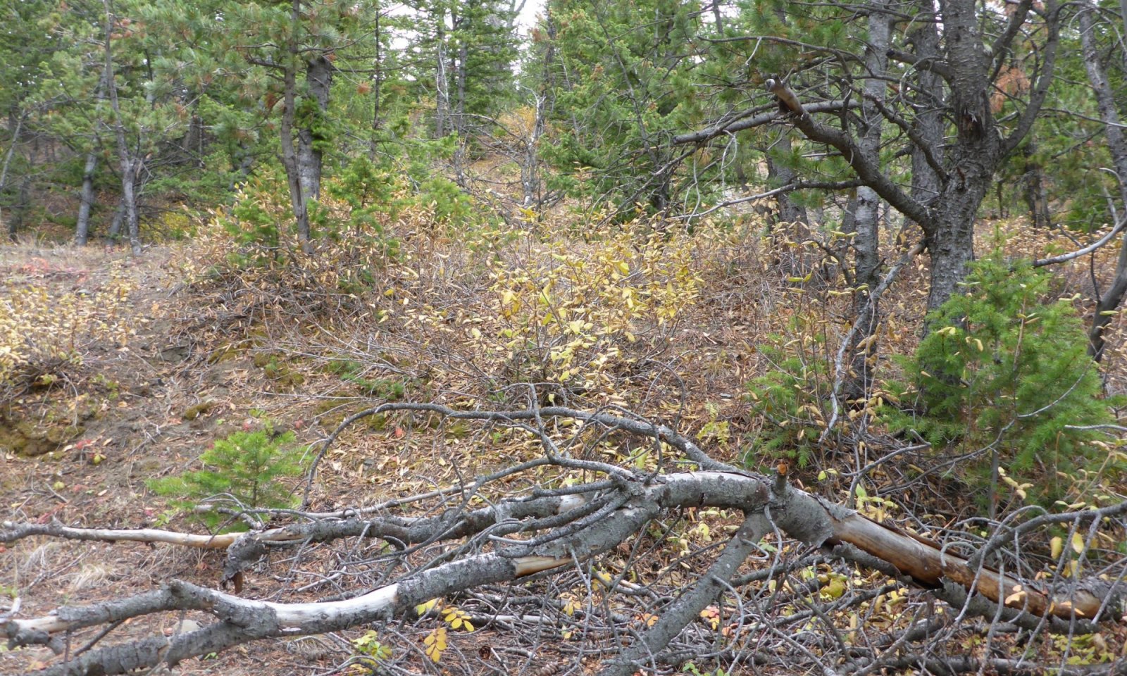
This community phase is characterized by the dense monoculture (or near so) stands of Douglas-fir. These stands tend to have very little under story vegetation, and are difficult to move through due to litter, loose soils, and generally downed timber in the under story.
Resilience management. Maintenance of these stand to prevent catastrophic fires or other major natural disturbances and to maintain stand health is a needed management tool. Selective thinning, small path fires, and other fuels management tools can be used to protect this community.
Dominant plant species
-
Douglas-fir (Pseudotsuga menziesii), tree
-
currant (Ribes), shrub
-
Geyer's sedge (Carex geyeri), grass
-
spike fescue (Leucopoa kingii), grass
-
pussytoes (Antennaria), other herbaceous
-
Missouri milkvetch (Astragalus missouriensis), other herbaceous
State 3
Degraded UnderstoryThis community has shifted in over story to a limber pine community, with a degraded under story that is susceptible to invasive species.
Characteristics and indicators. This community is primarily herbaceous species of declining quality including sandberg bluegrass, prairie junegrass, and a few forbs, and then the remaining community is comprised of invasive or weedy species. There are a few shrubs in the community and limber pine is the main over story species. The major species of concern are thistles, cheatgrass, and a variety of local species varying by location.
Resilience management. The difficulty to manage weedy species due their aggressive growth patterns, ability to spread easily, and competitive nature with natives, make this site difficult to change with general management.
Dominant plant species
-
limber pine (Pinus flexilis), tree
-
Rocky Mountain juniper (Juniperus scopulorum), tree
-
currant (Ribes), shrub
-
Woods' rose (Rosa woodsii), shrub
-
common juniper (Juniperus communis), shrub
-
Sandberg bluegrass (Poa secunda), grass
-
prairie Junegrass (Koeleria macrantha), grass
-
cheatgrass (Bromus tectorum), grass
-
thistle (Cirsium), other herbaceous
-
common yarrow (Achillea millefolium), other herbaceous
-
flatspine stickseed (Lappula occidentalis), other herbaceous
Dominant resource concerns
-
Sheet and rill erosion
-
Aggregate instability
-
Plant productivity and health
-
Plant structure and composition
-
Terrestrial habitat for wildlife and invertebrates
-
Feed and forage imbalance
Community 3.1
PIFL2/Invaded
Figure 11. Limber pine is dying in this community leaving Rocky mountain juniper, bluegrasses and cheatgrass the dominant species.
The limber pine canopy is dominant on the site, but is generally threatened by Rocky mountain juniper in many areas. While there is competition in the over story, the under story is degraded to low-stature grasses such as sandberg bluegrass and prairie junegrass. The other challenge in this community is the threat of invasive species. Cheatgrass and thistles are the major threats with various others across the extent of this ecological site.
Resilience management. Management of the invader species, including the control of Rocky mountain juniper is the major management needed to maintain this community and to prevent further degradation.
Dominant plant species
-
limber pine (Pinus flexilis), tree
-
Rocky Mountain juniper (Juniperus scopulorum), tree
-
currant (Ribes), shrub
-
Woods' rose (Rosa woodsii), shrub
-
mountain big sagebrush (Artemisia tridentata ssp. vaseyana), shrub
-
Sandberg bluegrass (Poa secunda), grass
-
prairie Junegrass (Koeleria macrantha), grass
-
cheatgrass (Bromus tectorum), grass
-
thistle (Cirsium), other herbaceous
-
common yarrow (Achillea millefolium), other herbaceous
-
flatspine stickseed (Lappula occidentalis), other herbaceous
Transition T1A
State 1 to 2Fire suppression has led to aging, dense stands of timber across much of the forested lands. In this community, the lack of fire has led to the existence of dog-haired, maturing stands of Douglas-fir. With shading from maturing Douglas-fir, and minus the propagating fires for limber pine, limber pine is pushed out leaving a Douglas-fir community.
Constraints to recovery.Slope, location, and surrounding sites are the limits to recovery. Lack of viable seed or nursery stock or the presence of invasive species such as cheatgrass are also vulnerabilities or threats to the recovery of this community.
Context dependence.Pre-existing community composition is key. Fire suppression in a high juniper area may lead this community to a juniper dominated condition.
Transition T1B
State 1 to 3Within the Limber Pine dominated community, understory burns or other disturbances can impact the vegetative cover leaving the community vulnerable to invasive species. Heavy grazing pressure, insects, drought and other disturbances can both impact the community making it susceptible as well as introduce the undesirable species.
Constraints to recovery.The ability to control some invasive species limits the ability to recover a community. Access to do integrated pest management or weed control as well as limitations in reseeding the community can make it difficult as well.
Key drivers
-
Wildlife grazing or browsing
-
Fire
-
Seed dispersal by livestock
-
Climate
-
Mechanical soil disturbance
-
Timber management
-
Fire frequency
Key ecosystem services affected
-
Erosion control
-
Aesthetic values
-
Nutrient cycling
-
Wildlife forage
-
Wildlife habitat
-
Plant biodiversity
Restoration pathway R2A
State 2 to 1The use of prescribed fire or selective harvest to thin the timber stand and allow succession of other woody species in the canopy helps to improve this site. Litter or under story management will help to encourage more under story growth on the site. Proper grazing management will help prevent community degradation and will aid in the site recovery following treatments.
Conservation practices
Critical Area Planting Prescribed Grazing Grazing Land Mechanical Treatment Upland Wildlife Habitat Management Forest Stand Improvement Forest Land Management Prescribed Forestry Grazing management to improve wildlife habitat Forest stand improvement pre-treating vegetation and fuels Forest Stand Improvement, Prescribed burning Forest Stand Improvement to Reduce Wildfire Risk Forest stand improvement pre-treating vegetation and fuels preceding a prescribed fire Additional community tables
Table 5. Community 1.1 plant community composition
Group Common name Symbol Scientific name Annual production () Foliar cover (%) Table 6. Community 1.2 plant community composition
Group Common name Symbol Scientific name Annual production () Foliar cover (%) Table 7. Community 2.1 plant community composition
Group Common name Symbol Scientific name Annual production () Foliar cover (%) Table 8. Community 3.1 plant community composition
Group Common name Symbol Scientific name Annual production () Foliar cover (%) Interpretations
Animal community
This site and plant community complex has minimal livestock grazing capacity in the old stand forests. In new growth or following logging or fire, this site offers livestock forage. This site is common habitat for elk, mule deer, bear, wolf, mountain lion, and a
variety of other wildlife.Hydrological functions
Water is the principal factor limiting forage production on this site. This site is dominated by soils in hydrologic group C, with localized areas in hydrologic group B and D. Infiltration ranges from moderately slow to moderate. Runoff potential for this site varies from low to moderate depending on soil hydrologic group and ground cover. In many cases, areas with greater than 75% ground cover have the greatest potential for high infiltration and lower runoff. An example of an exception would be where short-grasses form a strong sod and dominate the site. Areas where ground cover is less than 50% have the greatest potential to have reduced infiltration and higher runoff (refer to Part 630, NRCS National Engineering Handbook for detailed hydrology information).
Rills and gullies should not typically be present. Water flow patterns should be barely distinguishable if at all present. Pedestals are only slightly present in association with bunchgrasses. Litter typically falls in place, and signs of movement are not common. Chemical and physical crusts are rare to non-existent. Cryptogamic crusts are present, but only cover 1-2% of the soil surface.Recreational uses
This site provides hunting opportunities for large ungulates and fur bearing species. Blue grouse and several other varieties of birds, including birds of prey, utilize these areas. However, the area is limited for upland game bird species. Hiking is slightly limited by density of tree stands.
Wood products
Timber harvest for lumber and firewood, as well as post and pole cuttings are common on this forest type. Christmas tree harvest occurs on lower extents of this forest type.
Other products
Medicinal plants can be found within this ecological site. Fungi (mushroom) harvest can also occur in specific locations.
Supporting information
Inventory data references
Information presented here has been derived from NRCS data and other inventory data. Field observations from range trained personnel were also used. Those involved in developing this site include: Bill Christensen, Range Management Specialist, NRCS; Karen Clause, Range Management Specialist, NRCS; and Everet Bainter, Range Management Specialist, NRCS. Other sources used as references include: USDA NRCS Water and Climate Center, USDA NRCS National Range and Pasture Handbook, and USDA NRCS Soil Surveys from various counties.
Other references
Steele, Robert; Cooper, Stephen V.; Ondov, David M.; Roberts, David W.; Pfister, Robert D. 1983. Forest Habitat Types of Eastern Idaho-Western Wyoming. General Technical Report INT-144. Ogden, UT: U.S. Department of Agriculture, Forest Service, Intermountain Forest and Range Experiment Station. 122 p.
Contributors
Karen Clause, Multi-County Rangeland Management Specialist, USDA-NRCS
Bryan Christensen, Ecological Site Specialist, USDA-NRCS
Marji Patz, Ecological Site Specialist, USDA-NRCSApproval
Kirt Walstad, 4/18/2025
Rangeland health reference sheet
Interpreting Indicators of Rangeland Health is a qualitative assessment protocol used to determine ecosystem condition based on benchmark characteristics described in the Reference Sheet. A suite of 17 (or more) indicators are typically considered in an assessment. The ecological site(s) representative of an assessment location must be known prior to applying the protocol and must be verified based on soils and climate. Current plant community cannot be used to identify the ecological site.
Author(s)/participant(s) Contact for lead author Date 03/05/2025 Approved by Approval date Composition (Indicators 10 and 12) based on Annual Production Indicators
-
Number and extent of rills:
-
Presence of water flow patterns:
-
Number and height of erosional pedestals or terracettes:
-
Bare ground from Ecological Site Description or other studies (rock, litter, lichen, moss, plant canopy are not bare ground):
-
Number of gullies and erosion associated with gullies:
-
Extent of wind scoured, blowouts and/or depositional areas:
-
Amount of litter movement (describe size and distance expected to travel):
-
Soil surface (top few mm) resistance to erosion (stability values are averages - most sites will show a range of values):
-
Soil surface structure and SOM content (include type of structure and A-horizon color and thickness):
-
Effect of community phase composition (relative proportion of different functional groups) and spatial distribution on infiltration and runoff:
-
Presence and thickness of compaction layer (usually none; describe soil profile features which may be mistaken for compaction on this site):
-
Functional/Structural Groups (list in order of descending dominance by above-ground annual-production or live foliar cover using symbols: >>, >, = to indicate much greater than, greater than, and equal to):
Dominant:
Sub-dominant:
Other:
Additional:
-
Amount of plant mortality and decadence (include which functional groups are expected to show mortality or decadence):
-
Average percent litter cover (%) and depth ( in):
-
Expected annual annual-production (this is TOTAL above-ground annual-production, not just forage annual-production):
-
Potential invasive (including noxious) species (native and non-native). List species which BOTH characterize degraded states and have the potential to become a dominant or co-dominant species on the ecological site if their future establishment and growth is not actively controlled by management interventions. Species that become dominant for only one to several years (e.g., short-term response to drought or wildfire) are not invasive plants. Note that unlike other indicators, we are describing what is NOT expected in the reference state for the ecological site:
-
Perennial plant reproductive capability:
Print Options
Sections
Font
AAAAOther
PrintThe Ecosystem Dynamics Interpretive Tool is an information system framework developed by the USDA-ARS Jornada Experimental Range, USDA Natural Resources Conservation Service, and New Mexico State University.
Accessibility statement